Total solar eclipse of 02/19/1254
| Day of week: | Thursday |
| Maximum duration of eclipse: | 03m59s |
| Maximum width of eclipse path: | 225 km |
| Saros cycle: | 118 |
| Coverage: | 100% |
| Magnitude: | 1.0534 |
| Gamma: | -0.6227 |
Wo kann man die Sonnenfinsternis vom 02/19/1254 sehen?
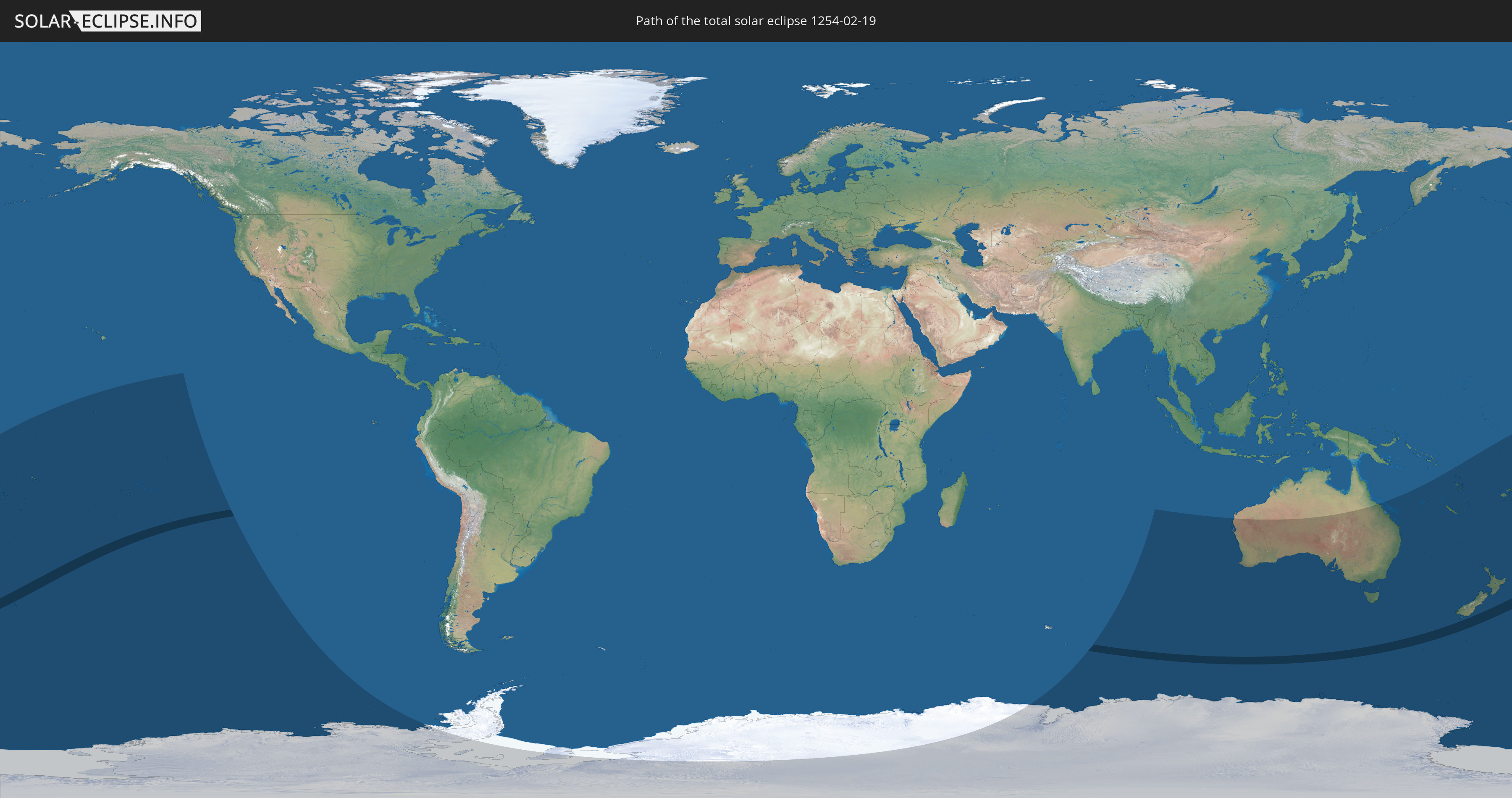
Die Sonnenfinsternis am 02/19/1254 kann man in 20 Ländern als partielle Sonnenfinsternis beobachten.
Der Finsternispfad verläuft durch 3 Länder. Nur in diesen Ländern ist sie als total Sonnenfinsternis zu sehen.
In den folgenden Ländern ist die Sonnenfinsternis total zu sehen
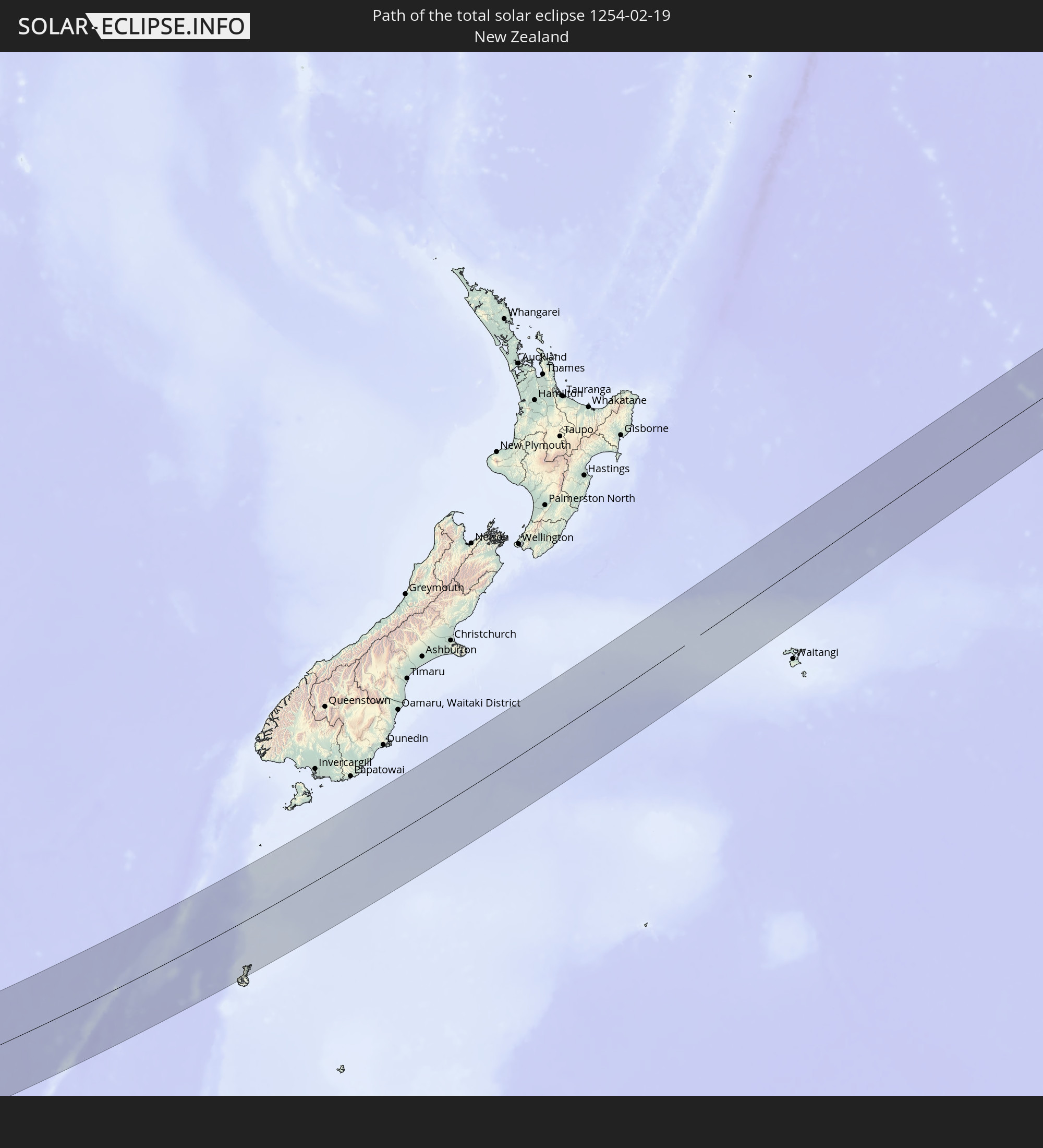 New Zealand
 French Polynesia
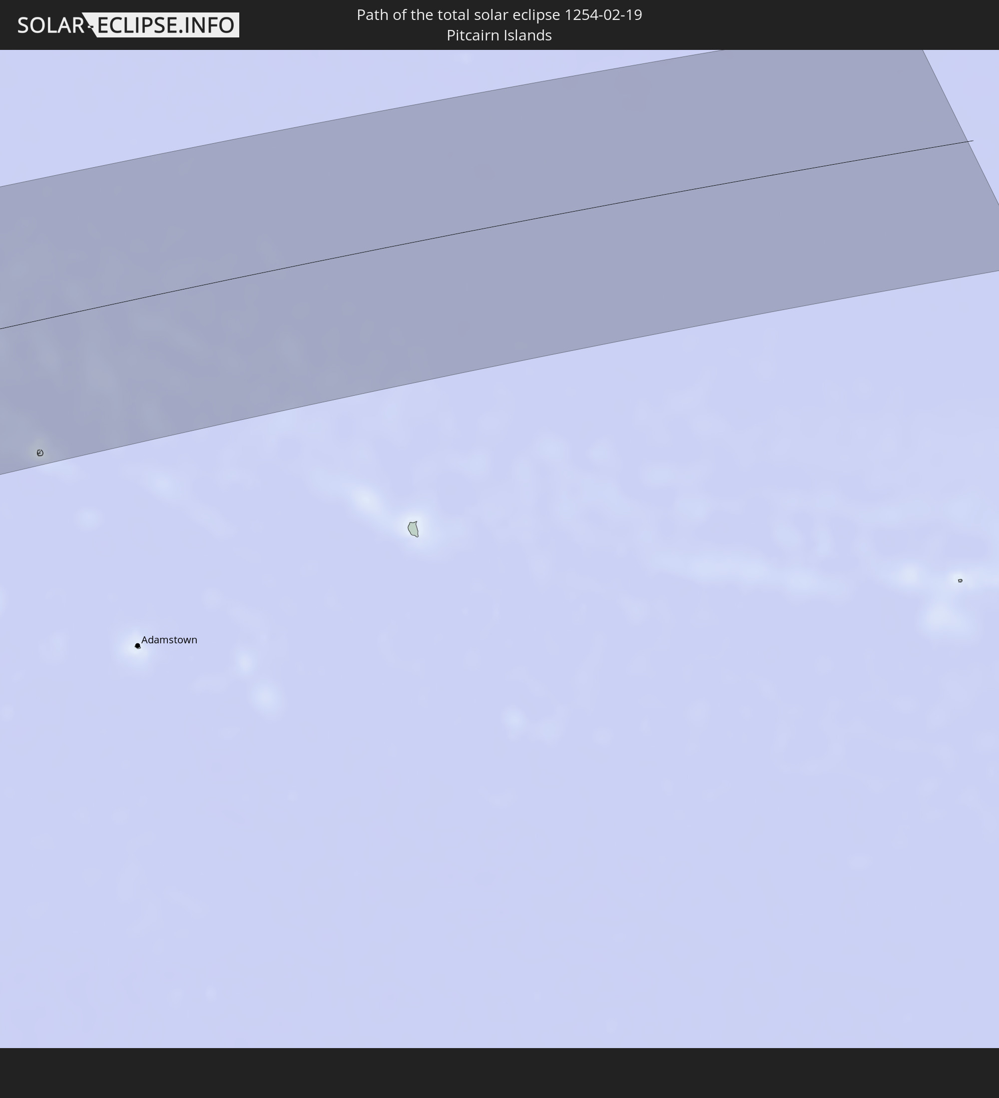 Pitcairn Islands
In den folgenden Ländern ist die Sonnenfinsternis partiell zu sehen


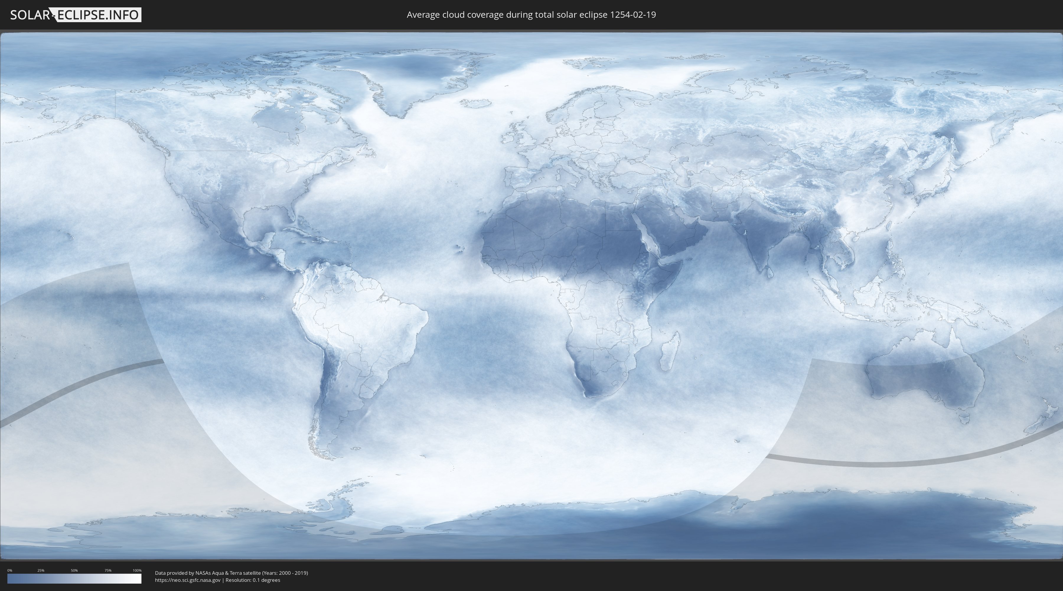
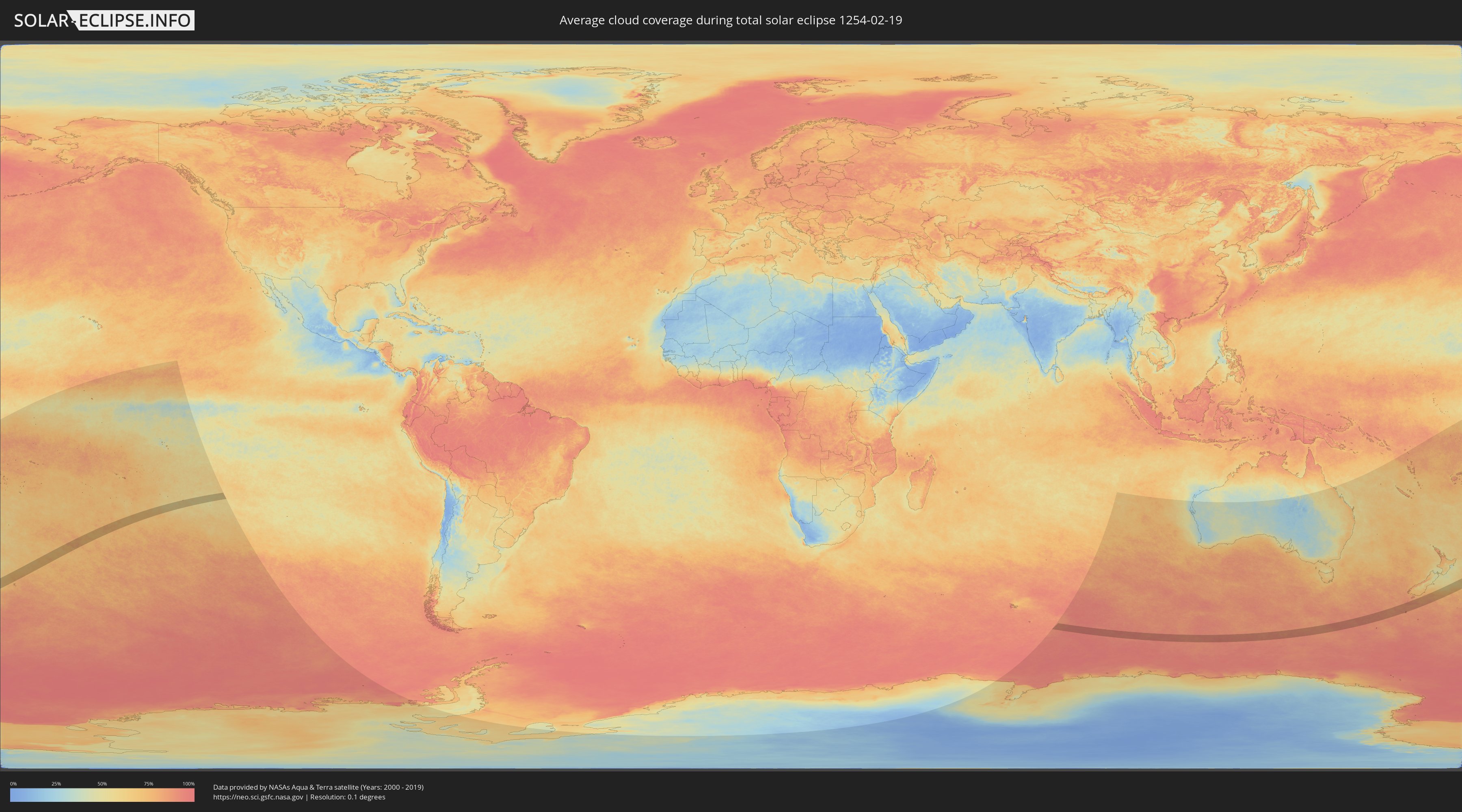
How will be the weather during the total solar eclipse on 02/19/1254?
Where is the best place to see the total solar eclipse of 02/19/1254?
The following maps show the average cloud coverage for the day of the total solar eclipse.
With the help of these maps, it is possible to find the place along the eclipse path, which has the best
chance of a cloudless sky.
Nevertheless, you should consider local circumstances and inform about the weather of your chosen
observation site.
The data is provided by NASAs satellites
AQUA and TERRA.
The cloud maps are averaged over a period of 19 years (2000 - 2019).
Detailed country maps
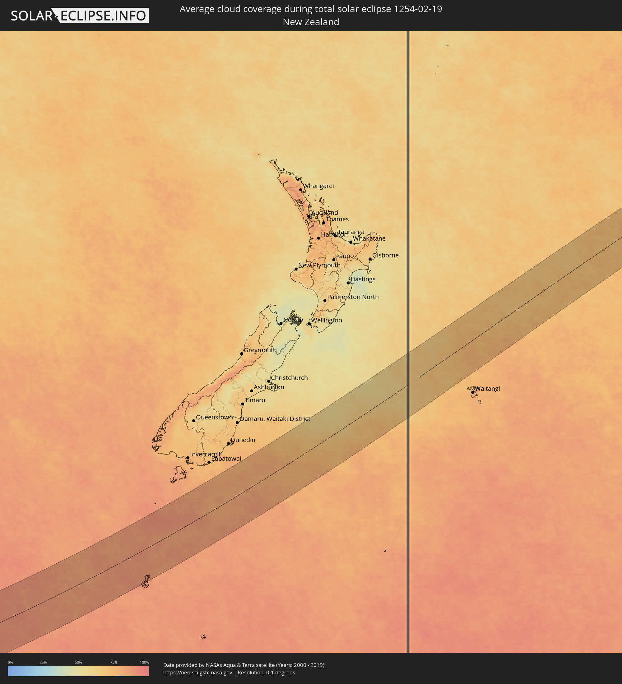 New Zealand
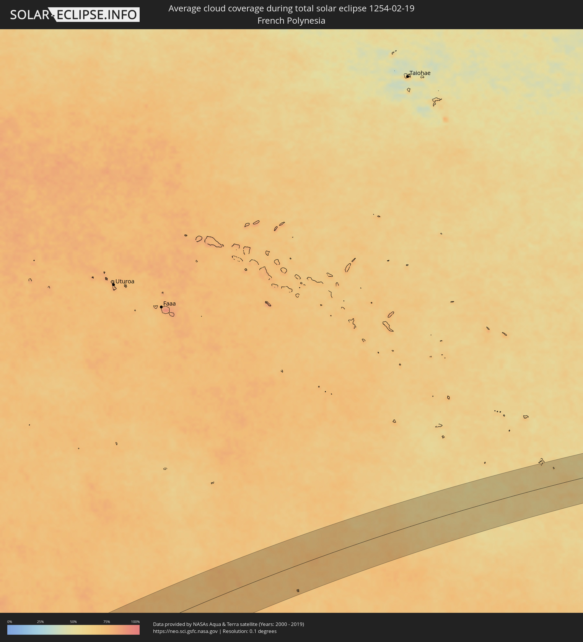 French Polynesia
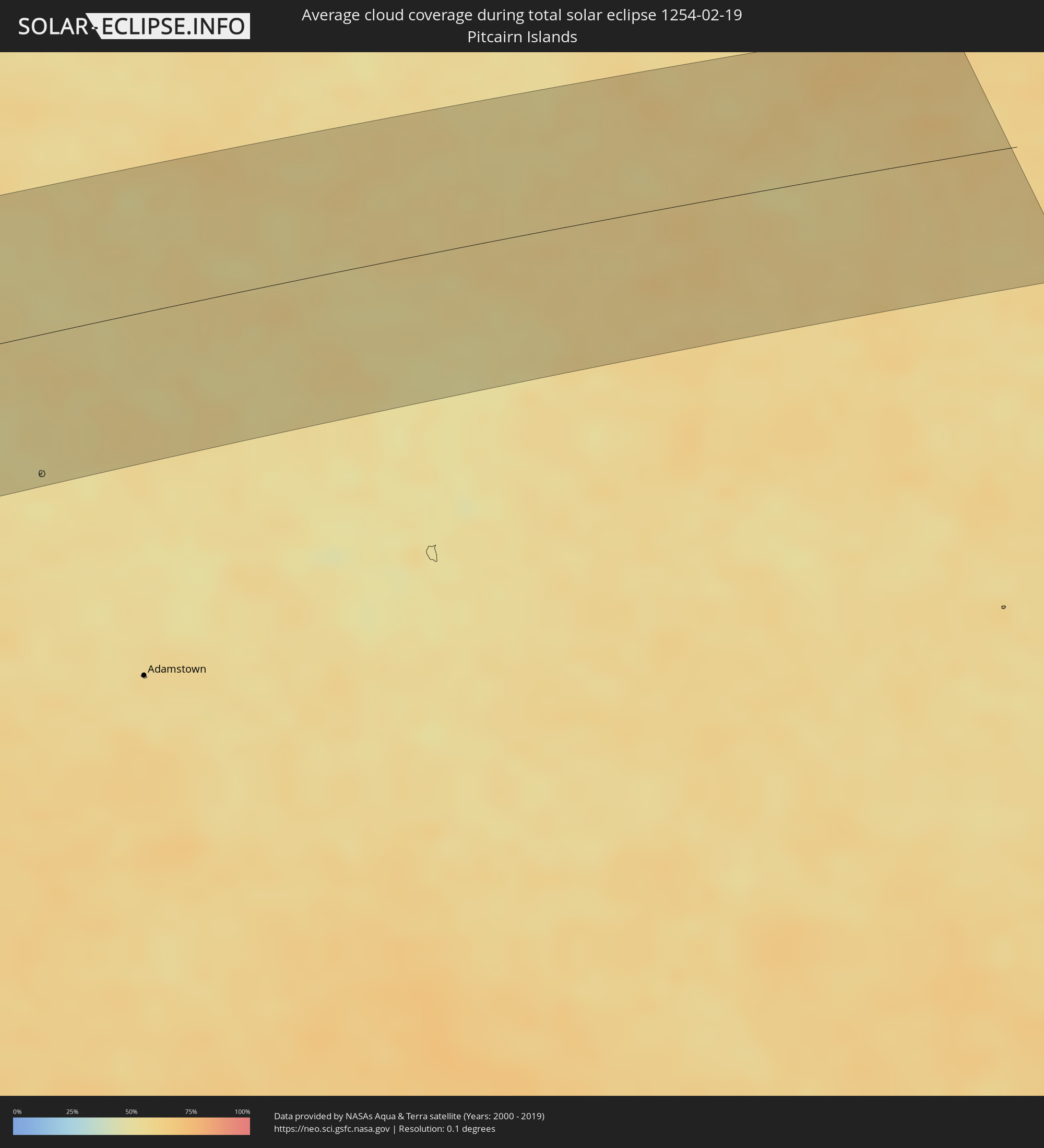 Pitcairn Islands