Annular solar eclipse of 11/30/1434
| Day of week: | Sunday |
| Maximum duration of eclipse: | 07m54s |
| Maximum width of eclipse path: | 229 km |
| Saros cycle: | 123 |
| Coverage: | 94.2% |
| Magnitude: | 0.9416 |
| Gamma: | 0.329 |
Wo kann man die Sonnenfinsternis vom 11/30/1434 sehen?
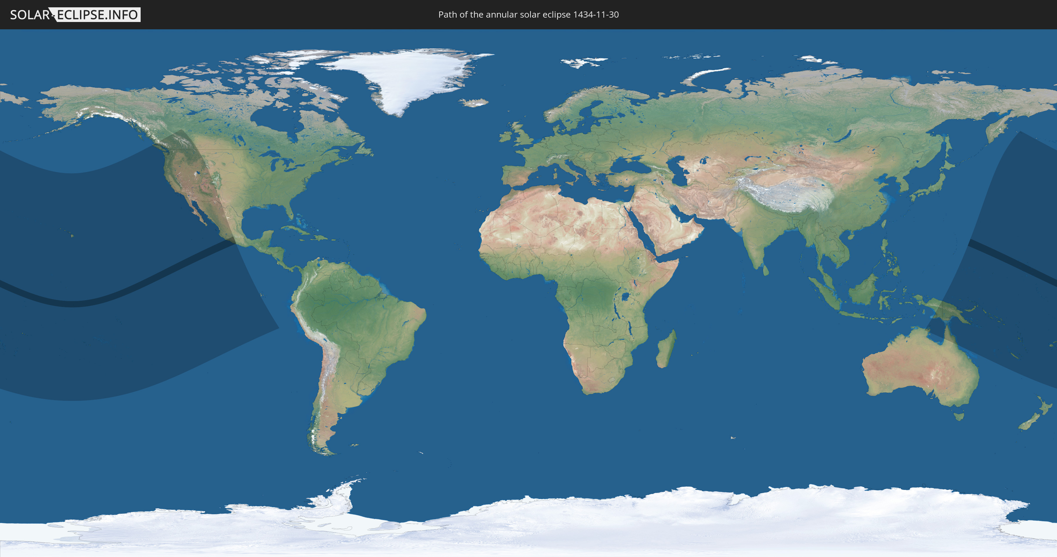
Die Sonnenfinsternis am 11/30/1434 kann man in 29 Ländern als partielle Sonnenfinsternis beobachten.
Der Finsternispfad verläuft durch 4 Länder. Nur in diesen Ländern ist sie als annular Sonnenfinsternis zu sehen.
In den folgenden Ländern ist die Sonnenfinsternis annular zu sehen
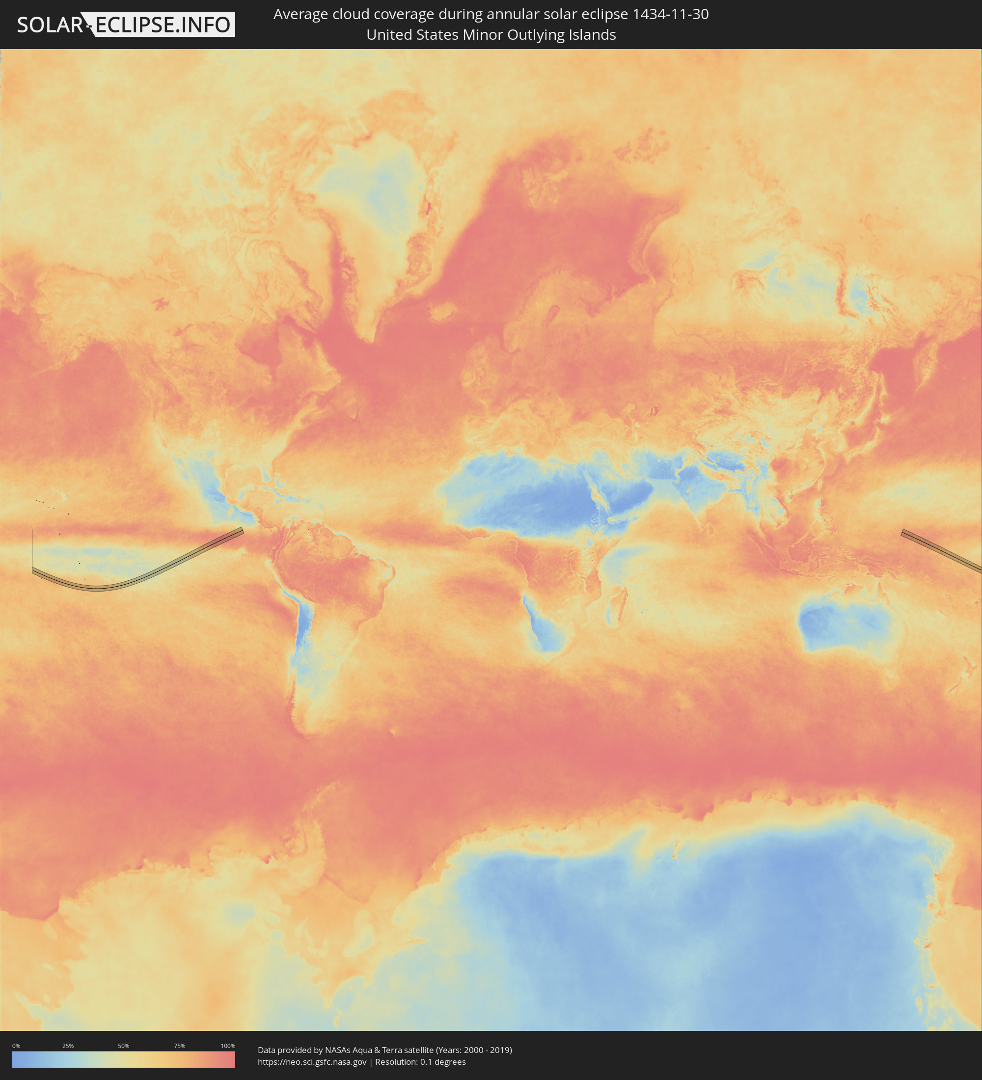
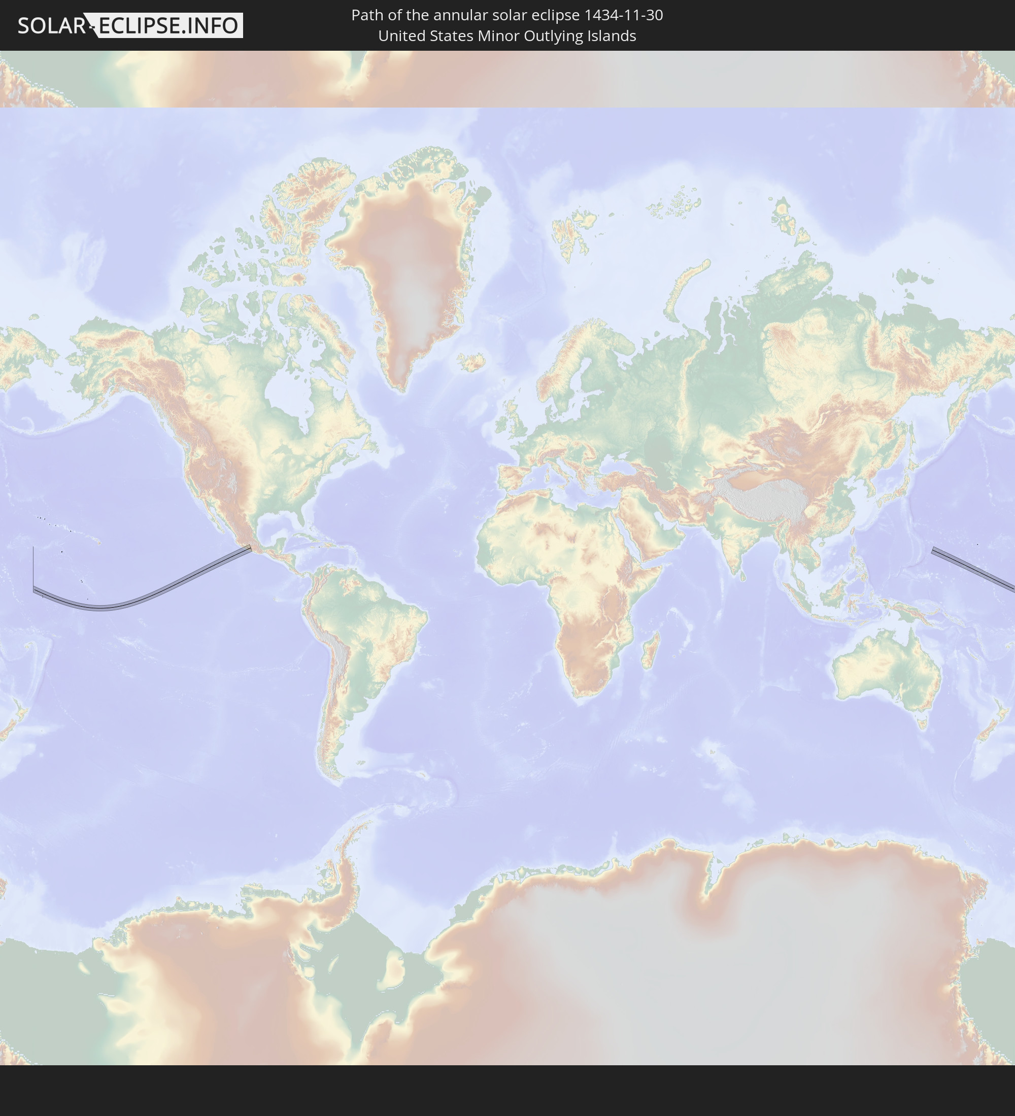 United States Minor Outlying Islands
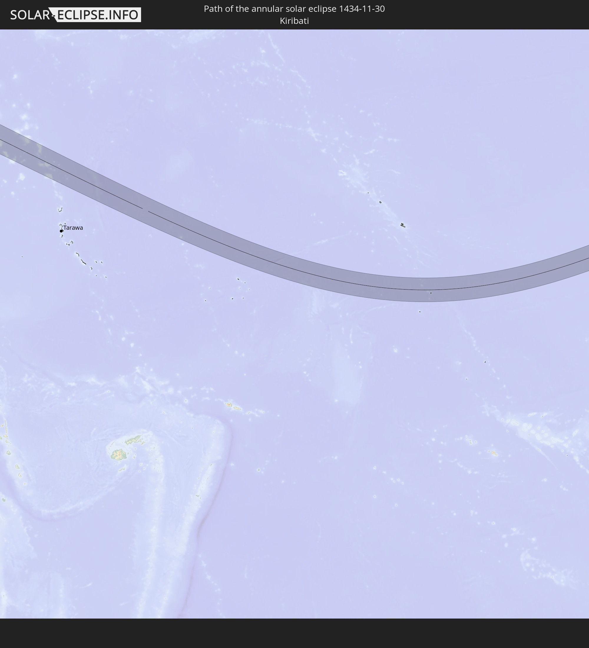 Kiribati
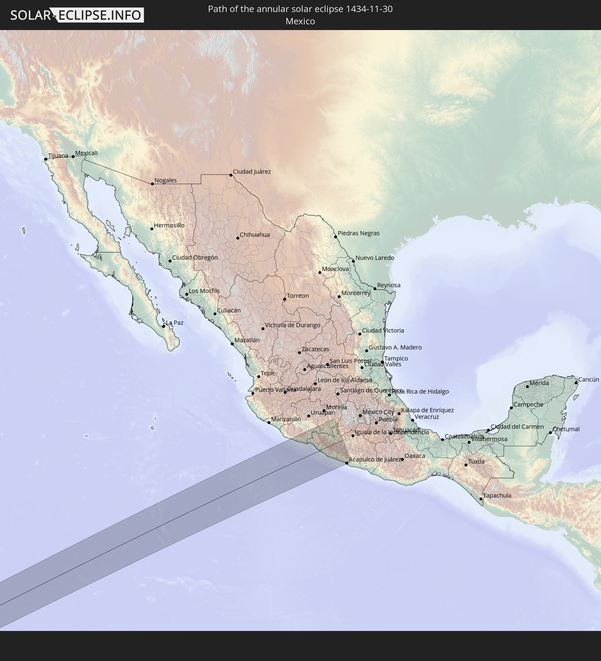 Mexico
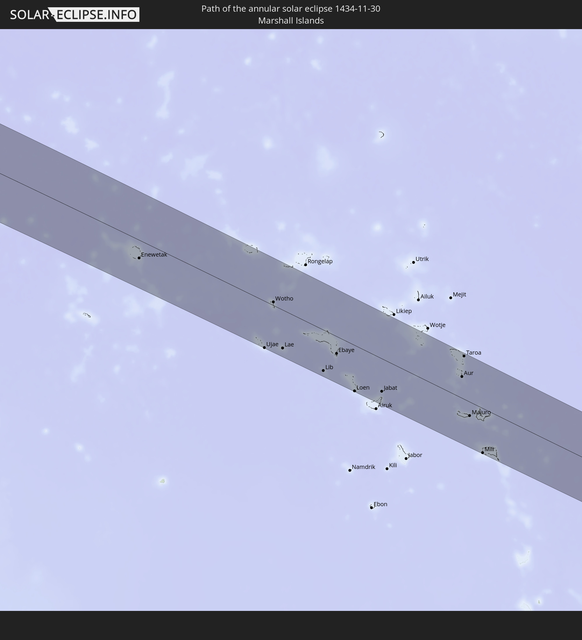 Marshall Islands
In den folgenden Ländern ist die Sonnenfinsternis partiell zu sehen
 Fiji
Fiji
 Russia
 United States
 New Zealand
 United States Minor Outlying Islands
 Wallis and Futuna
 Tonga
Tonga
 Kiribati
 Samoa
Samoa
 Tokelau
 American Samoa
 Niue
Niue
 Cook Islands
 French Polynesia
 Canada
 Pitcairn Islands
 Mexico
 Ecuador
 Indonesia
 Australia
 Japan
Japan
 Federated States of Micronesia
 Papua New Guinea
 Solomon Islands
 New Caledonia
 Marshall Islands
 Vanuatu
 Nauru
Nauru
 Tuvalu
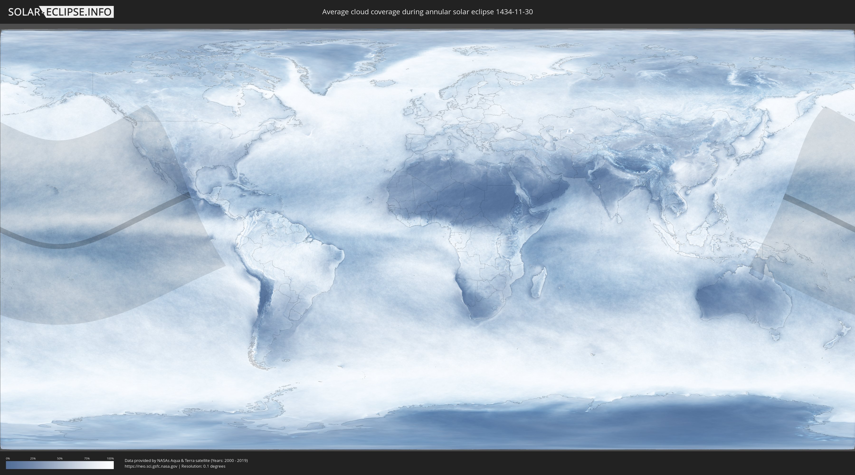
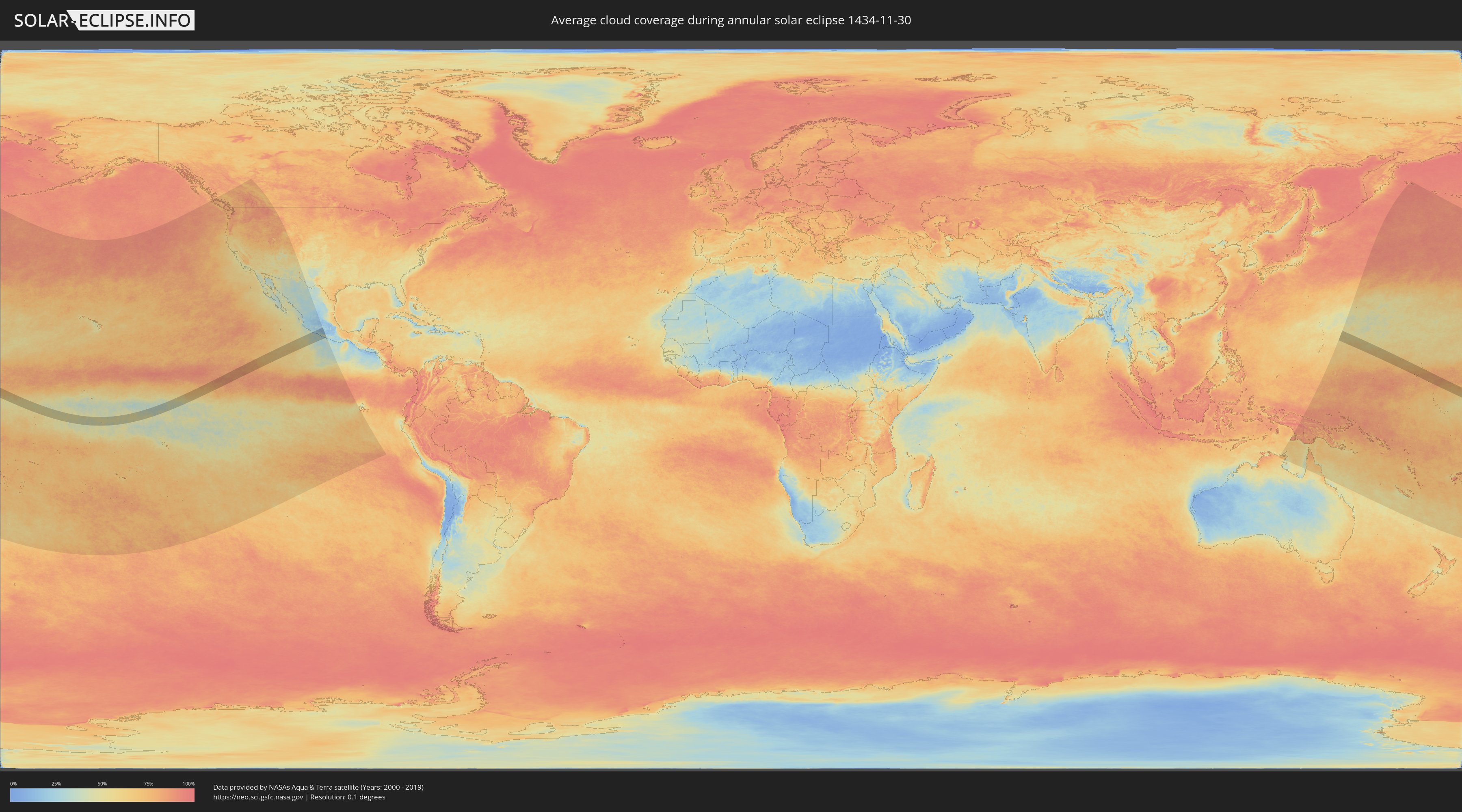
How will be the weather during the annular solar eclipse on 11/30/1434?
Where is the best place to see the annular solar eclipse of 11/30/1434?
The following maps show the average cloud coverage for the day of the annular solar eclipse.
With the help of these maps, it is possible to find the place along the eclipse path, which has the best
chance of a cloudless sky.
Nevertheless, you should consider local circumstances and inform about the weather of your chosen
observation site.
The data is provided by NASAs satellites
AQUA and TERRA.
The cloud maps are averaged over a period of 19 years (2000 - 2019).
Detailed country maps
 United States Minor Outlying Islands
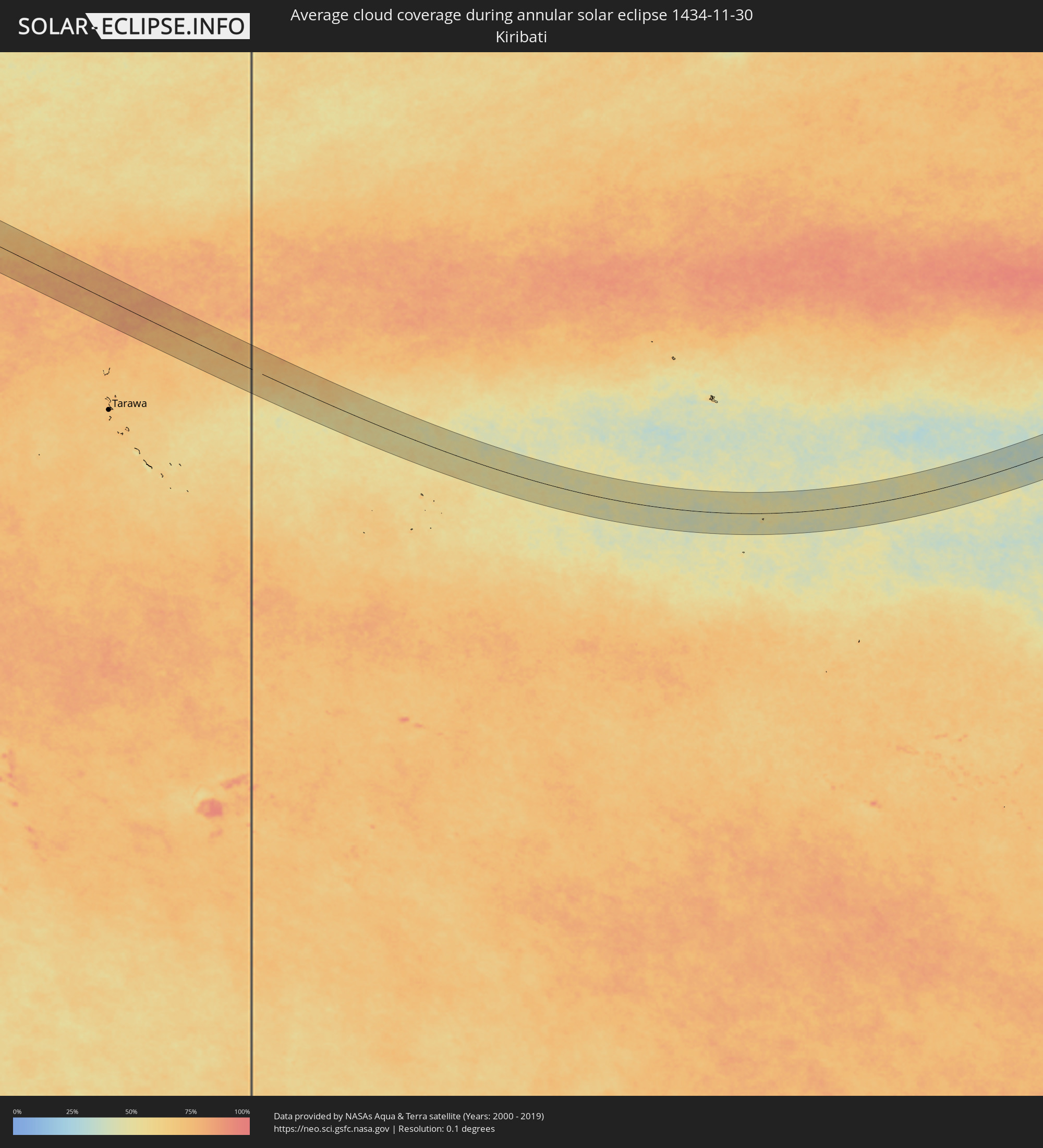 Kiribati
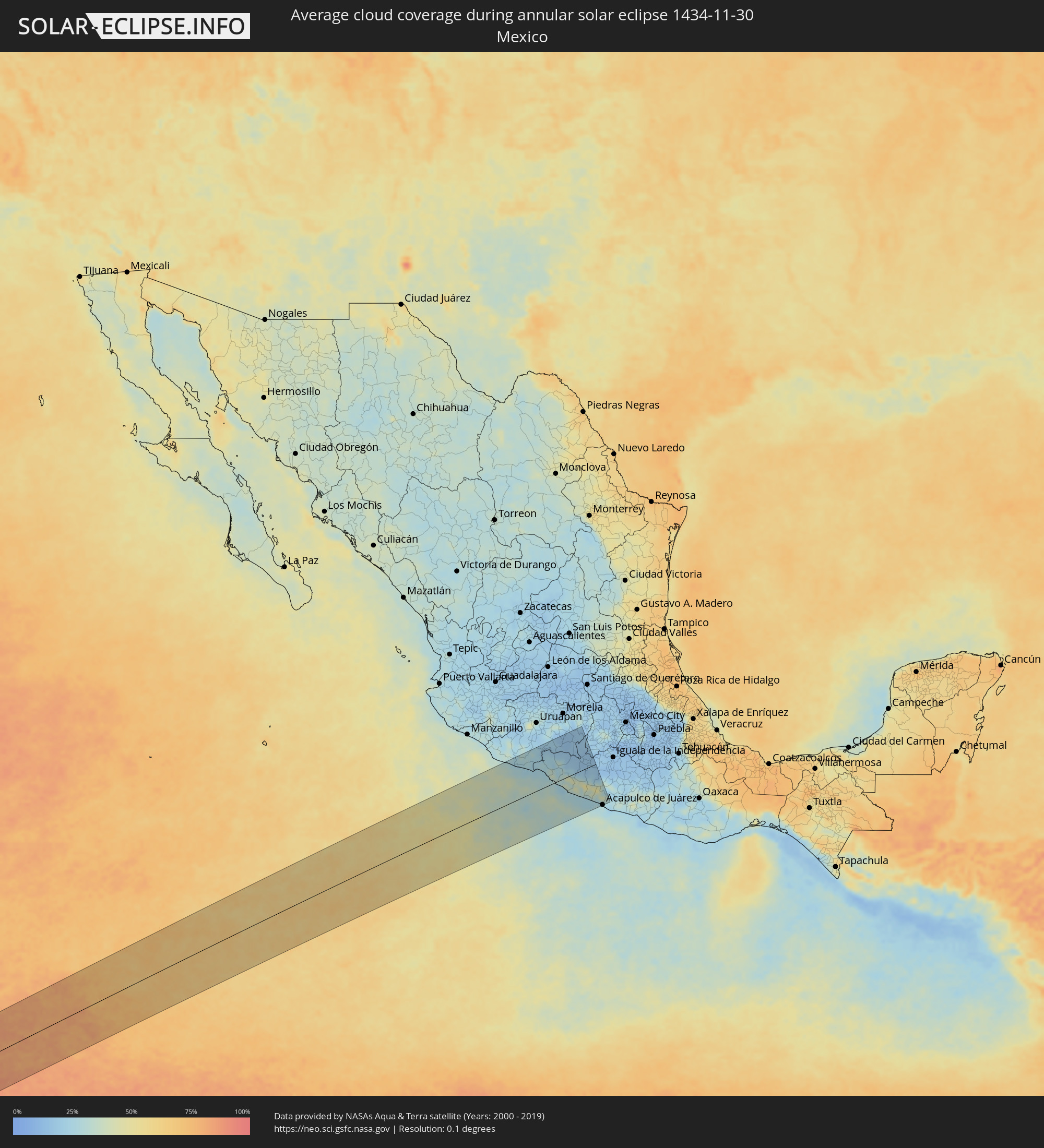 Mexico
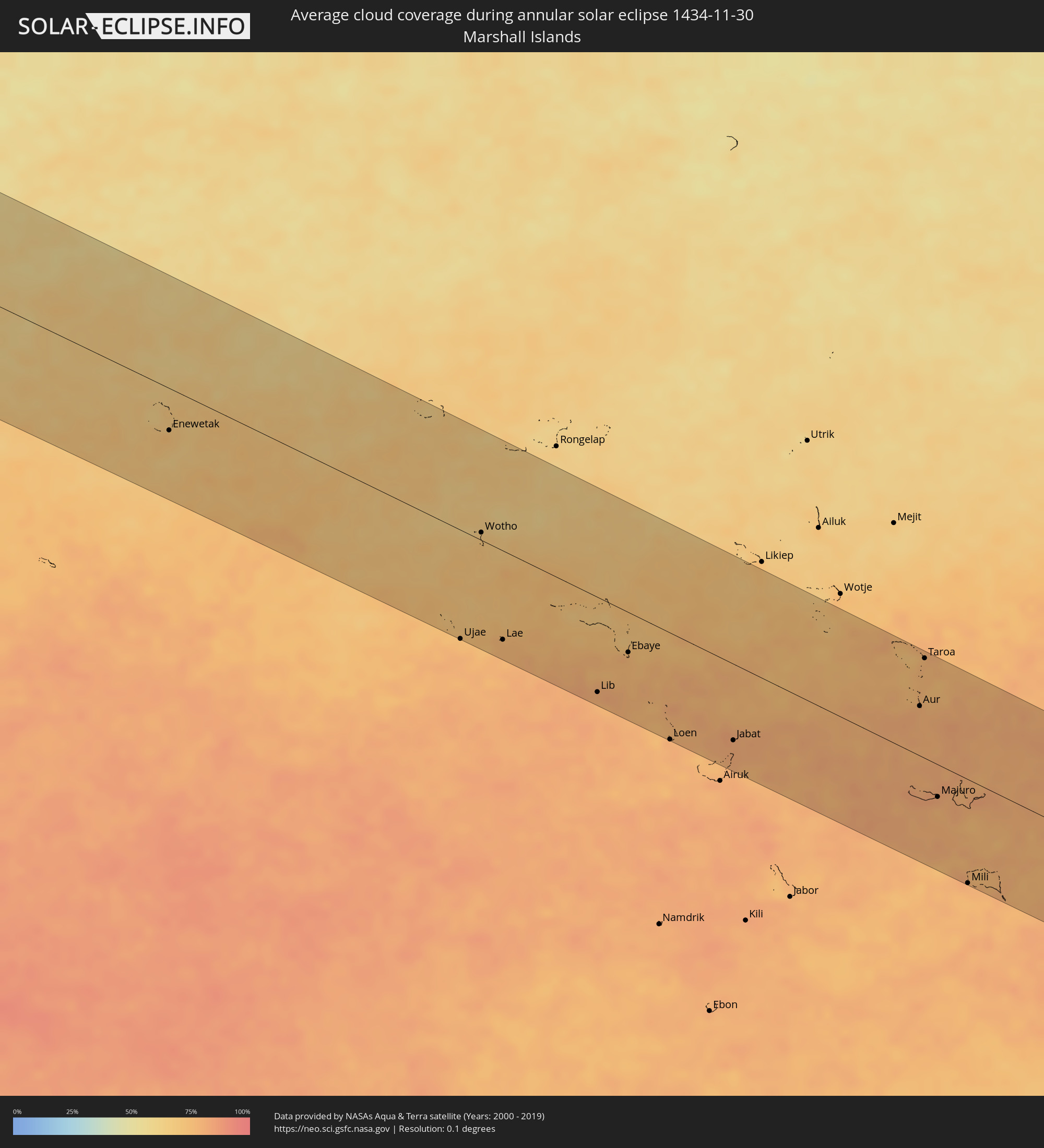 Marshall Islands
Cities inside the path of the eclipse
The following table shows all locations with a population of more than 5,000 inside the eclipse path. Cities which have more than 100,000 inhabitants are marked bold. A click at the locations opens a detailed map.
| City | Type | Eclipse duration | Local time of max. eclipse | Distance to central line | Ø Cloud coverage |
|
Arteaga, Michoacán
|
annular | - | 17:25:16 UTC-06:36 | 118 km | 27% |
|
Buenos Aires, Michoacán
|
annular | - | 17:25:21 UTC-06:36 | 84 km | 25% |
|
La Orilla, Michoacán
|
annular | - | 17:25:22 UTC-06:36 | 78 km | 25% |
|
Ciudad Lázaro Cárdenas, Michoacán
|
annular | - | 17:25:23 UTC-06:36 | 76 km | 25% |
|
Guacamayas, Michoacán
|
annular | - | 17:25:22 UTC-06:36 | 80 km | 25% |
|
Ixtapa, Guerrero
|
annular | - | 17:25:34 UTC-06:36 | 19 km | 29% |
|
San José Ixtapa (Barrio Viejo), Guerrero
|
annular | - | 17:25:33 UTC-06:36 | 22 km | 29% |
|
Ixtapa-Zihuatanejo, Guerrero
|
annular | - | 17:25:35 UTC-06:36 | 13 km | 29% |
|
El Coacoyul, Guerrero
|
annular | - | 17:25:36 UTC-06:36 | 9 km | 29% |
|
San Jeronimito, Guerrero
|
annular | - | 17:25:38 UTC-06:36 | 4 km | 28% |
|
Petatlán, Guerrero
|
annular | - | 17:25:39 UTC-06:36 | 10 km | 23% |
|
Huetamo de Núñez, Michoacán
|
annular | - | 17:25:25 UTC-06:36 | 84 km | 16% |
|
Coyuca de Catalán, Guerrero
|
annular | - | 17:25:32 UTC-06:36 | 45 km | 16% |
|
Ciudad Altamirano, Guerrero
|
annular | - | 17:25:31 UTC-06:36 | 46 km | 17% |
|
El Súchil, Guerrero
|
annular | - | 17:25:49 UTC-06:36 | 70 km | 26% |
|
Técpan de Galeana, Guerrero
|
annular | - | 17:25:49 UTC-06:36 | 71 km | 26% |
|
Cutzamala de Pinzón, Guerrero
|
annular | - | 17:25:30 UTC-06:36 | 54 km | 15% |
|
Tlapehuala, Guerrero
|
annular | - | 17:25:34 UTC-06:36 | 29 km | 15% |
|
Ajuchitlán del Progreso, Guerrero
|
annular | - | 17:25:36 UTC-06:36 | 17 km | 15% |
|
San Jerónimo de Juárez, Guerrero
|
annular | - | 17:25:52 UTC-06:36 | 86 km | 25% |
|
Atoyac de Álvarez, Guerrero
|
annular | - | 17:25:51 UTC-06:36 | 81 km | 27% |
|
Arcelia, Guerrero
|
annular | - | 17:25:35 UTC-06:36 | 25 km | 16% |
|
Coyuca de Benítez, Guerrero
|
annular | - | 17:25:56 UTC-06:36 | 116 km | 26% |
|
Bajos del Ejido, Guerrero
|
annular | - | 17:25:58 UTC-06:36 | 126 km | 26% |
|
Kilómetro 30, Guerrero
|
annular | - | 17:25:58 UTC-06:36 | 130 km | 28% |
|
Enewetak, Enewetak Atoll
|
annular | - | 07:27:26 UTC+11:00 | 49 km | 70% |
|
Ujae, Ujae Atoll
|
annular | - | 07:30:07 UTC+11:00 | 126 km | 75% |
|
Wotho, Wotho Atoll
|
annular | - | 07:30:12 UTC+11:00 | 9 km | 68% |
|
Lae, Lae Atoll
|
annular | - | 07:30:32 UTC+11:00 | 103 km | 77% |
|
Lib, Lib Island
|
annular | - | 07:31:37 UTC+11:00 | 110 km | 79% |
|
Ebaye, Kwajalein Atoll
|
annular | - | 07:31:54 UTC+11:00 | 47 km | 78% |
|
Loen, Namu Atoll
|
annular | - | 07:32:32 UTC+11:00 | 124 km | 79% |
|
Jabat, Jabat Island
|
annular | - | 07:33:17 UTC+11:00 | 89 km | 81% |
|
Aur, Aur Atoll
|
annular | - | 07:35:38 UTC+11:00 | 58 km | 78% |
|
Taroa, Maloelap Atoll
|
annular | - | 07:35:36 UTC+11:00 | 116 km | 77% |
|
Majuro, Majuro Atoll
|
annular | - | 07:36:06 UTC+11:00 | 38 km | 81% |
|
RMI Capitol, Majuro Atoll
|
annular | - | 07:36:06 UTC+11:00 | 38 km | 81% |
|
Arno, Arno Atoll
|
annular | - | 07:36:19 UTC+11:00 | 32 km | 80% |
|
Mili, Mili Atoll
|
annular | - | 07:36:47 UTC+11:00 | 121 km | 80% |