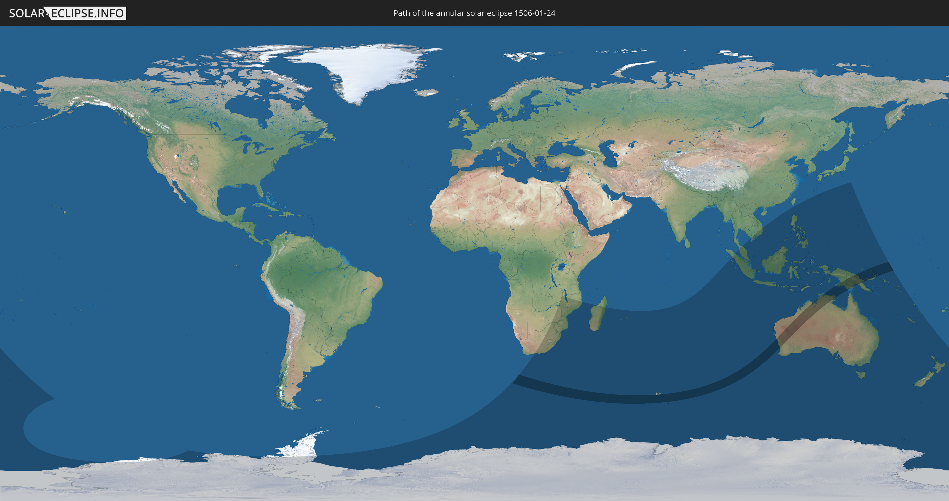
Annular solar eclipse of 01/24/1506
| Day of week: | Wednesday |
| Maximum duration of eclipse: | 08m26s |
| Maximum width of eclipse path: | 325 km |
| Saros cycle: | 113 |
| Coverage: | 92.1% |
| Magnitude: | 0.9209 |
| Gamma: | -0.3979 |
Wo kann man die Sonnenfinsternis vom 01/24/1506 sehen?
Die Sonnenfinsternis am 01/24/1506 kann man in 37 Ländern als partielle Sonnenfinsternis beobachten.
Der Finsternispfad verläuft durch 4 Länder. Nur in diesen Ländern ist sie als annular Sonnenfinsternis zu sehen.
In den folgenden Ländern ist die Sonnenfinsternis annular zu sehen
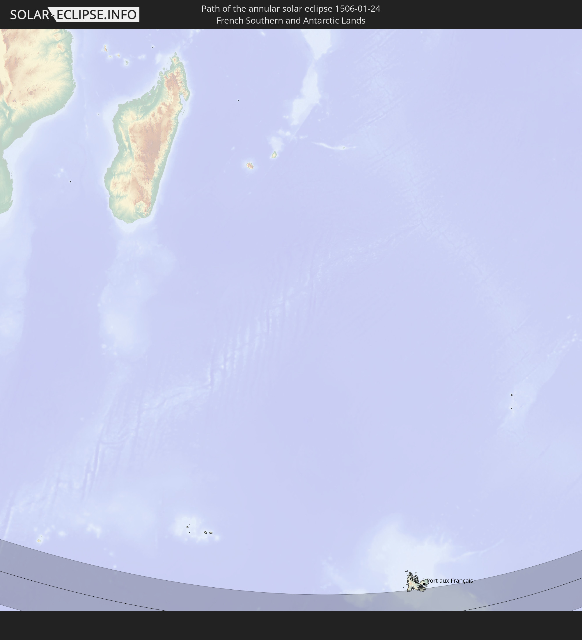 French Southern and Antarctic Lands
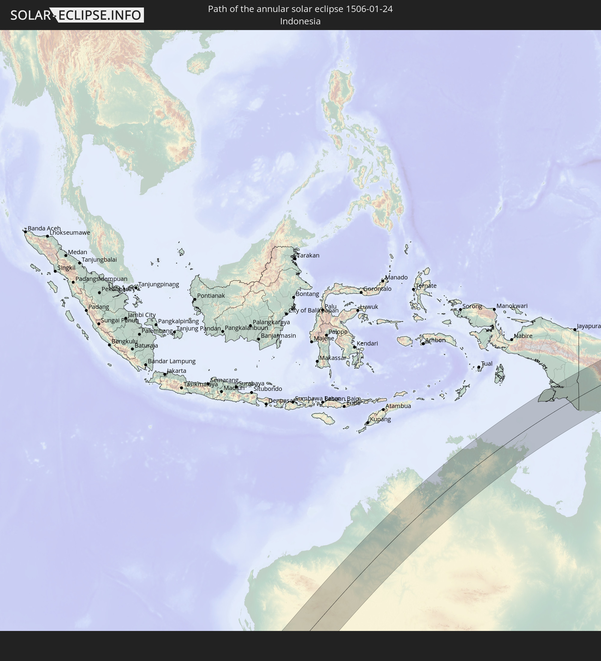 Indonesia
 Australia
 Papua New Guinea
In den folgenden Ländern ist die Sonnenfinsternis partiell zu sehen
 Antarctica
 New Zealand
 South Africa
 Botswana
 Zambia
 Zimbabwe
 Lesotho
 Mozambique
 Swaziland
 Malawi
 French Southern and Antarctic Lands
 Madagascar
 Réunion
 Mauritius
 Heard Island and McDonald Islands
 Indonesia
 Cocos Islands
 Thailand
 Malaysia
 Vietnam
 Cambodia
 Singapore
 Christmas Island
 Australia
 Brunei
 Philippines
 Japan
Japan
 East Timor
 Palau
Palau
 Federated States of Micronesia
 Papua New Guinea
 Guam
Guam
 Northern Mariana Islands
 Solomon Islands
 New Caledonia
 Vanuatu
 Norfolk Island
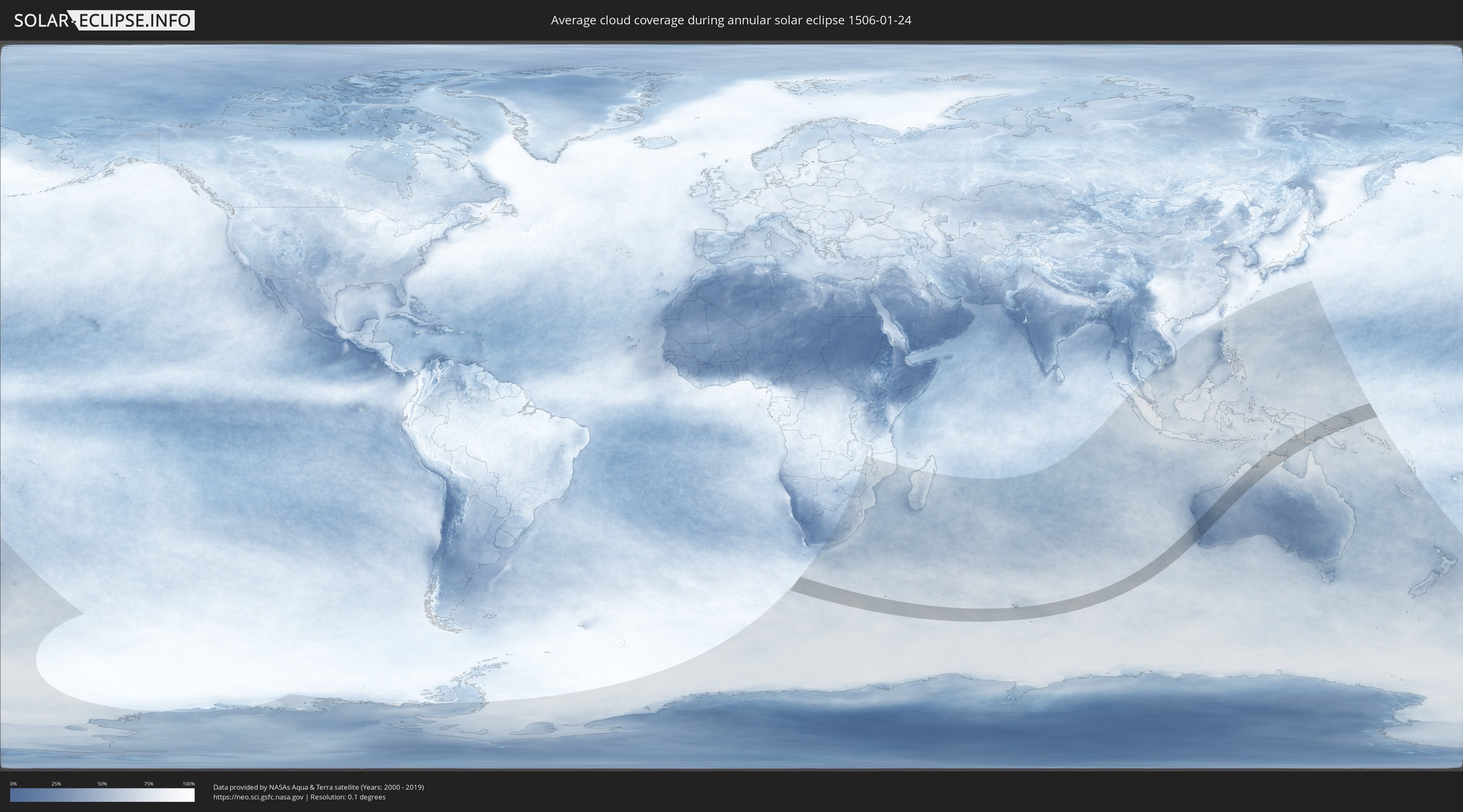
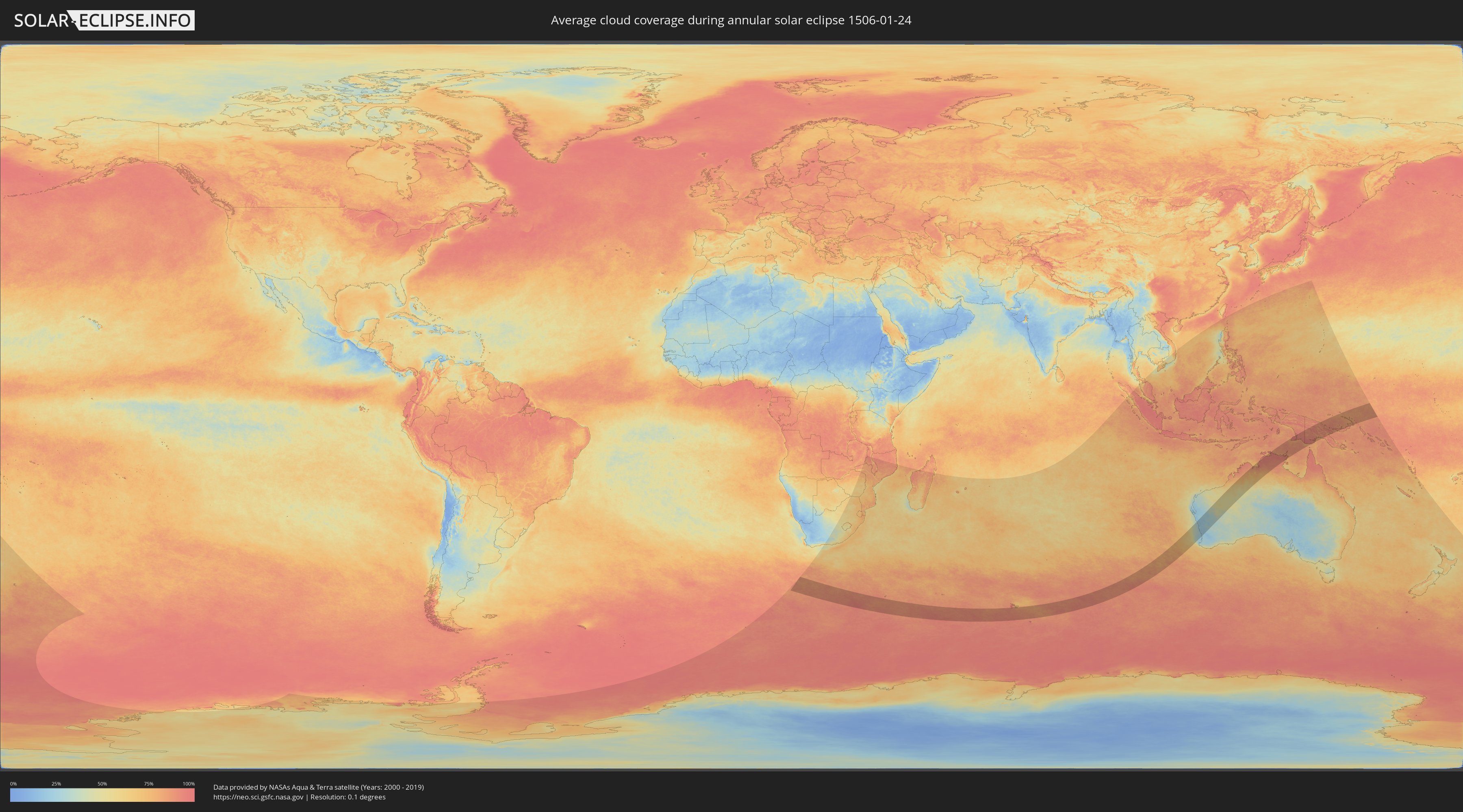
How will be the weather during the annular solar eclipse on 01/24/1506?
Where is the best place to see the annular solar eclipse of 01/24/1506?
The following maps show the average cloud coverage for the day of the annular solar eclipse.
With the help of these maps, it is possible to find the place along the eclipse path, which has the best
chance of a cloudless sky.
Nevertheless, you should consider local circumstances and inform about the weather of your chosen
observation site.
The data is provided by NASAs satellites
AQUA and TERRA.
The cloud maps are averaged over a period of 19 years (2000 - 2019).
Detailed country maps
 French Southern and Antarctic Lands
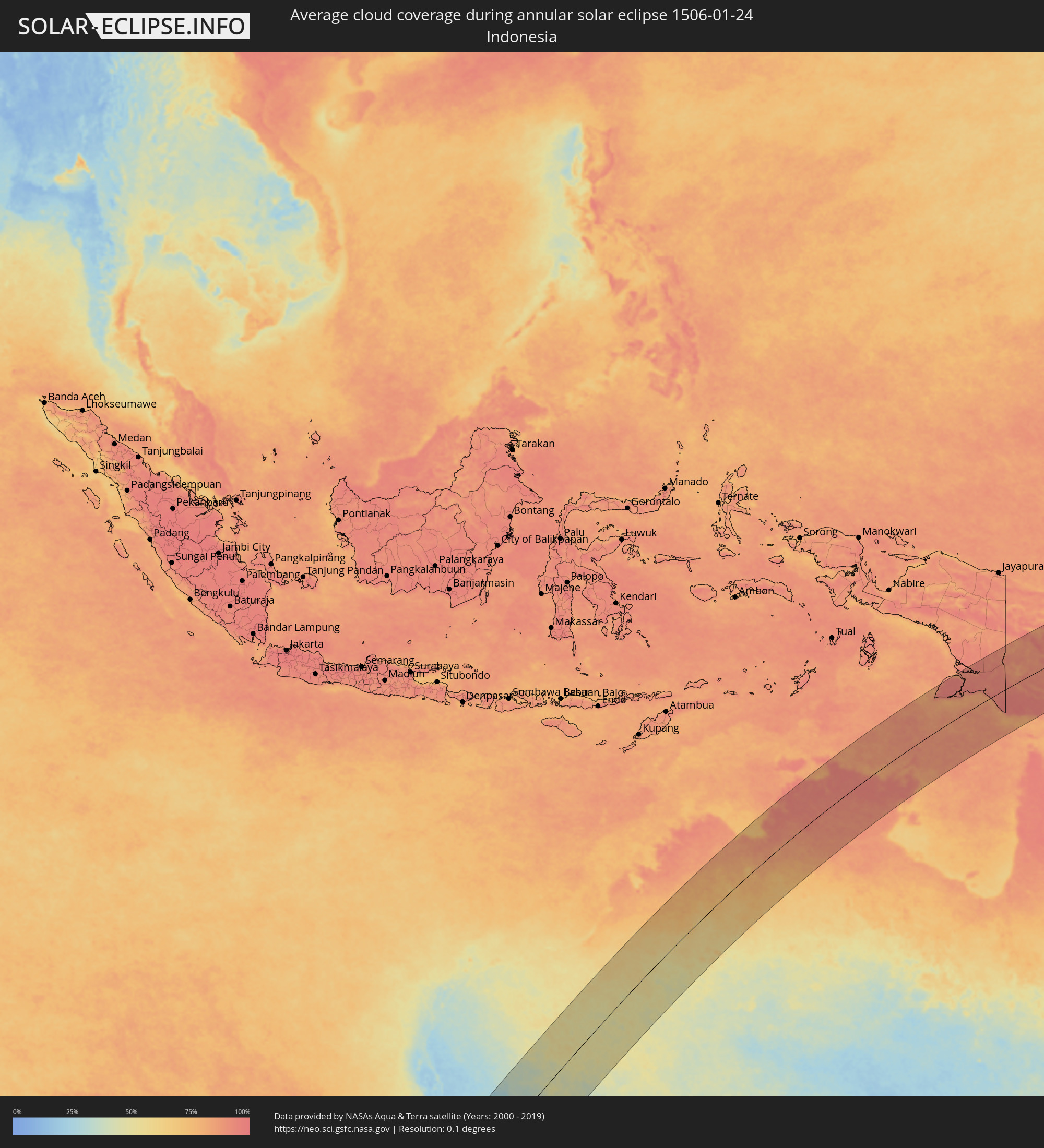 Indonesia
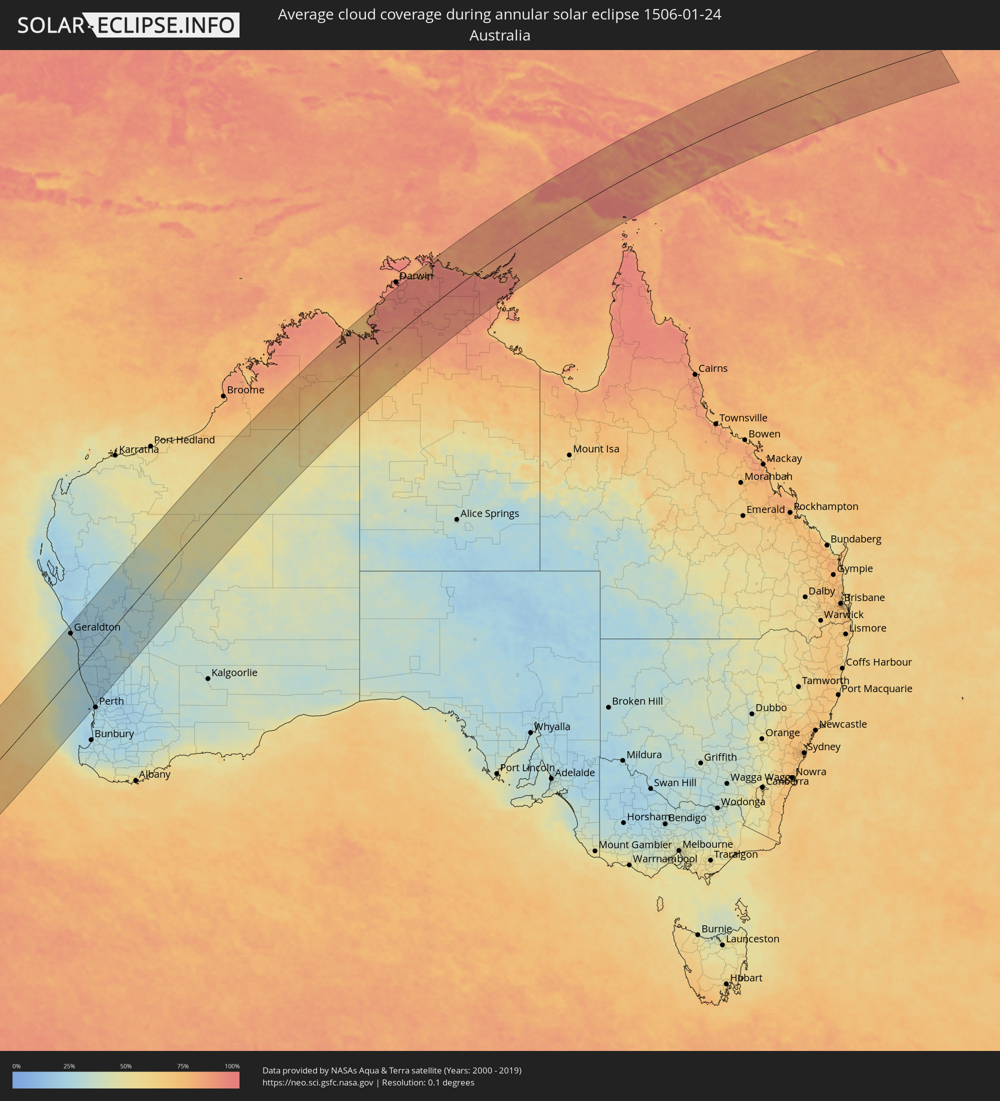 Australia
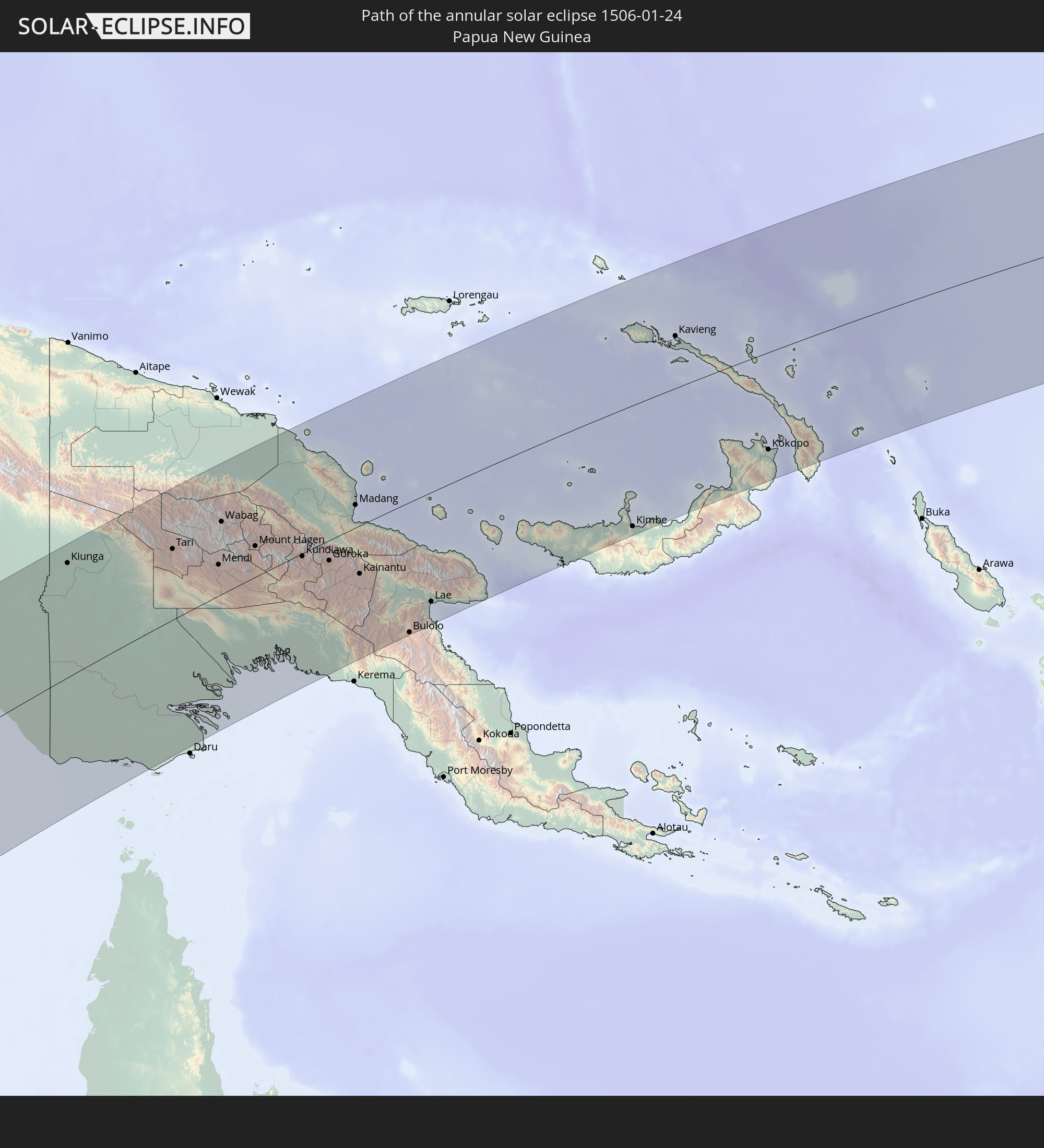
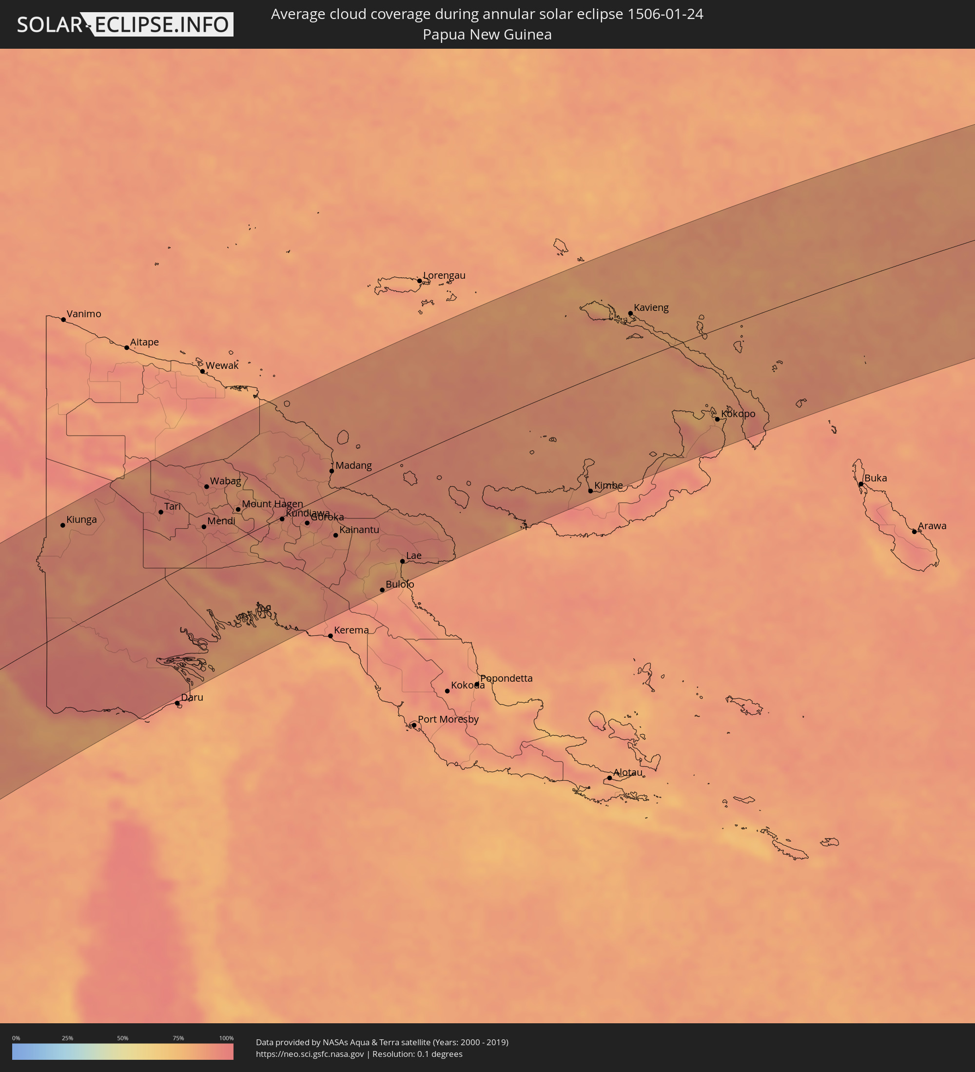 Papua New Guinea
Cities inside the path of the eclipse
The following table shows all locations with a population of more than 5,000 inside the eclipse path. Cities which have more than 100,000 inhabitants are marked bold. A click at the locations opens a detailed map.
| City | Type | Eclipse duration | Local time of max. eclipse | Distance to central line | Ø Cloud coverage |
|
Geraldton, Western Australia
|
annular | - | 14:31:17 UTC+08:00 | 139 km | 34% |
|
Quinns Rocks, Western Australia
|
annular | - | 14:26:01 UTC+08:00 | 150 km | 27% |
|
Butler, Western Australia
|
annular | - | 14:26:06 UTC+08:00 | 148 km | 26% |
|
Mindarie, Western Australia
|
annular | - | 14:26:00 UTC+08:00 | 152 km | 27% |
|
Clarkson, Western Australia
|
annular | - | 14:26:02 UTC+08:00 | 152 km | 27% |
|
Ocean Reef, Western Australia
|
annular | - | 14:25:52 UTC+08:00 | 159 km | 26% |
|
Mullaloo, Western Australia
|
annular | - | 14:25:50 UTC+08:00 | 160 km | 26% |
|
Kinross, Western Australia
|
annular | - | 14:25:58 UTC+08:00 | 156 km | 27% |
|
Hillarys, Western Australia
|
annular | - | 14:25:46 UTC+08:00 | 162 km | 26% |
|
Currambine, Western Australia
|
annular | - | 14:25:57 UTC+08:00 | 158 km | 27% |
|
Kallaroo, Western Australia
|
annular | - | 14:25:49 UTC+08:00 | 162 km | 24% |
|
Heathridge, Western Australia
|
annular | - | 14:25:54 UTC+08:00 | 161 km | 24% |
|
Scarborough, Western Australia
|
annular | - | 14:25:36 UTC+08:00 | 171 km | 23% |
|
Joondalup, Western Australia
|
annular | - | 14:25:57 UTC+08:00 | 160 km | 23% |
|
Padbury, Western Australia
|
annular | - | 14:25:49 UTC+08:00 | 165 km | 24% |
|
Carramar, Western Australia
|
annular | - | 14:26:05 UTC+08:00 | 156 km | 23% |
|
Karrinyup, Western Australia
|
annular | - | 14:25:40 UTC+08:00 | 170 km | 23% |
|
Tapping, Western Australia
|
annular | - | 14:26:03 UTC+08:00 | 160 km | 23% |
|
Woodvale, Western Australia
|
annular | - | 14:25:53 UTC+08:00 | 165 km | 24% |
|
Wanneroo, Western Australia
|
annular | - | 14:25:59 UTC+08:00 | 163 km | 24% |
|
Marangaroo, Western Australia
|
annular | - | 14:25:52 UTC+08:00 | 171 km | 24% |
|
Darch, Western Australia
|
annular | - | 14:25:55 UTC+08:00 | 171 km | 24% |
|
Newman, Western Australia
|
annular | - | 14:51:18 UTC+08:00 | 153 km | 51% |
|
Kununurra, Western Australia
|
annular | - | 15:16:48 UTC+08:00 | 80 km | 81% |
|
McMinns Lagoon, Northern Territory
|
annular | - | 16:54:35 UTC+09:30 | 192 km | 95% |
|
Katherine, Northern Territory
|
annular | - | 16:51:46 UTC+09:30 | 52 km | 90% |
|
Kiunga, Western Province
|
annular | - | 17:39:02 UTC+10:00 | 173 km | 86% |
|
Tari, Hela
|
annular | - | 17:39:37 UTC+10:00 | 109 km | 90% |
|
Mendi, Southern Highlands
|
annular | - | 17:39:23 UTC+10:00 | 48 km | 91% |
|
Wabag, Enga
|
annular | - | 17:40:17 UTC+10:00 | 112 km | 91% |
|
Ialibu, Southern Highlands
|
annular | - | 17:39:15 UTC+10:00 | 17 km | 91% |
|
Mount Hagen, Western Highlands
|
annular | - | 17:39:51 UTC+10:00 | 48 km | 83% |
|
Minj, Jiwaka
|
annular | - | 17:39:50 UTC+10:00 | 20 km | 87% |
|
Kundiawa, Chimbu
|
annular | - | 17:39:43 UTC+10:00 | 4 km | 87% |
|
Goroka, Eastern Highlands
|
annular | - | 17:39:40 UTC+10:00 | 32 km | 80% |
|
Madang, Madang
|
annular | - | 17:40:49 UTC+10:00 | 36 km | 86% |
|
Kainantu, Eastern Highlands
|
annular | - | 17:39:26 UTC+10:00 | 75 km | 88% |
|
Bulolo, Morobe
|
annular | - | 17:38:17 UTC+10:00 | 204 km | 83% |
|
Lae, Morobe
|
annular | - | 17:38:56 UTC+10:00 | 172 km | 81% |
|
Kimbe, West New Britain
|
annular | - | 17:40:26 UTC+10:00 | 194 km | 91% |
|
Kavieng, New Ireland
|
annular | - | 17:43:50 UTC+10:00 | 84 km | 84% |
|
Rabaul, East New Britain
|
annular | - | 17:41:53 UTC+10:00 | 138 km | 82% |
|
Kokopo, East New Britain
|
annular | - | 17:41:41 UTC+10:00 | 158 km | 82% |