Total solar eclipse of 03/29/1634
| Day of week: | Wednesday |
| Maximum duration of eclipse: | 02m24s |
| Maximum width of eclipse path: | 198 km |
| Saros cycle: | 133 |
| Coverage: | 100% |
| Magnitude: | 1.0346 |
| Gamma: | 0.8169 |
Wo kann man die Sonnenfinsternis vom 03/29/1634 sehen?
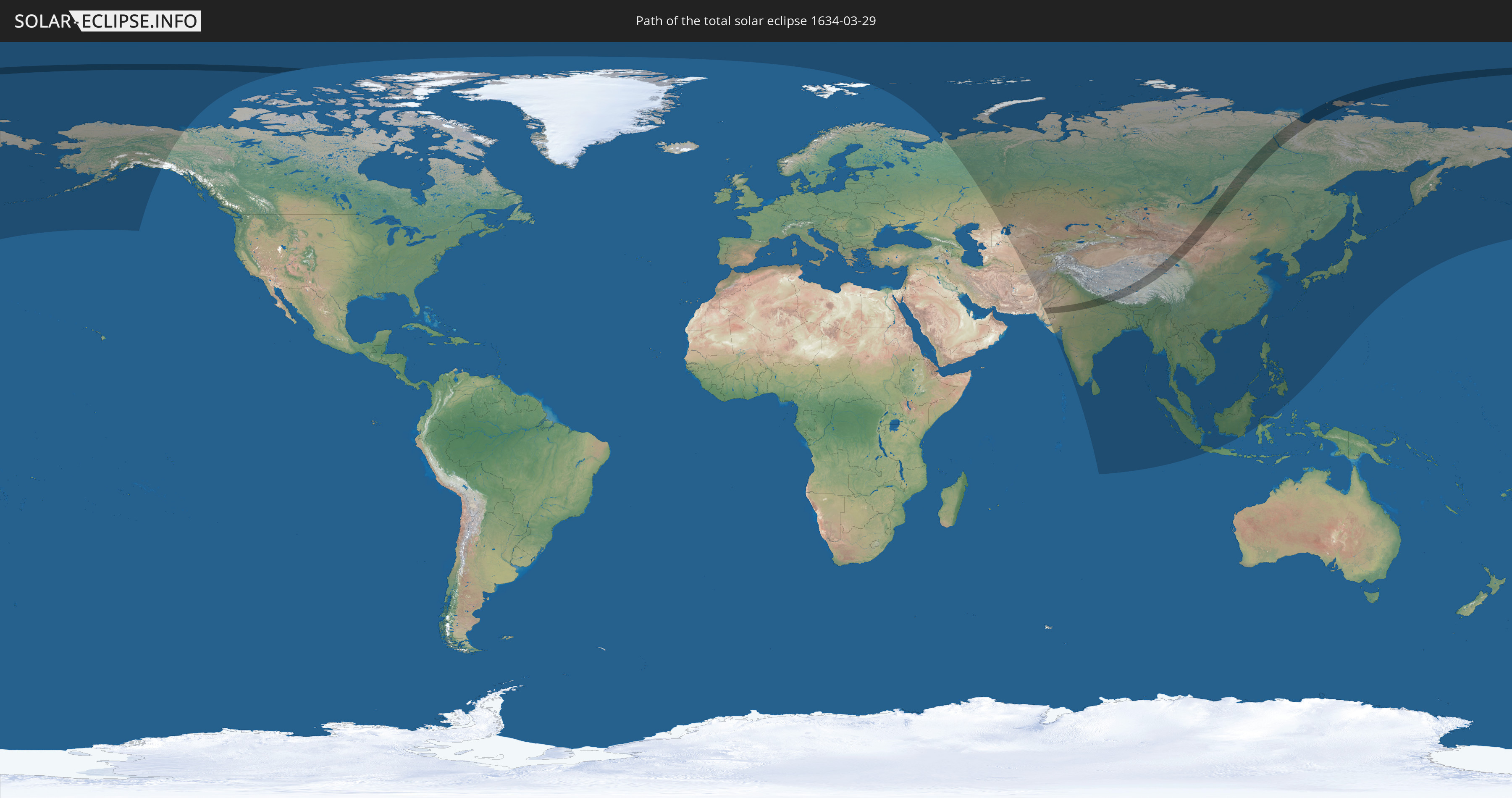
Die Sonnenfinsternis am 03/29/1634 kann man in 34 Ländern als partielle Sonnenfinsternis beobachten.
Der Finsternispfad verläuft durch 6 Länder. Nur in diesen Ländern ist sie als total Sonnenfinsternis zu sehen.
In den folgenden Ländern ist die Sonnenfinsternis total zu sehen
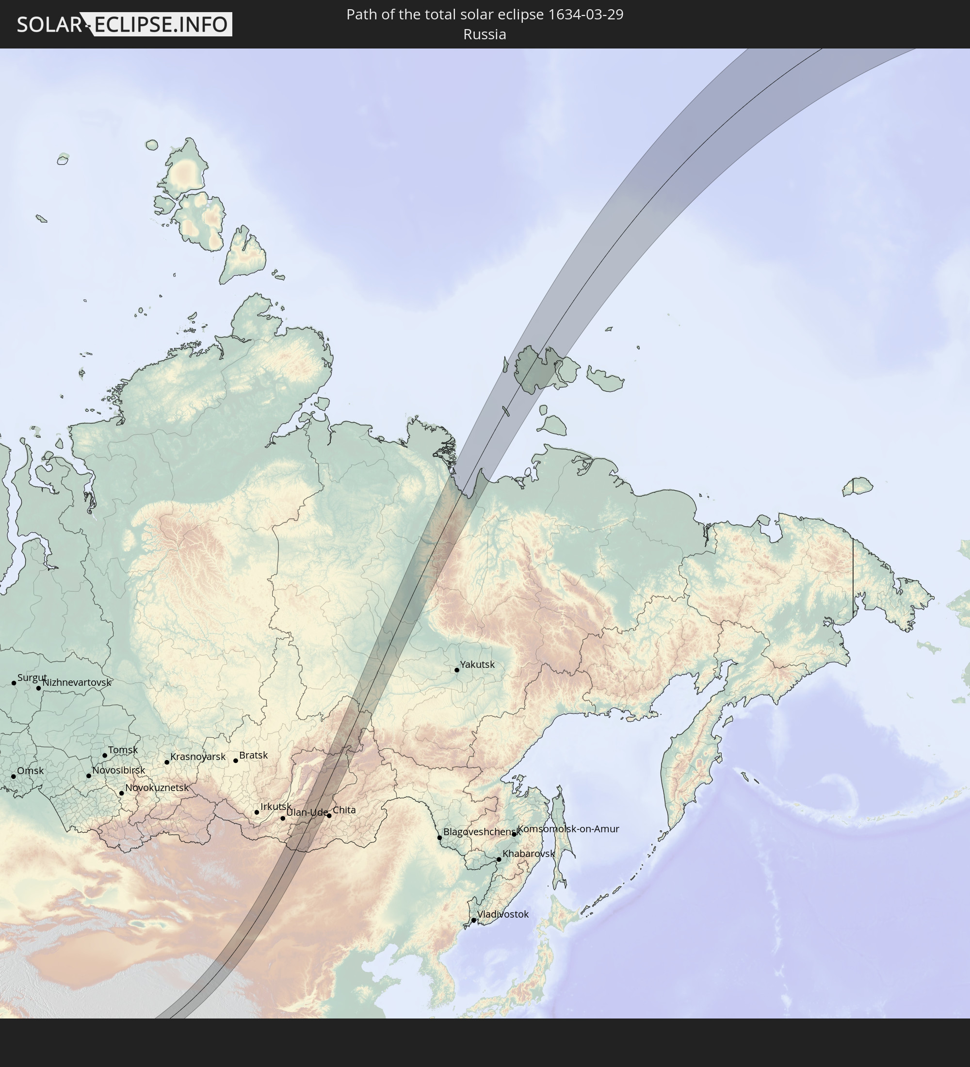 Russia
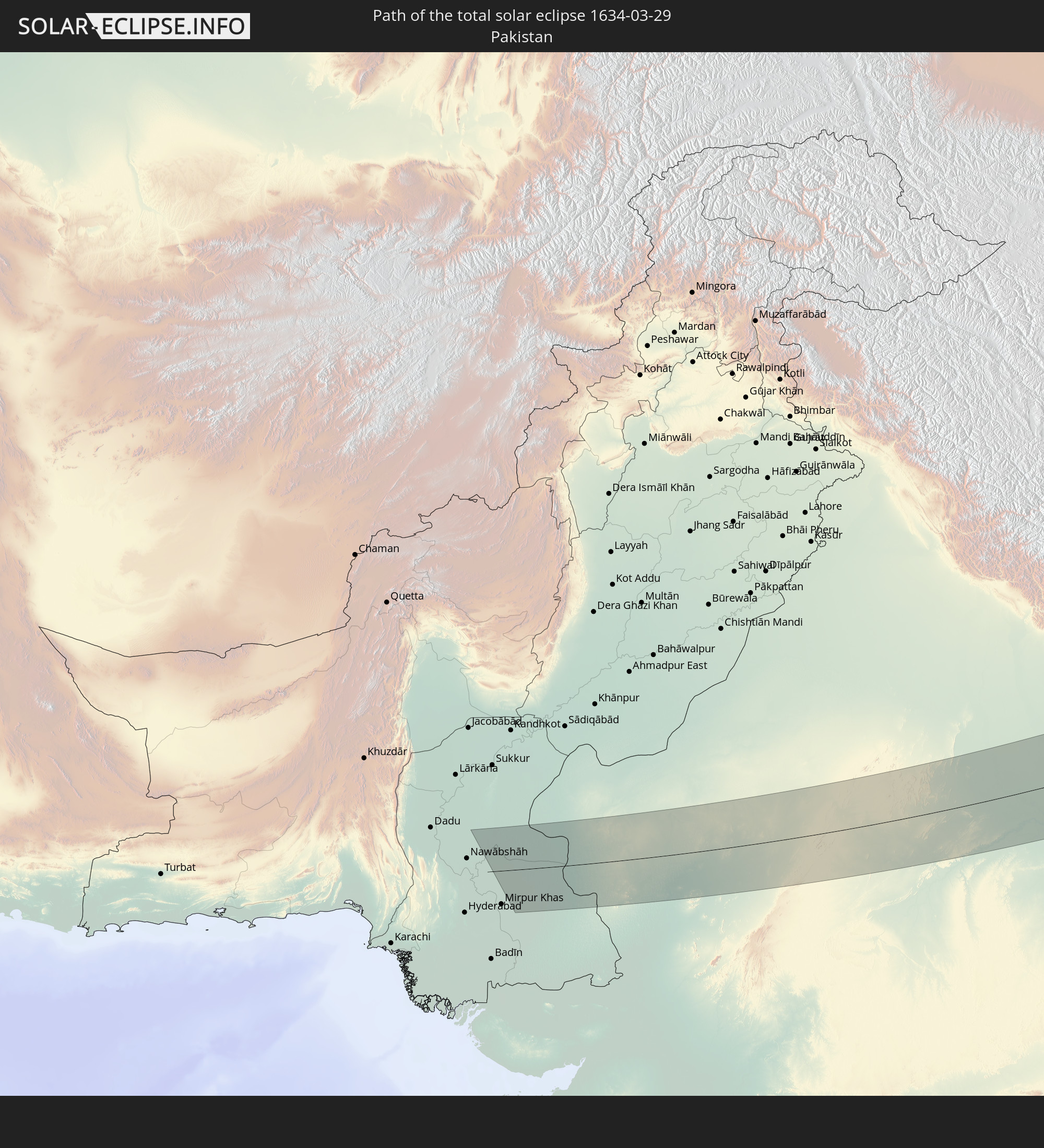 Pakistan
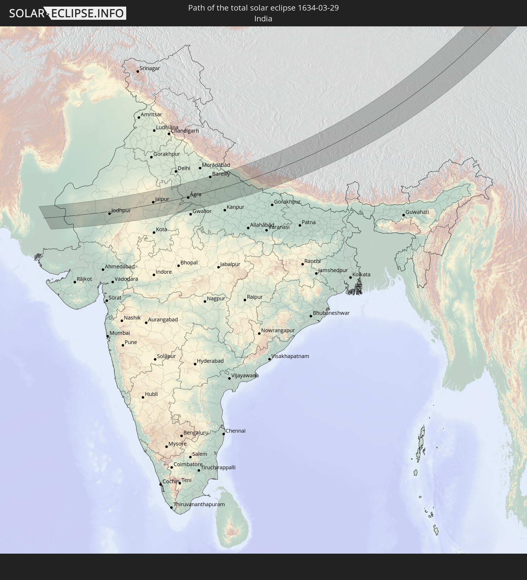 India
India
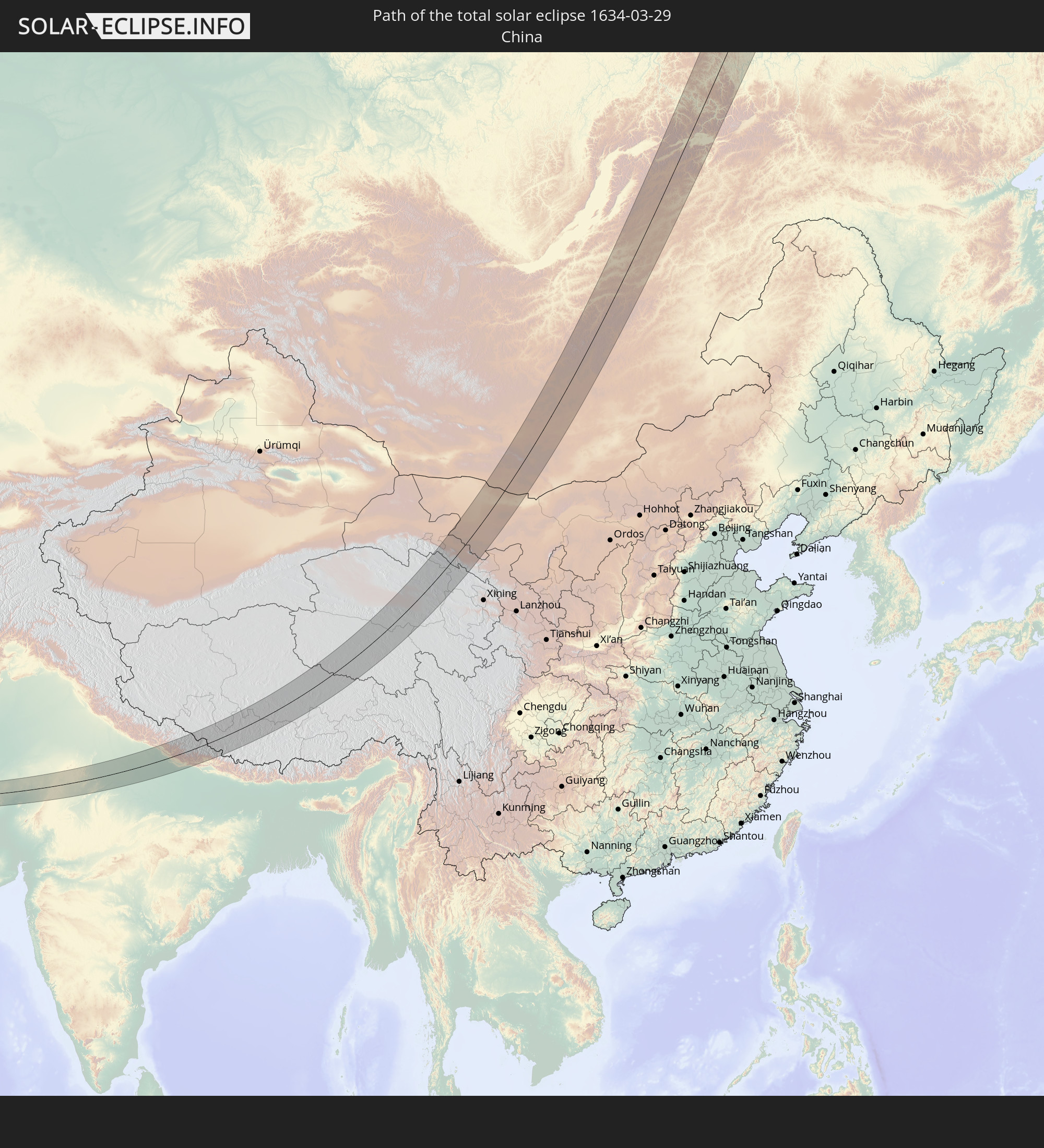 China
China
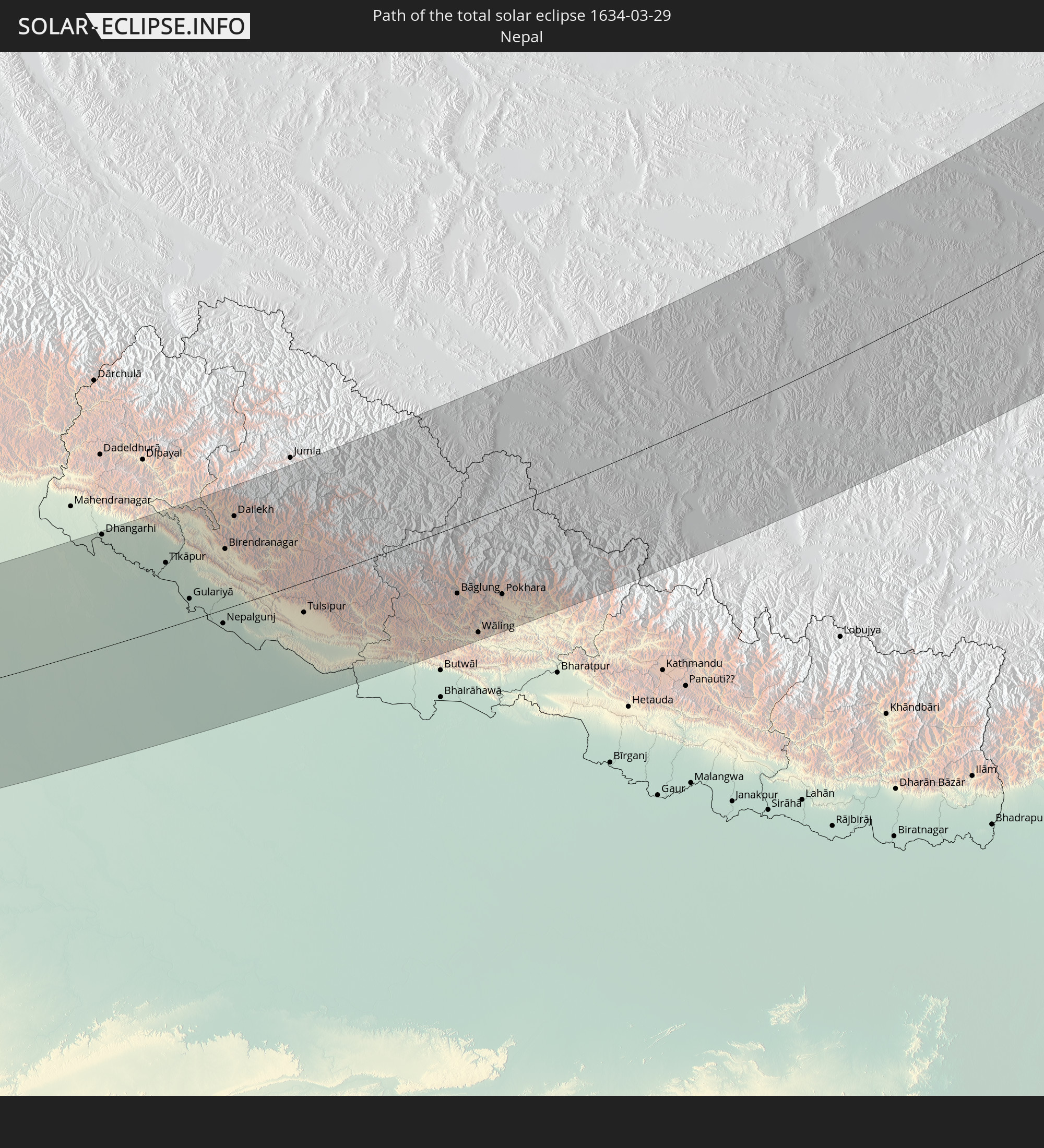 Nepal
Nepal
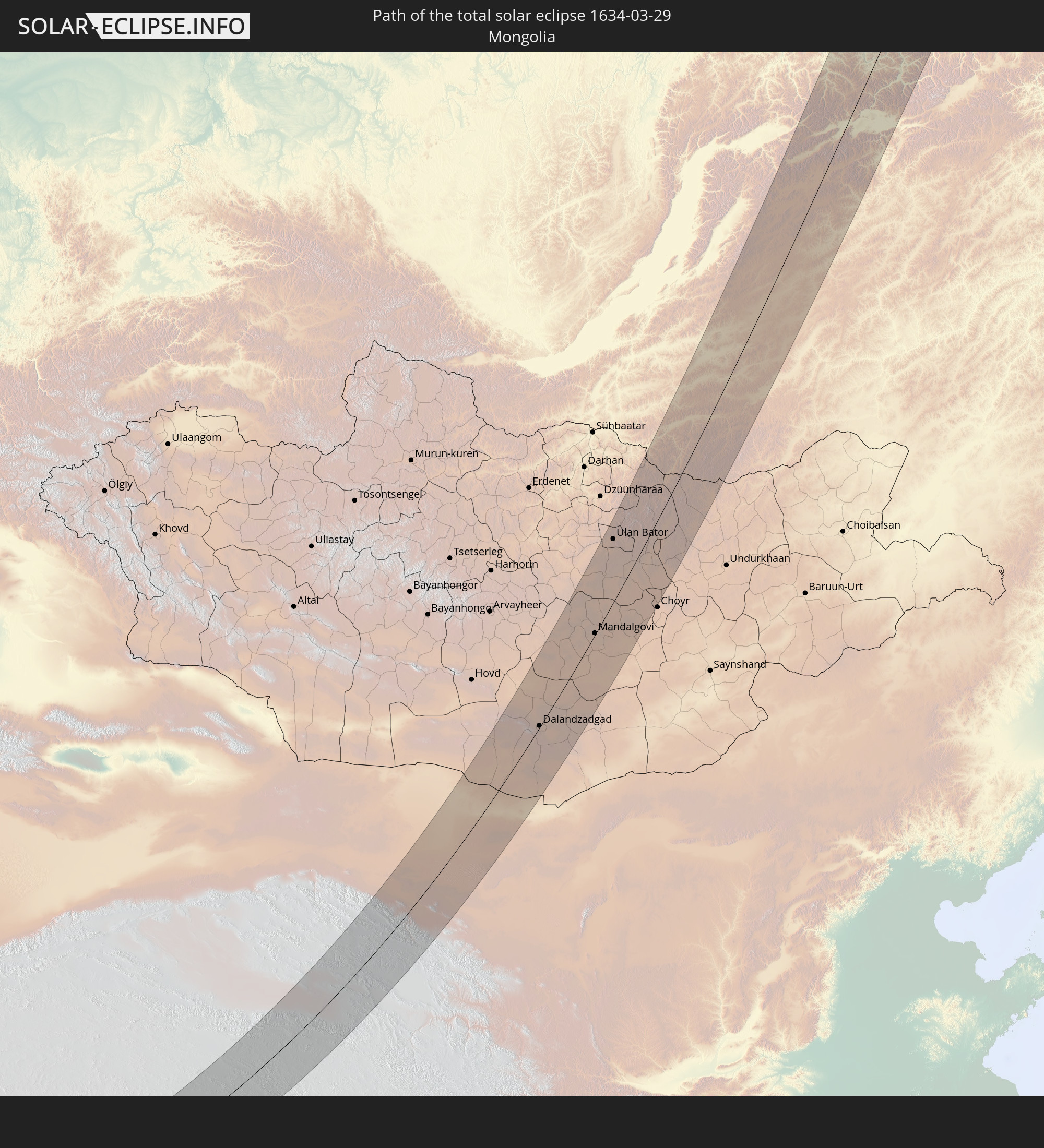 Mongolia
In den folgenden Ländern ist die Sonnenfinsternis partiell zu sehen
 Russia
 United States
 Canada
 Svalbard and Jan Mayen
 Kazakhstan
 Turkmenistan
 Uzbekistan
 Afghanistan
 Pakistan
 Tajikistan
 India
India
 Kyrgyzstan
 China
China
 Sri Lanka
 Nepal
Nepal
 Mongolia
 Bangladesh
 Bhutan
 Myanmar
 Indonesia
 Thailand
 Malaysia
 Laos
Laos
 Vietnam
 Cambodia
 Singapore
 Macau
Macau
 Hong Kong
 Brunei
 Taiwan
 Philippines
 Japan
Japan
 North Korea
 South Korea
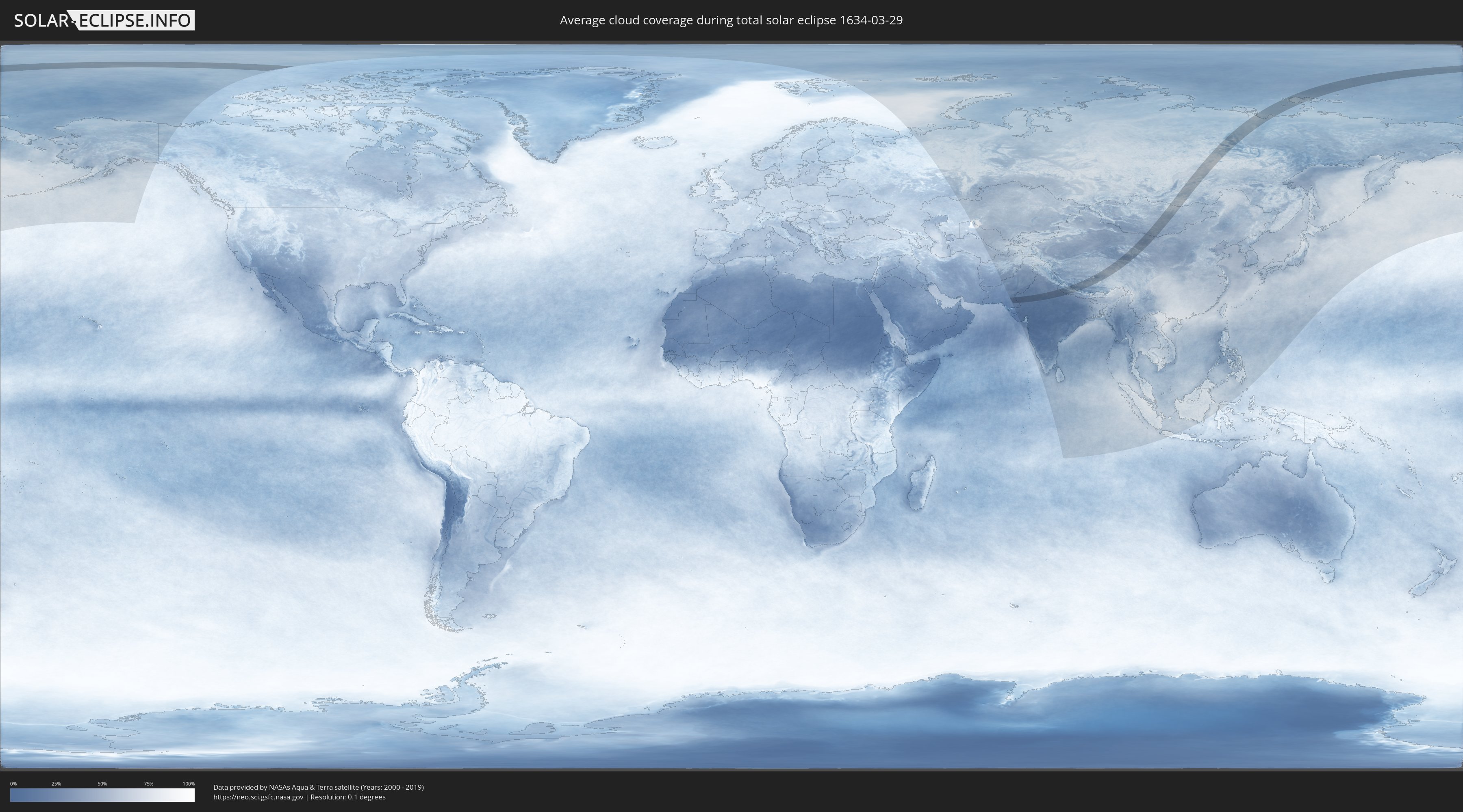
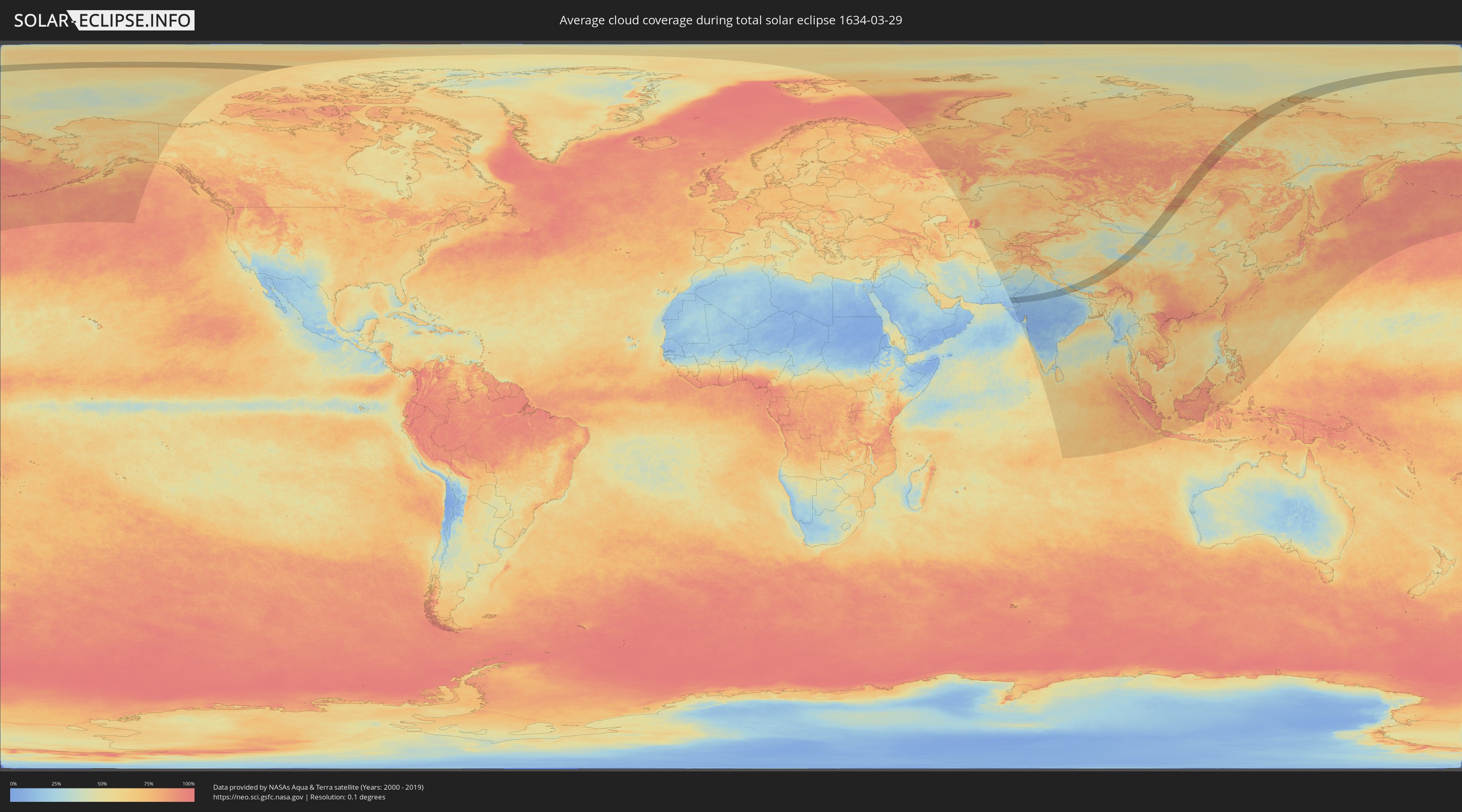
How will be the weather during the total solar eclipse on 03/29/1634?
Where is the best place to see the total solar eclipse of 03/29/1634?
The following maps show the average cloud coverage for the day of the total solar eclipse.
With the help of these maps, it is possible to find the place along the eclipse path, which has the best
chance of a cloudless sky.
Nevertheless, you should consider local circumstances and inform about the weather of your chosen
observation site.
The data is provided by NASAs satellites
AQUA and TERRA.
The cloud maps are averaged over a period of 19 years (2000 - 2019).
Detailed country maps
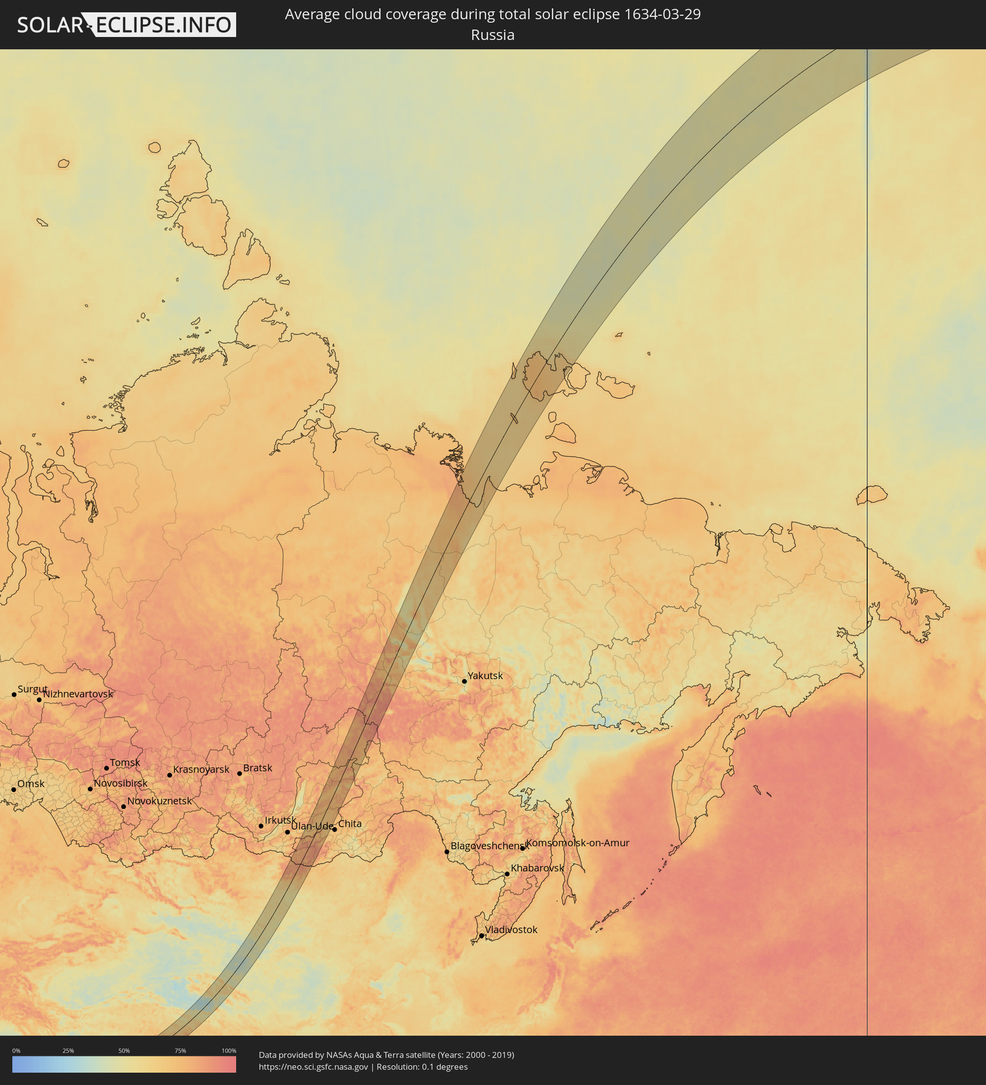 Russia
 Pakistan
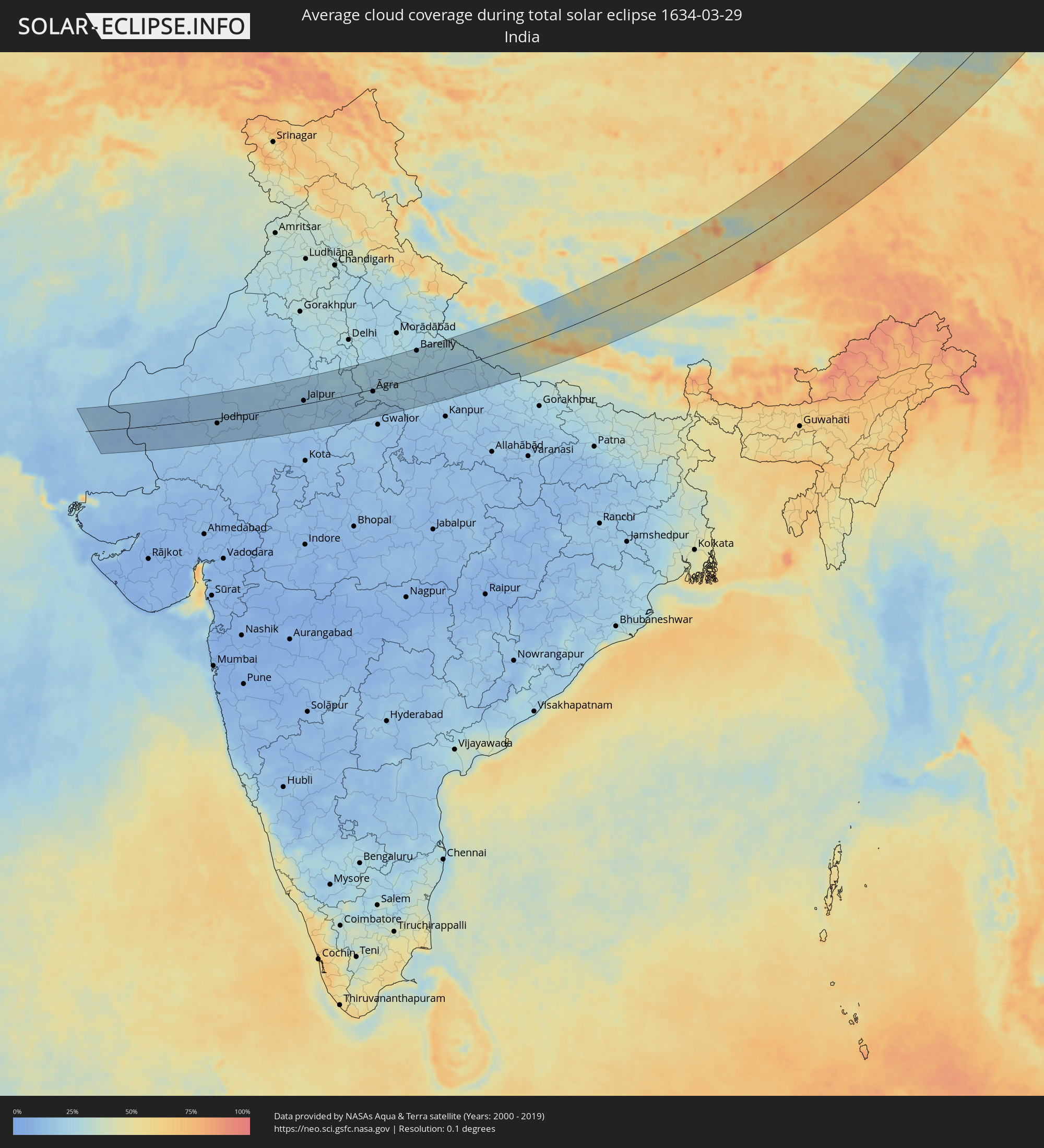 India
India
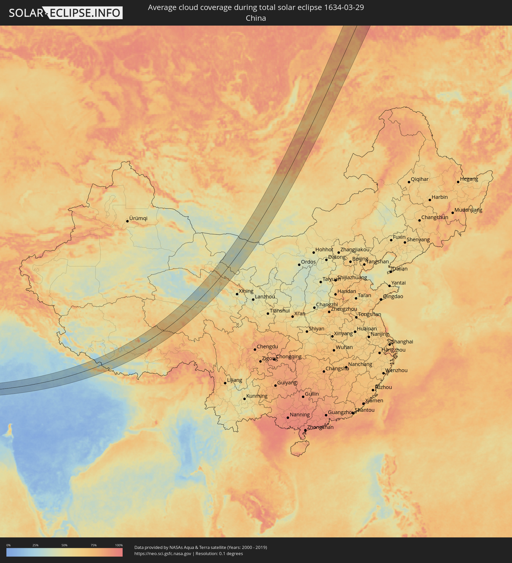 China
China
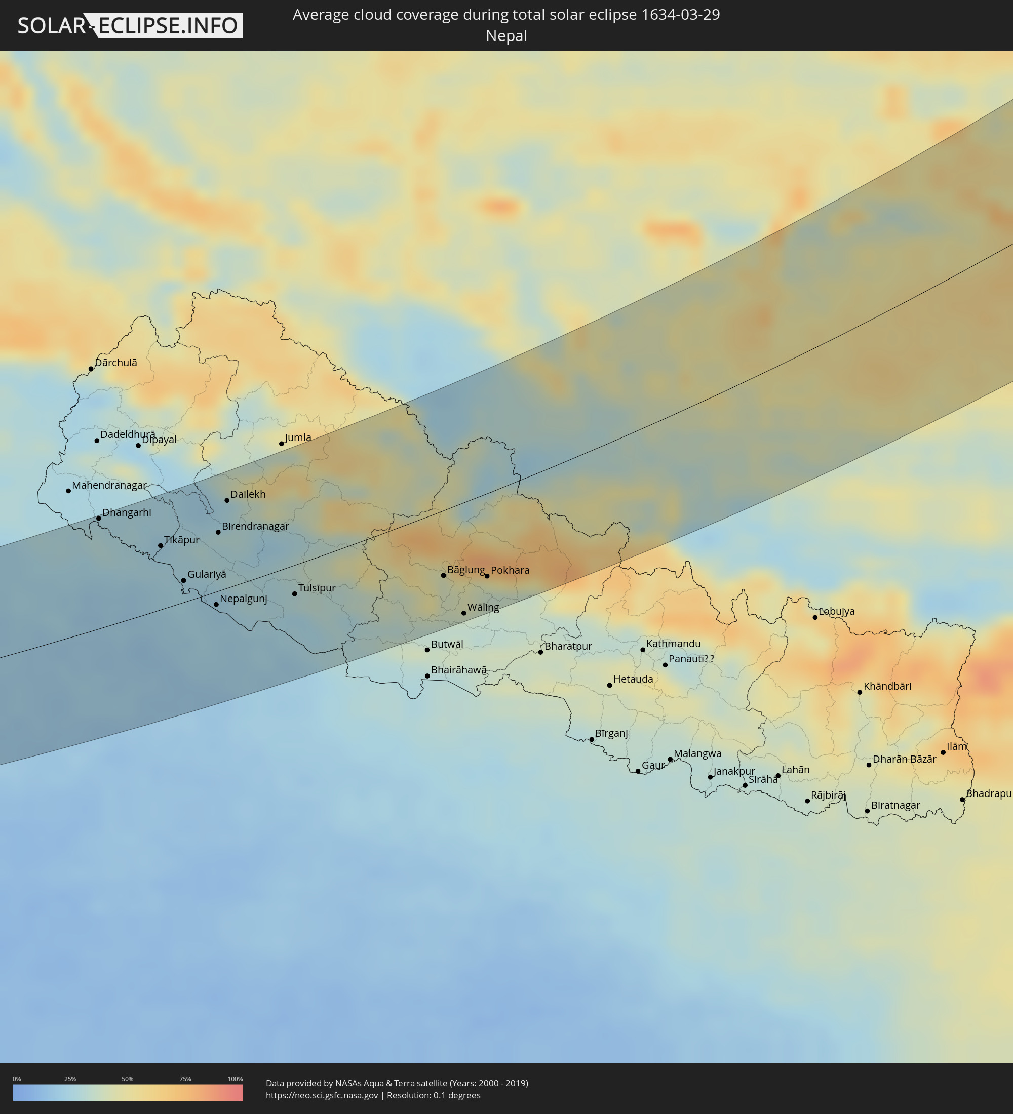 Nepal
Nepal
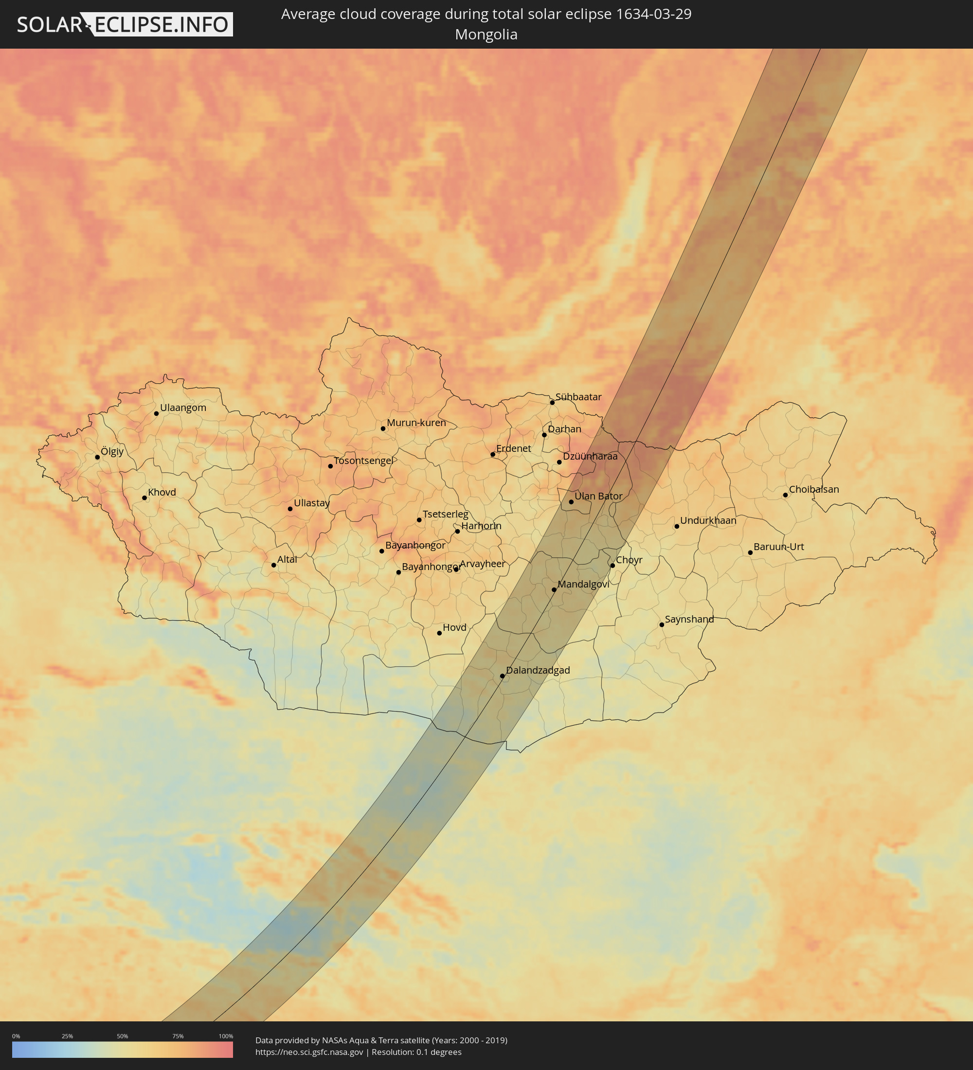 Mongolia
Cities inside the path of the eclipse
The following table shows all locations with a population of more than 5,000 inside the eclipse path. Cities which have more than 100,000 inhabitants are marked bold. A click at the locations opens a detailed map.
| City | Type | Eclipse duration | Local time of max. eclipse | Distance to central line | Ø Cloud coverage |
|
Sānghar, Sindh
|
total | - | 05:51:38 UTC+04:28 | 0 km | 15% |
|
Pithoro, Sindh
|
total | - | 05:50:49 UTC+04:28 | 63 km | 16% |
|
Dhoro Naro, Sindh
|
total | - | 05:50:47 UTC+04:28 | 65 km | 16% |
|
Chor, Sindh
|
total | - | 05:50:47 UTC+04:28 | 65 km | 15% |
|
Bārmer, Rajasthan
|
total | - | 06:44:01 UTC+05:21 | 55 km | 14% |
|
Jodhpur, Rajasthan
|
total | - | 06:44:48 UTC+05:21 | 16 km | 15% |
|
Pāli, Rajasthan
|
total | - | 06:44:03 UTC+05:21 | 76 km | 16% |
|
Nāgaur, Rajasthan
|
total | - | 06:46:17 UTC+05:21 | 76 km | 18% |
|
Beāwar, Rajasthan
|
total | - | 06:44:35 UTC+05:21 | 54 km | 14% |
|
Ajmer, Rajasthan
|
total | - | 06:45:09 UTC+05:21 | 21 km | 16% |
|
Makrāna, Rajasthan
|
total | - | 06:46:05 UTC+05:21 | 43 km | 17% |
|
Kishangarh, Rajasthan
|
total | - | 06:45:21 UTC+05:21 | 11 km | 16% |
|
Jaipur, Rajasthan
|
total | - | 06:45:58 UTC+05:21 | 10 km | 17% |
|
Tonk, Rajasthan
|
total | - | 06:44:47 UTC+05:21 | 72 km | 14% |
|
Alwar, Rajasthan
|
total | - | 06:47:06 UTC+05:21 | 64 km | 23% |
|
Gangāpur, Rajasthan
|
total | - | 06:45:22 UTC+05:21 | 56 km | 16% |
|
Hindaun, Rajasthan
|
total | - | 06:45:49 UTC+05:21 | 34 km | 16% |
|
Bharatpur, Rajasthan
|
total | - | 06:46:39 UTC+05:21 | 8 km | 19% |
|
Mathura, Uttar Pradesh
|
total | - | 06:47:08 UTC+05:21 | 35 km | 22% |
|
Dhaulpur, Rajasthan
|
total | - | 06:45:52 UTC+05:21 | 57 km | 19% |
|
Morena, Madhya Pradesh
|
total | - | 06:45:34 UTC+05:21 | 81 km | 16% |
|
Āgra, Uttar Pradesh
|
total | - | 06:46:40 UTC+05:21 | 7 km | 20% |
|
Hāthras, Uttar Pradesh
|
total | - | 06:47:21 UTC+05:21 | 37 km | 21% |
|
Alīgarh, Uttar Pradesh
|
total | - | 06:47:49 UTC+05:21 | 67 km | 22% |
|
Fīrozābād, Uttar Pradesh
|
total | - | 06:46:41 UTC+05:21 | 20 km | 21% |
|
Shikohābād, Uttar Pradesh
|
total | - | 06:46:38 UTC+05:21 | 29 km | 21% |
|
Kāsganj, Uttar Pradesh
|
total | - | 06:47:48 UTC+05:21 | 45 km | 23% |
|
Etāwah, Uttar Pradesh
|
total | - | 06:46:11 UTC+05:21 | 75 km | 17% |
|
Mainpuri, Uttar Pradesh
|
total | - | 06:46:55 UTC+05:21 | 27 km | 21% |
|
Budaun, Uttar Pradesh
|
total | - | 06:48:16 UTC+05:21 | 58 km | 24% |
|
Bareilly, Uttar Pradesh
|
total | - | 06:48:50 UTC+05:21 | 83 km | 24% |
|
Farrukhābād, Uttar Pradesh
|
total | - | 06:47:17 UTC+05:21 | 23 km | 19% |
|
Shāhjānpur, Uttar Pradesh
|
total | - | 06:48:10 UTC+05:21 | 21 km | 21% |
|
Kannauj, Uttar Pradesh
|
total | - | 06:46:48 UTC+05:21 | 68 km | 18% |
|
Hardoī, Uttar Pradesh
|
total | - | 06:47:24 UTC+05:21 | 38 km | 19% |
|
Dhangarhi, Far Western
|
total | - | 07:09:48 UTC+05:41 | 89 km | 29% |
|
Sītāpur, Uttar Pradesh
|
total | - | 06:47:48 UTC+05:21 | 35 km | 20% |
|
Lakhīmpur, Uttar Pradesh
|
total | - | 06:48:28 UTC+05:21 | 3 km | 21% |
|
Tīkāpur, Far Western
|
total | - | 07:09:35 UTC+05:41 | 51 km | 24% |
|
Gulariyā, Mid Western
|
total | - | 07:09:11 UTC+05:41 | 17 km | 25% |
|
Bahraigh, Uttar Pradesh
|
total | - | 06:48:02 UTC+05:21 | 61 km | 21% |
|
Nepalgunj, Mid Western
|
total | - | 07:08:57 UTC+05:41 | 11 km | 21% |
|
Birendranagar, Mid Western
|
total | - | 07:09:53 UTC+05:41 | 47 km | 27% |
|
Dailekh, Mid Western
|
total | - | 07:10:19 UTC+05:41 | 70 km | 25% |
|
Tulsīpur, Mid Western
|
total | - | 07:09:16 UTC+05:41 | 24 km | 24% |
|
Besisahar
|
total | - | 07:09:28 UTC+05:41 | 17 km | 31% |
|
Tānsen, Western Region
|
total | - | 07:09:10 UTC+05:41 | 93 km | 34% |
|
Bāglung, Western Region
|
total | - | 07:09:53 UTC+05:41 | 52 km | 41% |
|
Wāling, Western Region
|
total | - | 07:09:26 UTC+05:41 | 88 km | 33% |
|
Pokhara, Western Region
|
total | - | 07:09:59 UTC+05:41 | 66 km | 47% |
|
Zhangye, Gansu
|
total | - | 09:58:18 UTC+08:00 | 24 km | 42% |
|
Dalandzadgad, Ömnögovĭ
|
total | - | 09:18:13 UTC+07:07 | 3 km | 49% |
|
Mandalgovi, Middle Govĭ
|
total | - | 09:24:01 UTC+07:07 | 2 km | 59% |
|
Ulan Bator, Ulaanbaatar
|
total | - | 09:28:31 UTC+07:07 | 76 km | 63% |
|
Зуунмод, Central Aimak
|
total | - | 09:28:13 UTC+07:07 | 61 km | 62% |
|
Dzuunmod, Central Aimak
|
total | - | 09:28:13 UTC+07:07 | 61 km | 62% |
|
Krasnyy Chikoy, Transbaikal Territory
|
total | - | 11:06:01 UTC+08:38 | 76 km | 73% |
|
Bada, Transbaikal Territory
|
total | - | 11:08:48 UTC+08:38 | 56 km | 74% |
|
Kizhinga, Respublika Buryatiya
|
total | - | 09:27:44 UTC+06:57 | 74 km | 63% |
|
Khilok, Transbaikal Territory
|
total | - | 11:09:19 UTC+08:38 | 16 km | 78% |
|
Sosnovo-Ozerskoye, Respublika Buryatiya
|
total | - | 09:30:21 UTC+06:57 | 6 km | 62% |
|
Taksimo, Respublika Buryatiya
|
total | - | 09:39:20 UTC+06:57 | 13 km | 78% |
|
Kuanda, Transbaikal Territory
|
total | - | 11:22:14 UTC+08:38 | 81 km | 65% |
|
Verkhnevilyuysk, Sakha
|
total | - | 11:34:50 UTC+08:38 | 33 km | 83% |
|
Vilyuysk, Sakha
|
total | - | 11:36:10 UTC+08:38 | 14 km | 65% |
|
Tiksi, Sakha
|
total | - | 11:47:22 UTC+08:38 | 82 km | 80% |