Annular solar eclipse of 02/28/1691
| Day of week: | Wednesday |
| Maximum duration of eclipse: | 06m40s |
| Maximum width of eclipse path: | 220 km |
| Saros cycle: | 125 |
| Coverage: | 94.1% |
| Magnitude: | 0.9414 |
| Gamma: | 0.1701 |
Wo kann man die Sonnenfinsternis vom 02/28/1691 sehen?
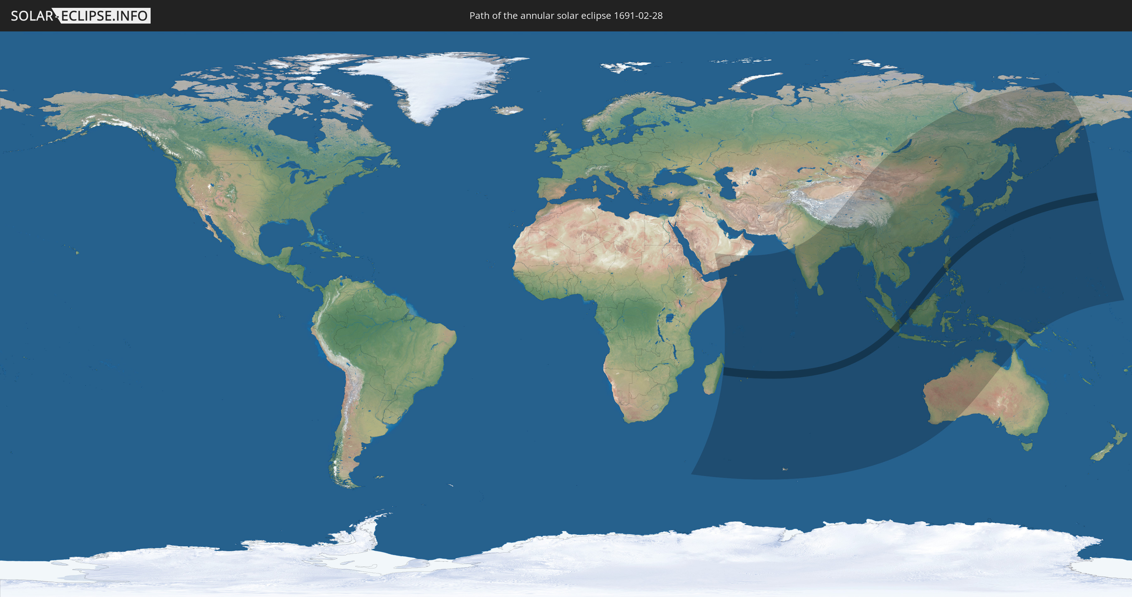
Die Sonnenfinsternis am 02/28/1691 kann man in 46 Ländern als partielle Sonnenfinsternis beobachten.
Der Finsternispfad verläuft durch 6 Länder. Nur in diesen Ländern ist sie als annular Sonnenfinsternis zu sehen.
In den folgenden Ländern ist die Sonnenfinsternis annular zu sehen
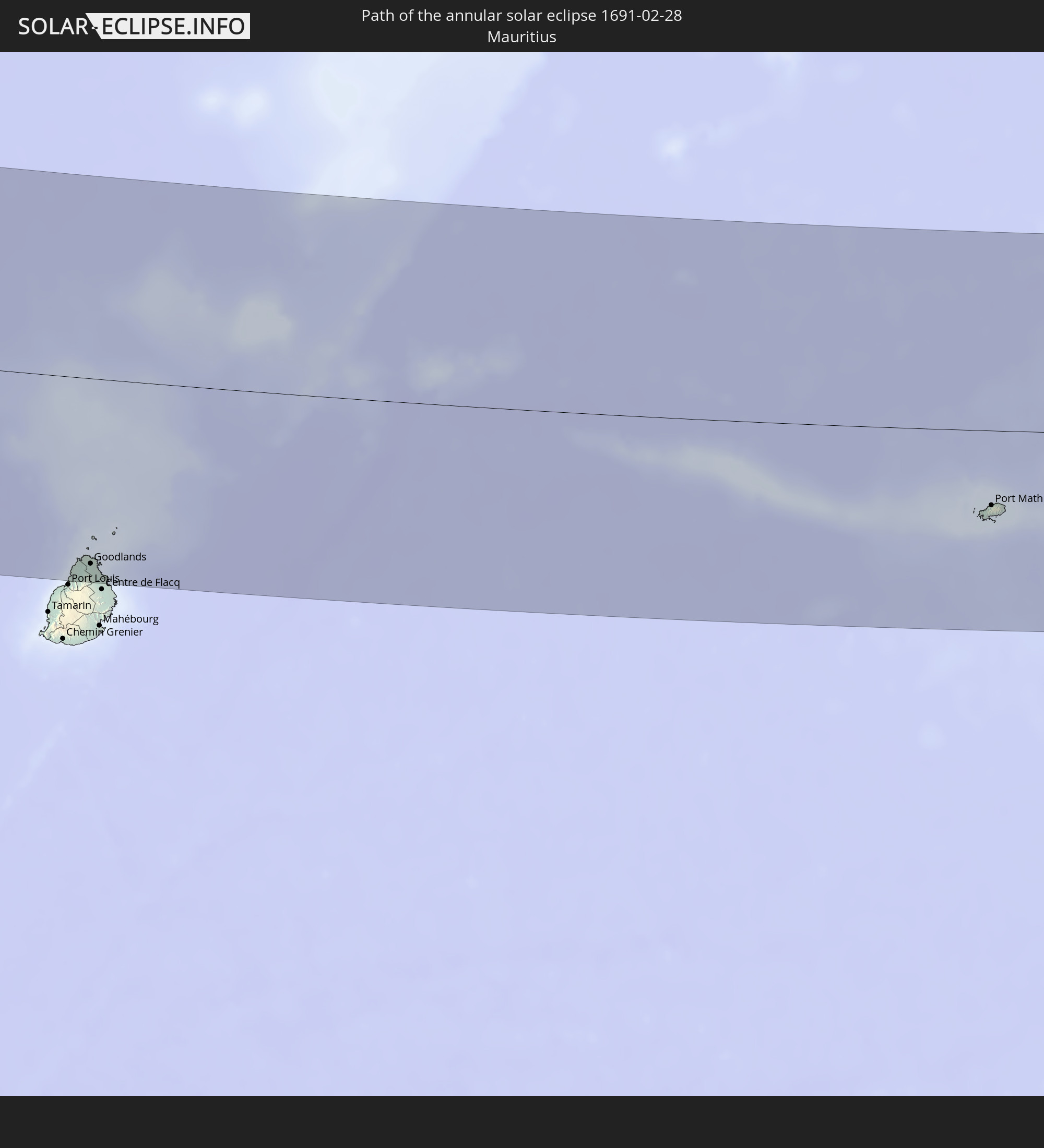 Mauritius
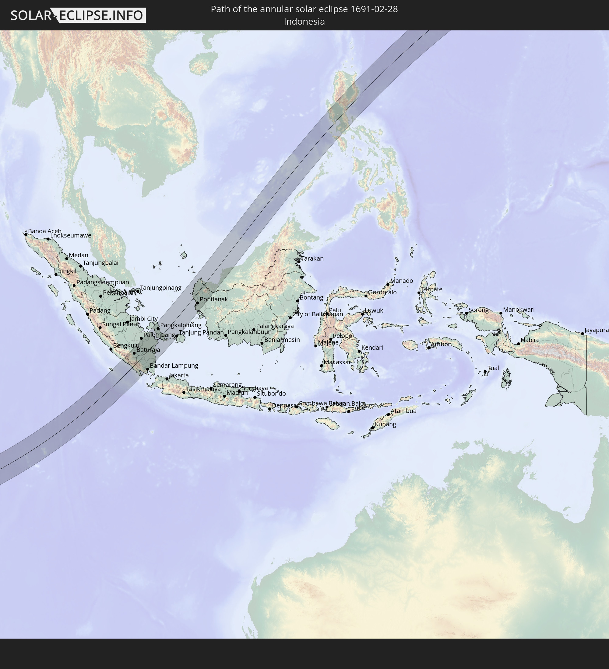 Indonesia
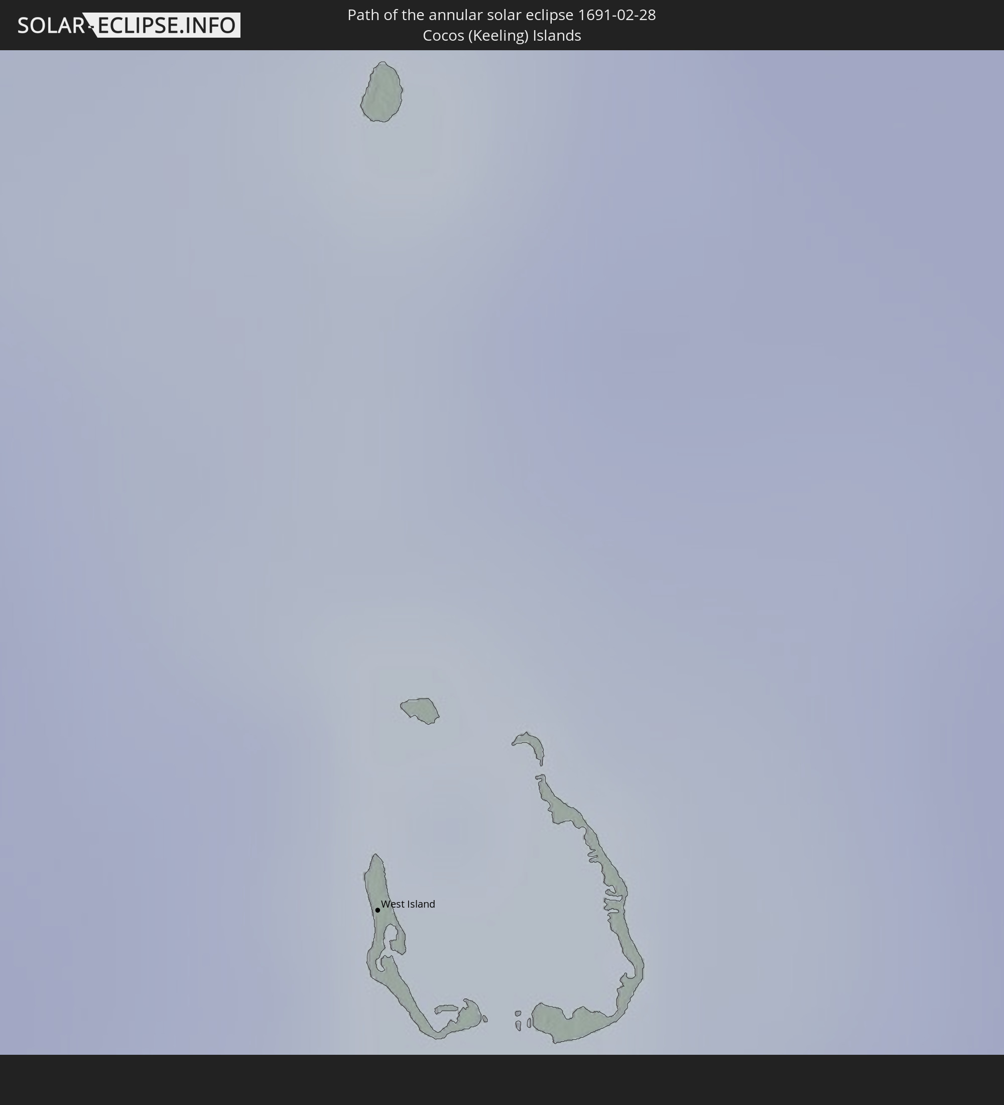 Cocos Islands
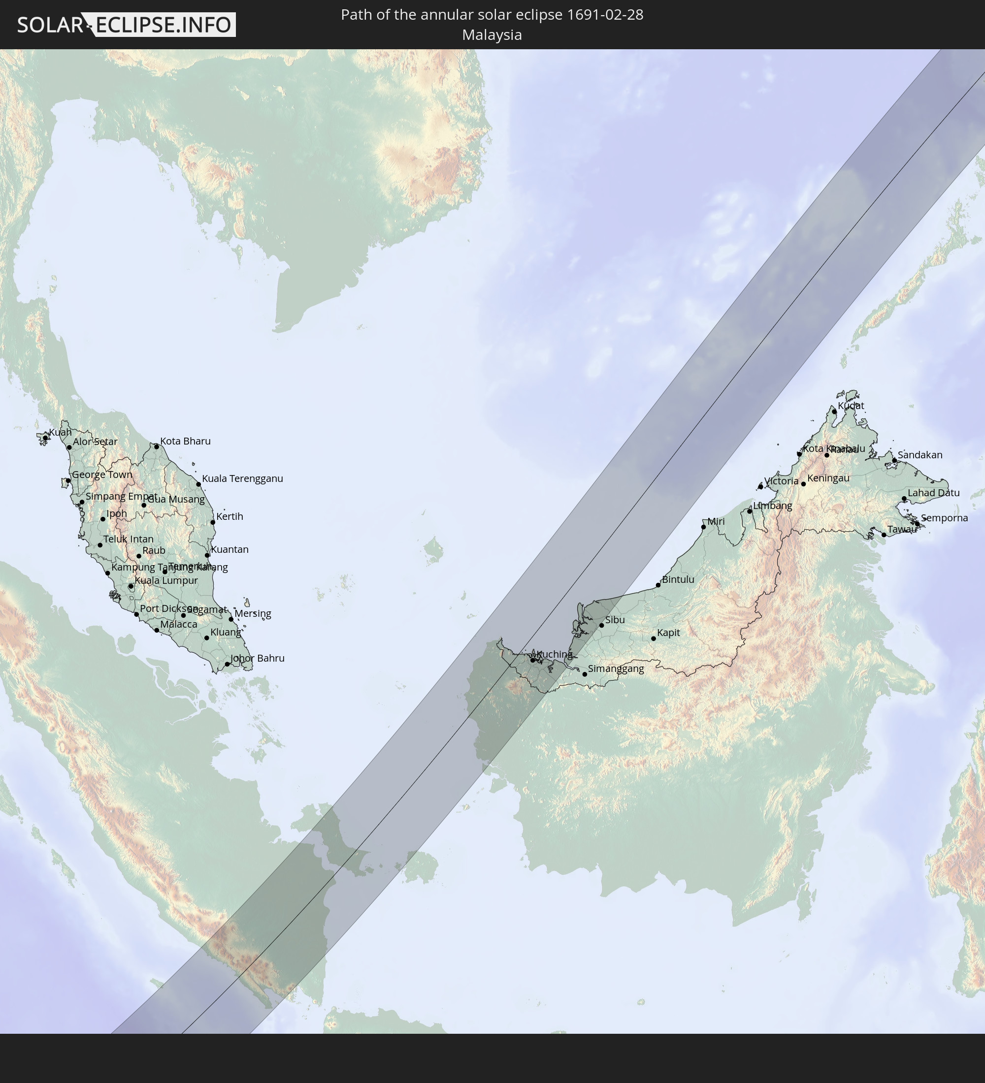 Malaysia
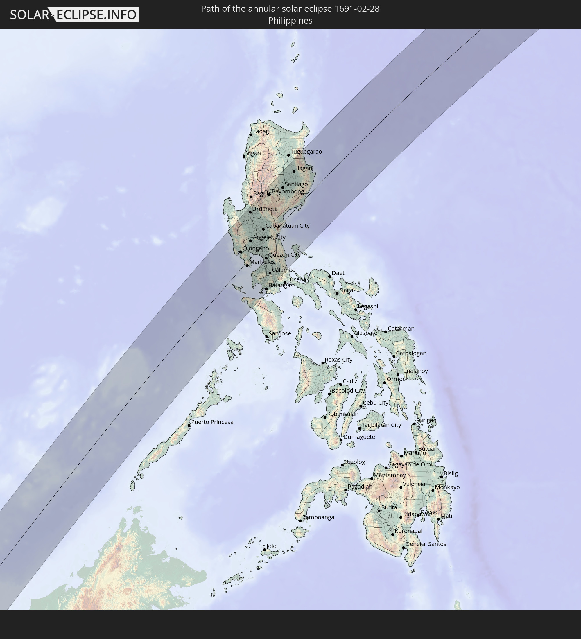 Philippines
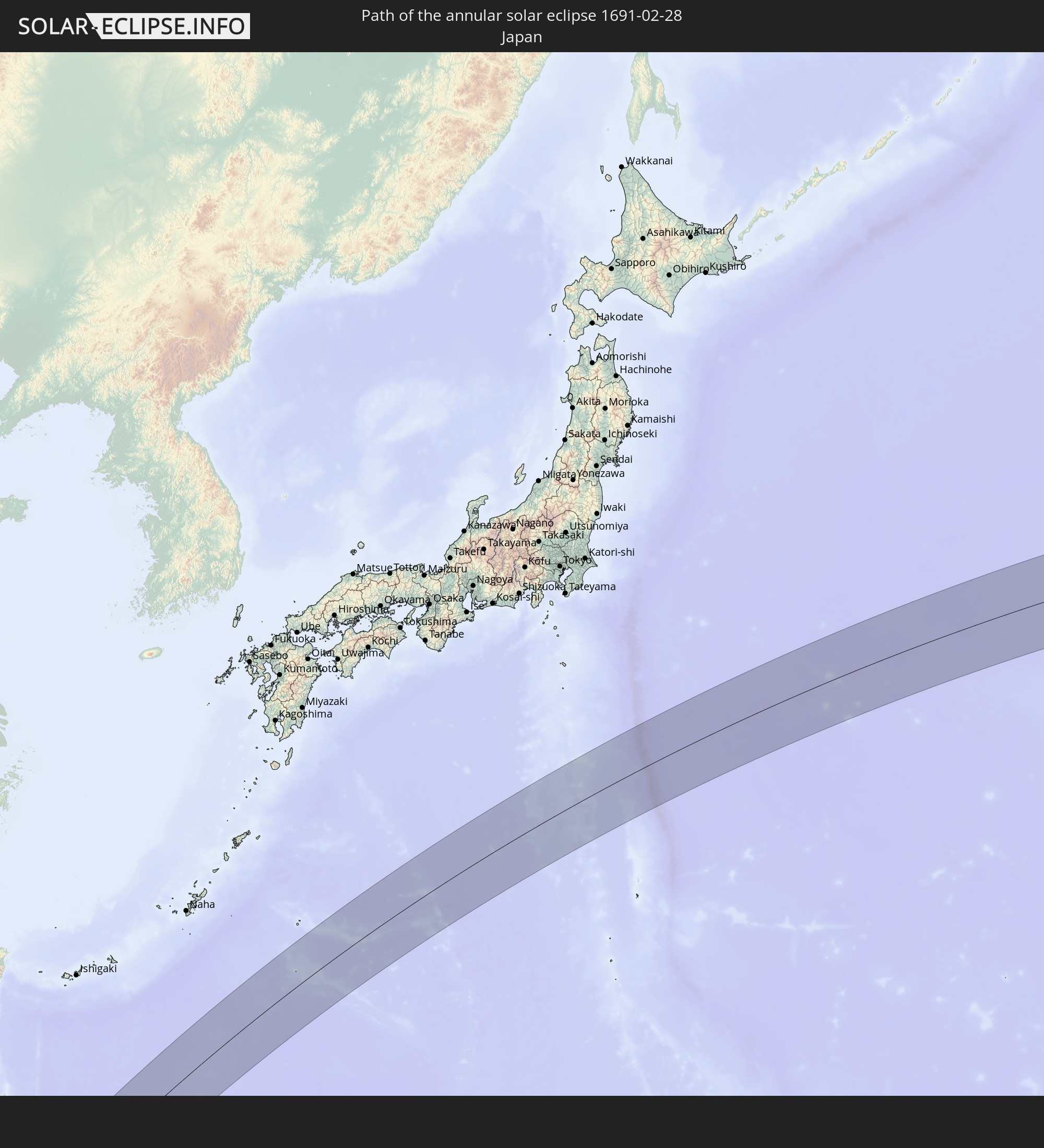 Japan
Japan
In den folgenden Ländern ist die Sonnenfinsternis partiell zu sehen
 Russia
 United States Minor Outlying Islands
 Saudi Arabia
 French Southern and Antarctic Lands
 Somalia
 Yemen
Yemen
 Madagascar
 Seychelles
 Oman
Oman
 Réunion
 Mauritius
 India
India
 British Indian Ocean Territory
 Maldives
 China
China
 Sri Lanka
 Nepal
Nepal
 Mongolia
 Bangladesh
 Bhutan
 Myanmar
 Indonesia
 Cocos Islands
 Thailand
 Malaysia
 Laos
Laos
 Vietnam
 Cambodia
 Singapore
 Christmas Island
 Australia
 Macau
Macau
 Hong Kong
 Brunei
 Taiwan
 Philippines
 Japan
Japan
 East Timor
 North Korea
 South Korea
 Palau
Palau
 Federated States of Micronesia
 Papua New Guinea
 Guam
Guam
 Northern Mariana Islands
 Marshall Islands
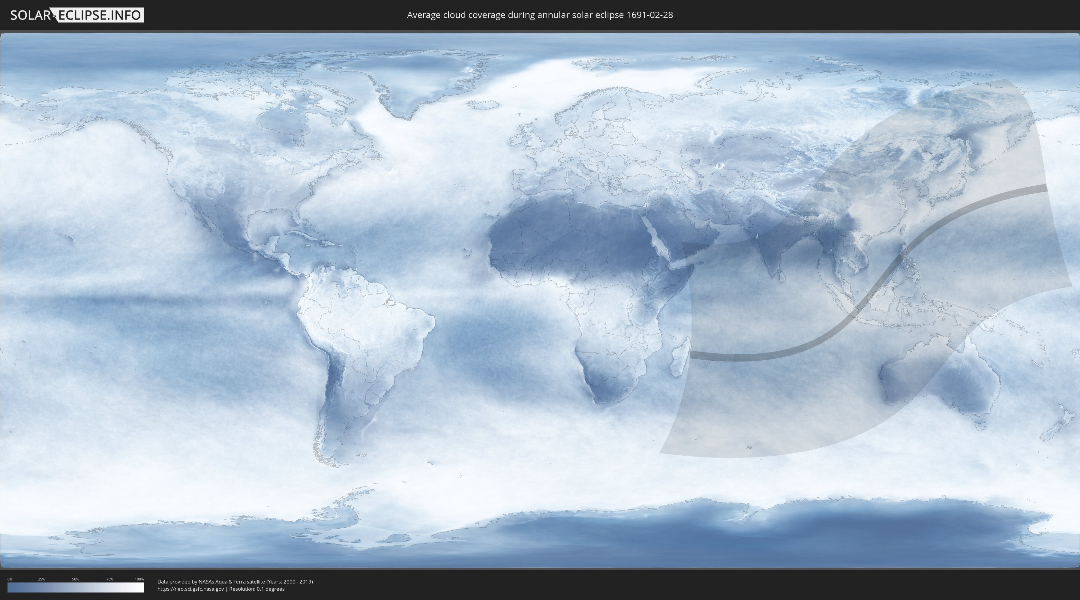
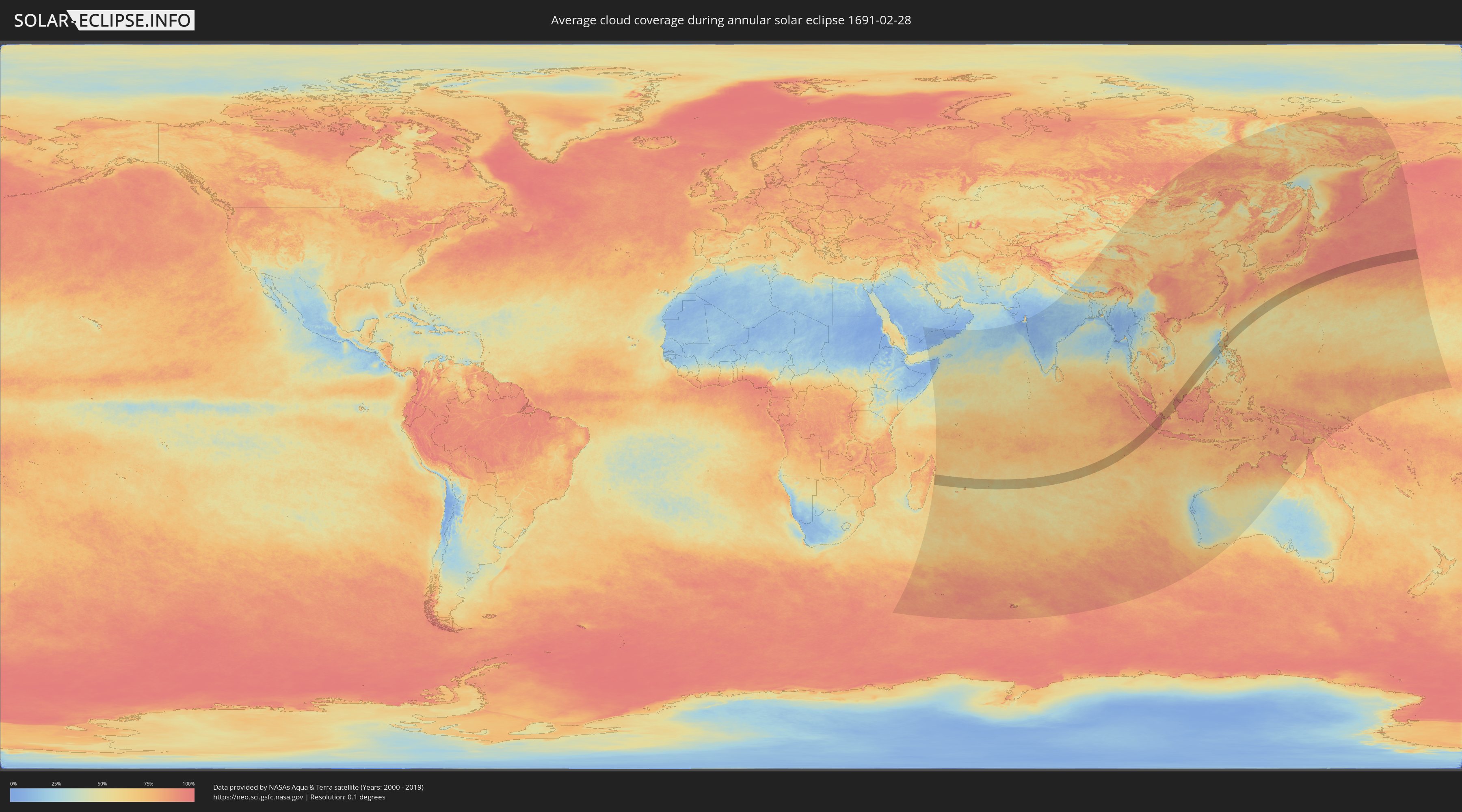
How will be the weather during the annular solar eclipse on 02/28/1691?
Where is the best place to see the annular solar eclipse of 02/28/1691?
The following maps show the average cloud coverage for the day of the annular solar eclipse.
With the help of these maps, it is possible to find the place along the eclipse path, which has the best
chance of a cloudless sky.
Nevertheless, you should consider local circumstances and inform about the weather of your chosen
observation site.
The data is provided by NASAs satellites
AQUA and TERRA.
The cloud maps are averaged over a period of 19 years (2000 - 2019).
Detailed country maps
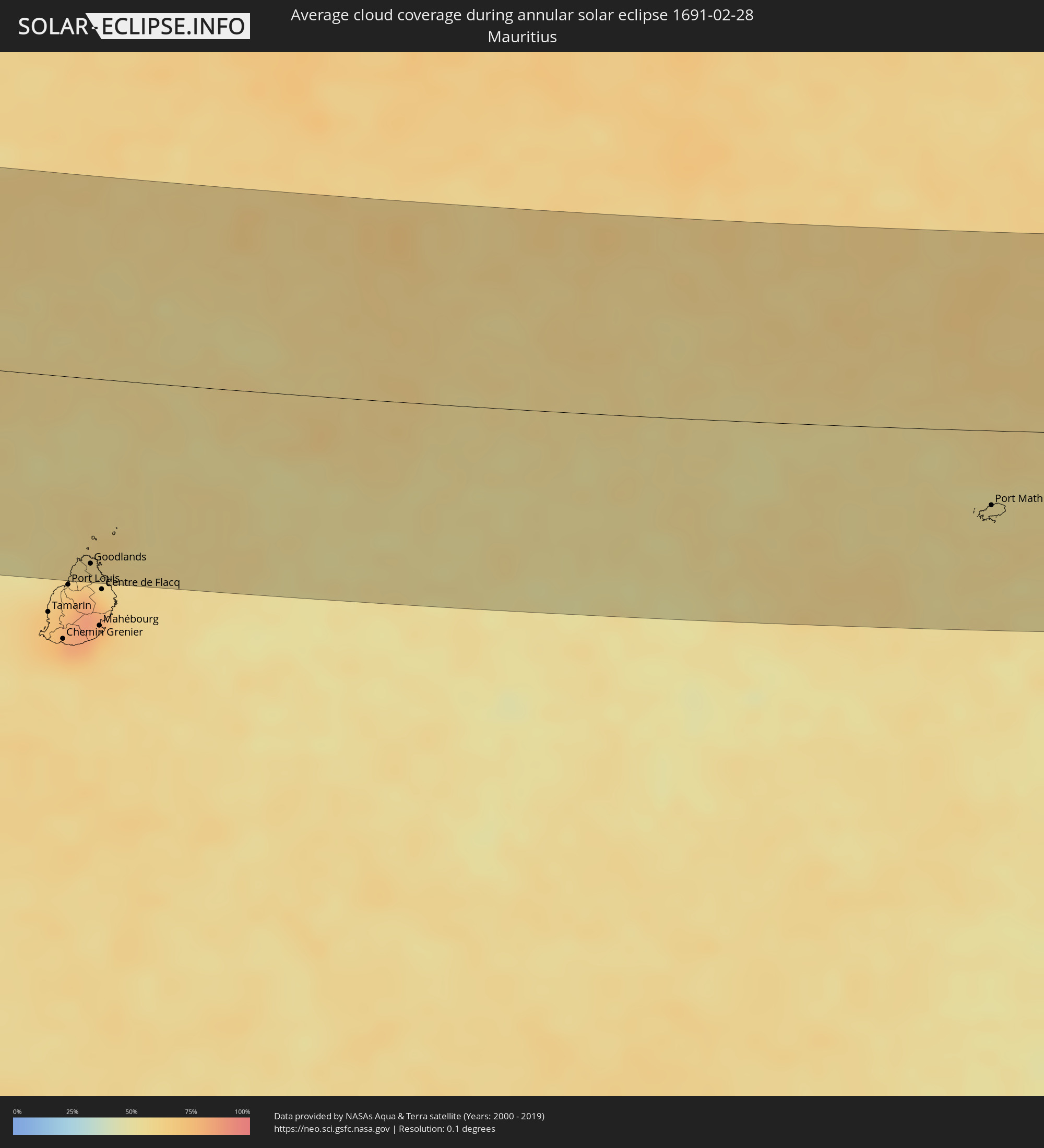 Mauritius
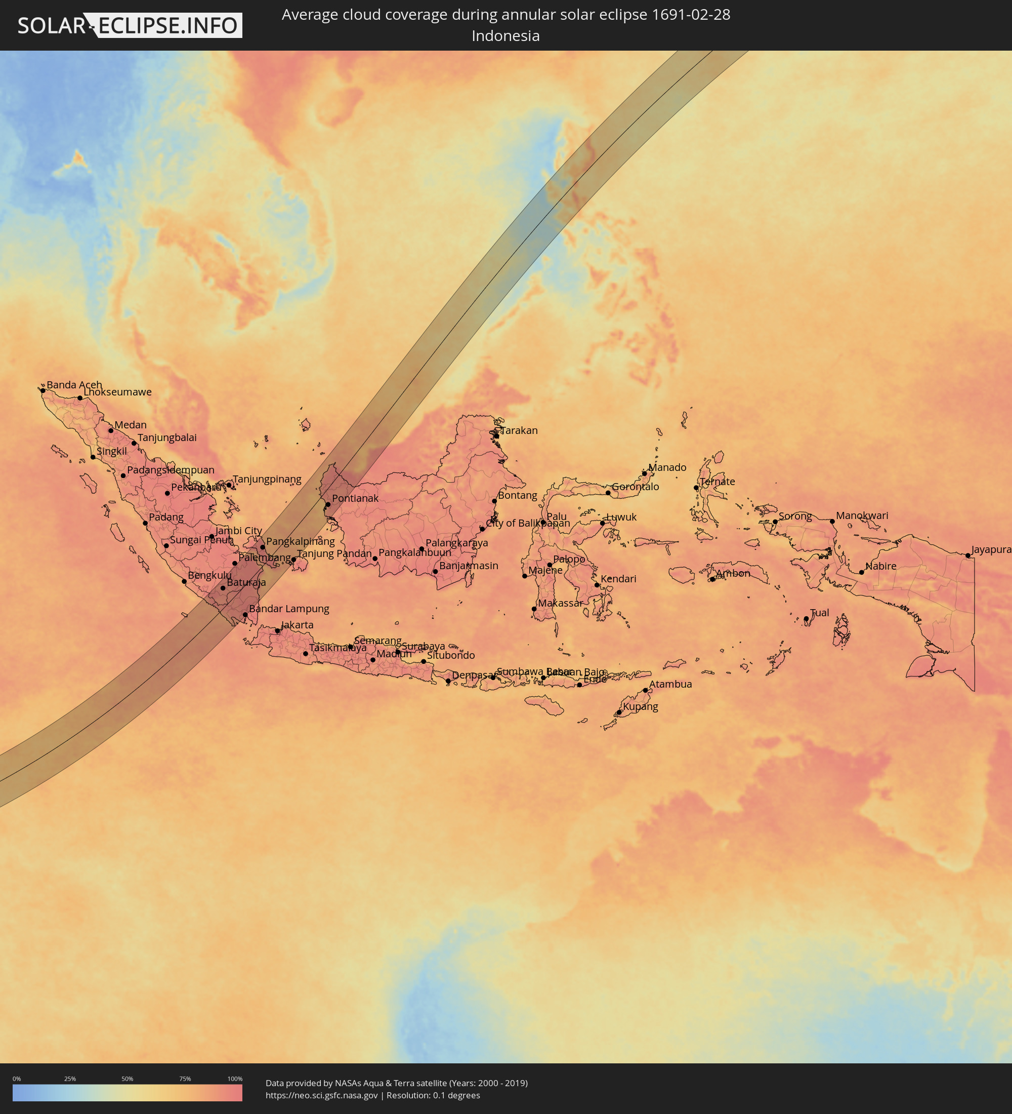 Indonesia
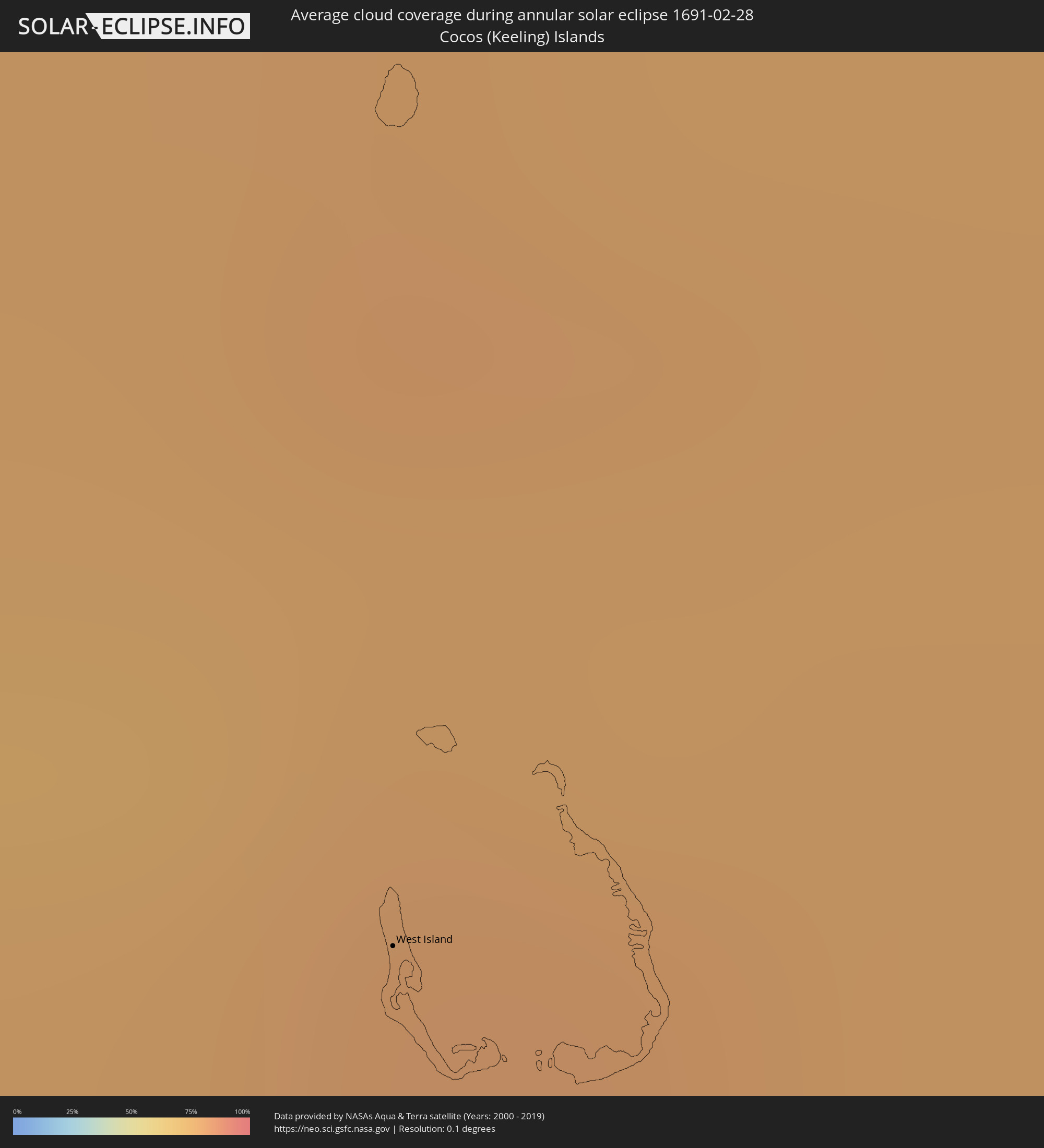 Cocos Islands
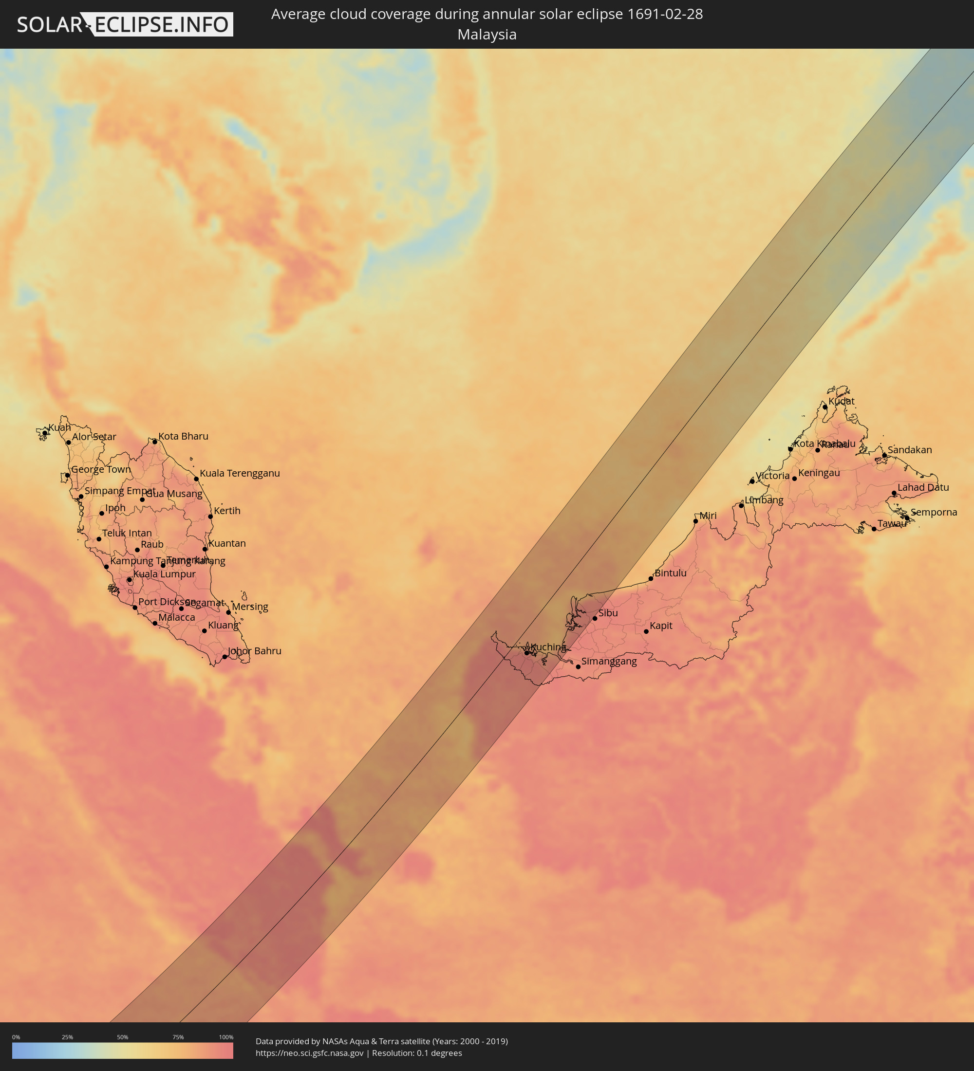 Malaysia
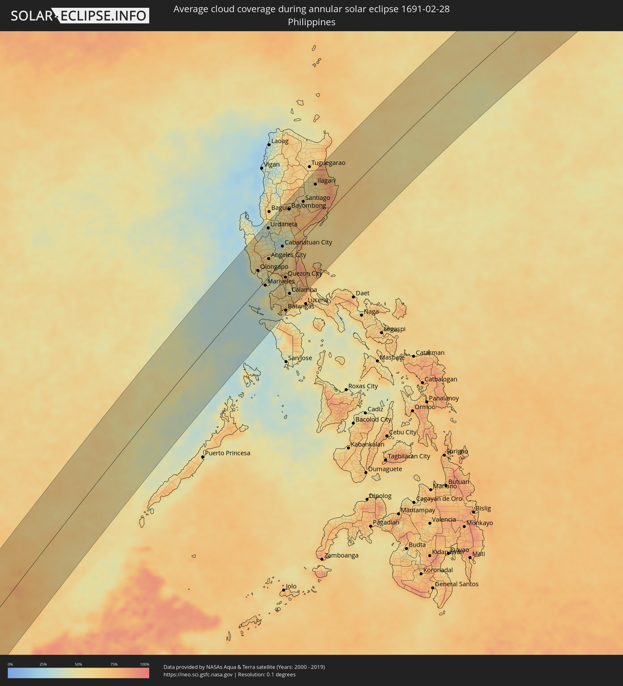 Philippines
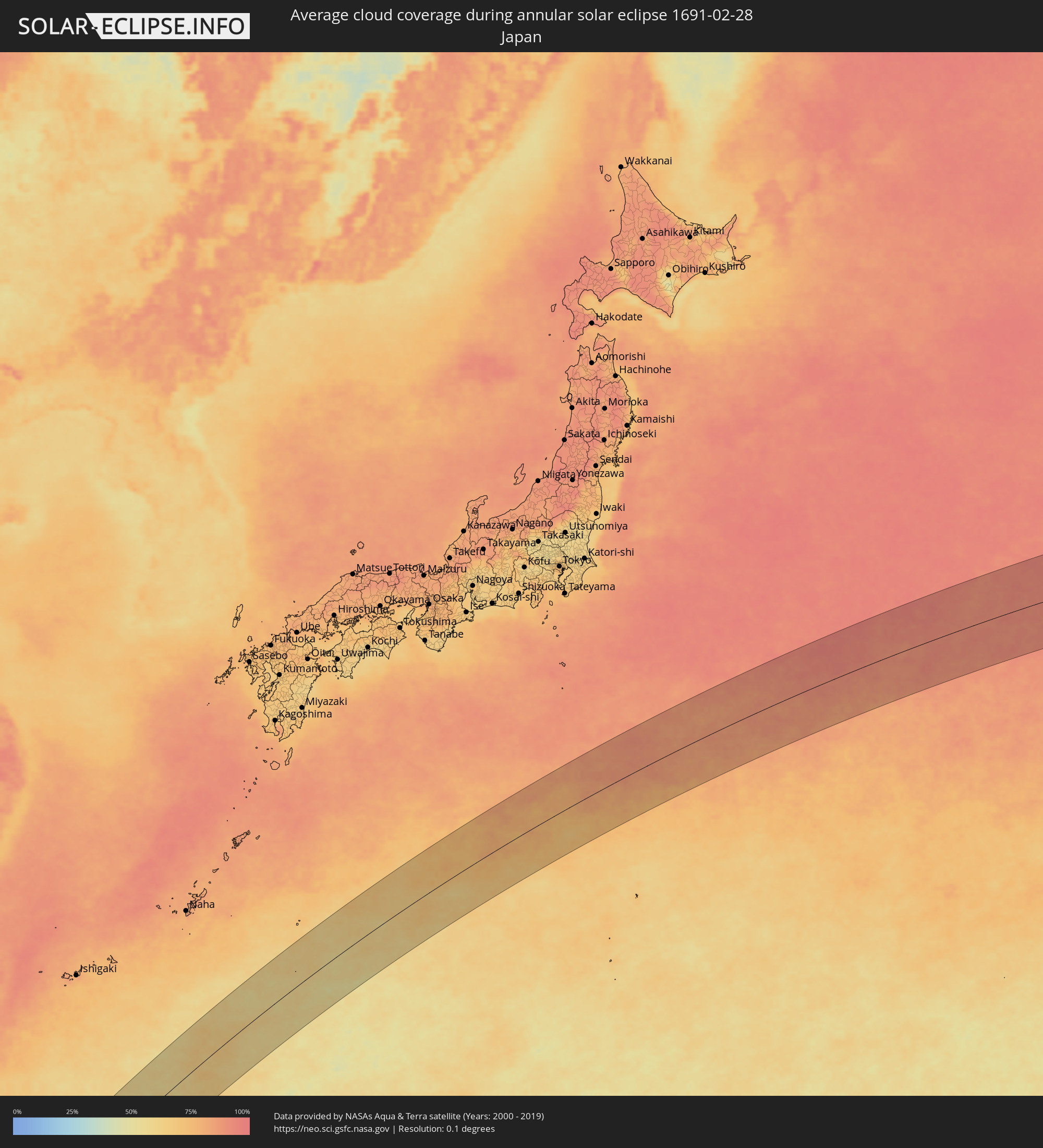 Japan
Japan
Cities inside the path of the eclipse
The following table shows all locations with a population of more than 5,000 inside the eclipse path. Cities which have more than 100,000 inhabitants are marked bold. A click at the locations opens a detailed map.
| City | Type | Eclipse duration | Local time of max. eclipse | Distance to central line | Ø Cloud coverage |
|
Grande Pointe aux Piments, Pamplemousses
|
annular | - | 06:33:13 UTC+03:50 | 128 km | 74% |
|
Le Hochet, Pamplemousses
|
annular | - | 06:33:12 UTC+03:50 | 136 km | 74% |
|
Terre Rouge, Pamplemousses
|
annular | - | 06:33:12 UTC+03:50 | 135 km | 74% |
|
Triolet, Pamplemousses
|
annular | - | 06:33:14 UTC+03:50 | 127 km | 74% |
|
Morcellemont Saint André, Pamplemousses
|
annular | - | 06:33:14 UTC+03:50 | 129 km | 81% |
|
Pamplemousses, Pamplemousses
|
annular | - | 06:33:13 UTC+03:50 | 132 km | 81% |
|
Plaine des Papayes, Pamplemousses
|
annular | - | 06:33:14 UTC+03:50 | 128 km | 81% |
|
Fond du Sac, Pamplemousses
|
annular | - | 06:33:14 UTC+03:50 | 126 km | 68% |
|
Grand Baie, Rivière du Rempart
|
annular | - | 06:33:15 UTC+03:50 | 123 km | 68% |
|
Petit Raffray, Rivière du Rempart
|
annular | - | 06:33:15 UTC+03:50 | 122 km | 68% |
|
Piton, Rivière du Rempart
|
annular | - | 06:33:15 UTC+03:50 | 130 km | 81% |
|
Goodlands, Rivière du Rempart
|
annular | - | 06:33:16 UTC+03:50 | 124 km | 68% |
|
Grand Gaube, Rivière du Rempart
|
annular | - | 06:33:16 UTC+03:50 | 121 km | 61% |
|
Laventure, Flacq
|
annular | - | 06:33:15 UTC+03:50 | 136 km | 72% |
|
Rivière du Rempart, Rivière du Rempart
|
annular | - | 06:33:15 UTC+03:50 | 131 km | 72% |
|
Roches Noire, Rivière du Rempart
|
annular | - | 06:33:16 UTC+03:50 | 132 km | 72% |
|
Port Mathurin, Rodrigues
|
annular | - | 06:35:38 UTC+03:50 | 50 km | 57% |
|
West Island
|
annular | - | 10:09:12 UTC+06:30 | 82 km | 76% |
|
Baturaja, South Sumatra
|
annular | - | 11:20:41 UTC+07:07 | 73 km | 91% |
|
Kotabumi, Lampung
|
annular | - | 11:20:33 UTC+07:07 | 38 km | 92% |
|
Terbanggi Besar, Lampung
|
annular | - | 11:21:10 UTC+07:07 | 69 km | 95% |
|
Metro, Lampung
|
annular | - | 11:20:47 UTC+07:07 | 94 km | 95% |
|
Pangkalpinang, Bangka–Belitung Islands
|
annular | - | 11:30:10 UTC+07:07 | 63 km | 95% |
|
Sungailiat, Bangka–Belitung Islands
|
annular | - | 11:30:53 UTC+07:07 | 82 km | 93% |
|
Tanjung Pandan, Bangka–Belitung Islands
|
annular | - | 11:31:59 UTC+07:07 | 109 km | 89% |
|
Sungai Raya, West Kalimantan
|
annular | - | 11:43:41 UTC+07:07 | 28 km | 83% |
|
Pemangkat, West Kalimantan
|
annular | - | 11:45:03 UTC+07:07 | 54 km | 89% |
|
Singkawang, West Kalimantan
|
annular | - | 11:44:25 UTC+07:07 | 35 km | 90% |
|
Pontianak, West Kalimantan
|
annular | - | 11:42:42 UTC+07:07 | 60 km | 91% |
|
Kuching, Sarawak
|
annular | - | 12:03:08 UTC+07:21 | 38 km | 95% |
|
Sarikei, Sarawak
|
annular | - | 12:07:08 UTC+07:21 | 102 km | 94% |
|
San Antonio, Central Luzon
|
annular | - | 13:32:49 UTC+08:00 | 60 km | 48% |
|
Olongapo, Central Luzon
|
annular | - | 13:32:55 UTC+08:00 | 36 km | 45% |
|
Camiling, Central Luzon
|
annular | - | 13:34:51 UTC+08:00 | 89 km | 46% |
|
Dinalupihan, Central Luzon
|
annular | - | 13:33:19 UTC+08:00 | 26 km | 48% |
|
Mariveles, Central Luzon
|
annular | - | 13:32:28 UTC+08:00 | 10 km | 35% |
|
Balanga, Central Luzon
|
annular | - | 13:33:03 UTC+08:00 | 4 km | 45% |
|
Urdaneta, Ilocos
|
annular | - | 13:35:41 UTC+08:00 | 98 km | 41% |
|
Paniqui, Central Luzon
|
annular | - | 13:35:06 UTC+08:00 | 75 km | 41% |
|
Angeles City, Central Luzon
|
annular | - | 13:34:05 UTC+08:00 | 36 km | 59% |
|
Capas, Central Luzon
|
annular | - | 13:34:27 UTC+08:00 | 49 km | 57% |
|
Tarlac City, Central Luzon
|
annular | - | 13:34:46 UTC+08:00 | 59 km | 52% |
|
Nasugbu, Calabarzon
|
annular | - | 13:31:59 UTC+08:00 | 49 km | 62% |
|
San Fernando, Central Luzon
|
annular | - | 13:34:01 UTC+08:00 | 18 km | 55% |
|
Balayan, Calabarzon
|
annular | - | 13:31:53 UTC+08:00 | 66 km | 50% |
|
Naic, Calabarzon
|
annular | - | 13:32:44 UTC+08:00 | 41 km | 60% |
|
Guimba, Central Luzon
|
annular | - | 13:35:24 UTC+08:00 | 59 km | 33% |
|
Arayat, Central Luzon
|
annular | - | 13:34:24 UTC+08:00 | 21 km | 47% |
|
Malolos, Central Luzon
|
annular | - | 13:33:52 UTC+08:00 | 5 km | 63% |
|
Baliuag, Central Luzon
|
annular | - | 13:34:14 UTC+08:00 | 4 km | 59% |
|
Cavite City, Calabarzon
|
annular | - | 13:33:18 UTC+08:00 | 39 km | 58% |
|
Muñoz, Central Luzon
|
annular | - | 13:35:45 UTC+08:00 | 53 km | 32% |
|
Taal, Calabarzon
|
annular | - | 13:32:06 UTC+08:00 | 86 km | 66% |
|
Dasmariñas, Calabarzon
|
annular | - | 13:33:03 UTC+08:00 | 54 km | 62% |
|
Gapan, Central Luzon
|
annular | - | 13:35:01 UTC+08:00 | 18 km | 55% |
|
Cabanatuan City, Central Luzon
|
annular | - | 13:35:24 UTC+08:00 | 30 km | 58% |
|
Patuto, Calabarzon
|
annular | - | 13:32:40 UTC+08:00 | 72 km | 57% |
|
San Miguel, Central Luzon
|
annular | - | 13:34:45 UTC+08:00 | 4 km | 63% |
|
San Jose del Monte, Central Luzon
|
annular | - | 13:34:13 UTC+08:00 | 26 km | 71% |
|
Quezon City, Metro Manila
|
annular | - | 13:33:53 UTC+08:00 | 39 km | 66% |
|
Batangas, Calabarzon
|
annular | - | 13:32:05 UTC+08:00 | 106 km | 63% |
|
Bongabon, Central Luzon
|
annular | - | 13:36:00 UTC+08:00 | 27 km | 58% |
|
Bayombong, Cagayan Valley
|
annular | - | 13:37:38 UTC+08:00 | 91 km | 56% |
|
Lipa City, Calabarzon
|
annular | - | 13:32:39 UTC+08:00 | 101 km | 66% |
|
Calamba, Calabarzon
|
annular | - | 13:33:12 UTC+08:00 | 81 km | 65% |
|
Binangonan, Calabarzon
|
annular | - | 13:33:46 UTC+08:00 | 64 km | 51% |
|
Rodriguez, Calabarzon
|
annular | - | 13:34:22 UTC+08:00 | 43 km | 68% |
|
San Pablo, Calabarzon
|
annular | - | 13:33:12 UTC+08:00 | 104 km | 71% |
|
Santa Cruz, Calabarzon
|
annular | - | 13:33:47 UTC+08:00 | 96 km | 60% |
|
Santiago, Cagayan Valley
|
annular | - | 13:38:42 UTC+08:00 | 75 km | 56% |
|
Ilagan, Cagayan Valley
|
annular | - | 13:40:07 UTC+08:00 | 84 km | 61% |