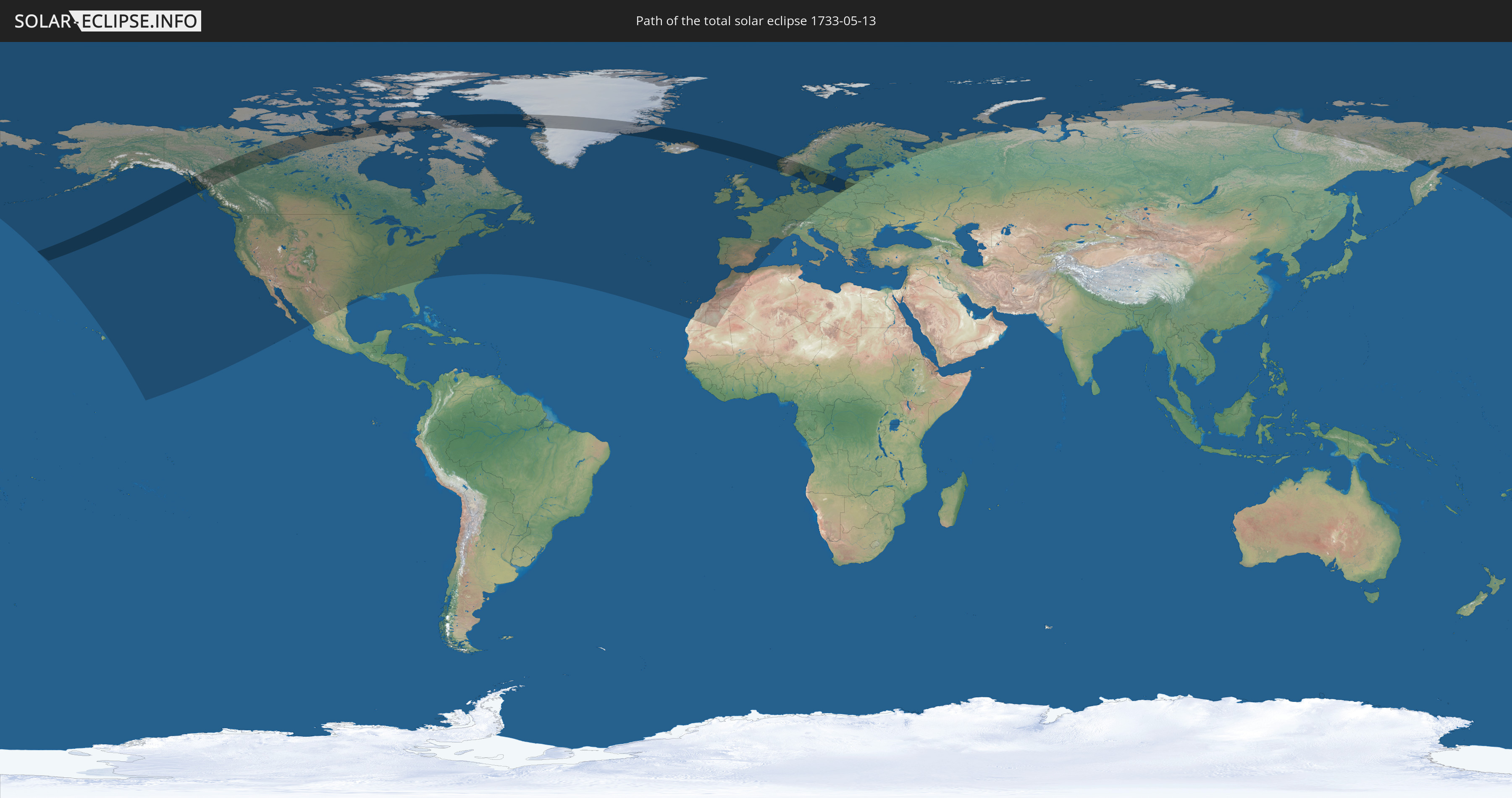
Total solar eclipse of 05/13/1733
| Day of week: | Wednesday |
| Maximum duration of eclipse: | 04m06s |
| Maximum width of eclipse path: | 339 km |
| Saros cycle: | 114 |
| Coverage: | 100% |
| Magnitude: | 1.0656 |
| Gamma: | 0.7712 |
Wo kann man die Sonnenfinsternis vom 05/13/1733 sehen?
Die Sonnenfinsternis am 05/13/1733 kann man in 40 Ländern als partielle Sonnenfinsternis beobachten.
Der Finsternispfad verläuft durch 11 Länder. Nur in diesen Ländern ist sie als total Sonnenfinsternis zu sehen.
In den folgenden Ländern ist die Sonnenfinsternis total zu sehen
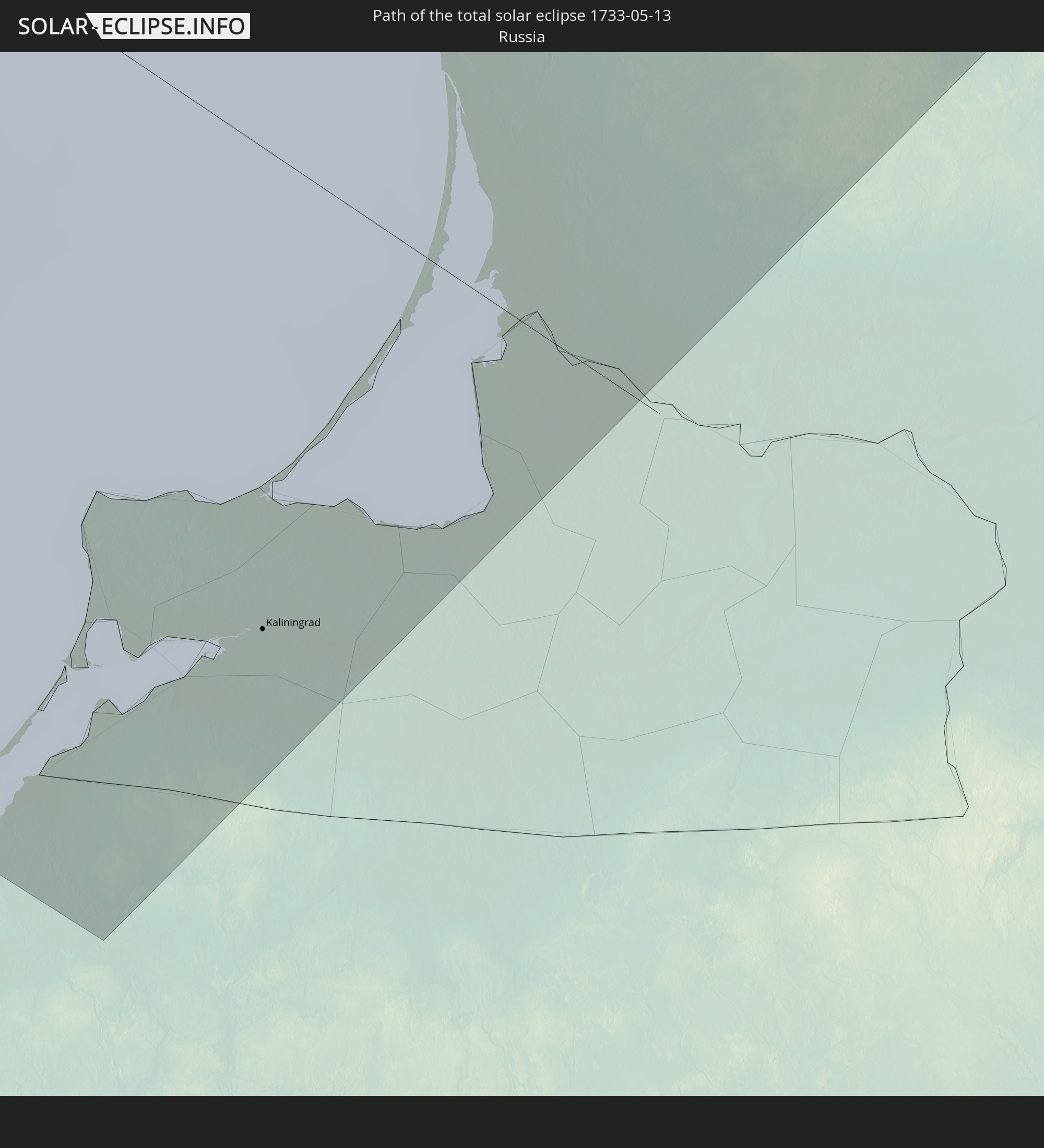 Russia
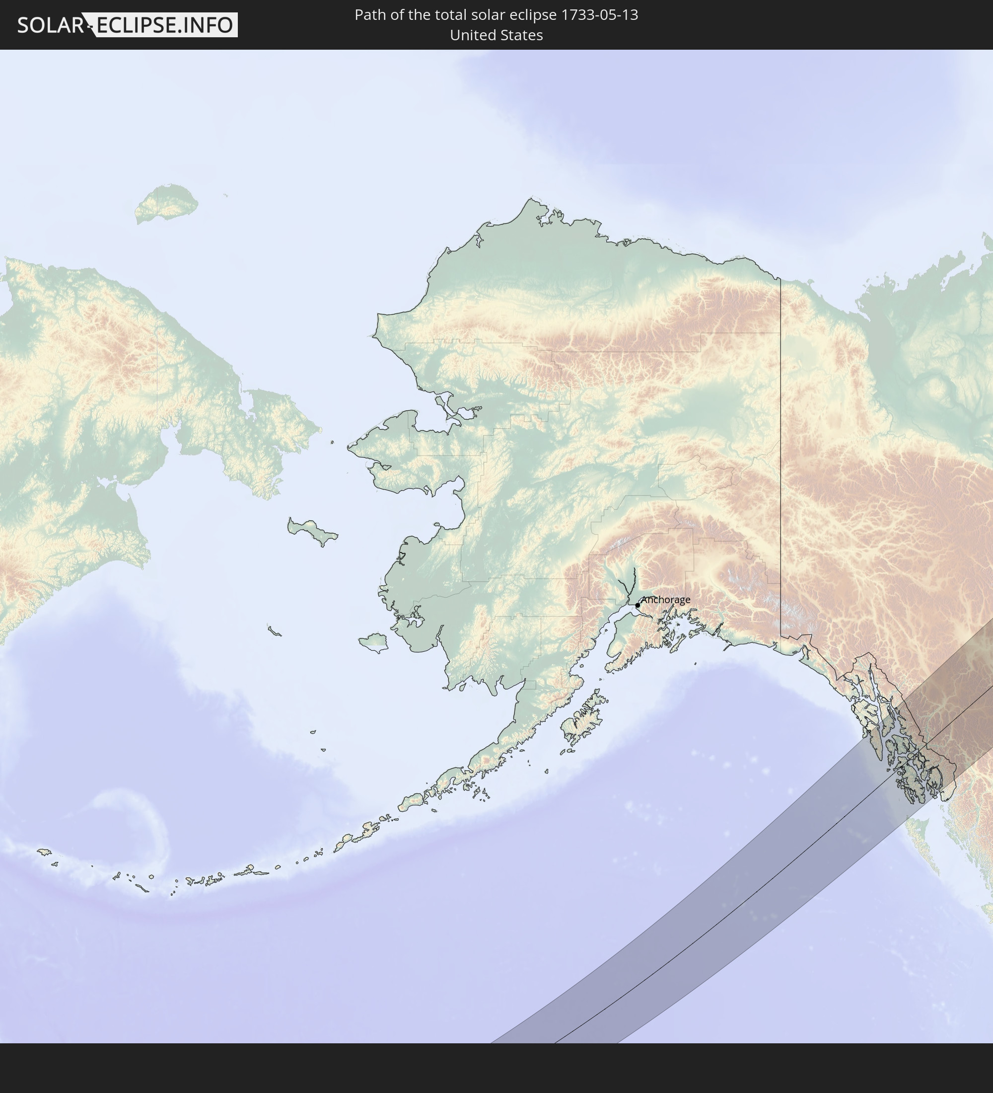 United States
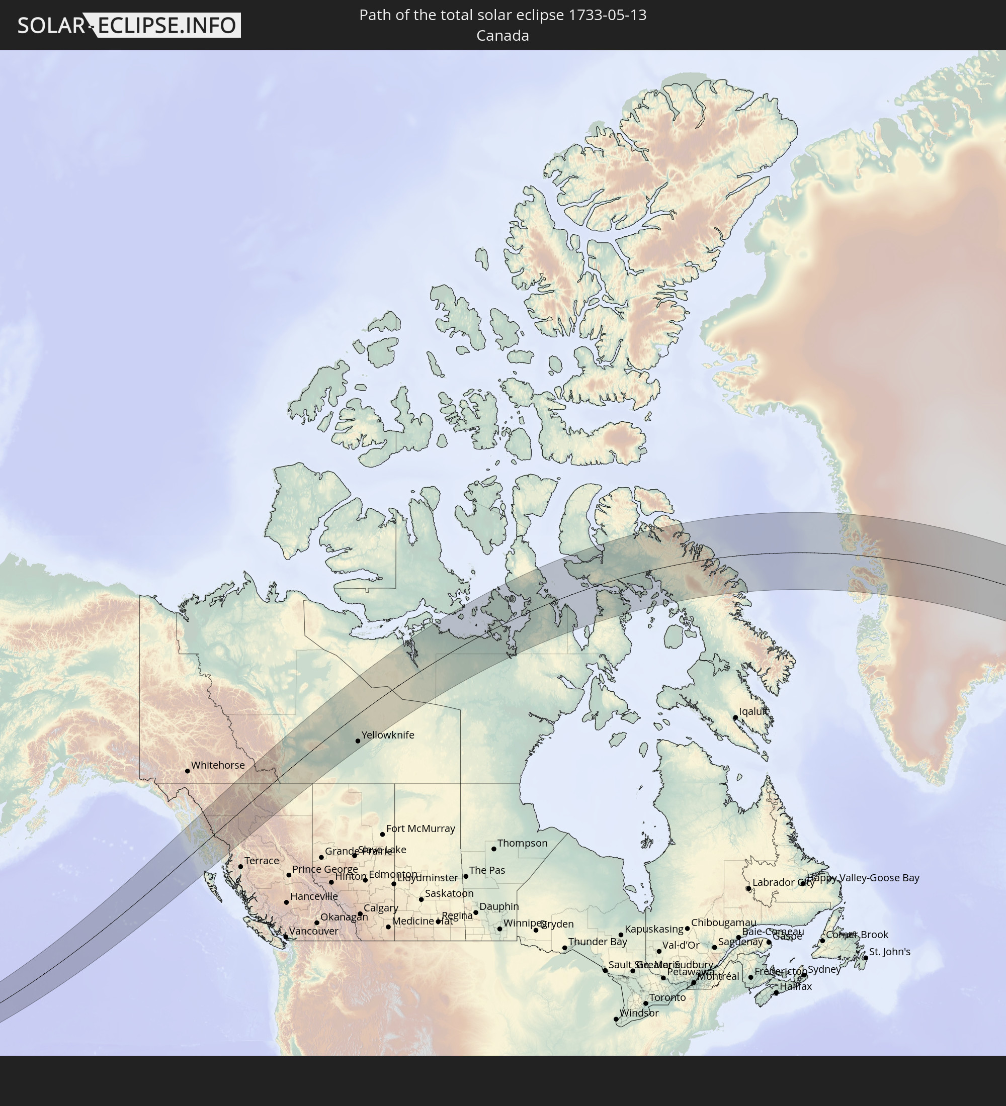 Canada
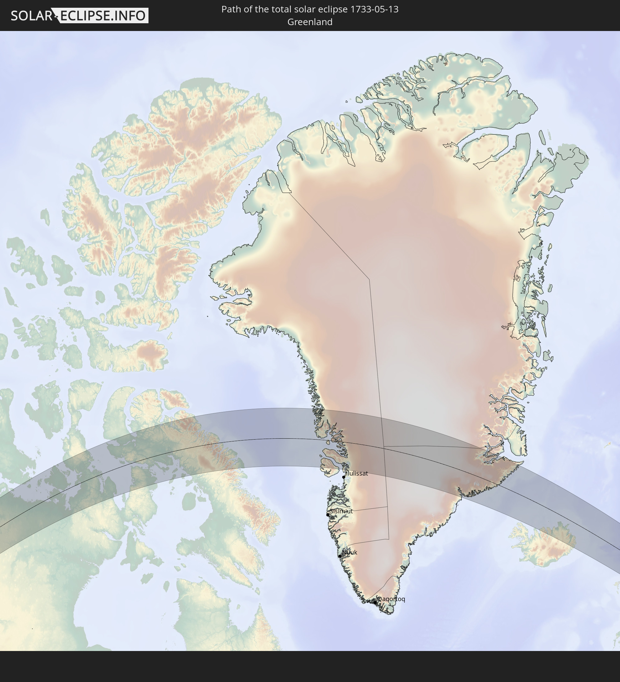 Greenland
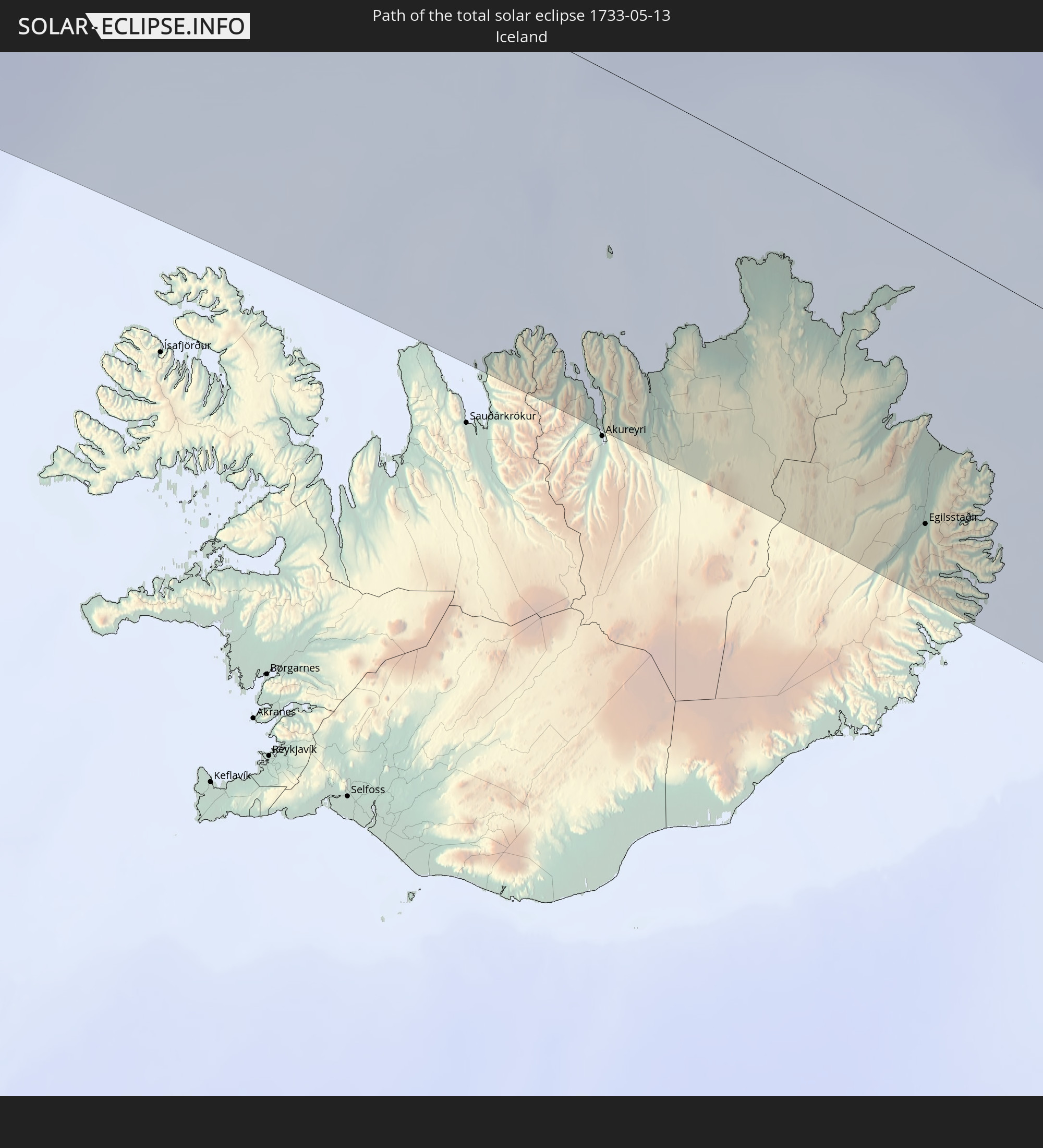 Iceland
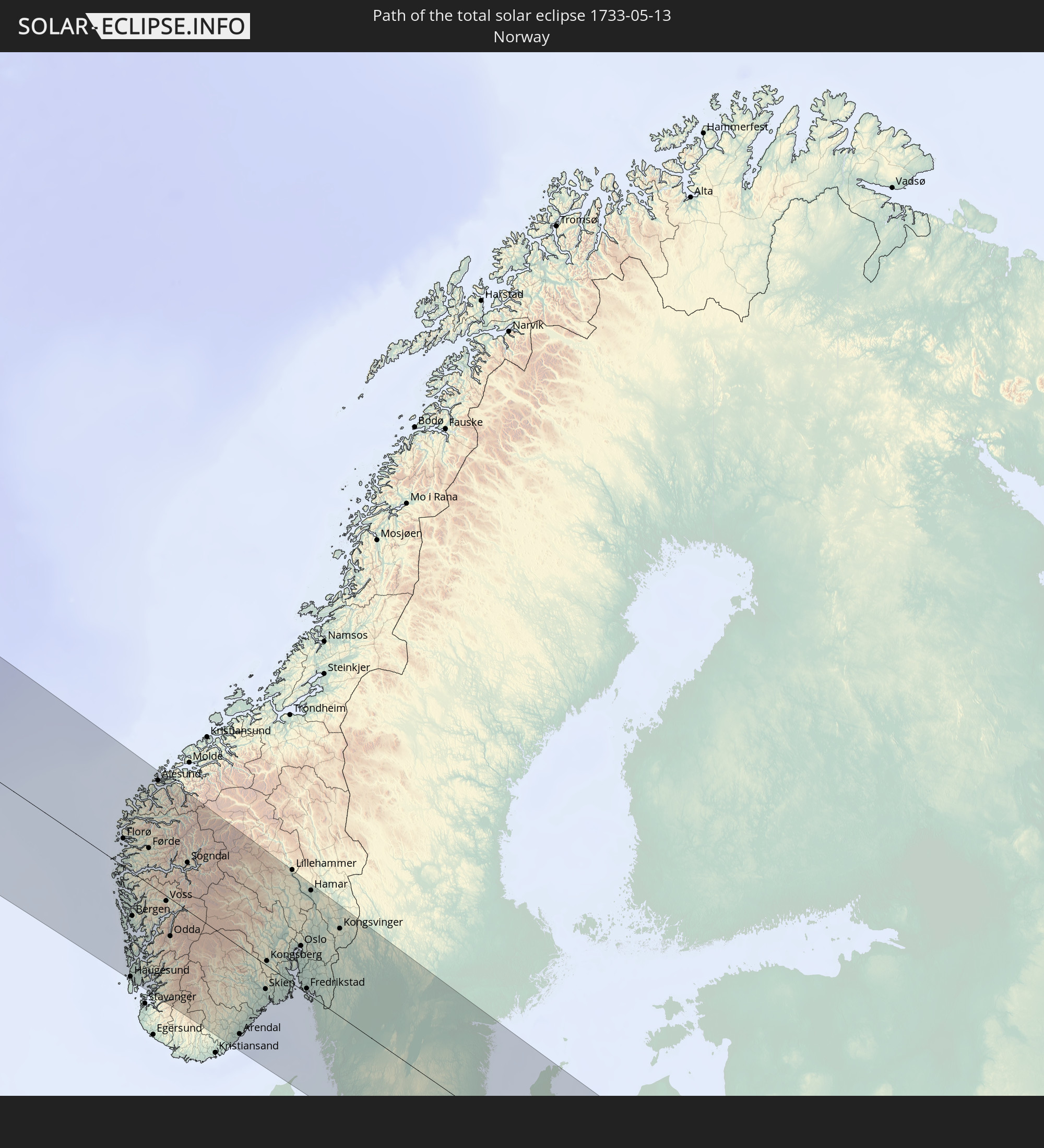 Norway
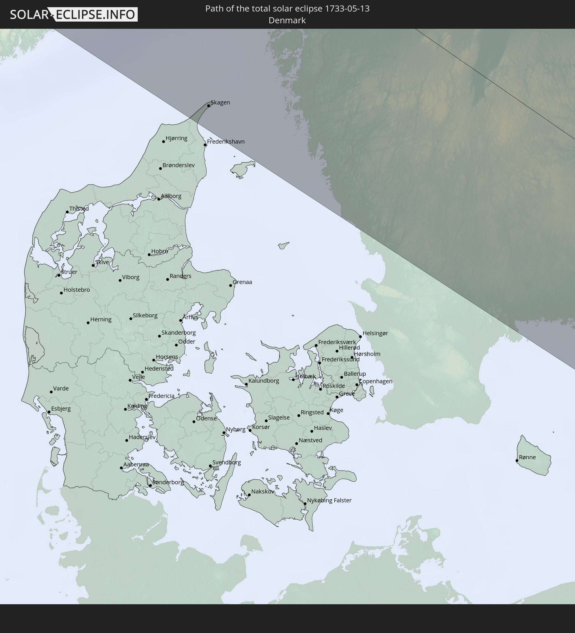 Denmark
 Sweden
 Poland
 Lithuania
 Latvia
In den folgenden Ländern ist die Sonnenfinsternis partiell zu sehen
 Russia
 United States
 Canada
 Mexico
 Greenland
 Saint Pierre and Miquelon
 Portugal
 Iceland
 Spain
Spain
 Mauritania
 Morocco
 Republic of Ireland
 Svalbard and Jan Mayen
 Algeria
 United Kingdom
 Faroe Islands
 Gibraltar
 France
 Isle of Man
 Guernsey
 Jersey
 Andorra
 Belgium
 Netherlands
 Norway
 Luxembourg
 Germany
 Switzerland
 Italy
Italy
 Denmark
 Liechtenstein
 Austria
 Sweden
 Czechia
 Poland
 Åland Islands
 Finland
 Lithuania
 Latvia
 Estonia
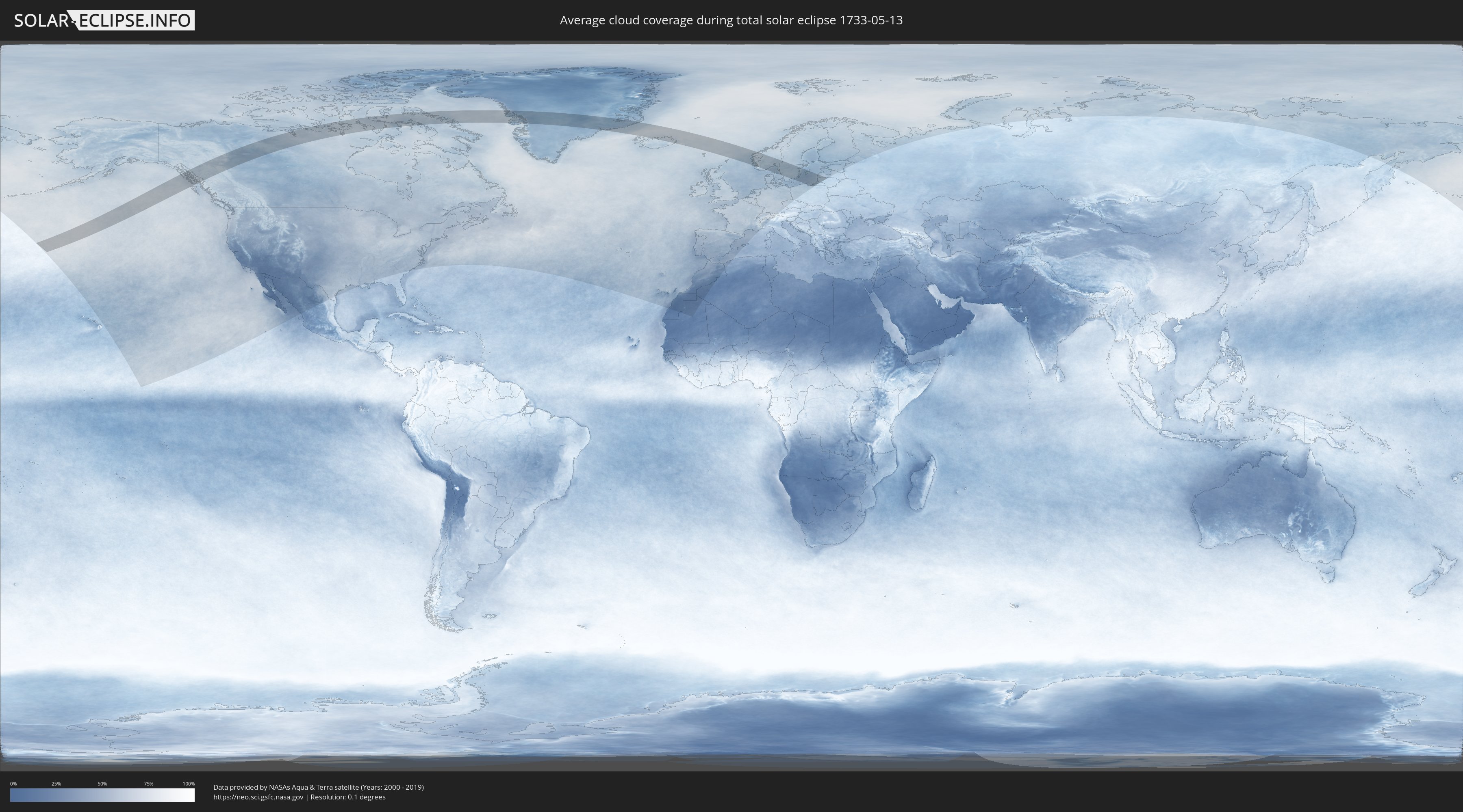
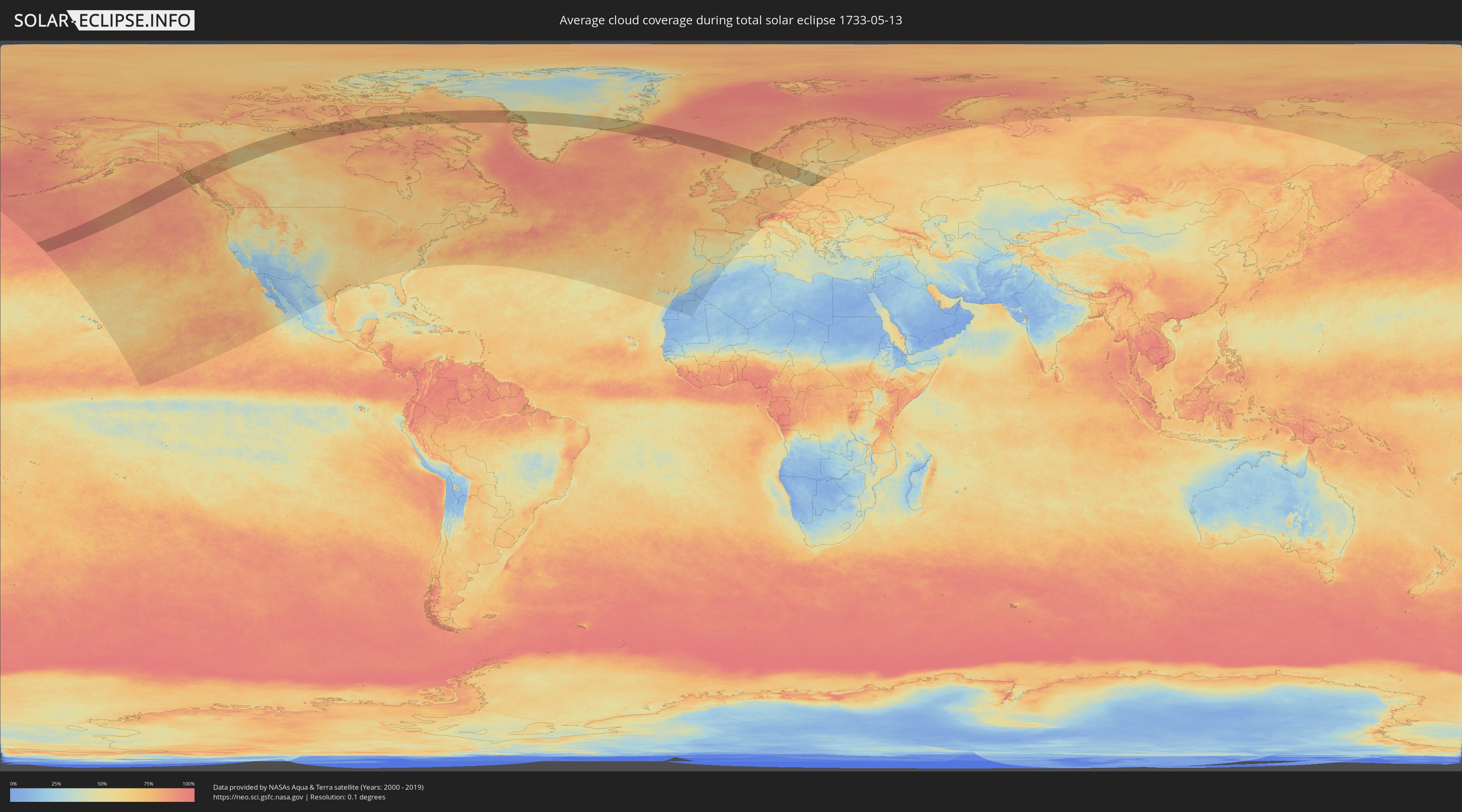
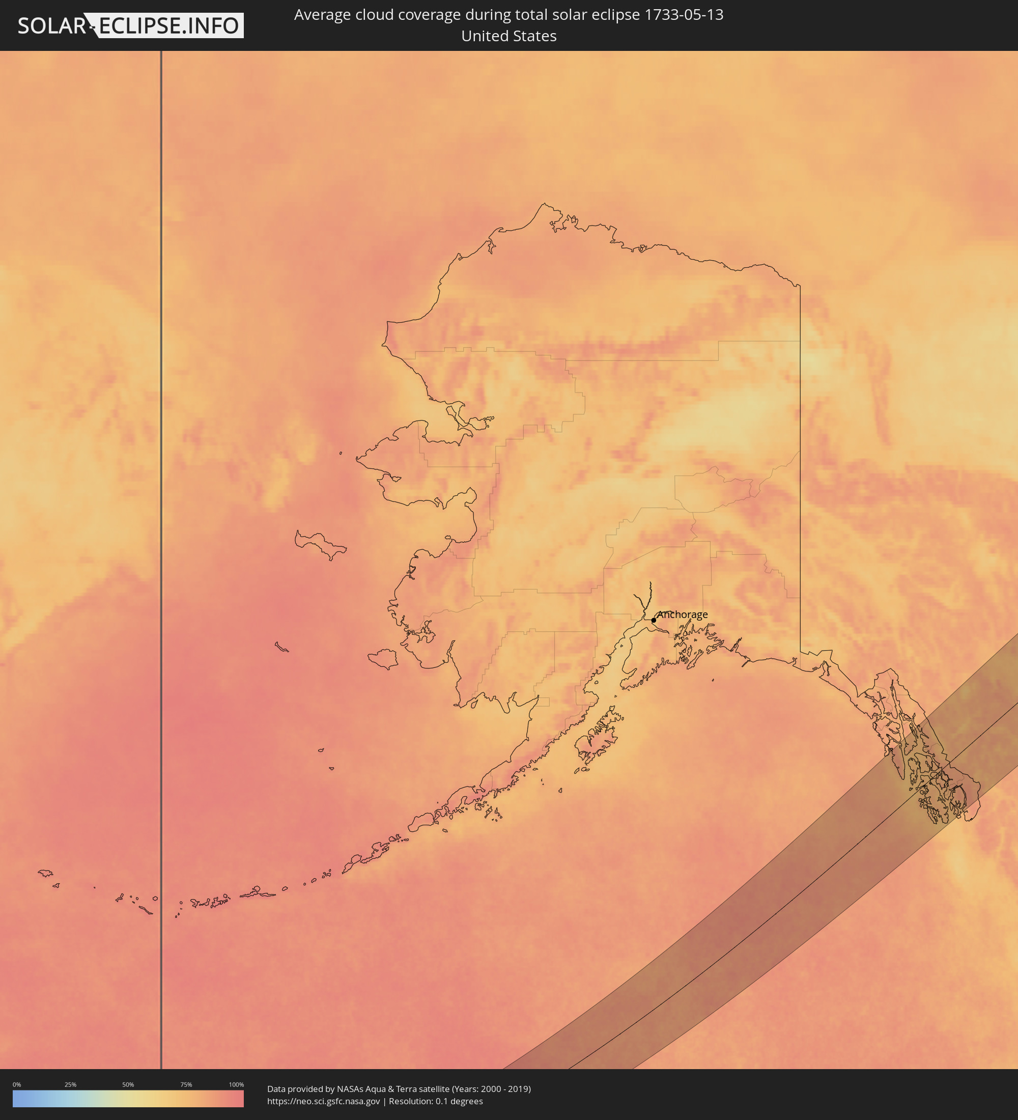
How will be the weather during the total solar eclipse on 05/13/1733?
Where is the best place to see the total solar eclipse of 05/13/1733?
The following maps show the average cloud coverage for the day of the total solar eclipse.
With the help of these maps, it is possible to find the place along the eclipse path, which has the best
chance of a cloudless sky.
Nevertheless, you should consider local circumstances and inform about the weather of your chosen
observation site.
The data is provided by NASAs satellites
AQUA and TERRA.
The cloud maps are averaged over a period of 19 years (2000 - 2019).
Detailed country maps
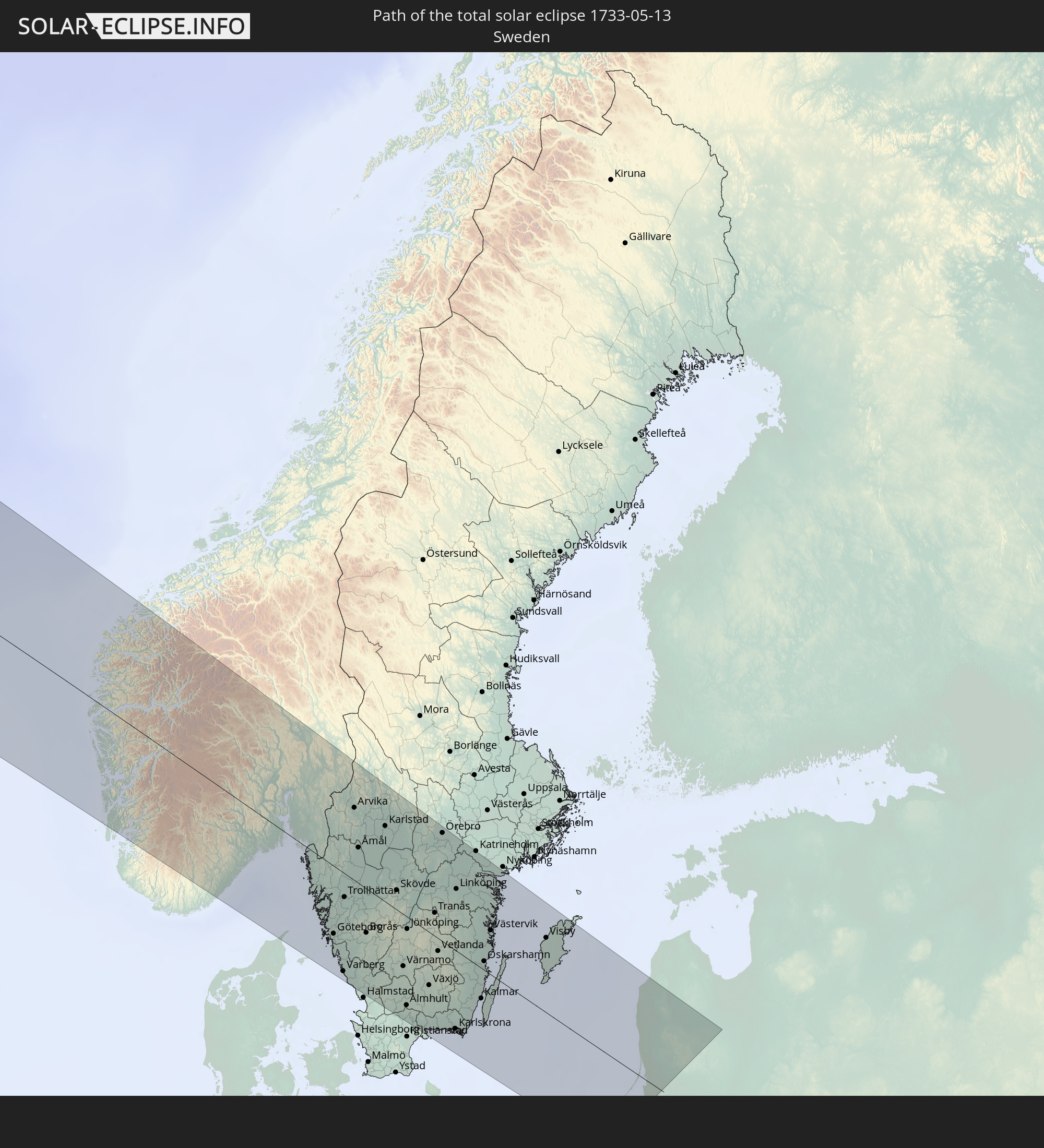
 Russia
 United States
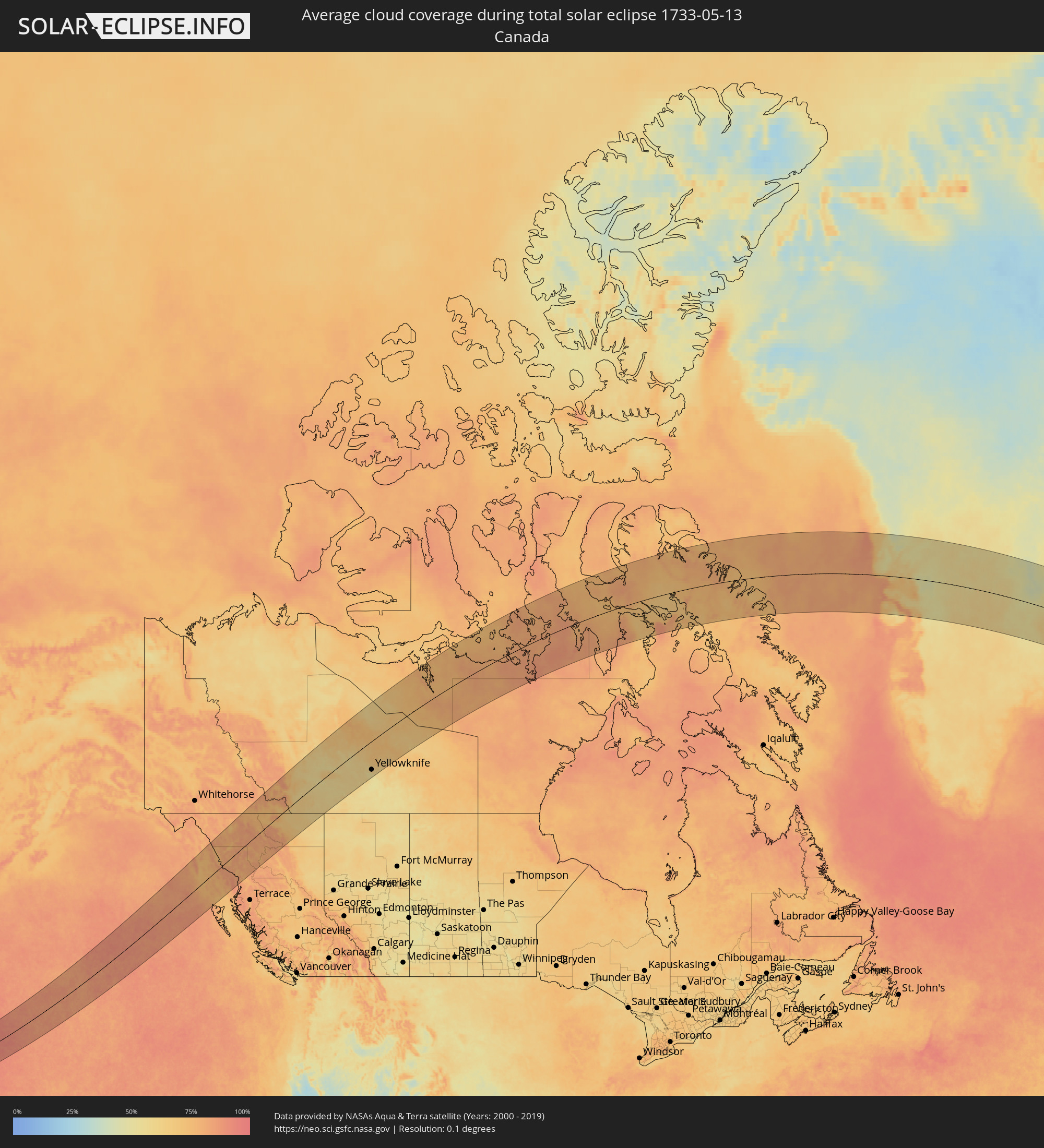 Canada
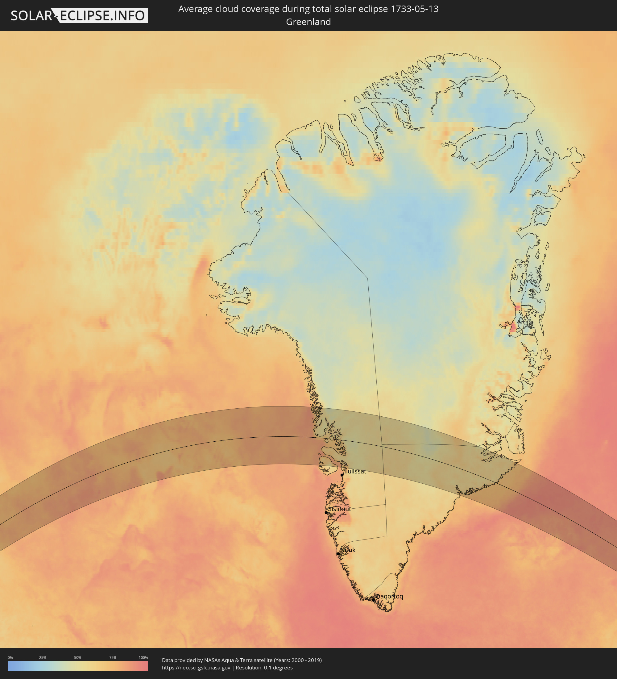 Greenland
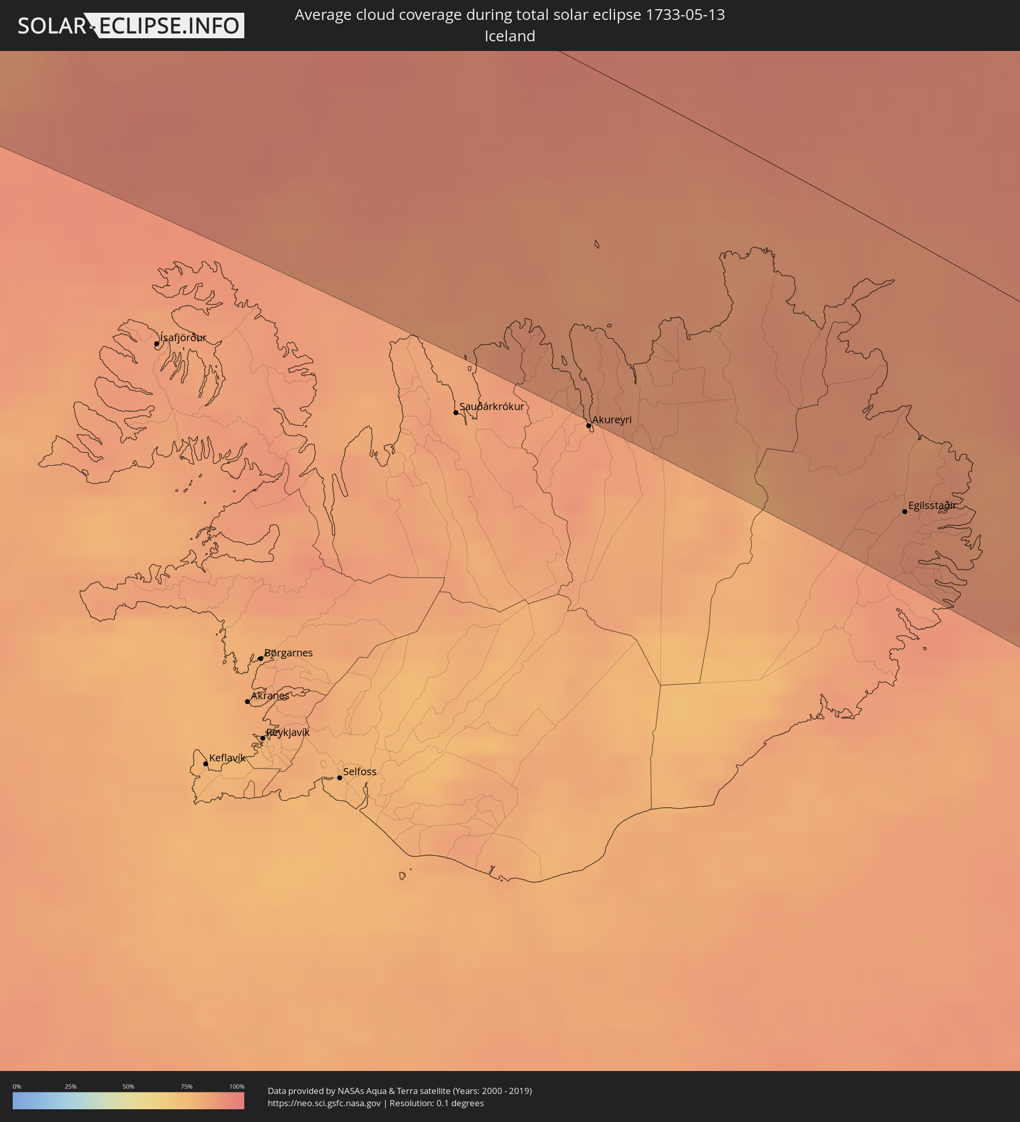 Iceland
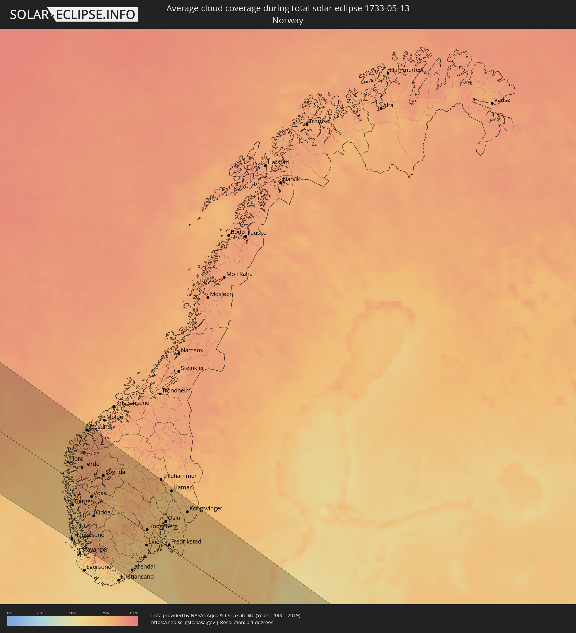 Norway
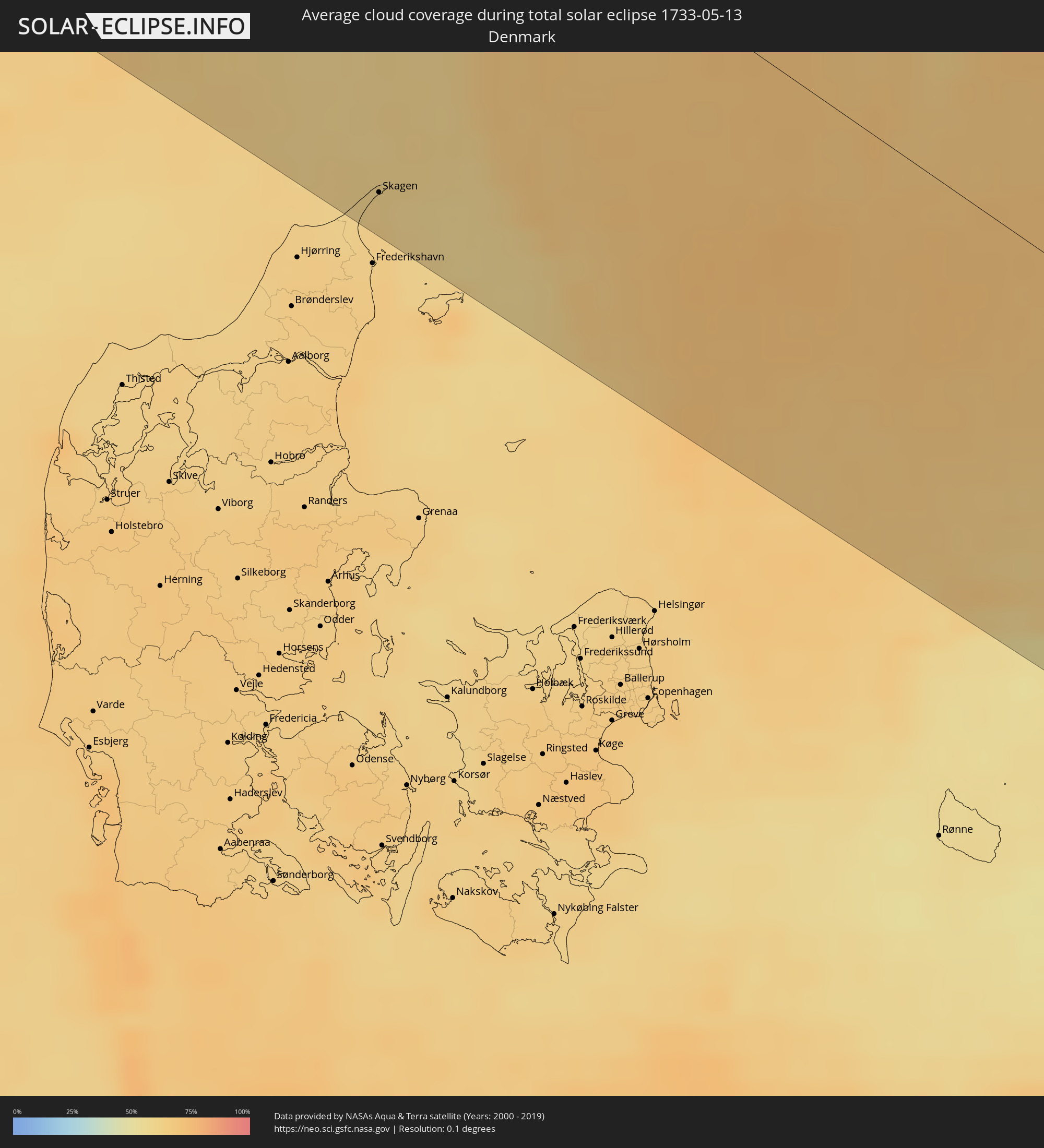 Denmark
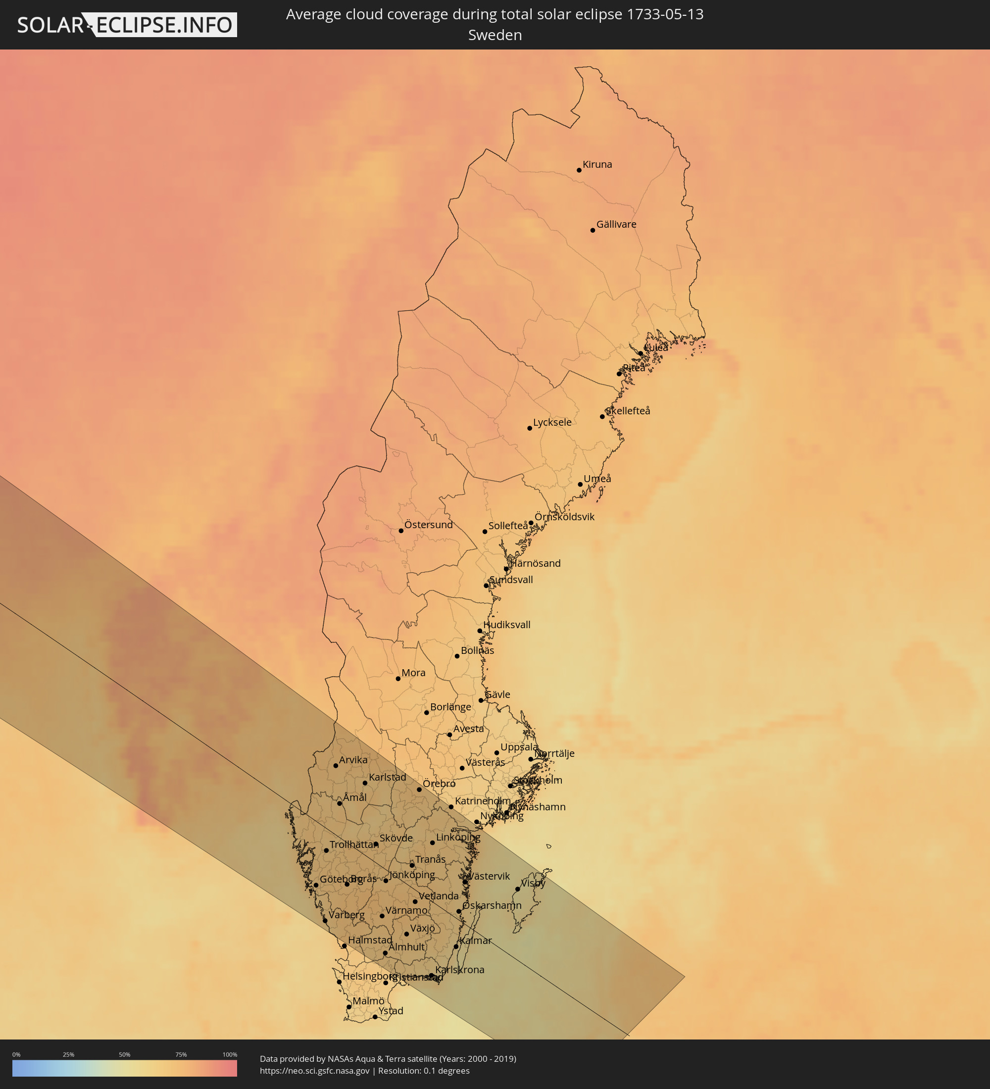 Sweden
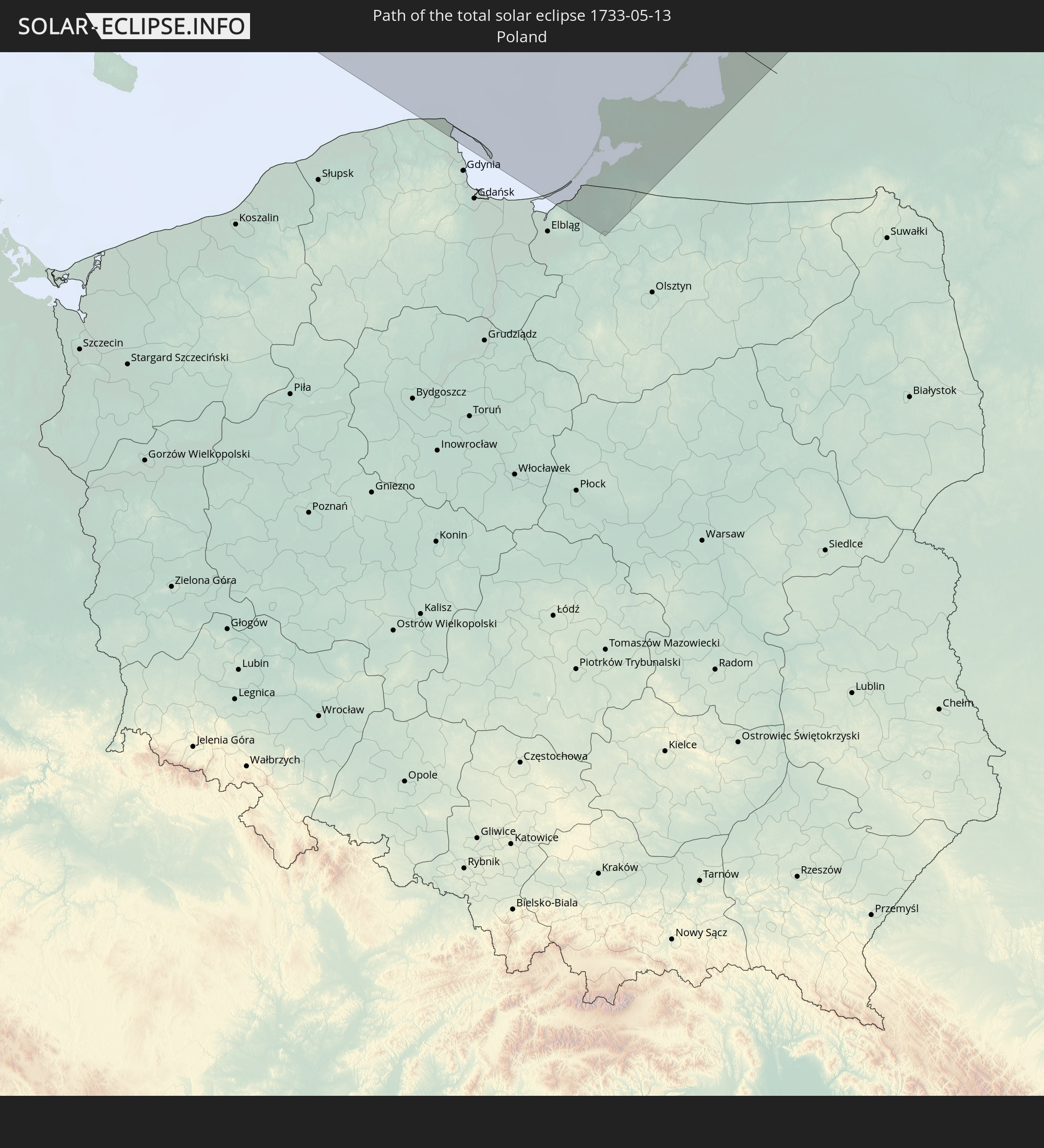
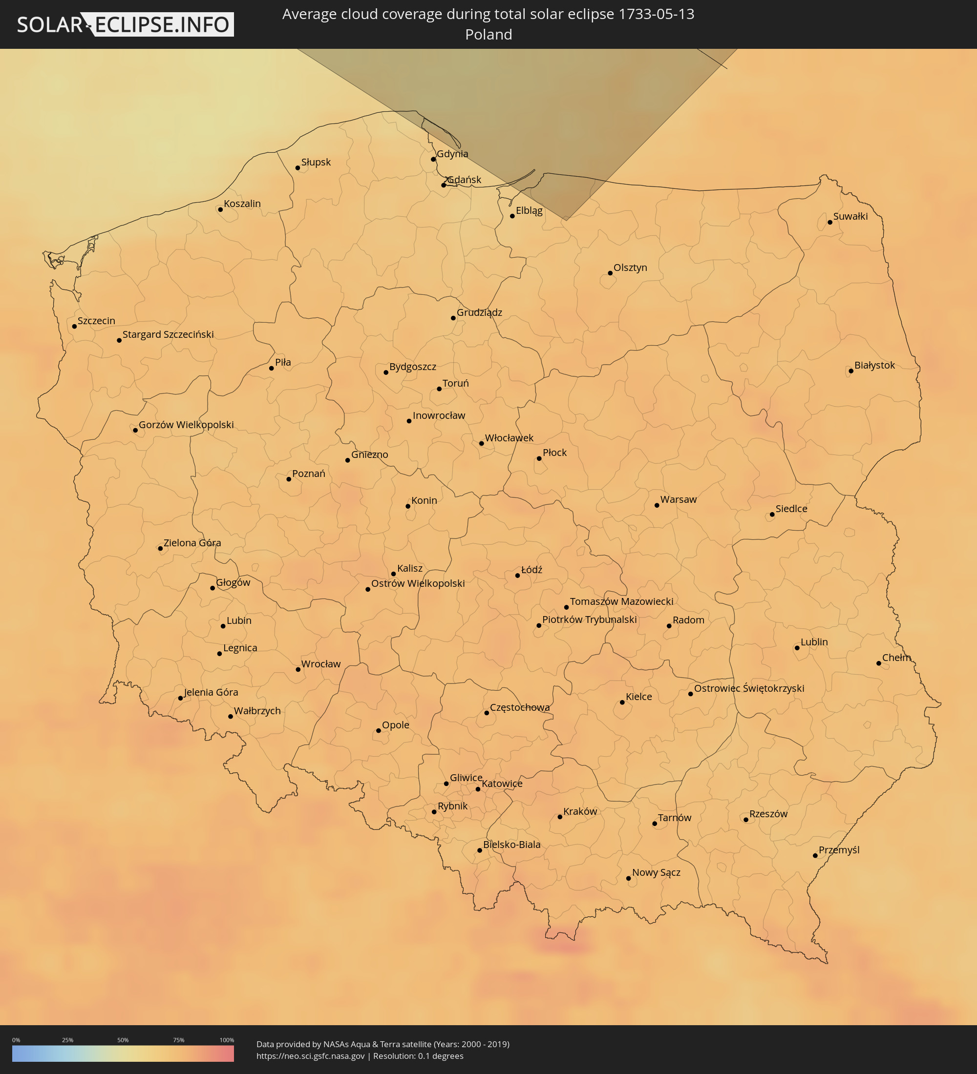 Poland
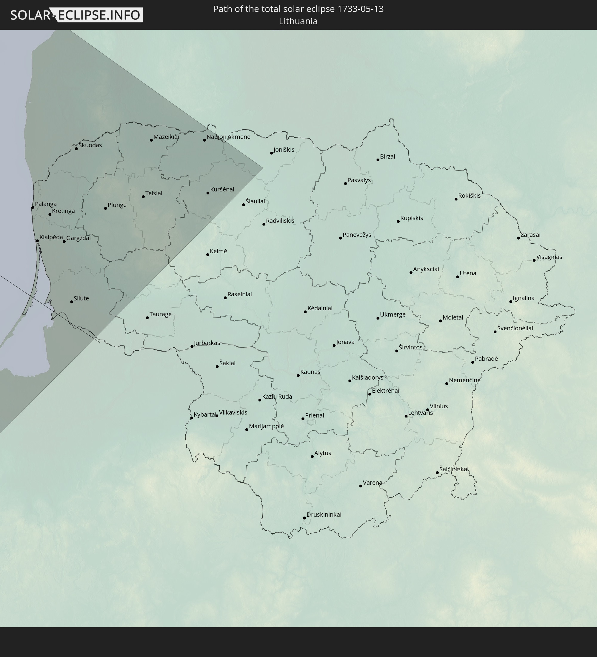
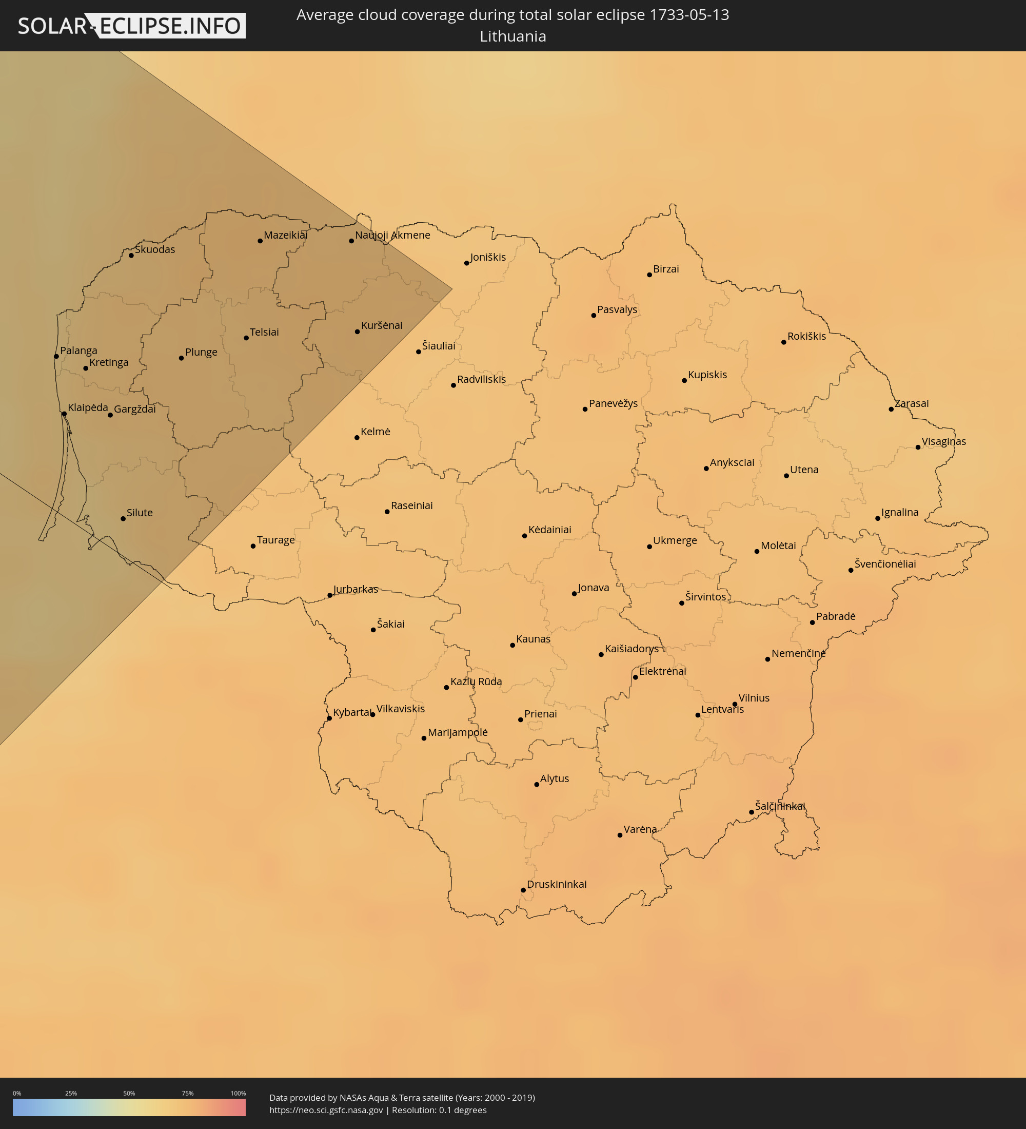 Lithuania
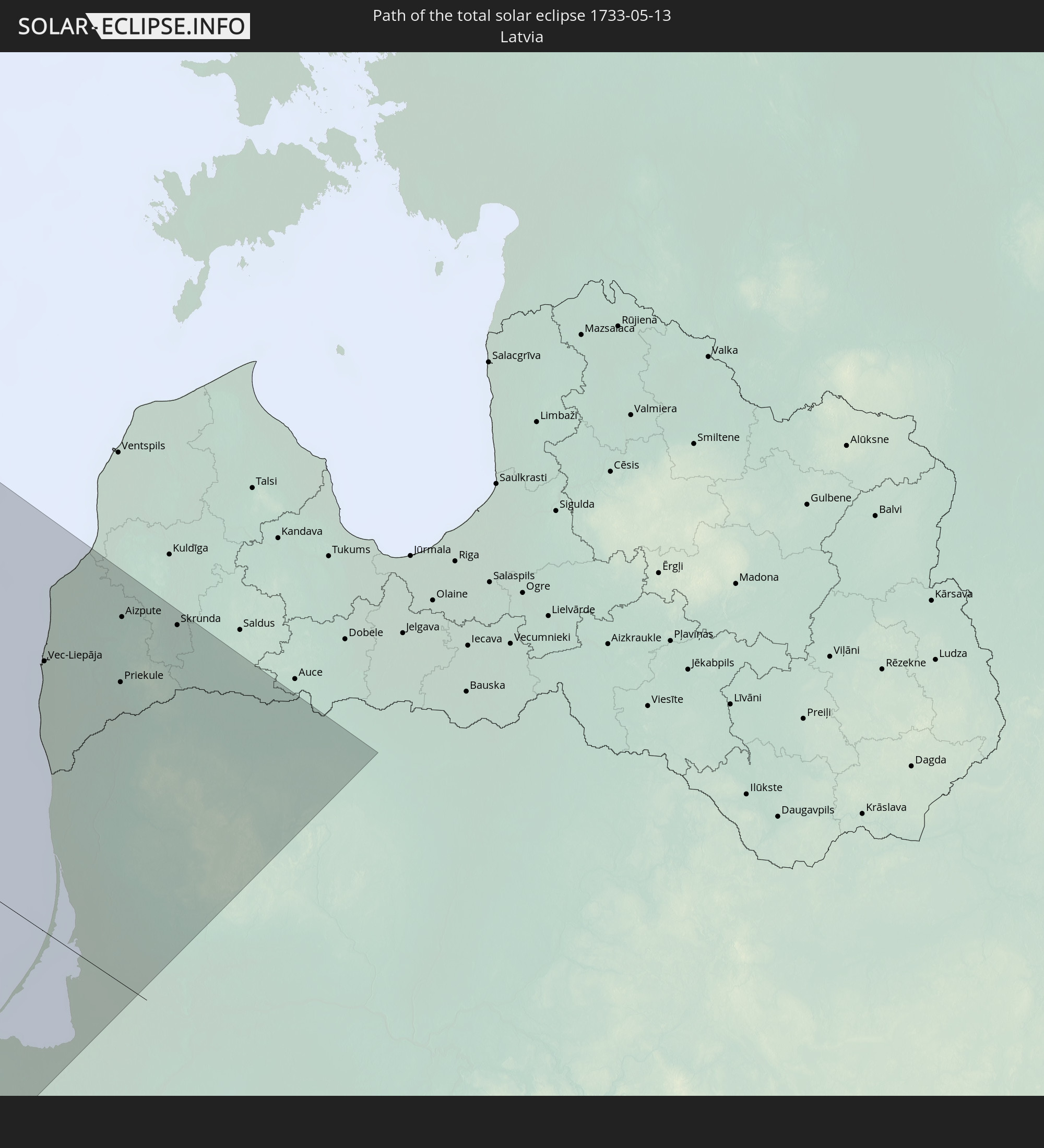
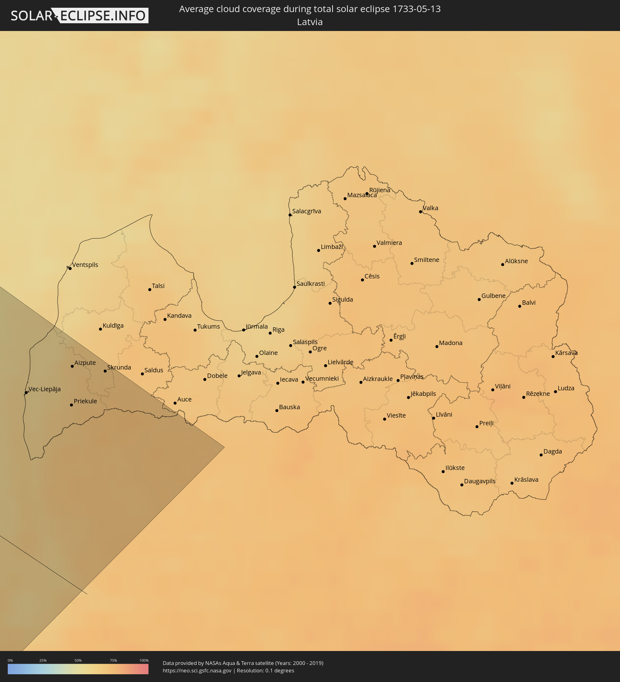 Latvia
Cities inside the path of the eclipse
The following table shows all locations with a population of more than 5,000 inside the eclipse path. Cities which have more than 100,000 inhabitants are marked bold. A click at the locations opens a detailed map.
| City | Type | Eclipse duration | Local time of max. eclipse | Distance to central line | Ø Cloud coverage |
|
Sitka, Alaska
|
total | - | 06:40:12 UTC-10:00 | 165 km | 82% |
|
Ketchikan, Alaska
|
total | - | 06:38:44 UTC-10:00 | 129 km | 78% |
|
Yellowknife, Northwest Territories
|
total | - | 09:26:59 UTC-07:33 | 135 km | 62% |
|
Egilsstaðir, East
|
total | - | 16:46:04 UTC-01:28 | 128 km | 87% |
|
Haugesund, Rogaland
|
total | - | 19:23:00 UTC+01:00 | 156 km | 61% |
|
Bergen, Hordaland
|
total | - | 19:21:37 UTC+01:00 | 63 km | 68% |
|
Ålesund, Møre og Romsdal
|
total | - | 19:18:32 UTC+01:00 | 152 km | 79% |
|
Arendal, Aust-Agder
|
total | - | 19:23:38 UTC+01:00 | 132 km | 66% |
|
Skien, Telemark
|
total | - | 19:22:27 UTC+01:00 | 36 km | 69% |
|
Kongsberg, Buskerud
|
total | - | 19:21:49 UTC+01:00 | 9 km | 71% |
|
Drammen, Buskerud
|
total | - | 19:21:36 UTC+01:00 | 33 km | 72% |
|
Sandefjord, Vestfold
|
total | - | 19:22:25 UTC+01:00 | 24 km | 67% |
|
Hønefoss, Buskerud
|
total | - | 19:21:01 UTC+01:00 | 72 km | 69% |
|
Tønsberg, Vestfold
|
total | - | 19:22:11 UTC+01:00 | 6 km | 67% |
|
Skagen, North Denmark
|
total | - | 19:24:11 UTC+01:00 | 142 km | 61% |
|
Moss, Østfold
|
total | - | 19:21:55 UTC+01:00 | 18 km | 65% |
|
Gjøvik, Oppland
|
total | - | 19:20:04 UTC+01:00 | 143 km | 70% |
|
Oslo, Oslo
|
total | - | 19:21:15 UTC+01:00 | 65 km | 74% |
|
Ski, Akershus
|
total | - | 19:21:29 UTC+01:00 | 51 km | 68% |
|
Fredrikstad, Østfold
|
total | - | 19:22:08 UTC+01:00 | 12 km | 67% |
|
Lillestrøm, Akershus
|
total | - | 19:21:07 UTC+01:00 | 80 km | 72% |
|
Hamar, Hedmark
|
total | - | 19:19:59 UTC+01:00 | 155 km | 69% |
|
Askim, Østfold
|
total | - | 19:21:35 UTC+01:00 | 50 km | 68% |
|
Jessheim, Akershus
|
total | - | 19:20:50 UTC+01:00 | 100 km | 71% |
|
Halden, Østfold
|
total | - | 19:22:09 UTC+01:00 | 22 km | 67% |
|
Uddevalla, Västra Götaland
|
total | - | 19:23:01 UTC+01:00 | 41 km | 69% |
|
Göteborg, Västra Götaland
|
total | - | 19:23:51 UTC+01:00 | 98 km | 67% |
|
Kungälv, Västra Götaland
|
total | - | 19:23:38 UTC+01:00 | 84 km | 67% |
|
Varberg, Halland
|
total | - | 19:24:32 UTC+01:00 | 144 km | 65% |
|
Trollhättan, Västra Götaland
|
total | - | 19:23:01 UTC+01:00 | 35 km | 67% |
|
Alingsås, Västra Götaland
|
total | - | 19:23:24 UTC+01:00 | 58 km | 69% |
|
Borås, Västra Götaland
|
total | - | 19:23:33 UTC+01:00 | 64 km | 70% |
|
Lidköping, Västra Götaland
|
total | - | 19:22:30 UTC+01:00 | 15 km | 68% |
|
Karlstad, Värmland
|
total | - | 19:21:16 UTC+01:00 | 106 km | 64% |
|
Skövde, Västra Götaland
|
total | - | 19:22:27 UTC+01:00 | 28 km | 69% |
|
Jönköping, Jönköping
|
total | - | 19:23:08 UTC+01:00 | 22 km | 69% |
|
Karlskoga, Örebro
|
total | - | 19:21:03 UTC+01:00 | 136 km | 68% |
|
Växjö, Kronoberg
|
total | - | 19:24:03 UTC+01:00 | 78 km | 69% |
|
Motala, Östergötland
|
total | - | 19:21:55 UTC+01:00 | 83 km | 64% |
|
Örebro, Örebro
|
total | - | 19:20:56 UTC+01:00 | 154 km | 71% |
|
Karlskrona, Blekinge
|
total | - | 19:24:41 UTC+01:00 | 119 km | 63% |
|
Linköping, Östergötland
|
total | - | 19:21:54 UTC+01:00 | 91 km | 69% |
|
Norrköping, Östergötland
|
total | - | 19:21:29 UTC+01:00 | 125 km | 66% |
|
Kalmar, Kalmar
|
total | - | 19:23:49 UTC+01:00 | 48 km | 58% |
|
Visby, Gotland
|
total | - | 19:21:58 UTC+01:00 | 112 km | 52% |
|
Władysławowo, Pomeranian Voivodeship
|
total | - | 19:49:16 UTC+01:24 | 149 km | 63% |
|
Puck, Pomeranian Voivodeship
|
total | - | 19:49:21 UTC+01:24 | 156 km | 64% |
|
Braniewo, Warmian-Masurian Voivodeship
|
total | - | 19:49:10 UTC+01:24 | 137 km | 65% |
|
Baltiysk, Kaliningrad
|
total | - | 19:24:50 UTC+01:00 | 108 km | 62% |
|
Mamonovo, Kaliningrad
|
total | - | 19:25:02 UTC+01:00 | 125 km | 63% |
|
Yantarnyy, Kaliningrad
|
total | - | 19:24:34 UTC+01:00 | 88 km | 61% |
|
Svetlyy, Kaliningrad
|
total | - | 19:24:43 UTC+01:00 | 98 km | 61% |
|
Svetlogorsk, Kaliningrad
|
total | - | 19:24:25 UTC+01:00 | 74 km | 61% |
|
Pionerskiy, Kaliningrad
|
total | - | 19:24:22 UTC+01:00 | 70 km | 62% |
|
Zelenogradsk, Kaliningrad
|
total | - | 19:24:15 UTC+01:00 | 59 km | 64% |
|
Kaliningrad, Kaliningrad
|
total | - | 19:24:31 UTC+01:00 | 83 km | 64% |
|
Gur’yevsk, Kaliningrad
|
total | - | 19:24:25 UTC+01:00 | 74 km | 66% |
|
Vec-Liepāja, Liepāja
|
total | - | 19:58:49 UTC+01:36 | 105 km | 60% |
|
Liepāja, Liepāja
|
total | - | 19:58:50 UTC+01:36 | 103 km | 60% |
|
Karosta, Liepāja
|
total | - | 19:58:48 UTC+01:36 | 106 km | 59% |
|
Nīca, Nīca
|
total | - | 19:59:01 UTC+01:36 | 91 km | 61% |
|
Palanga, Klaipėda County
|
total | - | 19:46:56 UTC+01:24 | 51 km | 63% |
|
Polessk, Kaliningrad
|
total | - | 19:24:06 UTC+01:00 | 46 km | 64% |
|
Klaipėda, Klaipėda County
|
total | - | 19:47:09 UTC+01:24 | 36 km | 64% |
|
Rucava, Rucavas
|
total | - | 19:59:11 UTC+01:36 | 76 km | 64% |
|
Grobiņa, Grobiņa
|
total | - | 19:58:46 UTC+01:36 | 111 km | 61% |
|
Pāvilosta, Pāvilostas
|
total | - | 19:58:21 UTC+01:36 | 143 km | 57% |
|
Kretinga, Klaipėda County
|
total | - | 19:46:55 UTC+01:24 | 55 km | 68% |
|
Lieģi, Durbe
|
total | - | 19:58:38 UTC+01:36 | 121 km | 61% |
|
Gargždai, Klaipėda County
|
total | - | 19:47:02 UTC+01:24 | 43 km | 65% |
|
Silute, Klaipėda County
|
total | - | 19:47:24 UTC+01:24 | 15 km | 62% |
|
Skuodas, Klaipėda County
|
total | - | 19:46:21 UTC+01:24 | 99 km | 67% |
|
Priekule, Priekule
|
total | - | 19:58:42 UTC+01:36 | 117 km | 68% |
|
Aizpute, Aizpute
|
total | - | 19:58:23 UTC+01:36 | 143 km | 66% |
|
Plunge, Telšiai County
|
total | - | 19:46:38 UTC+01:24 | 78 km | 70% |
|
Vaiņode, Vaiņode
|
total | - | 19:58:36 UTC+01:36 | 126 km | 71% |
|
Skrunda, Skrunda
|
total | - | 19:58:15 UTC+01:36 | 154 km | 69% |
|
Šilalė
|
total | - | 19:46:57 UTC+01:24 | 50 km | 71% |
|
Telsiai, Telšiai County
|
total | - | 19:46:23 UTC+01:24 | 98 km | 70% |
|
Mazeikiai, Telšiai County
|
total | - | 19:45:58 UTC+01:24 | 132 km | 71% |
|
Naujoji Akmene
|
total | - | 19:45:44 UTC+01:24 | 151 km | 72% |
|
Kuršėnai, Šiauliai County
|
total | - | 19:46:04 UTC+01:24 | 124 km | 71% |