Annular solar eclipse of 12/18/1740
| Day of week: | Sunday |
| Maximum duration of eclipse: | 00m53s |
| Maximum width of eclipse path: | 40 km |
| Saros cycle: | 118 |
| Coverage: | 99.2% |
| Magnitude: | 0.9917 |
| Gamma: | 0.6876 |
Wo kann man die Sonnenfinsternis vom 12/18/1740 sehen?
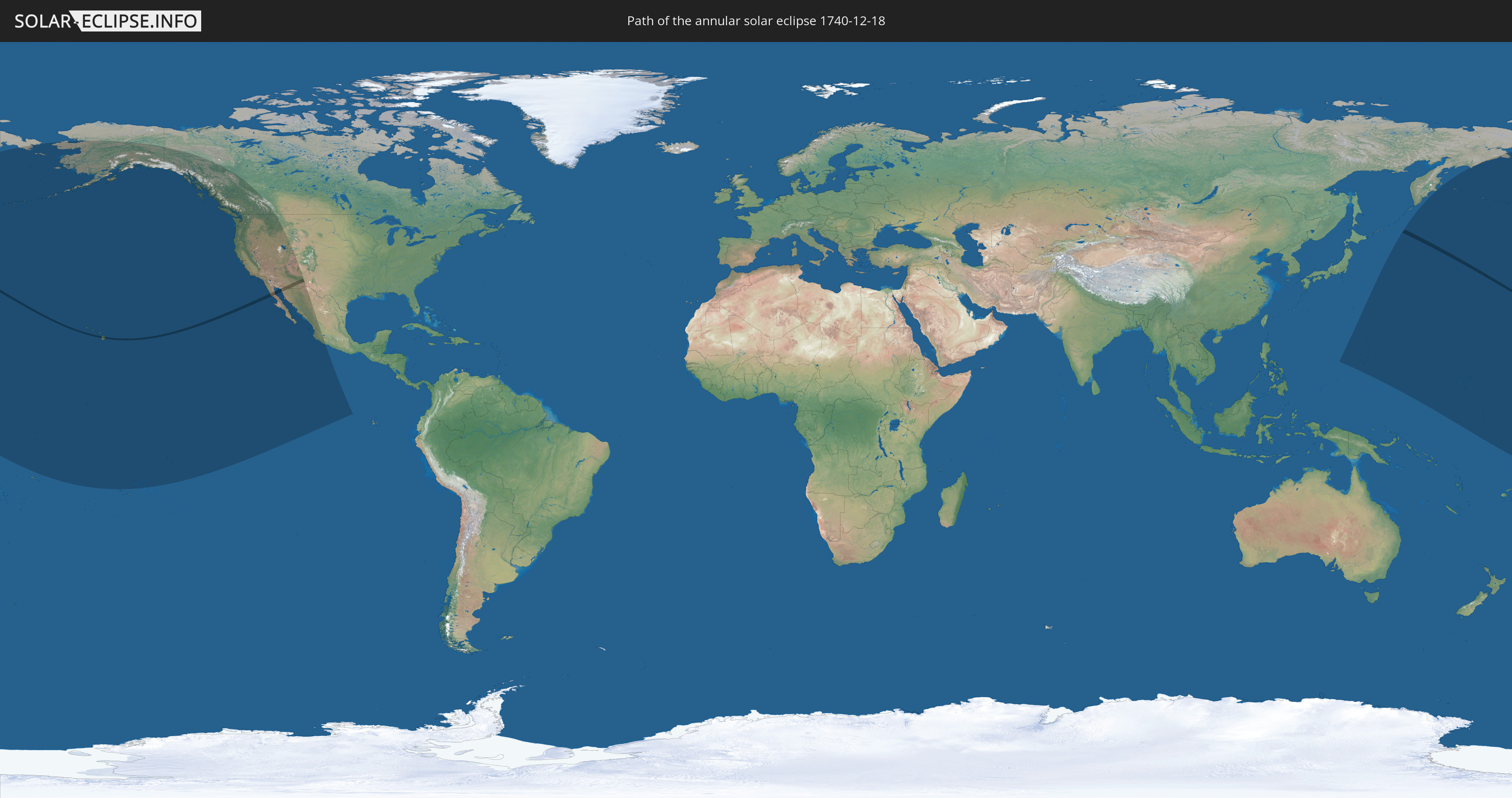
Die Sonnenfinsternis am 12/18/1740 kann man in 17 Ländern als partielle Sonnenfinsternis beobachten.
Der Finsternispfad verläuft durch 3 Länder. Nur in diesen Ländern ist sie als annular Sonnenfinsternis zu sehen.
In den folgenden Ländern ist die Sonnenfinsternis annular zu sehen
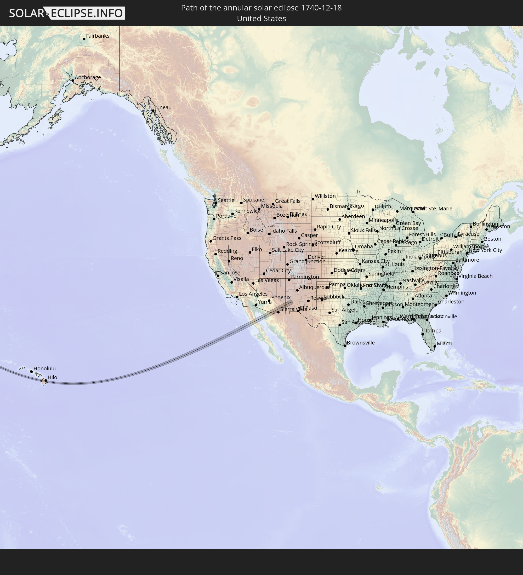 United States
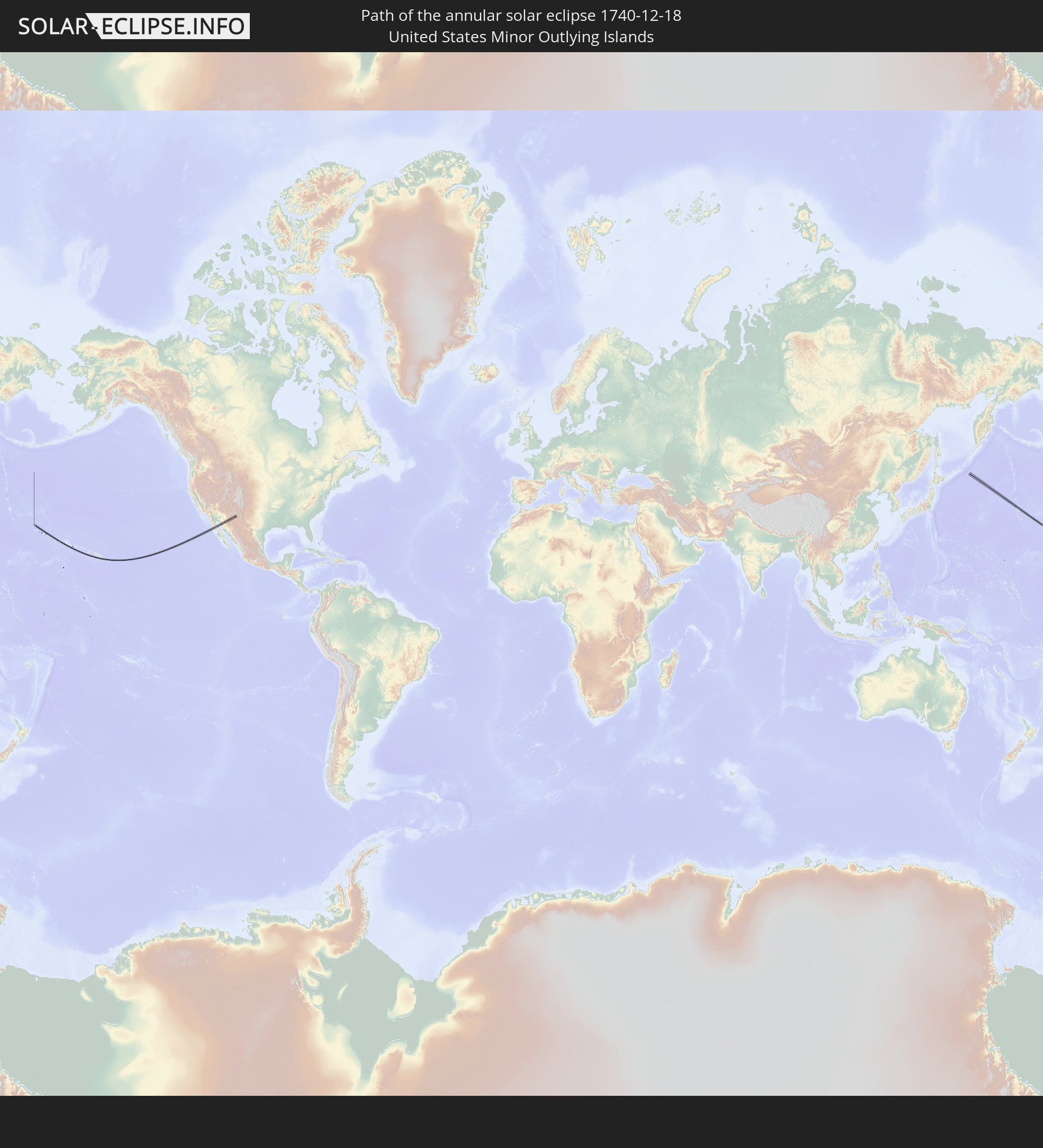 United States Minor Outlying Islands
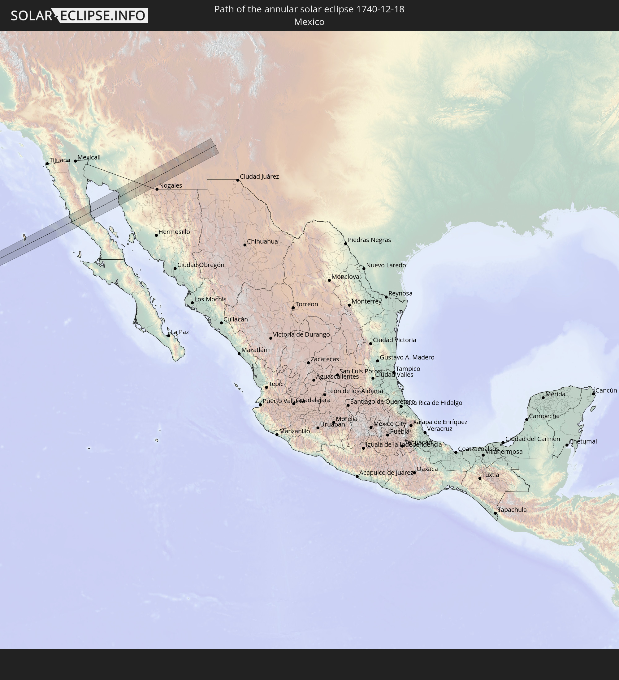 Mexico
In den folgenden Ländern ist die Sonnenfinsternis partiell zu sehen


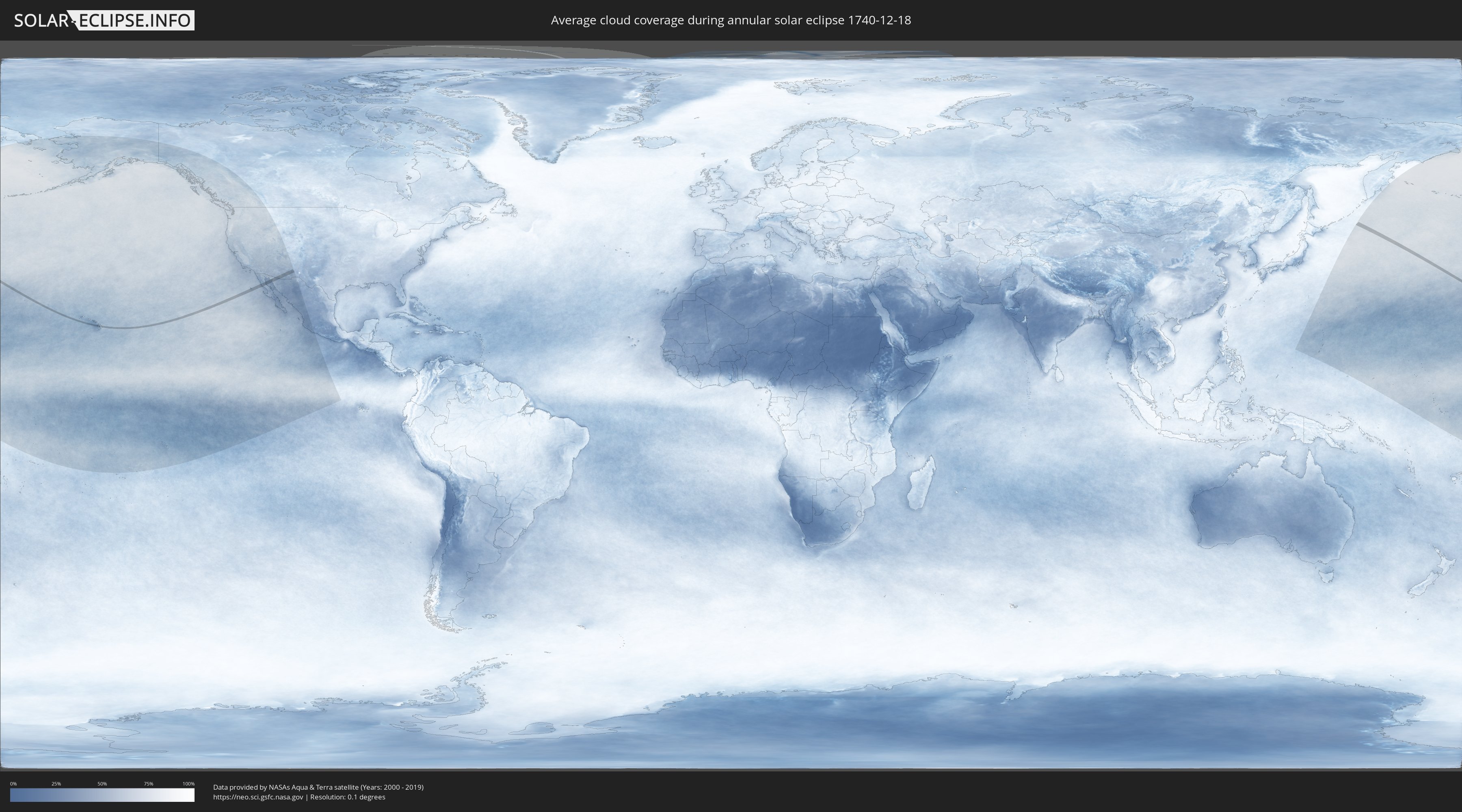
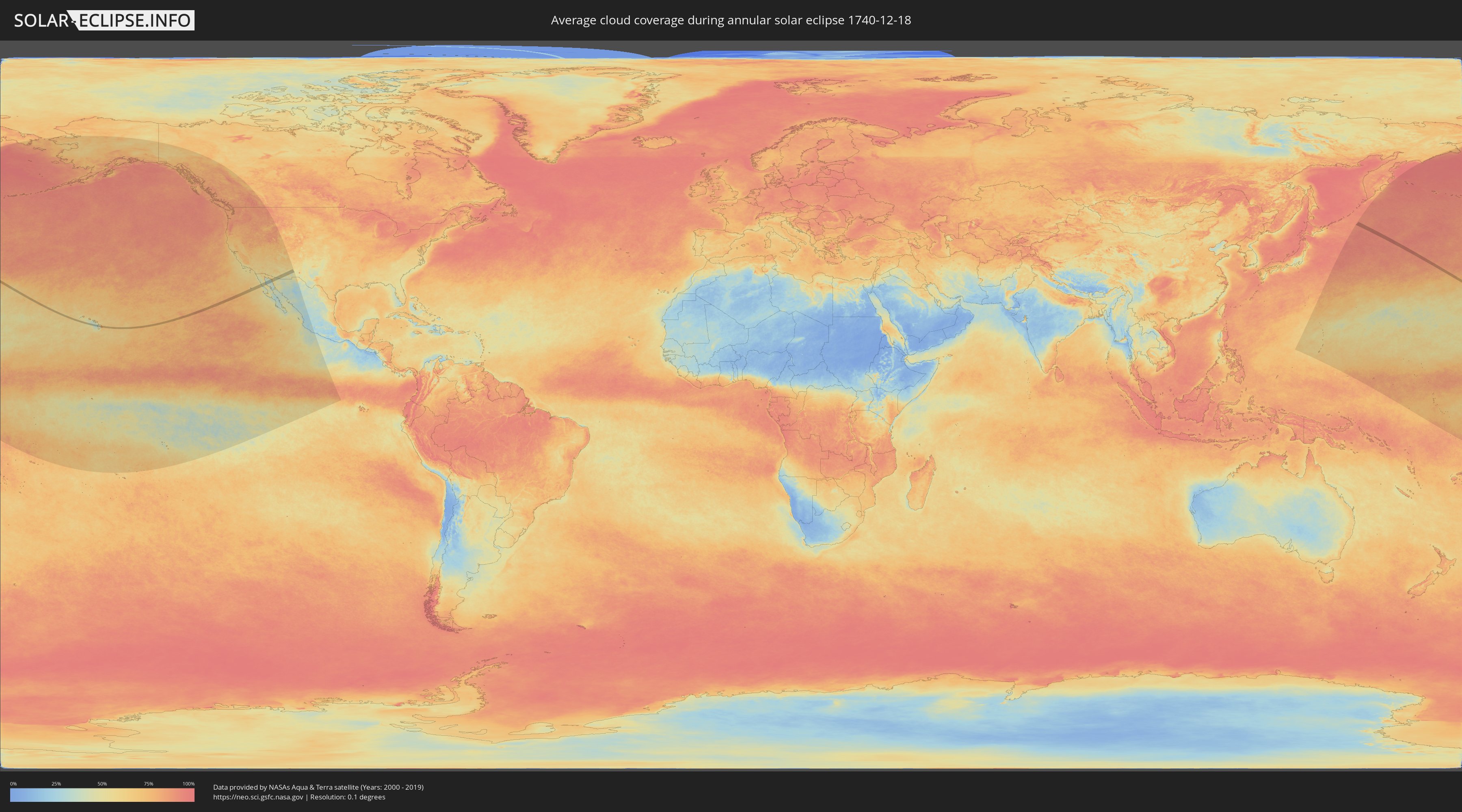
How will be the weather during the annular solar eclipse on 12/18/1740?
Where is the best place to see the annular solar eclipse of 12/18/1740?
The following maps show the average cloud coverage for the day of the annular solar eclipse.
With the help of these maps, it is possible to find the place along the eclipse path, which has the best
chance of a cloudless sky.
Nevertheless, you should consider local circumstances and inform about the weather of your chosen
observation site.
The data is provided by NASAs satellites
AQUA and TERRA.
The cloud maps are averaged over a period of 19 years (2000 - 2019).
Detailed country maps
 United States
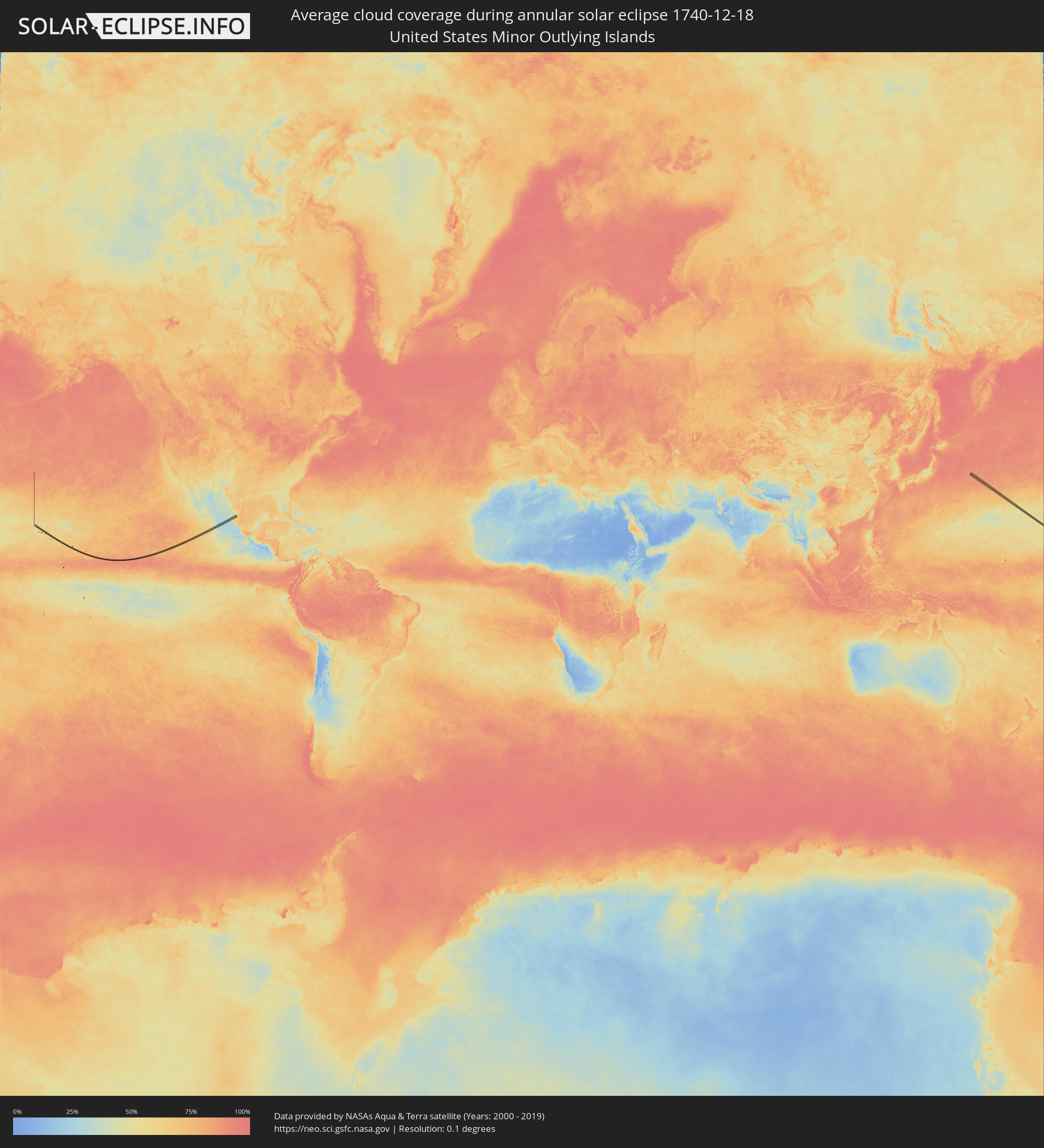 United States Minor Outlying Islands
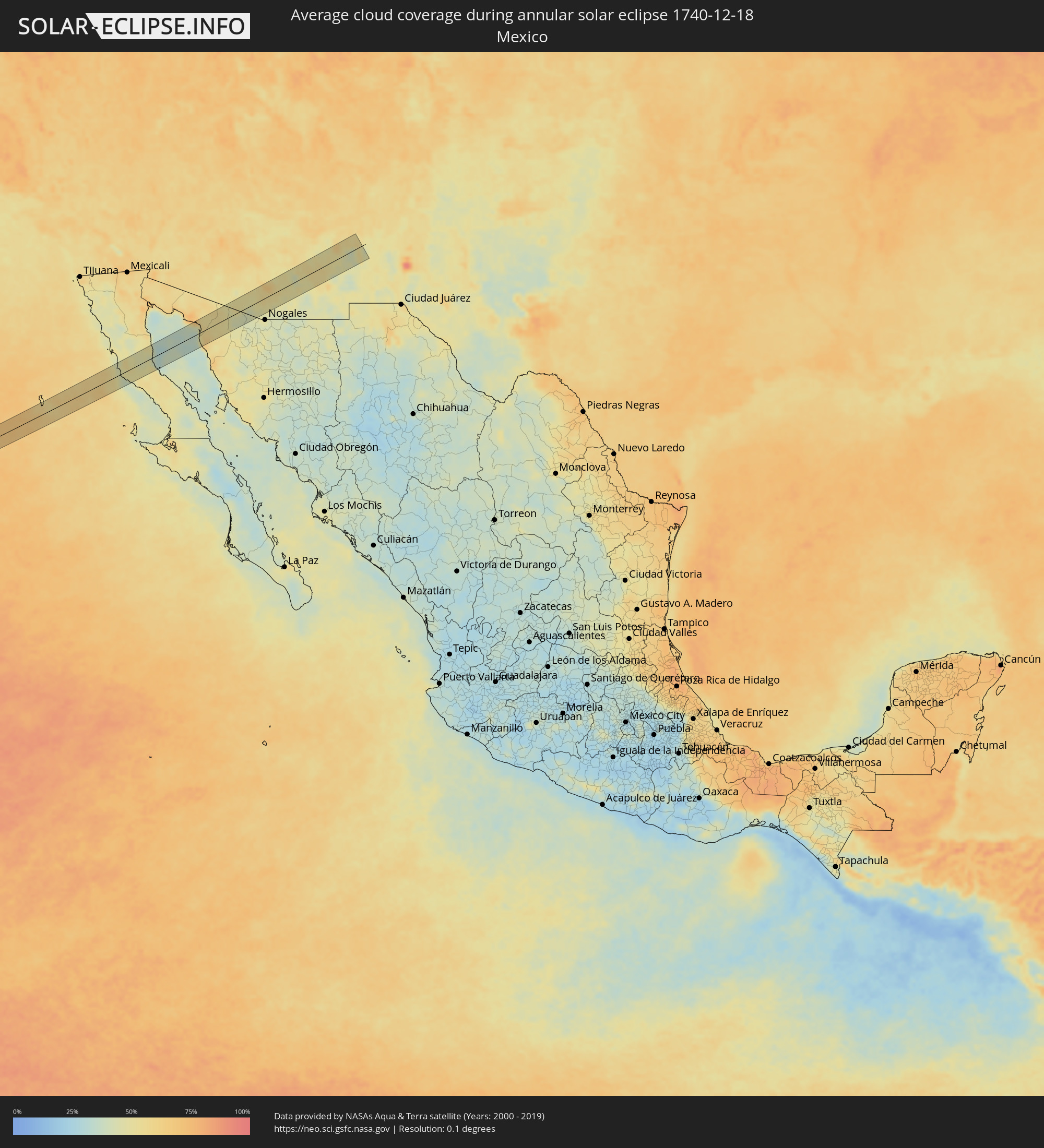 Mexico
Cities inside the path of the eclipse
The following table shows all locations with a population of more than 5,000 inside the eclipse path. Cities which have more than 100,000 inhabitants are marked bold. A click at the locations opens a detailed map.
| City | Type | Eclipse duration | Local time of max. eclipse | Distance to central line | Ø Cloud coverage |
 Kailua-Kona, Hawaii
|
annular | - | 12:14:31 UTC-10:30 | 16 km | 40% |
|
Kalaoa, Hawaii
|
annular | - | 12:14:31 UTC-10:30 | 6 km | 50% |
|
Hōlualoa, Hawaii
|
annular | - | 12:14:41 UTC-10:30 | 17 km | 58% |
|
Waikoloa Village, Hawaii
|
annular | - | 12:14:53 UTC-10:30 | 20 km | 45% |
|
Hilo, Hawaii
|
annular | - | 12:17:20 UTC-10:30 | 11 km | 79% |
|
Hawaiian Paradise Park, Hawaii
|
annular | - | 12:17:47 UTC-10:30 | 2 km | 81% |
|
Three Points, Arizona
|
annular | - | 17:01:12 UTC-07:00 | 32 km | 51% |
|
Valencia West, Arizona
|
annular | - | 17:01:16 UTC-07:00 | 29 km | 54% |
|
Tucson Estates, Arizona
|
annular | - | 17:01:14 UTC-07:00 | 33 km | 55% |
|
Drexel Heights, Arizona
|
annular | - | 17:01:19 UTC-07:00 | 26 km | 54% |
|
Flowing Wells, Arizona
|
annular | - | 17:01:10 UTC-07:00 | 40 km | 63% |
|
Green Valley, Arizona
|
annular | - | 17:01:38 UTC-07:00 | 4 km | 55% |
|
South Tucson, Arizona
|
annular | - | 17:01:18 UTC-07:00 | 29 km | 58% |
|
Sahuarita, Arizona
|
annular | - | 17:01:33 UTC-07:00 | 4 km | 55% |
|
Summit, Arizona
|
annular | - | 17:01:27 UTC-07:00 | 15 km | 54% |
|
Tucson, Arizona
|
annular | - | 17:01:18 UTC-07:00 | 29 km | 60% |
|
Catalina Foothills, Arizona
|
annular | - | 17:01:13 UTC-07:00 | 36 km | 66% |
|
Corona de Tucson, Arizona
|
annular | - | 17:01:39 UTC-07:00 | 3 km | 54% |
|
Tanque Verde, Arizona
|
annular | - | 17:01:23 UTC-07:00 | 23 km | 58% |
|
Vail, Arizona
|
annular | - | 17:01:36 UTC-07:00 | 2 km | 52% |
|
Benson, Arizona
|
annular | - | 17:01:56 UTC-07:00 | 24 km | 47% |
|
Safford, Arizona
|
annular | - | 17:01:22 UTC-07:00 | 35 km | 55% |
|
Silver City, New Mexico
|
annular | - | 17:02:12 UTC-07:00 | 35 km | 47% |