Total solar eclipse of 01/30/1767
| Day of week: | Friday |
| Maximum duration of eclipse: | 04m06s |
| Maximum width of eclipse path: | 157 km |
| Saros cycle: | 127 |
| Coverage: | 100% |
| Magnitude: | 1.0471 |
| Gamma: | 0.019 |
Wo kann man die Sonnenfinsternis vom 01/30/1767 sehen?
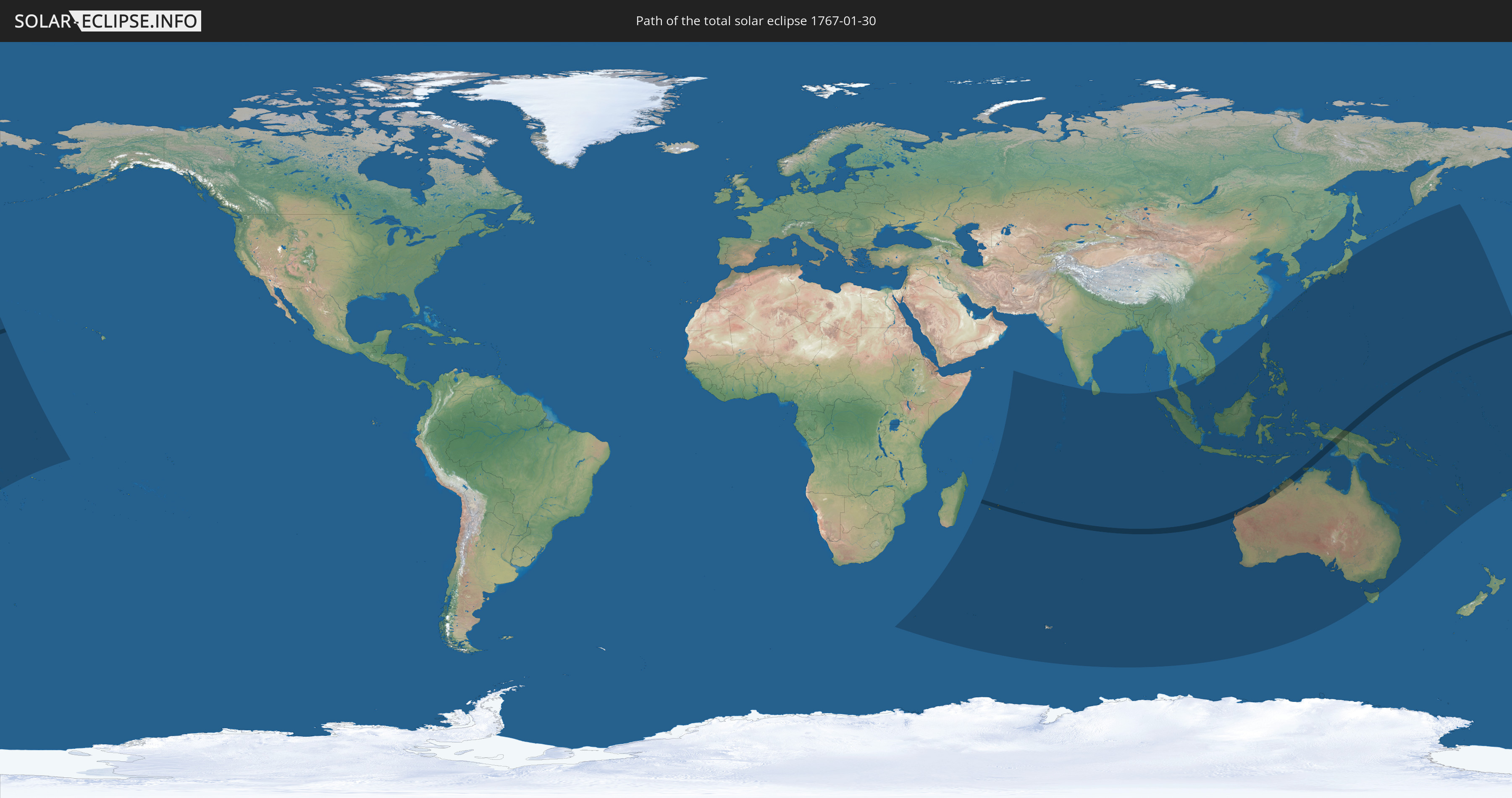
Die Sonnenfinsternis am 01/30/1767 kann man in 38 Ländern als partielle Sonnenfinsternis beobachten.
Der Finsternispfad verläuft durch 5 Länder. Nur in diesen Ländern ist sie als total Sonnenfinsternis zu sehen.
In den folgenden Ländern ist die Sonnenfinsternis total zu sehen
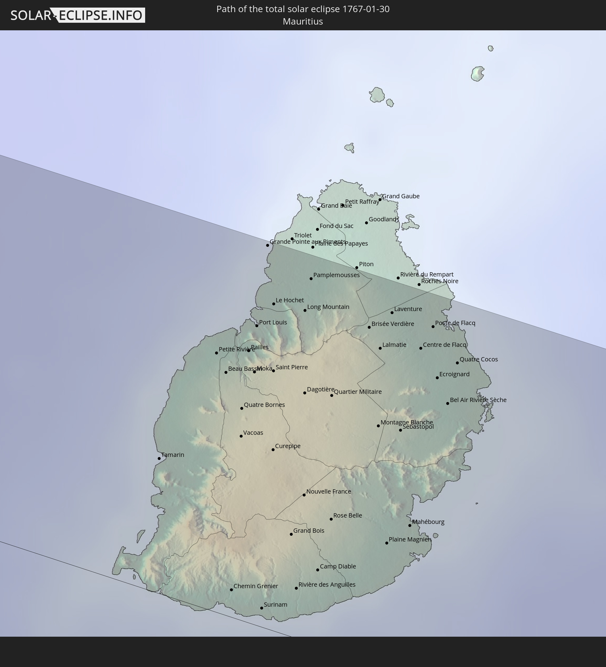 Mauritius
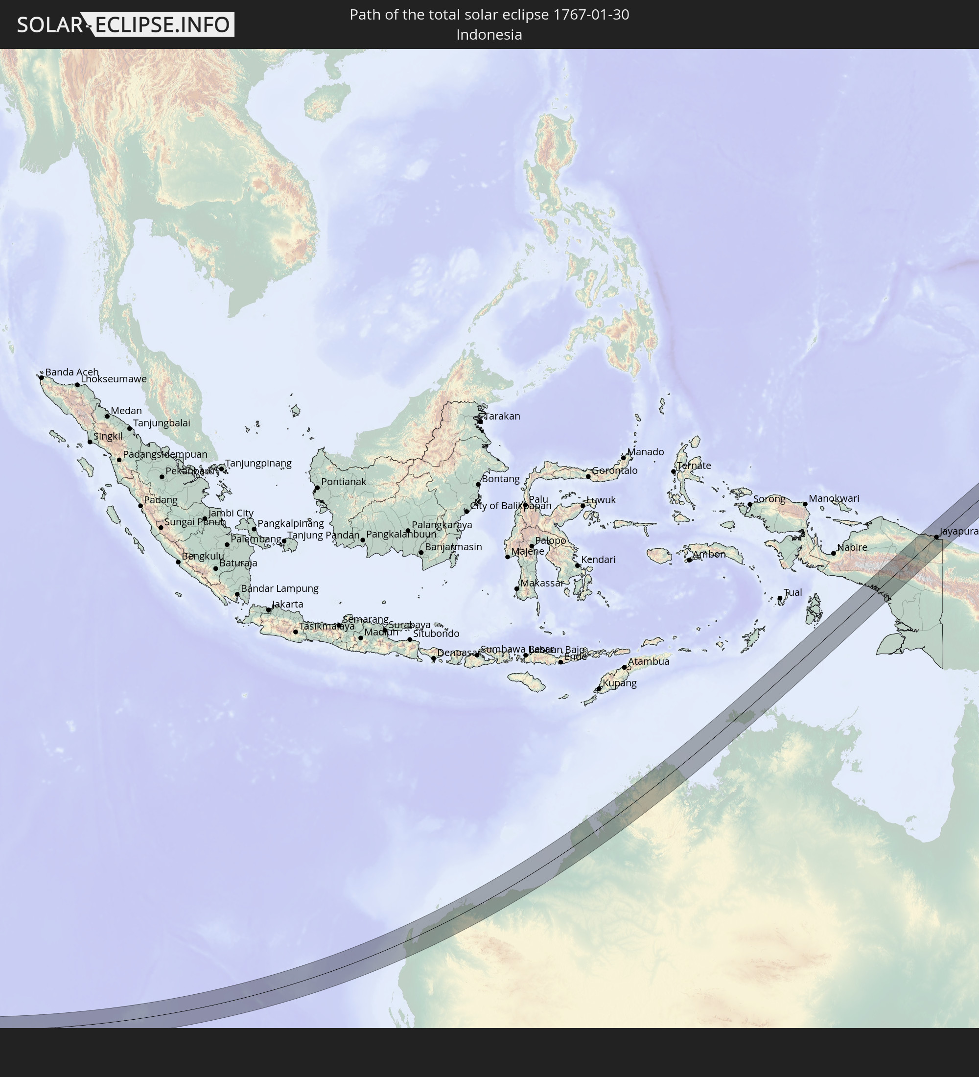 Indonesia
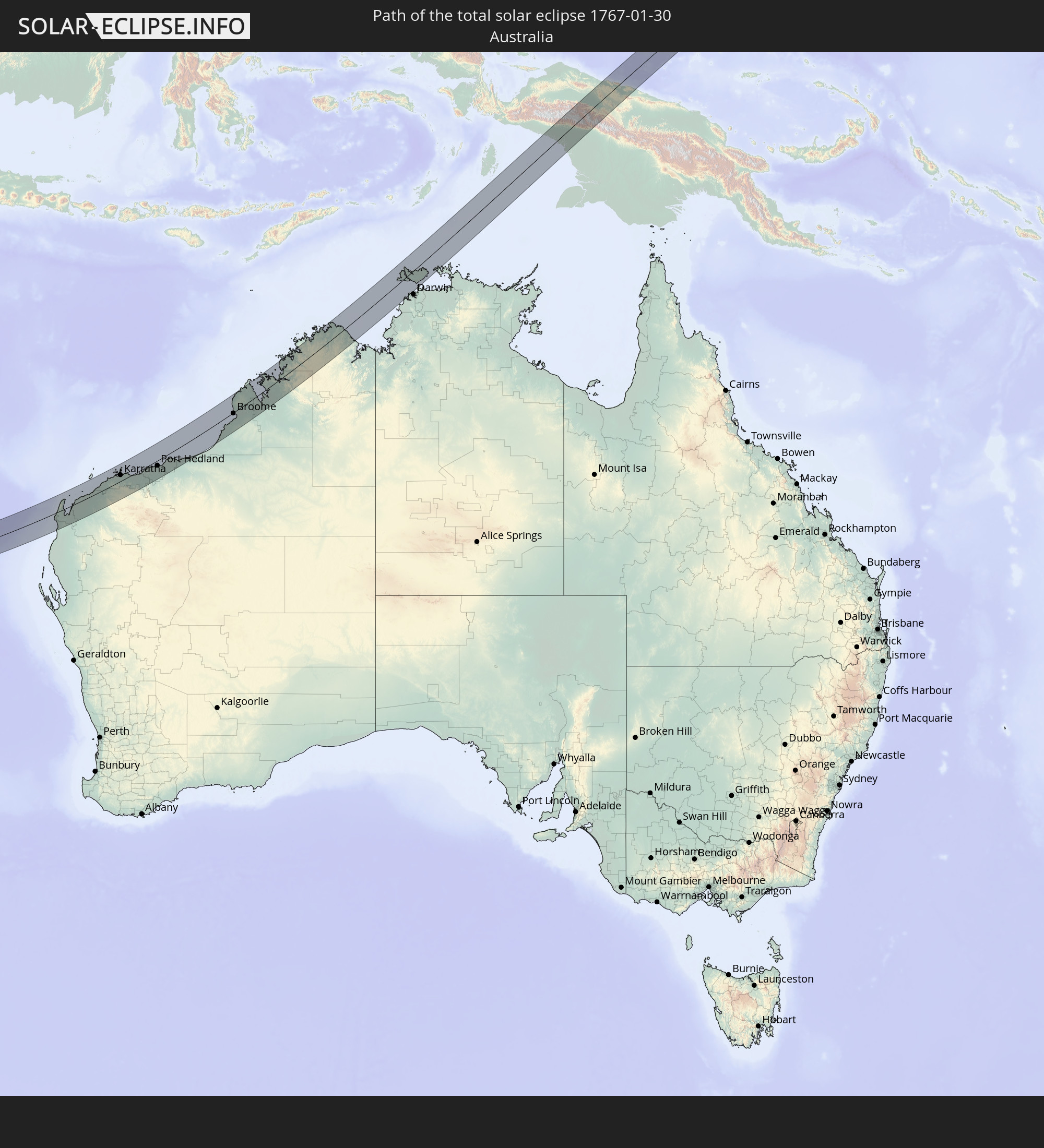 Australia
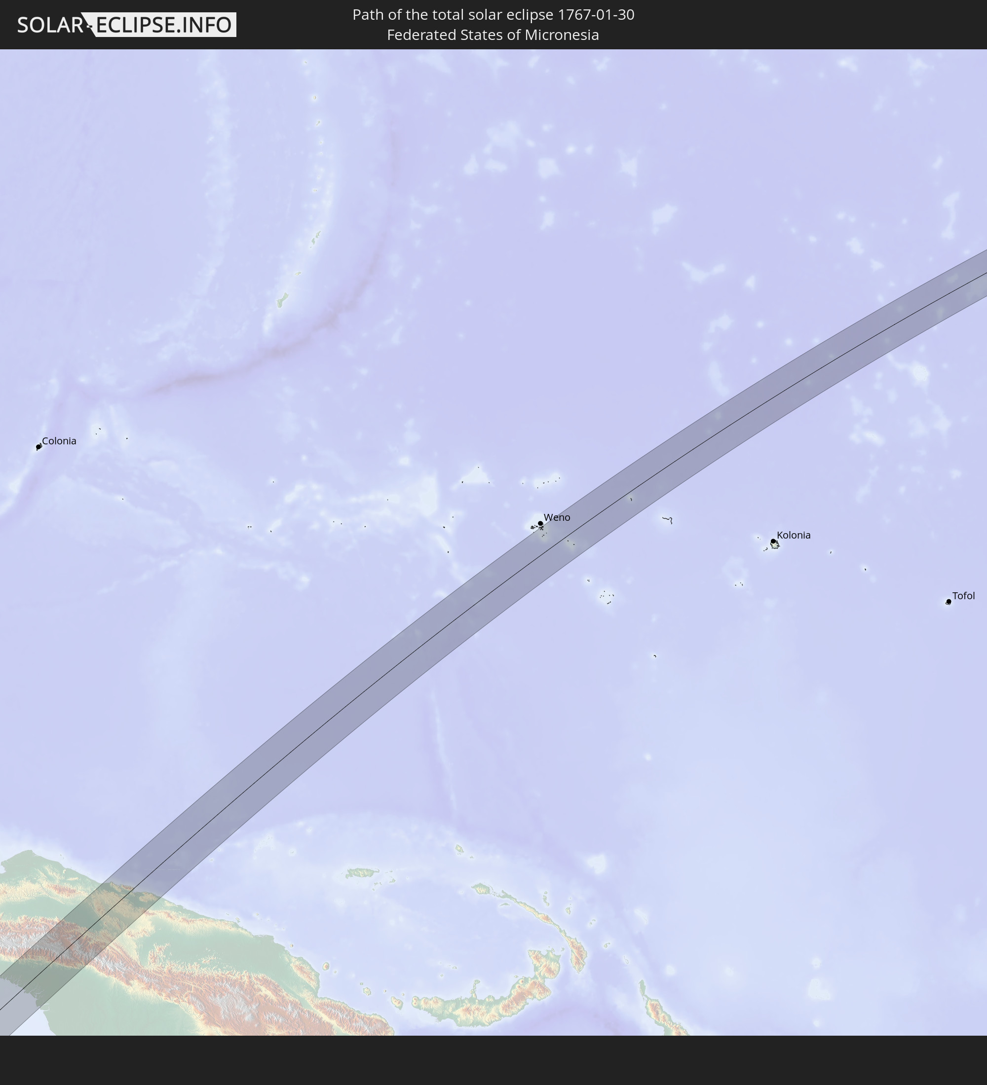 Federated States of Micronesia
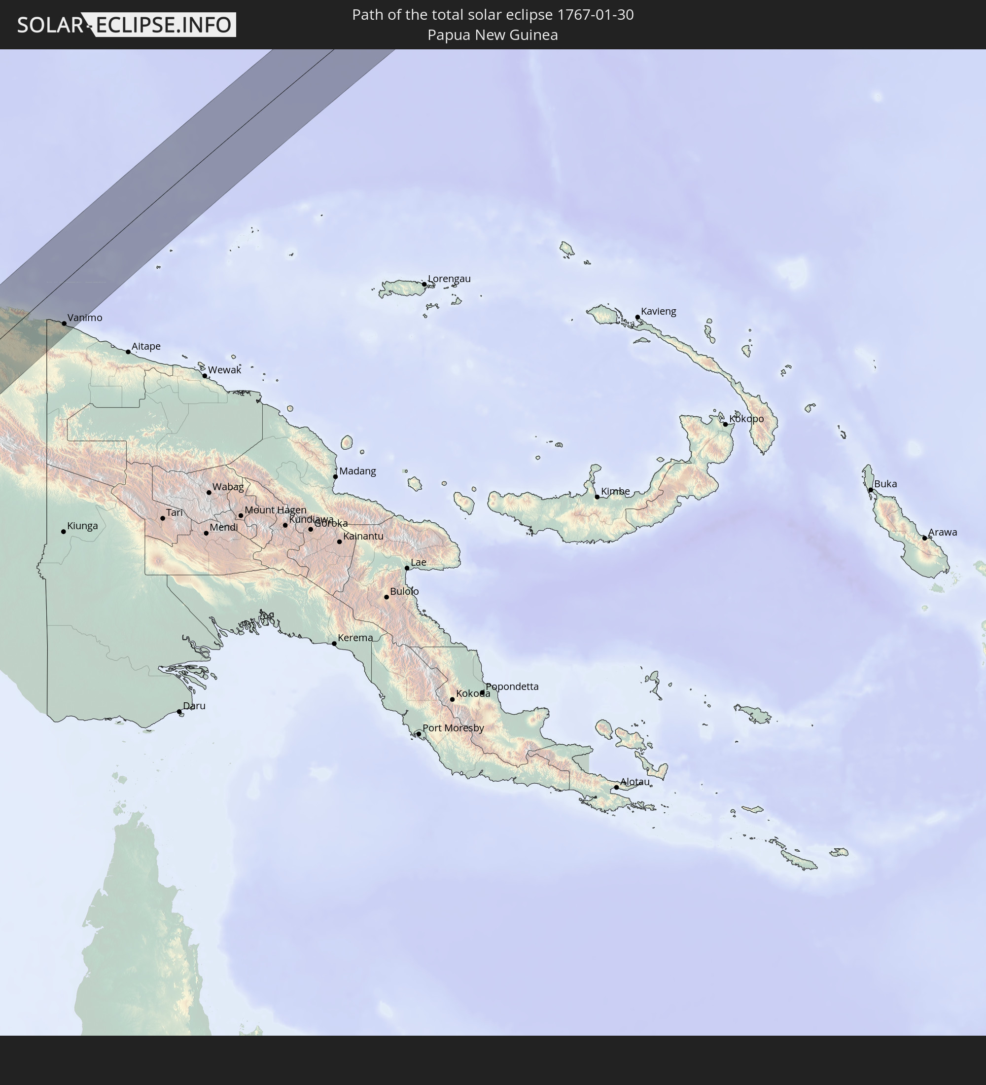 Papua New Guinea
In den folgenden Ländern ist die Sonnenfinsternis partiell zu sehen
 Fiji
Fiji
 United States Minor Outlying Islands
 Wallis and Futuna
 Kiribati
 Tokelau
 American Samoa
 French Southern and Antarctic Lands
 Réunion
 Mauritius
 British Indian Ocean Territory
 Heard Island and McDonald Islands
 Maldives
 Sri Lanka
 Indonesia
 Cocos Islands
 Thailand
 Malaysia
 Vietnam
 Cambodia
 Singapore
 Christmas Island
 Australia
 Brunei
 Taiwan
 Philippines
 Japan
Japan
 East Timor
 Palau
Palau
 Federated States of Micronesia
 Papua New Guinea
 Guam
Guam
 Northern Mariana Islands
 Solomon Islands
 New Caledonia
 Marshall Islands
 Vanuatu
 Nauru
Nauru
 Tuvalu
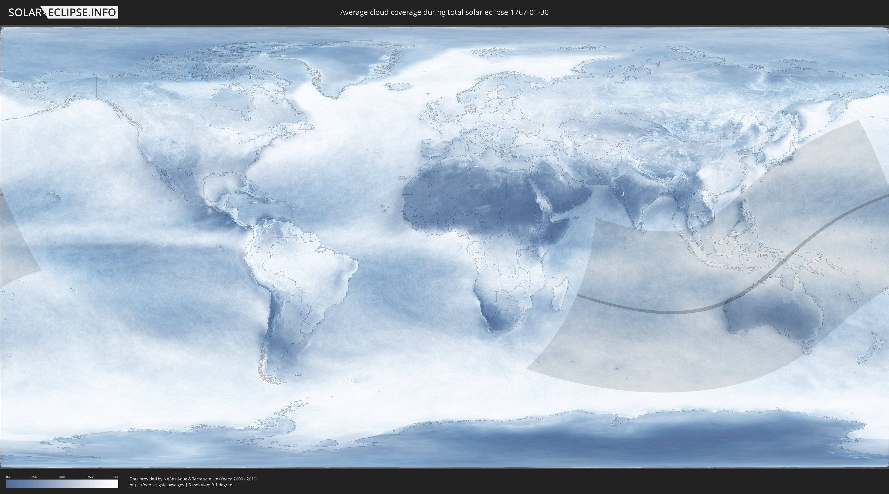
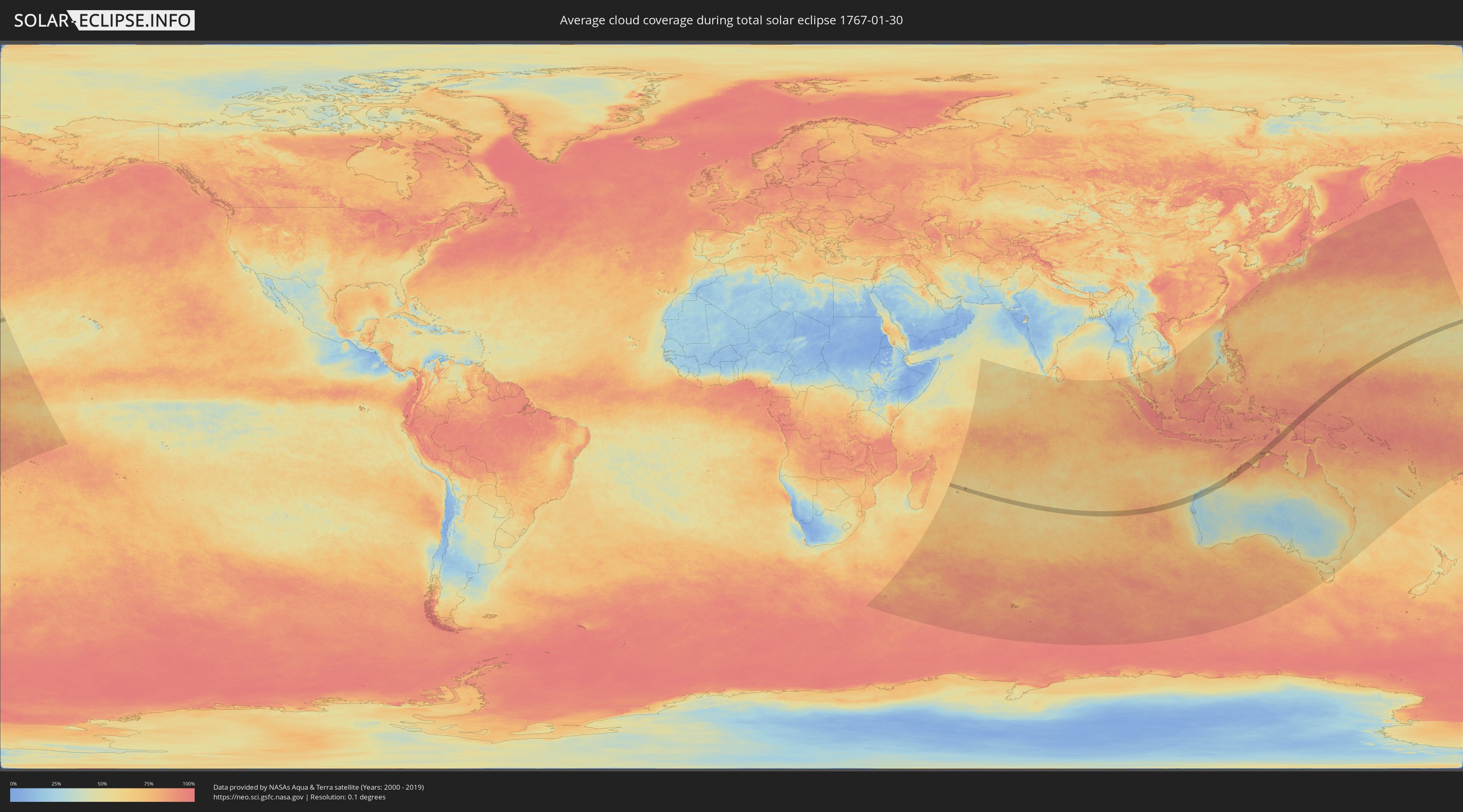
How will be the weather during the total solar eclipse on 01/30/1767?
Where is the best place to see the total solar eclipse of 01/30/1767?
The following maps show the average cloud coverage for the day of the total solar eclipse.
With the help of these maps, it is possible to find the place along the eclipse path, which has the best
chance of a cloudless sky.
Nevertheless, you should consider local circumstances and inform about the weather of your chosen
observation site.
The data is provided by NASAs satellites
AQUA and TERRA.
The cloud maps are averaged over a period of 19 years (2000 - 2019).
Detailed country maps
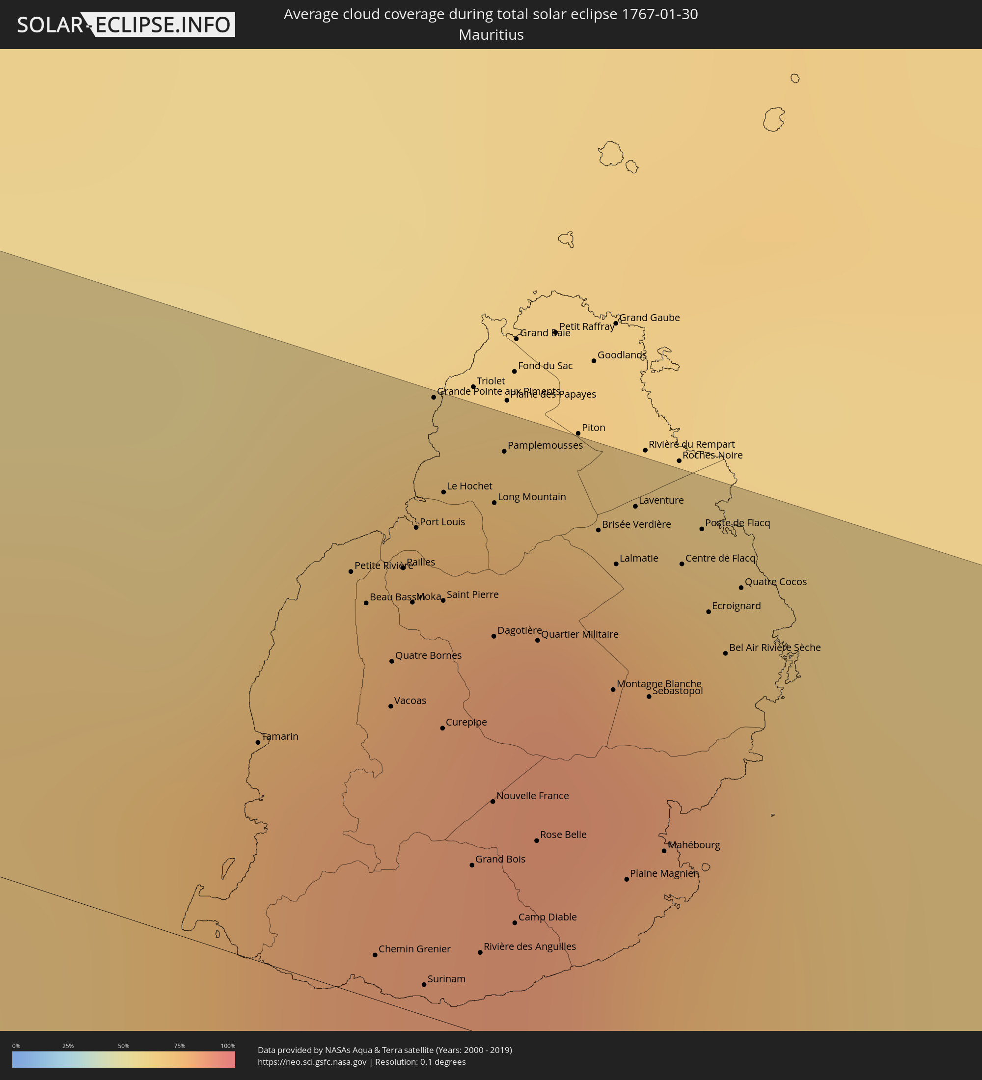 Mauritius
 Indonesia
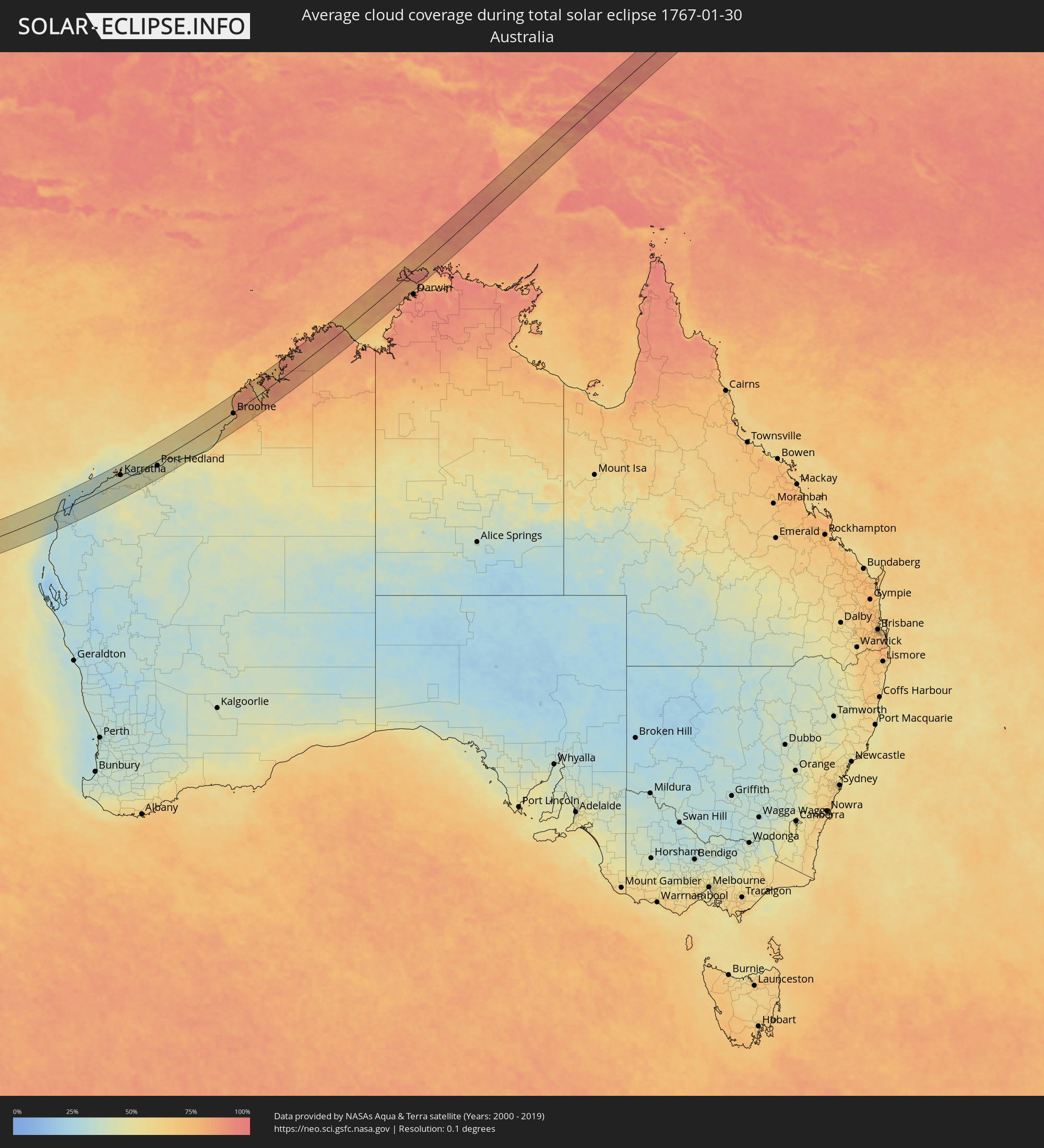 Australia
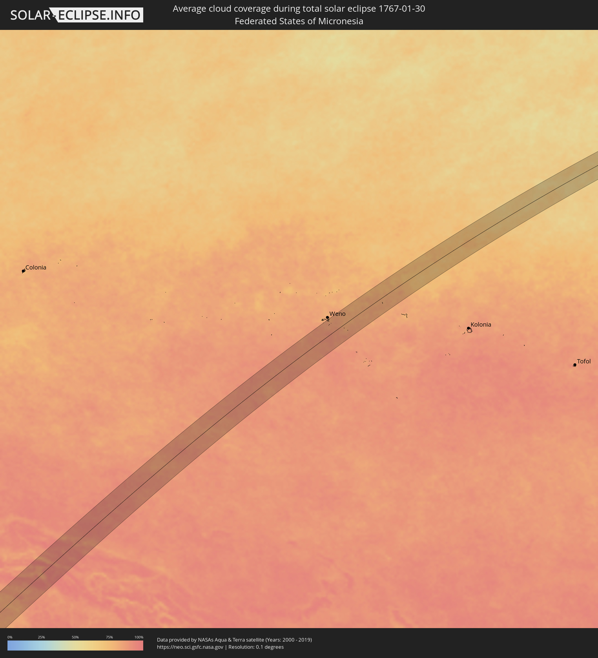 Federated States of Micronesia
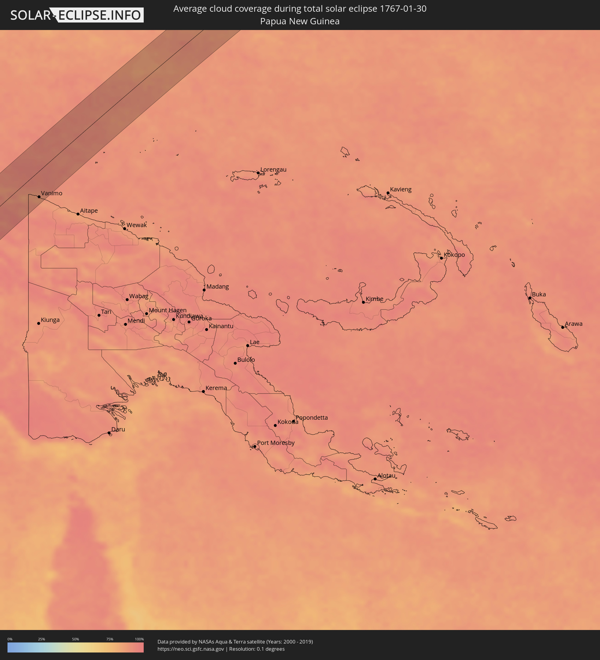 Papua New Guinea
Cities inside the path of the eclipse
The following table shows all locations with a population of more than 5,000 inside the eclipse path. Cities which have more than 100,000 inhabitants are marked bold. A click at the locations opens a detailed map.
| City | Type | Eclipse duration | Local time of max. eclipse | Distance to central line | Ø Cloud coverage |
|
Tamarin, Black River
|
total | - | 06:03:42 UTC+03:50 | 18 km | 81% |
|
Petite Rivière, Black River
|
total | - | 06:03:40 UTC+03:50 | 34 km | 80% |
|
Beau Bassin, Plaines Wilhems
|
total | - | 06:03:41 UTC+03:50 | 32 km | 83% |
|
Chemin Grenier, Savanne
|
total | - | 06:03:44 UTC+03:50 | 4 km | 70% |
|
Vacoas, Plaines Wilhems
|
total | - | 06:03:42 UTC+03:50 | 24 km | 85% |
|
Quatre Bornes, Plaines Wilhems
|
total | - | 06:03:41 UTC+03:50 | 28 km | 85% |
|
Pailles, Moka
|
total | - | 06:03:41 UTC+03:50 | 35 km | 83% |
|
Moka, Moka
|
total | - | 06:03:41 UTC+03:50 | 33 km | 83% |
|
Port Louis, Port Louis
|
total | - | 06:03:40 UTC+03:50 | 39 km | 83% |
|
Surinam, Savanne
|
total | - | 06:03:45 UTC+03:50 | 2 km | 70% |
|
Grande Pointe aux Piments, Pamplemousses
|
total | - | 06:03:39 UTC+03:50 | 50 km | 80% |
|
Souillac, Savanne
|
total | - | 06:03:45 UTC+03:50 | 2 km | 70% |
|
Curepipe, Plaines Wilhems
|
total | - | 06:03:42 UTC+03:50 | 24 km | 85% |
|
Saint Pierre, Moka
|
total | - | 06:03:41 UTC+03:50 | 34 km | 83% |
|
Le Hochet, Pamplemousses
|
total | - | 06:03:40 UTC+03:50 | 43 km | 80% |
|
Terre Rouge, Pamplemousses
|
total | - | 06:03:40 UTC+03:50 | 44 km | 80% |
|
Grand Bois, Savanne
|
total | - | 06:03:44 UTC+03:50 | 13 km | 83% |
|
Rivière des Anguilles, Savanne
|
total | - | 06:03:45 UTC+03:50 | 6 km | 69% |
|
Morcellemont Saint André, Pamplemousses
|
total | - | 06:03:39 UTC+03:50 | 50 km | 84% |
|
Nouvelle France, Grand Port
|
total | - | 06:03:43 UTC+03:50 | 19 km | 79% |
|
Dagotière, Moka
|
total | - | 06:03:41 UTC+03:50 | 32 km | 87% |
|
Long Mountain, Pamplemousses
|
total | - | 06:03:40 UTC+03:50 | 43 km | 84% |
|
Pamplemousses, Pamplemousses
|
total | - | 06:03:40 UTC+03:50 | 47 km | 84% |
|
Camp Diable, Savanne
|
total | - | 06:03:45 UTC+03:50 | 10 km | 69% |
|
Rose Belle, Grand Port
|
total | - | 06:03:44 UTC+03:50 | 17 km | 79% |
|
Quartier Militaire, Moka
|
total | - | 06:03:42 UTC+03:50 | 33 km | 87% |
|
New Grove, Grand Port
|
total | - | 06:03:44 UTC+03:50 | 17 km | 79% |
|
Brisée Verdière, Flacq
|
total | - | 06:03:41 UTC+03:50 | 44 km | 87% |
|
Bon Accueil, Flacq
|
total | - | 06:03:41 UTC+03:50 | 43 km | 83% |
|
Montagne Blanche
|
total | - | 06:03:42 UTC+03:50 | 31 km | 77% |
|
Lalmatie, Flacq
|
total | - | 06:03:41 UTC+03:50 | 41 km | 83% |
|
Plaine Magnien, Grand Port
|
total | - | 06:03:44 UTC+03:50 | 16 km | 70% |
|
Laventure, Flacq
|
total | - | 06:03:41 UTC+03:50 | 46 km | 75% |
|
Sebastopol, Flacq
|
total | - | 06:03:43 UTC+03:50 | 32 km | 77% |
|
Beau Vallon, Grand Port
|
total | - | 06:03:44 UTC+03:50 | 18 km | 70% |
|
Mahébourg, Grand Port
|
total | - | 06:03:44 UTC+03:50 | 19 km | 70% |
|
Centre de Flacq, Flacq
|
total | - | 06:03:41 UTC+03:50 | 43 km | 83% |
|
Poste de Flacq, Flacq
|
total | - | 06:03:41 UTC+03:50 | 46 km | 83% |
|
Ecroignard, Flacq
|
total | - | 06:03:42 UTC+03:50 | 40 km | 83% |
|
Bel Air Rivière Sèche, Flacq
|
total | - | 06:03:42 UTC+03:50 | 37 km | 77% |
|
Quatre Cocos, Flacq
|
total | - | 06:03:42 UTC+03:50 | 43 km | 68% |
|
Karratha, Western Australia
|
total | - | 11:34:21 UTC+08:00 | 26 km | 40% |
|
Port Hedland, Western Australia
|
total | - | 11:39:03 UTC+08:00 | 22 km | 45% |
|
Broome, Western Australia
|
total | - | 11:51:05 UTC+08:00 | 4 km | 63% |
|
Abepura, Papua
|
total | - | 14:16:36 UTC+09:22 | 2 km | 88% |
|
Jayapura, Papua
|
total | - | 14:16:49 UTC+09:22 | 4 km | 91% |
|
Vanimo, Sandaun
|
total | - | 14:54:37 UTC+10:00 | 55 km | 89% |
|
Vanimo, Sandaun
|
total | - | 14:54:39 UTC+10:00 | 59 km | 89% |