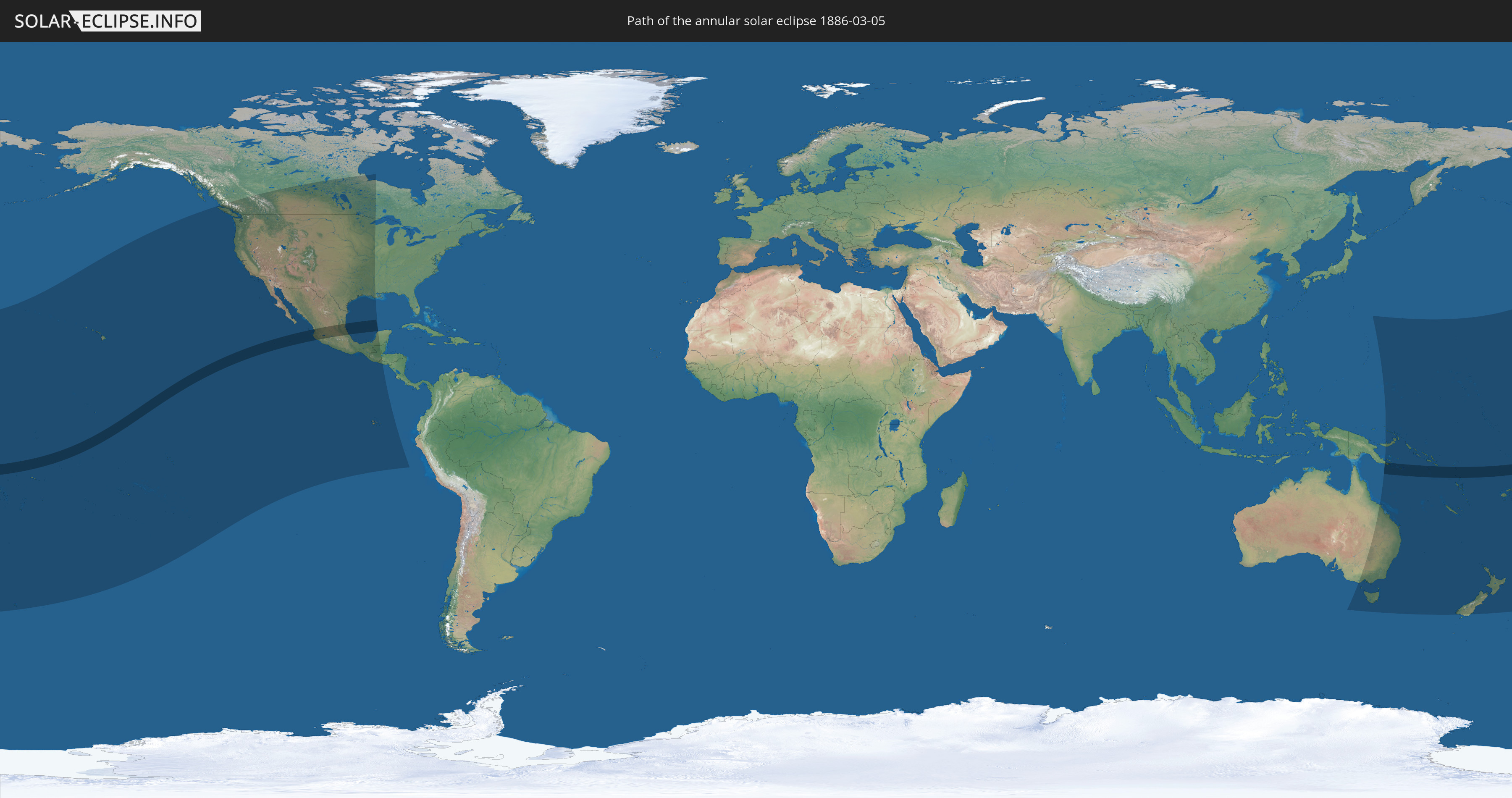
Annular solar eclipse of 03/05/1886
| Day of week: | Friday |
| Maximum duration of eclipse: | 08m20s |
| Maximum width of eclipse path: | 241 km |
| Saros cycle: | 128 |
| Coverage: | 93.6% |
| Magnitude: | 0.9357 |
| Gamma: | 0.097 |
Wo kann man die Sonnenfinsternis vom 03/05/1886 sehen?
Die Sonnenfinsternis am 03/05/1886 kann man in 30 Ländern als partielle Sonnenfinsternis beobachten.
Der Finsternispfad verläuft durch 9 Länder. Nur in diesen Ländern ist sie als annular Sonnenfinsternis zu sehen.
In den folgenden Ländern ist die Sonnenfinsternis annular zu sehen
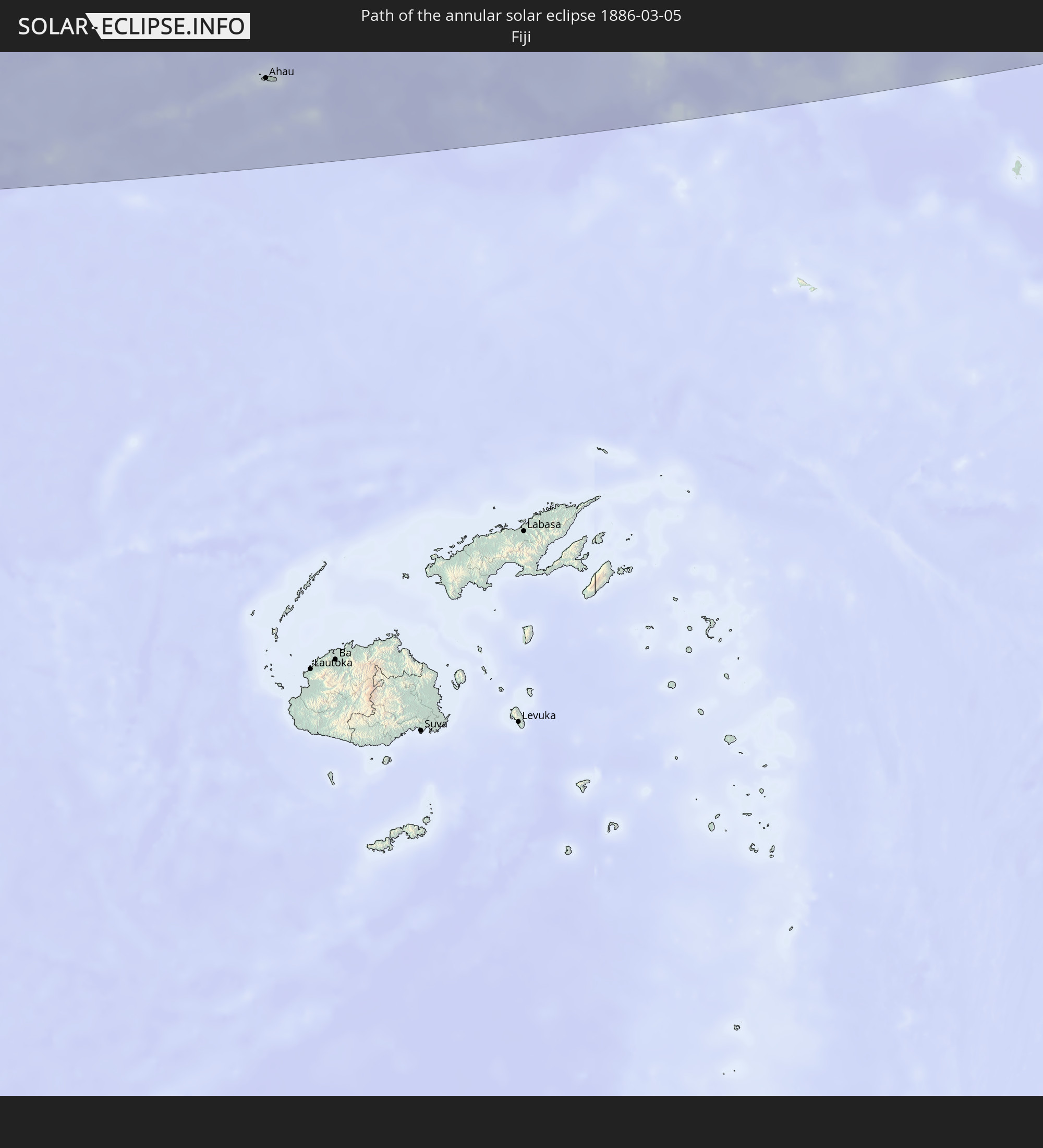 Fiji
Fiji
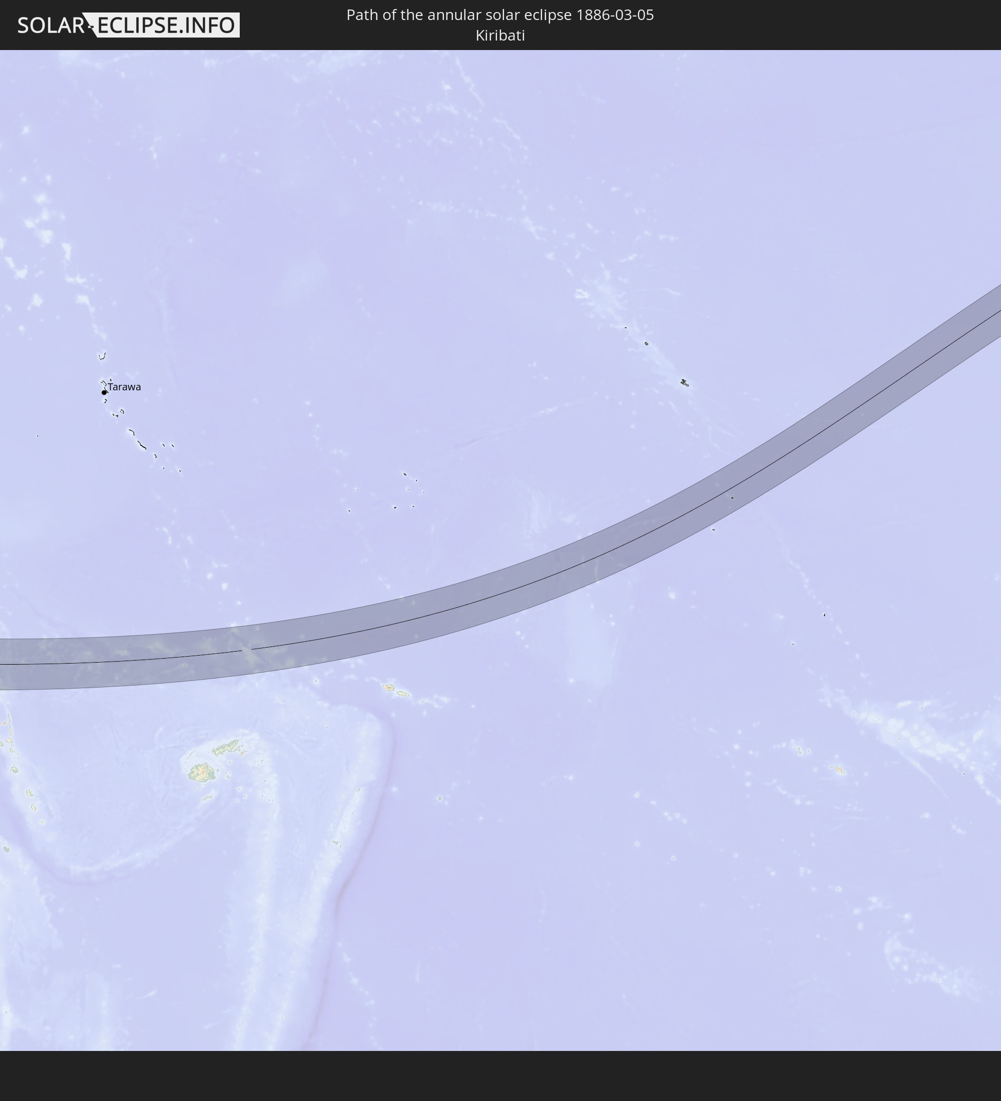 Kiribati
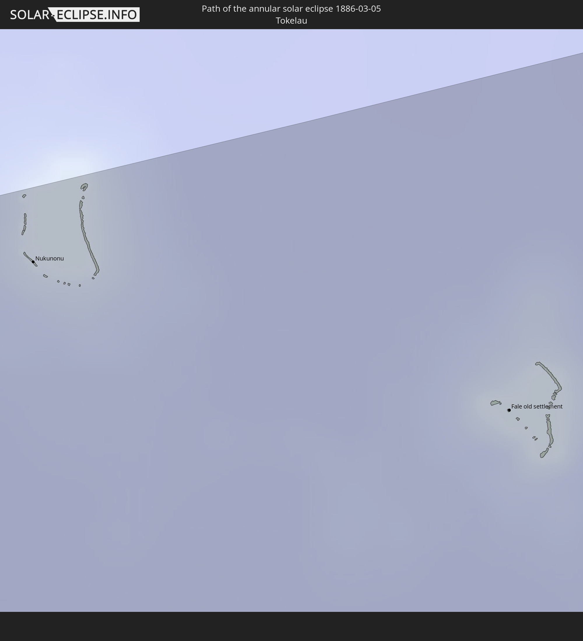 Tokelau
 American Samoa
 Mexico
 Papua New Guinea
 Solomon Islands
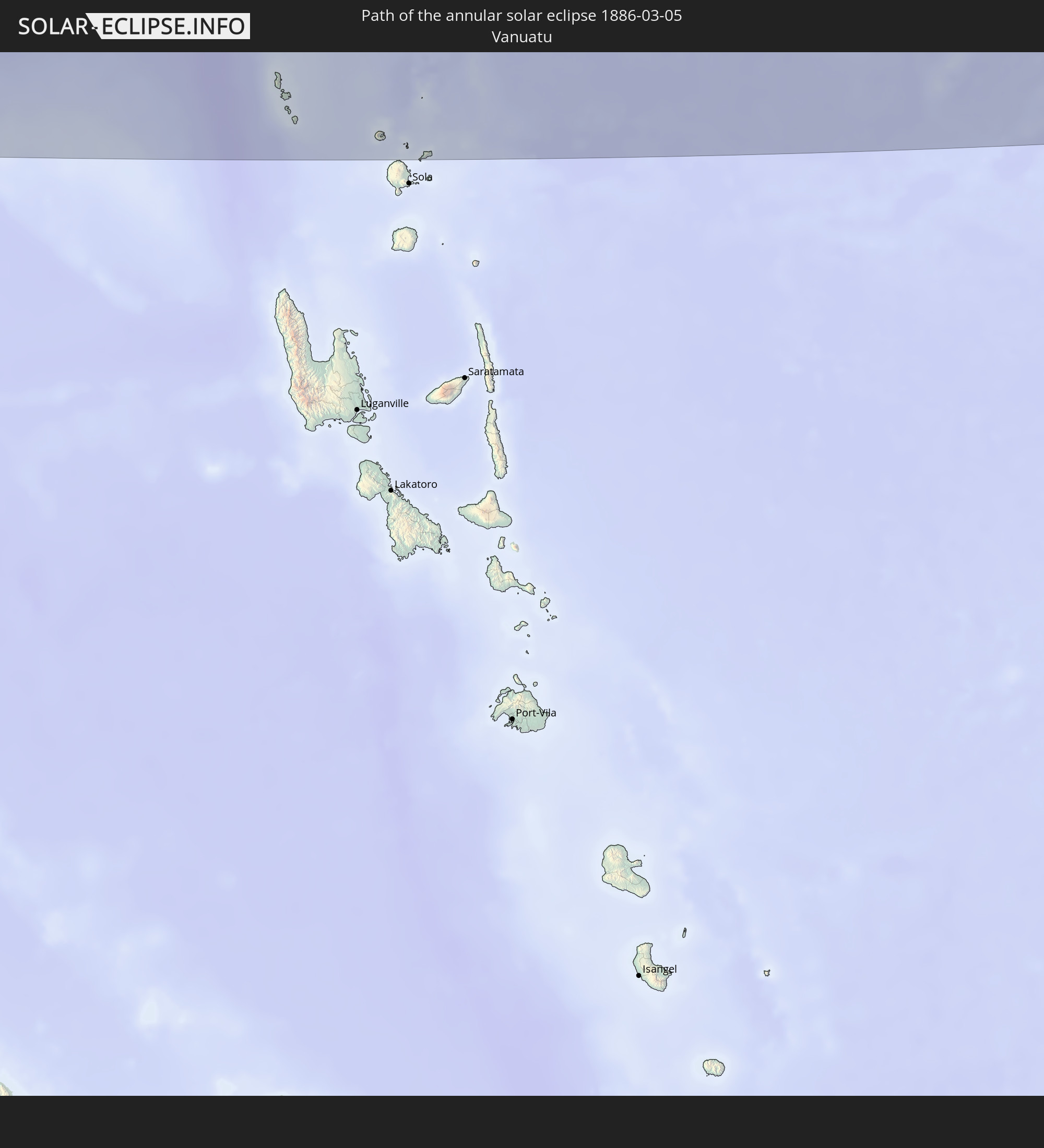 Vanuatu
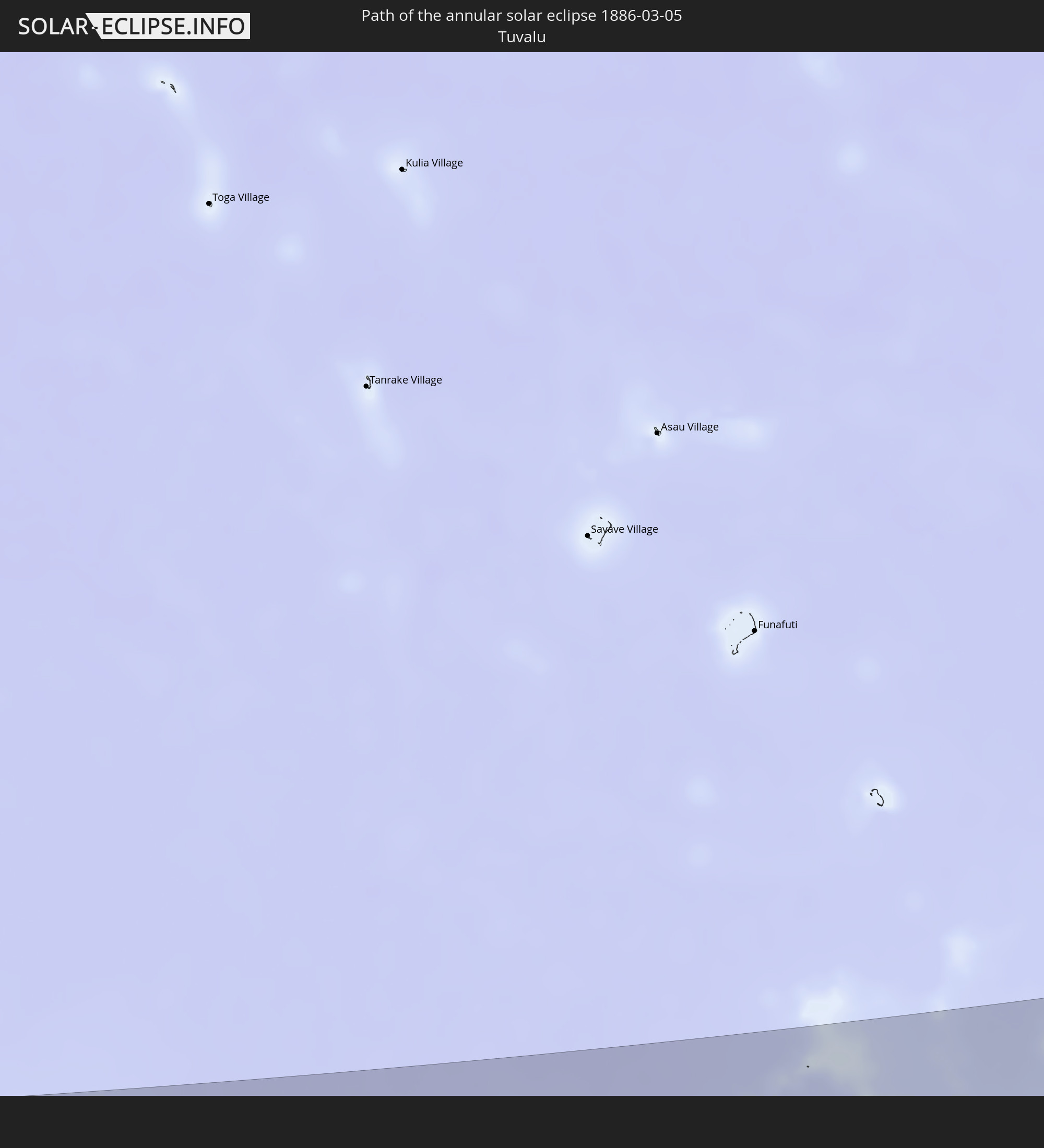 Tuvalu
In den folgenden Ländern ist die Sonnenfinsternis partiell zu sehen
 Fiji
Fiji
 United States
 New Zealand
 United States Minor Outlying Islands
 Wallis and Futuna
 Tonga
Tonga
 Kiribati
 Samoa
Samoa
 Tokelau
 American Samoa
 Niue
Niue
 Cook Islands
 French Polynesia
 Canada
 Pitcairn Islands
 Mexico
 Guatemala
 Ecuador
 El Salvador
 Honduras
 Australia
 Federated States of Micronesia
 Papua New Guinea
 Solomon Islands
 New Caledonia
 Marshall Islands
 Vanuatu
 Nauru
Nauru
 Norfolk Island
 Tuvalu
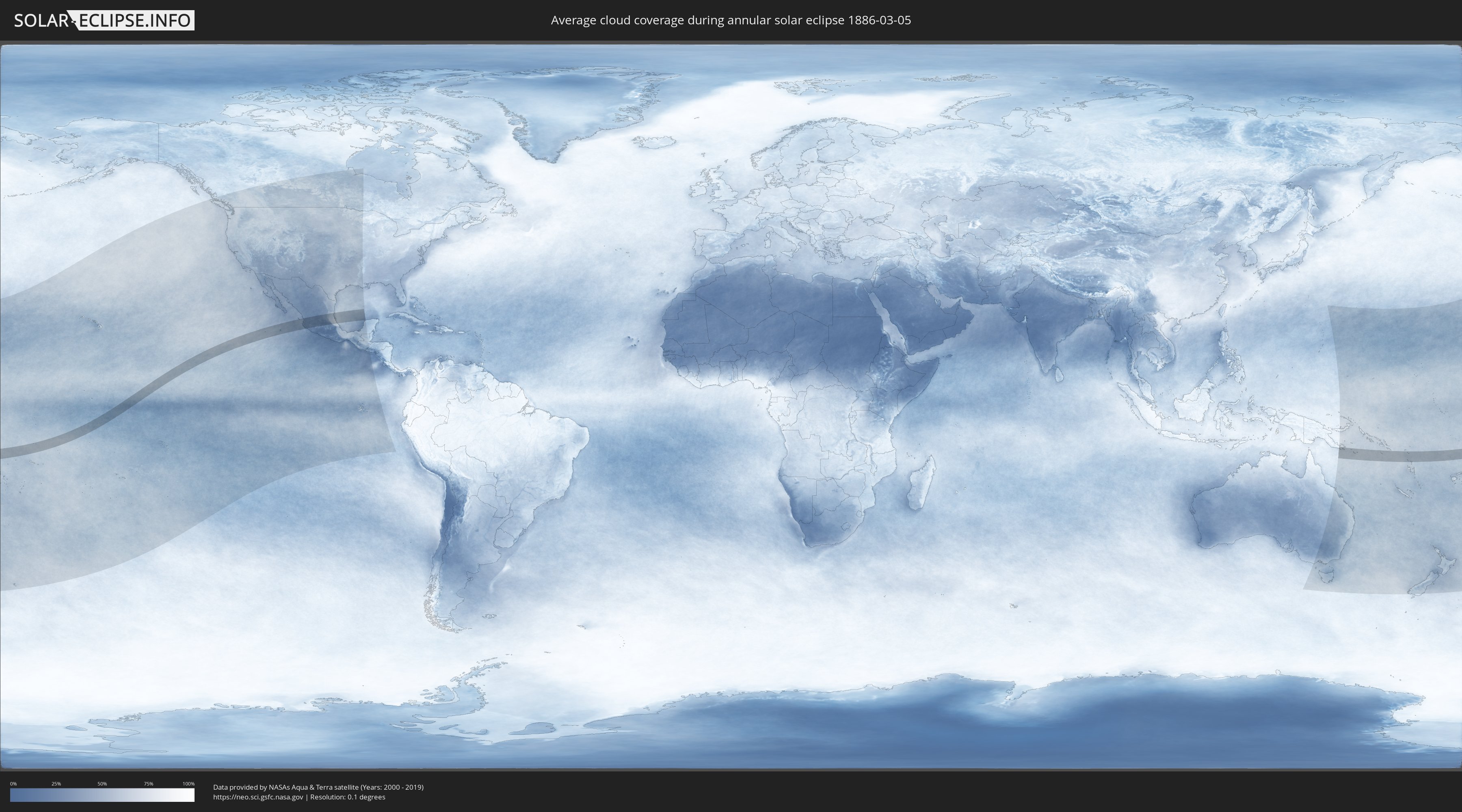
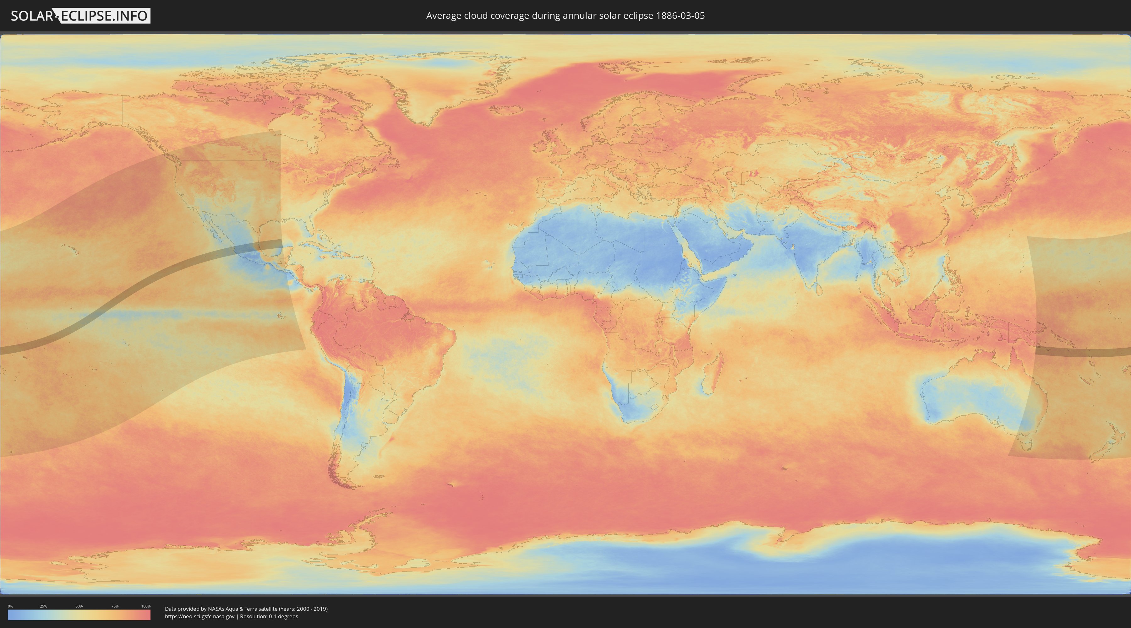
How will be the weather during the annular solar eclipse on 03/05/1886?
Where is the best place to see the annular solar eclipse of 03/05/1886?
The following maps show the average cloud coverage for the day of the annular solar eclipse.
With the help of these maps, it is possible to find the place along the eclipse path, which has the best
chance of a cloudless sky.
Nevertheless, you should consider local circumstances and inform about the weather of your chosen
observation site.
The data is provided by NASAs satellites
AQUA and TERRA.
The cloud maps are averaged over a period of 19 years (2000 - 2019).
Detailed country maps
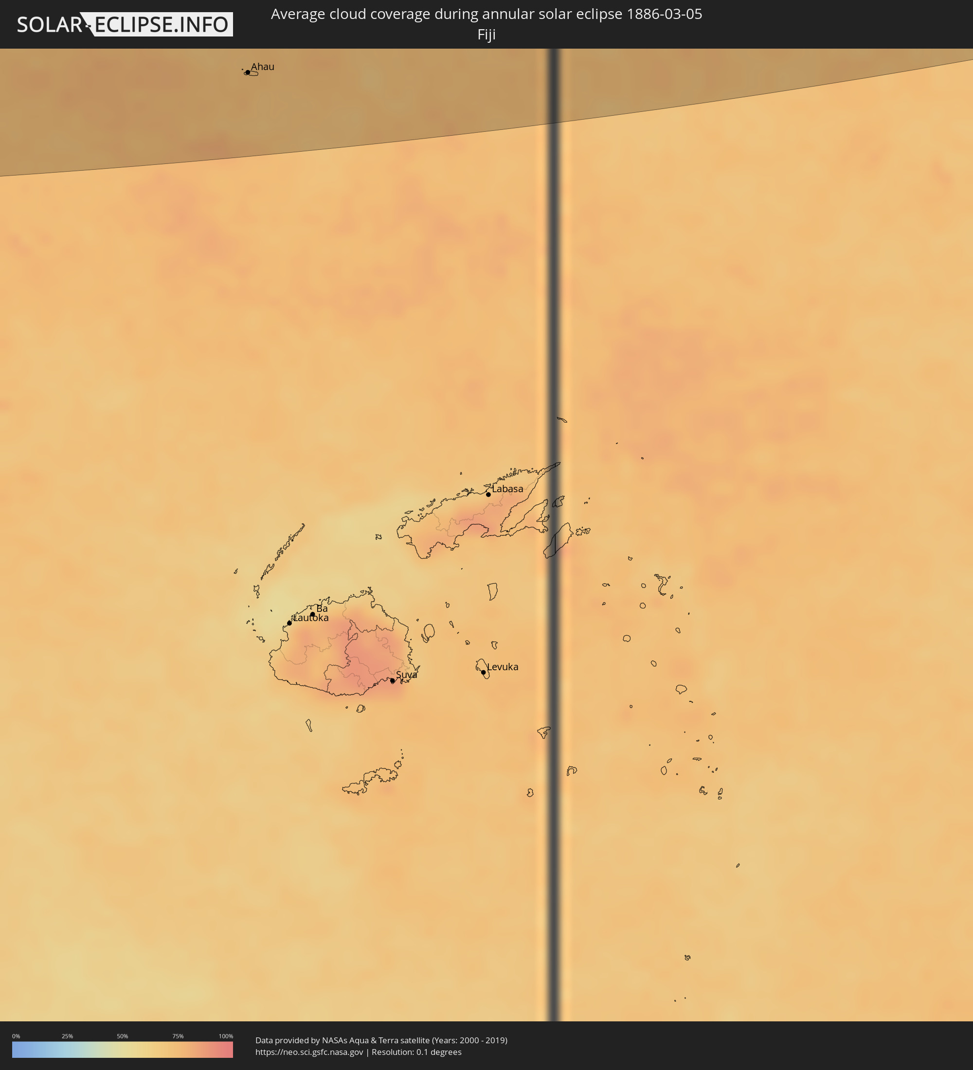 Fiji
Fiji
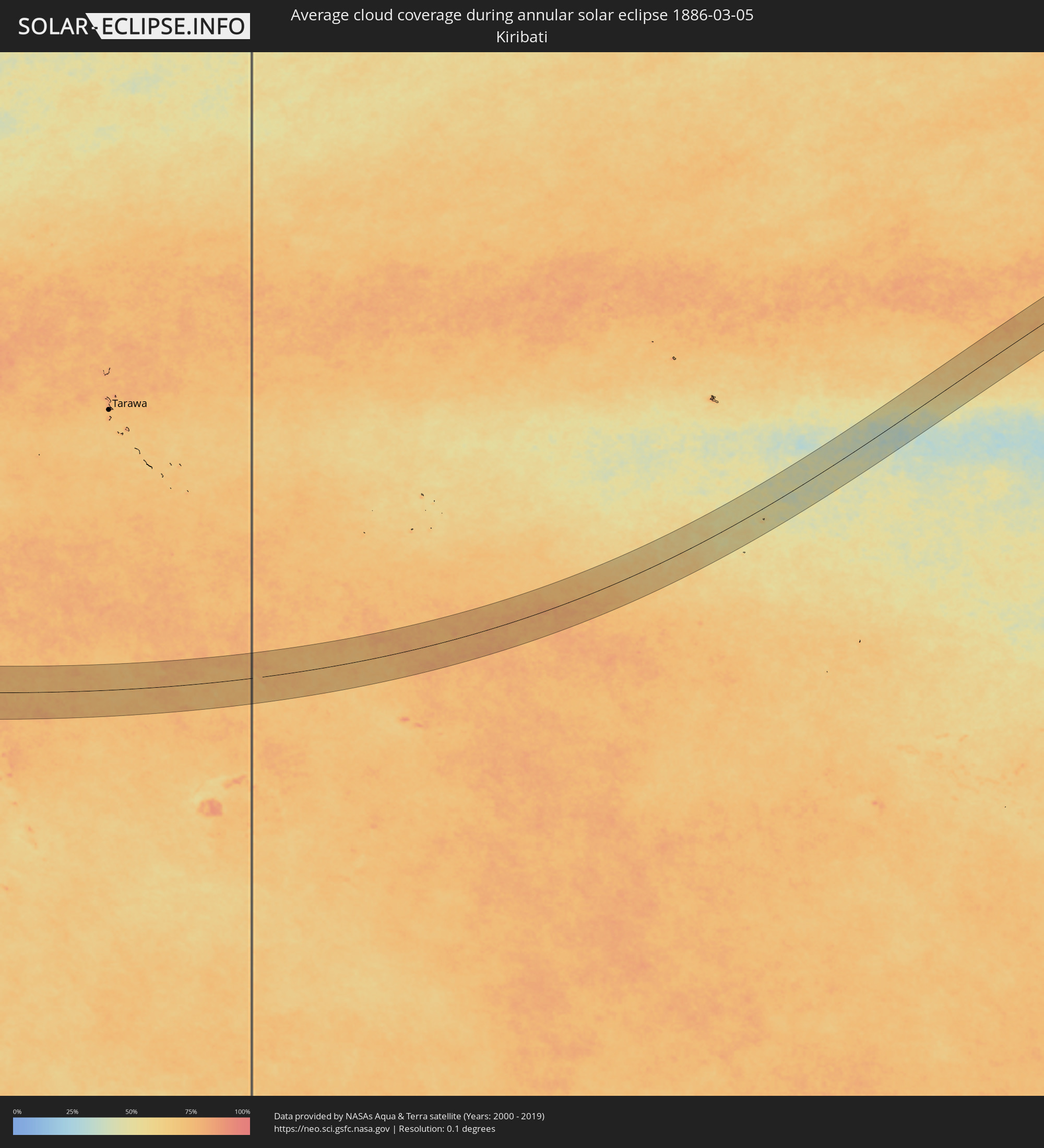 Kiribati
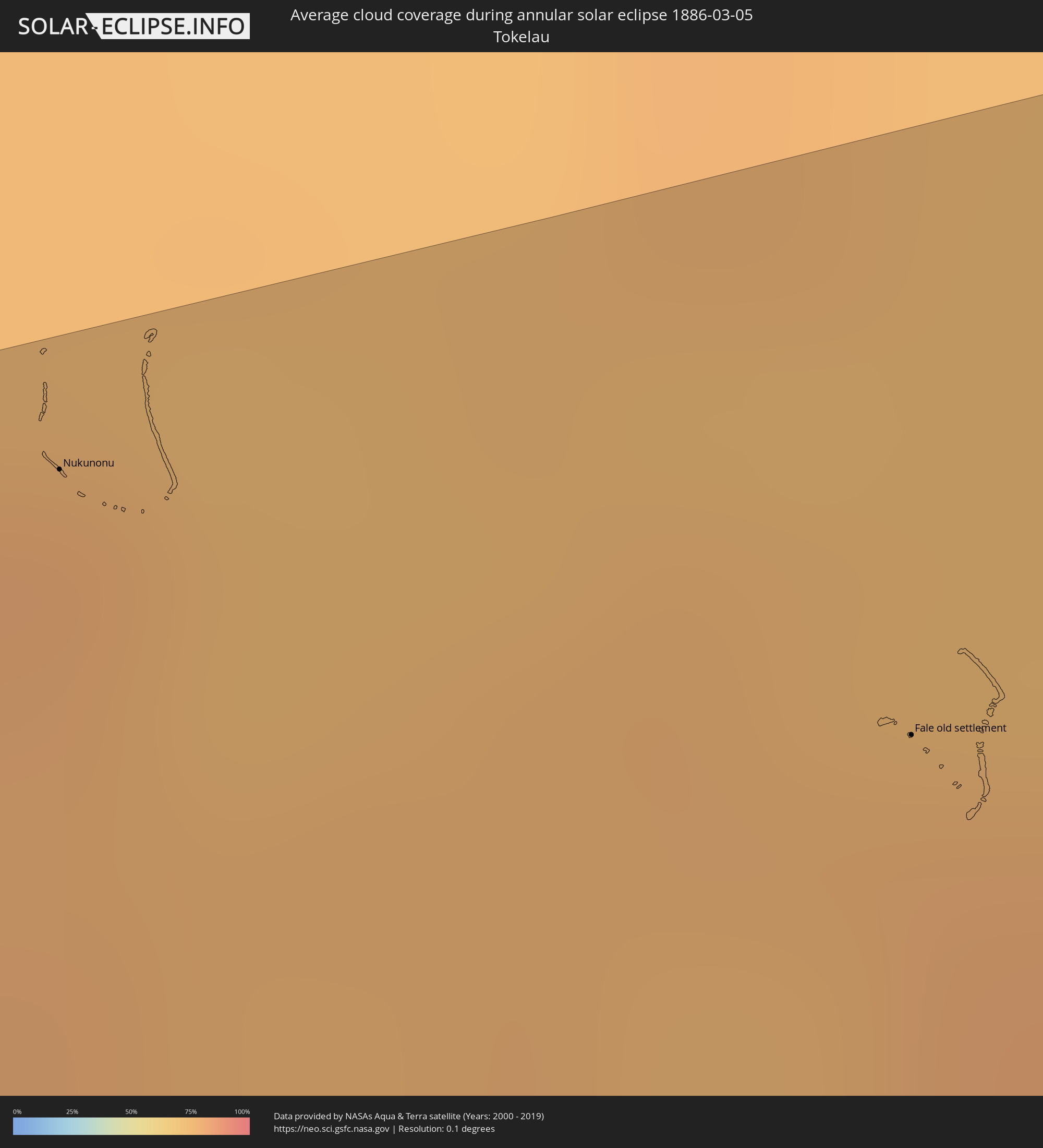 Tokelau
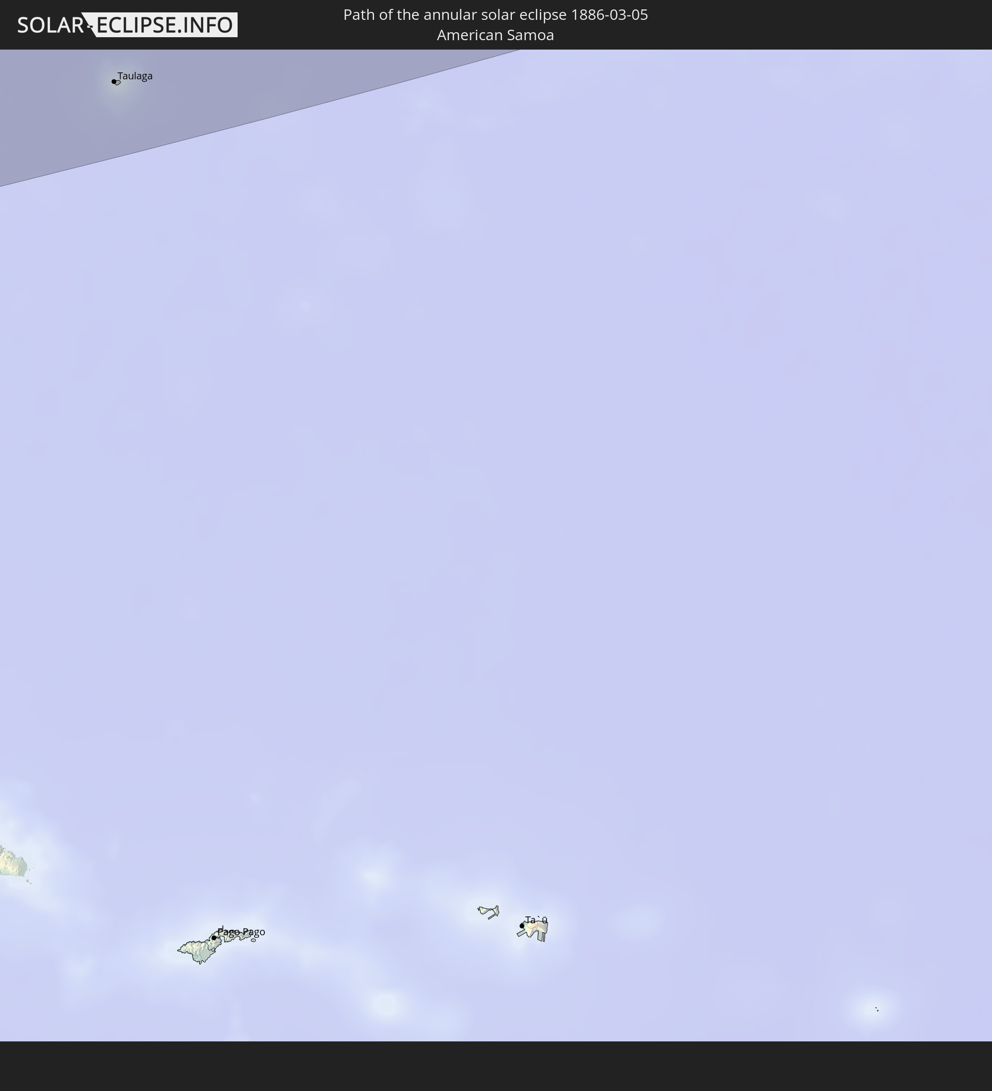
 American Samoa
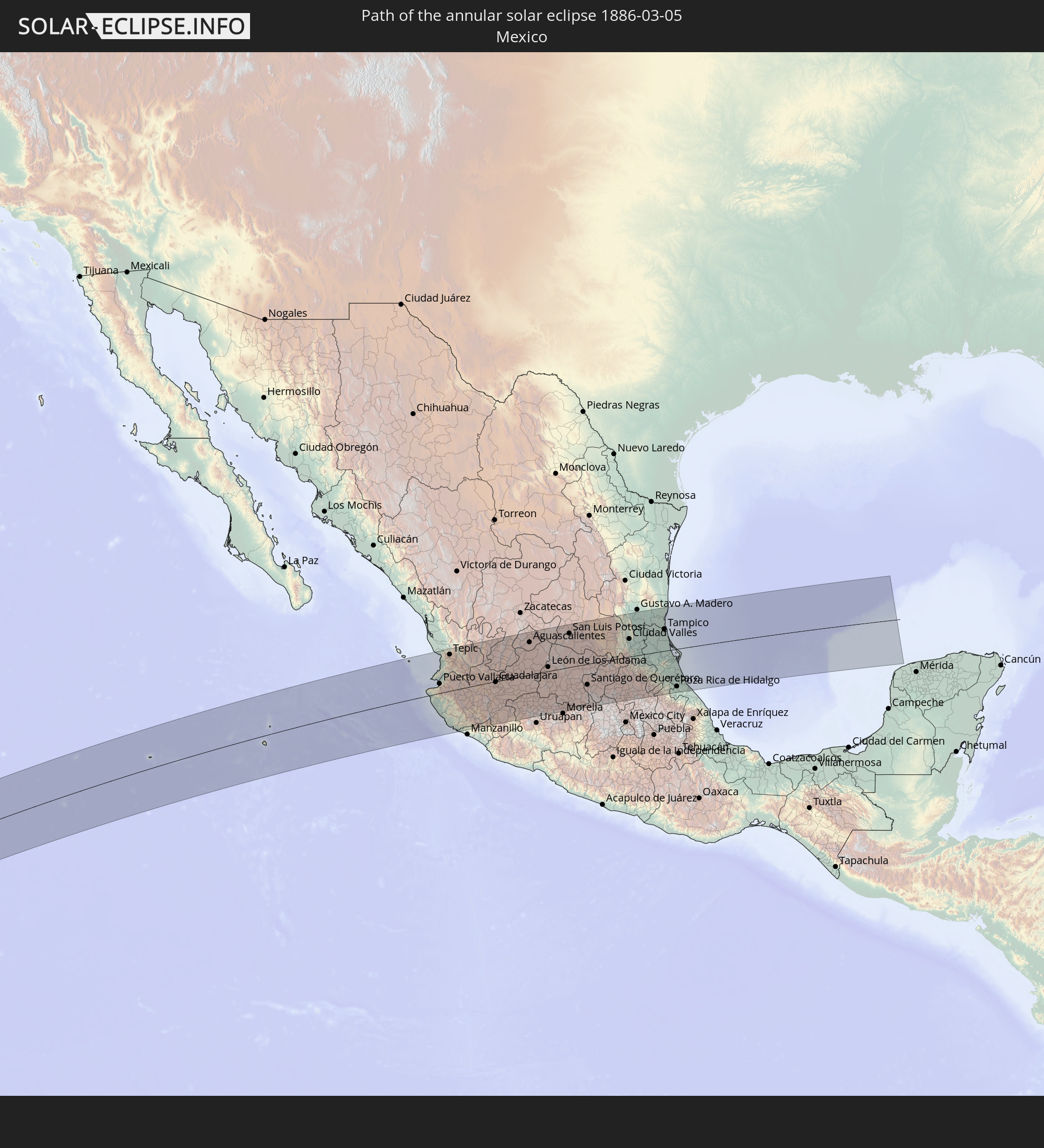
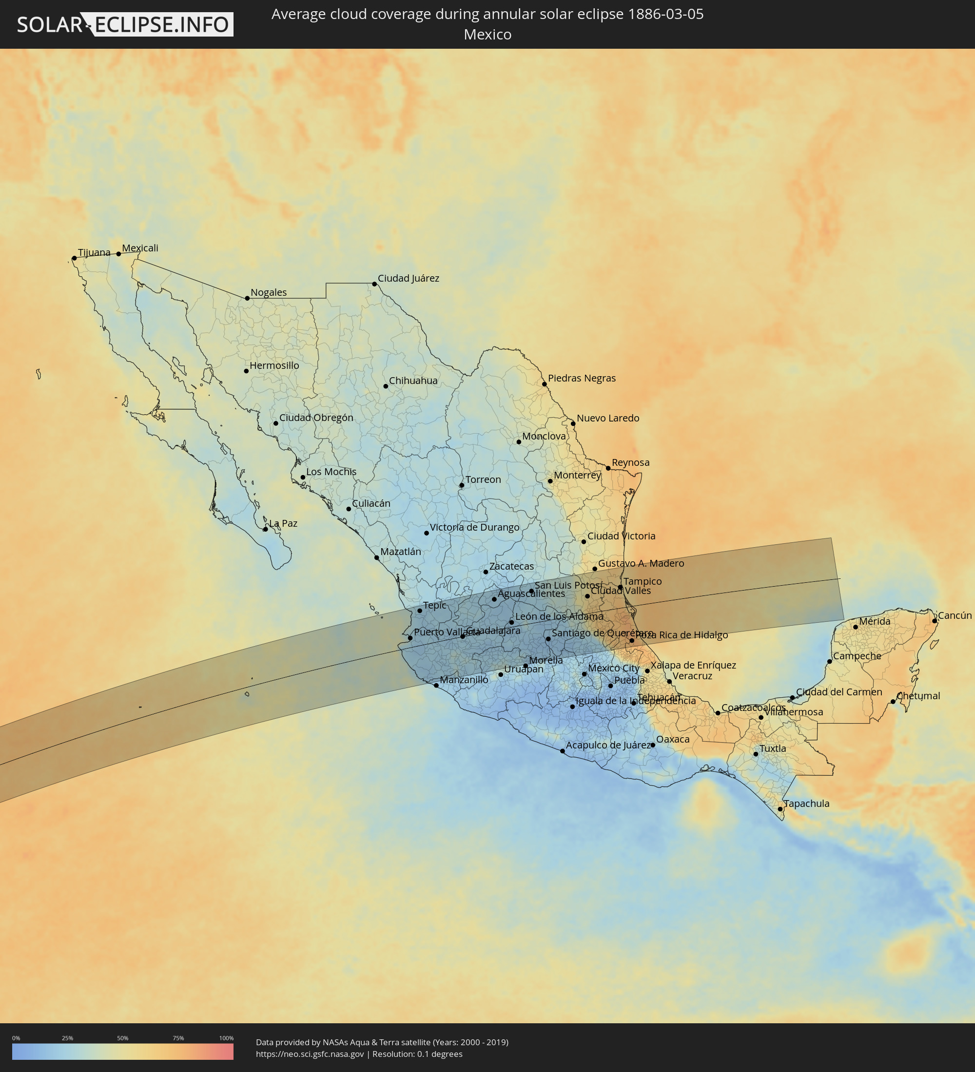 Mexico
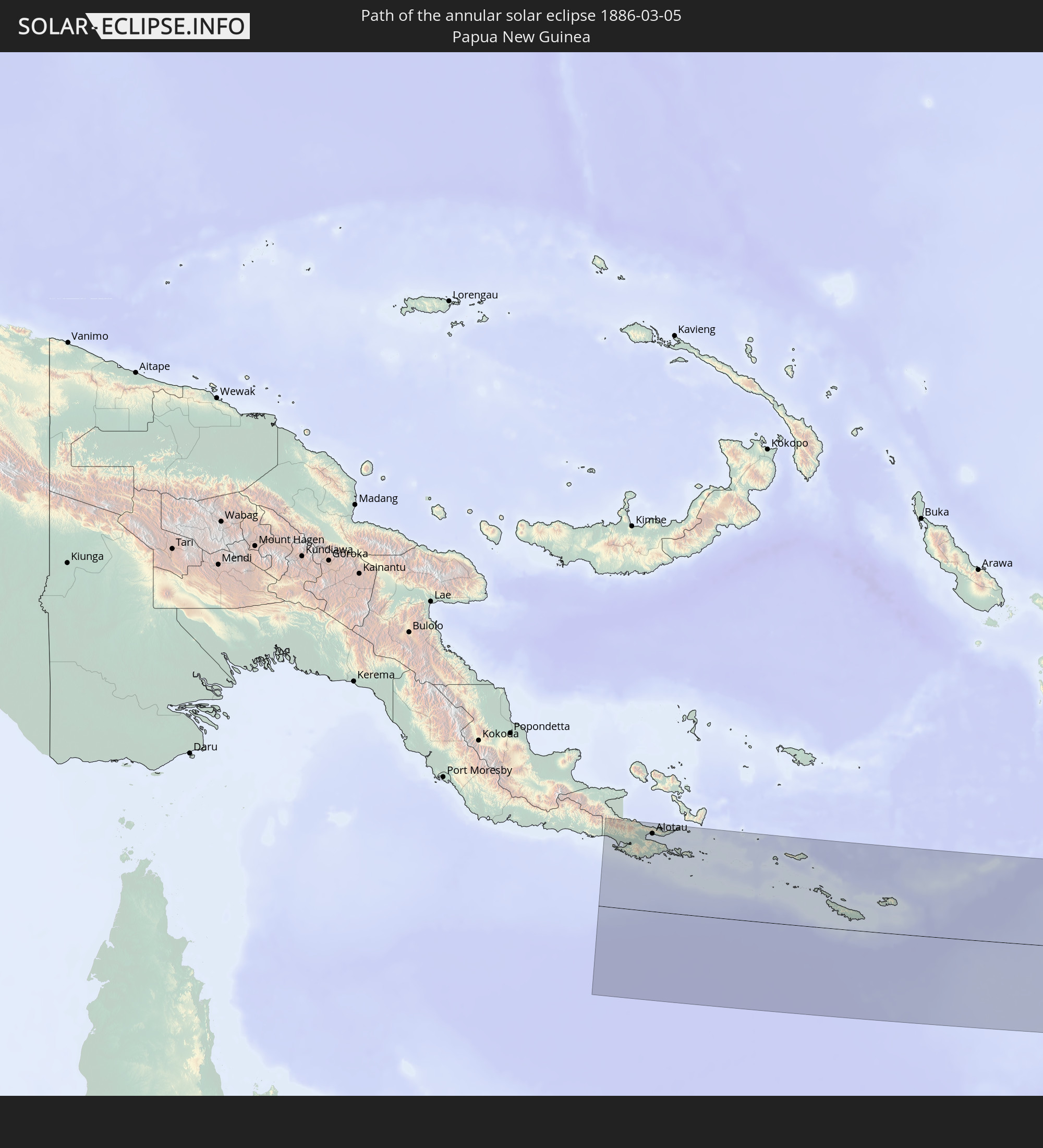
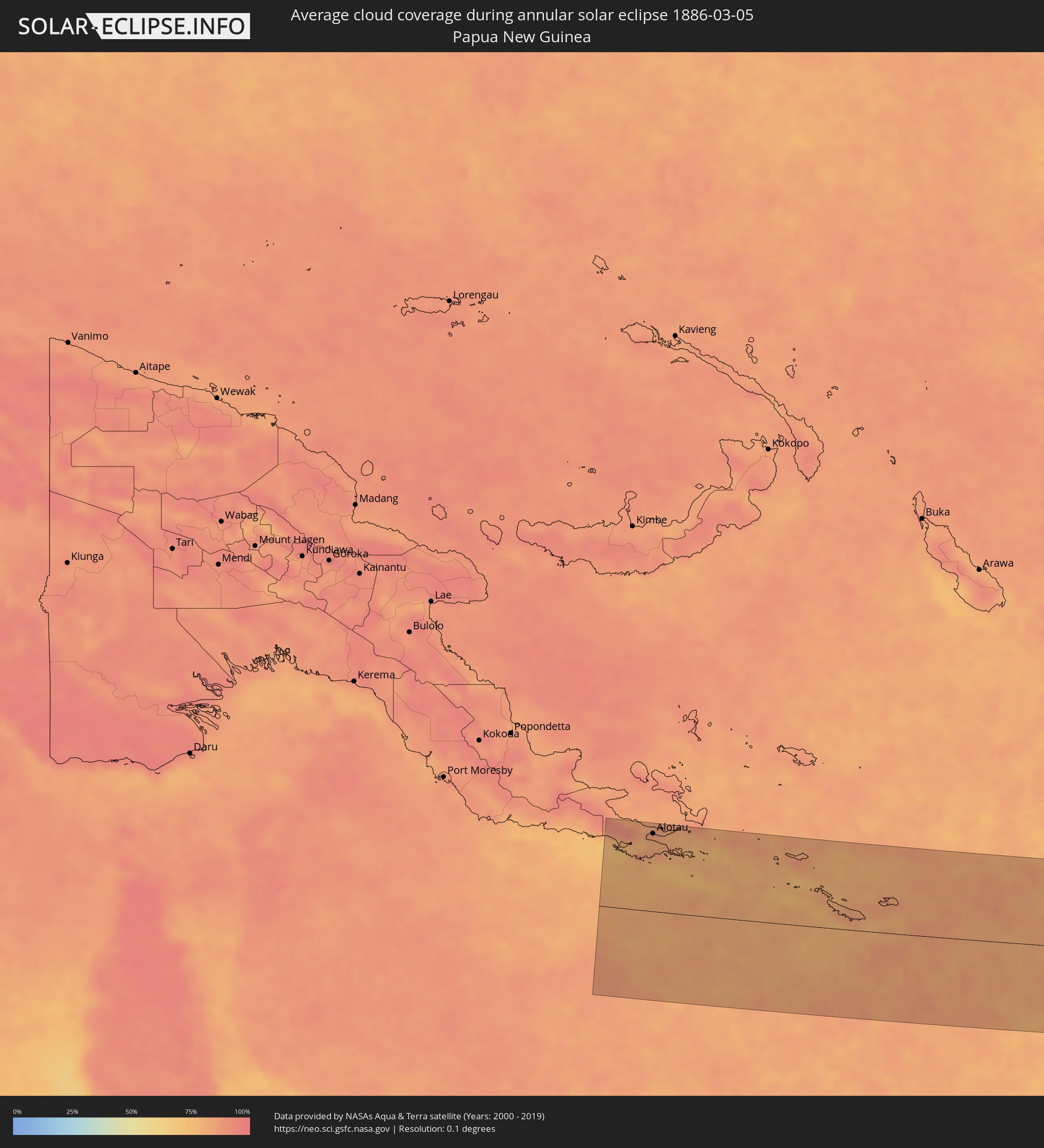 Papua New Guinea
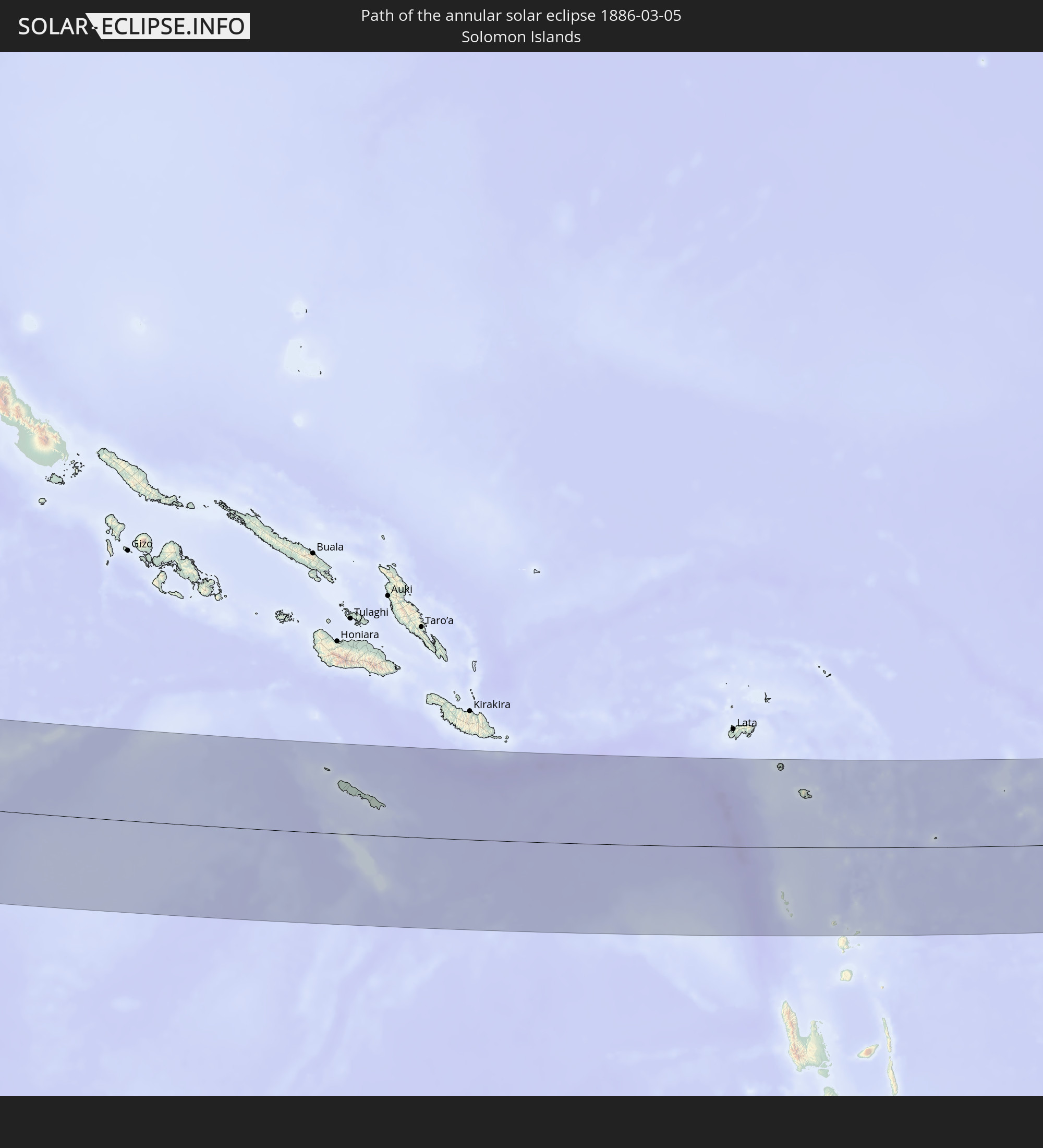
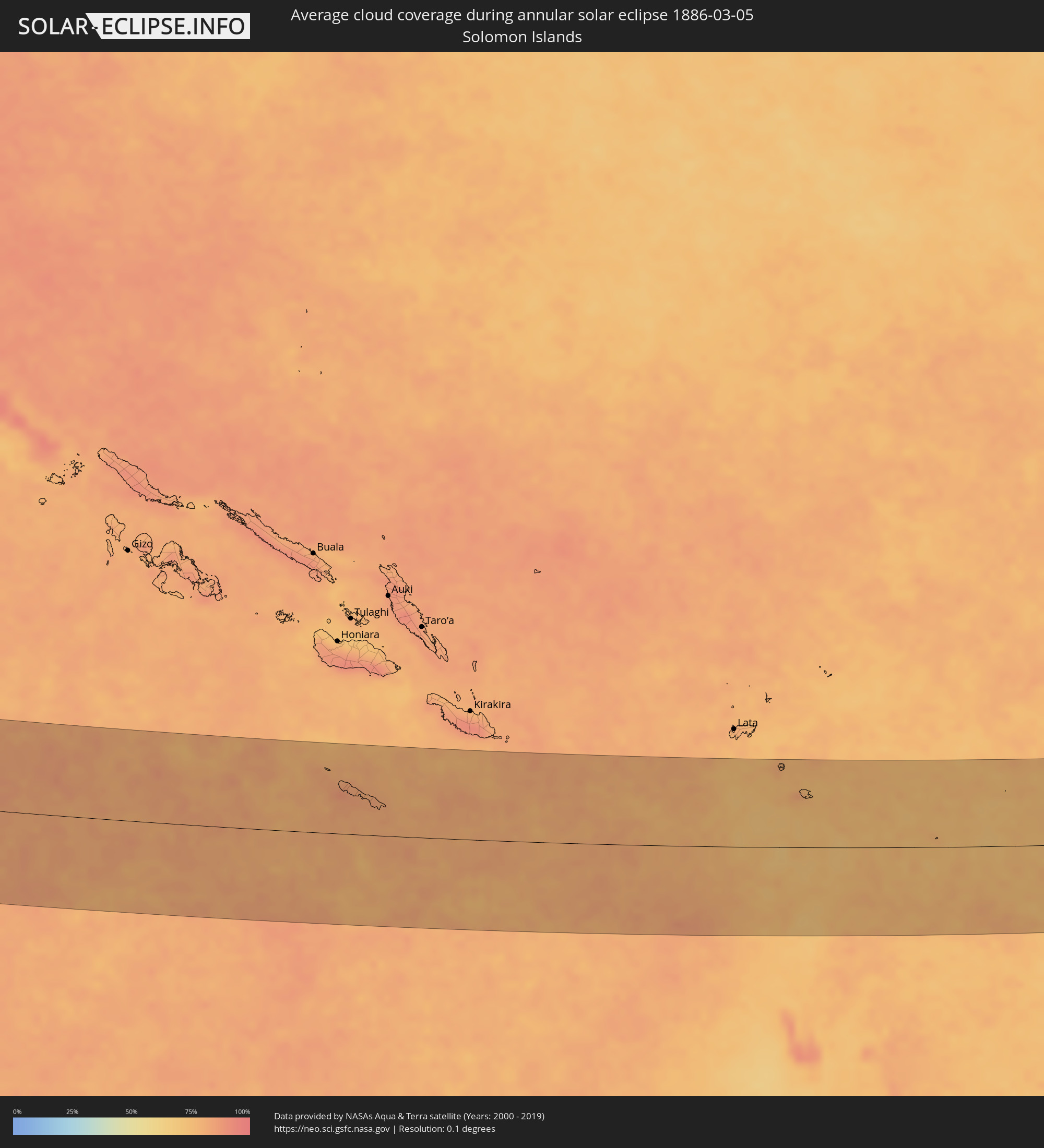 Solomon Islands
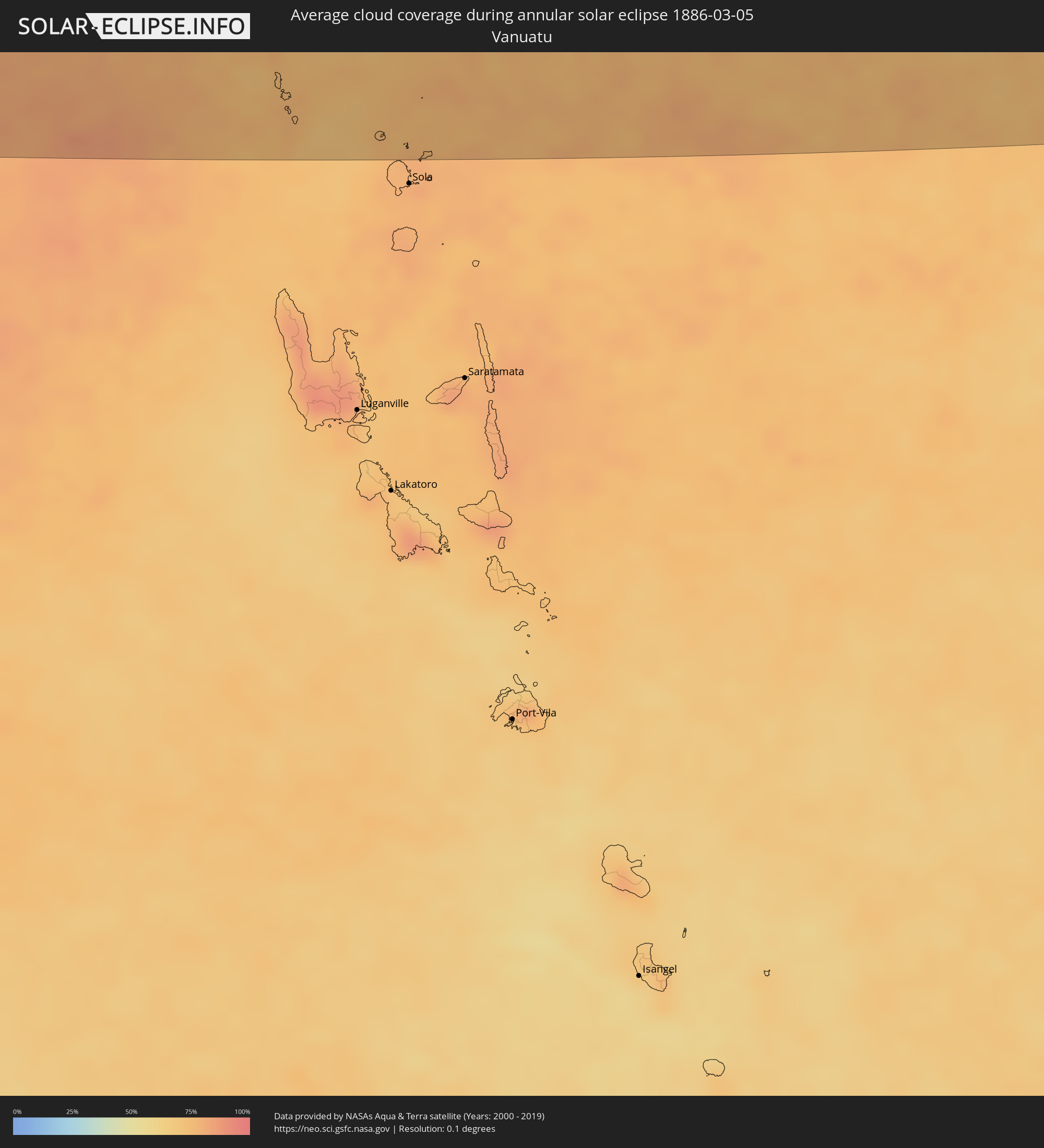 Vanuatu
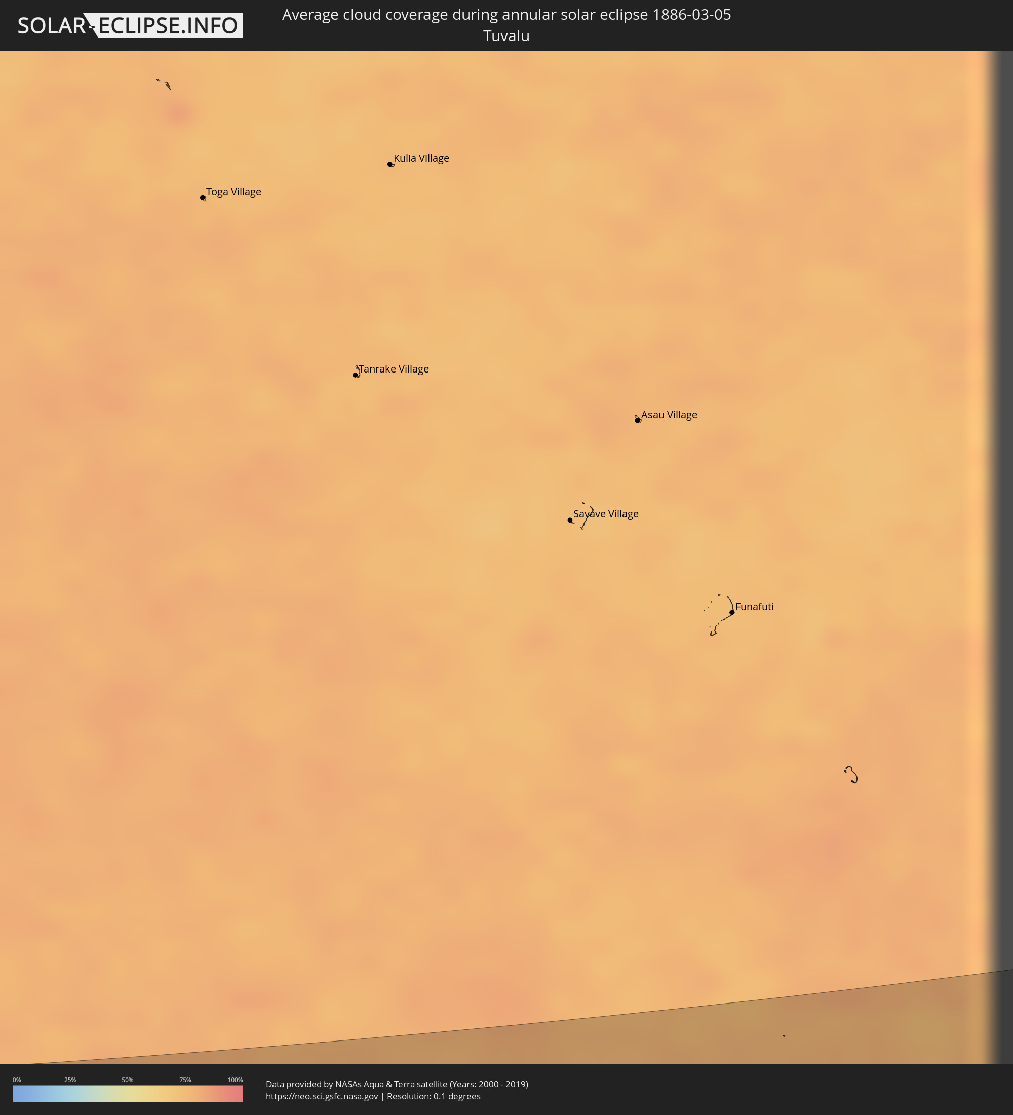 Tuvalu
Cities inside the path of the eclipse
The following table shows all locations with a population of more than 5,000 inside the eclipse path. Cities which have more than 100,000 inhabitants are marked bold. A click at the locations opens a detailed map.
| City | Type | Eclipse duration | Local time of max. eclipse | Distance to central line | Ø Cloud coverage |
|
Nukunonu, Nukunonu
|
annular | - | 09:46:51 UTC-11:00 | 121 km | 78% |
|
Fale old settlement, Fakaofo
|
annular | - | 09:48:02 UTC-11:00 | 85 km | 79% |
|
Taulaga, Swains Island
|
annular | - | 20:46:49 UTC+00:00 | 100 km | 80% |
|
Puerto Vallarta, Jalisco
|
annular | - | 17:21:42 UTC-06:36 | 31 km | 25% |
|
Tepic, Nayarit
|
annular | - | 16:52:54 UTC-07:05 | 121 km | 20% |
|
Ciudad Guzmán, Jalisco
|
annular | - | 17:22:31 UTC-06:36 | 106 km | 24% |
|
Guadalajara, Jalisco
|
annular | - | 17:22:40 UTC-06:36 | 2 km | 23% |
|
Hacienda Santa Fe, Jalisco
|
annular | - | 17:22:39 UTC-06:36 | 19 km | 24% |
|
Tonalá, Jalisco
|
annular | - | 17:22:44 UTC-06:36 | 10 km | 23% |
|
Ocotlán, Jalisco
|
annular | - | 17:22:56 UTC-06:36 | 49 km | 17% |
|
Tepatitlán de Morelos, Jalisco
|
annular | - | 17:22:58 UTC-06:36 | 1 km | 24% |
|
Sahuayo de Morelos, Michoacán
|
annular | - | 17:22:56 UTC-06:36 | 83 km | 22% |
|
Zamora, Michoacán
|
annular | - | 17:23:07 UTC-06:36 | 99 km | 20% |
|
Aguascalientes, Aguascalientes
|
annular | - | 17:23:14 UTC-06:36 | 108 km | 22% |
|
La Piedad, Michoacán
|
annular | - | 17:23:16 UTC-06:36 | 65 km | 21% |
|
Lagos de Moreno, Jalisco
|
annular | - | 17:23:22 UTC-06:36 | 44 km | 19% |
|
San Francisco del Rincón, Guanajuato
|
annular | - | 17:23:23 UTC-06:36 | 5 km | 21% |
|
Zacapú, Michoacán
|
annular | - | 17:23:19 UTC-06:36 | 128 km | 27% |
|
León de los Aldama, Guanajuato
|
annular | - | 17:23:28 UTC-06:36 | 14 km | 18% |
|
Silao, Guanajuato
|
annular | - | 17:23:34 UTC-06:36 | 11 km | 20% |
|
Irapuato, Guanajuato
|
annular | - | 17:23:35 UTC-06:36 | 42 km | 20% |
|
Guanajuato, Guanajuato
|
annular | - | 17:23:38 UTC-06:36 | 6 km | 20% |
|
Valle de Santiago, Guanajuato
|
annular | - | 17:23:37 UTC-06:36 | 76 km | 19% |
|
Salamanca, Guanajuato
|
annular | - | 17:23:38 UTC-06:36 | 56 km | 17% |
|
Uriangato, Guanajuato
|
annular | - | 17:23:36 UTC-06:36 | 104 km | 22% |
|
San Luis Potosí, San Luis Potosí
|
annular | - | 17:23:46 UTC-06:36 | 112 km | 26% |
|
Cortazar, Guanajuato
|
annular | - | 17:23:43 UTC-06:36 | 71 km | 18% |
|
Dolores Hidalgo Cuna de la Independencia Nacional, Guanajuato
|
annular | - | 17:23:46 UTC-06:36 | 3 km | 21% |
|
Celaya, Guanajuato
|
annular | - | 17:23:47 UTC-06:36 | 69 km | 16% |
|
San Miguel de Allende, Guanajuato
|
annular | - | 17:23:50 UTC-06:36 | 27 km | 21% |
|
Acámbaro, Guanajuato
|
annular | - | 17:23:47 UTC-06:36 | 124 km | 22% |
|
San Luis de la Paz, Guanajuato
|
annular | - | 17:23:56 UTC-06:36 | 11 km | 20% |
|
Santiago de Querétaro, Querétaro
|
annular | - | 17:23:57 UTC-06:36 | 70 km | 14% |
|
San Juan del Río, Querétaro
|
annular | - | 17:24:05 UTC-06:36 | 99 km | 15% |
|
Río Verde, San Luis Potosí
|
annular | - | 17:24:08 UTC-06:36 | 70 km | 32% |
|
Ciudad Valles, San Luis Potosí
|
annular | - | 17:24:27 UTC-06:36 | 59 km | 57% |
|
Ciudad Mante, Tamaulipas
|
annular | - | 17:24:26 UTC-06:36 | 142 km | 53% |
|
Tantoyuca, Veracruz
|
annular | - | 17:24:41 UTC-06:36 | 24 km | 71% |
|
Tampico, Tamaulipas
|
annular | - | 17:24:46 UTC-06:36 | 72 km | 60% |
|
Temapache, Veracruz
|
annular | - | 17:24:50 UTC-06:36 | 65 km | 78% |
|
Poza Rica de Hidalgo, Veracruz
|
annular | - | 17:24:53 UTC-06:36 | 126 km | 74% |
|
Tuxpan de Rodríguez Cano, Veracruz
|
annular | - | 17:24:54 UTC-06:36 | 80 km | 73% |
|
Papantla de Olarte, Veracruz
|
annular | - | 17:24:55 UTC-06:36 | 138 km | 74% |
|
Alotau, Milne Bay
|
annular | - | 06:08:21 UTC+10:00 | 132 km | 81% |
|
Ahau, Rotuma
|
annular | - | 08:20:34 UTC+11:55 | 50 km | 73% |