Annular solar eclipse of 05/09/1948
| Day of week: | Sunday |
| Maximum duration of eclipse: | 00m00s |
| Maximum width of eclipse path: | 0 km |
| Saros cycle: | 137 |
| Coverage: | 100% |
| Magnitude: | 0.9999 |
| Gamma: | 0.4133 |
Wo kann man die Sonnenfinsternis vom 05/09/1948 sehen?
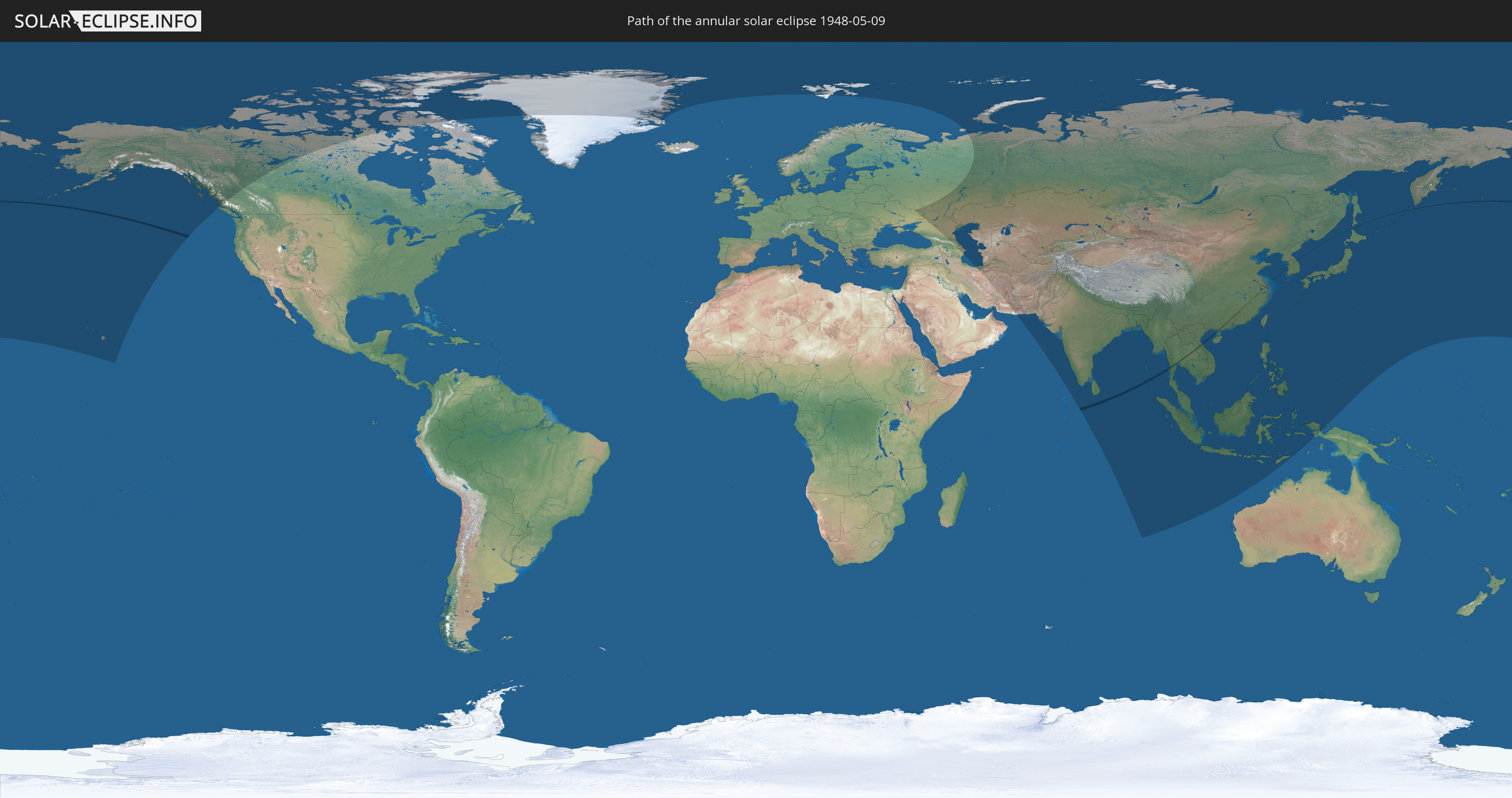
Die Sonnenfinsternis am 05/09/1948 kann man in 47 Ländern als partielle Sonnenfinsternis beobachten.
Der Finsternispfad verläuft durch 10 Länder. Nur in diesen Ländern ist sie als annular Sonnenfinsternis zu sehen.
In den folgenden Ländern ist die Sonnenfinsternis annular zu sehen
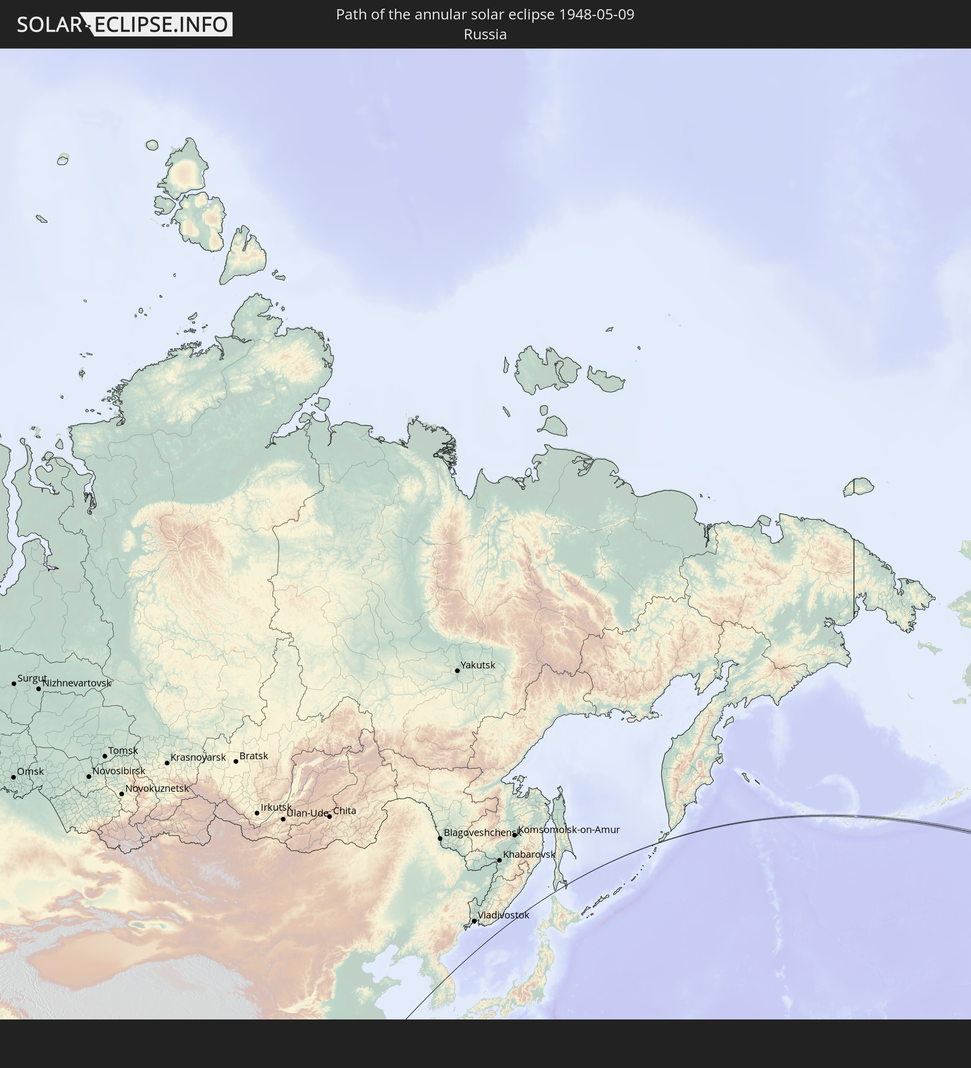 Russia
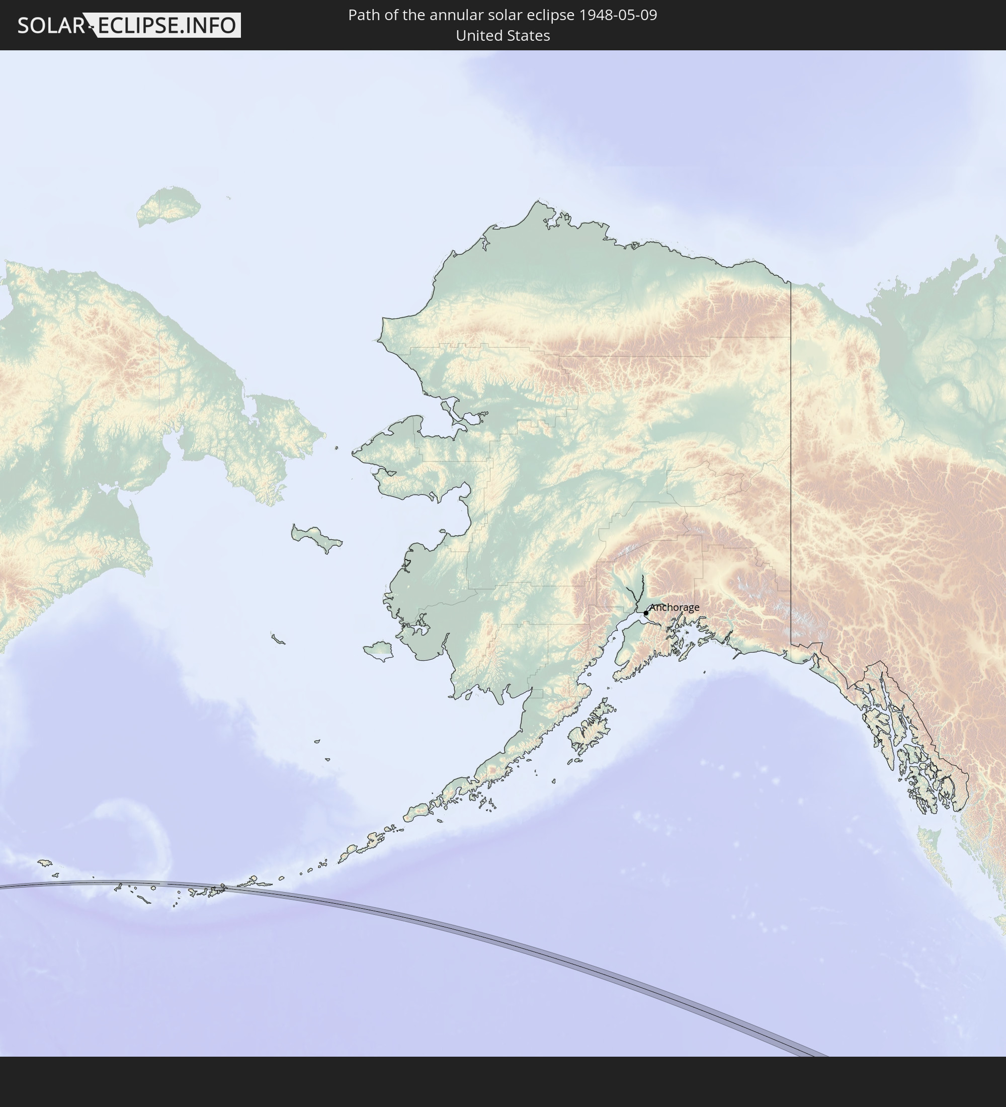 United States
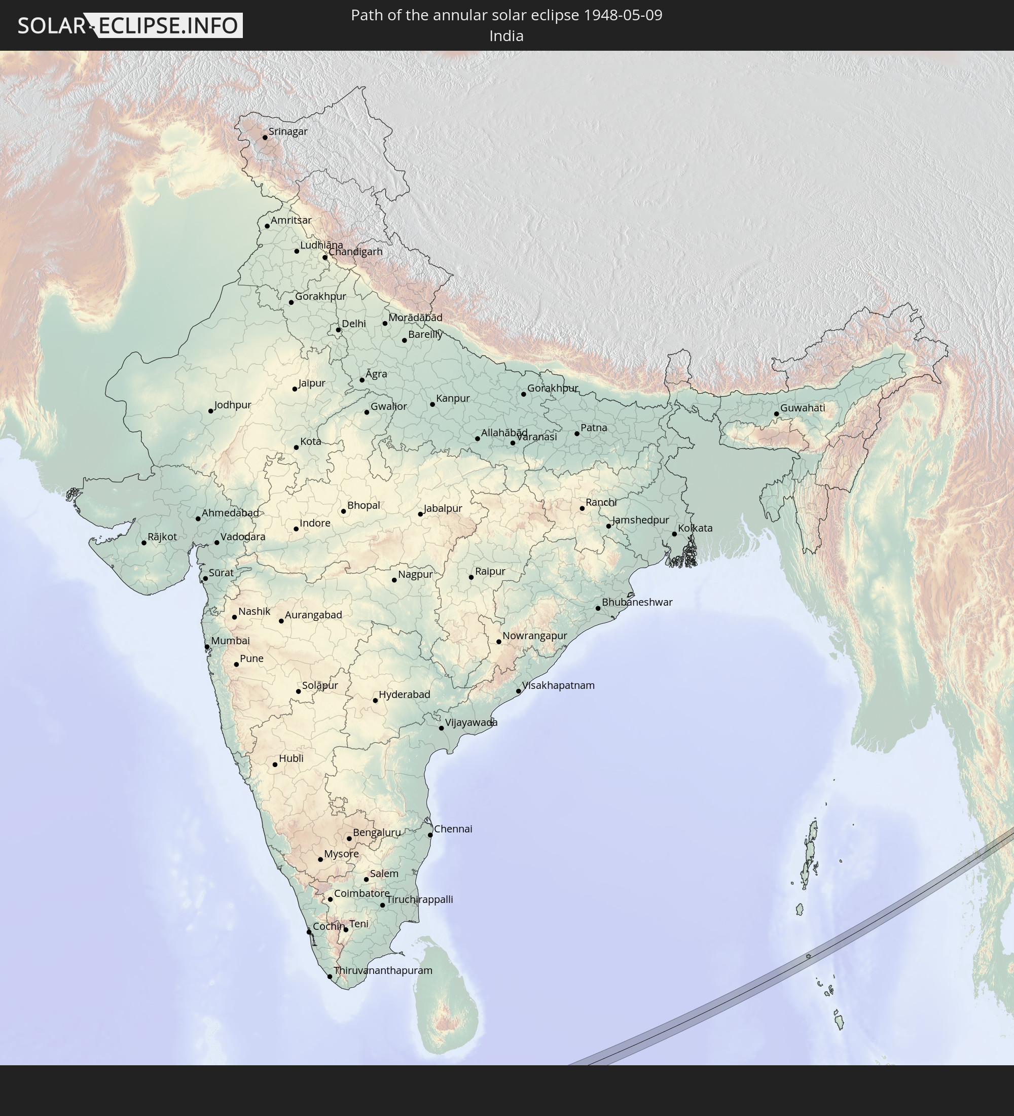 India
India
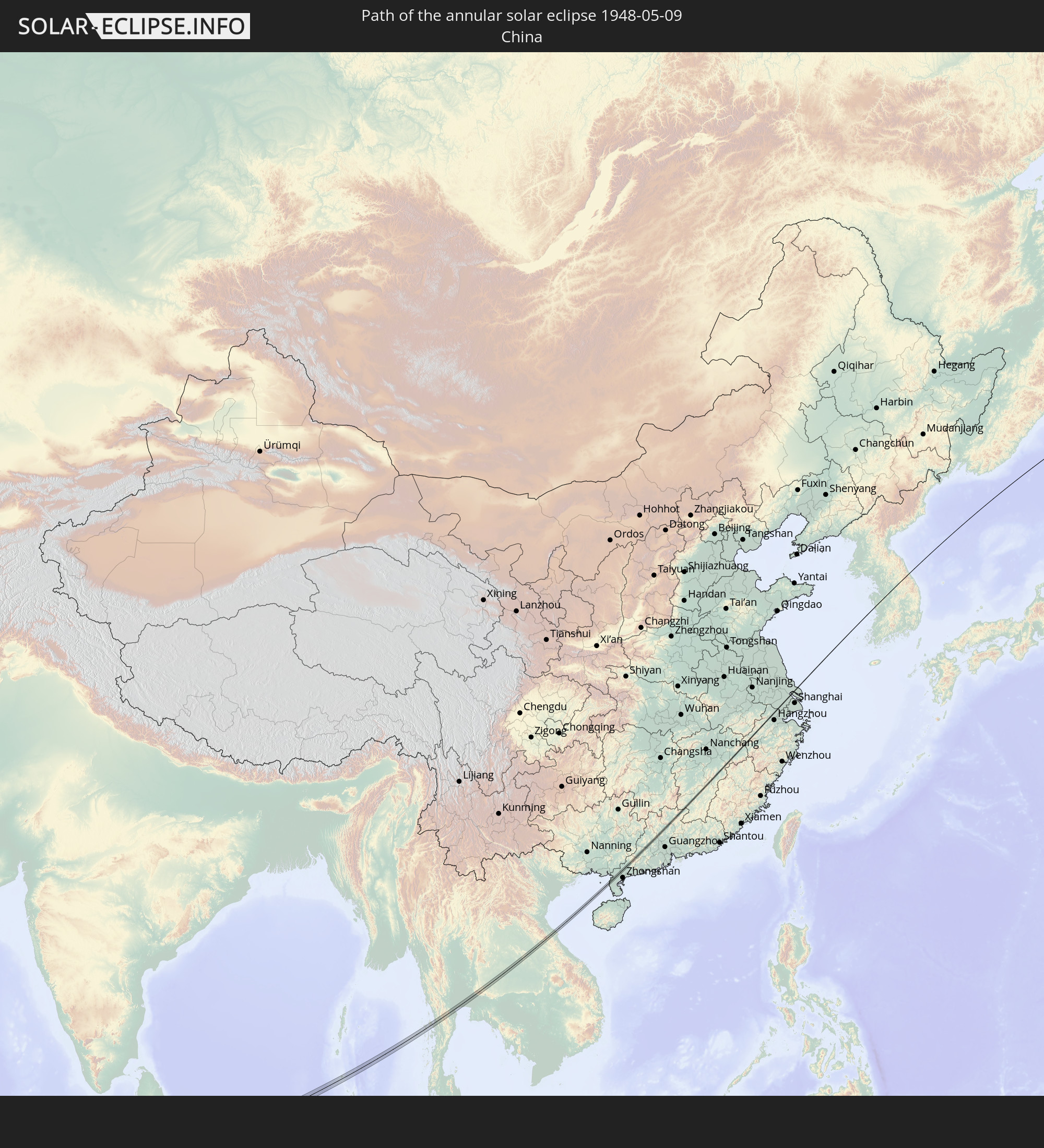 China
China
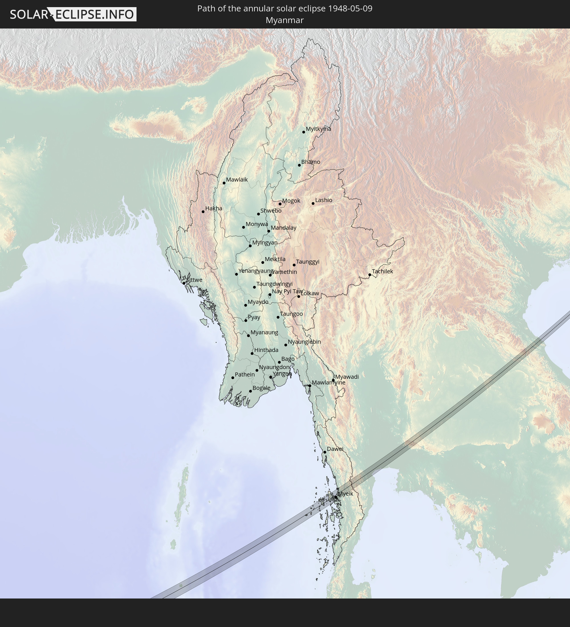 Myanmar
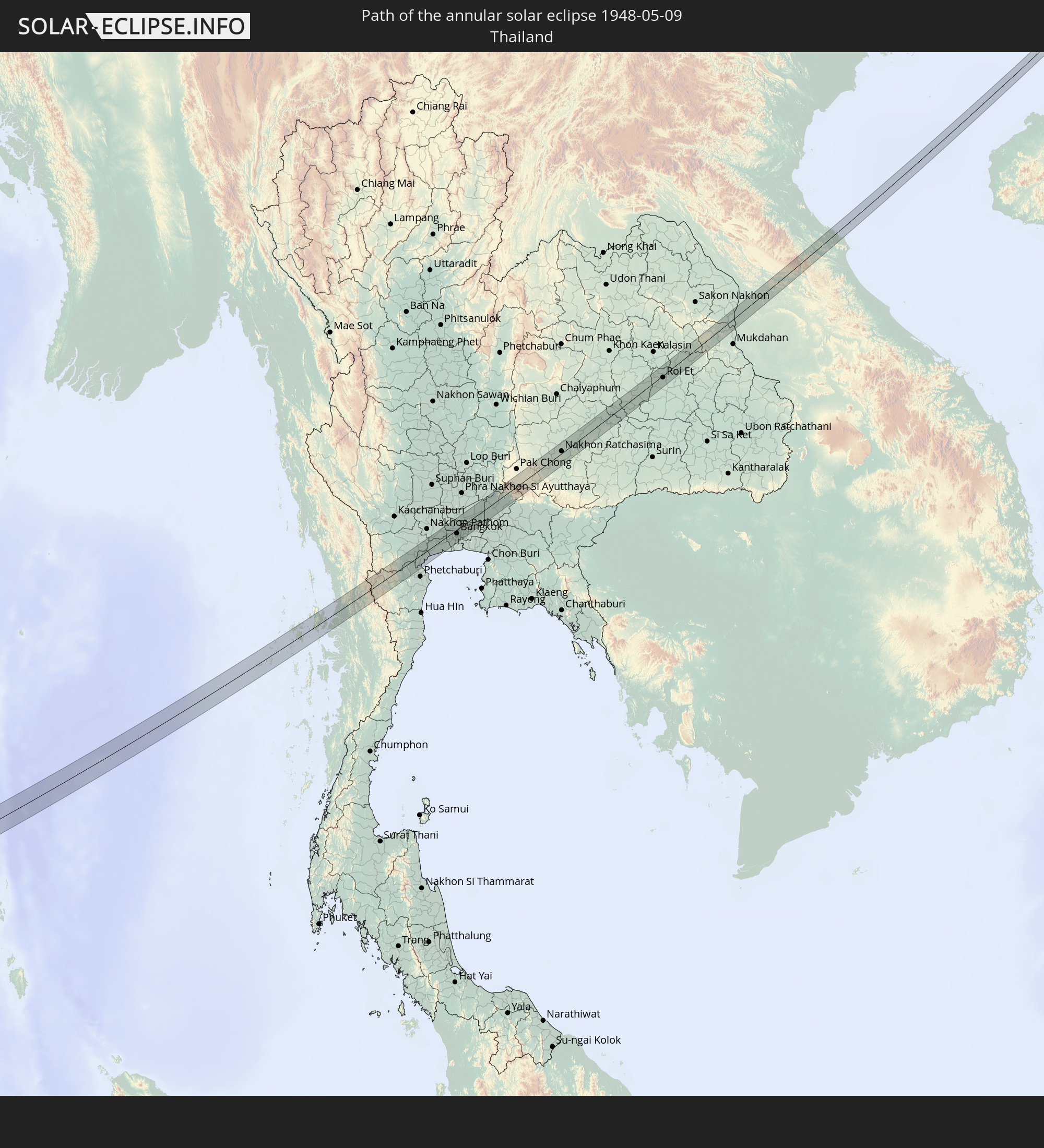 Thailand
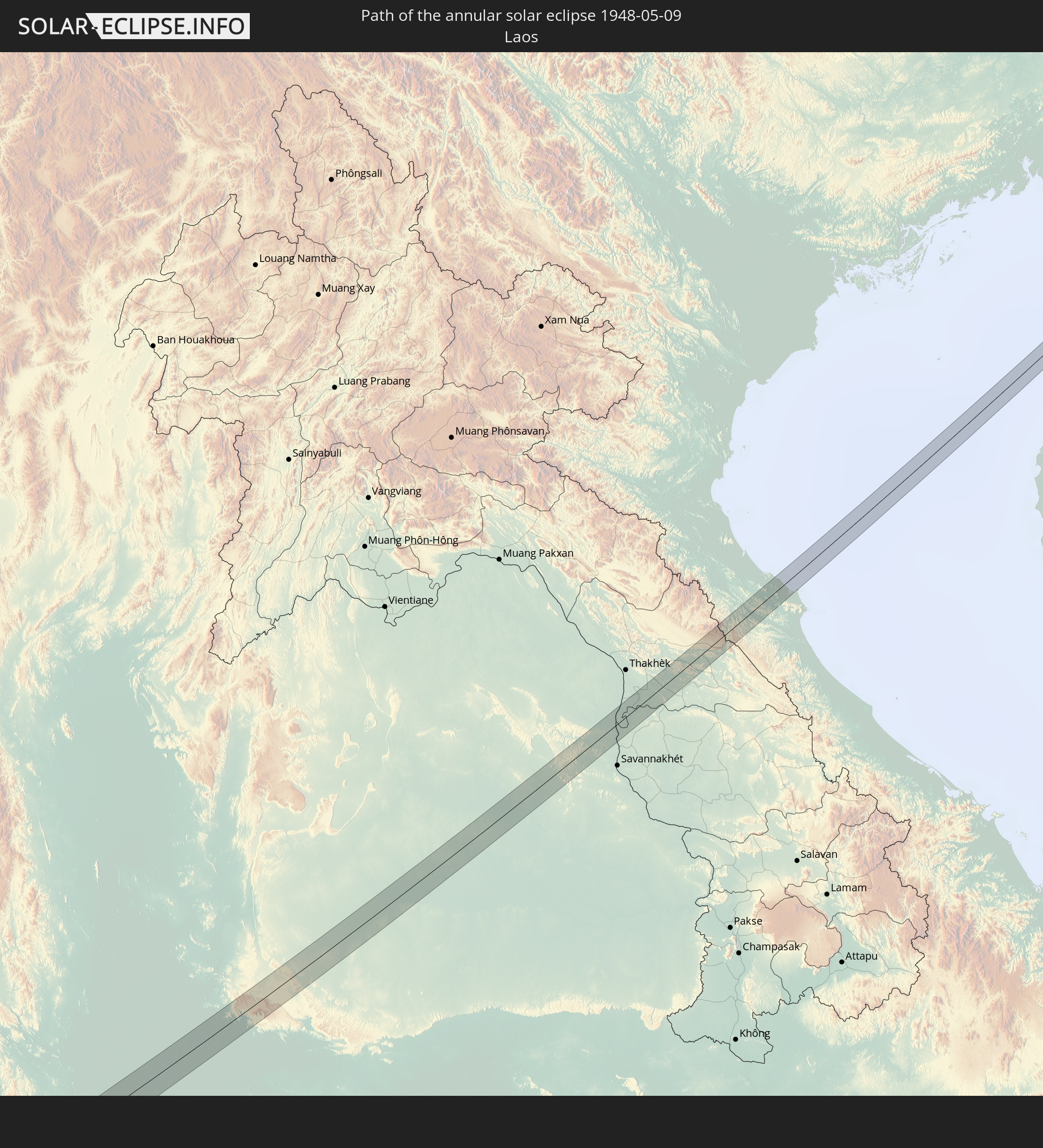 Laos
Laos
 Vietnam
 Japan
Japan
 South Korea
In den folgenden Ländern ist die Sonnenfinsternis partiell zu sehen
 Russia
 United States
 United States Minor Outlying Islands
 Canada
 Greenland
 Svalbard and Jan Mayen
 Ukraine
 Iran
Iran
 Azerbaijan
 Kazakhstan
 Turkmenistan
 Uzbekistan
 Afghanistan
 Pakistan
 Tajikistan
 India
India
 Kyrgyzstan
 China
China
 Sri Lanka
 Nepal
Nepal
 Mongolia
 Bangladesh
 Bhutan
 Myanmar
 Indonesia
 Cocos Islands
 Thailand
 Malaysia
 Laos
Laos
 Vietnam
 Cambodia
 Singapore
 Christmas Island
 Australia
 Macau
Macau
 Hong Kong
 Brunei
 Taiwan
 Philippines
 Japan
Japan
 East Timor
 North Korea
 South Korea
 Palau
Palau
 Federated States of Micronesia
 Guam
Guam
 Northern Mariana Islands
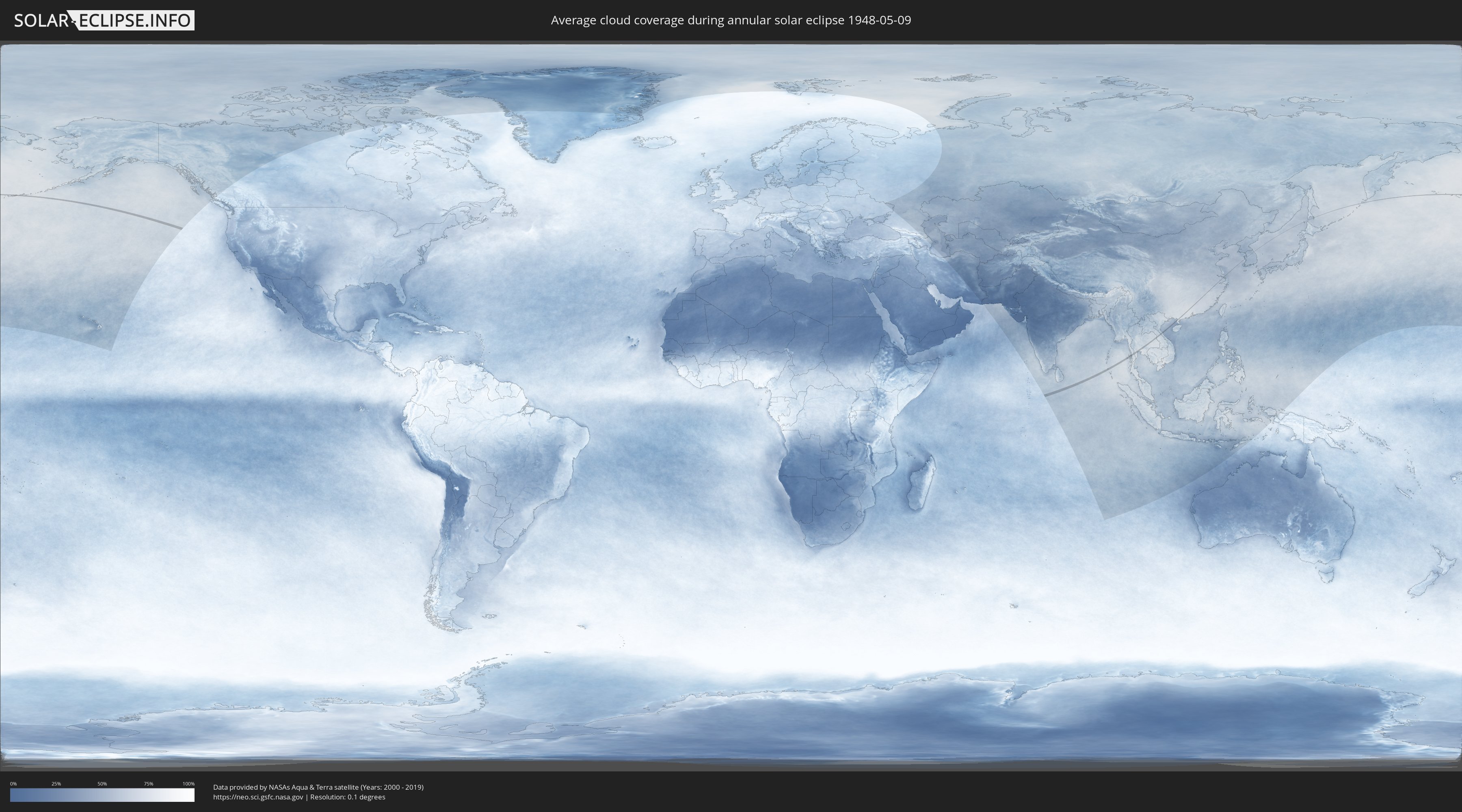
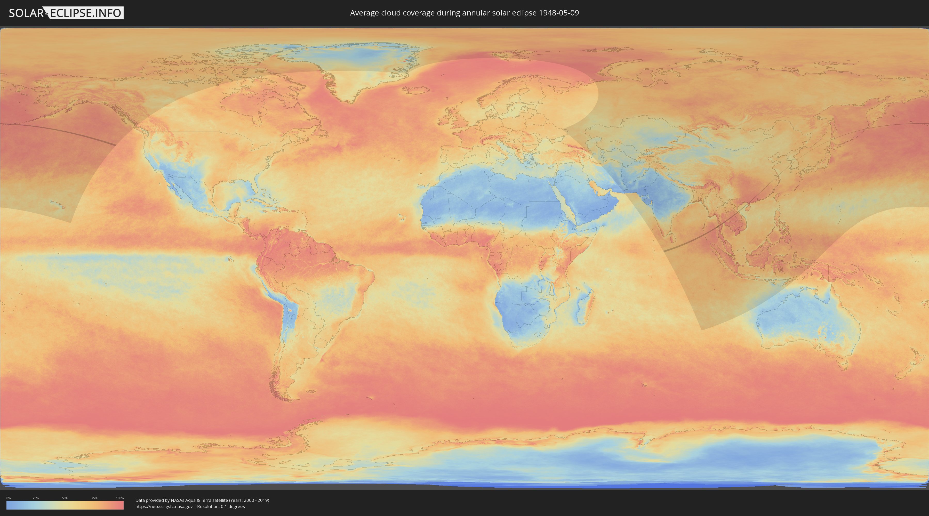
How will be the weather during the annular solar eclipse on 05/09/1948?
Where is the best place to see the annular solar eclipse of 05/09/1948?
The following maps show the average cloud coverage for the day of the annular solar eclipse.
With the help of these maps, it is possible to find the place along the eclipse path, which has the best
chance of a cloudless sky.
Nevertheless, you should consider local circumstances and inform about the weather of your chosen
observation site.
The data is provided by NASAs satellites
AQUA and TERRA.
The cloud maps are averaged over a period of 19 years (2000 - 2019).
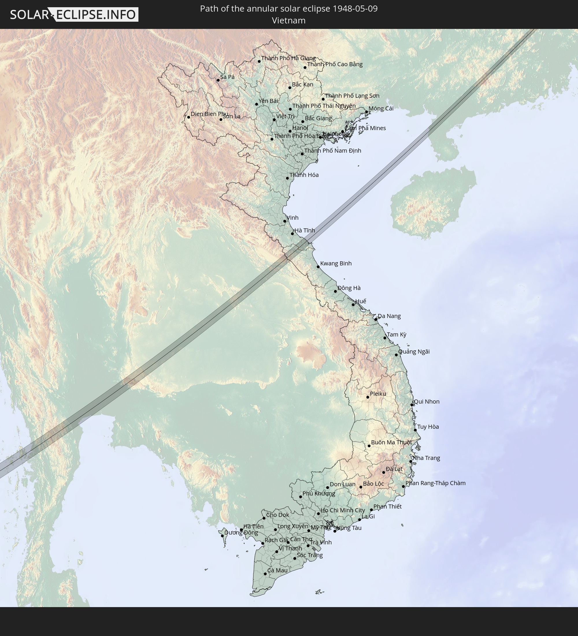
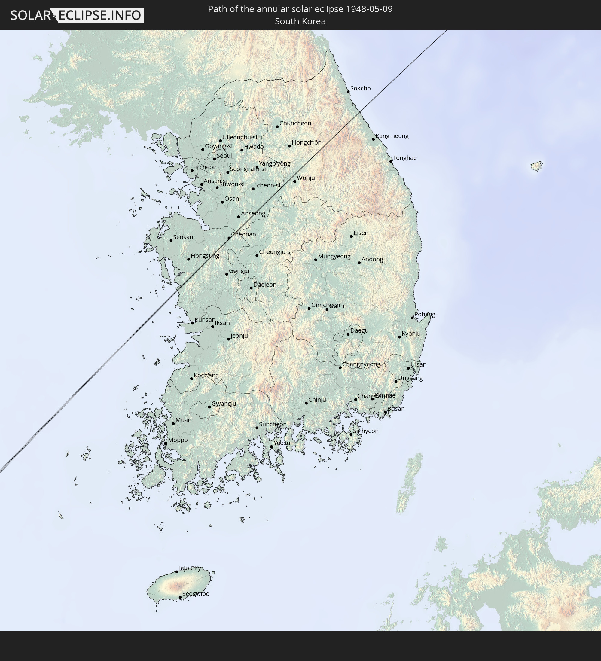
Detailed country maps
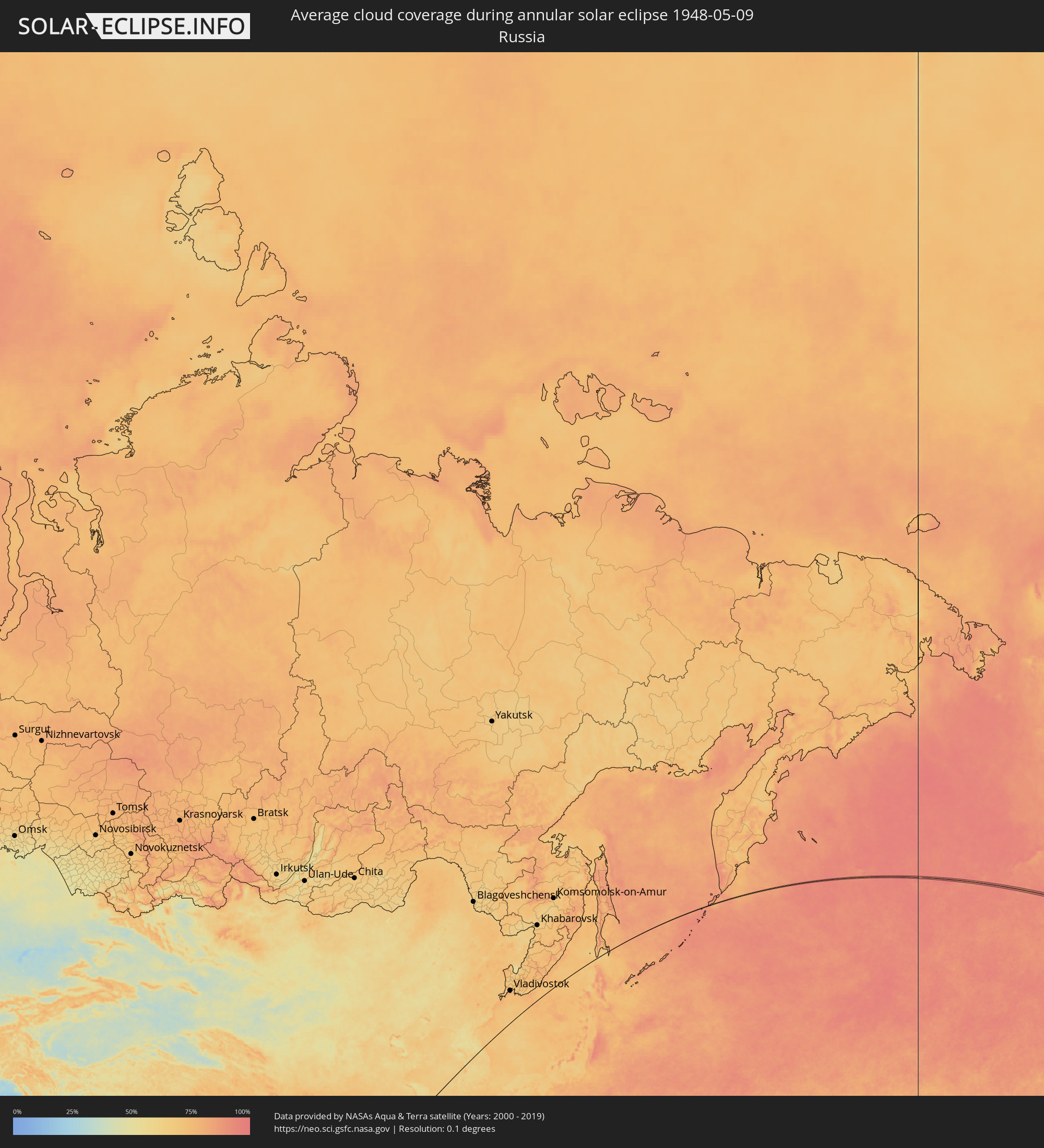 Russia
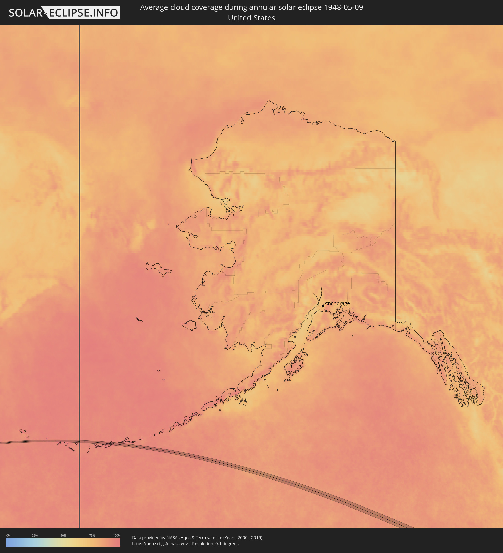 United States
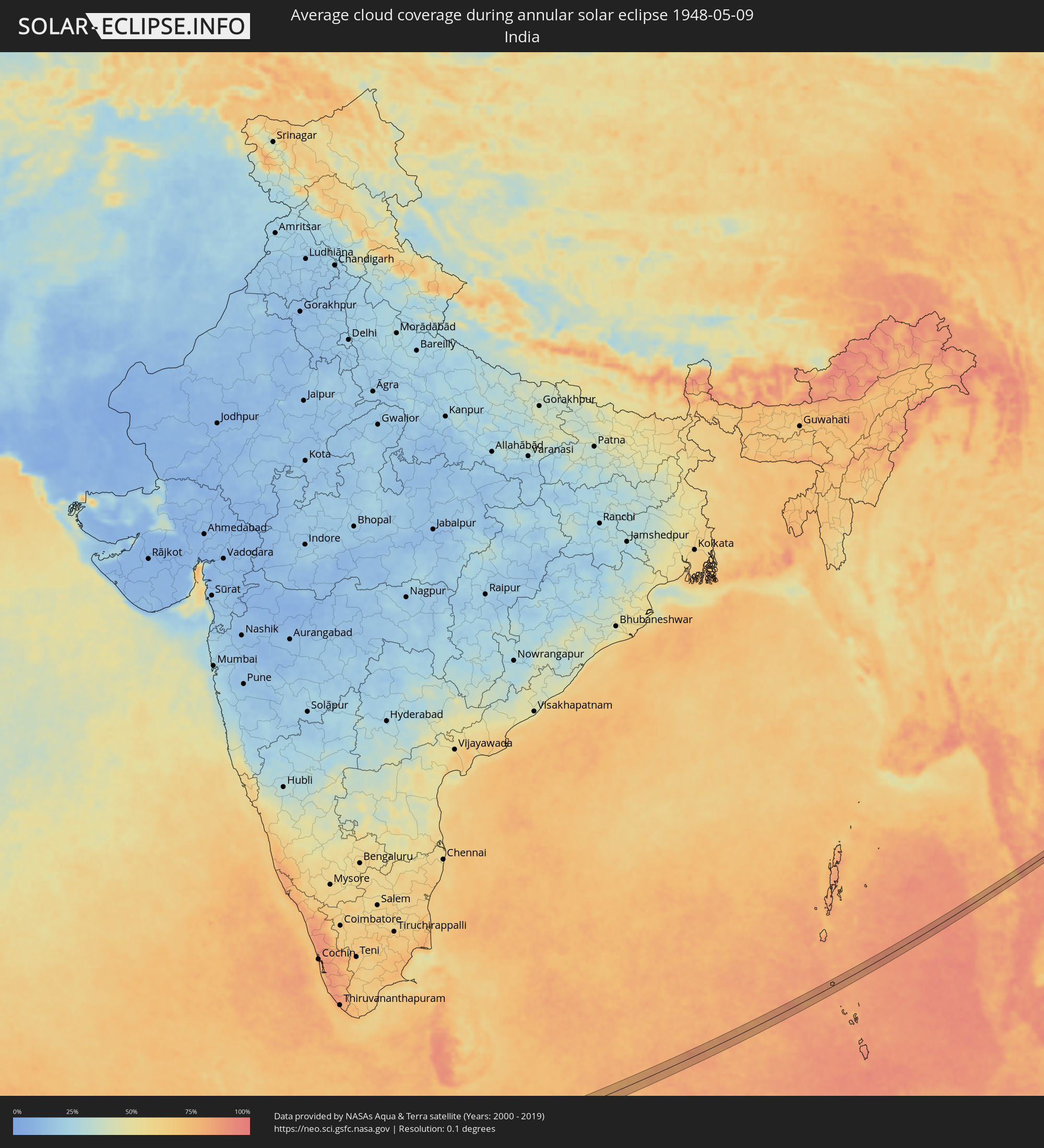 India
India
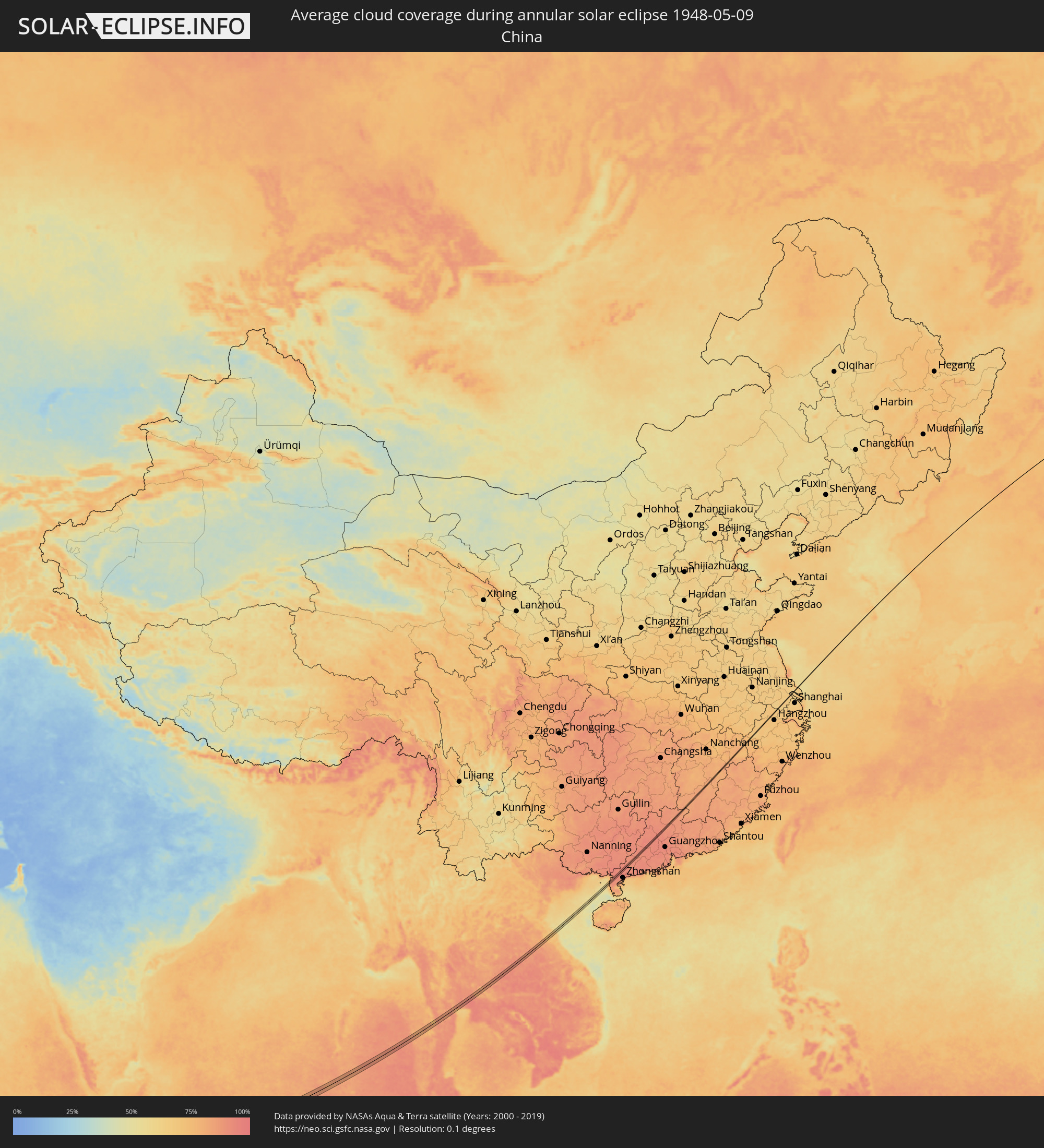 China
China
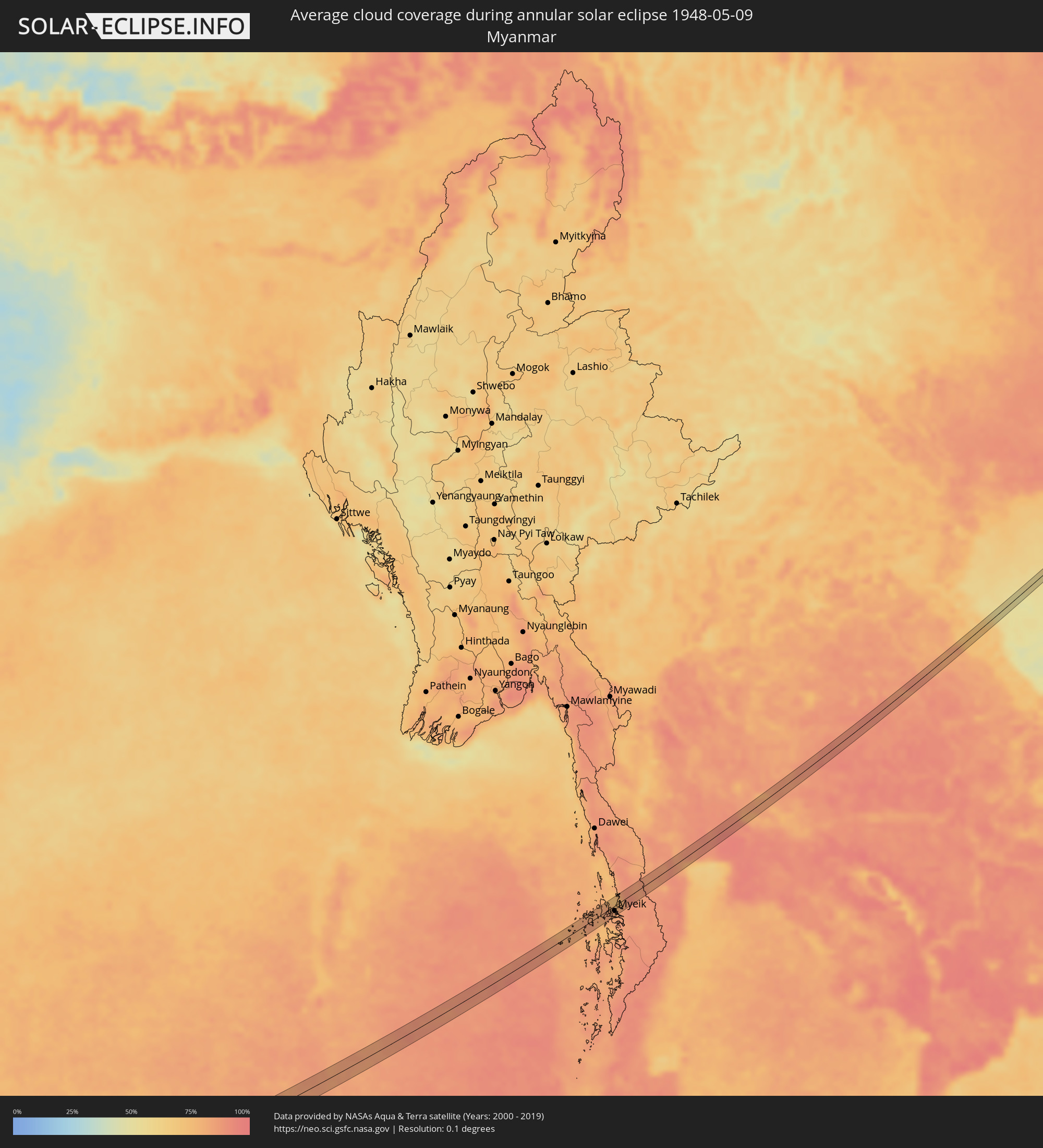 Myanmar
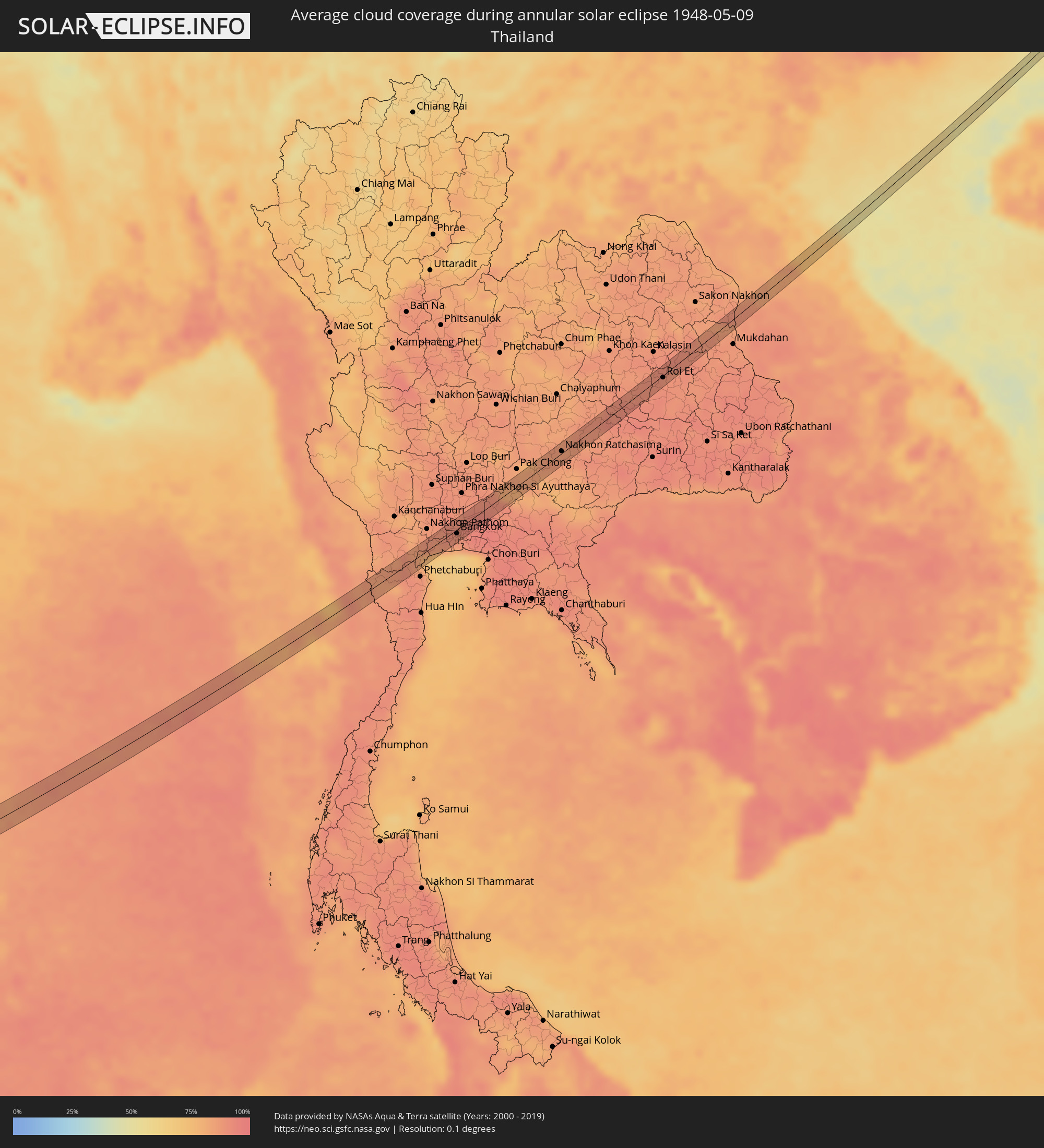 Thailand
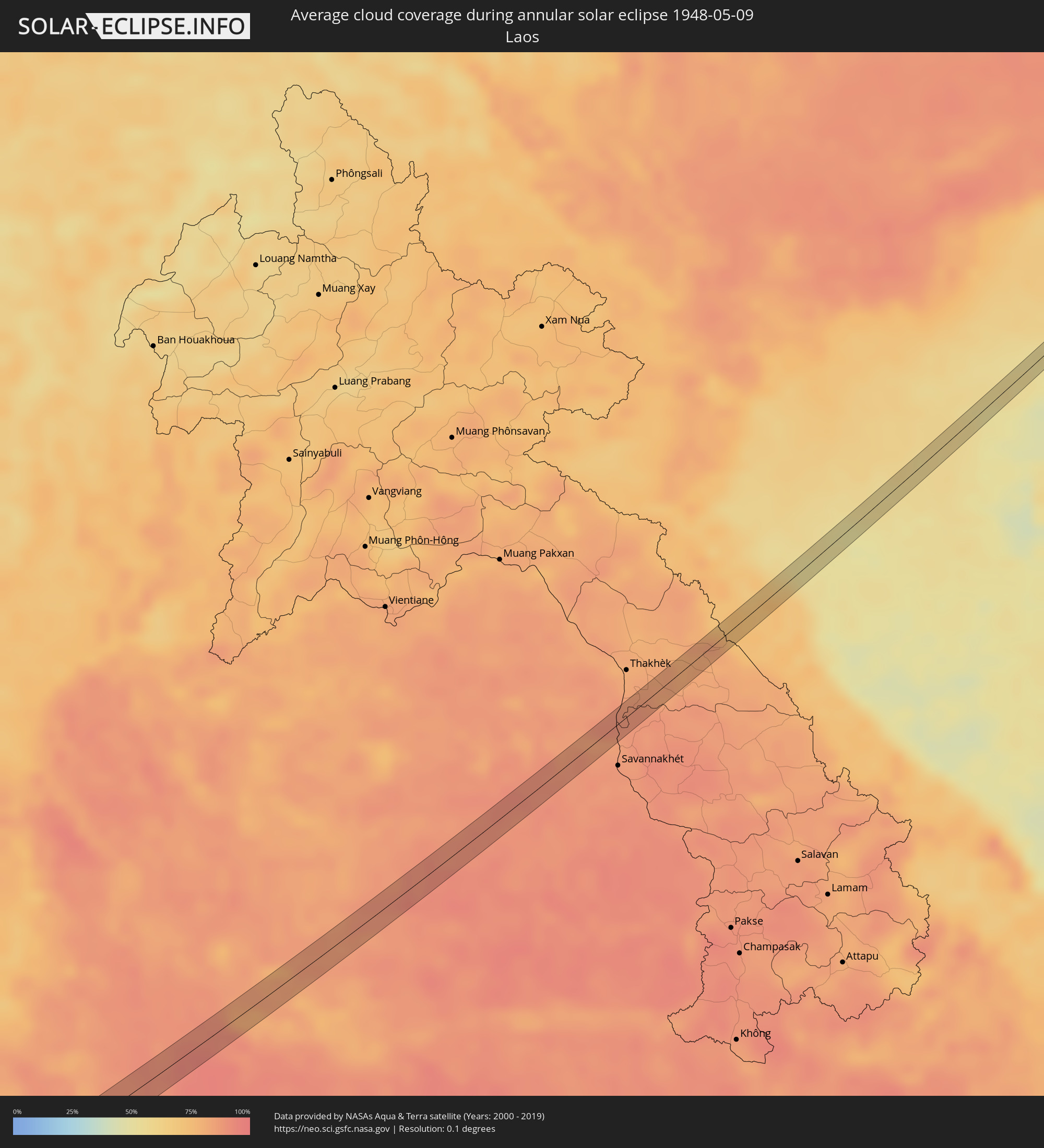 Laos
Laos
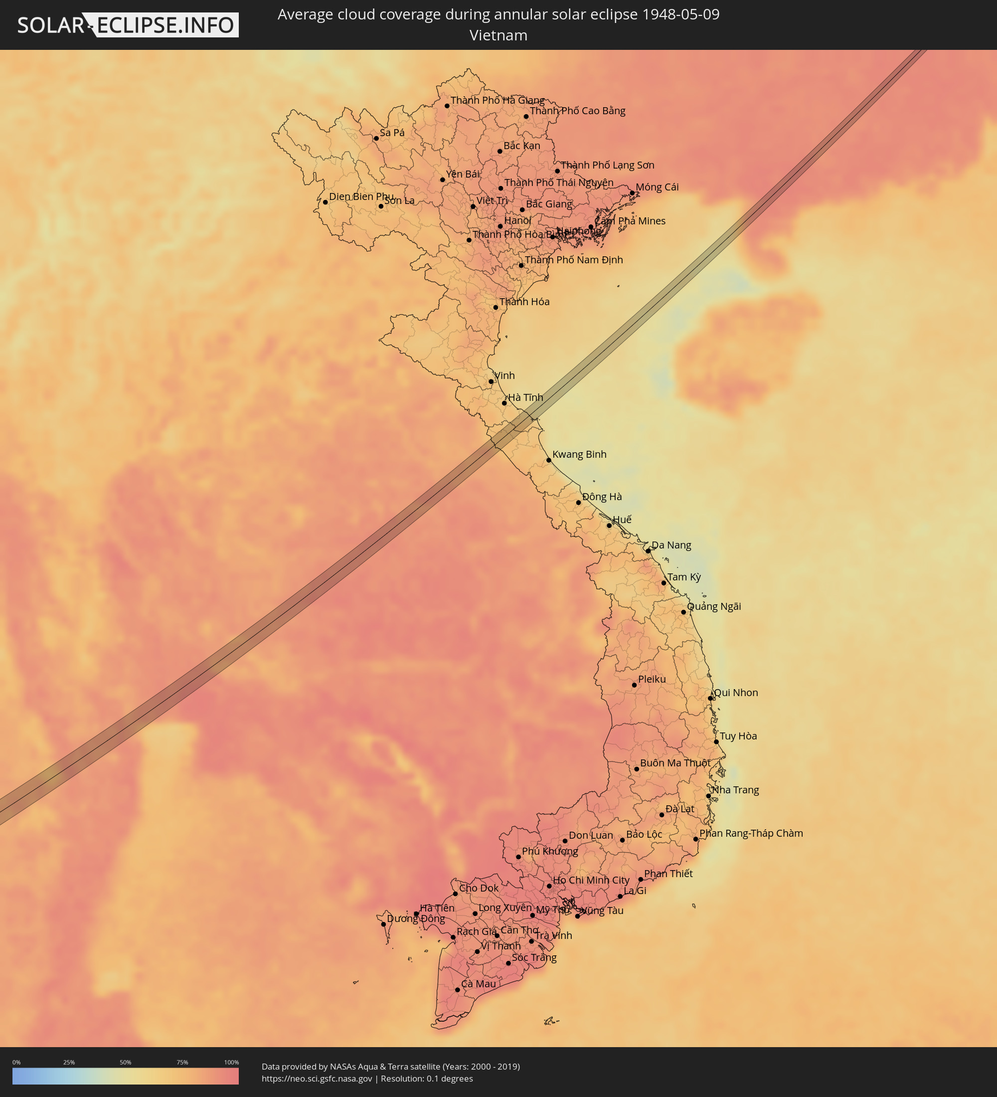 Vietnam
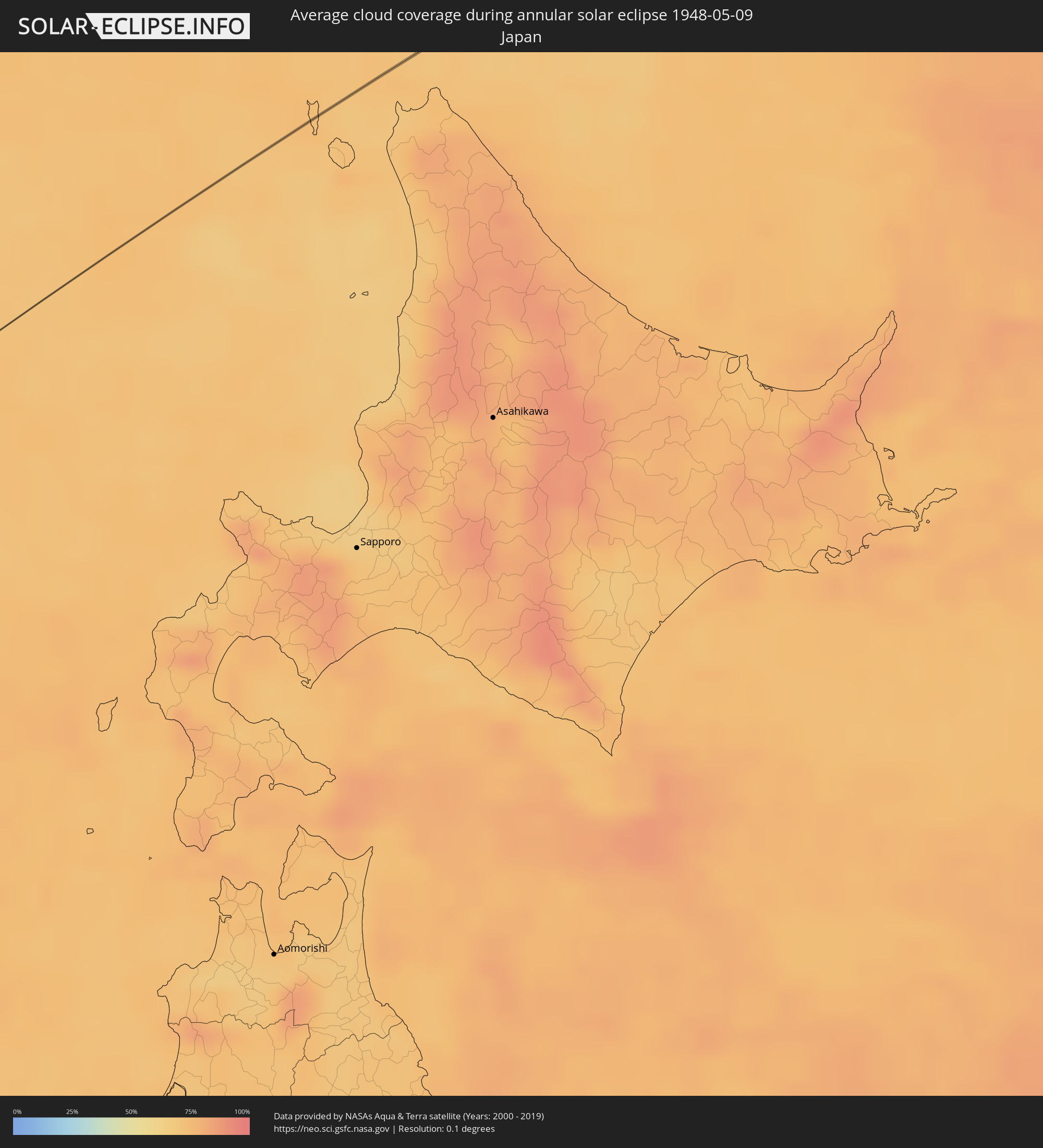 Japan
Japan
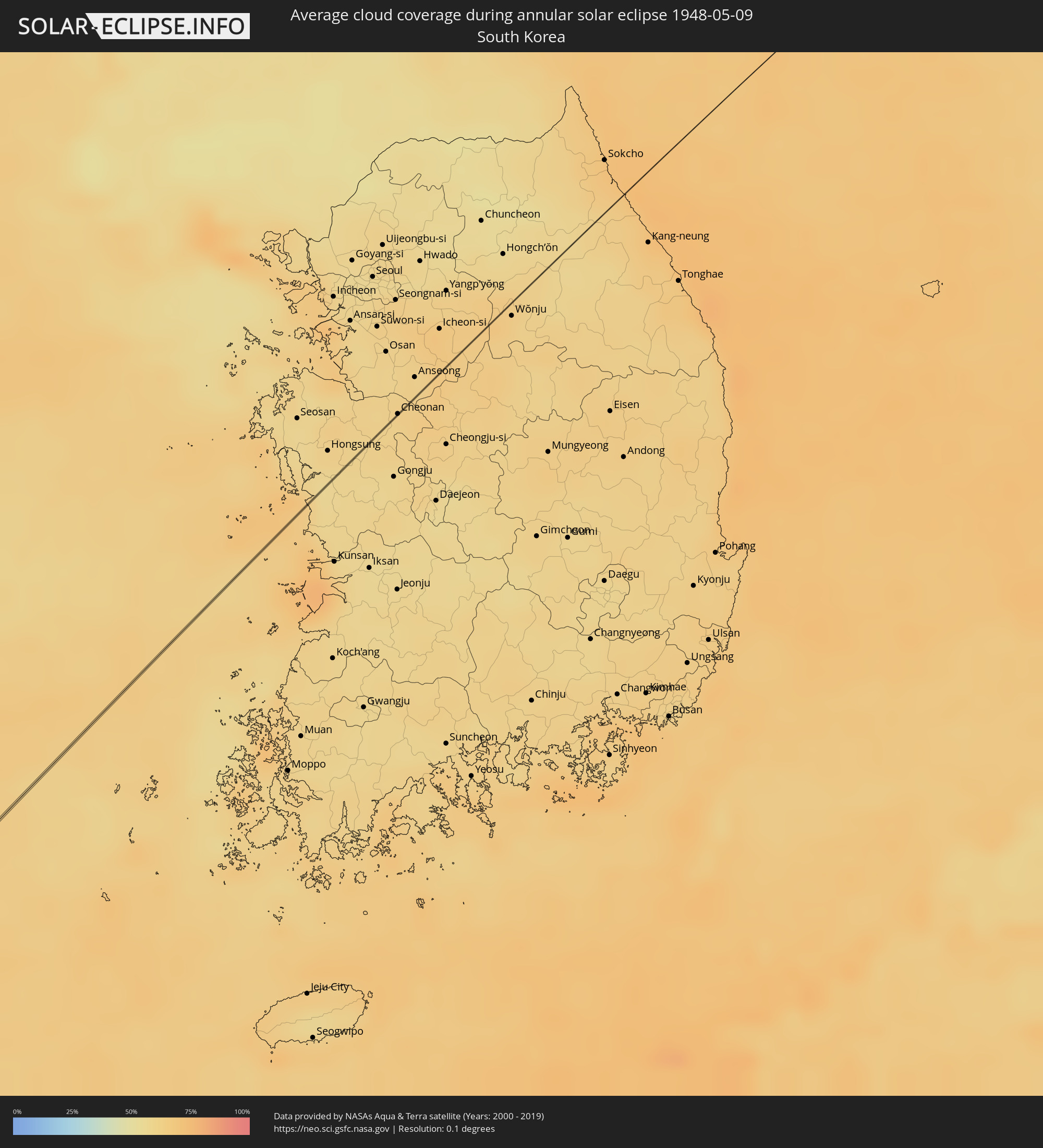 South Korea
Cities inside the path of the eclipse
The following table shows all locations with a population of more than 5,000 inside the eclipse path. Cities which have more than 100,000 inhabitants are marked bold. A click at the locations opens a detailed map.
| City | Type | Eclipse duration | Local time of max. eclipse | Distance to central line | Ø Cloud coverage |
|
Myeik, Tanintharyi
|
annular | - | 07:27:08 UTC+06:30 | 9 km | 83% |
|
Khao Yoi, Phetchaburi
|
annular | - | 07:58:51 UTC+07:00 | 10 km | 90% |
|
Damnoen Saduak, Ratchaburi
|
annular | - | 07:59:21 UTC+07:00 | 8 km | 80% |
|
Samut Songkhram, Samut Songkhram
|
annular | - | 07:59:12 UTC+07:00 | 5 km | 78% |
|
Ban Phaeo, Samut Sakhon
|
annular | - | 07:59:32 UTC+07:00 | 5 km | 88% |
|
Sam Phran, Nakhon Pathom
|
annular | - | 07:59:47 UTC+07:00 | 10 km | 86% |
|
Krathum Baen, Samut Sakhon
|
annular | - | 07:59:42 UTC+07:00 | 1 km | 89% |
|
Samut Sakhon, Samut Sakhon
|
annular | - | 07:59:32 UTC+07:00 | 10 km | 69% |
|
Bang Yai, Nonthaburi
|
annular | - | 08:00:02 UTC+07:00 | 12 km | 91% |
|
Bang Bua Thong, Nonthaburi
|
annular | - | 08:00:11 UTC+07:00 | 15 km | 91% |
|
Bang Kruai, Nonthaburi
|
annular | - | 08:00:02 UTC+07:00 | 1 km | 89% |
|
Pak Kret, Nonthaburi
|
annular | - | 08:00:13 UTC+07:00 | 10 km | 90% |
|
Bangkok, Bangkok
|
annular | - | 07:59:58 UTC+07:00 | 5 km | 89% |
|
Mueang Nonthaburi, Nonthaburi
|
annular | - | 08:00:08 UTC+07:00 | 4 km | 90% |
|
Phra Pradaeng, Samut Prakan
|
annular | - | 07:59:50 UTC+07:00 | 16 km | 88% |
|
Ban Bang Kadi Pathum Thani, Phra Nakhon Si Ayutthaya
|
annular | - | 08:00:23 UTC+07:00 | 14 km | 89% |
|
Khlong Luang, Pathum Thani
|
annular | - | 08:00:31 UTC+07:00 | 14 km | 89% |
|
Ban Lam Luk Ka, Pathum Thani
|
annular | - | 08:00:27 UTC+07:00 | 2 km | 93% |
|
Nakhon Nayok, Nakhon Nayok
|
annular | - | 08:01:01 UTC+07:00 | 9 km | 91% |
|
Sung Noen, Nakhon Ratchasima
|
annular | - | 08:02:27 UTC+07:00 | 14 km | 86% |
|
Nakhon Ratchasima, Nakhon Ratchasima
|
annular | - | 08:02:43 UTC+07:00 | 3 km | 85% |
|
Non Sung, Nakhon Ratchasima
|
annular | - | 08:03:09 UTC+07:00 | 11 km | 87% |
|
Phimai, Nakhon Ratchasima
|
annular | - | 08:03:21 UTC+07:00 | 1 km | 85% |
|
Wapi Pathum, Maha Sarakham
|
annular | - | 08:04:53 UTC+07:00 | 3 km | 90% |
|
Roi Et, Roi Et
|
annular | - | 08:05:25 UTC+07:00 | 3 km | 88% |
|
Pho Chai, Roi Et
|
annular | - | 08:05:57 UTC+07:00 | 13 km | 90% |
|
Waeng, Roi Et
|
annular | - | 08:06:02 UTC+07:00 | 3 km | 90% |
|
Kuchinarai, Kalasin
|
annular | - | 08:06:29 UTC+07:00 | 13 km | 89% |
|
Moeiwadi, Roi Et
|
annular | - | 08:06:17 UTC+07:00 | 7 km | 90% |
|
That Phanom, Nakhon Phanom
|
annular | - | 08:07:35 UTC+07:00 | 3 km | 84% |
|
Lianjiang, Guangdong
|
annular | - | 10:20:36 UTC+09:00 | 7 km | 93% |
|
Shixing, Guangdong
|
annular | - | 10:30:57 UTC+09:00 | 5 km | 85% |
|
Deqing, Zhejiang
|
annular | - | 10:49:49 UTC+09:00 | 1 km | 67% |
|
Cheonan, Chungcheongnam-do
|
annular | - | 11:13:18 UTC+09:00 | 0 km | 62% |