Annular solar eclipse of 10/24/2060
| Day of week: | Sunday |
| Maximum duration of eclipse: | 08m06s |
| Maximum width of eclipse path: | 281 km |
| Saros cycle: | 144 |
| Coverage: | 92.8% |
| Magnitude: | 0.9277 |
| Gamma: | -0.2625 |
Wo kann man die Sonnenfinsternis vom 10/24/2060 sehen?
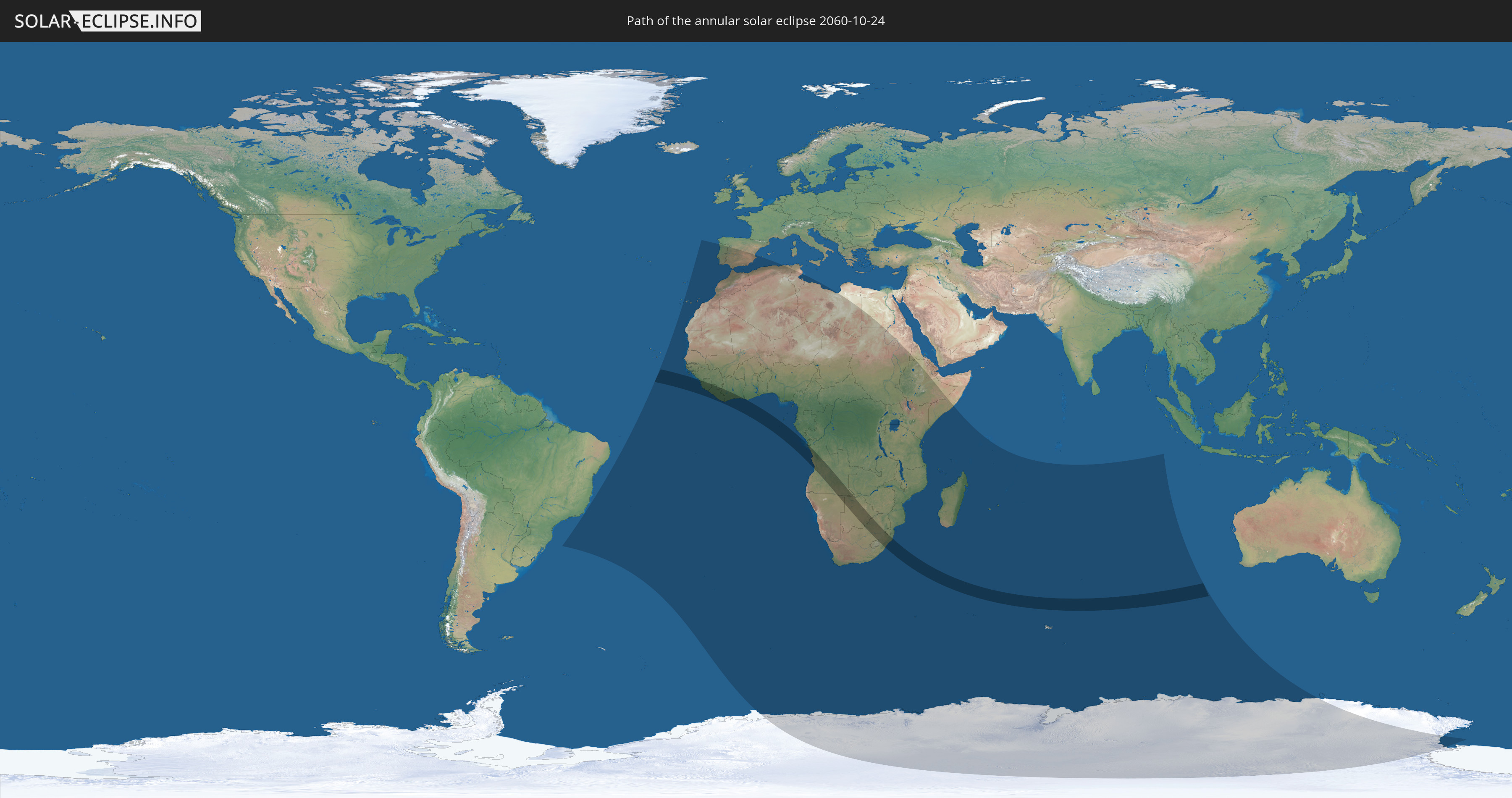
Die Sonnenfinsternis am 10/24/2060 kann man in 63 Ländern als partielle Sonnenfinsternis beobachten.
Der Finsternispfad verläuft durch 12 Länder. Nur in diesen Ländern ist sie als annular Sonnenfinsternis zu sehen.
In den folgenden Ländern ist die Sonnenfinsternis annular zu sehen
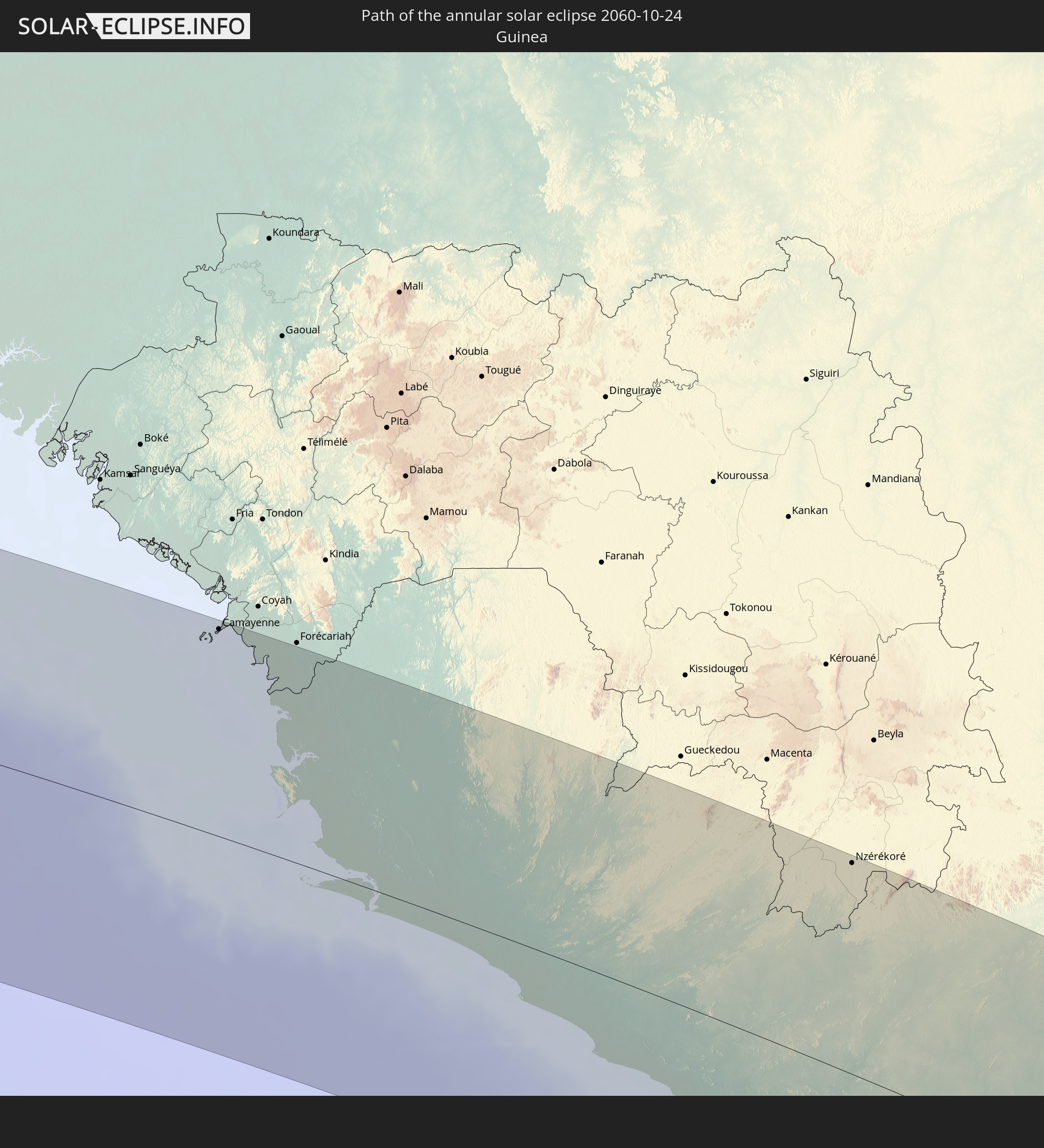 Guinea
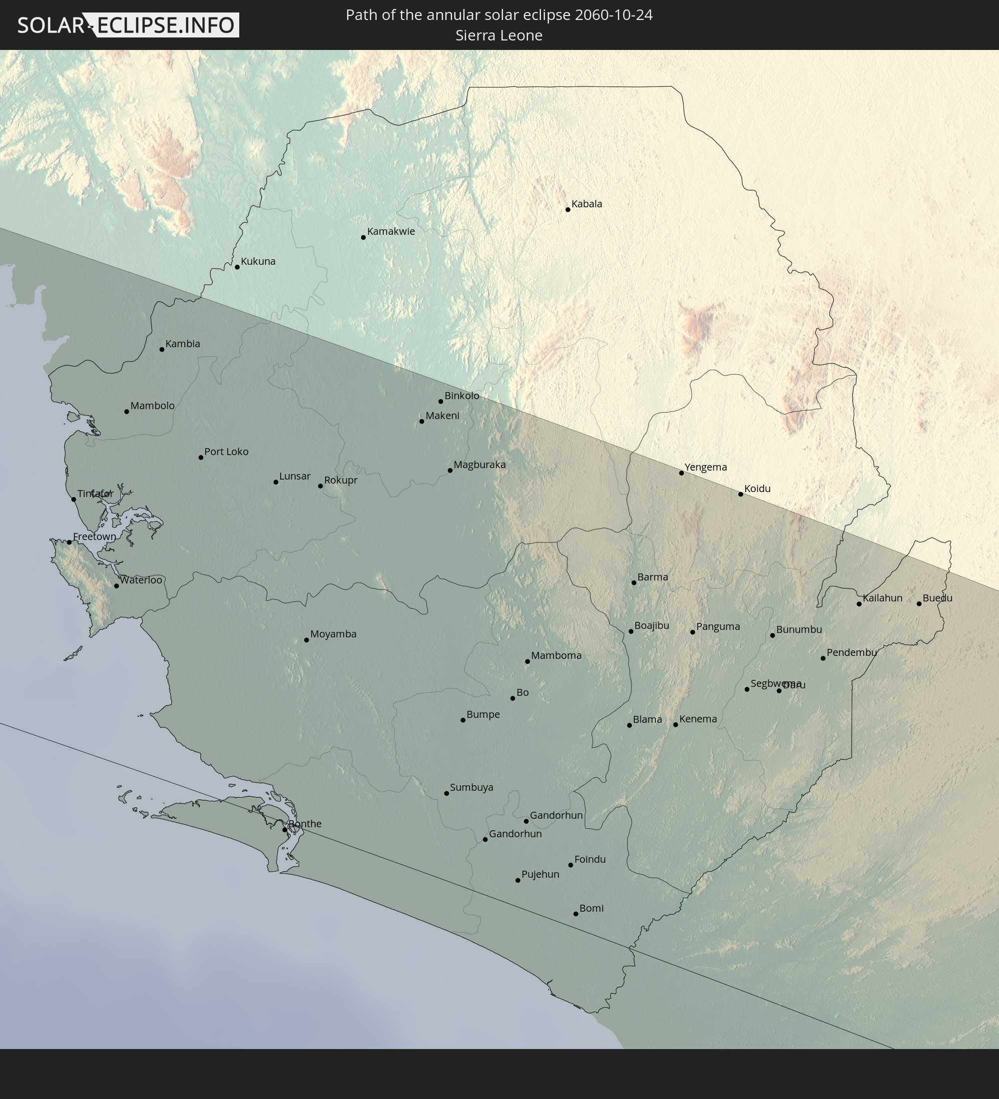 Sierra Leone
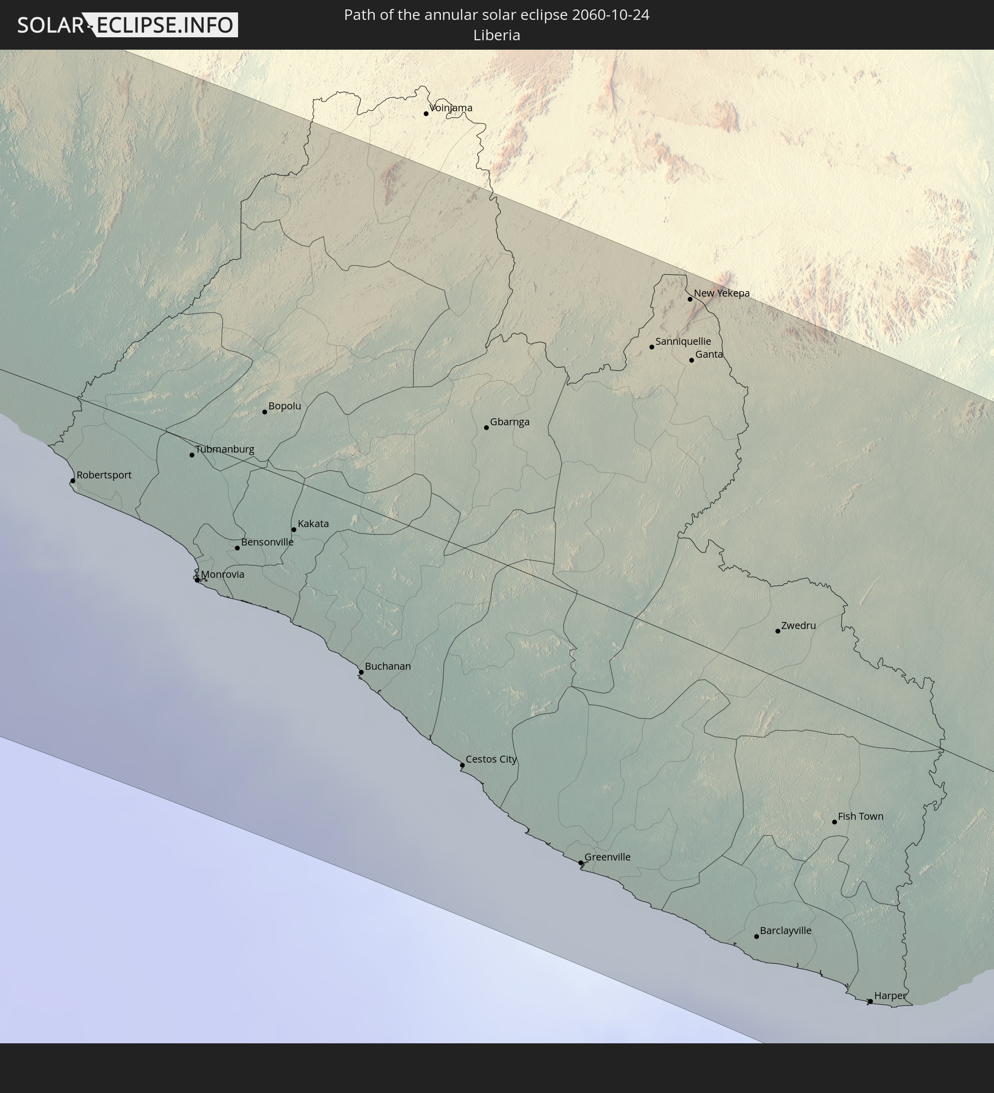 Liberia
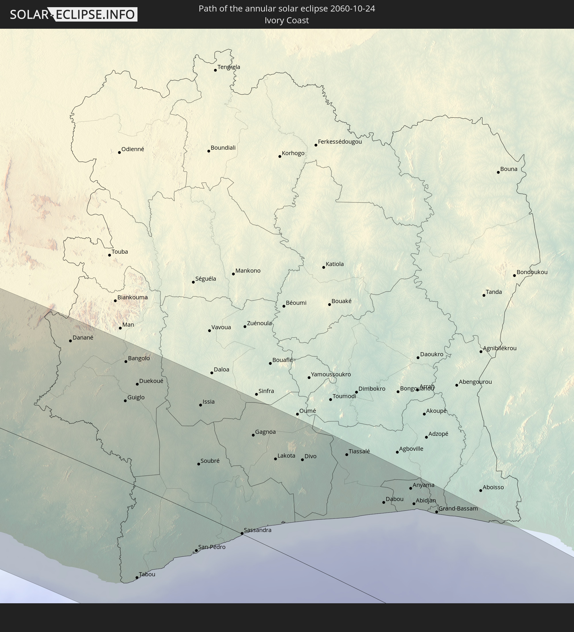 Ivory Coast
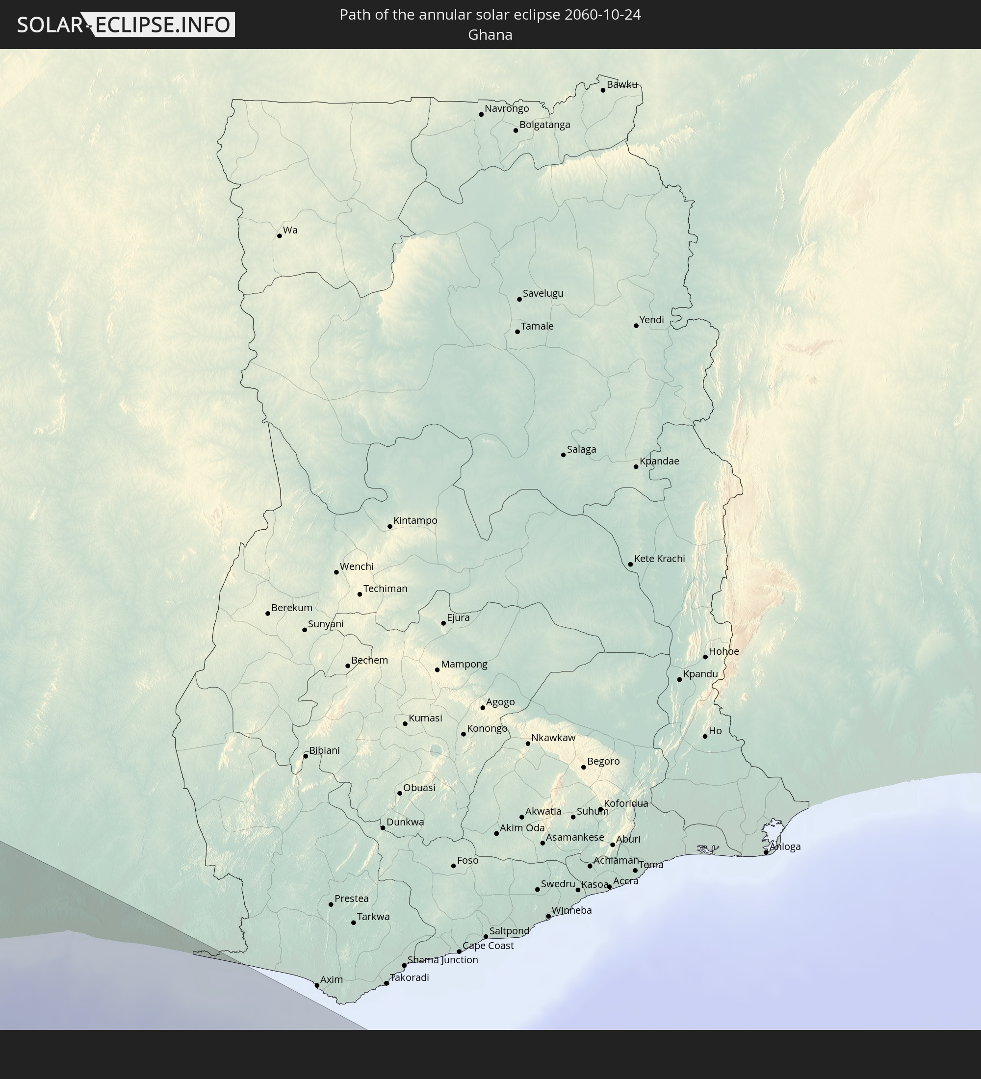 Ghana
Ghana
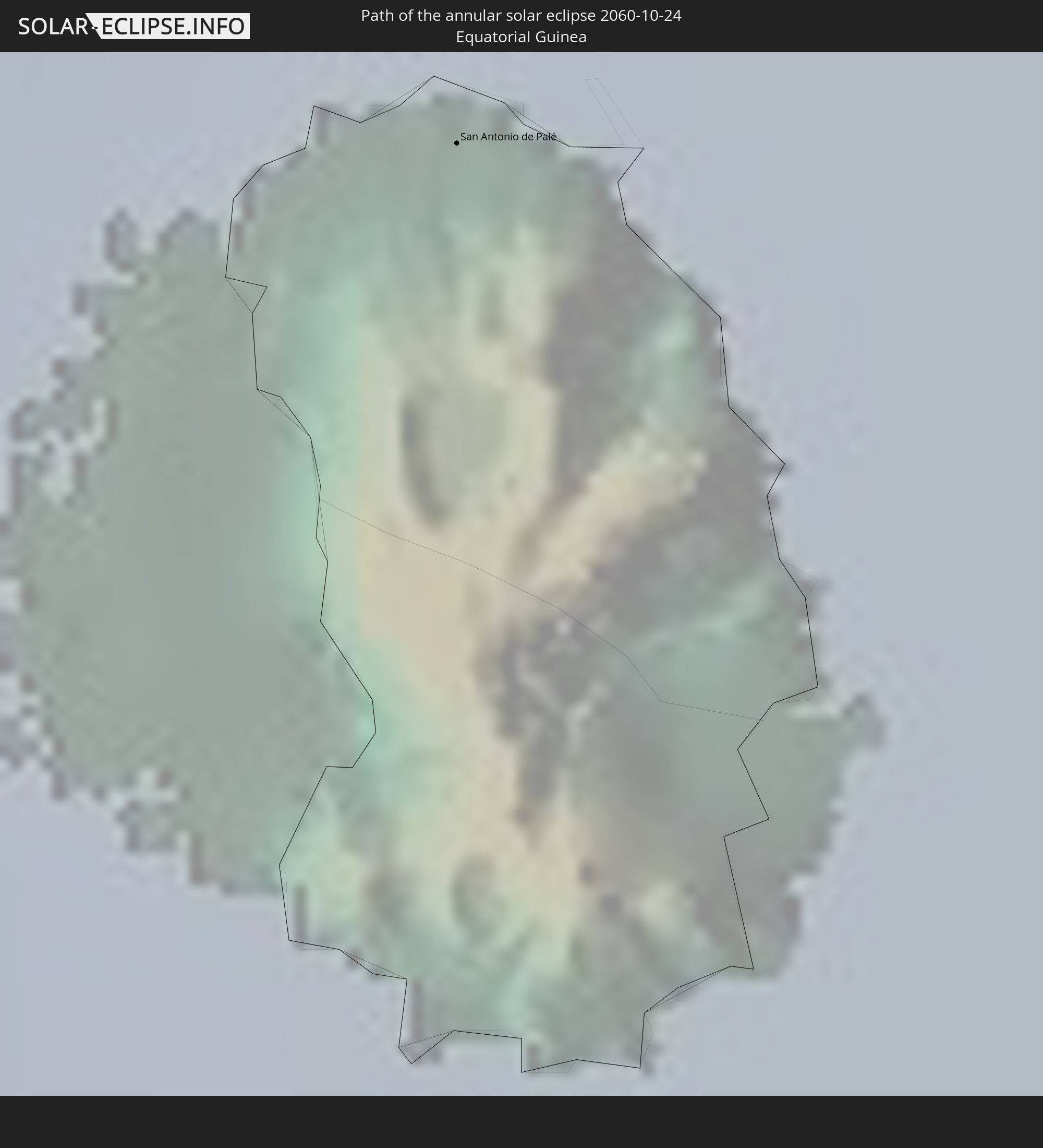 Equatorial Guinea
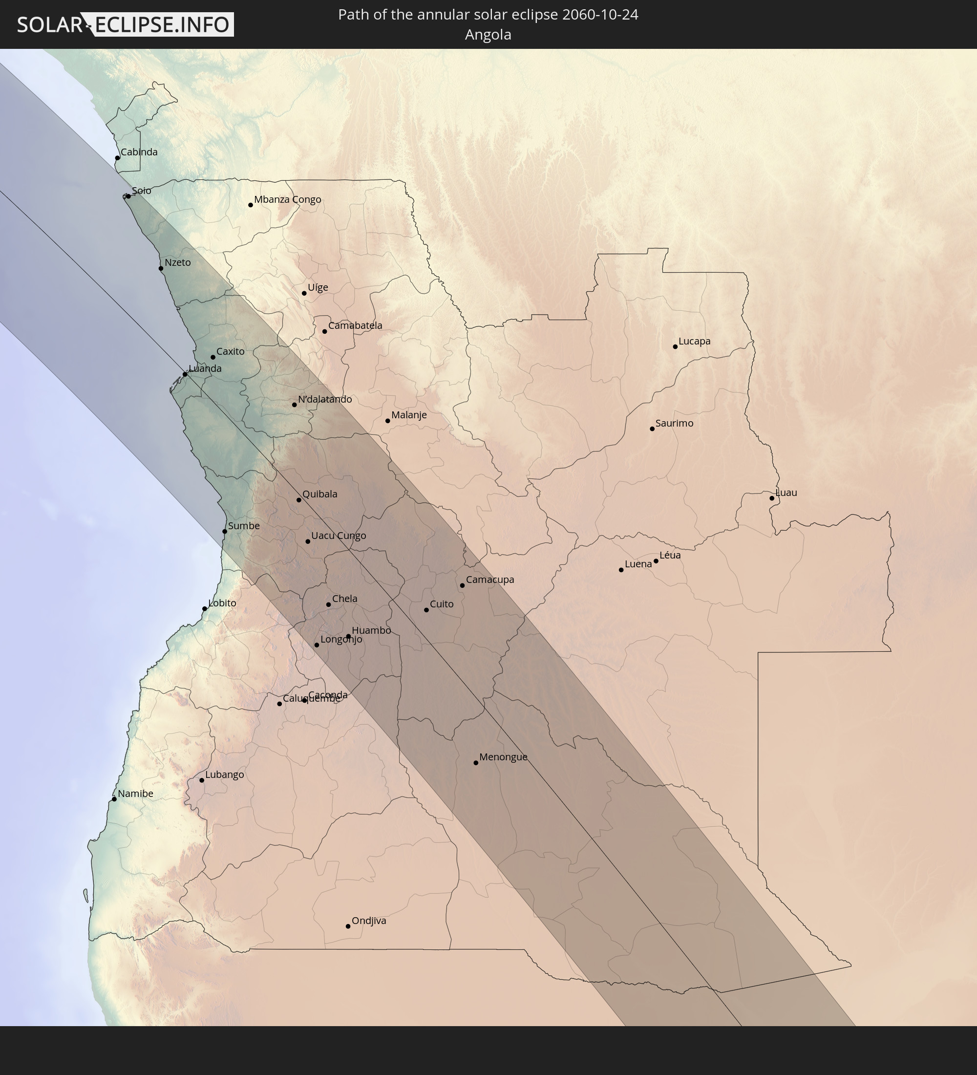 Angola
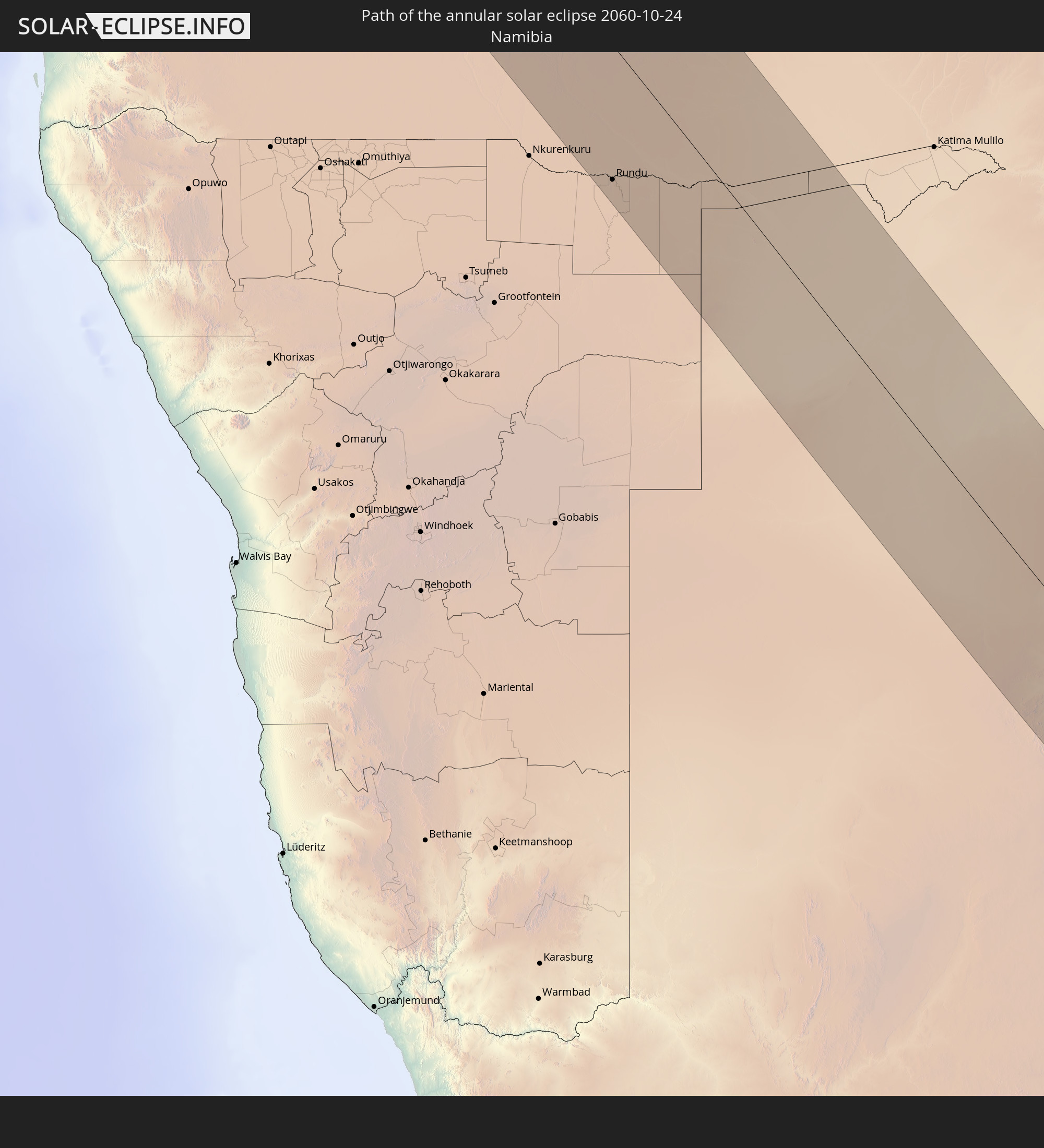 Namibia
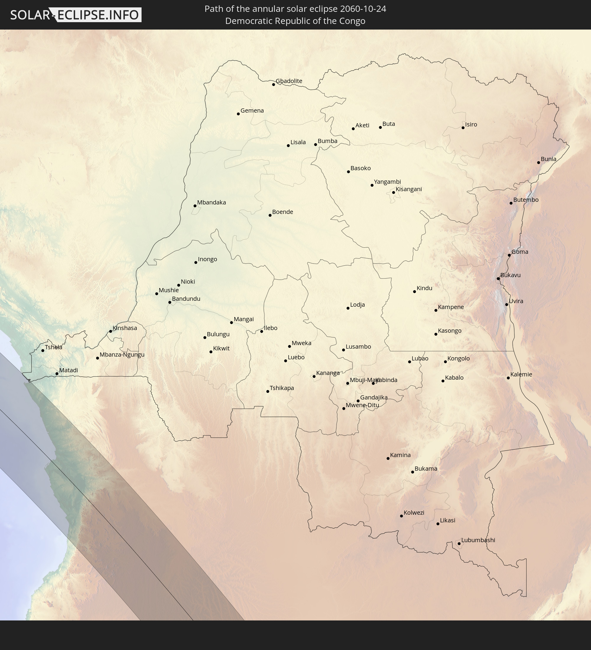 Democratic Republic of the Congo
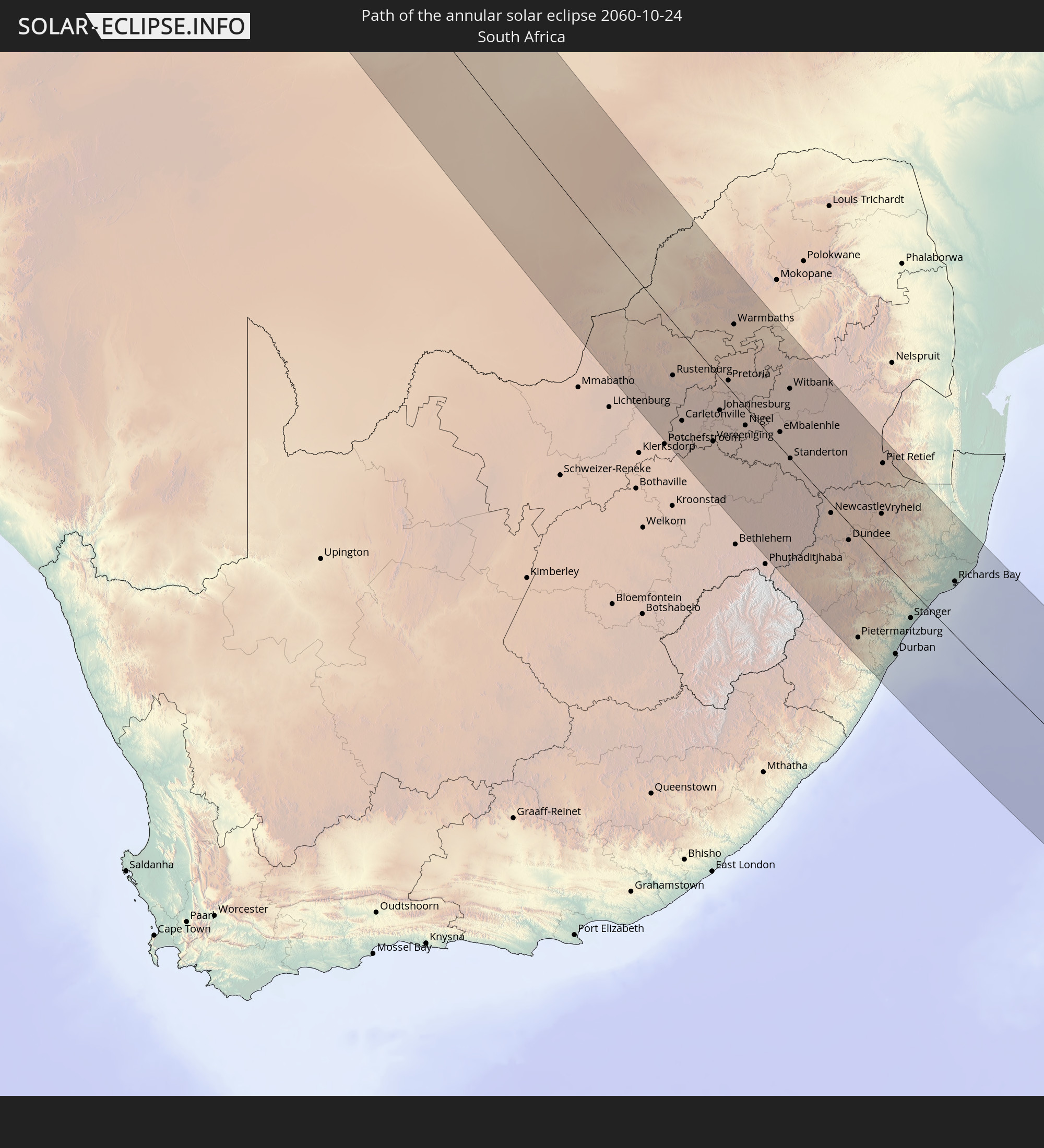 South Africa
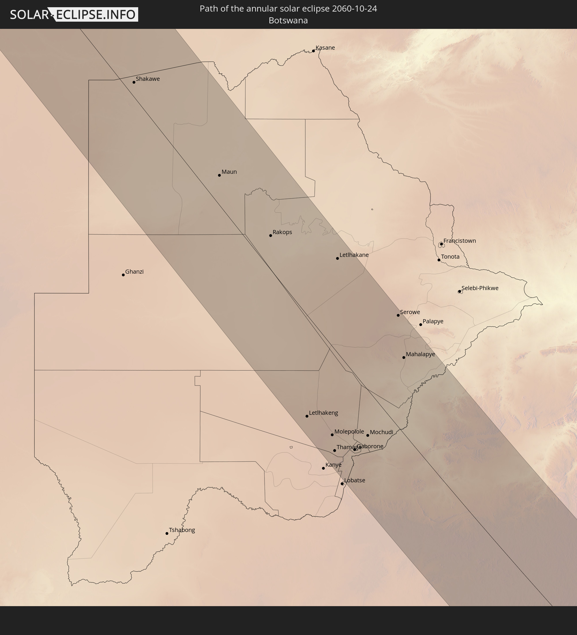 Botswana
 Swaziland
In den folgenden Ländern ist die Sonnenfinsternis partiell zu sehen
 Antarctica
 Brazil
 Portugal
 Spain
Spain
 Senegal
 Mauritania
 The Gambia
 Guinea-Bissau
 Guinea
 Saint Helena, Ascension and Tristan da Cunha
 Sierra Leone
 Morocco
 Mali
Mali
 Liberia
 Algeria
 Ivory Coast
 Burkina Faso
 Gibraltar
 Ghana
Ghana
 Togo
Togo
 Niger
Niger
 Benin
Benin
 Nigeria
 Bouvet Island
 Equatorial Guinea
 São Tomé and Príncipe
 Tunisia
 Cameroon
 Gabon
Gabon
 Libya
Libya
 Republic of the Congo
 Angola
 Namibia
 Democratic Republic of the Congo
 Chad
Chad
 Central African Republic
 South Africa
 Botswana
 Sudan
Sudan
 Zambia
 Egypt
Egypt
 Zimbabwe
 Lesotho
 Rwanda
 Burundi
 Tanzania
 Uganda
 Mozambique
 Swaziland
 Malawi
 Ethiopia
 Kenya
Kenya
 Eritrea
 French Southern and Antarctic Lands
 Somalia
 Madagascar
 Comoros
 Mayotte
 Seychelles
 Réunion
 Mauritius
 Heard Island and McDonald Islands
 Cocos Islands
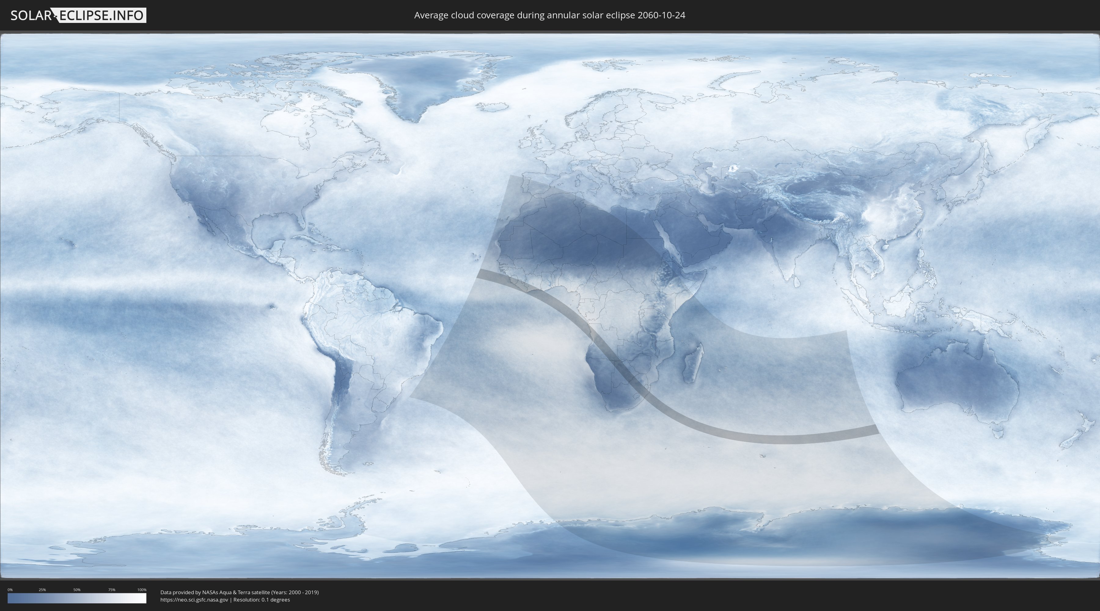
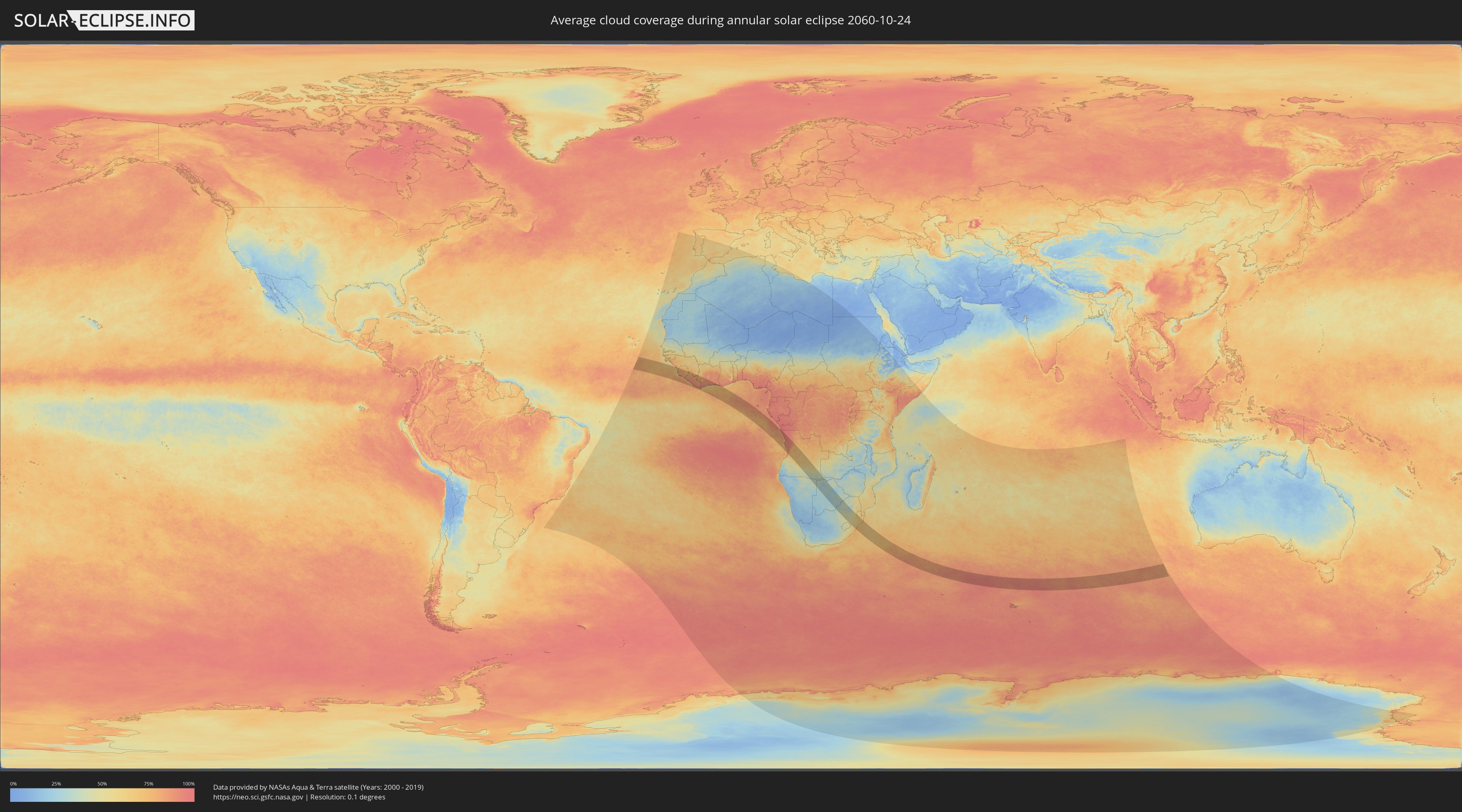
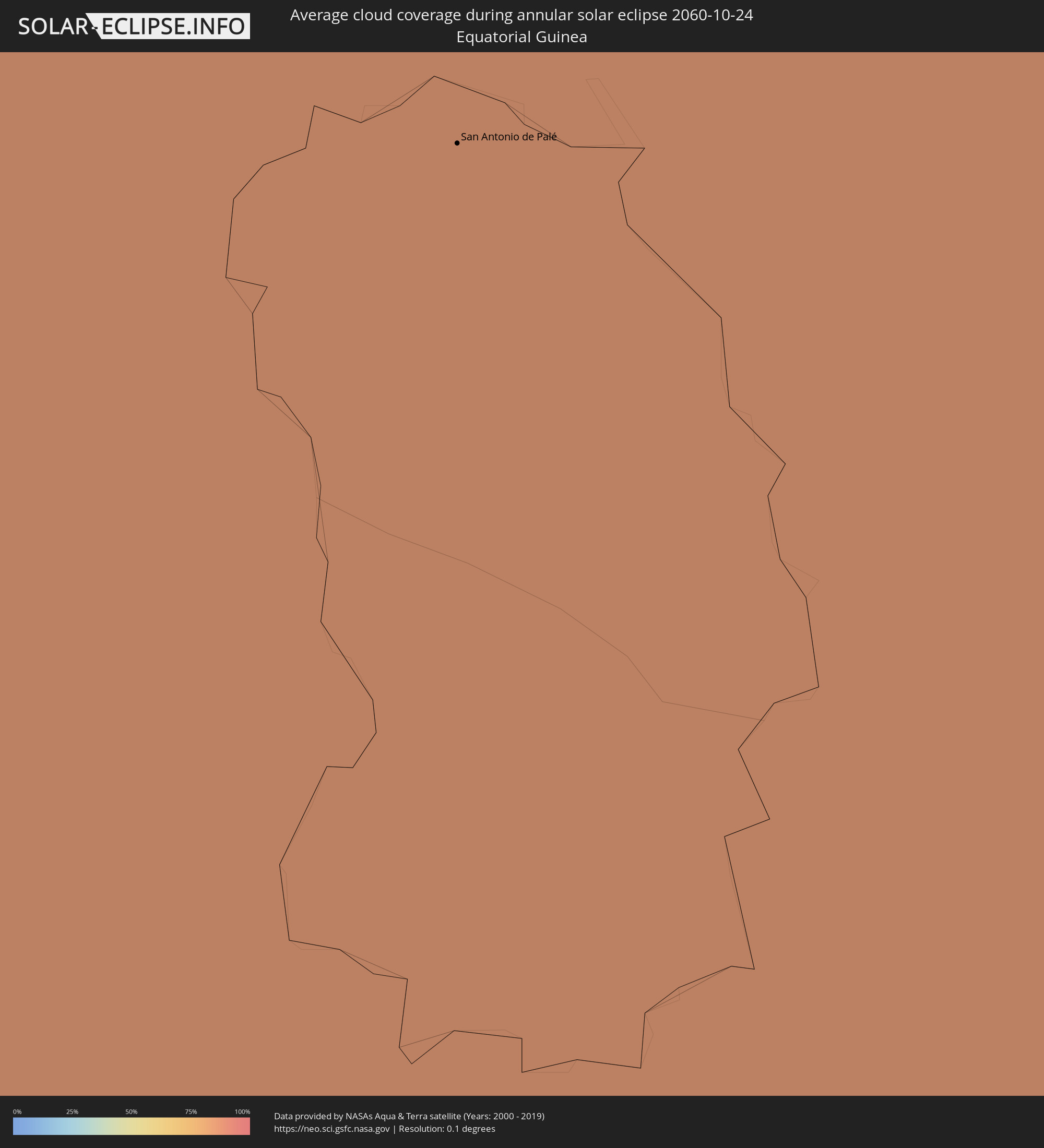
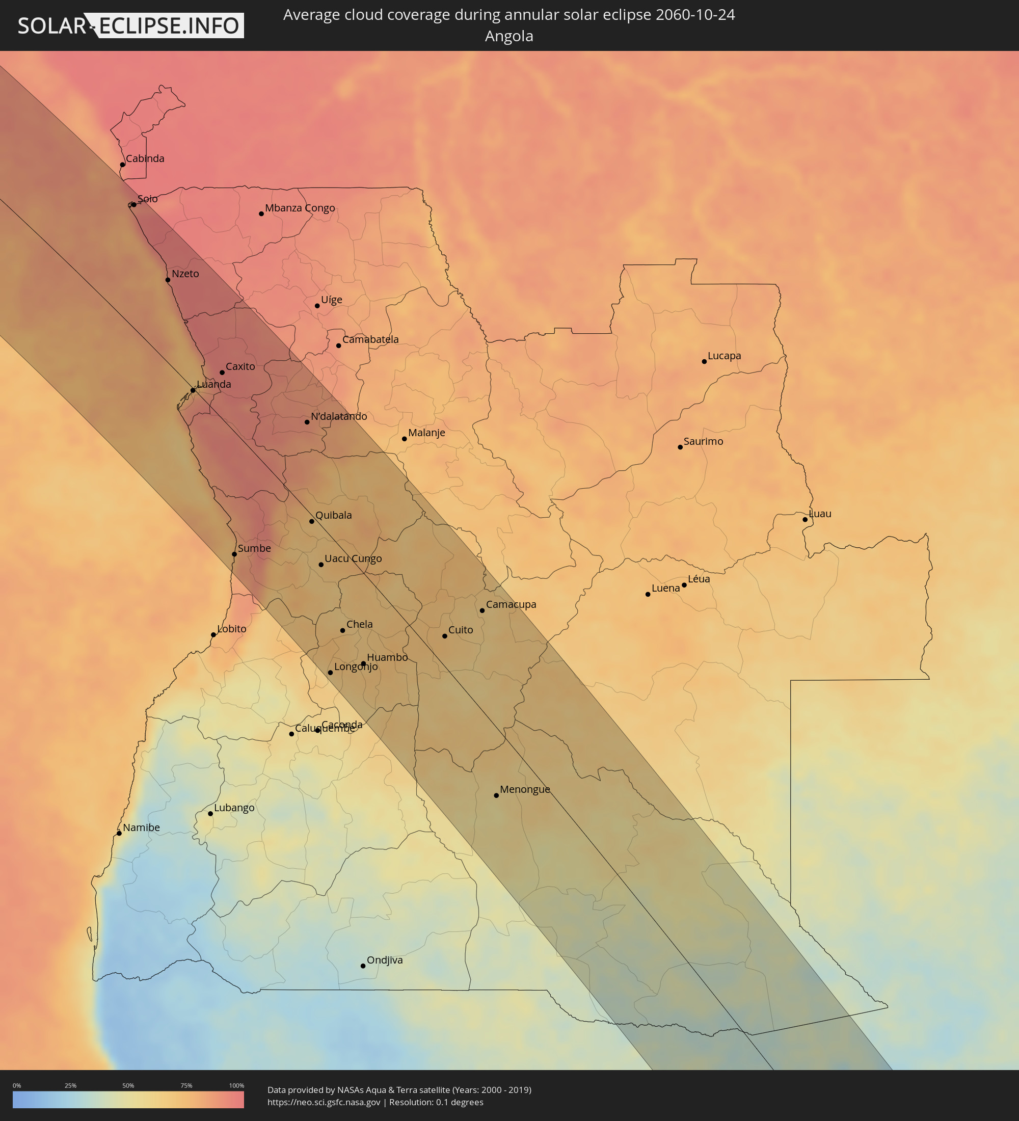
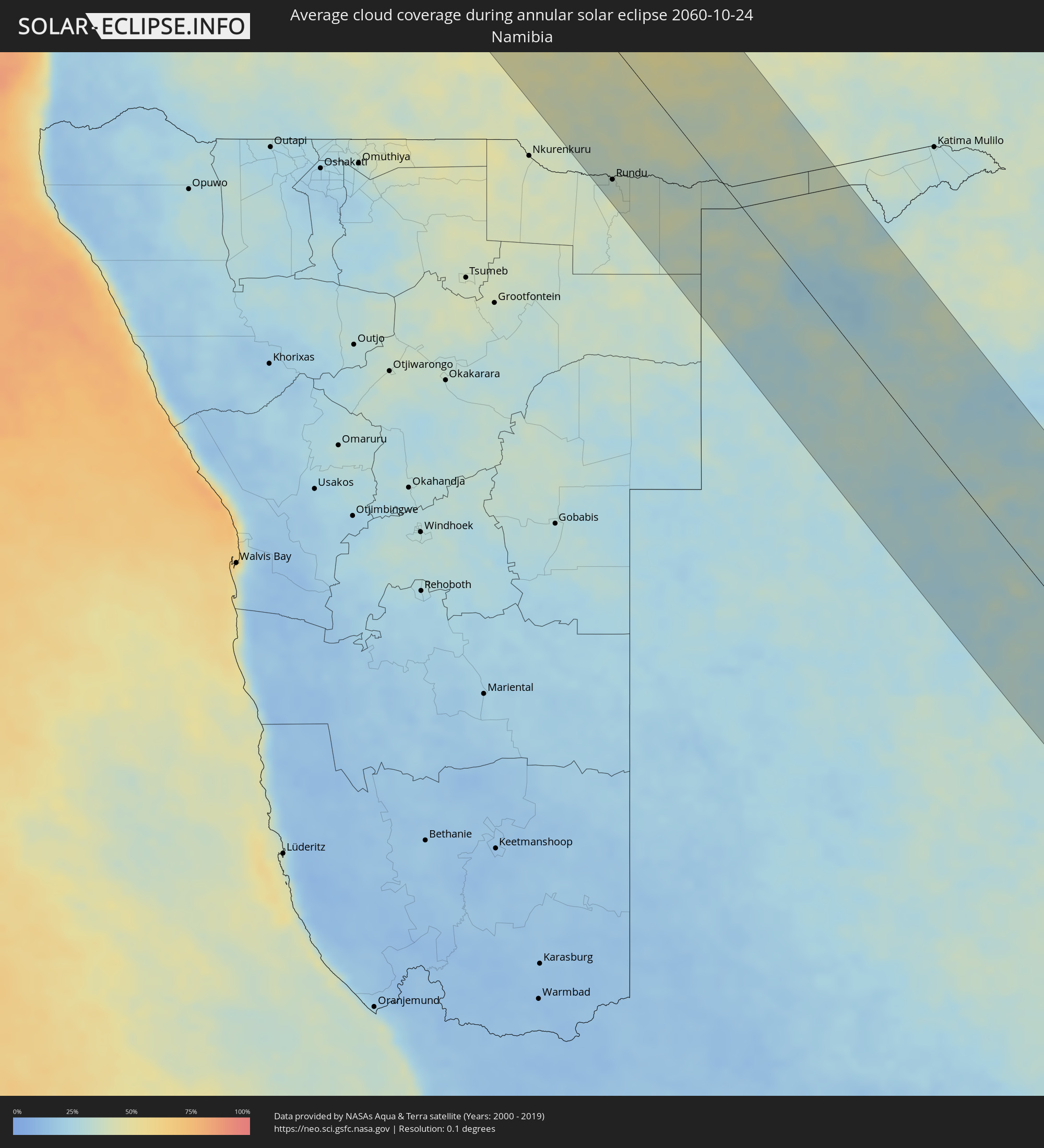
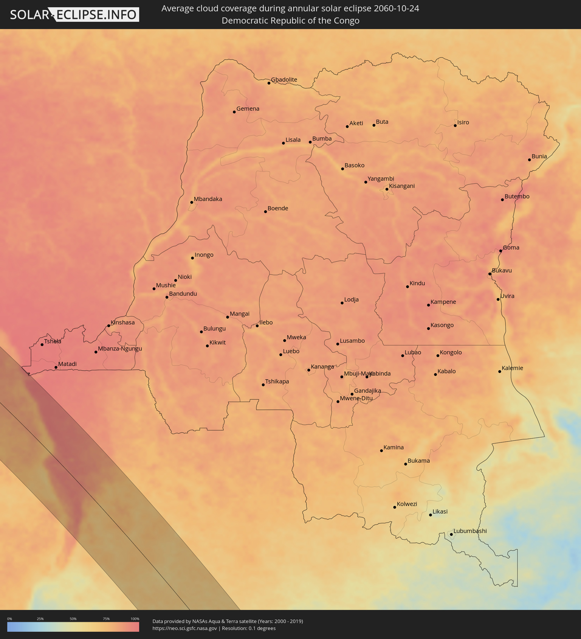
How will be the weather during the annular solar eclipse on 10/24/2060?
Where is the best place to see the annular solar eclipse of 10/24/2060?
The following maps show the average cloud coverage for the day of the annular solar eclipse.
With the help of these maps, it is possible to find the place along the eclipse path, which has the best
chance of a cloudless sky.
Nevertheless, you should consider local circumstances and inform about the weather of your chosen
observation site.
The data is provided by NASAs satellites
AQUA and TERRA.
The cloud maps are averaged over a period of 19 years (2000 - 2019).
Detailed country maps
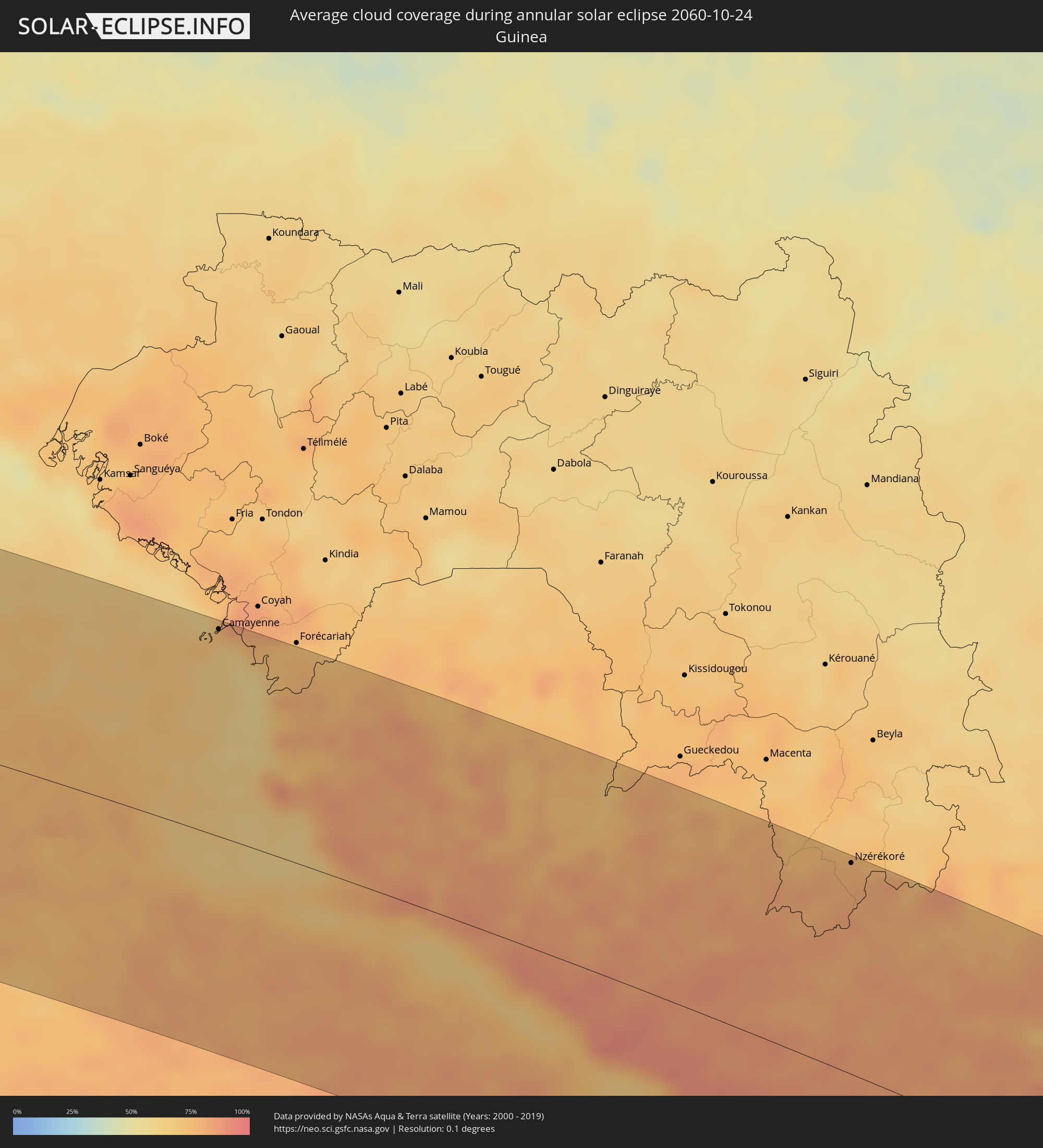 Guinea
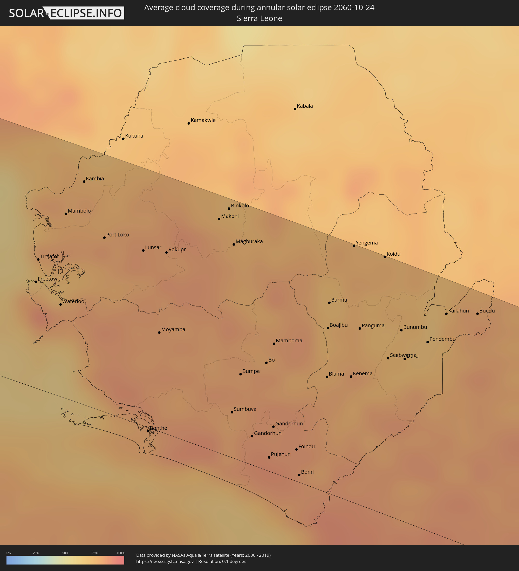 Sierra Leone
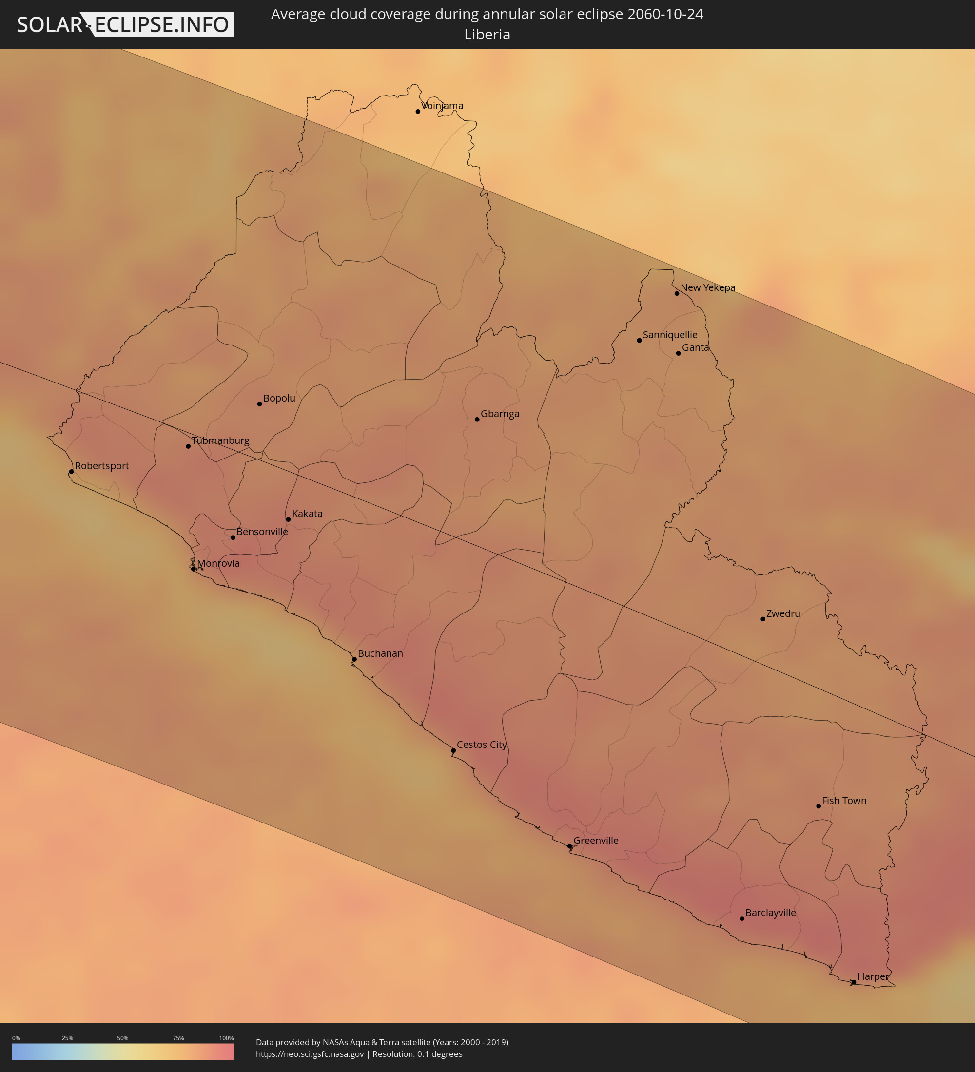 Liberia
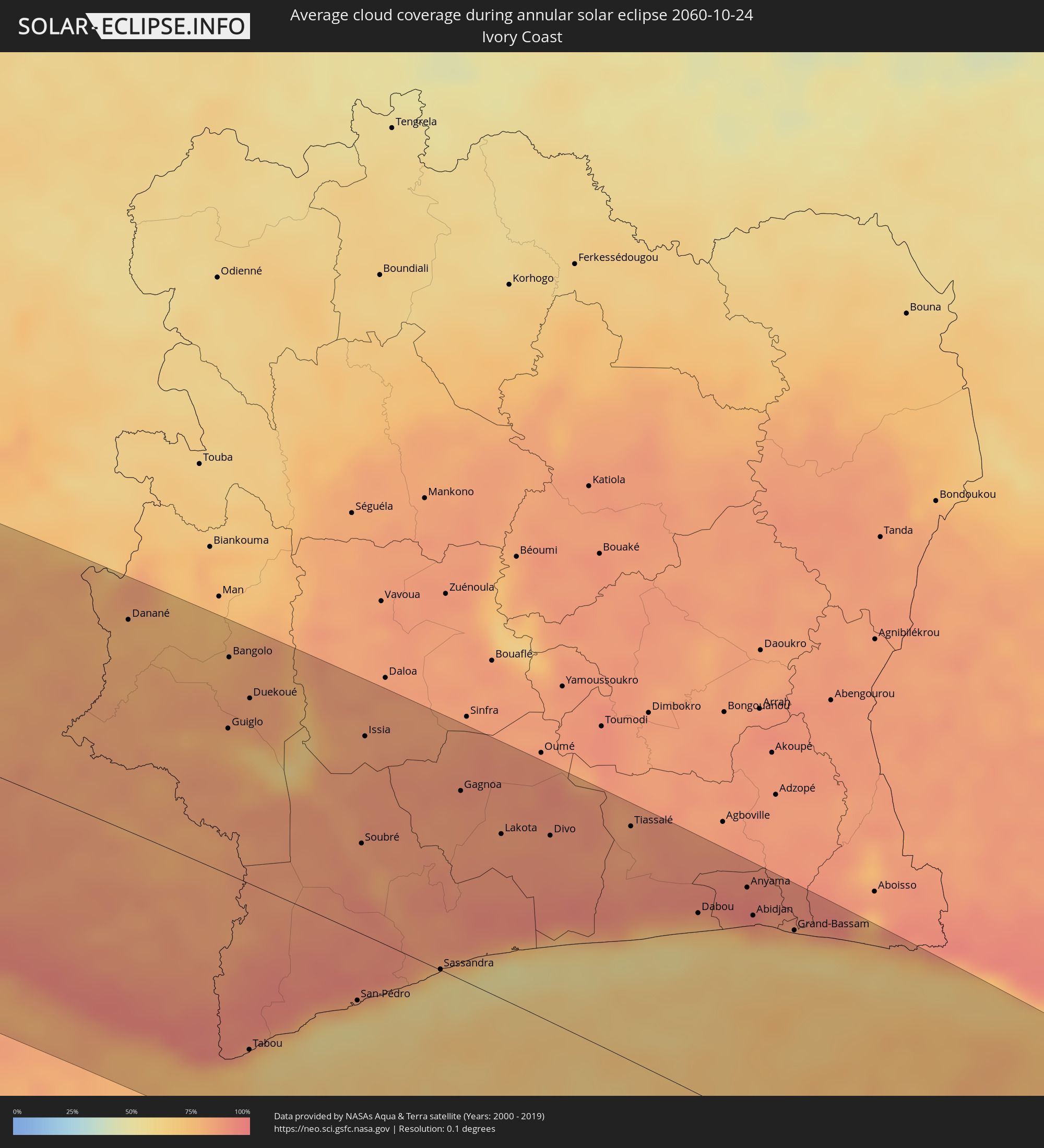 Ivory Coast
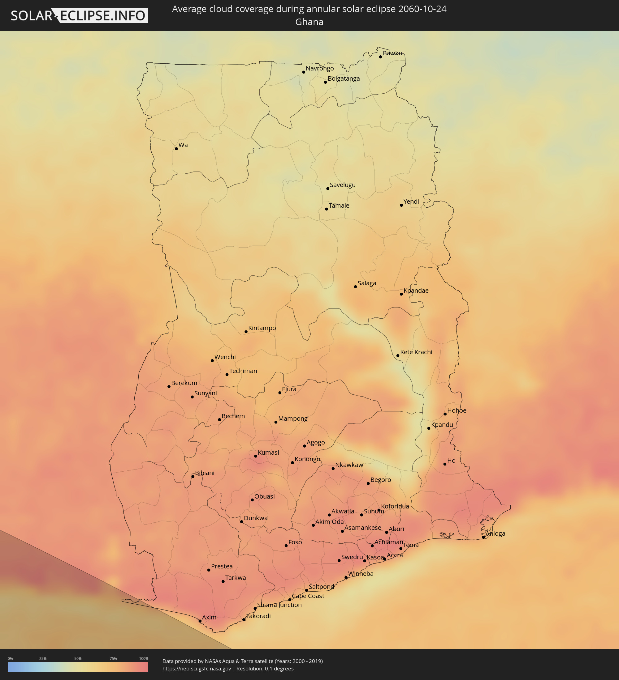 Ghana
Ghana
 Equatorial Guinea
 Angola
 Namibia
 Democratic Republic of the Congo
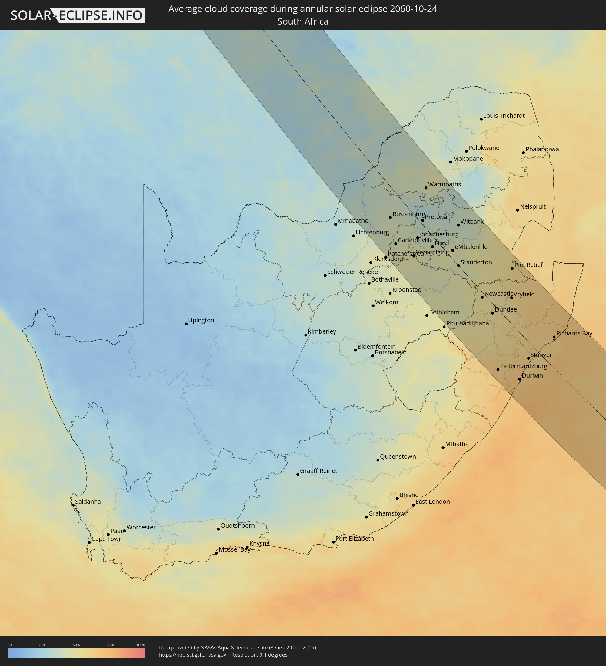 South Africa
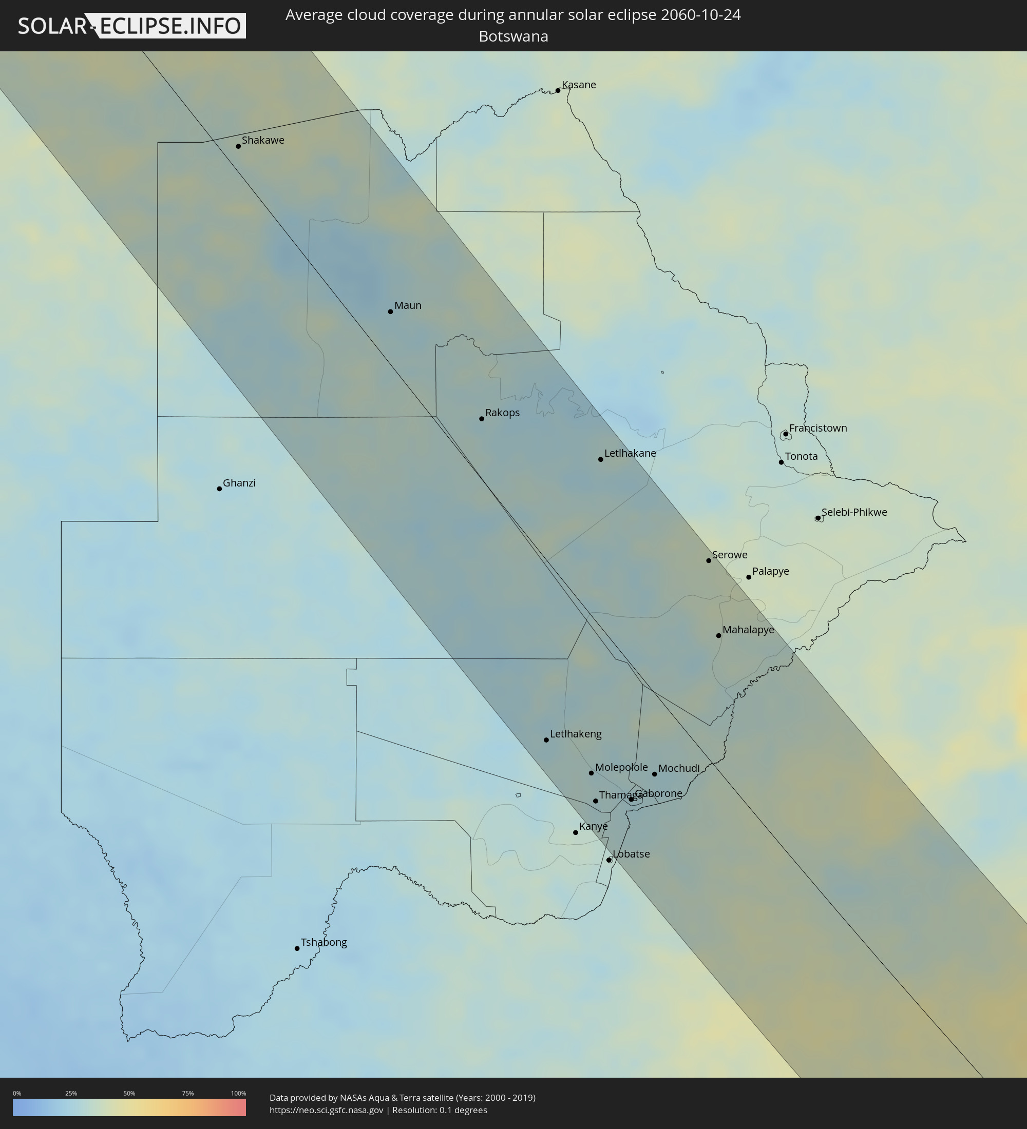 Botswana
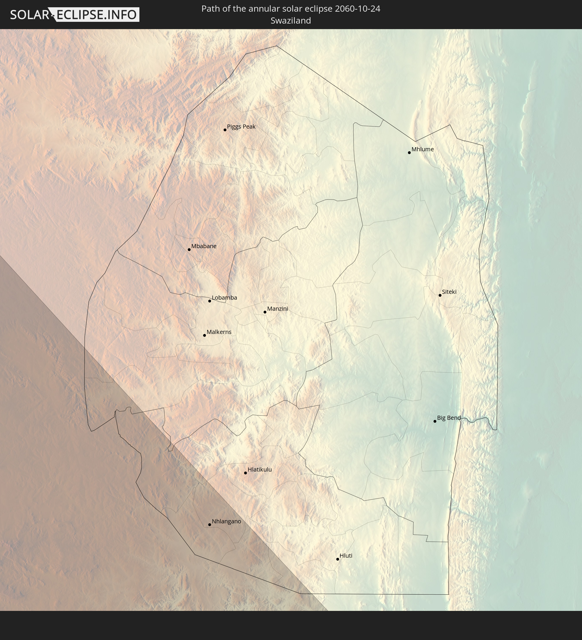
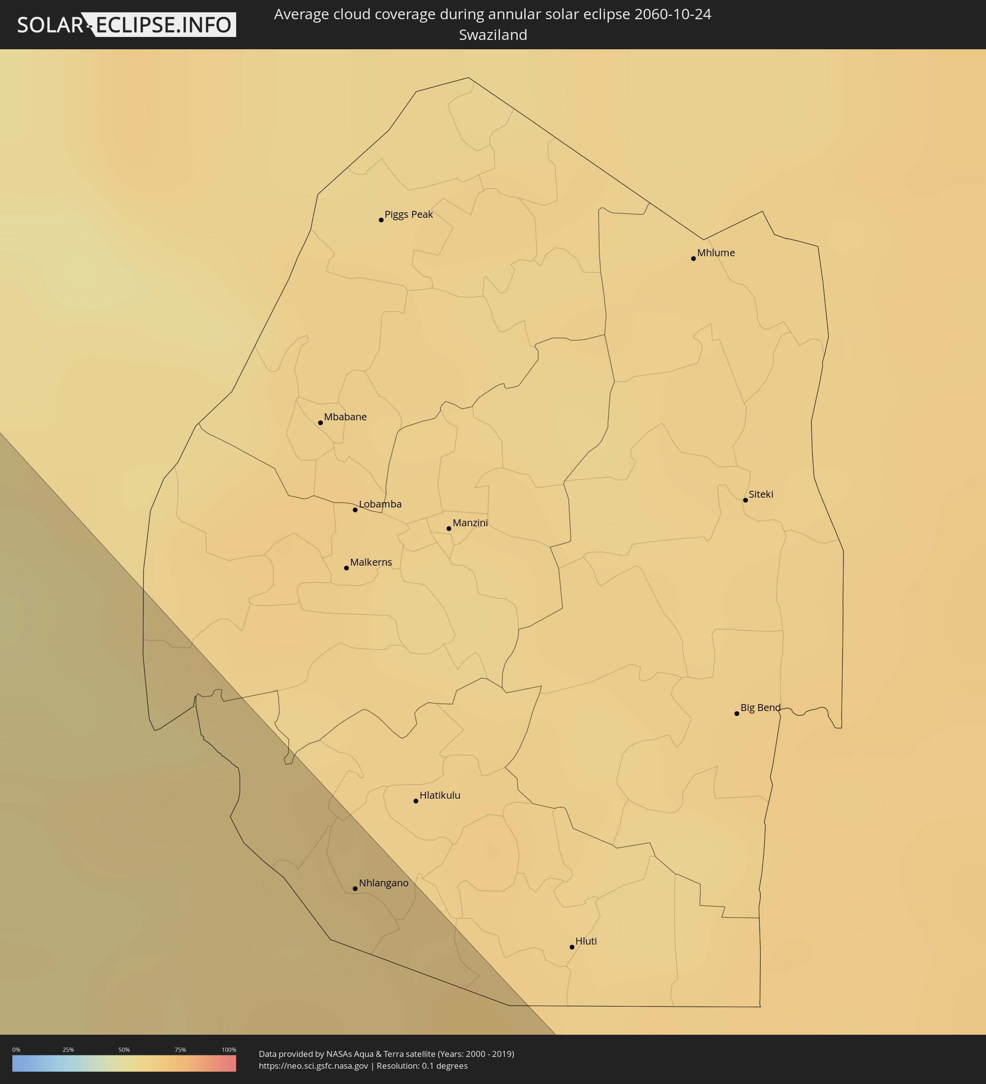 Swaziland
Cities inside the path of the eclipse
The following table shows all locations with a population of more than 5,000 inside the eclipse path. Cities which have more than 100,000 inhabitants are marked bold. A click at the locations opens a detailed map.
| City | Type | Eclipse duration | Local time of max. eclipse | Distance to central line | Ø Cloud coverage |
|
Camayenne, Conakry
|
annular | - | 07:28:02 UTC+00:00 | 166 km | 67% |
|
Conakry, Conakry
|
annular | - | 07:28:02 UTC+00:00 | 167 km | 67% |
|
Freetown, Western Area
|
annular | - | 07:29:03 UTC+00:00 | 72 km | 79% |
|
Waterloo, Western Area
|
annular | - | 07:29:12 UTC+00:00 | 62 km | 79% |
|
Kambia, Northern Province
|
annular | - | 07:28:30 UTC+00:00 | 150 km | 79% |
|
Port Loko, Northern Province
|
annular | - | 07:28:51 UTC+00:00 | 117 km | 82% |
|
Lunsar, Northern Province
|
annular | - | 07:28:58 UTC+00:00 | 118 km | 82% |
|
Bonthe, Southern Province
|
annular | - | 07:30:04 UTC+00:00 | 3 km | 79% |
|
Rokupr, Northern Province
|
annular | - | 07:29:00 UTC+00:00 | 122 km | 81% |
|
Makeni, Northern Province
|
annular | - | 07:28:51 UTC+00:00 | 157 km | 77% |
|
Magburaka, Northern Province
|
annular | - | 07:29:01 UTC+00:00 | 143 km | 77% |
|
Bumpe, Southern Province
|
annular | - | 07:29:50 UTC+00:00 | 58 km | 81% |
|
Gandorhun, Southern Province
|
annular | - | 07:30:14 UTC+00:00 | 19 km | 86% |
|
Bo, Southern Province
|
annular | - | 07:29:47 UTC+00:00 | 72 km | 82% |
|
Gandorhun, Southern Province
|
annular | - | 07:30:12 UTC+00:00 | 31 km | 83% |
|
Robertsport, Grand Cape Mount
|
annular | - | 07:31:05 UTC+00:00 | 40 km | 74% |
|
Blama, Eastern Province
|
annular | - | 07:29:57 UTC+00:00 | 77 km | 79% |
|
Kenema, Eastern Province
|
annular | - | 07:29:59 UTC+00:00 | 84 km | 77% |
|
Yengema, Eastern Province
|
annular | - | 07:29:10 UTC+00:00 | 172 km | 76% |
|
Koidu, Eastern Province
|
annular | - | 07:29:17 UTC+00:00 | 172 km | 75% |
|
Segbwema, Eastern Province
|
annular | - | 07:29:55 UTC+00:00 | 105 km | 73% |
|
Tubmanburg, Bomi
|
annular | - | 07:31:05 UTC+00:00 | 7 km | 90% |
|
Monrovia, Montserrado
|
annular | - | 07:31:41 UTC+00:00 | 65 km | 76% |
|
Pendembu, Eastern Province
|
annular | - | 07:29:52 UTC+00:00 | 126 km | 71% |
|
Bensonville, Montserrado
|
annular | - | 07:31:35 UTC+00:00 | 43 km | 92% |
|
Kailahun, Eastern Province
|
annular | - | 07:29:43 UTC+00:00 | 149 km | 76% |
|
Bopolu, Gbarpolu
|
annular | - | 07:30:58 UTC+00:00 | 27 km | 84% |
|
Kakata, Margibi
|
annular | - | 07:31:33 UTC+00:00 | 23 km | 90% |
|
Buchanan, Grand Bassa
|
annular | - | 07:32:20 UTC+00:00 | 78 km | 83% |
|
Cestos City, River Cess
|
annular | - | 07:32:56 UTC+00:00 | 103 km | 81% |
|
Gbarnga, Bong
|
annular | - | 07:31:18 UTC+00:00 | 60 km | 84% |
|
Greenville, Sinoe
|
annular | - | 07:33:37 UTC+00:00 | 126 km | 83% |
|
Nzérékoré, Nzerekore
|
annular | - | 07:30:41 UTC+00:00 | 166 km | 78% |
|
Sanniquellie, Nimba
|
annular | - | 07:31:07 UTC+00:00 | 130 km | 80% |
|
New Yekepa, Nimba
|
annular | - | 07:30:56 UTC+00:00 | 160 km | 81% |
|
Ganta, Nimba
|
annular | - | 07:31:14 UTC+00:00 | 131 km | 79% |
|
Barclayville, Grand Kru
|
annular | - | 07:34:17 UTC+00:00 | 125 km | 93% |
|
Danané, Montagnes
|
annular | - | 07:31:23 UTC+00:00 | 143 km | 78% |
|
Zwedru, Grand Gedeh
|
annular | - | 07:32:42 UTC+00:00 | 22 km | 82% |
|
Fish Town, River Gee
|
annular | - | 07:33:47 UTC+00:00 | 56 km | 87% |
|
Harper, Maryland
|
annular | - | 07:34:49 UTC+00:00 | 132 km | 79% |
|
Guiglo, Montagnes
|
annular | - | 07:32:23 UTC+00:00 | 98 km | 77% |
|
Bangolo, Montagnes
|
annular | - | 07:31:52 UTC+00:00 | 146 km | 81% |
|
Tabou, Bas-Sassandra
|
annular | - | 07:34:54 UTC+00:00 | 112 km | 70% |
|
Duekoué, Montagnes
|
annular | - | 07:32:13 UTC+00:00 | 125 km | 84% |
|
San-Pédro, Bas-Sassandra
|
annular | - | 07:34:47 UTC+00:00 | 46 km | 57% |
|
Soubré, Bas-Sassandra
|
annular | - | 07:33:34 UTC+00:00 | 61 km | 85% |
|
Issia, Sassandra-Marahoué
|
annular | - | 07:32:45 UTC+00:00 | 133 km | 83% |
|
Sassandra, Bas-Sassandra
|
annular | - | 07:34:45 UTC+00:00 | 1 km | 61% |
|
Gagnoa, Gôh-Djiboua
|
annular | - | 07:33:25 UTC+00:00 | 126 km | 87% |
|
Lakota, Gôh-Djiboua
|
annular | - | 07:33:51 UTC+00:00 | 109 km | 88% |
|
Divo, Gôh-Djiboua
|
annular | - | 07:33:59 UTC+00:00 | 124 km | 89% |
|
Tiassalé, Lagunes
|
annular | - | 07:34:08 UTC+00:00 | 155 km | 86% |
|
Dabou, Lagunes
|
annular | - | 07:35:02 UTC+00:00 | 119 km | 70% |
|
Anyama, Abidjan
|
annular | - | 07:34:58 UTC+00:00 | 152 km | 94% |
|
Abidjan, Abidjan
|
annular | - | 07:35:13 UTC+00:00 | 135 km | 82% |
|
Bingerville, Abidjan
|
annular | - | 07:35:13 UTC+00:00 | 146 km | 89% |
|
Grand-Bassam, Comoé
|
annular | - | 07:35:28 UTC+00:00 | 139 km | 67% |
|
Bonoua
|
annular | - | 07:35:27 UTC+00:00 | 152 km | 86% |
|
Adiaké, Comoé
|
annular | - | 07:35:35 UTC+00:00 | 168 km | 82% |
|
San Antonio de Palé, Annobón Province
|
annular | - | 08:51:48 UTC+01:00 | 58 km | 87% |
|
Soio, Zaire
|
annular | - | 09:08:08 UTC+01:00 | 143 km | 95% |
|
Nzeto, Zaire
|
annular | - | 09:11:06 UTC+01:00 | 94 km | 92% |
|
Luanda, Luanda
|
annular | - | 09:15:08 UTC+01:00 | 2 km | 86% |
|
Caxito, Bengo
|
annular | - | 09:15:07 UTC+01:00 | 52 km | 95% |
|
Sumbe, Kwanza Sul
|
annular | - | 09:21:22 UTC+01:00 | 134 km | 76% |
|
N’dalatando, Cuanza Norte
|
annular | - | 09:18:25 UTC+01:00 | 96 km | 88% |
|
Quibala, Kwanza Sul
|
annular | - | 09:21:51 UTC+01:00 | 7 km | 68% |
|
Uacu Cungo, Kwanza Sul
|
annular | - | 09:23:30 UTC+01:00 | 42 km | 68% |
|
Longonjo, Huambo
|
annular | - | 09:27:23 UTC+01:00 | 145 km | 63% |
|
Chela, Huambo
|
annular | - | 09:26:12 UTC+01:00 | 86 km | 72% |
|
Caála, Huambo
|
annular | - | 09:27:42 UTC+01:00 | 115 km | 67% |
|
Huambo, Huambo
|
annular | - | 09:27:47 UTC+01:00 | 95 km | 70% |
|
Cuito, Bíe
|
annular | - | 09:28:36 UTC+01:00 | 32 km | 71% |
|
Catabola, Bíe
|
annular | - | 09:28:33 UTC+01:00 | 77 km | 65% |
|
Chissamba, Bíe
|
annular | - | 09:28:40 UTC+01:00 | 80 km | 65% |
|
Camacupa, Bíe
|
annular | - | 09:28:32 UTC+01:00 | 104 km | 64% |
|
Menongue, Cuando Cobango
|
annular | - | 09:35:20 UTC+01:00 | 69 km | 54% |
|
Rundu, Kavango East
|
annular | - | 10:46:56 UTC+02:00 | 125 km | 36% |
|
Shakawe, North-West
|
annular | - | 10:51:36 UTC+02:00 | 18 km | 32% |
|
Maun, North-West
|
annular | - | 10:58:34 UTC+02:00 | 36 km | 28% |
|
Rakops, Central
|
annular | - | 11:02:59 UTC+02:00 | 41 km | 29% |
|
Letlhakeng, Kweneng
|
annular | - | 11:12:02 UTC+02:00 | 120 km | 27% |
|
Orapa, Central
|
annular | - | 11:05:38 UTC+02:00 | 103 km | 28% |
|
Mosopa, Ngwaketsi
|
annular | - | 11:14:28 UTC+02:00 | 136 km | 33% |
|
Molepolole, Kweneng
|
annular | - | 11:13:42 UTC+02:00 | 105 km | 29% |
|
Thamaga, Kweneng
|
annular | - | 11:14:27 UTC+02:00 | 120 km | 29% |
|
Letlhakane, Central
|
annular | - | 11:06:19 UTC+02:00 | 113 km | 28% |
|
Otse, South-East
|
annular | - | 11:15:41 UTC+02:00 | 129 km | 32% |
|
Gabane, Kweneng
|
annular | - | 11:14:54 UTC+02:00 | 101 km | 29% |
|
Metsemotlhaba, Kweneng
|
annular | - | 11:14:39 UTC+02:00 | 91 km | 28% |
|
Mogoditshane, Kweneng
|
annular | - | 11:14:58 UTC+02:00 | 91 km | 27% |
|
Ramotswa, South-East
|
annular | - | 11:15:35 UTC+02:00 | 108 km | 29% |
|
Kopong, South-East
|
annular | - | 11:14:39 UTC+02:00 | 80 km | 28% |
|
Gaborone, South-East
|
annular | - | 11:15:07 UTC+02:00 | 90 km | 29% |
|
Mochudi, Kgatleng
|
annular | - | 11:15:00 UTC+02:00 | 54 km | 27% |
|
Serowe, Central
|
annular | - | 11:10:58 UTC+02:00 | 134 km | 37% |
|
Mahalapye, Central
|
annular | - | 11:12:59 UTC+02:00 | 91 km | 34% |
|
Carletonville, Gauteng
|
annular | - | 11:22:12 UTC+02:00 | 96 km | 41% |
|
Westonaria, Gauteng
|
annular | - | 11:22:36 UTC+02:00 | 74 km | 43% |
|
Krugersdorp, Gauteng
|
annular | - | 11:22:17 UTC+02:00 | 48 km | 42% |
|
Soweto, Gauteng
|
annular | - | 11:22:53 UTC+02:00 | 55 km | 45% |
|
Vereeniging, Gauteng
|
annular | - | 11:24:00 UTC+02:00 | 79 km | 47% |
|
Diepsloot, Gauteng
|
annular | - | 11:22:23 UTC+02:00 | 19 km | 36% |
|
Johannesburg, Gauteng
|
annular | - | 11:23:06 UTC+02:00 | 36 km | 40% |
|
Pretoria, Gauteng
|
annular | - | 11:22:17 UTC+02:00 | 8 km | 36% |
|
Tembisa, Gauteng
|
annular | - | 11:22:58 UTC+02:00 | 7 km | 39% |
|
Benoni, Gauteng
|
annular | - | 11:23:37 UTC+02:00 | 14 km | 40% |
|
Nigel, Gauteng
|
annular | - | 11:24:31 UTC+02:00 | 20 km | 44% |
|
eMbalenhle, Mpumalanga
|
annular | - | 11:25:57 UTC+02:00 | 17 km | 43% |
|
Witbank, Mpumalanga
|
annular | - | 11:24:42 UTC+02:00 | 78 km | 37% |
|
Middelburg, Mpumalanga
|
annular | - | 11:24:56 UTC+02:00 | 102 km | 37% |
|
Newcastle, KwaZulu-Natal
|
annular | - | 11:30:36 UTC+02:00 | 10 km | 51% |
|
Pietermaritzburg, KwaZulu-Natal
|
annular | - | 11:35:46 UTC+02:00 | 117 km | 62% |
|
Mpumalanga, KwaZulu-Natal
|
annular | - | 11:36:42 UTC+02:00 | 115 km | 68% |
|
Vryheid, KwaZulu-Natal
|
annular | - | 11:32:24 UTC+02:00 | 51 km | 54% |
|
Durban, KwaZulu-Natal
|
annular | - | 11:37:36 UTC+02:00 | 91 km | 66% |
|
Nhlangano, Shiselweni
|
annular | - | 11:31:43 UTC+02:00 | 130 km | 58% |
|
Richards Bay, KwaZulu-Natal
|
annular | - | 11:37:17 UTC+02:00 | 62 km | 62% |