Annular solar eclipse of 11/27/2114
| Day of week: | Tuesday |
| Maximum duration of eclipse: | 09m14s |
| Maximum width of eclipse path: | 298 km |
| Saros cycle: | 144 |
| Coverage: | 92.2% |
| Magnitude: | 0.9223 |
| Gamma: | -0.1815 |
Wo kann man die Sonnenfinsternis vom 11/27/2114 sehen?
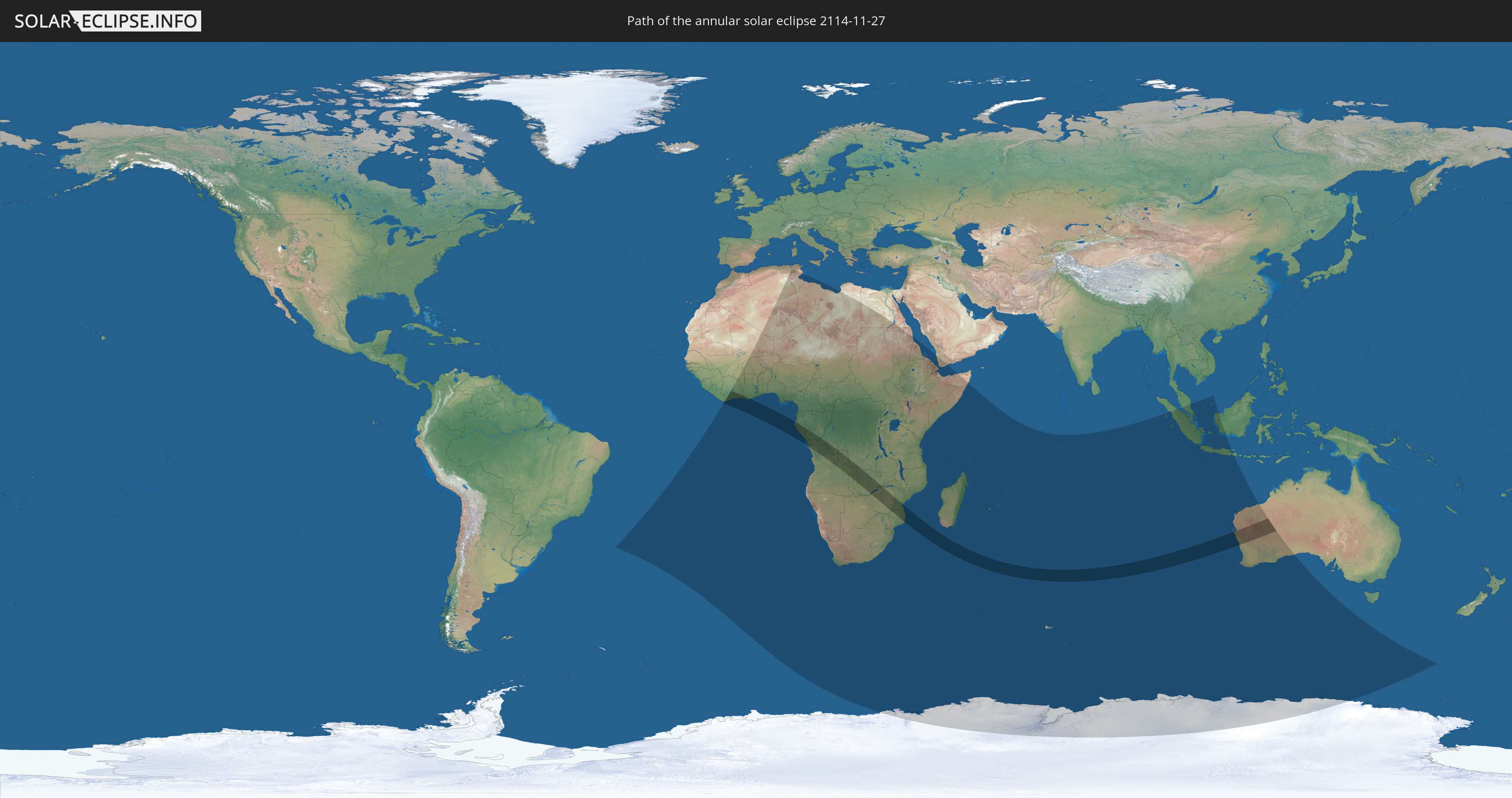
Die Sonnenfinsternis am 11/27/2114 kann man in 60 Ländern als partielle Sonnenfinsternis beobachten.
Der Finsternispfad verläuft durch 14 Länder. Nur in diesen Ländern ist sie als annular Sonnenfinsternis zu sehen.
In den folgenden Ländern ist die Sonnenfinsternis annular zu sehen
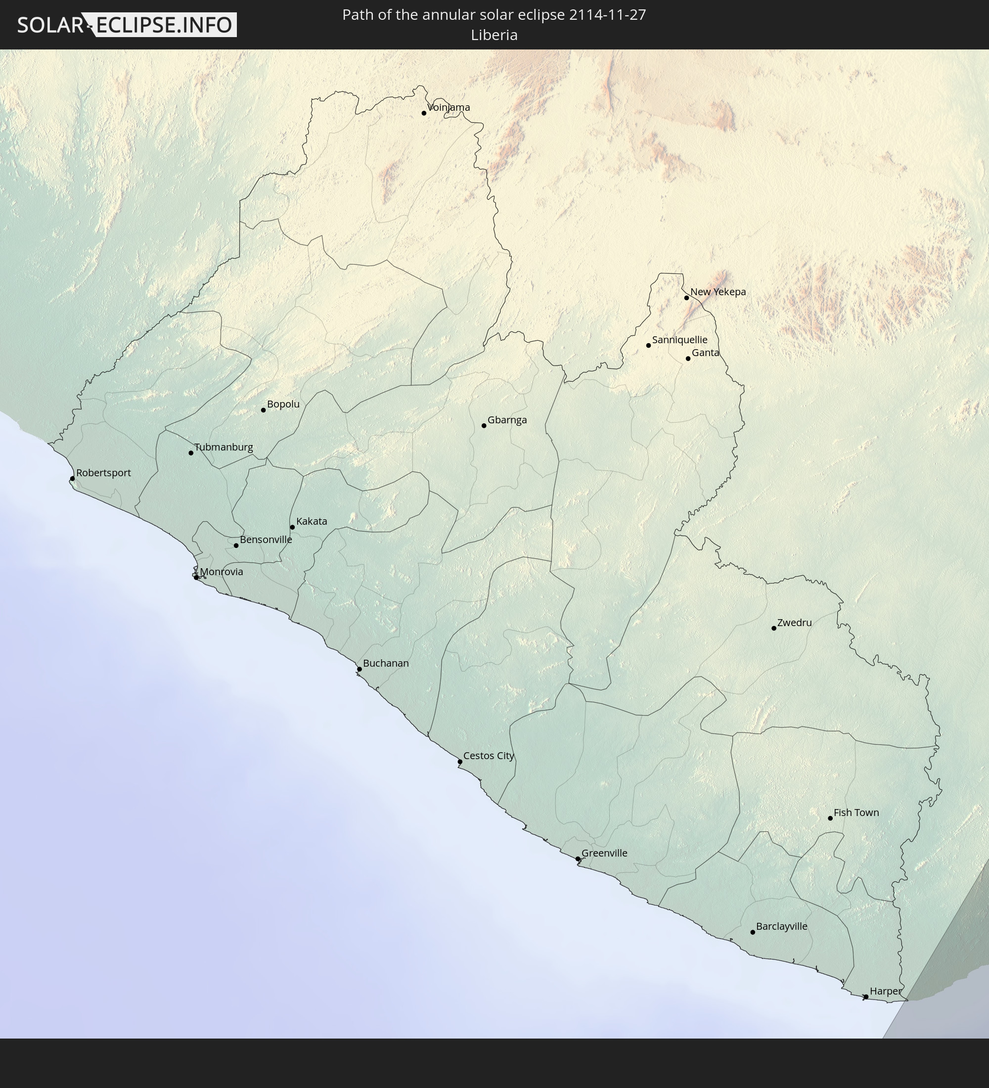 Liberia
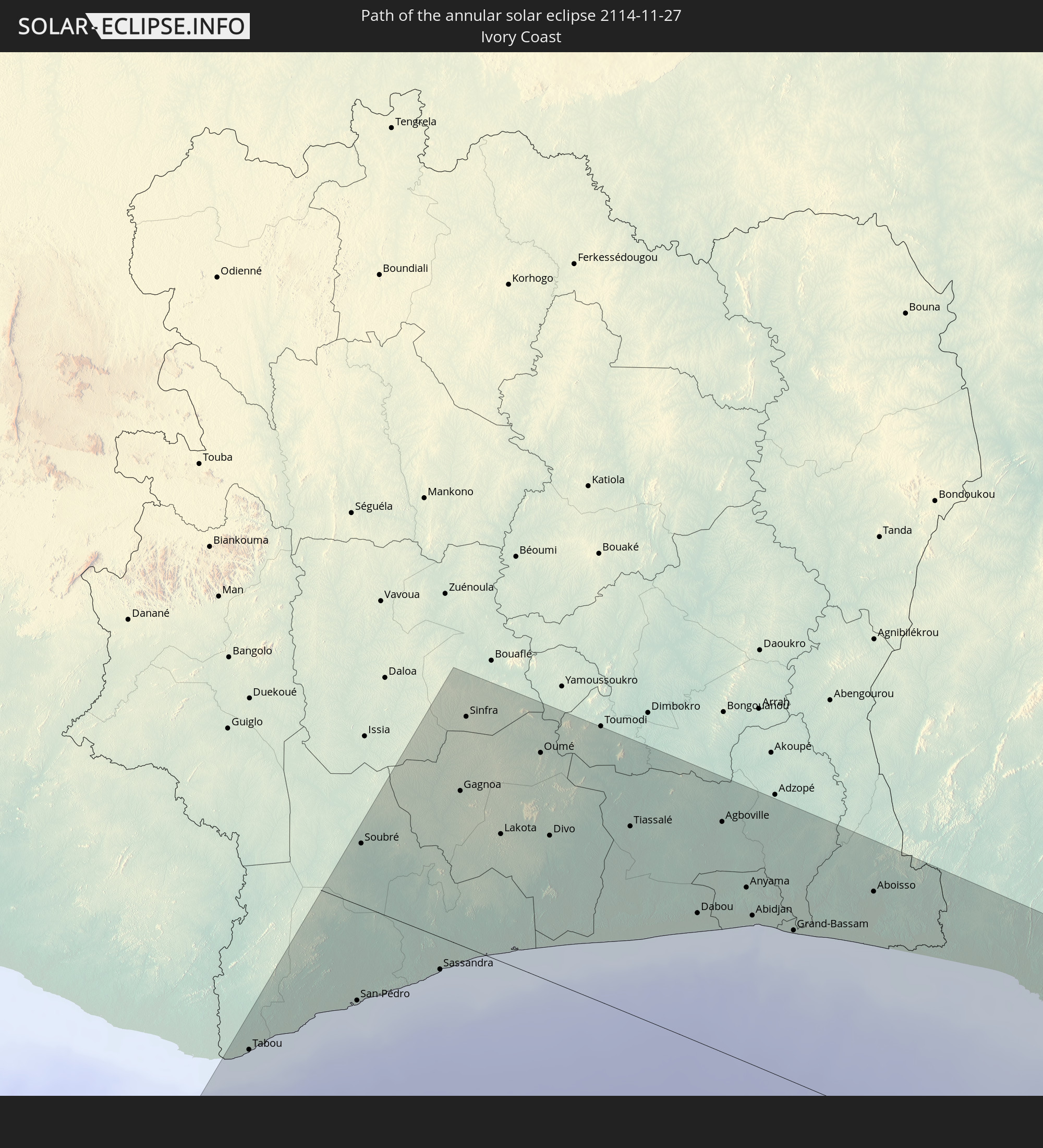 Ivory Coast
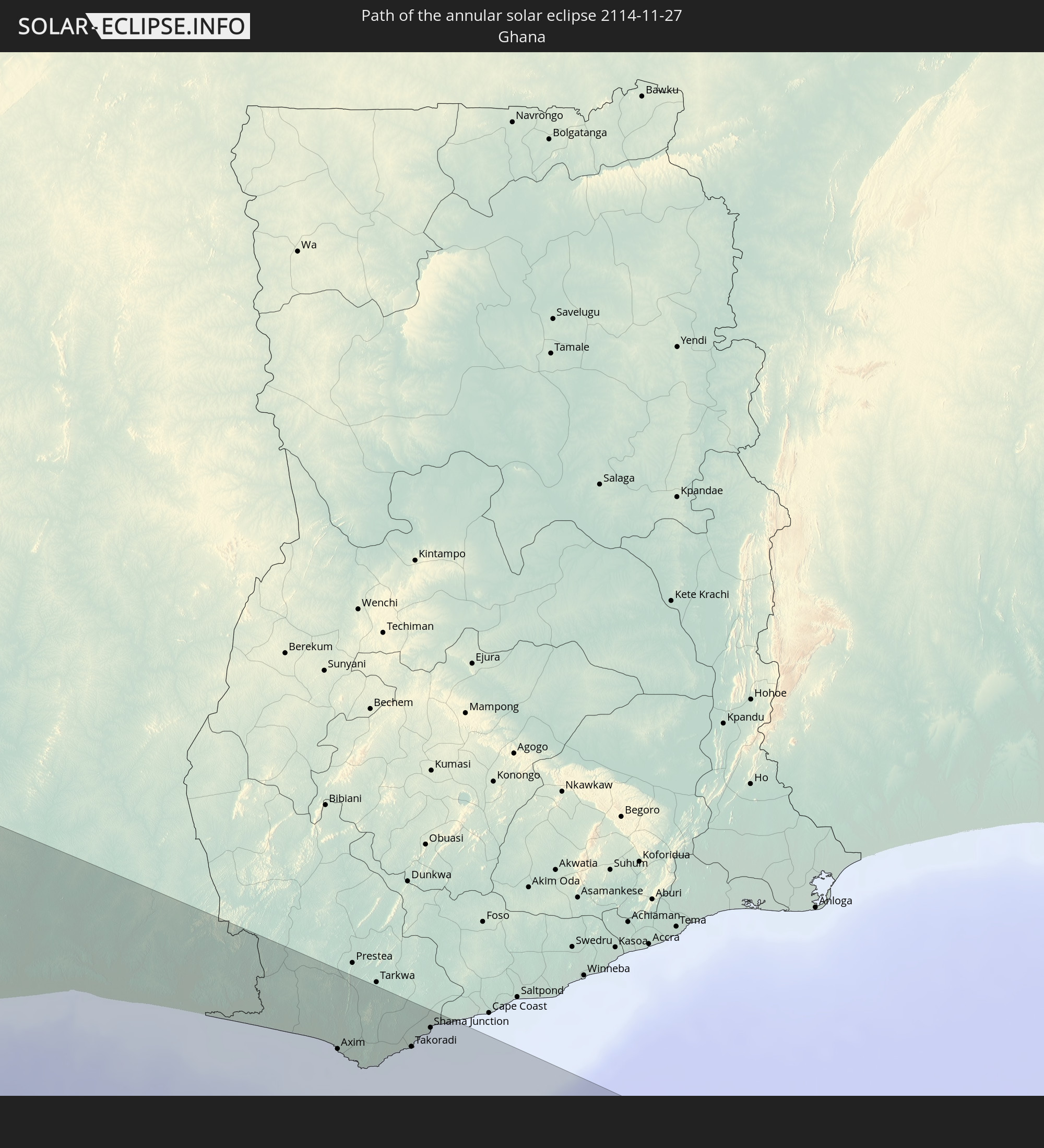 Ghana
Ghana
 Equatorial Guinea
 São Tomé and Príncipe
 Gabon
Gabon
 Republic of the Congo
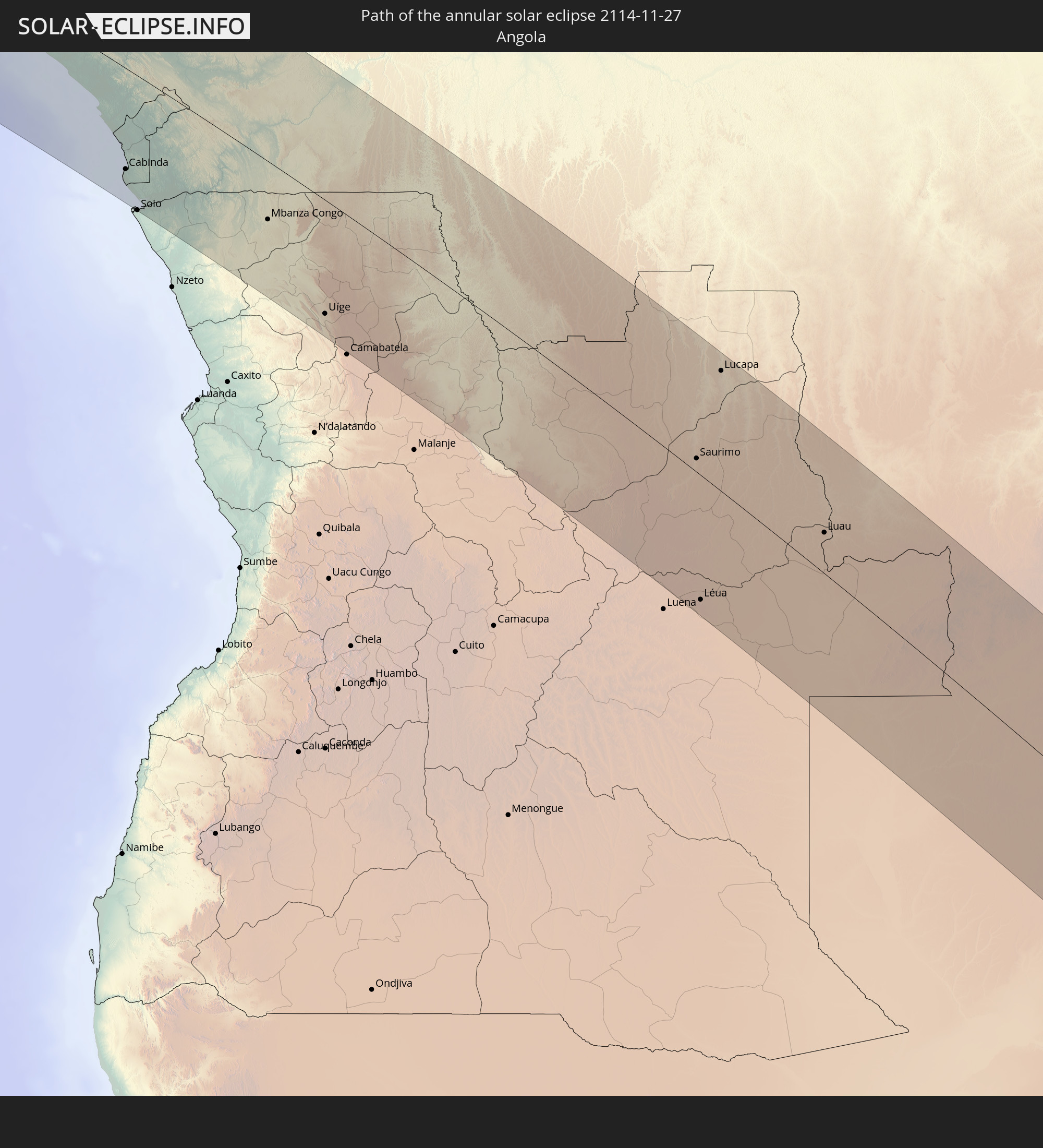 Angola
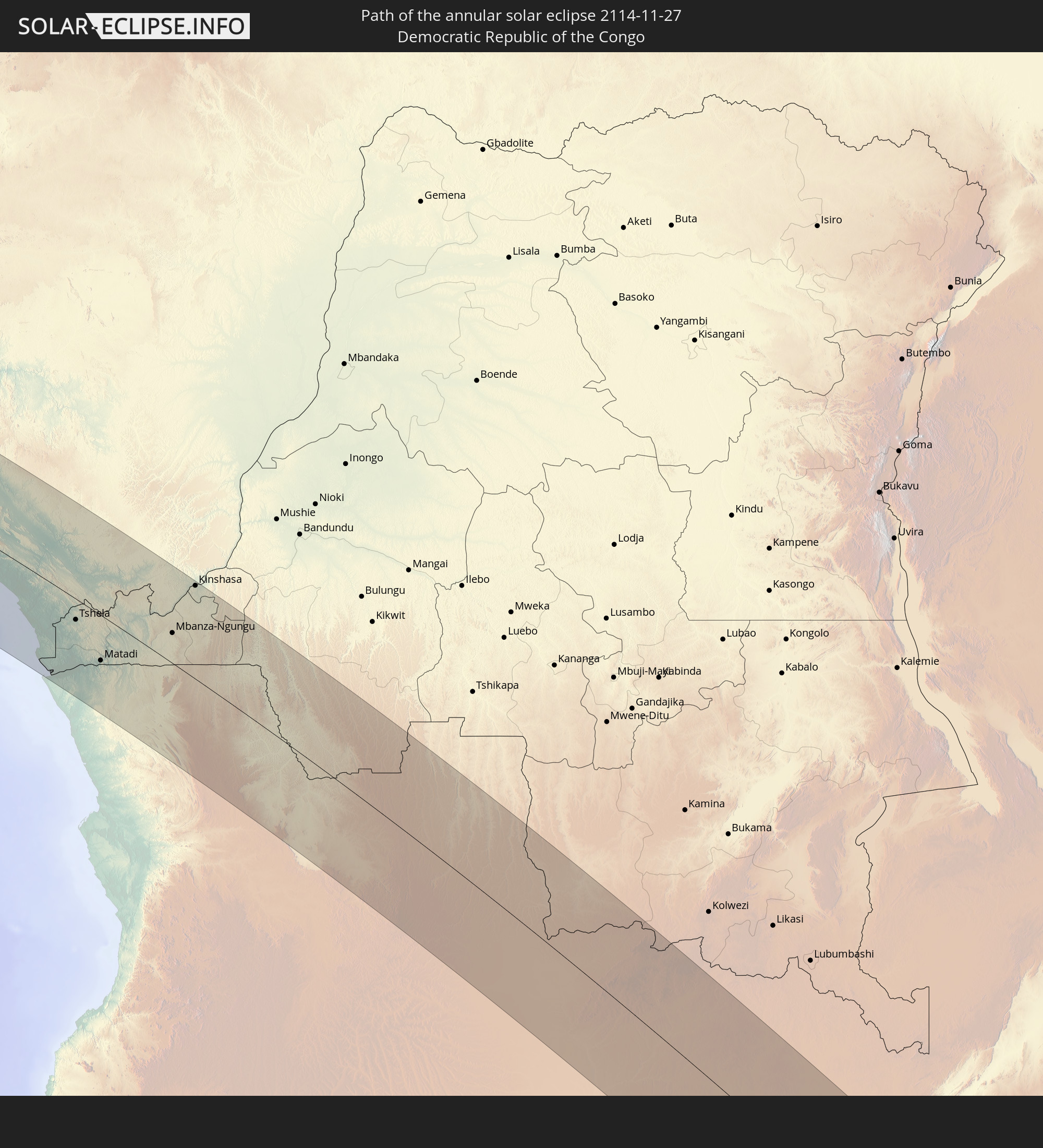 Democratic Republic of the Congo
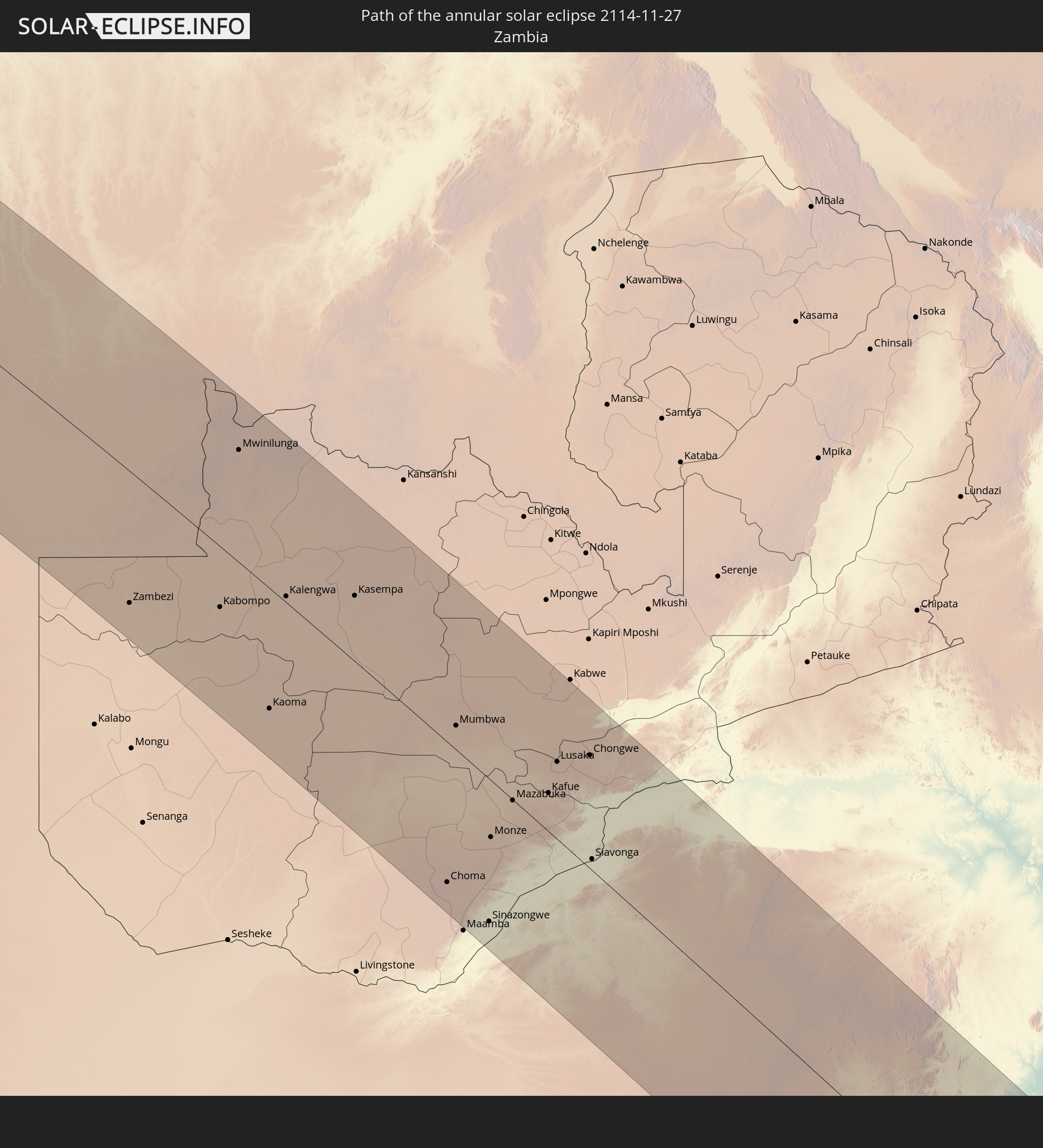 Zambia
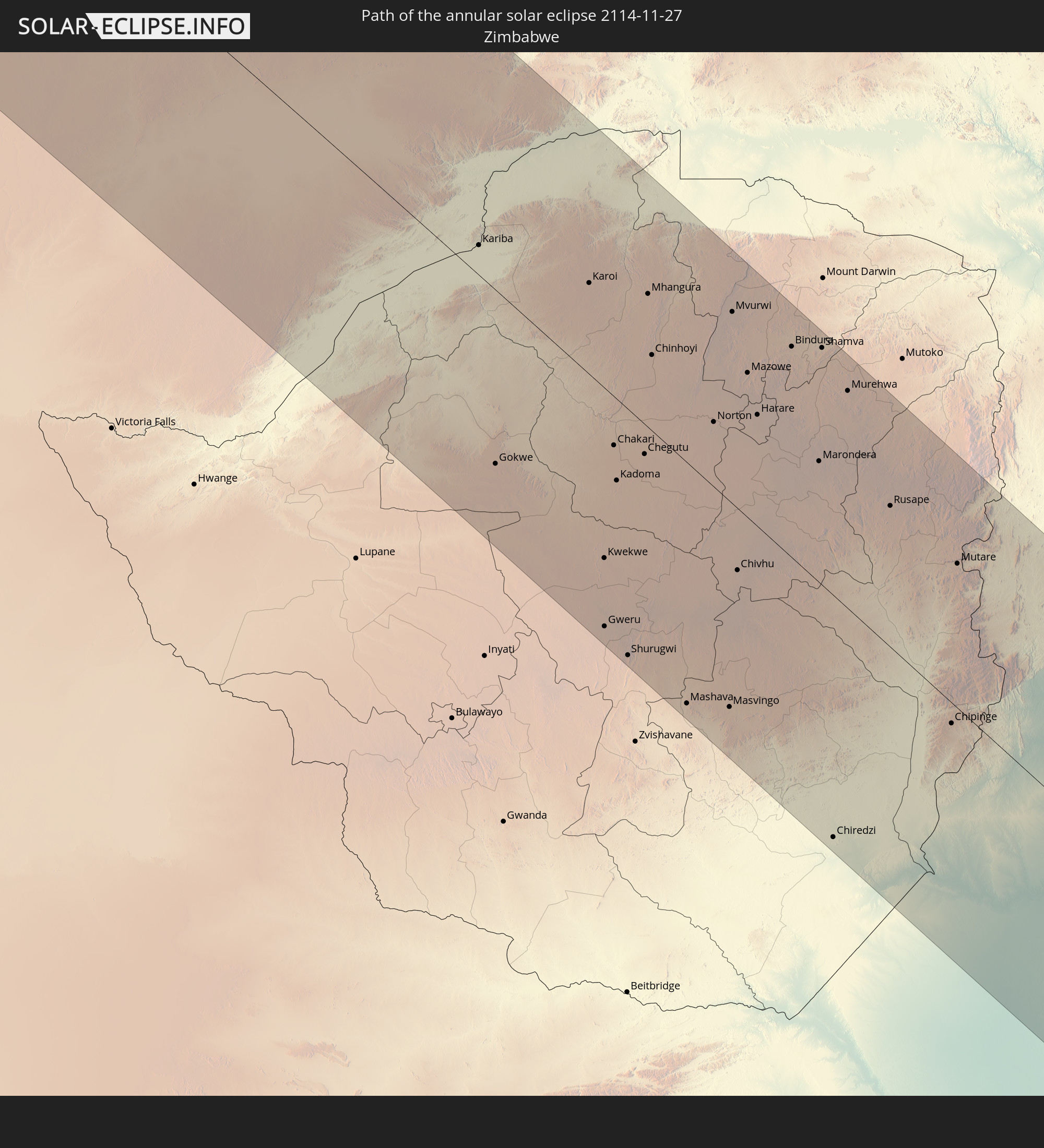 Zimbabwe
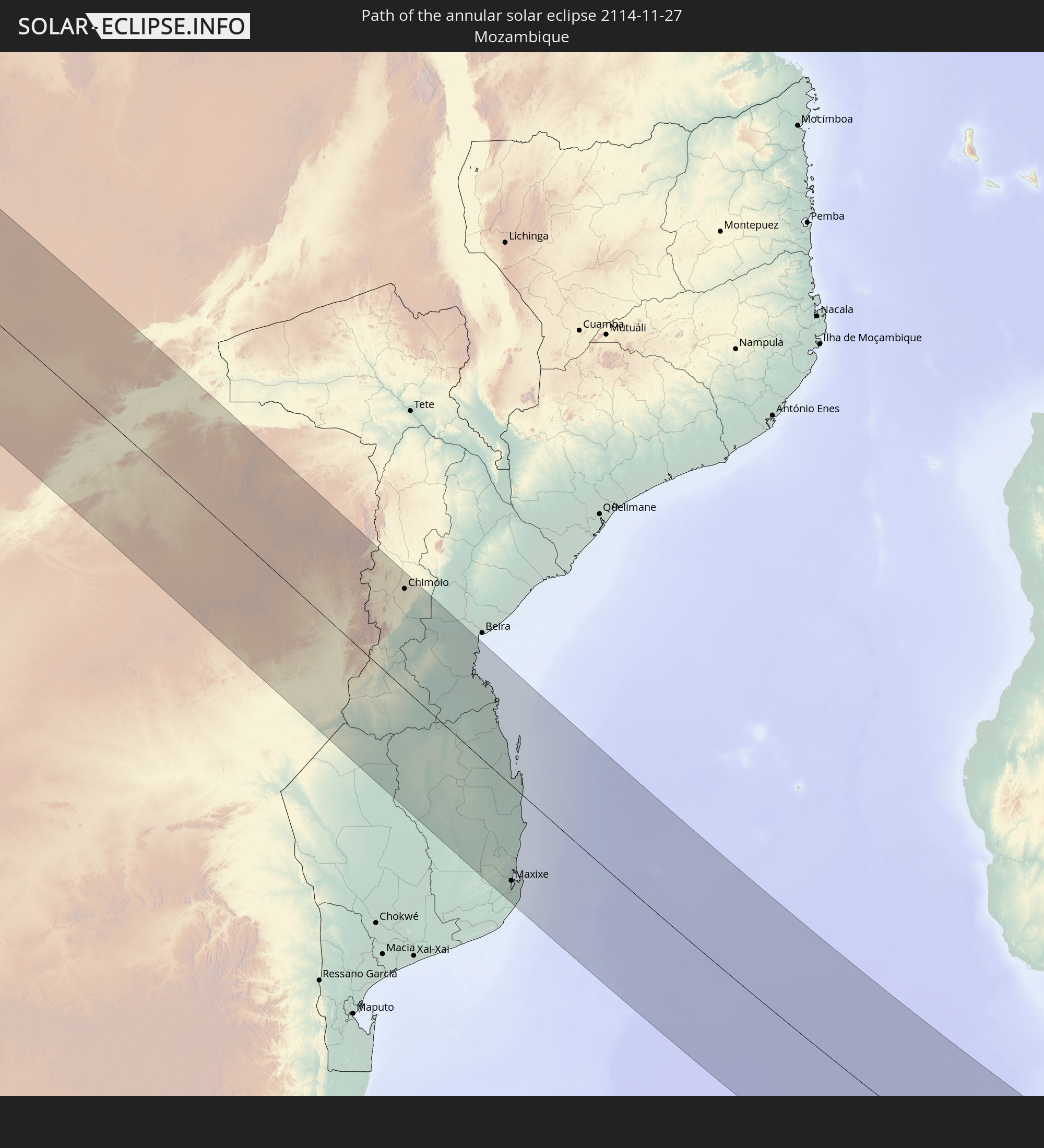 Mozambique
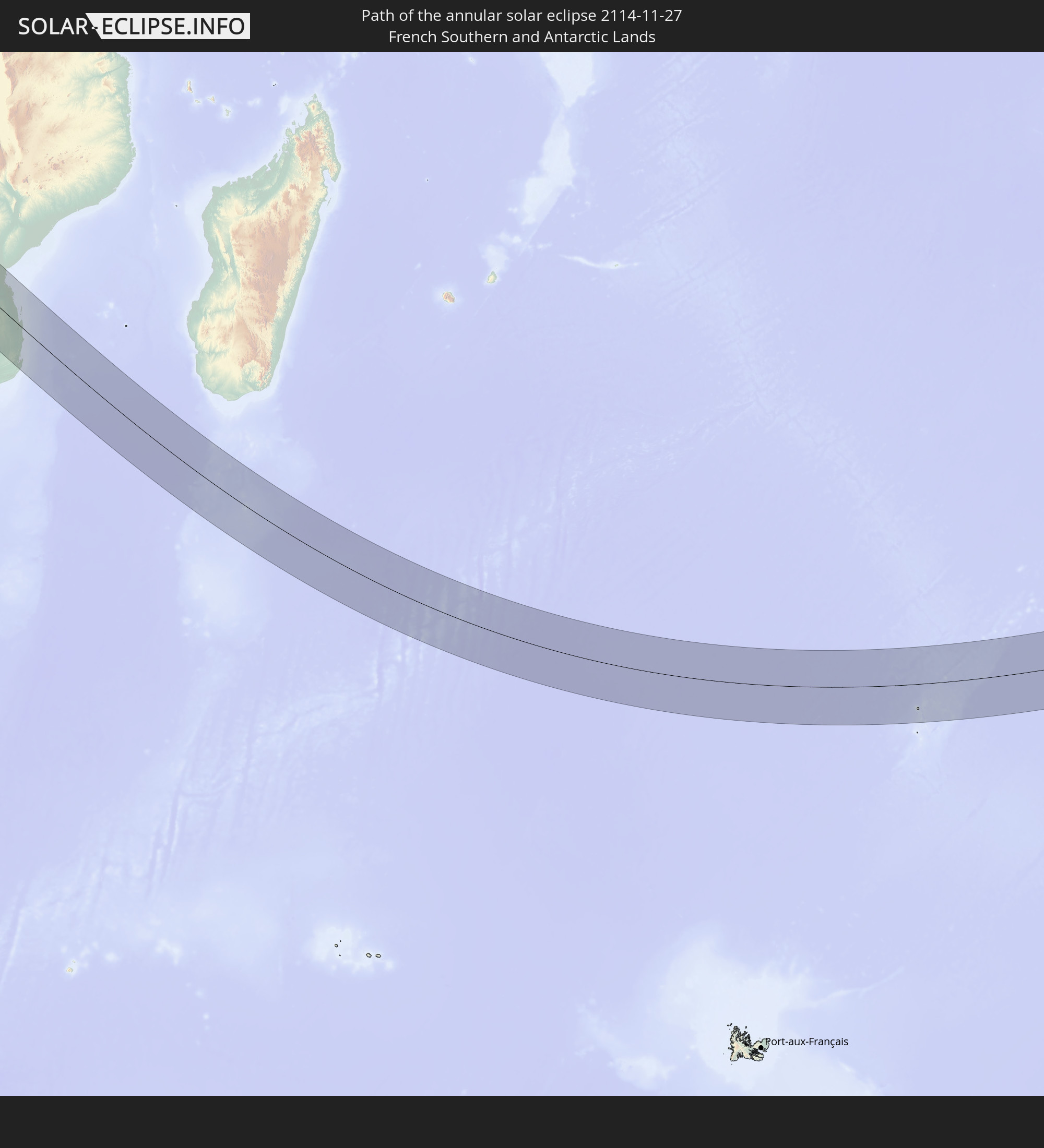 French Southern and Antarctic Lands
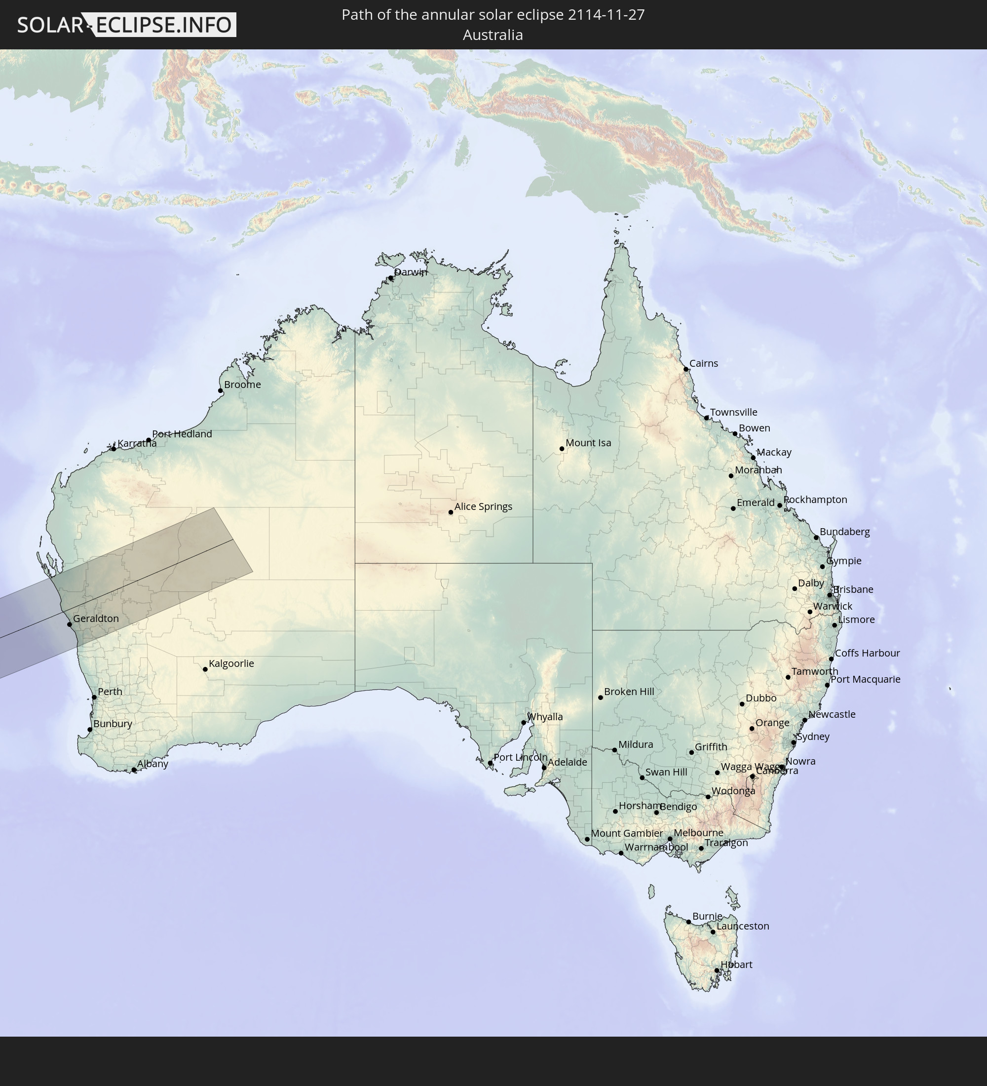 Australia
In den folgenden Ländern ist die Sonnenfinsternis partiell zu sehen
 Antarctica
 Saint Helena, Ascension and Tristan da Cunha
 Mali
Mali
 Liberia
 Algeria
 Ivory Coast
 Burkina Faso
 Ghana
Ghana
 Togo
Togo
 Niger
Niger
 Benin
Benin
 Nigeria
 Bouvet Island
 Equatorial Guinea
 São Tomé and Príncipe
 Tunisia
 Cameroon
 Gabon
Gabon
 Libya
Libya
 Republic of the Congo
 Angola
 Namibia
 Democratic Republic of the Congo
 Chad
Chad
 Central African Republic
 South Africa
 Botswana
 Sudan
Sudan
 Zambia
 Egypt
Egypt
 Zimbabwe
 Lesotho
 Rwanda
 Burundi
 Tanzania
 Uganda
 Mozambique
 Swaziland
 Malawi
 Ethiopia
 Kenya
Kenya
 Eritrea
 French Southern and Antarctic Lands
 Somalia
 Djibouti
 Yemen
Yemen
 Madagascar
 Comoros
 Mayotte
 Seychelles
 Réunion
 Mauritius
 British Indian Ocean Territory
 Heard Island and McDonald Islands
 Indonesia
 Cocos Islands
 Malaysia
 Singapore
 Christmas Island
 Australia
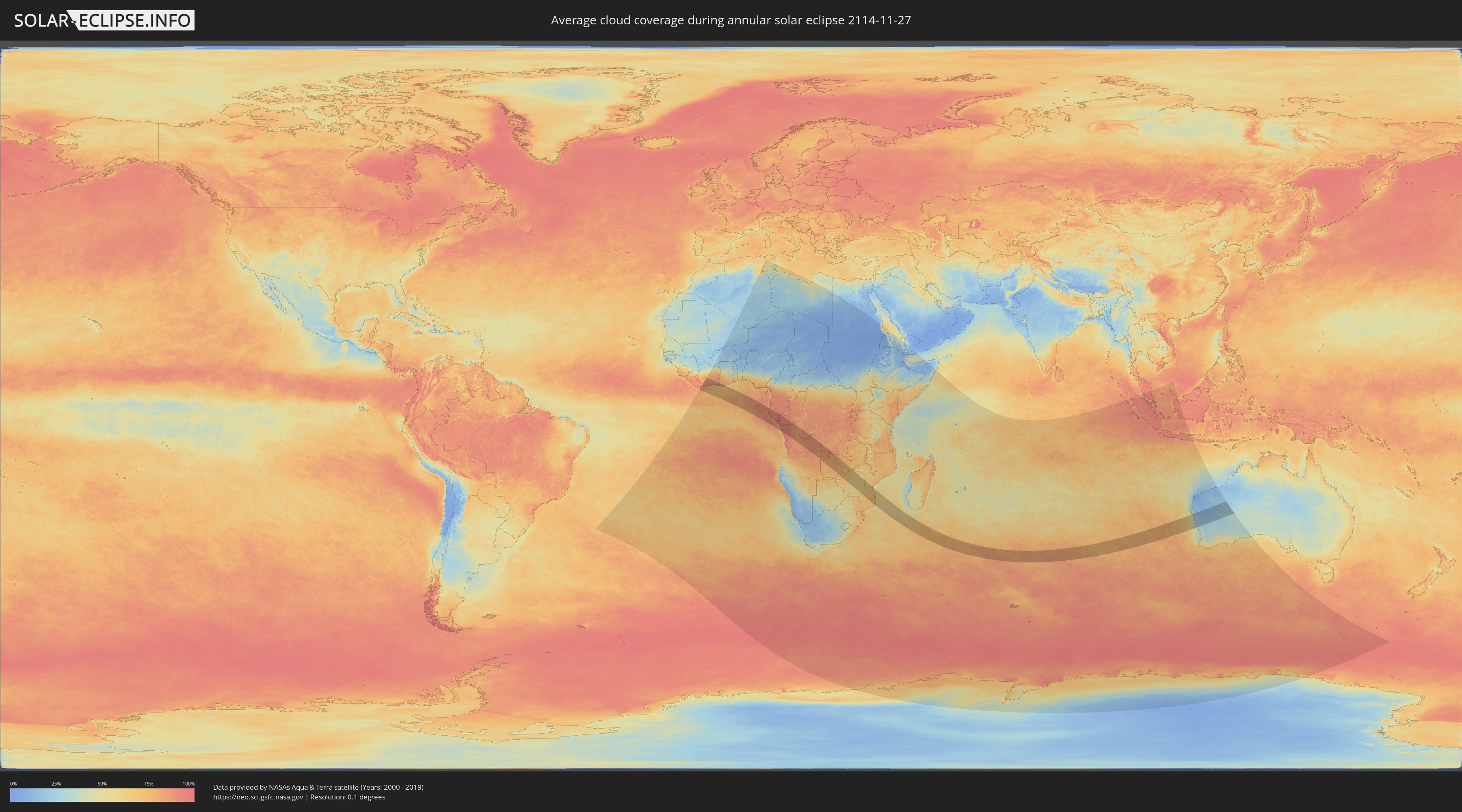
How will be the weather during the annular solar eclipse on 11/27/2114?
Where is the best place to see the annular solar eclipse of 11/27/2114?
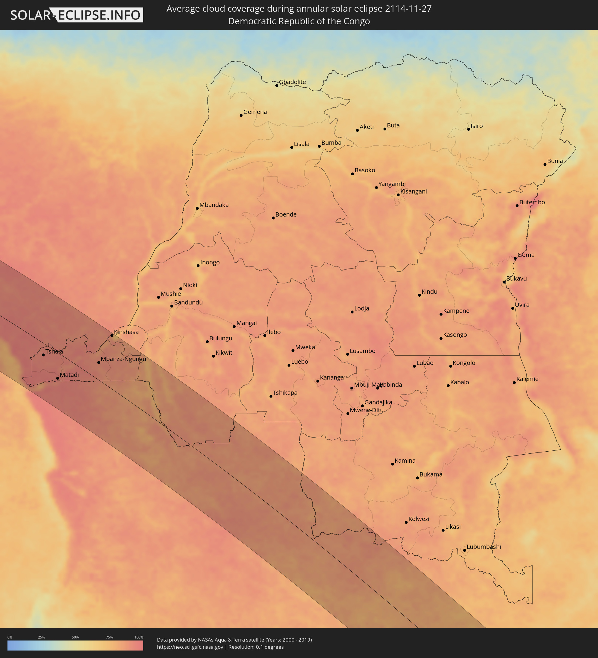
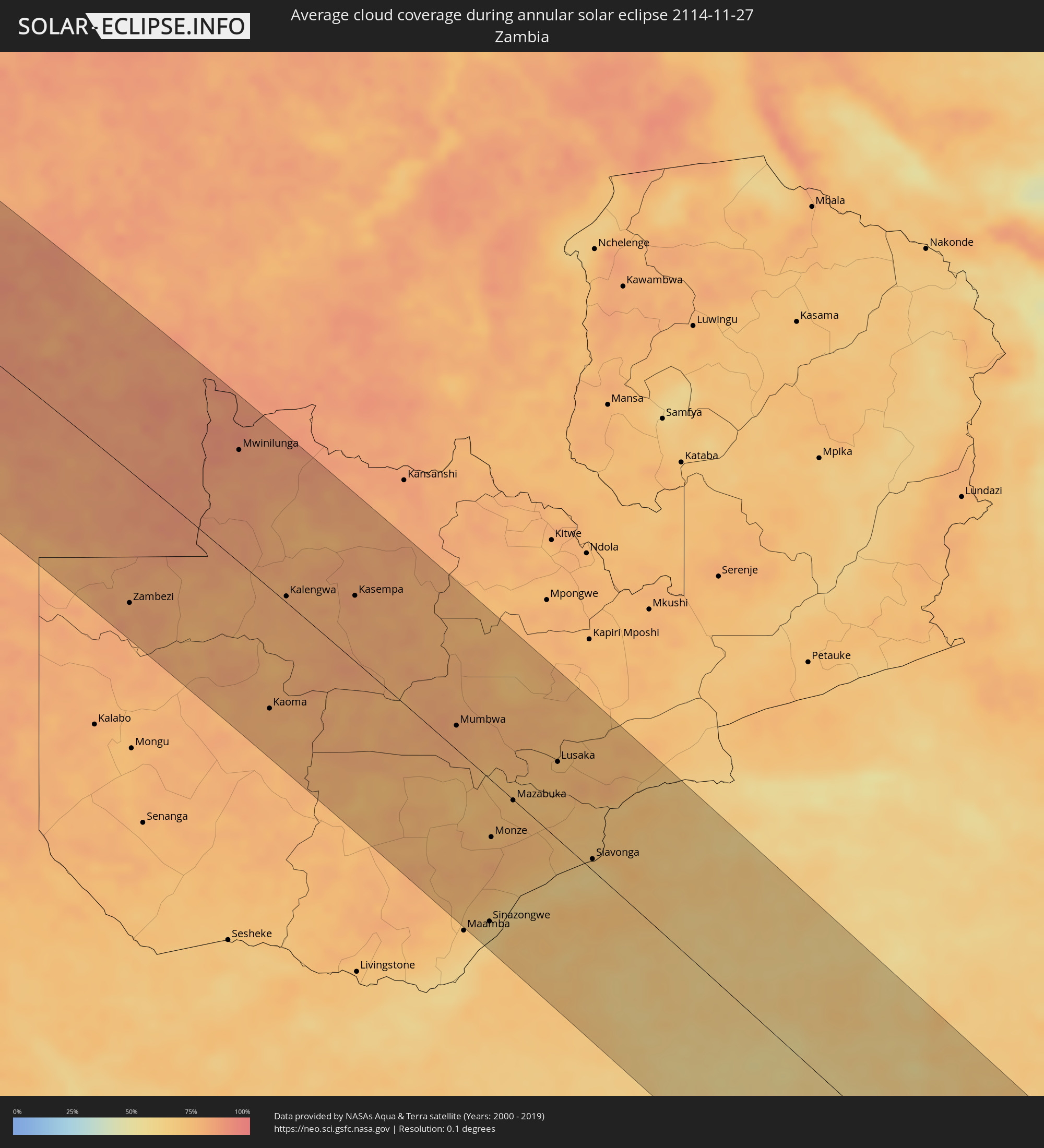
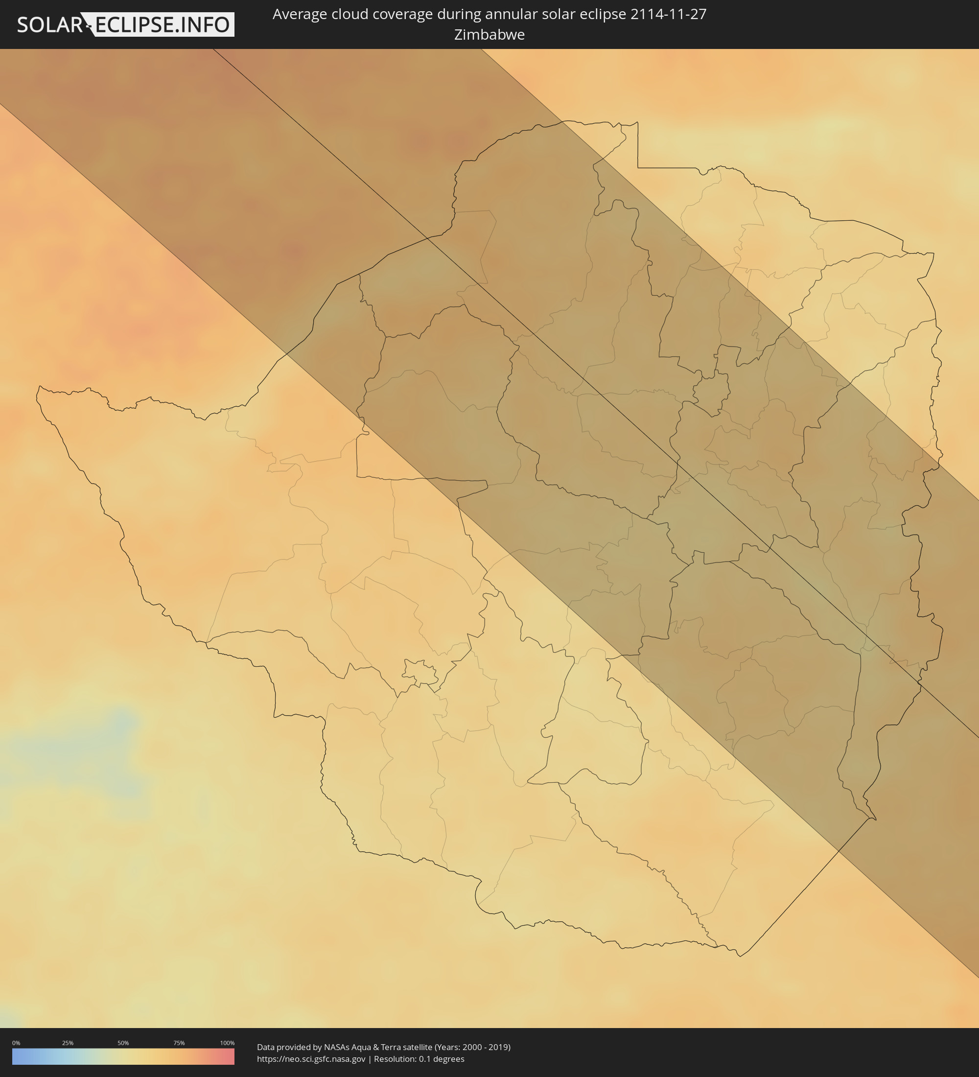
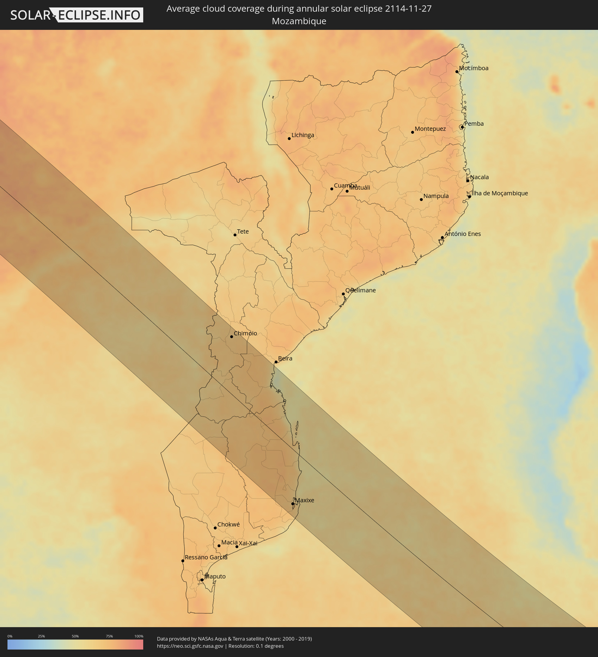
The following maps show the average cloud coverage for the day of the annular solar eclipse.
With the help of these maps, it is possible to find the place along the eclipse path, which has the best
chance of a cloudless sky.
Nevertheless, you should consider local circumstances and inform about the weather of your chosen
observation site.
The data is provided by NASAs satellites
AQUA and TERRA.
The cloud maps are averaged over a period of 19 years (2000 - 2019).

Detailed country maps
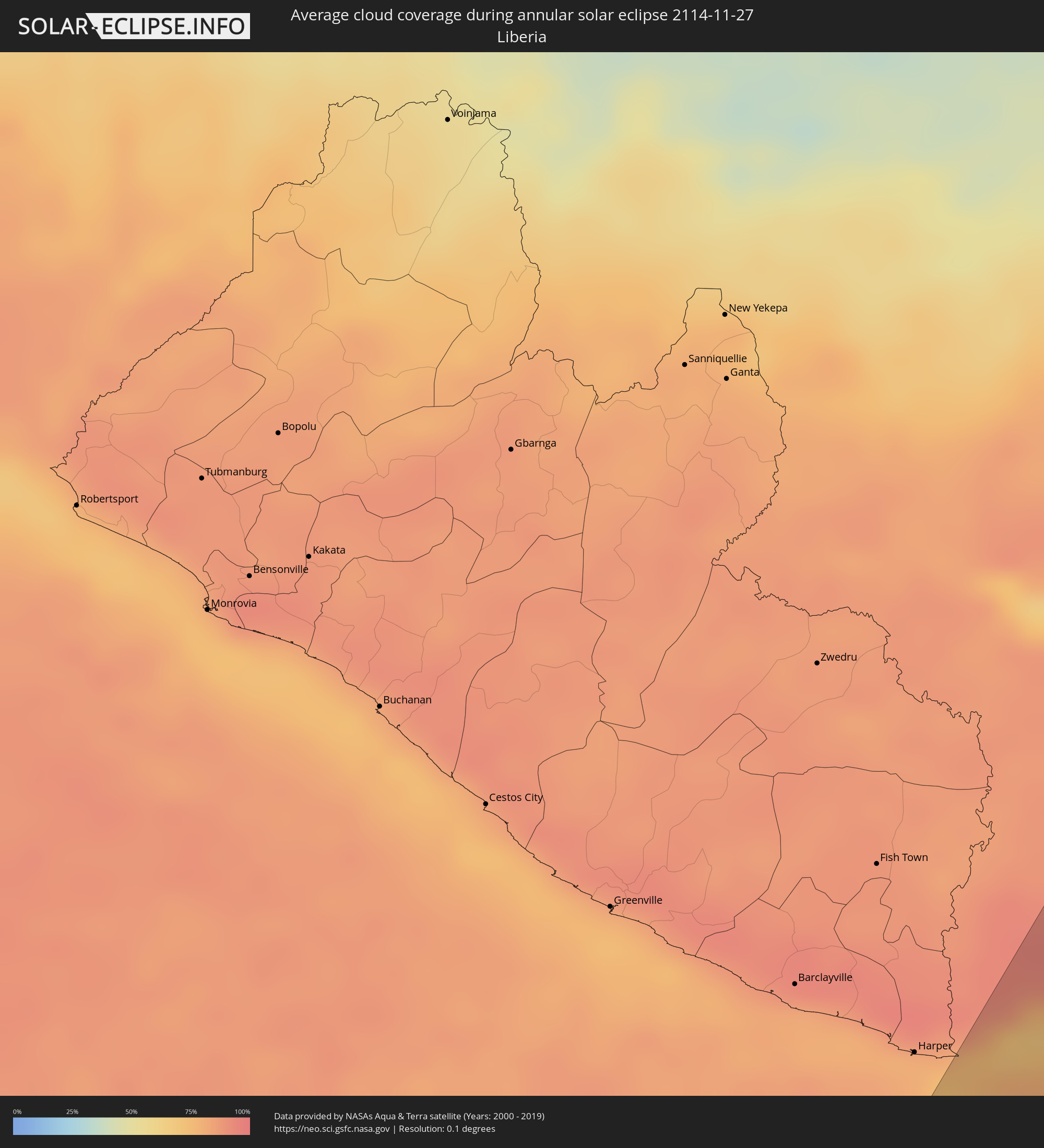 Liberia
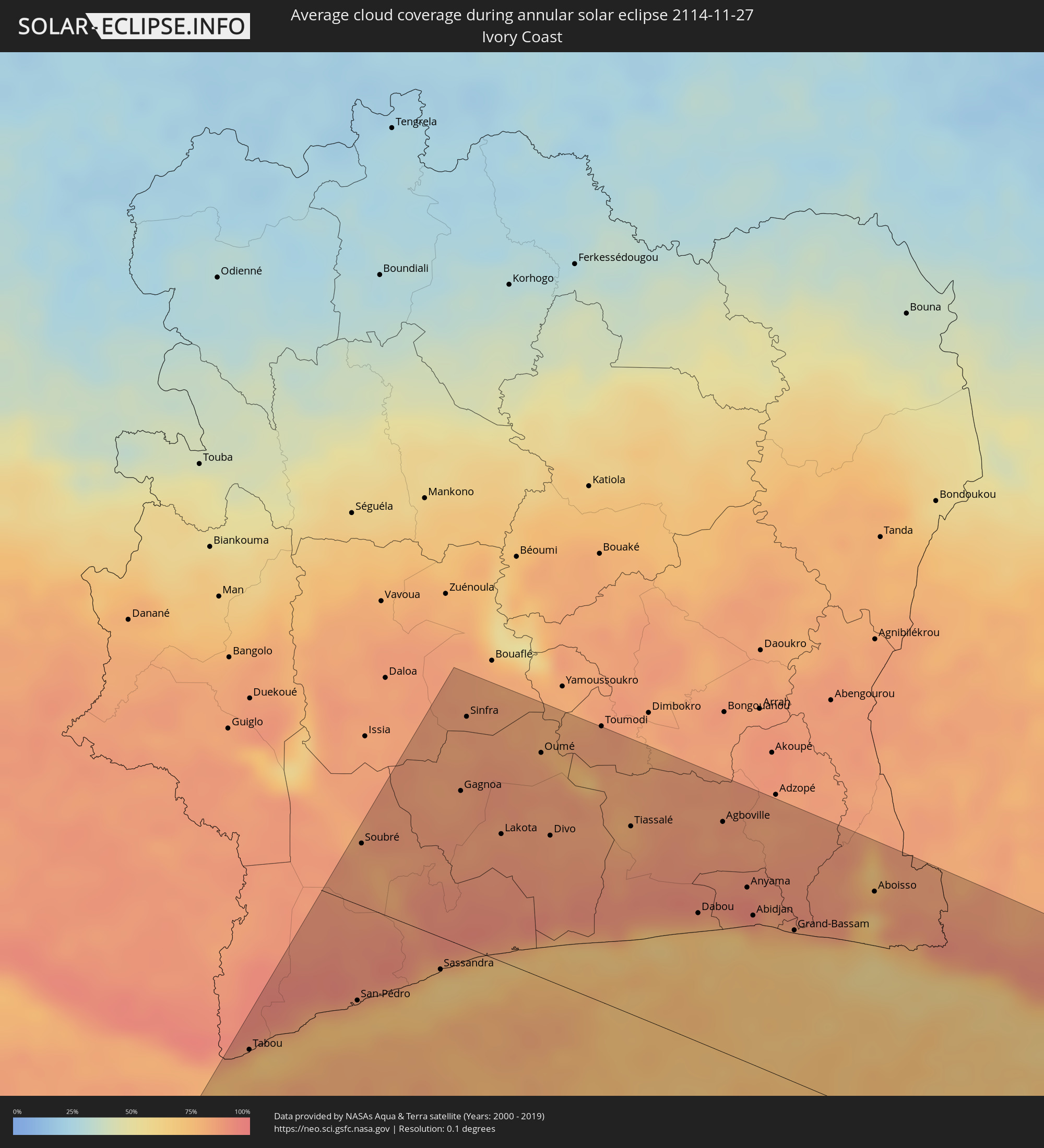 Ivory Coast
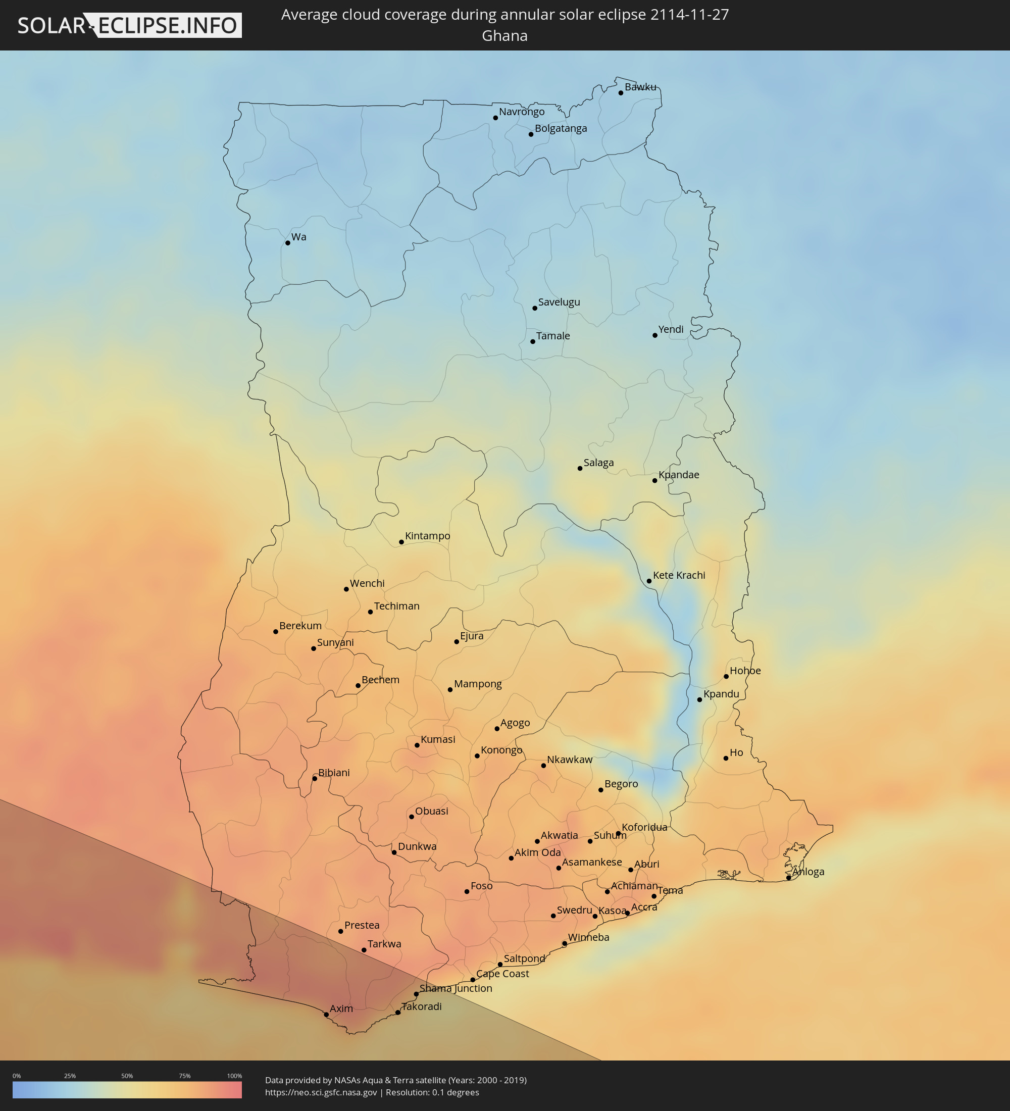 Ghana
Ghana
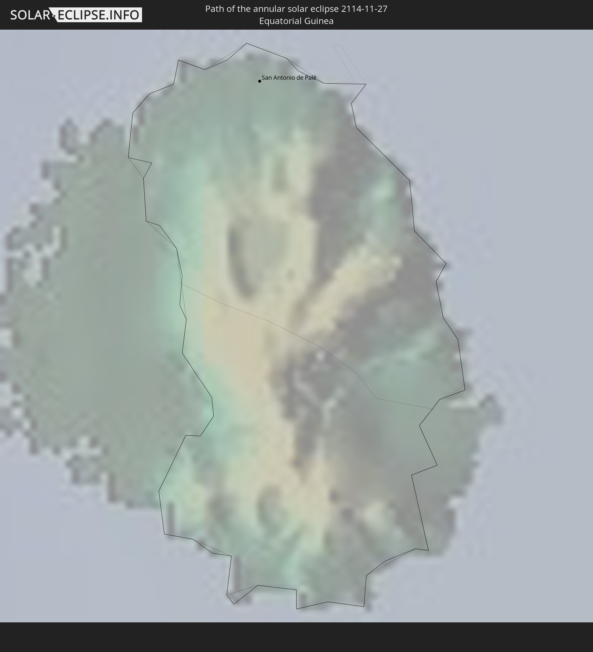
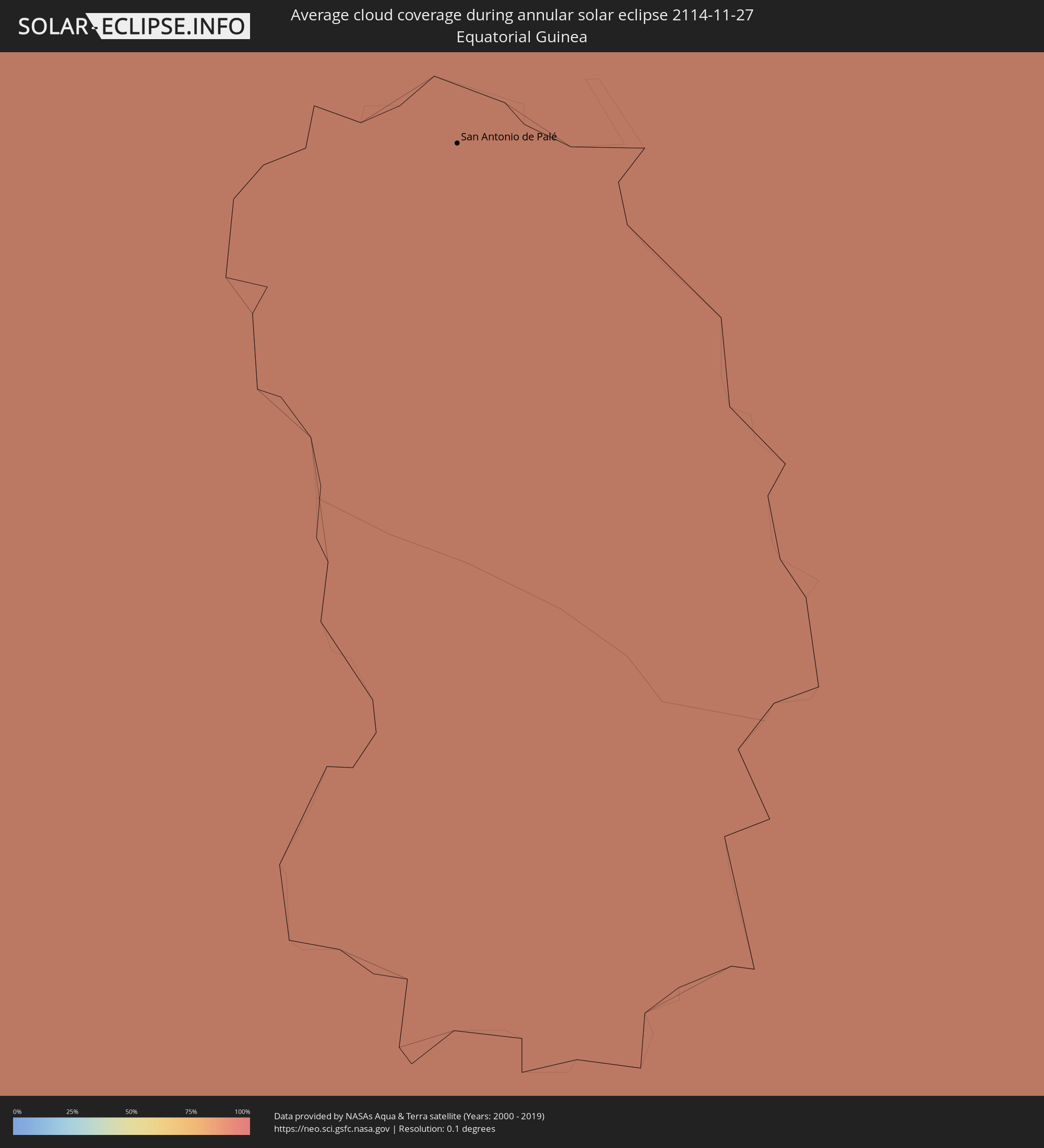 Equatorial Guinea
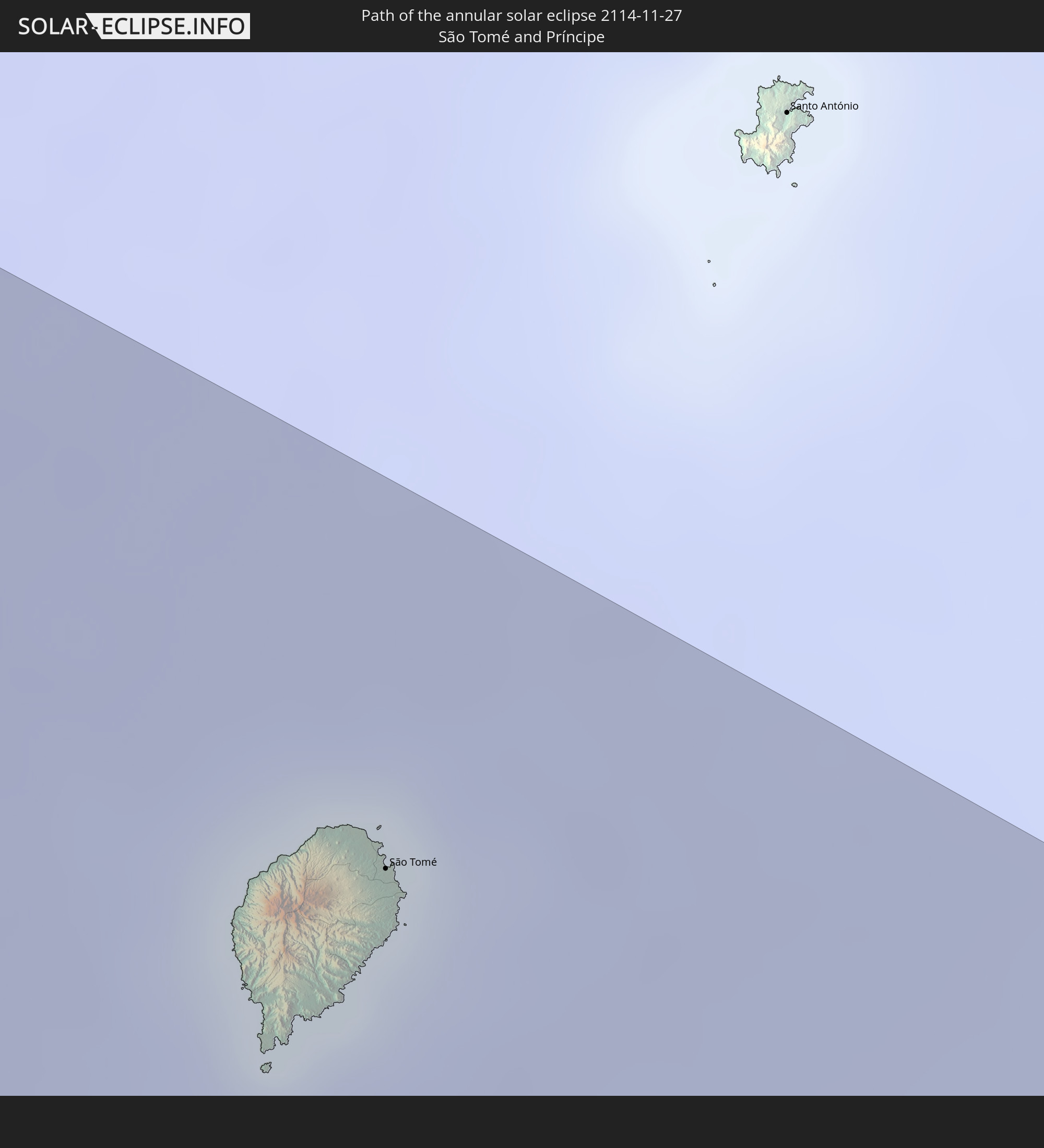
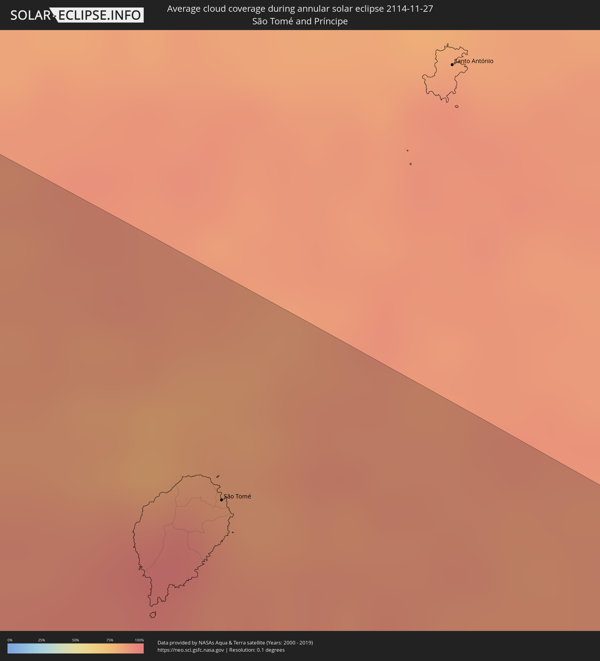 São Tomé and Príncipe
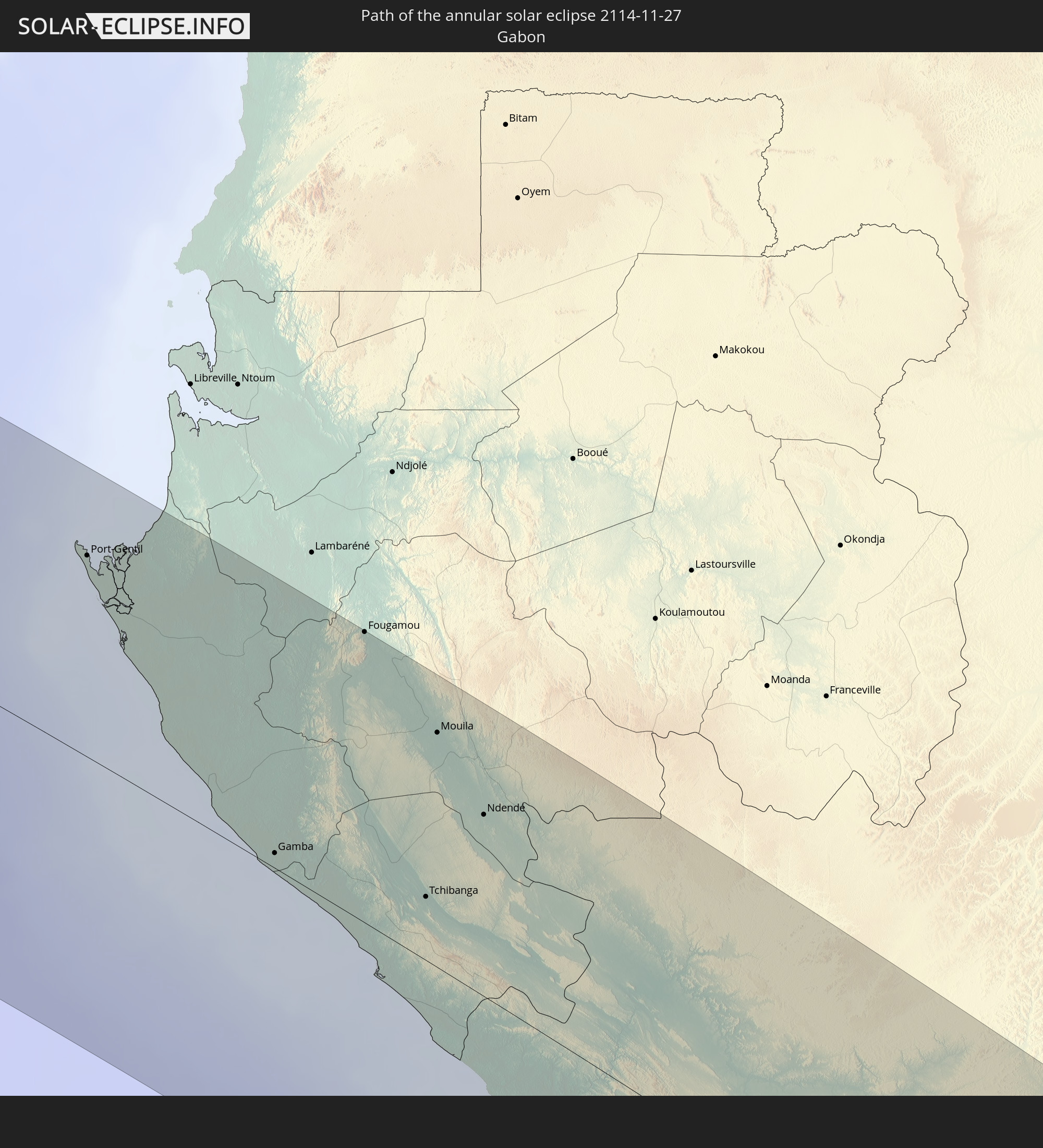
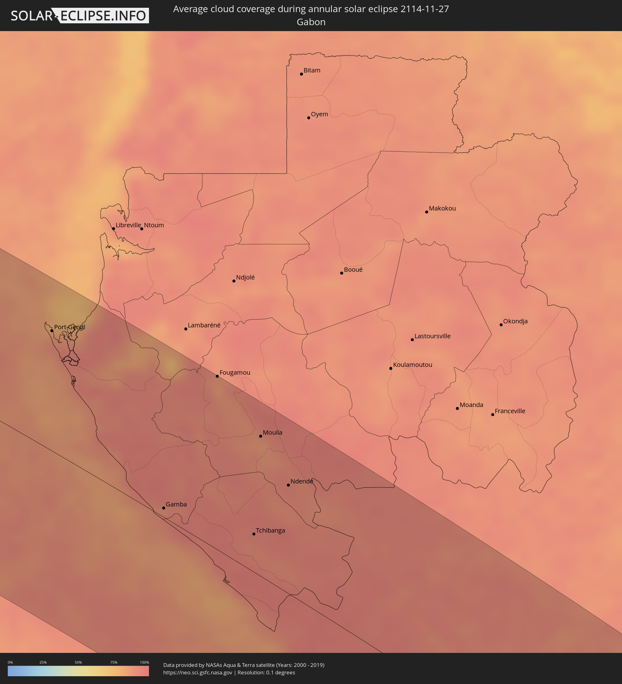 Gabon
Gabon
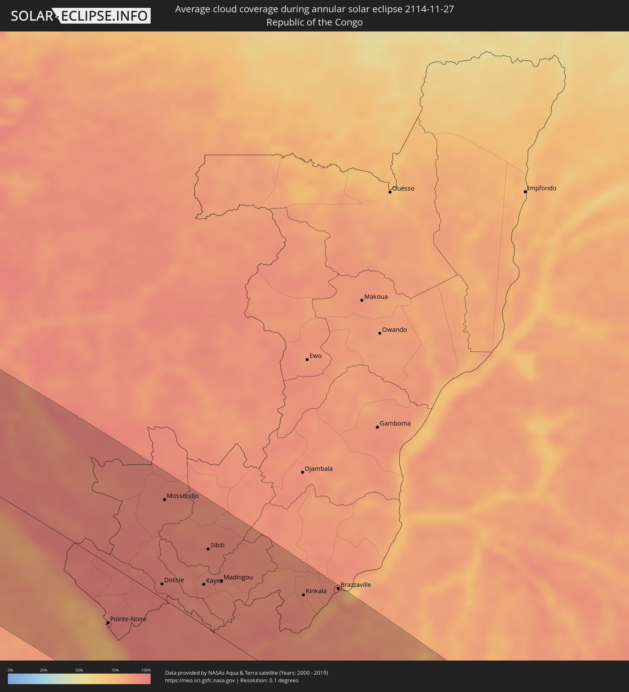 Republic of the Congo
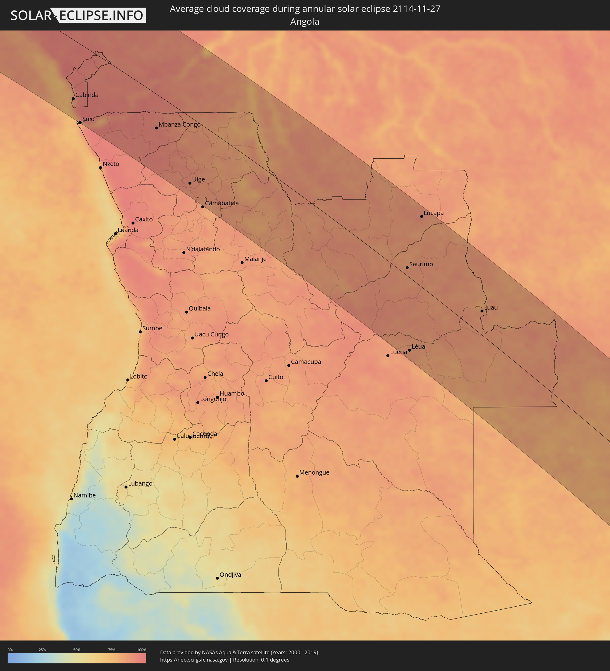 Angola
 Democratic Republic of the Congo
 Zambia
 Zimbabwe
 Mozambique
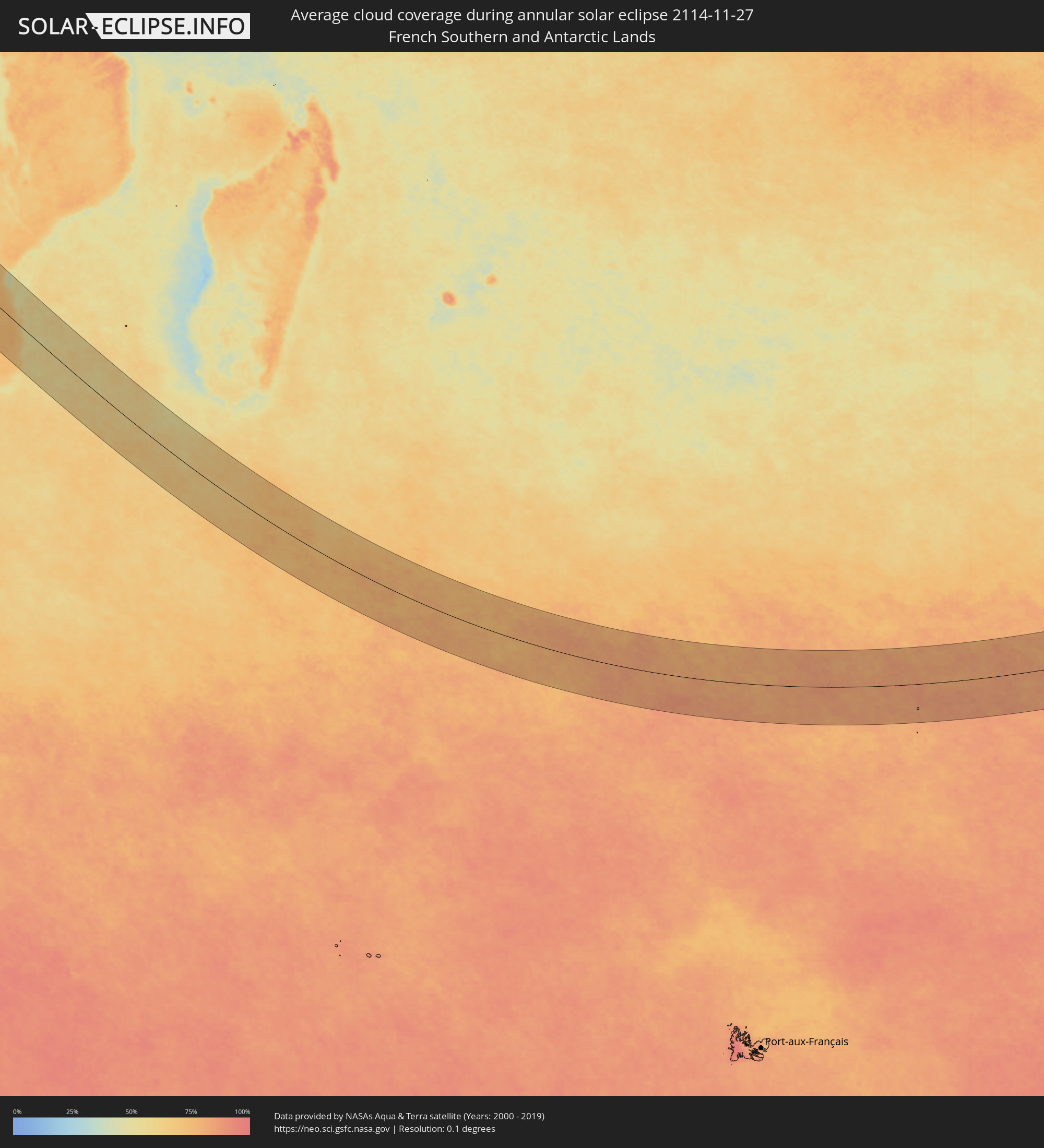 French Southern and Antarctic Lands
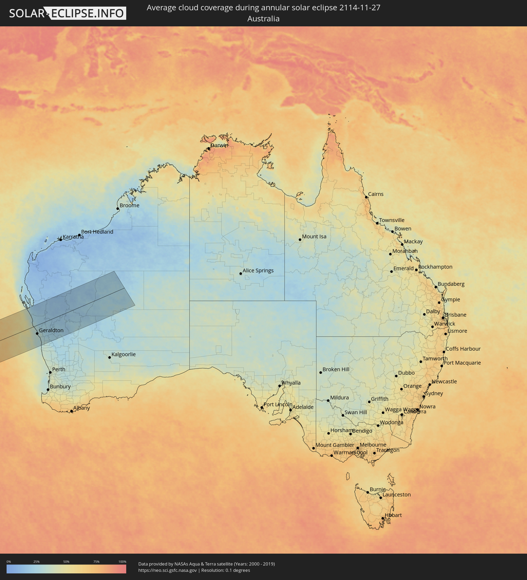 Australia
Cities inside the path of the eclipse
The following table shows all locations with a population of more than 5,000 inside the eclipse path. Cities which have more than 100,000 inhabitants are marked bold. A click at the locations opens a detailed map.
| City | Type | Eclipse duration | Local time of max. eclipse | Distance to central line | Ø Cloud coverage |
|
Tabou, Bas-Sassandra
|
annular | - | 06:24:04 UTC+00:00 | 129 km | 74% |
|
San-Pédro, Bas-Sassandra
|
annular | - | 06:23:41 UTC+00:00 | 66 km | 72% |
|
Soubré, Bas-Sassandra
|
annular | - | 06:23:00 UTC+00:00 | 43 km | 82% |
|
Sassandra, Bas-Sassandra
|
annular | - | 06:23:25 UTC+00:00 | 22 km | 67% |
|
Gagnoa, Gôh-Djiboua
|
annular | - | 06:22:37 UTC+00:00 | 105 km | 84% |
|
Sinfra, Zanzan
|
annular | - | 06:22:19 UTC+00:00 | 158 km | 85% |
|
Lakota, Gôh-Djiboua
|
annular | - | 06:22:44 UTC+00:00 | 87 km | 88% |
|
Oumé, Gôh-Djiboua
|
annular | - | 06:22:21 UTC+00:00 | 153 km | 83% |
|
Divo, Gôh-Djiboua
|
annular | - | 06:22:40 UTC+00:00 | 99 km | 86% |
|
Tiassalé, Lagunes
|
annular | - | 06:22:31 UTC+00:00 | 128 km | 81% |
|
Dabou, Lagunes
|
annular | - | 06:22:49 UTC+00:00 | 87 km | 72% |
|
Agboville, Lagunes
|
annular | - | 06:22:23 UTC+00:00 | 156 km | 86% |
|
Anyama, Abidjan
|
annular | - | 06:22:38 UTC+00:00 | 119 km | 93% |
|
Abidjan, Abidjan
|
annular | - | 06:22:45 UTC+00:00 | 101 km | 79% |
|
Bingerville, Abidjan
|
annular | - | 06:22:42 UTC+00:00 | 111 km | 84% |
|
Grand-Bassam, Comoé
|
annular | - | 06:22:46 UTC+00:00 | 103 km | 70% |
|
Bonoua
|
annular | - | 06:22:42 UTC+00:00 | 115 km | 84% |
|
Adiaké, Comoé
|
annular | - | 06:22:39 UTC+00:00 | 129 km | 74% |
|
Aboisso, Comoé
|
annular | - | 06:22:31 UTC+00:00 | 152 km | 79% |
|
Axim, Western
|
annular | - | 06:22:47 UTC+00:00 | 133 km | 78% |
|
Takoradi, Western
|
annular | - | 06:22:43 UTC+00:00 | 156 km | 60% |
|
Sekondi-Takoradi, Western
|
annular | - | 06:22:40 UTC+00:00 | 163 km | 58% |
|
Shama Junction, Western
|
annular | - | 06:22:36 UTC+00:00 | 174 km | 54% |
|
San Antonio de Palé, Annobón Province
|
annular | - | 07:28:22 UTC+01:00 | 112 km | 88% |
|
São Tomé, São Tomé Island
|
annular | - | 06:26:45 UTC+00:00 | 117 km | 90% |
|
Port-Gentil, Ogooué-Maritime
|
annular | - | 07:28:17 UTC+01:00 | 126 km | 91% |
|
Gamba, Ogooué-Maritime
|
annular | - | 07:30:48 UTC+01:00 | 9 km | 90% |
|
Fougamou, Ngouni
|
annular | - | 07:29:19 UTC+01:00 | 180 km | 85% |
|
Tchibanga, Nyanga
|
annular | - | 07:31:28 UTC+01:00 | 39 km | 92% |
|
Mouila, Ngouni
|
annular | - | 07:30:14 UTC+01:00 | 144 km | 86% |
|
Ndendé, Ngouni
|
annular | - | 07:30:57 UTC+01:00 | 111 km | 91% |
|
Loango, Kouilou
|
annular | - | 07:33:55 UTC+01:00 | 74 km | 84% |
|
Loandjili, Pointe-Noire
|
annular | - | 07:34:04 UTC+01:00 | 81 km | 90% |
|
Pointe-Noire, Pointe-Noire
|
annular | - | 07:34:06 UTC+01:00 | 83 km | 90% |
|
Cabinda, Cabinda
|
annular | - | 07:35:16 UTC+01:00 | 135 km | 91% |
|
Soio, Zaire
|
annular | - | 07:36:07 UTC+01:00 | 179 km | 91% |
|
Dolisie, Niari
|
annular | - | 07:33:42 UTC+01:00 | 19 km | 95% |
|
Mossendjo, Niari
|
annular | - | 07:32:08 UTC+01:00 | 139 km | 93% |
|
Tshela, Bas-Congo
|
annular | - | 07:34:52 UTC+01:00 | 38 km | 92% |
|
Kayes, Bouenza
|
annular | - | 07:33:59 UTC+01:00 | 56 km | 94% |
|
Sibiti, Lékoumou
|
annular | - | 07:33:20 UTC+01:00 | 109 km | 92% |
|
Matadi, Bas-Congo
|
annular | - | 07:36:10 UTC+01:00 | 83 km | 90% |
|
Madingou, Bouenza
|
annular | - | 07:34:02 UTC+01:00 | 77 km | 91% |
|
Mbanza Congo, Zaire
|
annular | - | 07:37:13 UTC+01:00 | 77 km | 93% |
|
Kinkala, Pool
|
annular | - | 07:34:54 UTC+01:00 | 132 km | 92% |
|
Mbanza-Ngungu, Bas-Congo
|
annular | - | 07:36:09 UTC+01:00 | 55 km | 87% |
|
Uíge, Uíge
|
annular | - | 07:39:36 UTC+01:00 | 148 km | 89% |
|
Kasangulu, Bas-Congo
|
annular | - | 07:35:24 UTC+01:00 | 136 km | 89% |
|
Brazzaville, Brazzaville
|
annular | - | 07:35:02 UTC+01:00 | 173 km | 88% |
|
Kinshasa, Kinshasa
|
annular | - | 07:35:08 UTC+01:00 | 169 km | 88% |
|
Masina, Kinshasa
|
annular | - | 07:35:15 UTC+01:00 | 169 km | 92% |
|
Kasongo-Lunda, Bandundu
|
annular | - | 07:39:01 UTC+01:00 | 67 km | 76% |
|
Saurimo, Lunda Sul
|
annular | - | 07:46:34 UTC+01:00 | 17 km | 86% |
|
Léua, Moxico
|
annular | - | 07:49:58 UTC+01:00 | 153 km | 87% |
|
Lucapa, Luanda Norte
|
annular | - | 07:44:50 UTC+01:00 | 150 km | 87% |
|
Luau, Moxico
|
annular | - | 07:49:57 UTC+01:00 | 50 km | 86% |
|
Zambezi, North-Western
|
annular | - | 08:55:54 UTC+02:00 | 133 km | 80% |
|
Mwinilunga, North-Western
|
annular | - | 08:53:59 UTC+02:00 | 113 km | 86% |
|
Mufumbwe, North-Western
|
annular | - | 08:58:00 UTC+02:00 | 27 km | 79% |
|
Kaoma, Western
|
annular | - | 09:00:05 UTC+02:00 | 119 km | 79% |
|
Kalengwa, North-Western
|
annular | - | 08:57:49 UTC+02:00 | 6 km | 79% |
|
Kasempa, North-Western
|
annular | - | 08:58:45 UTC+02:00 | 65 km | 83% |
|
Mumbwa, Central
|
annular | - | 09:03:12 UTC+02:00 | 24 km | 80% |
|
Sinazongwe, Southern
|
annular | - | 09:08:18 UTC+02:00 | 138 km | 62% |
|
Monze, Southern
|
annular | - | 09:06:20 UTC+02:00 | 55 km | 77% |
|
Mazabuka, Southern
|
annular | - | 09:05:49 UTC+02:00 | 1 km | 74% |
|
Nakambala, Southern
|
annular | - | 09:05:49 UTC+02:00 | 4 km | 72% |
|
Lusaka, Lusaka
|
annular | - | 09:05:38 UTC+02:00 | 75 km | 73% |
|
Siavonga, Southern
|
annular | - | 09:08:30 UTC+02:00 | 11 km | 63% |
|
Chimoio, Manica
|
annular | - | 09:21:21 UTC+02:00 | 136 km | 66% |
|
Maxixe, Inhambane
|
annular | - | 09:35:12 UTC+02:00 | 127 km | 67% |
|
Inhambane, Inhambane
|
annular | - | 09:35:17 UTC+02:00 | 125 km | 67% |
|
Geraldton, Western Australia
|
annular | - | 18:15:23 UTC+08:00 | 74 km | 34% |