Total solar eclipse of 11/07/2143
| Day of week: | Thursday |
| Maximum duration of eclipse: | 03m14s |
| Maximum width of eclipse path: | 111 km |
| Saros cycle: | 145 |
| Coverage: | 100% |
| Magnitude: | 1.0326 |
| Gamma: | 0.1206 |
Wo kann man die Sonnenfinsternis vom 11/07/2143 sehen?
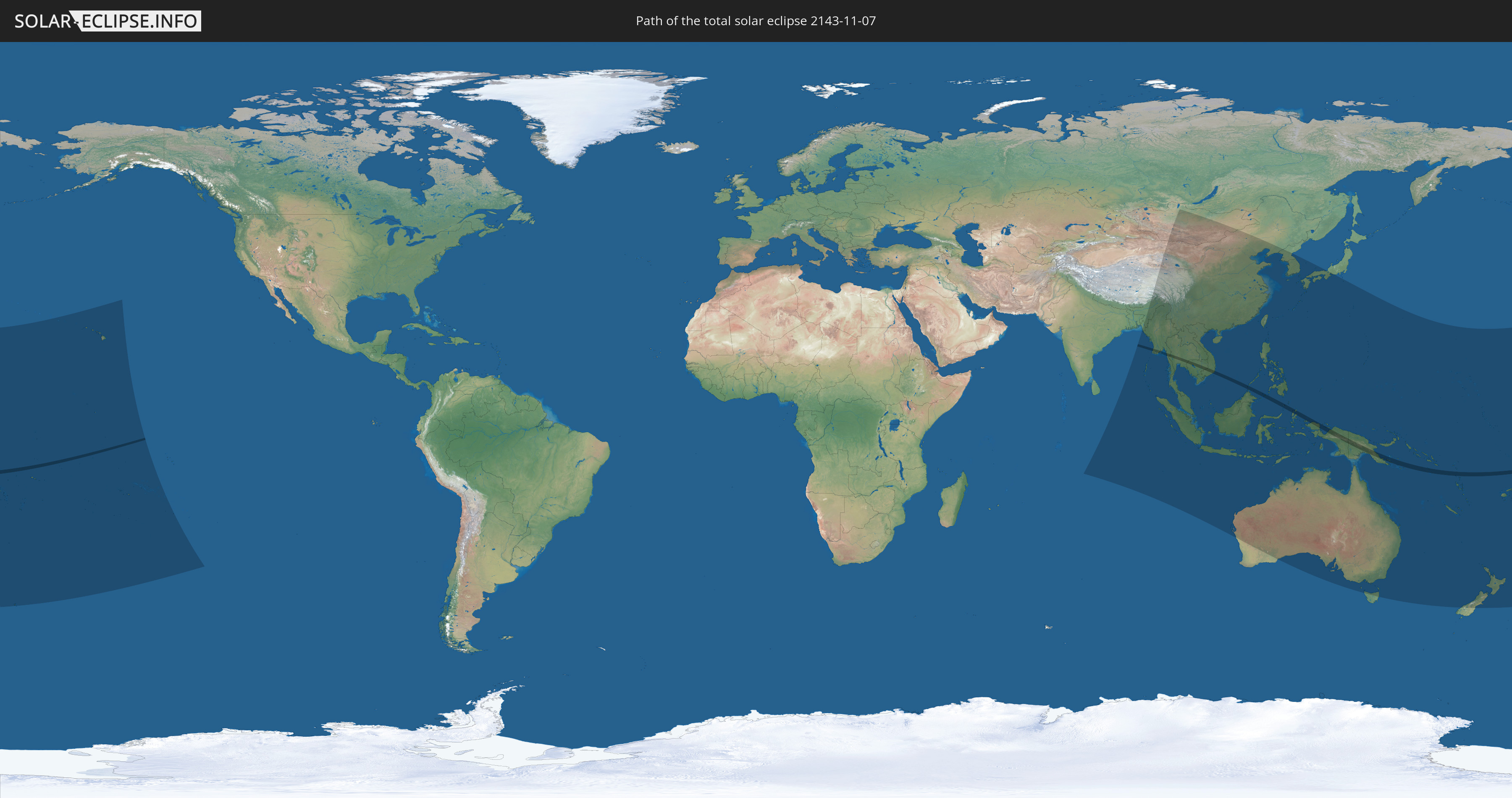
Die Sonnenfinsternis am 11/07/2143 kann man in 49 Ländern als partielle Sonnenfinsternis beobachten.
Der Finsternispfad verläuft durch 12 Länder. Nur in diesen Ländern ist sie als total Sonnenfinsternis zu sehen.
In den folgenden Ländern ist die Sonnenfinsternis total zu sehen
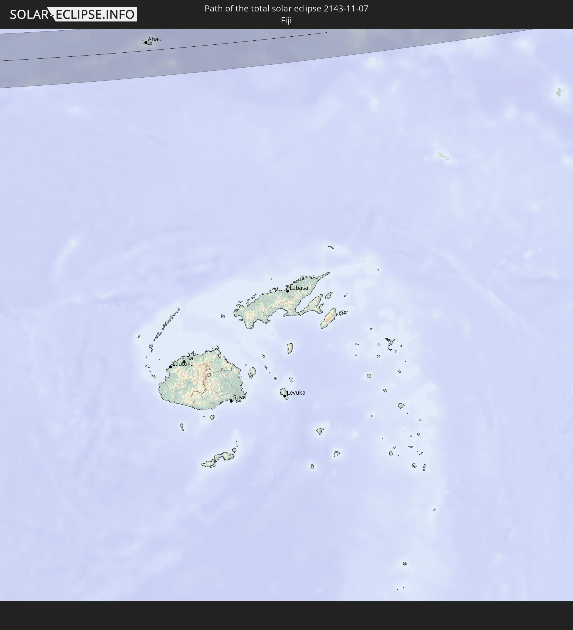 Fiji
Fiji
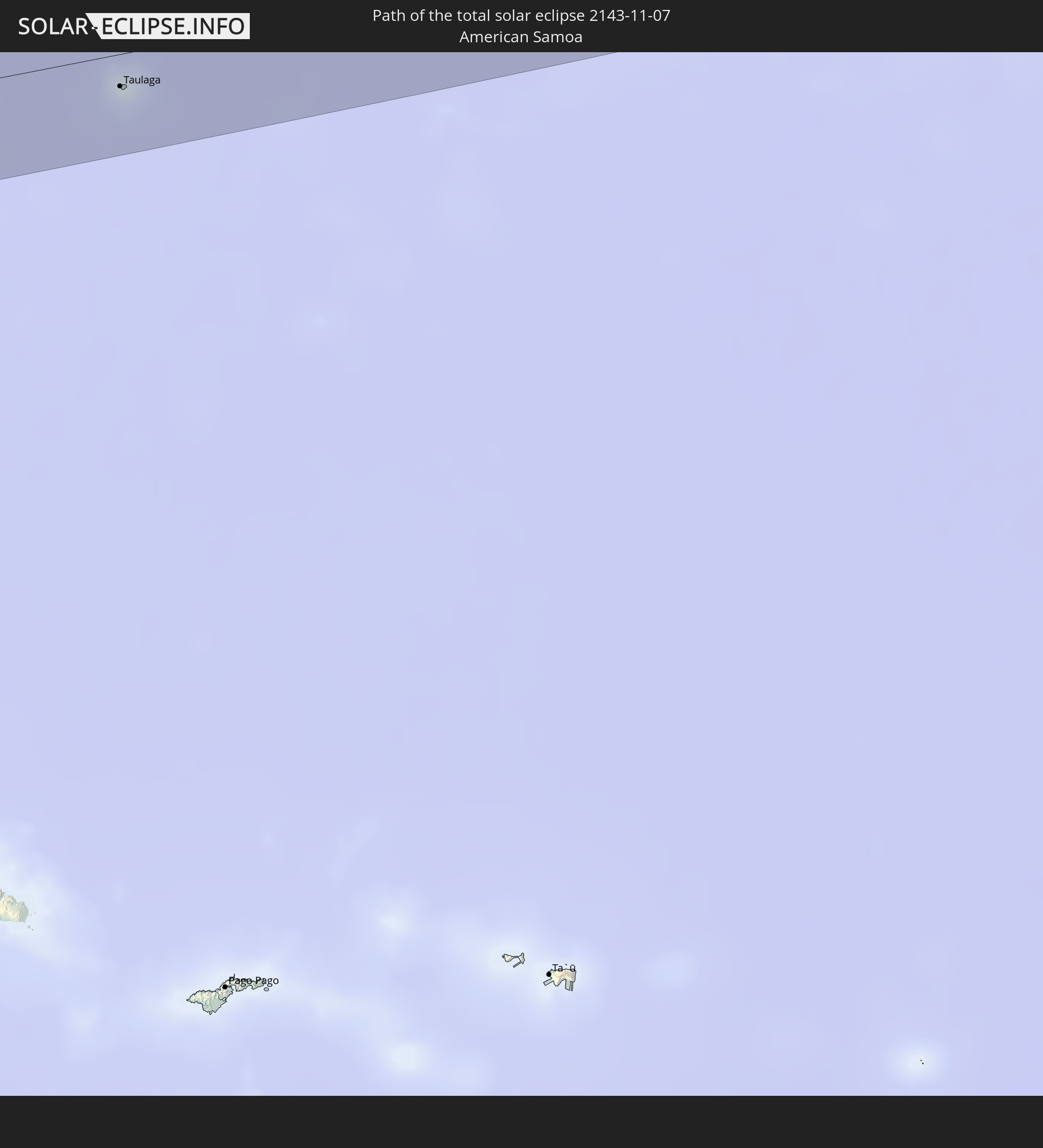 American Samoa
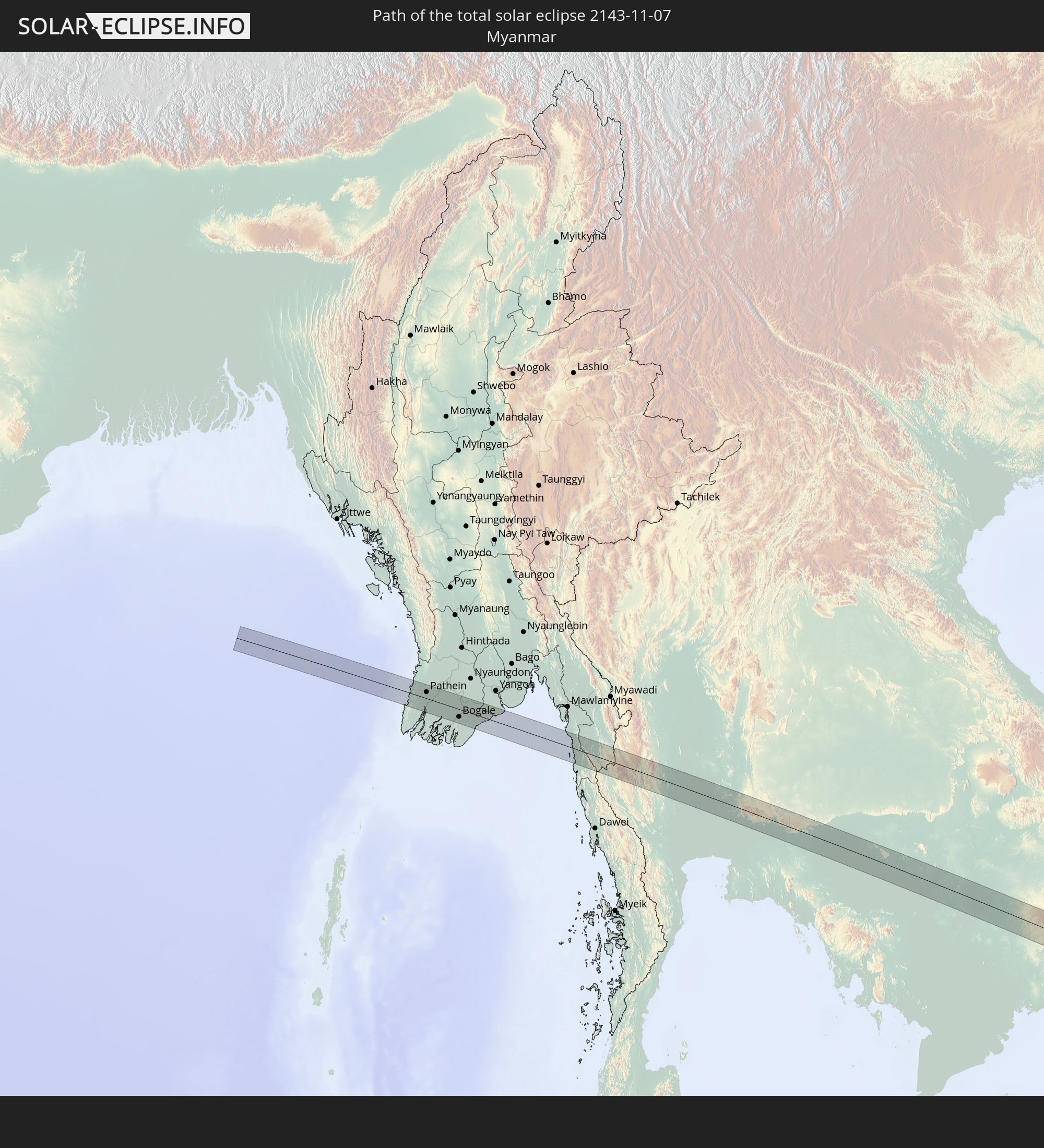 Myanmar
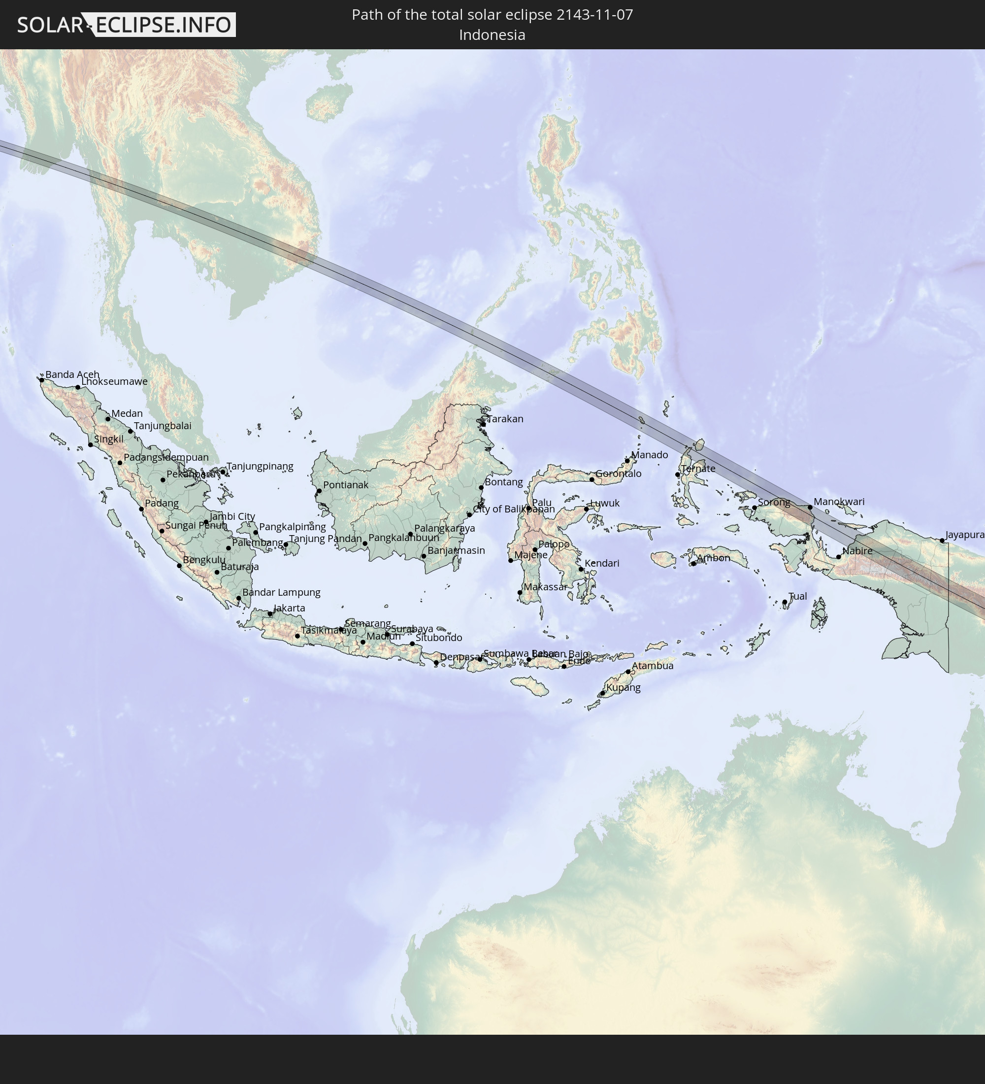 Indonesia
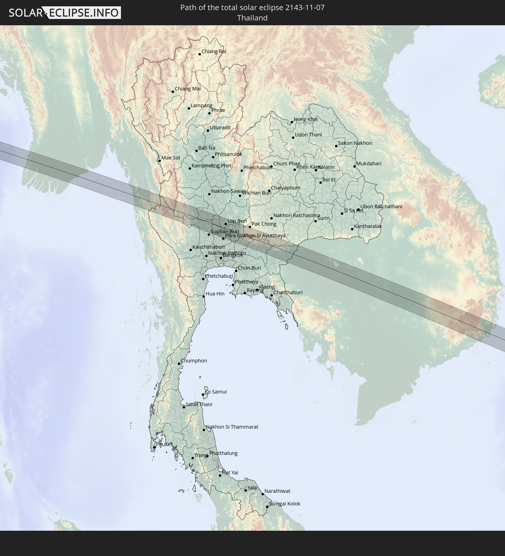 Thailand
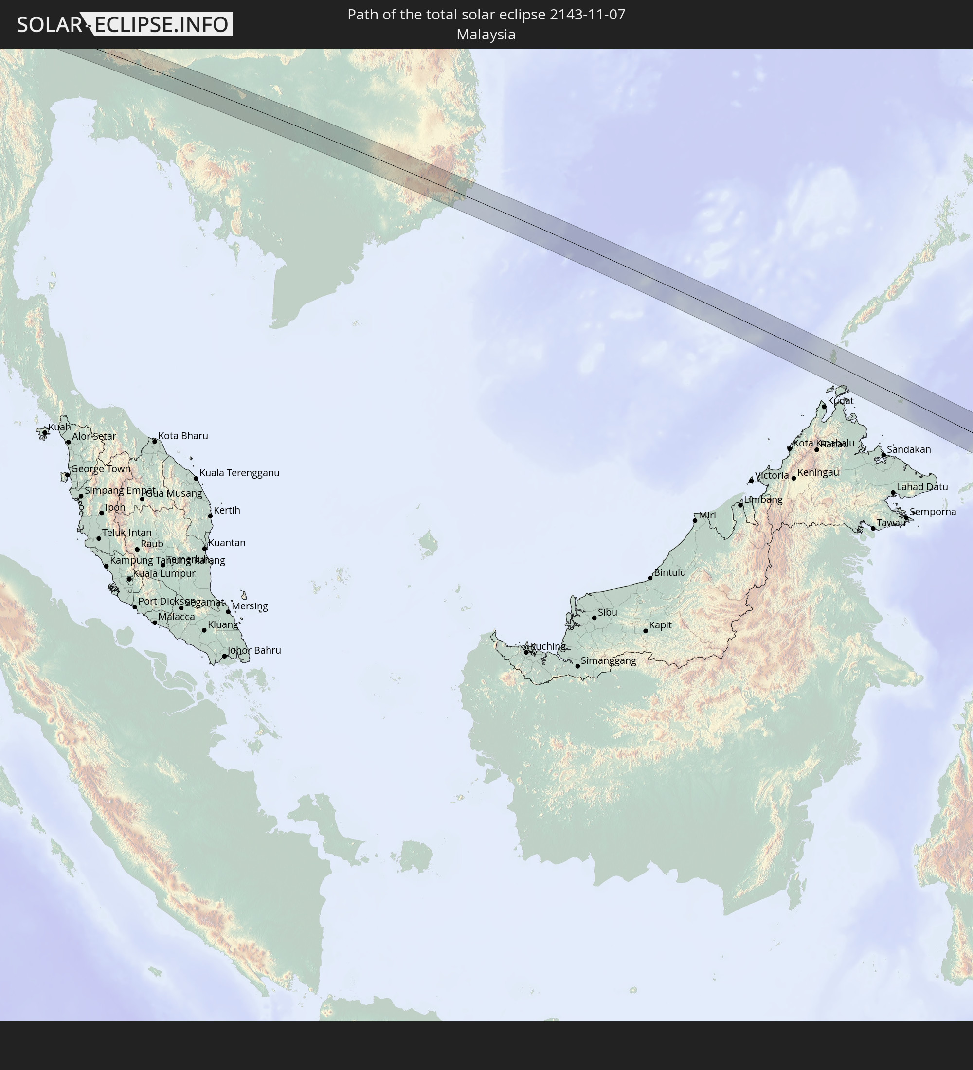 Malaysia
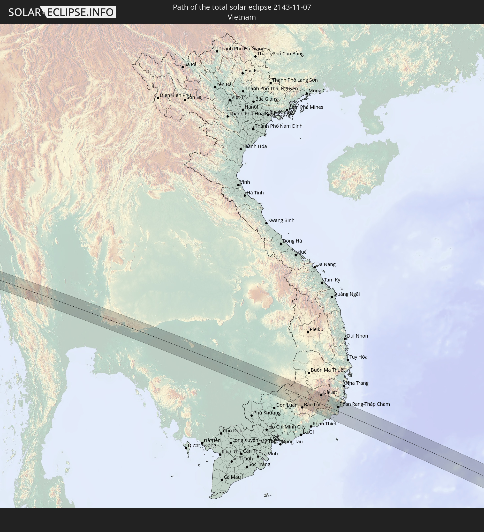 Vietnam
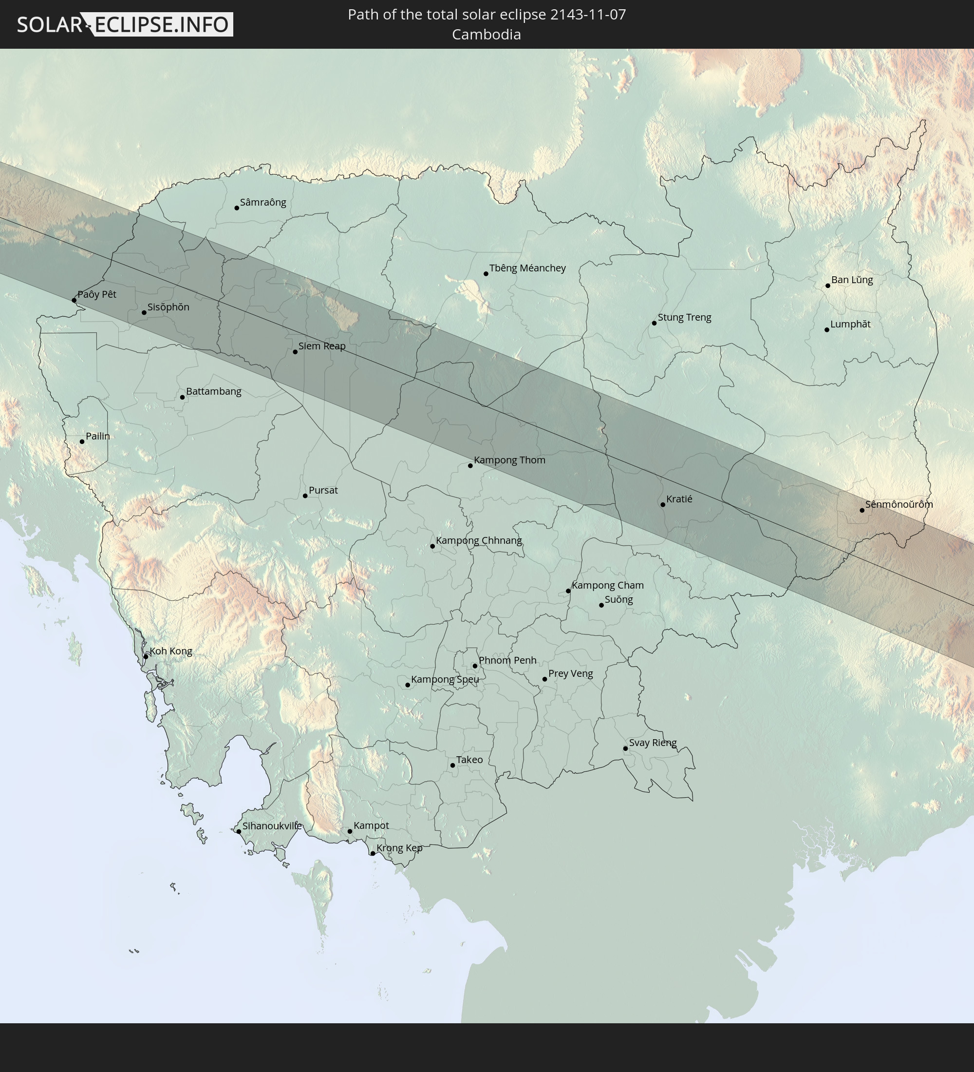 Cambodia
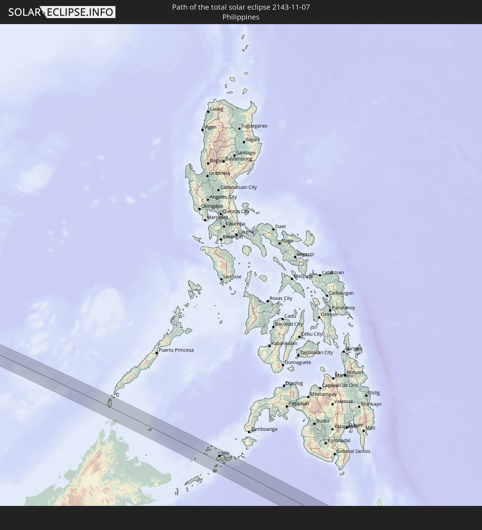 Philippines
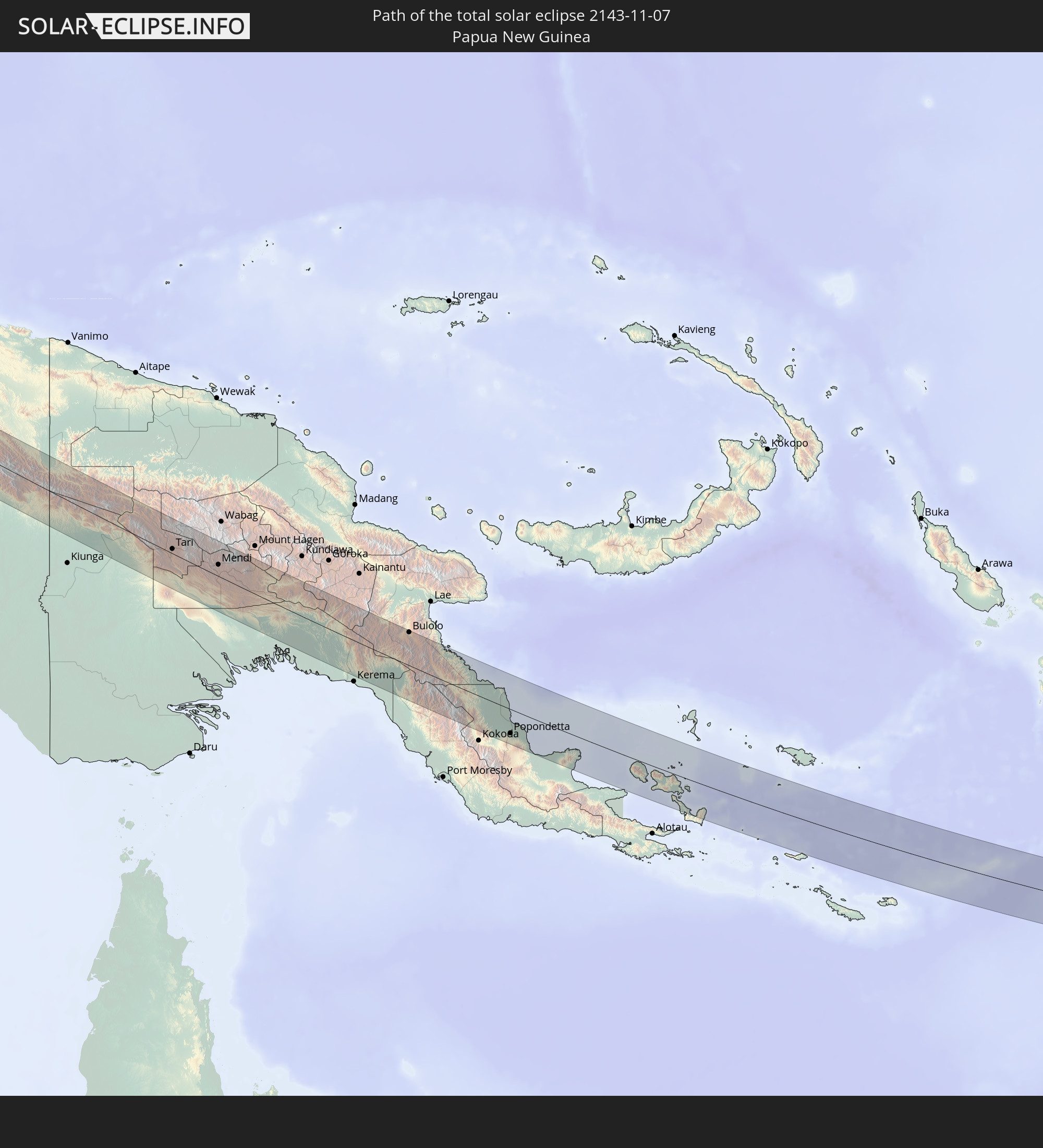 Papua New Guinea
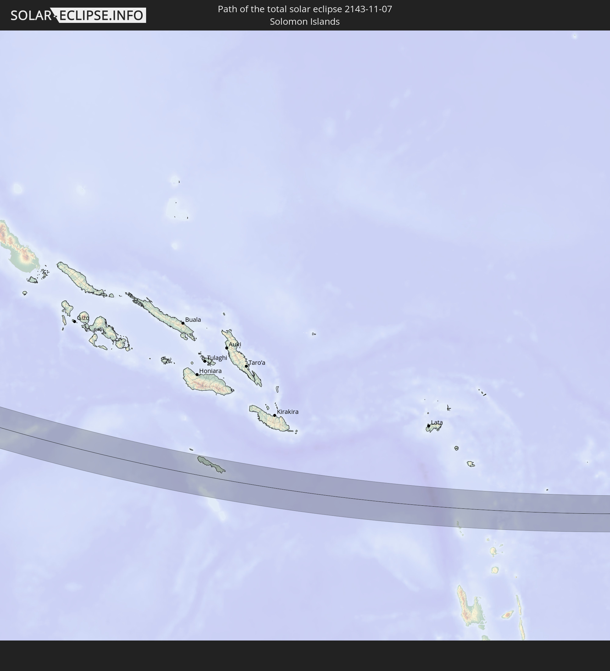 Solomon Islands
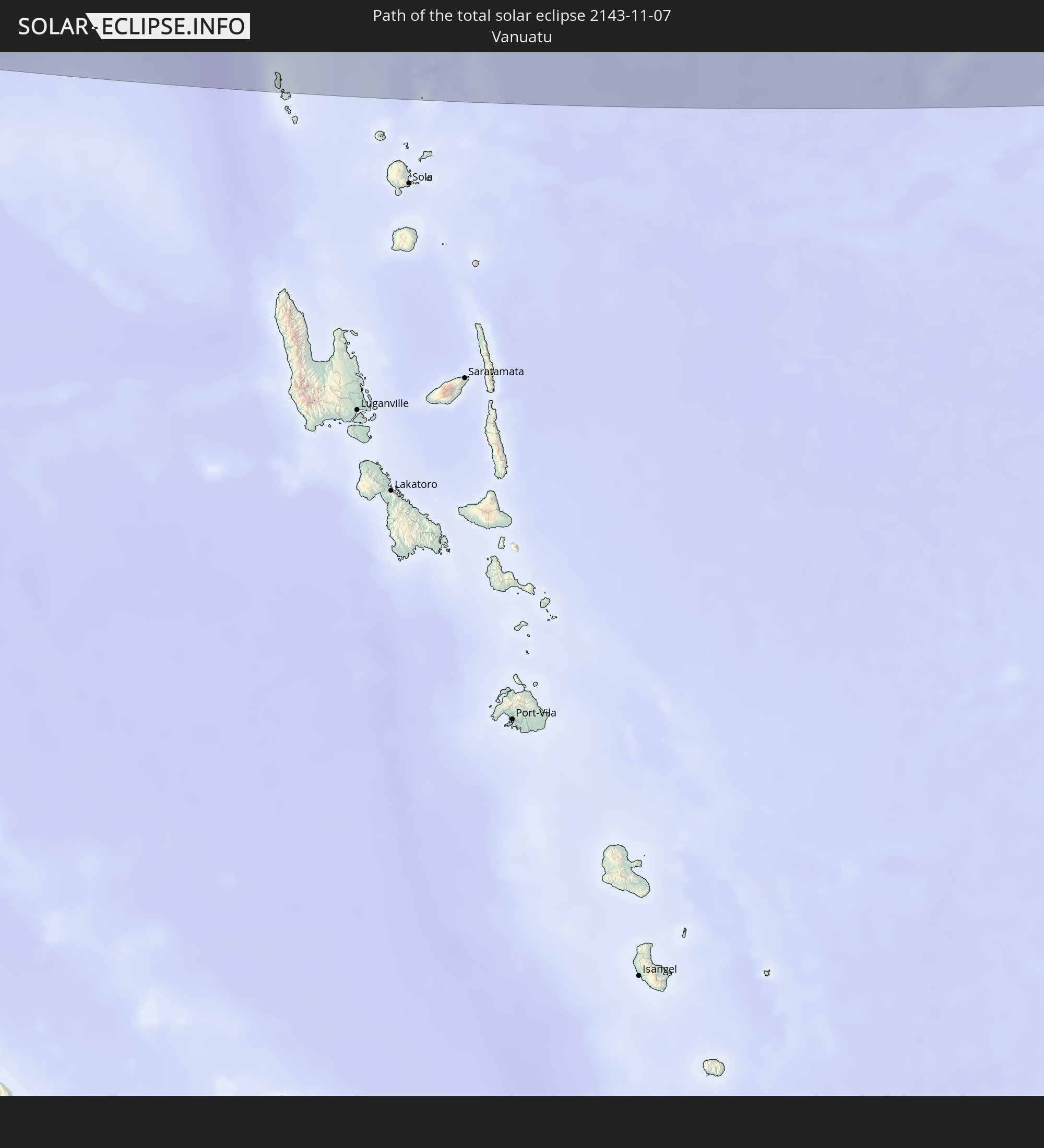 Vanuatu
In den folgenden Ländern ist die Sonnenfinsternis partiell zu sehen
 Fiji
Fiji
 United States
 New Zealand
 United States Minor Outlying Islands
 Wallis and Futuna
 Tonga
Tonga
 Kiribati
 Samoa
Samoa
 Tokelau
 American Samoa
 Niue
Niue
 Cook Islands
 French Polynesia
 India
India
 China
China
 Mongolia
 Bangladesh
 Myanmar
 Indonesia
 Cocos Islands
 Thailand
 Malaysia
 Laos
Laos
 Vietnam
 Cambodia
 Singapore
 Christmas Island
 Australia
 Macau
Macau
 Hong Kong
 Brunei
 Taiwan
 Philippines
 Japan
Japan
 East Timor
 North Korea
 South Korea
 Palau
Palau
 Federated States of Micronesia
 Papua New Guinea
 Guam
Guam
 Northern Mariana Islands
 Solomon Islands
 New Caledonia
 Marshall Islands
 Vanuatu
 Nauru
Nauru
 Norfolk Island
 Tuvalu
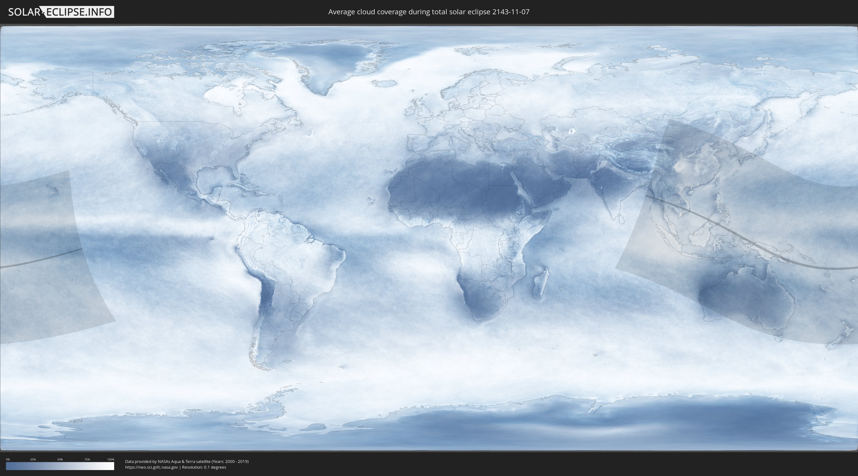
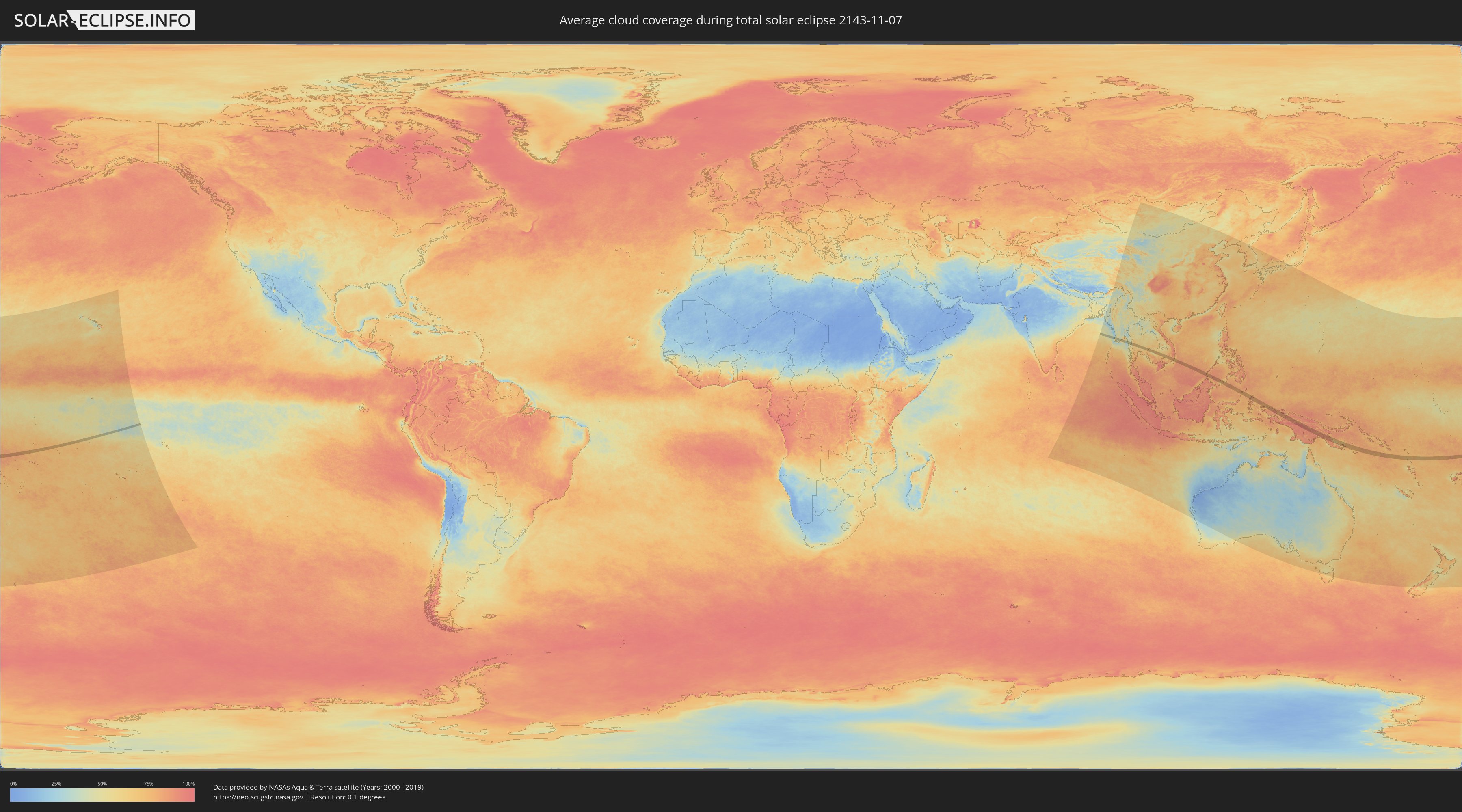
How will be the weather during the total solar eclipse on 11/07/2143?
Where is the best place to see the total solar eclipse of 11/07/2143?
The following maps show the average cloud coverage for the day of the total solar eclipse.
With the help of these maps, it is possible to find the place along the eclipse path, which has the best
chance of a cloudless sky.
Nevertheless, you should consider local circumstances and inform about the weather of your chosen
observation site.
The data is provided by NASAs satellites
AQUA and TERRA.
The cloud maps are averaged over a period of 19 years (2000 - 2019).
Detailed country maps
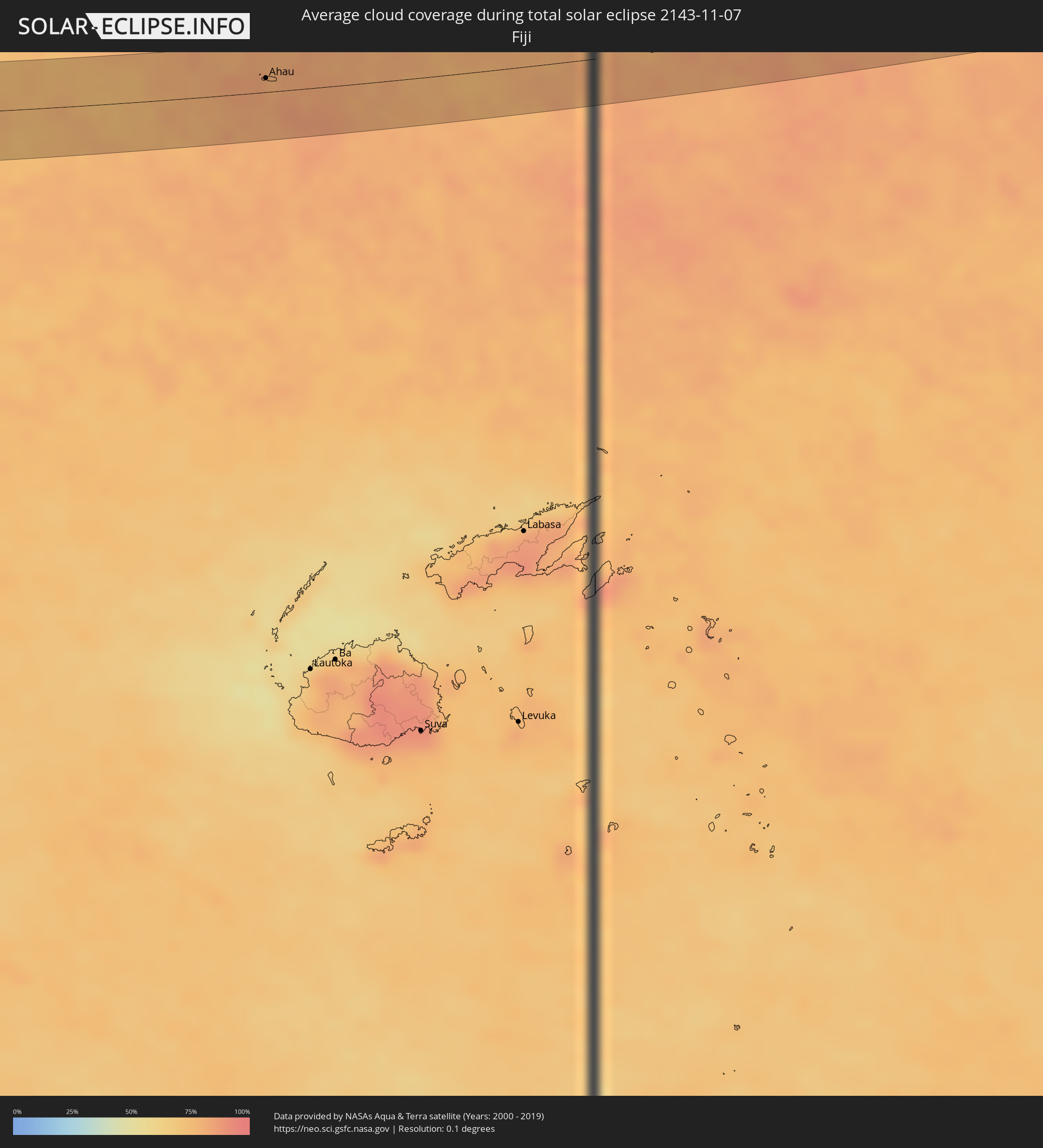 Fiji
Fiji
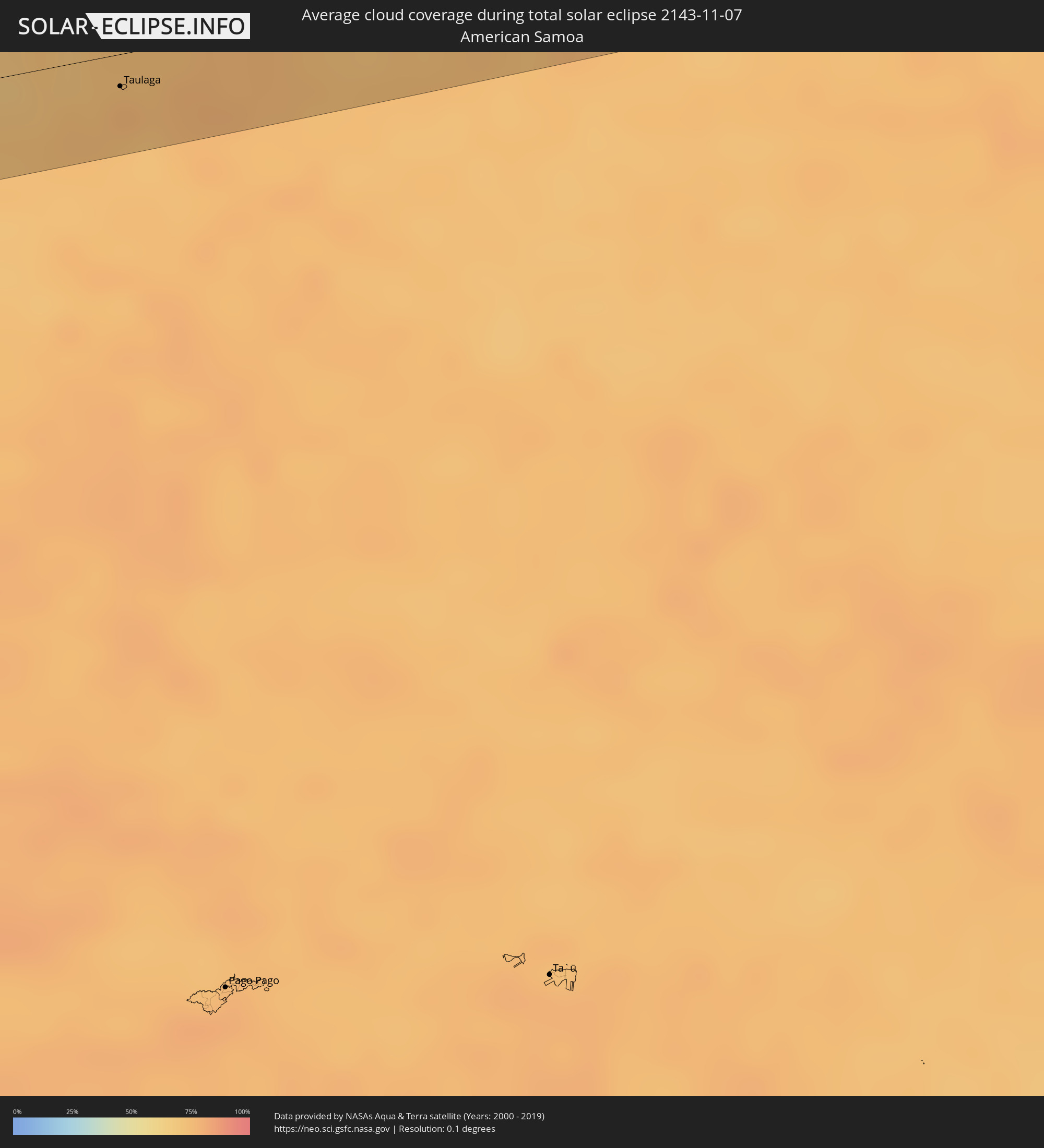 American Samoa
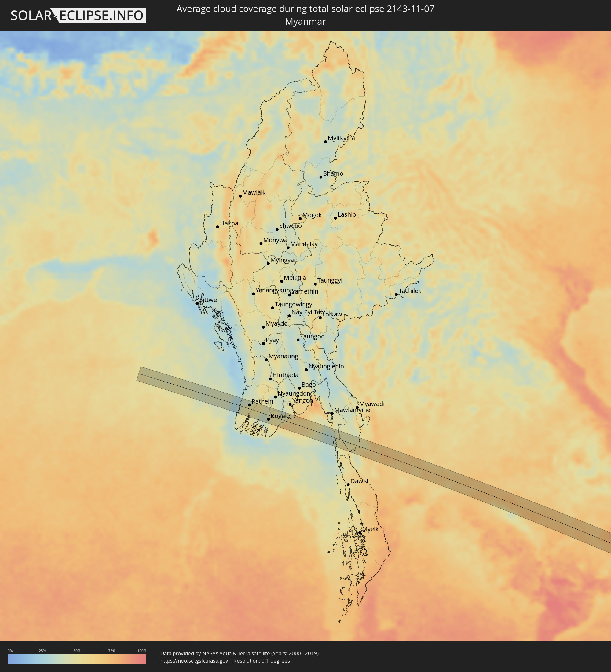 Myanmar
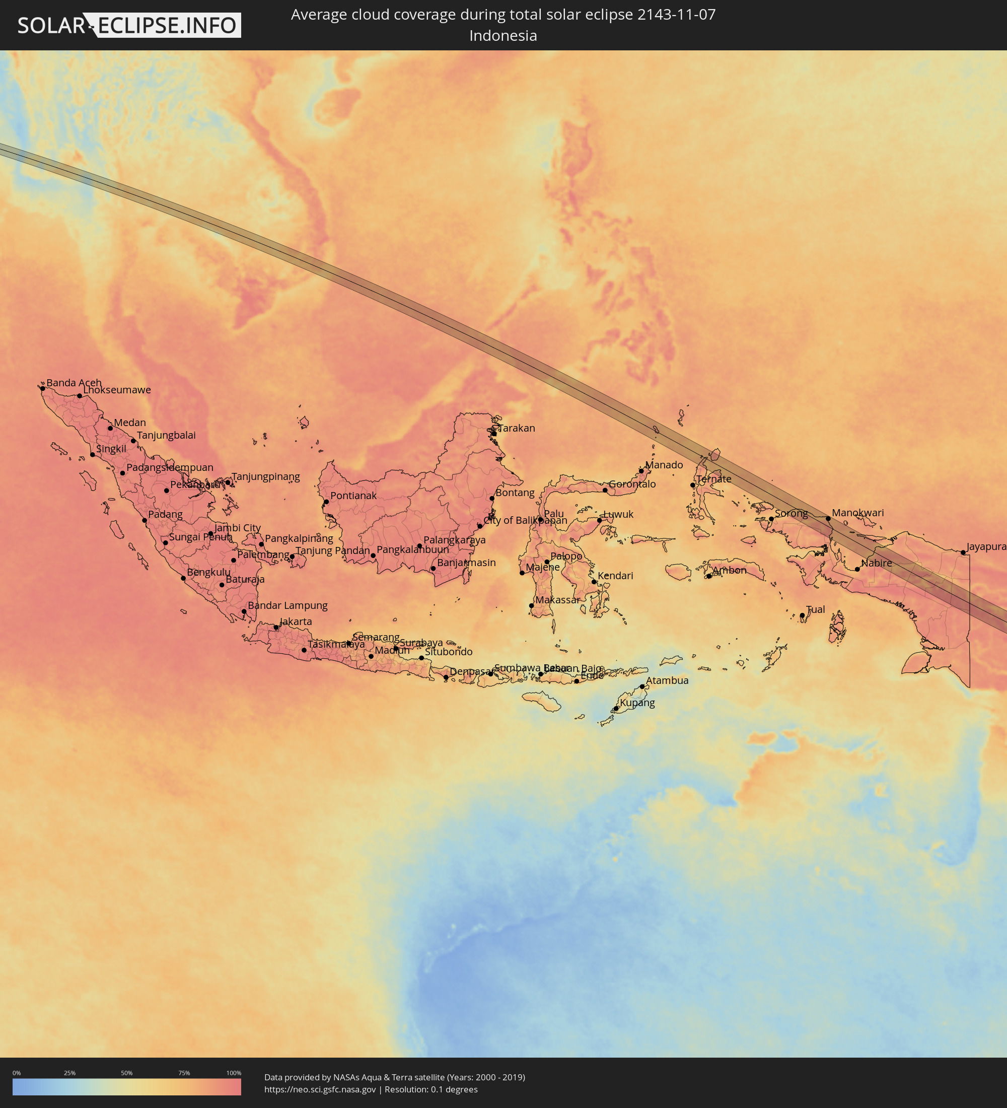 Indonesia
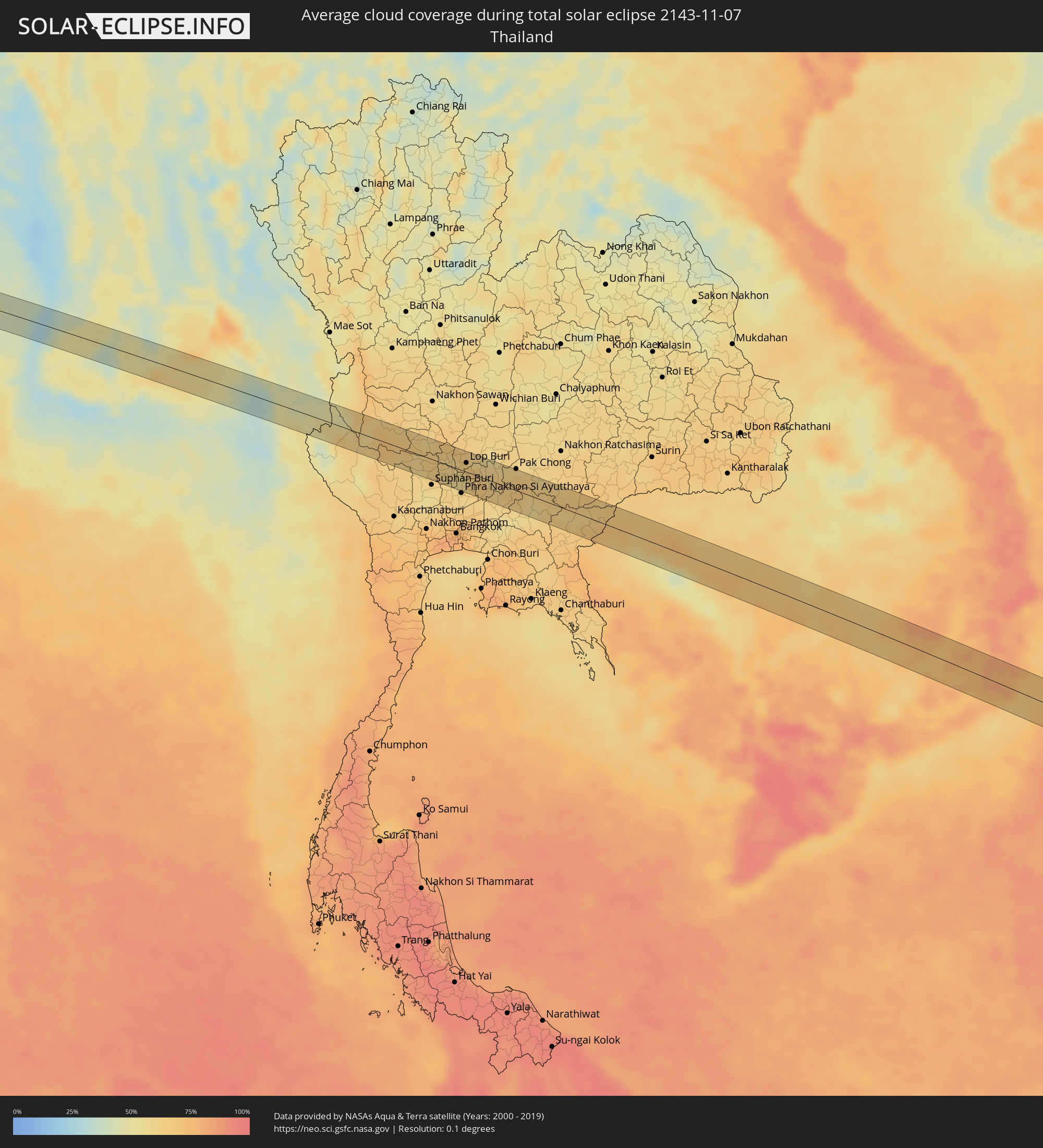 Thailand
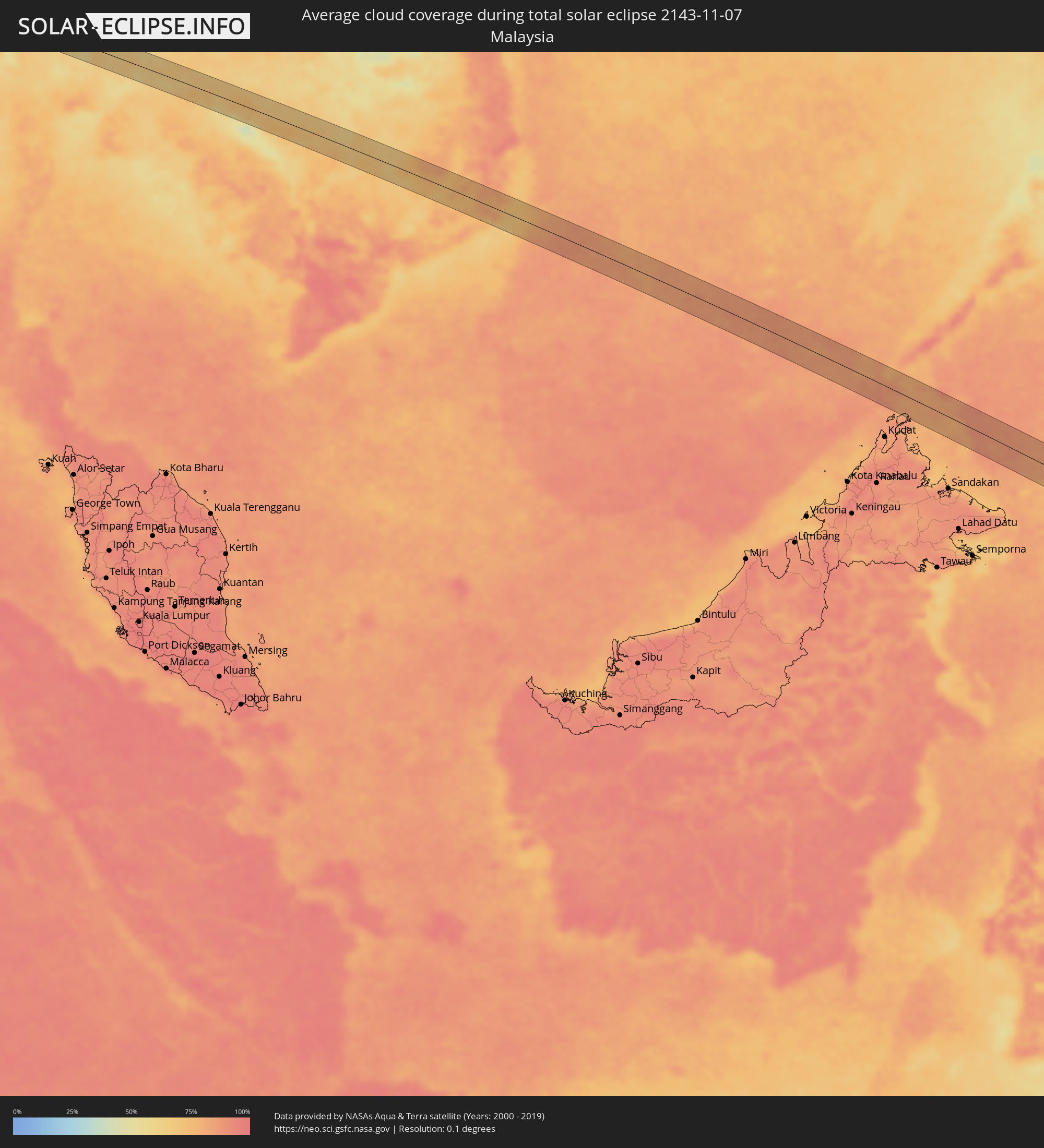 Malaysia
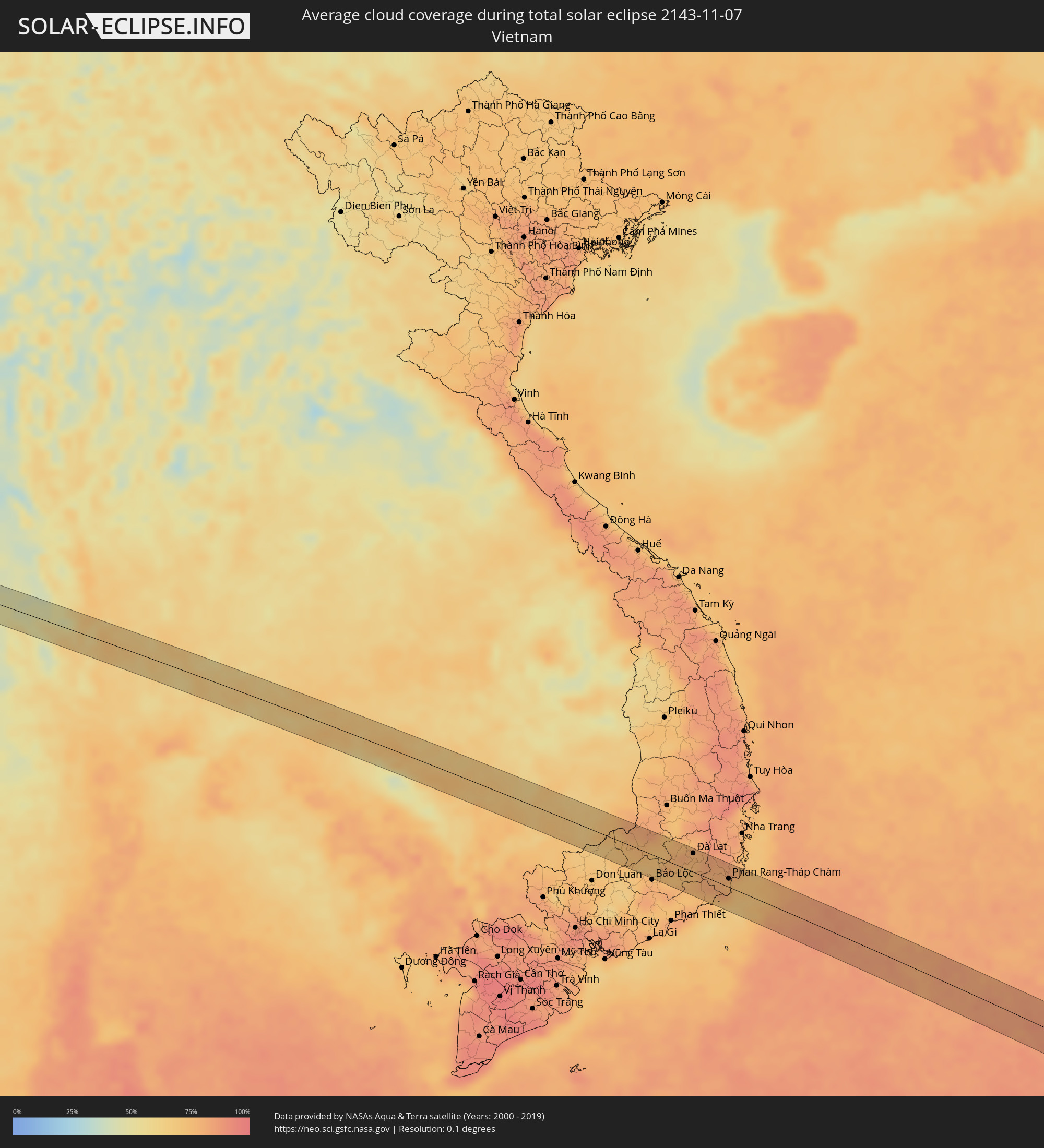 Vietnam
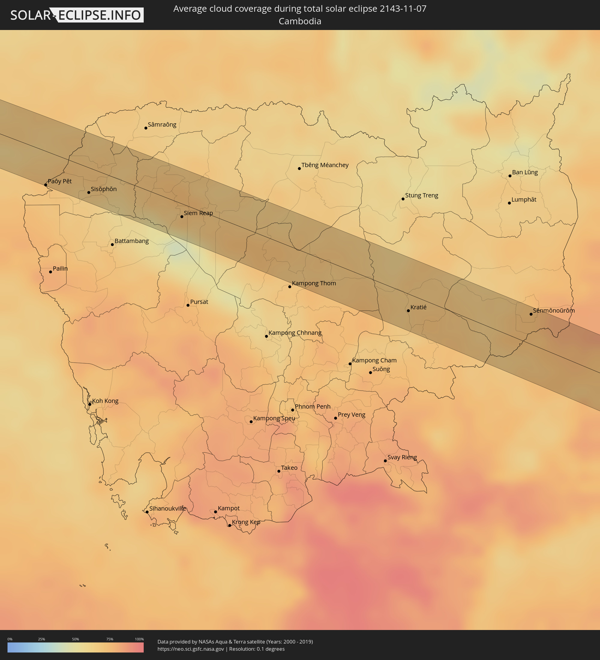 Cambodia
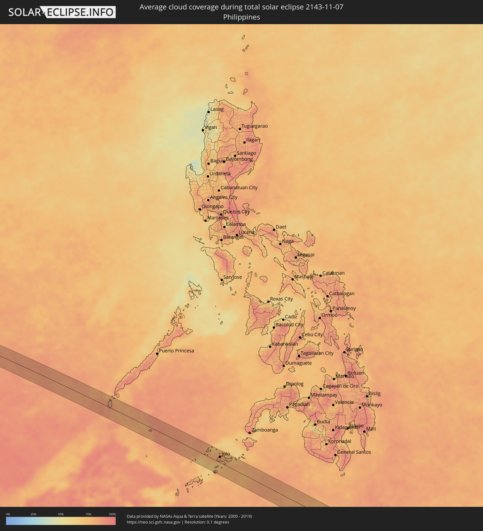 Philippines
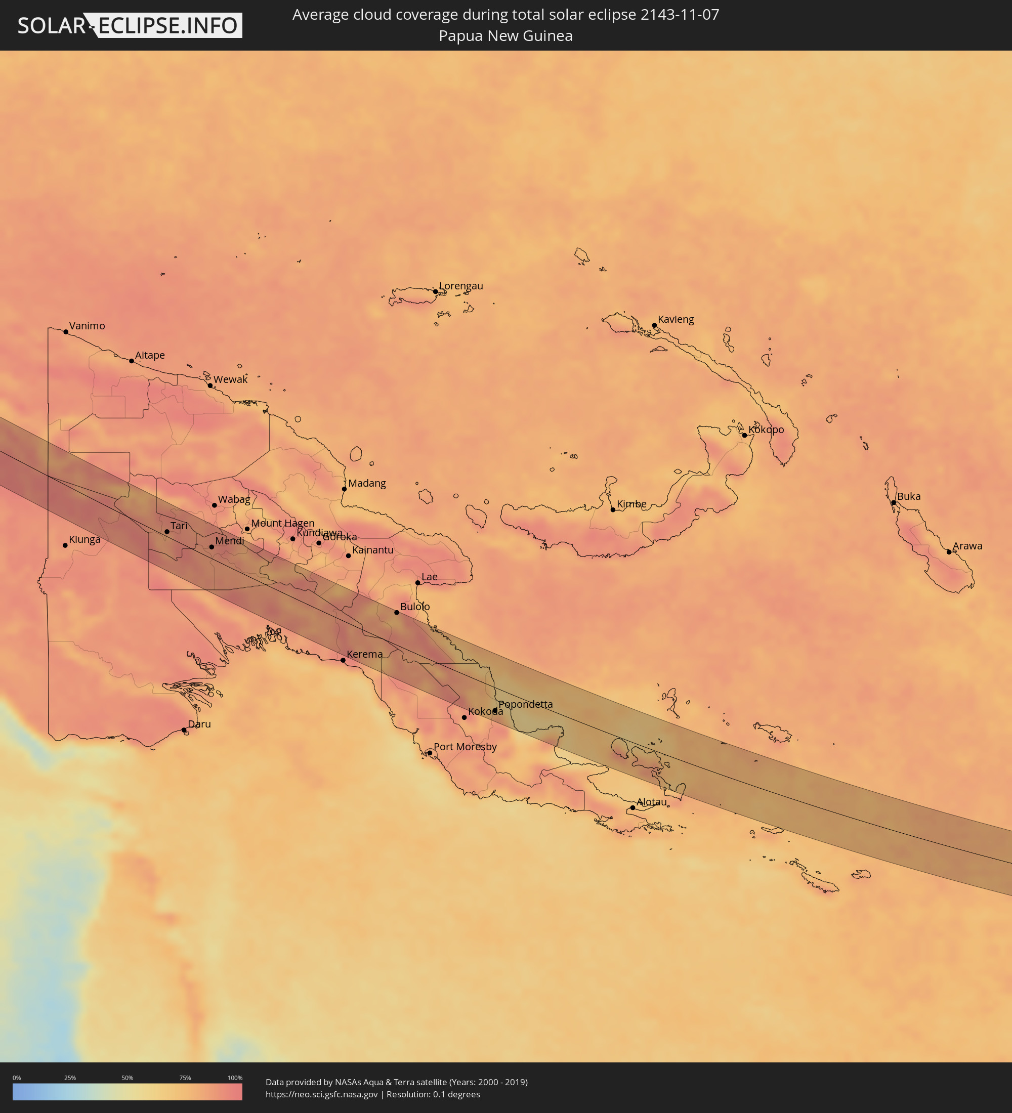 Papua New Guinea
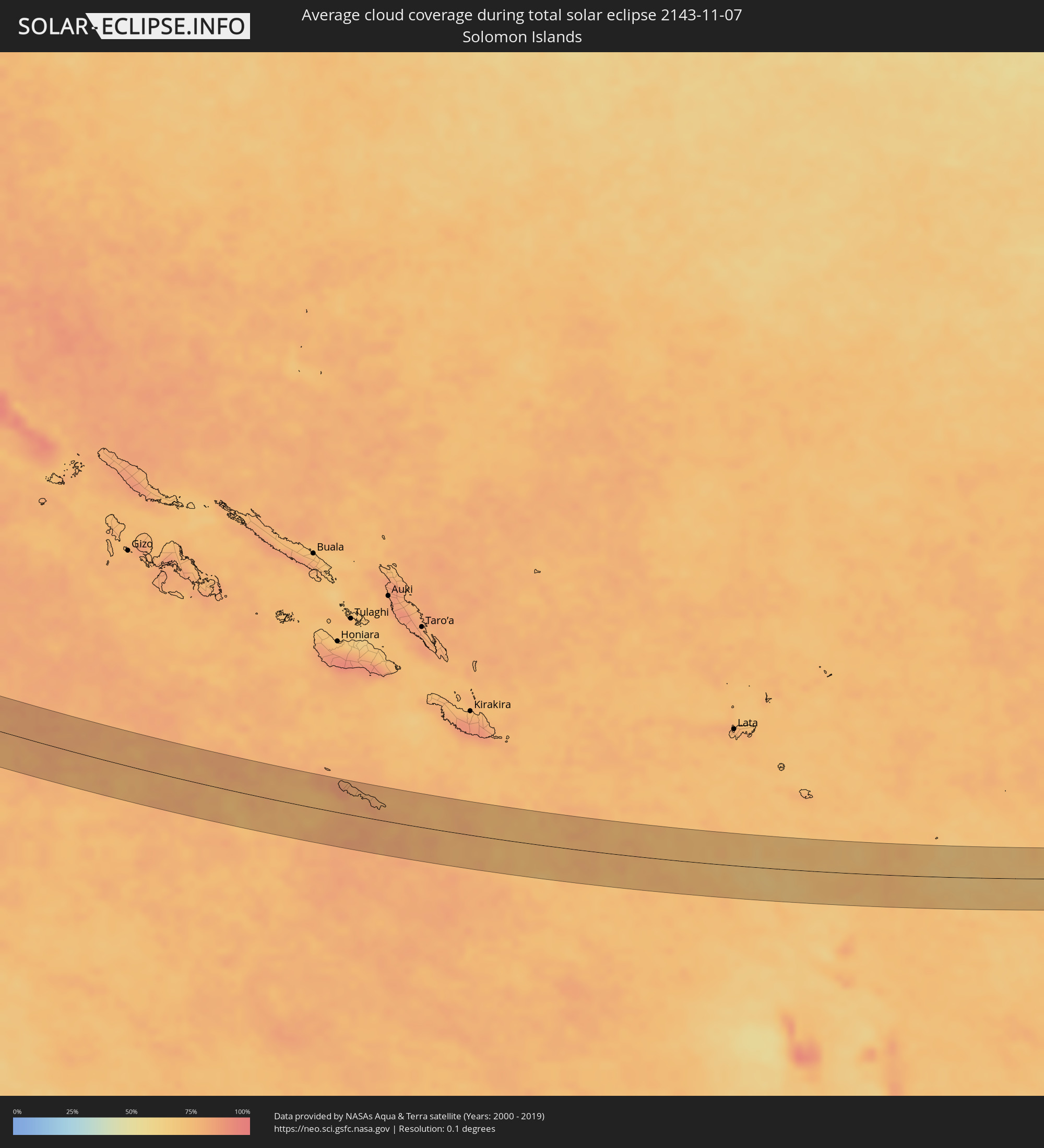 Solomon Islands
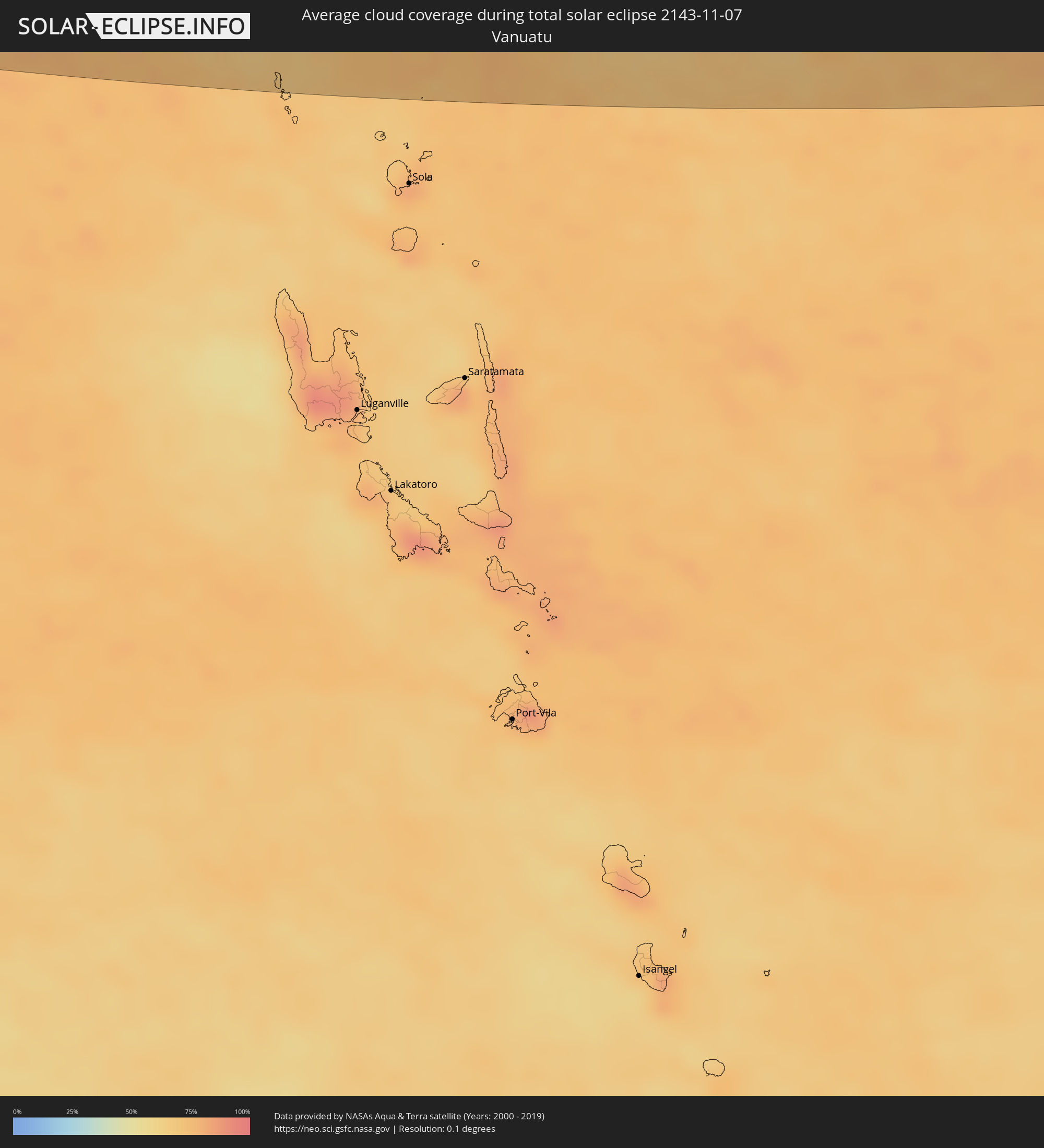 Vanuatu
Cities inside the path of the eclipse
The following table shows all locations with a population of more than 5,000 inside the eclipse path. Cities which have more than 100,000 inhabitants are marked bold. A click at the locations opens a detailed map.
| City | Type | Eclipse duration | Local time of max. eclipse | Distance to central line | Ø Cloud coverage |
|
Taulaga, Swains Island
|
total | - | 03:16:54 UTC+00:00 | 13 km | 73% |
|
Pathein, Ayeyarwady
|
total | - | 06:31:47 UTC+06:30 | 13 km | 51% |
|
Wakema, Ayeyarwady
|
total | - | 06:31:51 UTC+06:30 | 10 km | 38% |
|
Mawlamyinegyunn, Ayeyarwady
|
total | - | 06:31:53 UTC+06:30 | 12 km | 40% |
|
Bogale, Ayeyarwady
|
total | - | 06:31:54 UTC+06:30 | 16 km | 47% |
|
Pyapon, Ayeyarwady
|
total | - | 06:31:56 UTC+06:30 | 7 km | 50% |
|
Kyaiklat, Ayeyarwady
|
total | - | 06:31:56 UTC+06:30 | 11 km | 47% |
|
Sangkhla Buri, Kanchanaburi
|
total | - | 07:02:35 UTC+07:00 | 29 km | 43% |
|
Huai Khot, Uthai Thani
|
total | - | 07:02:52 UTC+07:00 | 27 km | 66% |
|
Ban Sam Chuk, Suphan Buri
|
total | - | 07:03:05 UTC+07:00 | 13 km | 64% |
|
Doembang Nangbuat, Suphan Buri
|
total | - | 07:03:04 UTC+07:00 | 3 km | 64% |
|
Bang Racham, Sing Buri
|
total | - | 07:03:07 UTC+07:00 | 11 km | 64% |
|
Wiset Chaichan, Ang Thong
|
total | - | 07:03:11 UTC+07:00 | 19 km | 60% |
|
Sing Buri, Sing Buri
|
total | - | 07:03:09 UTC+07:00 | 14 km | 62% |
|
Pho Thong, Ang Thong
|
total | - | 07:03:11 UTC+07:00 | 9 km | 60% |
|
Ang Thong, Ang Thong
|
total | - | 07:03:13 UTC+07:00 | 15 km | 58% |
|
Chaiyo, Ang Thong
|
total | - | 07:03:12 UTC+07:00 | 6 km | 58% |
|
Ban Thai Tan, Ang Thong
|
total | - | 07:03:13 UTC+07:00 | 11 km | 58% |
|
Nakhon Luang, Phra Nakhon Si Ayutthaya
|
total | - | 07:03:17 UTC+07:00 | 23 km | 61% |
|
Lop Buri, Lop Buri
|
total | - | 07:03:14 UTC+07:00 | 14 km | 66% |
|
Tha Ruea, Phra Nakhon Si Ayutthaya
|
total | - | 07:03:18 UTC+07:00 | 7 km | 63% |
|
Ban Mo, Sara Buri
|
total | - | 07:03:18 UTC+07:00 | 2 km | 63% |
|
Phra Phutthabat, Sara Buri
|
total | - | 07:03:18 UTC+07:00 | 12 km | 69% |
|
Nong Khae, Sara Buri
|
total | - | 07:03:23 UTC+07:00 | 26 km | 61% |
|
Saraburi, Sara Buri
|
total | - | 07:03:22 UTC+07:00 | 4 km | 67% |
|
Kaeng Khoi, Sara Buri
|
total | - | 07:03:23 UTC+07:00 | 5 km | 65% |
|
Nakhon Nayok, Nakhon Nayok
|
total | - | 07:03:32 UTC+07:00 | 27 km | 61% |
|
Aranyaprathet, Sa Kaeo
|
total | - | 07:04:05 UTC+07:00 | 31 km | 70% |
|
Paôy Pêt, Banteay Meanchey
|
total | - | 07:04:07 UTC+07:00 | 33 km | 70% |
|
Sisŏphŏn, Banteay Meanchey
|
total | - | 07:04:18 UTC+07:00 | 24 km | 64% |
|
Siem Reap, Siem Reap
|
total | - | 07:04:43 UTC+07:00 | 13 km | 70% |
|
Kratié, Kratie
|
total | - | 07:05:58 UTC+07:00 | 16 km | 67% |
|
Sênmônoŭrôm, Mondolkiri
|
total | - | 07:06:37 UTC+07:00 | 29 km | 73% |
|
Gia Nghĩa, Ðắk Nông
|
total | - | 07:07:03 UTC+07:00 | 3 km | 71% |
|
Đinh Văn, Lâm Đồng
|
total | - | 07:07:27 UTC+07:00 | 4 km | 74% |
|
Ðà Lạt, Lâm Đồng
|
total | - | 07:07:31 UTC+07:00 | 29 km | 74% |
|
Phan Rang-Tháp Chàm, Ninh Thuận
|
total | - | 07:08:00 UTC+07:00 | 13 km | 77% |
|
Balabac, Mimaropa
|
total | - | 08:16:26 UTC+08:00 | 17 km | 87% |
|
Siasi, Autonomous Region in Muslim Mindanao
|
total | - | 08:22:24 UTC+08:00 | 40 km | 81% |
|
Lugus, Autonomous Region in Muslim Mindanao
|
total | - | 08:22:17 UTC+08:00 | 24 km | 72% |
|
Parang, Autonomous Region in Muslim Mindanao
|
total | - | 08:22:15 UTC+08:00 | 1 km | 74% |
|
Laminusa, Autonomous Region in Muslim Mindanao
|
total | - | 08:22:31 UTC+08:00 | 34 km | 76% |
|
Kulase, Autonomous Region in Muslim Mindanao
|
total | - | 08:22:19 UTC+08:00 | 3 km | 74% |
|
Kajatian, Autonomous Region in Muslim Mindanao
|
total | - | 08:22:16 UTC+08:00 | 17 km | 83% |
|
Jolo, Autonomous Region in Muslim Mindanao
|
total | - | 08:22:16 UTC+08:00 | 20 km | 84% |
|
Anuling, Autonomous Region in Muslim Mindanao
|
total | - | 08:22:17 UTC+08:00 | 18 km | 83% |
|
Talipaw, Autonomous Region in Muslim Mindanao
|
total | - | 08:22:29 UTC+08:00 | 10 km | 75% |
|
Punay, Autonomous Region in Muslim Mindanao
|
total | - | 08:22:35 UTC+08:00 | 21 km | 78% |
|
Kansipati, Autonomous Region in Muslim Mindanao
|
total | - | 08:22:36 UTC+08:00 | 27 km | 78% |
|
Karungdong, Autonomous Region in Muslim Mindanao
|
total | - | 08:22:43 UTC+08:00 | 16 km | 78% |
|
Lu-uk, Autonomous Region in Muslim Mindanao
|
total | - | 08:22:43 UTC+08:00 | 27 km | 78% |
|
Tobelo, North Maluku
|
total | - | 09:36:28 UTC+09:00 | 39 km | 79% |
|
Manokwari, West Papua
|
total | - | 09:50:59 UTC+09:00 | 36 km | 84% |
|
Tari, Hela
|
total | - | 11:19:01 UTC+10:00 | 7 km | 84% |
|
Mendi, Southern Highlands
|
total | - | 11:21:19 UTC+10:00 | 18 km | 88% |
|
Ialibu, Southern Highlands
|
total | - | 11:22:26 UTC+10:00 | 21 km | 85% |
|
Bulolo, Morobe
|
total | - | 11:31:10 UTC+10:00 | 52 km | 75% |
|
Wau, Morobe
|
total | - | 11:31:33 UTC+10:00 | 41 km | 80% |
|
Popondetta, Northern Province
|
total | - | 11:37:45 UTC+10:00 | 38 km | 87% |
|
Ahau, Rotuma
|
total | - | 14:58:47 UTC+12:00 | 14 km | 80% |