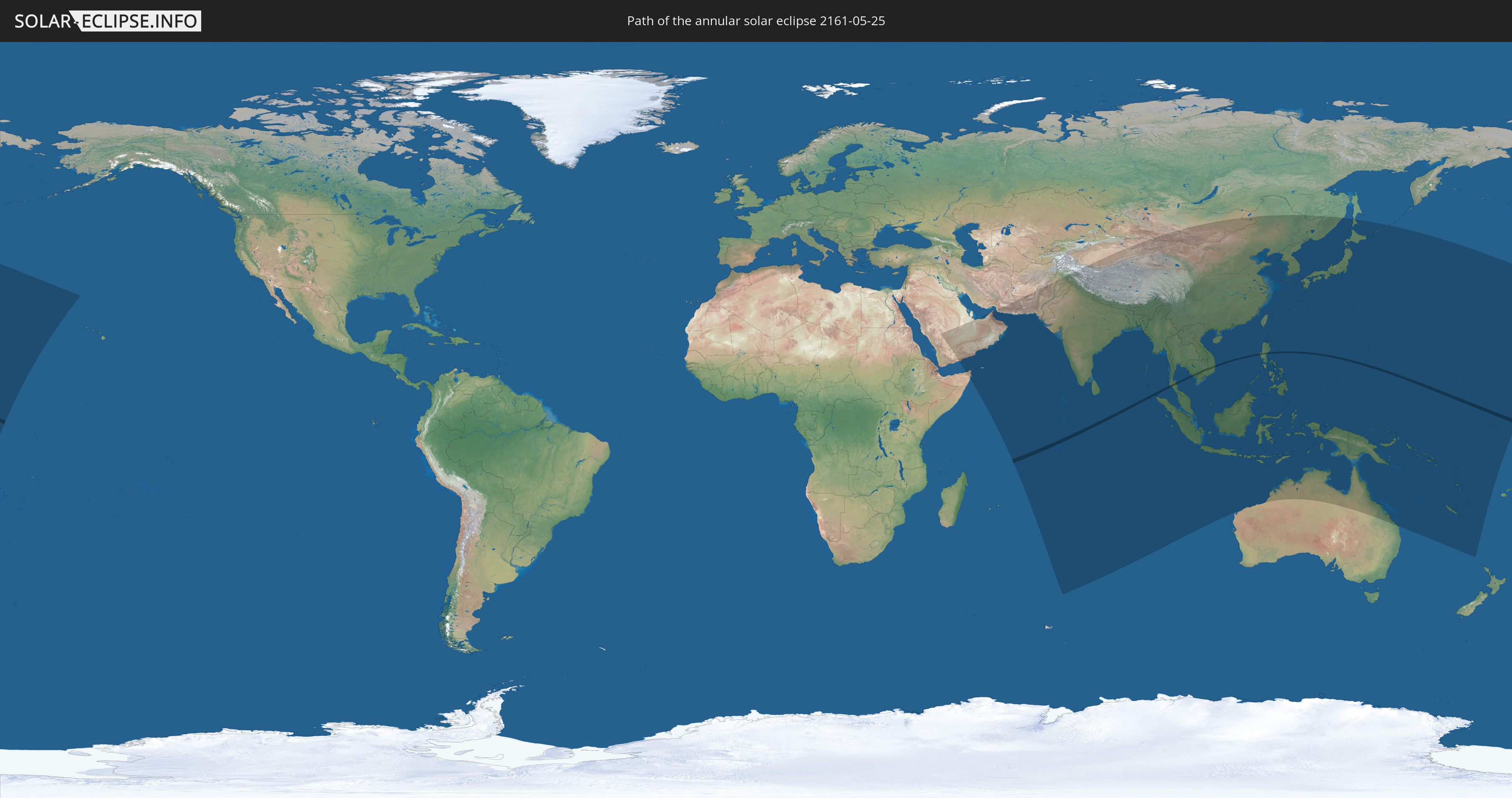
Annular solar eclipse of 05/25/2161
| Day of week: | Monday |
| Maximum duration of eclipse: | 01m12s |
| Maximum width of eclipse path: | 36 km |
| Saros cycle: | 140 |
| Coverage: | 99% |
| Magnitude: | 0.9898 |
| Gamma: | -0.095 |
Wo kann man die Sonnenfinsternis vom 05/25/2161 sehen?
Die Sonnenfinsternis am 05/25/2161 kann man in 53 Ländern als partielle Sonnenfinsternis beobachten.
Der Finsternispfad verläuft durch 8 Länder. Nur in diesen Ländern ist sie als annular Sonnenfinsternis zu sehen.
In den folgenden Ländern ist die Sonnenfinsternis annular zu sehen
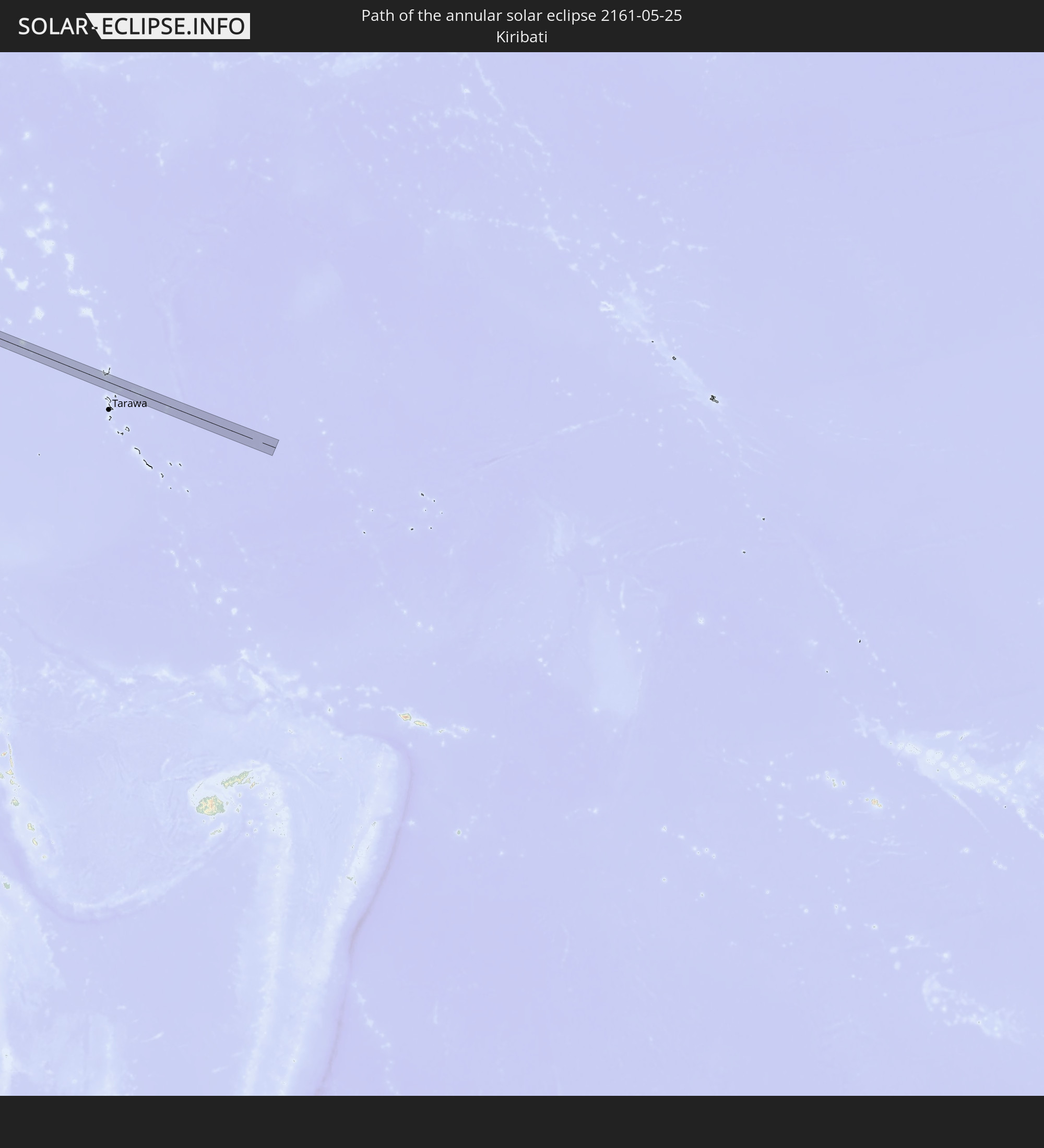 Kiribati
 British Indian Ocean Territory
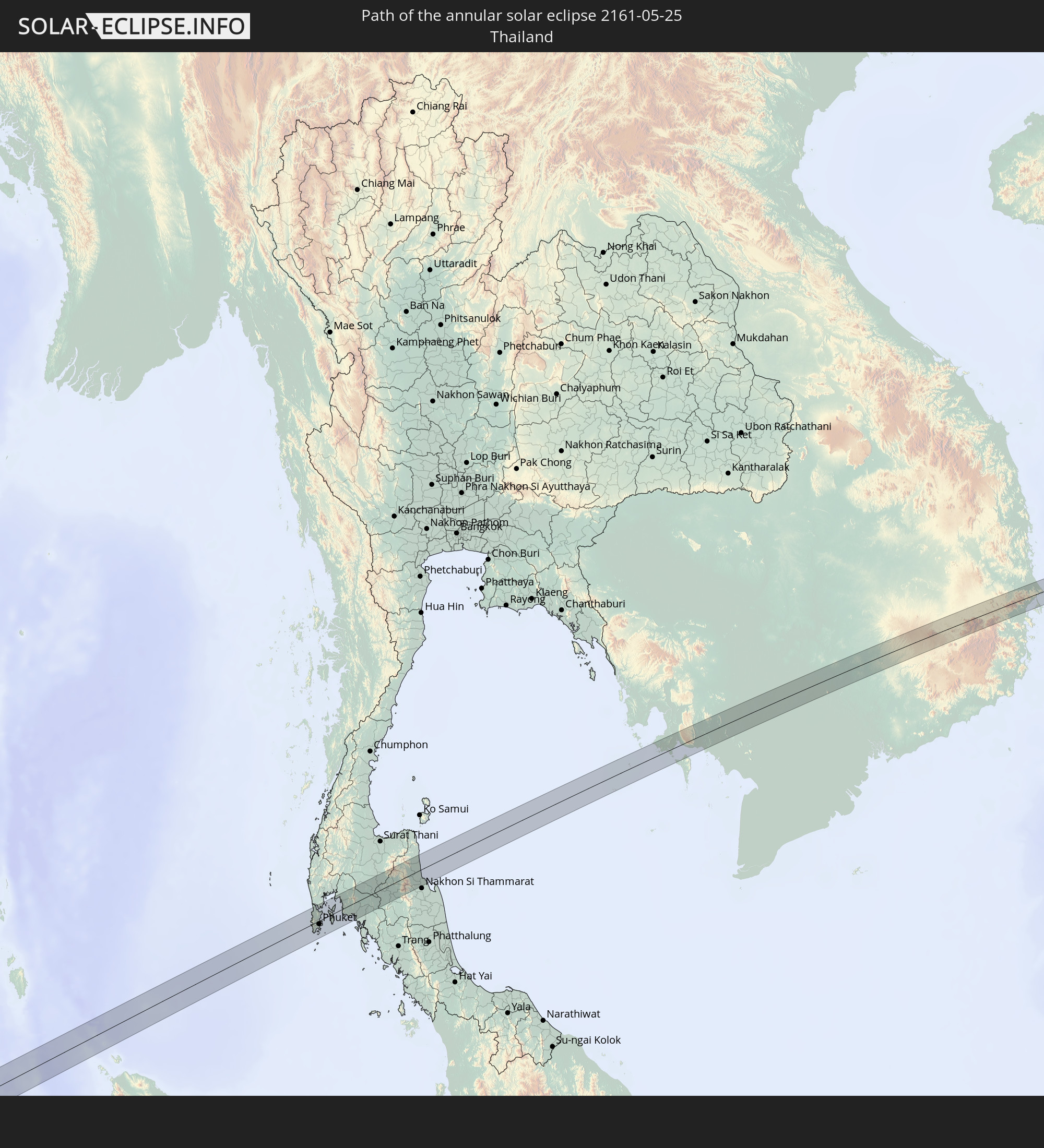 Thailand
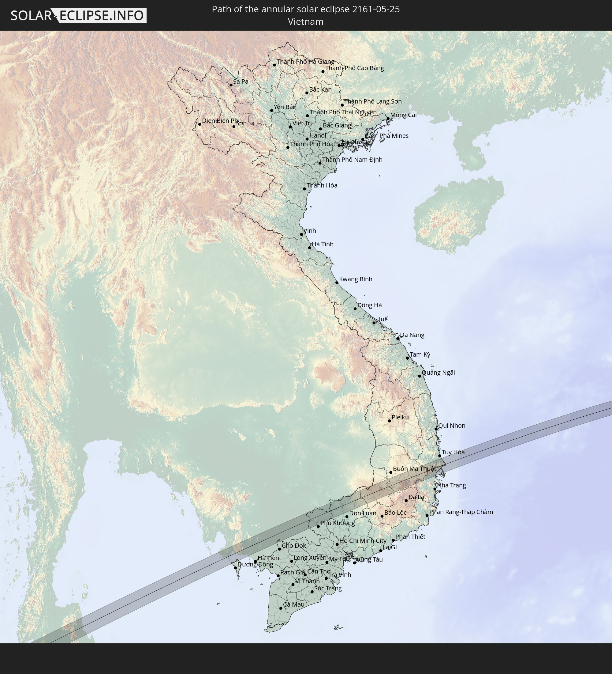 Vietnam
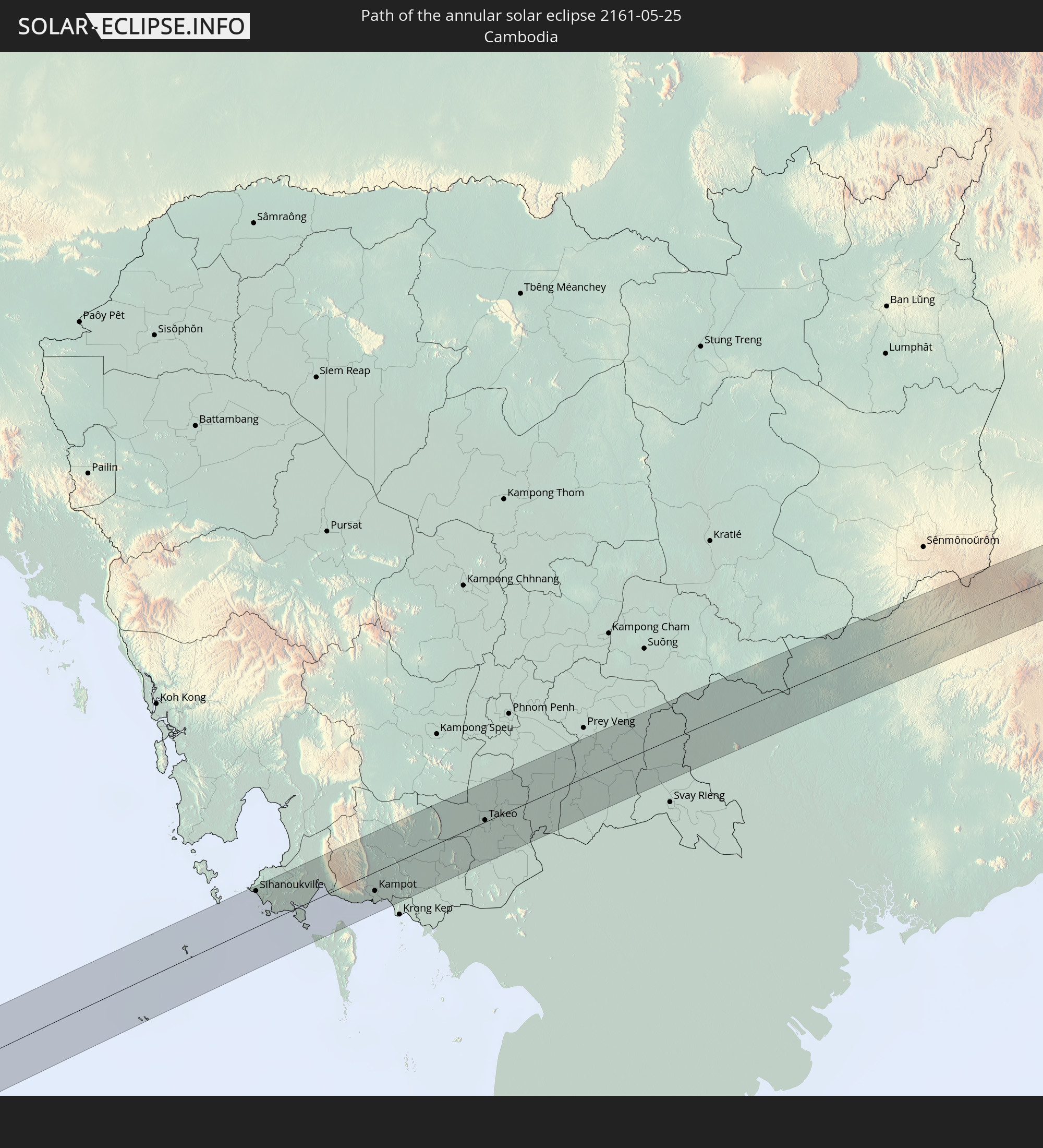 Cambodia
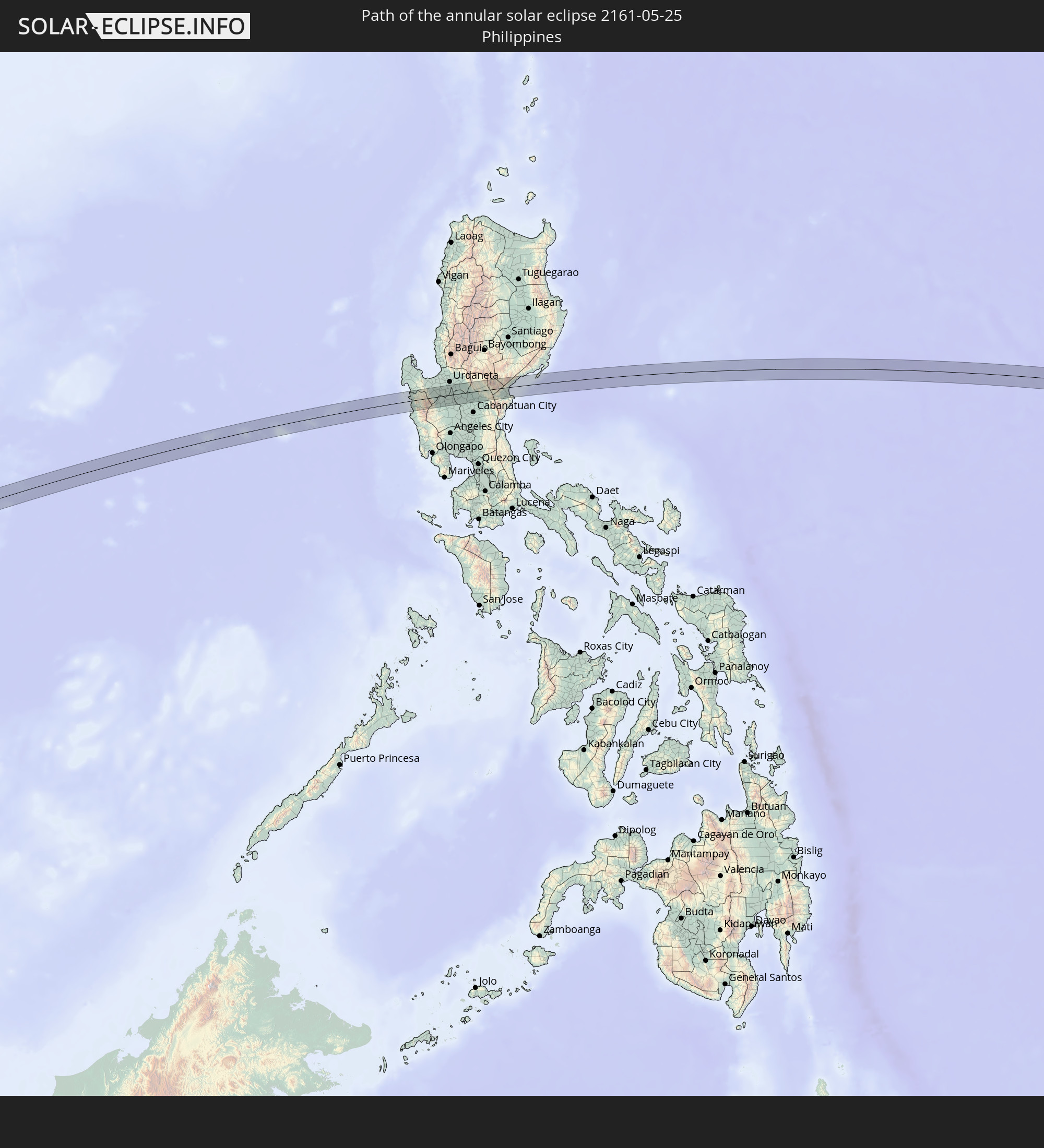 Philippines
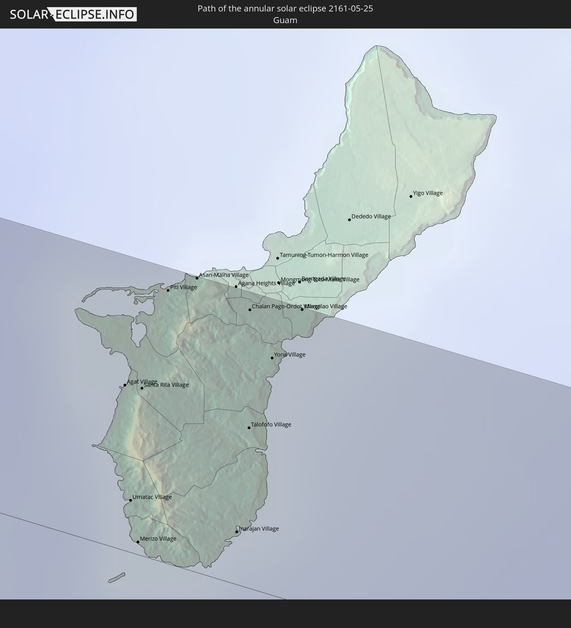 Guam
Guam
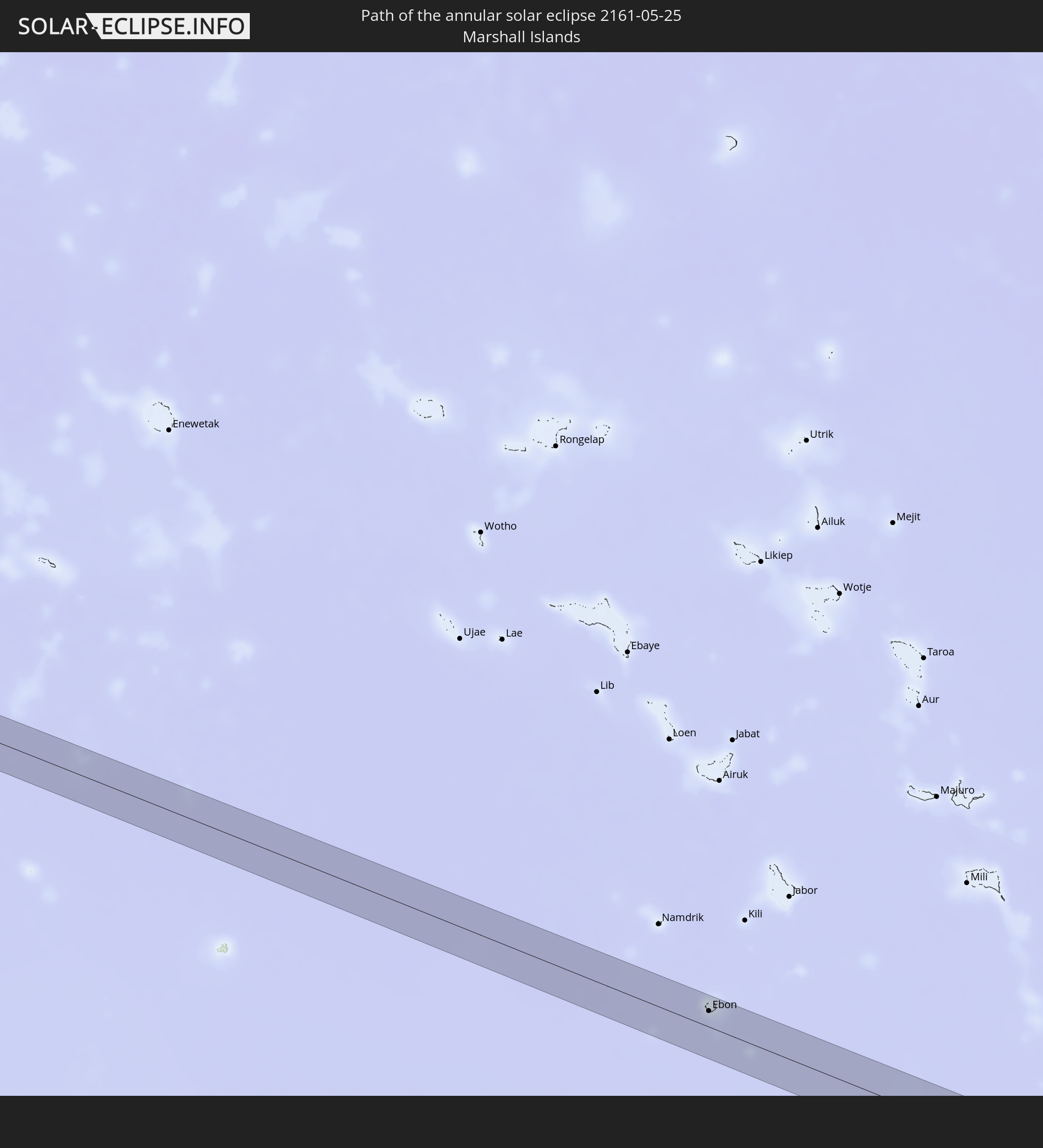 Marshall Islands
In den folgenden Ländern ist die Sonnenfinsternis partiell zu sehen
 Russia
 United States Minor Outlying Islands
 Kiribati
 Saudi Arabia
 French Southern and Antarctic Lands
 Somalia
 Yemen
Yemen
 Iran
Iran
 United Arab Emirates
 Oman
Oman
 Afghanistan
 Pakistan
 India
India
 British Indian Ocean Territory
 Maldives
 China
China
 Sri Lanka
 Nepal
Nepal
 Mongolia
 Bangladesh
 Bhutan
 Myanmar
 Indonesia
 Cocos Islands
 Thailand
 Malaysia
 Laos
Laos
 Vietnam
 Cambodia
 Singapore
 Christmas Island
 Australia
 Macau
Macau
 Hong Kong
 Brunei
 Taiwan
 Philippines
 Japan
Japan
 East Timor
 North Korea
 South Korea
 Palau
Palau
 Federated States of Micronesia
 Papua New Guinea
 Guam
Guam
 Northern Mariana Islands
 Solomon Islands
 New Caledonia
 Marshall Islands
 Vanuatu
 Nauru
Nauru
 Norfolk Island
 Tuvalu
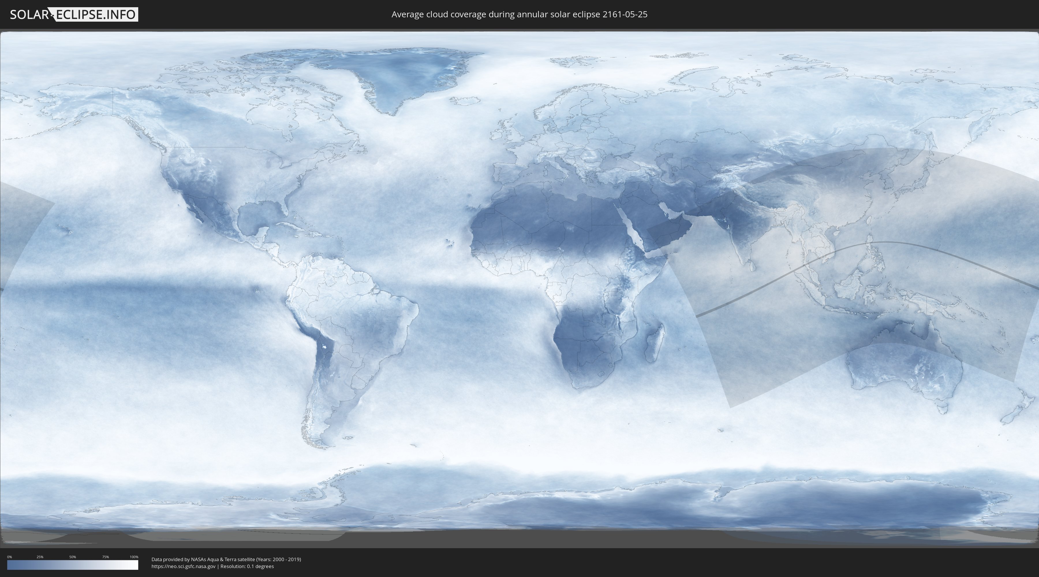
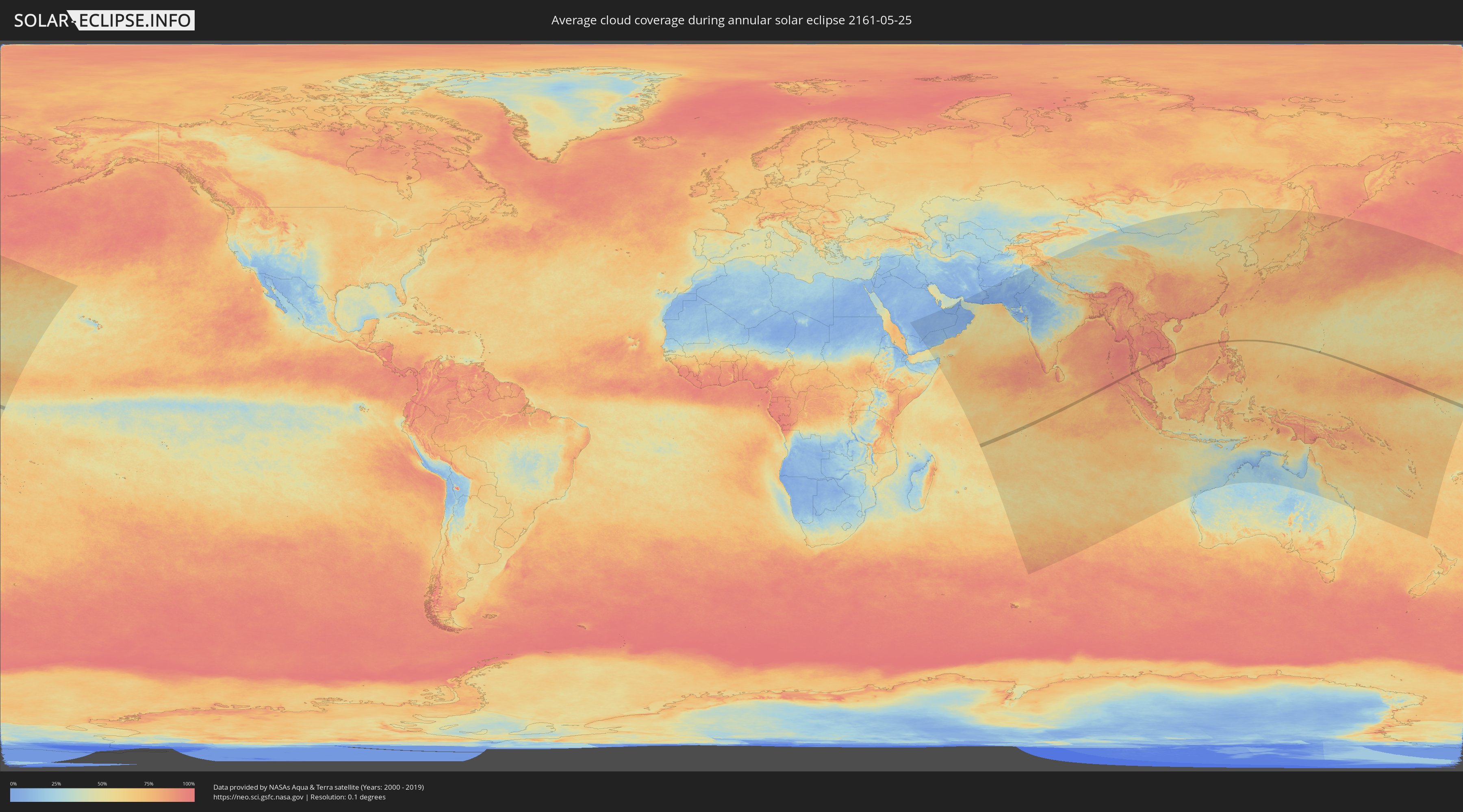
How will be the weather during the annular solar eclipse on 05/25/2161?
Where is the best place to see the annular solar eclipse of 05/25/2161?
The following maps show the average cloud coverage for the day of the annular solar eclipse.
With the help of these maps, it is possible to find the place along the eclipse path, which has the best
chance of a cloudless sky.
Nevertheless, you should consider local circumstances and inform about the weather of your chosen
observation site.
The data is provided by NASAs satellites
AQUA and TERRA.
The cloud maps are averaged over a period of 19 years (2000 - 2019).
Detailed country maps
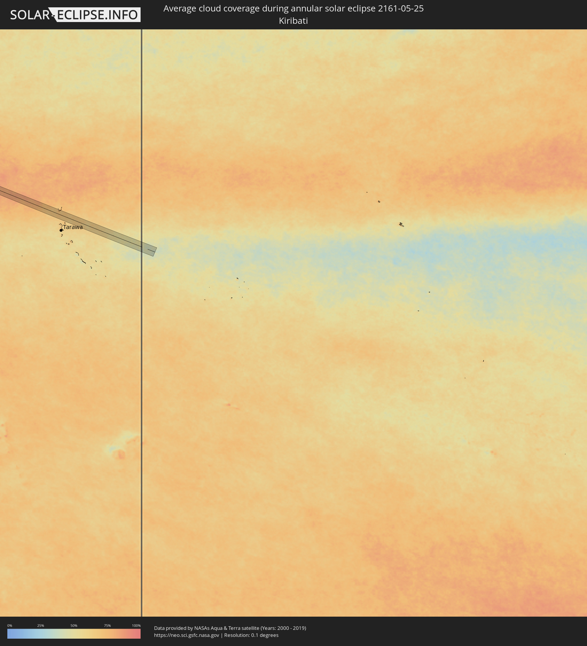 Kiribati
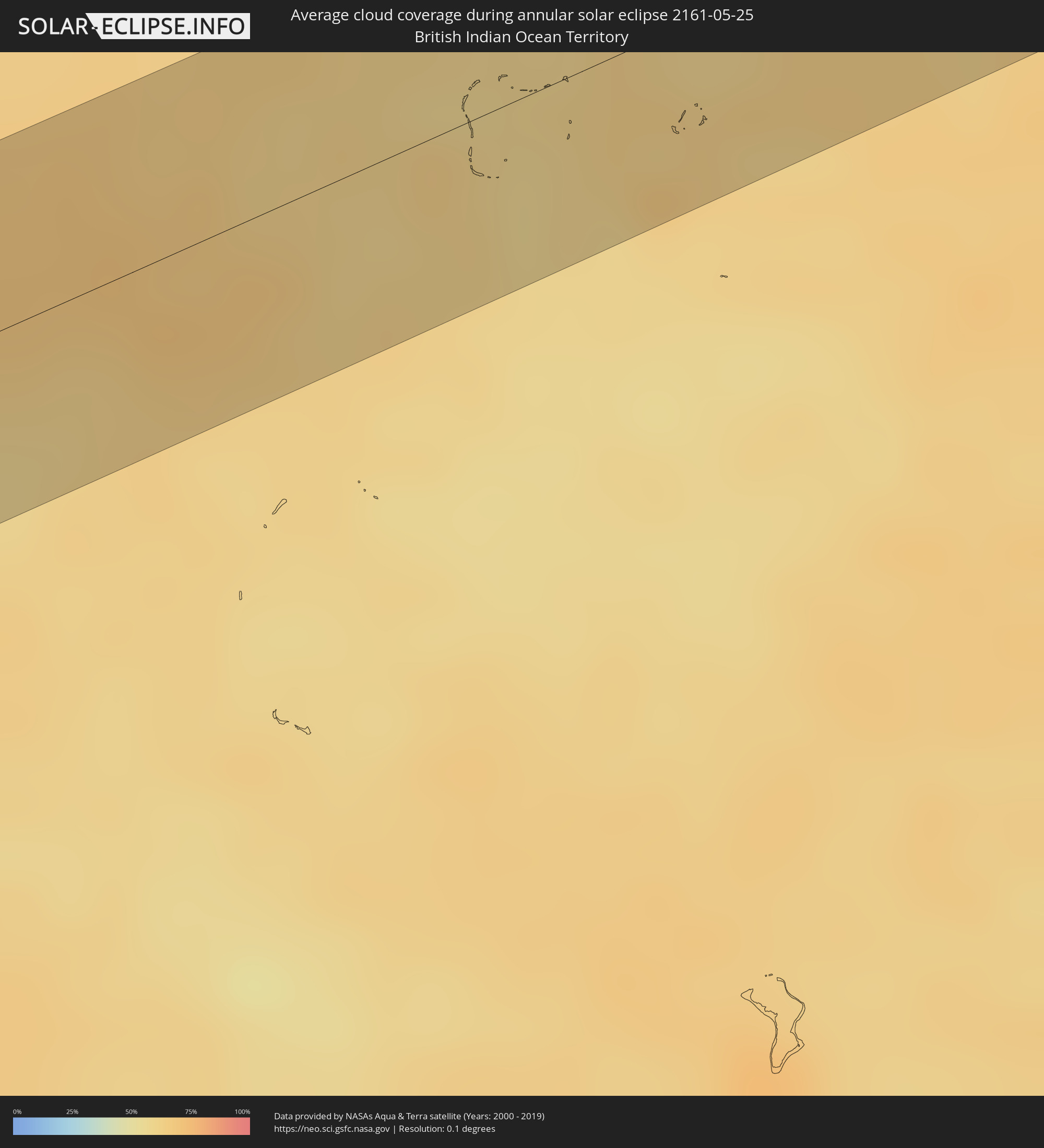 British Indian Ocean Territory
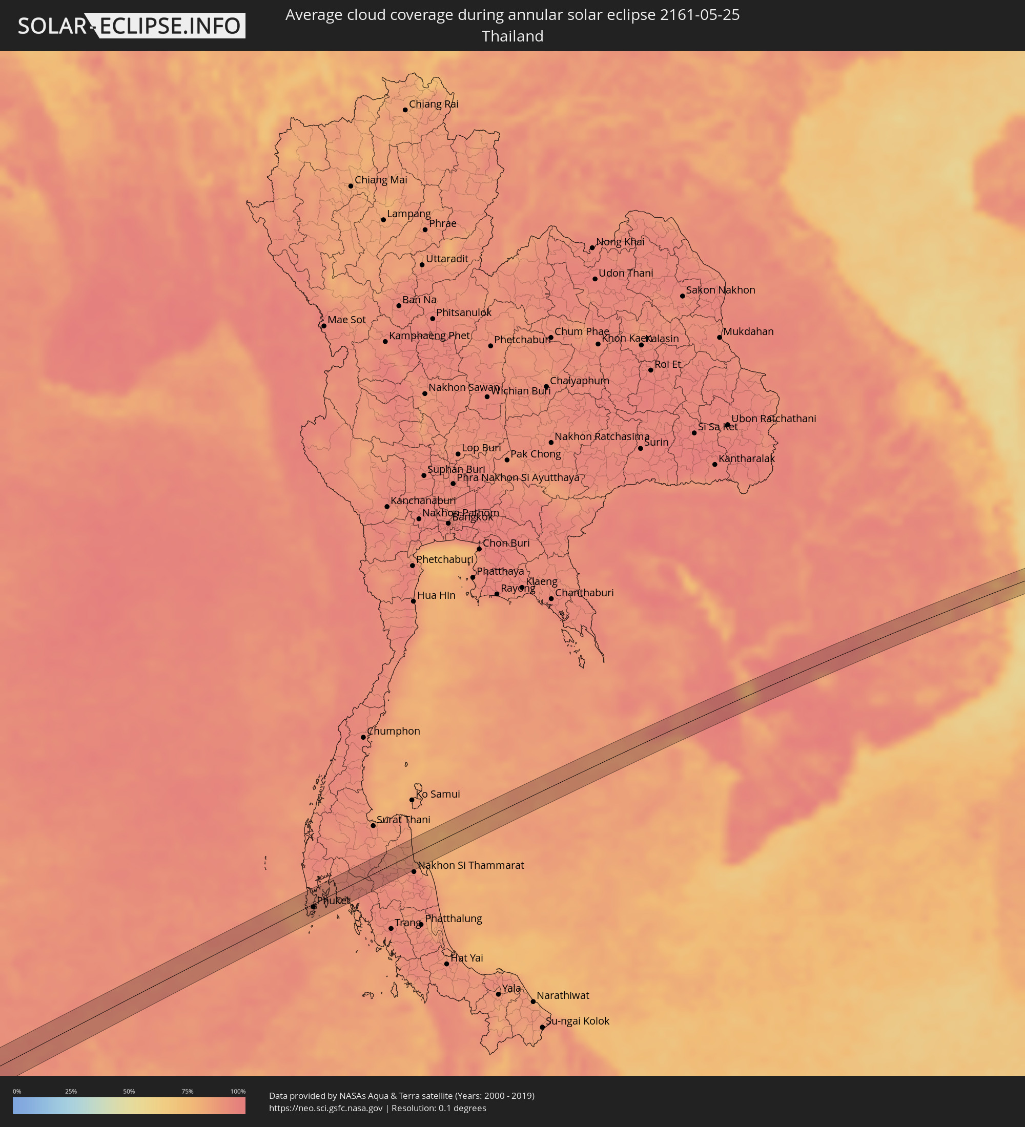 Thailand
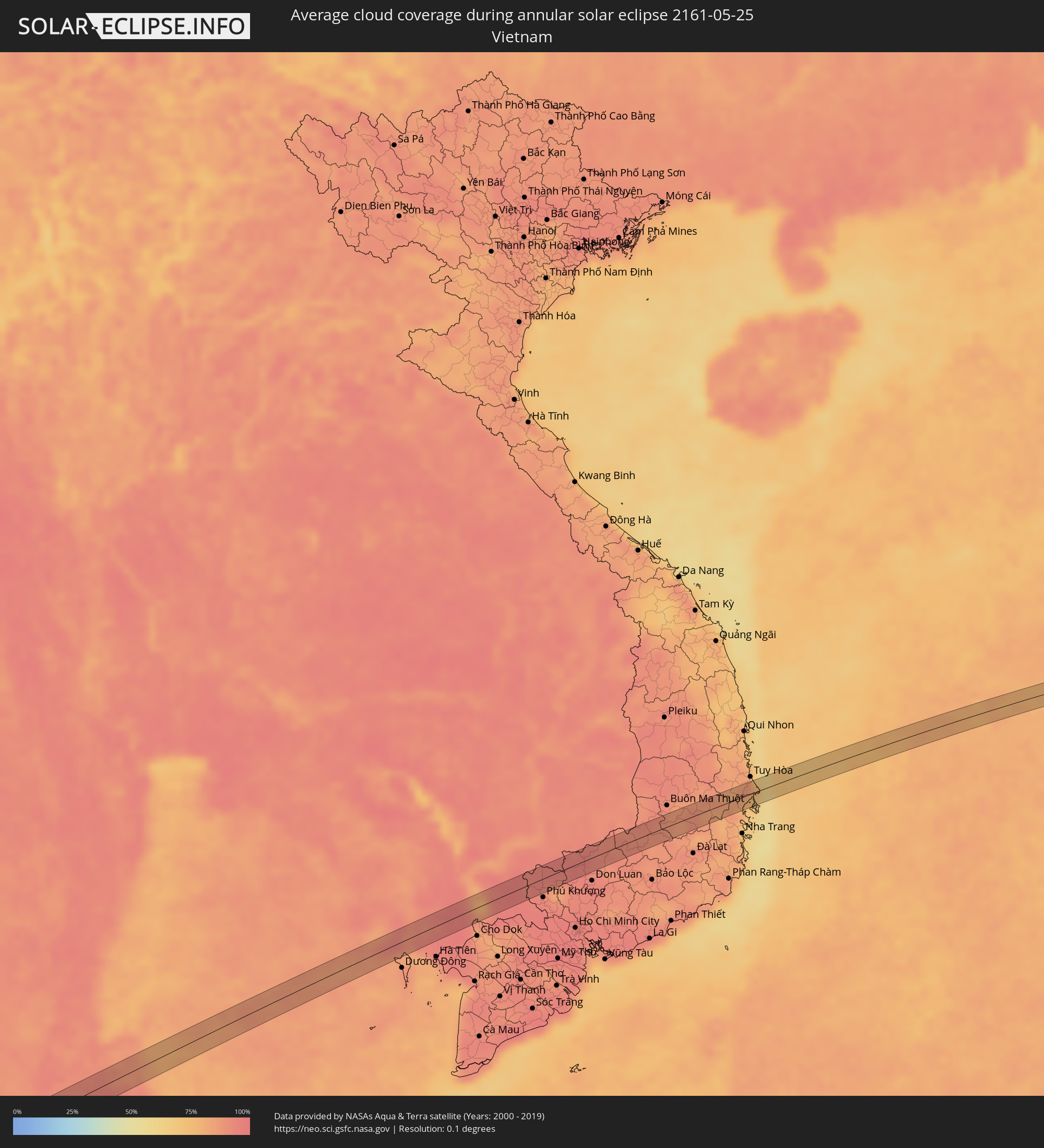 Vietnam
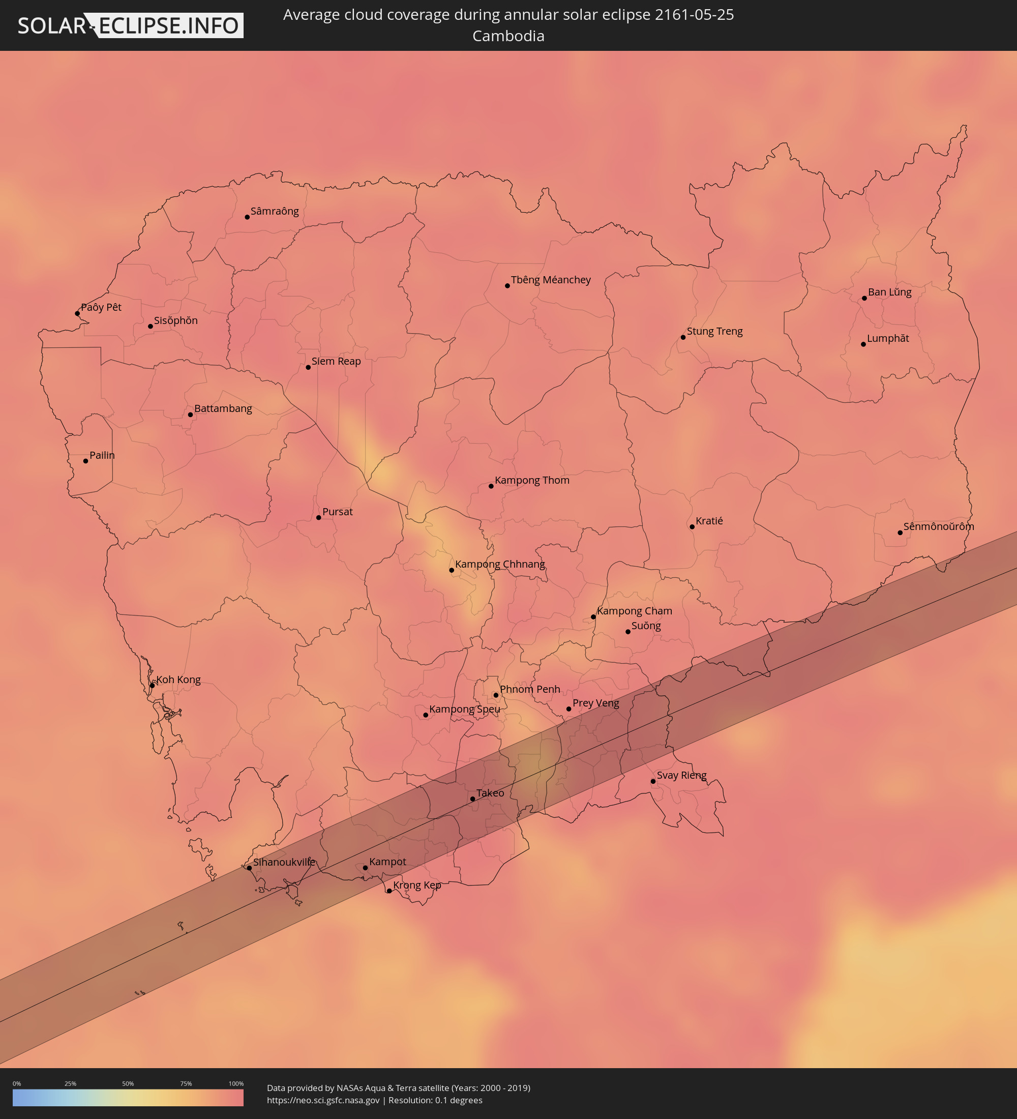 Cambodia
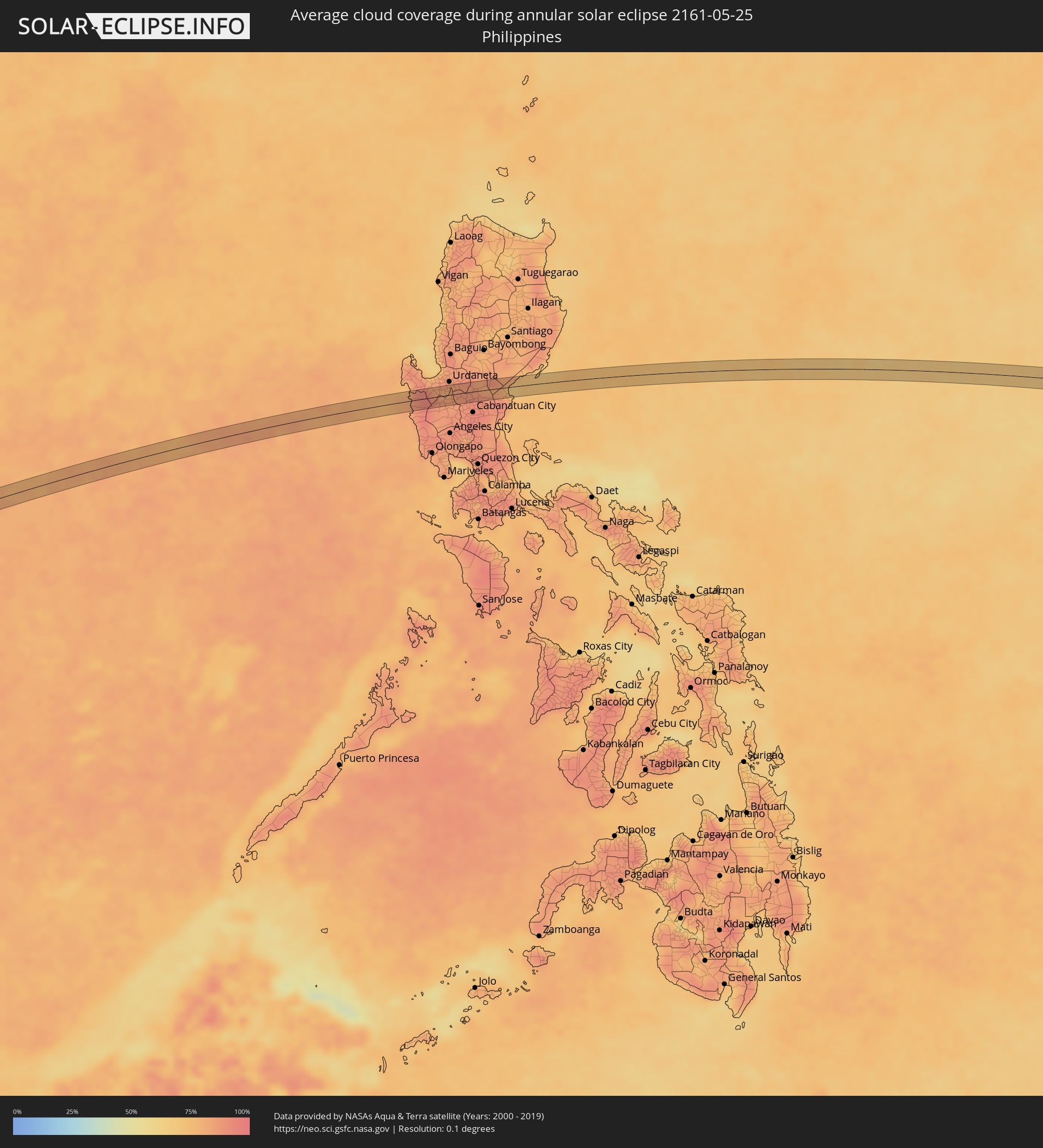 Philippines
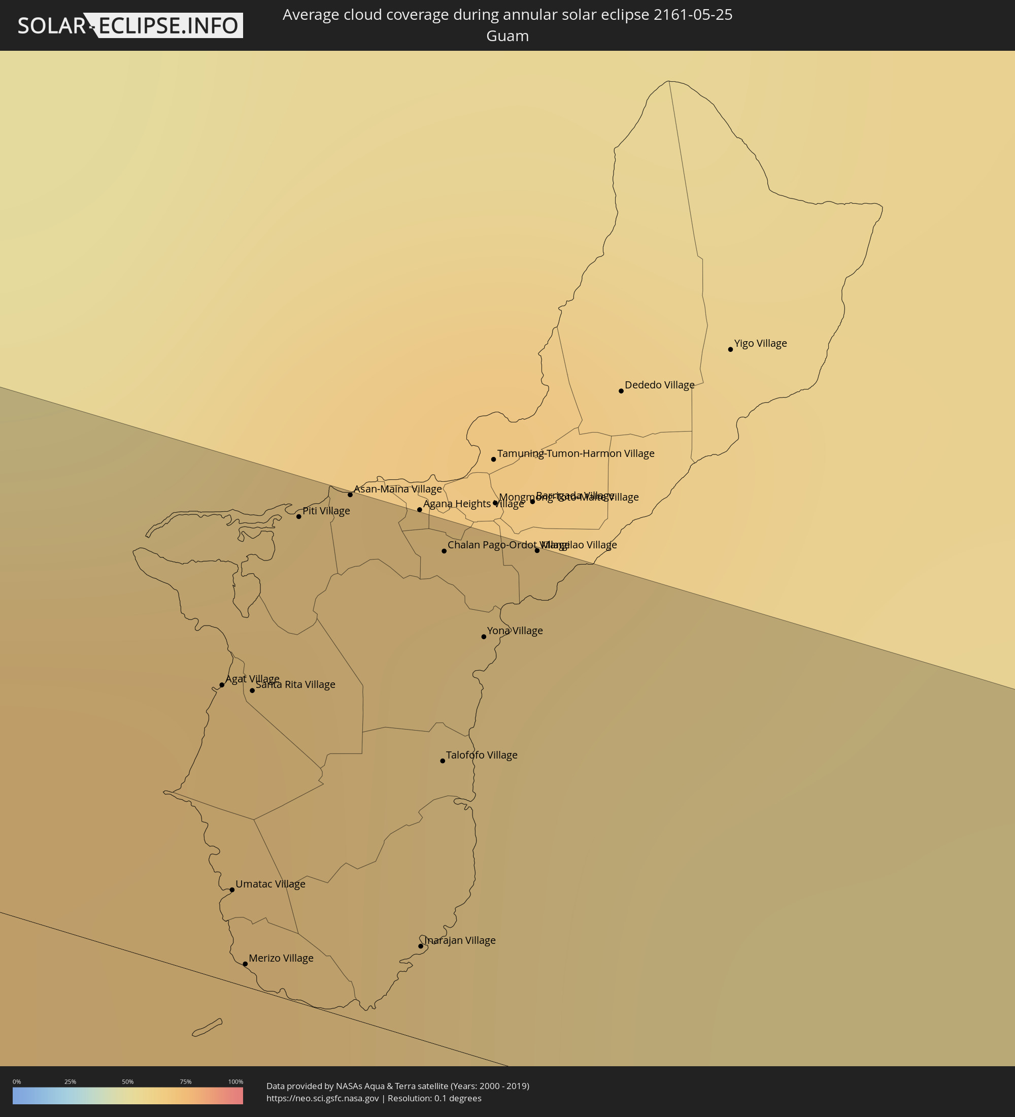 Guam
Guam
 Marshall Islands
Cities inside the path of the eclipse
The following table shows all locations with a population of more than 5,000 inside the eclipse path. Cities which have more than 100,000 inhabitants are marked bold. A click at the locations opens a detailed map.
| City | Type | Eclipse duration | Local time of max. eclipse | Distance to central line | Ø Cloud coverage |
|
Patong, Phuket
|
annular | - | 09:48:46 UTC+07:00 | 0 km | 87% |
|
Ban Karon, Phuket
|
annular | - | 09:48:43 UTC+07:00 | 5 km | 85% |
|
Rawai, Phuket
|
annular | - | 09:48:41 UTC+07:00 | 13 km | 85% |
|
Kathu, Phuket
|
annular | - | 09:48:52 UTC+07:00 | 1 km | 87% |
|
Ban Chalong, Phuket
|
annular | - | 09:48:47 UTC+07:00 | 7 km | 85% |
|
Wichit, Phuket
|
annular | - | 09:48:56 UTC+07:00 | 5 km | 90% |
|
Ban Talat Nua, Phuket
|
annular | - | 09:48:56 UTC+07:00 | 5 km | 90% |
|
Ban Ko Kaeo, Phuket
|
annular | - | 09:49:01 UTC+07:00 | 1 km | 90% |
|
Phuket, Phuket
|
annular | - | 09:48:58 UTC+07:00 | 5 km | 90% |
|
Ban Talat Yai, Phuket
|
annular | - | 09:48:58 UTC+07:00 | 6 km | 90% |
|
Ban Ratsada, Phuket
|
annular | - | 09:49:00 UTC+07:00 | 4 km | 90% |
|
Ban Phru Nai, Phangnga
|
annular | - | 09:49:26 UTC+07:00 | 8 km | 88% |
|
Ban Ao Nang, Phangnga
|
annular | - | 09:49:59 UTC+07:00 | 10 km | 87% |
|
Krabi, Krabi
|
annular | - | 09:50:13 UTC+07:00 | 13 km | 89% |
|
Nuea Khlong, Krabi
|
annular | - | 09:50:25 UTC+07:00 | 17 km | 90% |
|
Chai Buri, Surat Thani
|
annular | - | 09:51:01 UTC+07:00 | 18 km | 93% |
|
Wiang Sa, Surat Thani
|
annular | - | 09:51:50 UTC+07:00 | 21 km | 92% |
|
Tham Phannara, Nakhon Si Thammarat
|
annular | - | 09:51:38 UTC+07:00 | 2 km | 93% |
|
Chawang, Nakhon Si Thammarat
|
annular | - | 09:51:53 UTC+07:00 | 7 km | 94% |
|
Sihanoukville, Preah Sihanouk
|
annular | - | 10:03:46 UTC+07:00 | 19 km | 88% |
|
Kampot, Kampot
|
annular | - | 10:05:25 UTC+07:00 | 10 km | 85% |
|
Phumĭ Véal Srê, Takeo
|
annular | - | 10:07:24 UTC+07:00 | 0 km | 97% |
|
Takeo, Takeo
|
annular | - | 10:07:25 UTC+07:00 | 1 km | 97% |
|
Bình Long, Bình Phước
|
annular | - | 10:13:06 UTC+07:00 | 12 km | 93% |
|
Santa Cruz, Central Luzon
|
annular | - | 12:00:11 UTC+08:00 | 11 km | 81% |
|
Lucapon, Central Luzon
|
annular | - | 12:00:14 UTC+08:00 | 3 km | 83% |
|
Masinloc, Central Luzon
|
annular | - | 12:00:12 UTC+08:00 | 15 km | 88% |
|
Tamayo, Ilocos
|
annular | - | 12:01:34 UTC+08:00 | 17 km | 81% |
|
Mangatarem, Ilocos
|
annular | - | 12:01:33 UTC+08:00 | 7 km | 86% |
|
Urbiztondo, Ilocos
|
annular | - | 12:01:42 UTC+08:00 | 10 km | 86% |
|
Mayantoc, Central Luzon
|
annular | - | 12:01:45 UTC+08:00 | 13 km | 86% |
|
Dumpay, Ilocos
|
annular | - | 12:01:56 UTC+08:00 | 16 km | 84% |
|
Camiling, Central Luzon
|
annular | - | 12:01:55 UTC+08:00 | 6 km | 87% |
|
Santa Ignacia, Central Luzon
|
annular | - | 12:01:58 UTC+08:00 | 14 km | 86% |
|
Lepa, Ilocos
|
annular | - | 12:02:10 UTC+08:00 | 15 km | 81% |
|
Alcala, Ilocos
|
annular | - | 12:02:24 UTC+08:00 | 10 km | 80% |
|
Sapang, Central Luzon
|
annular | - | 12:02:19 UTC+08:00 | 6 km | 86% |
|
Puelay, Ilocos
|
annular | - | 12:02:36 UTC+08:00 | 13 km | 85% |
|
Paniqui, Central Luzon
|
annular | - | 12:02:30 UTC+08:00 | 11 km | 85% |
|
Bacag, Ilocos
|
annular | - | 12:02:39 UTC+08:00 | 18 km | 85% |
|
Villasis, Ilocos
|
annular | - | 12:02:39 UTC+08:00 | 15 km | 85% |
|
Carmen, Ilocos
|
annular | - | 12:02:41 UTC+08:00 | 13 km | 85% |
|
Caramutan, Ilocos
|
annular | - | 12:02:44 UTC+08:00 | 17 km | 85% |
|
Nampicuan, Central Luzon
|
annular | - | 12:02:42 UTC+08:00 | 5 km | 85% |
|
Rosales, Ilocos
|
annular | - | 12:02:48 UTC+08:00 | 13 km | 85% |
|
Pura, Central Luzon
|
annular | - | 12:02:43 UTC+08:00 | 17 km | 88% |
|
Cuyapo, Central Luzon
|
annular | - | 12:02:52 UTC+08:00 | 1 km | 87% |
|
Guimba, Central Luzon
|
annular | - | 12:03:10 UTC+08:00 | 14 km | 89% |
|
Talugtug, Central Luzon
|
annular | - | 12:03:23 UTC+08:00 | 2 km | 88% |
|
Santo Rosario, Central Luzon
|
annular | - | 12:03:29 UTC+08:00 | 18 km | 91% |
|
Baloc, Central Luzon
|
partial | - | 12:03:34 UTC+08:00 | 18 km | 91% |
|
Lupao, Central Luzon
|
annular | - | 12:03:44 UTC+08:00 | 8 km | 86% |
|
Muñoz, Central Luzon
|
annular | - | 12:03:40 UTC+08:00 | 10 km | 90% |
|
Carranglan, Central Luzon
|
annular | - | 12:04:22 UTC+08:00 | 14 km | 82% |
|
Rizal, Central Luzon
|
annular | - | 12:04:23 UTC+08:00 | 14 km | 91% |
|
Pantabangan, Central Luzon
|
annular | - | 12:04:34 UTC+08:00 | 3 km | 86% |
|
Maria Aurora, Central Luzon
|
annular | - | 12:05:44 UTC+08:00 | 9 km | 78% |
|
Suklayin, Central Luzon
|
annular | - | 12:05:59 UTC+08:00 | 15 km | 69% |
|
Agat Village, Agat
|
annular | - | 15:15:37 UTC+10:00 | 14 km | 65% |
|
Umatac Village, Umatac
|
annular | - | 15:15:41 UTC+10:00 | 4 km | 62% |
|
Merizo Village, Merizo
|
annular | - | 15:15:43 UTC+10:00 | 1 km | 62% |
|
Santa Rita Village, Santa Rita
|
annular | - | 15:15:39 UTC+10:00 | 14 km | 65% |
|
Piti Village, Piti
|
annular | - | 15:15:39 UTC+10:00 | 23 km | 65% |
|
Asan-Maina Village, Asan
|
annular | - | 15:15:41 UTC+10:00 | 25 km | 65% |
|
Inarajan Village, Inarajan
|
annular | - | 15:15:53 UTC+10:00 | 4 km | 62% |
|
Talofofo Village, Talofofo
|
annular | - | 15:15:51 UTC+10:00 | 13 km | 60% |
|
Chalan Pago-Ordot Village, Chalan Pago-Ordot
|
annular | - | 15:15:48 UTC+10:00 | 23 km | 60% |
|
Yona Village, Yona
|
annular | - | 15:15:51 UTC+10:00 | 20 km | 60% |
|
Mangilao Village, Mangilao
|
annular | - | 15:15:53 UTC+10:00 | 25 km | 60% |
|
Ebon, Ebon Atoll
|
annular | - | 17:48:23 UTC+12:00 | 19 km | 83% |