Total solar eclipse of 01/12/2252
| Day of week: | Monday |
| Maximum duration of eclipse: | 03m23s |
| Maximum width of eclipse path: | 123 km |
| Saros cycle: | 145 |
| Coverage: | 100% |
| Magnitude: | 1.0365 |
| Gamma: | 0.0608 |
Wo kann man die Sonnenfinsternis vom 01/12/2252 sehen?
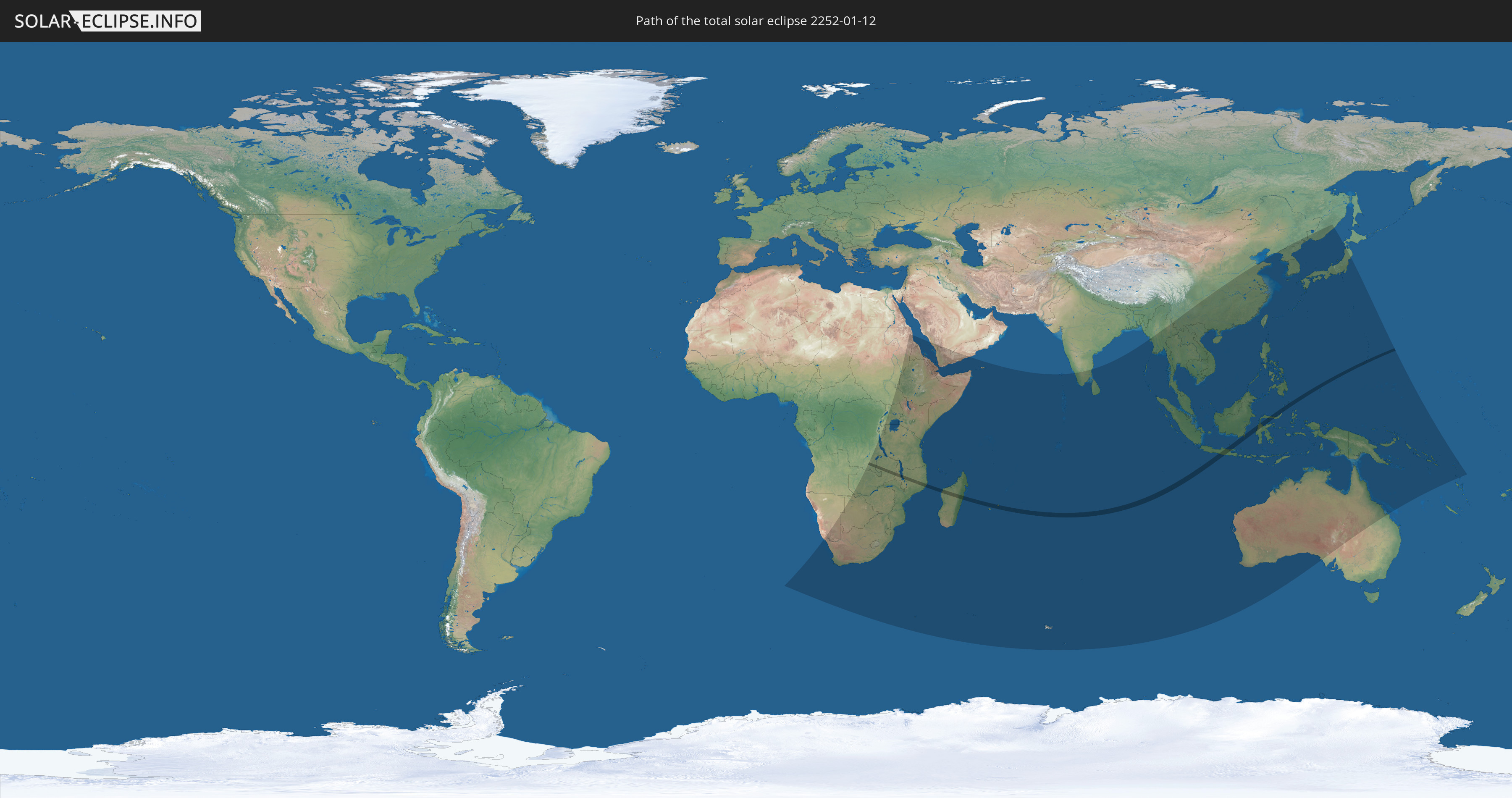
Die Sonnenfinsternis am 01/12/2252 kann man in 64 Ländern als partielle Sonnenfinsternis beobachten.
Der Finsternispfad verläuft durch 10 Länder. Nur in diesen Ländern ist sie als total Sonnenfinsternis zu sehen.
In den folgenden Ländern ist die Sonnenfinsternis total zu sehen
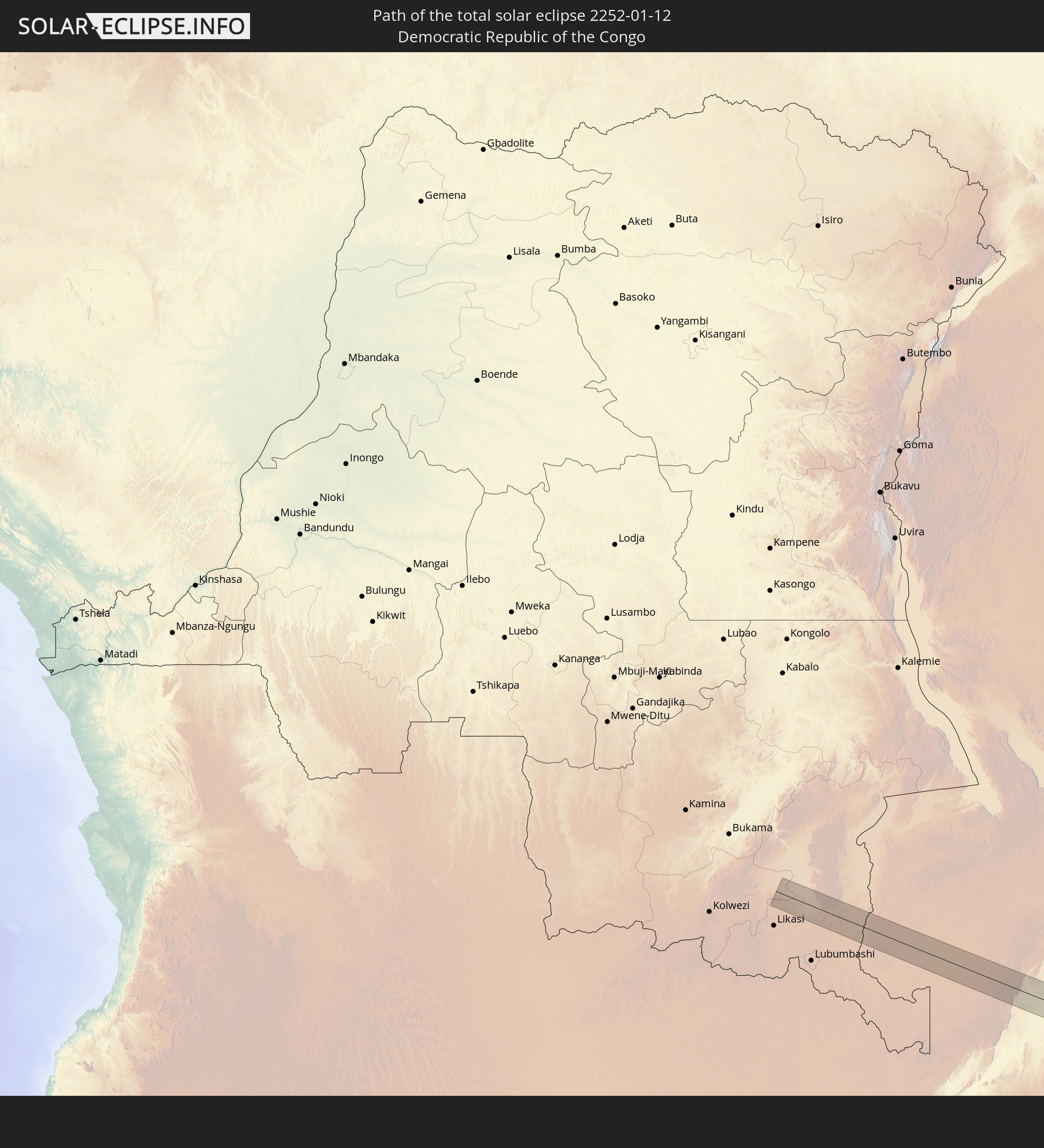 Democratic Republic of the Congo
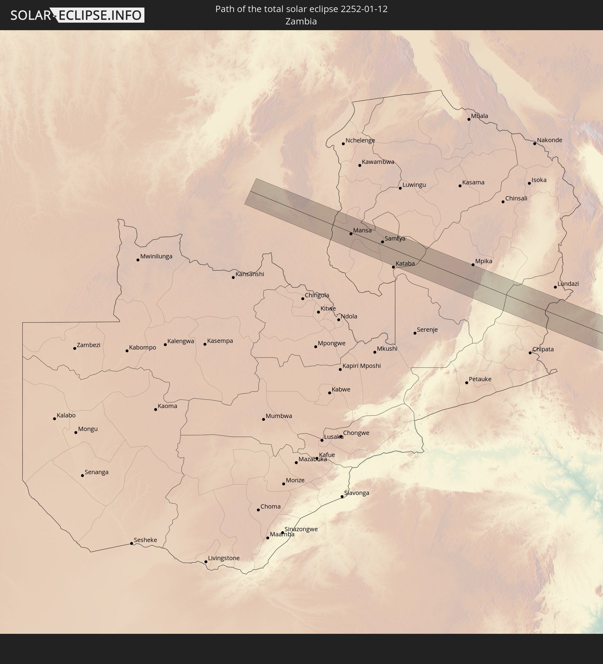 Zambia
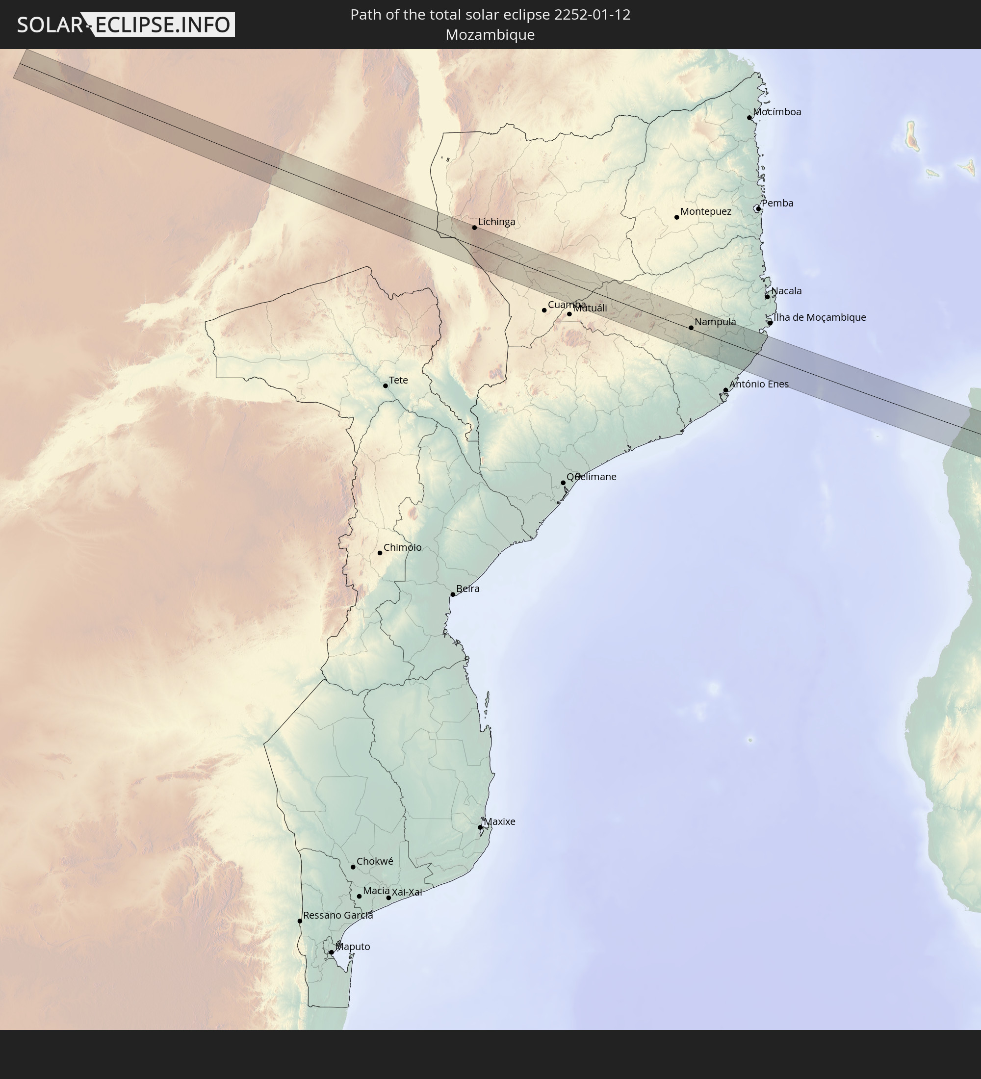 Mozambique
 Malawi
 Madagascar
 Mauritius
 Indonesia
 Palau
Palau
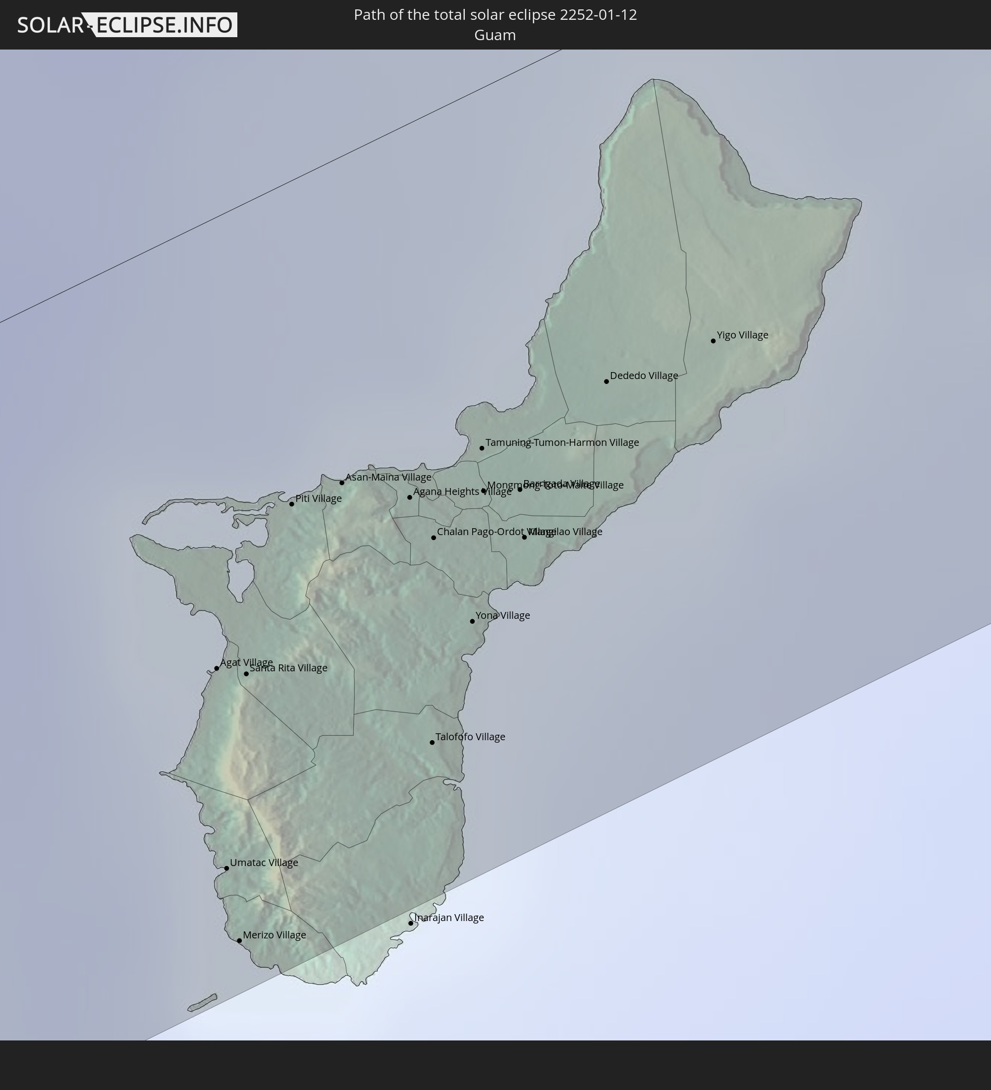 Guam
Guam
 Northern Mariana Islands
In den folgenden Ländern ist die Sonnenfinsternis partiell zu sehen
 Russia
 Angola
 Namibia
 Democratic Republic of the Congo
 South Africa
 Botswana
 Sudan
Sudan
 Zambia
 Zimbabwe
 Lesotho
 Rwanda
 Burundi
 Tanzania
 Uganda
 Mozambique
 Swaziland
 Malawi
 Ethiopia
 Kenya
Kenya
 Saudi Arabia
 Eritrea
 French Southern and Antarctic Lands
 Somalia
 Djibouti
 Yemen
Yemen
 Madagascar
 Comoros
 Mayotte
 Seychelles
 Réunion
 Mauritius
 India
India
 British Indian Ocean Territory
 Heard Island and McDonald Islands
 Maldives
 China
China
 Sri Lanka
 Myanmar
 Indonesia
 Cocos Islands
 Thailand
 Malaysia
 Laos
Laos
 Vietnam
 Cambodia
 Singapore
 Christmas Island
 Australia
 Macau
Macau
 Hong Kong
 Brunei
 Taiwan
 Philippines
 Japan
Japan
 East Timor
 North Korea
 South Korea
 Palau
Palau
 Federated States of Micronesia
 Papua New Guinea
 Guam
Guam
 Northern Mariana Islands
 Solomon Islands
 Vanuatu
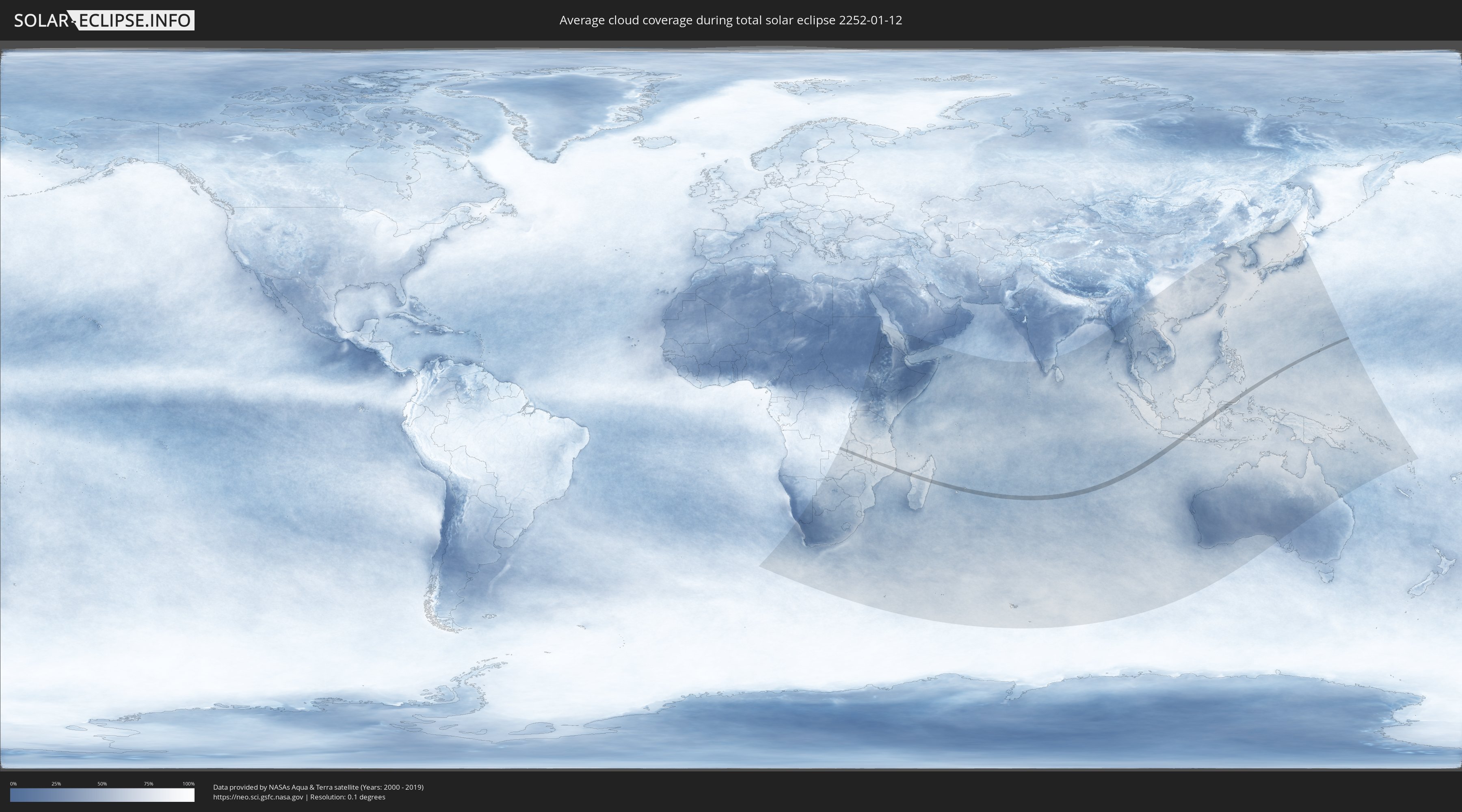
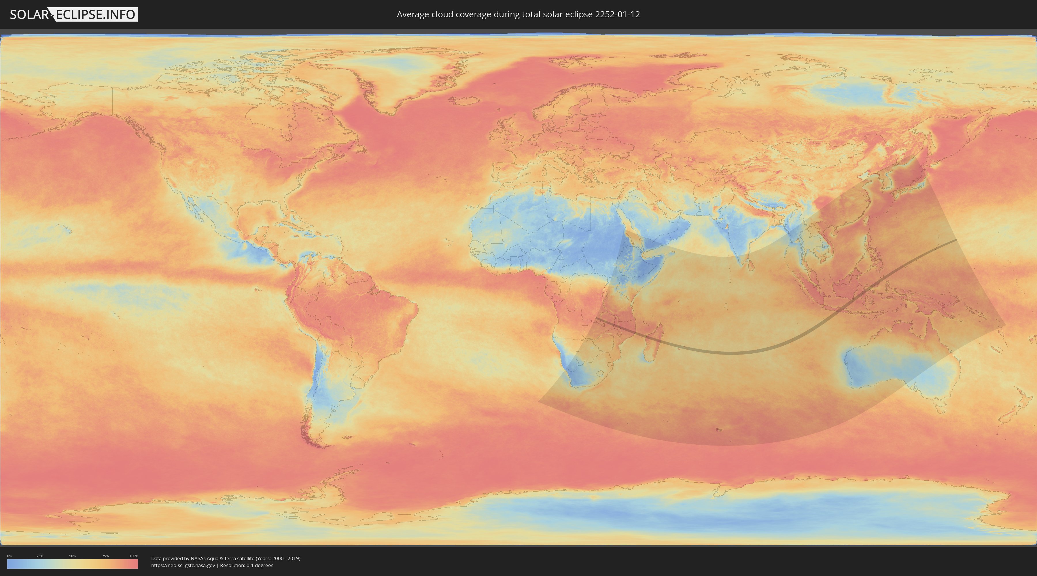
How will be the weather during the total solar eclipse on 01/12/2252?
Where is the best place to see the total solar eclipse of 01/12/2252?
The following maps show the average cloud coverage for the day of the total solar eclipse.
With the help of these maps, it is possible to find the place along the eclipse path, which has the best
chance of a cloudless sky.
Nevertheless, you should consider local circumstances and inform about the weather of your chosen
observation site.
The data is provided by NASAs satellites
AQUA and TERRA.
The cloud maps are averaged over a period of 19 years (2000 - 2019).
Detailed country maps
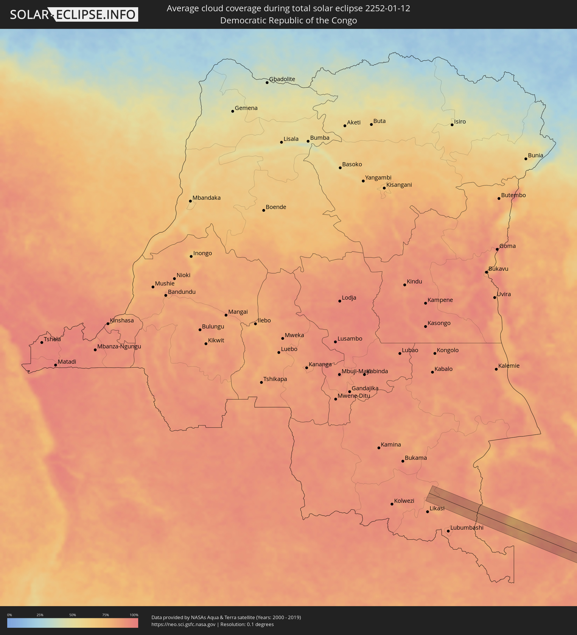 Democratic Republic of the Congo
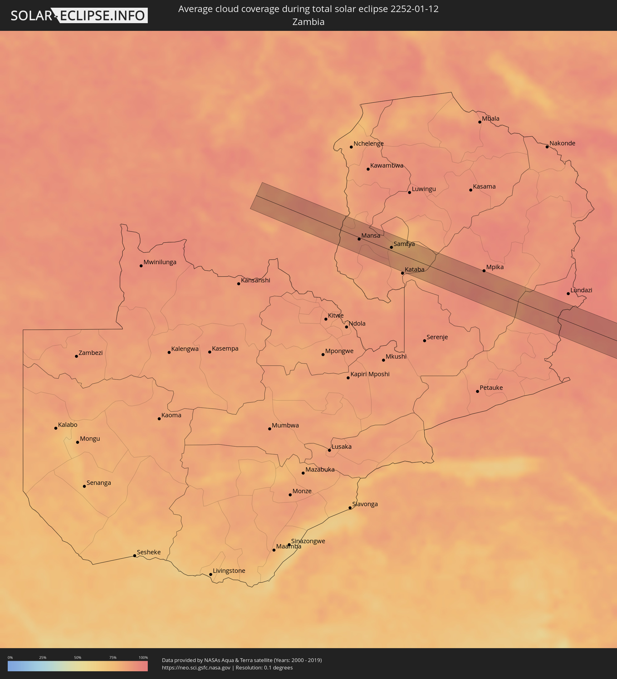 Zambia
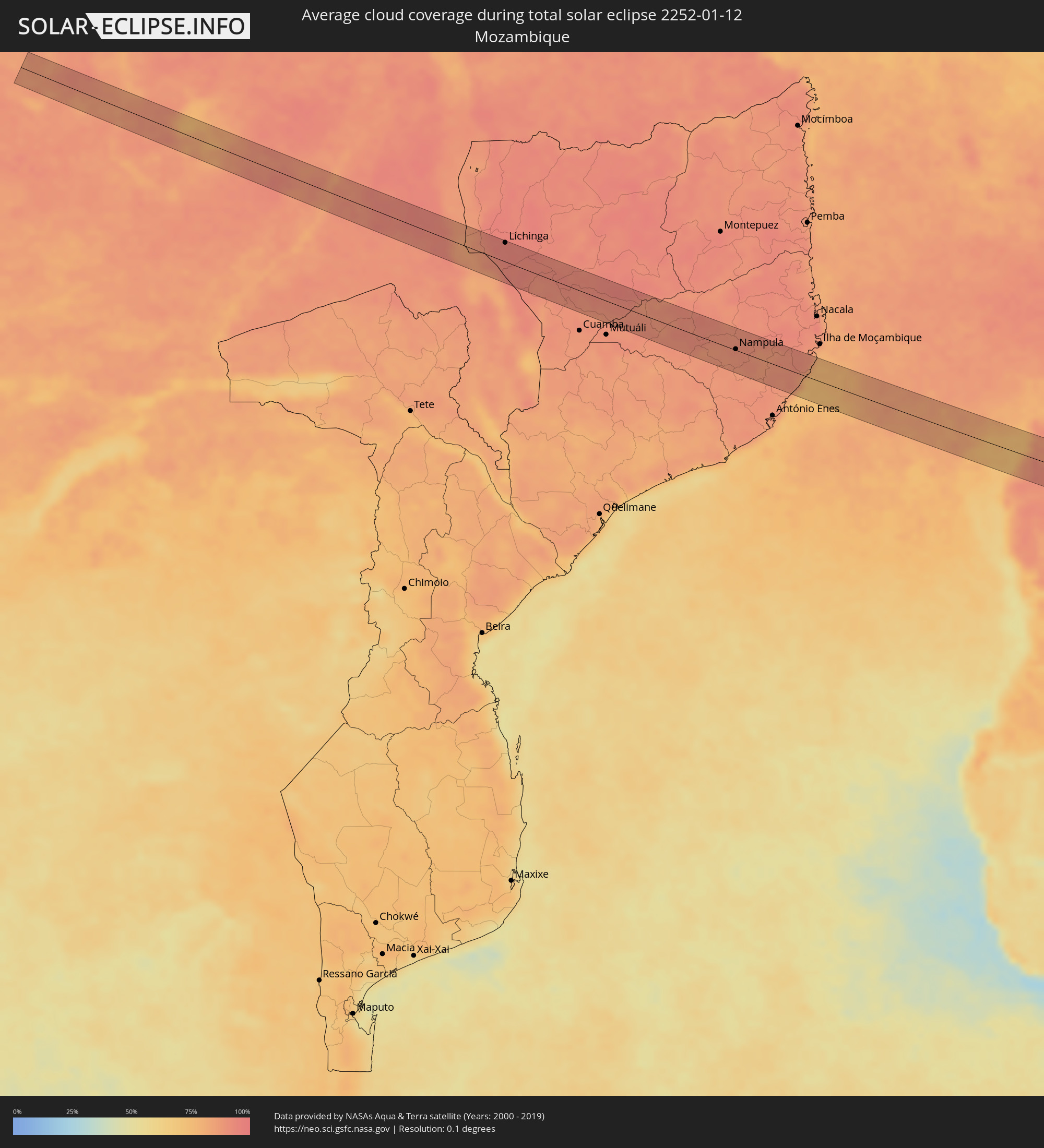 Mozambique
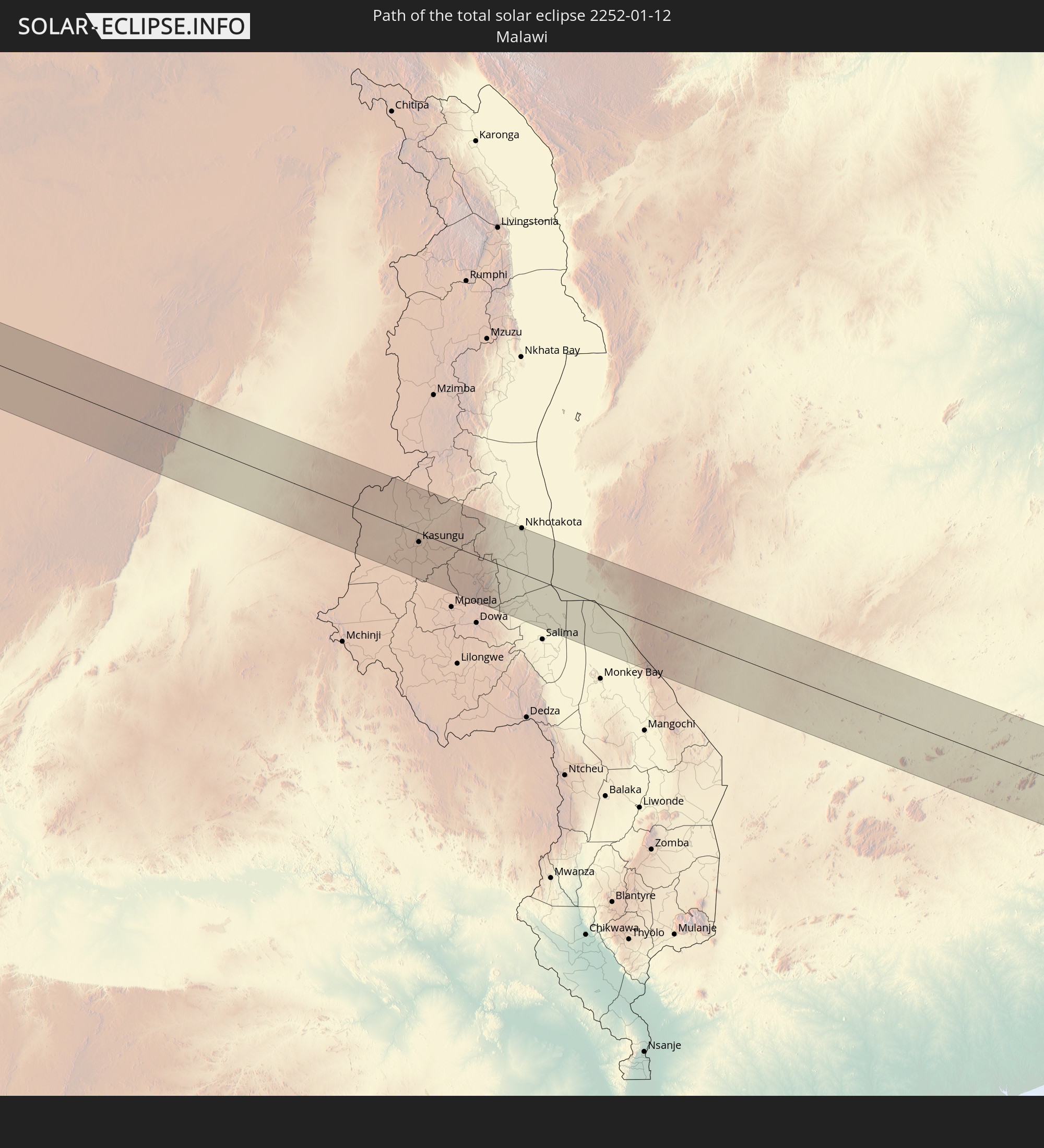
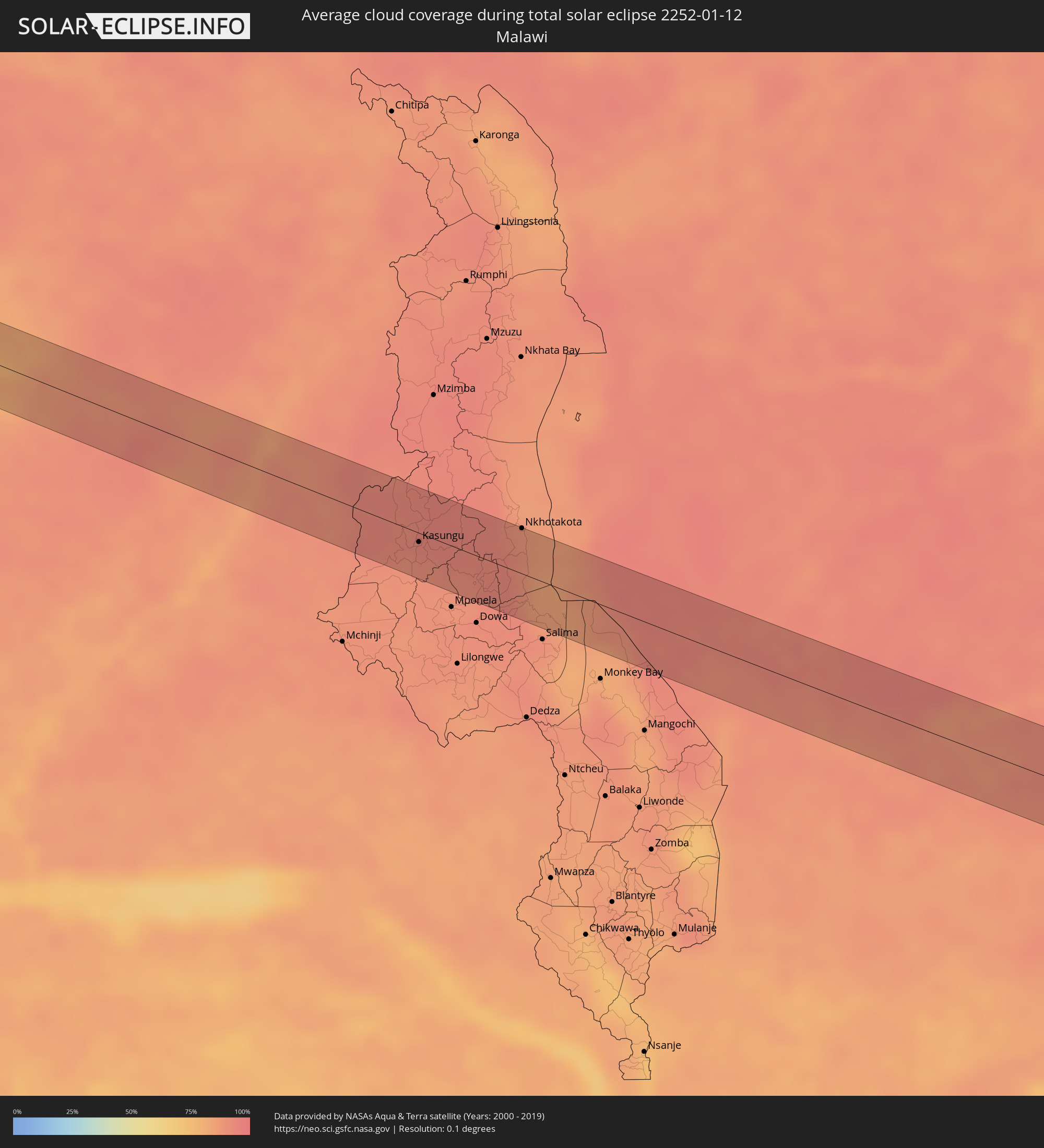 Malawi
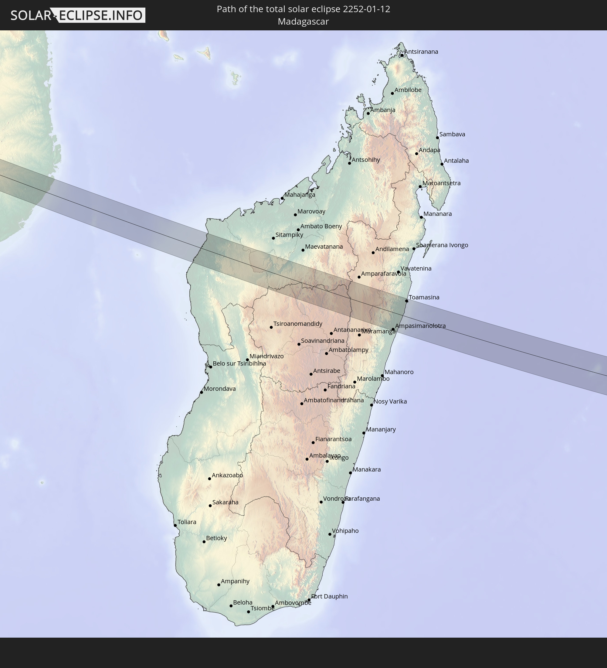
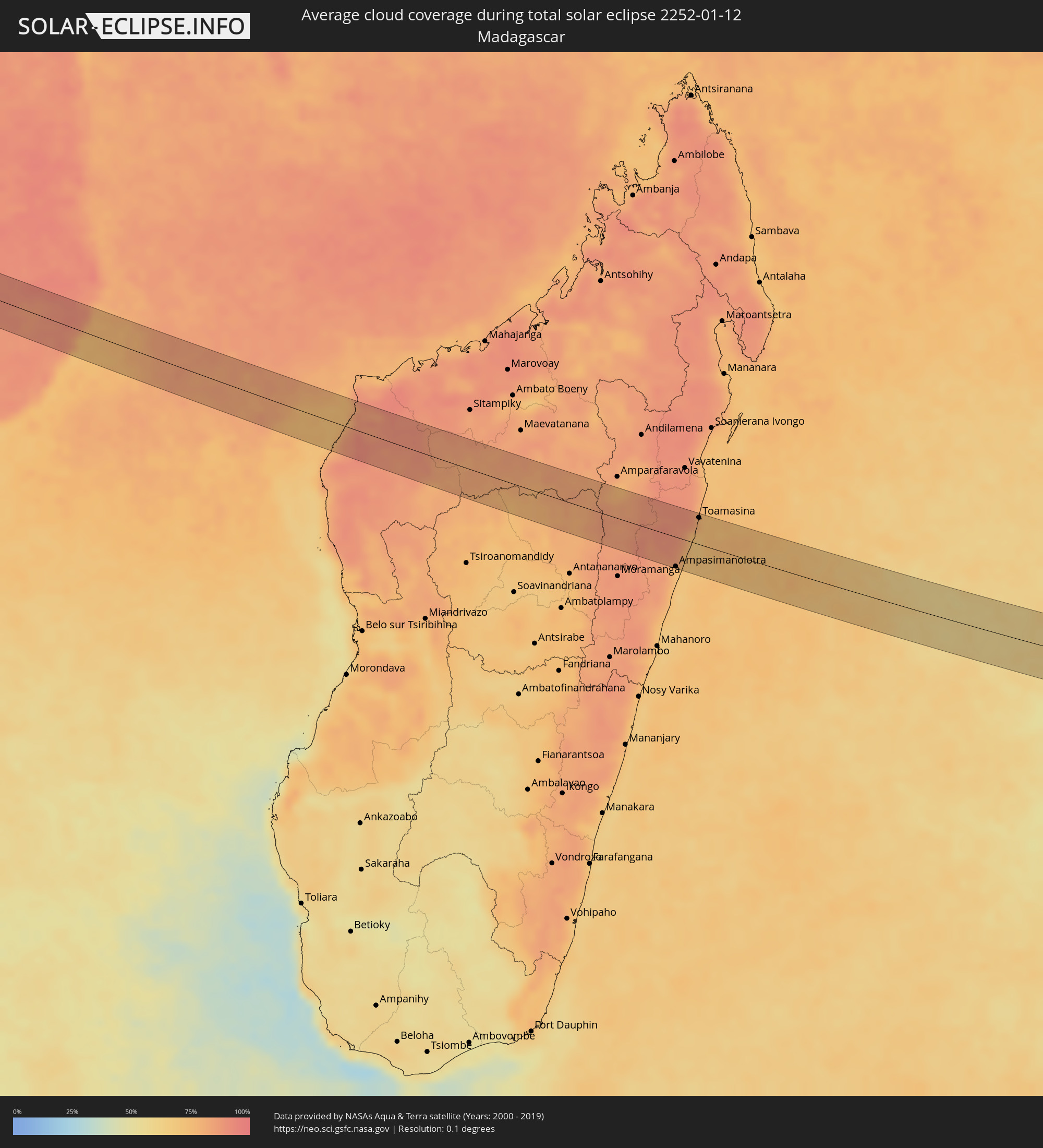 Madagascar
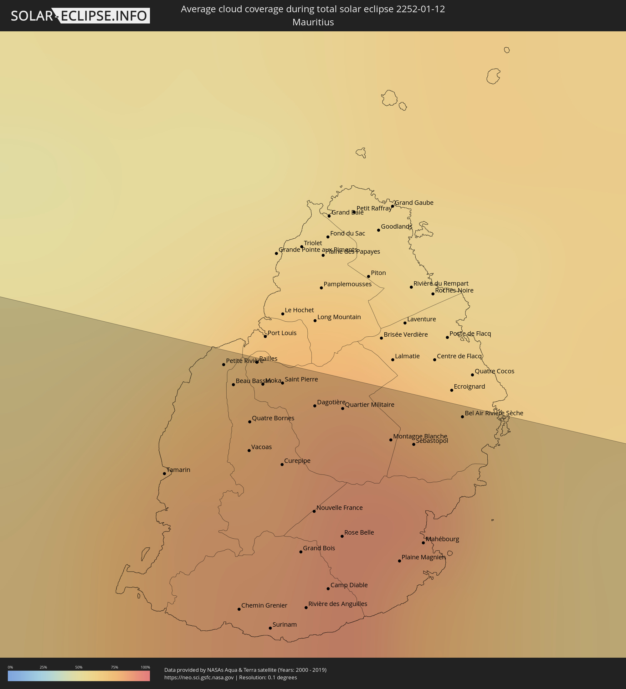 Mauritius
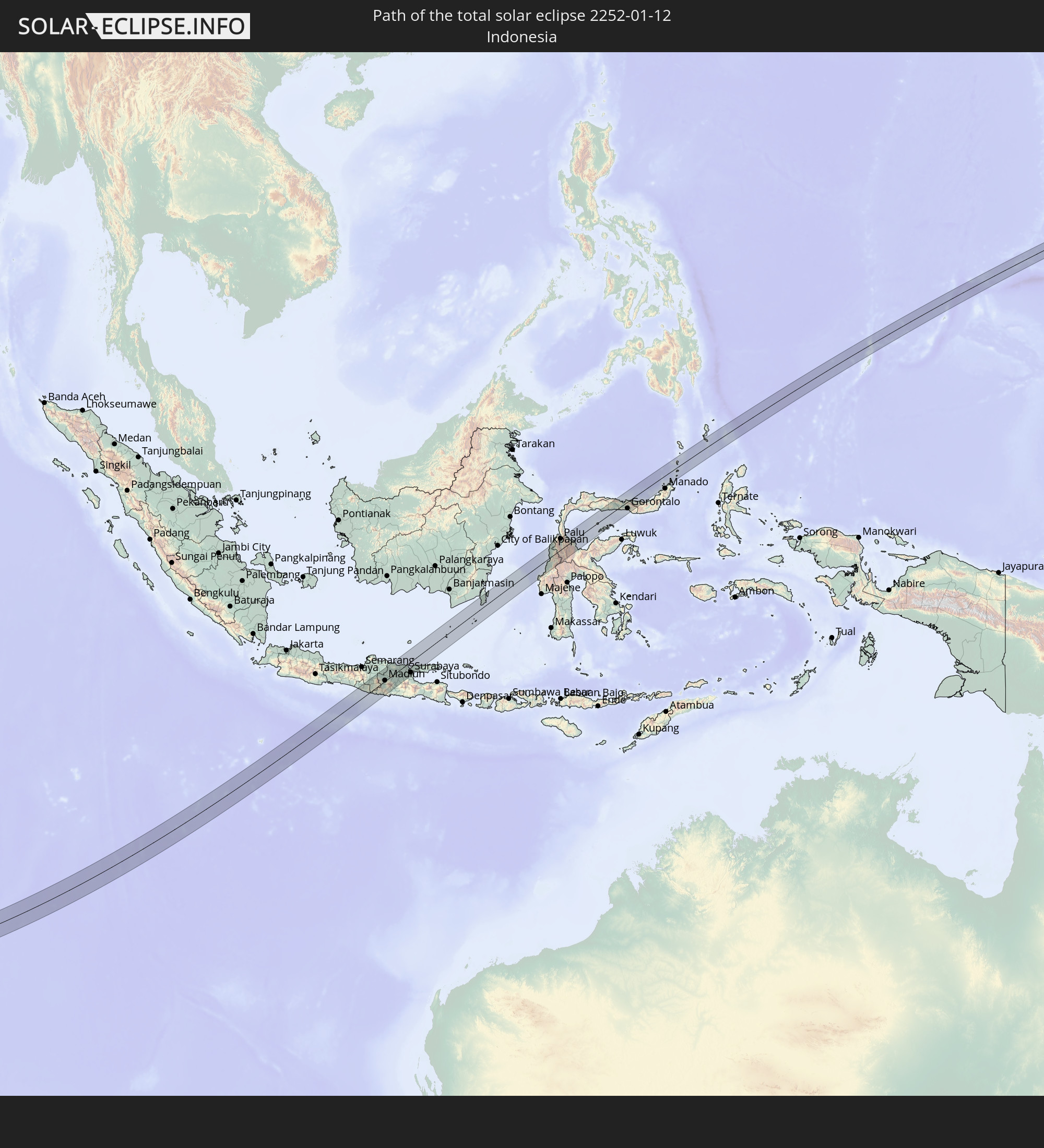
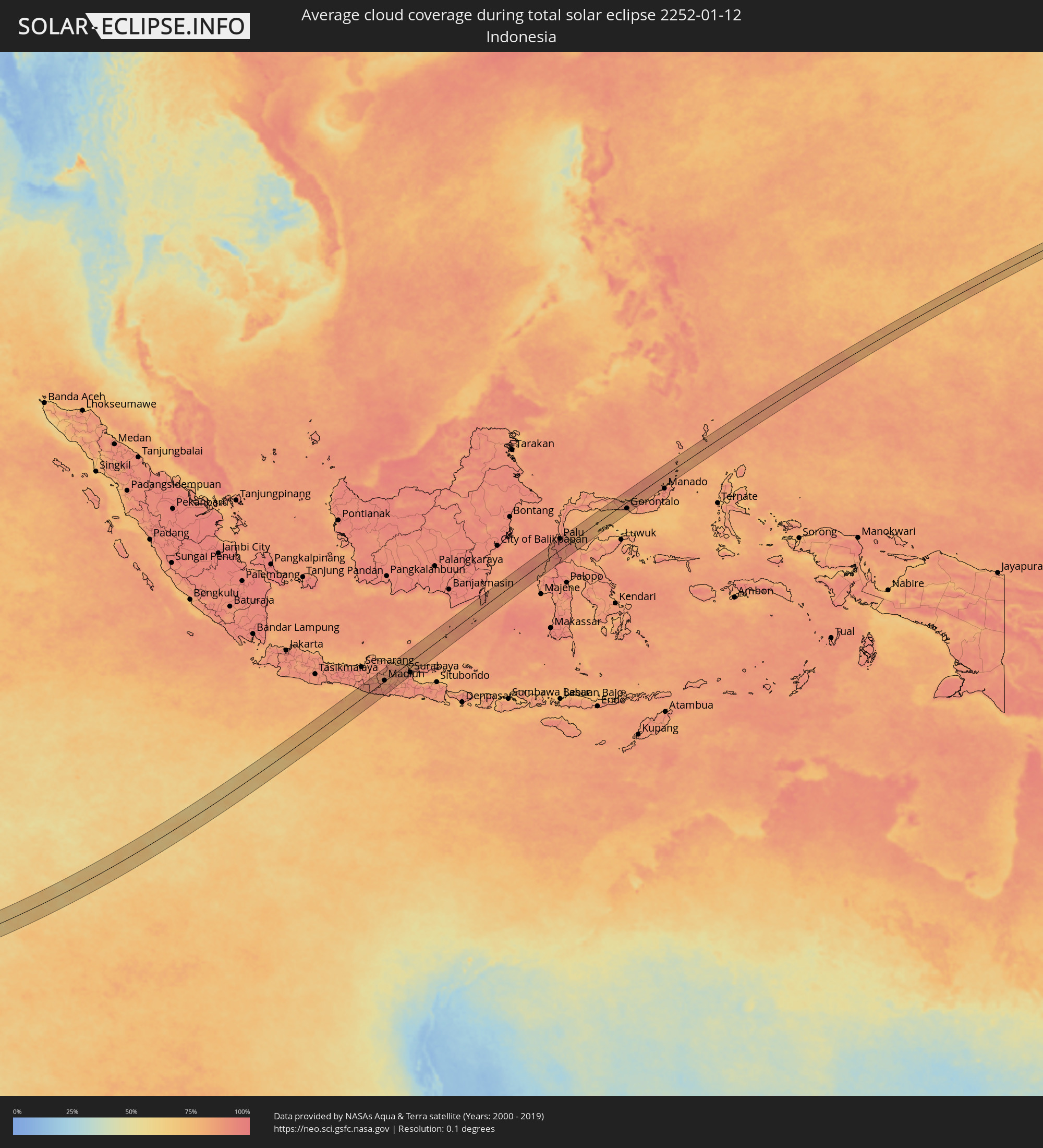 Indonesia
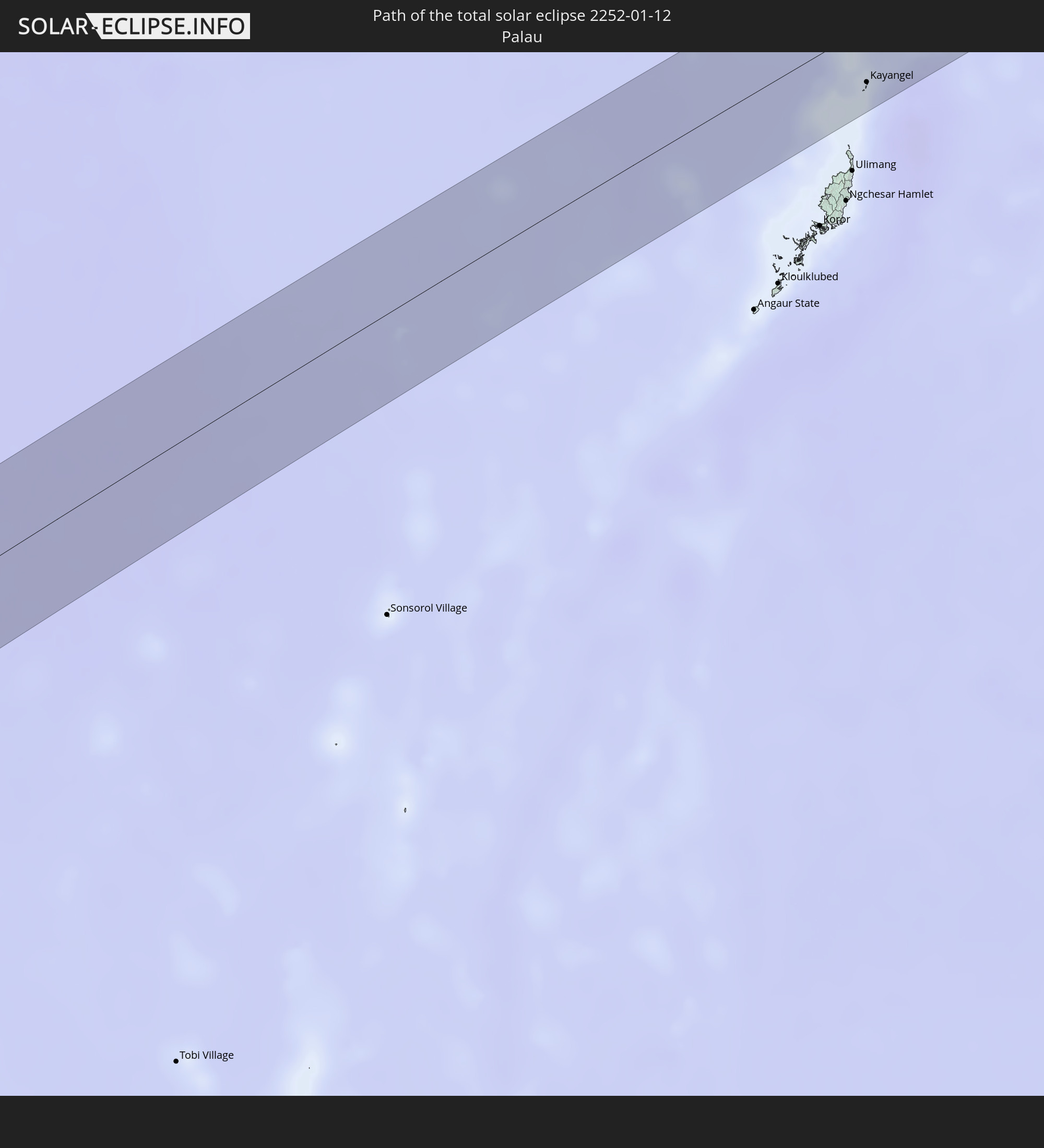
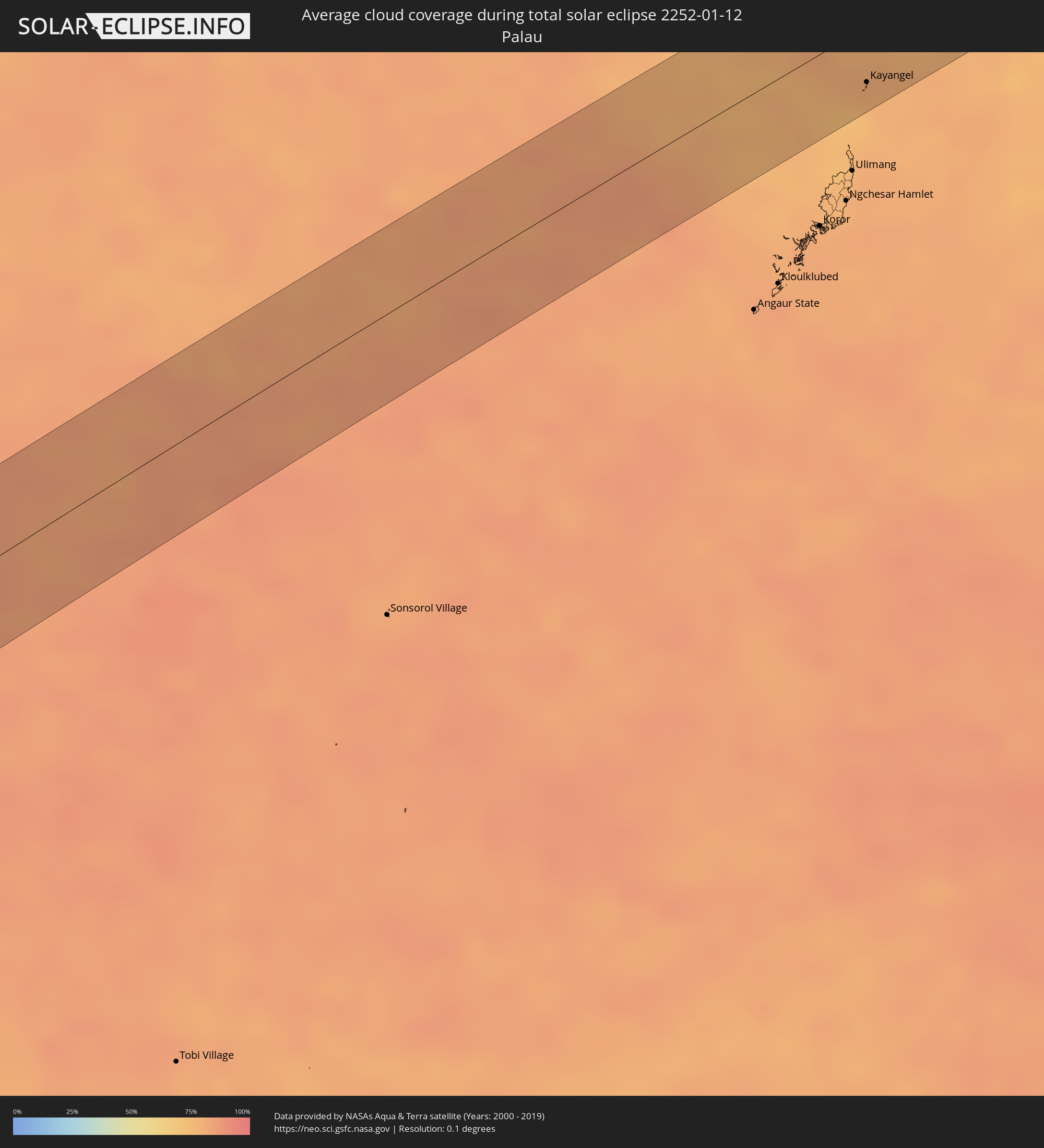 Palau
Palau
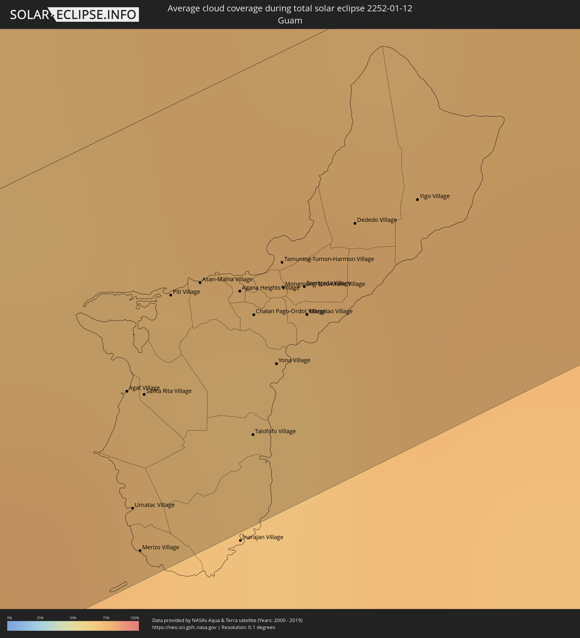 Guam
Guam
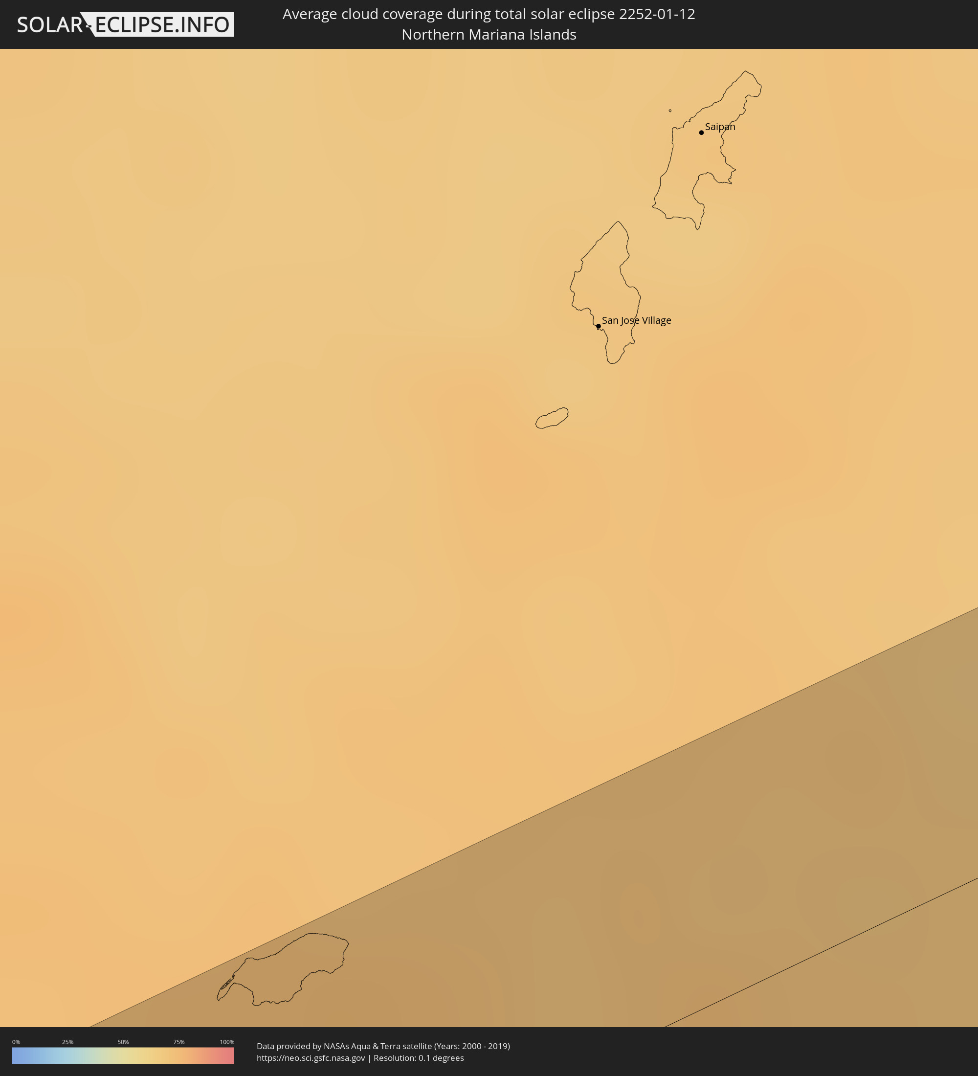 Northern Mariana Islands
Cities inside the path of the eclipse
The following table shows all locations with a population of more than 5,000 inside the eclipse path. Cities which have more than 100,000 inhabitants are marked bold. A click at the locations opens a detailed map.
| City | Type | Eclipse duration | Local time of max. eclipse | Distance to central line | Ø Cloud coverage |
|
Mansa, Luapula
|
total | - | 06:03:40 UTC+02:00 | 4 km | 89% |
|
Samfya, Luapula
|
total | - | 06:03:42 UTC+02:00 | 6 km | 81% |
|
Mpika, Muchinga Province
|
total | - | 06:03:54 UTC+02:00 | 35 km | 90% |
|
Kasungu, Central Region
|
total | - | 06:04:26 UTC+02:00 | 7 km | 92% |
|
Nkhotakota, Central Region
|
total | - | 06:04:32 UTC+02:00 | 36 km | 89% |
|
Lichinga, Niassa
|
total | - | 06:04:50 UTC+02:00 | 34 km | 94% |
|
Nampula, Nampula
|
total | - | 06:06:34 UTC+02:00 | 2 km | 89% |
|
Mahabe, Melaky
|
total | - | 07:10:20 UTC+03:00 | 16 km | 88% |
|
Anjozorobe, Analamanga
|
total | - | 07:12:37 UTC+03:00 | 37 km | 83% |
|
Ambatondrazaka, Alaotra Mangoro
|
total | - | 07:12:50 UTC+03:00 | 40 km | 82% |
|
Ampasimanolotra, Atsinanana
|
total | - | 07:13:44 UTC+03:00 | 43 km | 70% |
|
Toamasina, Atsinanana
|
total | - | 07:13:45 UTC+03:00 | 39 km | 78% |
|
Tamarin, Black River
|
total | - | 08:22:58 UTC+04:00 | 32 km | 80% |
|
Petite Rivière, Black River
|
total | - | 08:23:01 UTC+04:00 | 48 km | 79% |
|
Beau Bassin, Plaines Wilhems
|
total | - | 08:23:02 UTC+04:00 | 45 km | 81% |
|
Chemin Grenier, Savanne
|
total | - | 08:23:09 UTC+04:00 | 17 km | 65% |
|
Quatre Bornes, Plaines Wilhems
|
total | - | 08:23:05 UTC+04:00 | 41 km | 83% |
|
Pailles, Moka
|
total | - | 08:23:04 UTC+04:00 | 49 km | 81% |
|
Moka, Moka
|
total | - | 08:23:05 UTC+04:00 | 46 km | 81% |
|
Surinam, Savanne
|
total | - | 08:23:12 UTC+04:00 | 15 km | 65% |
|
Souillac, Savanne
|
total | - | 08:23:13 UTC+04:00 | 15 km | 65% |
|
Curepipe, Plaines Wilhems
|
total | - | 08:23:09 UTC+04:00 | 37 km | 83% |
|
Saint Pierre, Moka
|
total | - | 08:23:07 UTC+04:00 | 47 km | 81% |
|
Grand Bois, Savanne
|
total | - | 08:23:13 UTC+04:00 | 26 km | 82% |
|
Rivière des Anguilles, Savanne
|
total | - | 08:23:15 UTC+04:00 | 19 km | 63% |
|
Nouvelle France, Grand Port
|
total | - | 08:23:13 UTC+04:00 | 32 km | 79% |
|
Dagotière, Moka
|
total | - | 08:23:11 UTC+04:00 | 45 km | 87% |
|
Camp Diable, Savanne
|
total | - | 08:23:17 UTC+04:00 | 22 km | 63% |
|
Rose Belle, Grand Port
|
total | - | 08:23:17 UTC+04:00 | 29 km | 79% |
|
Quartier Militaire, Moka
|
total | - | 08:23:14 UTC+04:00 | 46 km | 87% |
|
New Grove, Grand Port
|
total | - | 08:23:18 UTC+04:00 | 29 km | 79% |
|
Montagne Blanche
|
total | - | 08:23:19 UTC+04:00 | 43 km | 77% |
|
Plaine Magnien, Grand Port
|
total | - | 08:23:23 UTC+04:00 | 28 km | 68% |
|
Sebastopol, Flacq
|
total | - | 08:23:21 UTC+04:00 | 43 km | 77% |
|
Beau Vallon, Grand Port
|
total | - | 08:23:25 UTC+04:00 | 30 km | 68% |
|
Mahébourg, Grand Port
|
total | - | 08:23:25 UTC+04:00 | 31 km | 68% |
|
Bel Air Rivière Sèche, Flacq
|
total | - | 08:23:26 UTC+04:00 | 48 km | 77% |
|
Bambanglipuro, Yogyakarta
|
total | - | 13:40:32 UTC+07:00 | 55 km | 75% |
|
Sewon, Yogyakarta
|
total | - | 13:40:47 UTC+07:00 | 57 km | 87% |
|
Wedi, Central Java
|
total | - | 13:41:23 UTC+07:00 | 54 km | 88% |
|
Klaten, Central Java
|
total | - | 13:41:29 UTC+07:00 | 56 km | 88% |
|
Surakarta, Central Java
|
total | - | 13:42:07 UTC+07:00 | 54 km | 90% |
|
Sragen, Central Java
|
total | - | 13:42:38 UTC+07:00 | 53 km | 85% |
|
Jatiroto, Central Java
|
total | - | 13:42:08 UTC+07:00 | 6 km | 91% |
|
Ponorogo, East Java
|
total | - | 13:42:46 UTC+07:00 | 15 km | 87% |
|
Madiun, East Java
|
total | - | 13:43:14 UTC+07:00 | 2 km | 85% |
|
Cepu, Central Java
|
total | - | 13:44:03 UTC+07:00 | 40 km | 83% |
|
Bojonegoro, East Java
|
total | - | 13:44:33 UTC+07:00 | 21 km | 86% |
|
Nganjuk, East Java
|
total | - | 13:43:55 UTC+07:00 | 21 km | 87% |
|
Kediri, East Java
|
total | - | 13:43:49 UTC+07:00 | 47 km | 90% |
|
Gampengrejo, East Java
|
total | - | 13:43:53 UTC+07:00 | 43 km | 90% |
|
Tuban, East Java
|
total | - | 13:45:13 UTC+07:00 | 31 km | 88% |
|
Kertosono, East Java
|
total | - | 13:44:18 UTC+07:00 | 32 km | 84% |
|
Pare, East Java
|
total | - | 13:44:12 UTC+07:00 | 55 km | 87% |
|
Jombang, East Java
|
total | - | 13:44:34 UTC+07:00 | 38 km | 87% |
|
Lamongan, East Java
|
total | - | 13:45:30 UTC+07:00 | 12 km | 87% |
|
Mojokerto, East Java
|
total | - | 13:45:02 UTC+07:00 | 44 km | 88% |
|
Kebomas, East Java
|
total | - | 13:45:48 UTC+07:00 | 31 km | 88% |
|
Bangkalan, East Java
|
total | - | 13:46:09 UTC+07:00 | 27 km | 81% |
|
Surabaya, East Java
|
total | - | 13:45:53 UTC+07:00 | 46 km | 86% |
|
Palu, Central Sulawesi
|
total | - | 15:04:24 UTC+08:00 | 47 km | 93% |
|
Gorontalo, Gorontalo
|
total | - | 15:09:35 UTC+08:00 | 29 km | 80% |
|
Kayangel, Kayangel
|
total | - | 16:24:40 UTC+09:00 | 27 km | 79% |
|
Agat Village, Agat
|
total | - | 17:30:15 UTC+10:00 | 20 km | 72% |
|
Umatac Village, Umatac
|
total | - | 17:30:13 UTC+10:00 | 30 km | 73% |
|
Merizo Village, Merizo
|
total | - | 17:30:13 UTC+10:00 | 33 km | 73% |
|
Santa Rita Village, Santa Rita
|
total | - | 17:30:15 UTC+10:00 | 21 km | 72% |
|
Piti Village, Piti
|
total | - | 17:30:17 UTC+10:00 | 15 km | 70% |
|
Asan-Maina Village, Asan
|
total | - | 17:30:17 UTC+10:00 | 15 km | 70% |
|
Agana Heights Village, Agana Heights
|
total | - | 17:30:17 UTC+10:00 | 17 km | 70% |
|
Hagåtña, Hagatna
|
total | - | 17:30:17 UTC+10:00 | 16 km | 70% |
|
Guam Government House, Hagatna
|
total | - | 17:30:17 UTC+10:00 | 16 km | 70% |
|
Sinajana Village, Sinajana
|
total | - | 17:30:17 UTC+10:00 | 17 km | 69% |
|
Talofofo Village, Talofofo
|
total | - | 17:30:15 UTC+10:00 | 28 km | 69% |
|
Chalan Pago-Ordot Village, Chalan Pago-Ordot
|
total | - | 17:30:17 UTC+10:00 | 19 km | 69% |
|
Yona Village, Yona
|
total | - | 17:30:16 UTC+10:00 | 24 km | 69% |
|
Tamuning-Tumon-Harmon Village, Tamuning
|
total | - | 17:30:18 UTC+10:00 | 16 km | 69% |
|
Mongmong-Toto-Maite Village, Mongmong-Toto-Maite
|
total | - | 17:30:18 UTC+10:00 | 18 km | 69% |
|
Barrigada Village, Barrigada
|
total | - | 17:30:18 UTC+10:00 | 19 km | 69% |
|
Mangilao Village, Mangilao
|
total | - | 17:30:17 UTC+10:00 | 21 km | 69% |
|
Dededo Village, Dededo
|
total | - | 17:30:19 UTC+10:00 | 16 km | 69% |
|
Yigo Village, Yigo
|
total | - | 17:30:20 UTC+10:00 | 17 km | 75% |