Total solar eclipse of 09/19/2267
| Day of week: | Thursday |
| Maximum duration of eclipse: | 04m34s |
| Maximum width of eclipse path: | 304 km |
| Saros cycle: | 158 |
| Coverage: | 100% |
| Magnitude: | 1.0642 |
| Gamma: | -0.7348 |
Wo kann man die Sonnenfinsternis vom 09/19/2267 sehen?
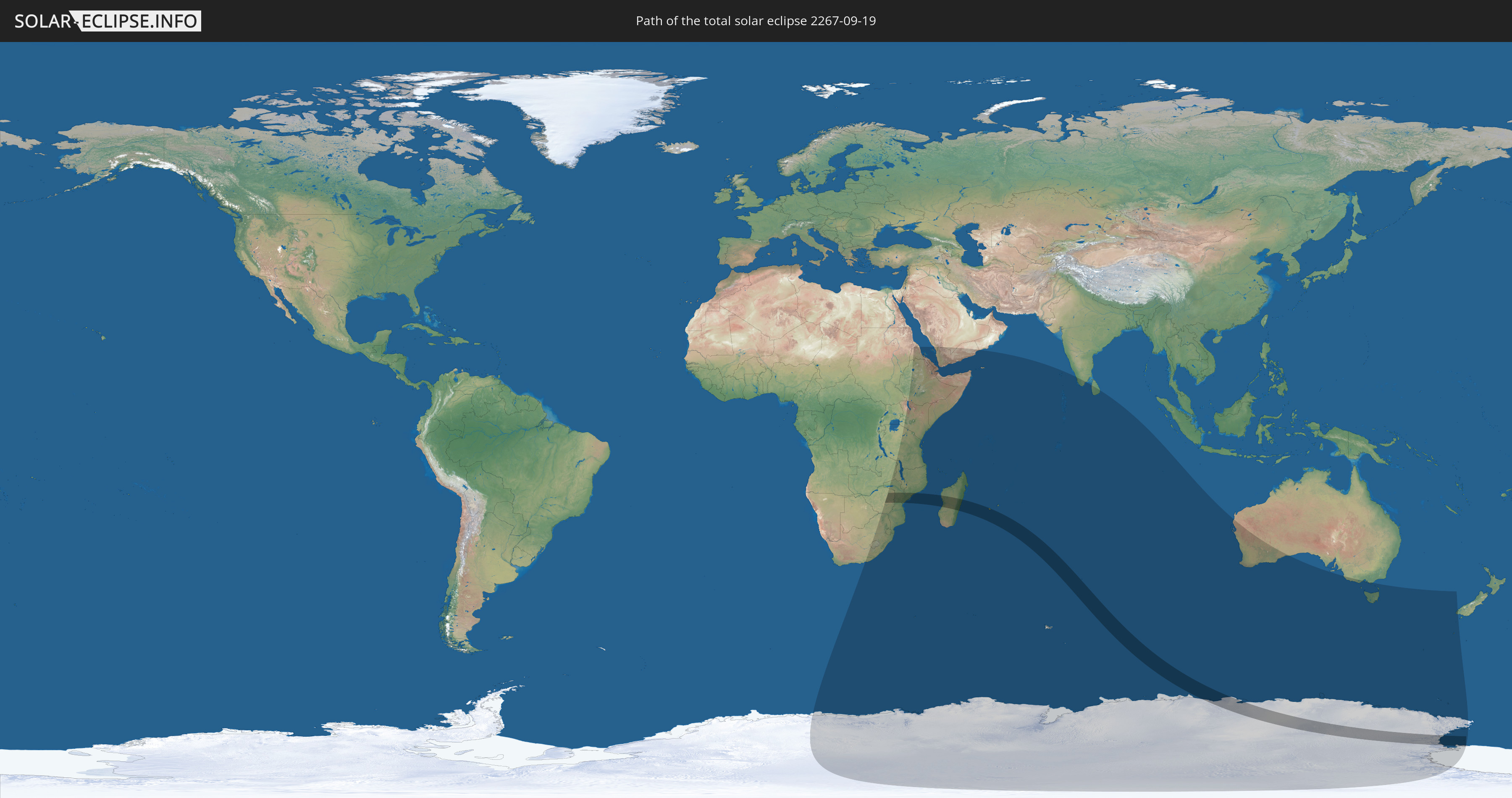
Die Sonnenfinsternis am 09/19/2267 kann man in 33 Ländern als partielle Sonnenfinsternis beobachten.
Der Finsternispfad verläuft durch 6 Länder. Nur in diesen Ländern ist sie als total Sonnenfinsternis zu sehen.
In den folgenden Ländern ist die Sonnenfinsternis total zu sehen
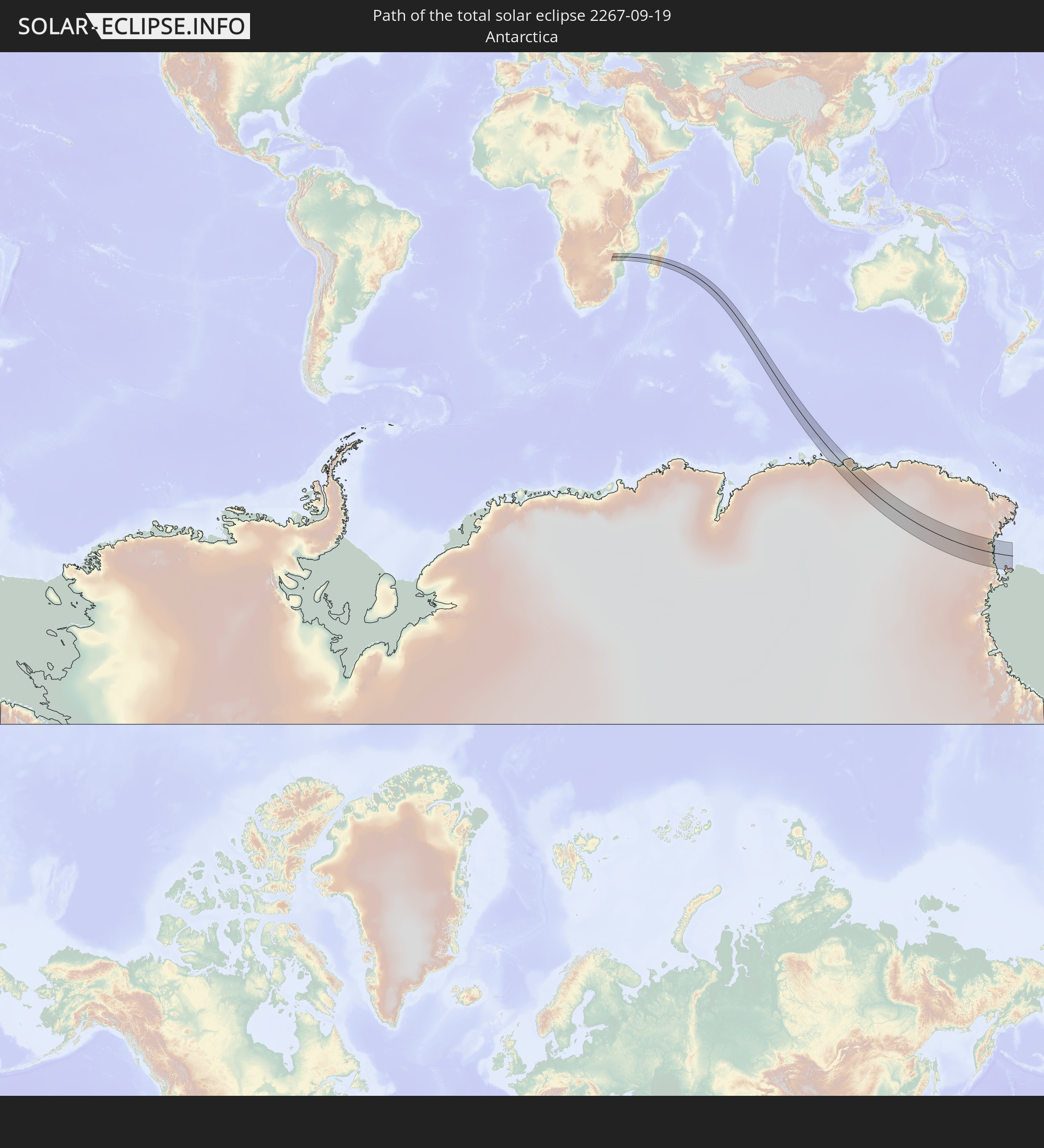 Antarctica
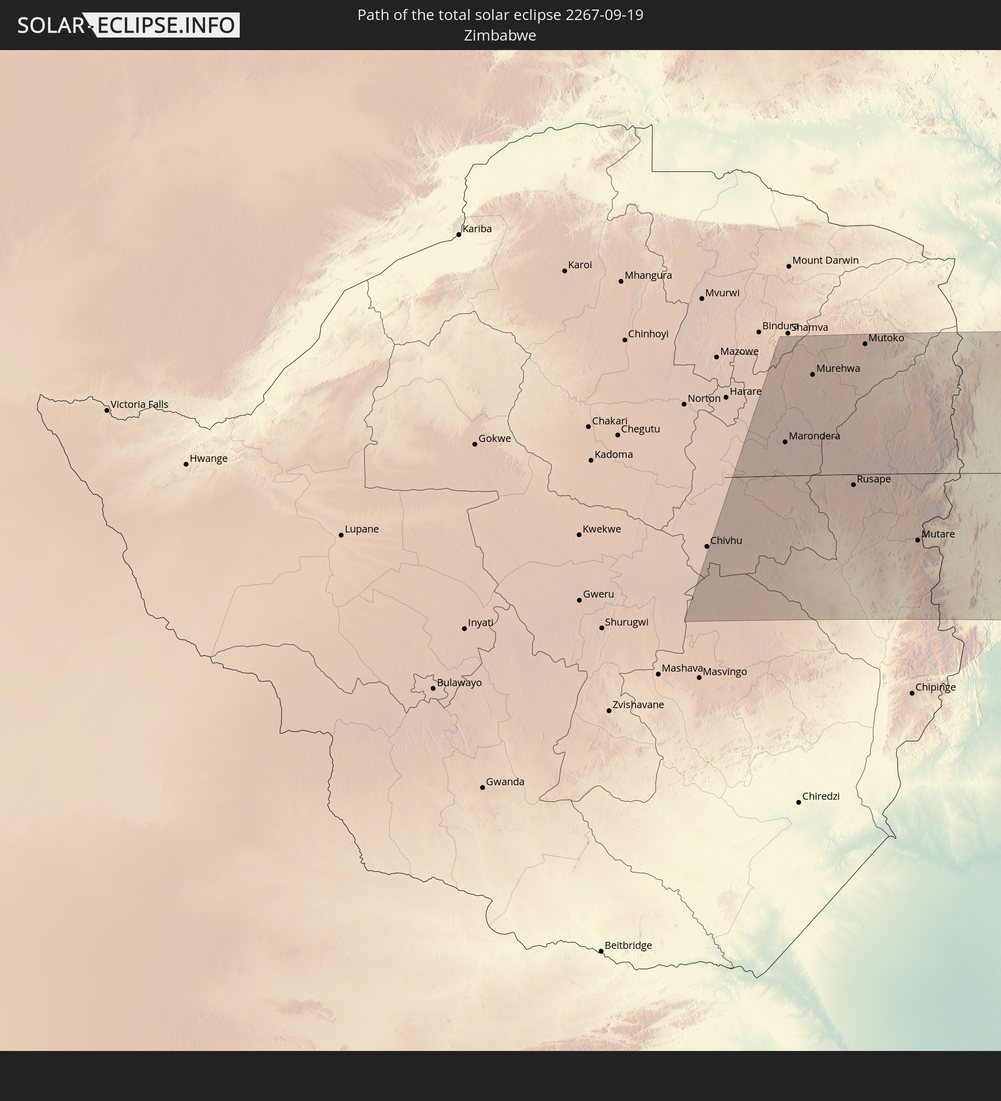 Zimbabwe
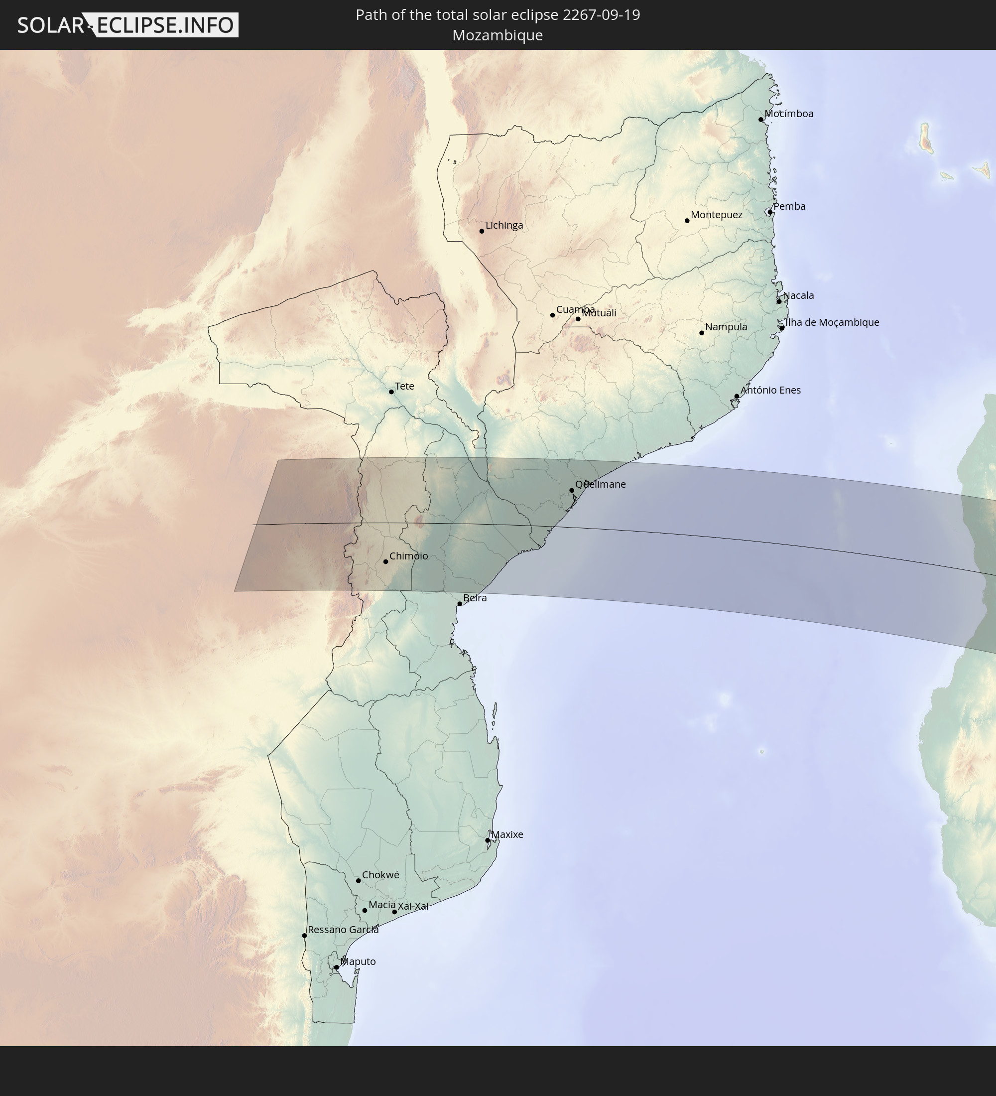 Mozambique
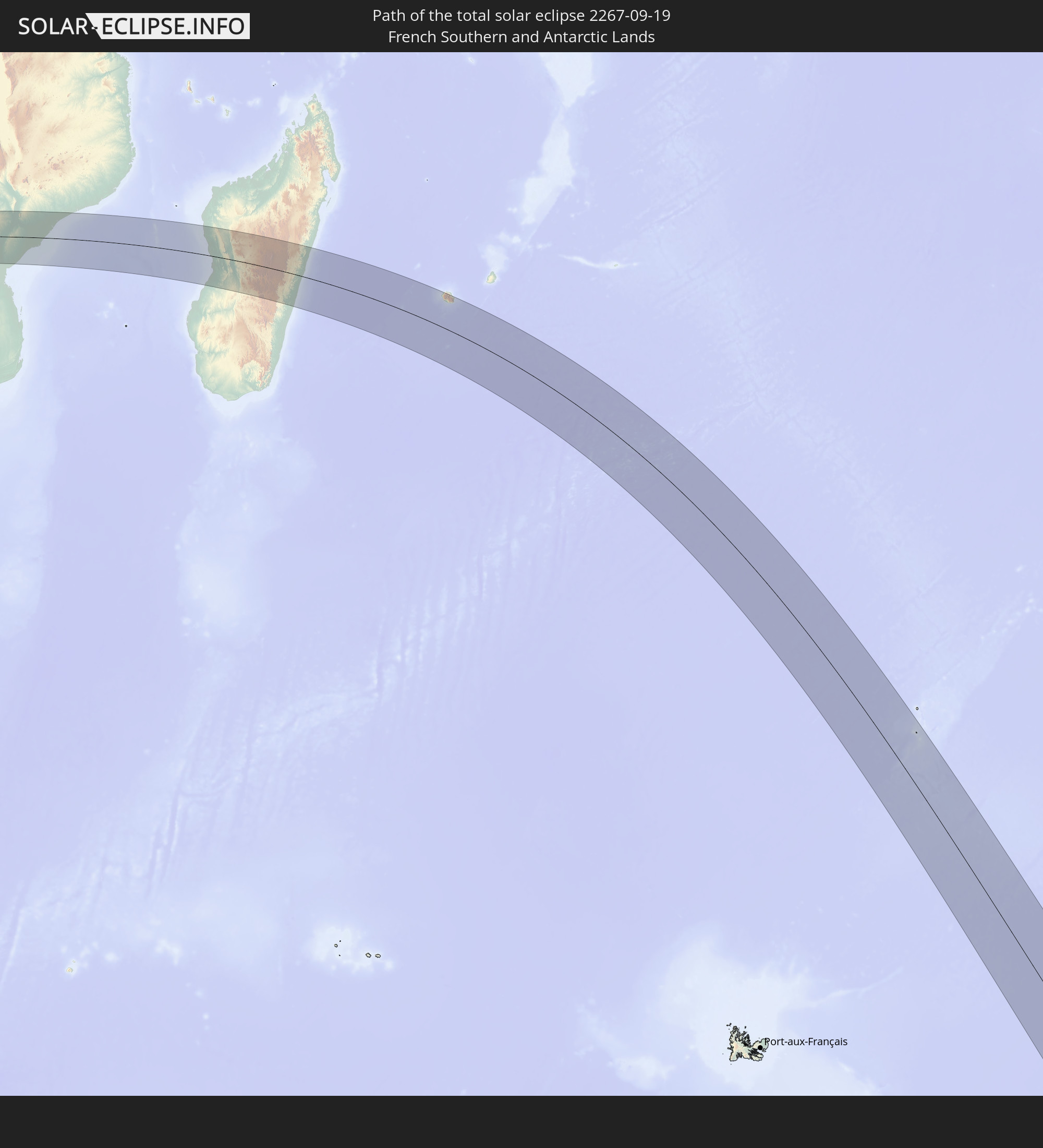 French Southern and Antarctic Lands
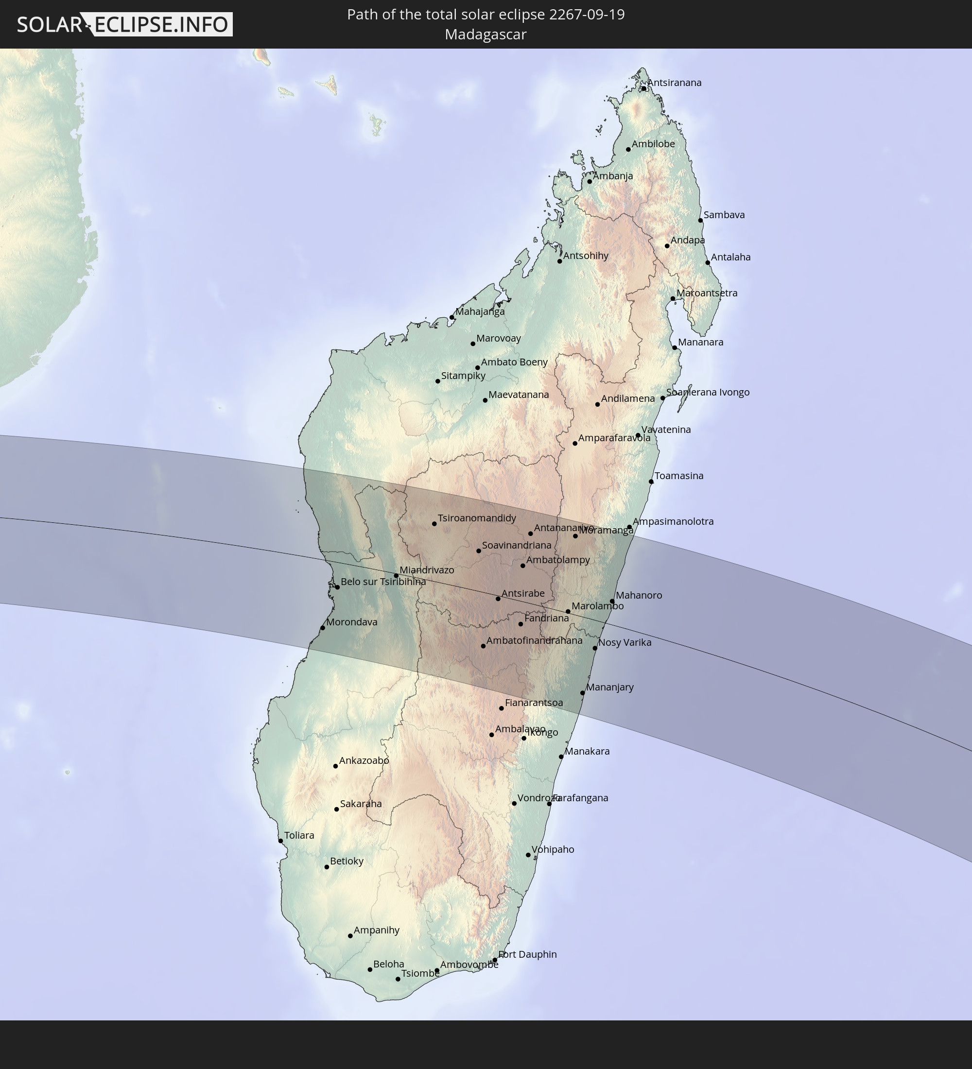 Madagascar
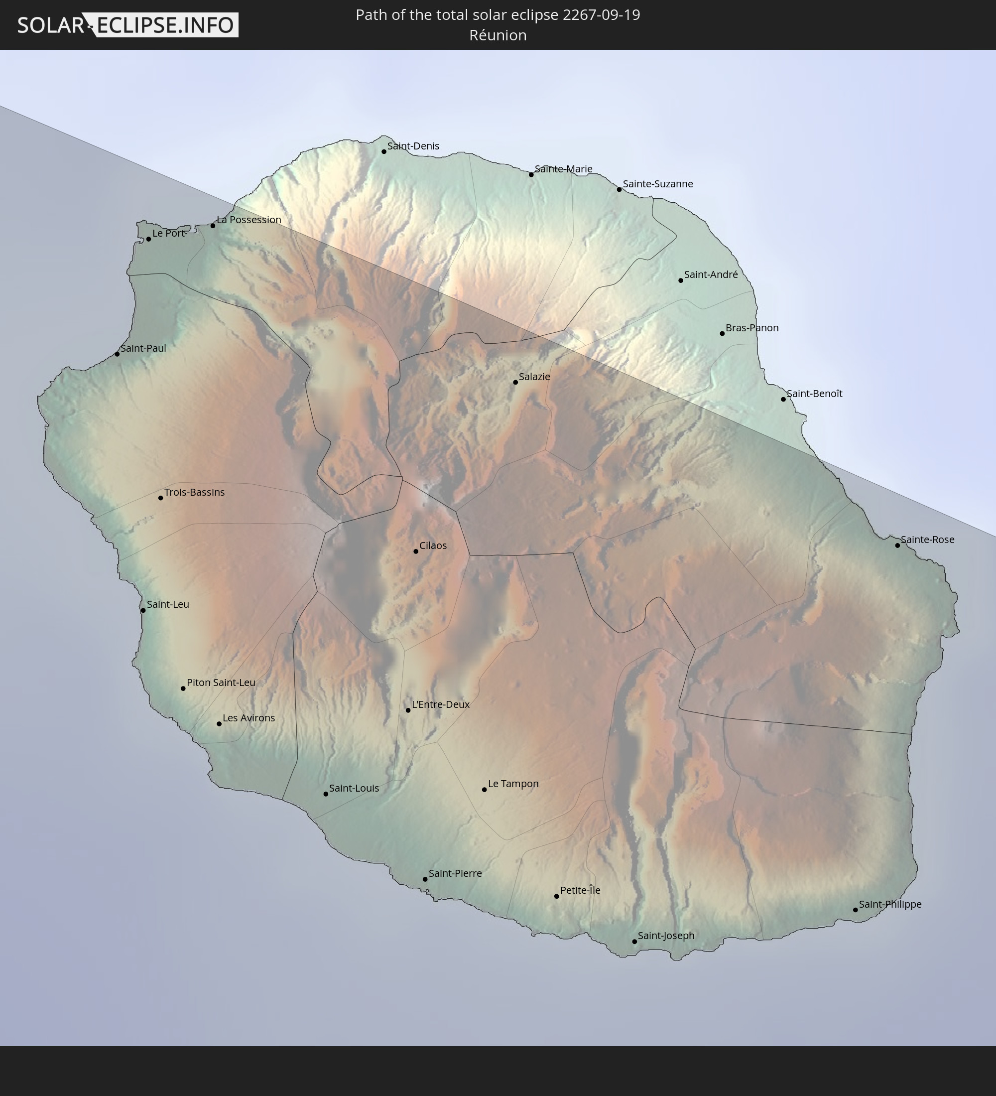 Réunion
In den folgenden Ländern ist die Sonnenfinsternis partiell zu sehen
 Antarctica
 New Zealand
 South Africa
 Sudan
Sudan
 Zambia
 Zimbabwe
 Lesotho
 Tanzania
 Mozambique
 Swaziland
 Malawi
 Ethiopia
 Kenya
Kenya
 Saudi Arabia
 Eritrea
 French Southern and Antarctic Lands
 Somalia
 Djibouti
 Yemen
Yemen
 Madagascar
 Comoros
 Mayotte
 Seychelles
 Oman
Oman
 Réunion
 Mauritius
 India
India
 British Indian Ocean Territory
 Heard Island and McDonald Islands
 Maldives
 Sri Lanka
 Cocos Islands
 Australia
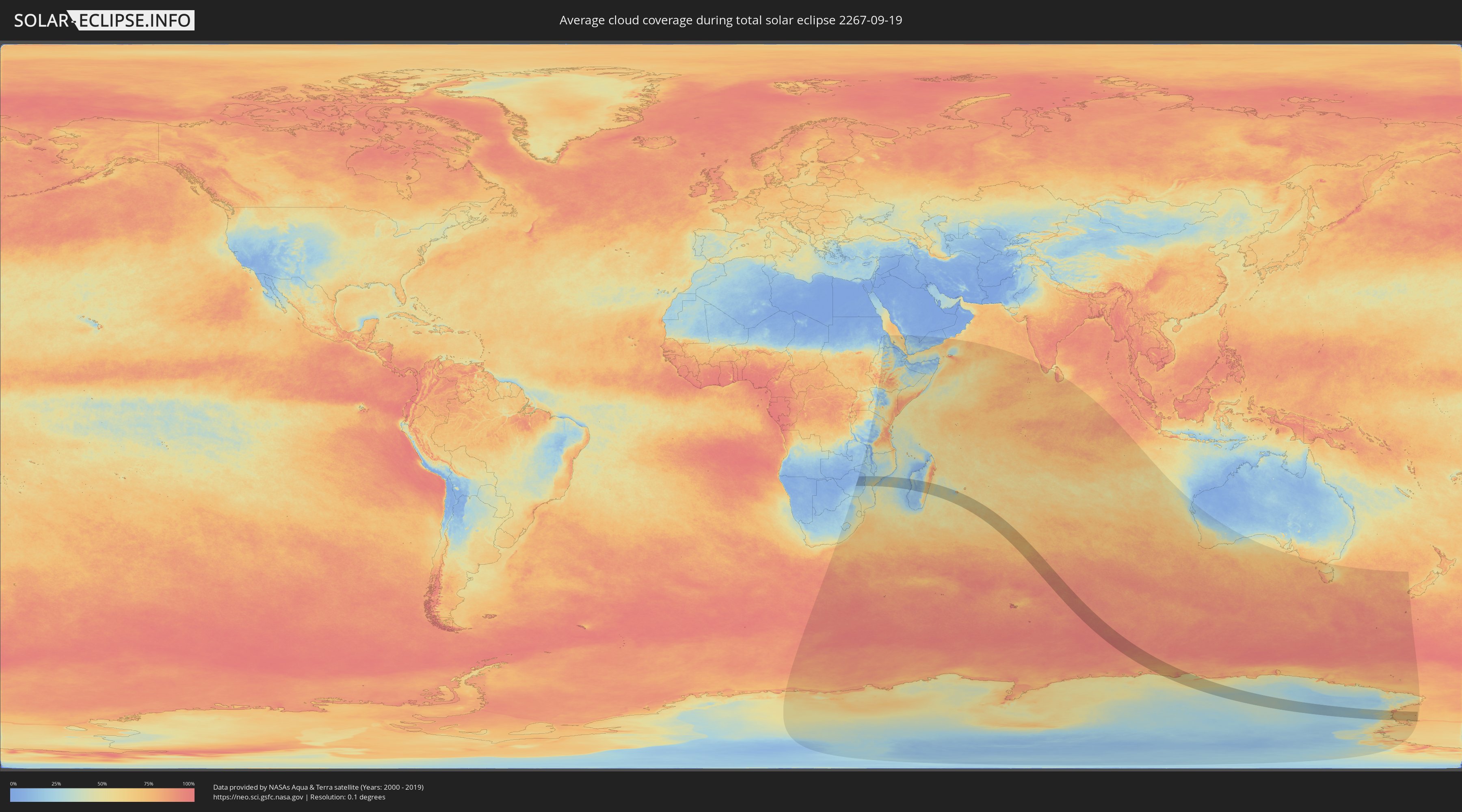
How will be the weather during the total solar eclipse on 09/19/2267?
Where is the best place to see the total solar eclipse of 09/19/2267?
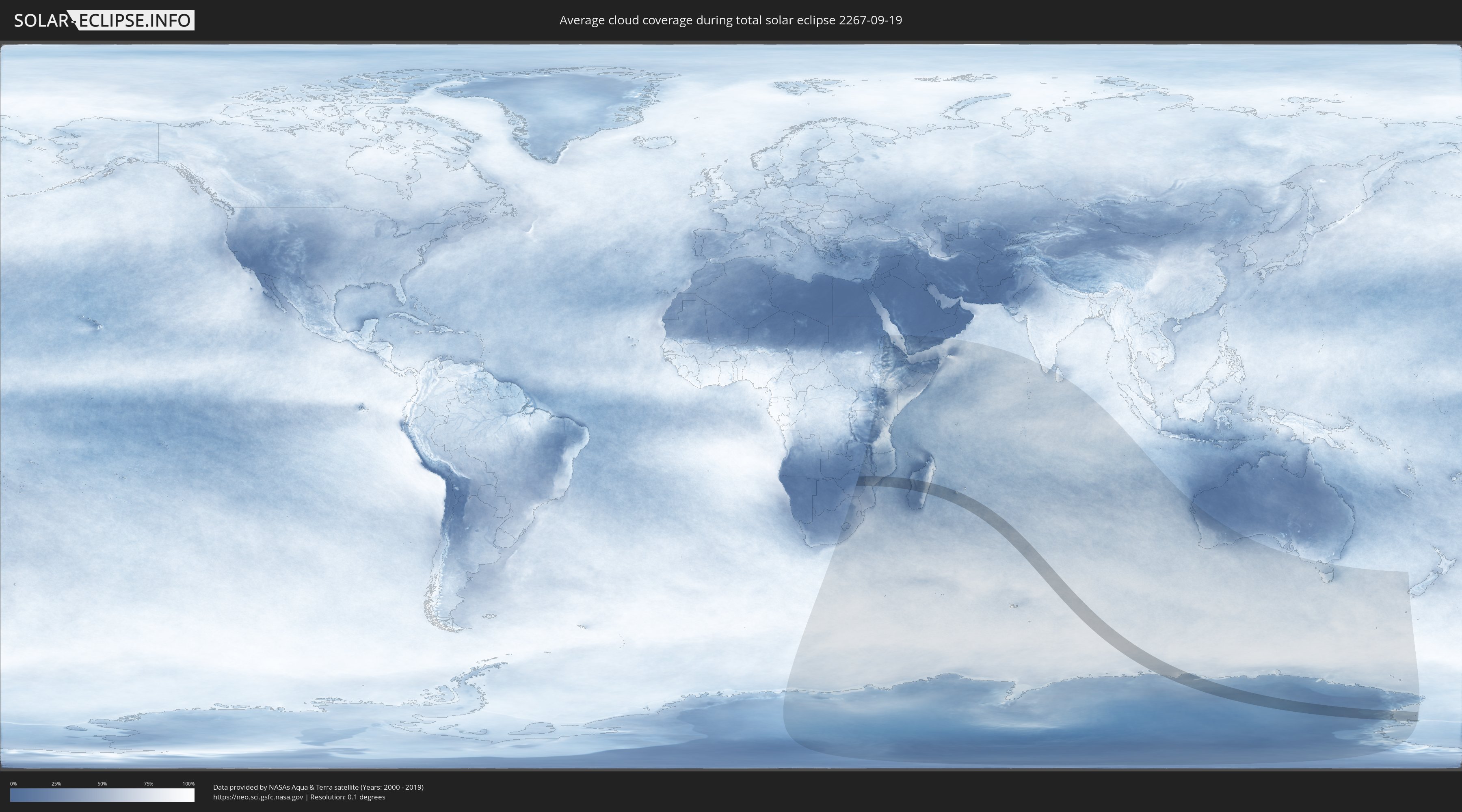
The following maps show the average cloud coverage for the day of the total solar eclipse.
With the help of these maps, it is possible to find the place along the eclipse path, which has the best
chance of a cloudless sky.
Nevertheless, you should consider local circumstances and inform about the weather of your chosen
observation site.
The data is provided by NASAs satellites
AQUA and TERRA.
The cloud maps are averaged over a period of 19 years (2000 - 2019).
Detailed country maps
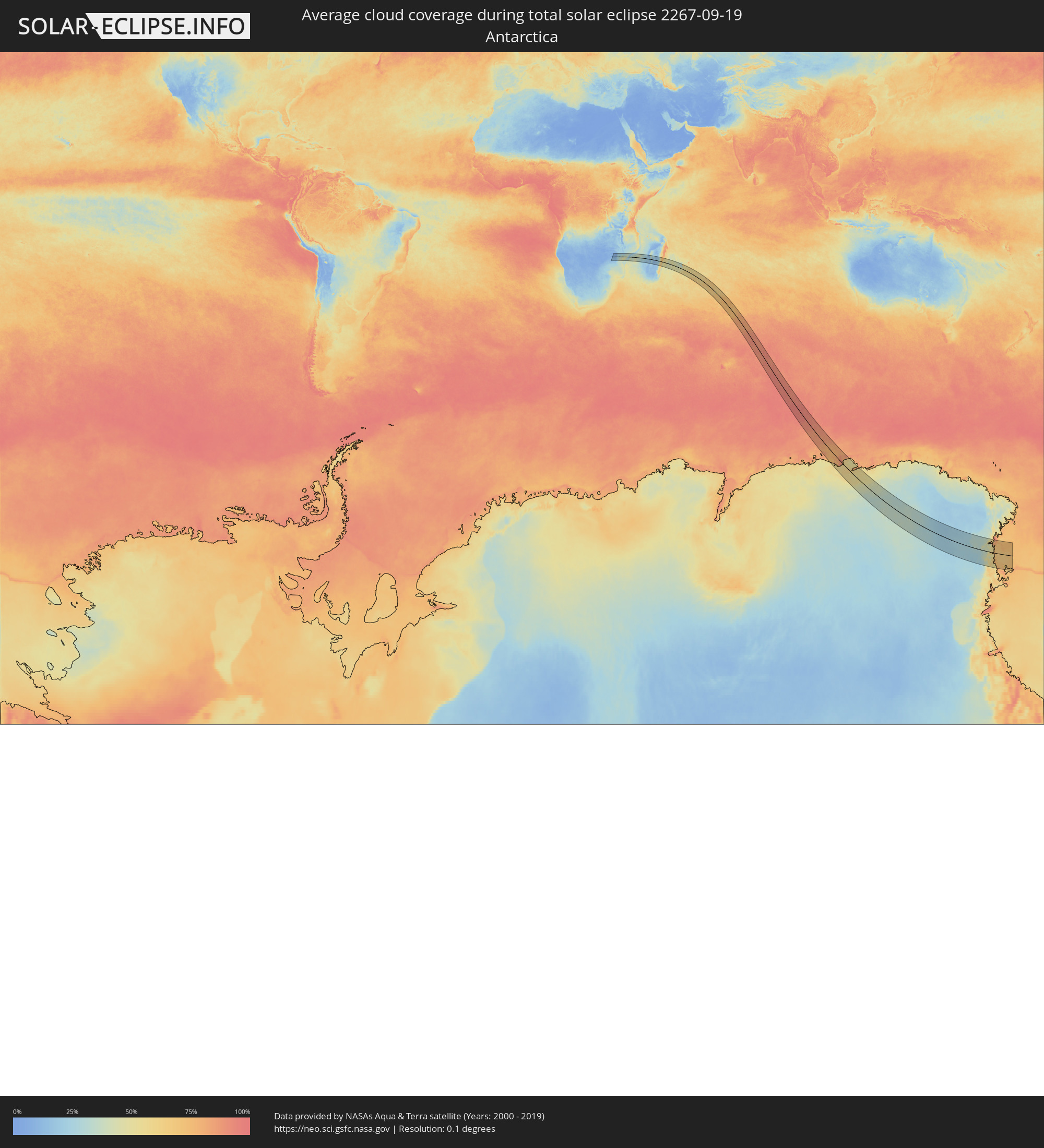 Antarctica
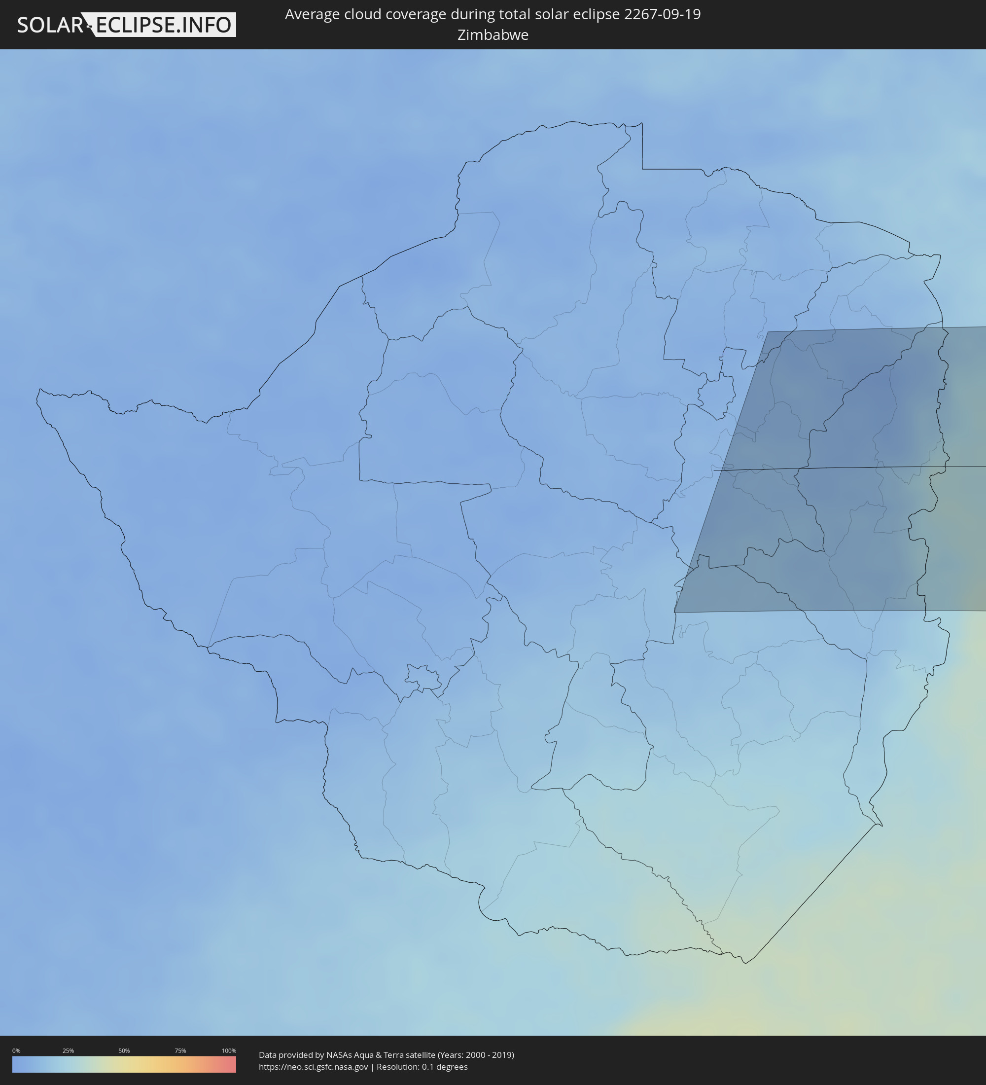 Zimbabwe
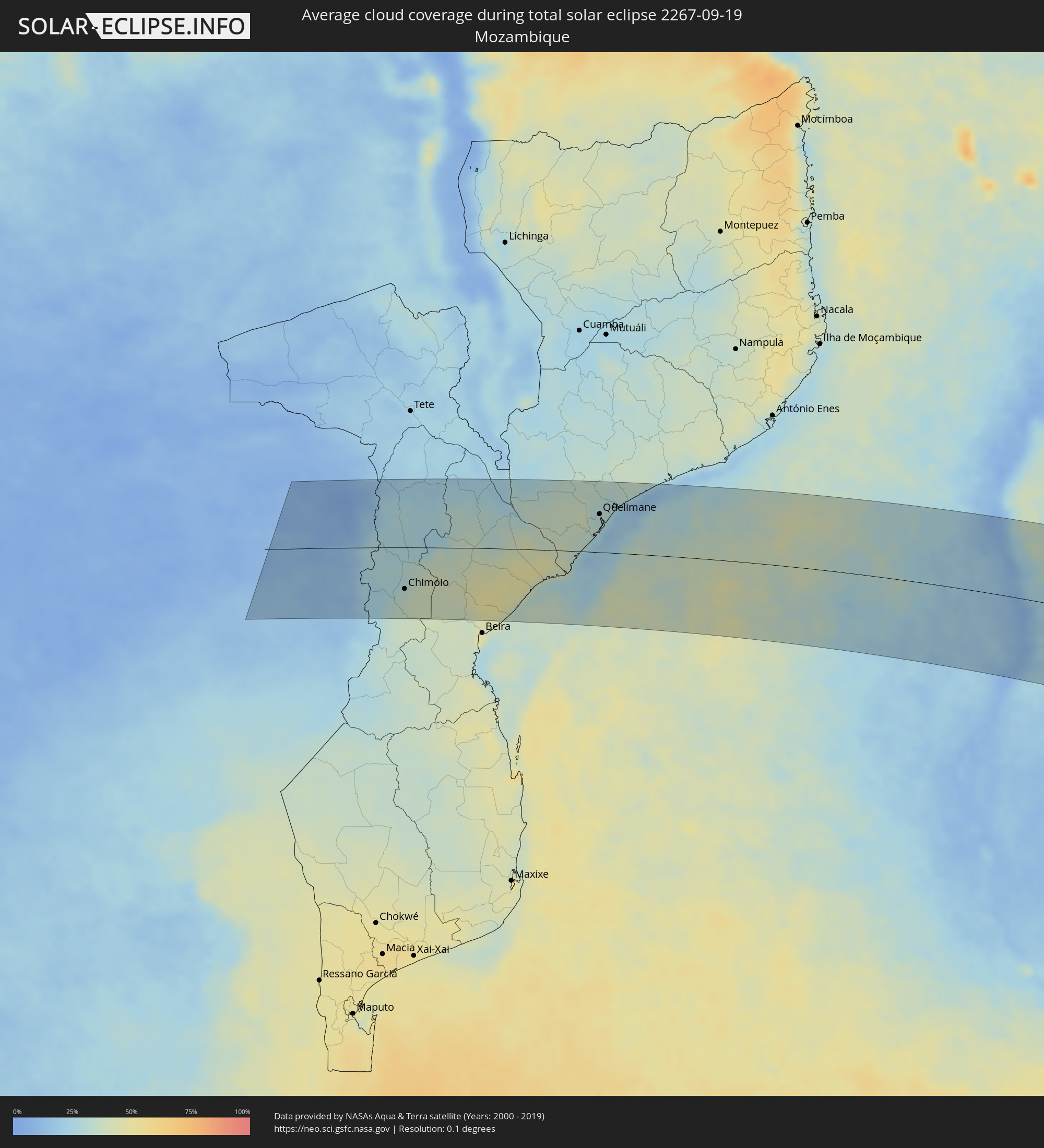 Mozambique
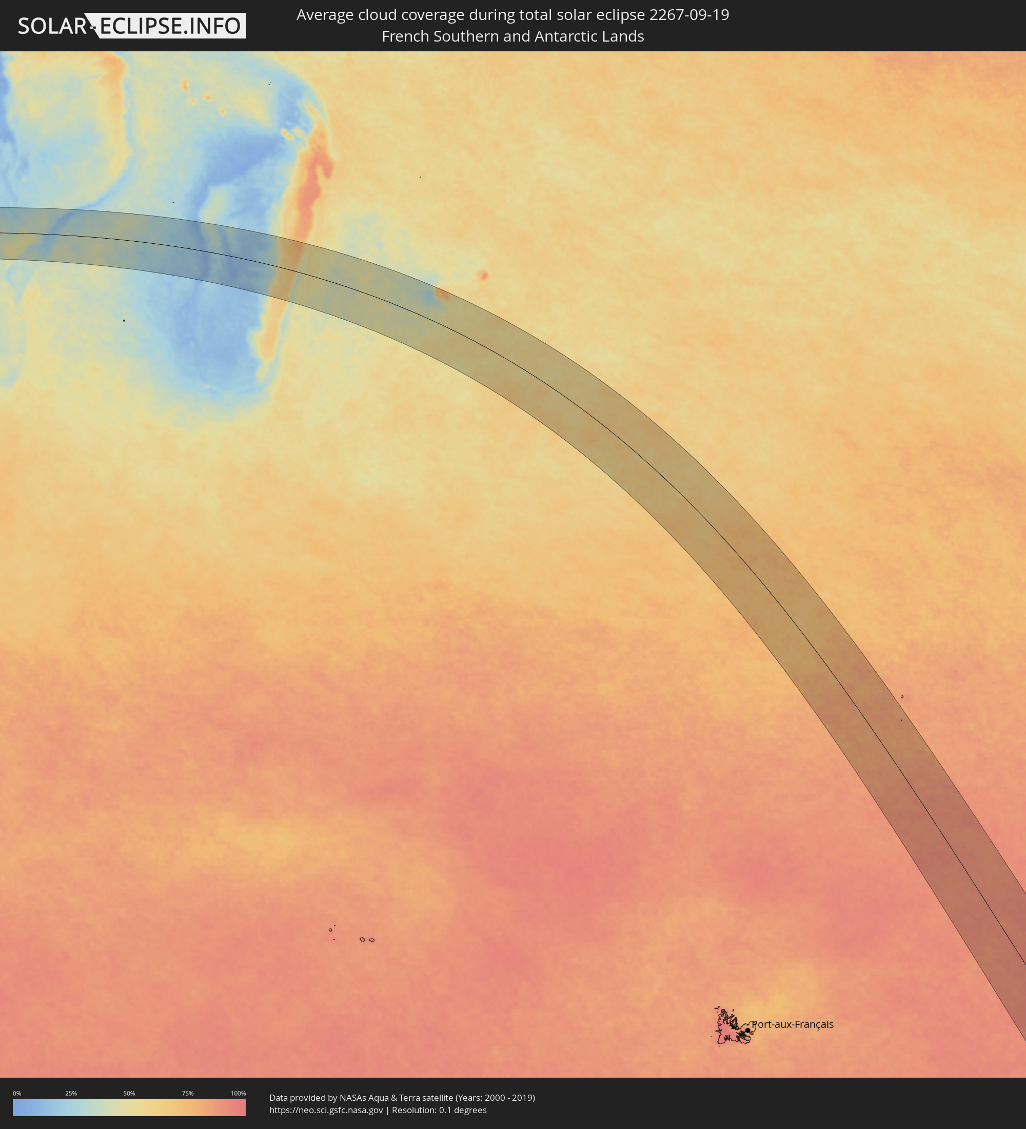 French Southern and Antarctic Lands
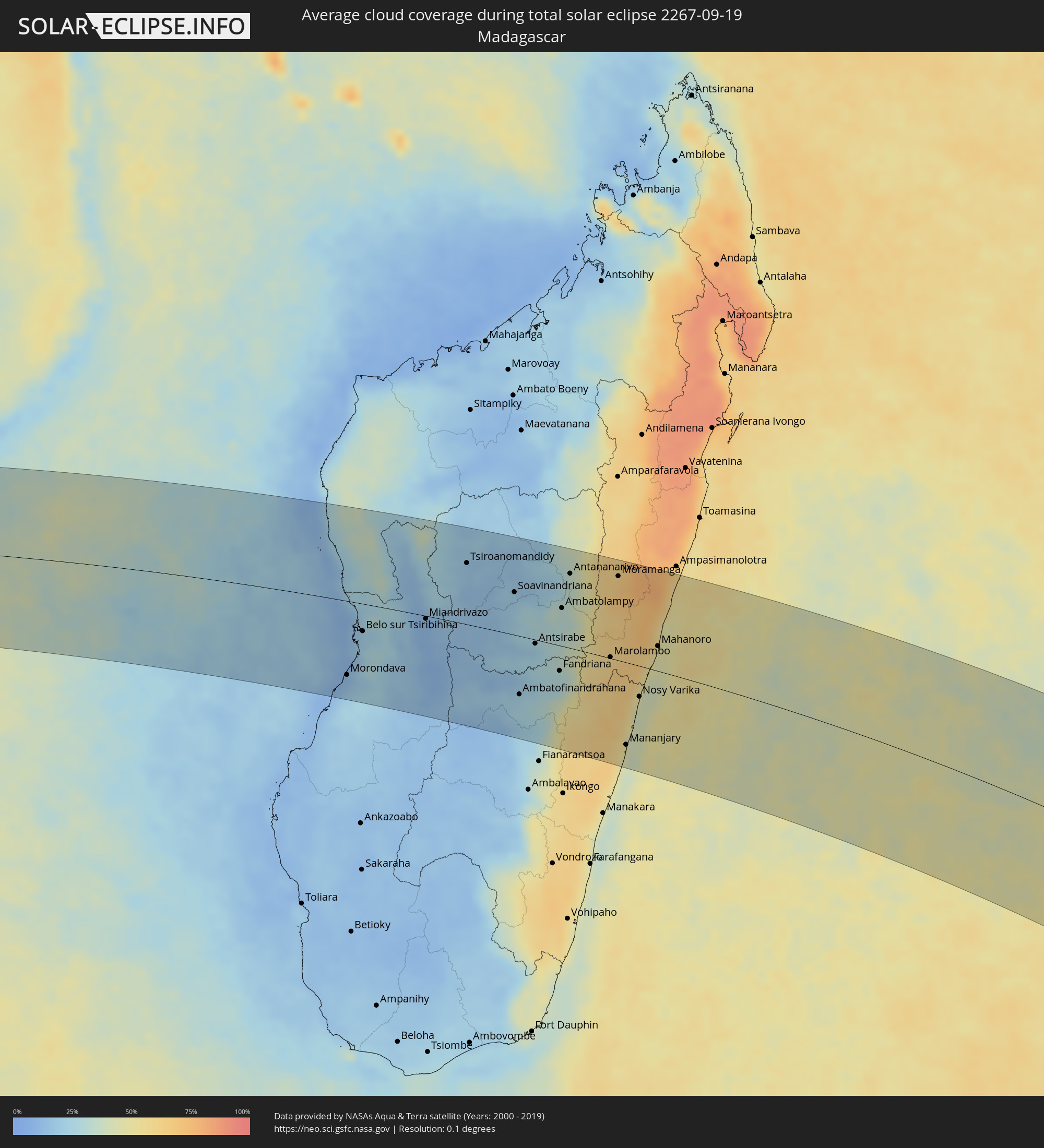 Madagascar
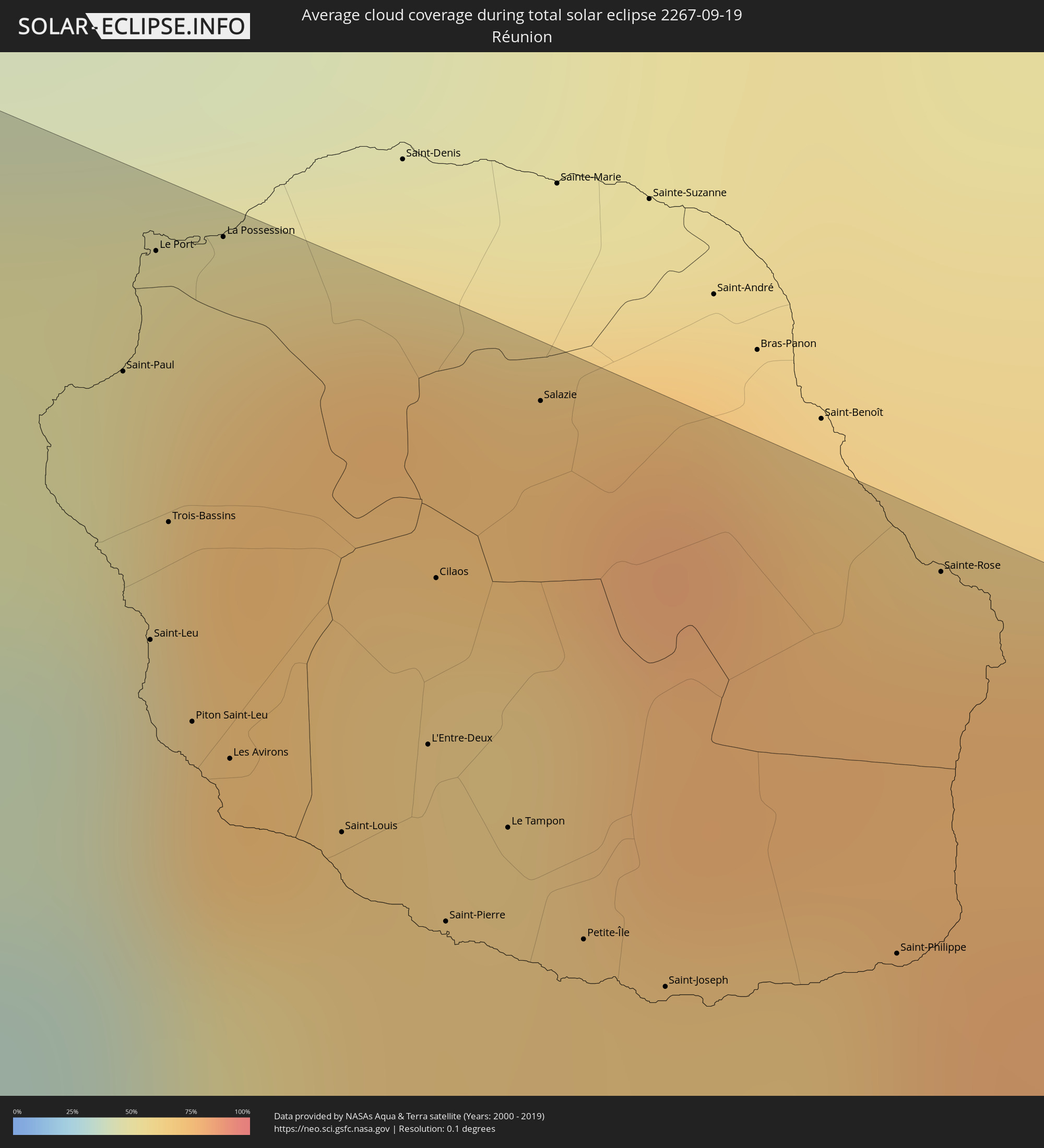 Réunion
Cities inside the path of the eclipse
The following table shows all locations with a population of more than 5,000 inside the eclipse path. Cities which have more than 100,000 inhabitants are marked bold. A click at the locations opens a detailed map.
| City | Type | Eclipse duration | Local time of max. eclipse | Distance to central line | Ø Cloud coverage |
|
Chimoio, Manica
|
total | - | 05:53:18 UTC+02:00 | 76 km | 32% |
|
Dondo, Sofala
|
total | - | 05:54:08 UTC+02:00 | 130 km | 39% |
|
Quelimane, Zambézia
|
total | - | 05:52:07 UTC+02:00 | 70 km | 29% |
|
Maintirano, Melaky
|
total | - | 06:54:32 UTC+03:00 | 129 km | 14% |
|
Morondava, Menabe
|
total | - | 06:58:02 UTC+03:00 | 110 km | 13% |
|
Belo sur Tsiribihina, Menabe
|
total | - | 06:57:13 UTC+03:00 | 41 km | 18% |
|
Miandrivazo, Menabe
|
total | - | 06:57:23 UTC+03:00 | 4 km | 11% |
|
Tsiroanomandidy, Bongolava
|
total | - | 06:56:30 UTC+03:00 | 91 km | 18% |
|
Fenoarivo Be, Bongolava
|
total | - | 06:56:15 UTC+03:00 | 139 km | 18% |
|
Soavinandriana, Itasy
|
total | - | 06:57:27 UTC+03:00 | 63 km | 18% |
|
Miandrarivo, Vakinankaratra
|
total | - | 06:57:53 UTC+03:00 | 35 km | 24% |
|
Ambatofinandrahana, Amoron'i Mania
|
total | - | 06:59:40 UTC+03:00 | 86 km | 24% |
|
Betafo, Vakinankaratra
|
total | - | 06:58:33 UTC+03:00 | 7 km | 19% |
|
Miarinarivo, Itasy
|
total | - | 06:57:13 UTC+03:00 | 90 km | 16% |
|
Faratsiho, Vakinankaratra
|
total | - | 06:57:56 UTC+03:00 | 43 km | 27% |
|
Antsirabe, Vakinankaratra
|
total | - | 06:58:42 UTC+03:00 | 6 km | 23% |
|
Arivonimamo, Itasy
|
total | - | 06:57:27 UTC+03:00 | 90 km | 21% |
|
Soanindrariny, Vakinankaratra
|
total | - | 06:58:52 UTC+03:00 | 5 km | 27% |
|
Ambositra, Amoron'i Mania
|
total | - | 06:59:52 UTC+03:00 | 73 km | 30% |
|
Antanifotsy, Vakinankaratra
|
total | - | 06:58:31 UTC+03:00 | 25 km | 30% |
|
Fandriana, Amoron'i Mania
|
total | - | 06:59:28 UTC+03:00 | 37 km | 28% |
|
Ambatolampy, Vakinankaratra
|
total | - | 06:58:09 UTC+03:00 | 56 km | 32% |
|
Antananarivo, Analamanga
|
total | - | 06:57:29 UTC+03:00 | 110 km | 32% |
|
Ifanadiana, Vatovavy Fitovinany
|
total | - | 07:01:19 UTC+03:00 | 146 km | 62% |
|
Ambohitrolomahitsy, Analamanga
|
total | - | 06:57:14 UTC+03:00 | 136 km | 45% |
|
Sadabe, Analamanga
|
total | - | 06:57:08 UTC+03:00 | 144 km | 43% |
|
Anjepy, Analamanga
|
total | - | 06:57:29 UTC+03:00 | 121 km | 42% |
|
Alarobia, Analamanga
|
total | - | 06:57:40 UTC+03:00 | 109 km | 42% |
|
Ankazondandy, Analamanga
|
total | - | 06:57:17 UTC+03:00 | 139 km | 52% |
|
Ambohitrandriamanitra, Analamanga
|
total | - | 06:57:53 UTC+03:00 | 97 km | 47% |
|
Miadanandriana, Analamanga
|
total | - | 06:57:48 UTC+03:00 | 103 km | 49% |
|
Sambaina, Analamanga
|
total | - | 06:57:36 UTC+03:00 | 117 km | 50% |
|
Ambohitseheno, Analamanga
|
total | - | 06:57:25 UTC+03:00 | 130 km | 51% |
|
Manjakandriana, Analamanga
|
total | - | 06:57:38 UTC+03:00 | 116 km | 50% |
|
Mantasoa, Analamanga
|
total | - | 06:57:48 UTC+03:00 | 106 km | 49% |
|
Merikanjaka, Analamanga
|
total | - | 06:58:00 UTC+03:00 | 94 km | 55% |
|
Marolambo, Atsinanana
|
total | - | 06:59:35 UTC+03:00 | 2 km | 62% |
|
Moramanga, Alaotra Mangoro
|
total | - | 06:57:55 UTC+03:00 | 123 km | 64% |
|
Sahavato, Vatovavy Fitovinany
|
total | - | 07:00:36 UTC+03:00 | 52 km | 64% |
|
Mananjary, Vatovavy Fitovinany
|
total | - | 07:01:37 UTC+03:00 | 119 km | 49% |
|
Nosy Varika, Vatovavy Fitovinany
|
total | - | 07:00:41 UTC+03:00 | 44 km | 44% |
|
Mahanoro, Atsinanana
|
total | - | 06:59:45 UTC+03:00 | 36 km | 46% |
|
Andovoranto, Atsinanana
|
total | - | 06:58:26 UTC+03:00 | 146 km | 55% |
|
Saint-Paul, Réunion
|
total | - | 08:06:05 UTC+04:00 | 145 km | 74% |
|
Saint-Leu, Réunion
|
total | - | 08:06:22 UTC+04:00 | 129 km | 54% |
|
Le Port, Réunion
|
total | - | 08:05:59 UTC+04:00 | 153 km | 66% |
|
Trois-Bassins, Réunion
|
total | - | 08:06:16 UTC+04:00 | 137 km | 71% |
|
Piton Saint-Leu, Réunion
|
total | - | 08:06:29 UTC+04:00 | 125 km | 54% |
|
La Possession, Réunion
|
total | - | 08:06:00 UTC+04:00 | 156 km | 66% |
|
Les Avirons, Réunion
|
total | - | 08:06:32 UTC+04:00 | 124 km | 54% |
|
Saint-Louis, Réunion
|
total | - | 08:06:40 UTC+04:00 | 122 km | 42% |
|
L'Entre-Deux, Réunion
|
total | - | 08:06:38 UTC+04:00 | 130 km | 65% |
|
Cilaos, Réunion
|
total | - | 08:06:28 UTC+04:00 | 140 km | 64% |
|
Saint-Pierre, Réunion
|
total | - | 08:06:49 UTC+04:00 | 120 km | 50% |
|
Le Tampon, Réunion
|
total | - | 08:06:45 UTC+04:00 | 127 km | 50% |
|
Salazie, Réunion
|
total | - | 08:06:20 UTC+04:00 | 154 km | 73% |
|
Petite-Île, Réunion
|
total | - | 08:06:54 UTC+04:00 | 122 km | 47% |
|
Saint-Joseph, Réunion
|
total | - | 08:07:00 UTC+04:00 | 122 km | 47% |
|
Saint-Philippe, Réunion
|
total | - | 08:07:05 UTC+04:00 | 130 km | 56% |
|
Sainte-Rose, Réunion
|
total | - | 08:06:43 UTC+04:00 | 155 km | 75% |