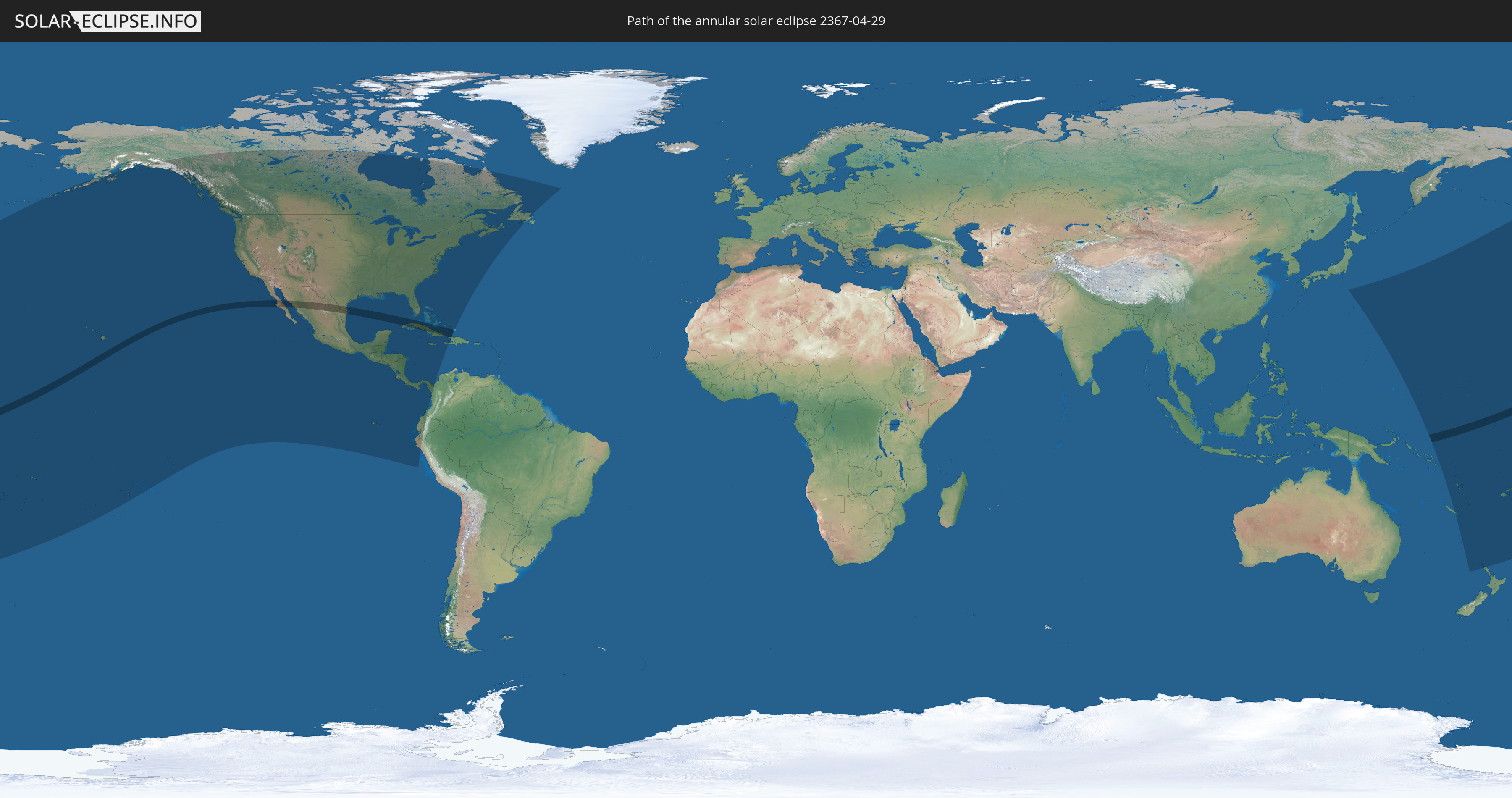
Annular solar eclipse of 04/29/2367
| Day of week: | Saturday |
| Maximum duration of eclipse: | 04m38s |
| Maximum width of eclipse path: | 144 km |
| Saros cycle: | 144 |
| Coverage: | 96.1% |
| Magnitude: | 0.9607 |
| Gamma: | 0.1451 |
Wo kann man die Sonnenfinsternis vom 04/29/2367 sehen?
Die Sonnenfinsternis am 04/29/2367 kann man in 41 Ländern als partielle Sonnenfinsternis beobachten.
Der Finsternispfad verläuft durch 7 Länder. Nur in diesen Ländern ist sie als annular Sonnenfinsternis zu sehen.
In den folgenden Ländern ist die Sonnenfinsternis annular zu sehen
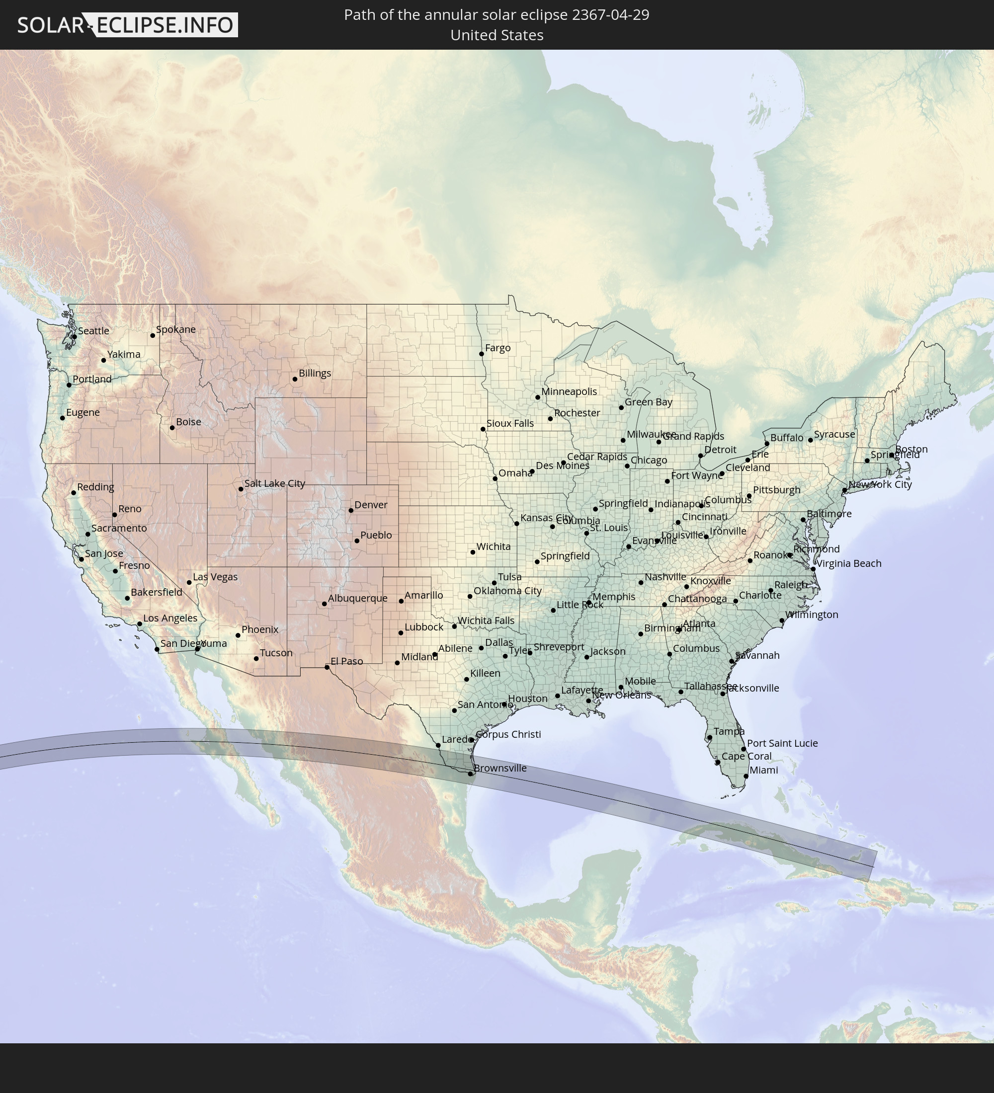 United States
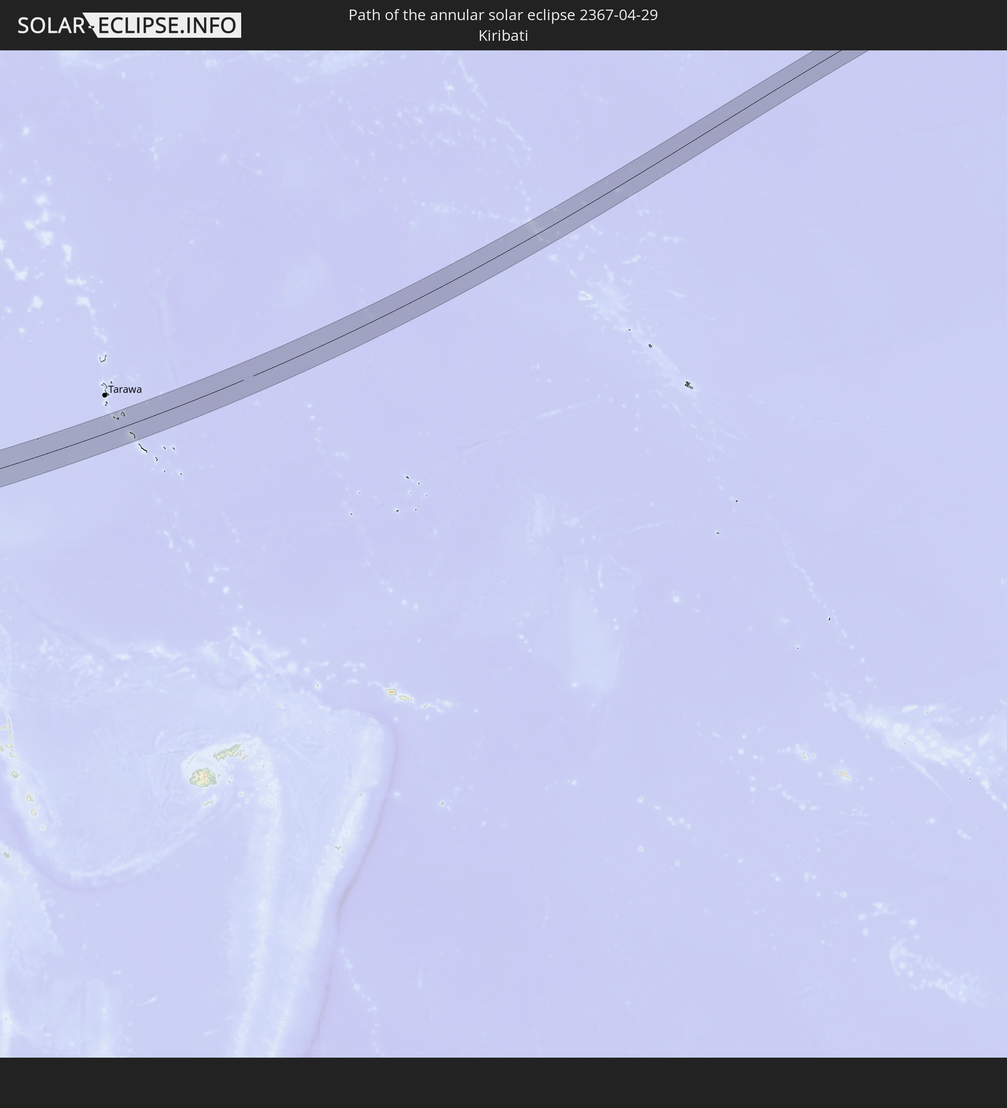 Kiribati
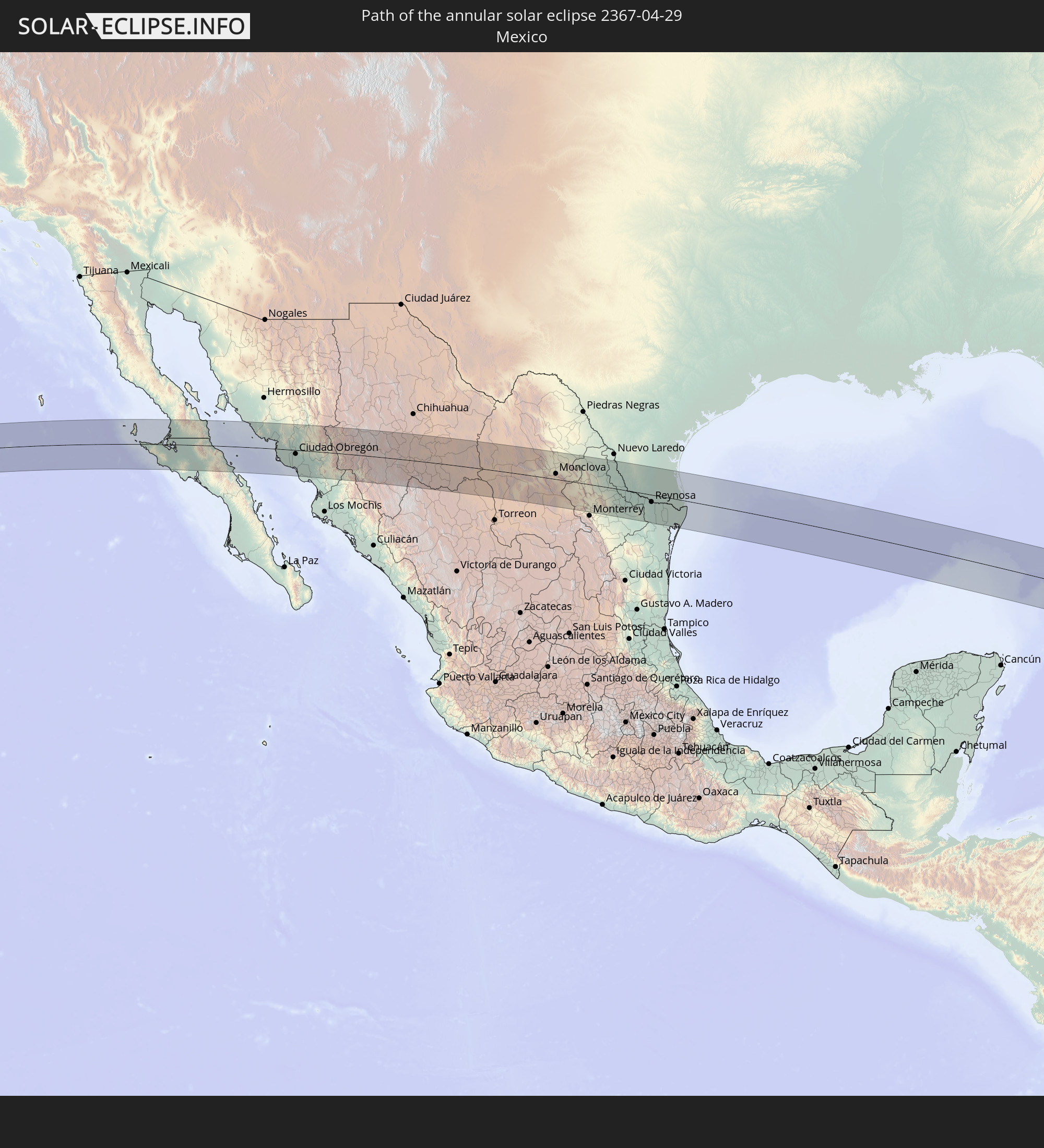 Mexico
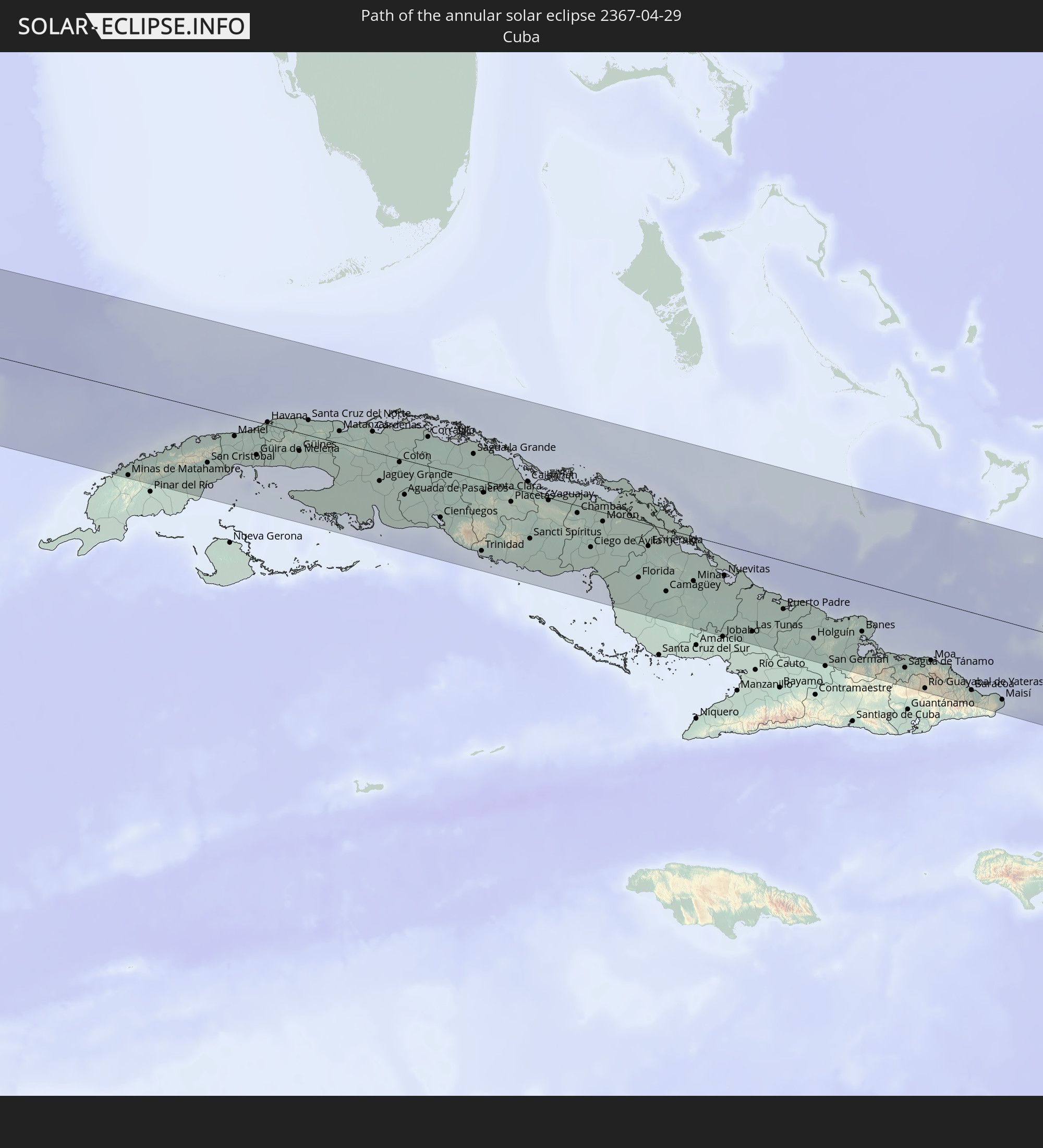 Cuba
Cuba
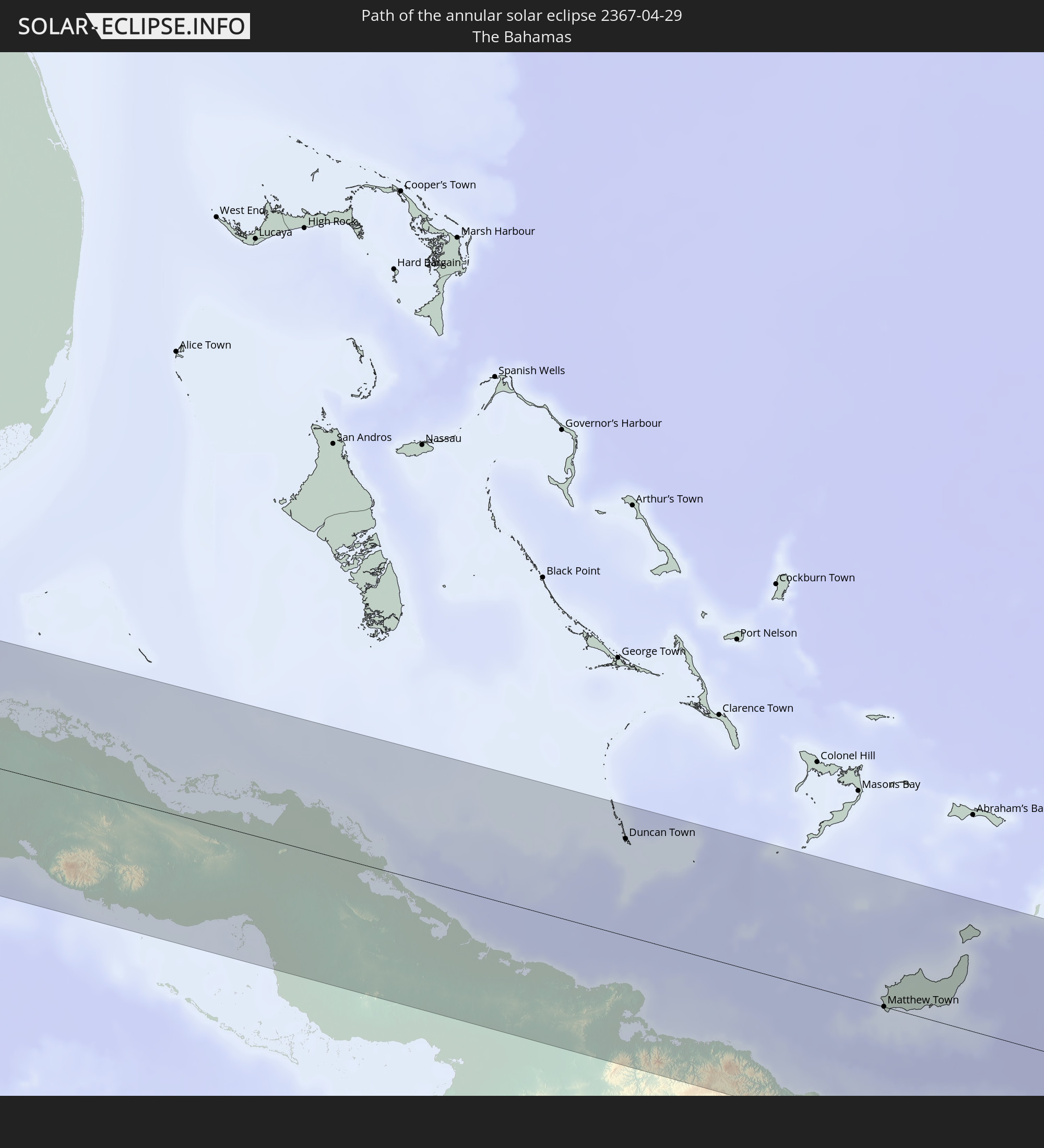 The Bahamas
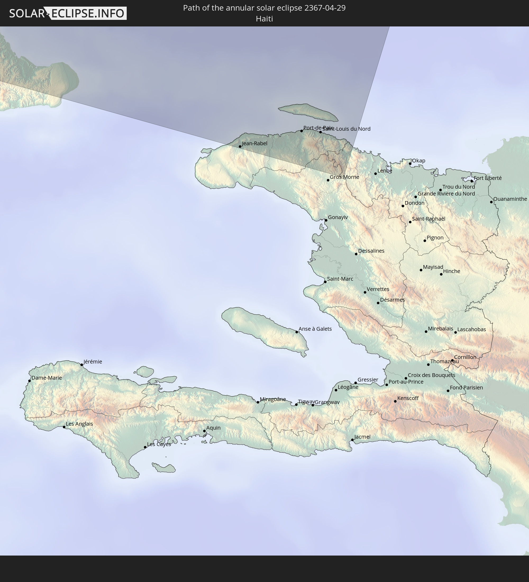 Haiti
Haiti
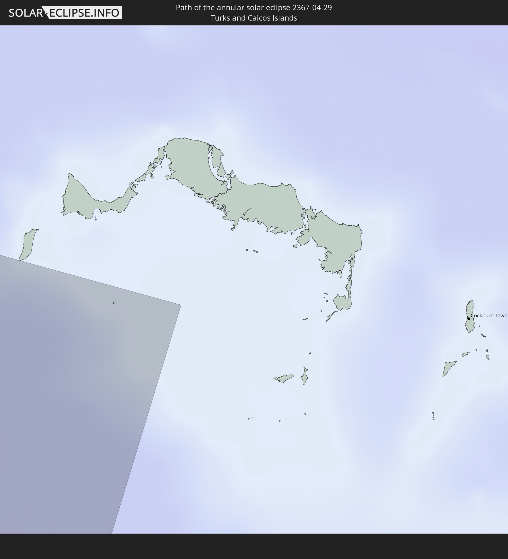 Turks and Caicos Islands
In den folgenden Ländern ist die Sonnenfinsternis partiell zu sehen
 Fiji
Fiji
 United States
 New Zealand
 United States Minor Outlying Islands
 Wallis and Futuna
 Tonga
Tonga
 Kiribati
 Samoa
Samoa
 Tokelau
 American Samoa
 Niue
Niue
 Cook Islands
 French Polynesia
 Canada
 Mexico
 Greenland
 Guatemala
 Ecuador
 El Salvador
 Honduras
 Belize
 Nicaragua
 Costa Rica
 Cuba
Cuba
 Panama
 Colombia
 Cayman Islands
 Peru
Peru
 The Bahamas
 Jamaica
 Haiti
Haiti
 Turks and Caicos Islands
 Saint Pierre and Miquelon
 Japan
Japan
 Federated States of Micronesia
 Solomon Islands
 New Caledonia
 Marshall Islands
 Vanuatu
 Nauru
Nauru
 Tuvalu
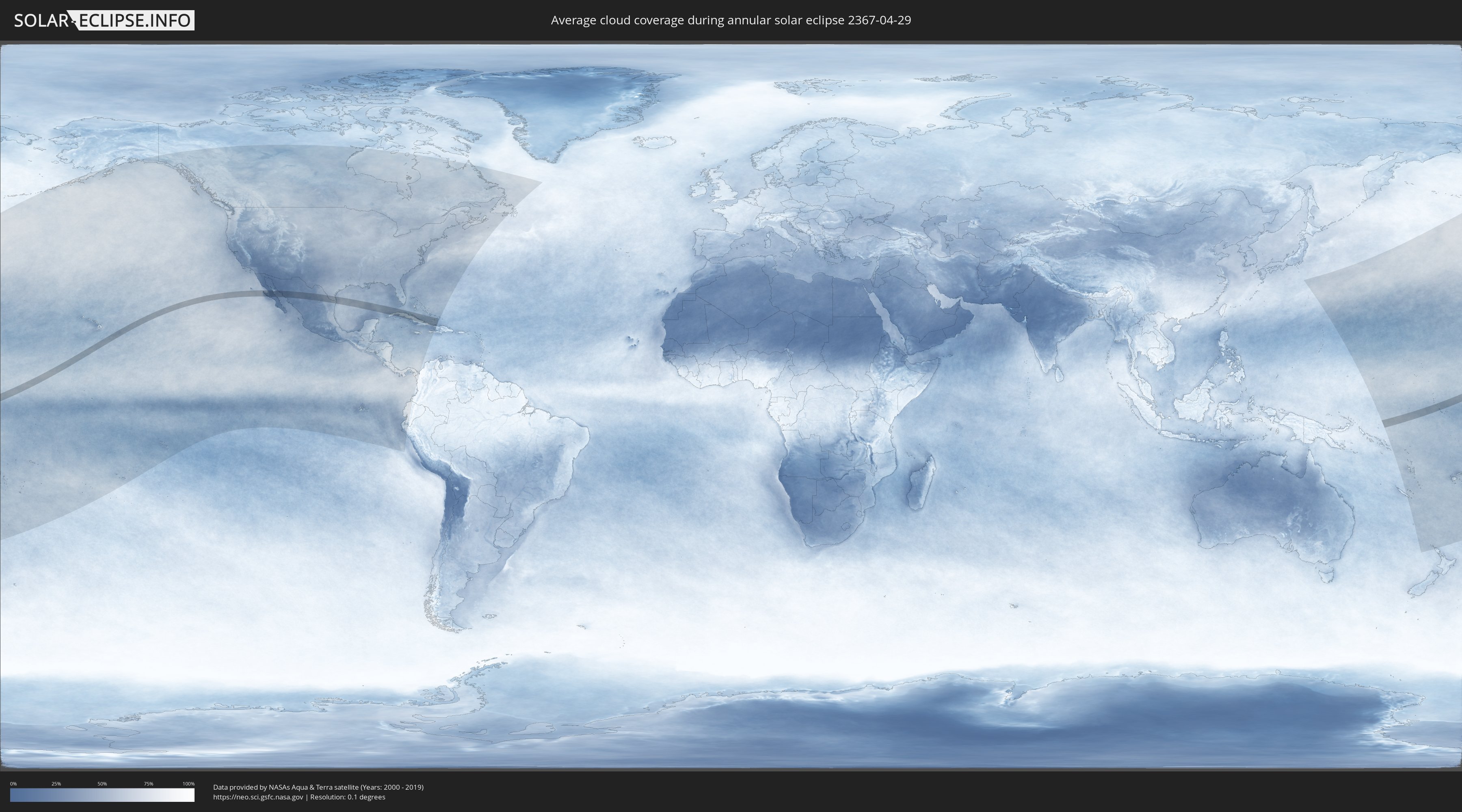
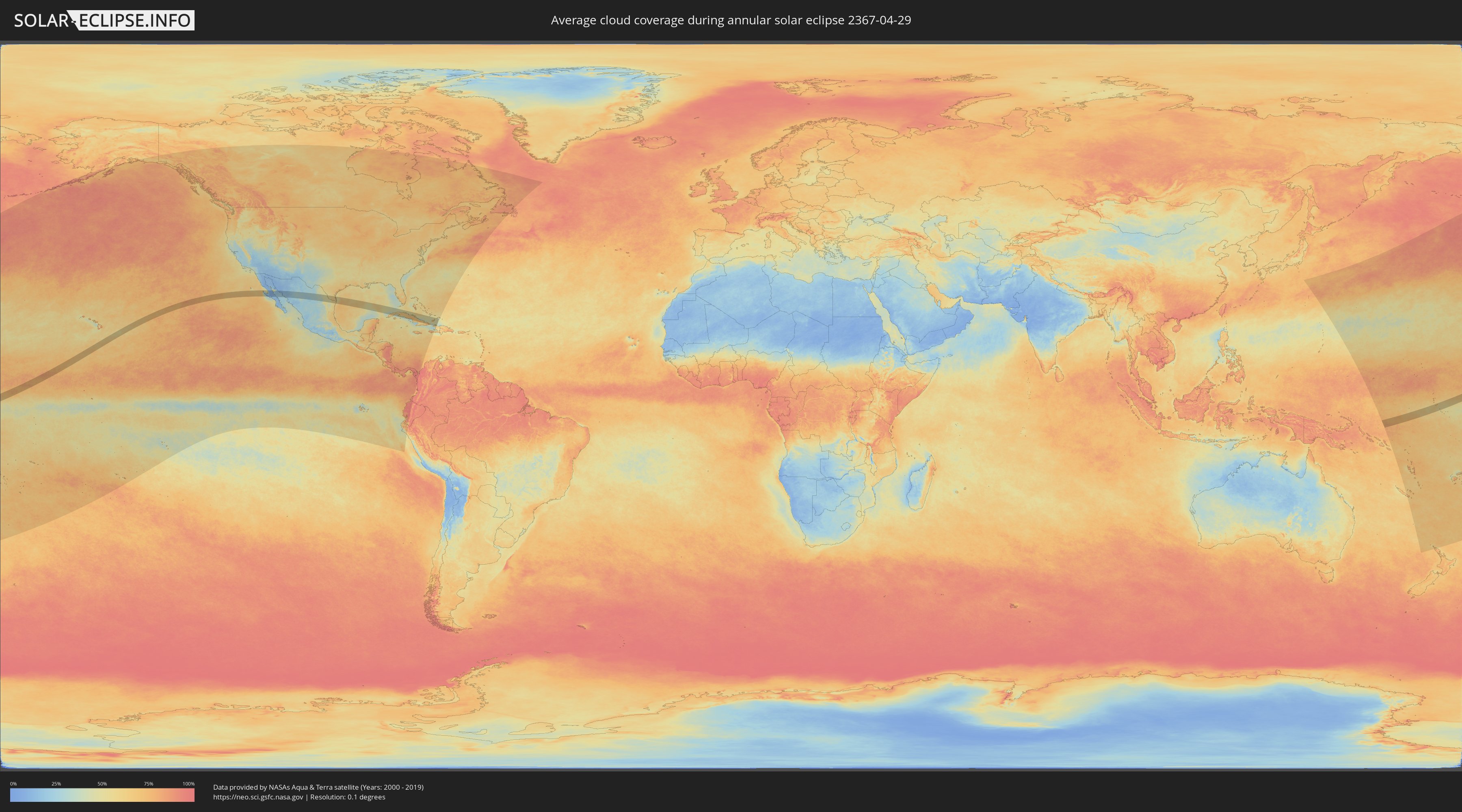
How will be the weather during the annular solar eclipse on 04/29/2367?
Where is the best place to see the annular solar eclipse of 04/29/2367?
The following maps show the average cloud coverage for the day of the annular solar eclipse.
With the help of these maps, it is possible to find the place along the eclipse path, which has the best
chance of a cloudless sky.
Nevertheless, you should consider local circumstances and inform about the weather of your chosen
observation site.
The data is provided by NASAs satellites
AQUA and TERRA.
The cloud maps are averaged over a period of 19 years (2000 - 2019).
Detailed country maps
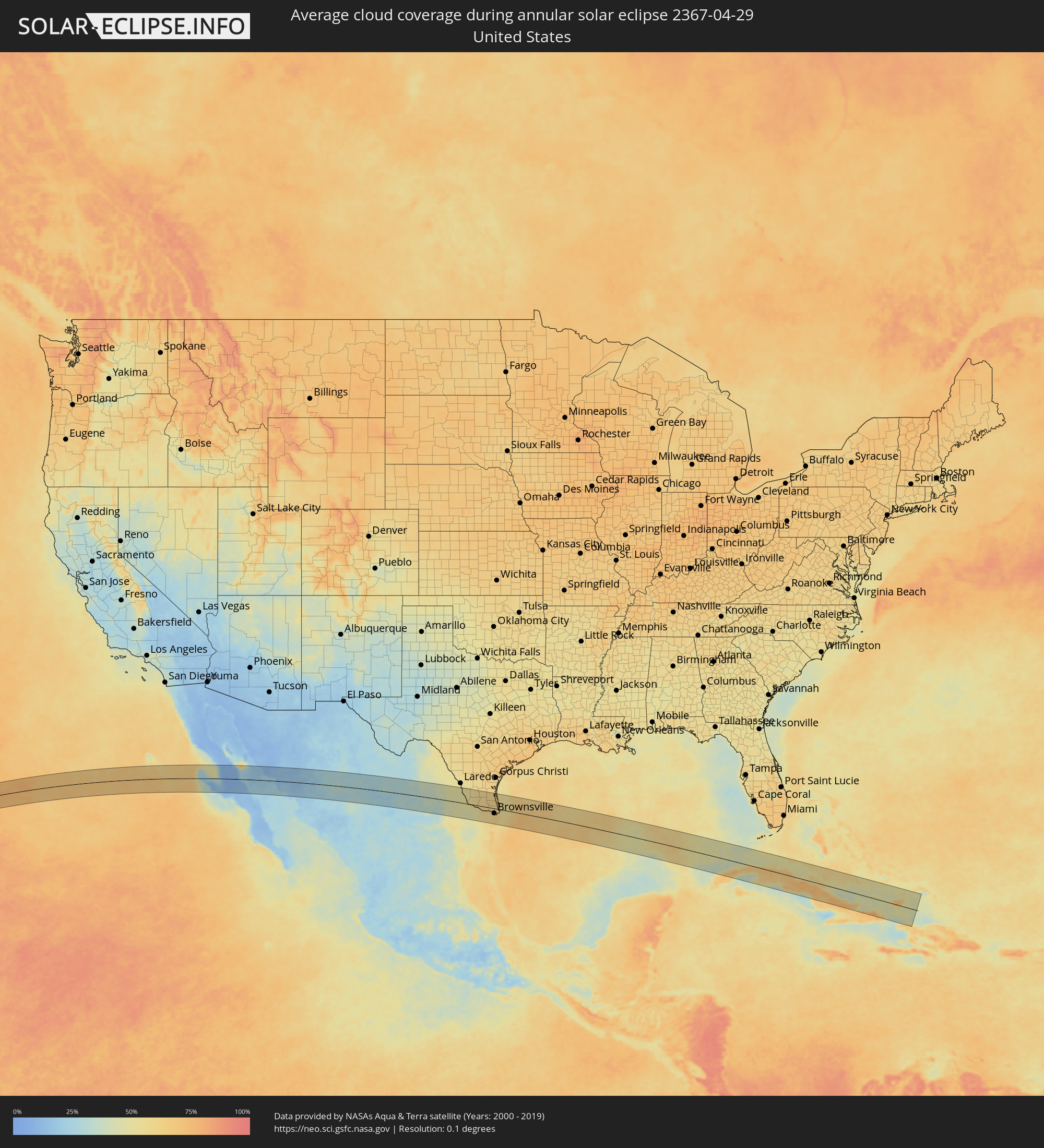 United States
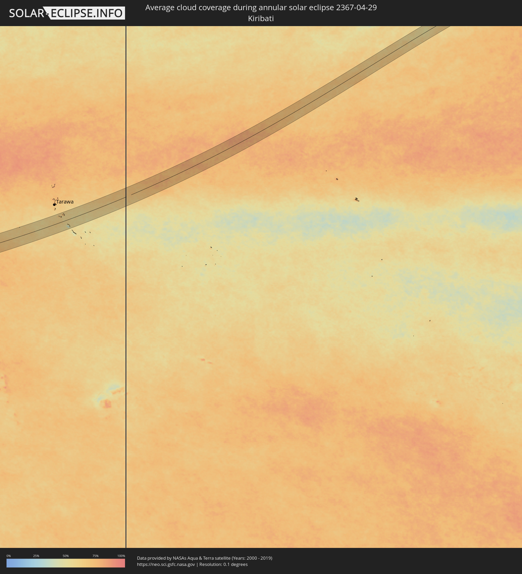 Kiribati
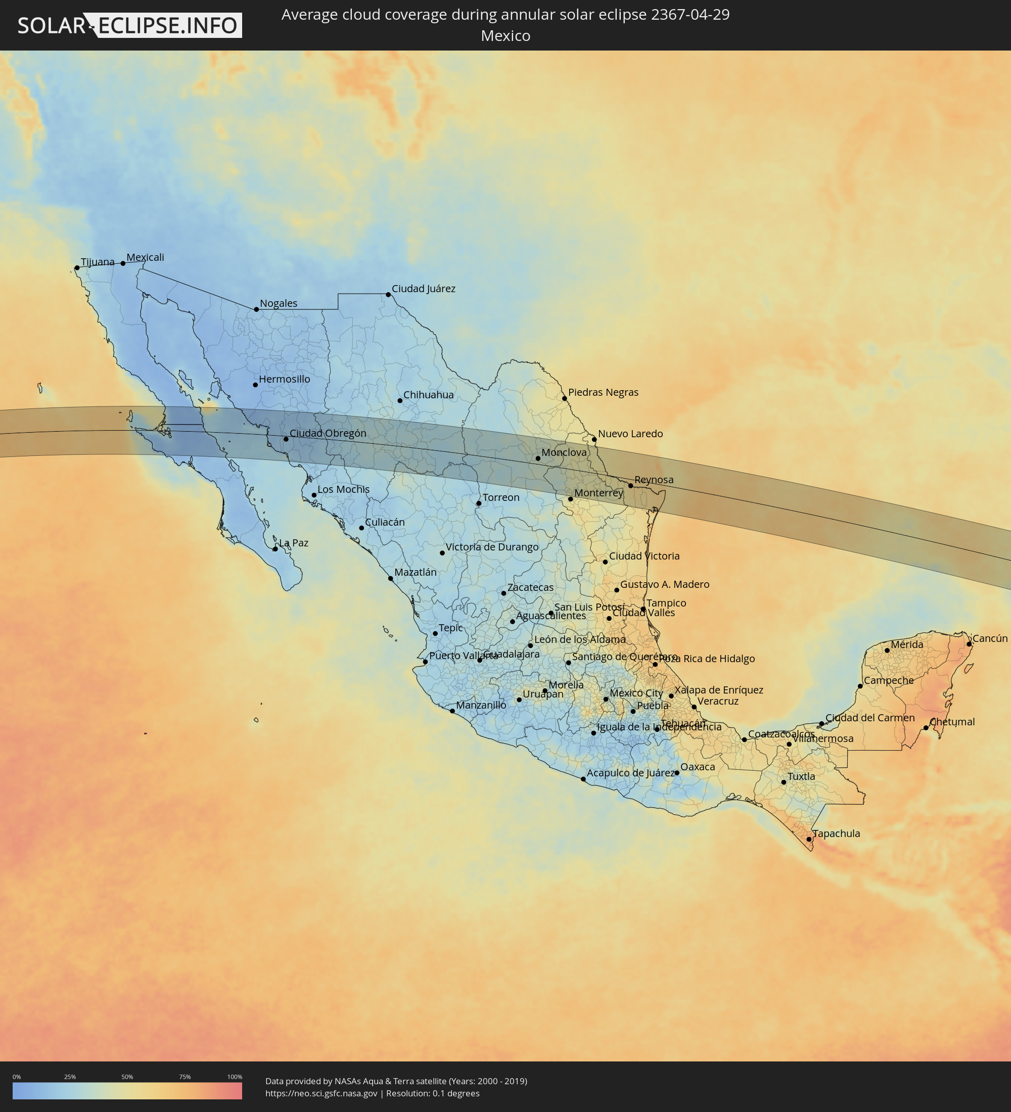 Mexico
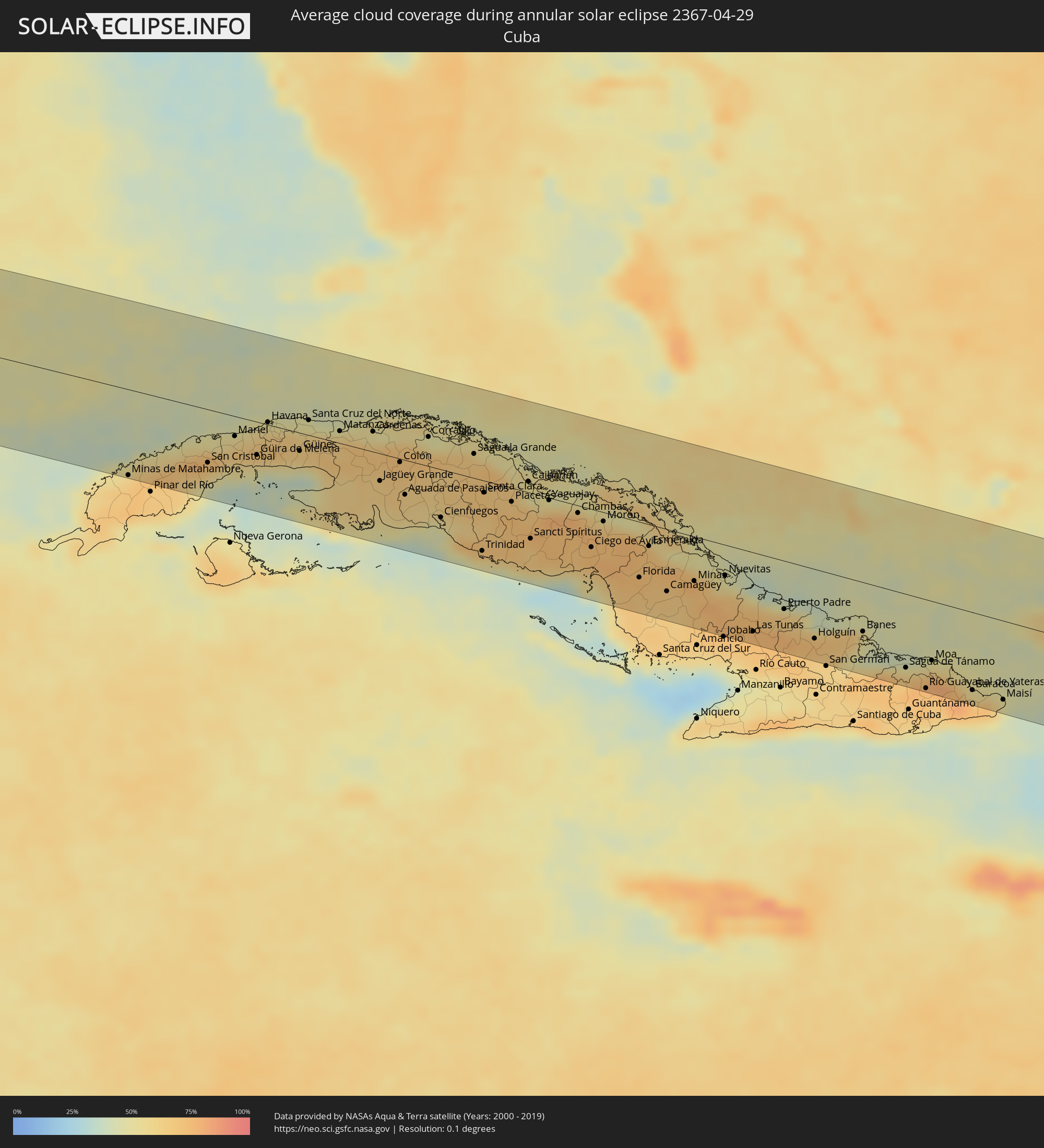 Cuba
Cuba
 The Bahamas
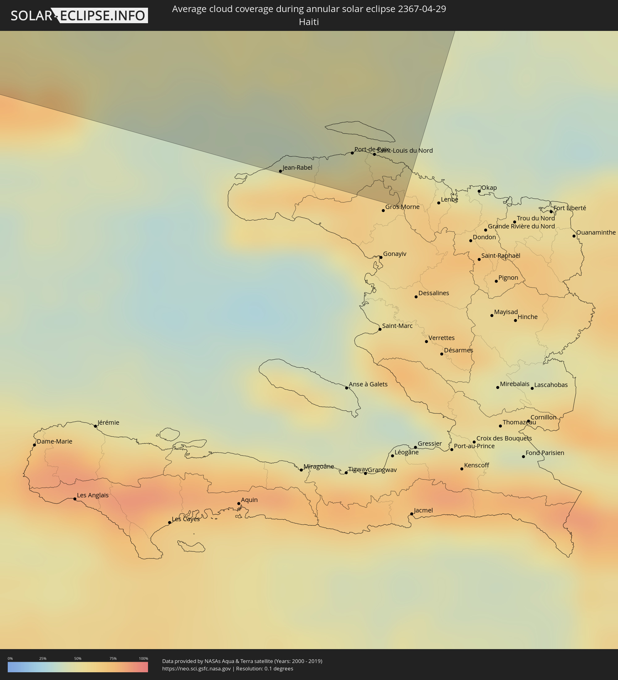 Haiti
Haiti
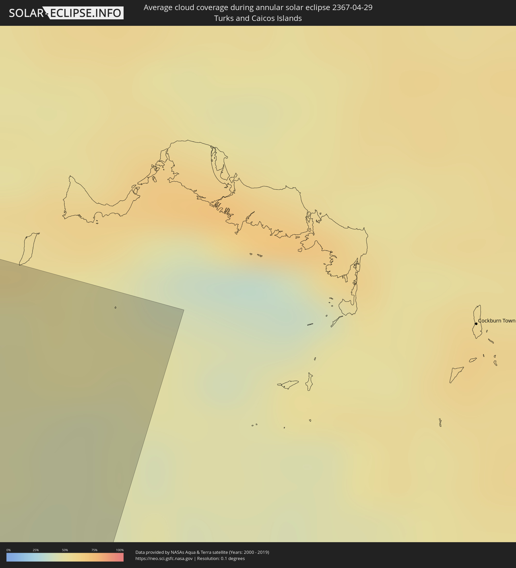 Turks and Caicos Islands
Cities inside the path of the eclipse
The following table shows all locations with a population of more than 5,000 inside the eclipse path. Cities which have more than 100,000 inhabitants are marked bold. A click at the locations opens a detailed map.
| City | Type | Eclipse duration | Local time of max. eclipse | Distance to central line | Ø Cloud coverage |
|
San Luis, Baja California
|
annular | - | 14:32:10 UTC-08:00 | 76 km | 11% |
|
Villa Alberto Andrés Alvarado Arámburo, Baja California Sur
|
annular | - | 15:33:10 UTC-07:00 | 11 km | 9% |
|
Santa Rosalia, Baja California Sur
|
annular | - | 15:35:23 UTC-07:00 | 41 km | 14% |
|
Heroica Guaymas, Sonora
|
annular | - | 15:37:35 UTC-07:00 | 30 km | 26% |
|
Empalme, Sonora
|
annular | - | 15:37:43 UTC-07:00 | 35 km | 17% |
|
Vicam, Sonora
|
annular | - | 15:38:46 UTC-07:00 | 3 km | 15% |
|
San Ignacio Río Muerto, Sonora
|
annular | - | 15:38:57 UTC-07:00 | 22 km | 19% |
|
Pueblo Yaqui, Sonora
|
annular | - | 15:39:20 UTC-07:00 | 28 km | 18% |
|
Cocorit, Sonora
|
annular | - | 15:39:22 UTC-07:00 | 3 km | 18% |
|
Ciudad Obregón, Sonora
|
annular | - | 15:39:26 UTC-07:00 | 12 km | 18% |
|
El Tobarito, Sonora
|
annular | - | 15:39:34 UTC-07:00 | 25 km | 19% |
|
Marte R. Gómez (Tobarito), Sonora
|
annular | - | 15:39:35 UTC-07:00 | 25 km | 19% |
|
Villa Juarez, Sonora
|
annular | - | 15:39:47 UTC-07:00 | 51 km | 22% |
|
Bacobampo, Sonora
|
annular | - | 15:40:10 UTC-07:00 | 66 km | 21% |
|
Etchojoa, Sonora
|
annular | - | 15:40:15 UTC-07:00 | 74 km | 20% |
|
Navojoa, Sonora
|
annular | - | 15:40:28 UTC-07:00 | 55 km | 17% |
|
Alamos, Sonora
|
annular | - | 15:41:20 UTC-07:00 | 56 km | 21% |
|
Santa Bárbara, Chihuahua
|
annular | - | 15:46:13 UTC-07:00 | 51 km | 30% |
|
Hidalgo del Parral, Chihuahua
|
annular | - | 15:46:22 UTC-07:00 | 35 km | 30% |
|
Ciudad Camargo, Chihuahua
|
annular | - | 15:46:37 UTC-07:00 | 53 km | 23% |
|
San Buenaventura, Coahuila
|
annular | - | 16:51:35 UTC-06:00 | 33 km | 37% |
|
Castaños, Coahuila
|
annular | - | 16:51:54 UTC-06:00 | 4 km | 35% |
|
Monclova, Coahuila
|
annular | - | 16:51:50 UTC-06:00 | 17 km | 38% |
|
General Escobedo, Nuevo León
|
annular | - | 16:53:47 UTC-06:00 | 88 km | 49% |
|
Emiliano Zapata, Nuevo León
|
annular | - | 16:53:45 UTC-06:00 | 75 km | 46% |
|
Sabinas Hidalgo, Nuevo León
|
annular | - | 16:53:29 UTC-06:00 | 8 km | 46% |
|
Ciénega de Flores, Nuevo León
|
annular | - | 16:53:51 UTC-06:00 | 68 km | 43% |
|
Fraccionamiento Real Palmas, Nuevo León
|
annular | - | 16:53:53 UTC-06:00 | 74 km | 46% |
|
Ciudad Anáhuac, Nuevo León
|
annular | - | 16:53:02 UTC-06:00 | 74 km | 48% |
|
Anáhuac, Nuevo León
|
annular | - | 16:53:03 UTC-06:00 | 74 km | 48% |
|
Hidalgo, Nuevo León
|
annular | - | 16:54:30 UTC-06:00 | 70 km | 47% |
|
Zapata, Texas
|
annular | - | 16:54:10 UTC-06:00 | 51 km | 47% |
|
China, Nuevo León
|
annular | - | 16:55:00 UTC-06:00 | 81 km | 46% |
|
Mier, Tamaulipas
|
annular | - | 16:54:37 UTC-06:00 | 1 km | 49% |
|
Ciudad Miguel Alemán, Tamaulipas
|
annular | - | 16:54:46 UTC-06:00 | 1 km | 49% |
|
Roma-Los Saenz, Texas
|
annular | - | 16:54:46 UTC-06:00 | 0 km | 49% |
|
Camargo, Tamaulipas
|
annular | - | 16:55:03 UTC-06:00 | 14 km | 51% |
|
Rio Grande City, Texas
|
annular | - | 16:54:59 UTC-06:00 | 1 km | 52% |
|
Ciudad Díaz Ordaz, Tamaulipas
|
annular | - | 16:55:19 UTC-06:00 | 12 km | 50% |
|
Perezville, Texas
|
annular | - | 16:55:31 UTC-06:00 | 9 km | 57% |
|
Doffing, Texas
|
annular | - | 16:55:29 UTC-06:00 | 4 km | 58% |
|
Palmview South, Texas
|
annular | - | 16:55:32 UTC-06:00 | 10 km | 57% |
|
Palmview, Texas
|
annular | - | 16:55:32 UTC-06:00 | 8 km | 57% |
|
La Homa, Texas
|
annular | - | 16:55:32 UTC-06:00 | 6 km | 58% |
|
Mission, Texas
|
annular | - | 16:55:35 UTC-06:00 | 9 km | 60% |
|
Alton, Texas
|
annular | - | 16:55:33 UTC-06:00 | 1 km | 59% |
|
Alton North (historical), Texas
|
annular | - | 16:55:33 UTC-06:00 | 0 km | 59% |
|
Reynosa, Tamaulipas
|
annular | - | 16:55:43 UTC-06:00 | 23 km | 58% |
|
Hidalgo, Texas
|
annular | - | 16:55:44 UTC-06:00 | 21 km | 58% |
|
McAllen, Texas
|
annular | - | 16:55:41 UTC-06:00 | 9 km | 60% |
|
Pharr, Texas
|
annular | - | 16:55:44 UTC-06:00 | 9 km | 60% |
|
Edinburg, Texas
|
annular | - | 16:55:41 UTC-06:00 | 3 km | 60% |
|
San Juan, Texas
|
annular | - | 16:55:46 UTC-06:00 | 9 km | 60% |
|
Alamo, Texas
|
annular | - | 16:55:48 UTC-06:00 | 9 km | 59% |
|
Nurillo, Texas
|
annular | - | 16:55:45 UTC-06:00 | 0 km | 59% |
|
Murillo Colonia, Texas
|
annular | - | 16:55:46 UTC-06:00 | 1 km | 59% |
|
Río Bravo, Tamaulipas
|
annular | - | 16:55:58 UTC-06:00 | 30 km | 58% |
|
Donna, Texas
|
annular | - | 16:55:53 UTC-06:00 | 9 km | 59% |
|
Elsa, Texas
|
annular | - | 16:55:52 UTC-06:00 | 5 km | 59% |
|
Weslaco, Texas
|
annular | - | 16:55:57 UTC-06:00 | 9 km | 58% |
|
Mila Doce, Texas
|
annular | - | 16:55:56 UTC-06:00 | 2 km | 58% |
|
Progreso, Texas
|
annular | - | 16:56:02 UTC-06:00 | 16 km | 58% |
|
Mercedes, Texas
|
annular | - | 16:56:02 UTC-06:00 | 9 km | 59% |
|
La Feria, Texas
|
annular | - | 16:56:07 UTC-06:00 | 6 km | 59% |
|
Valle Hermoso, Tamaulipas
|
annular | - | 16:56:27 UTC-06:00 | 60 km | 57% |
|
Raymondville, Texas
|
annular | - | 16:55:56 UTC-06:00 | 30 km | 61% |
|
Harlingen, Texas
|
annular | - | 16:56:13 UTC-06:00 | 1 km | 61% |
|
San Benito, Texas
|
annular | - | 16:56:19 UTC-06:00 | 6 km | 61% |
|
Heroica Matamoros, Tamaulipas
|
annular | - | 16:56:36 UTC-06:00 | 31 km | 61% |
|
Brownsville, Texas
|
annular | - | 16:56:35 UTC-06:00 | 29 km | 61% |
|
Cameron Park Colonia, Texas
|
annular | - | 16:56:34 UTC-06:00 | 21 km | 61% |
|
Cameron Park, Texas
|
annular | - | 16:56:34 UTC-06:00 | 22 km | 61% |
|
Los Fresnos, Texas
|
annular | - | 16:56:30 UTC-06:00 | 10 km | 60% |
|
Port Isabel, Texas
|
annular | - | 16:56:45 UTC-06:00 | 5 km | 63% |
|
Consolación del Sur, Pinar del Río
|
annular | - | 18:07:01 UTC-05:00 | 94 km | 66% |
|
San Cristobal, Artemisa
|
annular | - | 18:07:01 UTC-05:00 | 59 km | 69% |
|
Artemisa, Artemisa
|
annular | - | 18:07:02 UTC-05:00 | 41 km | 59% |
|
Bauta, Artemisa
|
annular | - | 18:06:59 UTC-05:00 | 18 km | 65% |
|
Güira de Melena, Artemisa
|
annular | - | 18:07:06 UTC-05:00 | 37 km | 58% |
|
Havana, La Habana
|
annular | - | 18:06:55 UTC-05:00 | 3 km | 63% |
|
Arroyo Naranjo, La Habana
|
annular | - | 18:07:01 UTC-05:00 | 8 km | 67% |
|
San José de las Lajas, Mayabeque
|
annular | - | 18:07:05 UTC-05:00 | 10 km | 67% |
|
Güines, Mayabeque
|
annular | - | 18:07:11 UTC-05:00 | 20 km | 58% |
|
Matanzas, Matanzas
|
annular | - | 18:07:09 UTC-05:00 | 13 km | 64% |
|
Cárdenas, Matanzas
|
annular | - | 18:07:14 UTC-05:00 | 22 km | 65% |
|
Jovellanos, Matanzas
|
annular | - | 18:07:22 UTC-05:00 | 2 km | 69% |
|
Jagüey Grande, Matanzas
|
annular | - | 18:07:33 UTC-05:00 | 31 km | 64% |
|
Colón, Matanzas
|
annular | - | 18:07:28 UTC-05:00 | 4 km | 69% |
|
Corralillo, Villa Clara
|
annular | - | 18:07:22 UTC-05:00 | 33 km | 58% |
|
Cienfuegos, Cienfuegos
|
annular | - | 18:07:53 UTC-05:00 | 54 km | 45% |
|
Santo Domingo, Villa Clara
|
annular | - | 18:07:39 UTC-05:00 | 1 km | 67% |
|
Ranchuelo, Villa Clara
|
annular | - | 18:07:48 UTC-05:00 | 22 km | 64% |
|
Sagua la Grande, Villa Clara
|
annular | - | 18:07:33 UTC-05:00 | 27 km | 67% |
|
Cifuentes, Villa Clara
|
annular | - | 18:07:39 UTC-05:00 | 11 km | 68% |
|
Trinidad, Sancti Spíritus
|
annular | - | 18:08:09 UTC-05:00 | 79 km | 54% |
|
Manicaragua, Villa Clara
|
annular | - | 18:07:57 UTC-05:00 | 41 km | 63% |
|
Santa Clara, Villa Clara
|
annular | - | 18:07:48 UTC-05:00 | 13 km | 69% |
|
Placetas, Villa Clara
|
annular | - | 18:07:54 UTC-05:00 | 15 km | 73% |
|
Cabaiguán, Sancti Spíritus
|
annular | - | 18:08:03 UTC-05:00 | 36 km | 72% |
|
Sancti Spíritus, Sancti Spíritus
|
annular | - | 18:08:08 UTC-05:00 | 51 km | 65% |
|
Yaguajay, Sancti Spíritus
|
annular | - | 18:07:56 UTC-05:00 | 3 km | 76% |
|
Ciego de Ávila, Ciego de Ávila
|
annular | - | 18:08:16 UTC-05:00 | 43 km | 72% |
|
Morón, Ciego de Ávila
|
annular | - | 18:08:07 UTC-05:00 | 10 km | 71% |
|
Florida, Camagüey
|
annular | - | 18:08:29 UTC-05:00 | 62 km | 72% |
|
Camagüey, Camagüey
|
annular | - | 18:08:35 UTC-05:00 | 69 km | 67% |
|
Guáimaro, Camagüey
|
annular | - | 18:08:47 UTC-05:00 | 90 km | 73% |
|
Nuevitas, Camagüey
|
annular | - | 18:08:31 UTC-05:00 | 34 km | 57% |
|
Las Tunas, Las Tunas
|
annular | - | 18:08:51 UTC-05:00 | 89 km | 73% |
|
Puerto Padre, Las Tunas
|
annular | - | 18:08:44 UTC-05:00 | 54 km | 66% |
|
Cacocum, Holguín
|
annular | - | 18:08:58 UTC-05:00 | 96 km | 67% |
|
Holguín, Holguín
|
annular | - | 18:08:54 UTC-05:00 | 78 km | 72% |
|
Duncan Town, Ragged Island
|
annular | - | 18:08:11 UTC-05:00 | 77 km | 57% |
|
Banes, Holguín
|
annular | - | 18:08:51 UTC-05:00 | 55 km | 54% |
|
Moa, Holguín
|
annular | - | 18:08:59 UTC-05:00 | 67 km | 56% |
|
Baracoa, Guantánamo
|
annular | - | 18:09:07 UTC-05:00 | 87 km | 76% |
|
Matthew Town, Inagua
|
annular | - | 18:08:45 UTC-05:00 | 0 km | 45% |
|
Jean-Rabel, Nord-Ouest
|
annular | - | 18:09:15 UTC-05:00 | 104 km | 53% |
|
Ti Port-de-Paix, Nord-Ouest
|
annular | - | 18:09:11 UTC-05:00 | 86 km | 56% |
|
Port-de-Paix, Nord-Ouest
|
annular | - | 18:09:10 UTC-05:00 | 85 km | 56% |
|
Saint-Louis du Nord, Nord-Ouest
|
annular | - | 18:09:10 UTC-05:00 | 83 km | 59% |