Annular solar eclipse of 01/03/2671
| Day of week: | Tuesday |
| Maximum duration of eclipse: | 04m27s |
| Maximum width of eclipse path: | 144 km |
| Saros cycle: | 152 |
| Coverage: | 96.4% |
| Magnitude: | 0.9643 |
| Gamma: | 0.4505 |
Wo kann man die Sonnenfinsternis vom 01/03/2671 sehen?
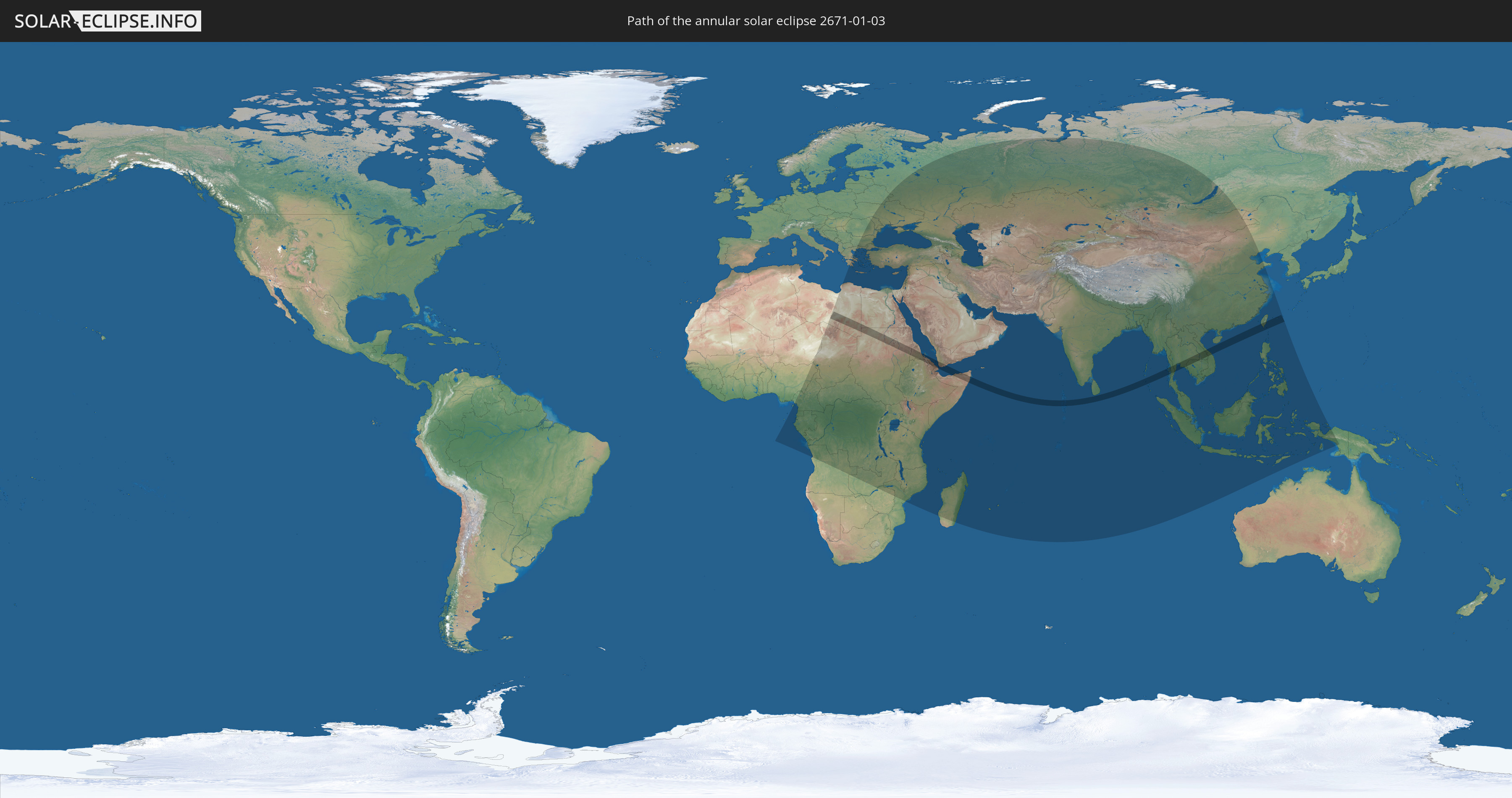
Die Sonnenfinsternis am 01/03/2671 kann man in 94 Ländern als partielle Sonnenfinsternis beobachten.
Der Finsternispfad verläuft durch 17 Länder. Nur in diesen Ländern ist sie als annular Sonnenfinsternis zu sehen.
In den folgenden Ländern ist die Sonnenfinsternis annular zu sehen
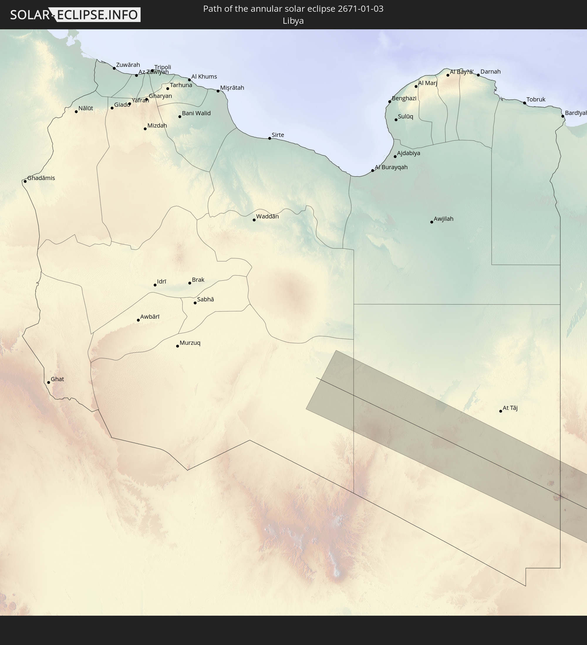 Libya
Libya
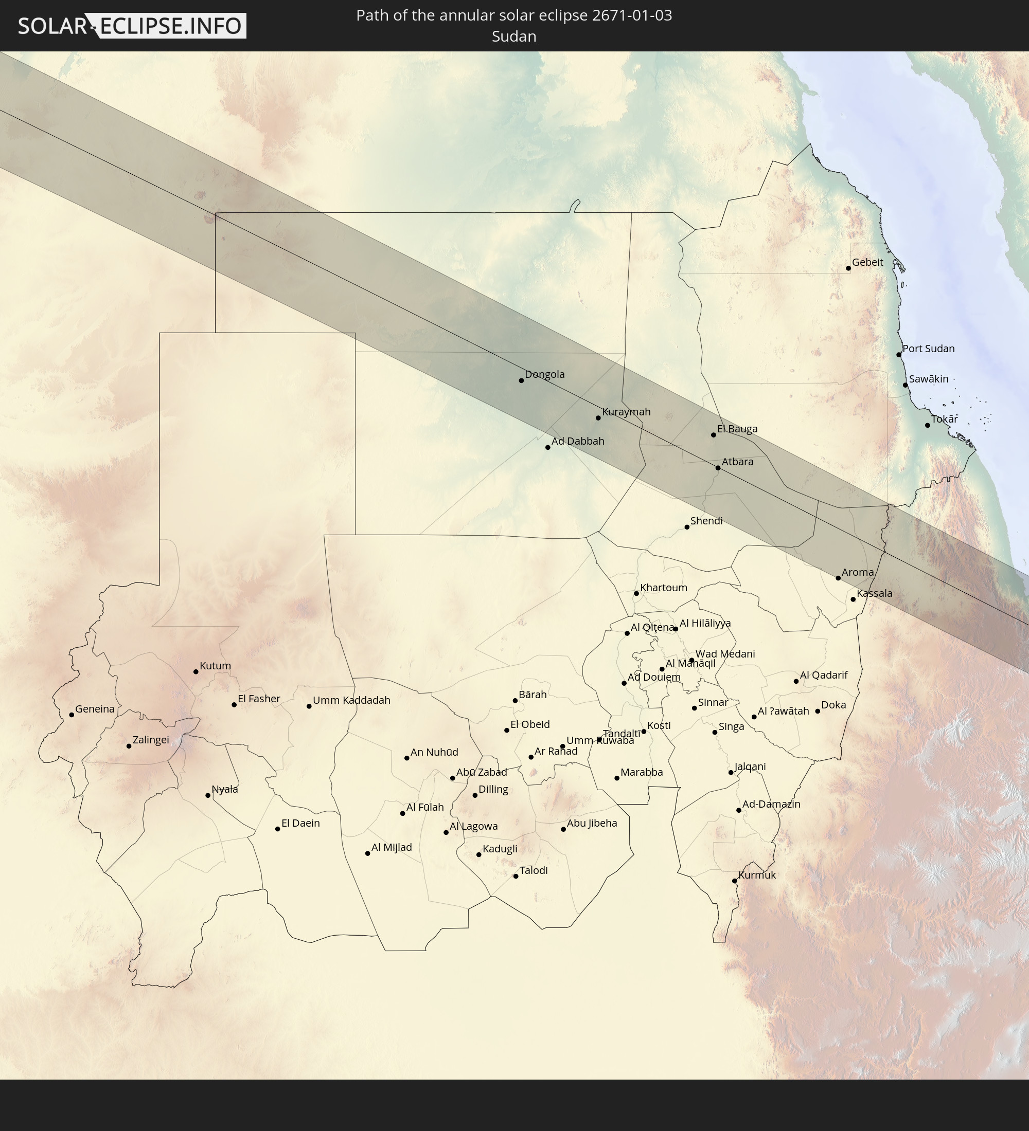 Sudan
Sudan
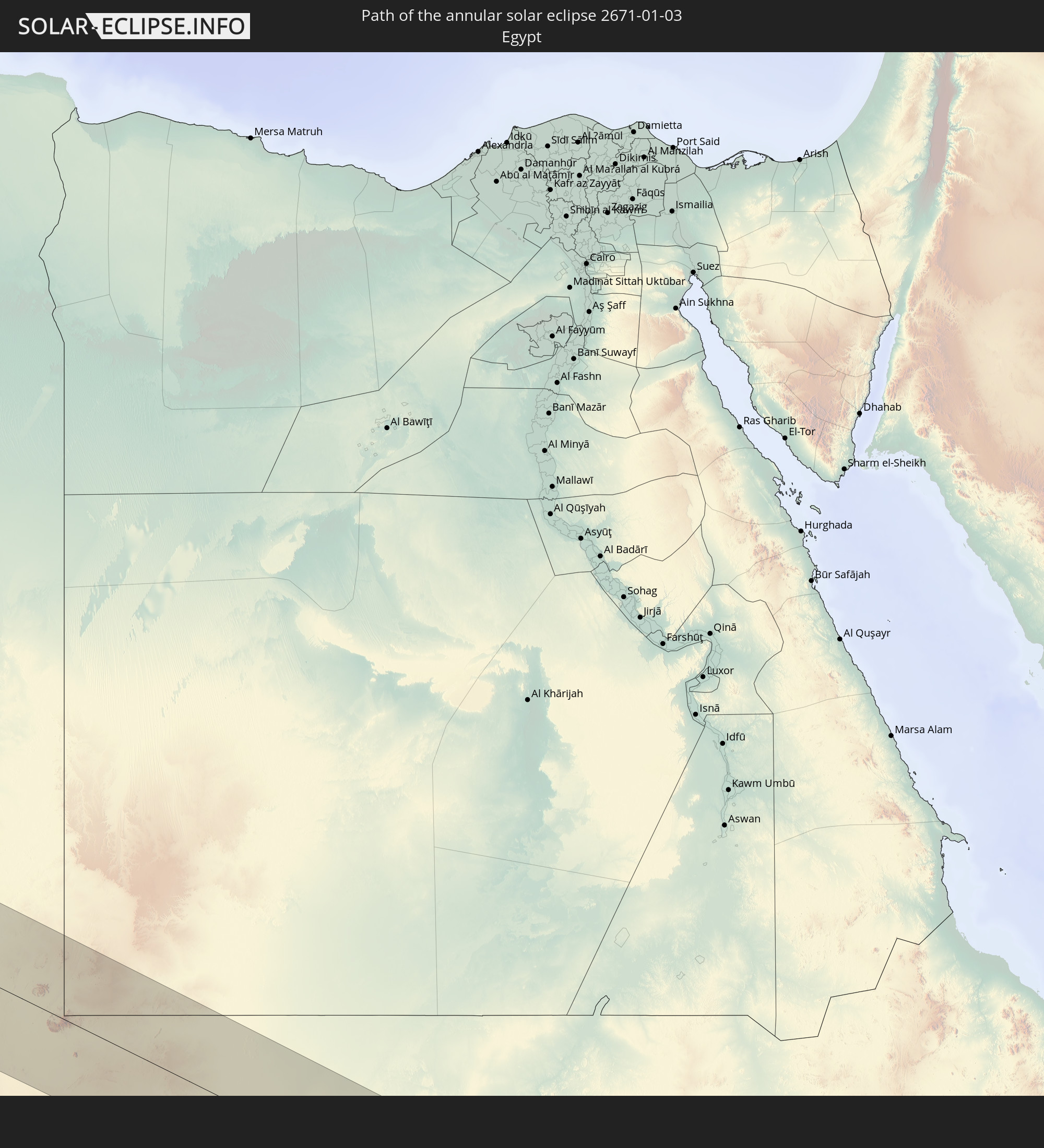 Egypt
Egypt
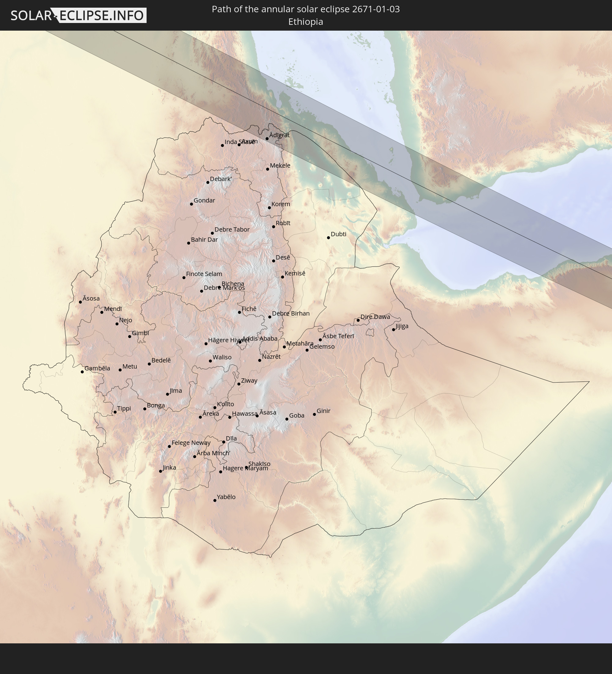 Ethiopia
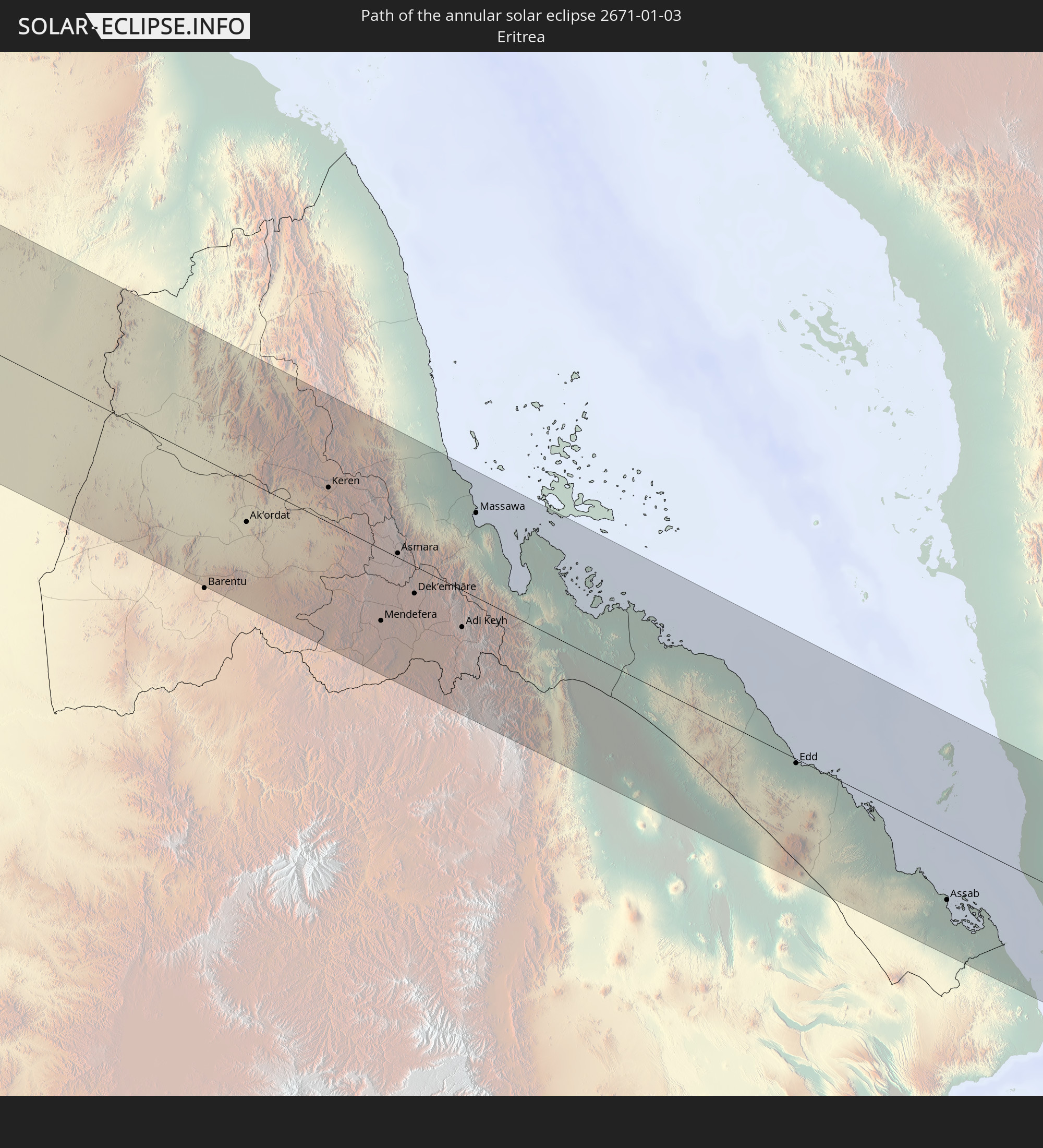 Eritrea
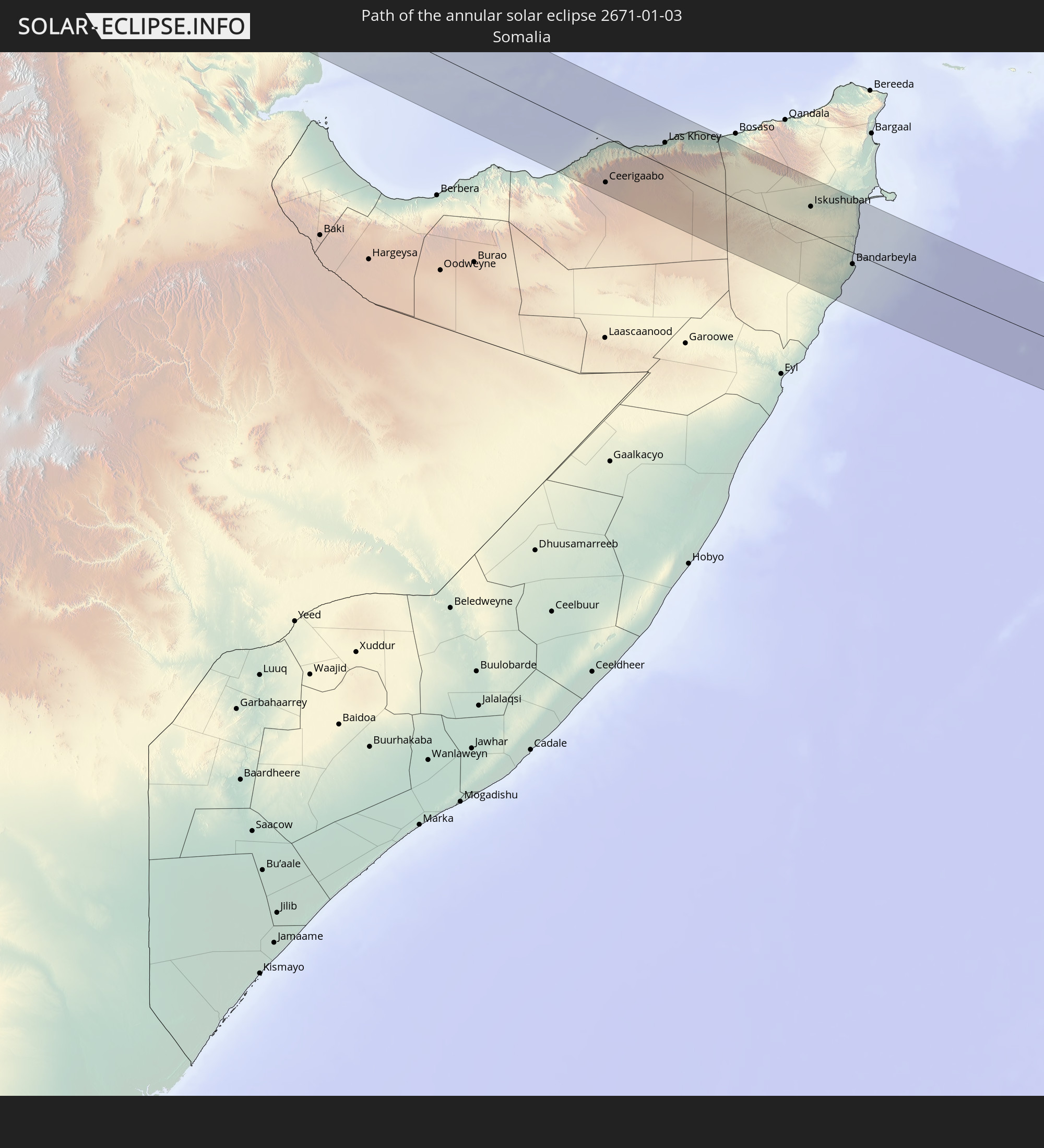 Somalia
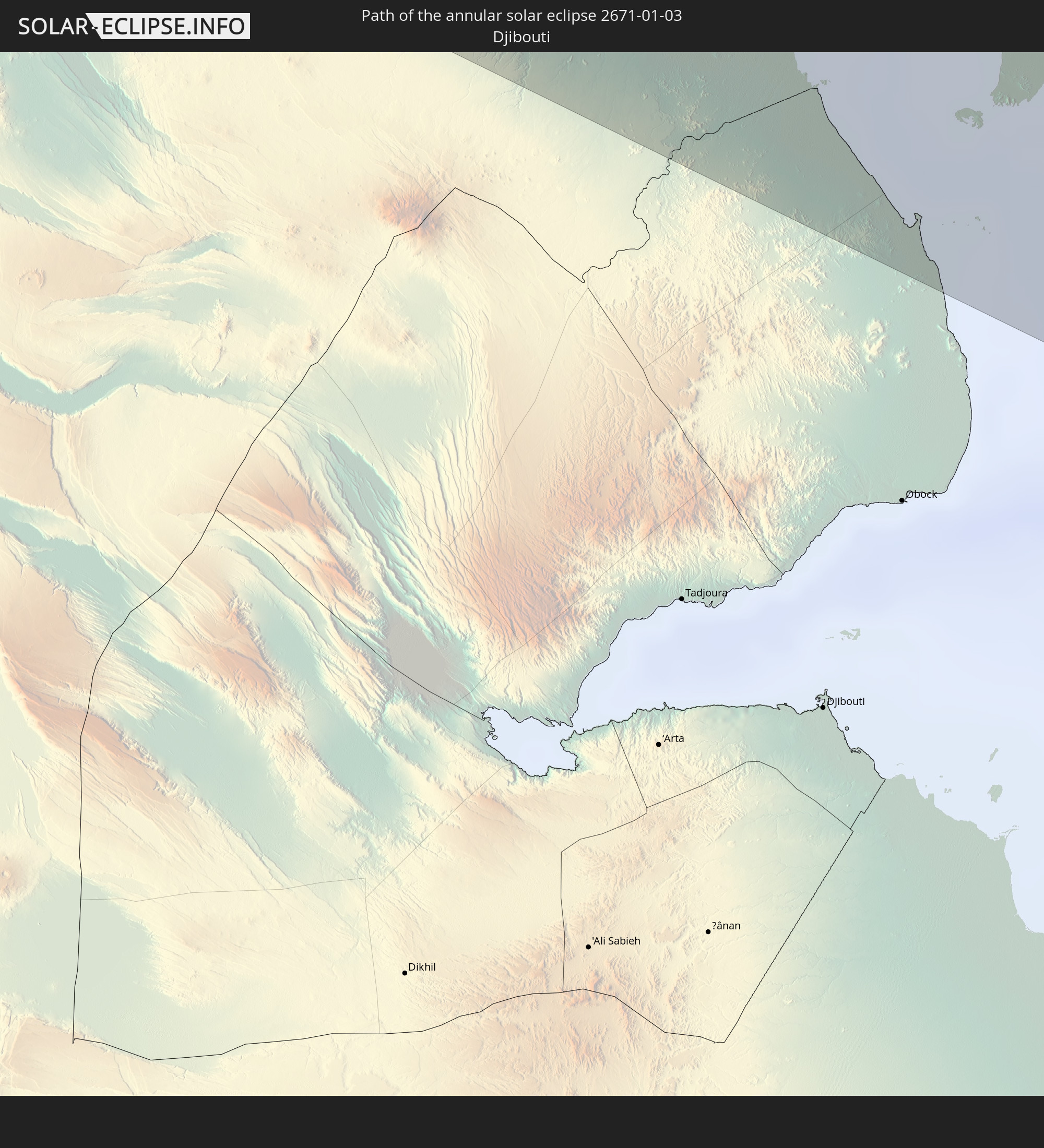 Djibouti
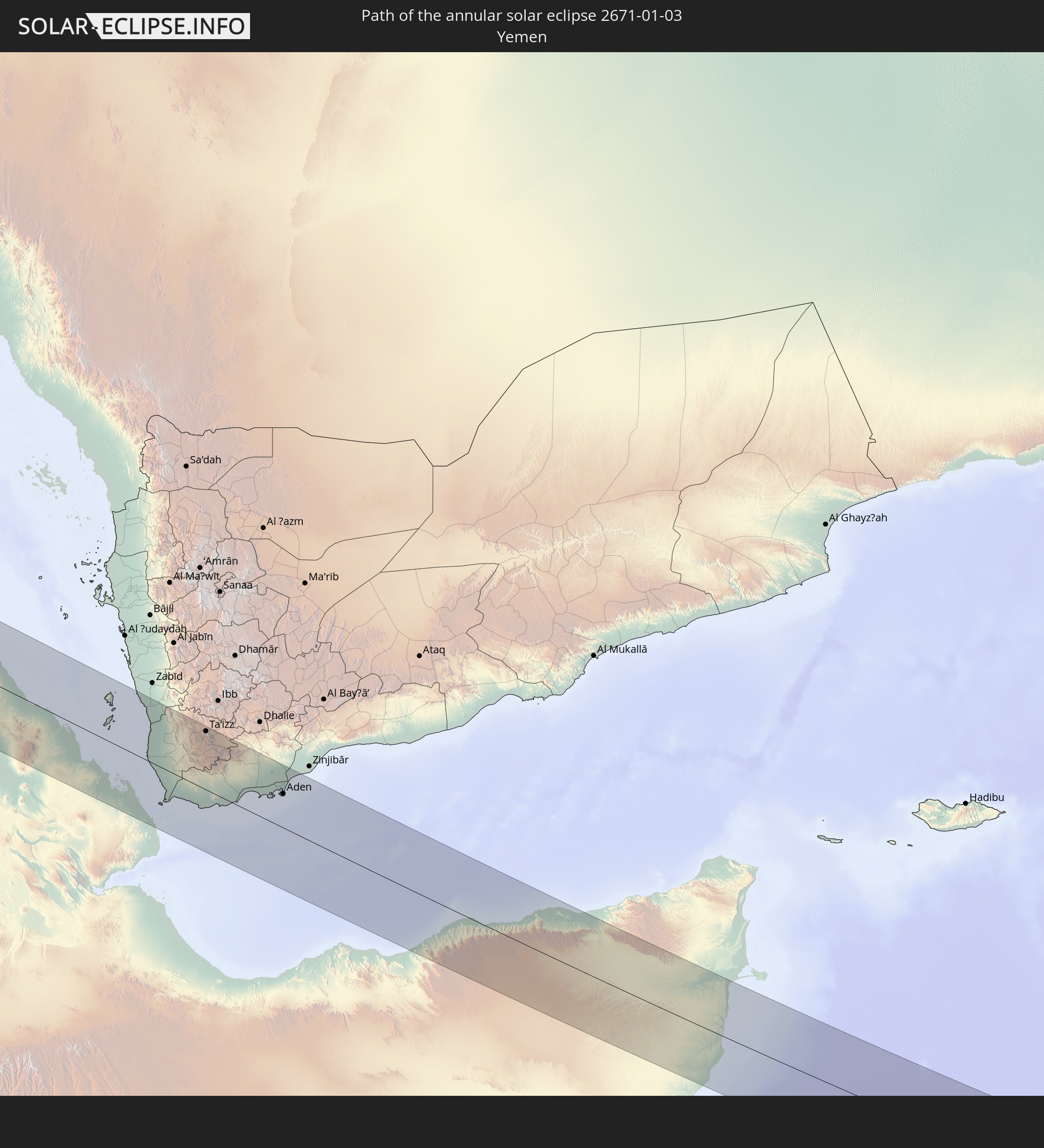 Yemen
Yemen
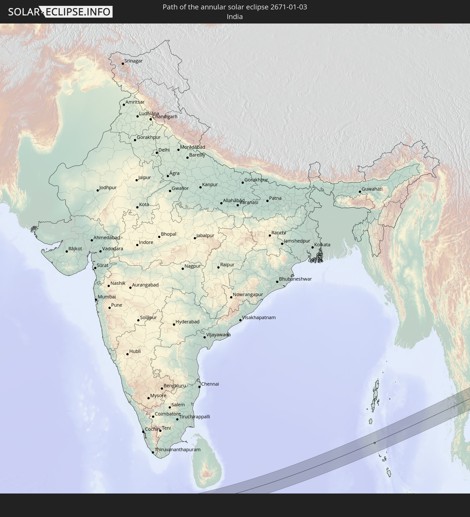 India
India
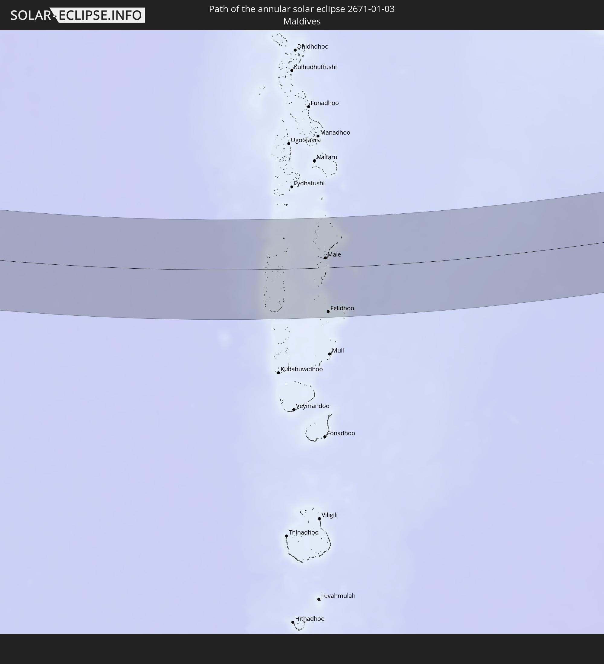 Maldives
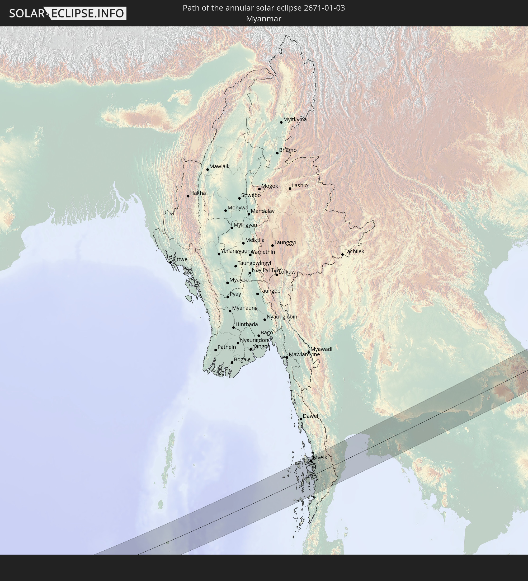 Myanmar
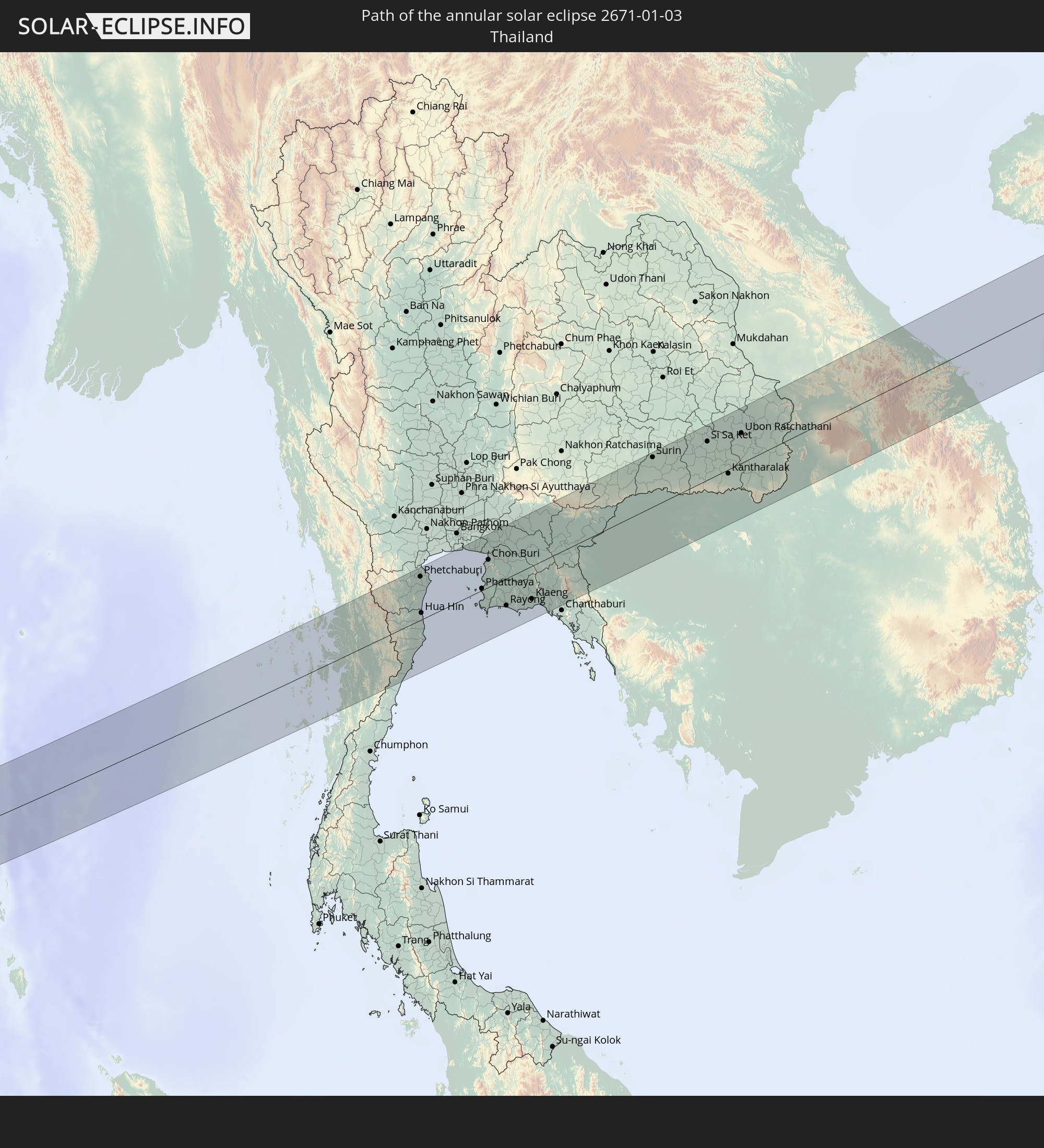 Thailand
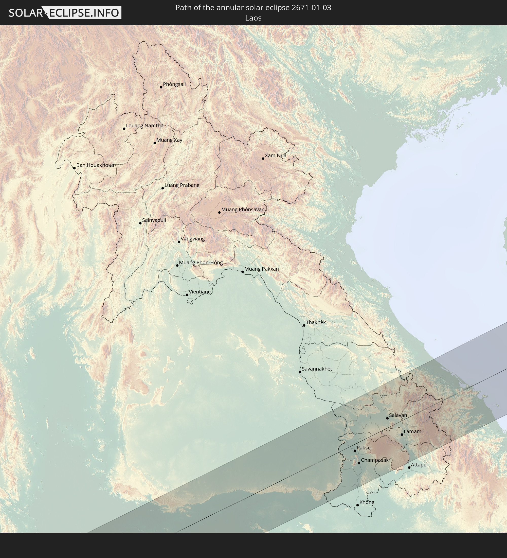 Laos
Laos
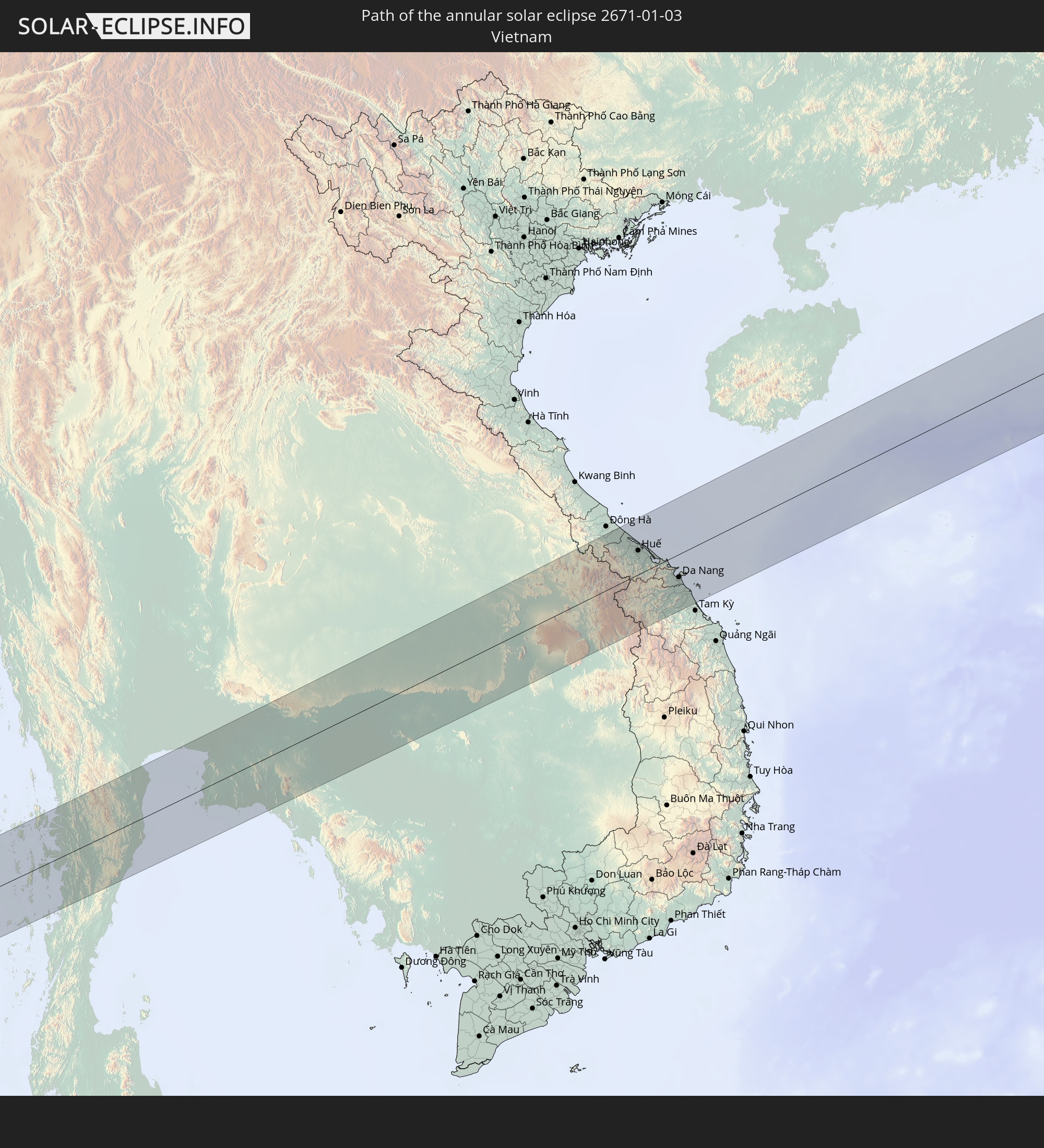 Vietnam
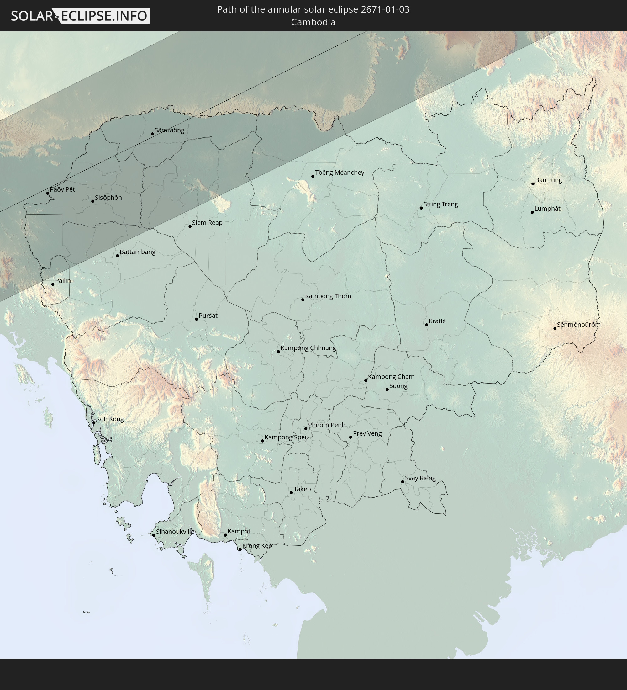 Cambodia
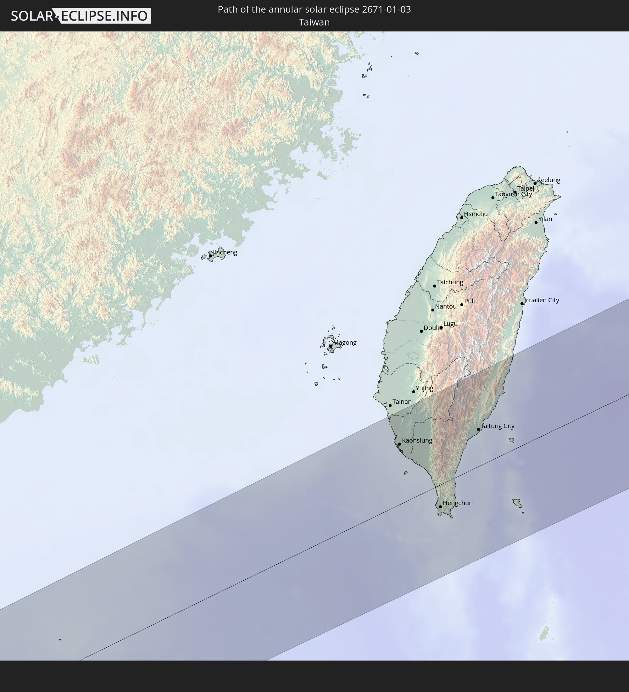 Taiwan
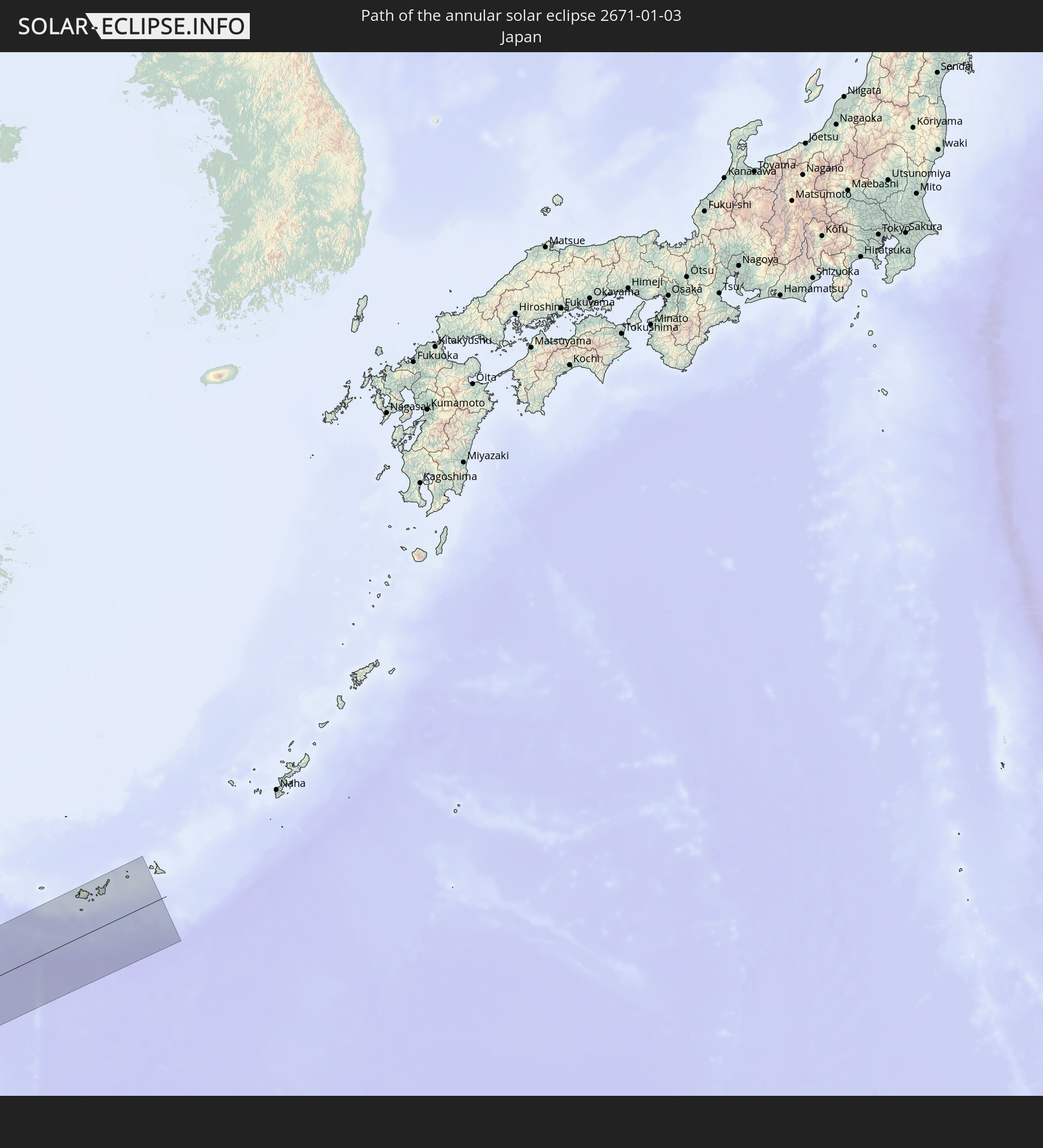 Japan
Japan
In den folgenden Ländern ist die Sonnenfinsternis partiell zu sehen
 Russia
 Niger
Niger
 Nigeria
 Equatorial Guinea
 Cameroon
 Gabon
Gabon
 Libya
Libya
 Republic of the Congo
 Angola
 Democratic Republic of the Congo
 Chad
Chad
 Central African Republic
 Greece
 Romania
 Sudan
Sudan
 Zambia
 Ukraine
 Bulgaria
 Belarus
 Egypt
Egypt
 Zimbabwe
 Turkey
 Moldova
 Rwanda
 Burundi
 Tanzania
 Uganda
 Mozambique
 Cyprus
 Malawi
 Ethiopia
 Kenya
Kenya
 State of Palestine
 Israel
 Saudi Arabia
 Jordan
 Lebanon
 Syria
Syria
 Eritrea
 Iraq
Iraq
 Georgia
 French Southern and Antarctic Lands
 Somalia
 Djibouti
 Yemen
Yemen
 Madagascar
 Comoros
 Armenia
 Iran
Iran
 Azerbaijan
 Mayotte
 Seychelles
 Kazakhstan
 Kuwait
 Bahrain
 Qatar
Qatar
 United Arab Emirates
 Oman
Oman
 Turkmenistan
 Réunion
 Uzbekistan
 Mauritius
 Afghanistan
 Pakistan
 Tajikistan
 India
India
 Kyrgyzstan
 British Indian Ocean Territory
 Maldives
 China
China
 Sri Lanka
 Nepal
Nepal
 Mongolia
 Bangladesh
 Bhutan
 Myanmar
 Indonesia
 Cocos Islands
 Thailand
 Malaysia
 Laos
Laos
 Vietnam
 Cambodia
 Singapore
 Christmas Island
 Australia
 Macau
Macau
 Hong Kong
 Brunei
 Taiwan
 Philippines
 Japan
Japan
 East Timor
 Palau
Palau
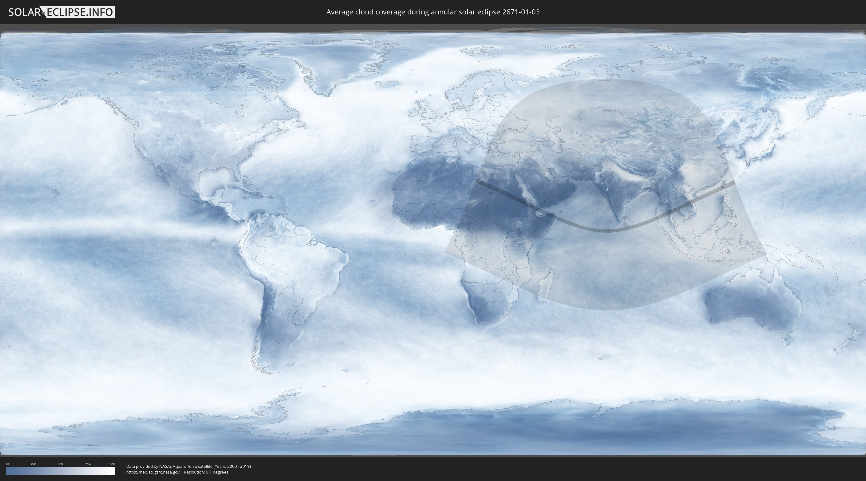
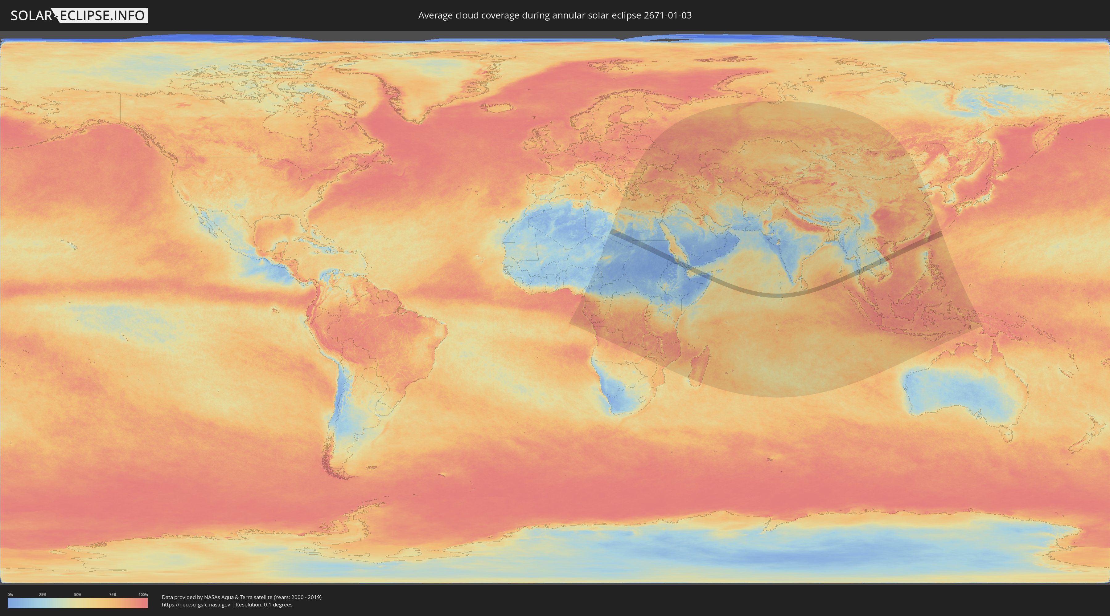
How will be the weather during the annular solar eclipse on 01/03/2671?
Where is the best place to see the annular solar eclipse of 01/03/2671?
The following maps show the average cloud coverage for the day of the annular solar eclipse.
With the help of these maps, it is possible to find the place along the eclipse path, which has the best
chance of a cloudless sky.
Nevertheless, you should consider local circumstances and inform about the weather of your chosen
observation site.
The data is provided by NASAs satellites
AQUA and TERRA.
The cloud maps are averaged over a period of 19 years (2000 - 2019).
Detailed country maps
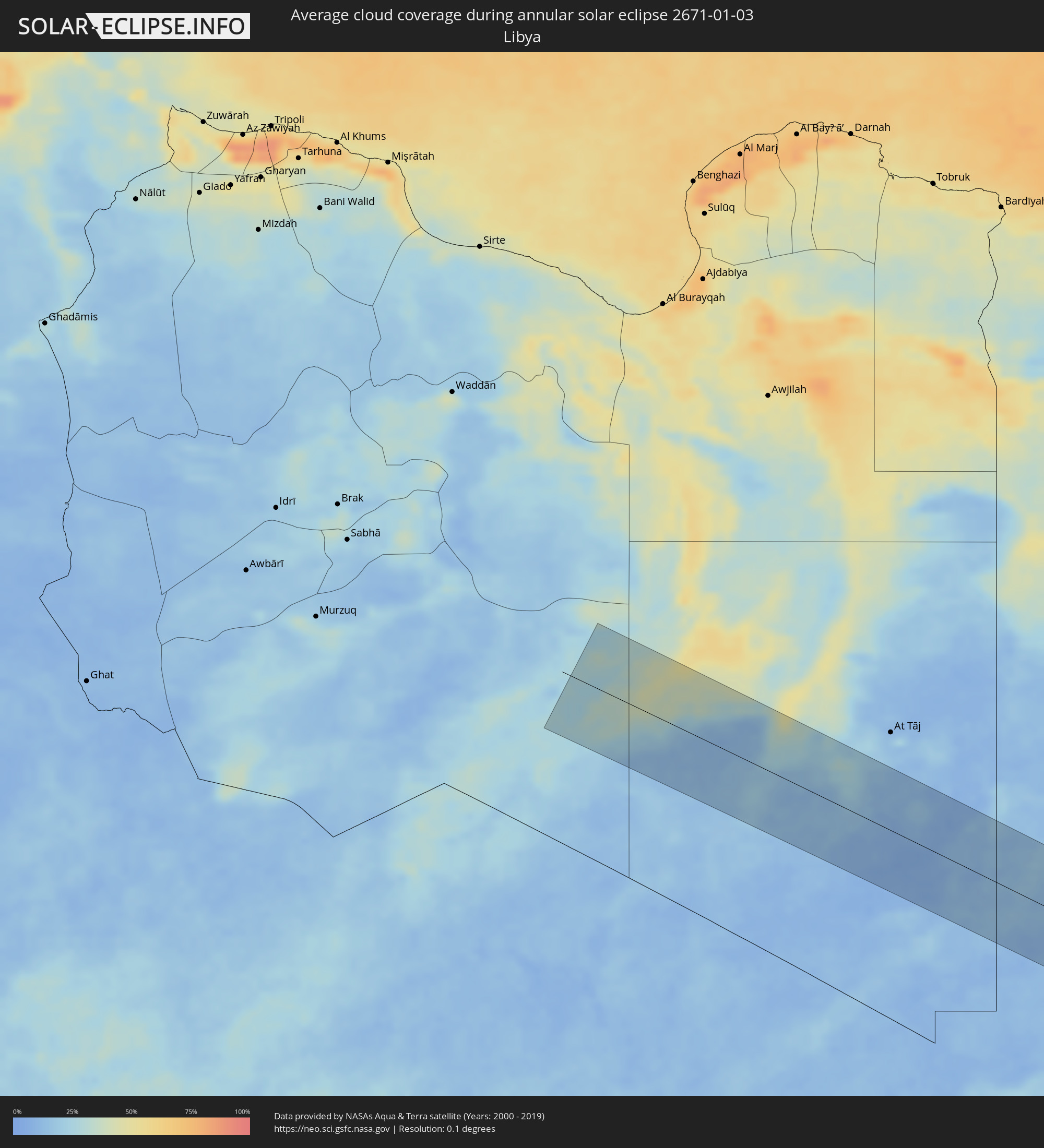 Libya
Libya
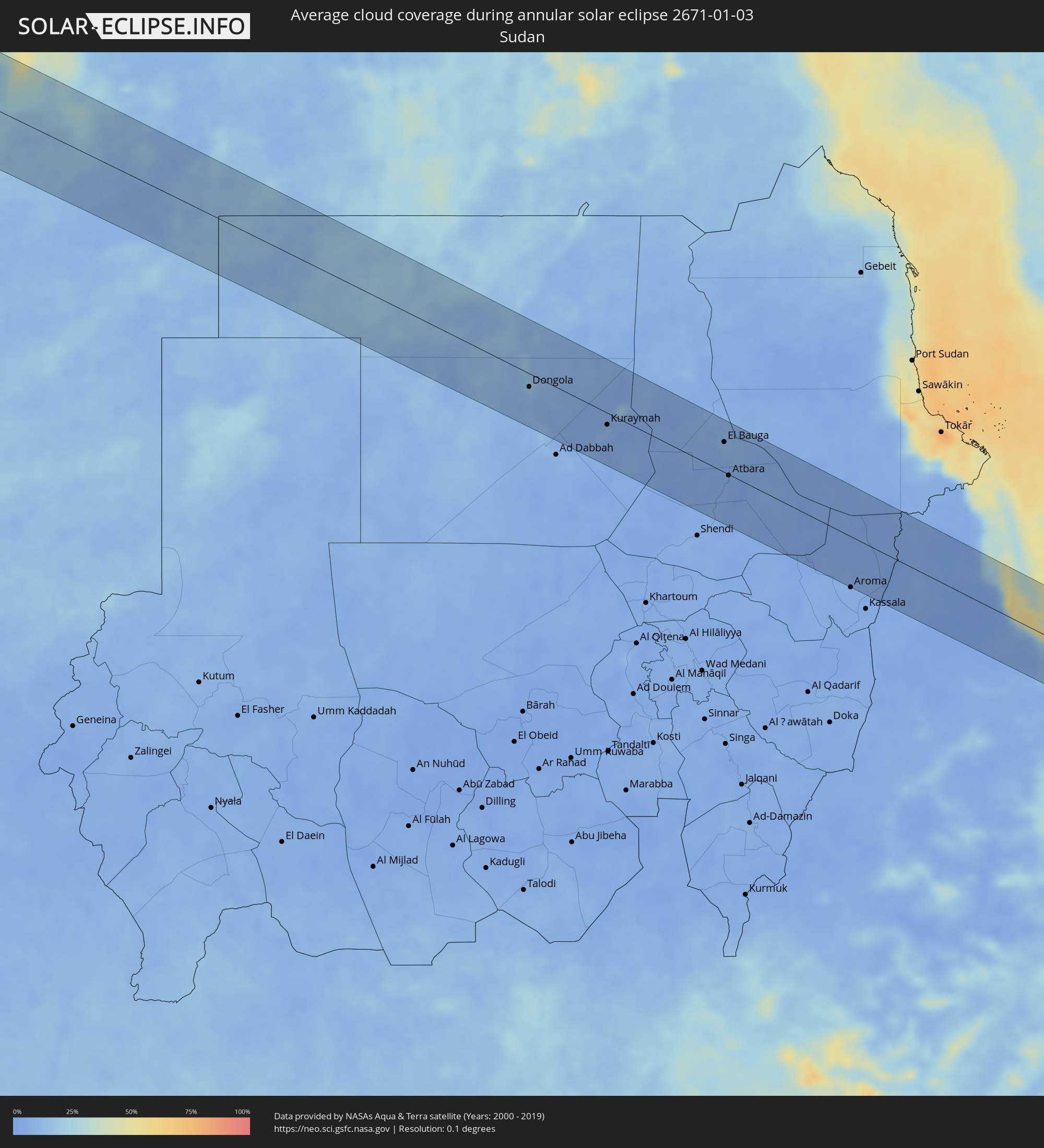 Sudan
Sudan
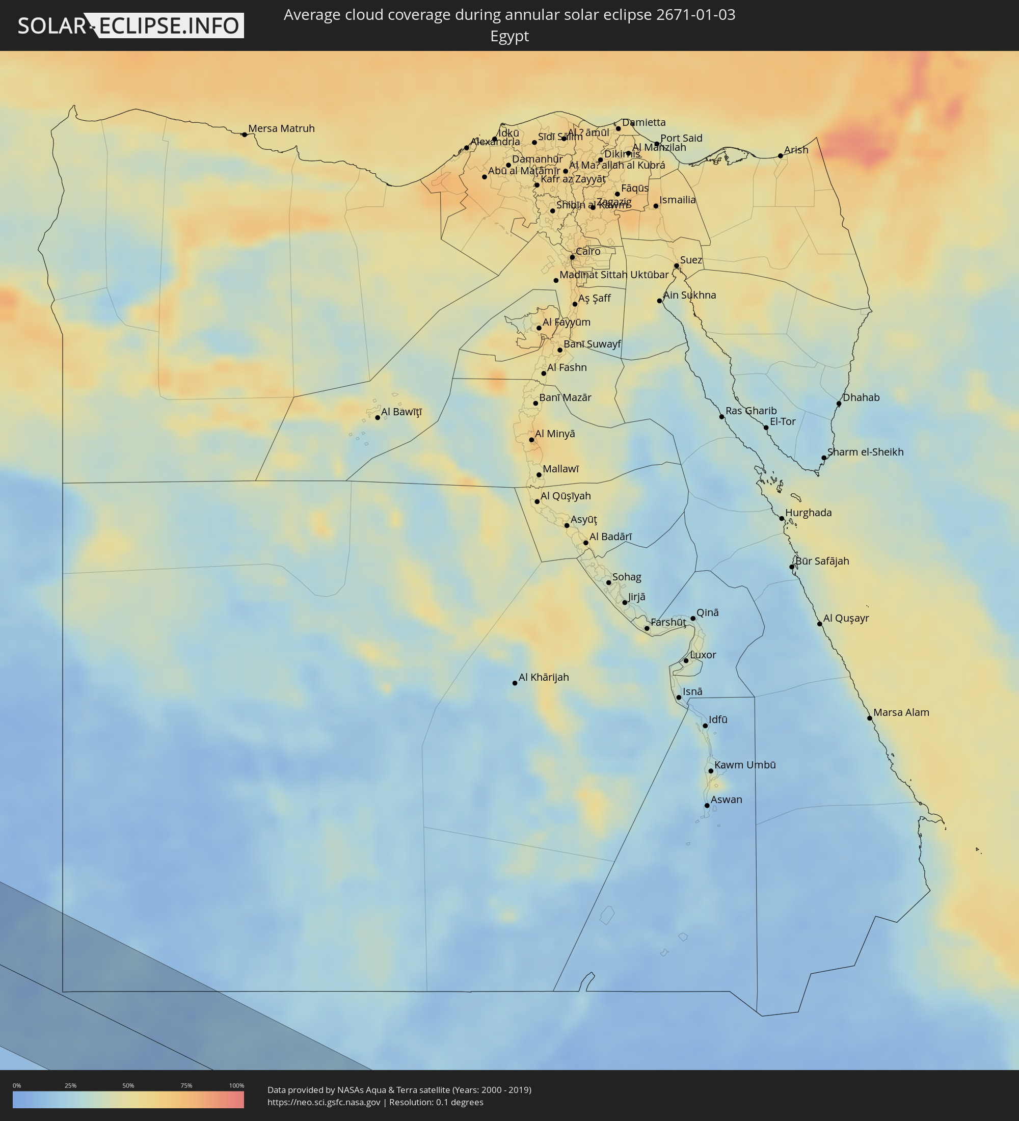 Egypt
Egypt
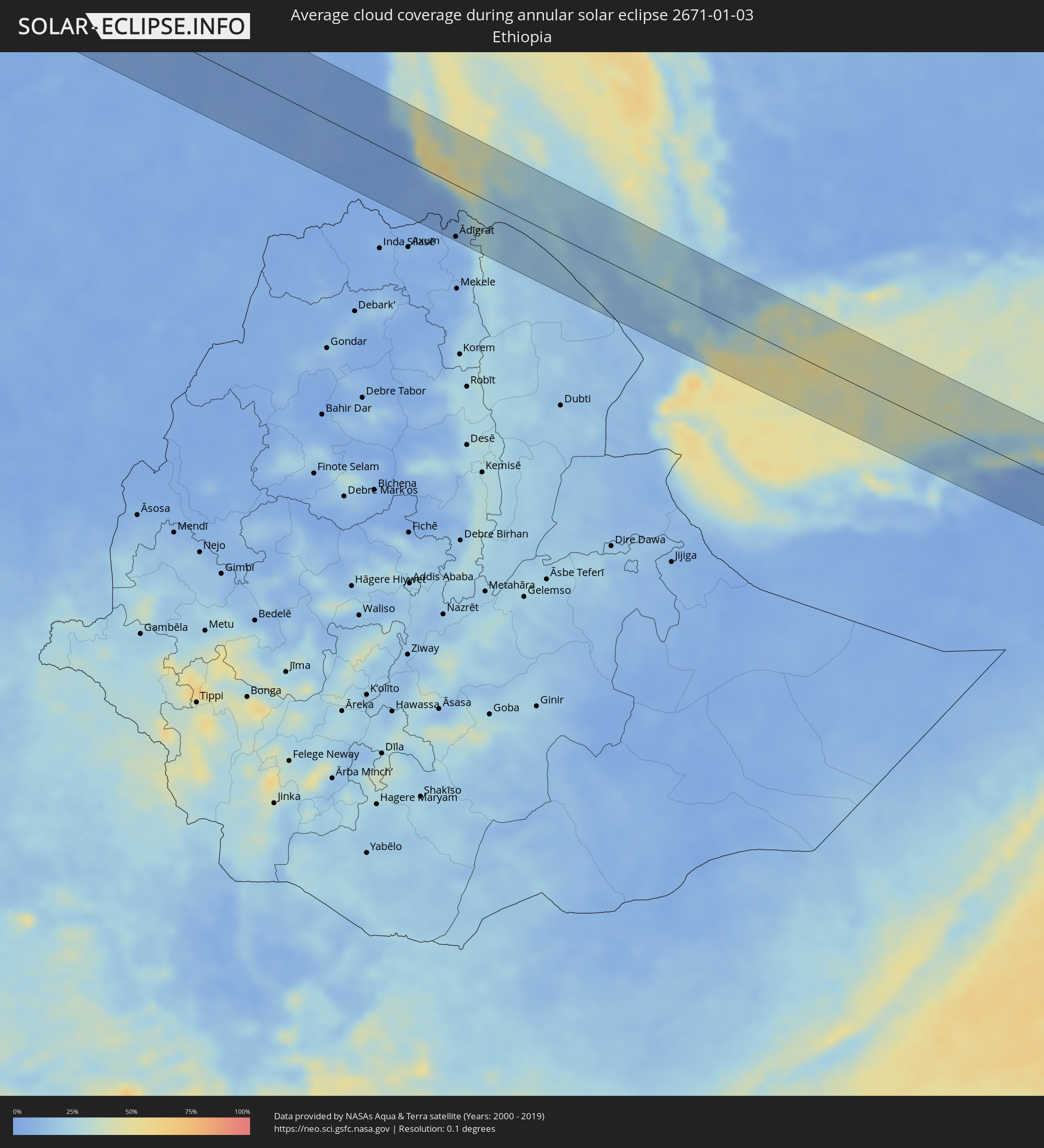 Ethiopia
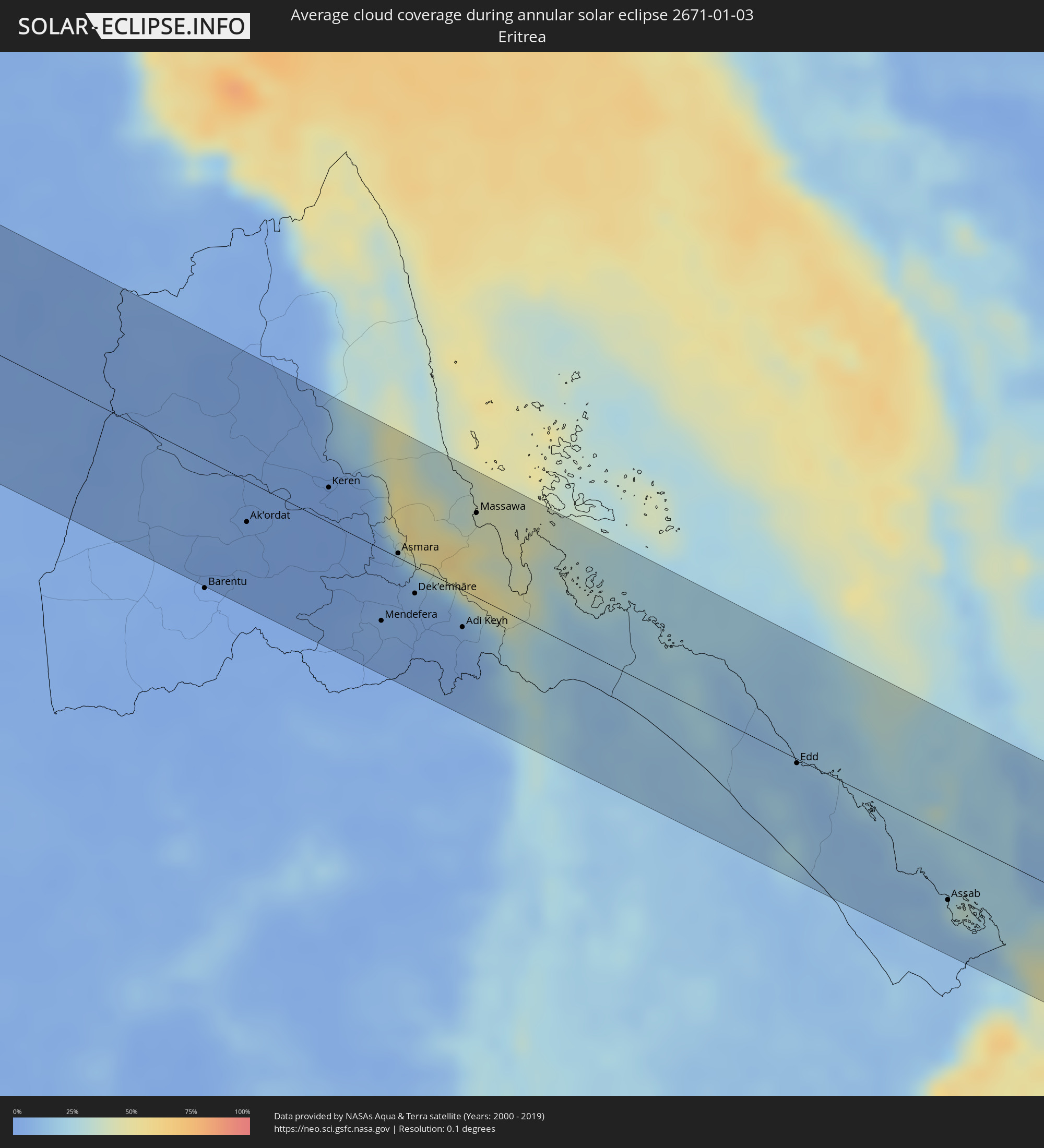 Eritrea
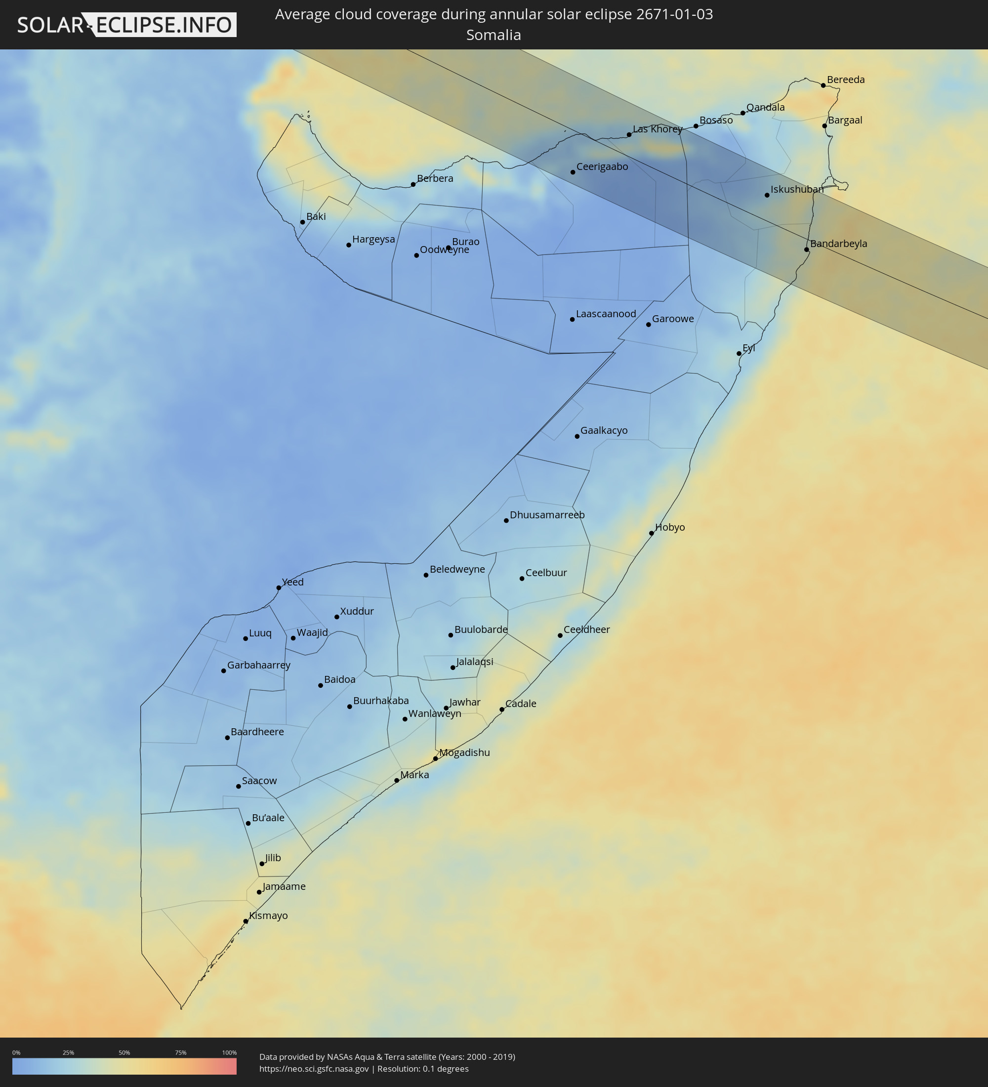 Somalia
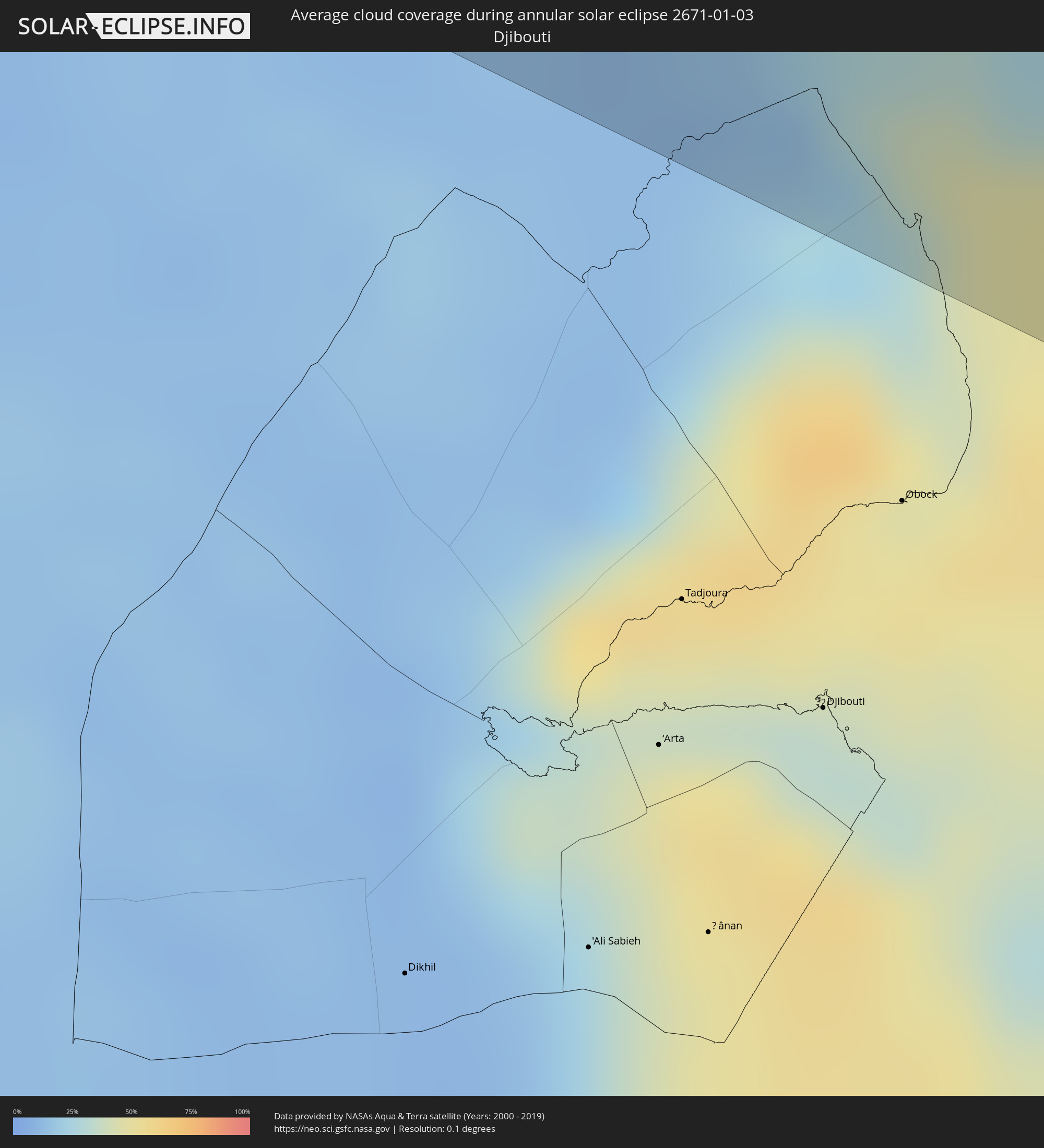 Djibouti
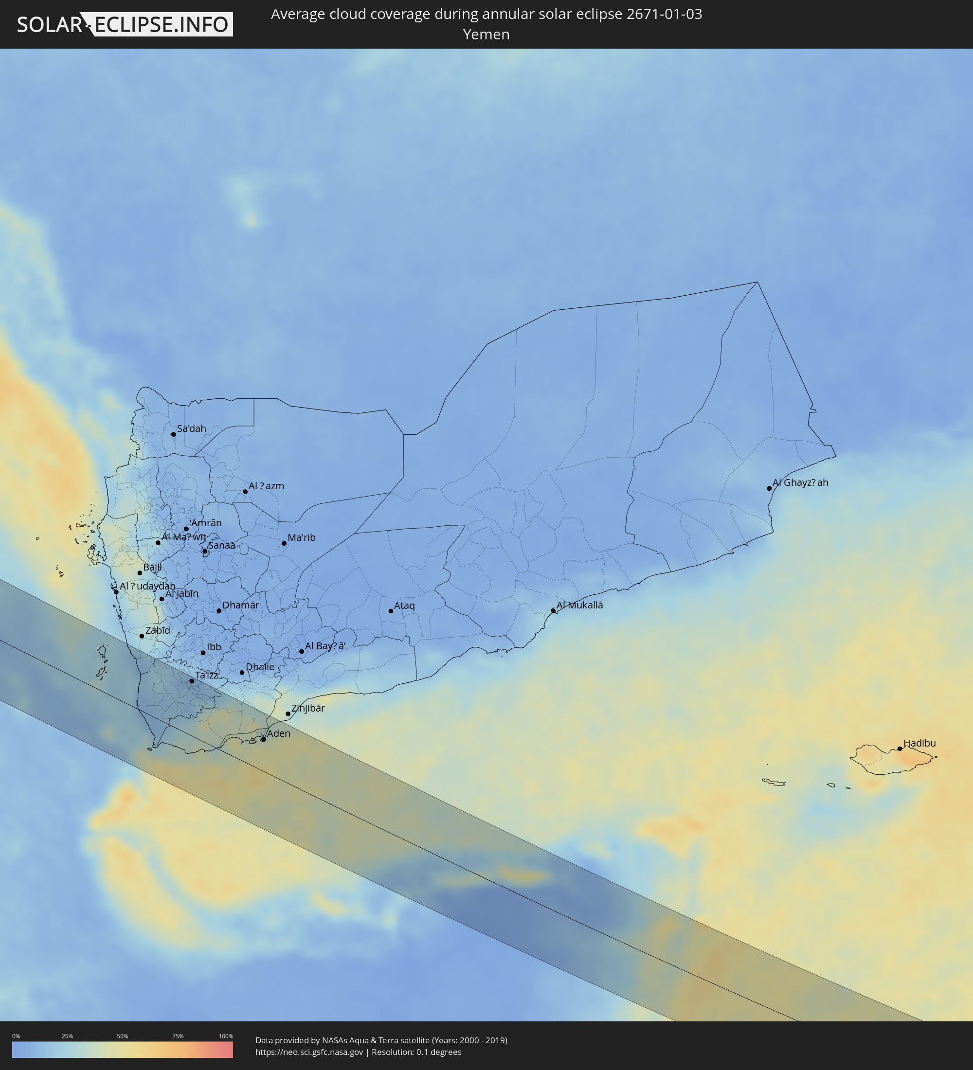 Yemen
Yemen
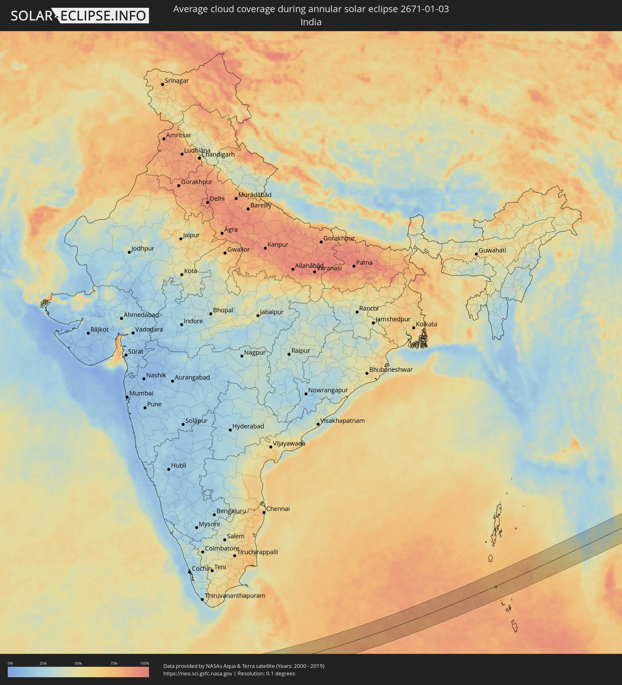 India
India
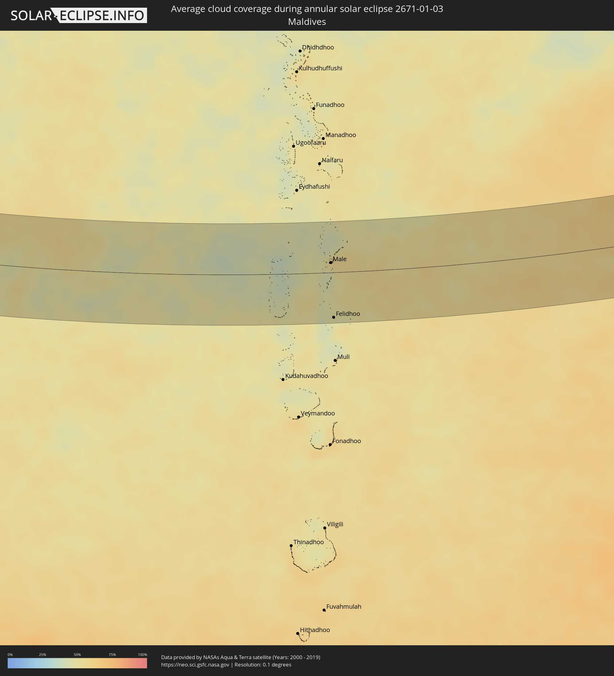 Maldives
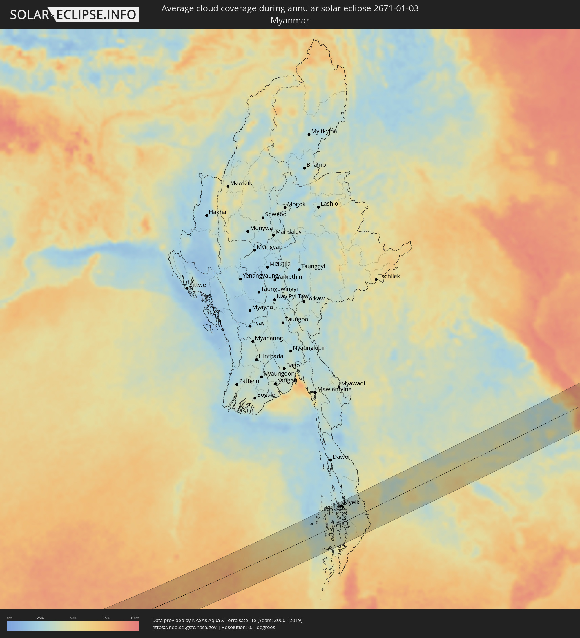 Myanmar
 Thailand
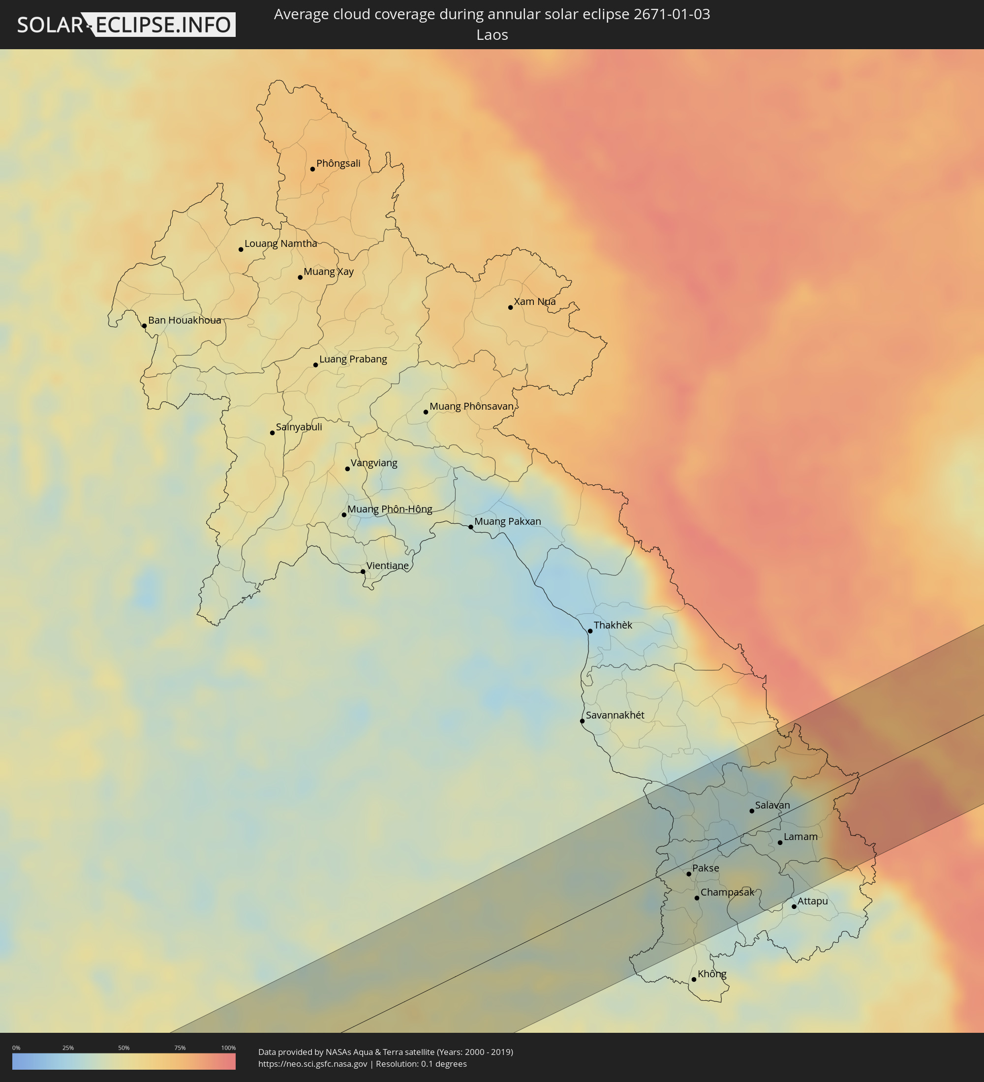 Laos
Laos
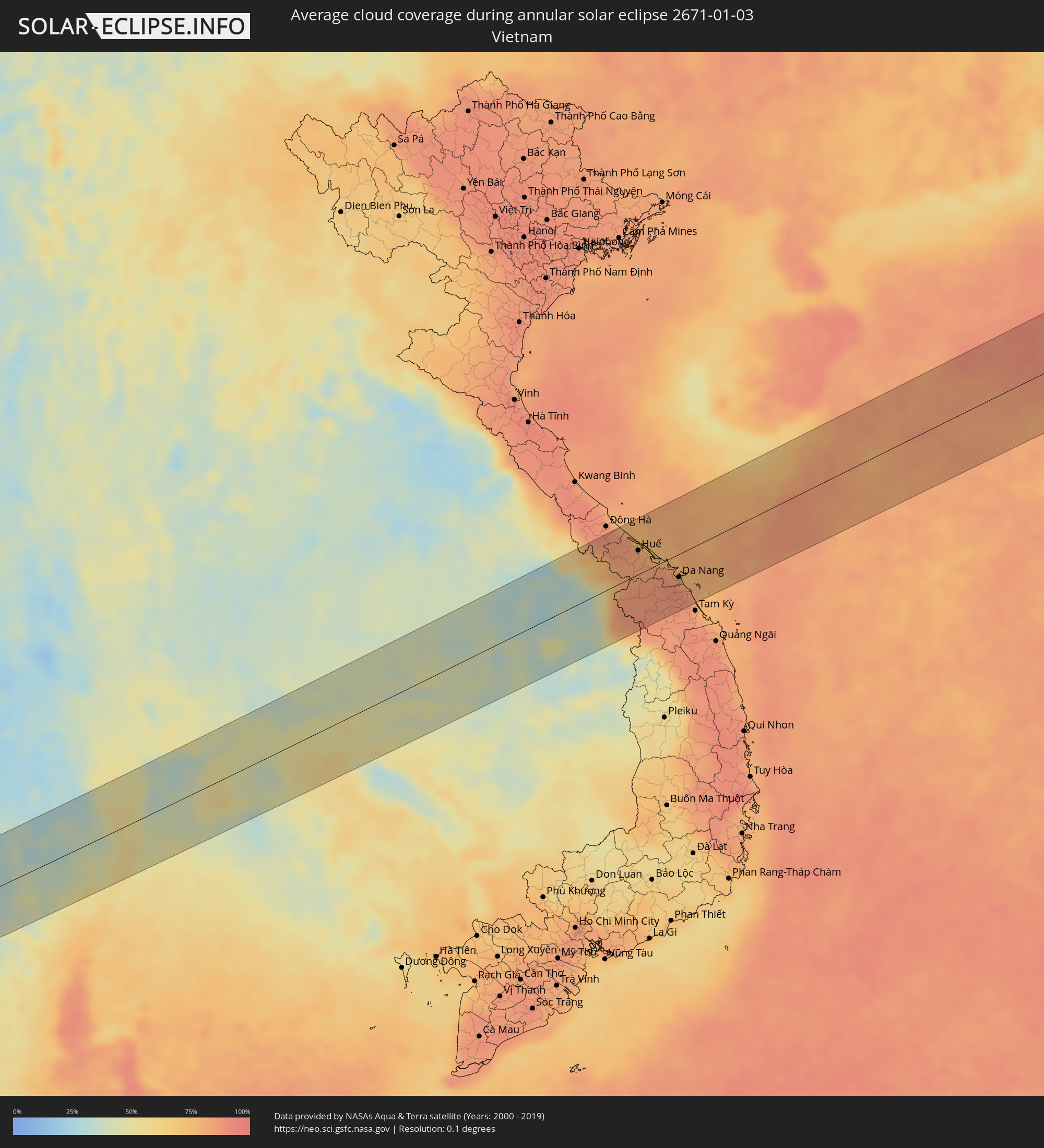 Vietnam
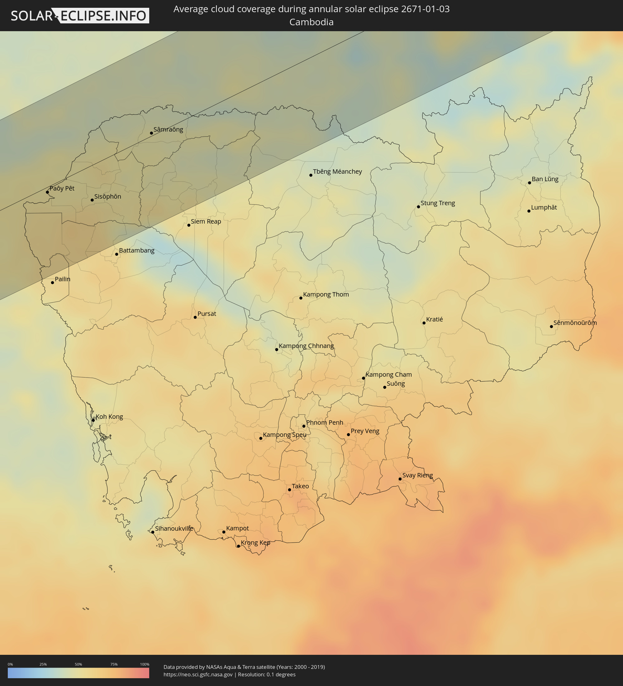 Cambodia
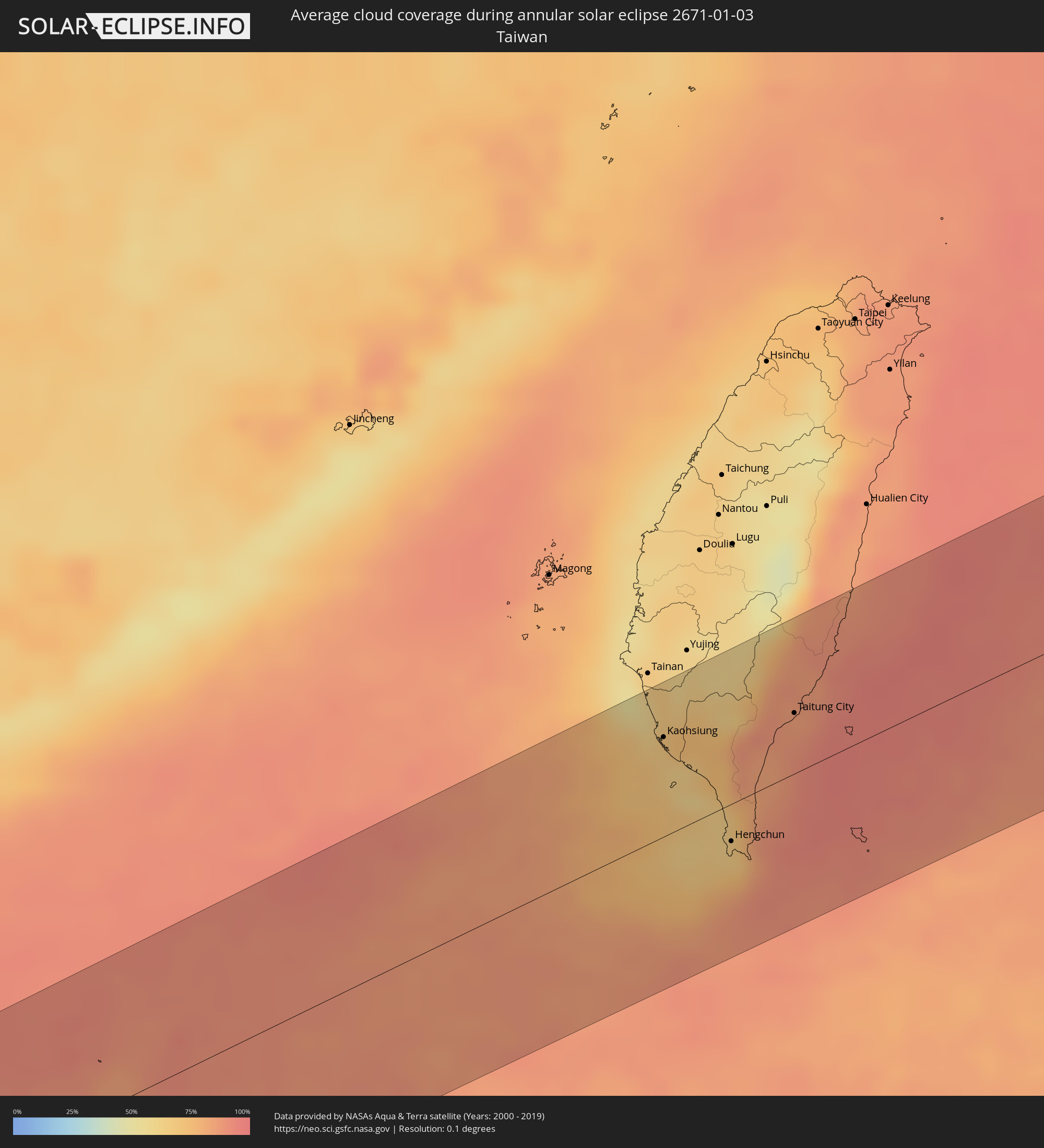 Taiwan
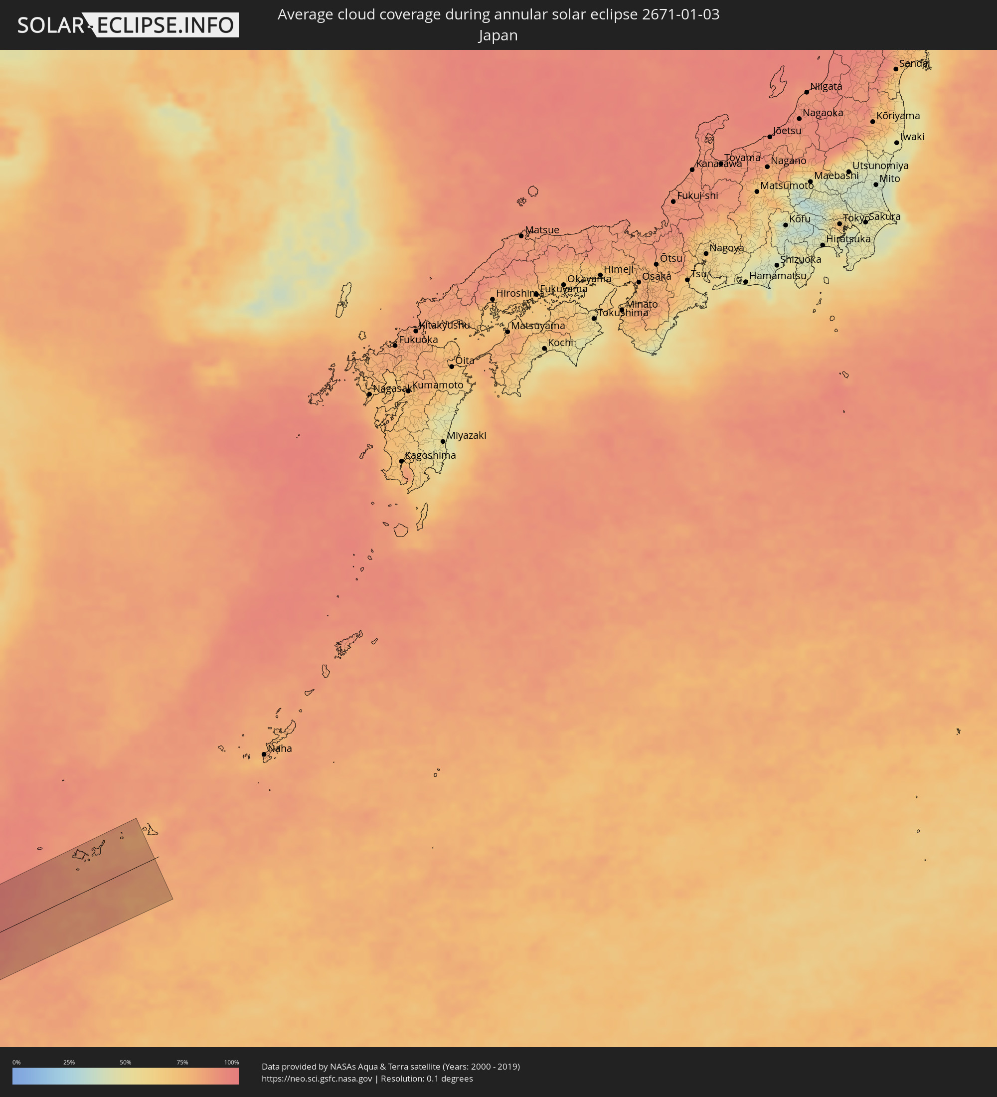 Japan
Japan
Cities inside the path of the eclipse
The following table shows all locations with a population of more than 5,000 inside the eclipse path. Cities which have more than 100,000 inhabitants are marked bold. A click at the locations opens a detailed map.
| City | Type | Eclipse duration | Local time of max. eclipse | Distance to central line | Ø Cloud coverage |
|
Argo, Northern State
|
annular | - | 07:40:01 UTC+02:00 | 9 km | 11% |
|
Dongola, Northern State
|
annular | - | 07:39:58 UTC+02:00 | 22 km | 12% |
|
Marawī, Northern State
|
annular | - | 07:40:50 UTC+02:00 | 28 km | 8% |
|
Kuraymah, Northern State
|
annular | - | 07:40:53 UTC+02:00 | 20 km | 8% |
|
El Bauga, River Nile
|
annular | - | 07:42:38 UTC+02:00 | 50 km | 8% |
|
Ed Damer, River Nile
|
annular | - | 07:42:33 UTC+02:00 | 13 km | 4% |
|
Berber, River Nile
|
annular | - | 07:42:39 UTC+02:00 | 30 km | 5% |
|
Atbara, River Nile
|
annular | - | 07:42:35 UTC+02:00 | 2 km | 4% |
|
Wagar, Kassala
|
annular | - | 07:44:34 UTC+02:00 | 49 km | 3% |
|
Ak’ordat, Gash-Barka
|
annular | - | 08:46:24 UTC+03:00 | 27 km | 2% |
|
Keren, Anseba
|
annular | - | 08:47:07 UTC+03:00 | 23 km | 1% |
|
Mendefera, Debub
|
annular | - | 08:47:29 UTC+03:00 | 48 km | 4% |
|
Asmara, Maekel
|
annular | - | 08:47:40 UTC+03:00 | 3 km | 4% |
|
Dek’emhāre, Debub
|
annular | - | 08:47:48 UTC+03:00 | 18 km | 5% |
|
Adi Keyh, Debub
|
annular | - | 08:48:12 UTC+03:00 | 25 km | 5% |
|
Ādīgrat, Tigray
|
annular | - | 08:48:17 UTC+03:00 | 77 km | 10% |
|
Massawa, Northern Red Sea
|
annular | - | 08:48:23 UTC+03:00 | 56 km | 42% |
|
Edd, Southern Red Sea
|
annular | - | 08:51:21 UTC+03:00 | 3 km | 14% |
|
Assab, Southern Red Sea
|
annular | - | 08:52:55 UTC+03:00 | 44 km | 15% |
|
Ta‘izz, Ta‘izz
|
annular | - | 08:54:57 UTC+03:00 | 75 km | 15% |
|
Laḩij, Laḩij
|
annular | - | 08:56:24 UTC+03:00 | 64 km | 45% |
|
Aden, Aden
|
annular | - | 08:56:40 UTC+03:00 | 44 km | 45% |
|
Ceerigaabo, Sanaag
|
annular | - | 09:01:09 UTC+03:00 | 62 km | 13% |
|
Las Khorey, Sanaag
|
annular | - | 09:02:42 UTC+03:00 | 32 km | 26% |
|
Iskushuban, Bari
|
annular | - | 09:07:05 UTC+03:00 | 37 km | 26% |
|
Bandarbeyla, Bari
|
annular | - | 09:08:32 UTC+03:00 | 16 km | 40% |
|
Male, Kaafu Atoll
|
annular | - | 12:23:48 UTC+05:00 | 14 km | 54% |
|
Felidhoo, Vaavu Atholhu
|
annular | - | 12:23:56 UTC+05:00 | 64 km | 48% |
|
Myeik, Tanintharyi
|
annular | - | 15:07:18 UTC+06:30 | 61 km | 35% |
|
Pran Buri, Prachuap Khiri Khan
|
annular | - | 15:39:28 UTC+07:00 | 6 km | 53% |
|
Tha Yang, Phetchaburi
|
annular | - | 15:39:28 UTC+07:00 | 51 km | 51% |
|
Phetchaburi, Phetchaburi
|
annular | - | 15:39:32 UTC+07:00 | 65 km | 51% |
|
Hua Hin, Prachuap Khiri Khan
|
annular | - | 15:39:34 UTC+07:00 | 10 km | 42% |
|
Cha-am, Phetchaburi
|
annular | - | 15:39:34 UTC+07:00 | 32 km | 40% |
|
Phatthaya, Chon Buri
|
annular | - | 15:41:01 UTC+07:00 | 3 km | 52% |
|
Sattahip, Chon Buri
|
annular | - | 15:41:02 UTC+07:00 | 25 km | 52% |
|
Si Racha, Chon Buri
|
annular | - | 15:41:05 UTC+07:00 | 24 km | 48% |
|
Chon Buri, Chon Buri
|
annular | - | 15:41:09 UTC+07:00 | 41 km | 46% |
|
Chachoengsao, Chachoengsao
|
annular | - | 15:41:16 UTC+07:00 | 69 km | 44% |
|
Rayong, Rayong
|
annular | - | 15:41:35 UTC+07:00 | 41 km | 49% |
|
Klaeng, Rayong
|
annular | - | 15:42:10 UTC+07:00 | 49 km | 45% |
|
Paôy Pêt, Banteay Meanchey
|
annular | - | 15:43:27 UTC+07:00 | 5 km | 51% |
|
Sisŏphŏn, Banteay Meanchey
|
annular | - | 15:44:02 UTC+07:00 | 32 km | 56% |
|
Surin, Surin
|
annular | - | 15:44:37 UTC+07:00 | 73 km | 41% |
|
Sâmraông, Ŏtâr Méanchey
|
annular | - | 15:44:43 UTC+07:00 | 2 km | 47% |
|
Si Sa Ket, Sisaket
|
annular | - | 15:45:41 UTC+07:00 | 57 km | 41% |
|
Kantharalak, Sisaket
|
annular | - | 15:46:09 UTC+07:00 | 6 km | 42% |
|
Ubon Ratchathani, Changwat Ubon Ratchathani
|
annular | - | 15:46:20 UTC+07:00 | 44 km | 37% |
|
Pakse, Champasak
|
annular | - | 15:47:30 UTC+07:00 | 13 km | 41% |
|
Champasak, Champasak
|
annular | - | 15:47:37 UTC+07:00 | 40 km | 38% |
|
Salavan, Salavan
|
annular | - | 15:48:08 UTC+07:00 | 17 km | 38% |
|
Lamam, Xékong
|
annular | - | 15:48:29 UTC+07:00 | 26 km | 40% |
|
Huế, Thừa Thiên-Huế
|
annular | - | 15:49:17 UTC+07:00 | 35 km | 82% |
|
Da Nang, Đà Nẵng
|
annular | - | 15:50:01 UTC+07:00 | 34 km | 86% |
|
Hội An, Quảng Nam
|
annular | - | 15:50:10 UTC+07:00 | 58 km | 87% |
|
Kaohsiung, Takao
|
annular | - | 16:56:22 UTC+08:00 | 59 km | 67% |
|
Hengchun, Taiwan
|
annular | - | 16:56:50 UTC+08:00 | 22 km | 65% |
|
Taitung City, Taiwan
|
annular | - | 16:56:39 UTC+08:00 | 36 km | 86% |
|
Ishigaki, Okinawa
|
annular | - | 17:56:50 UTC+09:00 | 62 km | 83% |