Annular solar eclipse of 02/27/2780
| Day of week: | Wednesday |
| Maximum duration of eclipse: | 10m03s |
| Maximum width of eclipse path: | 299 km |
| Saros cycle: | 162 |
| Coverage: | 92.2% |
| Magnitude: | 0.9221 |
| Gamma: | -0.1801 |
Wo kann man die Sonnenfinsternis vom 02/27/2780 sehen?
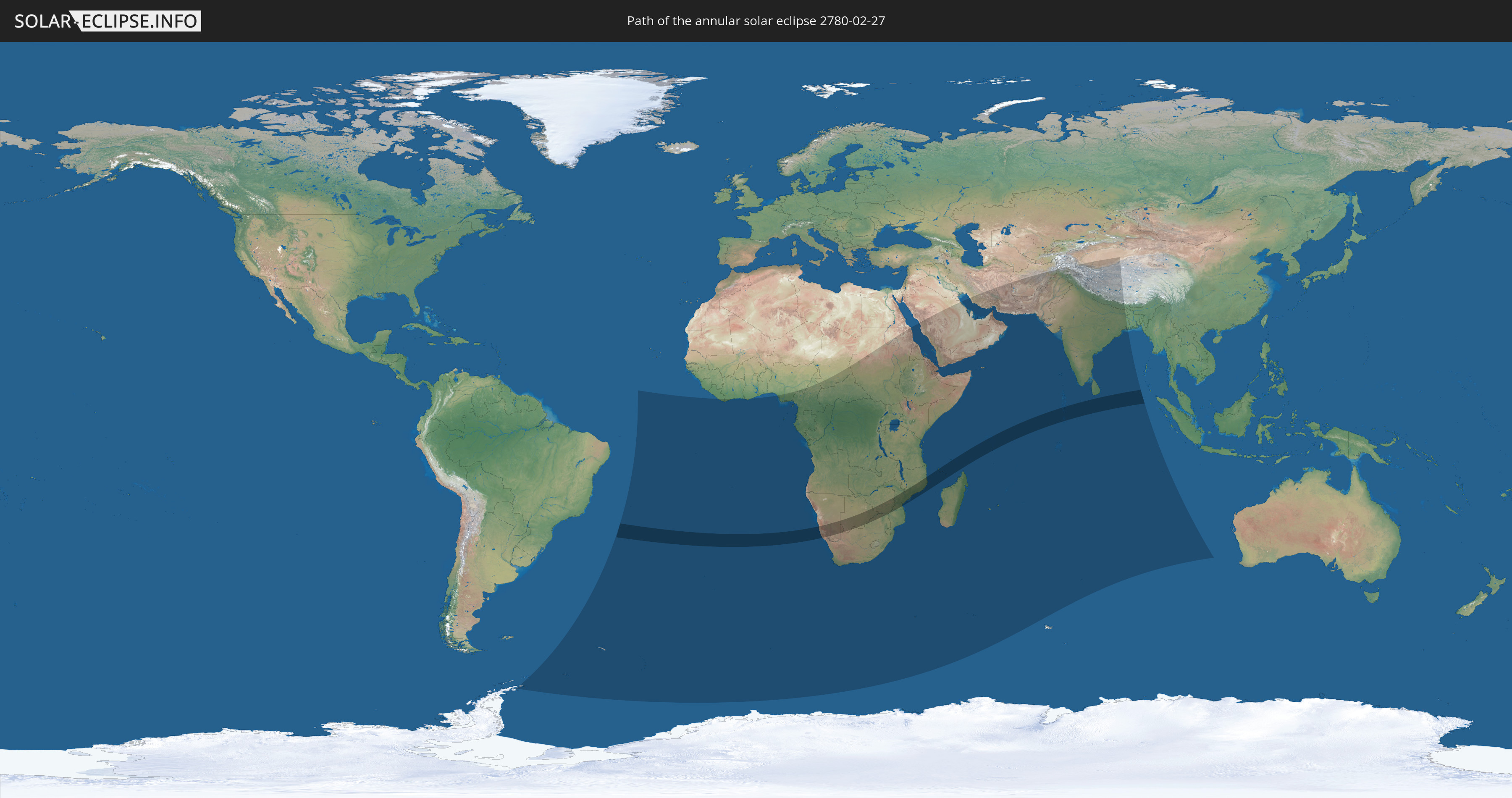
Die Sonnenfinsternis am 02/27/2780 kann man in 60 Ländern als partielle Sonnenfinsternis beobachten.
Der Finsternispfad verläuft durch 11 Länder. Nur in diesen Ländern ist sie als annular Sonnenfinsternis zu sehen.
In den folgenden Ländern ist die Sonnenfinsternis annular zu sehen
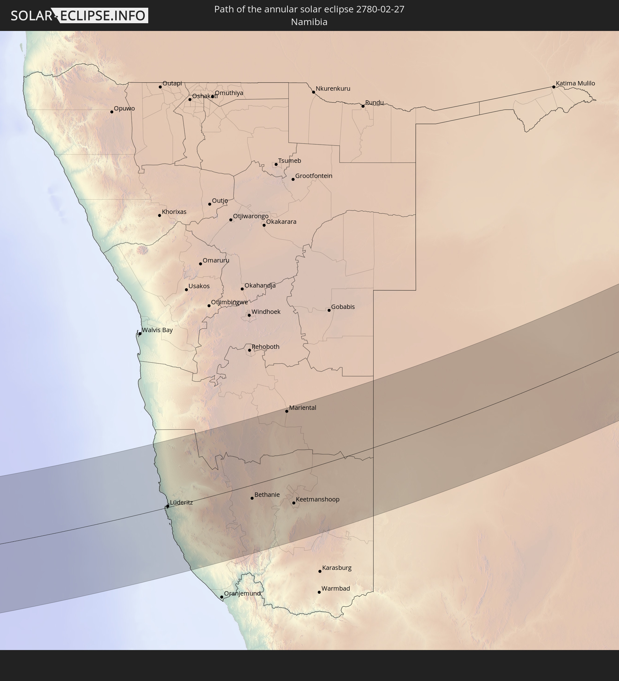 Namibia
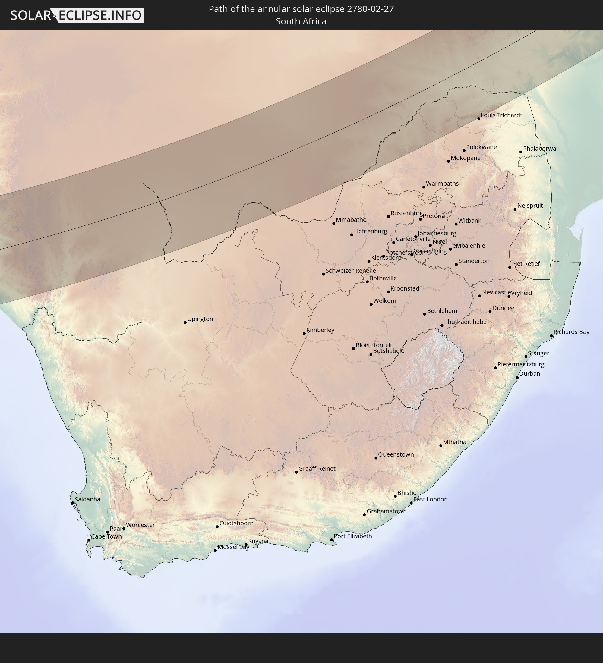 South Africa
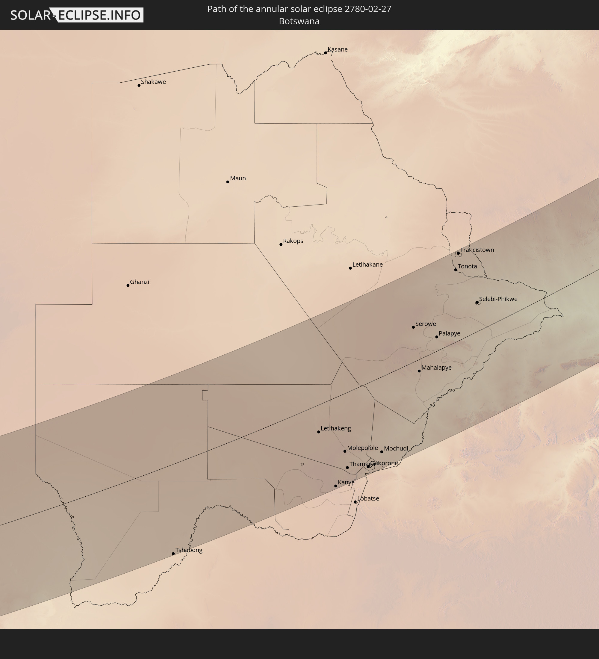 Botswana
 Zimbabwe
 Mozambique
 Malawi
 French Southern and Antarctic Lands
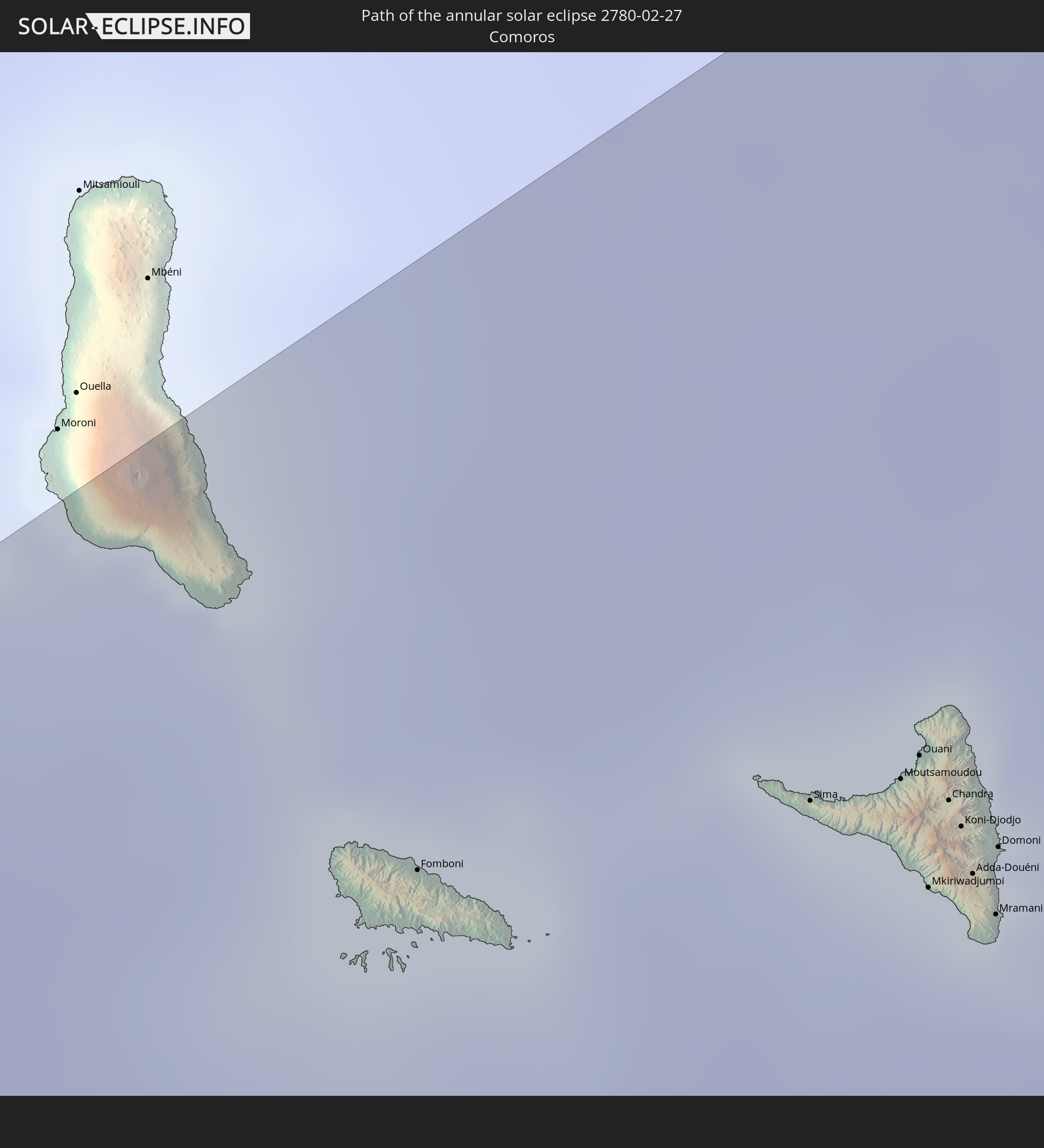 Comoros
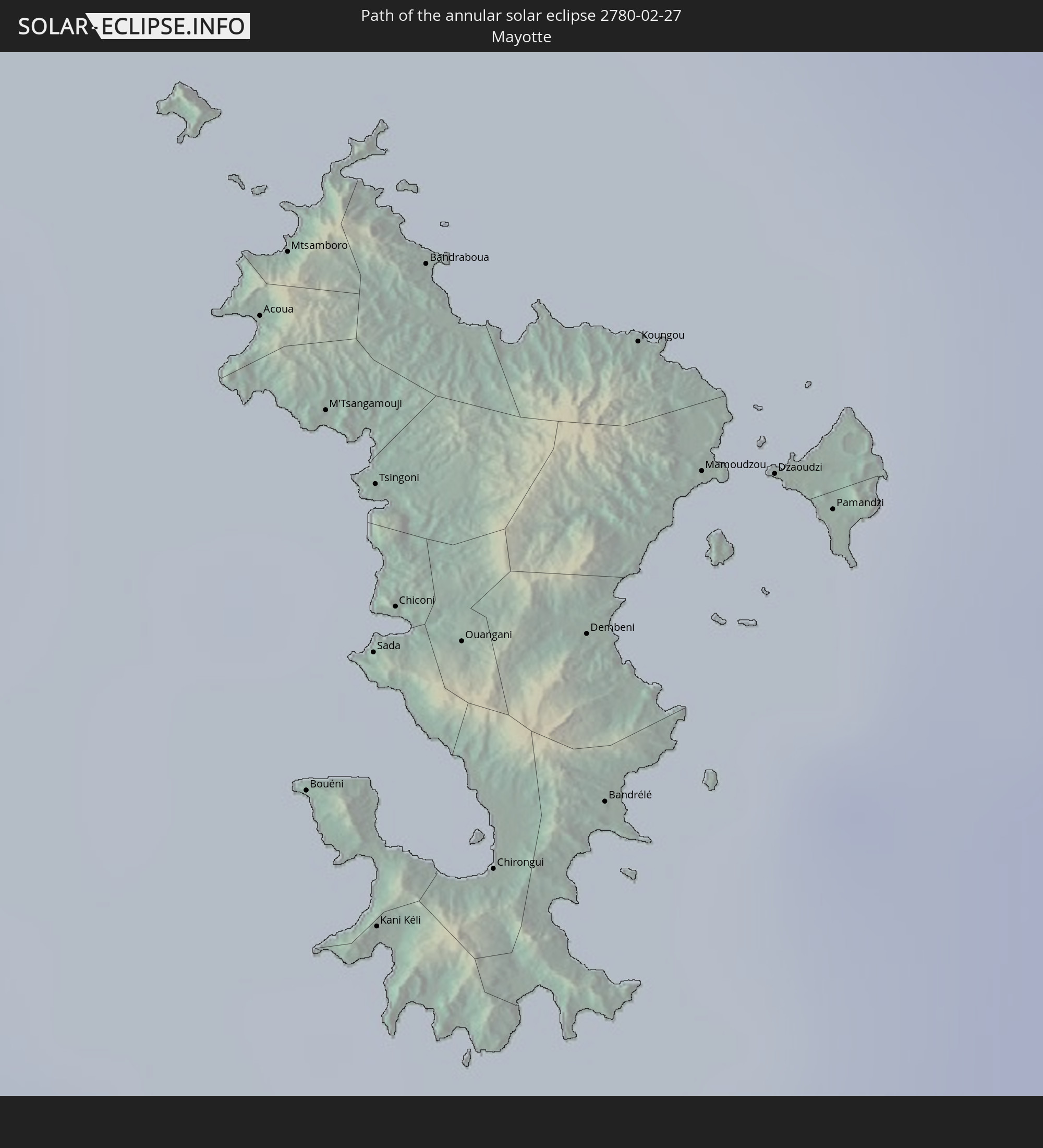 Mayotte
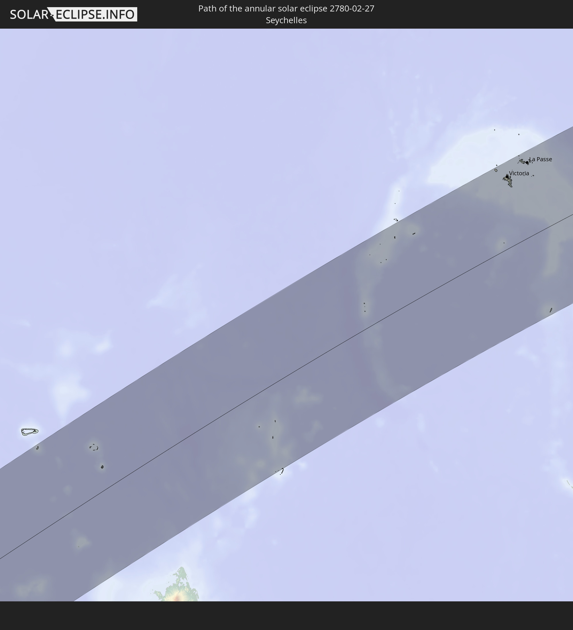 Seychelles
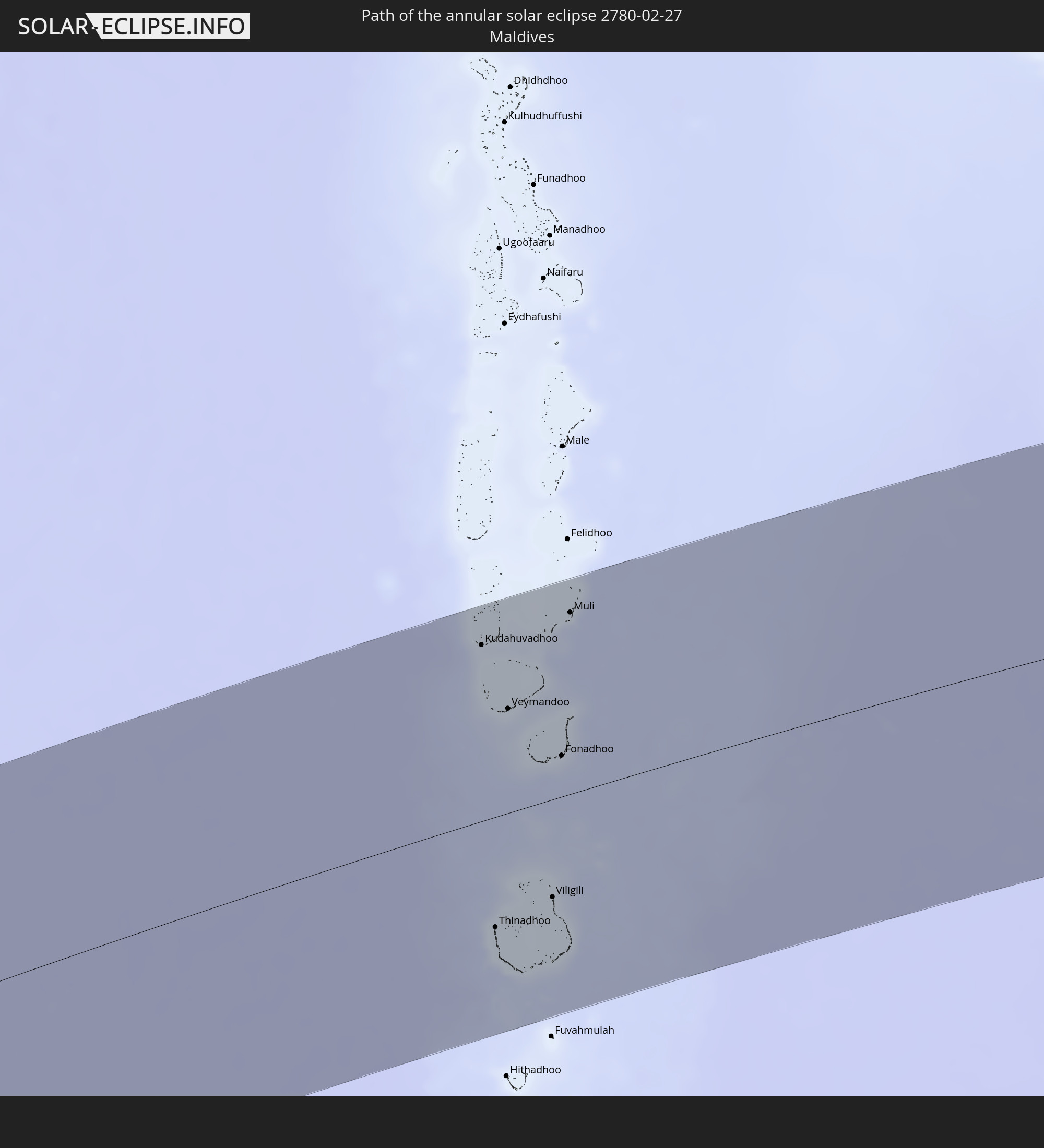 Maldives
In den folgenden Ländern ist die Sonnenfinsternis partiell zu sehen
 Antarctica
 Brazil
 South Georgia and the South Sandwich Islands
 Saint Helena, Ascension and Tristan da Cunha
 Liberia
 Ivory Coast
 Ghana
Ghana
 Nigeria
 Bouvet Island
 Equatorial Guinea
 São Tomé and Príncipe
 Cameroon
 Gabon
Gabon
 Republic of the Congo
 Angola
 Namibia
 Democratic Republic of the Congo
 Chad
Chad
 Central African Republic
 South Africa
 Botswana
 Sudan
Sudan
 Zambia
 Zimbabwe
 Lesotho
 Rwanda
 Burundi
 Tanzania
 Uganda
 Mozambique
 Swaziland
 Malawi
 Ethiopia
 Kenya
Kenya
 Saudi Arabia
 Eritrea
 French Southern and Antarctic Lands
 Somalia
 Djibouti
 Yemen
Yemen
 Madagascar
 Comoros
 Iran
Iran
 Mayotte
 Seychelles
 Bahrain
 Qatar
Qatar
 United Arab Emirates
 Oman
Oman
 Réunion
 Mauritius
 Afghanistan
 Pakistan
 India
India
 British Indian Ocean Territory
 Maldives
 China
China
 Sri Lanka
 Nepal
Nepal
 Cocos Islands
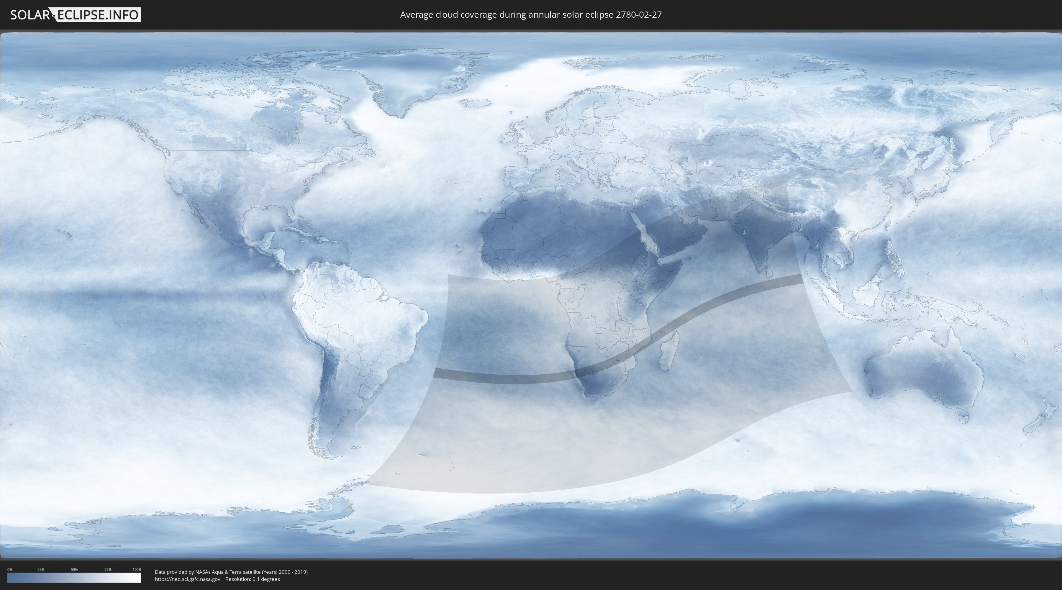
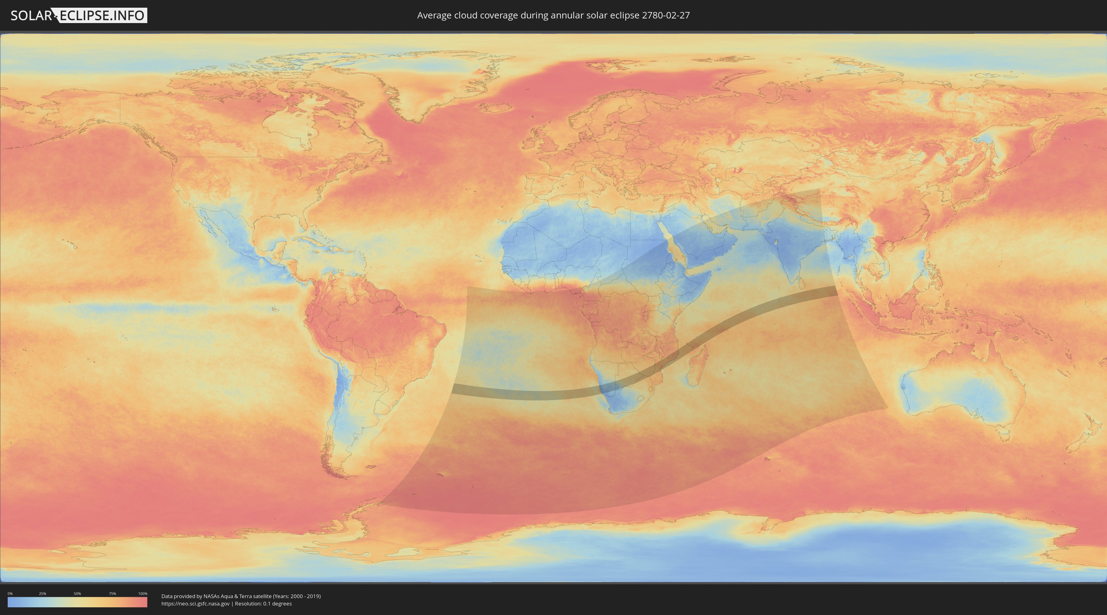
How will be the weather during the annular solar eclipse on 02/27/2780?
Where is the best place to see the annular solar eclipse of 02/27/2780?
The following maps show the average cloud coverage for the day of the annular solar eclipse.
With the help of these maps, it is possible to find the place along the eclipse path, which has the best
chance of a cloudless sky.
Nevertheless, you should consider local circumstances and inform about the weather of your chosen
observation site.
The data is provided by NASAs satellites
AQUA and TERRA.
The cloud maps are averaged over a period of 19 years (2000 - 2019).
Detailed country maps
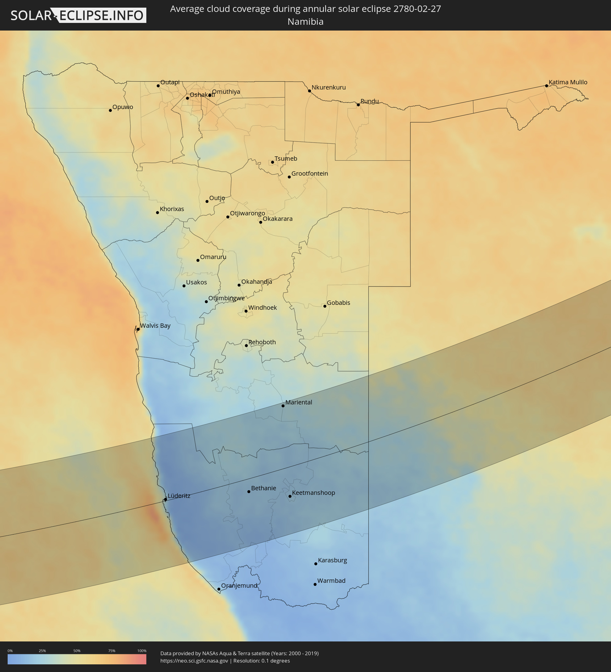 Namibia
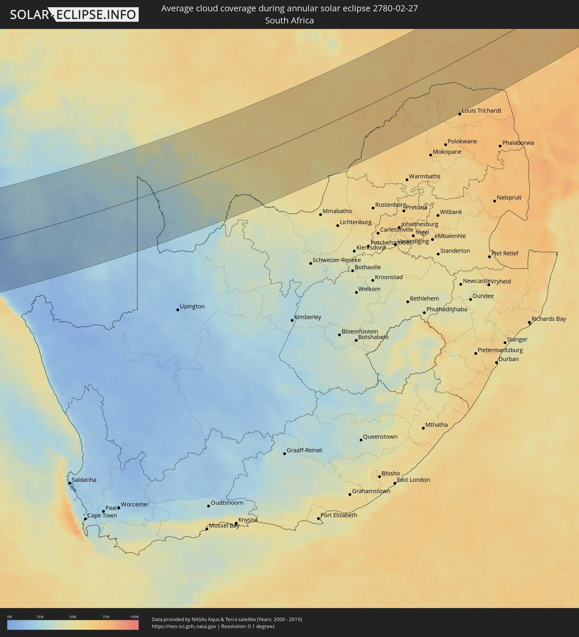 South Africa
 Botswana
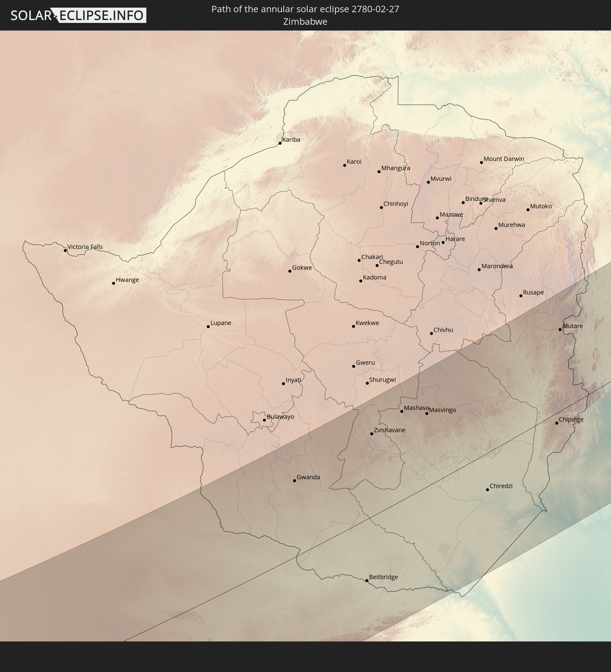
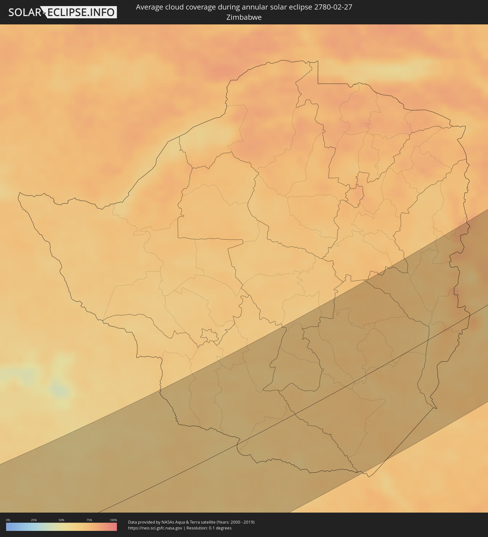 Zimbabwe
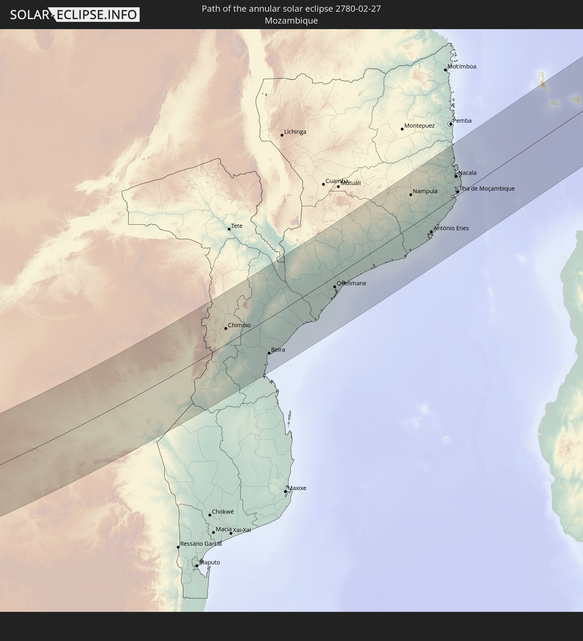
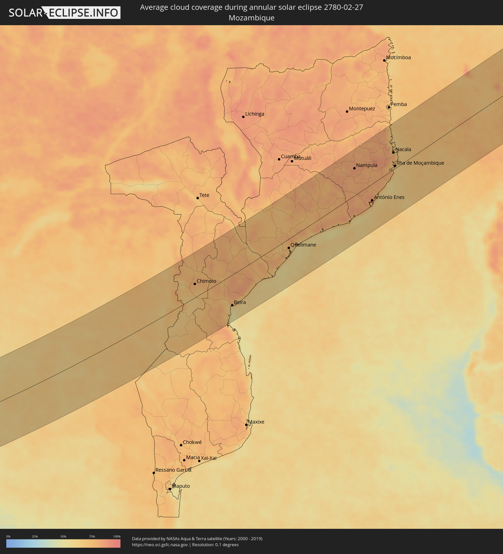 Mozambique
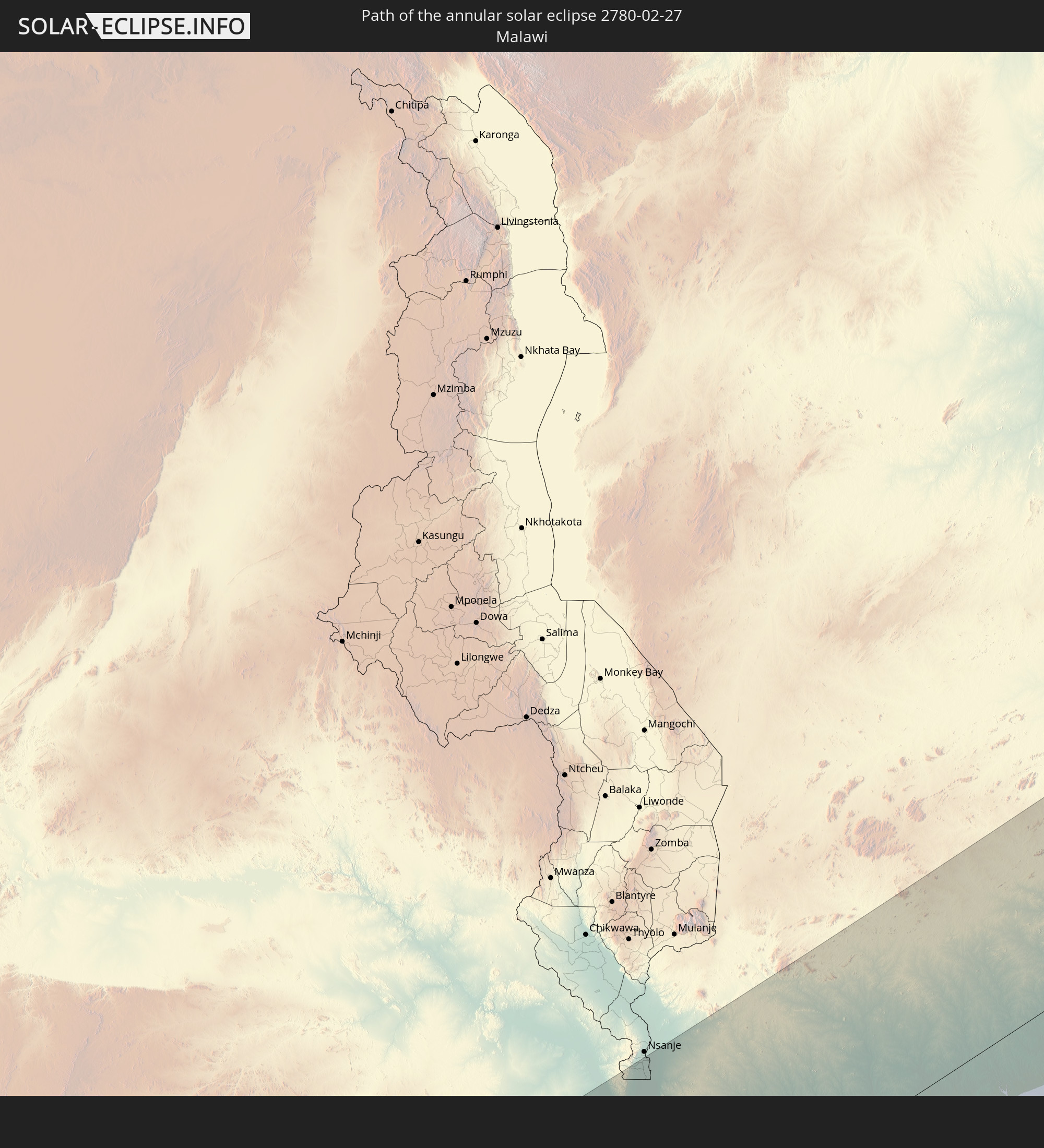
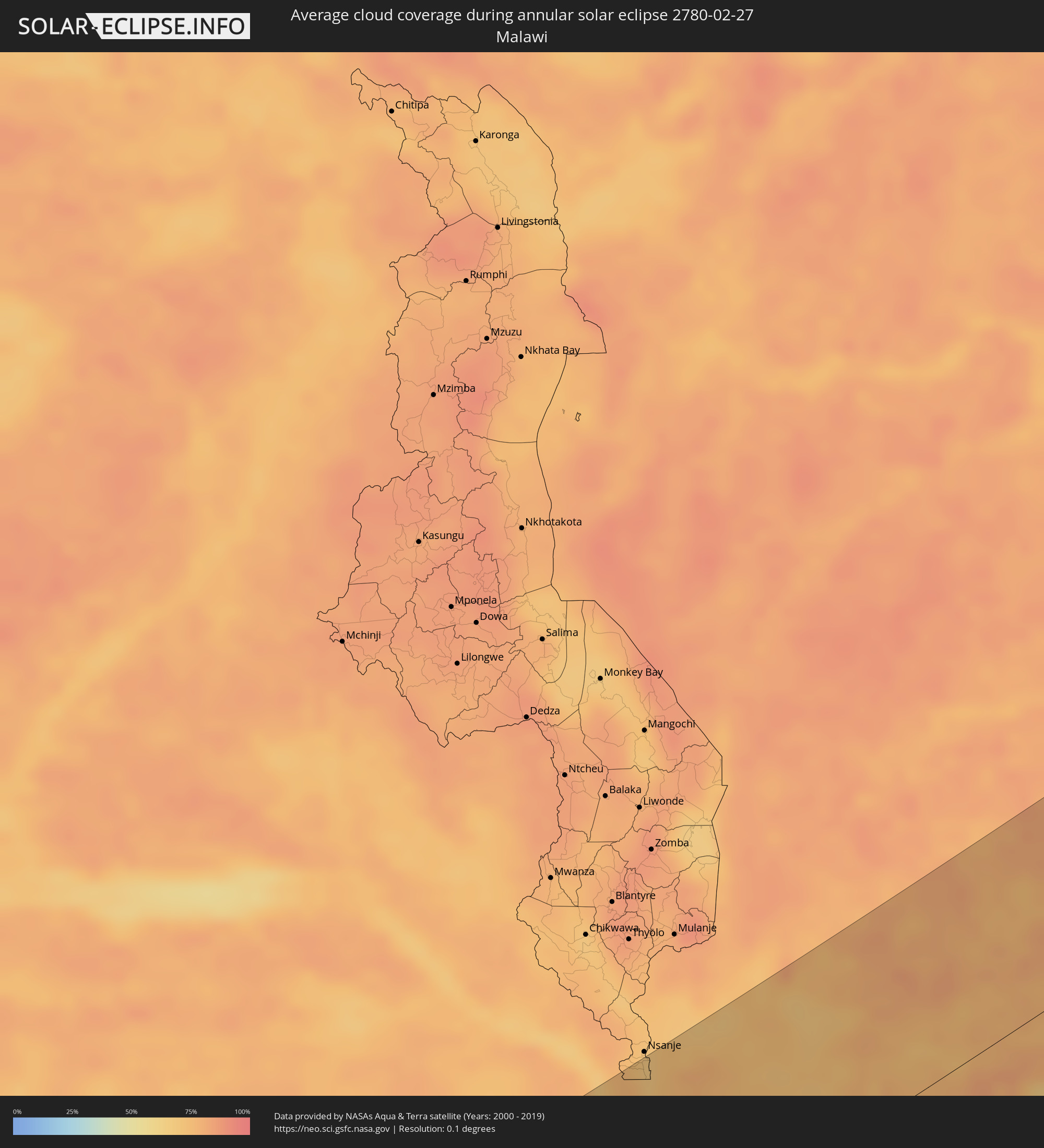 Malawi
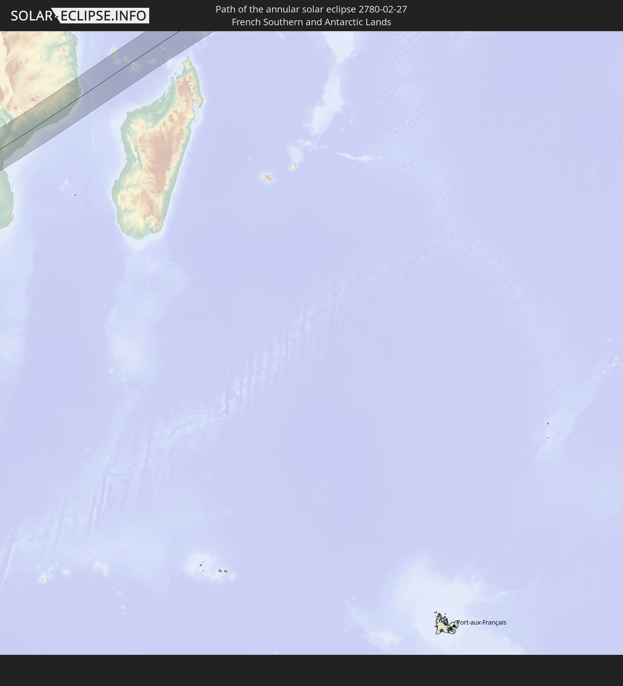
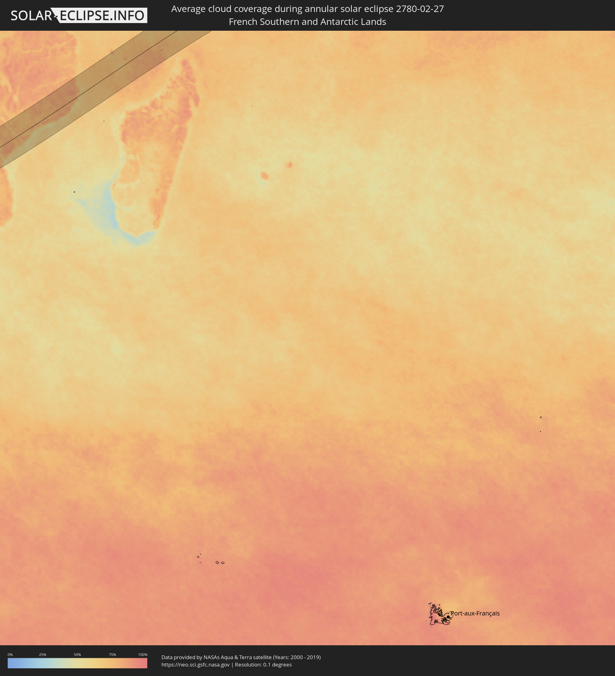 French Southern and Antarctic Lands
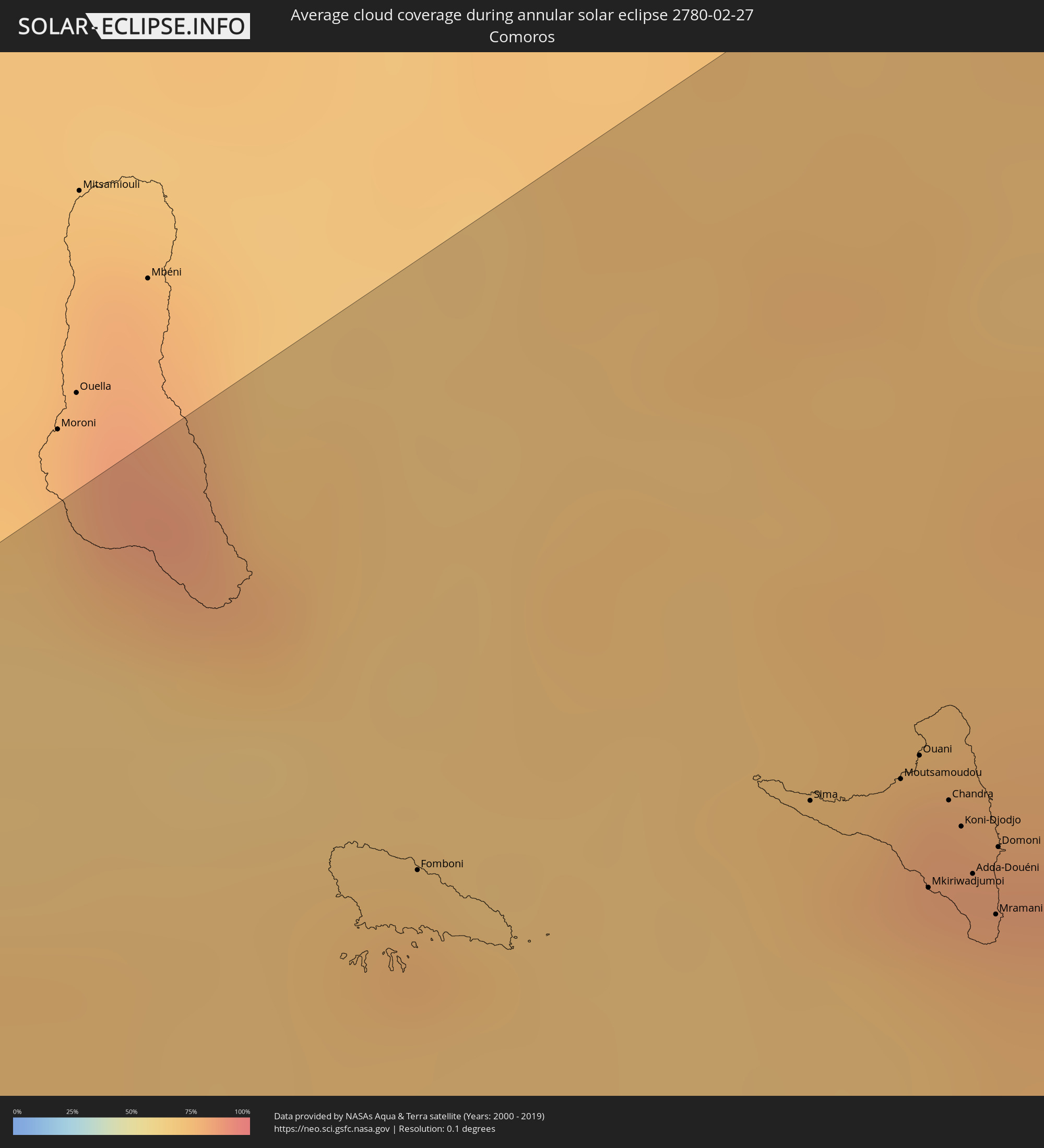 Comoros
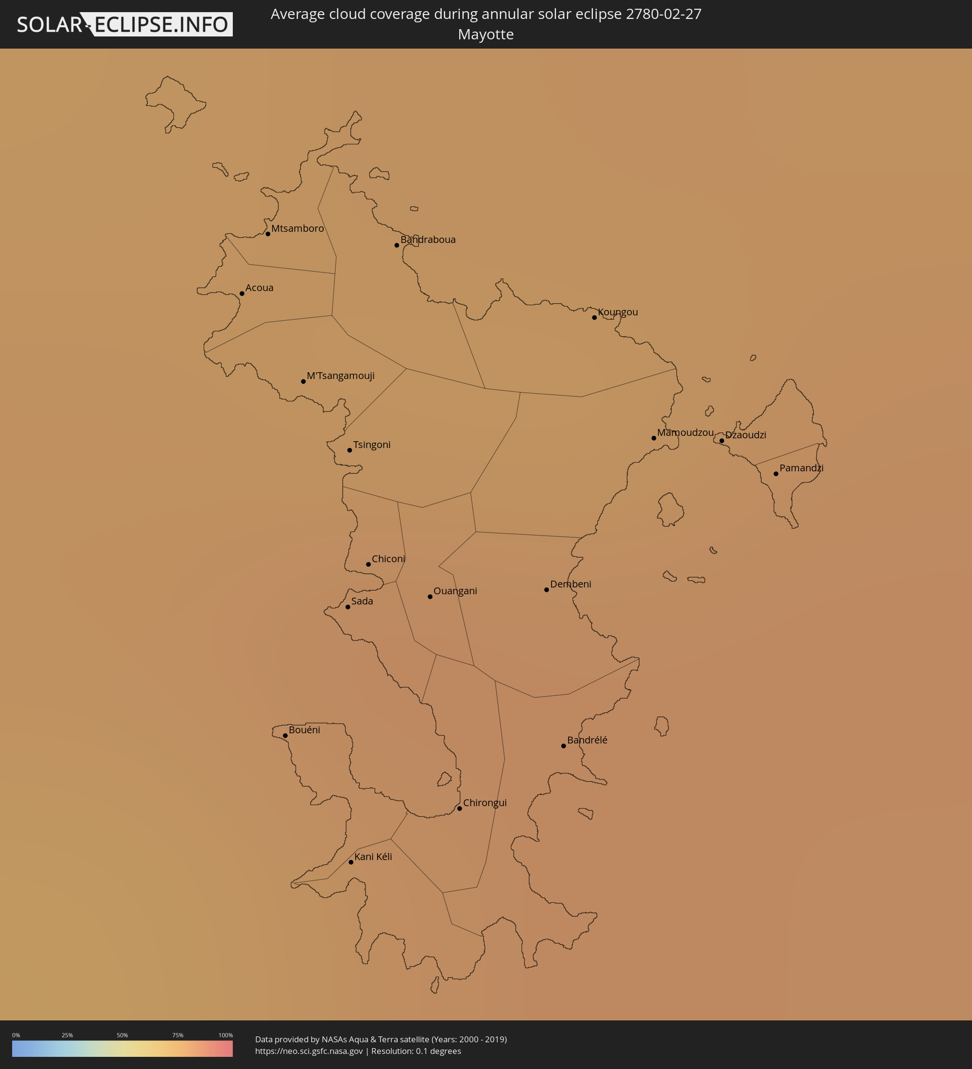 Mayotte
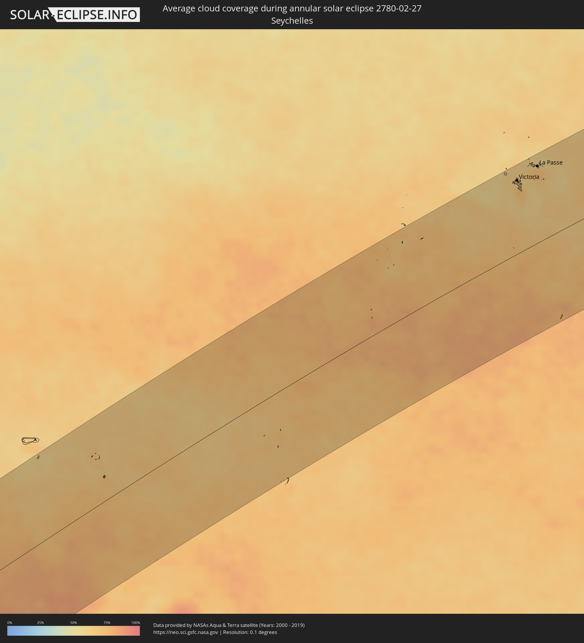 Seychelles
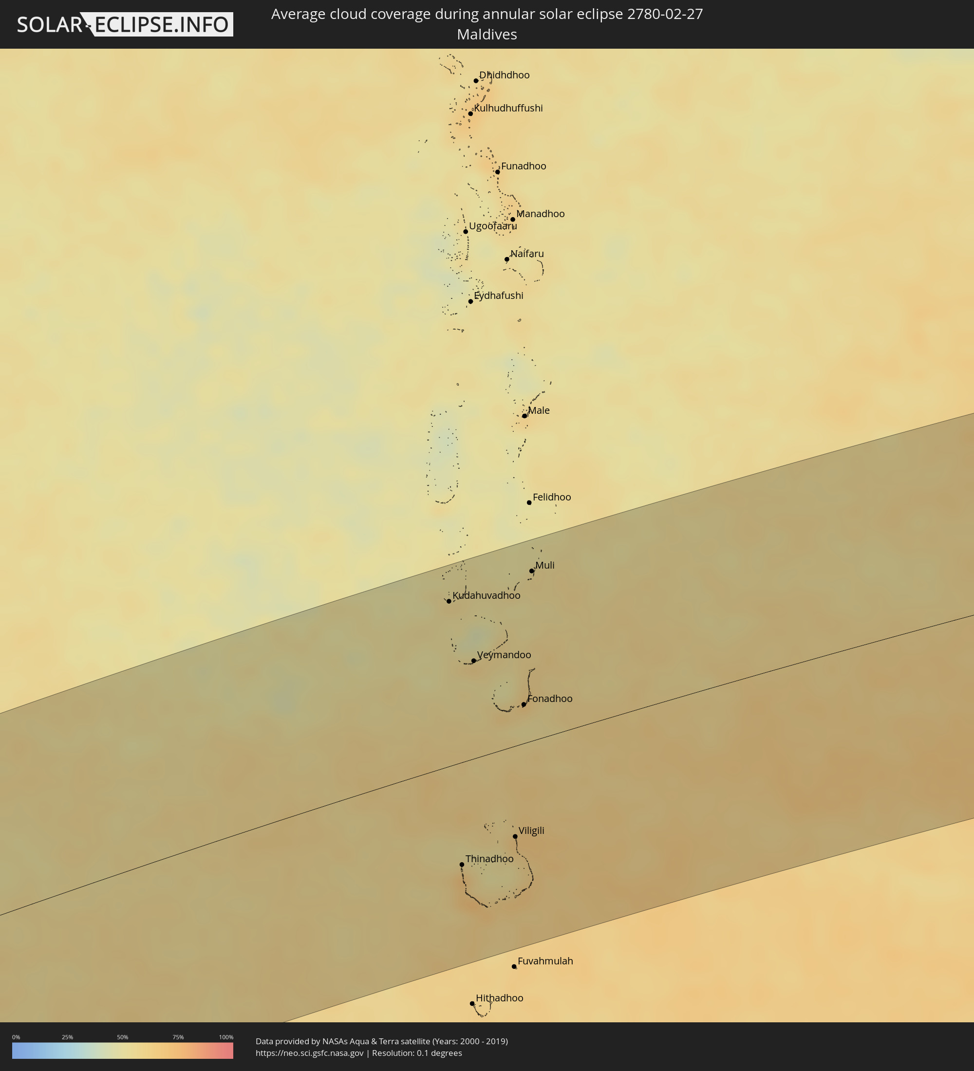 Maldives
Cities inside the path of the eclipse
The following table shows all locations with a population of more than 5,000 inside the eclipse path. Cities which have more than 100,000 inhabitants are marked bold. A click at the locations opens a detailed map.
| City | Type | Eclipse duration | Local time of max. eclipse | Distance to central line | Ø Cloud coverage |
|
Lüderitz, Karas
|
annular | - | 10:55:11 UTC+02:00 | 2 km | 10% |
|
Bethanie, Karas
|
annular | - | 11:00:07 UTC+02:00 | 31 km | 17% |
|
Mariental, Hardap
|
annular | - | 11:03:22 UTC+02:00 | 144 km | 26% |
|
Keetmanshoop, Karas
|
annular | - | 11:02:32 UTC+02:00 | 69 km | 16% |
|
Tshabong, Kgalagadi
|
annular | - | 11:14:18 UTC+02:00 | 150 km | 26% |
|
Letlhakeng, Kweneng
|
annular | - | 11:23:37 UTC+02:00 | 46 km | 60% |
|
Kanye, Ngwaketsi
|
annular | - | 11:23:29 UTC+02:00 | 147 km | 53% |
|
Mosopa, Ngwaketsi
|
annular | - | 11:23:57 UTC+02:00 | 131 km | 54% |
|
Molepolole, Kweneng
|
annular | - | 11:24:36 UTC+02:00 | 96 km | 53% |
|
Thamaga, Kweneng
|
annular | - | 11:24:25 UTC+02:00 | 125 km | 55% |
|
Gabane, Kweneng
|
annular | - | 11:25:07 UTC+02:00 | 135 km | 52% |
|
Metsemotlhaba, Kweneng
|
annular | - | 11:25:19 UTC+02:00 | 124 km | 52% |
|
Mogoditshane, Kweneng
|
annular | - | 11:25:24 UTC+02:00 | 134 km | 53% |
|
Kopong, South-East
|
annular | - | 11:25:38 UTC+02:00 | 120 km | 54% |
|
Gaborone, South-East
|
annular | - | 11:25:30 UTC+02:00 | 139 km | 53% |
|
Mochudi, Kgatleng
|
annular | - | 11:26:29 UTC+02:00 | 124 km | 56% |
|
Serowe, Central
|
annular | - | 11:30:48 UTC+02:00 | 57 km | 64% |
|
Mahalapye, Central
|
annular | - | 11:30:08 UTC+02:00 | 20 km | 65% |
|
Palapye, Central
|
annular | - | 11:31:50 UTC+02:00 | 23 km | 63% |
|
Tonota, Central
|
annular | - | 11:34:28 UTC+02:00 | 118 km | 61% |
|
Francistown, North-East
|
annular | - | 11:35:01 UTC+02:00 | 143 km | 62% |
|
Selebi-Phikwe, Central
|
annular | - | 11:34:51 UTC+02:00 | 47 km | 64% |
|
Chimoio, Manica
|
annular | - | 11:57:13 UTC+02:00 | 44 km | 76% |
|
Dondo, Sofala
|
annular | - | 12:00:10 UTC+02:00 | 72 km | 72% |
|
Beira, Sofala
|
annular | - | 12:00:01 UTC+02:00 | 99 km | 65% |
|
Quelimane, Zambézia
|
annular | - | 12:10:07 UTC+02:00 | 29 km | 70% |
|
Nampula, Nampula
|
annular | - | 12:23:01 UTC+02:00 | 88 km | 84% |
|
António Enes, Nampula
|
annular | - | 12:22:32 UTC+02:00 | 53 km | 76% |
|
Nacala, Nampula
|
annular | - | 12:28:20 UTC+02:00 | 54 km | 78% |
|
Ilha de Moçambique, Nampula
|
annular | - | 12:27:28 UTC+02:00 | 8 km | 70% |
|
Fomboni, Mohéli
|
annular | - | 13:41:44 UTC+03:00 | 79 km | 76% |
|
Sima, Anjouan
|
annular | - | 13:43:21 UTC+03:00 | 55 km | 77% |
|
Moutsamoudou, Anjouan
|
annular | - | 13:43:44 UTC+03:00 | 51 km | 82% |
|
Mirontsi, Anjouan
|
annular | - | 13:43:47 UTC+03:00 | 51 km | 82% |
|
Ouani, Anjouan
|
annular | - | 13:43:53 UTC+03:00 | 52 km | 81% |
|
Barakani, Anjouan
|
annular | - | 13:43:53 UTC+03:00 | 51 km | 81% |
|
Mkiriwadjumoi
|
annular | - | 13:43:32 UTC+03:00 | 35 km | 76% |
|
Moya, Anjouan
|
annular | - | 13:43:33 UTC+03:00 | 35 km | 76% |
|
Chandra, Anjouan
|
annular | - | 13:43:51 UTC+03:00 | 44 km | 83% |
|
Koni-Djodjo, Anjouan
|
annular | - | 13:43:50 UTC+03:00 | 40 km | 83% |
|
Adda-Douéni, Anjouan
|
annular | - | 13:43:44 UTC+03:00 | 33 km | 78% |
|
Mramani, Anjouan
|
annular | - | 13:43:42 UTC+03:00 | 26 km | 78% |
|
Domoni, Anjouan
|
annular | - | 13:43:54 UTC+03:00 | 34 km | 78% |
|
Acoua, Acoua
|
annular | - | 13:44:18 UTC+03:00 | 41 km | 80% |
|
Mtsamboro, Mtsamboro
|
annular | - | 13:44:23 UTC+03:00 | 39 km | 80% |
|
Bouéni, Bouéni
|
annular | - | 13:43:58 UTC+03:00 | 58 km | 77% |
|
M'Tsangamouji, M'Tsangamouji
|
annular | - | 13:44:17 UTC+03:00 | 46 km | 78% |
|
Sada, Sada
|
annular | - | 13:44:09 UTC+03:00 | 55 km | 77% |
|
Tsingoni, Tsingoni
|
annular | - | 13:44:17 UTC+03:00 | 49 km | 78% |
|
Kani Kéli, Kani-Kéli
|
annular | - | 13:43:56 UTC+03:00 | 65 km | 78% |
|
Chiconi, Chiconi
|
annular | - | 13:44:12 UTC+03:00 | 54 km | 78% |
|
Bandraboua, Bandraboua
|
annular | - | 13:44:30 UTC+03:00 | 43 km | 80% |
|
Ouangani, Ouangani
|
annular | - | 13:44:14 UTC+03:00 | 57 km | 78% |
|
Chirongui, Chirongui
|
annular | - | 13:44:06 UTC+03:00 | 65 km | 77% |
|
Dembeni, Dembeni
|
annular | - | 13:44:22 UTC+03:00 | 59 km | 80% |
|
Bandrélé, Bandrele
|
annular | - | 13:44:16 UTC+03:00 | 66 km | 78% |
|
Koungou, Koungou
|
annular | - | 13:44:39 UTC+03:00 | 50 km | 80% |
|
Mamoudzou, Mamoudzou
|
annular | - | 13:44:37 UTC+03:00 | 56 km | 80% |
|
Dzaoudzi, Dzaoudzi
|
annular | - | 13:44:41 UTC+03:00 | 58 km | 80% |
|
Pamandzi, Pamandzi
|
annular | - | 13:44:43 UTC+03:00 | 61 km | 80% |
|
Port Glaud, Port Glaud
|
annular | - | 15:22:43 UTC+04:00 | 131 km | 67% |
|
Bel Ombre, Bel Ombre
|
annular | - | 15:22:48 UTC+04:00 | 136 km | 74% |
|
Beau Vallon, Beau Vallon
|
annular | - | 15:22:49 UTC+04:00 | 135 km | 74% |
|
Victoria, English River
|
annular | - | 15:22:52 UTC+04:00 | 134 km | 73% |
|
Anse Boileau, Anse Boileau
|
annular | - | 15:22:45 UTC+04:00 | 123 km | 72% |
|
Takamaka, Takamaka
|
annular | - | 15:22:42 UTC+04:00 | 117 km | 68% |
|
Cascade, Cascade
|
annular | - | 15:22:52 UTC+04:00 | 127 km | 72% |
|
Anse Royale, Anse Royale
|
annular | - | 15:22:47 UTC+04:00 | 119 km | 72% |
|
La Passe, Inner Islands
|
annular | - | 15:23:59 UTC+04:00 | 141 km | 73% |
|
Kudahuvadhoo, Dhaalu Atholhu
|
annular | - | 16:53:03 UTC+05:00 | 142 km | 57% |
|
Thinadhoo, Gaafu Dhaalu Atholhu
|
annular | - | 16:51:07 UTC+05:00 | 89 km | 69% |
|
Veymandoo, Thaa Atholhu
|
annular | - | 16:52:45 UTC+05:00 | 84 km | 61% |
|
Viligili, Gaafu Alifu Atholhu
|
annular | - | 16:51:39 UTC+05:00 | 79 km | 65% |
|
Fonadhoo, Laamu
|
annular | - | 16:52:42 UTC+05:00 | 33 km | 57% |
|
Muli, Meemu Atholhu
|
annular | - | 16:53:43 UTC+05:00 | 147 km | 57% |