Totale Sonnenfinsternis vom 06.04.-0107
| Wochentag: | Dienstag |
| Maximale Dauer der Verfinsterung: | 06m10s |
| Maximale Breite des Finsternispfades: | 223 km |
| Saroszyklus: | 66 |
| Bedeckungsgrad: | 100% |
| Magnitude: | 1.0684 |
| Gamma: | -0.064 |
Wo kann man die Sonnenfinsternis vom 06.04.-0107 sehen?
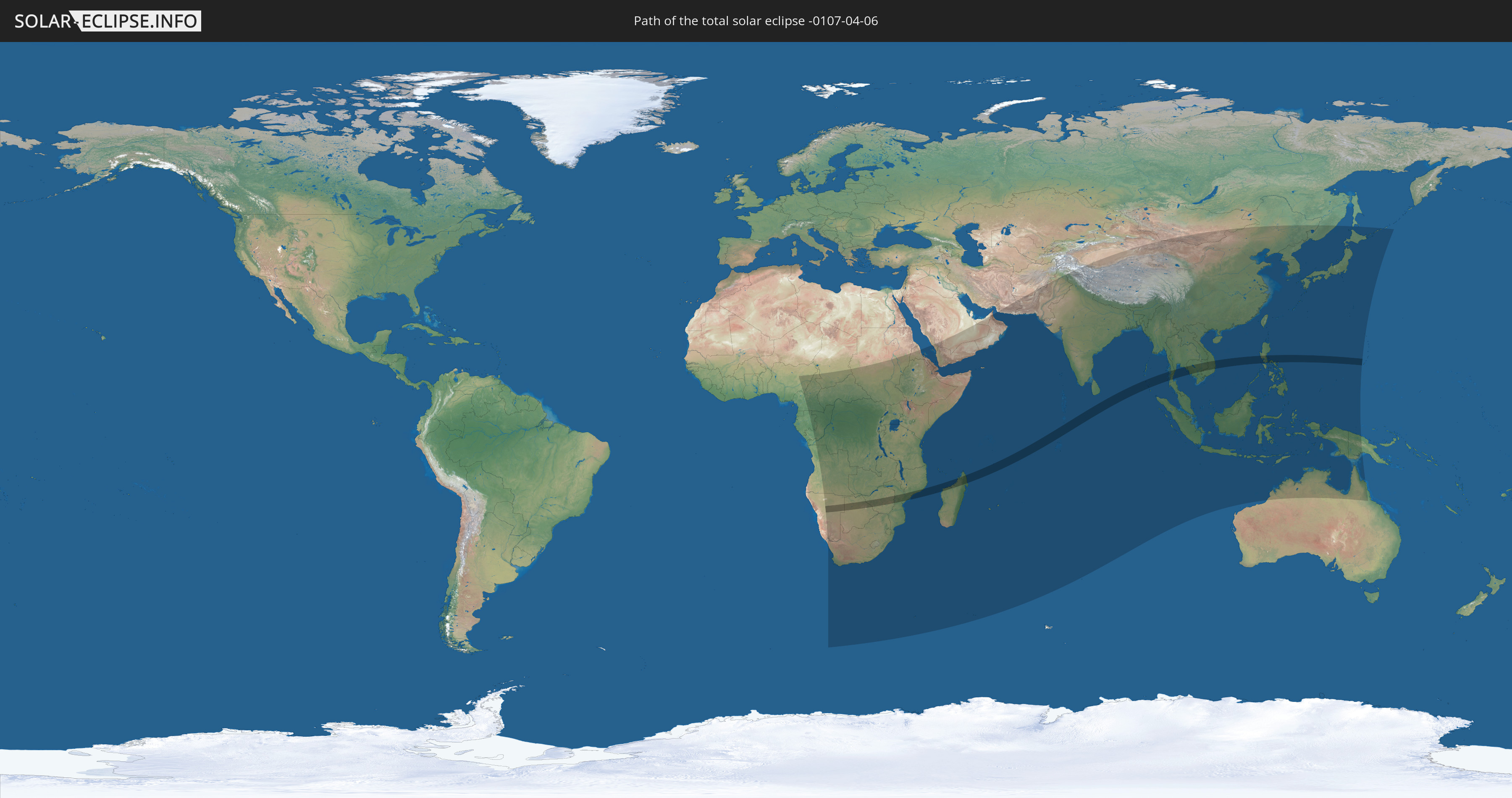
Die Sonnenfinsternis am 06.04.-0107 kann man in 75 Ländern als partielle Sonnenfinsternis beobachten.
Der Finsternispfad verläuft durch 13 Länder. Nur in diesen Ländern ist sie als totale Sonnenfinsternis zu sehen.
In den folgenden Ländern ist die Sonnenfinsternis total zu sehen
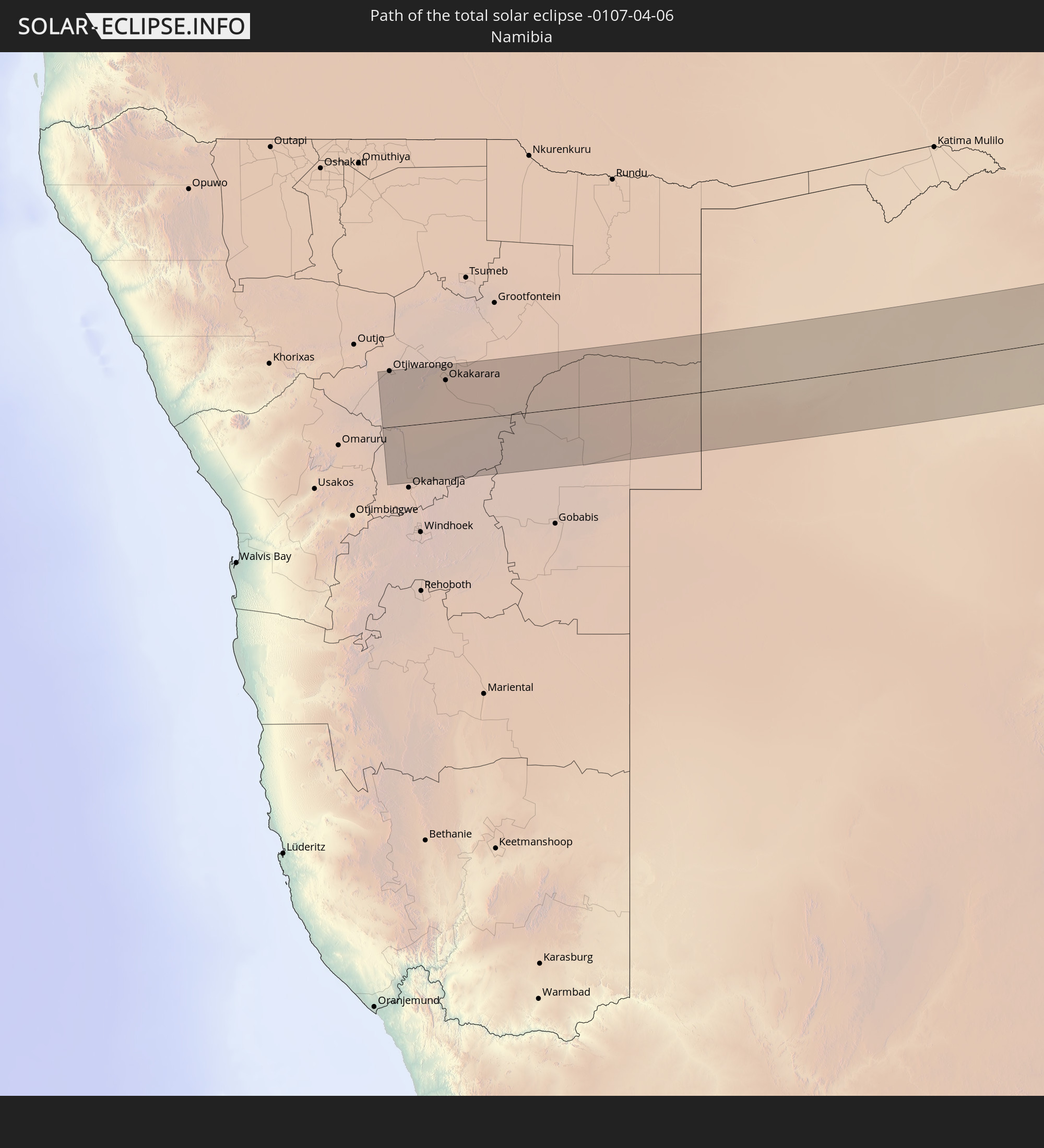 Namibia
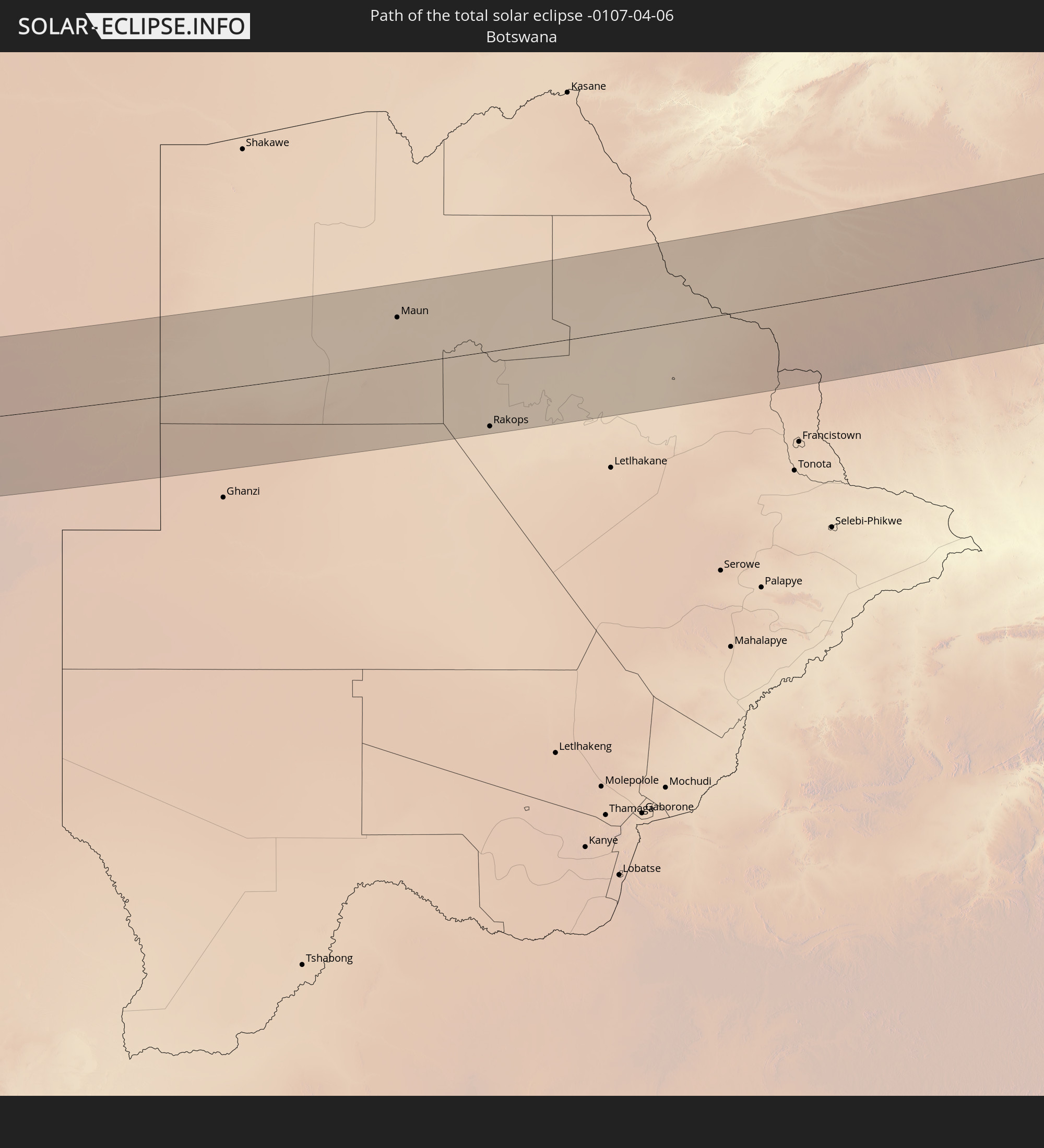 Botswana
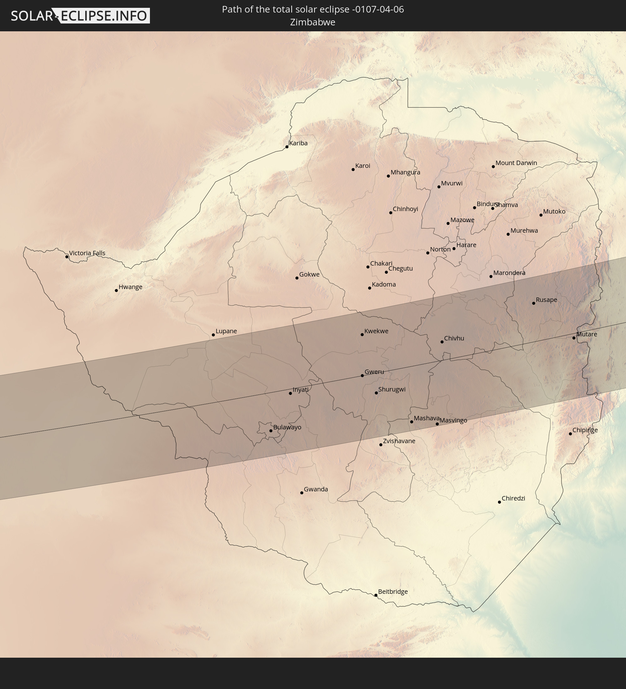 Simbabwe
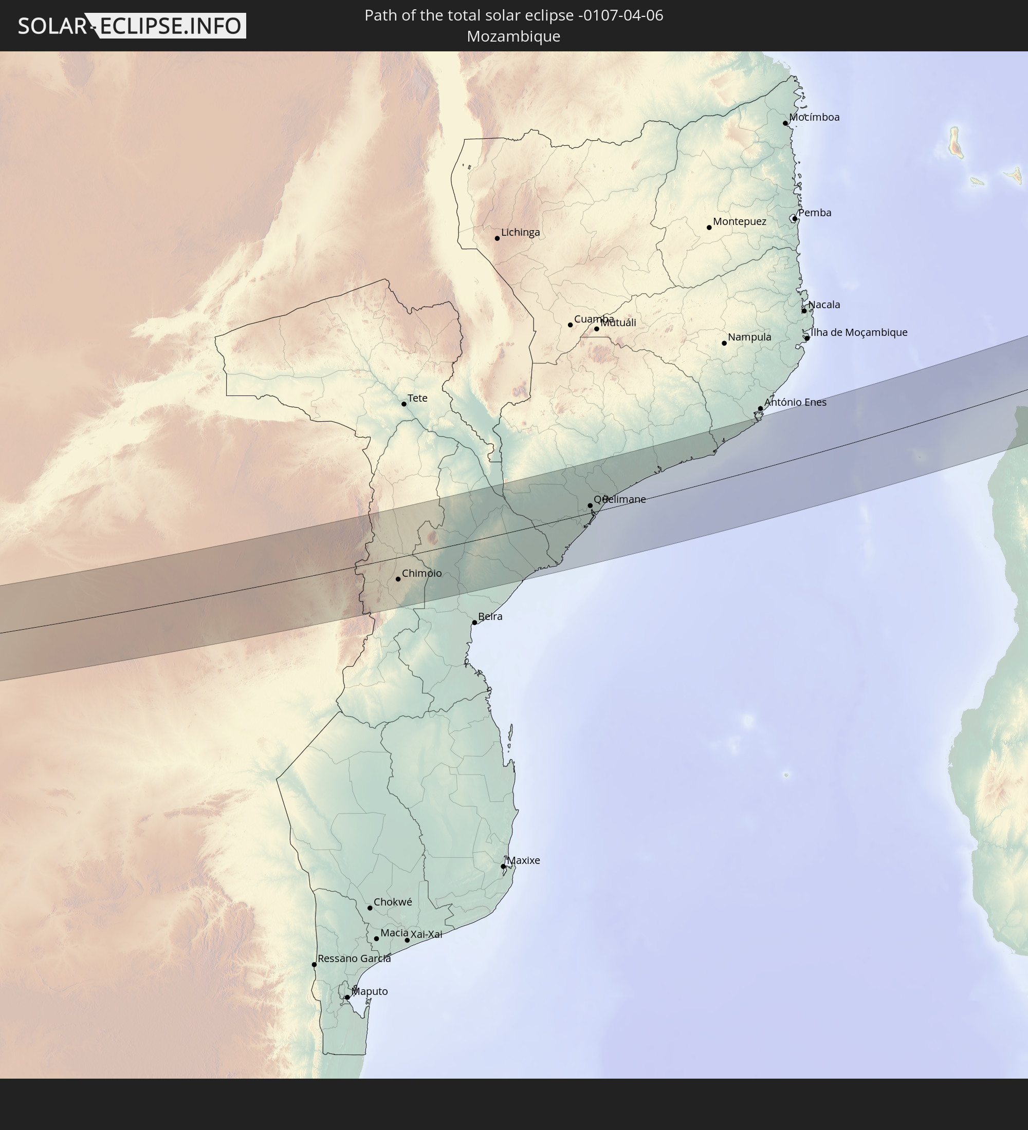 Mosambik
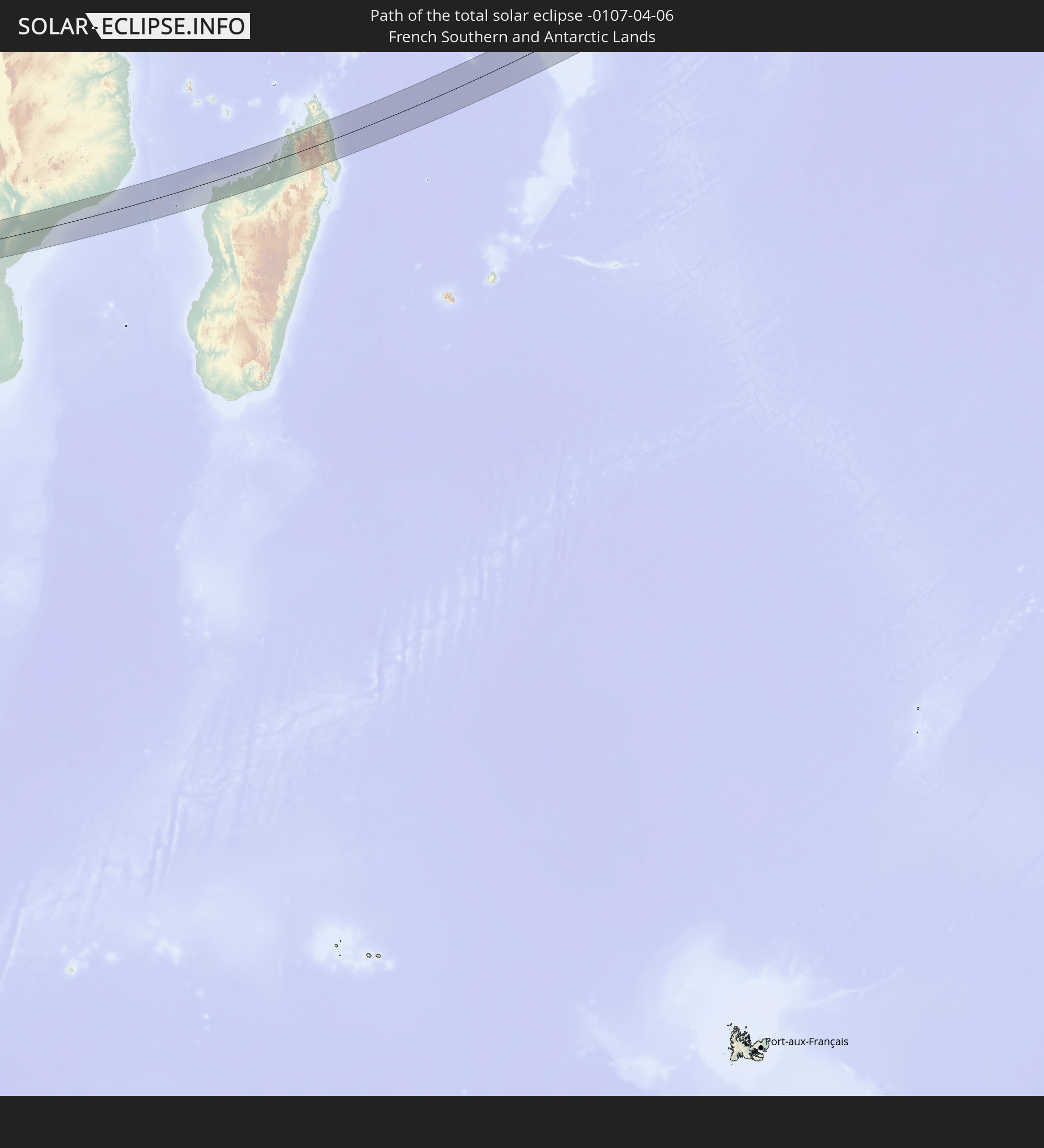 Französische Süd- und Antarktisgebiete
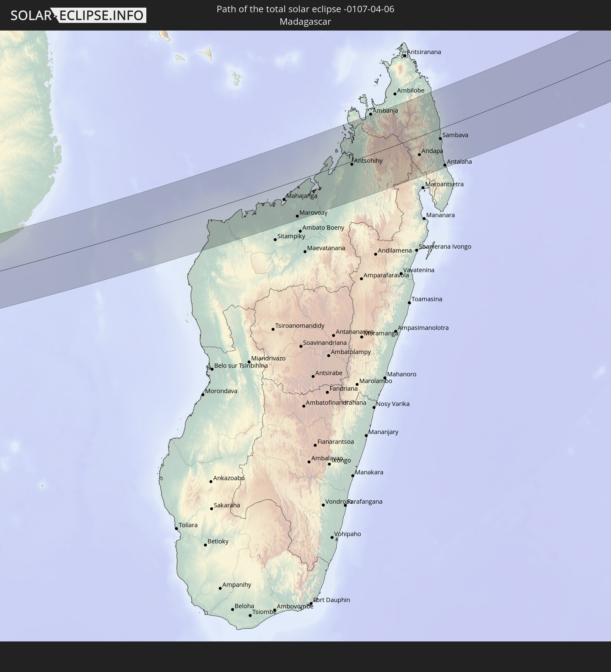 Madagaskar
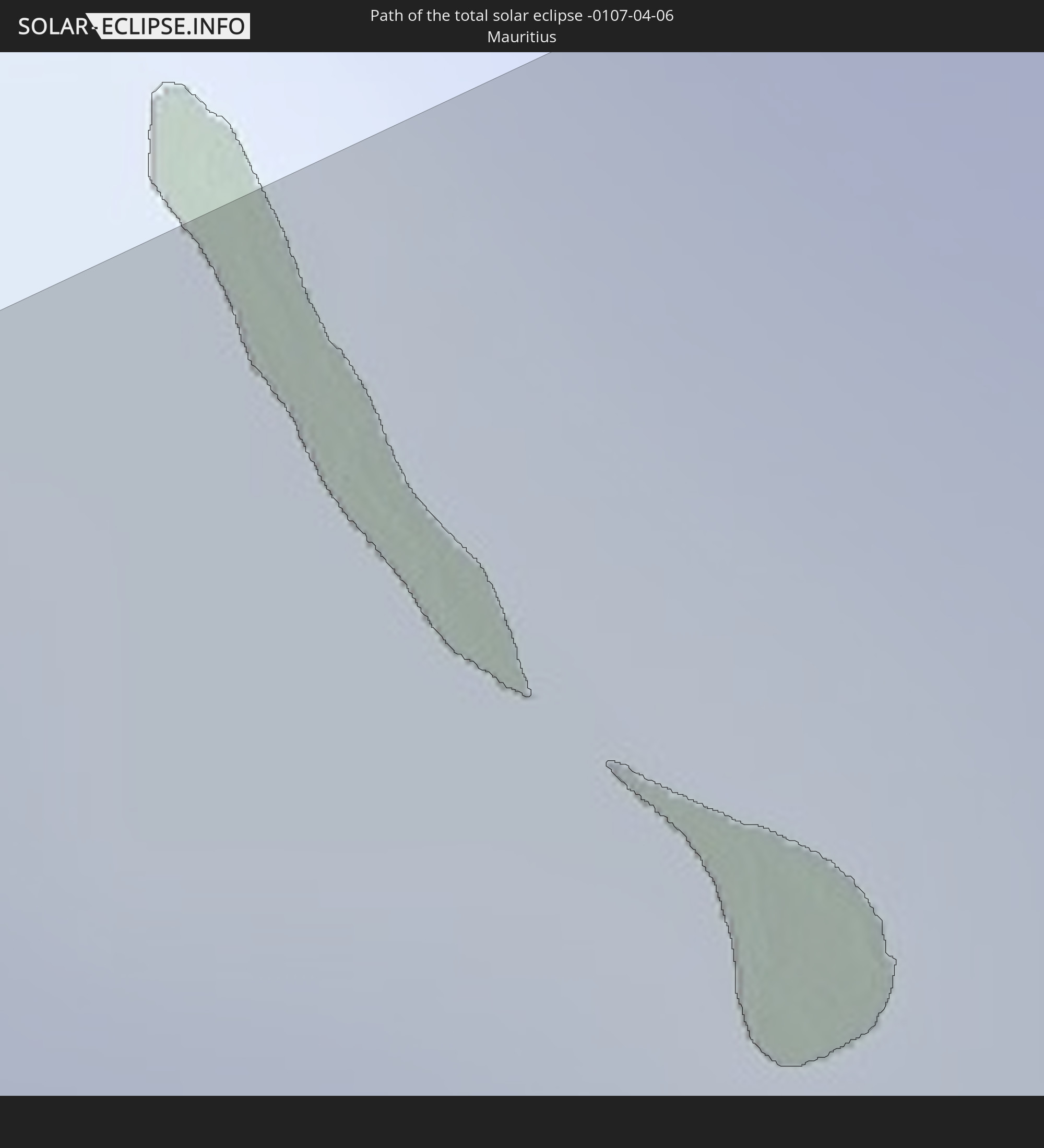 Mauritius
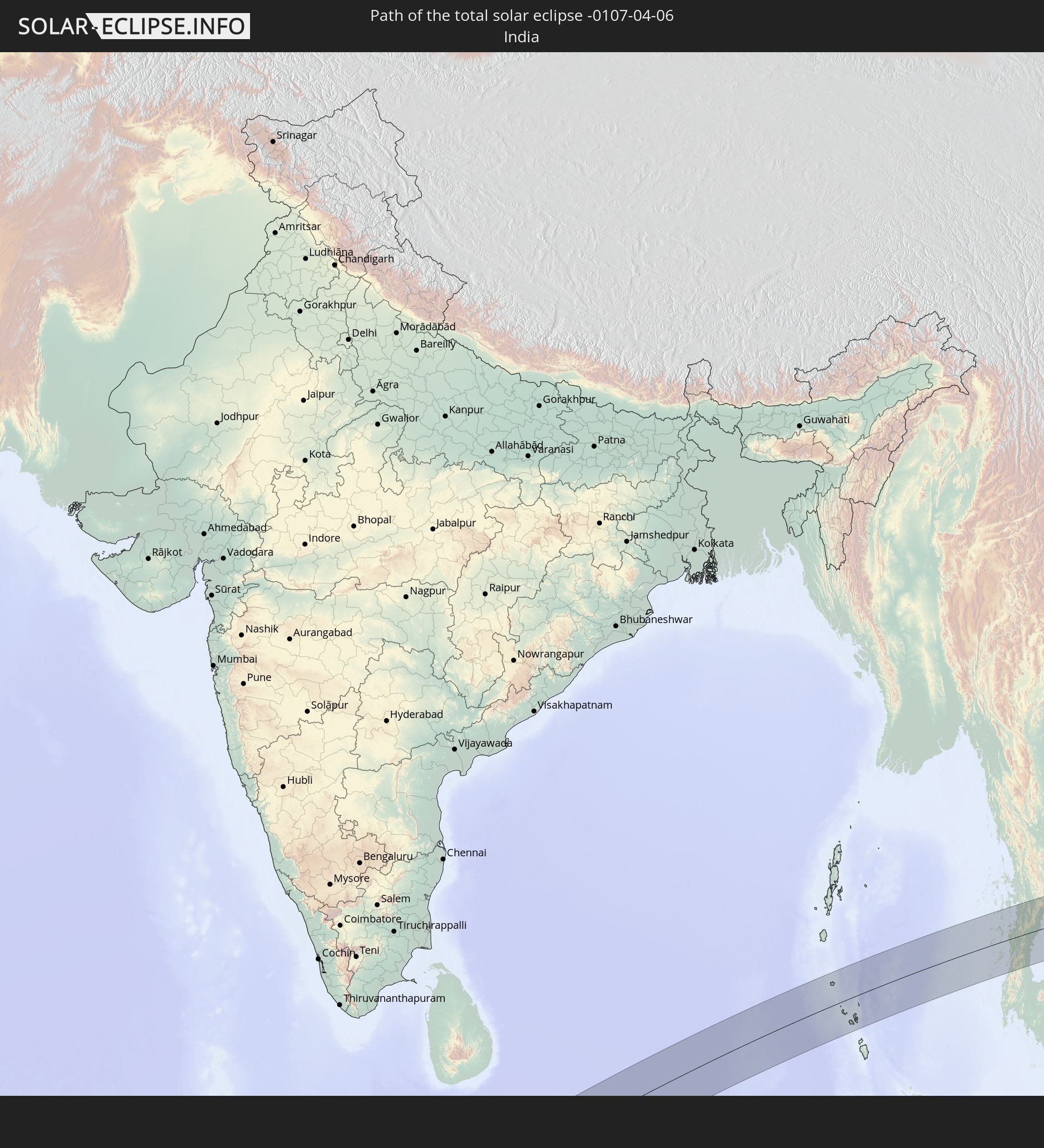 Indien
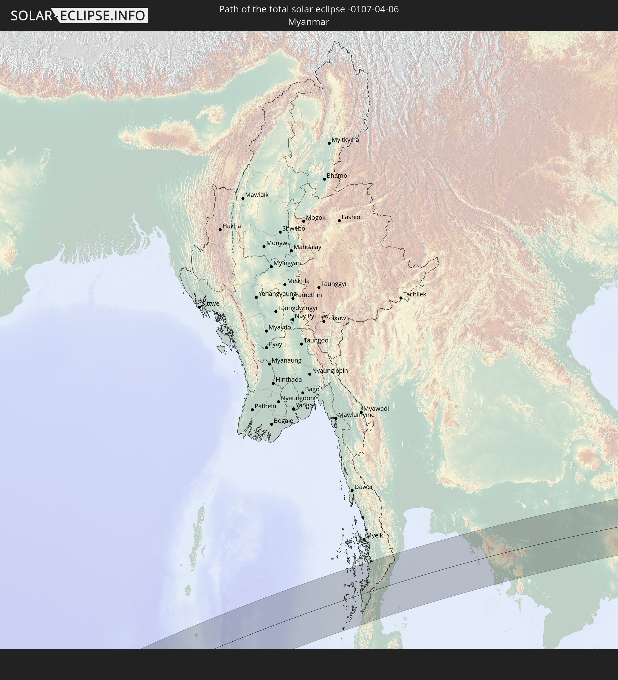 Myanmar
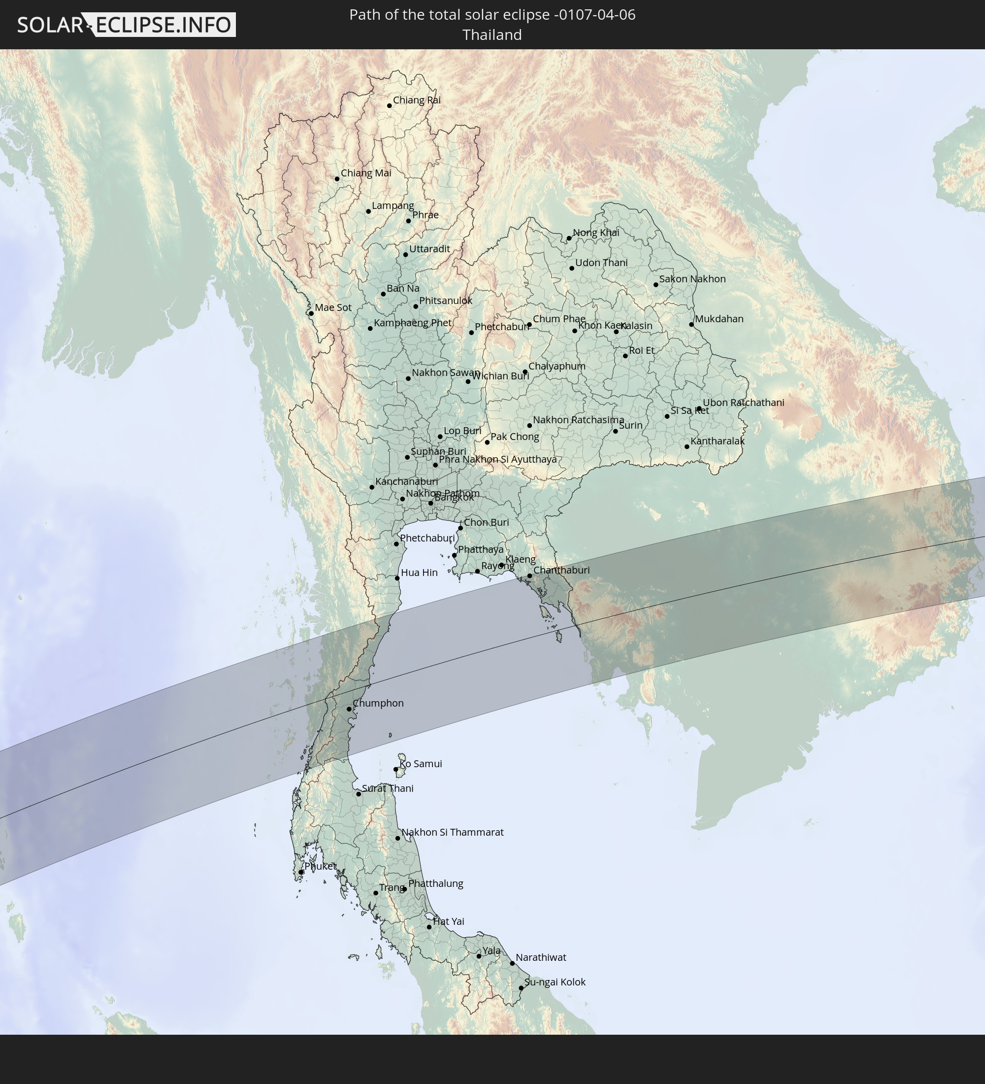 Thailand
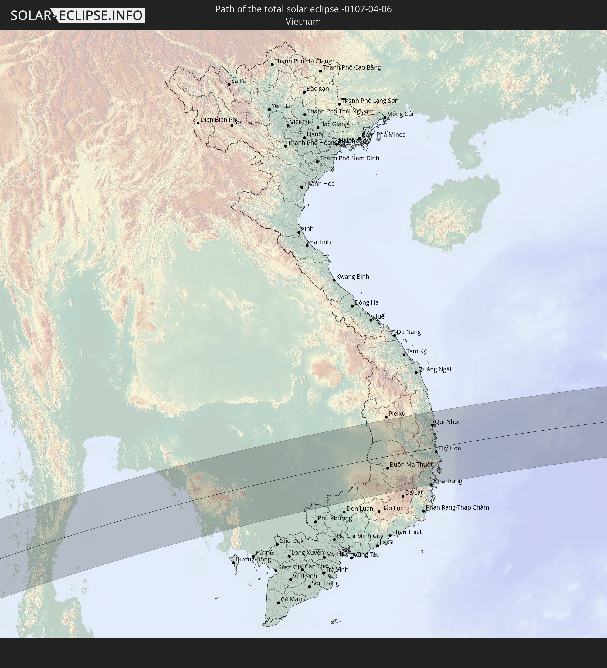 Vietnam
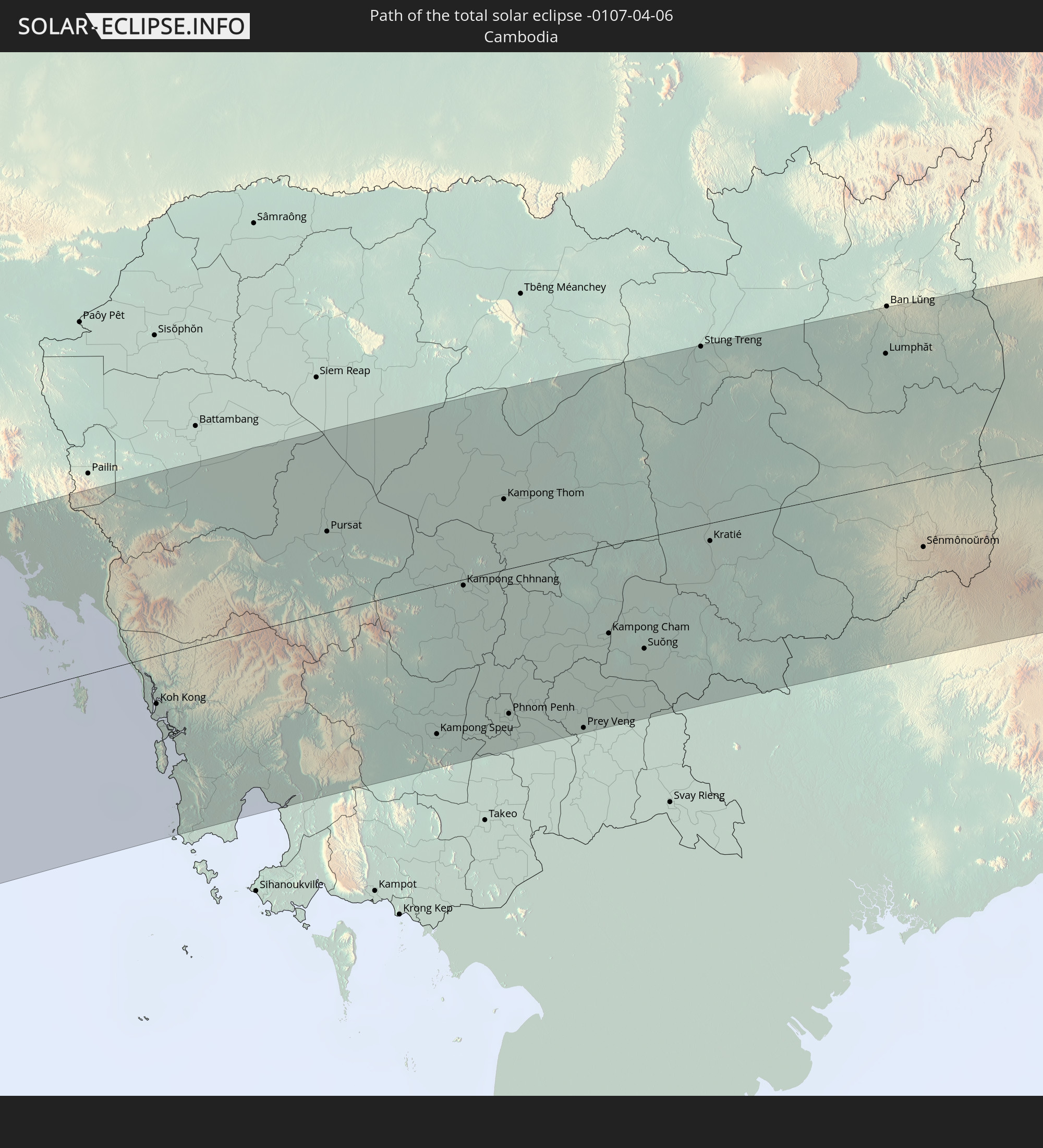 Kambodscha
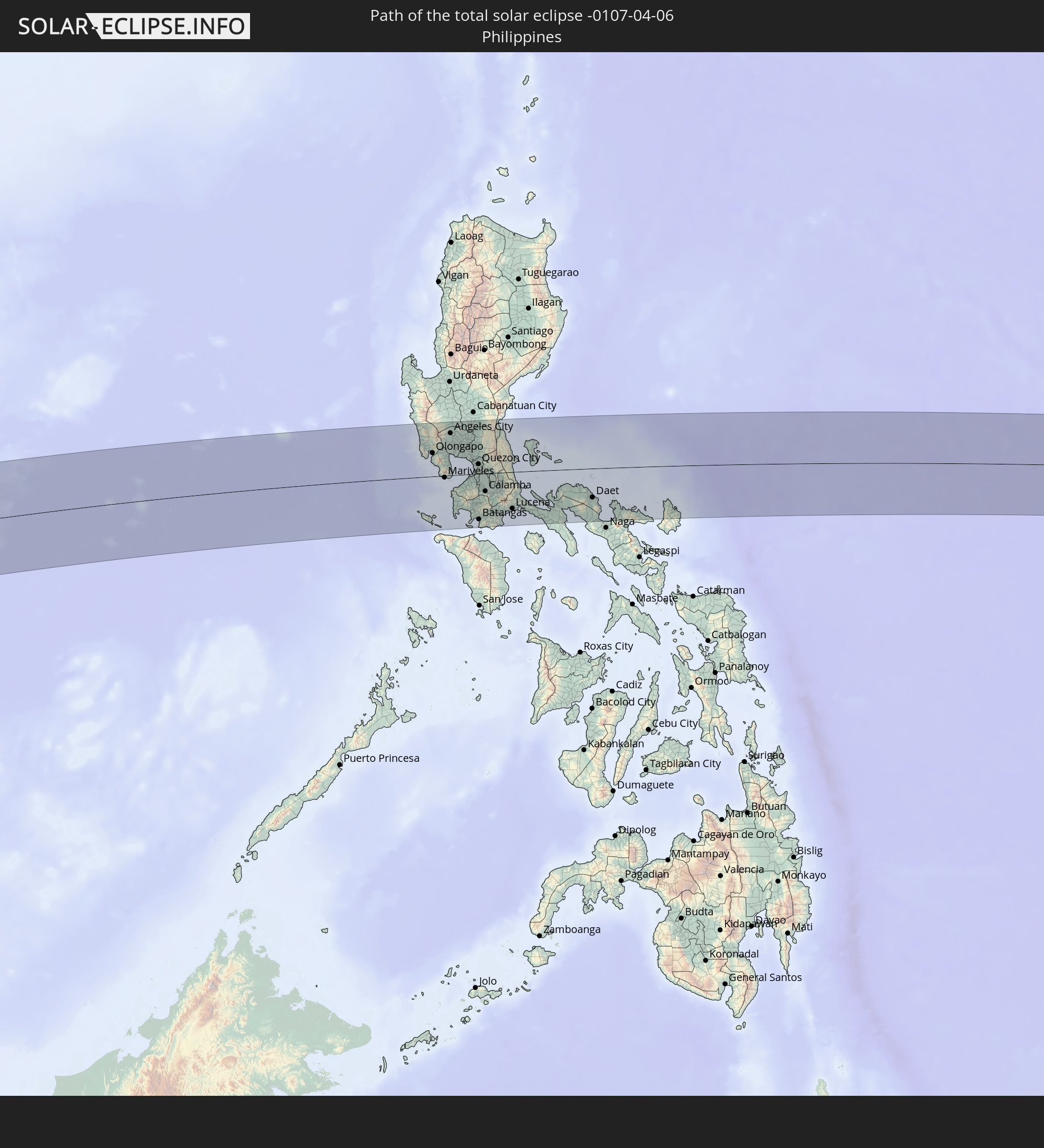 Philippinen
In den folgenden Ländern ist die Sonnenfinsternis partiell zu sehen
 Russland
 Nigeria
 Kamerun
 Gabun
Gabun
 Republik Kongo
 Angola
 Namibia
 Demokratische Republik Kongo
 Tschad
 Zentralafrikanische Republik
 Südafrika
 Botswana
 Sudan
Sudan
 Sambia
 Simbabwe
 Lesotho
 Ruanda
 Burundi
 Tansania
 Uganda
 Mosambik
 Swasiland
 Malawi
 Äthiopien
 Kenia
Kenia
 Saudi-Arabien
 Eritrea
 Französische Süd- und Antarktisgebiete
 Somalia
 Dschibuti
 Jemen
Jemen
 Madagaskar
 Komoren
 Iran
Iran
 Mayotte
 Seychellen
 Vereinigte Arabische Emirate
 Oman
Oman
 Réunion
 Mauritius
 Afghanistan
 Pakistan
 Indien
 Britisches Territorium im Indischen Ozean
 Malediven
 Volksrepublik China
 Sri Lanka
 Nepal
Nepal
 Mongolei
 Bangladesch
 Bhutan
 Myanmar
 Indonesien
 Kokosinseln
 Thailand
 Malaysia
 Laos
Laos
 Vietnam
 Kambodscha
 Singapur
 Weihnachtsinsel
 Australien
 Macau
Macau
 Hongkong
 Brunei
 Taiwan
 Philippinen
 Japan
Japan
 Osttimor
 Nordkorea
 Südkorea
 Palau
Palau
 Föderierte Staaten von Mikronesien
 Papua-Neuguinea
 Nördliche Marianen
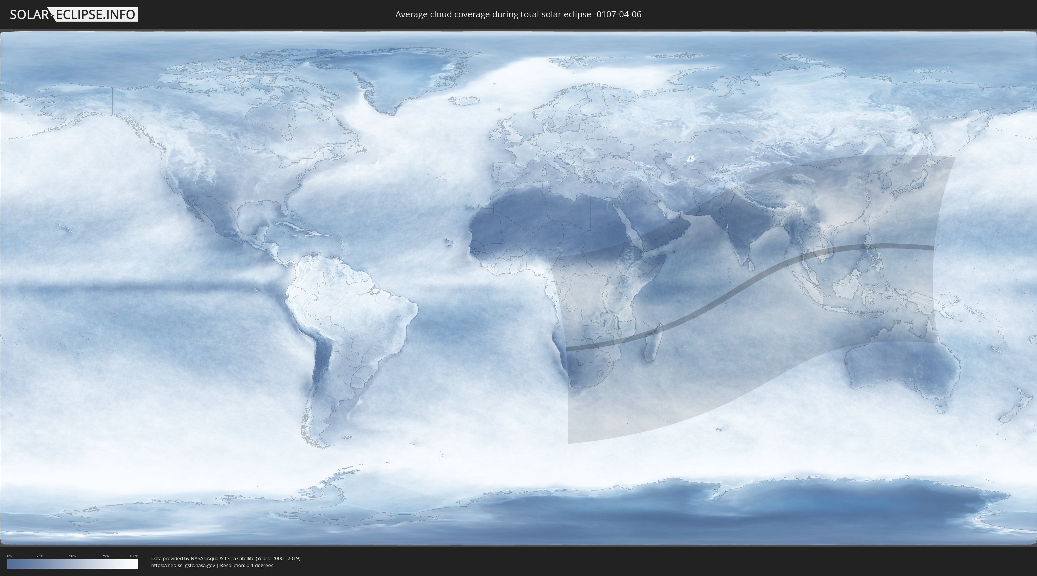
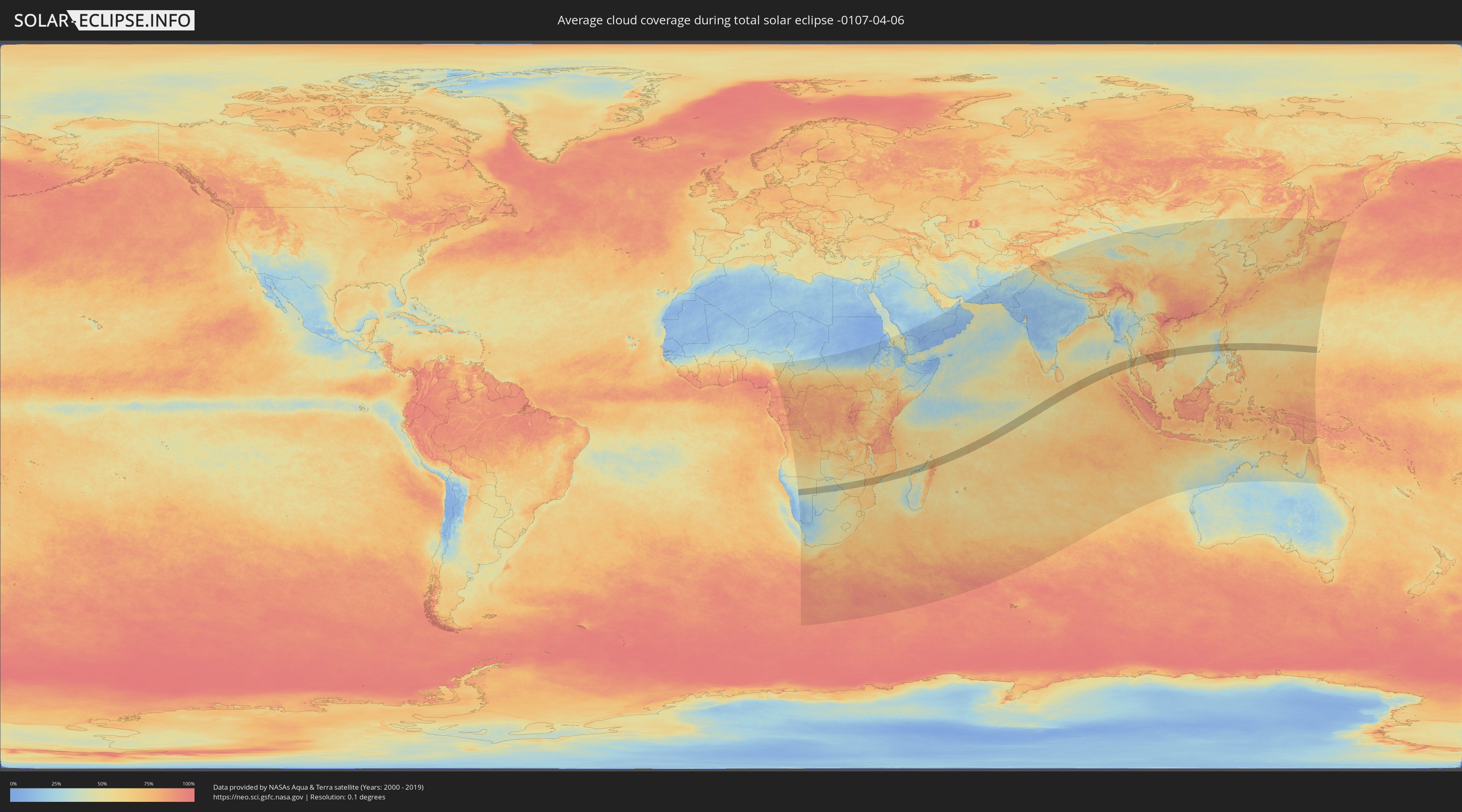
Wie wird das Wetter während der totalen Sonnenfinsternis am 06.04.-0107?
Wo ist der beste Ort, um die totale Sonnenfinsternis vom 06.04.-0107 zu beobachten?
Die folgenden Karten zeigen die durchschnittliche Bewölkung für den Tag, an dem die totale Sonnenfinsternis
stattfindet. Mit Hilfe der Karten lässt sich der Ort entlang des Finsternispfades eingrenzen,
der die besten Aussichen auf einen klaren wolkenfreien Himmel bietet.
Trotzdem muss man immer lokale Gegenenheiten beachten und sollte sich genau über das Wetter an seinem
gewählten Beobachtungsort informieren.
Die Daten stammen von den beiden NASA-Satelliten
AQUA und TERRA
und wurden über einen Zeitraum von 19 Jahren (2000 - 2019) gemittelt.
Detaillierte Länderkarten
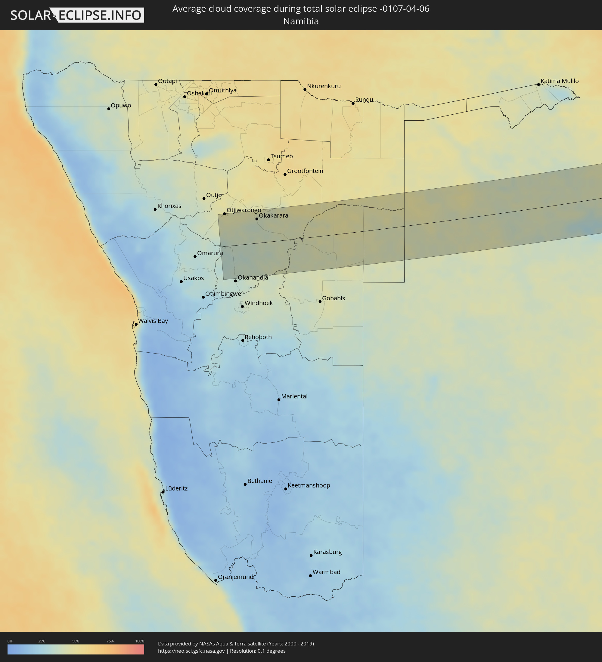 Namibia
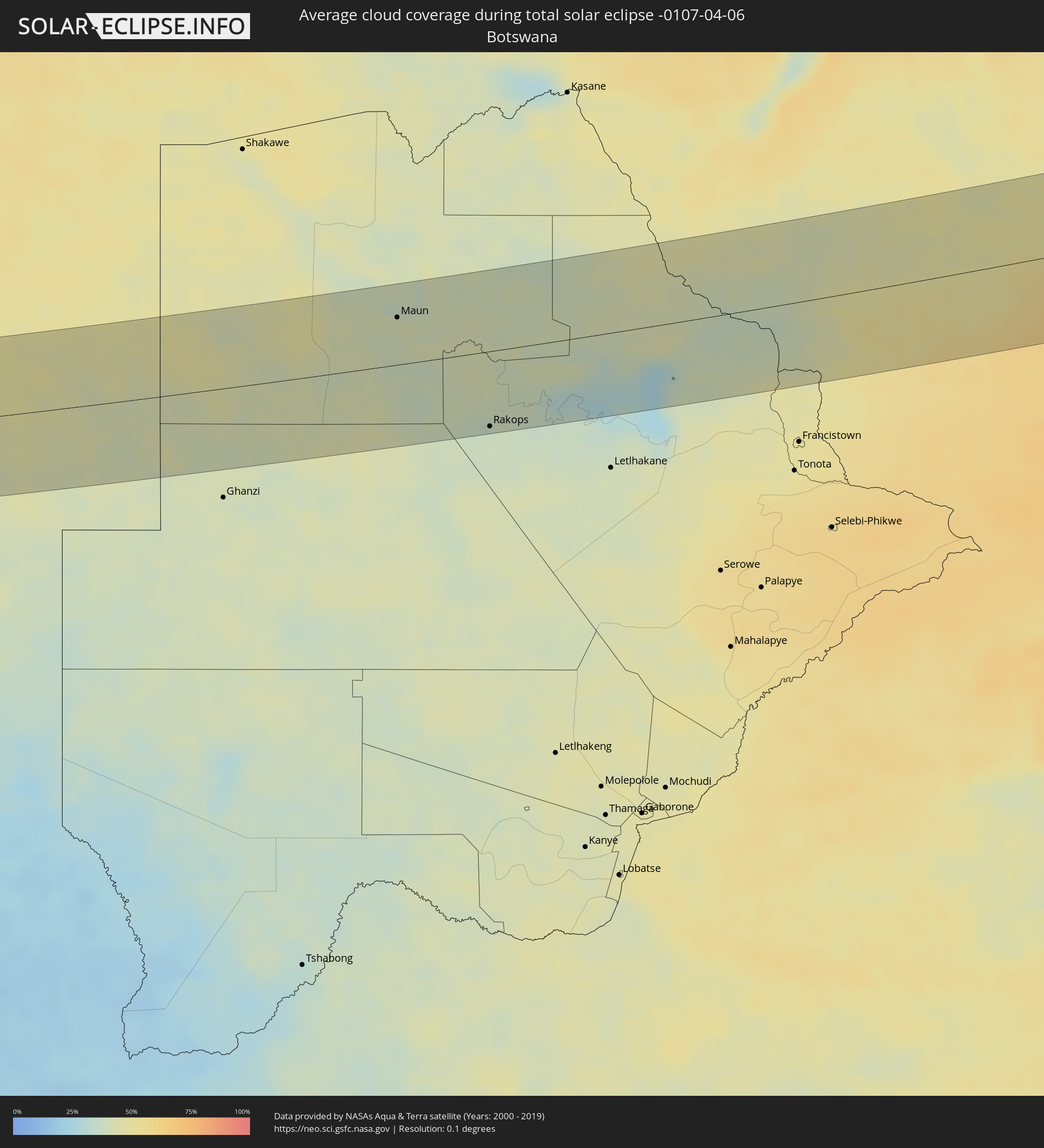 Botswana
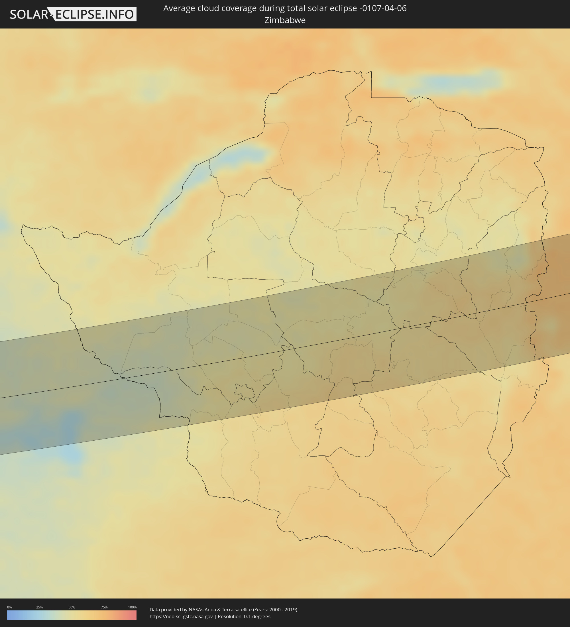 Simbabwe
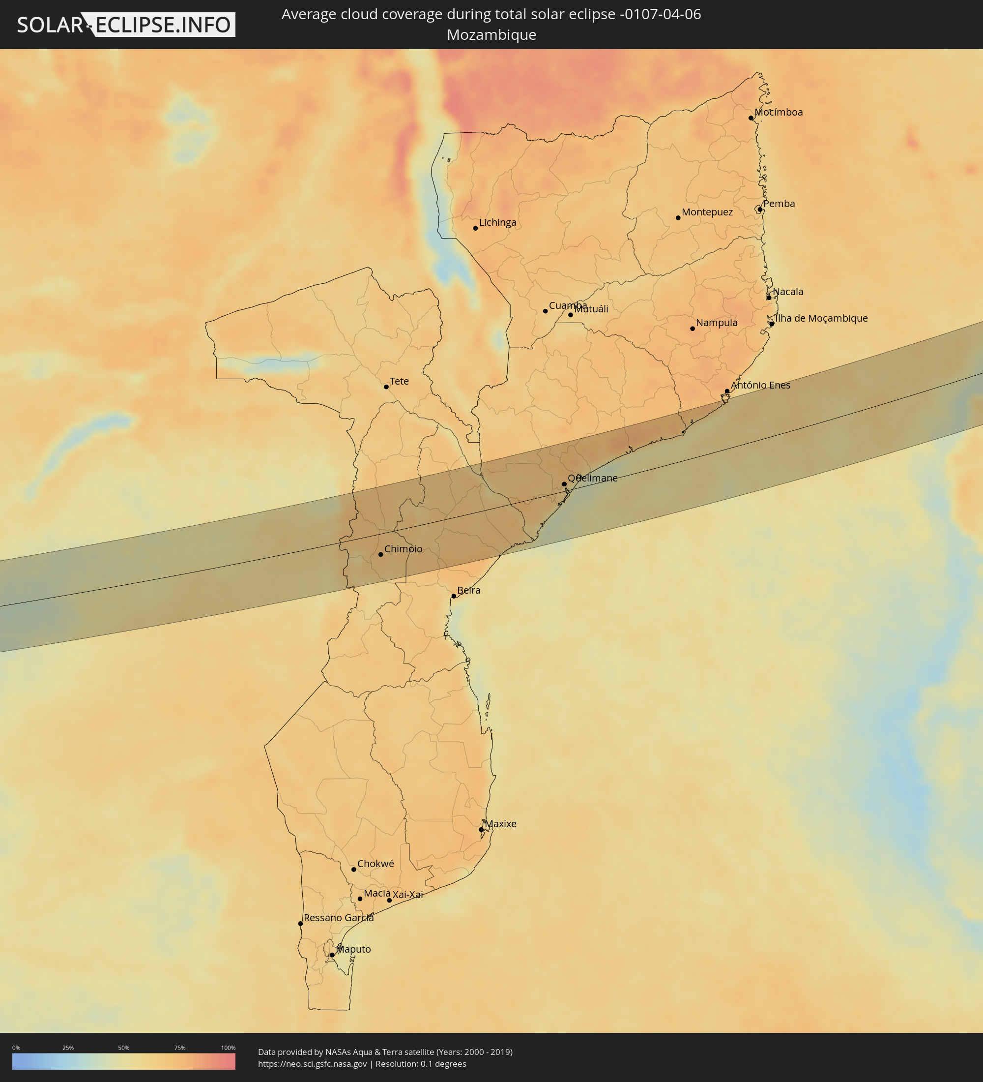 Mosambik
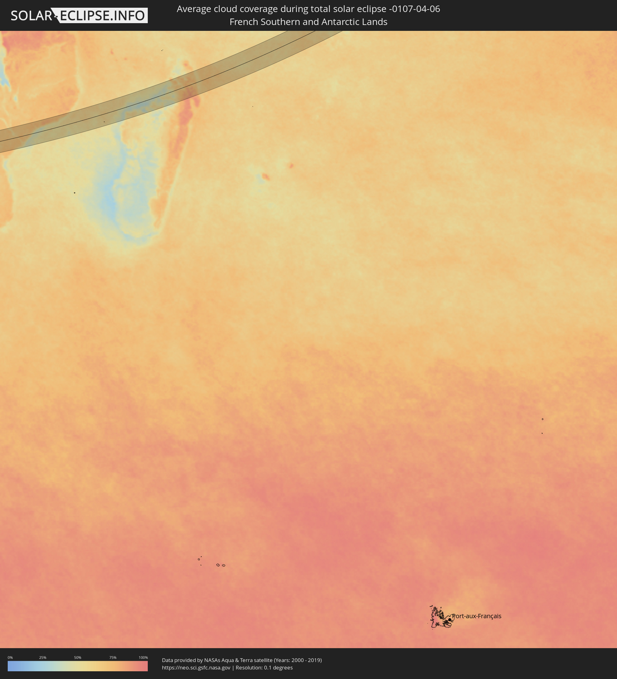 Französische Süd- und Antarktisgebiete
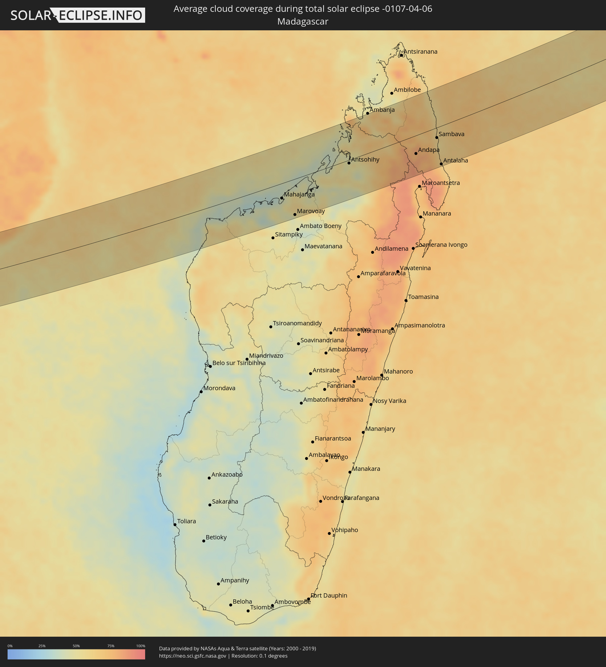 Madagaskar
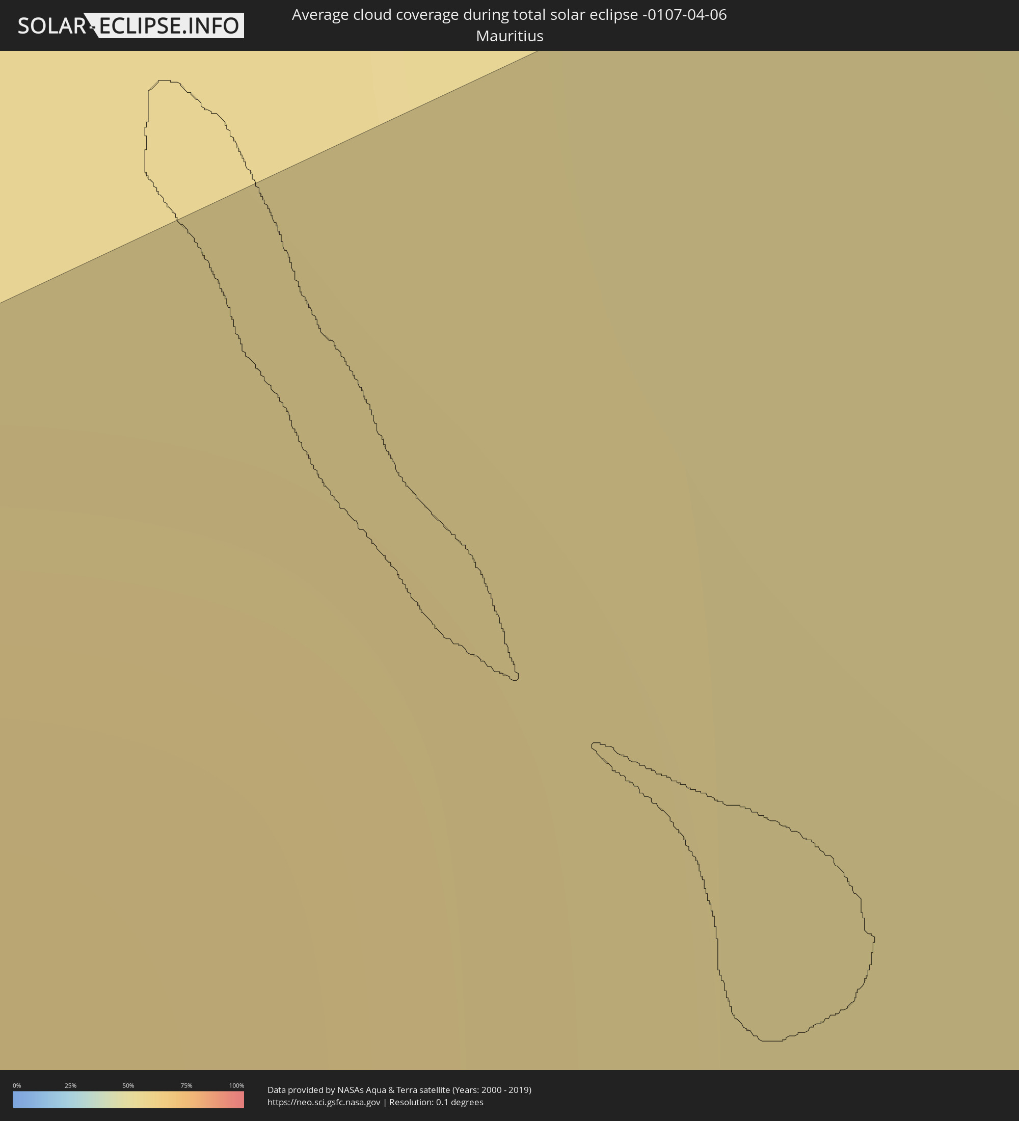 Mauritius
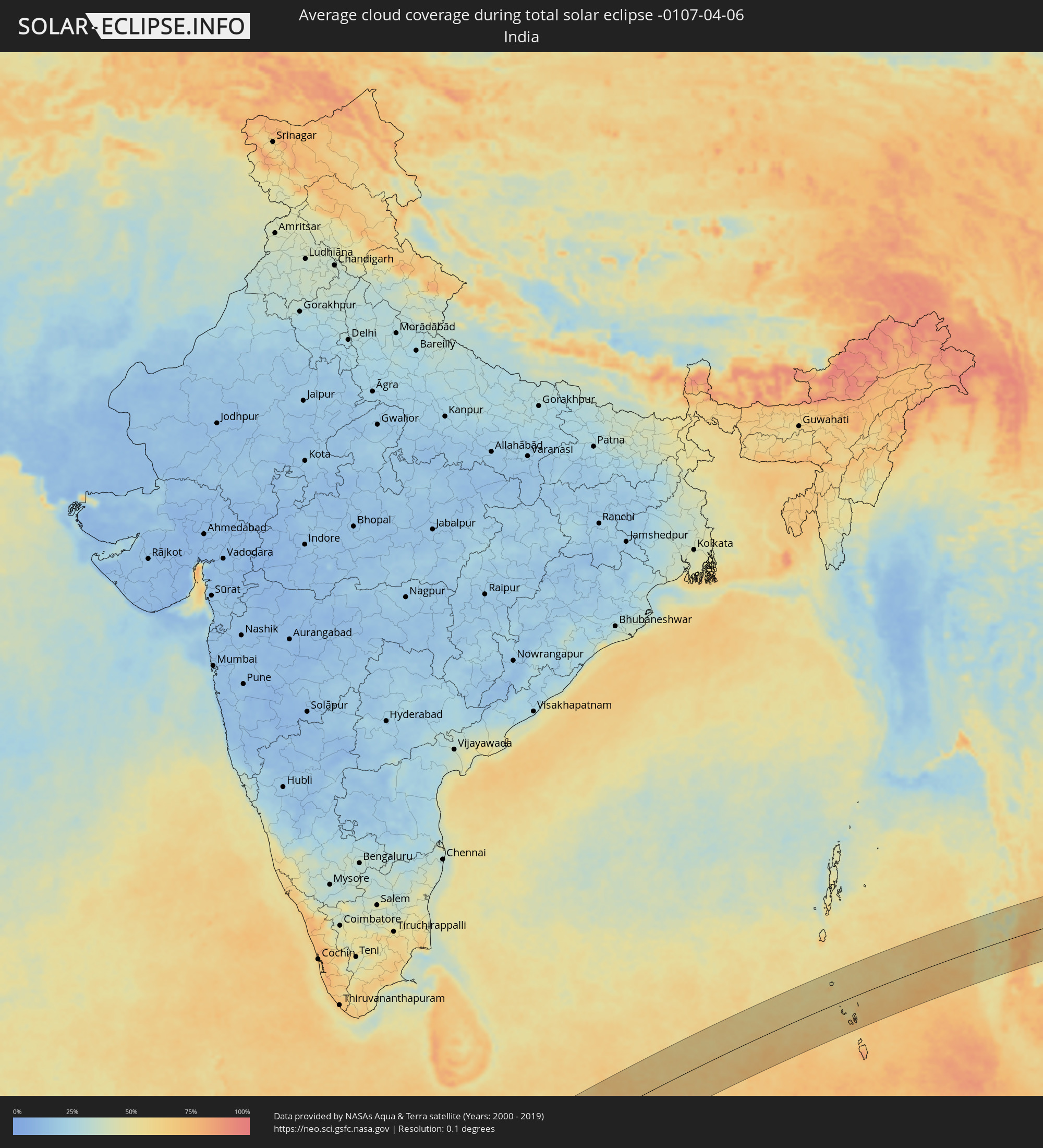 Indien
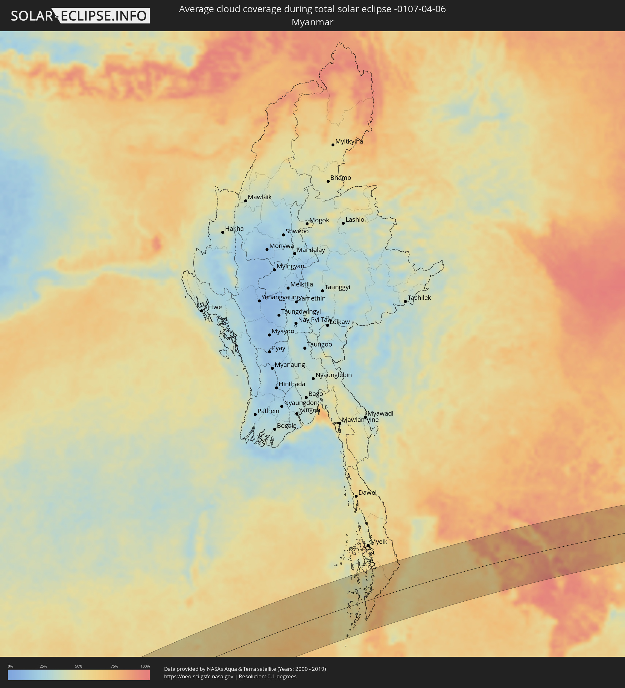 Myanmar
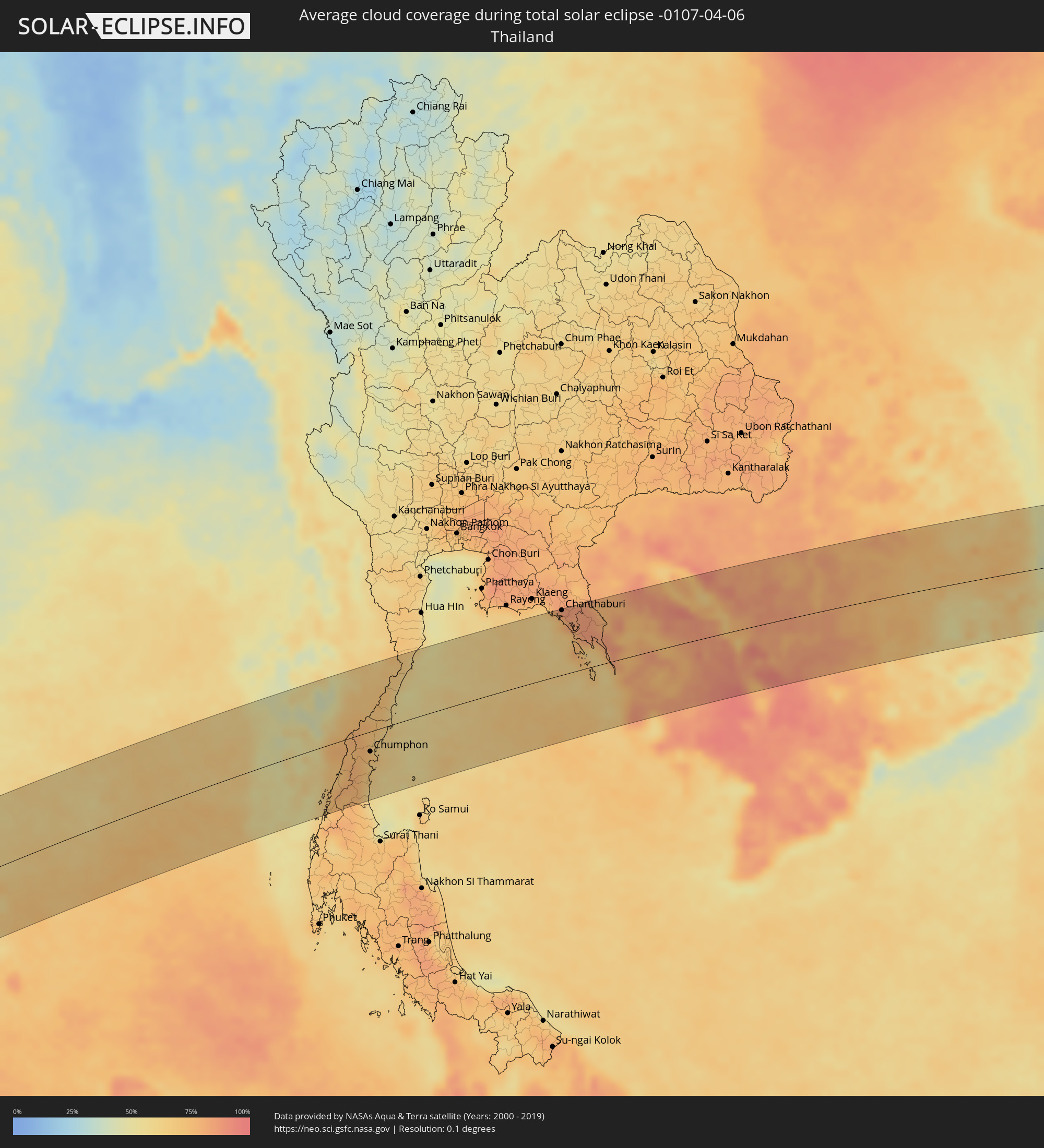 Thailand
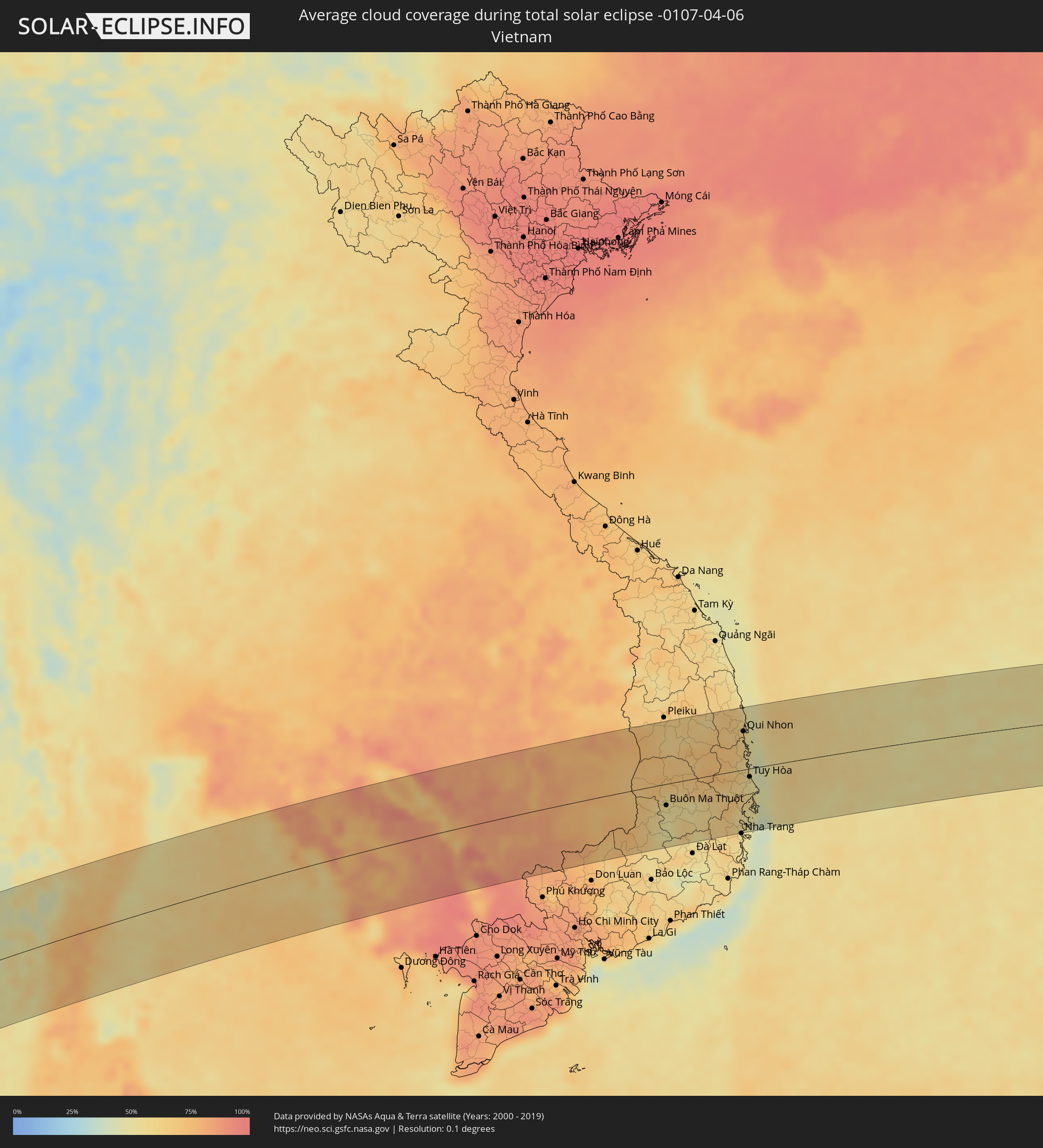 Vietnam
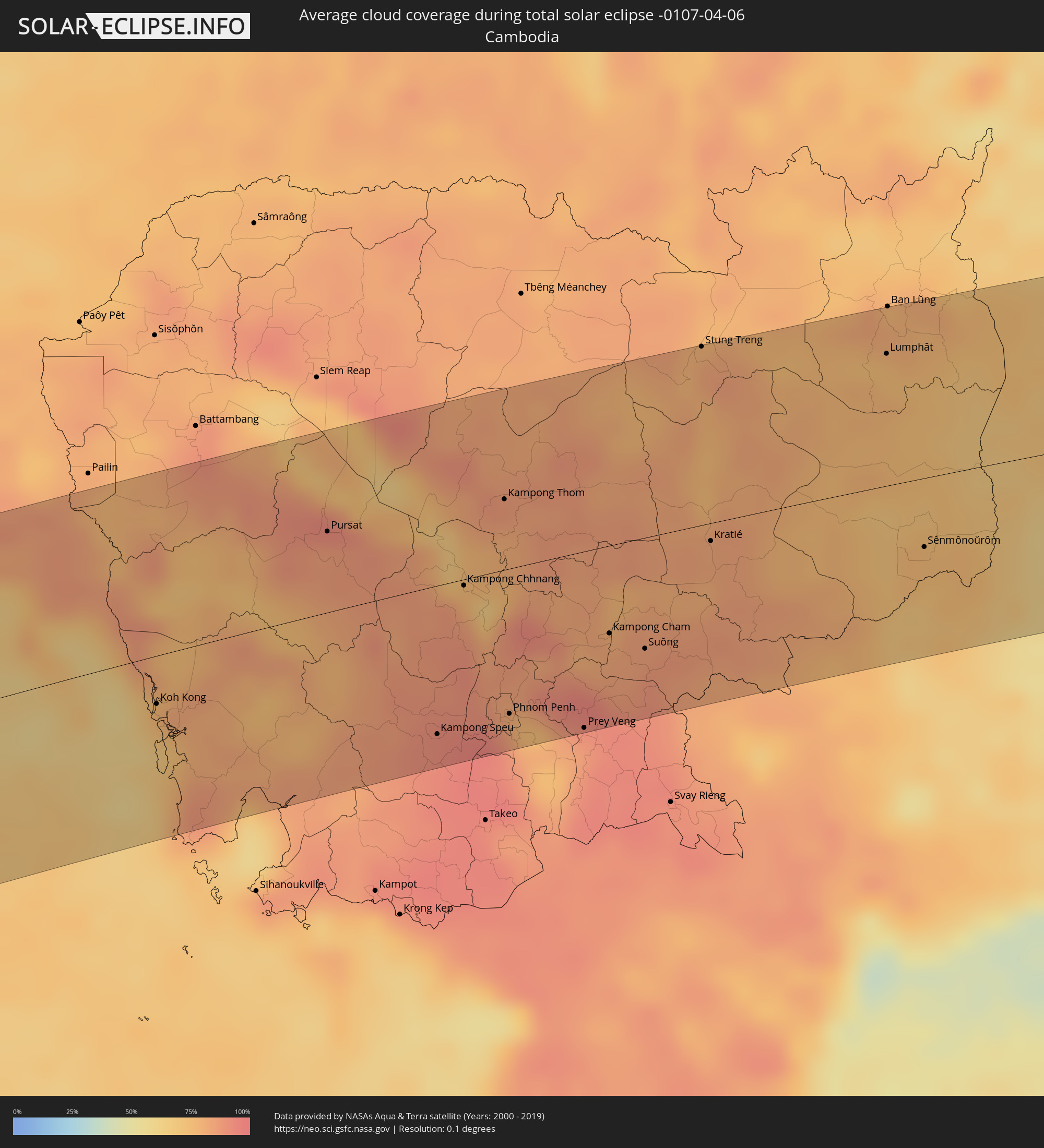 Kambodscha
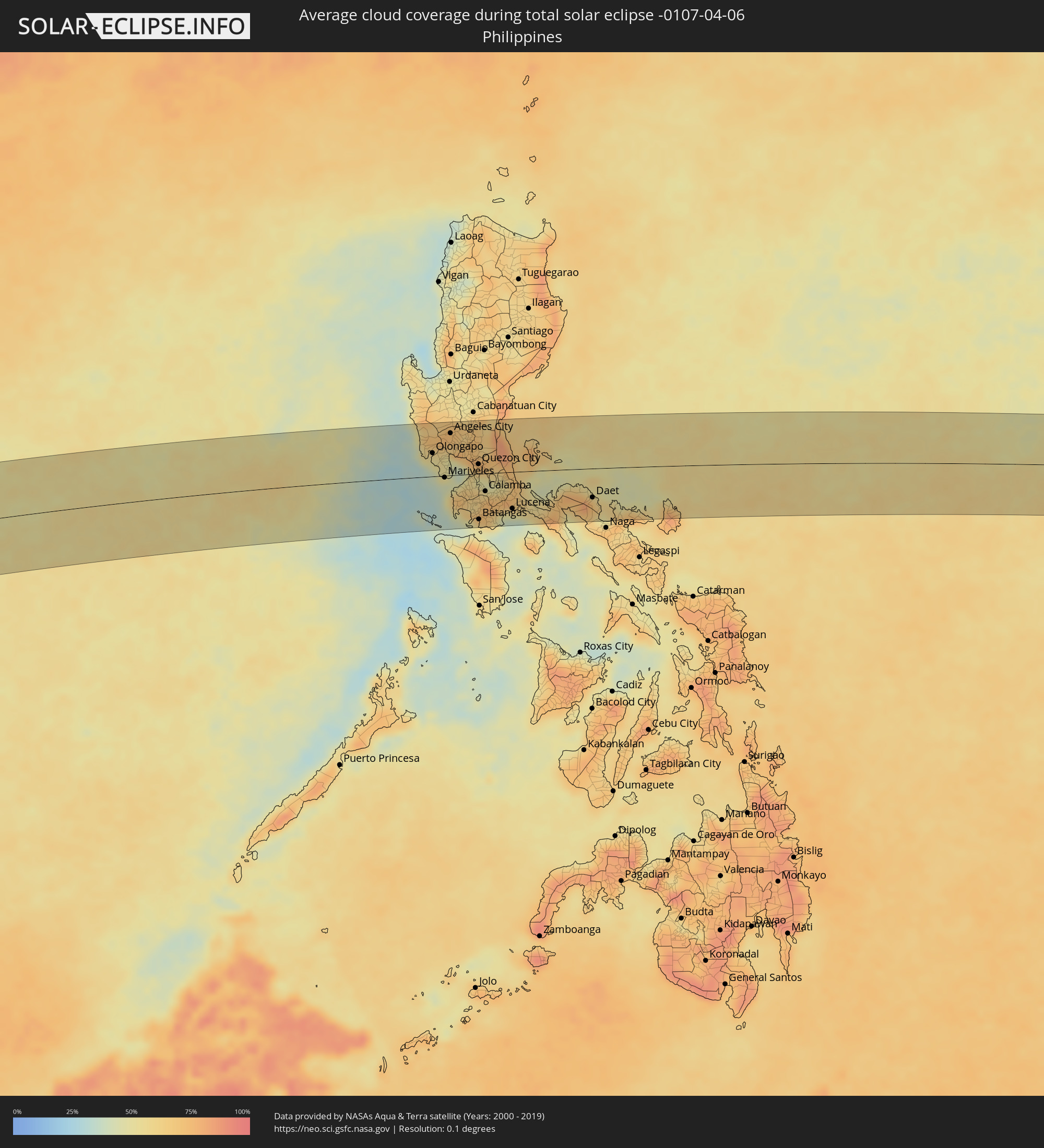 Philippinen
Orte im Finsternispfad
Die nachfolgene Tabelle zeigt Städte und Orte mit mehr als 5.000 Einwohnern, die sich im Finsternispfad befinden. Städte mit mehr als 100.000 Einwohnern sind dick gekennzeichnet. Mit einem Klick auf den Ort öffnet sich eine Detailkarte die die Lage des jeweiligen Ortes zusammen mit dem Verlauf der zentralen Finsternis präsentiert.
| Ort | Typ | Dauer der Verfinsterung | Ortszeit bei maximaler Verfinsterung | Entfernung zur Zentrallinie | Ø Bewölkung |
|
Otjiwarongo, Otjozondjupa
|
total | - | 06:34:34 UTC+01:30 | 81 km | 45% |
|
Okakarara, Otjozondjupa
|
total | - | 06:34:35 UTC+01:30 | 60 km | 38% |
|
Maun, North-West
|
total | - | 07:15:37 UTC+02:10 | 50 km | 41% |
|
Rakops, Central
|
total | - | 07:15:49 UTC+02:10 | 79 km | 39% |
|
Chimoio, Manica
|
total | - | 07:19:29 UTC+02:10 | 41 km | 70% |
|
Quelimane, Zambézia
|
total | - | 07:21:50 UTC+02:10 | 12 km | 61% |
|
Mahajanga, Boeny
|
total | - | 07:48:01 UTC+02:27 | 38 km | 43% |
|
Marovoay, Boeny
|
total | - | 07:48:11 UTC+02:27 | 90 km | 43% |
|
Antsohihy, Sofia
|
total | - | 07:50:22 UTC+02:27 | 8 km | 50% |
|
Bealanana, Sofia
|
total | - | 07:51:29 UTC+02:27 | 1 km | 63% |
|
Andapa, Sava
|
total | - | 07:52:34 UTC+02:27 | 46 km | 83% |
|
Ambodivoara, Sava
|
total | - | 07:53:11 UTC+02:27 | 26 km | 72% |
|
Sambava, Sava
|
total | - | 07:53:28 UTC+02:27 | 26 km | 54% |
|
Ampahana, Sava
|
total | - | 07:53:14 UTC+02:27 | 78 km | 67% |
|
Antalaha, Sava
|
total | - | 07:53:13 UTC+02:27 | 96 km | 65% |
|
Ranong, Ranong
|
total | - | 14:27:20 UTC+06:42 | 70 km | 71% |
|
Ban Nam Yuen, Chumphon
|
total | - | 14:27:44 UTC+06:42 | 87 km | 75% |
|
Lang Suan, Chumphon
|
total | - | 14:28:15 UTC+06:42 | 87 km | 66% |
|
Chumphon, Chumphon
|
total | - | 14:28:57 UTC+06:42 | 32 km | 71% |
|
Bang Saphan, Prachuap Khiri Khan
|
total | - | 14:30:16 UTC+06:42 | 33 km | 60% |
|
Prachuap Khiri Khan, Prachuap Khiri Khan
|
total | - | 14:31:20 UTC+06:42 | 89 km | 59% |
|
Laem Sing, Chanthaburi
|
total | - | 14:36:17 UTC+06:42 | 91 km | 75% |
|
Chanthaburi, Chanthaburi
|
total | - | 14:36:26 UTC+06:42 | 104 km | 83% |
|
Khlung, Chanthaburi
|
total | - | 14:36:33 UTC+06:42 | 84 km | 81% |
|
Trat, Trat
|
total | - | 14:36:56 UTC+06:42 | 53 km | 70% |
|
Bo Rai, Trat
|
total | - | 14:37:13 UTC+06:42 | 88 km | 85% |
|
Koh Kong, Koh Kong
|
total | - | 14:37:21 UTC+06:42 | 28 km | 71% |
|
Smach Mean Chey, Koh Kong
|
total | - | 14:37:24 UTC+06:42 | 37 km | 65% |
|
Pursat, Pursat
|
total | - | 14:39:42 UTC+06:42 | 47 km | 86% |
|
Kampong Speu, Kampong Speu
|
total | - | 14:40:02 UTC+06:42 | 86 km | 91% |
|
Kampong Chhnang, Kampong Chhnang
|
total | - | 14:40:50 UTC+06:42 | 4 km | 77% |
|
Kampong Thom, Kampong Thom
|
total | - | 14:41:32 UTC+06:42 | 41 km | 86% |
|
Phnom Penh, Phnom Penh
|
total | - | 14:40:49 UTC+06:42 | 84 km | 87% |
|
Ta Khmau, Kandal
|
total | - | 14:40:49 UTC+06:42 | 94 km | 81% |
|
Prey Veng, Prey Veng
|
total | - | 14:41:29 UTC+06:42 | 103 km | 84% |
|
Kampong Cham, Kampong Cham
|
total | - | 14:42:04 UTC+06:42 | 51 km | 83% |
|
Suŏng, Tboung Khmum
|
total | - | 14:42:21 UTC+06:42 | 65 km | 88% |
|
Stung Treng, Stung Treng
|
total | - | 14:43:51 UTC+06:42 | 104 km | 82% |
|
Kratié, Kratie
|
total | - | 14:43:19 UTC+06:42 | 10 km | 82% |
|
Lumphăt, Ratanakiri
|
total | - | 14:45:29 UTC+06:42 | 77 km | 74% |
|
Sênmônoŭrôm, Mondolkiri
|
total | - | 14:45:14 UTC+06:42 | 40 km | 75% |
|
Gia Nghĩa, Ðắk Nông
|
total | - | 15:10:23 UTC+07:06 | 100 km | 57% |
|
Buôn Ma Thuột, Ðắc Lắk
|
total | - | 15:11:19 UTC+07:06 | 35 km | 54% |
|
Sông Cầu, Phú Yên
|
total | - | 15:13:33 UTC+07:06 | 28 km | 61% |
|
Qui Nhon, Bình Định
|
total | - | 15:13:42 UTC+07:06 | 63 km | 61% |
|
Tuy Hòa, Phú Yên
|
total | - | 15:13:31 UTC+07:06 | 14 km | 54% |
|
Olongapo, Central Luzon
|
total | - | 16:20:39 UTC+08:00 | 42 km | 52% |
|
Dinalupihan, Central Luzon
|
total | - | 16:20:49 UTC+08:00 | 46 km | 56% |
|
Mariveles, Central Luzon
|
total | - | 16:20:45 UTC+08:00 | 3 km | 43% |
|
Balanga, Central Luzon
|
total | - | 16:20:51 UTC+08:00 | 23 km | 50% |
|
Angeles City, Central Luzon
|
total | - | 16:20:59 UTC+08:00 | 76 km | 72% |
|
Capas, Central Luzon
|
total | - | 16:21:02 UTC+08:00 | 96 km | 71% |
|
San Fernando, Central Luzon
|
total | - | 16:21:03 UTC+08:00 | 61 km | 68% |
|
Arayat, Central Luzon
|
total | - | 16:21:09 UTC+08:00 | 75 km | 62% |
|
Malolos, Central Luzon
|
total | - | 16:21:08 UTC+08:00 | 40 km | 68% |
|
Baliuag, Central Luzon
|
total | - | 16:21:14 UTC+08:00 | 52 km | 71% |
|
Cavite City, Calabarzon
|
total | - | 16:21:08 UTC+08:00 | 0 km | 58% |
|
Dasmariñas, Calabarzon
|
total | - | 16:21:08 UTC+08:00 | 18 km | 64% |
|
Gapan, Central Luzon
|
total | - | 16:21:20 UTC+08:00 | 91 km | 69% |
|
San Miguel, Central Luzon
|
total | - | 16:21:20 UTC+08:00 | 72 km | 73% |
|
San Jose del Monte, Central Luzon
|
total | - | 16:21:20 UTC+08:00 | 35 km | 76% |
|
Quezon City, Metro Manila
|
total | - | 16:21:18 UTC+08:00 | 17 km | 65% |
|
Batangas, Calabarzon
|
total | - | 16:21:06 UTC+08:00 | 82 km | 71% |
|
Lipa City, Calabarzon
|
total | - | 16:21:14 UTC+08:00 | 62 km | 69% |
|
Calamba, Calabarzon
|
total | - | 16:21:18 UTC+08:00 | 32 km | 67% |
|
Binangonan, Calabarzon
|
total | - | 16:21:23 UTC+08:00 | 4 km | 53% |
|
Rodriguez, Calabarzon
|
total | - | 16:21:27 UTC+08:00 | 29 km | 73% |
|
San Pablo, Calabarzon
|
total | - | 16:21:25 UTC+08:00 | 49 km | 74% |
|
Santa Cruz, Calabarzon
|
total | - | 16:21:33 UTC+08:00 | 26 km | 57% |
|
Lucena, Calabarzon
|
total | - | 16:21:38 UTC+08:00 | 66 km | 51% |
|
Daet, Bicol
|
total | - | 16:22:48 UTC+08:00 | 52 km | 61% |