Totale Sonnenfinsternis vom 25.09.-0386
| Wochentag: | Dienstag |
| Maximale Dauer der Verfinsterung: | 03m19s |
| Maximale Breite des Finsternispfades: | 125 km |
| Saroszyklus: | 57 |
| Bedeckungsgrad: | 100% |
| Magnitude: | 1.0357 |
| Gamma: | -0.2886 |
Wo kann man die Sonnenfinsternis vom 25.09.-0386 sehen?
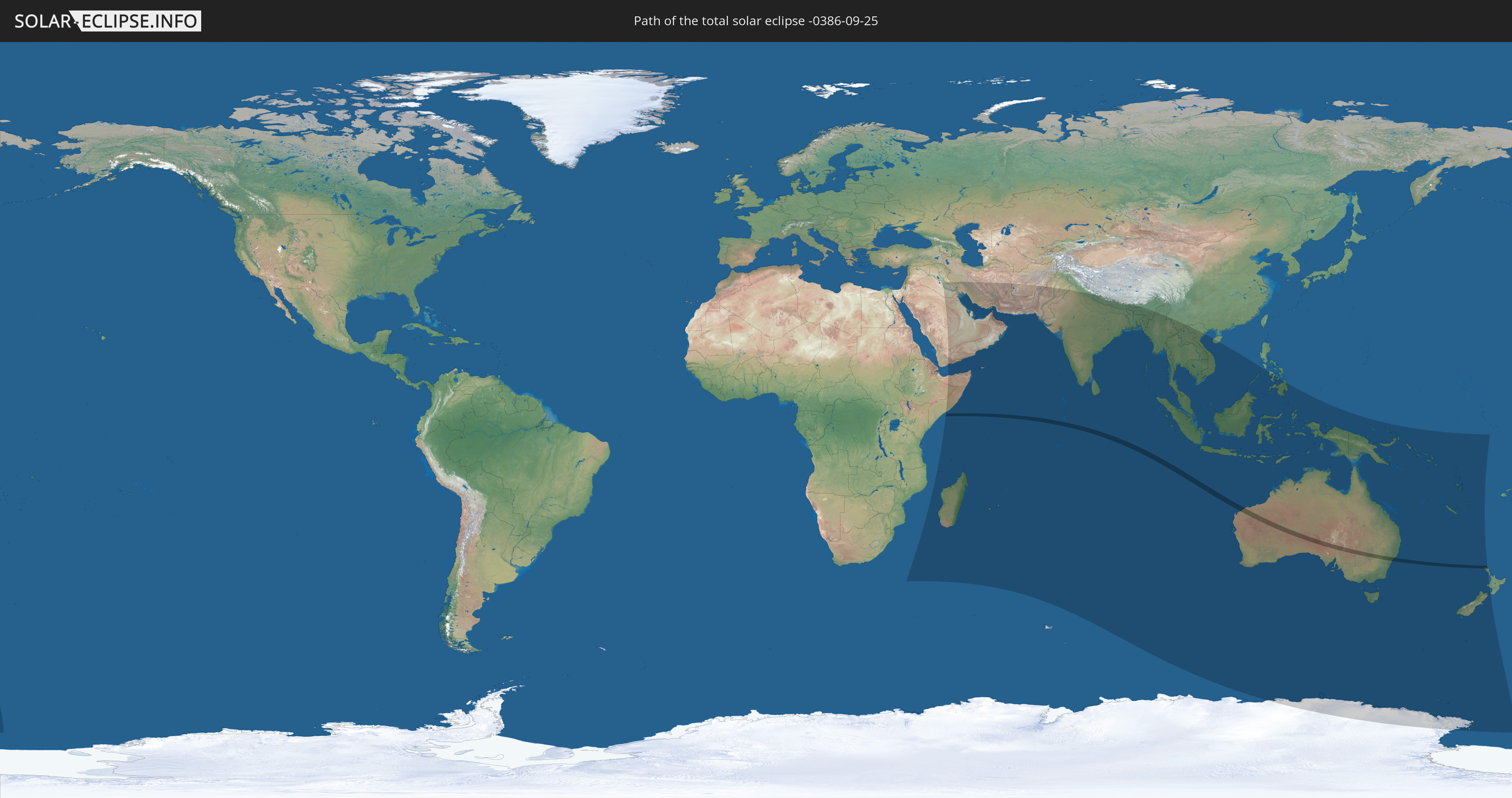
Die Sonnenfinsternis am 25.09.-0386 kann man in 50 Ländern als partielle Sonnenfinsternis beobachten.
Der Finsternispfad verläuft durch 3 Länder. Nur in diesen Ländern ist sie als totale Sonnenfinsternis zu sehen.
In den folgenden Ländern ist die Sonnenfinsternis total zu sehen
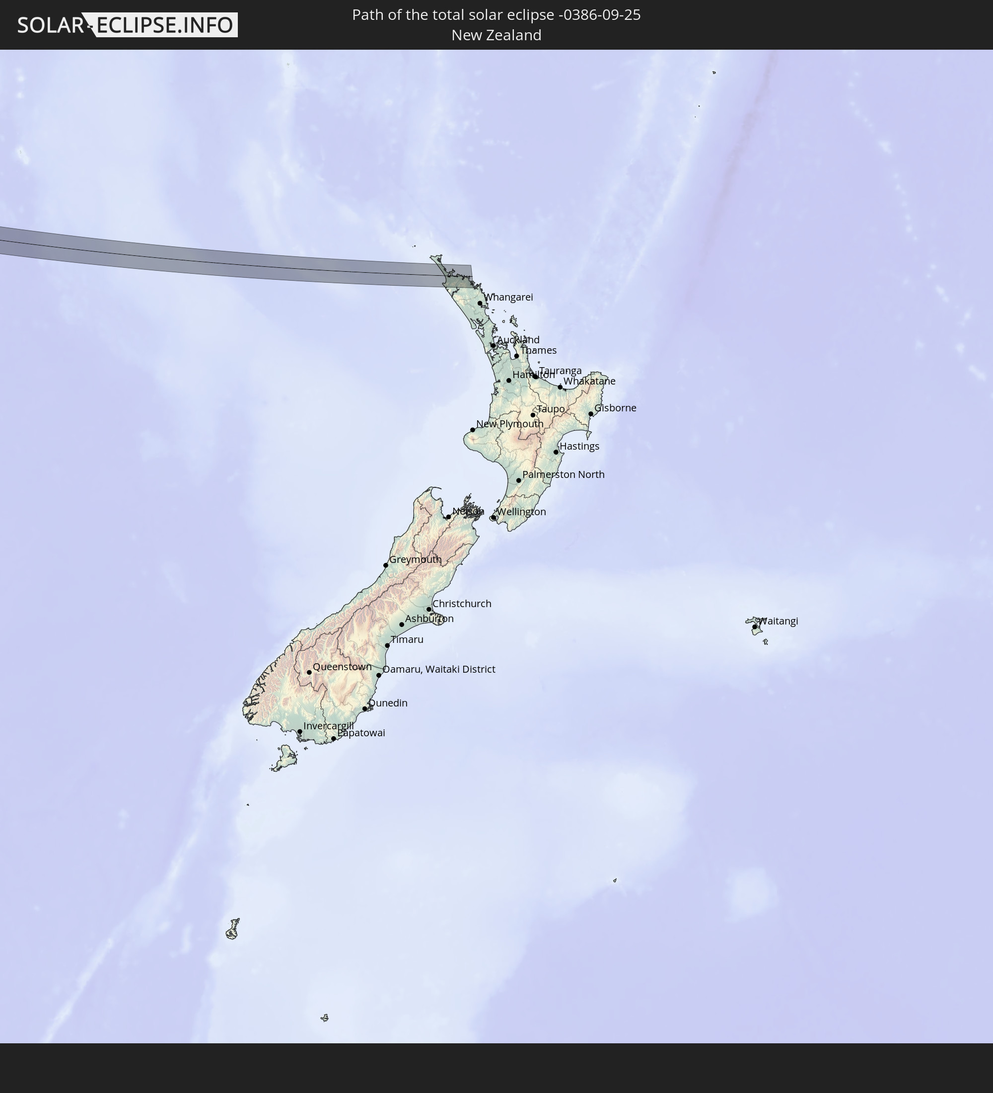 Neuseeland
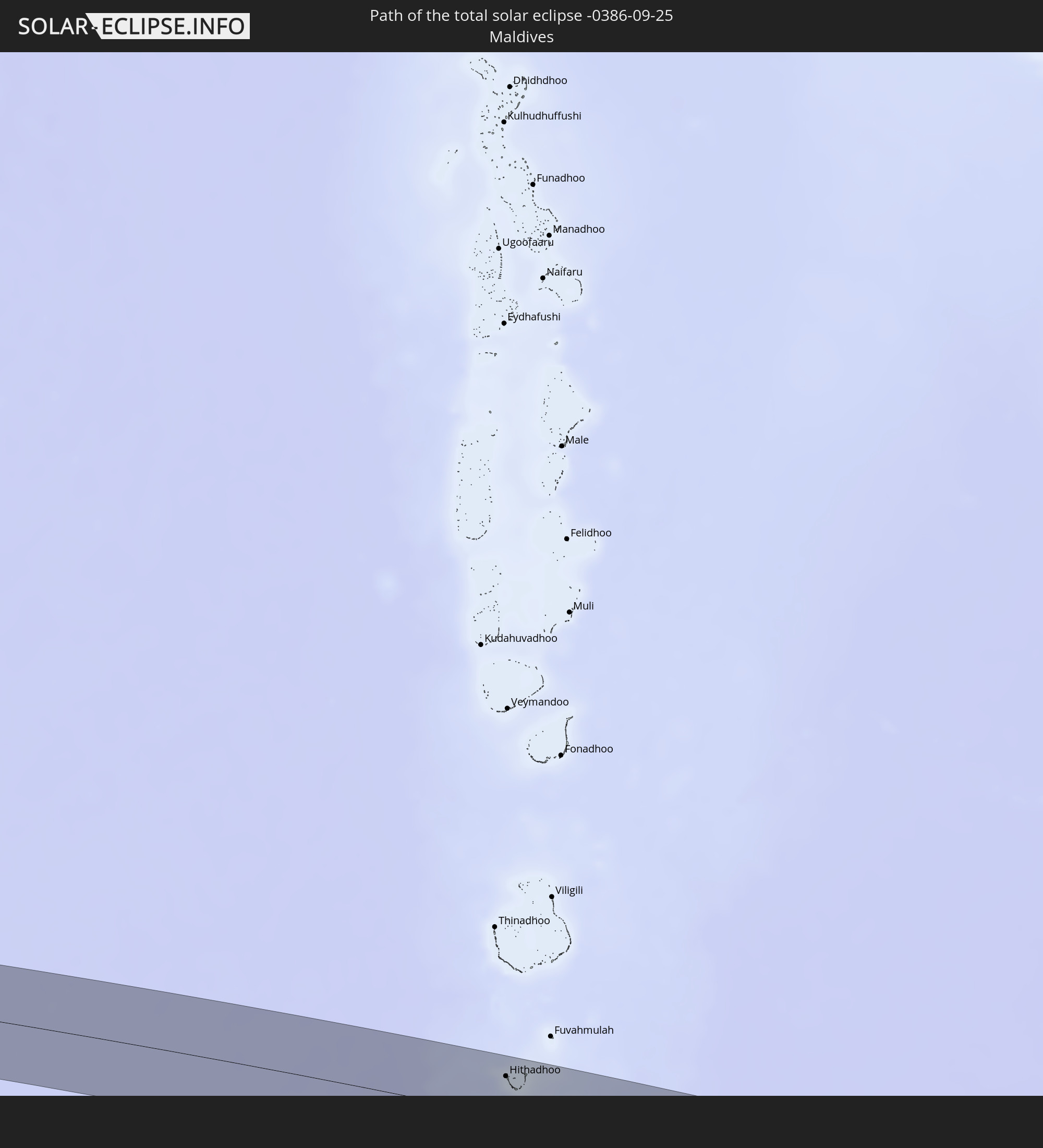 Malediven
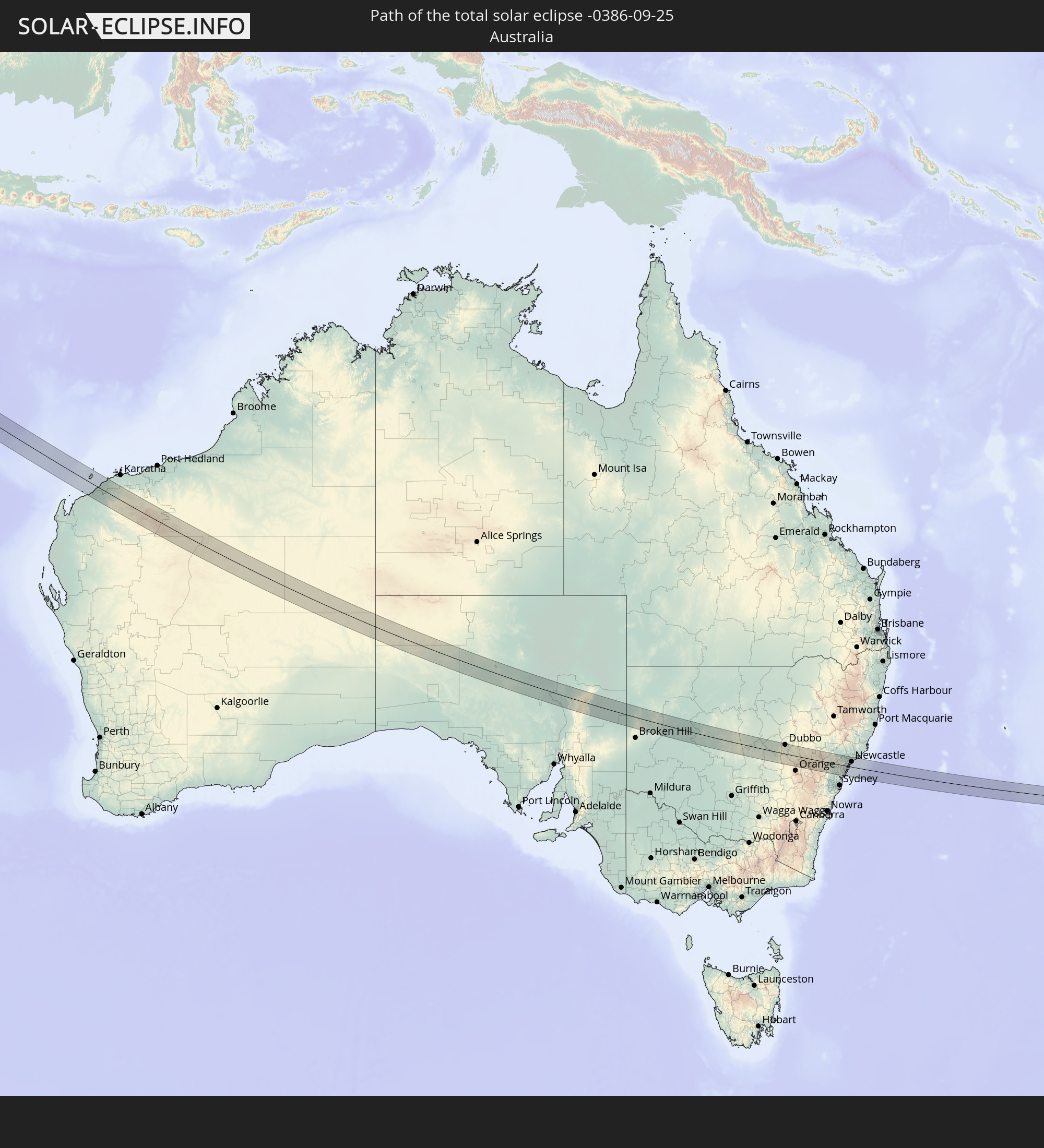 Australien
In den folgenden Ländern ist die Sonnenfinsternis partiell zu sehen
 Antarktika
 Neuseeland
 Äthiopien
 Saudi-Arabien
 Irak
Irak
 Französische Süd- und Antarktisgebiete
 Somalia
 Jemen
Jemen
 Madagaskar
 Komoren
 Iran
Iran
 Mayotte
 Seychellen
 Kuwait
 Bahrain
 Katar
Katar
 Vereinigte Arabische Emirate
 Oman
Oman
 Réunion
 Mauritius
 Afghanistan
 Pakistan
 Indien
 Britisches Territorium im Indischen Ozean
 Malediven
 Volksrepublik China
 Sri Lanka
 Nepal
Nepal
 Bangladesch
 Bhutan
 Myanmar
 Indonesien
 Kokosinseln
 Thailand
 Malaysia
 Laos
Laos
 Vietnam
 Kambodscha
 Singapur
 Weihnachtsinsel
 Australien
 Brunei
 Philippinen
 Osttimor
 Palau
Palau
 Papua-Neuguinea
 Salomonen
 Neukaledonien
 Vanuatu
 Norfolkinsel
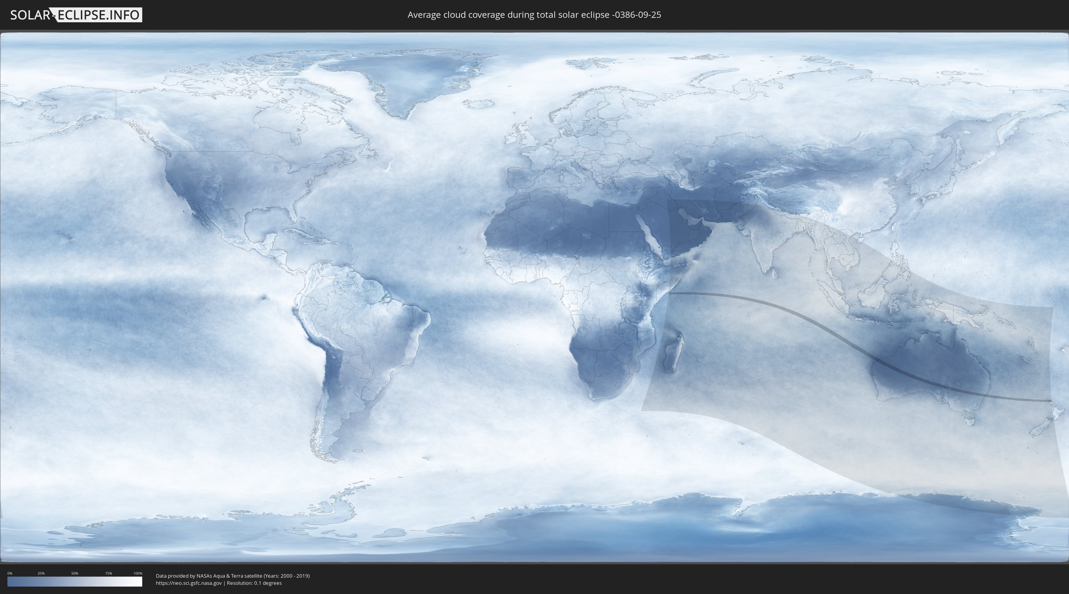
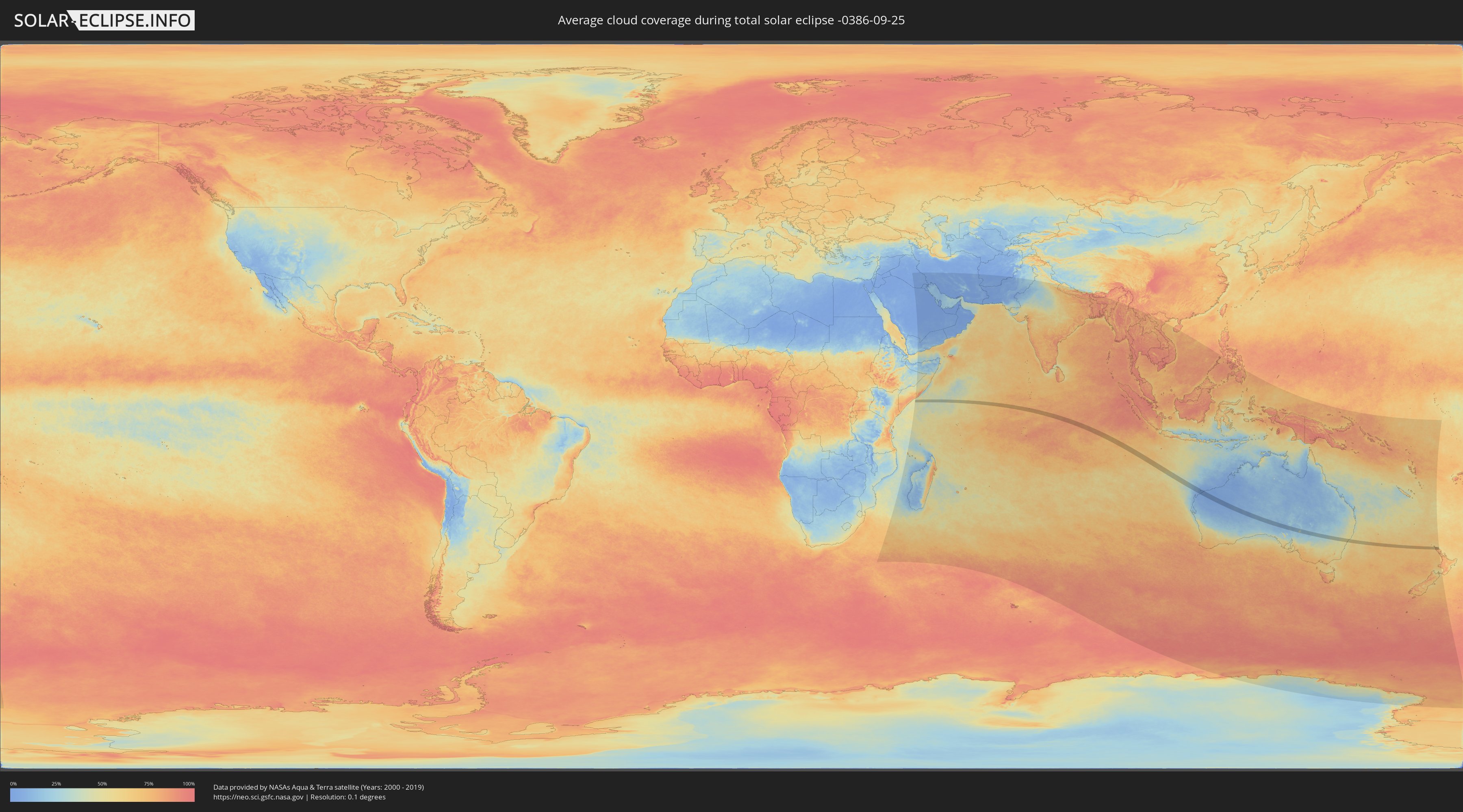
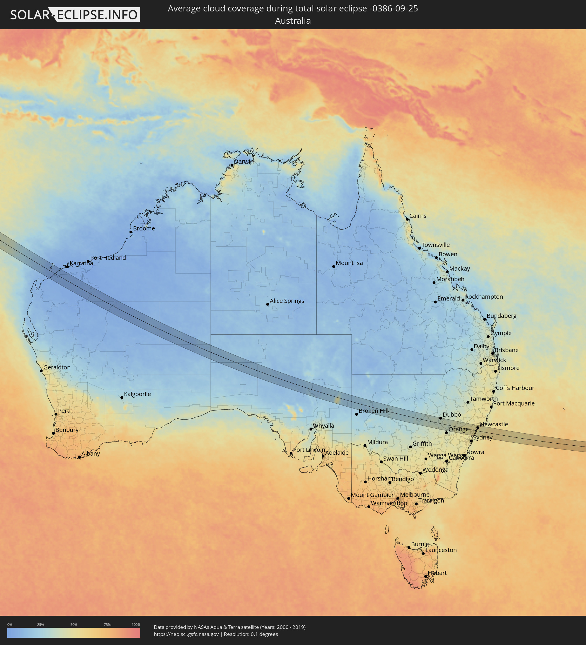
Wie wird das Wetter während der totalen Sonnenfinsternis am 25.09.-0386?
Wo ist der beste Ort, um die totale Sonnenfinsternis vom 25.09.-0386 zu beobachten?
Die folgenden Karten zeigen die durchschnittliche Bewölkung für den Tag, an dem die totale Sonnenfinsternis
stattfindet. Mit Hilfe der Karten lässt sich der Ort entlang des Finsternispfades eingrenzen,
der die besten Aussichen auf einen klaren wolkenfreien Himmel bietet.
Trotzdem muss man immer lokale Gegenenheiten beachten und sollte sich genau über das Wetter an seinem
gewählten Beobachtungsort informieren.
Die Daten stammen von den beiden NASA-Satelliten
AQUA und TERRA
und wurden über einen Zeitraum von 19 Jahren (2000 - 2019) gemittelt.
Detaillierte Länderkarten
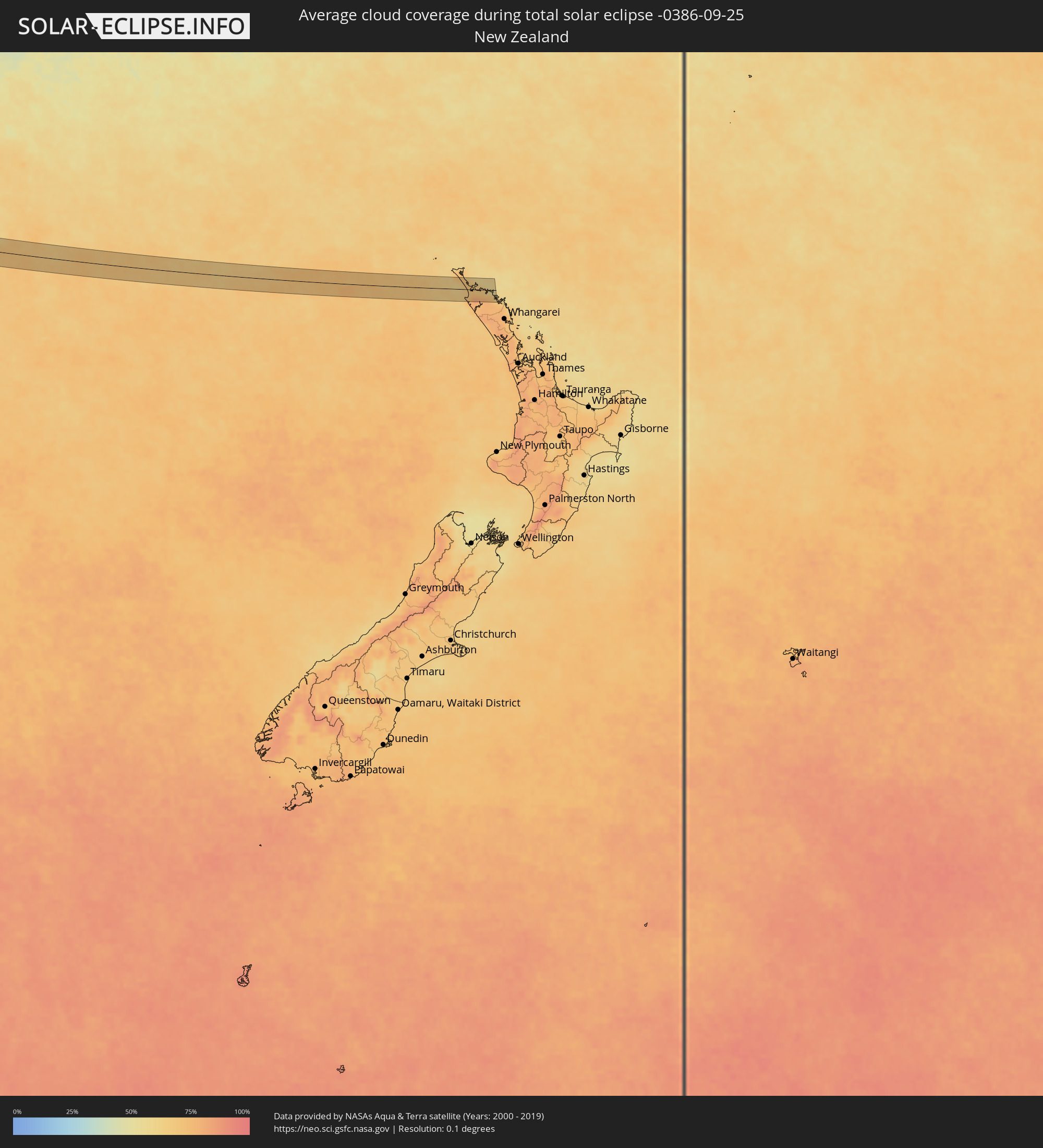 Neuseeland
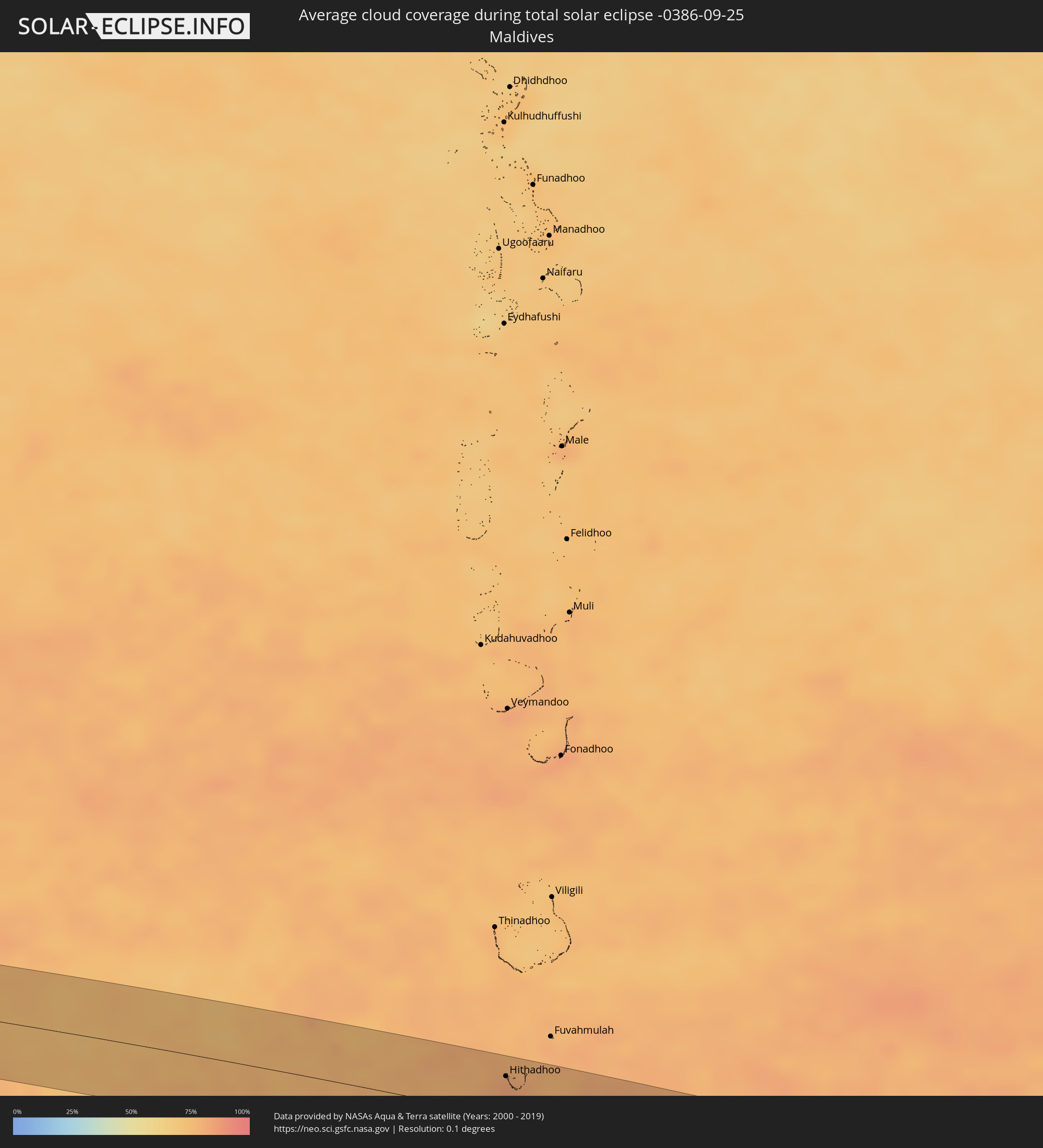 Malediven
 Australien
Orte im Finsternispfad
Die nachfolgene Tabelle zeigt Städte und Orte mit mehr als 5.000 Einwohnern, die sich im Finsternispfad befinden. Städte mit mehr als 100.000 Einwohnern sind dick gekennzeichnet. Mit einem Klick auf den Ort öffnet sich eine Detailkarte die die Lage des jeweiligen Ortes zusammen mit dem Verlauf der zentralen Finsternis präsentiert.
| Ort | Typ | Dauer der Verfinsterung | Ortszeit bei maximaler Verfinsterung | Entfernung zur Zentrallinie | Ø Bewölkung |
|
Hithadhoo
|
total | - | 08:04:10 UTC+04:54 | 33 km | 82% |
|
Newman, Western Australia
|
total | - | 13:21:02 UTC+08:00 | 3 km | 3% |
|
Dubbo, New South Wales
|
total | - | 16:05:52 UTC+10:00 | 40 km | 37% |
|
Wellington, New South Wales
|
total | - | 16:06:03 UTC+10:00 | 12 km | 39% |
|
Mudgee, New South Wales
|
total | - | 16:06:33 UTC+10:00 | 20 km | 43% |
|
Narara, New South Wales
|
total | - | 16:07:36 UTC+10:00 | 37 km | 50% |
|
Cessnock, New South Wales
|
total | - | 16:07:47 UTC+10:00 | 26 km | 53% |
|
Lisarow, New South Wales
|
total | - | 16:07:37 UTC+10:00 | 34 km | 50% |
|
Berkeley Vale, New South Wales
|
total | - | 16:07:41 UTC+10:00 | 30 km | 50% |
|
Bateau Bay, New South Wales
|
total | - | 16:07:42 UTC+10:00 | 33 km | 47% |
|
Kurri Kurri, New South Wales
|
total | - | 16:07:53 UTC+10:00 | 29 km | 53% |
|
Long Jetty, New South Wales
|
total | - | 16:07:43 UTC+10:00 | 30 km | 47% |
|
Gorokan, New South Wales
|
total | - | 16:07:46 UTC+10:00 | 18 km | 50% |
|
Rutherford, New South Wales
|
total | - | 16:07:57 UTC+10:00 | 41 km | 50% |
|
Maitland, New South Wales
|
total | - | 16:07:58 UTC+10:00 | 40 km | 51% |
|
East Maitland, New South Wales
|
total | - | 16:07:58 UTC+10:00 | 39 km | 52% |
|
Rathmines, New South Wales
|
total | - | 16:07:53 UTC+10:00 | 7 km | 52% |
|
Toronto, New South Wales
|
total | - | 16:07:54 UTC+10:00 | 10 km | 52% |
|
Eleebana, New South Wales
|
total | - | 16:07:56 UTC+10:00 | 13 km | 52% |
|
Charlestown, New South Wales
|
total | - | 16:07:58 UTC+10:00 | 18 km | 51% |
|
Belmont North, New South Wales
|
total | - | 16:07:57 UTC+10:00 | 10 km | 51% |
|
Elermore Vale, New South Wales
|
total | - | 16:07:59 UTC+10:00 | 22 km | 51% |
|
Mayfield, New South Wales
|
total | - | 16:08:02 UTC+10:00 | 25 km | 51% |
|
Raymond Terrace, New South Wales
|
total | - | 16:08:05 UTC+10:00 | 41 km | 52% |
|
Newcastle, New South Wales
|
total | - | 16:08:03 UTC+10:00 | 22 km | 51% |
|
Kerikeri, Northland Region
|
total | - | 17:44:23 UTC+11:30 | 27 km | 75% |