Totale Sonnenfinsternis vom 08.02.-0932
| Wochentag: | Donnerstag |
| Maximale Dauer der Verfinsterung: | 04m38s |
| Maximale Breite des Finsternispfades: | 196 km |
| Saroszyklus: | 35 |
| Bedeckungsgrad: | 100% |
| Magnitude: | 1.0579 |
| Gamma: | -0.233 |
Wo kann man die Sonnenfinsternis vom 08.02.-0932 sehen?
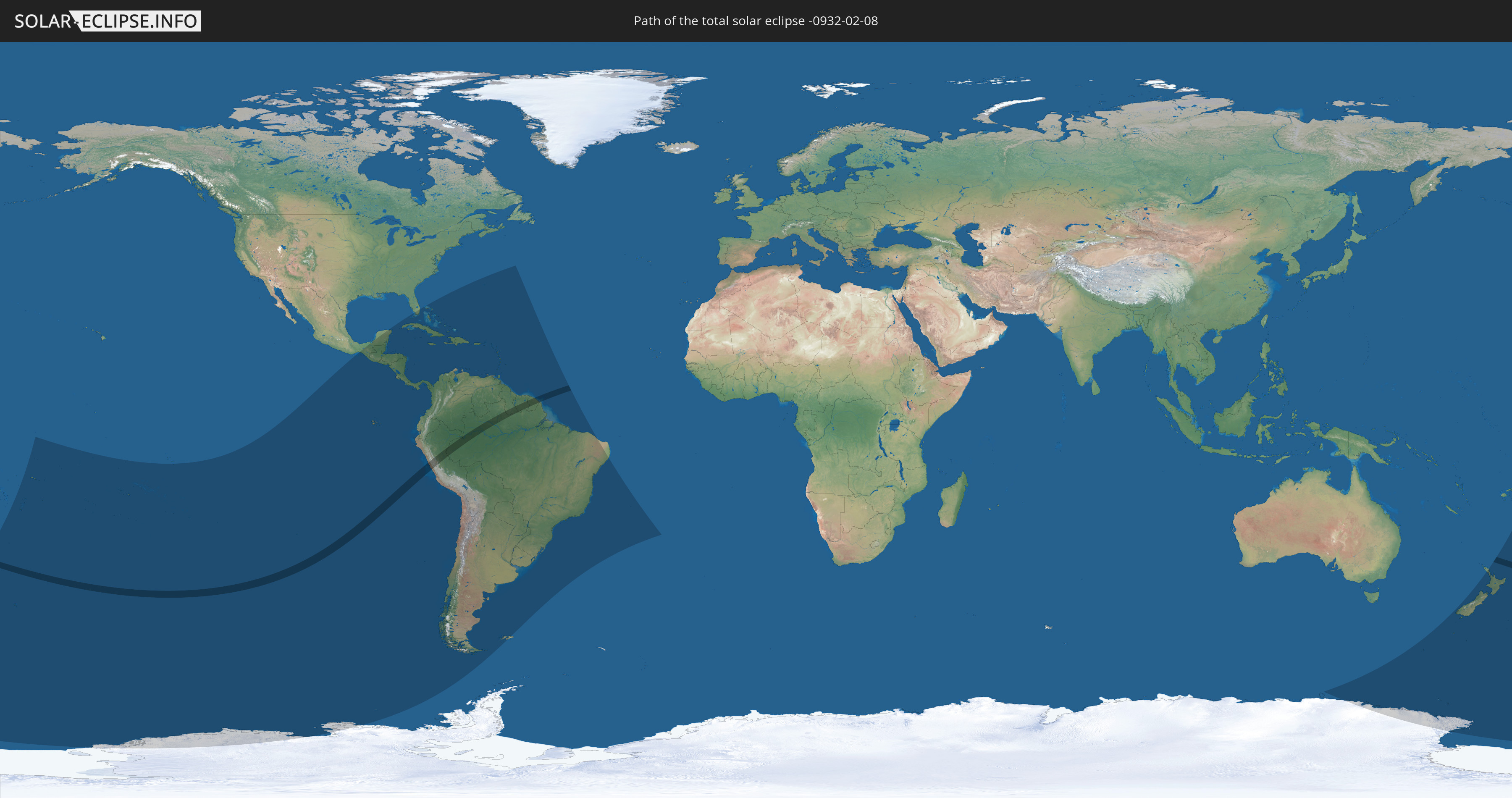
Die Sonnenfinsternis am 08.02.-0932 kann man in 62 Ländern als partielle Sonnenfinsternis beobachten.
Der Finsternispfad verläuft durch 6 Länder. Nur in diesen Ländern ist sie als totale Sonnenfinsternis zu sehen.
In den folgenden Ländern ist die Sonnenfinsternis total zu sehen
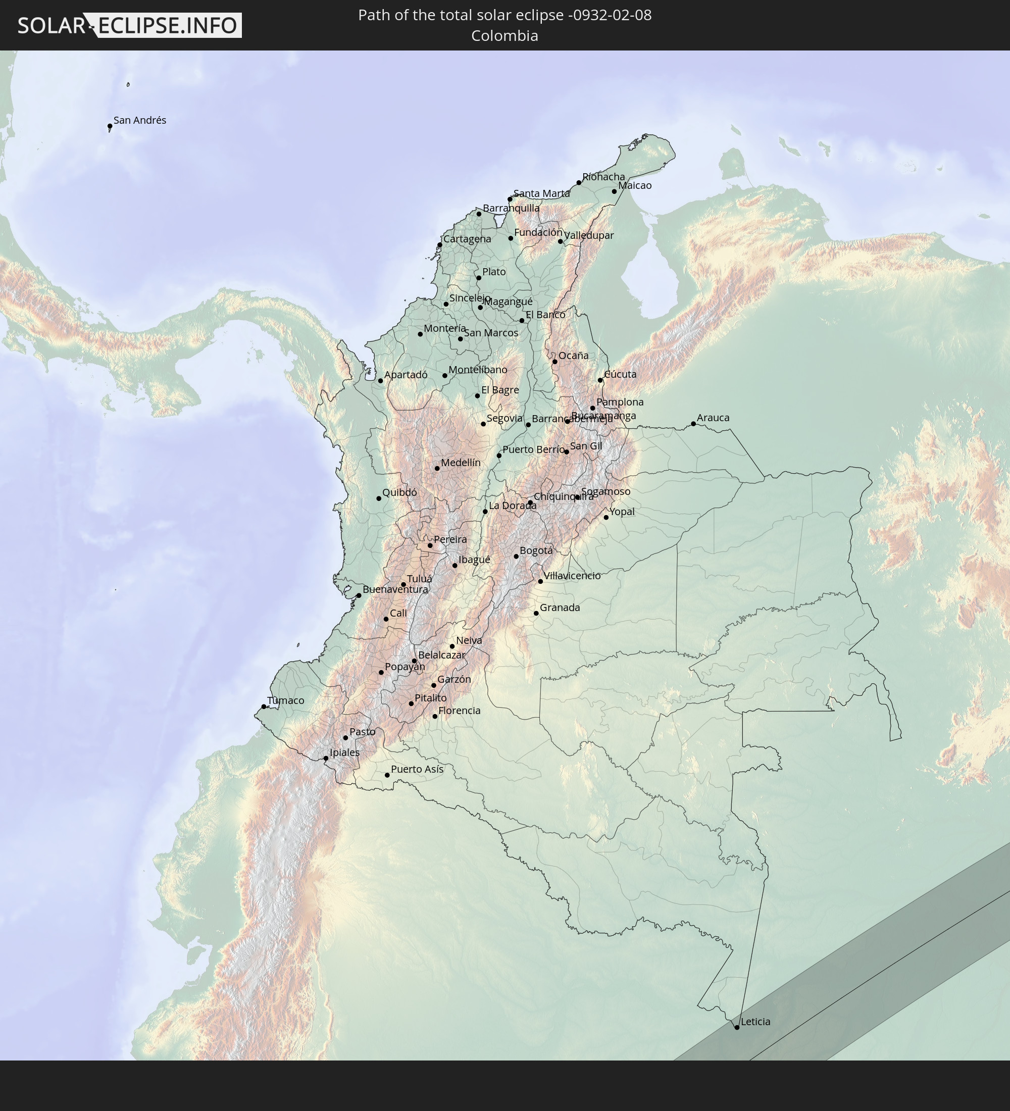 Kolumbien
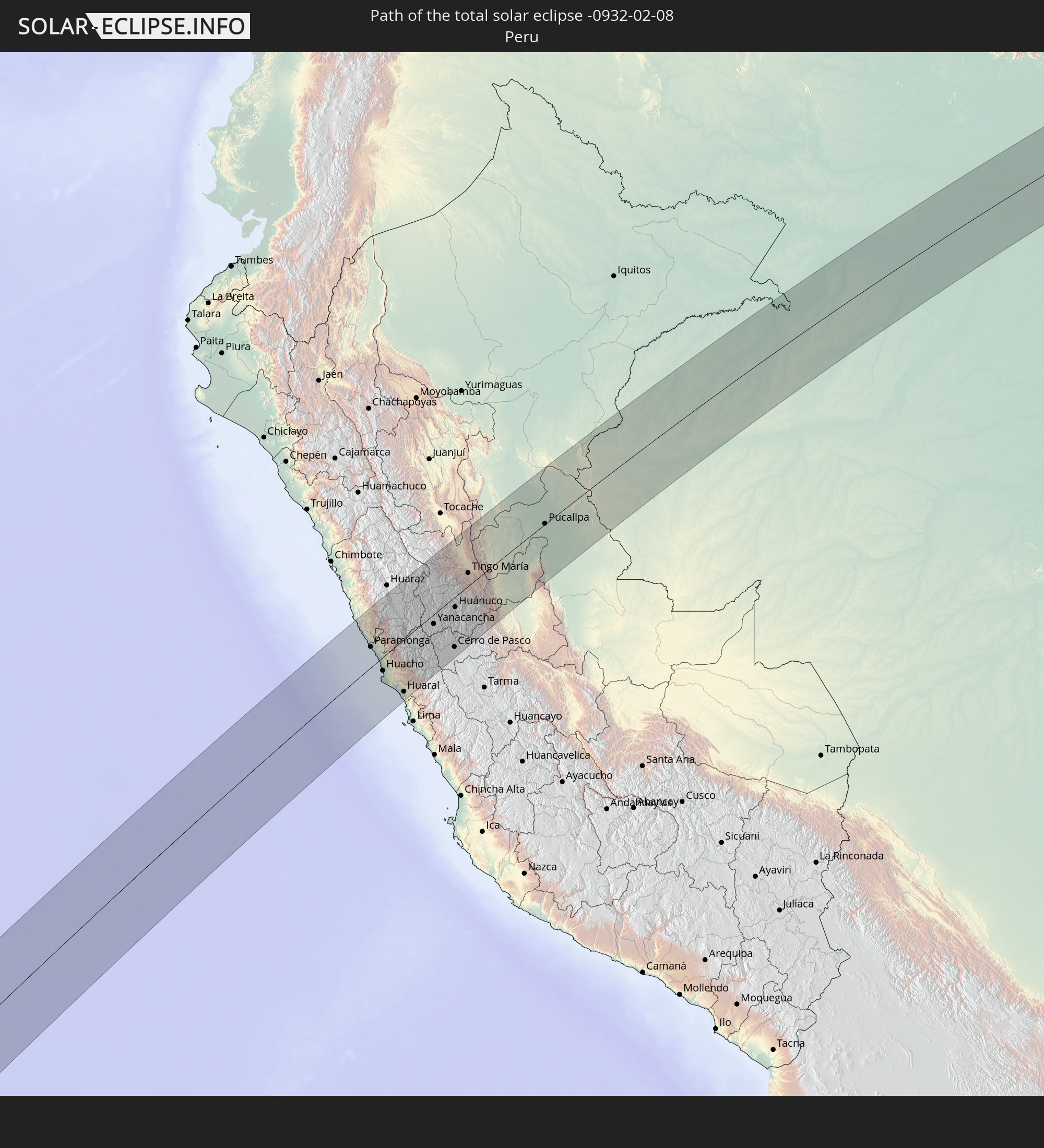 Peru
Peru
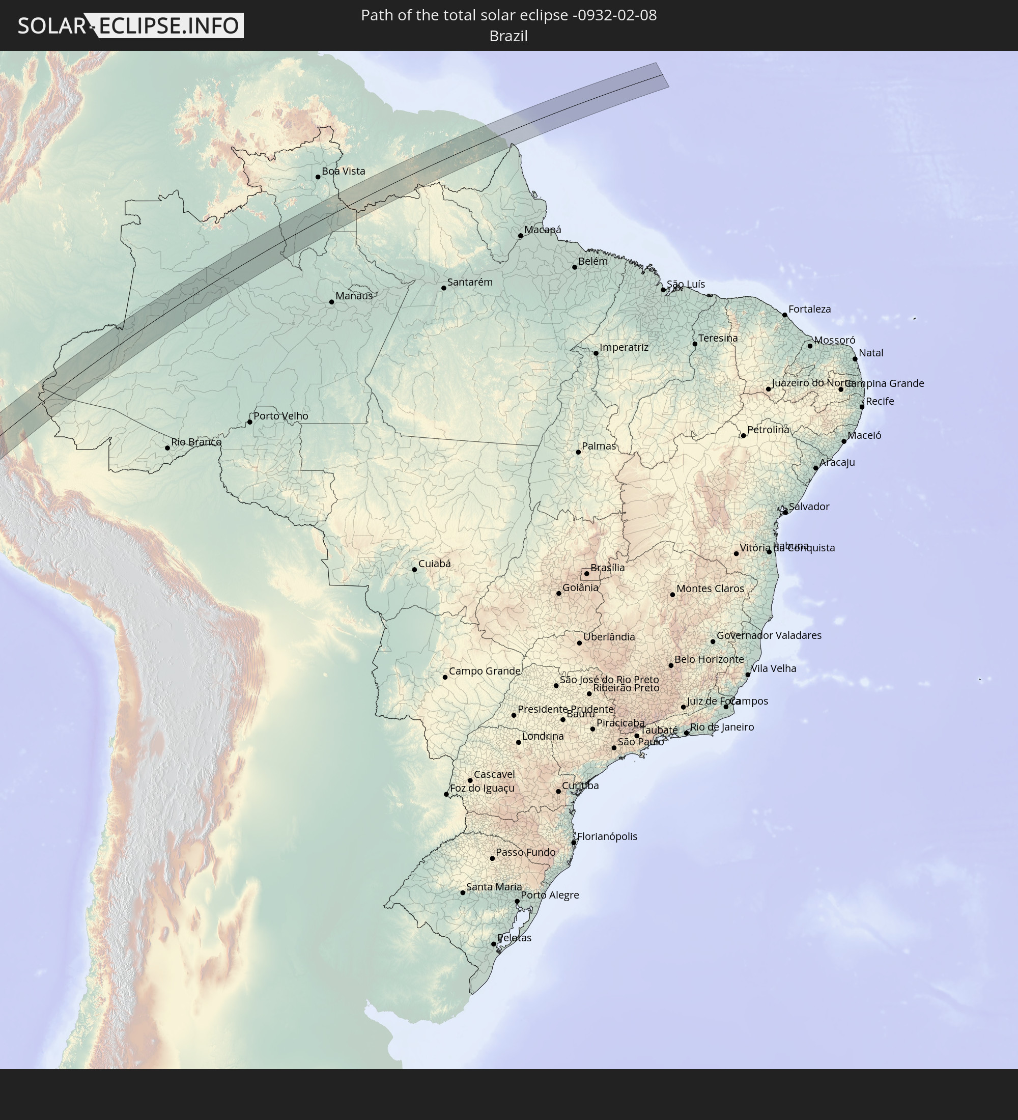 Brasilien
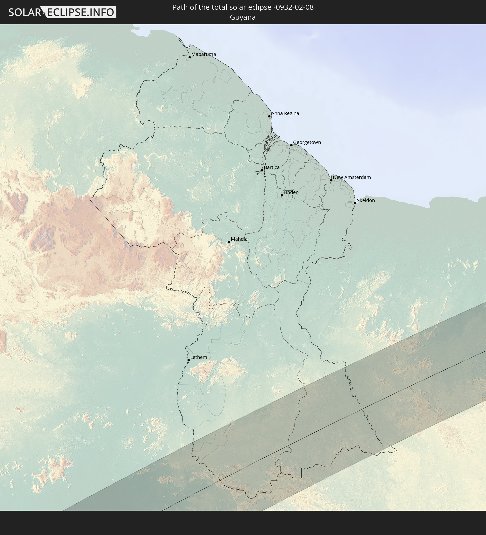 Guyana
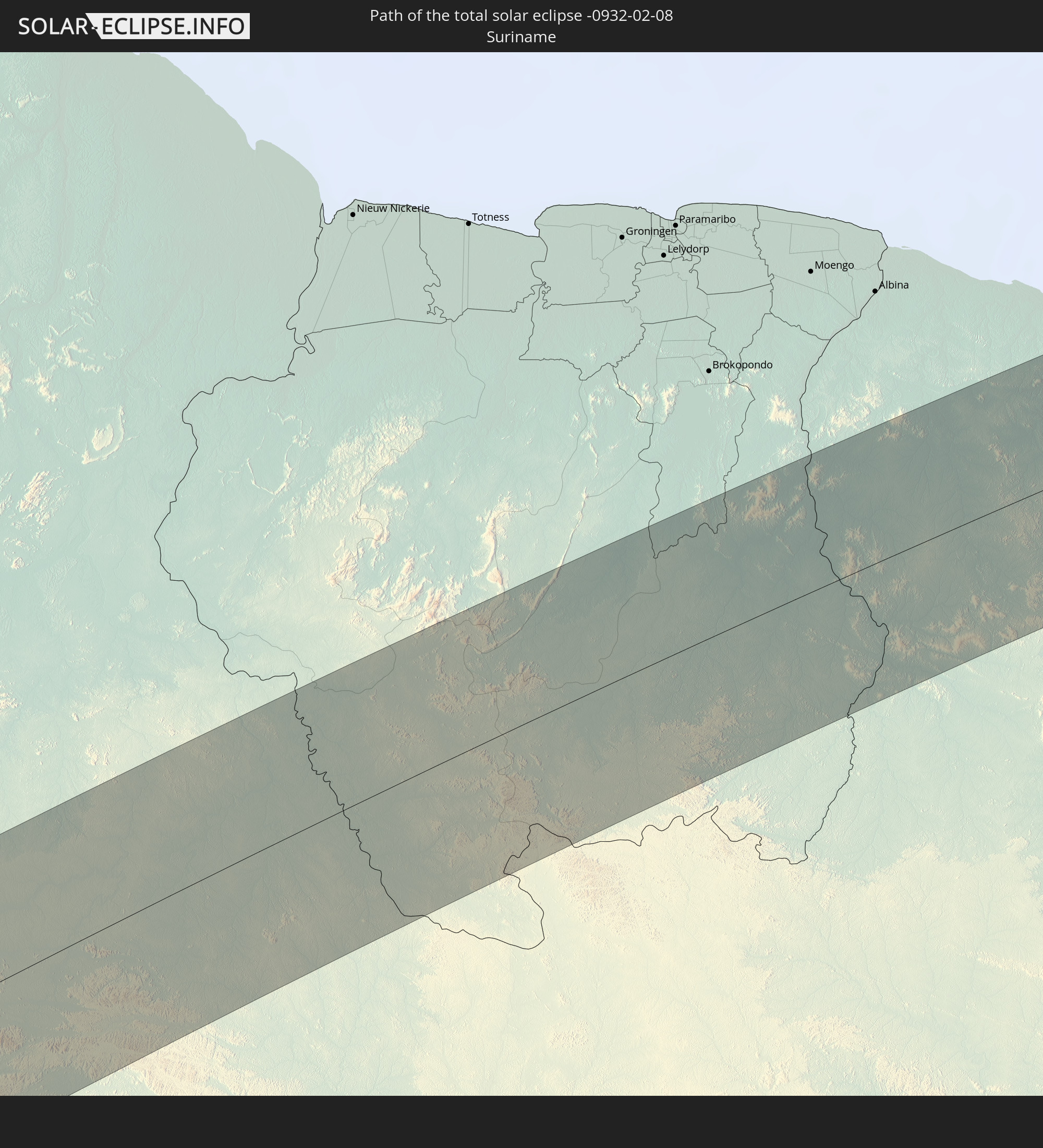 Suriname
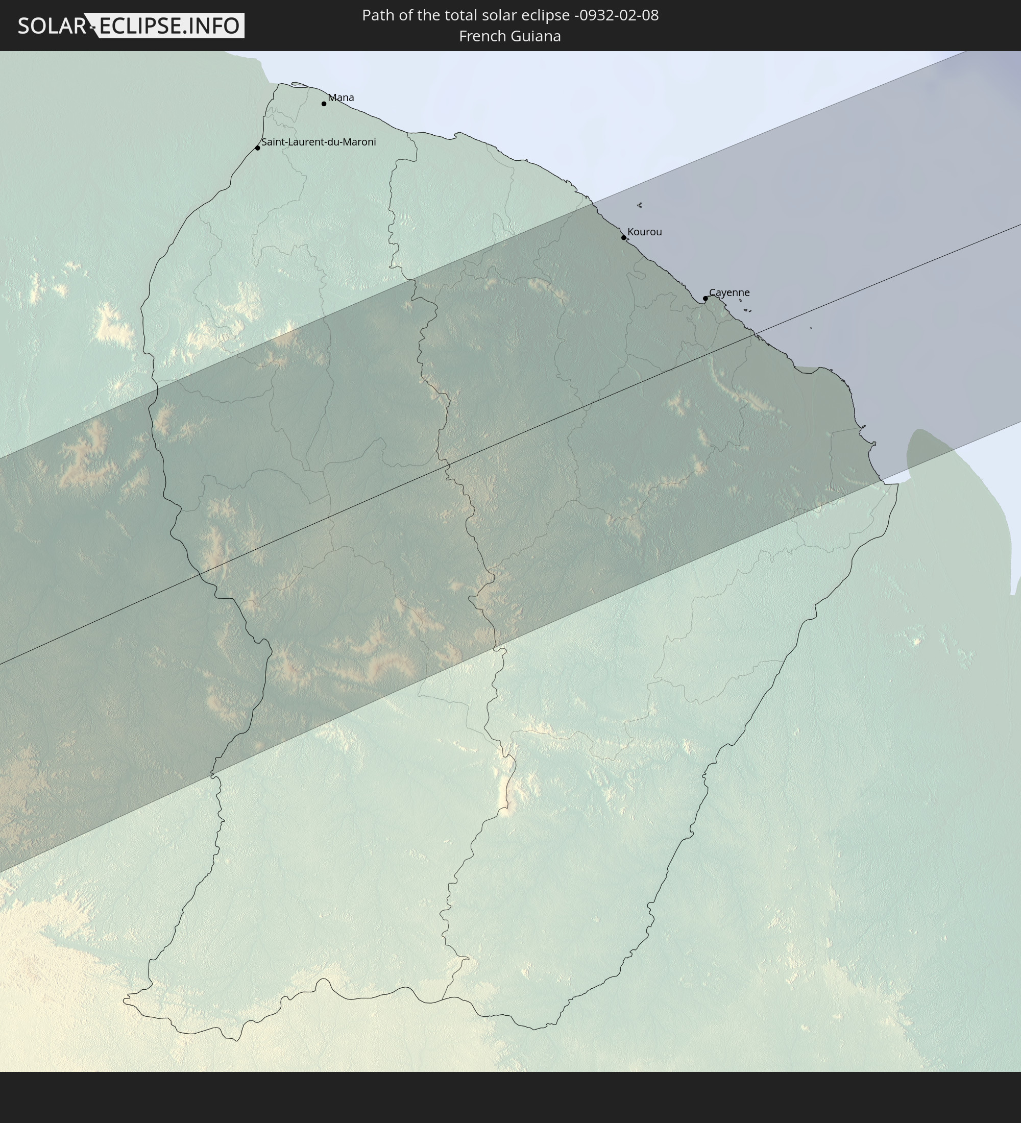 Französisch-Guayana
In den folgenden Ländern ist die Sonnenfinsternis partiell zu sehen
 Antarktika
 Vereinigte Staaten
 Neuseeland
 United States Minor Outlying Islands
 Tonga
Tonga
 Kiribati
 Samoa
Samoa
 Tokelau
 Amerikanisch-Samoa
 Niue
Niue
 Cookinseln
 Französisch-Polynesien
 Pitcairninseln
 Mexiko
 Chile
Chile
 Guatemala
 Ecuador
 El Salvador
 Honduras
 Belize
 Nicaragua
 Costa Rica
 Kuba
Kuba
 Panama
 Kolumbien
 Kaimaninseln
 Peru
Peru
 Bahamas
 Jamaika
 Haiti
Haiti
 Brasilien
 Argentinien
 Venezuela
 Turks- und Caicosinseln
 Dominikanische Republik
 Aruba
Aruba
 Bolivien
 Puerto Rico
 Amerikanische Jungferninseln
 Bermuda
 Britische Jungferninseln
 Anguilla
 Saint-Martin
 Saint-Barthélemy
 St. Kitts und Nevis
 Paraguay
 Antigua und Barbuda
 Montserrat
 Trinidad und Tobago
 Guadeloupe
 Grenada
 Dominica
 St. Vincent und die Grenadinen
 Falklandinseln
 Guyana
 Martinique
 St. Lucia
 Barbados
 Uruguay
 Suriname
 Französisch-Guayana
 Australien
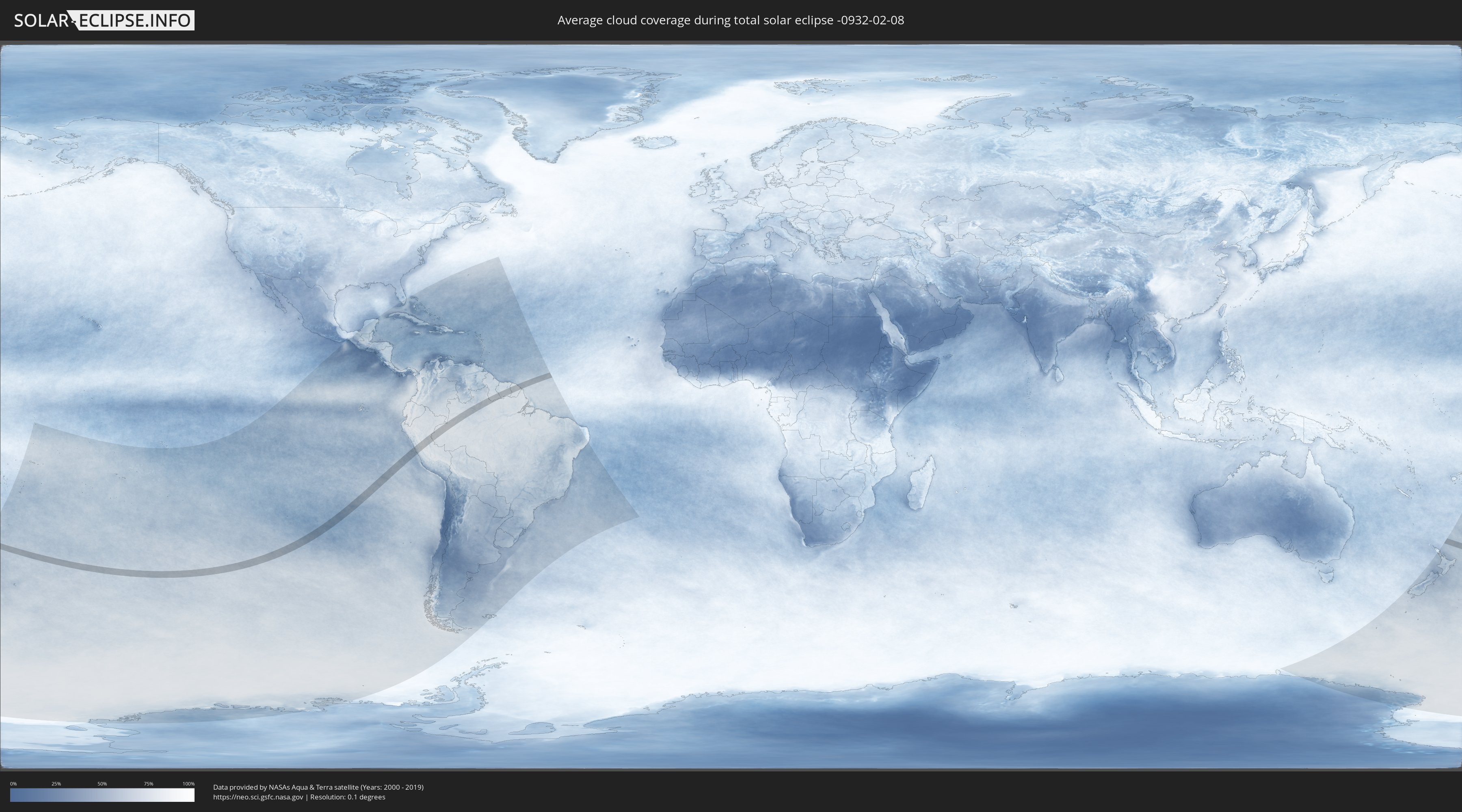
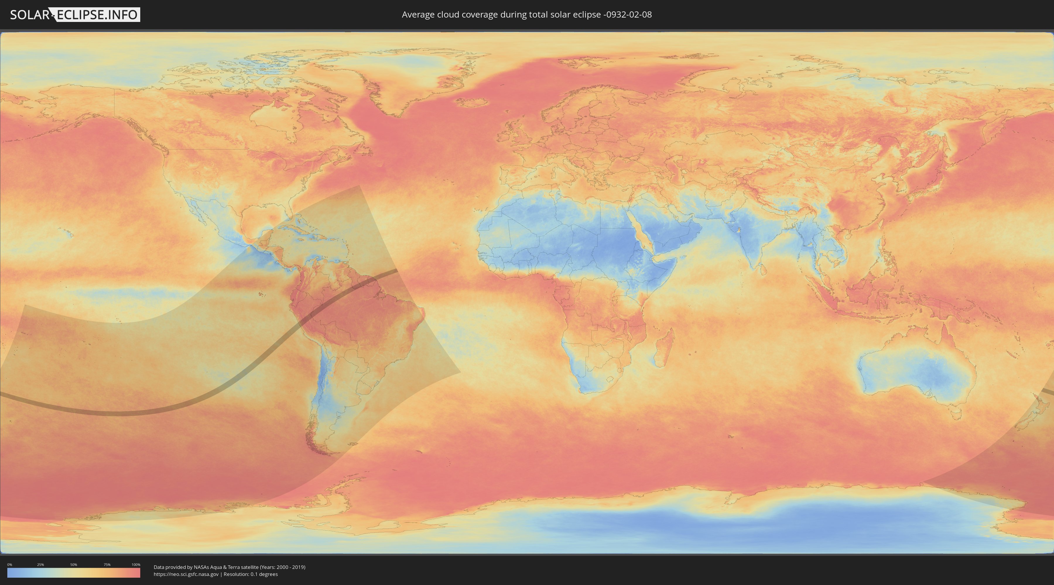
Wie wird das Wetter während der totalen Sonnenfinsternis am 08.02.-0932?
Wo ist der beste Ort, um die totale Sonnenfinsternis vom 08.02.-0932 zu beobachten?
Die folgenden Karten zeigen die durchschnittliche Bewölkung für den Tag, an dem die totale Sonnenfinsternis
stattfindet. Mit Hilfe der Karten lässt sich der Ort entlang des Finsternispfades eingrenzen,
der die besten Aussichen auf einen klaren wolkenfreien Himmel bietet.
Trotzdem muss man immer lokale Gegenenheiten beachten und sollte sich genau über das Wetter an seinem
gewählten Beobachtungsort informieren.
Die Daten stammen von den beiden NASA-Satelliten
AQUA und TERRA
und wurden über einen Zeitraum von 19 Jahren (2000 - 2019) gemittelt.
Detaillierte Länderkarten
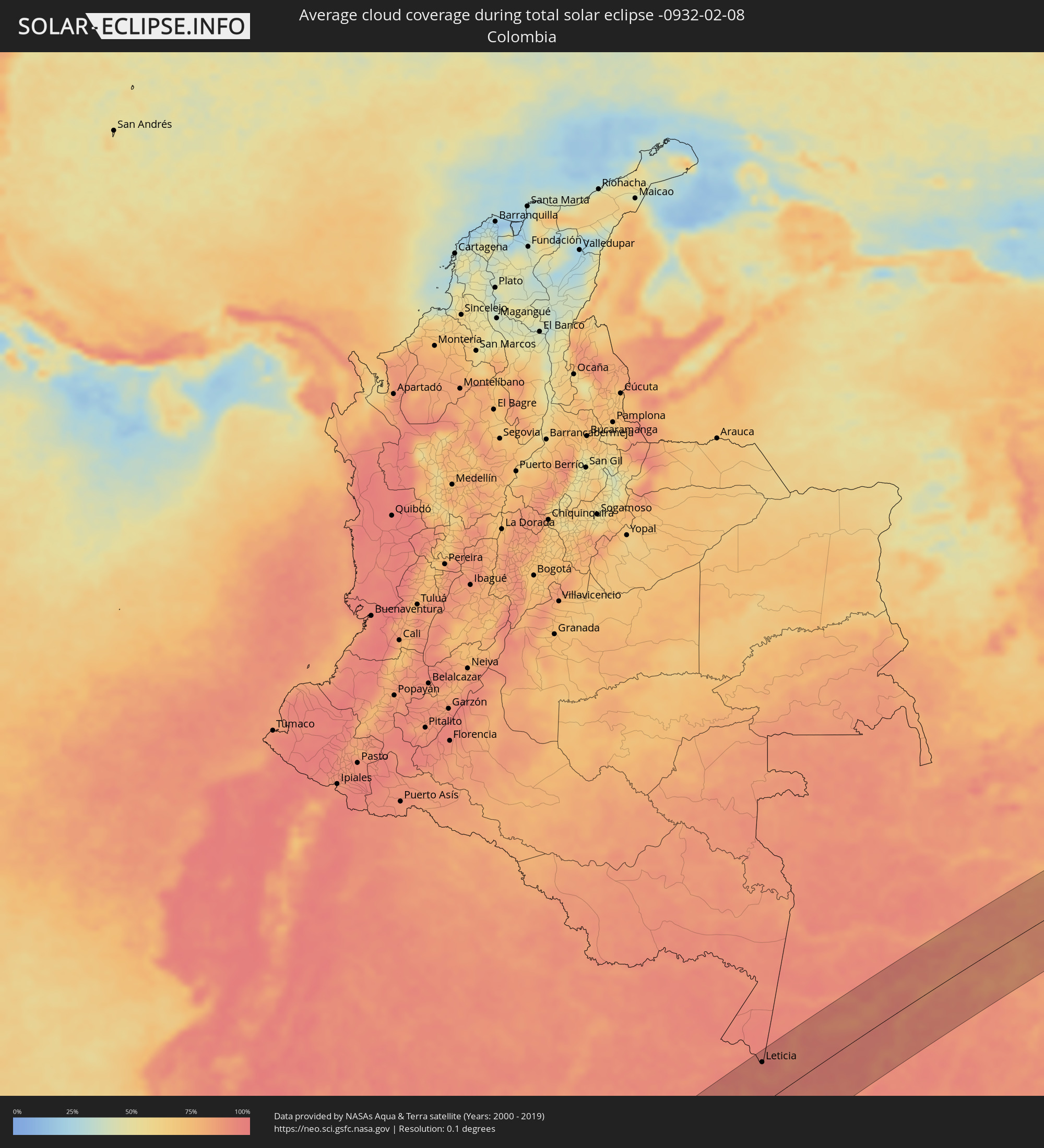 Kolumbien
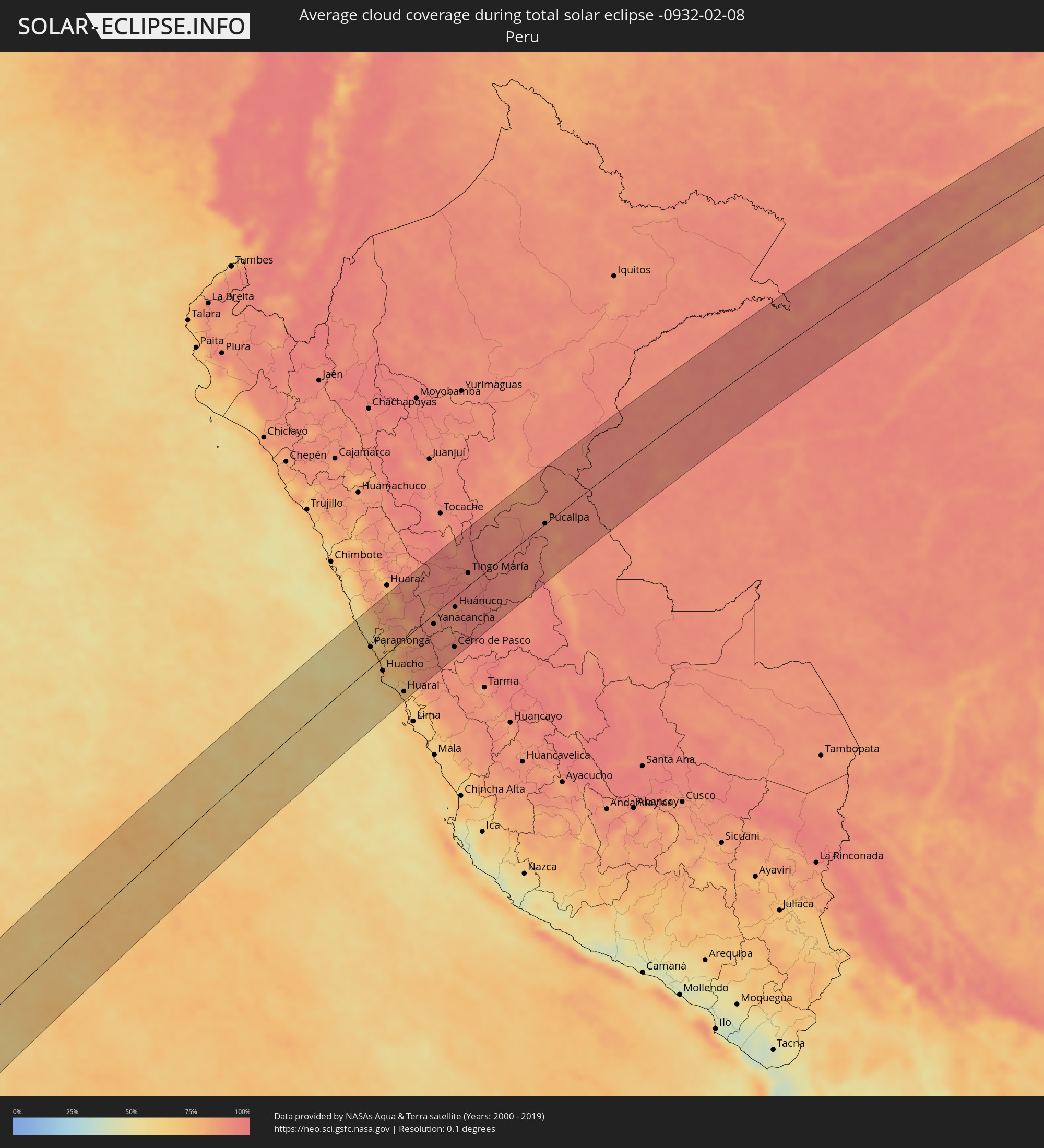 Peru
Peru
 Brasilien
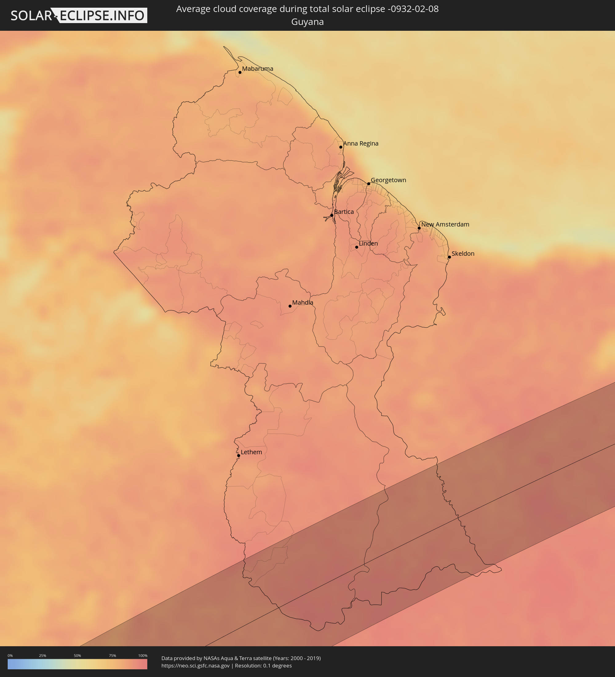 Guyana
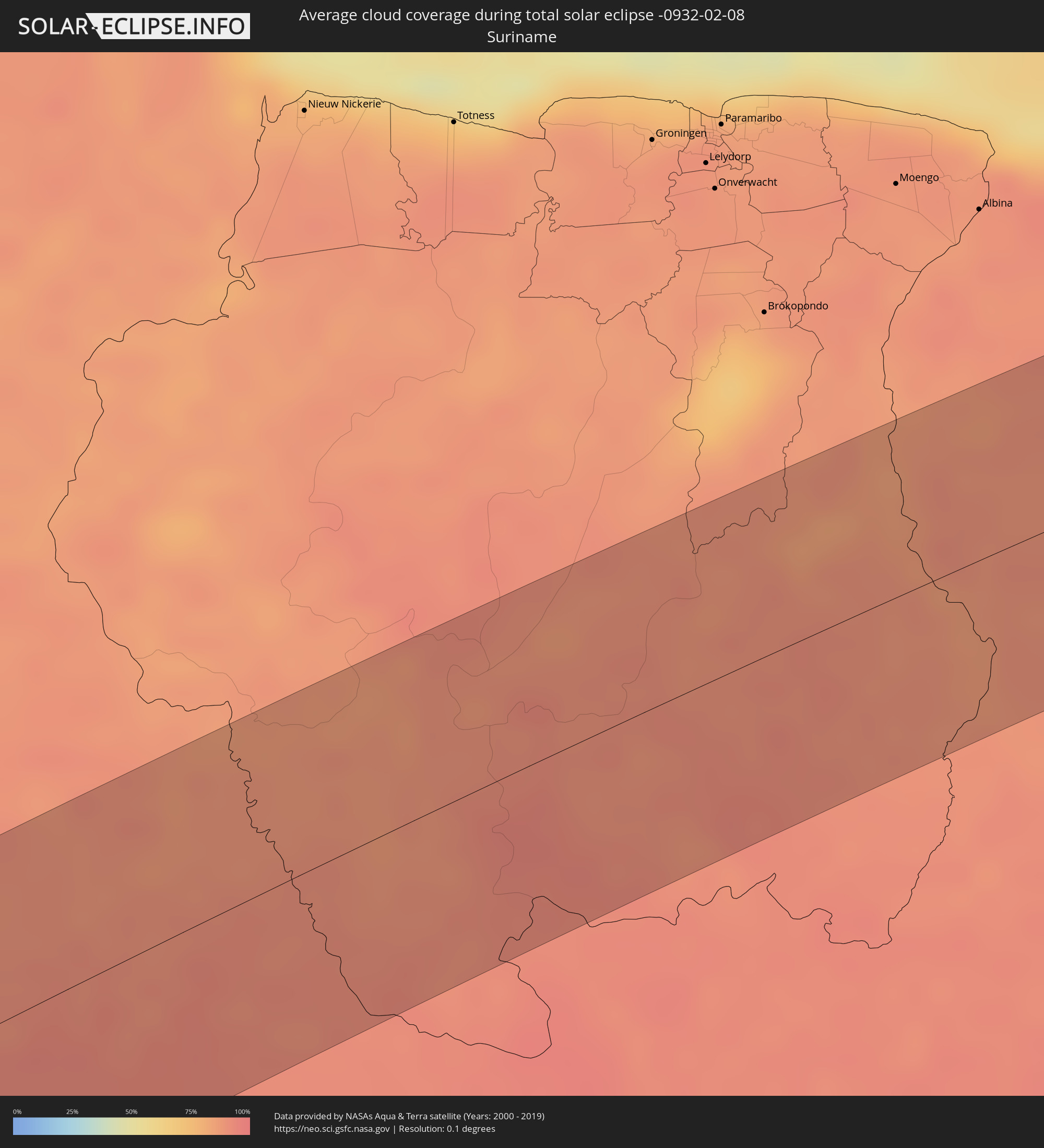 Suriname
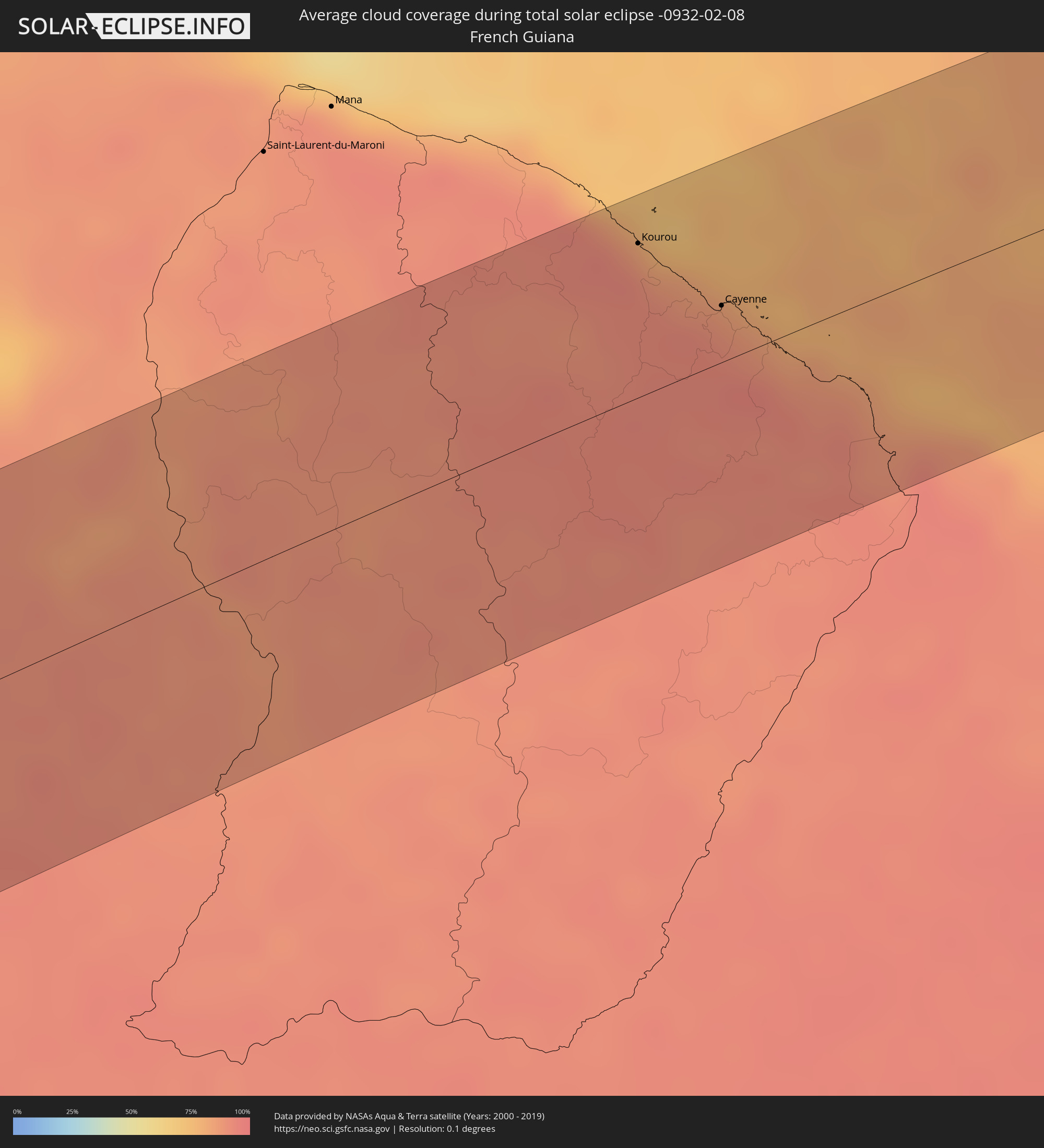 Französisch-Guayana
Orte im Finsternispfad
Die nachfolgene Tabelle zeigt Städte und Orte mit mehr als 5.000 Einwohnern, die sich im Finsternispfad befinden. Städte mit mehr als 100.000 Einwohnern sind dick gekennzeichnet. Mit einem Klick auf den Ort öffnet sich eine Detailkarte die die Lage des jeweiligen Ortes zusammen mit dem Verlauf der zentralen Finsternis präsentiert.
| Ort | Typ | Dauer der Verfinsterung | Ortszeit bei maximaler Verfinsterung | Entfernung zur Zentrallinie | Ø Bewölkung |
|
Paramonga, Lima region
|
total | - | 15:27:03 UTC-05:08 | 32 km | 70% |
|
Pativilca, Lima region
|
total | - | 15:27:03 UTC-05:08 | 26 km | 70% |
|
Barranca, Lima region
|
total | - | 15:26:59 UTC-05:08 | 20 km | 65% |
|
Puerto Supe, Lima region
|
total | - | 15:26:56 UTC-05:08 | 14 km | 70% |
|
Supe, Lima region
|
total | - | 15:26:58 UTC-05:08 | 13 km | 70% |
|
Végueta, Lima region
|
total | - | 15:26:40 UTC-05:08 | 11 km | 77% |
|
Caleta de Carquín, Lima region
|
total | - | 15:26:35 UTC-05:08 | 18 km | 72% |
|
Hualmay, Lima region
|
total | - | 15:26:35 UTC-05:08 | 20 km | 72% |
|
Huacho, Lima region
|
total | - | 15:26:34 UTC-05:08 | 21 km | 72% |
|
Huaura, Lima region
|
total | - | 15:26:38 UTC-05:08 | 18 km | 72% |
|
Chancay, Lima region
|
total | - | 15:26:09 UTC-05:08 | 84 km | 69% |
|
Huaral, Lima region
|
total | - | 15:26:20 UTC-05:08 | 82 km | 74% |
|
Sayán, Lima region
|
total | - | 15:26:55 UTC-05:08 | 53 km | 75% |
|
Oyón, Lima region
|
total | - | 15:28:02 UTC-05:08 | 43 km | 89% |
|
Yanacancha, Huanuco
|
total | - | 15:28:49 UTC-05:08 | 15 km | 90% |
|
San Miguel de Cauri, Huanuco
|
total | - | 15:29:00 UTC-05:08 | 8 km | 90% |
|
Yanahuanca, Pasco Region
|
total | - | 15:28:31 UTC-05:08 | 49 km | 91% |
|
Chaupimarca, Pasco Region
|
total | - | 15:28:44 UTC-05:08 | 42 km | 89% |
|
Tinyahuarco, Pasco Region
|
total | - | 15:28:20 UTC-05:08 | 86 km | 89% |
|
Cerro de Pasco, Pasco Region
|
total | - | 15:28:30 UTC-05:08 | 79 km | 90% |
|
Huánuco, Huanuco
|
total | - | 15:29:39 UTC-05:08 | 17 km | 90% |
|
Ambo, Huanuco
|
total | - | 15:29:23 UTC-05:08 | 37 km | 91% |
|
Tingo María, Huanuco
|
total | - | 15:30:50 UTC-05:08 | 21 km | 93% |
|
Campoverde, Ucayali
|
total | - | 15:33:04 UTC-05:08 | 10 km | 93% |
|
Pucallpa, Ucayali
|
total | - | 15:33:25 UTC-05:08 | 1 km | 94% |
|
Mâncio Lima, Acre
|
total | - | 16:13:12 UTC-04:31 | 44 km | 95% |
|
Cruzeiro do Sul, Acre
|
total | - | 16:13:20 UTC-04:31 | 60 km | 94% |
|
Benjamin Constant, Amazonas
|
total | - | 16:48:01 UTC-04:02 | 60 km | 93% |
|
Ramón Castilla, Loreto
|
total | - | 15:42:16 UTC-05:08 | 66 km | 90% |
|
Leticia, Amazonas
|
total | - | 16:48:16 UTC-04:02 | 69 km | 93% |
|
Tabatinga, Amazonas
|
total | - | 16:48:15 UTC-04:02 | 67 km | 93% |
|
Jutaí, Amazonas
|
total | - | 16:47:39 UTC-04:02 | 85 km | 95% |
|
São Paulo de Olivença, Amazonas
|
total | - | 16:49:56 UTC-04:02 | 79 km | 90% |
|
Santo Antônio do Içá, Amazonas
|
total | - | 16:50:46 UTC-04:02 | 47 km | 88% |
|
Fonte Boa, Amazonas
|
total | - | 16:52:21 UTC-04:02 | 9 km | 87% |
|
Barcelos, Amazonas
|
total | - | 16:55:20 UTC-04:02 | 45 km | 81% |
|
Kourou, Guyane
|
total | - | 17:35:58 UTC-03:29 | 58 km | 77% |
|
Macouria, Guyane
|
total | - | 17:35:47 UTC-03:29 | 21 km | 91% |
|
Cayenne, Guyane
|
total | - | 17:35:48 UTC-03:29 | 21 km | 87% |
|
Matoury, Guyane
|
total | - | 17:35:45 UTC-03:29 | 12 km | 91% |
|
Rémire-Montjoly, Guyane
|
total | - | 17:35:48 UTC-03:29 | 17 km | 87% |