Totale Sonnenfinsternis vom 29.03.-1018
| Wochentag: | Mittwoch |
| Maximale Dauer der Verfinsterung: | 04m38s |
| Maximale Breite des Finsternispfades: | 194 km |
| Saroszyklus: | 42 |
| Bedeckungsgrad: | 100% |
| Magnitude: | 1.0531 |
| Gamma: | -0.4276 |
Wo kann man die Sonnenfinsternis vom 29.03.-1018 sehen?
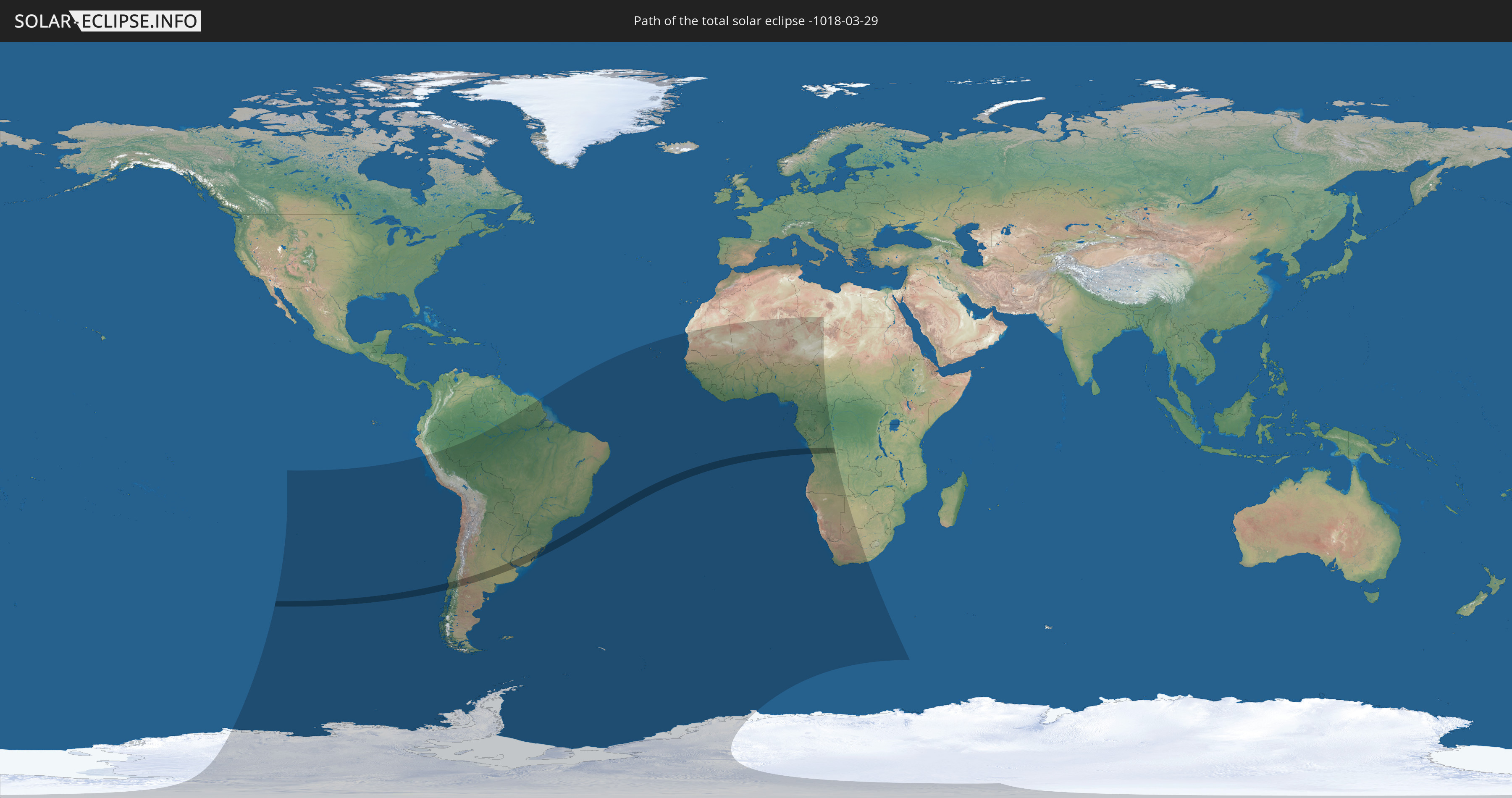
Die Sonnenfinsternis am 29.03.-1018 kann man in 44 Ländern als partielle Sonnenfinsternis beobachten.
Der Finsternispfad verläuft durch 6 Länder. Nur in diesen Ländern ist sie als totale Sonnenfinsternis zu sehen.
In den folgenden Ländern ist die Sonnenfinsternis total zu sehen
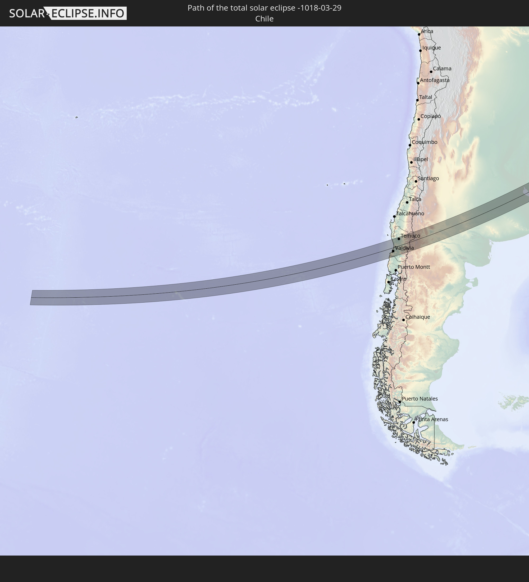 Chile
Chile
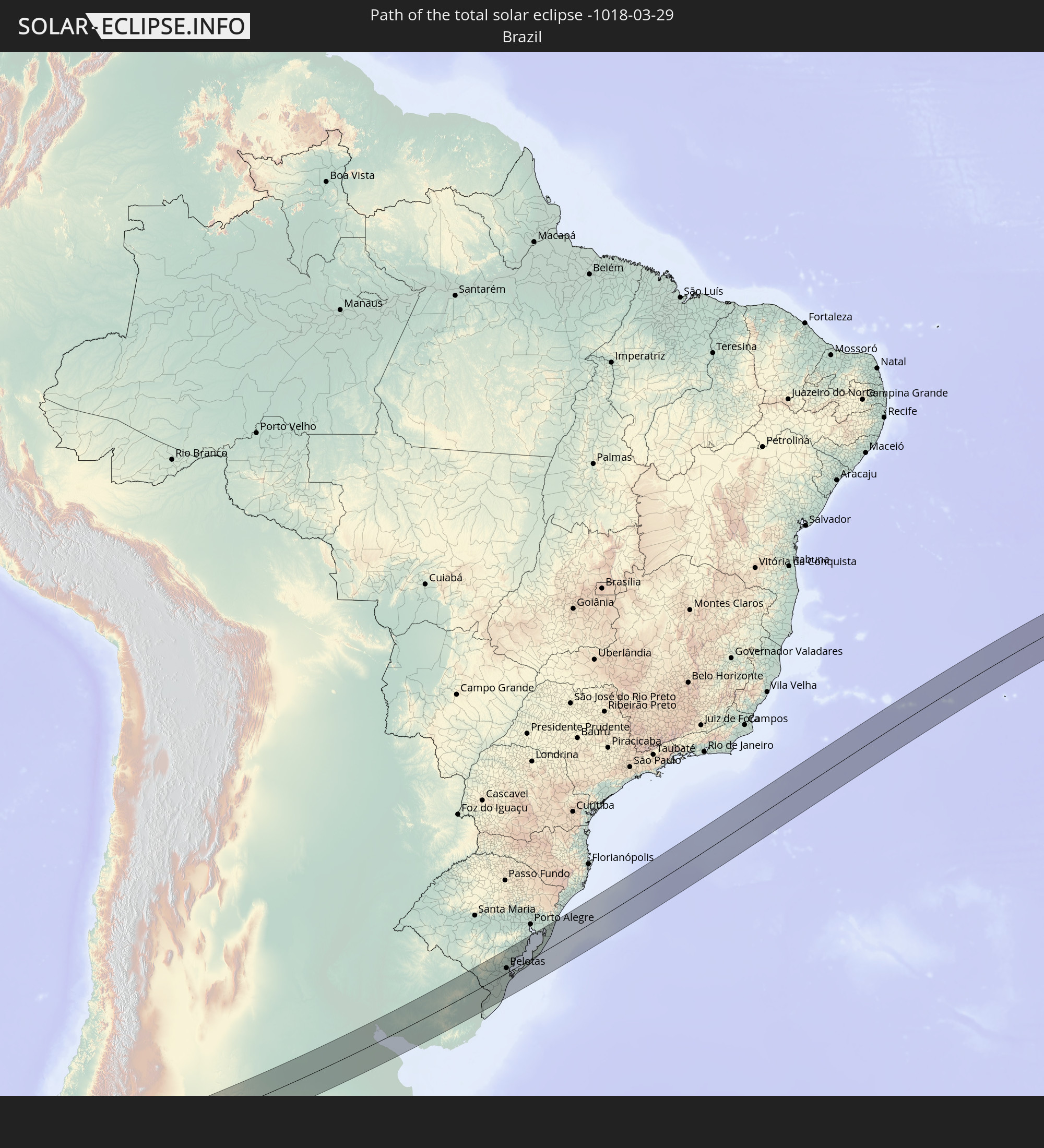 Brasilien
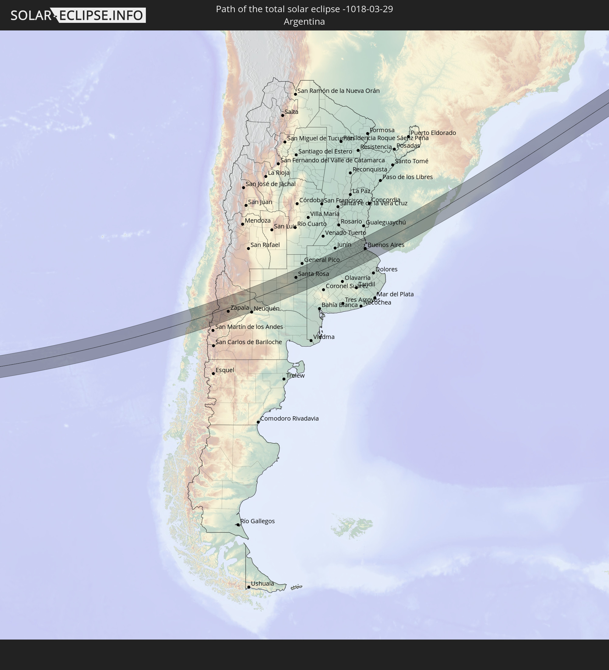 Argentinien
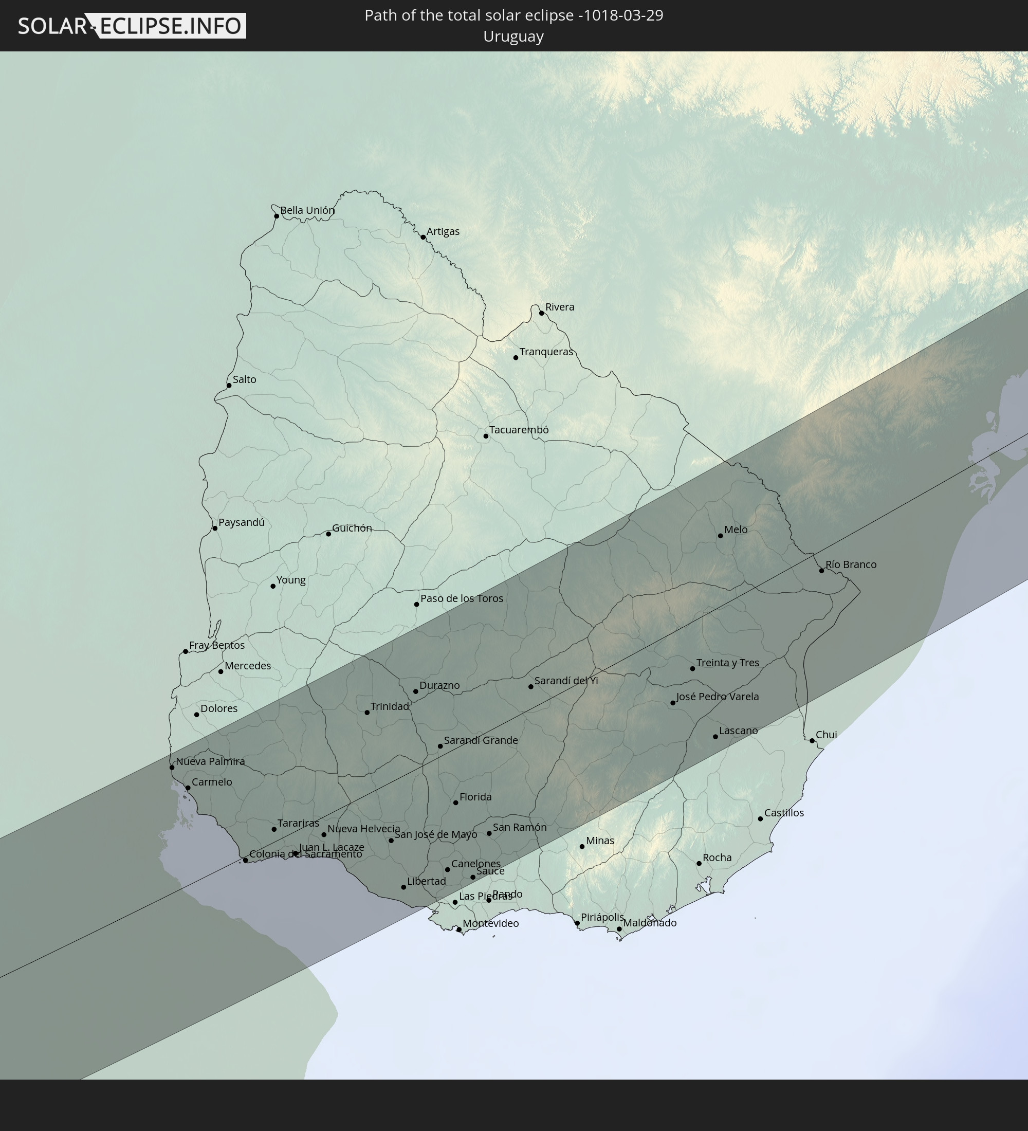 Uruguay
 Angola
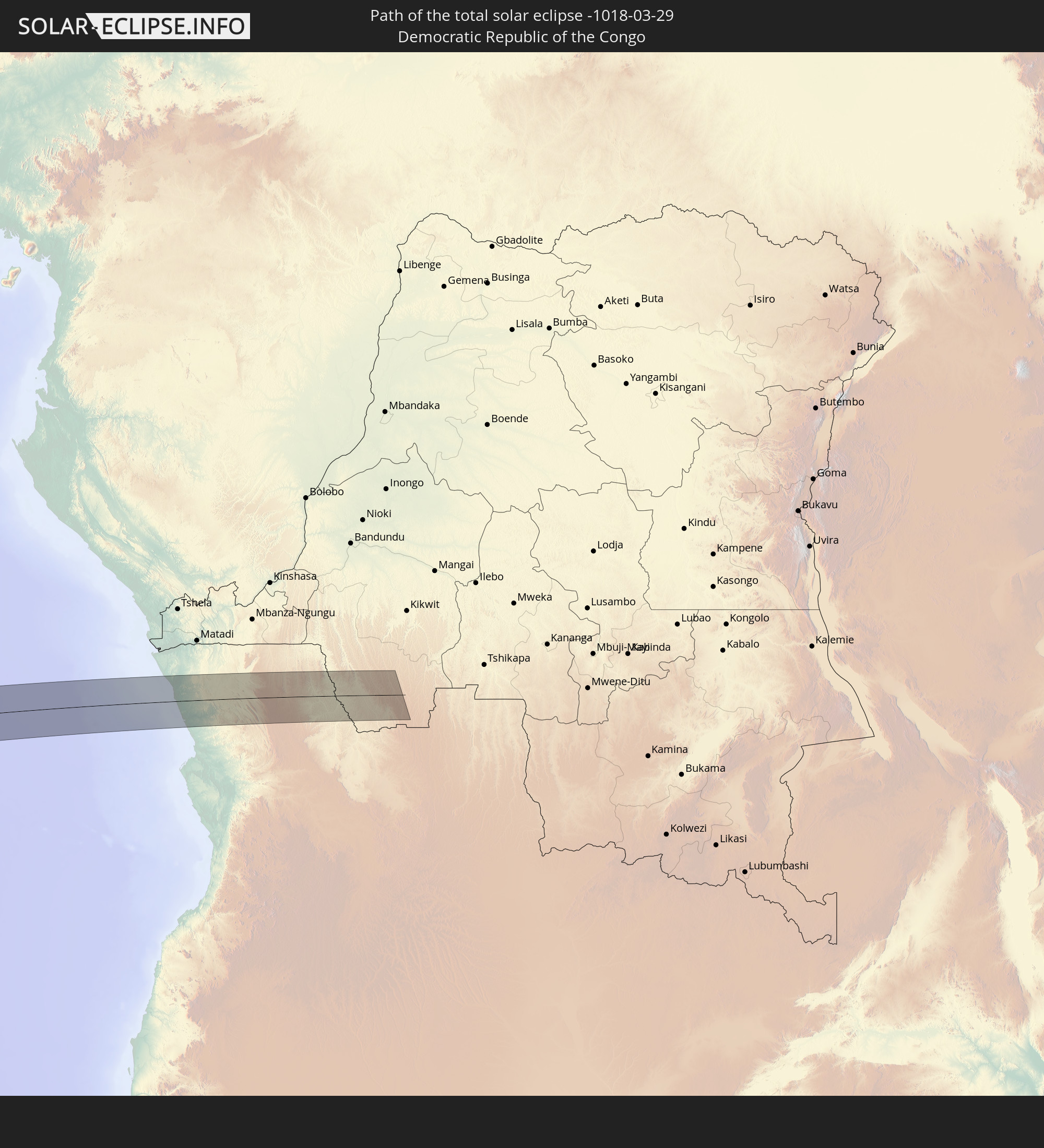 Demokratische Republik Kongo
In den folgenden Ländern ist die Sonnenfinsternis partiell zu sehen
 Antarktika
 Chile
Chile
 Peru
Peru
 Brasilien
 Argentinien
 Bolivien
 Paraguay
 Falklandinseln
 Uruguay
 Suriname
 Französisch-Guayana
 Südgeorgien und die Südlichen Sandwichinseln
 Kap Verde
 Senegal
 Mauretanien
 Gambia
 Guinea-Bissau
 Guinea
 St. Helena
 Sierra Leone
 Mali
Mali
 Liberia
 Algerien
 Elfenbeinküste
 Burkina Faso
 Ghana
Ghana
 Togo
Togo
 Niger
Niger
 Benin
Benin
 Nigeria
 Bouvetinsel
 Äquatorialguinea
 São Tomé und Príncipe
 Kamerun
 Gabun
Gabun
 Libyen
 Republik Kongo
 Angola
 Namibia
 Demokratische Republik Kongo
 Tschad
 Zentralafrikanische Republik
 Südafrika
 Botswana
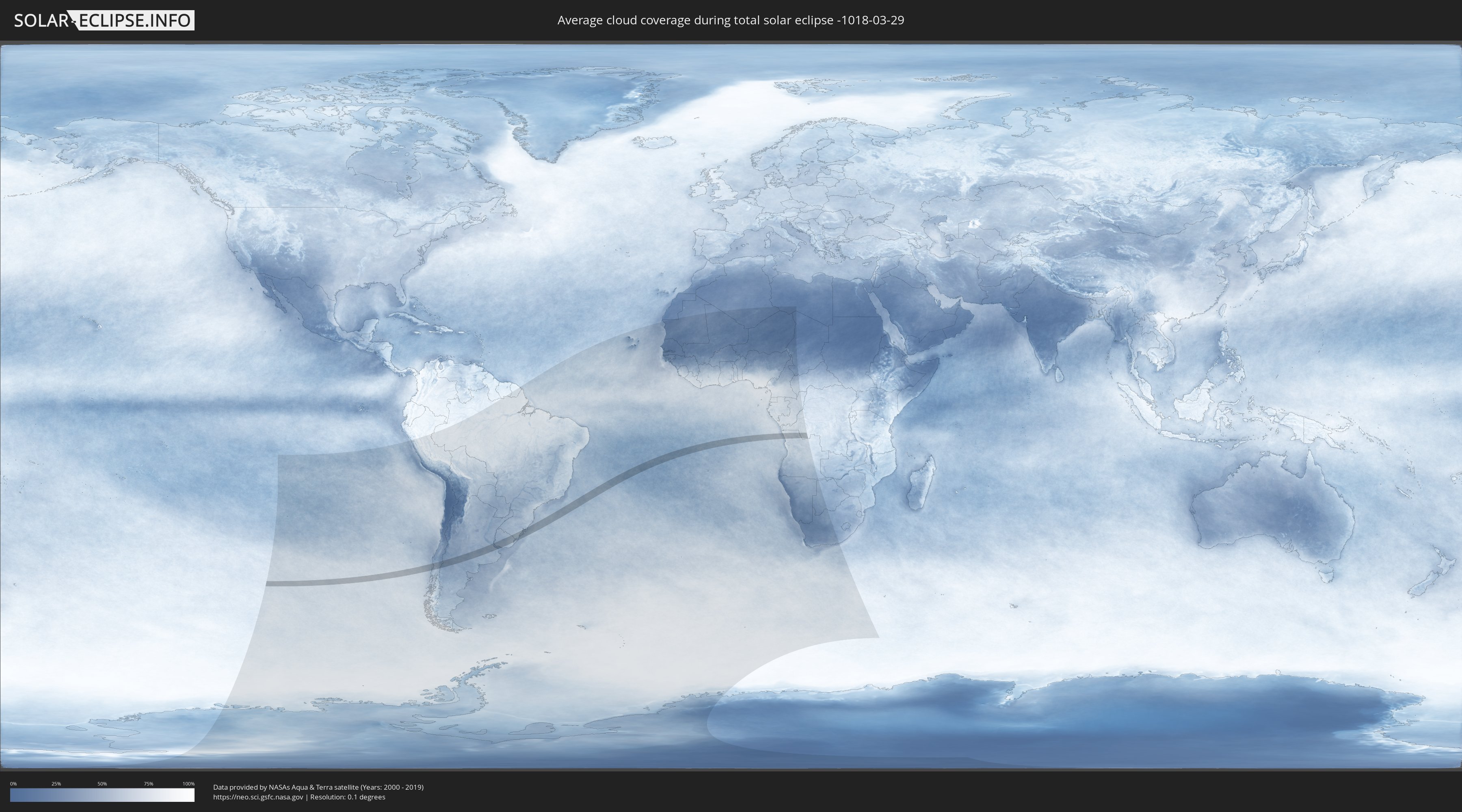
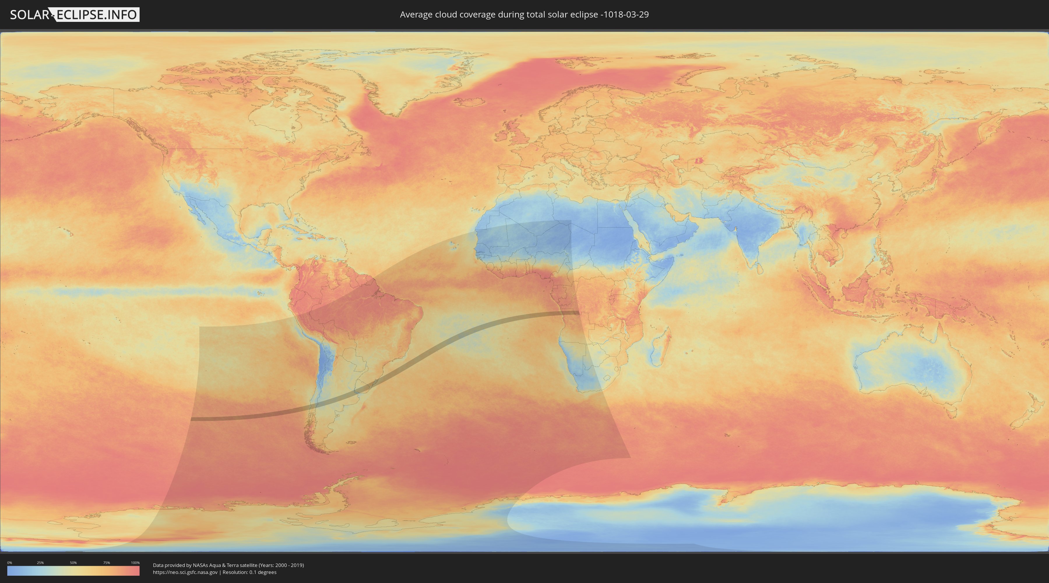
Wie wird das Wetter während der totalen Sonnenfinsternis am 29.03.-1018?
Wo ist der beste Ort, um die totale Sonnenfinsternis vom 29.03.-1018 zu beobachten?
Die folgenden Karten zeigen die durchschnittliche Bewölkung für den Tag, an dem die totale Sonnenfinsternis
stattfindet. Mit Hilfe der Karten lässt sich der Ort entlang des Finsternispfades eingrenzen,
der die besten Aussichen auf einen klaren wolkenfreien Himmel bietet.
Trotzdem muss man immer lokale Gegenenheiten beachten und sollte sich genau über das Wetter an seinem
gewählten Beobachtungsort informieren.
Die Daten stammen von den beiden NASA-Satelliten
AQUA und TERRA
und wurden über einen Zeitraum von 19 Jahren (2000 - 2019) gemittelt.
Detaillierte Länderkarten
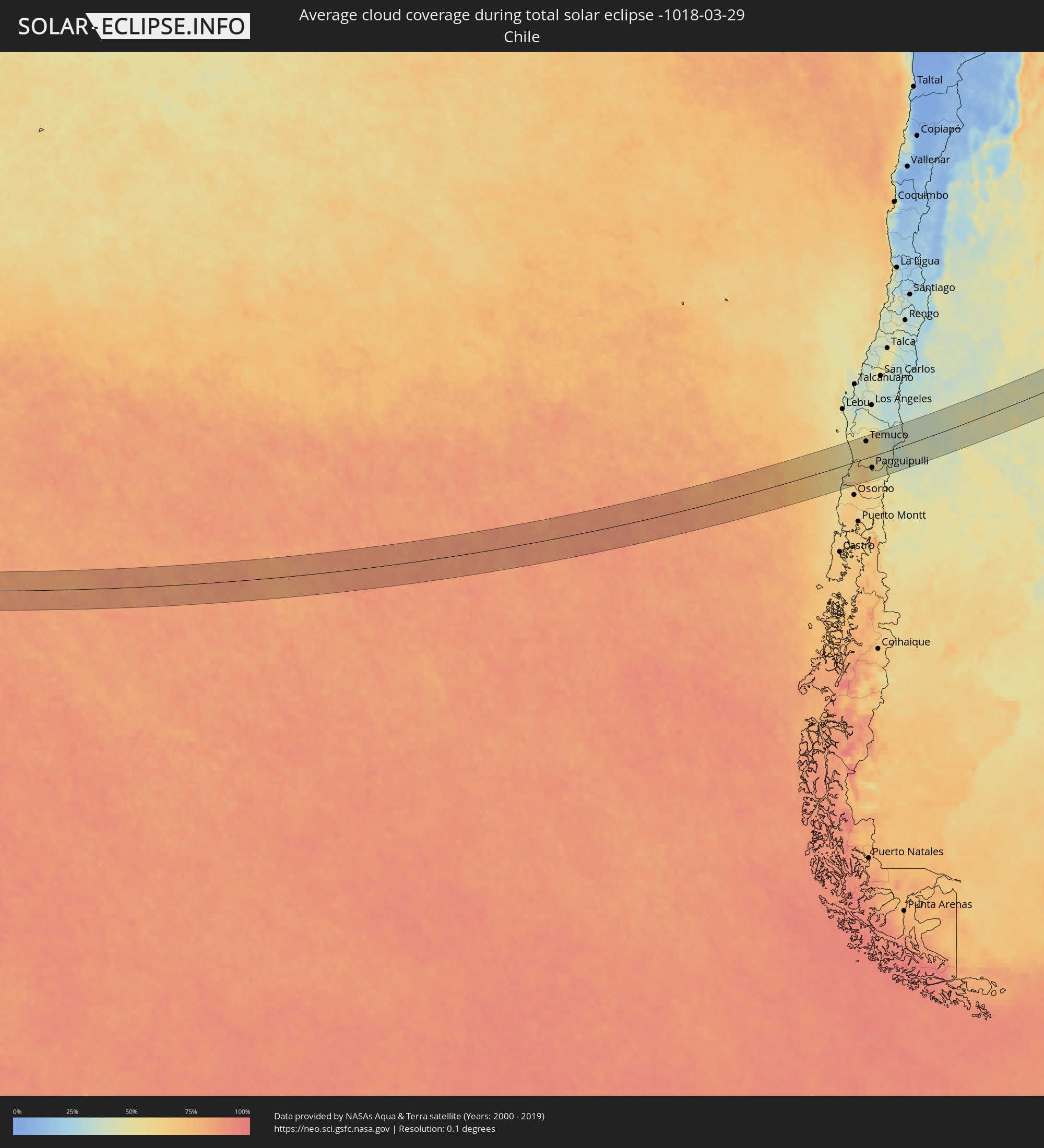 Chile
Chile
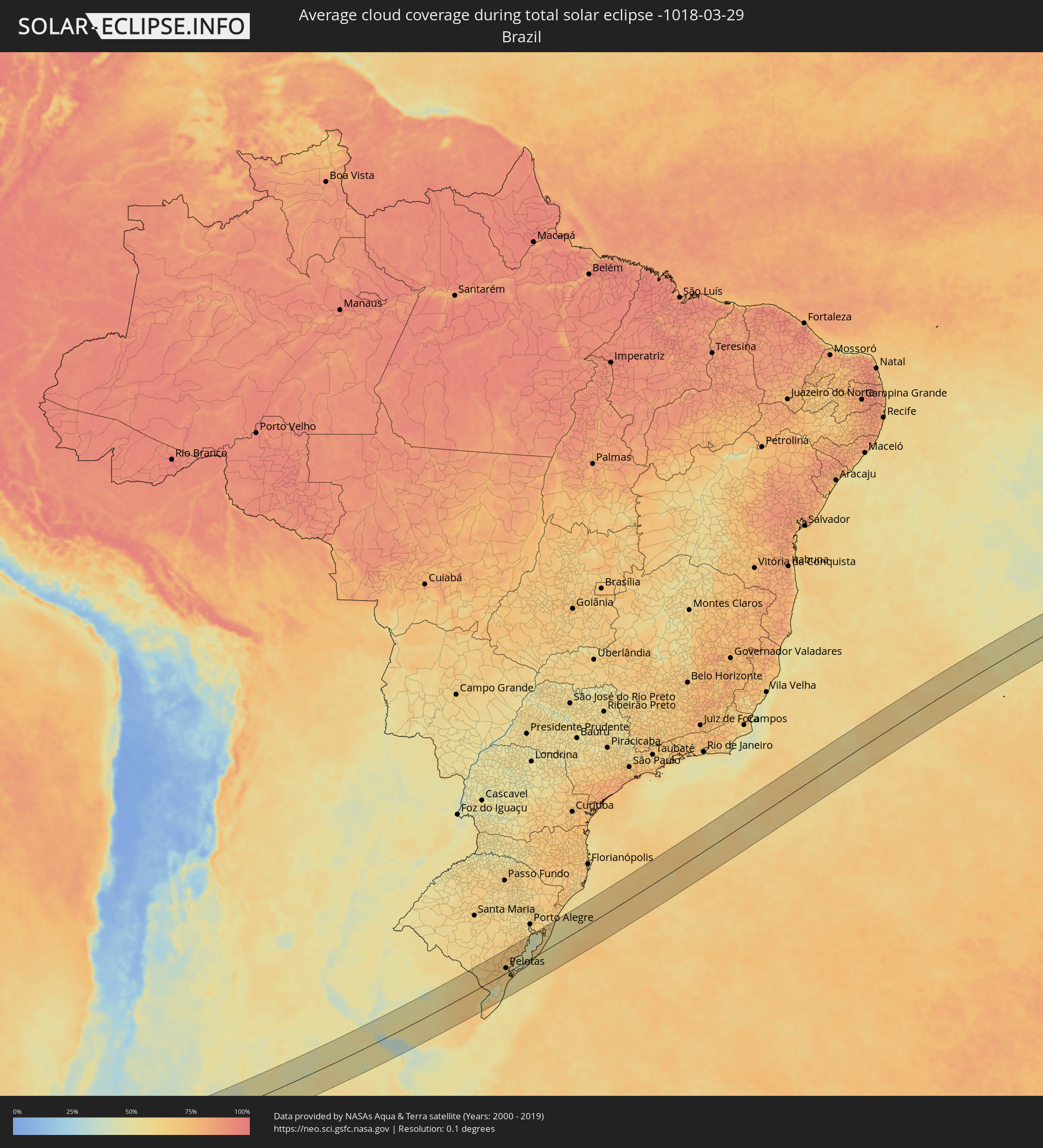 Brasilien
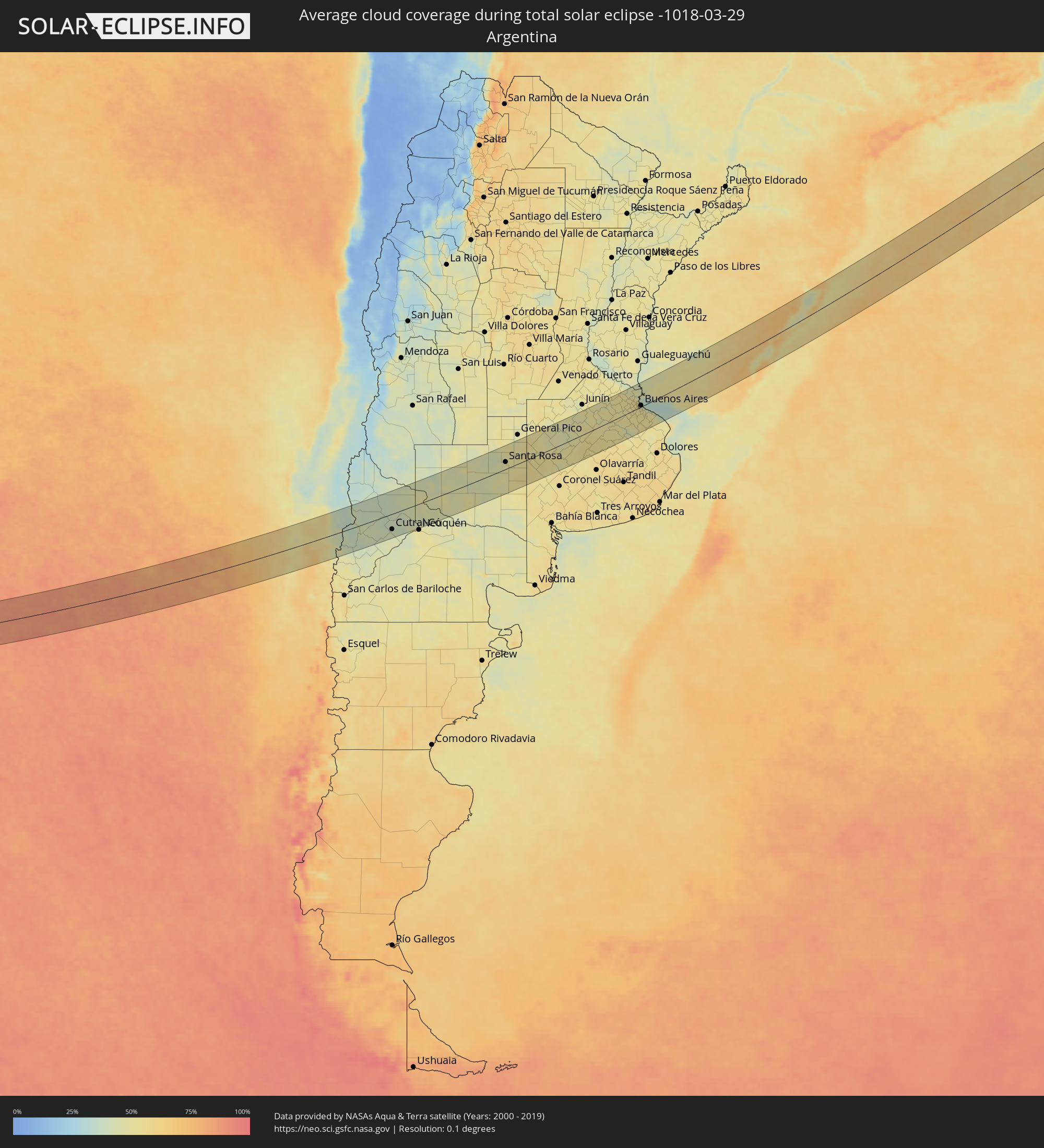 Argentinien
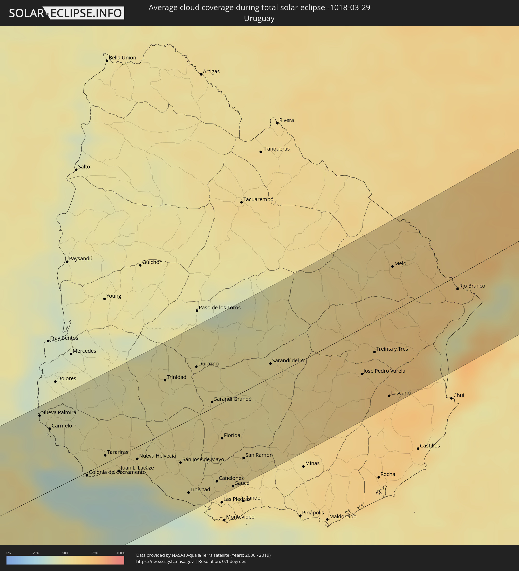 Uruguay
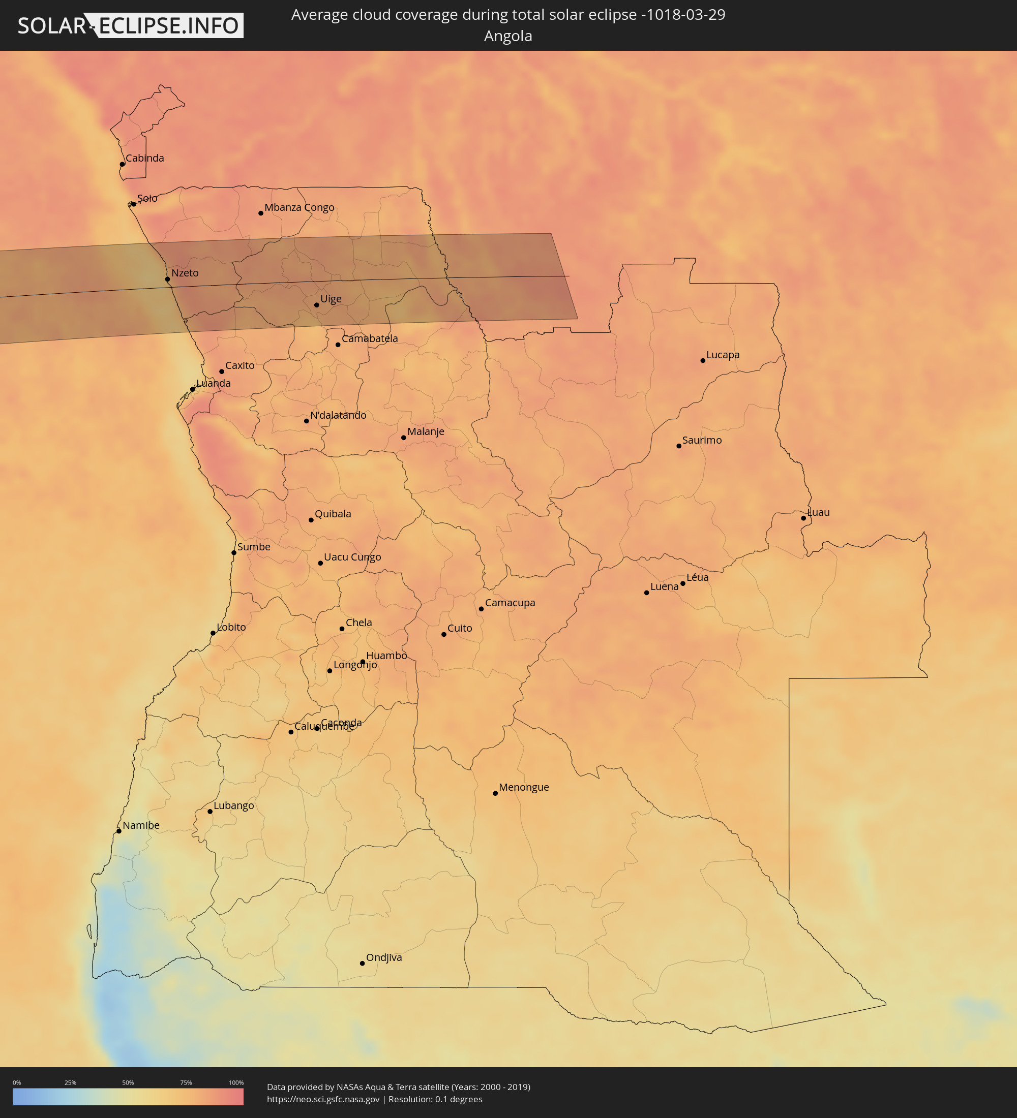 Angola
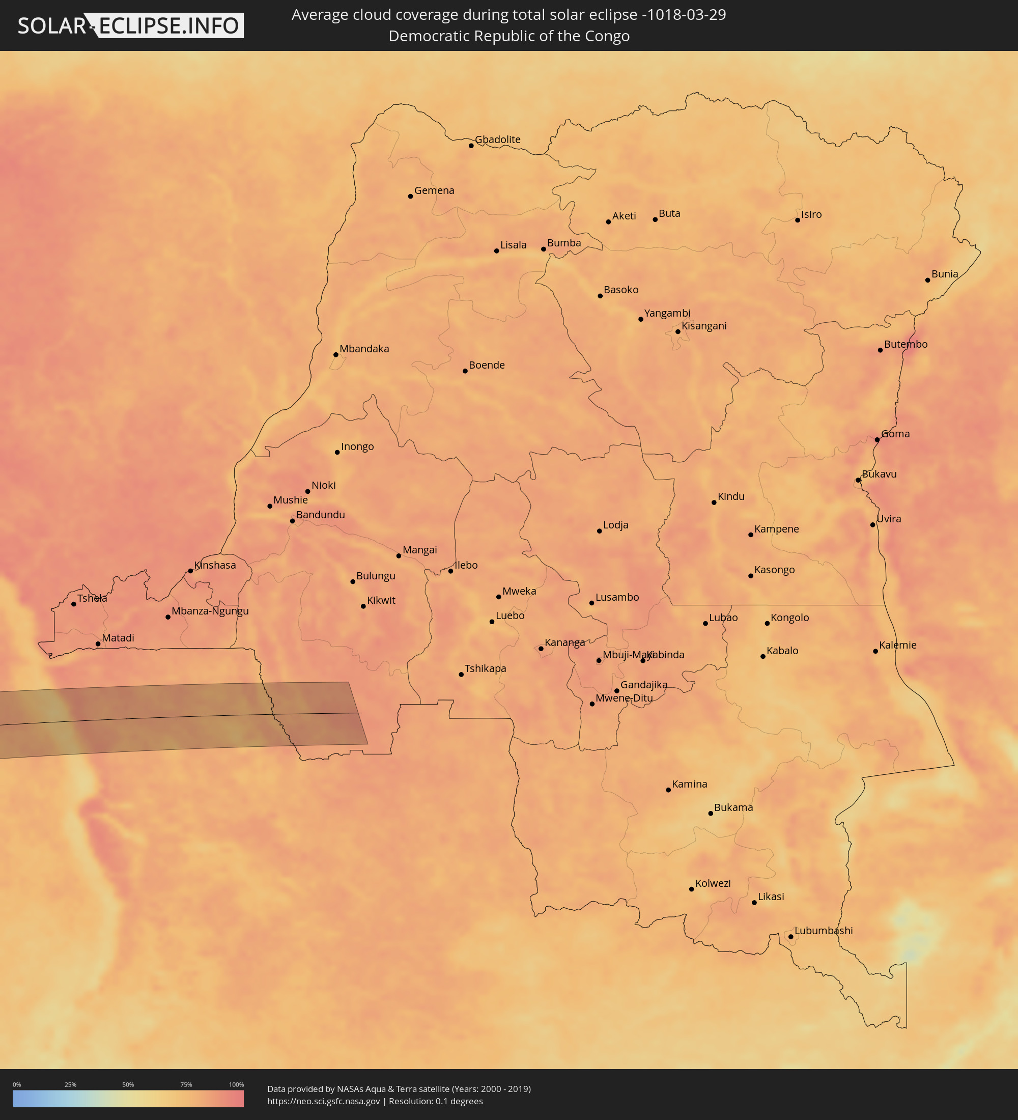 Demokratische Republik Kongo
Orte im Finsternispfad
Die nachfolgene Tabelle zeigt Städte und Orte mit mehr als 5.000 Einwohnern, die sich im Finsternispfad befinden. Städte mit mehr als 100.000 Einwohnern sind dick gekennzeichnet. Mit einem Klick auf den Ort öffnet sich eine Detailkarte die die Lage des jeweiligen Ortes zusammen mit dem Verlauf der zentralen Finsternis präsentiert.
| Ort | Typ | Dauer der Verfinsterung | Ortszeit bei maximaler Verfinsterung | Entfernung zur Zentrallinie | Ø Bewölkung |
|
Valdivia, Los Ríos
|
total | - | 09:21:29 UTC-04:42 | 35 km | 54% |
|
Las Animas, Los Lagos
|
total | - | 09:21:31 UTC-04:42 | 35 km | 54% |
|
Carahue, Araucanía
|
total | - | 09:21:22 UTC-04:42 | 80 km | 54% |
|
Nueva Imperial, Araucanía
|
total | - | 09:21:38 UTC-04:42 | 70 km | 56% |
|
Pitrufquén, Araucanía
|
total | - | 09:22:04 UTC-04:42 | 36 km | 56% |
|
Loncoche, Araucanía
|
total | - | 09:22:09 UTC-04:42 | 4 km | 55% |
|
Freire, Araucanía
|
total | - | 09:22:05 UTC-04:42 | 40 km | 56% |
|
Temuco, Araucanía
|
total | - | 09:22:04 UTC-04:42 | 62 km | 54% |
|
Lautaro, Araucanía
|
total | - | 09:22:15 UTC-04:42 | 79 km | 55% |
|
Panguipulli, Araucanía
|
total | - | 09:22:34 UTC-04:42 | 41 km | 56% |
|
Villarrica, Araucanía
|
total | - | 09:22:38 UTC-04:42 | 6 km | 53% |
|
Vilcún, Araucanía
|
total | - | 09:22:32 UTC-04:42 | 59 km | 56% |
|
Pucón, Araucanía
|
total | - | 09:22:59 UTC-04:42 | 13 km | 51% |
|
Zapala, Neuquén Province
|
total | - | 09:51:22 UTC-04:16 | 27 km | 42% |
|
Cutral-Có, Neuquén Province
|
total | - | 09:52:29 UTC-04:16 | 55 km | 41% |
|
Plaza Huincul, Neuquén Province
|
total | - | 09:52:31 UTC-04:16 | 55 km | 41% |
|
Centenario, Neuquén Province
|
total | - | 09:54:00 UTC-04:16 | 77 km | 47% |
|
Cinco Saltos, Río Negro Province
|
total | - | 09:54:05 UTC-04:16 | 78 km | 47% |
|
Catriel, Río Negro Province
|
total | - | 09:54:27 UTC-04:16 | 11 km | 49% |
|
Veinticinco de Mayo, La Pampa Province
|
total | - | 09:54:34 UTC-04:16 | 20 km | 47% |
|
General Acha, La Pampa Province
|
total | - | 09:59:15 UTC-04:16 | 42 km | 45% |
|
Santa Rosa, La Pampa Province
|
total | - | 09:59:53 UTC-04:16 | 25 km | 50% |
|
Nueve de Julio, Buenos Aires
|
total | - | 10:05:48 UTC-04:16 | 20 km | 53% |
|
Chacabuco, Buenos Aires
|
total | - | 10:06:49 UTC-04:16 | 85 km | 49% |
|
Veinticinco de Mayo, Buenos Aires
|
total | - | 10:07:02 UTC-04:16 | 6 km | 50% |
|
Chivilcoy, Buenos Aires
|
total | - | 10:07:31 UTC-04:16 | 41 km | 50% |
|
Mercedes, Buenos Aires
|
total | - | 10:08:39 UTC-04:16 | 43 km | 48% |
|
Luján, Buenos Aires
|
total | - | 10:09:17 UTC-04:16 | 38 km | 51% |
|
Zárate, Buenos Aires
|
total | - | 10:09:38 UTC-04:16 | 82 km | 48% |
|
Campana, Buenos Aires
|
total | - | 10:09:44 UTC-04:16 | 72 km | 50% |
|
Pontevedra, Buenos Aires
|
total | - | 10:09:55 UTC-04:16 | 4 km | 51% |
|
Morón, Buenos Aires
|
total | - | 10:10:07 UTC-04:16 | 10 km | 52% |
|
Tigre, Buenos Aires
|
total | - | 10:10:18 UTC-04:16 | 31 km | 52% |
|
San Isidro, Buenos Aires
|
total | - | 10:10:22 UTC-04:16 | 24 km | 53% |
|
Villa Santa Rita, Buenos Aires F.D.
|
total | - | 10:10:23 UTC-04:16 | 9 km | 55% |
|
Villa Lugano, Buenos Aires F.D.
|
total | - | 10:10:22 UTC-04:16 | 2 km | 54% |
|
Colegiales, Buenos Aires F.D.
|
total | - | 10:10:28 UTC-04:16 | 11 km | 52% |
|
Nueva Palmira, Colonia
|
total | - | 10:42:50 UTC-03:44 | 79 km | 47% |
|
Adrogué, Buenos Aires
|
total | - | 10:10:28 UTC-04:16 | 14 km | 51% |
|
Retiro, Buenos Aires F.D.
|
total | - | 10:10:34 UTC-04:16 | 7 km | 52% |
|
Buenos Aires, Buenos Aires F.D.
|
total | - | 10:10:34 UTC-04:16 | 4 km | 52% |
|
Carmelo, Colonia
|
total | - | 10:42:59 UTC-03:44 | 61 km | 44% |
|
Quilmes, Buenos Aires
|
total | - | 10:10:43 UTC-04:16 | 12 km | 51% |
|
La Plata, Buenos Aires
|
total | - | 10:11:11 UTC-04:16 | 44 km | 51% |
|
Colonia del Sacramento, Colonia
|
total | - | 10:43:34 UTC-03:44 | 3 km | 34% |
|
Tarariras, Colonia
|
total | - | 10:44:05 UTC-03:44 | 7 km | 50% |
|
Juan L. Lacaze, Colonia
|
total | - | 10:44:18 UTC-03:44 | 15 km | 42% |
|
Rosario, Colonia
|
total | - | 10:44:33 UTC-03:44 | 9 km | 50% |
|
Nueva Helvecia, Colonia
|
total | - | 10:44:46 UTC-03:44 | 12 km | 51% |
|
Trinidad, Flores
|
total | - | 10:45:50 UTC-03:44 | 51 km | 51% |
|
Trinidad, Flores
|
total | - | 10:45:50 UTC-03:44 | 49 km | 51% |
|
San José de Mayo, San José
|
total | - | 10:45:43 UTC-03:44 | 38 km | 53% |
|
Libertad, San José
|
total | - | 10:45:44 UTC-03:44 | 71 km | 49% |
|
Durazno, Durazno
|
total | - | 10:46:38 UTC-03:44 | 49 km | 52% |
|
Santa Lucía, Canelones
|
total | - | 10:46:15 UTC-03:44 | 63 km | 53% |
|
Sarandí Grande, Florida
|
total | - | 10:46:47 UTC-03:44 | 6 km | 54% |
|
Canelones, Canelones
|
total | - | 10:46:26 UTC-03:44 | 74 km | 54% |
|
Florida, Florida
|
total | - | 10:46:47 UTC-03:44 | 35 km | 56% |
|
Sauce, Canelones
|
total | - | 10:46:46 UTC-03:44 | 87 km | 56% |
|
San Ramón, Canelones
|
total | - | 10:47:10 UTC-03:44 | 65 km | 55% |
|
Sarandí del Yi, Durazno
|
total | - | 10:48:21 UTC-03:44 | 13 km | 53% |
|
José Pedro Varela, Lavalleja
|
total | - | 10:50:24 UTC-03:44 | 45 km | 63% |
|
Treinta y Tres, Treinta y Tres
|
total | - | 10:50:50 UTC-03:44 | 30 km | 65% |
|
Lascano, Rocha
|
total | - | 10:50:53 UTC-03:44 | 81 km | 68% |
|
Melo, Cerro Largo
|
total | - | 10:51:53 UTC-03:44 | 44 km | 61% |
|
Herval, Rio Grande do Sul
|
total | - | 11:32:04 UTC-03:06 | 43 km | 65% |
|
Río Branco, Cerro Largo
|
total | - | 10:53:16 UTC-03:44 | 14 km | 66% |
|
Pinheiro Machado, Rio Grande do Sul
|
total | - | 11:32:27 UTC-03:06 | 85 km | 65% |
|
Jaguarão, Rio Grande do Sul
|
total | - | 11:31:41 UTC-03:06 | 11 km | 66% |
|
Arroio Grande, Rio Grande do Sul
|
total | - | 11:32:31 UTC-03:06 | 8 km | 70% |
|
Canguçu, Rio Grande do Sul
|
total | - | 11:34:02 UTC-03:06 | 70 km | 68% |
|
Pelotas, Rio Grande do Sul
|
total | - | 11:34:24 UTC-03:06 | 18 km | 61% |
|
Rio Grande, Rio Grande do Sul
|
total | - | 11:34:41 UTC-03:06 | 19 km | 60% |
|
São Lourenço do Sul, Rio Grande do Sul
|
total | - | 11:35:30 UTC-03:06 | 40 km | 57% |
|
Camaquã, Rio Grande do Sul
|
total | - | 11:36:17 UTC-03:06 | 82 km | 75% |
|
Tapes, Rio Grande do Sul
|
total | - | 11:37:19 UTC-03:06 | 79 km | 54% |
|
Palmares do Sul, Rio Grande do Sul
|
total | - | 11:39:34 UTC-03:06 | 76 km | 63% |
|
Cidreira, Rio Grande do Sul
|
total | - | 11:40:17 UTC-03:06 | 69 km | 54% |
|
Tramandaí, Rio Grande do Sul
|
total | - | 11:40:38 UTC-03:06 | 84 km | 53% |
|
Nzeto, Zaire
|
total | - | 17:06:06 UTC+00:13 | 12 km | 77% |
|
Uíge, Uíge
|
total | - | 17:06:06 UTC+00:13 | 40 km | 80% |