Total solar eclipse of 03/29/-1018
| Day of week: | Wednesday |
| Maximum duration of eclipse: | 04m38s |
| Maximum width of eclipse path: | 194 km |
| Saros cycle: | 42 |
| Coverage: | 100% |
| Magnitude: | 1.0531 |
| Gamma: | -0.4276 |
Wo kann man die Sonnenfinsternis vom 03/29/-1018 sehen?
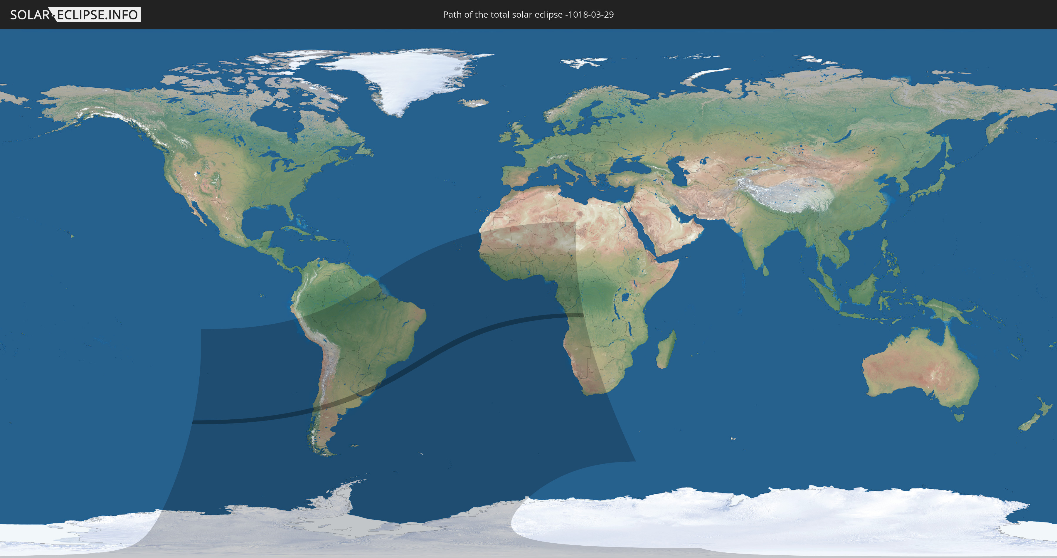
Die Sonnenfinsternis am 03/29/-1018 kann man in 44 Ländern als partielle Sonnenfinsternis beobachten.
Der Finsternispfad verläuft durch 6 Länder. Nur in diesen Ländern ist sie als total Sonnenfinsternis zu sehen.
In den folgenden Ländern ist die Sonnenfinsternis total zu sehen
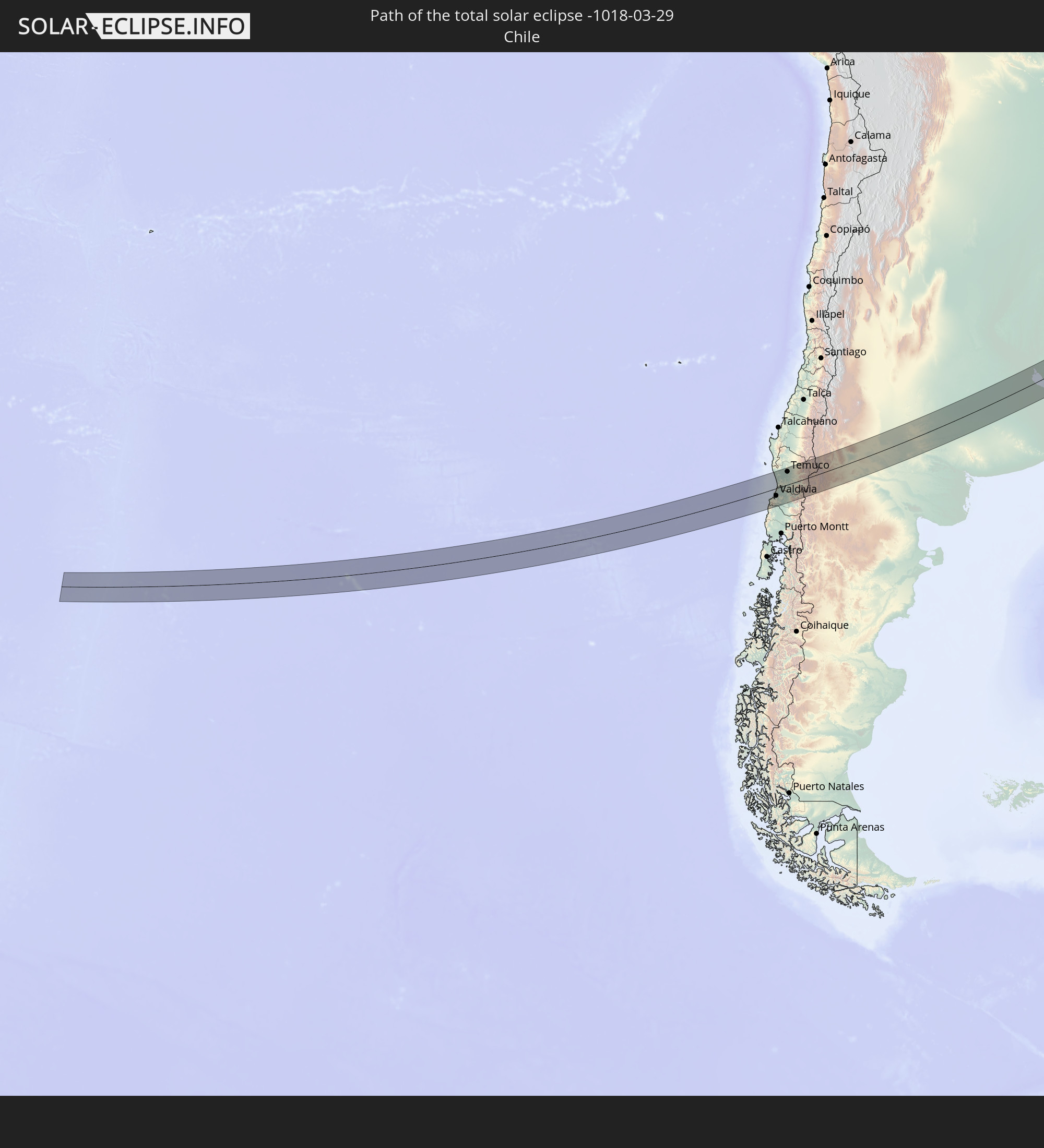 Chile
Chile
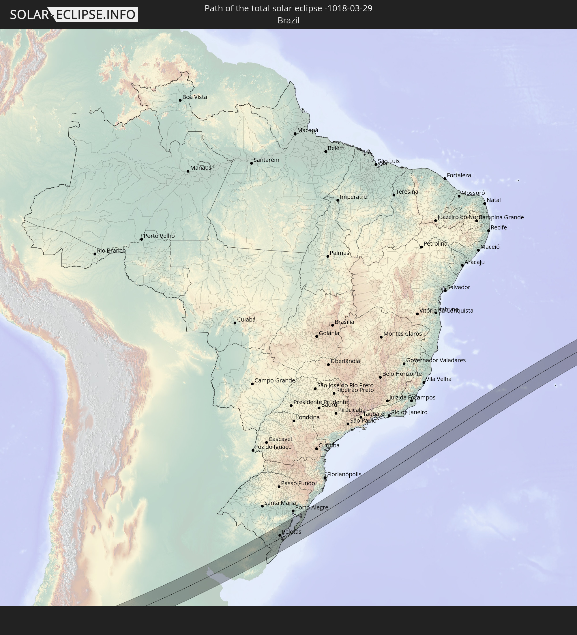 Brazil
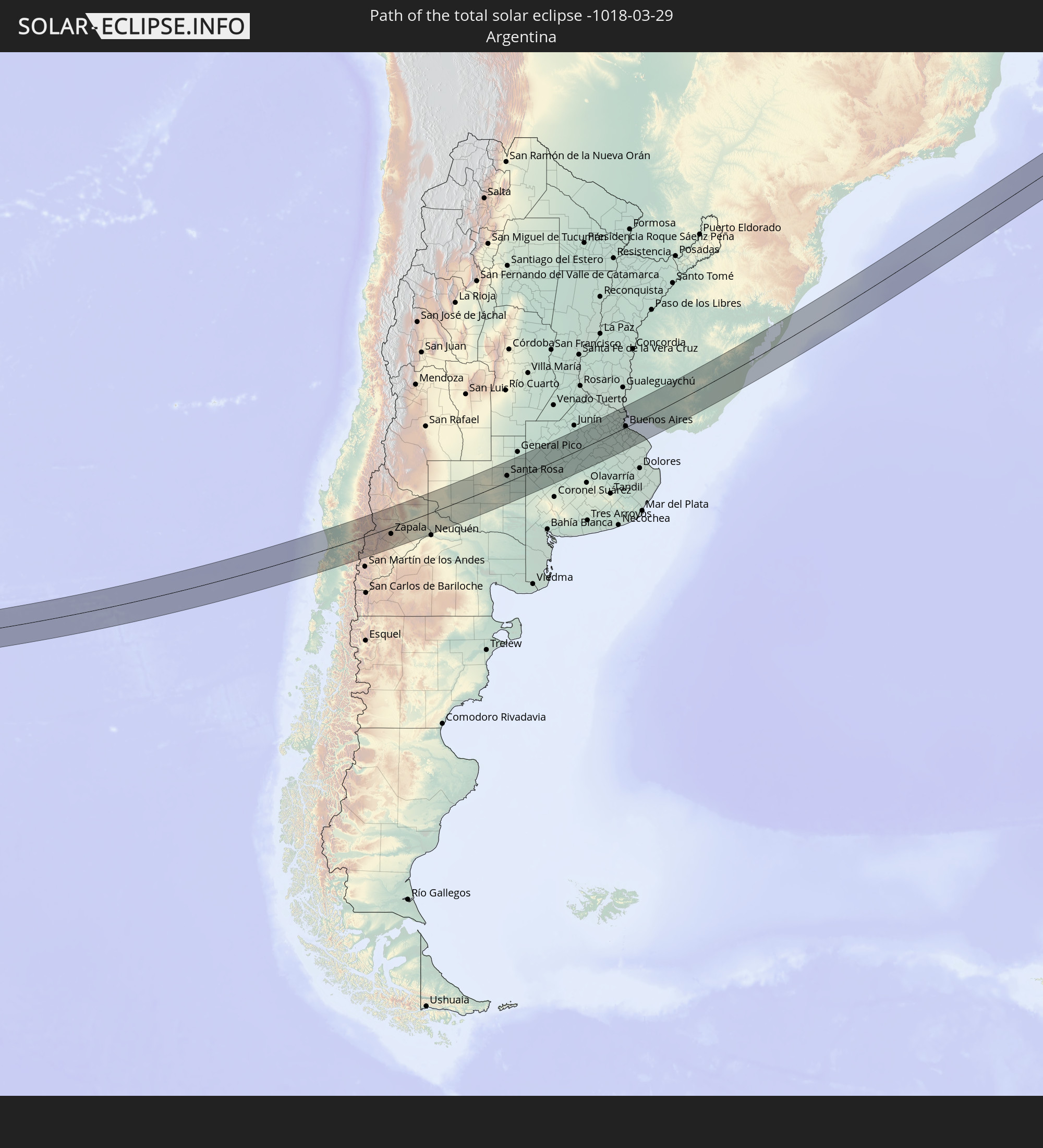 Argentina
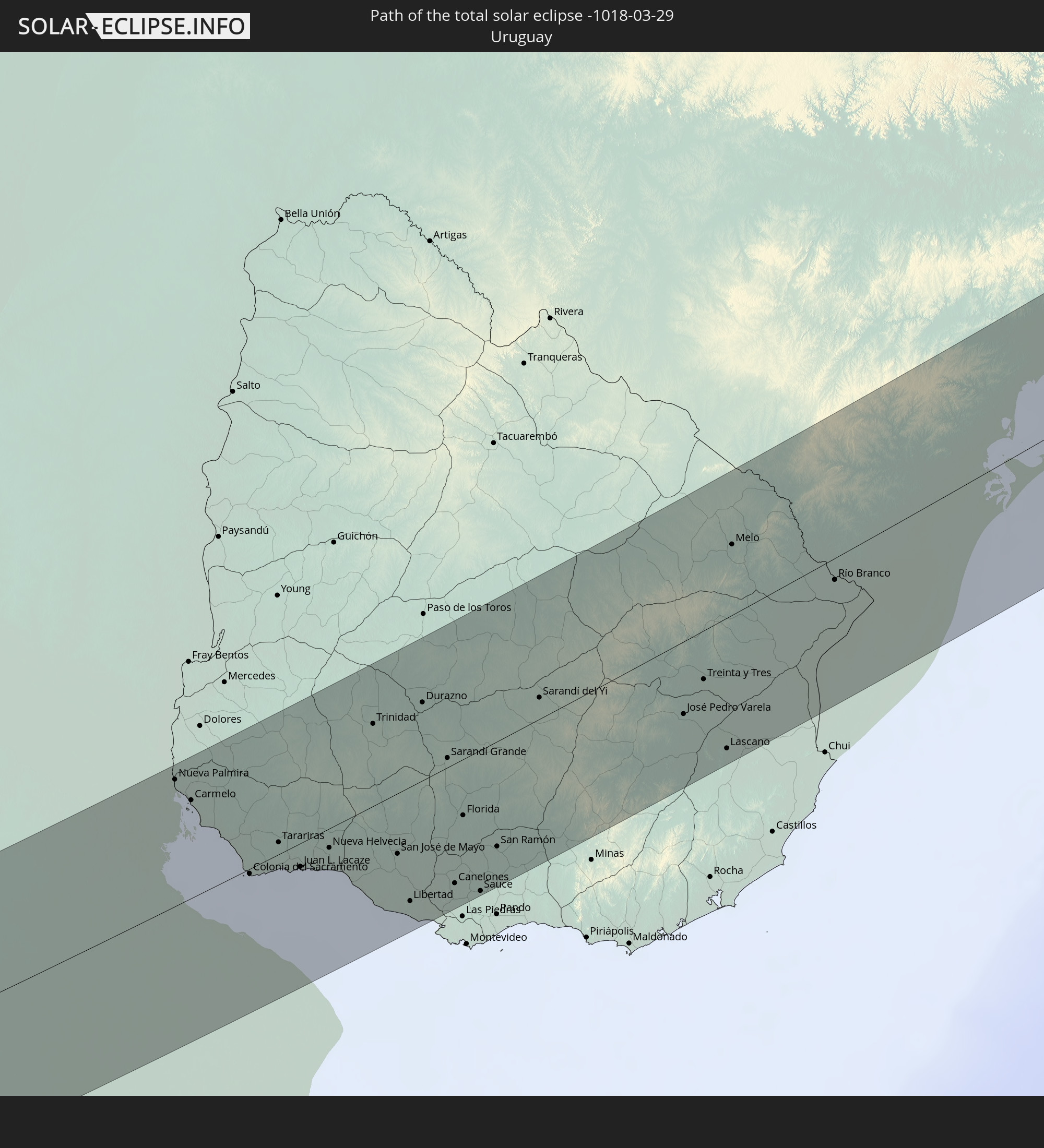 Uruguay
 Angola
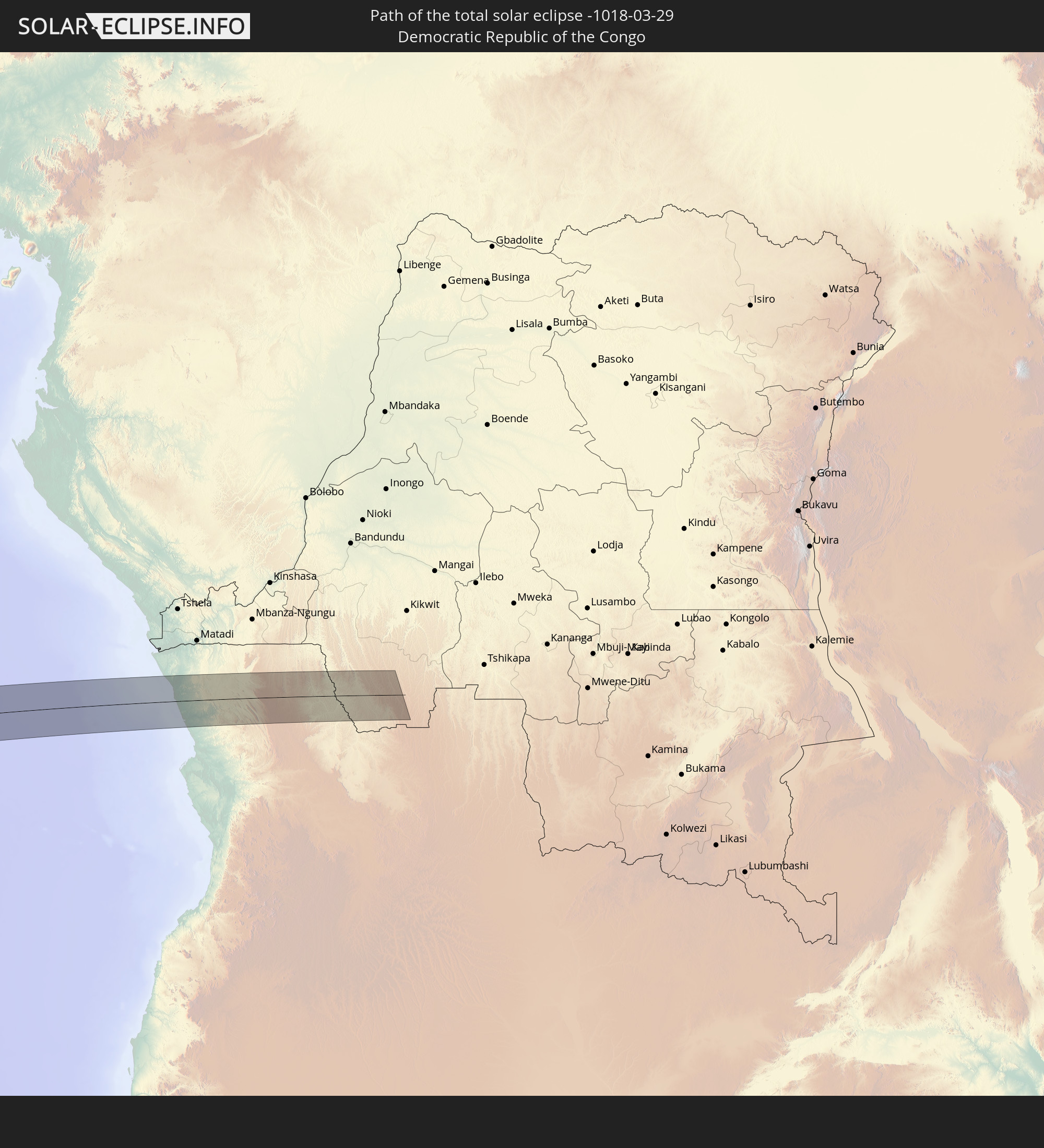 Democratic Republic of the Congo
In den folgenden Ländern ist die Sonnenfinsternis partiell zu sehen
 Antarctica
 Chile
Chile
 Peru
Peru
 Brazil
 Argentina
 Bolivia
 Paraguay
 Falkland Islands
 Uruguay
 Suriname
 French Guiana
 South Georgia and the South Sandwich Islands
 Cabo Verde
 Senegal
 Mauritania
 The Gambia
 Guinea-Bissau
 Guinea
 Saint Helena, Ascension and Tristan da Cunha
 Sierra Leone
 Mali
Mali
 Liberia
 Algeria
 Ivory Coast
 Burkina Faso
 Ghana
Ghana
 Togo
Togo
 Niger
Niger
 Benin
Benin
 Nigeria
 Bouvet Island
 Equatorial Guinea
 São Tomé and Príncipe
 Cameroon
 Gabon
Gabon
 Libya
Libya
 Republic of the Congo
 Angola
 Namibia
 Democratic Republic of the Congo
 Chad
Chad
 Central African Republic
 South Africa
 Botswana
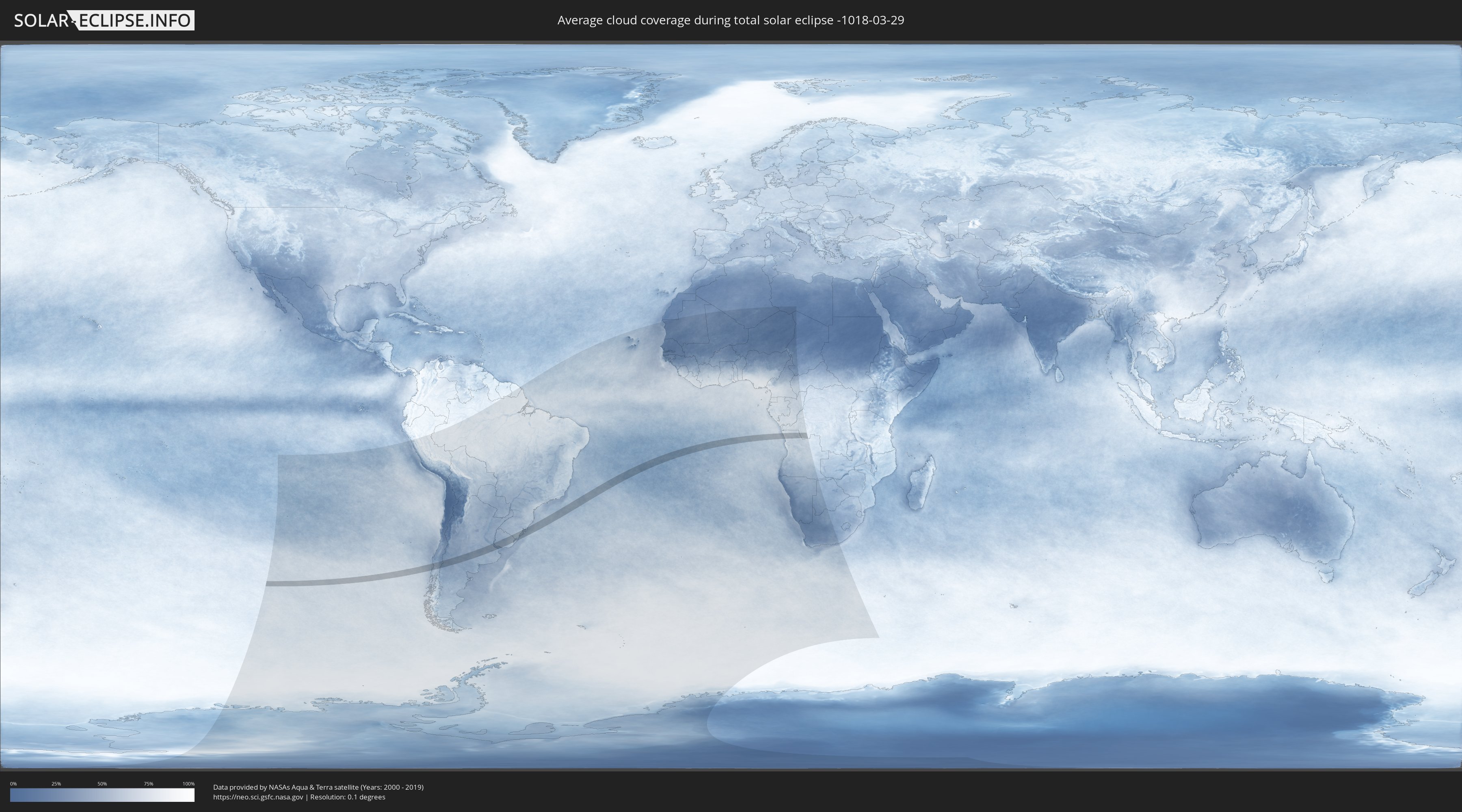
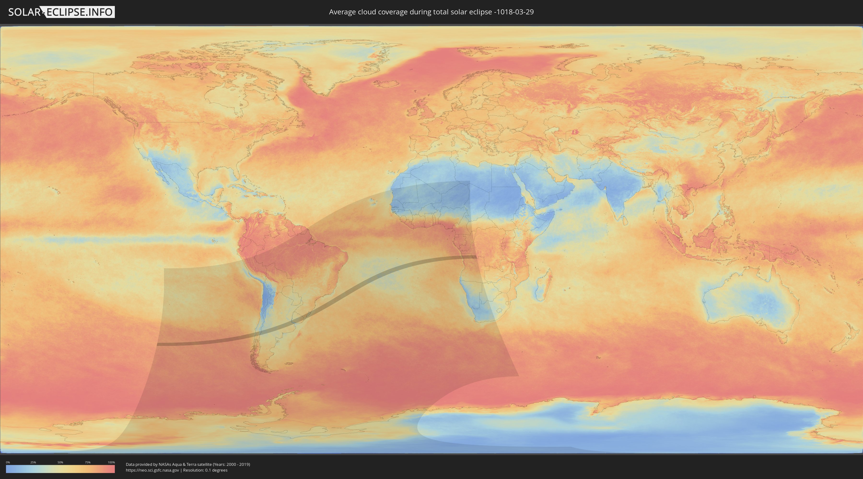
How will be the weather during the total solar eclipse on 03/29/-1018?
Where is the best place to see the total solar eclipse of 03/29/-1018?
The following maps show the average cloud coverage for the day of the total solar eclipse.
With the help of these maps, it is possible to find the place along the eclipse path, which has the best
chance of a cloudless sky.
Nevertheless, you should consider local circumstances and inform about the weather of your chosen
observation site.
The data is provided by NASAs satellites
AQUA and TERRA.
The cloud maps are averaged over a period of 19 years (2000 - 2019).
Detailed country maps
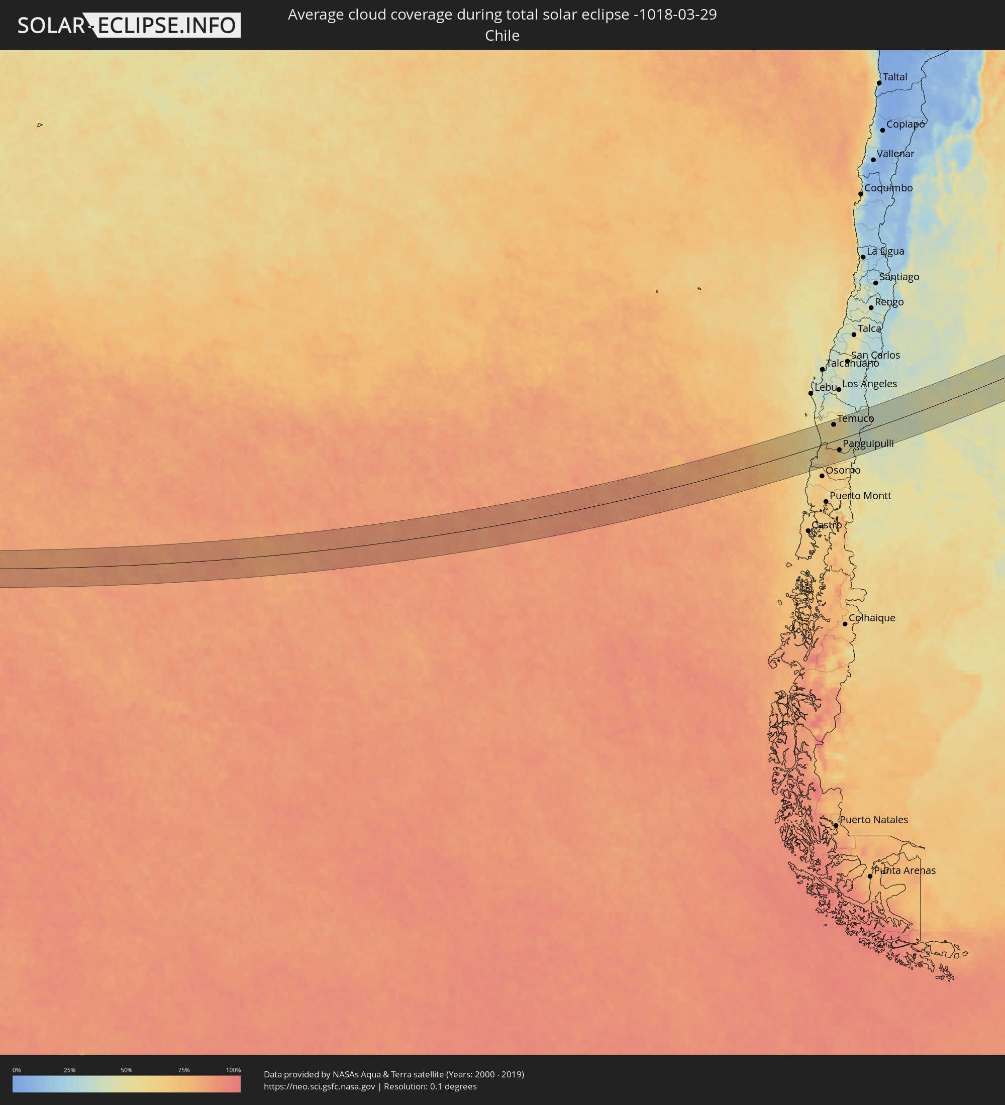 Chile
Chile
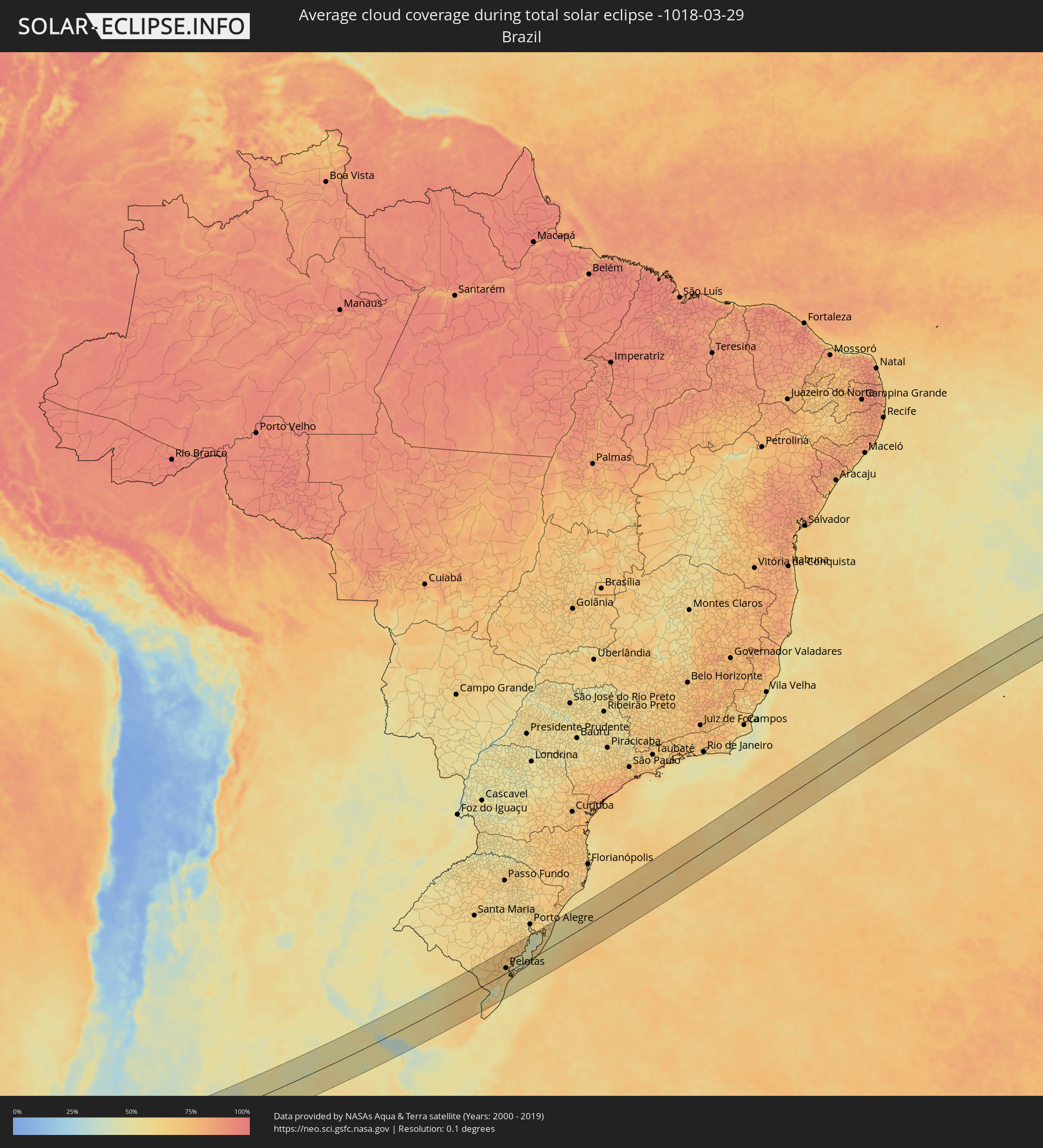 Brazil
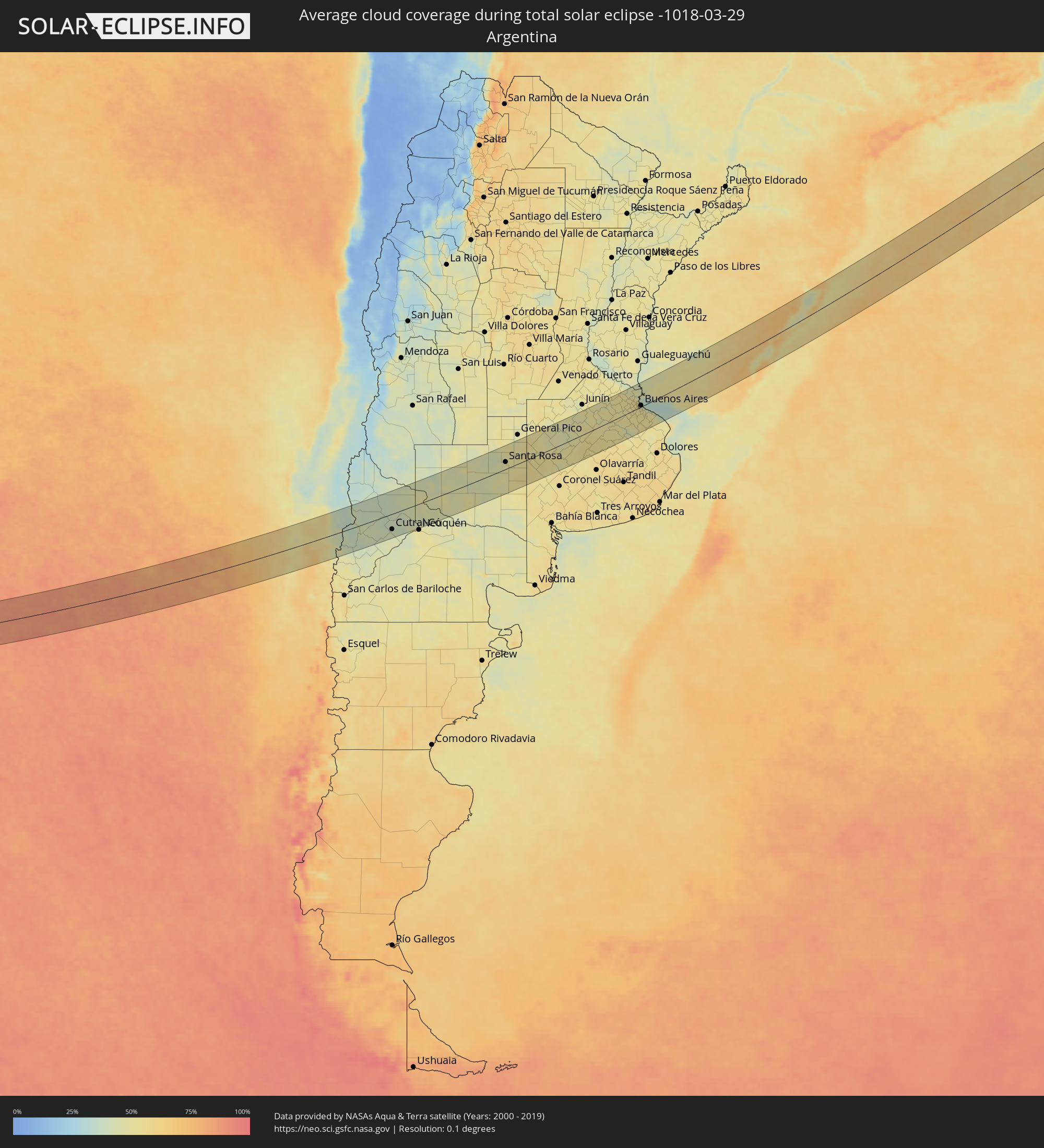 Argentina
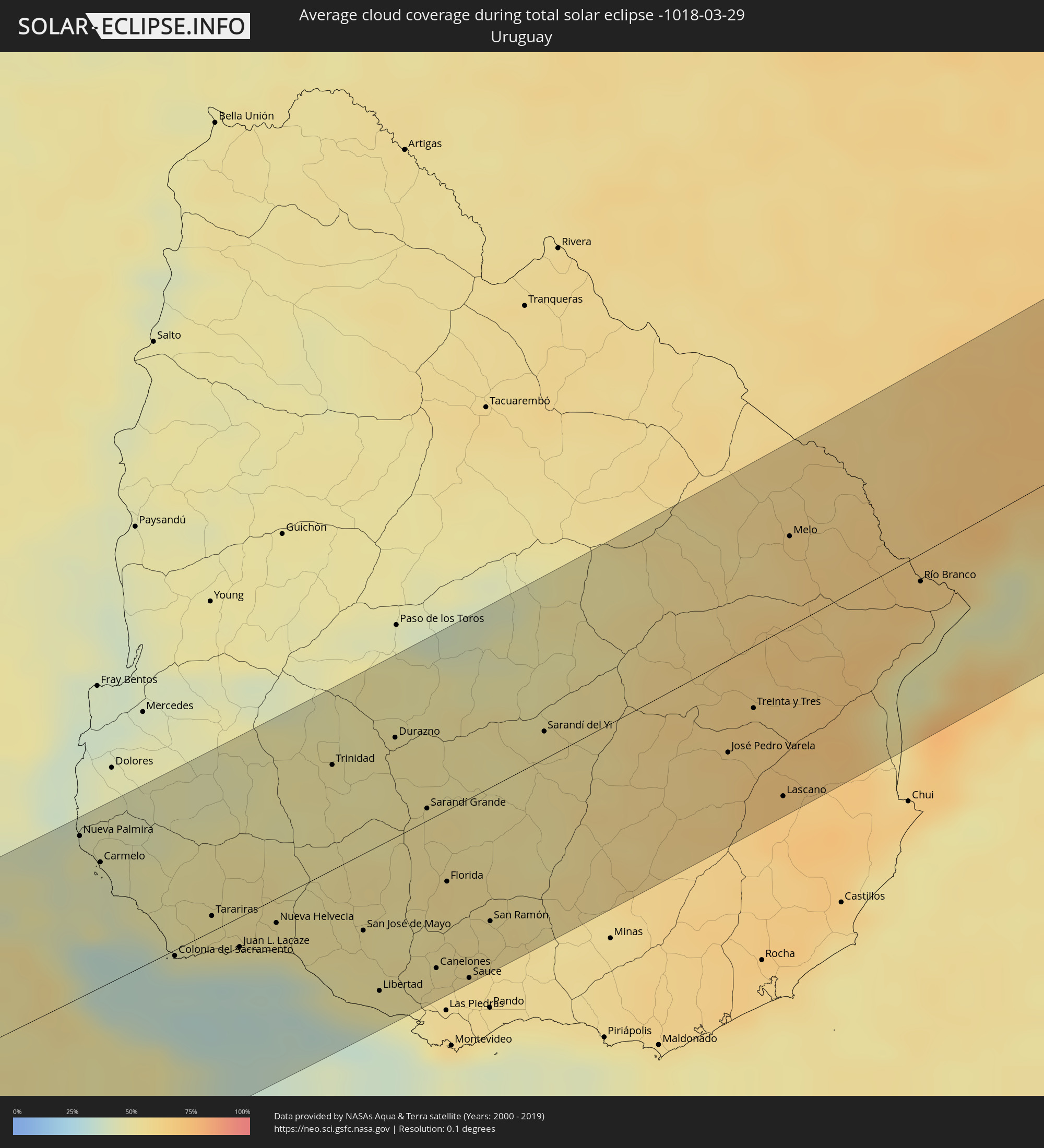 Uruguay
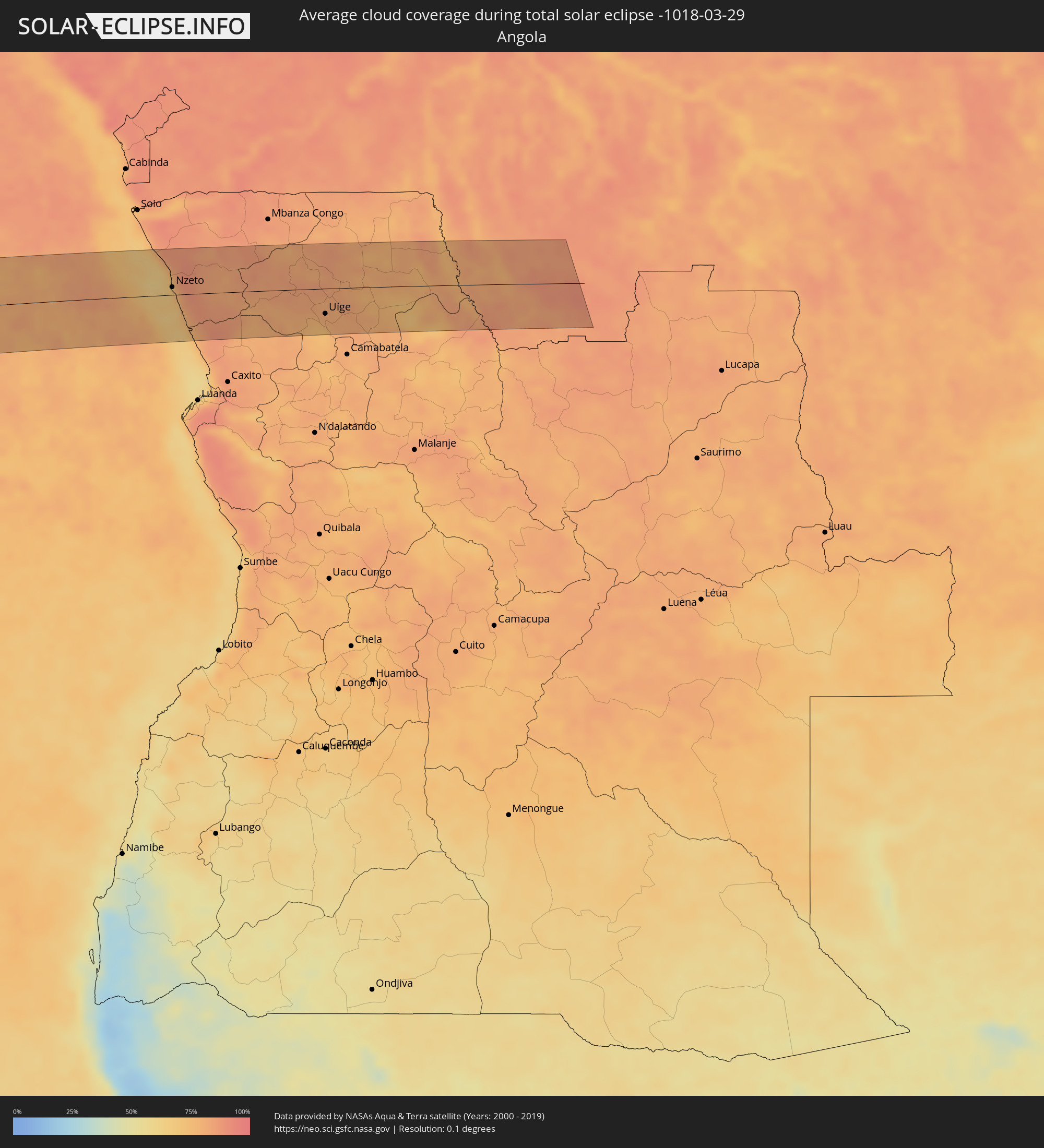 Angola
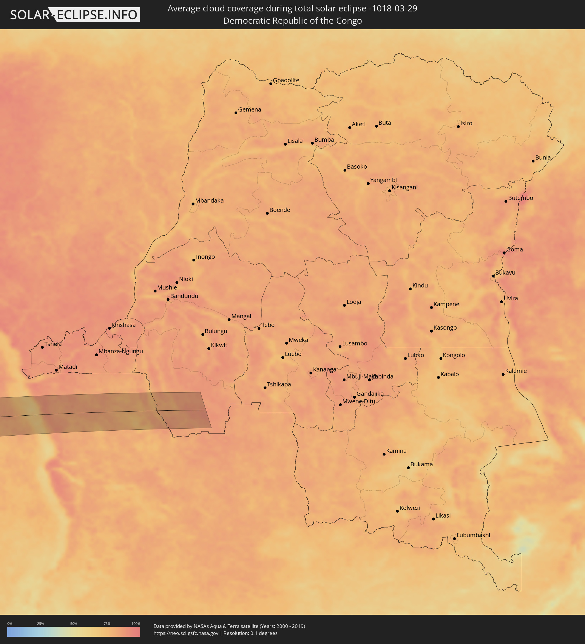 Democratic Republic of the Congo
Cities inside the path of the eclipse
The following table shows all locations with a population of more than 5,000 inside the eclipse path. Cities which have more than 100,000 inhabitants are marked bold. A click at the locations opens a detailed map.
| City | Type | Eclipse duration | Local time of max. eclipse | Distance to central line | Ø Cloud coverage |
|
Valdivia, Los Ríos
|
total | - | 09:21:29 UTC-04:42 | 35 km | 54% |
|
Las Animas, Los Lagos
|
total | - | 09:21:31 UTC-04:42 | 35 km | 54% |
|
Carahue, Araucanía
|
total | - | 09:21:22 UTC-04:42 | 80 km | 54% |
|
Nueva Imperial, Araucanía
|
total | - | 09:21:38 UTC-04:42 | 70 km | 56% |
|
Pitrufquén, Araucanía
|
total | - | 09:22:04 UTC-04:42 | 36 km | 56% |
|
Loncoche, Araucanía
|
total | - | 09:22:09 UTC-04:42 | 4 km | 55% |
|
Freire, Araucanía
|
total | - | 09:22:05 UTC-04:42 | 40 km | 56% |
|
Temuco, Araucanía
|
total | - | 09:22:04 UTC-04:42 | 62 km | 54% |
|
Lautaro, Araucanía
|
total | - | 09:22:15 UTC-04:42 | 79 km | 55% |
|
Panguipulli, Araucanía
|
total | - | 09:22:34 UTC-04:42 | 41 km | 56% |
|
Villarrica, Araucanía
|
total | - | 09:22:38 UTC-04:42 | 6 km | 53% |
|
Vilcún, Araucanía
|
total | - | 09:22:32 UTC-04:42 | 59 km | 56% |
|
Pucón, Araucanía
|
total | - | 09:22:59 UTC-04:42 | 13 km | 51% |
|
Zapala, Neuquén Province
|
total | - | 09:51:22 UTC-04:16 | 27 km | 42% |
|
Cutral-Có, Neuquén Province
|
total | - | 09:52:29 UTC-04:16 | 55 km | 41% |
|
Plaza Huincul, Neuquén Province
|
total | - | 09:52:31 UTC-04:16 | 55 km | 41% |
|
Centenario, Neuquén Province
|
total | - | 09:54:00 UTC-04:16 | 77 km | 47% |
|
Cinco Saltos, Río Negro Province
|
total | - | 09:54:05 UTC-04:16 | 78 km | 47% |
|
Catriel, Río Negro Province
|
total | - | 09:54:27 UTC-04:16 | 11 km | 49% |
|
Veinticinco de Mayo, La Pampa Province
|
total | - | 09:54:34 UTC-04:16 | 20 km | 47% |
|
General Acha, La Pampa Province
|
total | - | 09:59:15 UTC-04:16 | 42 km | 45% |
|
Santa Rosa, La Pampa Province
|
total | - | 09:59:53 UTC-04:16 | 25 km | 50% |
|
Nueve de Julio, Buenos Aires
|
total | - | 10:05:48 UTC-04:16 | 20 km | 53% |
|
Chacabuco, Buenos Aires
|
total | - | 10:06:49 UTC-04:16 | 85 km | 49% |
|
Veinticinco de Mayo, Buenos Aires
|
total | - | 10:07:02 UTC-04:16 | 6 km | 50% |
|
Chivilcoy, Buenos Aires
|
total | - | 10:07:31 UTC-04:16 | 41 km | 50% |
|
Mercedes, Buenos Aires
|
total | - | 10:08:39 UTC-04:16 | 43 km | 48% |
|
Luján, Buenos Aires
|
total | - | 10:09:17 UTC-04:16 | 38 km | 51% |
|
Zárate, Buenos Aires
|
total | - | 10:09:38 UTC-04:16 | 82 km | 48% |
|
Campana, Buenos Aires
|
total | - | 10:09:44 UTC-04:16 | 72 km | 50% |
|
Pontevedra, Buenos Aires
|
total | - | 10:09:55 UTC-04:16 | 4 km | 51% |
|
Morón, Buenos Aires
|
total | - | 10:10:07 UTC-04:16 | 10 km | 52% |
|
Tigre, Buenos Aires
|
total | - | 10:10:18 UTC-04:16 | 31 km | 52% |
|
San Isidro, Buenos Aires
|
total | - | 10:10:22 UTC-04:16 | 24 km | 53% |
|
Villa Santa Rita, Buenos Aires F.D.
|
total | - | 10:10:23 UTC-04:16 | 9 km | 55% |
|
Villa Lugano, Buenos Aires F.D.
|
total | - | 10:10:22 UTC-04:16 | 2 km | 54% |
|
Colegiales, Buenos Aires F.D.
|
total | - | 10:10:28 UTC-04:16 | 11 km | 52% |
|
Nueva Palmira, Colonia
|
total | - | 10:42:50 UTC-03:44 | 79 km | 47% |
|
Adrogué, Buenos Aires
|
total | - | 10:10:28 UTC-04:16 | 14 km | 51% |
|
Retiro, Buenos Aires F.D.
|
total | - | 10:10:34 UTC-04:16 | 7 km | 52% |
|
Buenos Aires, Buenos Aires F.D.
|
total | - | 10:10:34 UTC-04:16 | 4 km | 52% |
|
Carmelo, Colonia
|
total | - | 10:42:59 UTC-03:44 | 61 km | 44% |
|
Quilmes, Buenos Aires
|
total | - | 10:10:43 UTC-04:16 | 12 km | 51% |
|
La Plata, Buenos Aires
|
total | - | 10:11:11 UTC-04:16 | 44 km | 51% |
|
Colonia del Sacramento, Colonia
|
total | - | 10:43:34 UTC-03:44 | 3 km | 34% |
|
Tarariras, Colonia
|
total | - | 10:44:05 UTC-03:44 | 7 km | 50% |
|
Juan L. Lacaze, Colonia
|
total | - | 10:44:18 UTC-03:44 | 15 km | 42% |
|
Rosario, Colonia
|
total | - | 10:44:33 UTC-03:44 | 9 km | 50% |
|
Nueva Helvecia, Colonia
|
total | - | 10:44:46 UTC-03:44 | 12 km | 51% |
|
Trinidad, Flores
|
total | - | 10:45:50 UTC-03:44 | 51 km | 51% |
|
Trinidad, Flores
|
total | - | 10:45:50 UTC-03:44 | 49 km | 51% |
|
San José de Mayo, San José
|
total | - | 10:45:43 UTC-03:44 | 38 km | 53% |
|
Libertad, San José
|
total | - | 10:45:44 UTC-03:44 | 71 km | 49% |
|
Durazno, Durazno
|
total | - | 10:46:38 UTC-03:44 | 49 km | 52% |
|
Santa Lucía, Canelones
|
total | - | 10:46:15 UTC-03:44 | 63 km | 53% |
|
Sarandí Grande, Florida
|
total | - | 10:46:47 UTC-03:44 | 6 km | 54% |
|
Canelones, Canelones
|
total | - | 10:46:26 UTC-03:44 | 74 km | 54% |
|
Florida, Florida
|
total | - | 10:46:47 UTC-03:44 | 35 km | 56% |
|
Sauce, Canelones
|
total | - | 10:46:46 UTC-03:44 | 87 km | 56% |
|
San Ramón, Canelones
|
total | - | 10:47:10 UTC-03:44 | 65 km | 55% |
|
Sarandí del Yi, Durazno
|
total | - | 10:48:21 UTC-03:44 | 13 km | 53% |
|
José Pedro Varela, Lavalleja
|
total | - | 10:50:24 UTC-03:44 | 45 km | 63% |
|
Treinta y Tres, Treinta y Tres
|
total | - | 10:50:50 UTC-03:44 | 30 km | 65% |
|
Lascano, Rocha
|
total | - | 10:50:53 UTC-03:44 | 81 km | 68% |
|
Melo, Cerro Largo
|
total | - | 10:51:53 UTC-03:44 | 44 km | 61% |
|
Herval, Rio Grande do Sul
|
total | - | 11:32:04 UTC-03:06 | 43 km | 65% |
|
Río Branco, Cerro Largo
|
total | - | 10:53:16 UTC-03:44 | 14 km | 66% |
|
Pinheiro Machado, Rio Grande do Sul
|
total | - | 11:32:27 UTC-03:06 | 85 km | 65% |
|
Jaguarão, Rio Grande do Sul
|
total | - | 11:31:41 UTC-03:06 | 11 km | 66% |
|
Arroio Grande, Rio Grande do Sul
|
total | - | 11:32:31 UTC-03:06 | 8 km | 70% |
|
Canguçu, Rio Grande do Sul
|
total | - | 11:34:02 UTC-03:06 | 70 km | 68% |
|
Pelotas, Rio Grande do Sul
|
total | - | 11:34:24 UTC-03:06 | 18 km | 61% |
|
Rio Grande, Rio Grande do Sul
|
total | - | 11:34:41 UTC-03:06 | 19 km | 60% |
|
São Lourenço do Sul, Rio Grande do Sul
|
total | - | 11:35:30 UTC-03:06 | 40 km | 57% |
|
Camaquã, Rio Grande do Sul
|
total | - | 11:36:17 UTC-03:06 | 82 km | 75% |
|
Tapes, Rio Grande do Sul
|
total | - | 11:37:19 UTC-03:06 | 79 km | 54% |
|
Palmares do Sul, Rio Grande do Sul
|
total | - | 11:39:34 UTC-03:06 | 76 km | 63% |
|
Cidreira, Rio Grande do Sul
|
total | - | 11:40:17 UTC-03:06 | 69 km | 54% |
|
Tramandaí, Rio Grande do Sul
|
total | - | 11:40:38 UTC-03:06 | 84 km | 53% |
|
Nzeto, Zaire
|
total | - | 17:06:06 UTC+00:13 | 12 km | 77% |
|
Uíge, Uíge
|
total | - | 17:06:06 UTC+00:13 | 40 km | 80% |