Totale Sonnenfinsternis vom 17.02.-1481
| Wochentag: | Mittwoch |
| Maximale Dauer der Verfinsterung: | 04m01s |
| Maximale Breite des Finsternispfades: | 170 km |
| Saroszyklus: | 26 |
| Bedeckungsgrad: | 100% |
| Magnitude: | 1.048 |
| Gamma: | -0.343 |
Wo kann man die Sonnenfinsternis vom 17.02.-1481 sehen?
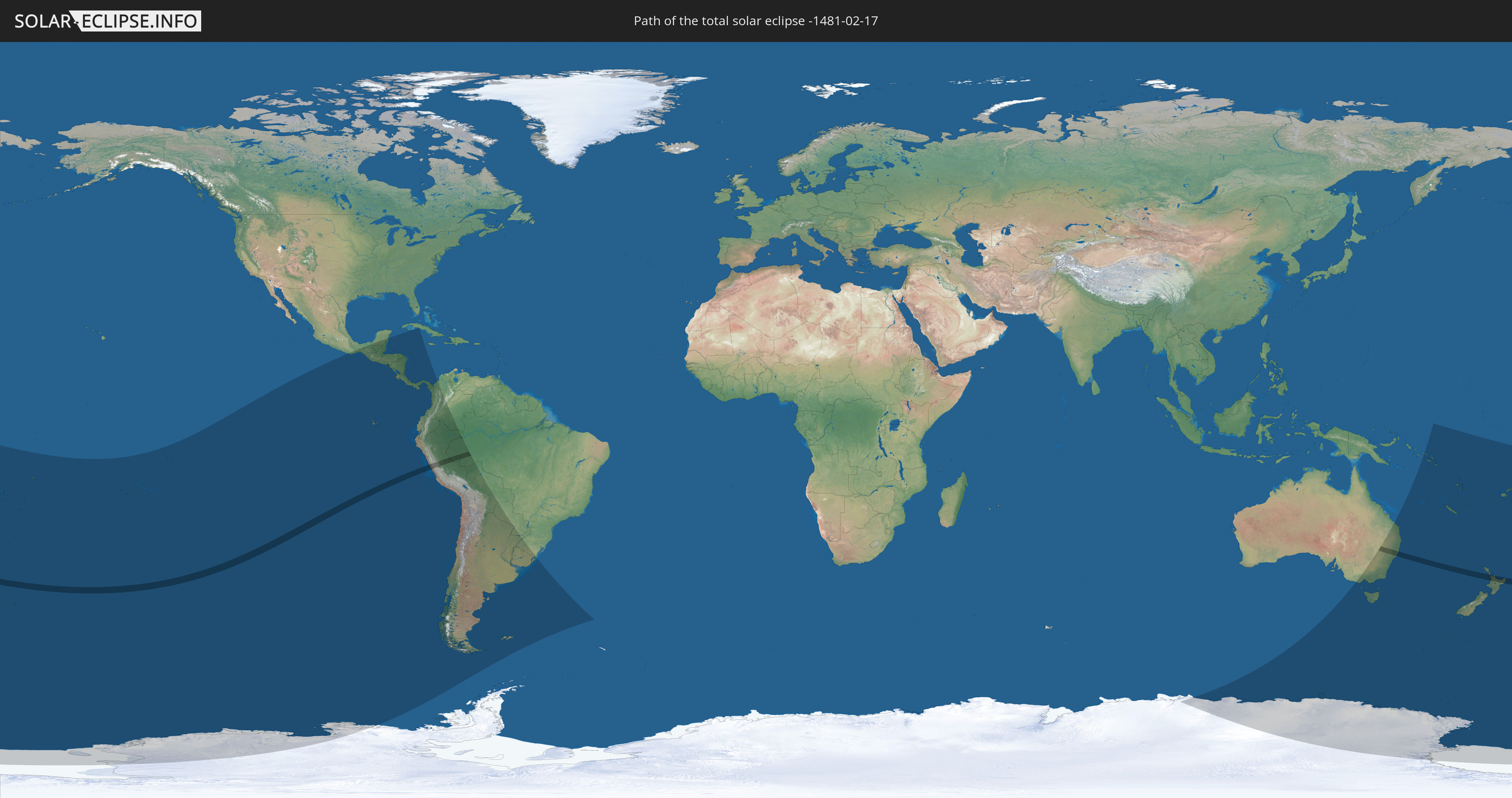
Die Sonnenfinsternis am 17.02.-1481 kann man in 39 Ländern als partielle Sonnenfinsternis beobachten.
Der Finsternispfad verläuft durch 5 Länder. Nur in diesen Ländern ist sie als totale Sonnenfinsternis zu sehen.
In den folgenden Ländern ist die Sonnenfinsternis total zu sehen
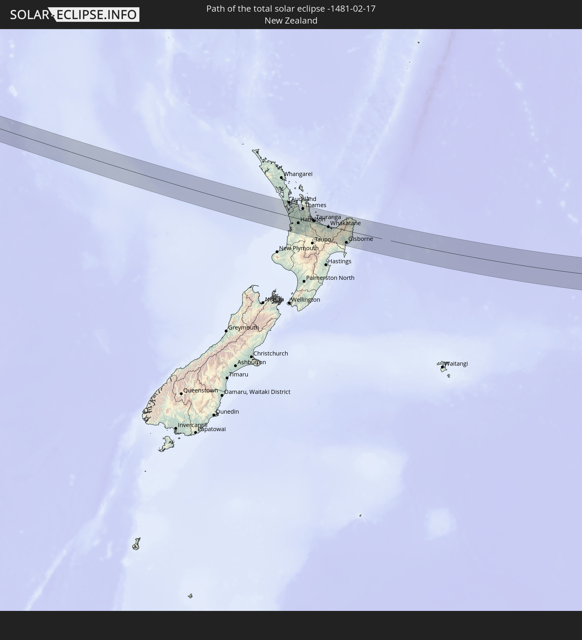 Neuseeland
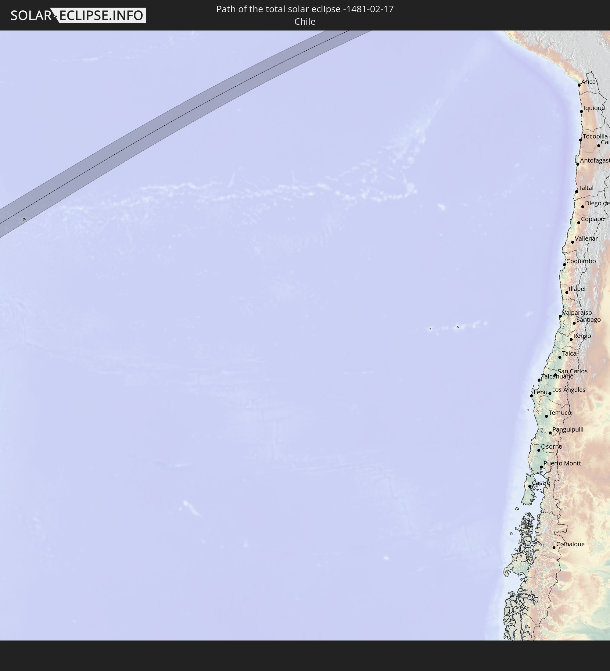 Chile
Chile
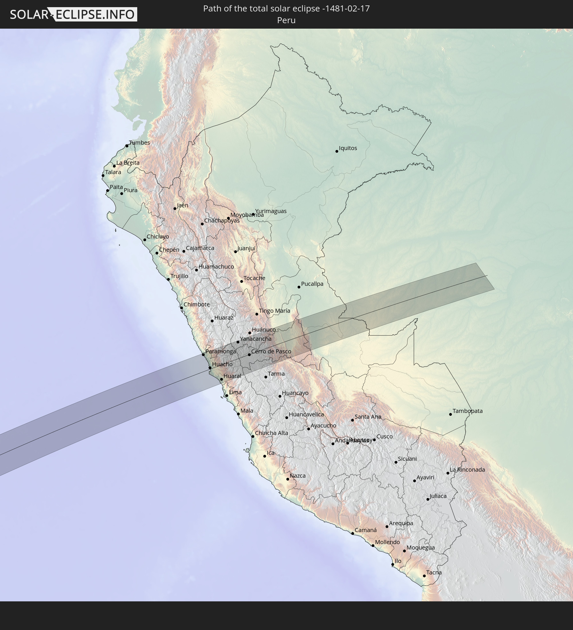 Peru
Peru
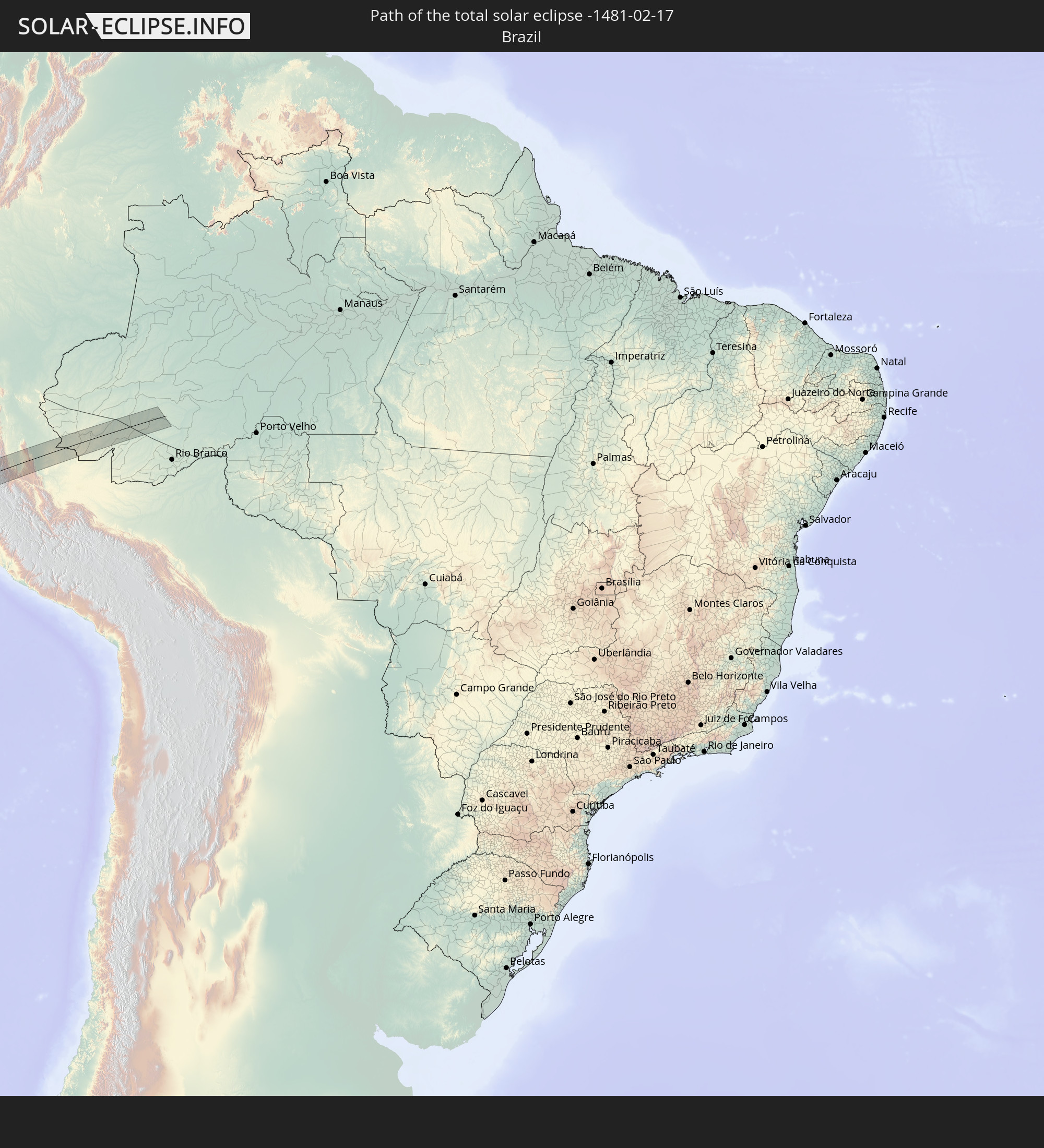 Brasilien
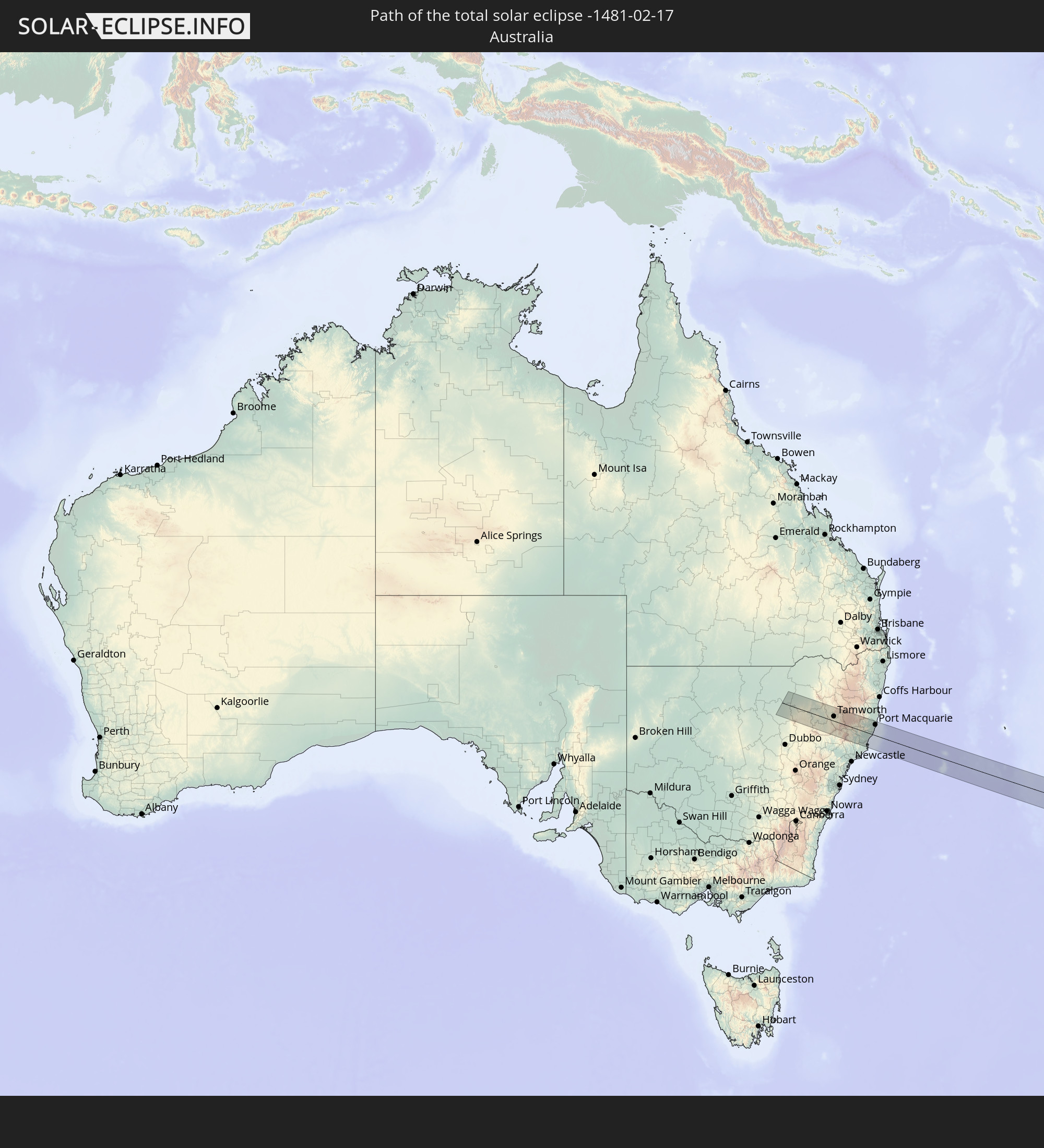 Australien
In den folgenden Ländern ist die Sonnenfinsternis partiell zu sehen
 Antarktika
 Fidschi
 Neuseeland
 Wallis und Futuna
 Tonga
Tonga
 Kiribati
 Samoa
Samoa
 Tokelau
 Amerikanisch-Samoa
 Niue
Niue
 Cookinseln
 Französisch-Polynesien
 Pitcairninseln
 Mexiko
 Chile
Chile
 Guatemala
 Ecuador
 El Salvador
 Honduras
 Belize
 Nicaragua
 Costa Rica
 Kuba
Kuba
 Panama
 Kolumbien
 Kaimaninseln
 Peru
Peru
 Brasilien
 Argentinien
 Bolivien
 Paraguay
 Falklandinseln
 Uruguay
 Australien
 Salomonen
 Neukaledonien
 Vanuatu
 Norfolkinsel
 Tuvalu
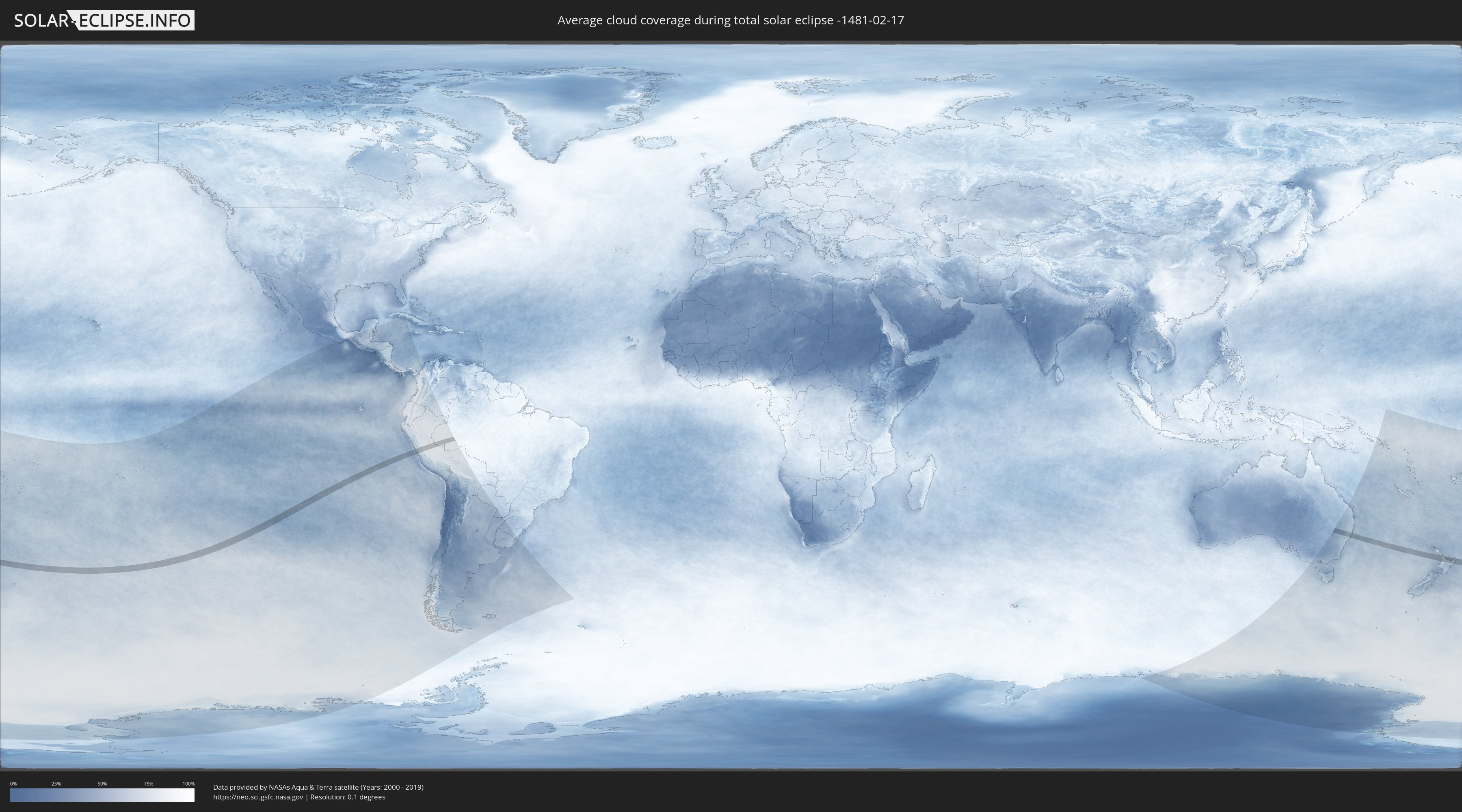
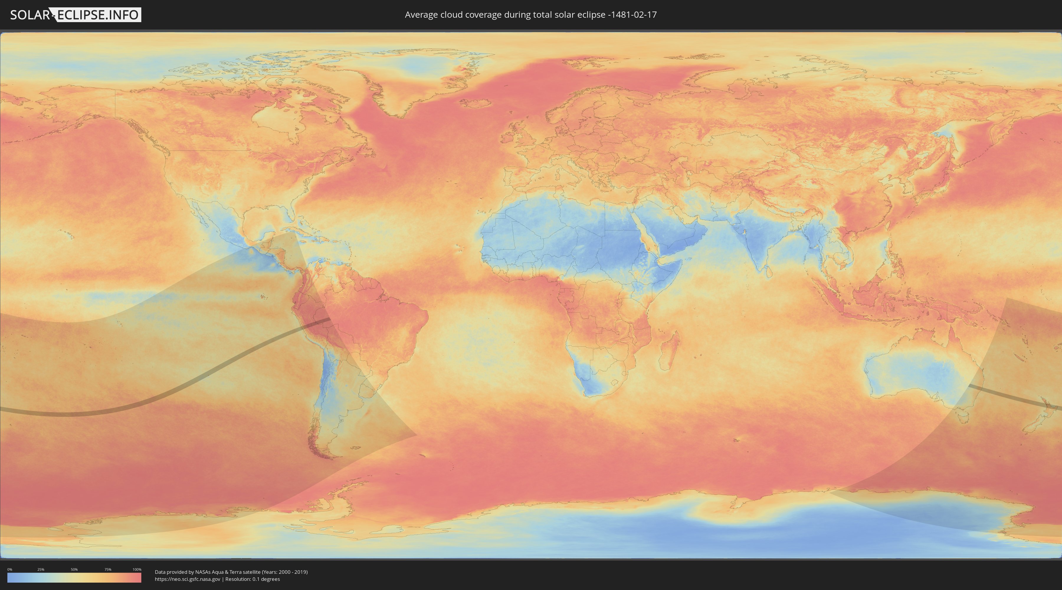
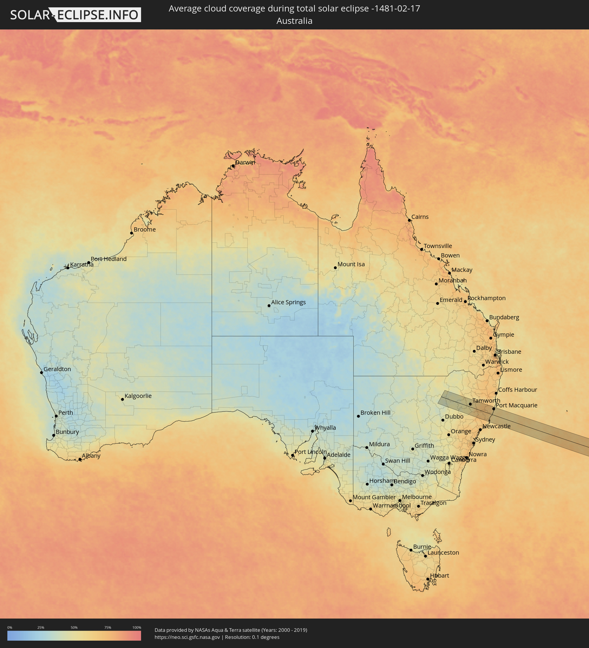
Wie wird das Wetter während der totalen Sonnenfinsternis am 17.02.-1481?
Wo ist der beste Ort, um die totale Sonnenfinsternis vom 17.02.-1481 zu beobachten?
Die folgenden Karten zeigen die durchschnittliche Bewölkung für den Tag, an dem die totale Sonnenfinsternis
stattfindet. Mit Hilfe der Karten lässt sich der Ort entlang des Finsternispfades eingrenzen,
der die besten Aussichen auf einen klaren wolkenfreien Himmel bietet.
Trotzdem muss man immer lokale Gegenenheiten beachten und sollte sich genau über das Wetter an seinem
gewählten Beobachtungsort informieren.
Die Daten stammen von den beiden NASA-Satelliten
AQUA und TERRA
und wurden über einen Zeitraum von 19 Jahren (2000 - 2019) gemittelt.
Detaillierte Länderkarten
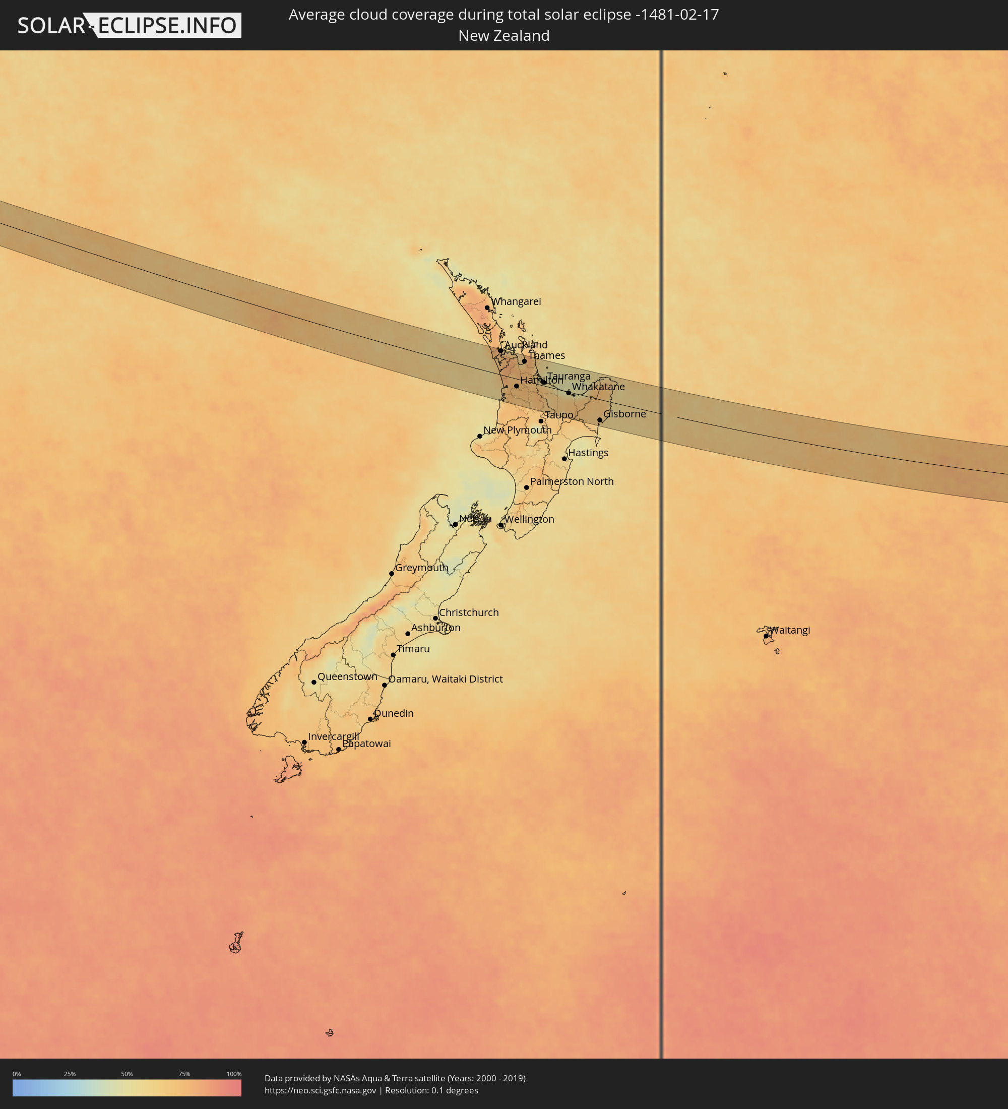 Neuseeland
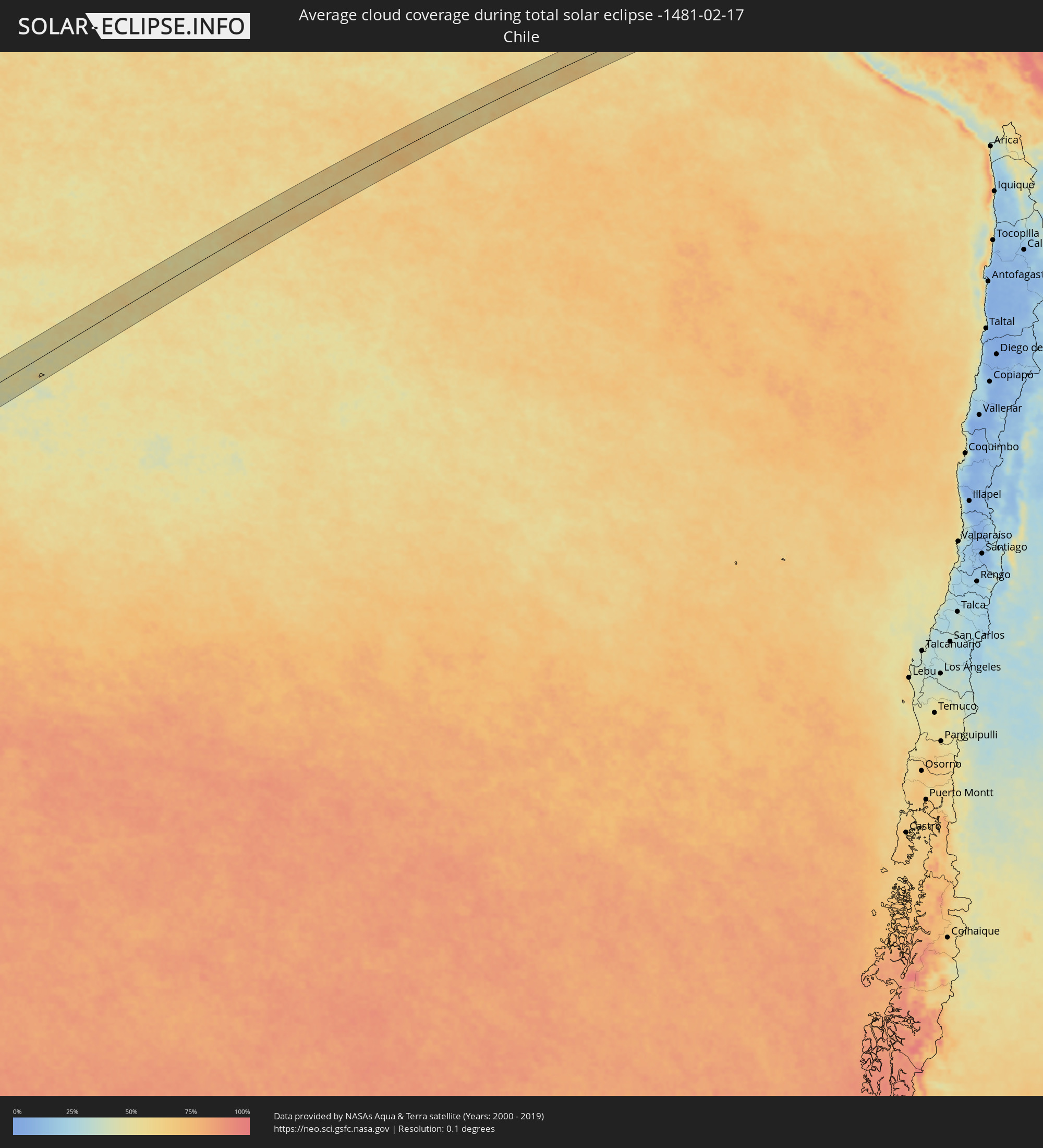 Chile
Chile
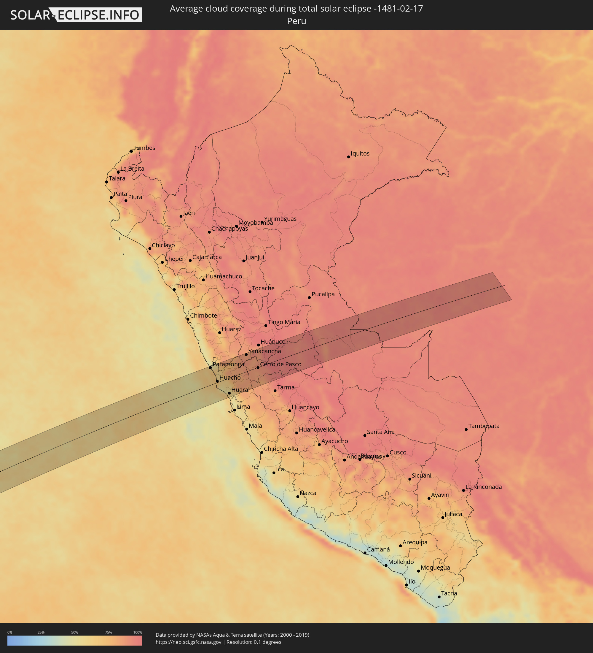 Peru
Peru
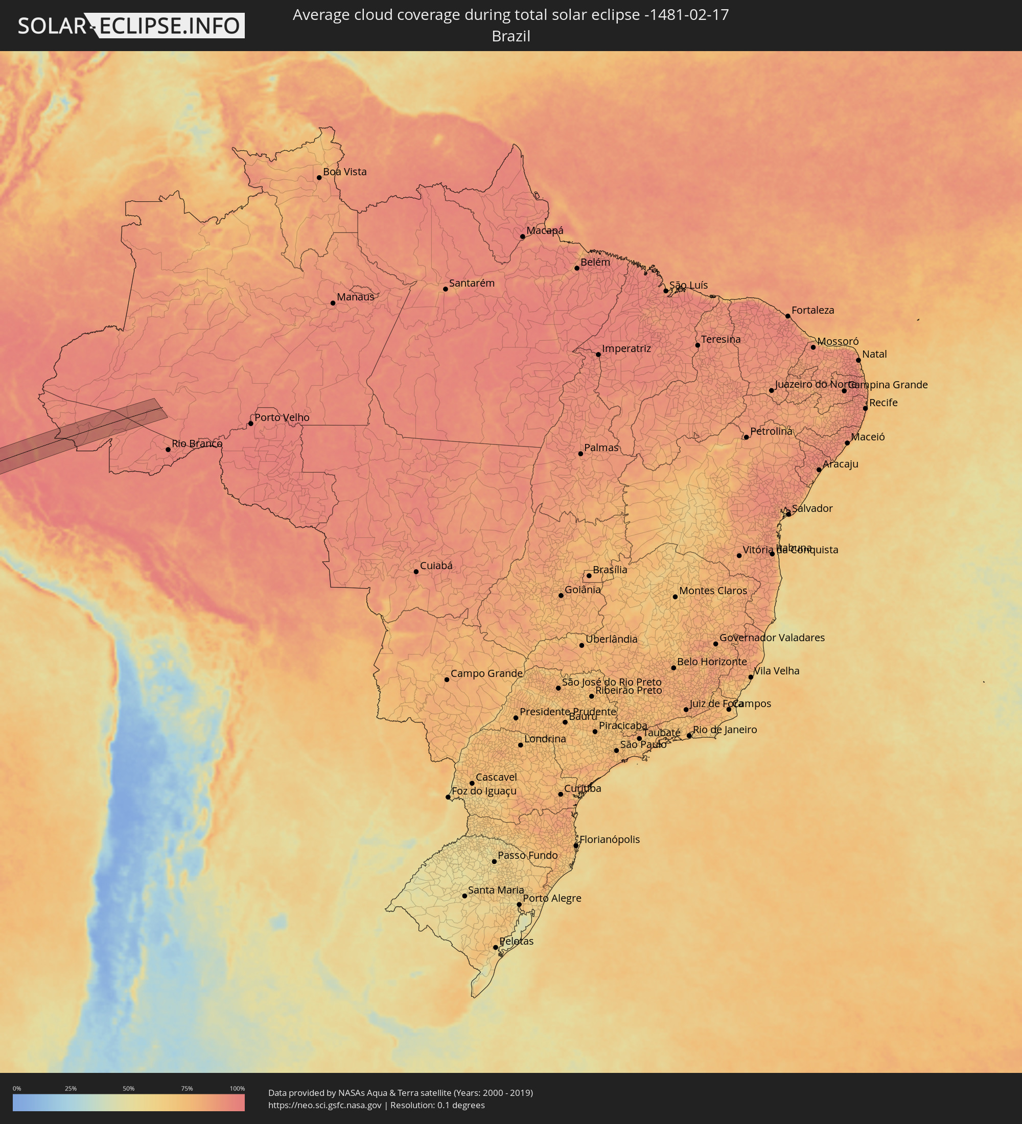 Brasilien
 Australien
Orte im Finsternispfad
Die nachfolgene Tabelle zeigt Städte und Orte mit mehr als 5.000 Einwohnern, die sich im Finsternispfad befinden. Städte mit mehr als 100.000 Einwohnern sind dick gekennzeichnet. Mit einem Klick auf den Ort öffnet sich eine Detailkarte die die Lage des jeweiligen Ortes zusammen mit dem Verlauf der zentralen Finsternis präsentiert.
| Ort | Typ | Dauer der Verfinsterung | Ortszeit bei maximaler Verfinsterung | Entfernung zur Zentrallinie | Ø Bewölkung |
|
Paramonga, Lima region
|
total | - | 17:51:35 UTC-05:08 | 58 km | 71% |
|
Pativilca, Lima region
|
total | - | 17:51:34 UTC-05:08 | 52 km | 71% |
|
Barranca, Lima region
|
total | - | 17:51:31 UTC-05:08 | 46 km | 67% |
|
Puerto Supe, Lima region
|
total | - | 17:51:28 UTC-05:08 | 40 km | 67% |
|
Supe, Lima region
|
total | - | 17:51:29 UTC-05:08 | 39 km | 67% |
|
Végueta, Lima region
|
total | - | 17:51:16 UTC-05:08 | 13 km | 68% |
|
Caleta de Carquín, Lima region
|
total | - | 17:51:12 UTC-05:08 | 5 km | 64% |
|
Hualmay, Lima region
|
total | - | 17:51:12 UTC-05:08 | 4 km | 64% |
|
Huacho, Lima region
|
total | - | 17:51:12 UTC-05:08 | 3 km | 64% |
|
Huaura, Lima region
|
total | - | 17:51:14 UTC-05:08 | 7 km | 64% |
|
Chancay, Lima region
|
total | - | 17:50:47 UTC-05:08 | 58 km | 64% |
|
Huaral, Lima region
|
total | - | 17:50:51 UTC-05:08 | 53 km | 61% |
|
Sayán, Lima region
|
total | - | 17:51:11 UTC-05:08 | 16 km | 62% |
|
Oyón, Lima region
|
total | - | 17:51:38 UTC-05:08 | 17 km | 82% |
|
Yanacancha, Huanuco
|
total | - | 17:52:01 UTC-05:08 | 57 km | 87% |
|
Yanahuanca, Pasco Region
|
total | - | 17:51:46 UTC-05:08 | 22 km | 83% |
|
Chaupimarca, Pasco Region
|
total | - | 17:51:52 UTC-05:08 | 32 km | 85% |
|
Tinyahuarco, Pasco Region
|
total | - | 17:51:33 UTC-05:08 | 12 km | 84% |
|
Cerro de Pasco, Pasco Region
|
total | - | 17:51:38 UTC-05:08 | 3 km | 84% |
|
Ambo, Huanuco
|
total | - | 17:52:07 UTC-05:08 | 52 km | 88% |
|
Carhuamayo, Junín Region
|
total | - | 17:51:25 UTC-05:08 | 37 km | 88% |
|
Oxapampa, Pasco Region
|
total | - | 17:51:43 UTC-05:08 | 25 km | 96% |
|
Villa Rica, Pasco Region
|
total | - | 17:51:34 UTC-05:08 | 47 km | 96% |
|
Feijó, Acre
|
total | - | 18:30:39 UTC-04:31 | 52 km | 94% |
|
Gunnedah, New South Wales
|
total | - | 05:45:29 UTC+10:00 | 10 km | 48% |
|
South Tamworth, New South Wales
|
total | - | 05:45:28 UTC+10:00 | 17 km | 52% |
|
Tamworth, New South Wales
|
total | - | 05:45:28 UTC+10:00 | 20 km | 52% |
|
Taree, New South Wales
|
total | - | 05:45:53 UTC+10:00 | 19 km | 61% |
|
Forster, New South Wales
|
total | - | 05:46:06 UTC+10:00 | 46 km | 59% |
|
Port Macquarie, New South Wales
|
total | - | 05:45:27 UTC+10:00 | 46 km | 57% |
|
Waitakere, Auckland
|
total | - | 07:25:12 UTC+11:30 | 58 km | 71% |
|
Waiuku, Auckland
|
total | - | 07:25:35 UTC+11:30 | 24 km | 71% |
|
Auckland, Auckland
|
total | - | 07:25:13 UTC+11:30 | 66 km | 73% |
|
Mangere, Auckland
|
total | - | 07:25:20 UTC+11:30 | 56 km | 71% |
|
Manukau City, Auckland
|
total | - | 07:25:25 UTC+11:30 | 55 km | 75% |
|
Takanini, Auckland
|
total | - | 07:25:29 UTC+11:30 | 49 km | 75% |
|
Pakuranga, Auckland
|
total | - | 07:25:20 UTC+11:30 | 68 km | 76% |
|
Papakura, Auckland
|
total | - | 07:25:31 UTC+11:30 | 48 km | 80% |
|
Pukekohe East, Auckland
|
total | - | 07:25:39 UTC+11:30 | 34 km | 79% |
|
Ngaruawahia, Waikato
|
total | - | 07:26:14 UTC+11:30 | 12 km | 73% |
|
Hamilton, Waikato
|
total | - | 07:26:26 UTC+11:30 | 21 km | 72% |
|
Cambridge, Waikato
|
total | - | 07:26:37 UTC+11:30 | 28 km | 72% |
|
Thames, Waikato
|
total | - | 07:25:57 UTC+11:30 | 54 km | 64% |
|
Matamata, Waikato
|
total | - | 07:26:45 UTC+11:30 | 14 km | 72% |
|
Tokoroa, Waikato
|
total | - | 07:27:14 UTC+11:30 | 57 km | 70% |
|
Tauranga, Bay of Plenty Region
|
total | - | 07:26:53 UTC+11:30 | 8 km | 64% |
|
Rotorua, Bay of Plenty Region
|
total | - | 07:27:23 UTC+11:30 | 39 km | 69% |
|
Kawerau, Bay of Plenty Region
|
total | - | 07:27:38 UTC+11:30 | 25 km | 66% |
|
Whakatane, Bay of Plenty Region
|
total | - | 07:27:41 UTC+11:30 | 4 km | 64% |
|
Gisborne, Gisborne
|
total | - | 07:29:05 UTC+11:30 | 58 km | 57% |