Totale Sonnenfinsternis vom 13.01.-1684
| Wochentag: | Mittwoch |
| Maximale Dauer der Verfinsterung: | 04m55s |
| Maximale Breite des Finsternispfades: | 177 km |
| Saroszyklus: | 14 |
| Bedeckungsgrad: | 100% |
| Magnitude: | 1.0533 |
| Gamma: | 0.0613 |
Wo kann man die Sonnenfinsternis vom 13.01.-1684 sehen?
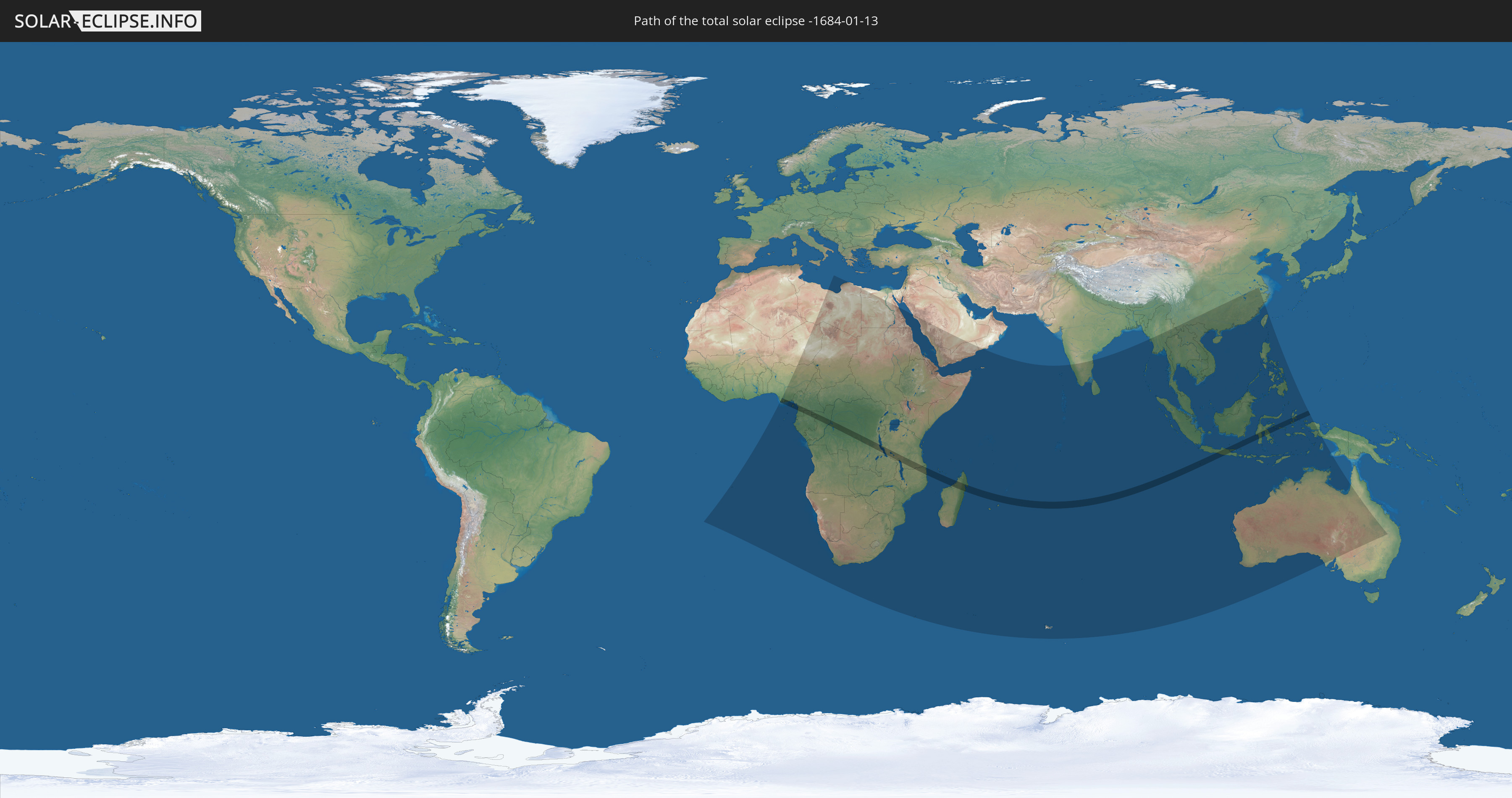
Die Sonnenfinsternis am 13.01.-1684 kann man in 65 Ländern als partielle Sonnenfinsternis beobachten.
Der Finsternispfad verläuft durch 13 Länder. Nur in diesen Ländern ist sie als totale Sonnenfinsternis zu sehen.
In den folgenden Ländern ist die Sonnenfinsternis total zu sehen
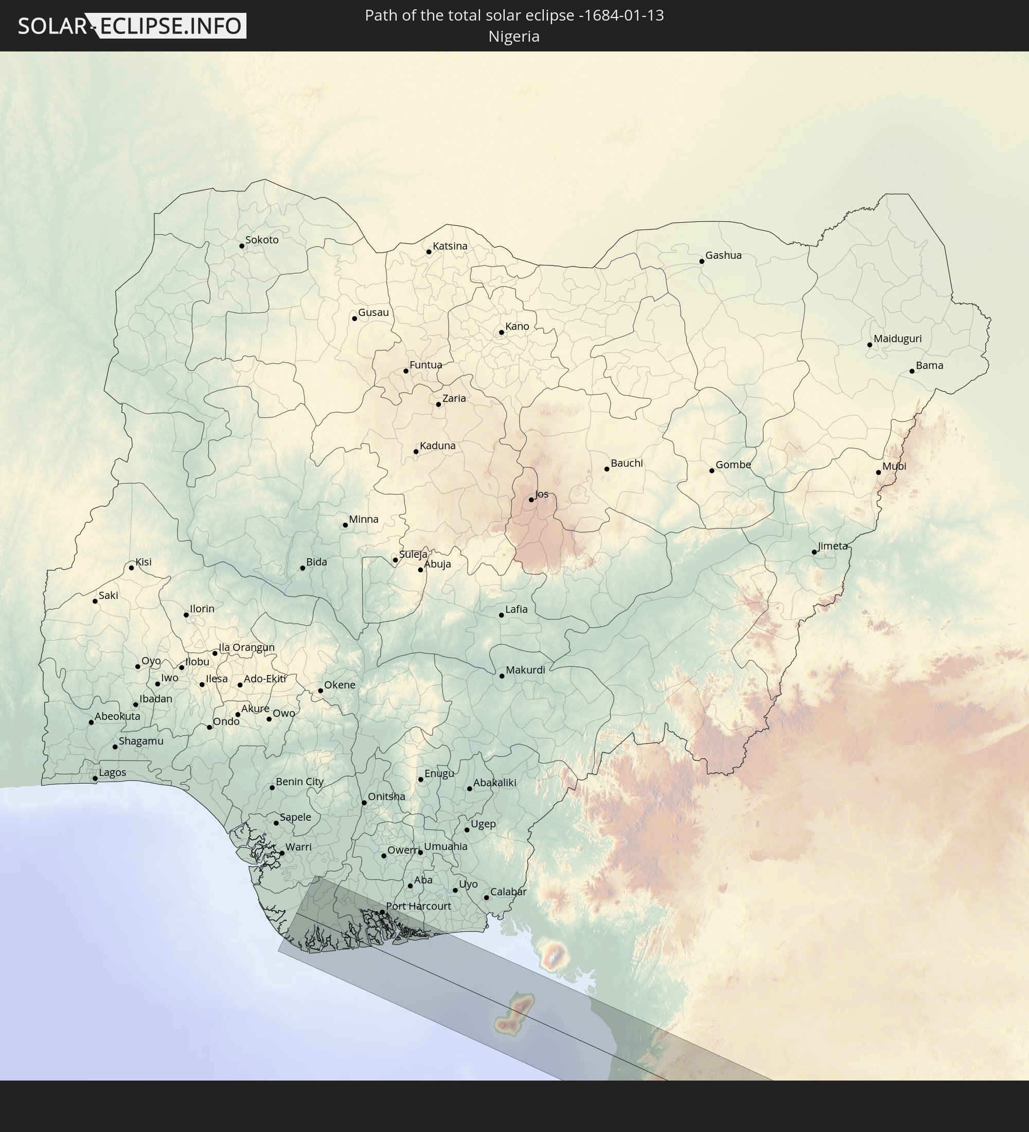 Nigeria
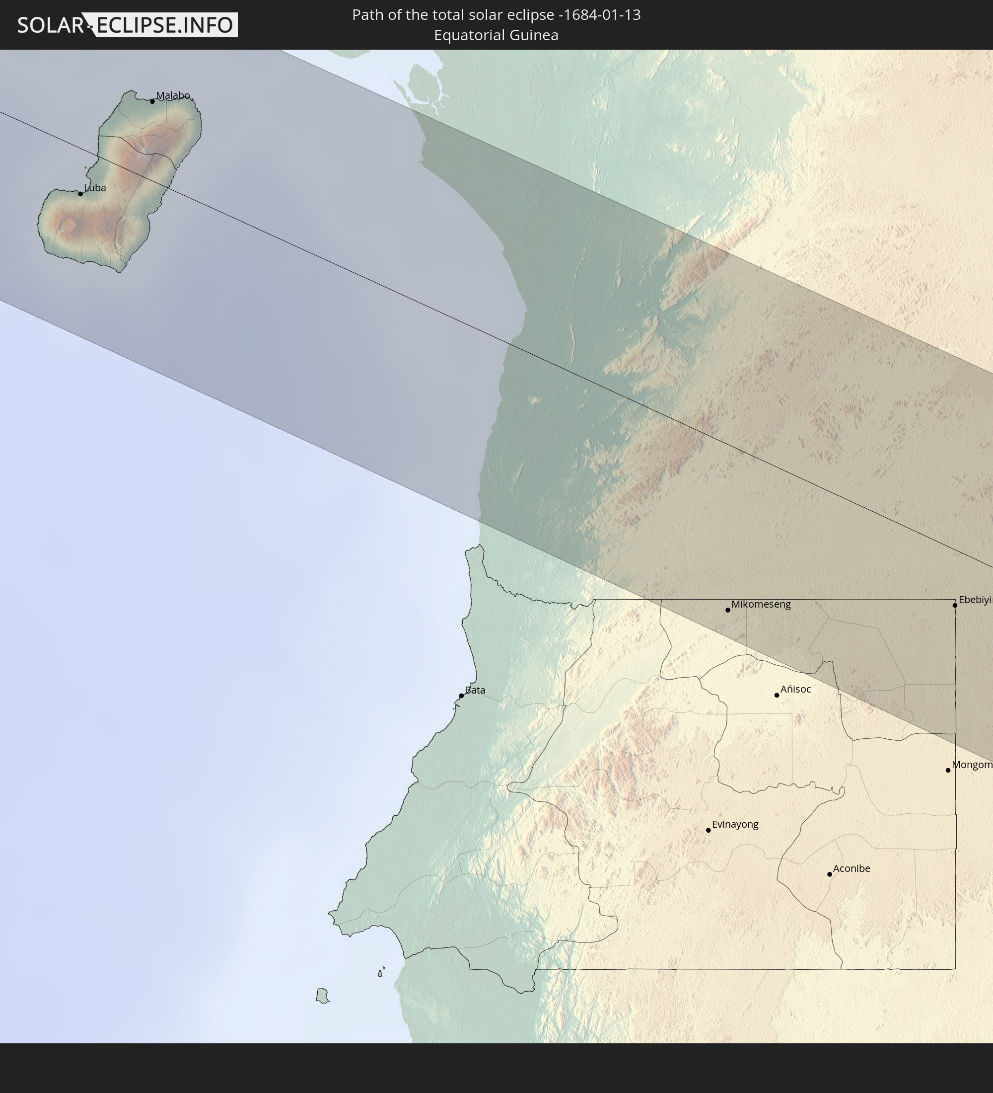 Äquatorialguinea
 Kamerun
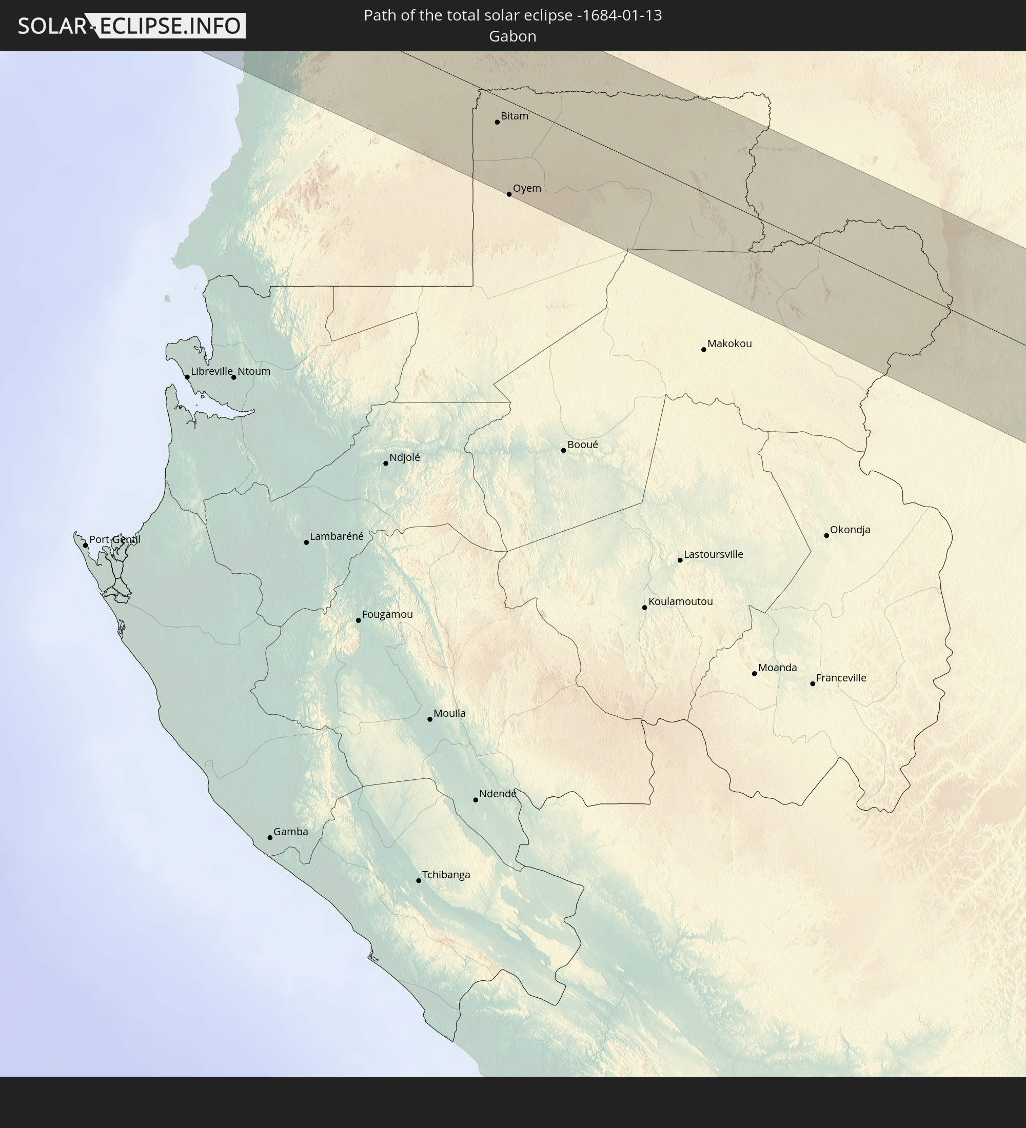 Gabun
Gabun
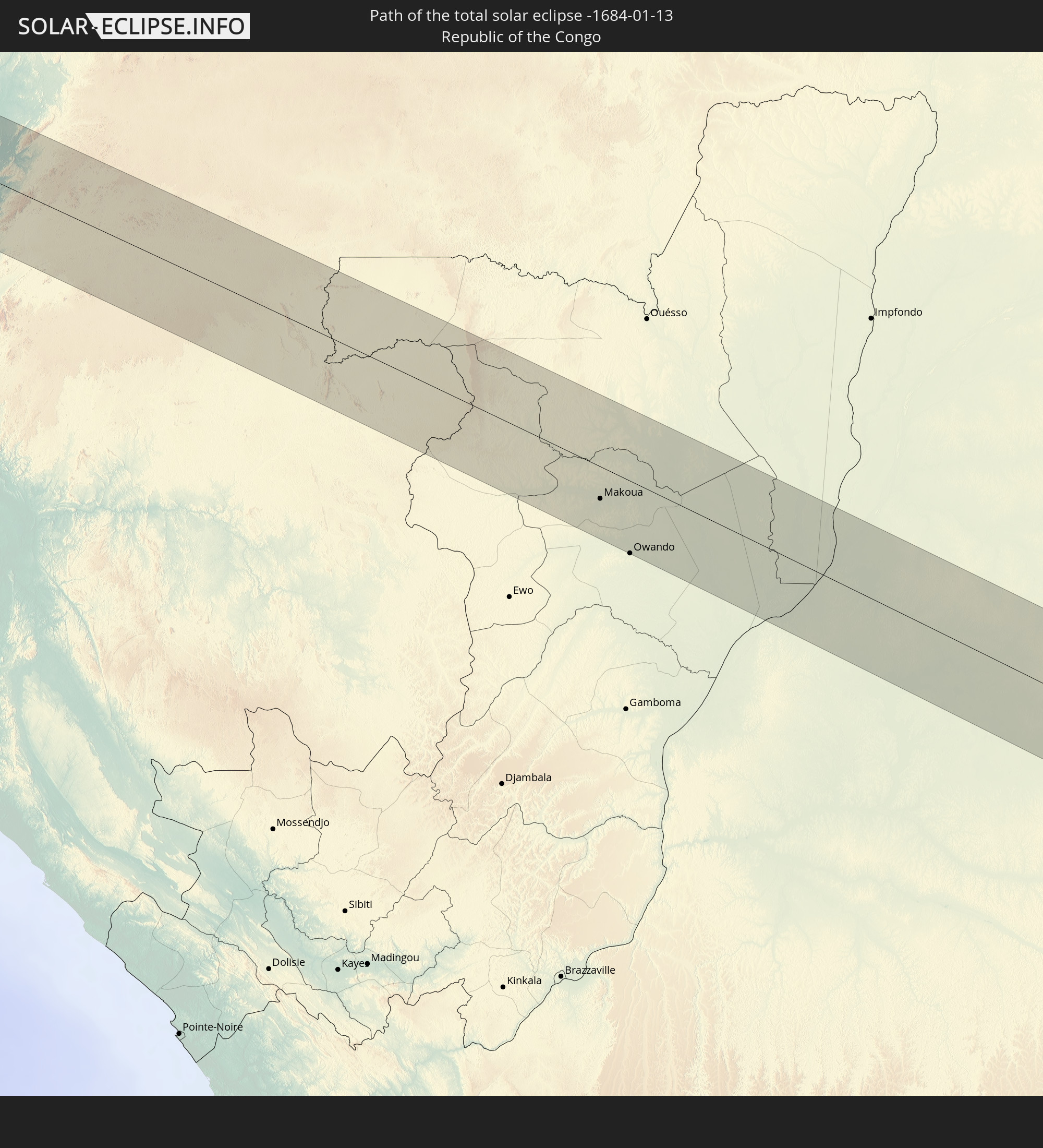 Republik Kongo
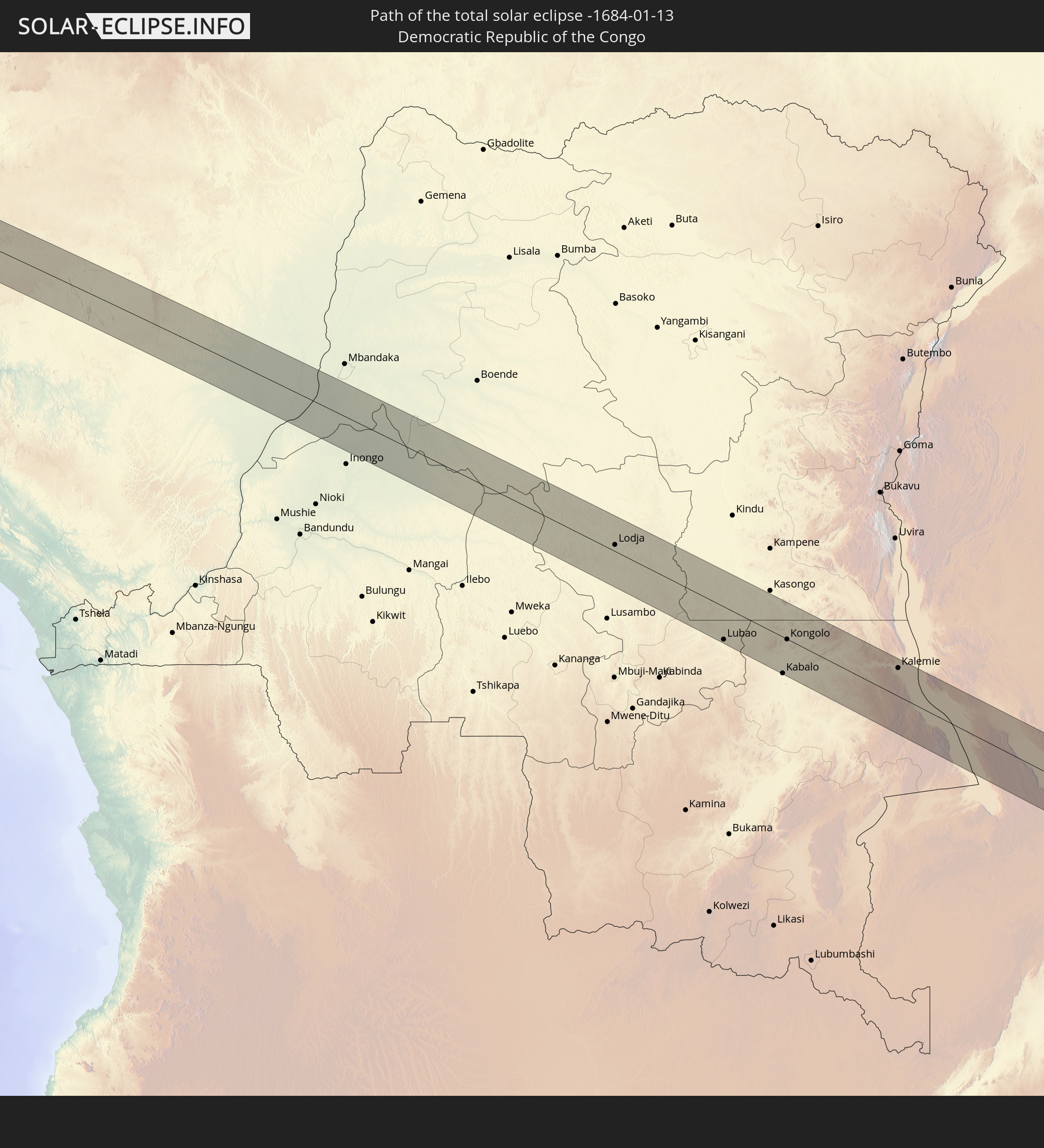 Demokratische Republik Kongo
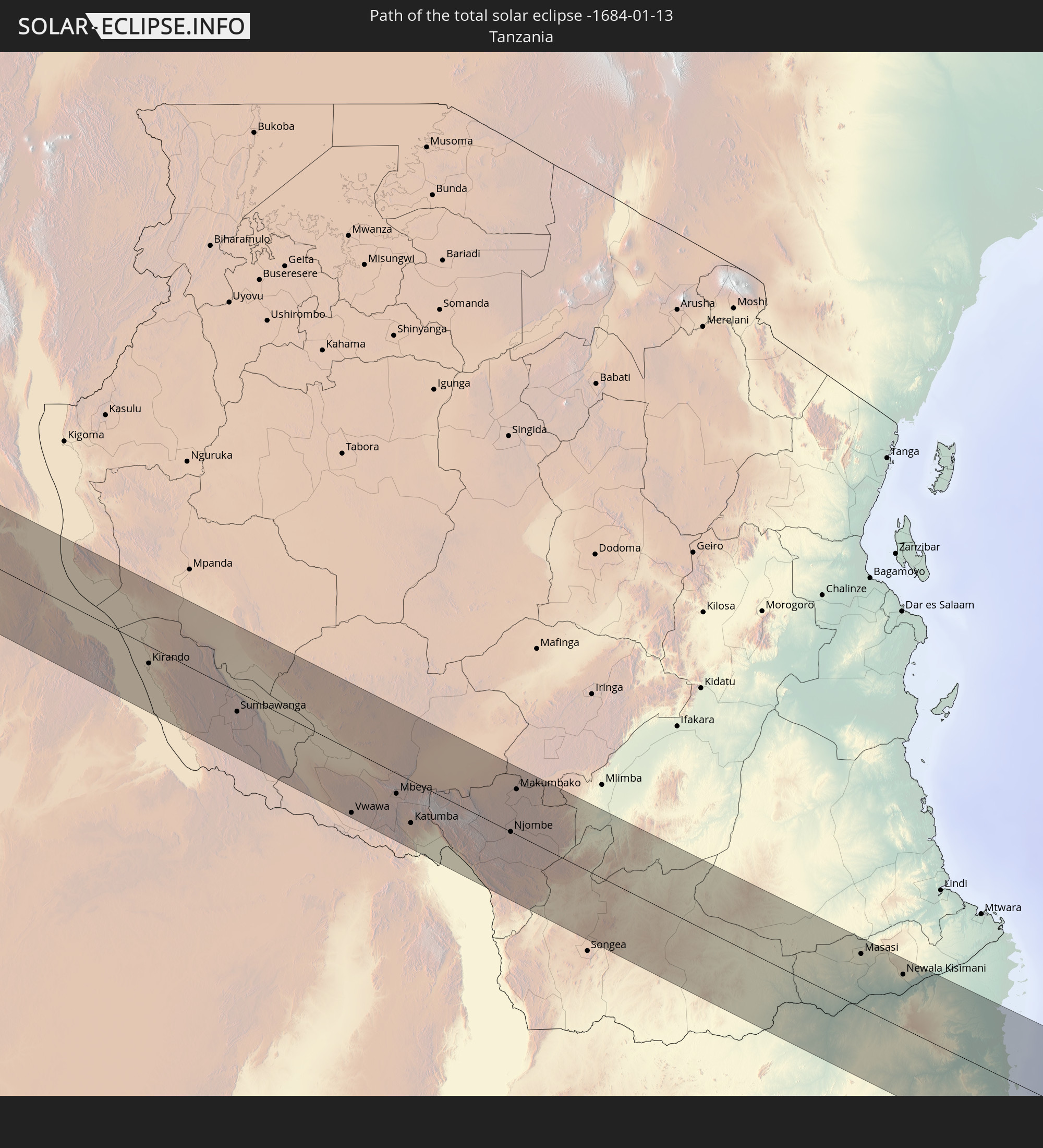 Tansania
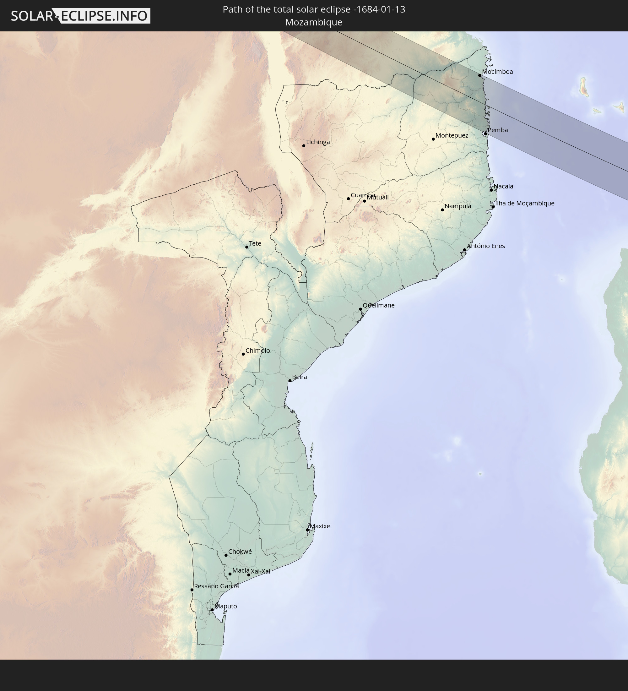 Mosambik
 Malawi
 Madagaskar
 Mauritius
 Indonesien
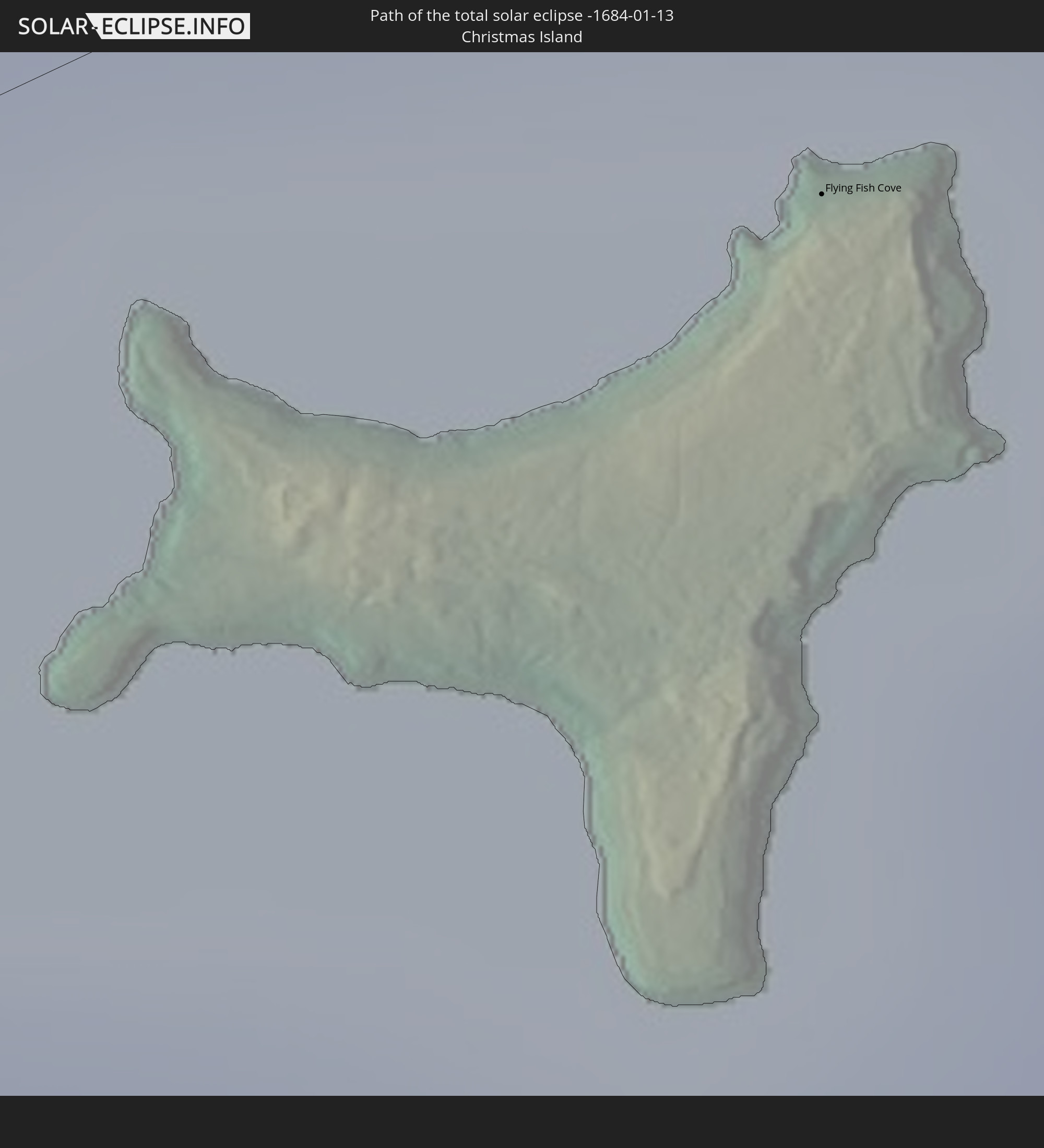 Weihnachtsinsel
In den folgenden Ländern ist die Sonnenfinsternis partiell zu sehen
 St. Helena
 Niger
Niger
 Nigeria
 Äquatorialguinea
 São Tomé und Príncipe
 Kamerun
 Gabun
Gabun
 Libyen
 Republik Kongo
 Angola
 Namibia
 Demokratische Republik Kongo
 Tschad
 Zentralafrikanische Republik
 Südafrika
 Botswana
 Sudan
Sudan
 Sambia
 Ägypten
 Simbabwe
 Lesotho
 Ruanda
 Burundi
 Tansania
 Uganda
 Mosambik
 Swasiland
 Malawi
 Äthiopien
 Kenia
Kenia
 Saudi-Arabien
 Eritrea
 Französische Süd- und Antarktisgebiete
 Somalia
 Dschibuti
 Jemen
Jemen
 Madagaskar
 Komoren
 Mayotte
 Seychellen
 Oman
Oman
 Réunion
 Mauritius
 Indien
 Britisches Territorium im Indischen Ozean
 Malediven
 Volksrepublik China
 Sri Lanka
 Myanmar
 Indonesien
 Kokosinseln
 Thailand
 Malaysia
 Laos
Laos
 Vietnam
 Kambodscha
 Singapur
 Weihnachtsinsel
 Australien
 Macau
Macau
 Hongkong
 Brunei
 Taiwan
 Philippinen
 Osttimor
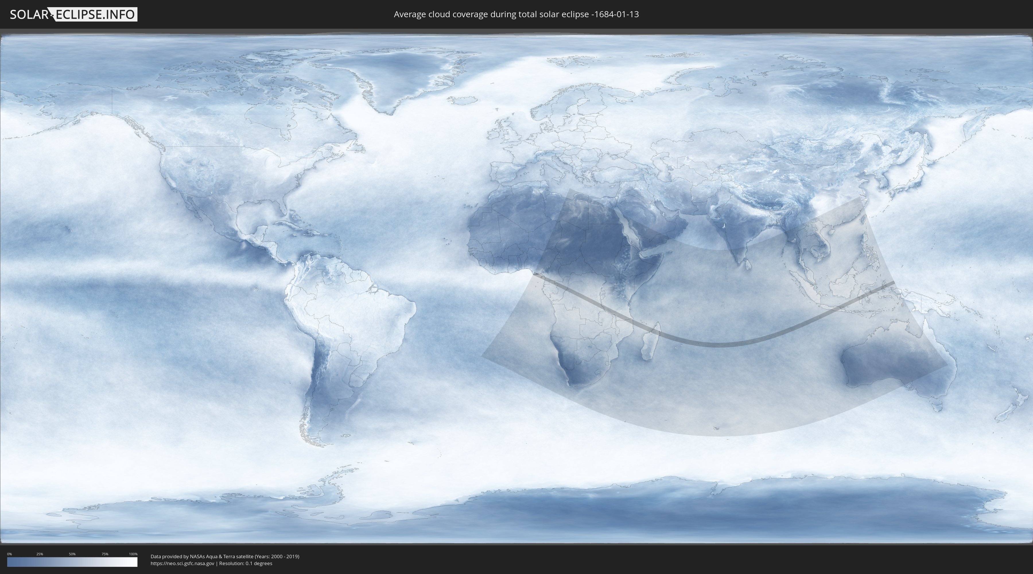
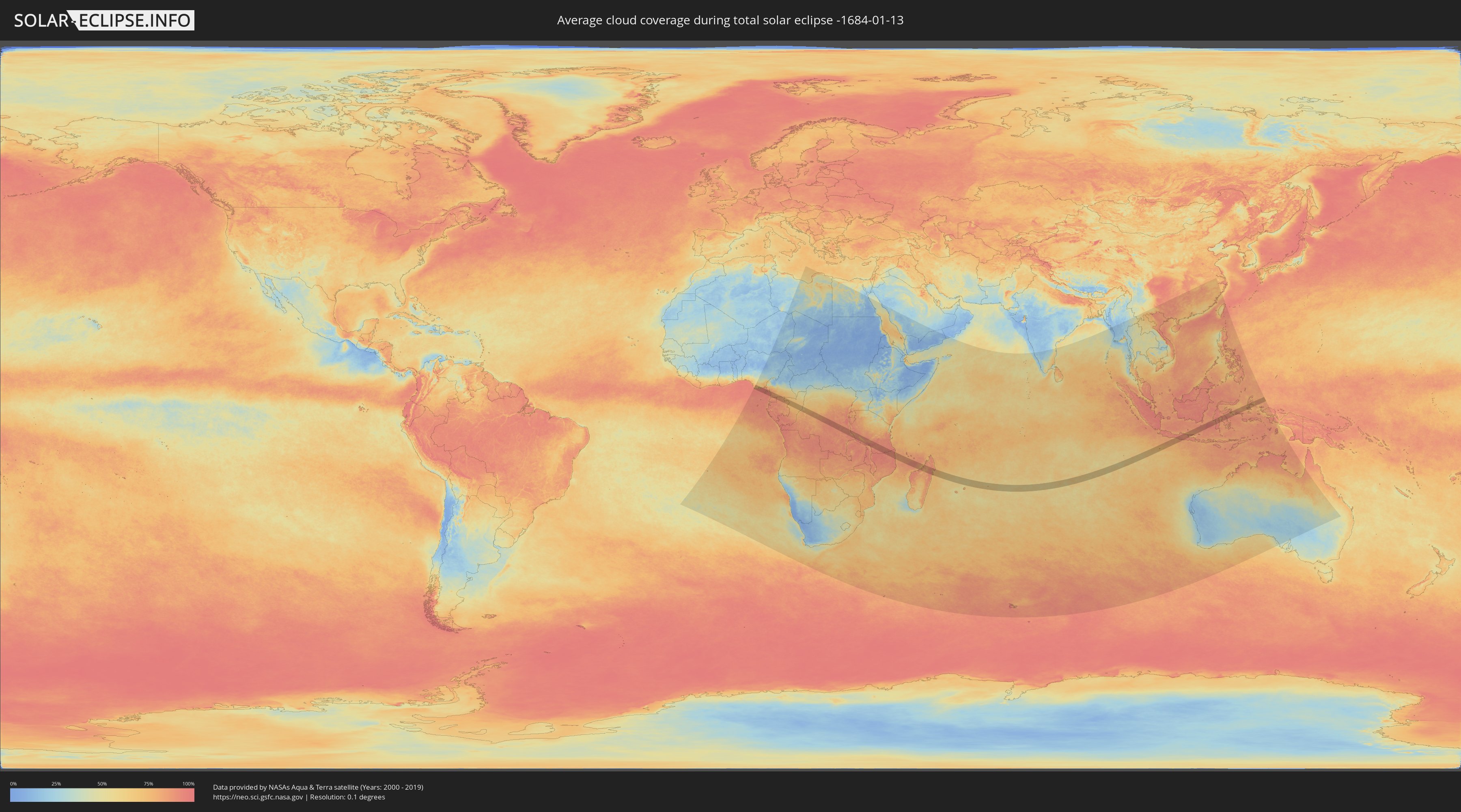
Wie wird das Wetter während der totalen Sonnenfinsternis am 13.01.-1684?
Wo ist der beste Ort, um die totale Sonnenfinsternis vom 13.01.-1684 zu beobachten?
Die folgenden Karten zeigen die durchschnittliche Bewölkung für den Tag, an dem die totale Sonnenfinsternis
stattfindet. Mit Hilfe der Karten lässt sich der Ort entlang des Finsternispfades eingrenzen,
der die besten Aussichen auf einen klaren wolkenfreien Himmel bietet.
Trotzdem muss man immer lokale Gegenenheiten beachten und sollte sich genau über das Wetter an seinem
gewählten Beobachtungsort informieren.
Die Daten stammen von den beiden NASA-Satelliten
AQUA und TERRA
und wurden über einen Zeitraum von 19 Jahren (2000 - 2019) gemittelt.
Detaillierte Länderkarten
 Nigeria
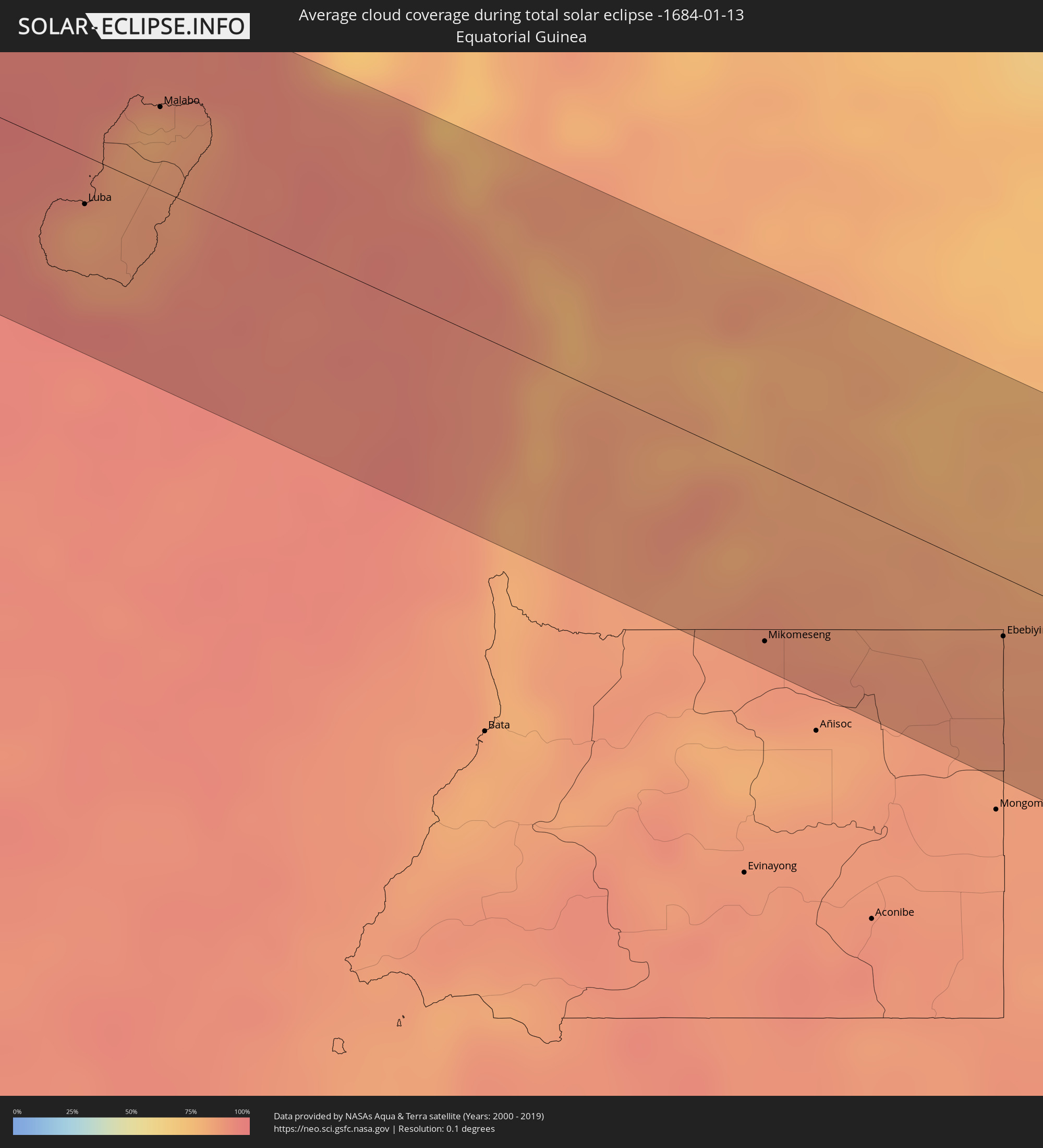 Äquatorialguinea
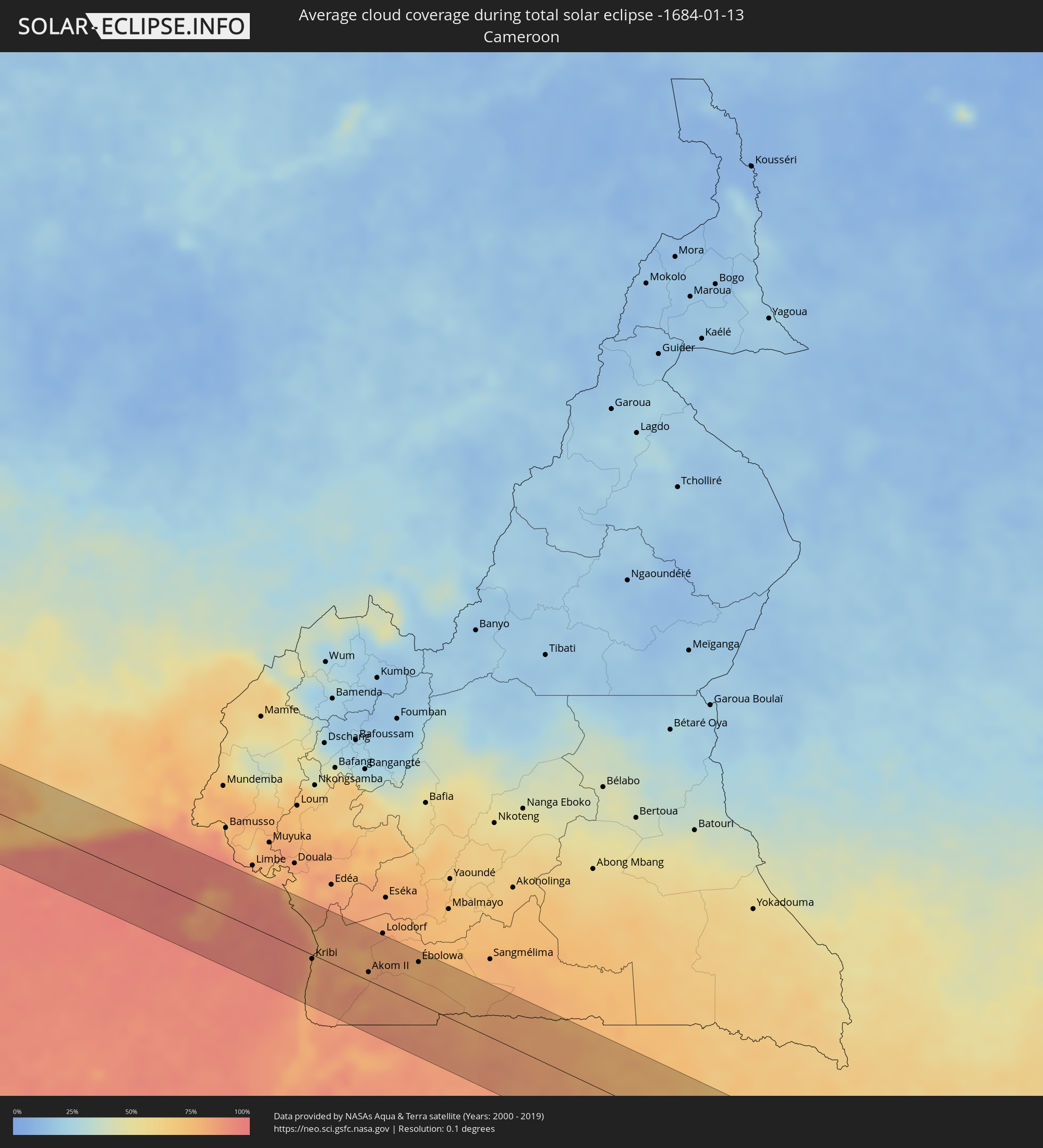 Kamerun
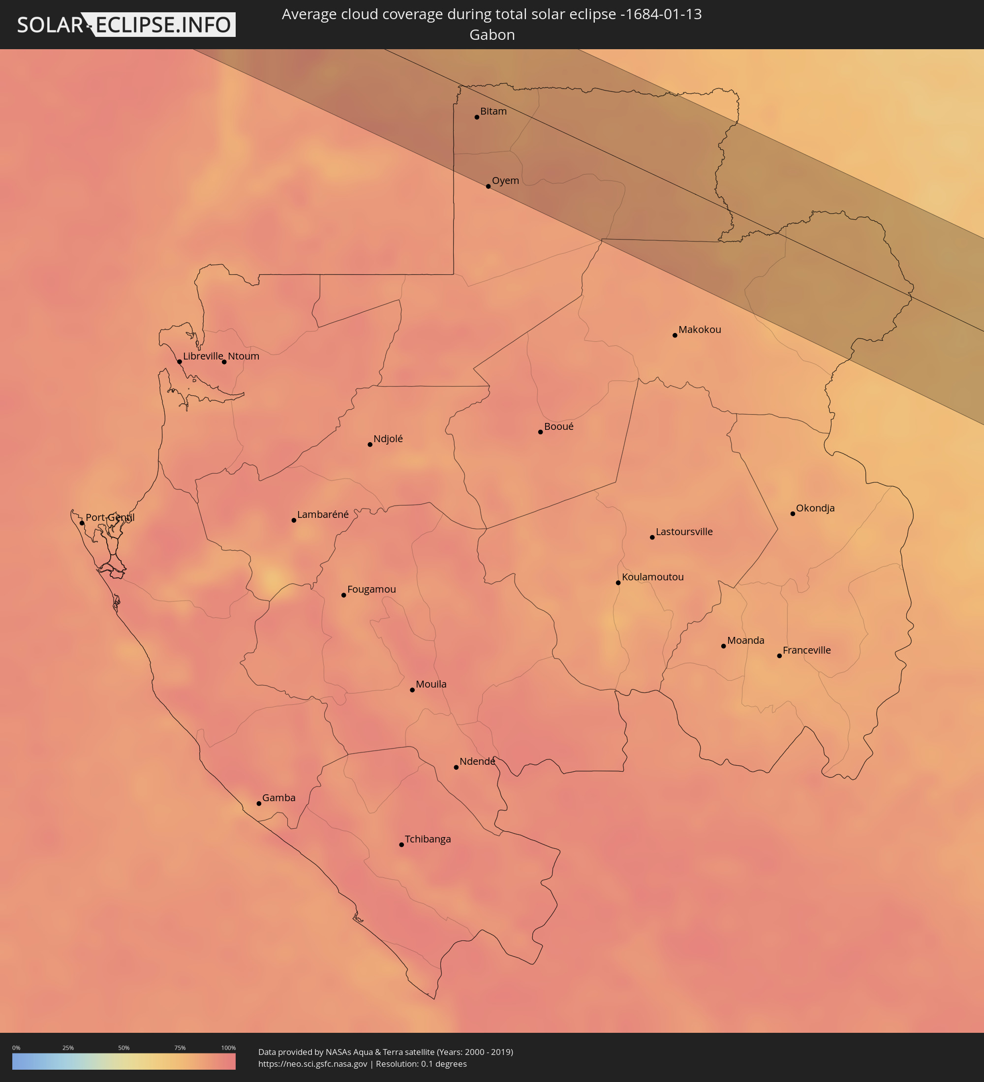 Gabun
Gabun
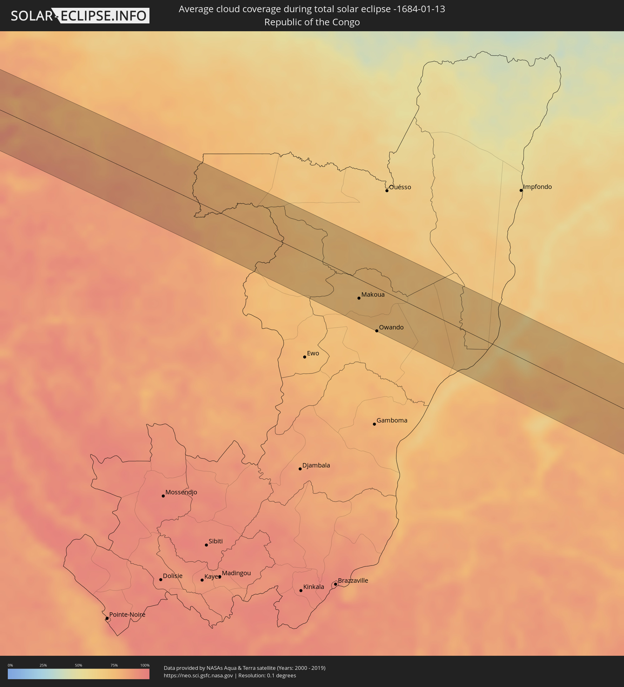 Republik Kongo
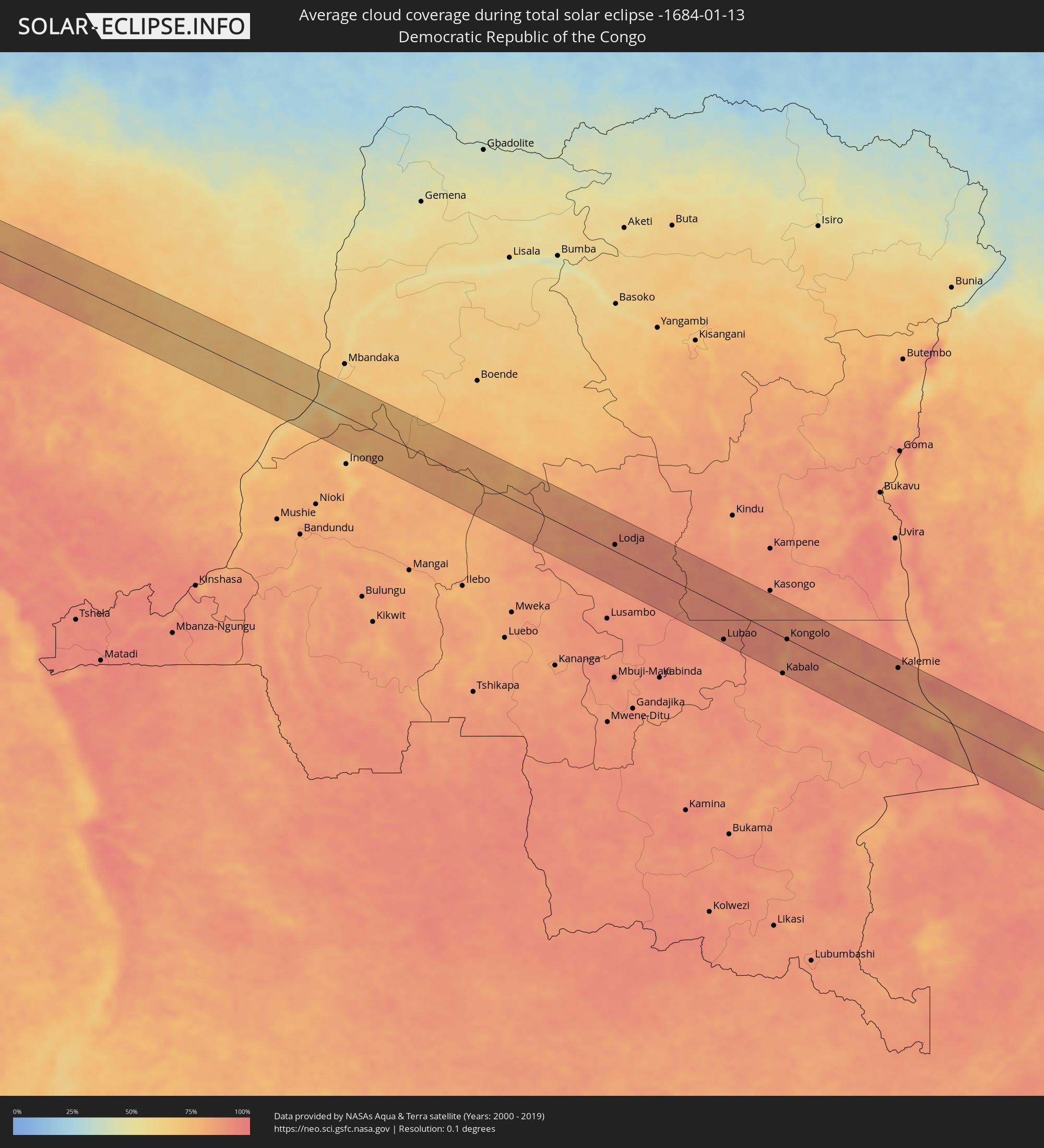 Demokratische Republik Kongo
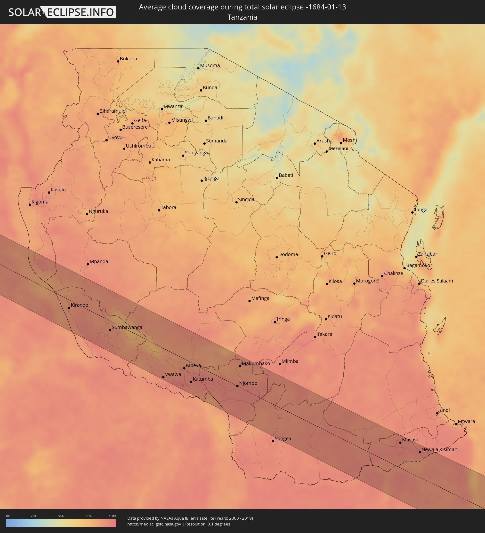 Tansania
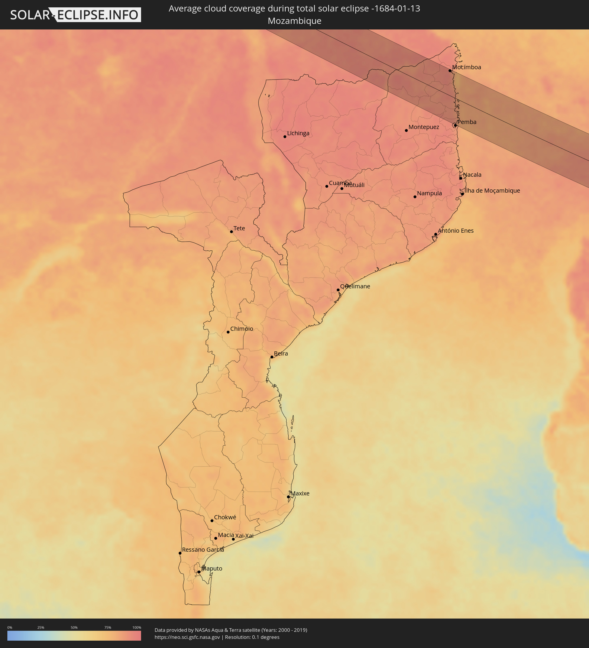 Mosambik
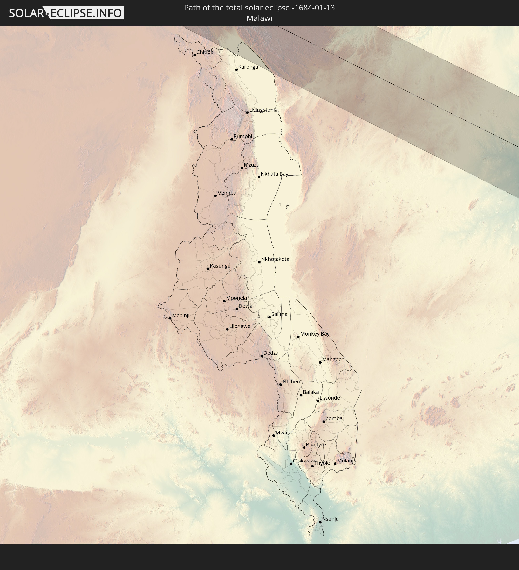
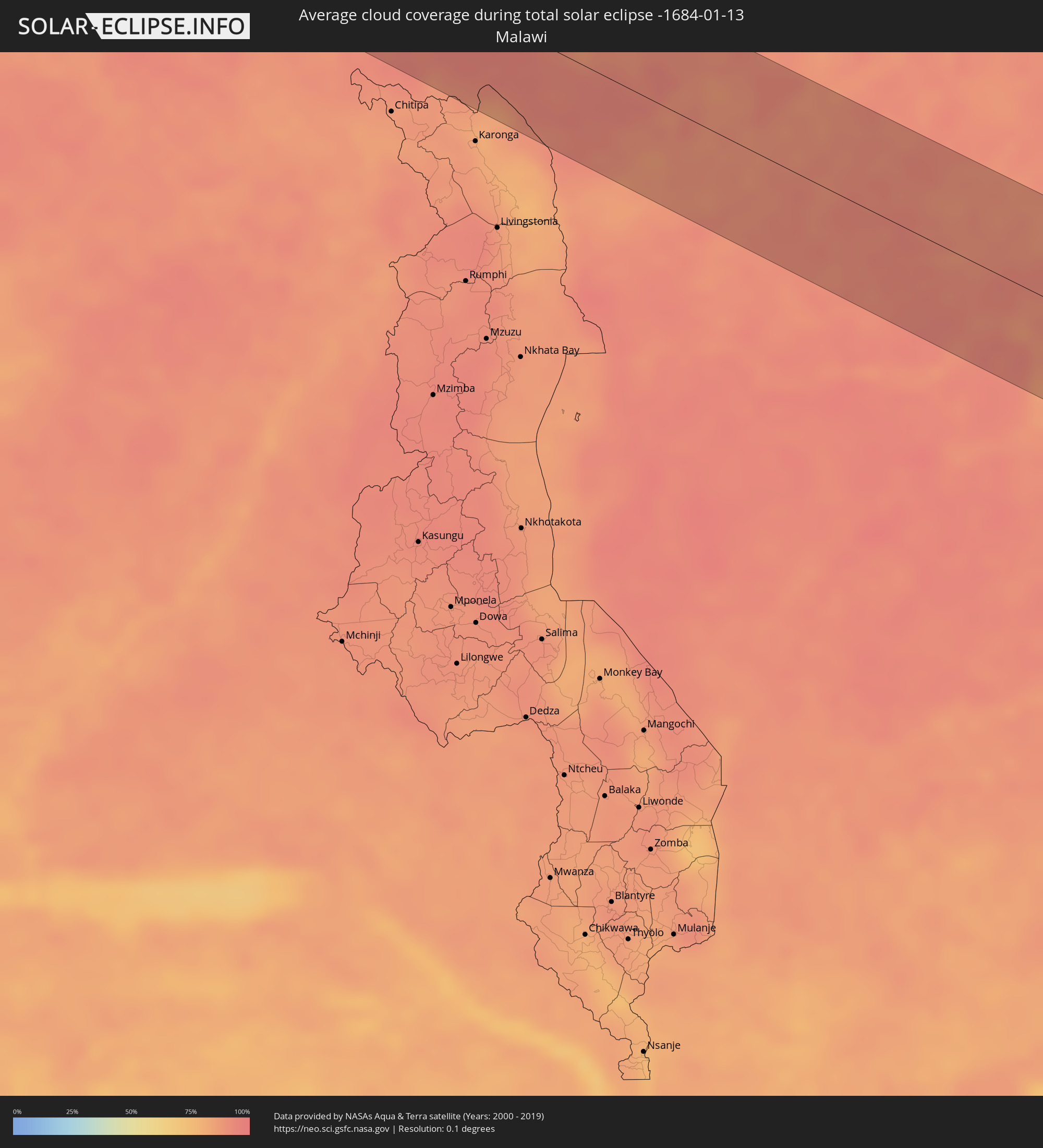 Malawi
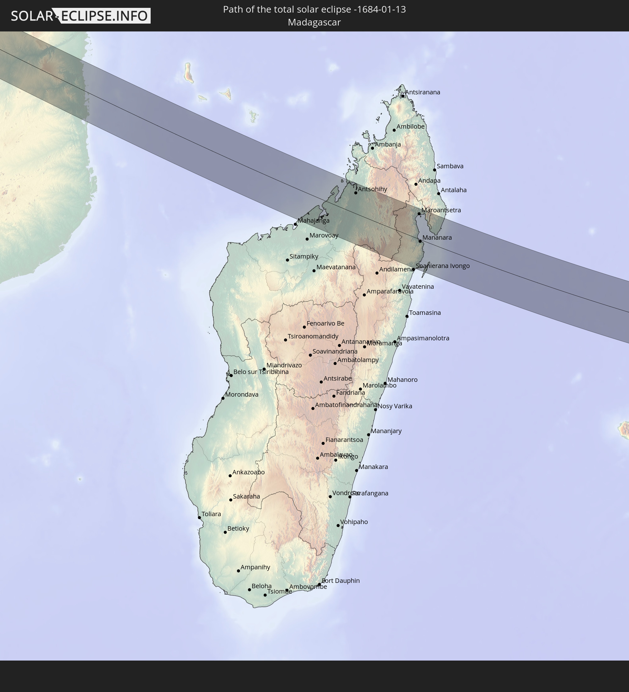
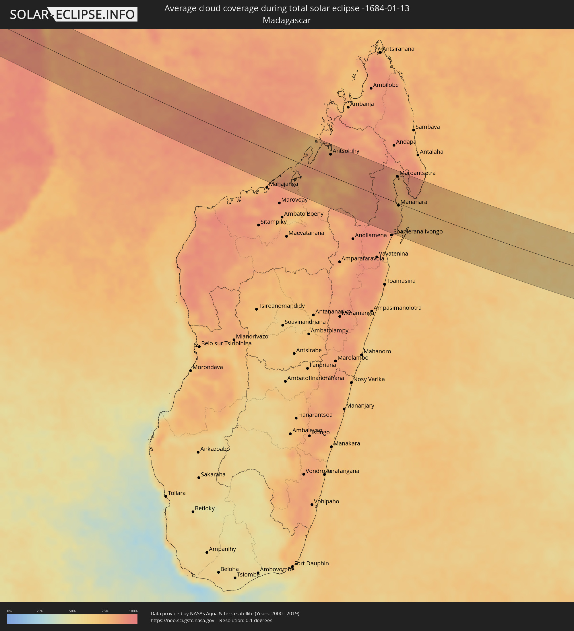 Madagaskar
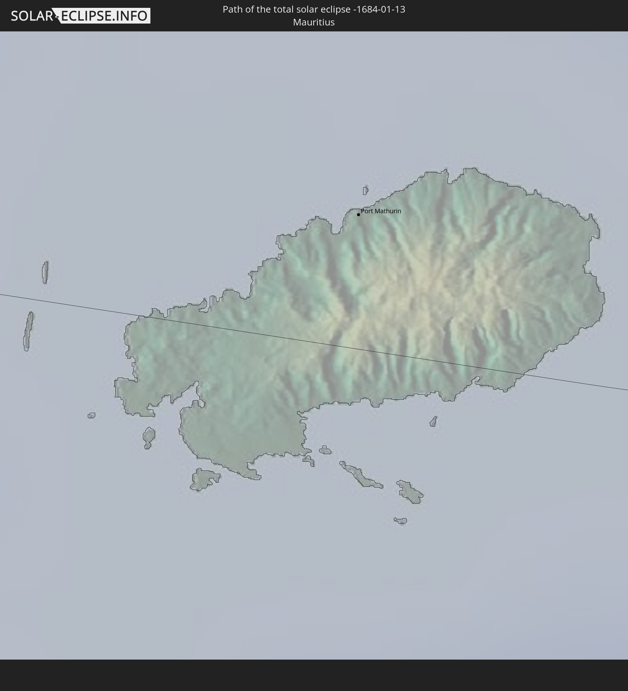
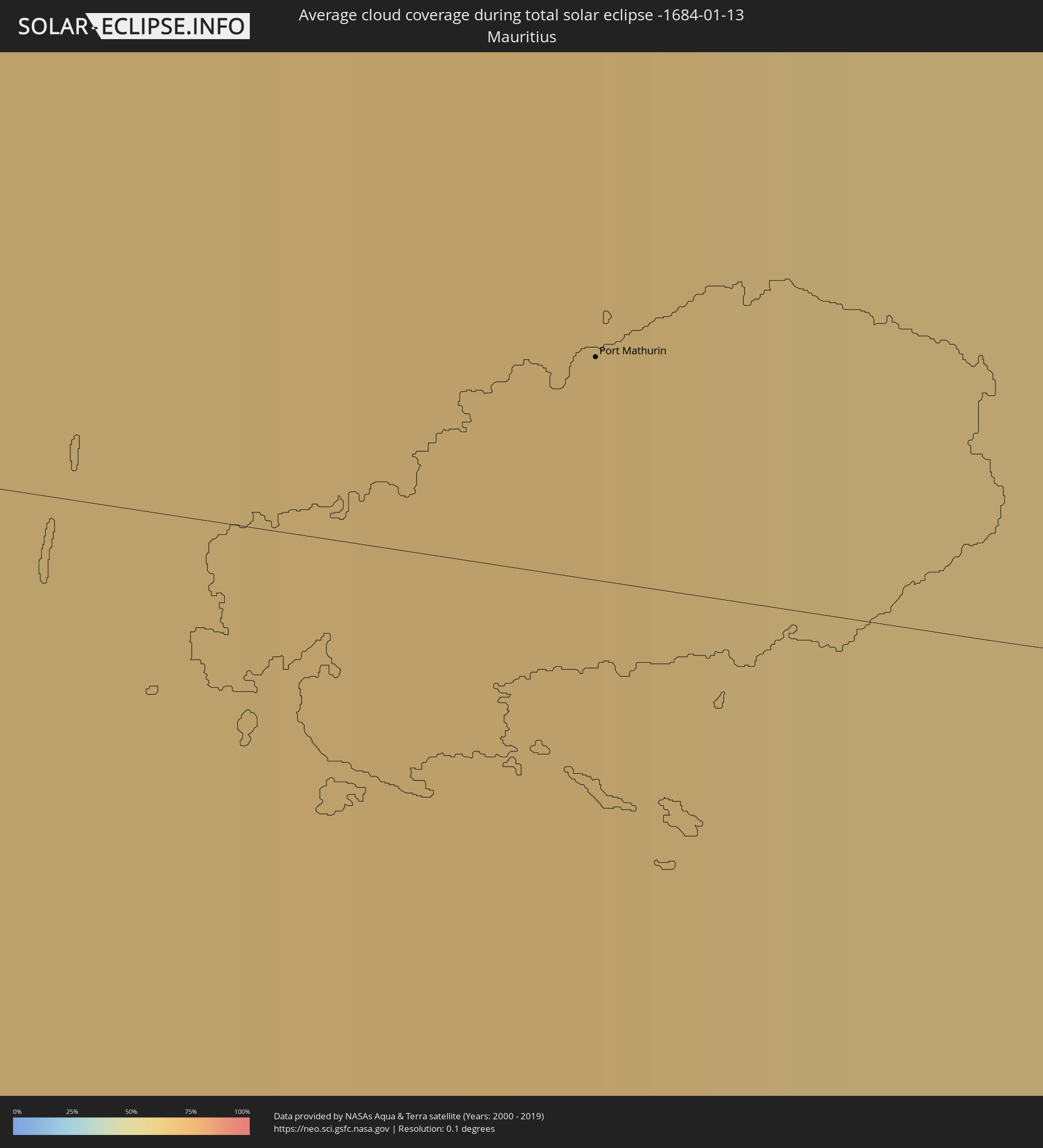 Mauritius
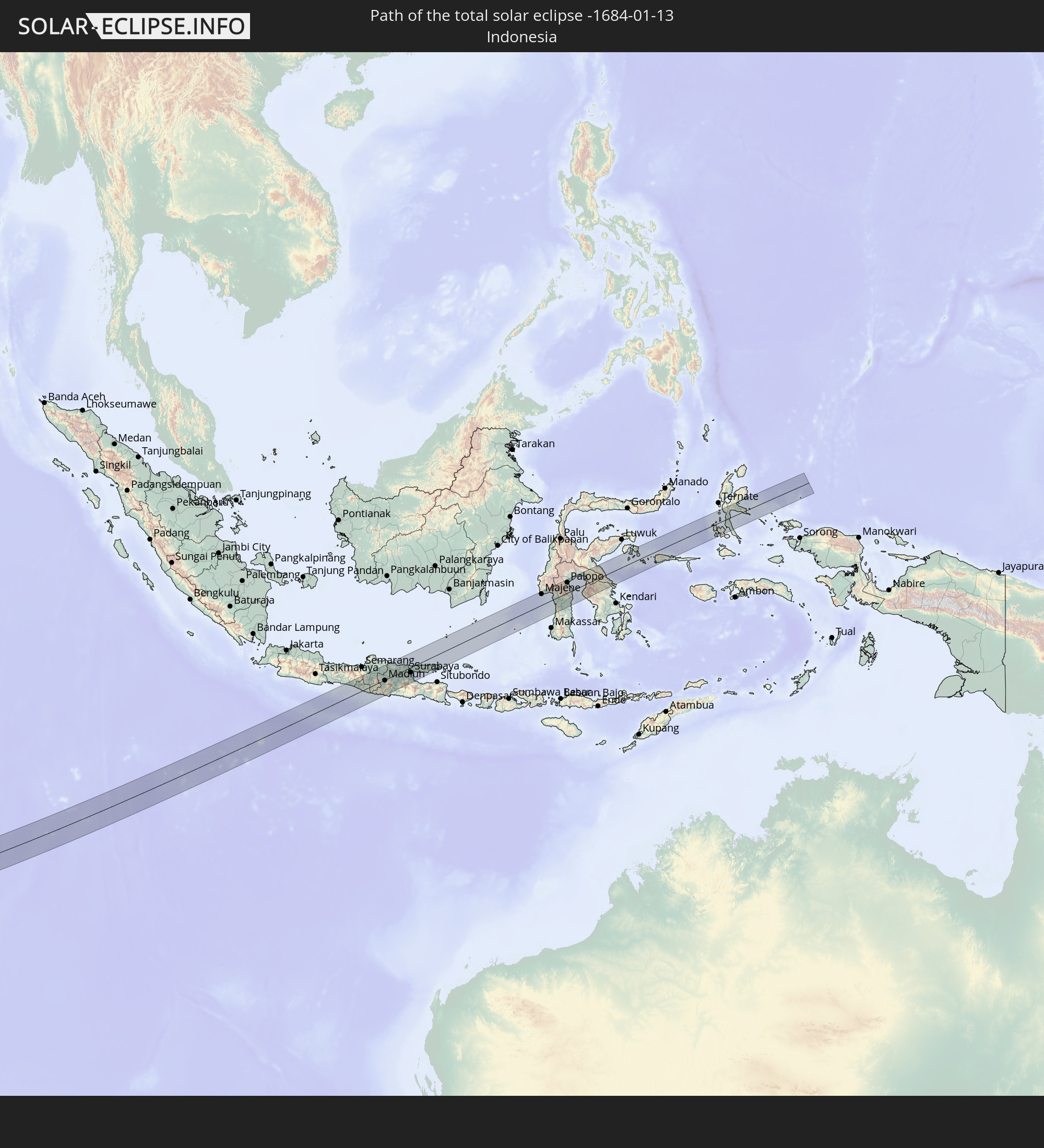
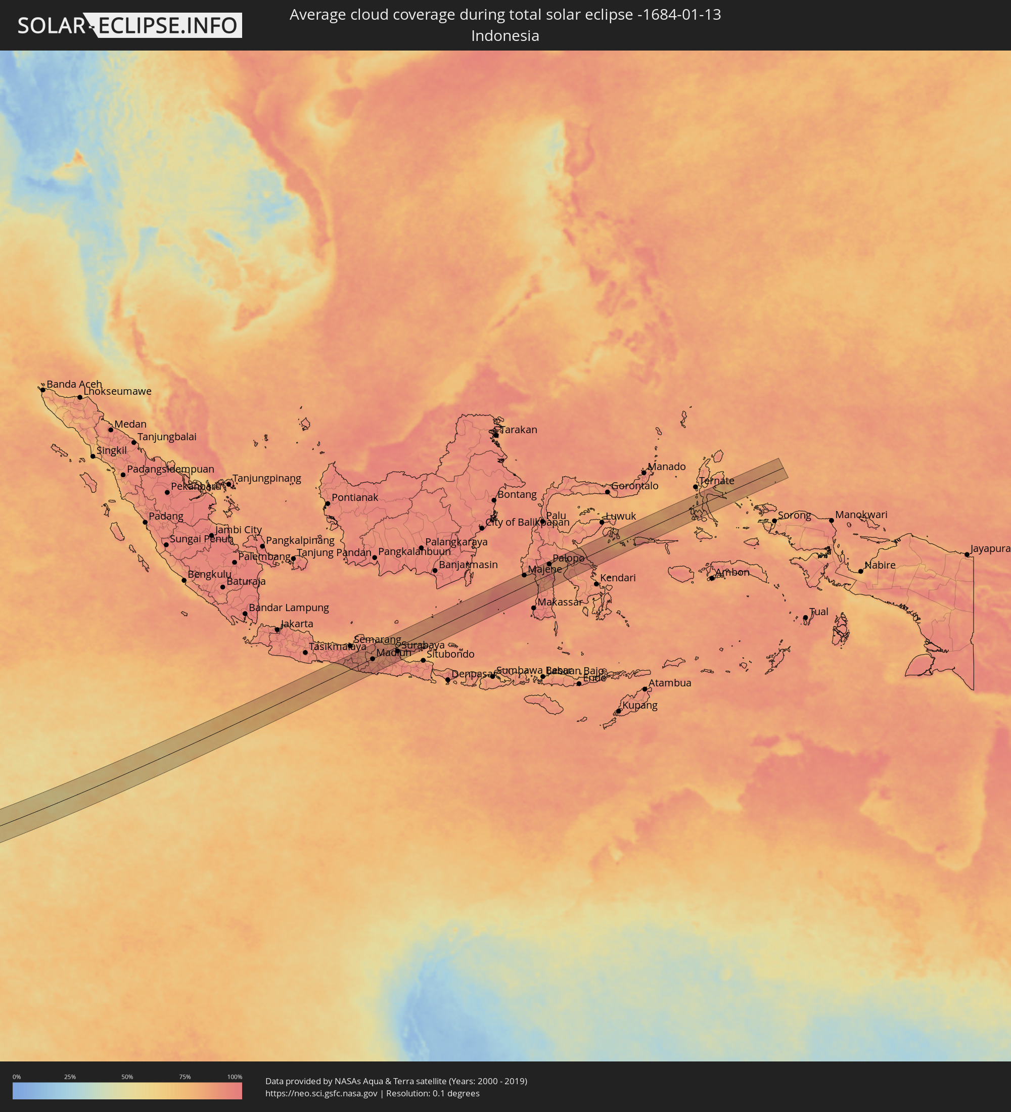 Indonesien
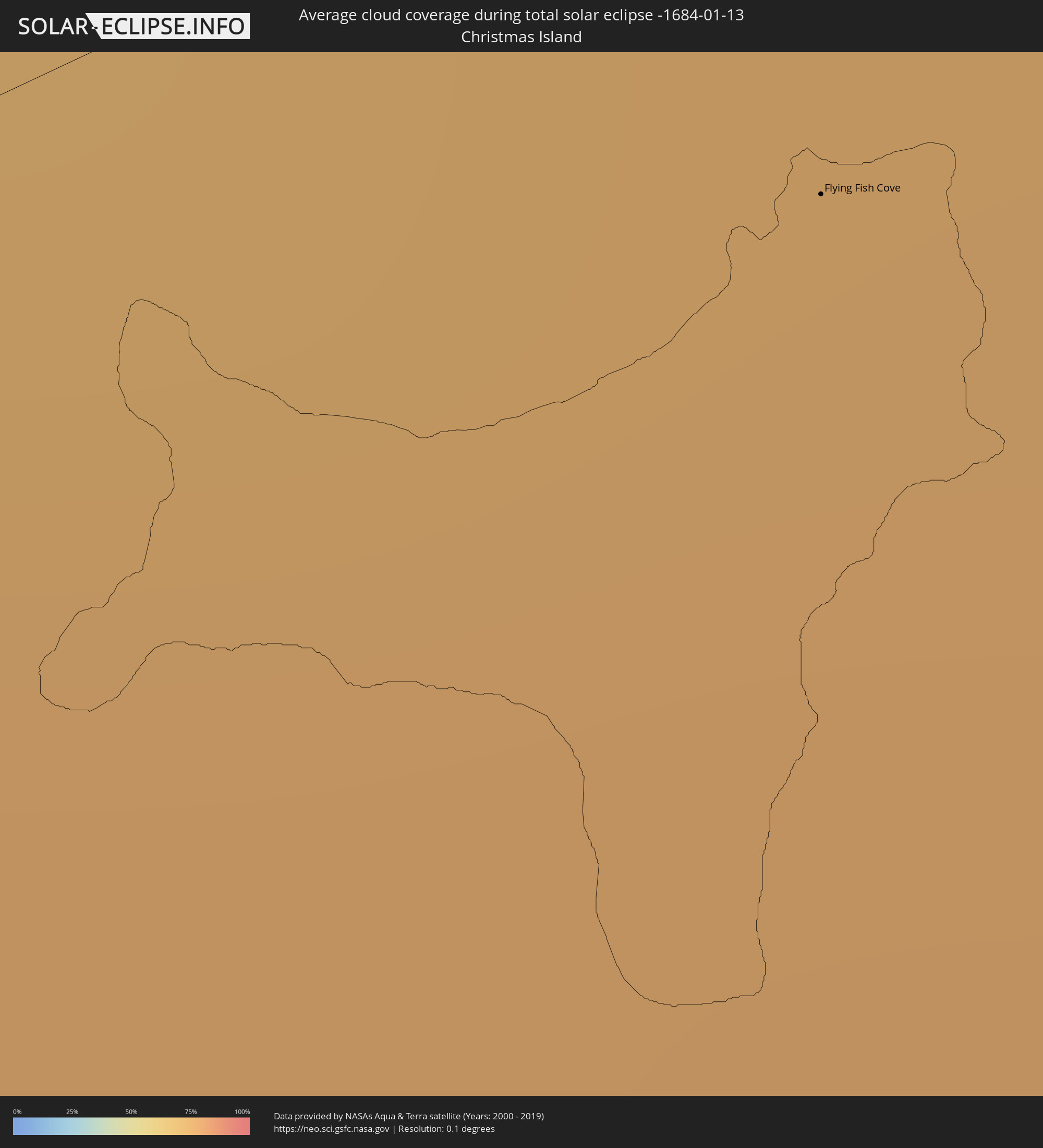 Weihnachtsinsel
Orte im Finsternispfad
Die nachfolgene Tabelle zeigt Städte und Orte mit mehr als 5.000 Einwohnern, die sich im Finsternispfad befinden. Städte mit mehr als 100.000 Einwohnern sind dick gekennzeichnet. Mit einem Klick auf den Ort öffnet sich eine Detailkarte die die Lage des jeweiligen Ortes zusammen mit dem Verlauf der zentralen Finsternis präsentiert.
| Ort | Typ | Dauer der Verfinsterung | Ortszeit bei maximaler Verfinsterung | Entfernung zur Zentrallinie | Ø Bewölkung |
|
Amassoma, Bayelsa
|
total | - | 06:09:53 UTC+00:13 | 28 km | 81% |
|
Patani, Delta
|
total | - | 06:09:50 UTC+00:13 | 58 km | 77% |
|
Twon-Brass, Bayelsa
|
total | - | 06:10:00 UTC+00:13 | 33 km | 85% |
|
Yenagoa, Bayelsa
|
total | - | 06:09:53 UTC+00:13 | 36 km | 82% |
|
Degema Hulk, Rivers
|
total | - | 06:09:53 UTC+00:13 | 36 km | 74% |
|
Obonoma, Rivers
|
total | - | 06:09:53 UTC+00:13 | 32 km | 68% |
|
Buguma, Rivers
|
total | - | 06:09:53 UTC+00:13 | 38 km | 63% |
|
Port Harcourt, Rivers
|
total | - | 06:09:52 UTC+00:13 | 49 km | 63% |
|
Okrika, Rivers
|
total | - | 06:09:52 UTC+00:13 | 49 km | 64% |
|
Bonny, Rivers
|
total | - | 06:09:55 UTC+00:13 | 23 km | 69% |
|
Bori, Rivers
|
total | - | 06:09:52 UTC+00:13 | 55 km | 68% |
|
Luba, Bioko Sur
|
total | - | 06:10:07 UTC+00:13 | 15 km | 84% |
|
Malabo, Bioko Norte
|
total | - | 06:10:02 UTC+00:13 | 25 km | 83% |
|
Rebola, Bioko Norte
|
total | - | 06:10:03 UTC+00:13 | 24 km | 84% |
|
Kribi, South
|
total | - | 06:10:16 UTC+00:13 | 5 km | 80% |
|
Akom II, South
|
total | - | 06:10:20 UTC+00:13 | 10 km | 81% |
|
Mikomeseng, Kié-Ntem
|
total | - | 06:10:31 UTC+00:13 | 53 km | 89% |
|
Ébolowa, South
|
total | - | 06:10:20 UTC+00:13 | 49 km | 77% |
|
Ambam, South
|
total | - | 06:10:30 UTC+00:13 | 3 km | 82% |
|
Ebebiyin, Kié-Ntem
|
total | - | 06:10:34 UTC+00:13 | 18 km | 86% |
|
Bitam, Woleu-Ntem
|
total | - | 06:10:36 UTC+00:13 | 18 km | 85% |
|
Oyem, Woleu-Ntem
|
total | - | 06:10:46 UTC+00:13 | 62 km | 87% |
|
Makoua, Cuvette
|
total | - | 06:11:59 UTC+00:13 | 29 km | 72% |
|
Owando, Cuvette
|
total | - | 06:12:15 UTC+00:13 | 65 km | 72% |
|
Lukolela, Équateur
|
total | - | 06:12:51 UTC+00:13 | 60 km | 70% |
|
Lodja, Kasaï-Oriental
|
total | - | 08:13:34 UTC+02:10 | 13 km | 90% |
|
Lubao, Kasaï-Oriental
|
total | - | 08:16:00 UTC+02:10 | 64 km | 90% |
|
Kabalo, Katanga
|
total | - | 08:17:15 UTC+02:10 | 71 km | 89% |
|
Kongolo, Katanga
|
total | - | 08:16:53 UTC+02:10 | 1 km | 85% |
|
Kalemie, Katanga
|
total | - | 08:18:59 UTC+02:10 | 55 km | 85% |
|
Kirando, Rukwa
|
total | - | 08:38:11 UTC+02:27 | 20 km | 86% |
|
Namanyere, Rukwa
|
total | - | 08:38:41 UTC+02:27 | 7 km | 89% |
|
Matai, Rukwa
|
total | - | 08:39:43 UTC+02:27 | 61 km | 91% |
|
Sumbawanga, Rukwa
|
total | - | 08:39:34 UTC+02:27 | 23 km | 90% |
|
Vwawa, Mbeya
|
total | - | 08:41:48 UTC+02:27 | 70 km | 92% |
|
Mbeya, Mbeya
|
total | - | 08:42:11 UTC+02:27 | 23 km | 92% |
|
Katumba, Mbeya
|
total | - | 08:42:38 UTC+02:27 | 48 km | 91% |
|
Kyela, Mbeya
|
total | - | 08:43:10 UTC+02:27 | 71 km | 85% |
|
Igurusi, Mbeya
|
total | - | 08:42:35 UTC+02:27 | 2 km | 92% |
|
Chimala, Mbeya
|
total | - | 08:42:47 UTC+02:27 | 10 km | 90% |
|
Rujewa, Mbeya
|
total | - | 08:43:04 UTC+02:27 | 44 km | 84% |
|
Njombe, Njombe
|
total | - | 08:44:01 UTC+02:27 | 0 km | 94% |
|
Makumbako, Njombe
|
total | - | 08:43:42 UTC+02:27 | 51 km | 88% |
|
Nangomba, Mtwara
|
total | - | 08:50:07 UTC+02:27 | 28 km | 93% |
|
Masasi, Mtwara
|
total | - | 08:50:23 UTC+02:27 | 61 km | 93% |
|
Lukuledi, Mtwara
|
total | - | 08:50:15 UTC+02:27 | 76 km | 93% |
|
Newala Kisimani, Mtwara
|
total | - | 08:51:16 UTC+02:27 | 61 km | 92% |
|
Mocímboa, Cabo Delgado
|
total | - | 08:36:15 UTC+02:10 | 75 km | 87% |
|
Antsohihy, Sofia
|
total | - | 09:10:01 UTC+02:27 | 56 km | 84% |
|
Antsirabe Afovoany, Sofia
|
total | - | 09:13:02 UTC+02:27 | 14 km | 88% |
|
Maroantsetra, Analanjirofo
|
total | - | 09:14:13 UTC+02:27 | 69 km | 76% |
|
Mananara, Analanjirofo
|
total | - | 09:14:56 UTC+02:27 | 6 km | 78% |
|
Antakotako, Analanjirofo
|
total | - | 09:14:15 UTC+02:27 | 84 km | 80% |
|
Port Mathurin, Rodrigues
|
total | - | 11:15:05 UTC+03:50 | 5 km | 65% |
|
Flying Fish Cove
|
total | - | 16:06:08 UTC+07:00 | 9 km | 76% |
|
Yogyakarta, Yogyakarta
|
total | - | 16:19:09 UTC+07:07 | 34 km | 92% |
|
Klaten, Central Java
|
total | - | 16:19:24 UTC+07:07 | 32 km | 89% |
|
Surakarta, Central Java
|
total | - | 16:19:39 UTC+07:07 | 36 km | 91% |
|
Ponorogo, East Java
|
total | - | 16:19:55 UTC+07:07 | 25 km | 89% |
|
Madiun, East Java
|
total | - | 16:20:06 UTC+07:07 | 4 km | 88% |
|
Bojonegoro, East Java
|
total | - | 16:20:37 UTC+07:07 | 27 km | 88% |
|
Kedungwaru, East Java
|
total | - | 16:20:07 UTC+07:07 | 67 km | 91% |
|
Kediri, East Java
|
total | - | 16:20:20 UTC+07:07 | 46 km | 91% |
|
Jombang, East Java
|
total | - | 16:20:38 UTC+07:07 | 29 km | 87% |
|
Mojokerto, East Java
|
total | - | 16:20:49 UTC+07:07 | 31 km | 89% |
|
Sidoarjo, East Java
|
total | - | 16:21:01 UTC+07:07 | 43 km | 92% |
|
Surabaya, East Java
|
total | - | 16:21:09 UTC+07:07 | 24 km | 87% |
|
Bangil, East Java
|
total | - | 16:20:59 UTC+07:07 | 63 km | 92% |
|
Pamekasan, East Java
|
total | - | 16:21:39 UTC+07:07 | 50 km | 85% |
|
Sumenep, East Java
|
total | - | 16:21:58 UTC+07:07 | 54 km | 90% |
|
Parepare, South Sulawesi
|
total | - | 17:16:28 UTC+07:57 | 27 km | 87% |
|
Palopo, South Sulawesi
|
total | - | 17:17:04 UTC+07:57 | 49 km | 88% |