Totale Sonnenfinsternis vom 25.08.-1900
| Wochentag: | Mittwoch |
| Maximale Dauer der Verfinsterung: | 03m56s |
| Maximale Breite des Finsternispfades: | 222 km |
| Saroszyklus: | 24 |
| Bedeckungsgrad: | 100% |
| Magnitude: | 1.0467 |
| Gamma: | -0.725 |
Wo kann man die Sonnenfinsternis vom 25.08.-1900 sehen?
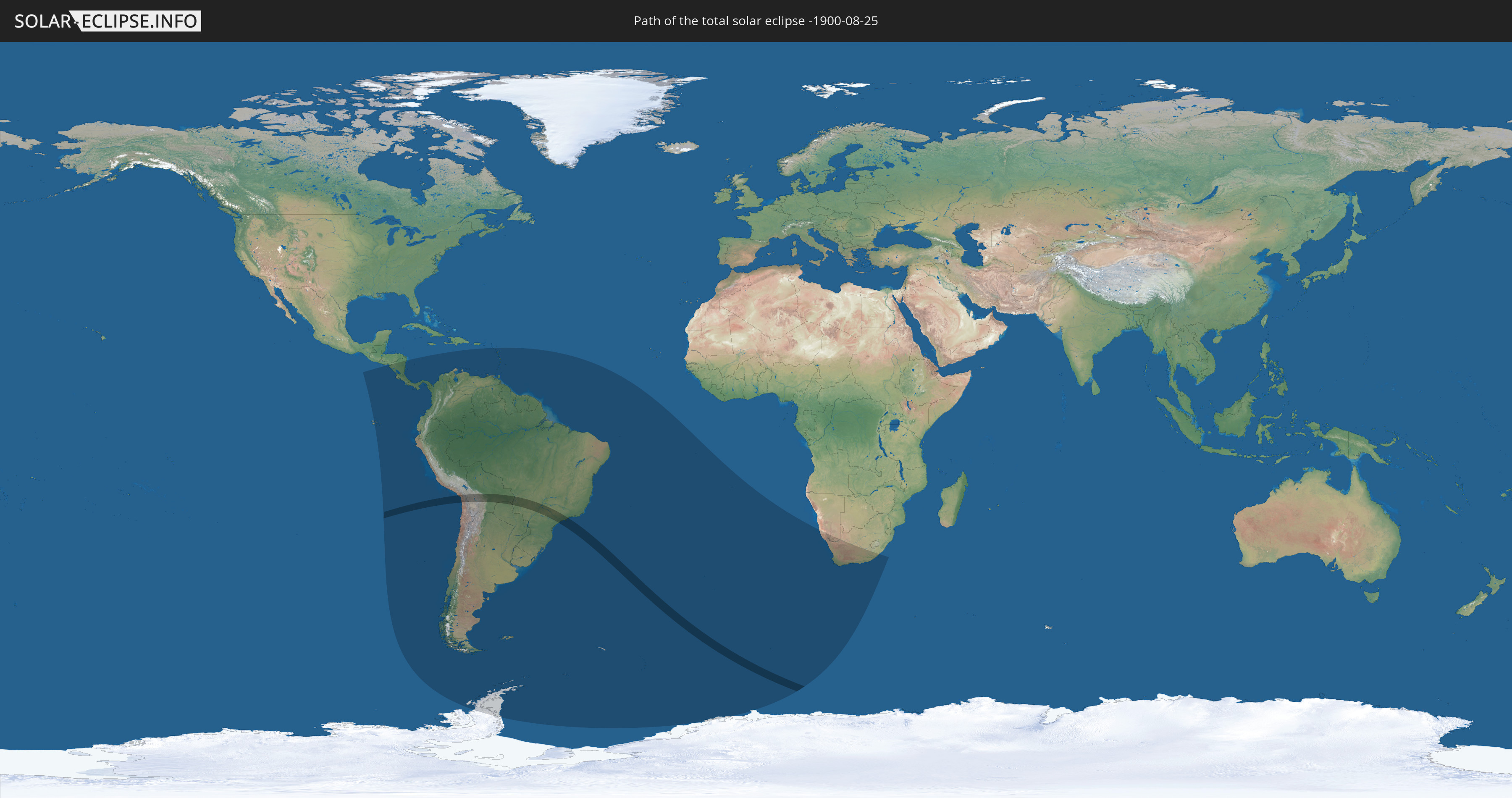
Die Sonnenfinsternis am 25.08.-1900 kann man in 36 Ländern als partielle Sonnenfinsternis beobachten.
Der Finsternispfad verläuft durch 5 Länder. Nur in diesen Ländern ist sie als totale Sonnenfinsternis zu sehen.
In den folgenden Ländern ist die Sonnenfinsternis total zu sehen
 Chile
Chile
 Peru
Peru
 Brasilien
 Bolivien
 Paraguay
In den folgenden Ländern ist die Sonnenfinsternis partiell zu sehen
 Antarktika
 Chile
Chile
 Ecuador
 Honduras
 Nicaragua
 Costa Rica
 Panama
 Kolumbien
 Peru
Peru
 Brasilien
 Argentinien
 Venezuela
 Aruba
Aruba
 Bolivien
 St. Kitts und Nevis
 Paraguay
 Antigua und Barbuda
 Montserrat
 Trinidad und Tobago
 Guadeloupe
 Grenada
 Dominica
 St. Vincent und die Grenadinen
 Falklandinseln
 Guyana
 Martinique
 St. Lucia
 Barbados
 Uruguay
 Suriname
 Französisch-Guayana
 Südgeorgien und die Südlichen Sandwichinseln
 St. Helena
 Bouvetinsel
 Namibia
 Südafrika
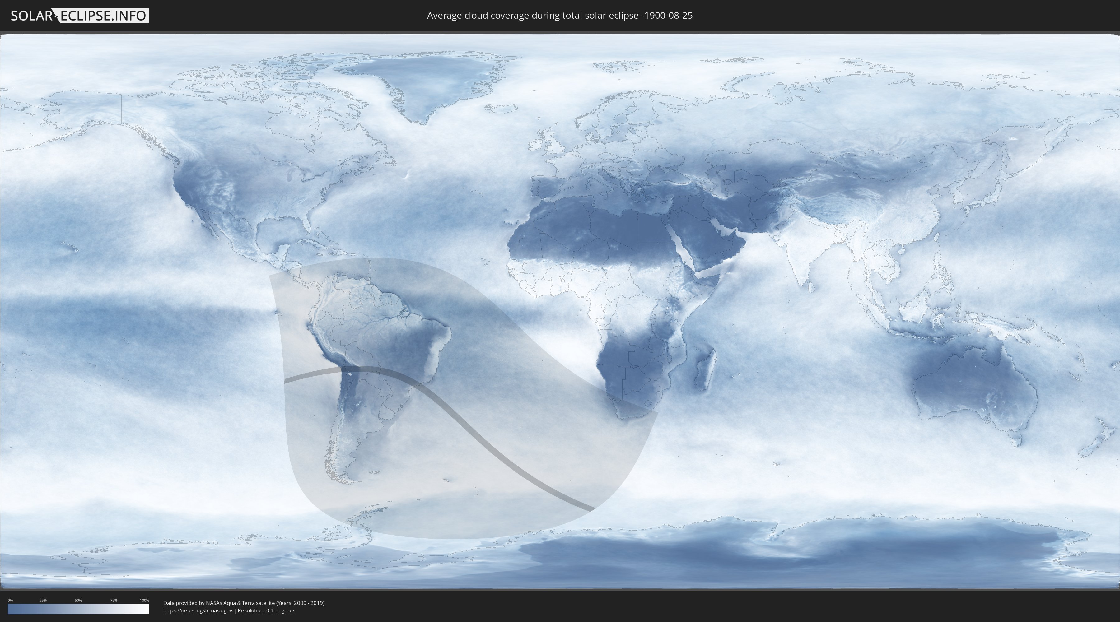
Wie wird das Wetter während der totalen Sonnenfinsternis am 25.08.-1900?
Wo ist der beste Ort, um die totale Sonnenfinsternis vom 25.08.-1900 zu beobachten?
Die folgenden Karten zeigen die durchschnittliche Bewölkung für den Tag, an dem die totale Sonnenfinsternis
stattfindet. Mit Hilfe der Karten lässt sich der Ort entlang des Finsternispfades eingrenzen,
der die besten Aussichen auf einen klaren wolkenfreien Himmel bietet.
Trotzdem muss man immer lokale Gegenenheiten beachten und sollte sich genau über das Wetter an seinem
gewählten Beobachtungsort informieren.
Die Daten stammen von den beiden NASA-Satelliten
AQUA und TERRA
und wurden über einen Zeitraum von 19 Jahren (2000 - 2019) gemittelt.
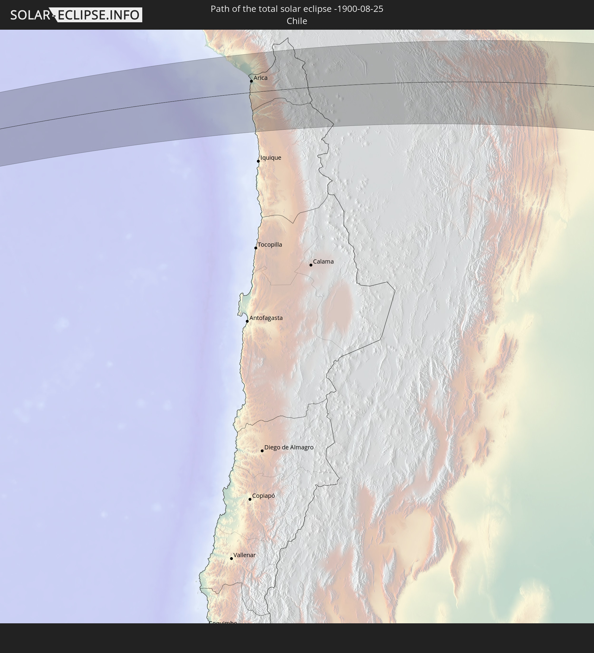
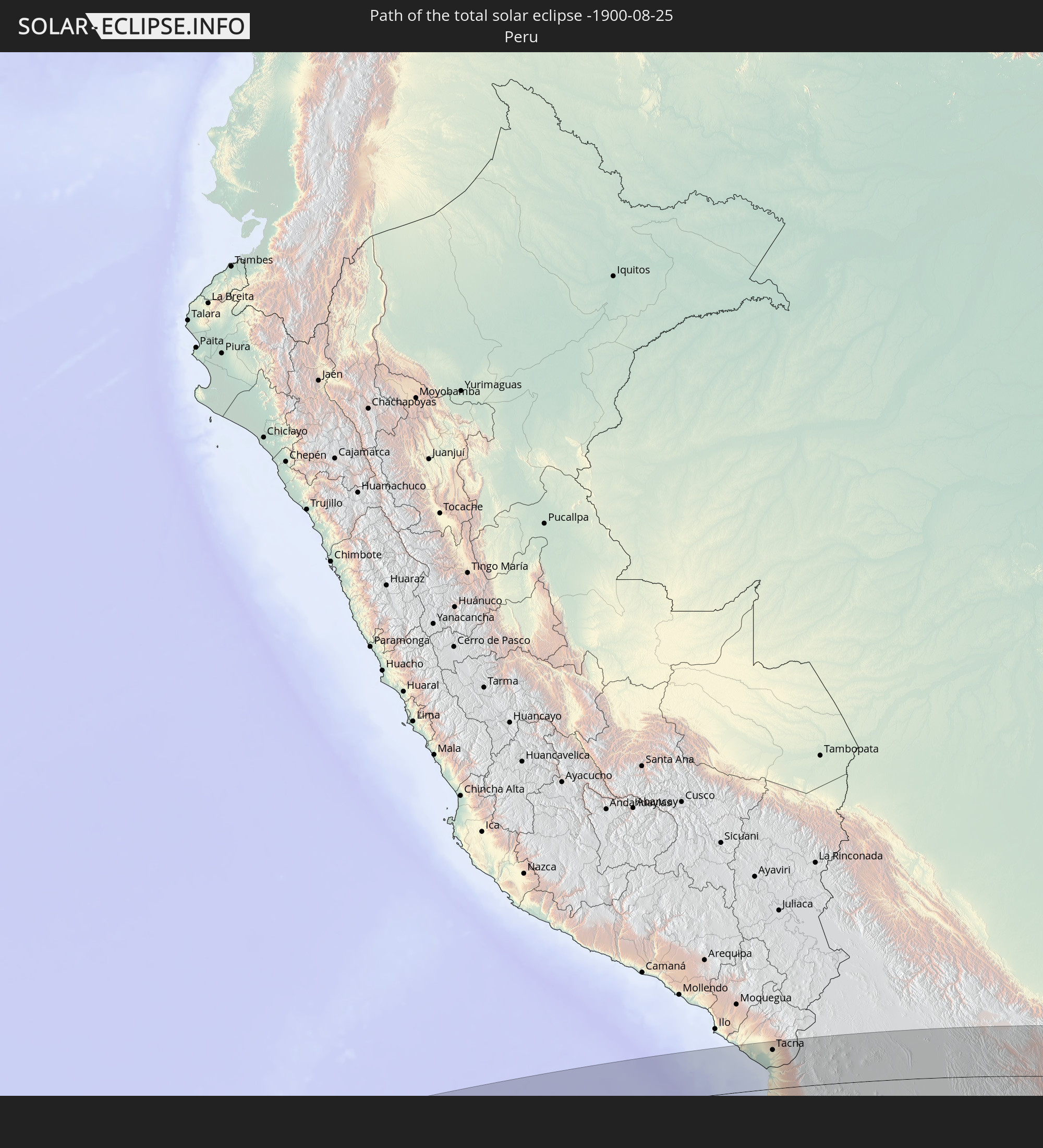
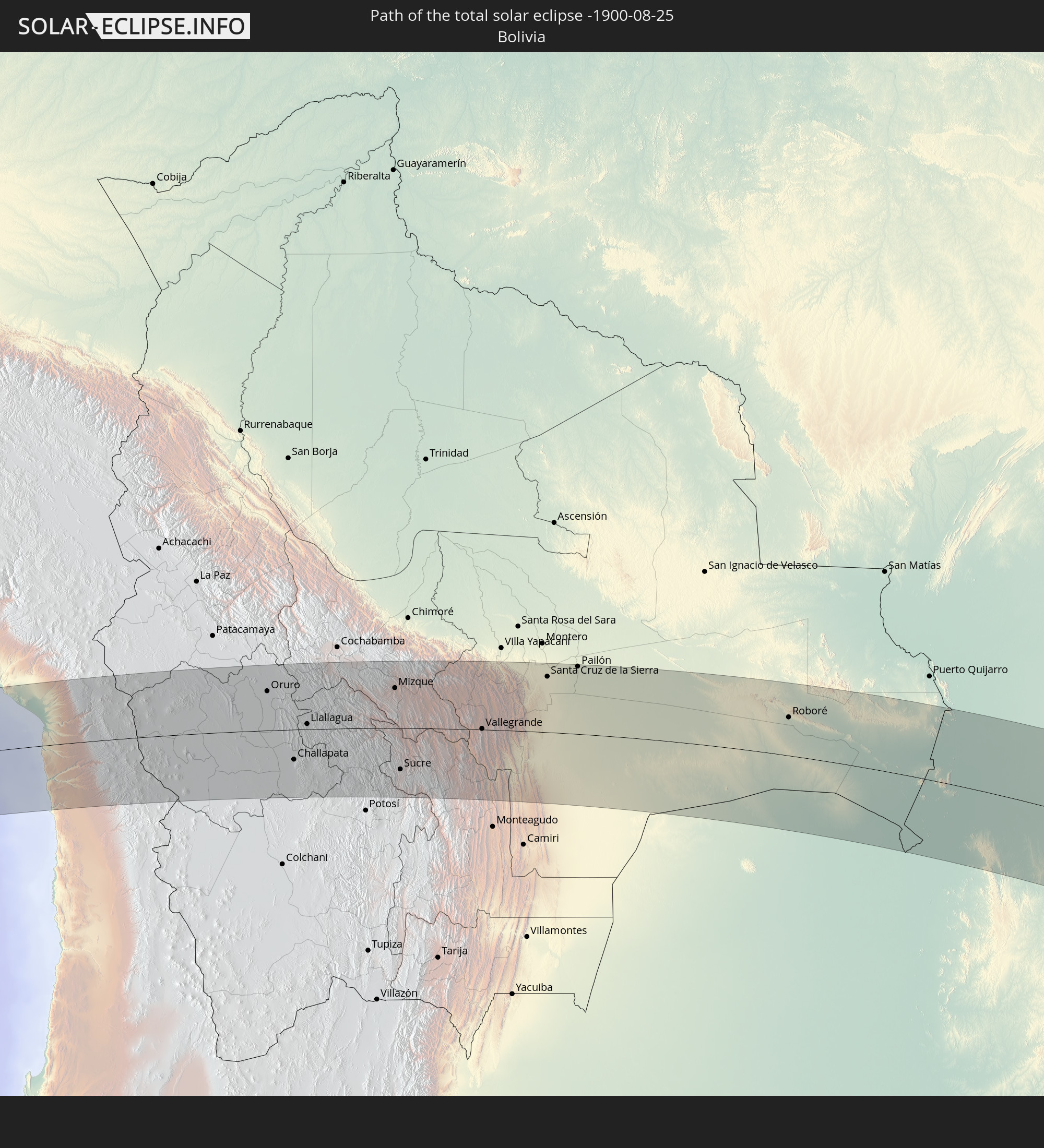
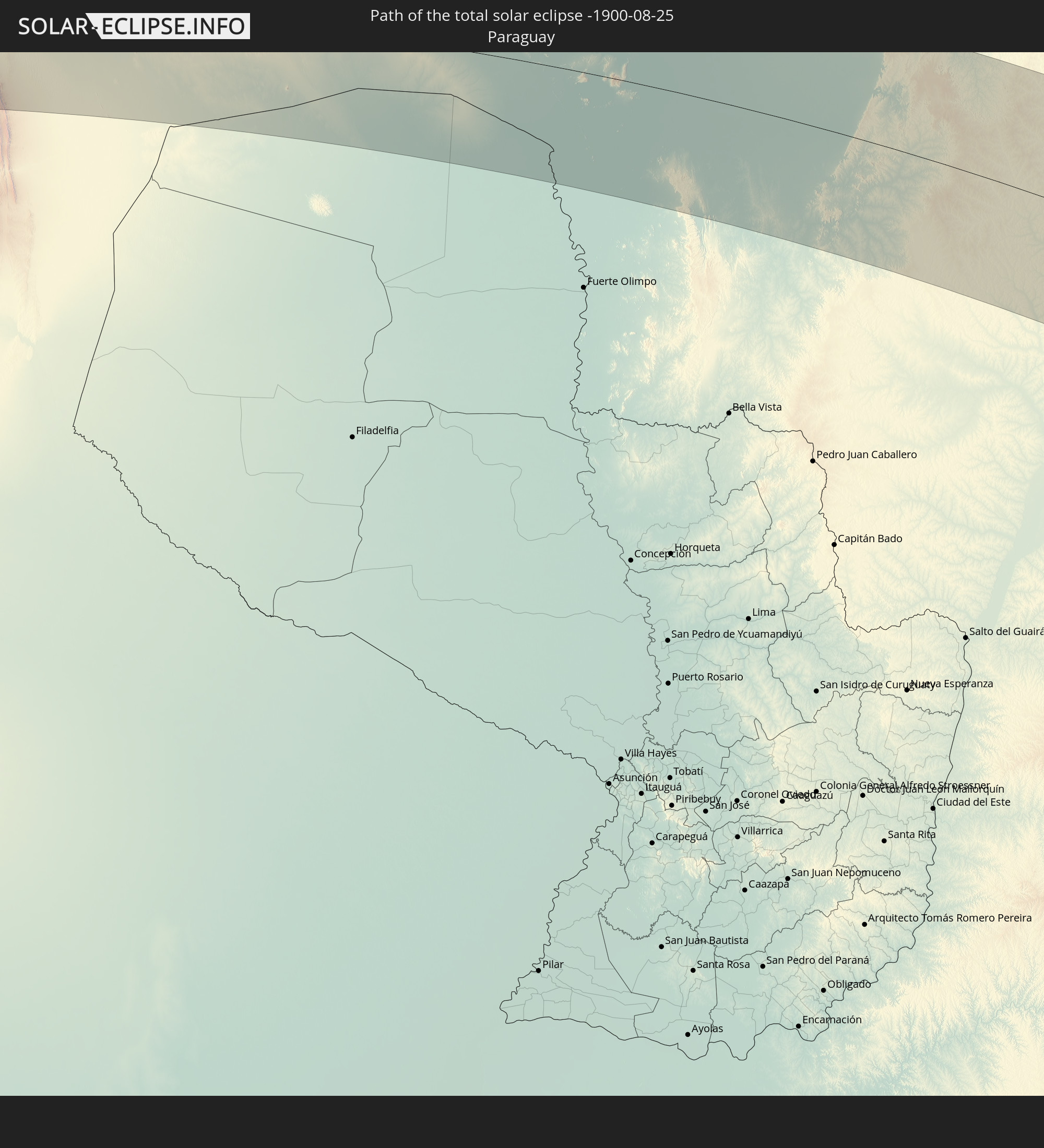
Detaillierte Länderkarten
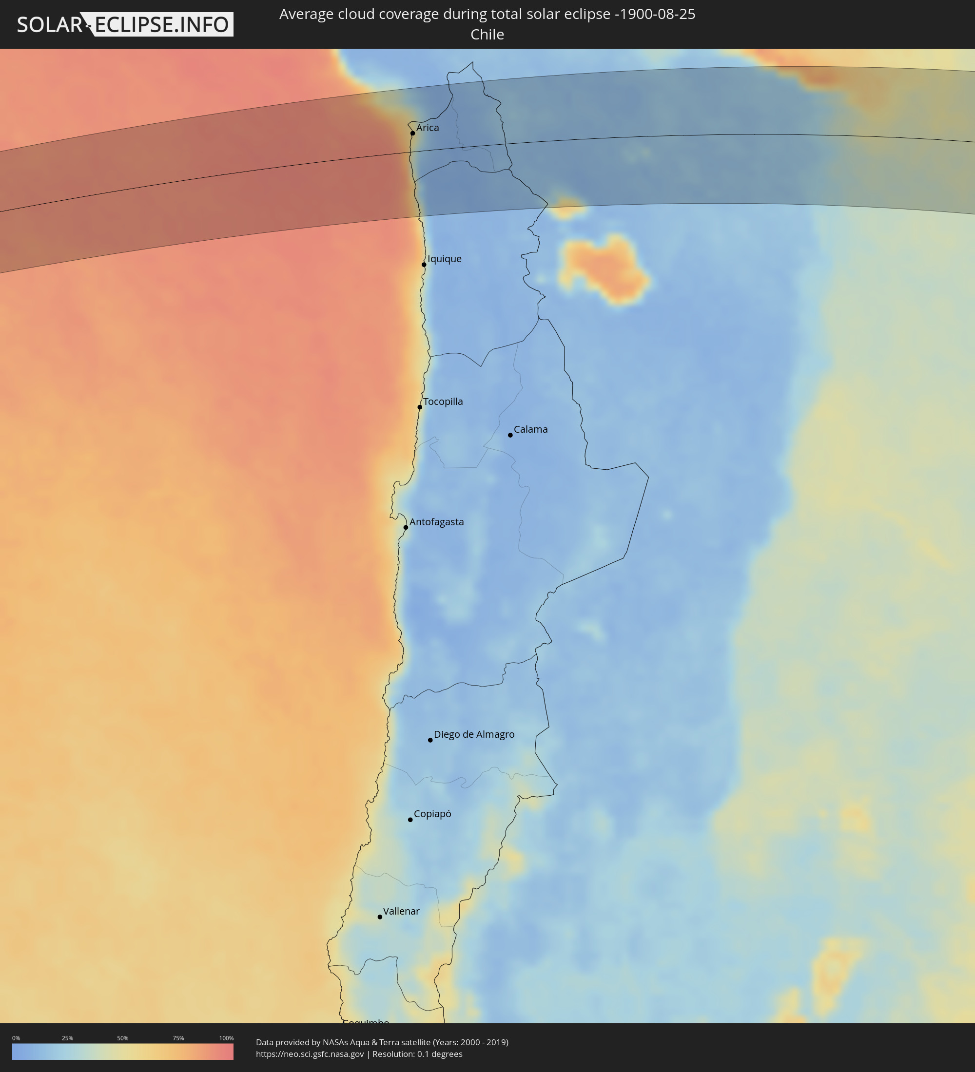 Chile
Chile
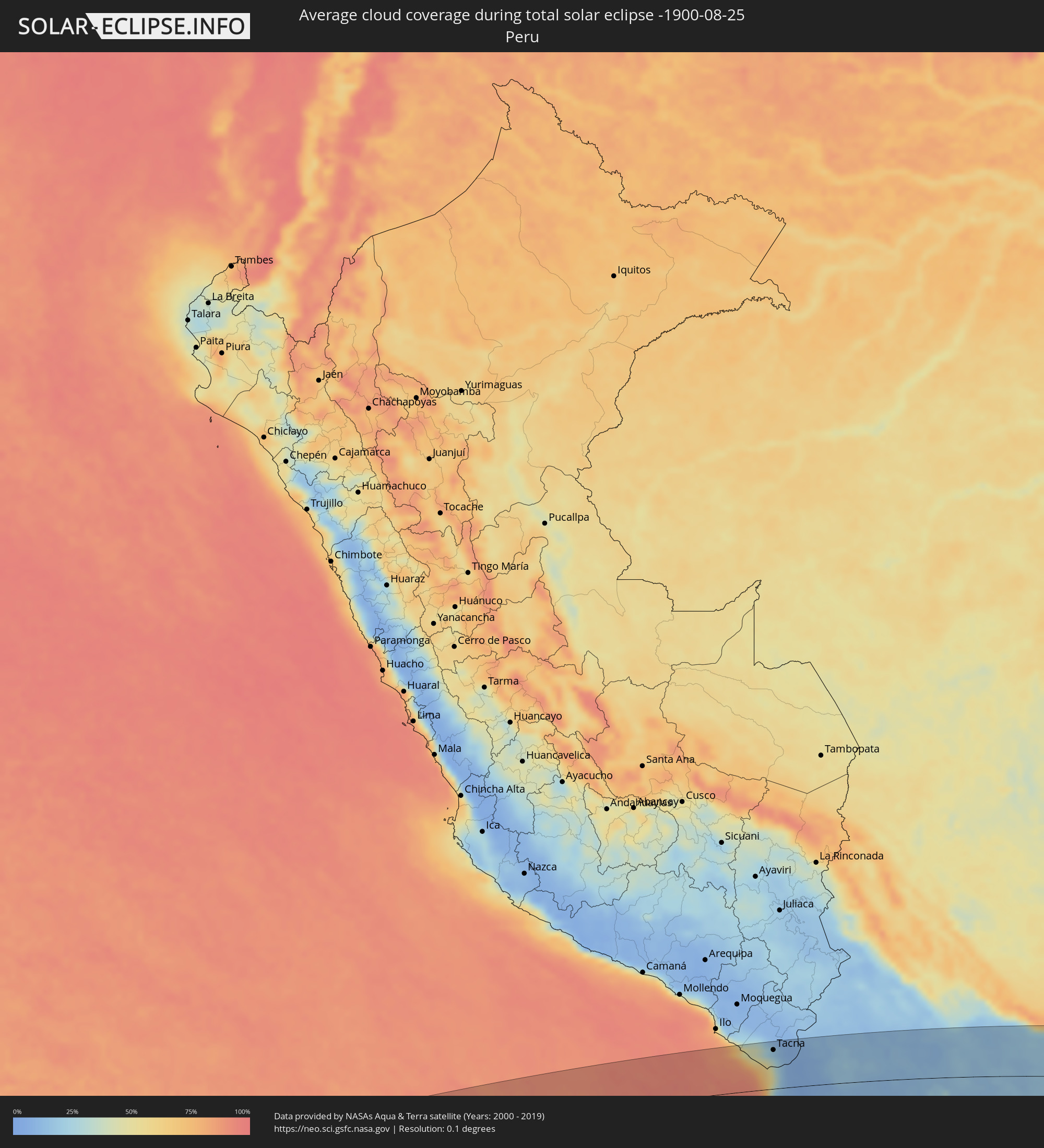 Peru
Peru
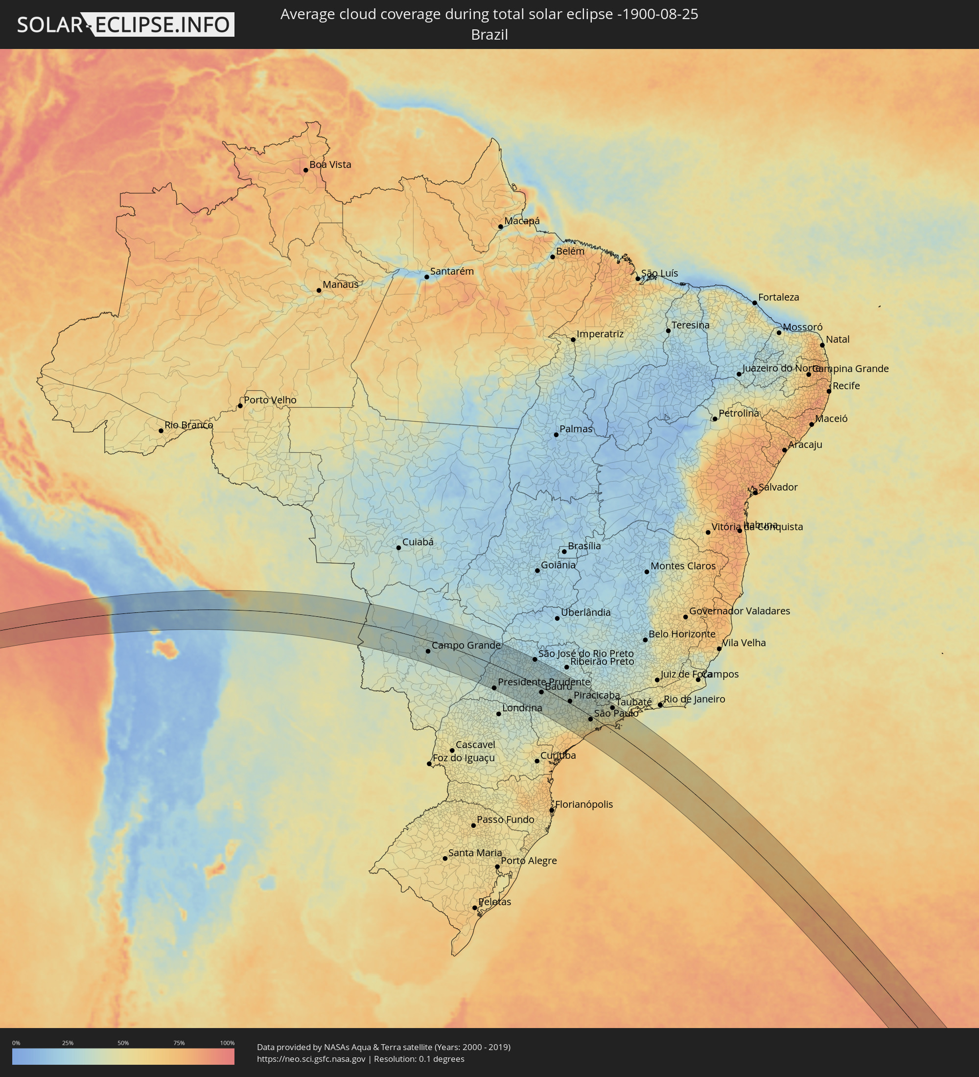 Brasilien
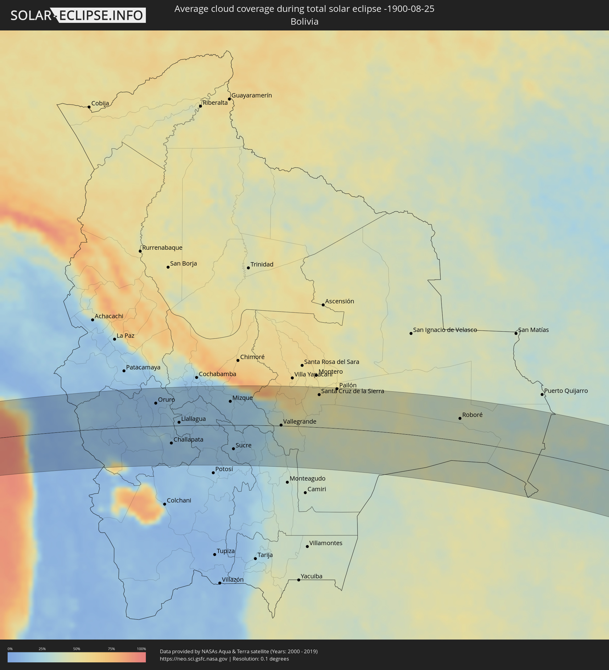 Bolivien
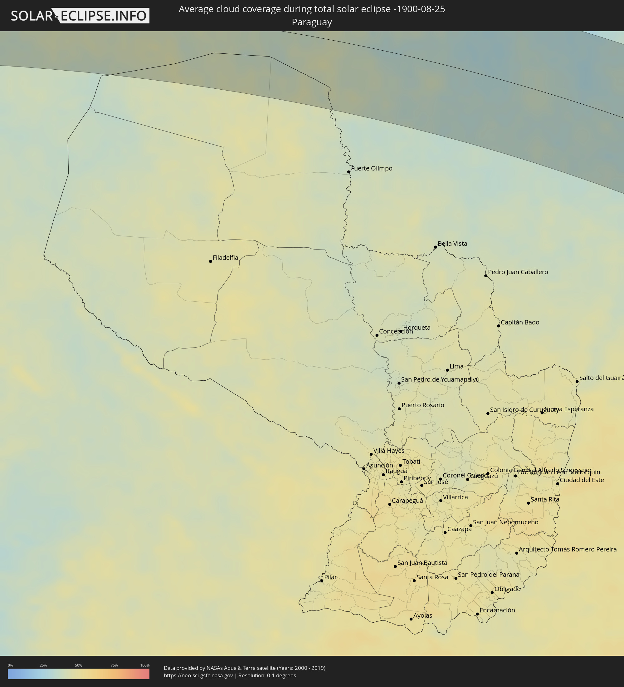 Paraguay
Orte im Finsternispfad
Die nachfolgene Tabelle zeigt Städte und Orte mit mehr als 5.000 Einwohnern, die sich im Finsternispfad befinden. Städte mit mehr als 100.000 Einwohnern sind dick gekennzeichnet. Mit einem Klick auf den Ort öffnet sich eine Detailkarte die die Lage des jeweiligen Ortes zusammen mit dem Verlauf der zentralen Finsternis präsentiert.
| Ort | Typ | Dauer der Verfinsterung | Ortszeit bei maximaler Verfinsterung | Entfernung zur Zentrallinie | Ø Bewölkung |
|
Arica, Arica y Parinacota
|
total | - | 07:52:58 UTC-04:42 | 26 km | 47% |
|
Tacna, Tacna
|
total | - | 07:26:34 UTC-05:08 | 77 km | 33% |
|
Oruro, Oruro
|
total | - | 08:06:23 UTC-04:32 | 59 km | 11% |
|
Huanuni, Oruro
|
total | - | 08:07:13 UTC-04:32 | 24 km | 18% |
|
Challapata, Oruro
|
total | - | 08:08:10 UTC-04:32 | 45 km | 15% |
|
Llallagua, Potosí
|
total | - | 08:07:45 UTC-04:32 | 8 km | 20% |
|
Capinota, Cochabamba
|
total | - | 08:07:13 UTC-04:32 | 86 km | 14% |
|
Tarata, Cochabamba
|
total | - | 08:07:24 UTC-04:32 | 97 km | 15% |
|
Cliza, Cochabamba
|
total | - | 08:07:29 UTC-04:32 | 100 km | 16% |
|
Mizque, Cochabamba
|
total | - | 08:08:49 UTC-04:32 | 60 km | 19% |
|
Sucre, Chuquisaca
|
total | - | 08:10:27 UTC-04:32 | 61 km | 17% |
|
Aiquile, Cochabamba
|
total | - | 08:09:24 UTC-04:32 | 31 km | 18% |
|
Vallegrande, Santa Cruz
|
total | - | 08:11:23 UTC-04:32 | 1 km | 37% |
|
Santiago del Torno, Santa Cruz
|
total | - | 08:11:45 UTC-04:32 | 60 km | 46% |
|
Santa Cruz de la Sierra, Santa Cruz
|
total | - | 08:11:47 UTC-04:32 | 83 km | 47% |
|
Cotoca, Santa Cruz
|
total | - | 08:12:01 UTC-04:32 | 81 km | 47% |
|
San Julian, Santa Cruz
|
total | - | 08:12:15 UTC-04:32 | 85 km | 46% |
|
Pailón, Santa Cruz
|
total | - | 08:12:15 UTC-04:32 | 101 km | 49% |
|
Roboré, Santa Cruz
|
total | - | 08:18:06 UTC-04:32 | 57 km | 38% |
|
Corumbá, Mato Grosso do Sul
|
total | - | 09:16:57 UTC-03:38 | 20 km | 37% |
|
Campo Grande, Mato Grosso do Sul
|
total | - | 09:24:48 UTC-03:38 | 55 km | 31% |
|
Três Lagoas, Mato Grosso do Sul
|
total | - | 09:31:13 UTC-03:38 | 14 km | 27% |
|
Presidente Prudente, São Paulo
|
total | - | 10:05:59 UTC-03:06 | 110 km | 34% |
|
Araçatuba, São Paulo
|
total | - | 10:06:31 UTC-03:06 | 24 km | 28% |
|
Marília, São Paulo
|
total | - | 10:09:07 UTC-03:06 | 55 km | 32% |
|
São José do Rio Preto, São Paulo
|
total | - | 10:08:06 UTC-03:06 | 110 km | 27% |
|
Bauru, São Paulo
|
total | - | 10:11:08 UTC-03:06 | 23 km | 34% |
|
Catanduva, São Paulo
|
total | - | 10:09:28 UTC-03:06 | 98 km | 28% |
|
Avaré, São Paulo
|
total | - | 10:12:39 UTC-03:06 | 93 km | 40% |
|
Jaú, São Paulo
|
total | - | 10:12:10 UTC-03:06 | 4 km | 37% |
|
Botucatu, São Paulo
|
total | - | 10:13:20 UTC-03:06 | 48 km | 36% |
|
Matão, São Paulo
|
total | - | 10:11:29 UTC-03:06 | 81 km | 31% |
|
Araraquara, São Paulo
|
total | - | 10:12:11 UTC-03:06 | 72 km | 32% |
|
Itapetininga, São Paulo
|
total | - | 10:15:16 UTC-03:06 | 95 km | 43% |
|
São Carlos, São Paulo
|
total | - | 10:13:09 UTC-03:06 | 64 km | 32% |
|
Tatuí, São Paulo
|
total | - | 10:15:19 UTC-03:06 | 63 km | 40% |
|
Piracicaba, São Paulo
|
total | - | 10:14:46 UTC-03:06 | 9 km | 37% |
|
Rio Claro, São Paulo
|
total | - | 10:14:28 UTC-03:06 | 43 km | 35% |
|
Sorocaba, São Paulo
|
total | - | 10:16:24 UTC-03:06 | 55 km | 42% |
|
Santa Bárbara d'Oeste, São Paulo
|
total | - | 10:15:19 UTC-03:06 | 18 km | 38% |
|
Limeira, São Paulo
|
total | - | 10:15:03 UTC-03:06 | 37 km | 37% |
|
Leme, São Paulo
|
total | - | 10:14:29 UTC-03:06 | 74 km | 33% |
|
Araras, São Paulo
|
total | - | 10:14:46 UTC-03:06 | 58 km | 35% |
|
Itu, São Paulo
|
total | - | 10:16:22 UTC-03:06 | 24 km | 39% |
|
Sumaré, São Paulo
|
total | - | 10:15:44 UTC-03:06 | 19 km | 38% |
|
Indaiatuba, São Paulo
|
total | - | 10:16:17 UTC-03:06 | 3 km | 39% |
|
Campinas, São Paulo
|
total | - | 10:16:19 UTC-03:06 | 22 km | 36% |
|
Mogi-Gaucu, São Paulo
|
total | - | 10:15:43 UTC-03:06 | 80 km | 33% |
|
Cotia, São Paulo
|
total | - | 10:17:42 UTC-03:06 | 36 km | 46% |
|
Santana de Parnaíba, São Paulo
|
total | - | 10:17:28 UTC-03:06 | 21 km | 44% |
|
Jundiaí, São Paulo
|
total | - | 10:17:08 UTC-03:06 | 5 km | 40% |
|
Embu Guaçu, São Paulo
|
total | - | 10:18:18 UTC-03:06 | 52 km | 51% |
|
Osasco, São Paulo
|
total | - | 10:17:52 UTC-03:06 | 22 km | 44% |
|
Itanhaém, São Paulo
|
total | - | 10:18:53 UTC-03:06 | 83 km | 63% |
|
Francisco Morato, São Paulo
|
total | - | 10:17:35 UTC-03:06 | 4 km | 41% |
|
São Paulo, São Paulo
|
total | - | 10:18:14 UTC-03:06 | 15 km | 45% |
|
São Bernardo do Campo, São Paulo
|
total | - | 10:18:36 UTC-03:06 | 25 km | 47% |
|
Atibaia, São Paulo
|
total | - | 10:17:44 UTC-03:06 | 30 km | 38% |
|
Bragança Paulista, São Paulo
|
total | - | 10:17:30 UTC-03:06 | 46 km | 35% |
|
Ribeirão Pires, São Paulo
|
total | - | 10:18:58 UTC-03:06 | 18 km | 55% |
|
Itaquaquecetuba, São Paulo
|
total | - | 10:18:45 UTC-03:06 | 6 km | 47% |
|
Santos, São Paulo
|
total | - | 10:19:31 UTC-03:06 | 37 km | 58% |
|
Mogi das Cruzes, São Paulo
|
total | - | 10:19:09 UTC-03:06 | 12 km | 48% |
|
Jacareí, São Paulo
|
total | - | 10:19:17 UTC-03:06 | 45 km | 47% |
|
São José dos Campos, São Paulo
|
total | - | 10:19:16 UTC-03:06 | 61 km | 45% |
|
Taubaté, São Paulo
|
total | - | 10:19:44 UTC-03:06 | 94 km | 43% |
|
Caraguatatuba, São Paulo
|
total | - | 10:20:58 UTC-03:06 | 47 km | 57% |
|
São Sebastião, São Paulo
|
total | - | 10:21:12 UTC-03:06 | 34 km | 54% |
|
Ubatuba, São Paulo
|
total | - | 10:21:25 UTC-03:06 | 83 km | 58% |