Ringförmige Sonnenfinsternis vom 29.12.0167
| Wochentag: | Dienstag |
| Maximale Dauer der Verfinsterung: | 08m08s |
| Maximale Breite des Finsternispfades: | 255 km |
| Saroszyklus: | 73 |
| Bedeckungsgrad: | 93.2% |
| Magnitude: | 0.9324 |
| Gamma: | -0.1262 |
Wo kann man die Sonnenfinsternis vom 29.12.0167 sehen?
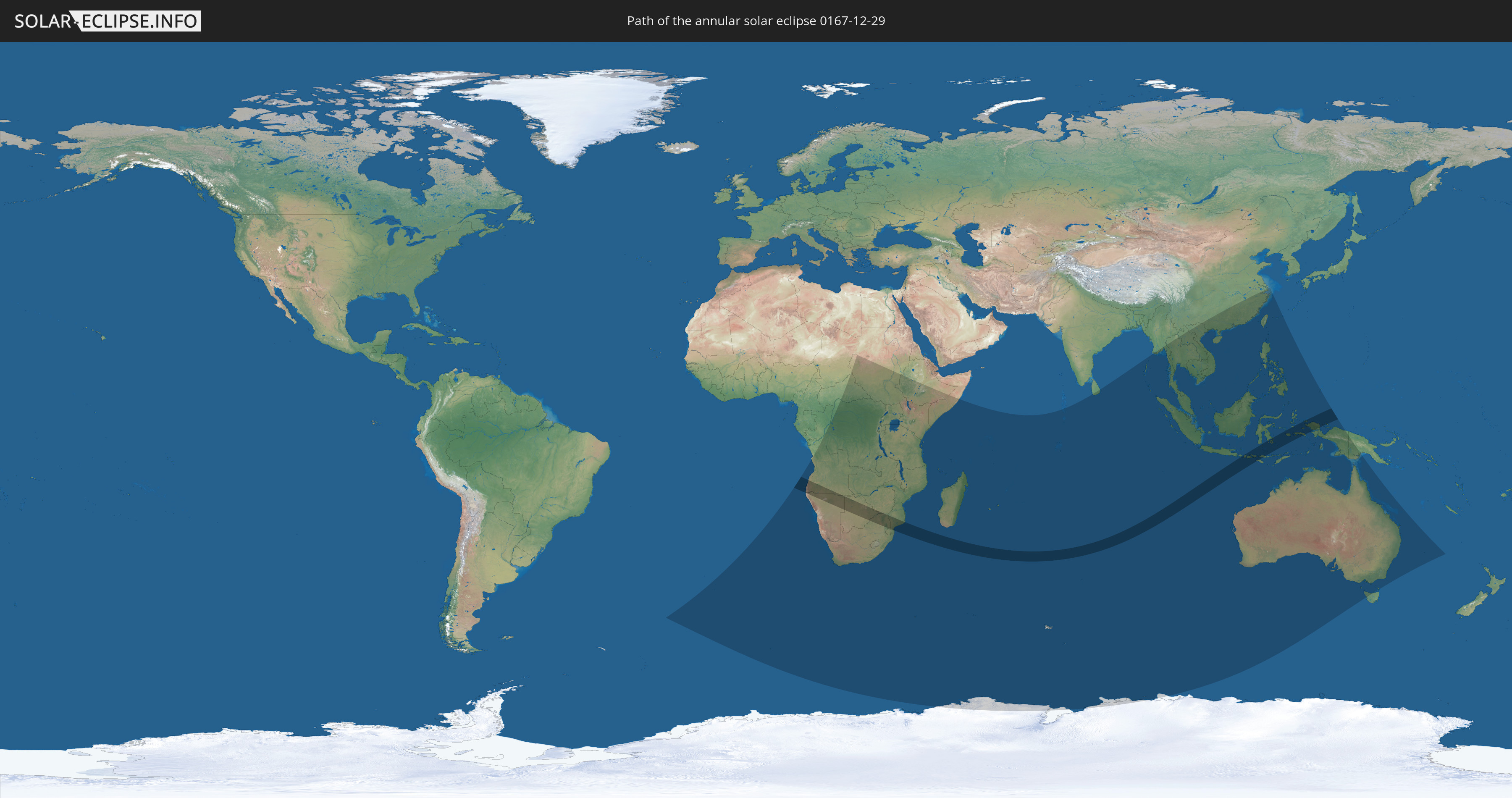
Die Sonnenfinsternis am 29.12.0167 kann man in 57 Ländern als partielle Sonnenfinsternis beobachten.
Der Finsternispfad verläuft durch 7 Länder. Nur in diesen Ländern ist sie als ringförmige Sonnenfinsternis zu sehen.
In den folgenden Ländern ist die Sonnenfinsternis ringförmig zu sehen
 Angola
 Namibia
 Südafrika
 Botswana
 Simbabwe
 Mosambik
 Indonesien
In den folgenden Ländern ist die Sonnenfinsternis partiell zu sehen
 Antarktika
 St. Helena
 Bouvetinsel
 Angola
 Namibia
 Demokratische Republik Kongo
 Tschad
 Zentralafrikanische Republik
 Südafrika
 Botswana
 Sudan
Sudan
 Sambia
 Simbabwe
 Lesotho
 Ruanda
 Burundi
 Tansania
 Uganda
 Mosambik
 Swasiland
 Malawi
 Äthiopien
 Kenia
Kenia
 Französische Süd- und Antarktisgebiete
 Somalia
 Madagaskar
 Komoren
 Mayotte
 Seychellen
 Réunion
 Mauritius
 Indien
 Britisches Territorium im Indischen Ozean
 Heard und McDonaldinseln
 Malediven
 Volksrepublik China
 Sri Lanka
 Myanmar
 Indonesien
 Kokosinseln
 Thailand
 Malaysia
 Laos
Laos
 Vietnam
 Kambodscha
 Singapur
 Weihnachtsinsel
 Australien
 Macau
Macau
 Hongkong
 Brunei
 Taiwan
 Philippinen
 Japan
Japan
 Osttimor
 Palau
Palau
 Papua-Neuguinea
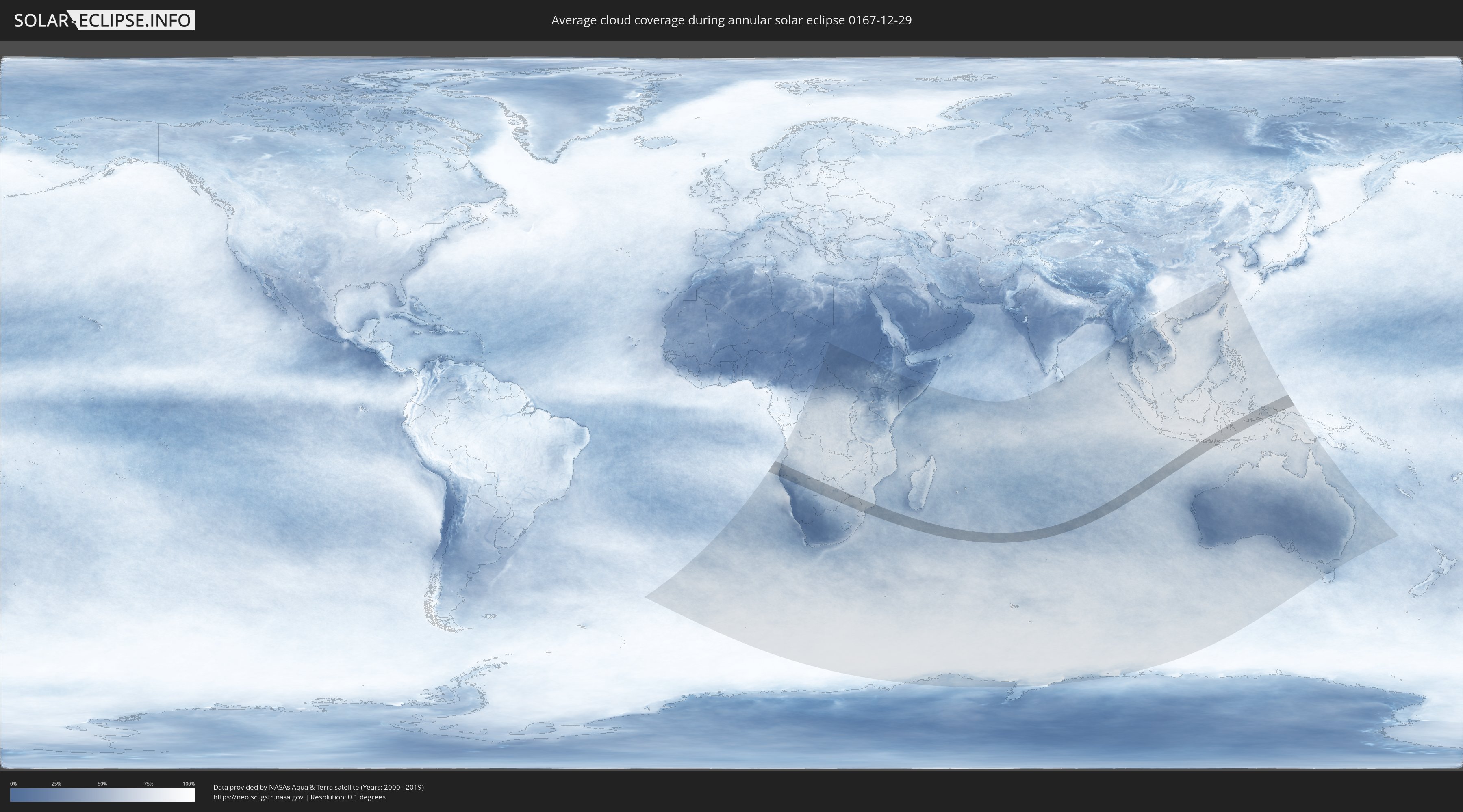
Wie wird das Wetter während der ringförmigen Sonnenfinsternis am 29.12.0167?
Wo ist der beste Ort, um die ringförmige Sonnenfinsternis vom 29.12.0167 zu beobachten?
Die folgenden Karten zeigen die durchschnittliche Bewölkung für den Tag, an dem die ringförmige Sonnenfinsternis
stattfindet. Mit Hilfe der Karten lässt sich der Ort entlang des Finsternispfades eingrenzen,
der die besten Aussichen auf einen klaren wolkenfreien Himmel bietet.
Trotzdem muss man immer lokale Gegenenheiten beachten und sollte sich genau über das Wetter an seinem
gewählten Beobachtungsort informieren.
Die Daten stammen von den beiden NASA-Satelliten
AQUA und TERRA
und wurden über einen Zeitraum von 19 Jahren (2000 - 2019) gemittelt.

Detaillierte Länderkarten
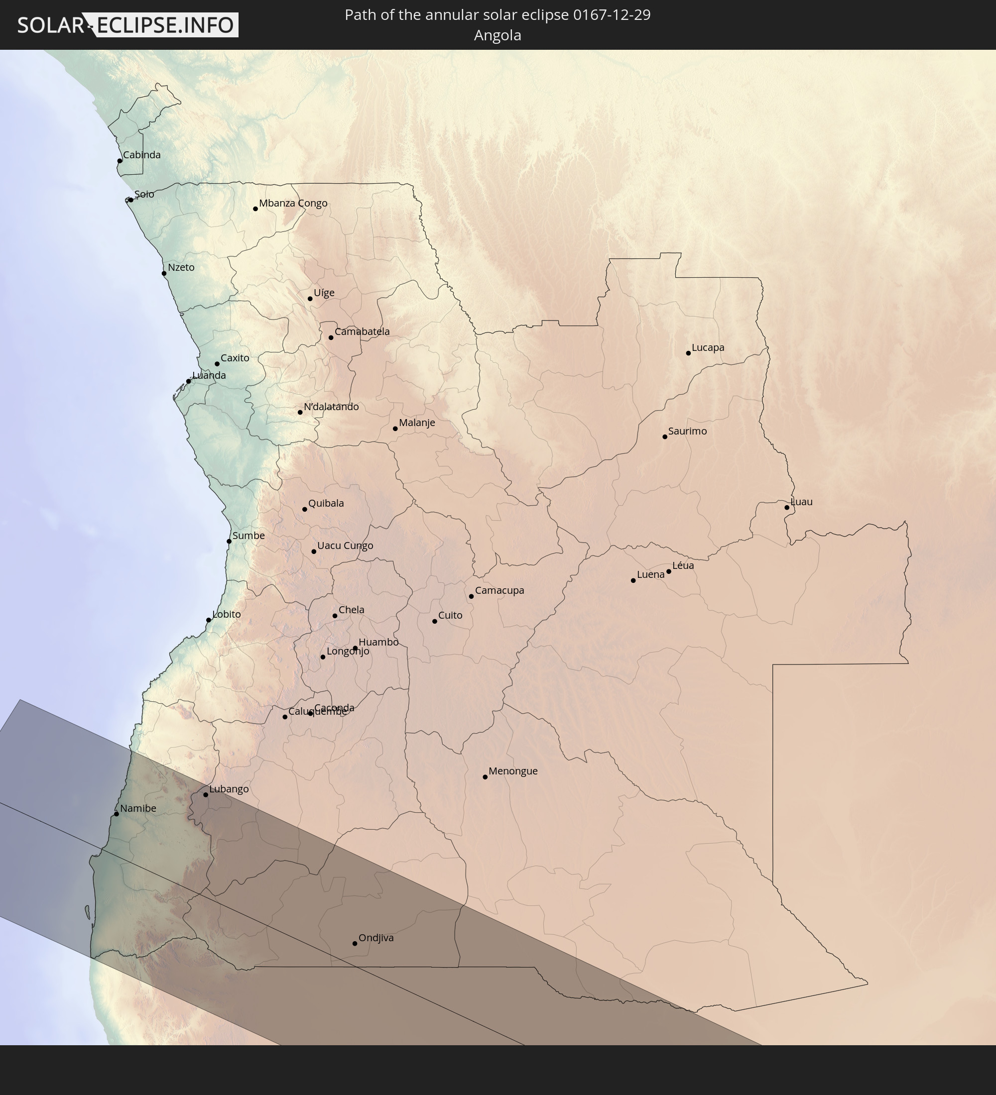
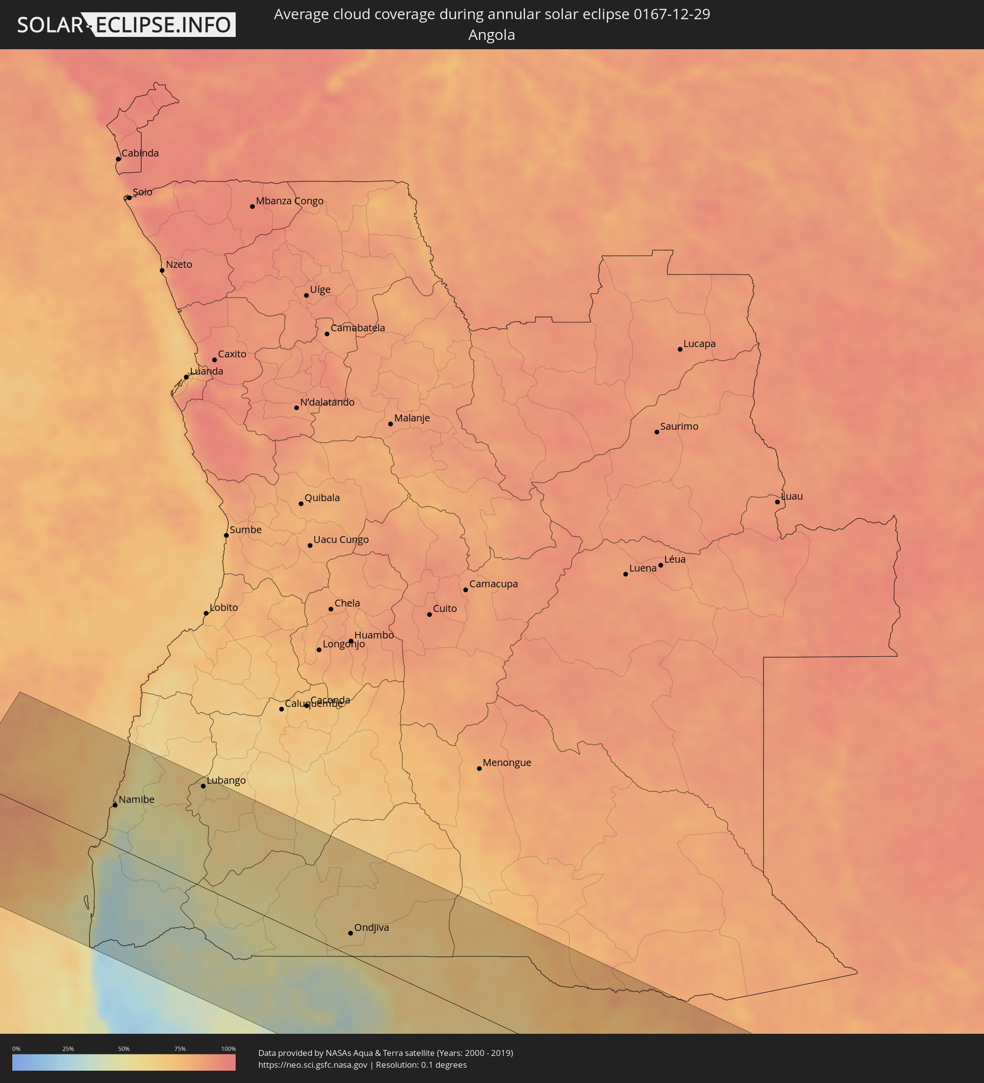 Angola
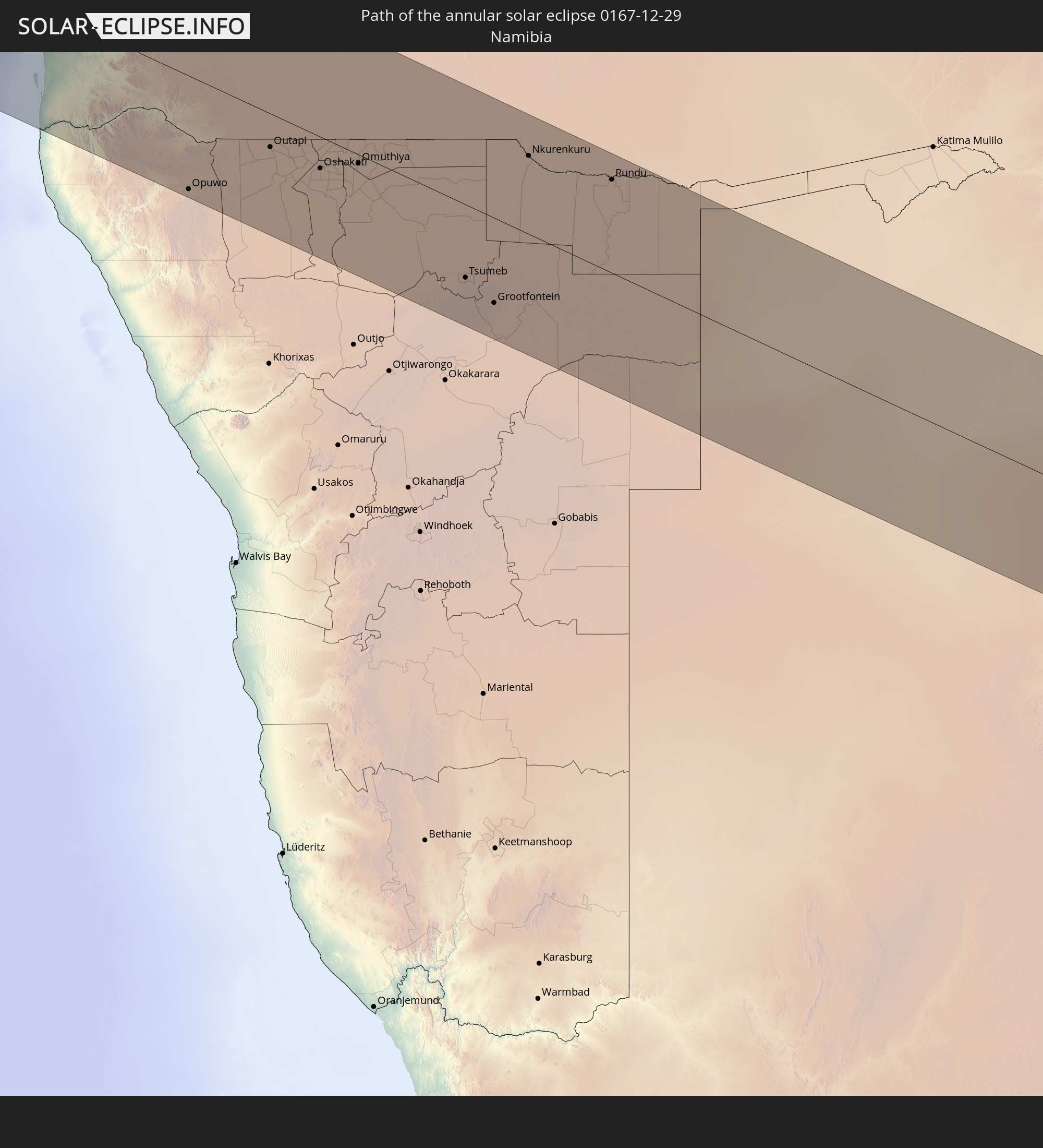
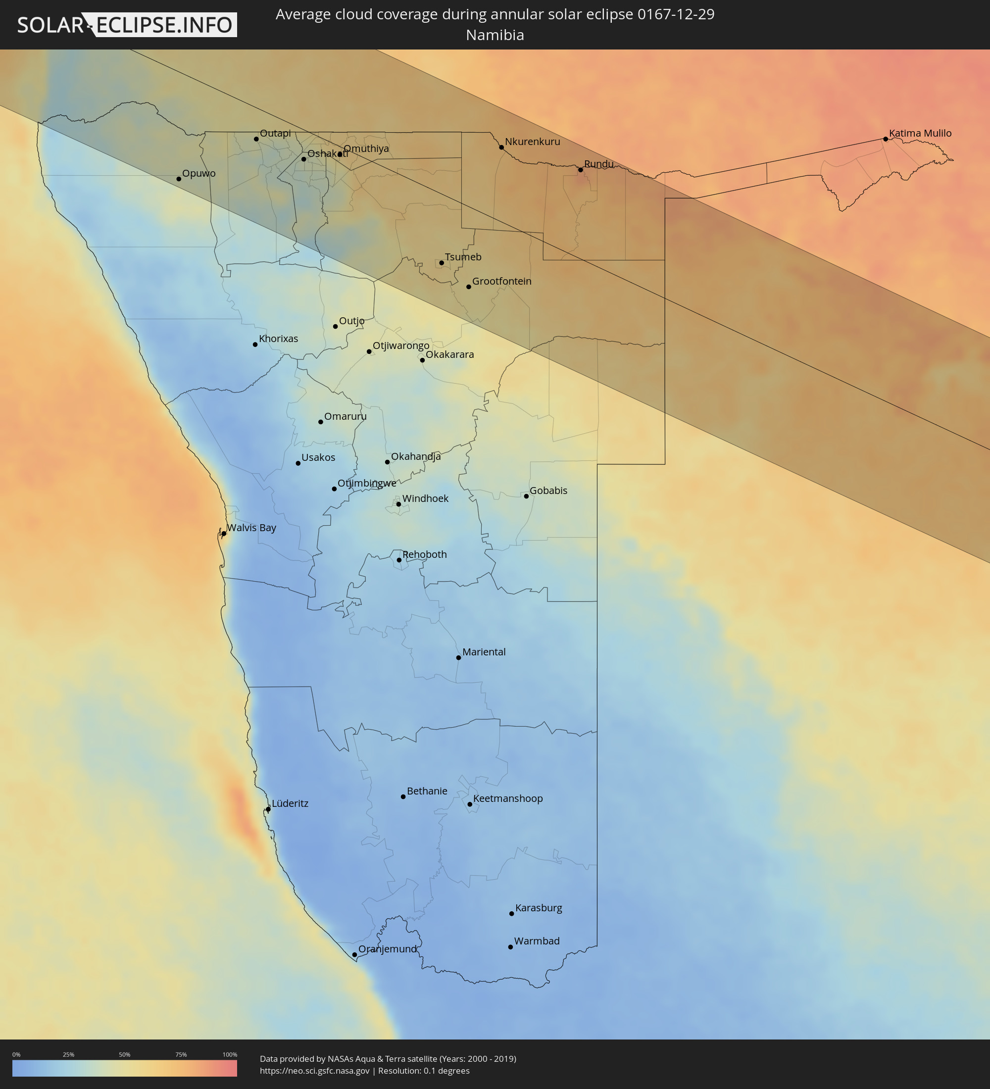 Namibia
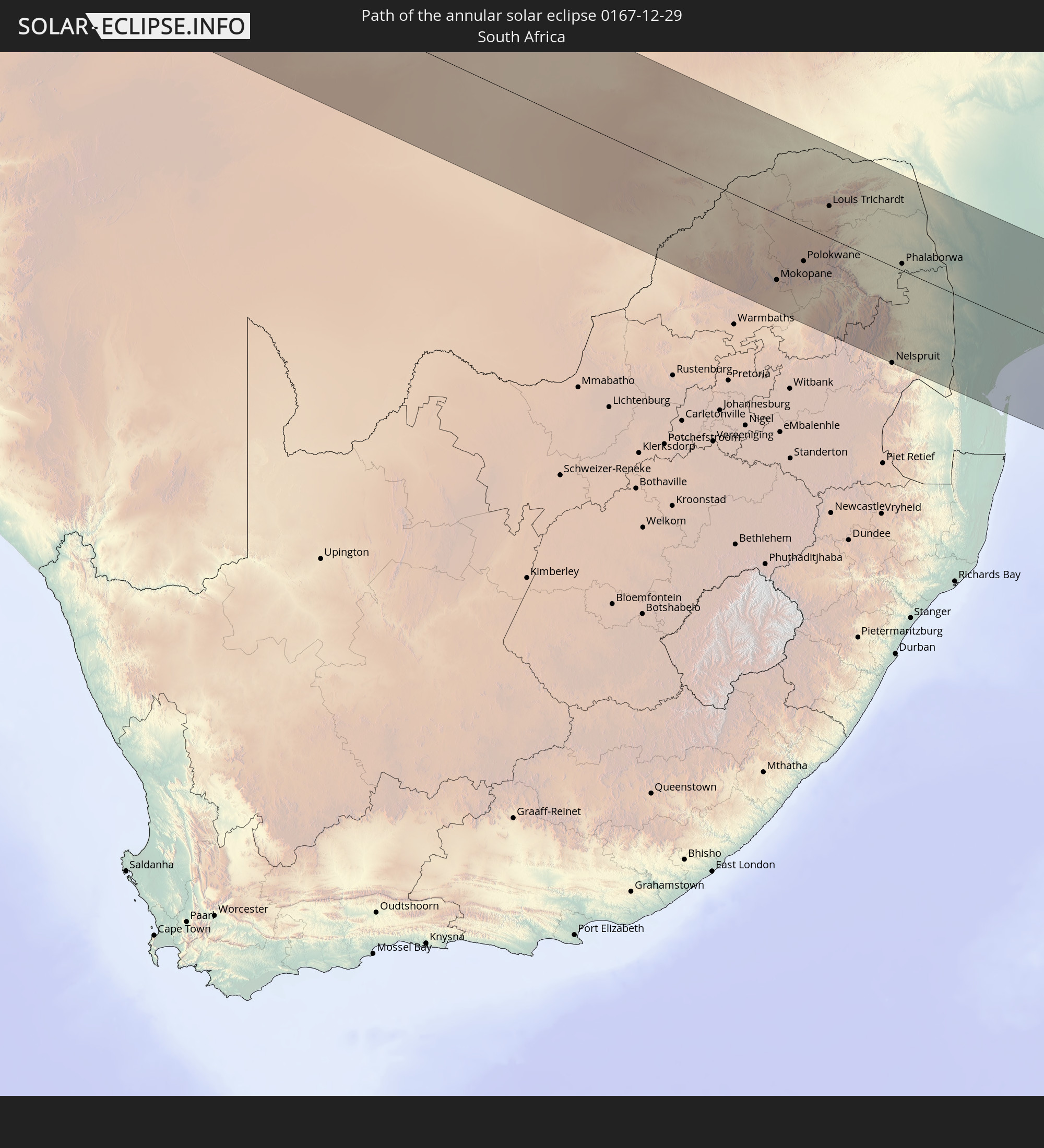
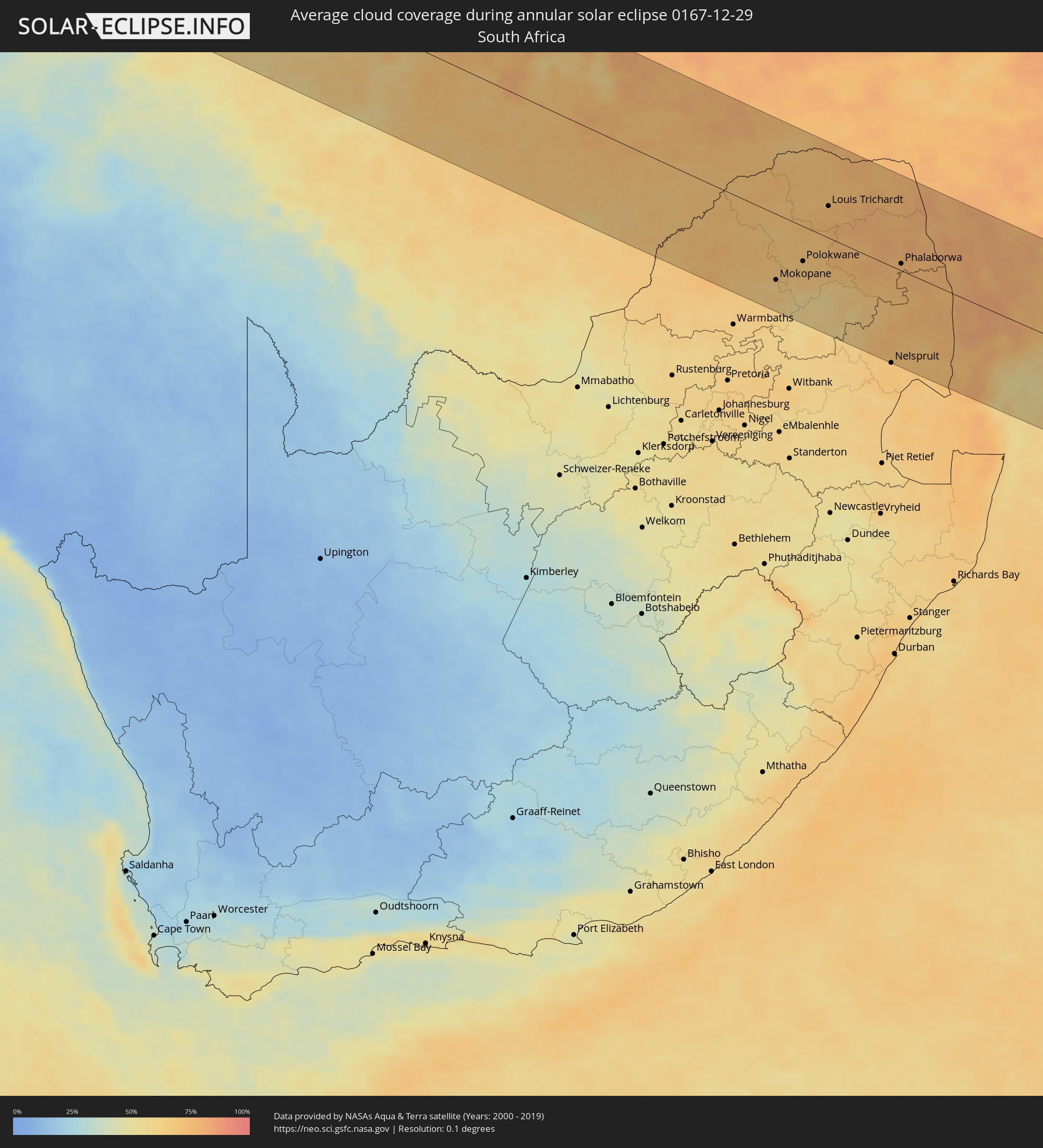 Südafrika
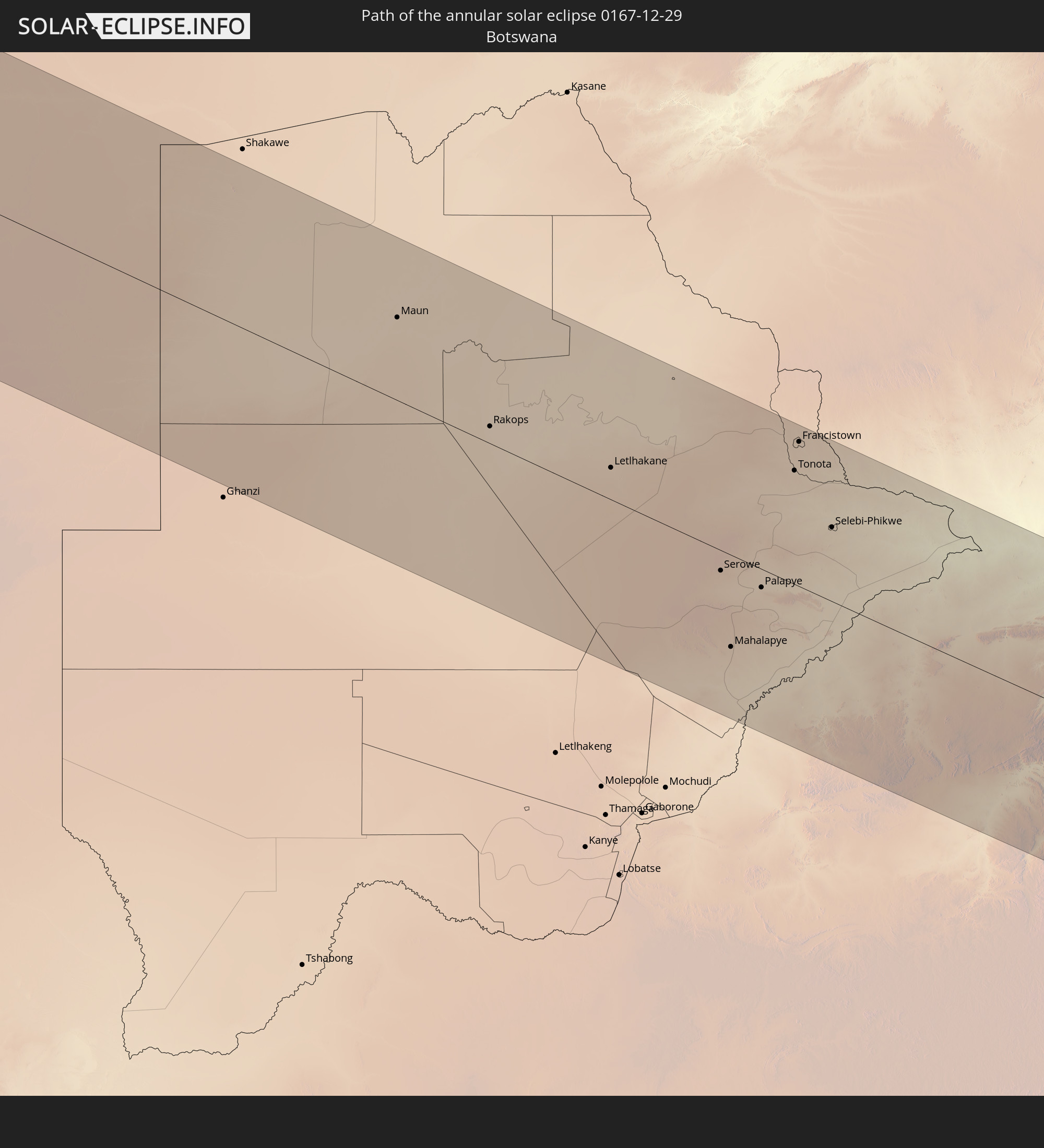
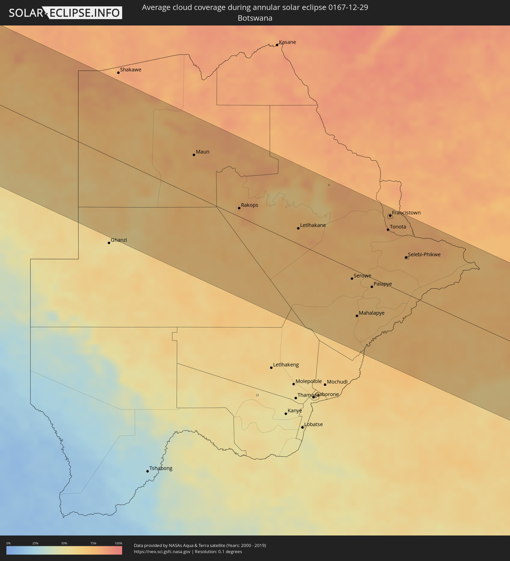 Botswana
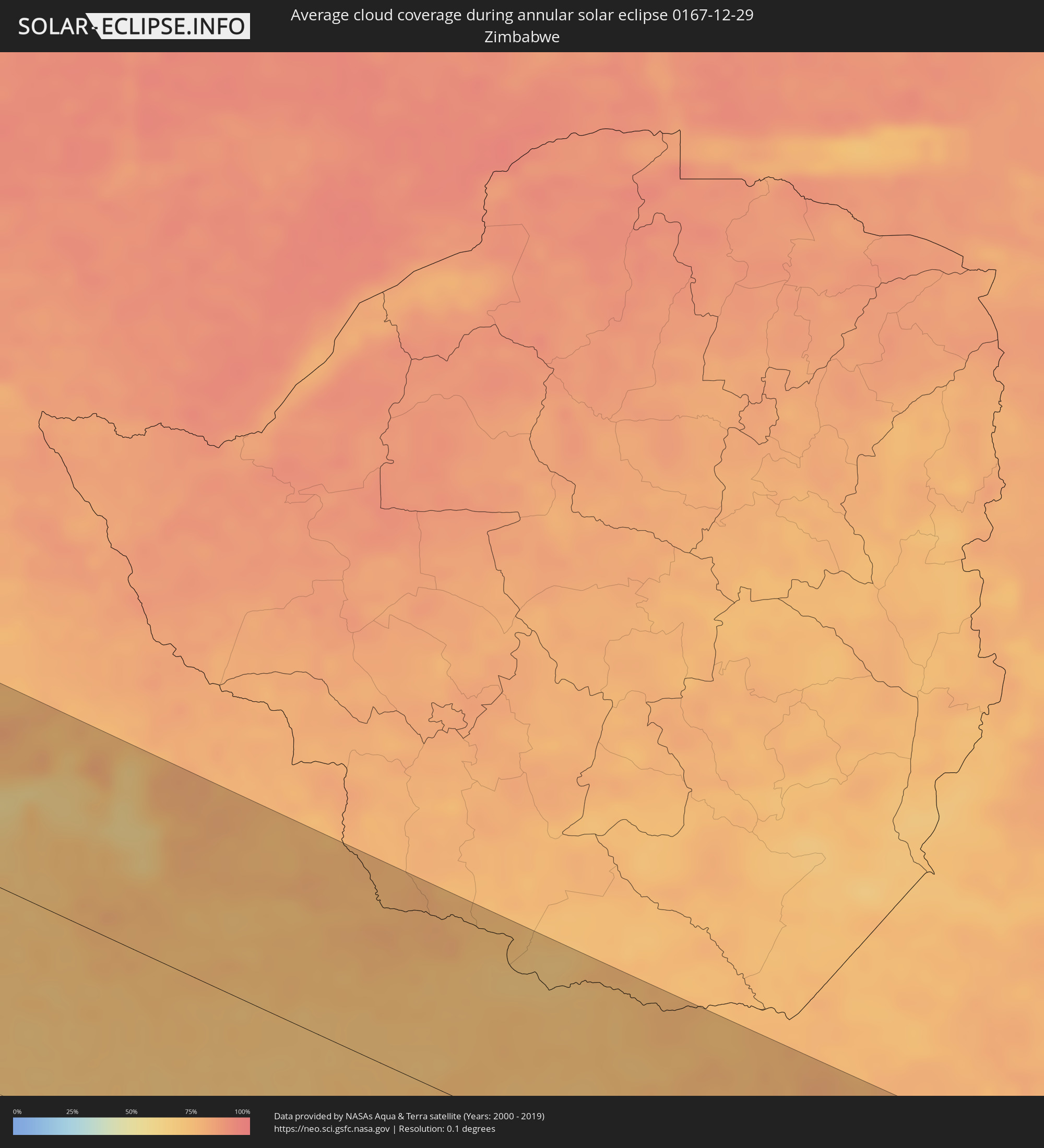 Simbabwe
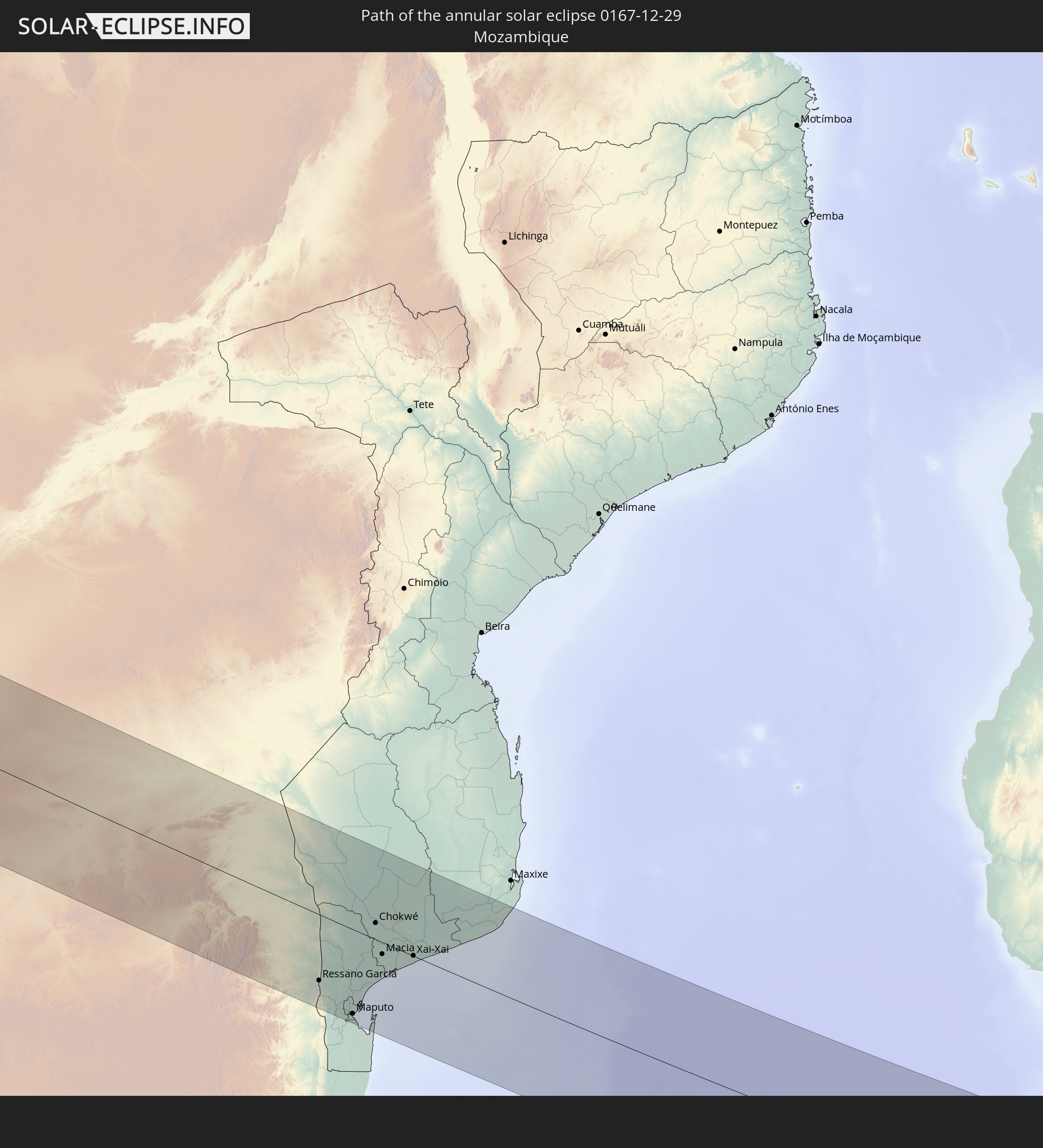
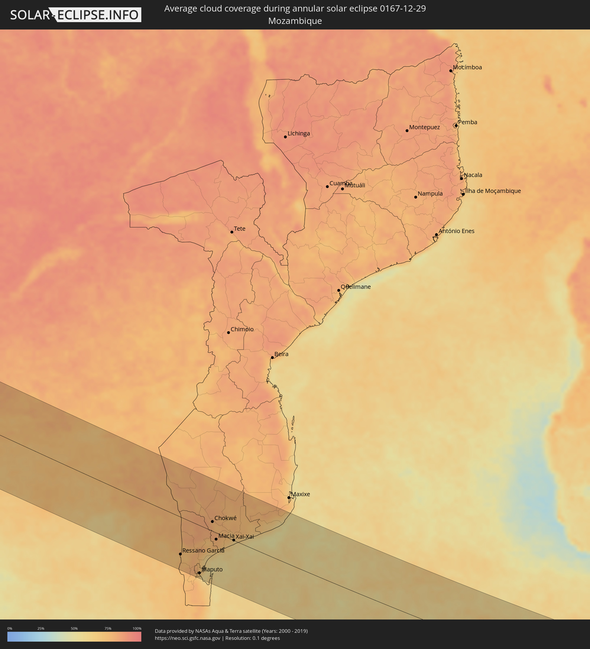 Mosambik
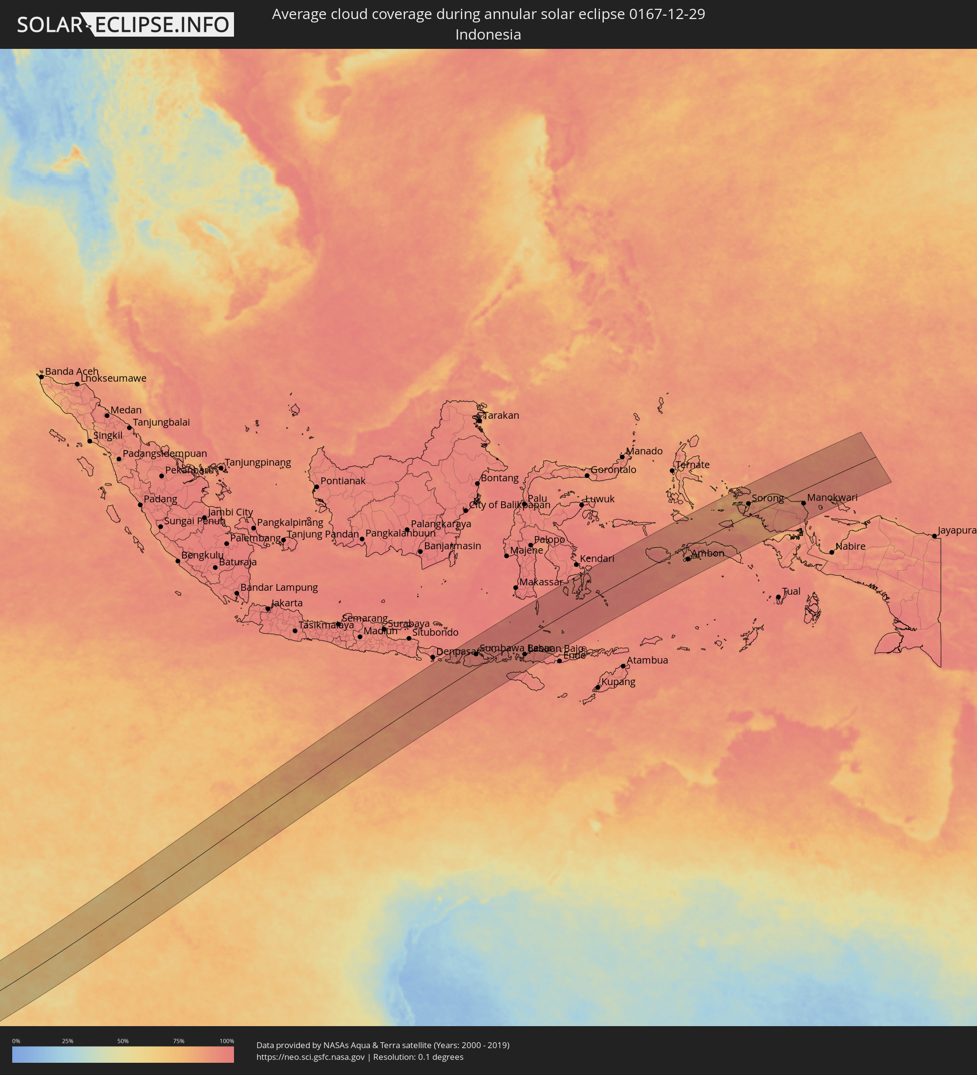 Indonesien
Orte im Finsternispfad
Die nachfolgene Tabelle zeigt Städte und Orte mit mehr als 5.000 Einwohnern, die sich im Finsternispfad befinden. Städte mit mehr als 100.000 Einwohnern sind dick gekennzeichnet. Mit einem Klick auf den Ort öffnet sich eine Detailkarte die die Lage des jeweiligen Ortes zusammen mit dem Verlauf der zentralen Finsternis präsentiert.
| Ort | Typ | Dauer der Verfinsterung | Ortszeit bei maximaler Verfinsterung | Entfernung zur Zentrallinie | Ø Bewölkung |
|
Namibe, Namibe
|
ringförmig | - | 05:13:43 UTC+00:13 | 61 km | 49% |
|
Lubango, Huíla
|
ringförmig | - | 05:13:20 UTC+00:13 | 149 km | 62% |
|
Opuwo, Kunene
|
ringförmig | - | 06:31:44 UTC+01:30 | 153 km | 44% |
|
Outapi, Omusati
|
ringförmig | - | 06:31:14 UTC+01:30 | 45 km | 41% |
|
Oshakati, Oshana
|
ringförmig | - | 06:31:24 UTC+01:30 | 42 km | 41% |
|
Ondjiva, Cunene
|
ringförmig | - | 05:14:29 UTC+00:13 | 32 km | 58% |
|
Ongwediva, Oshana
|
ringförmig | - | 06:31:23 UTC+01:30 | 39 km | 42% |
|
Ondangwa, Oshana
|
ringförmig | - | 06:31:28 UTC+01:30 | 44 km | 40% |
|
Omuthiya, Oshikoto
|
ringförmig | - | 06:31:19 UTC+01:30 | 12 km | 56% |
|
Eenhana, Ohangwena
|
ringförmig | - | 06:31:09 UTC+01:30 | 19 km | 60% |
|
Tsumeb, Oshikoto
|
ringförmig | - | 06:32:26 UTC+01:30 | 98 km | 58% |
|
Grootfontein, Otjozondjupa
|
ringförmig | - | 06:32:42 UTC+01:30 | 113 km | 52% |
|
Nkurenkuru, Kavango West
|
ringförmig | - | 06:31:16 UTC+01:30 | 105 km | 69% |
|
Rundu, Kavango East
|
ringförmig | - | 06:31:35 UTC+01:30 | 125 km | 81% |
|
Maun, North-West
|
ringförmig | - | 07:14:08 UTC+02:10 | 80 km | 77% |
|
Rakops, Central
|
ringförmig | - | 07:15:16 UTC+02:10 | 16 km | 75% |
|
Orapa, Central
|
ringförmig | - | 07:15:50 UTC+02:10 | 32 km | 70% |
|
Letlhakane, Central
|
ringförmig | - | 07:16:00 UTC+02:10 | 31 km | 77% |
|
Serowe, Central
|
ringförmig | - | 07:17:19 UTC+02:10 | 19 km | 70% |
|
Mahalapye, Central
|
ringförmig | - | 07:18:01 UTC+02:10 | 87 km | 72% |
|
Palapye, Central
|
ringförmig | - | 07:17:38 UTC+02:10 | 18 km | 70% |
|
Tonota, Central
|
ringförmig | - | 07:16:46 UTC+02:10 | 109 km | 78% |
|
Francistown, North-East
|
ringförmig | - | 07:16:33 UTC+02:10 | 138 km | 78% |
|
Selebi-Phikwe, Central
|
ringförmig | - | 07:17:25 UTC+02:10 | 71 km | 73% |
|
Mokopane, Limpopo
|
ringförmig | - | 06:39:46 UTC+01:30 | 104 km | 63% |
|
Polokwane, Limpopo
|
ringförmig | - | 06:39:44 UTC+01:30 | 55 km | 69% |
|
Lebowakgomo, Limpopo
|
ringförmig | - | 06:40:02 UTC+01:30 | 84 km | 65% |
|
Mankoeng, Limpopo
|
ringförmig | - | 06:39:55 UTC+01:30 | 40 km | 66% |
|
Louis Trichardt, Limpopo
|
ringförmig | - | 06:39:08 UTC+01:30 | 50 km | 75% |
|
Duiwelskloof, Limpopo
|
ringförmig | - | 06:39:54 UTC+01:30 | 6 km | 75% |
|
Tzaneen, Limpopo
|
ringförmig | - | 06:40:03 UTC+01:30 | 19 km | 73% |
|
Ga-Kgapane, Limpopo
|
ringförmig | - | 06:39:54 UTC+01:30 | 3 km | 73% |
|
Nkowakowa, Limpopo
|
ringförmig | - | 06:40:11 UTC+01:30 | 19 km | 75% |
|
Lydenburg, Mpumalanga
|
ringförmig | - | 06:41:29 UTC+01:30 | 135 km | 62% |
|
Thohoyandou, Limpopo
|
ringförmig | - | 06:39:23 UTC+01:30 | 85 km | 77% |
|
Giyani, Limpopo
|
ringförmig | - | 06:39:52 UTC+01:30 | 58 km | 77% |
|
Nelspruit, Mpumalanga
|
ringförmig | - | 06:42:11 UTC+01:30 | 152 km | 71% |
|
White River, Mpumalanga
|
ringförmig | - | 06:42:04 UTC+01:30 | 136 km | 72% |
|
Phalaborwa, Limpopo
|
ringförmig | - | 06:40:45 UTC+01:30 | 11 km | 75% |
|
Thulamahashi, Limpopo
|
ringförmig | - | 06:41:34 UTC+01:30 | 66 km | 75% |
|
Komatipoort, Mpumalanga
|
ringförmig | - | 06:42:47 UTC+01:30 | 107 km | 73% |
|
Ressano Garcia, Maputo
|
ringförmig | - | 07:23:10 UTC+02:10 | 106 km | 73% |
|
Matola, Maputo
|
ringförmig | - | 07:24:01 UTC+02:10 | 140 km | 70% |
|
Maputo, Maputo City
|
ringförmig | - | 07:24:07 UTC+02:10 | 136 km | 65% |
|
Chokwé, Gaza
|
ringförmig | - | 07:22:55 UTC+02:10 | 27 km | 77% |
|
Macia, Gaza
|
ringförmig | - | 07:23:31 UTC+02:10 | 19 km | 78% |
|
Chibuto, Gaza
|
ringförmig | - | 07:23:29 UTC+02:10 | 33 km | 73% |
|
Xai-Xai, Gaza
|
ringförmig | - | 07:23:57 UTC+02:10 | 1 km | 62% |
|
Manjacaze, Gaza
|
ringförmig | - | 07:23:47 UTC+02:10 | 45 km | 75% |
|
Mataram, West Nusa Tenggara
|
ringförmig | - | 16:38:59 UTC+07:57 | 131 km | 93% |
|
Praya, West Nusa Tenggara
|
ringförmig | - | 16:38:55 UTC+07:57 | 110 km | 95% |
|
Sumbawa Besar, West Nusa Tenggara
|
ringförmig | - | 16:39:48 UTC+07:57 | 63 km | 95% |
|
Dompu, West Nusa Tenggara
|
ringförmig | - | 16:40:16 UTC+07:57 | 1 km | 94% |
|
Bima, West Nusa Tenggara
|
ringförmig | - | 16:40:29 UTC+07:57 | 9 km | 93% |
|
Labuan Bajo, East Nusa Tenggara
|
ringförmig | - | 16:40:58 UTC+07:57 | 79 km | 93% |
|
Ruteng, East Nusa Tenggara
|
ringförmig | - | 16:41:04 UTC+07:57 | 123 km | 97% |
|
Katabu, Southeast Sulawesi
|
ringförmig | - | 16:45:37 UTC+07:57 | 116 km | 95% |
|
Ambon, Maluku
|
ringförmig | - | 18:12:53 UTC+09:22 | 65 km | 89% |
|
Amahai, Maluku
|
ringförmig | - | 18:13:13 UTC+09:22 | 68 km | 90% |
|
Sorong, West Papua
|
ringförmig | - | 18:15:05 UTC+09:22 | 60 km | 84% |
|
Manokwari, West Papua
|
ringförmig | - | 18:14:50 UTC+09:22 | 74 km | 91% |