Totale Sonnenfinsternis vom 11.02.0324
| Wochentag: | Montag |
| Maximale Dauer der Verfinsterung: | 03m50s |
| Maximale Breite des Finsternispfades: | 163 km |
| Saroszyklus: | 84 |
| Bedeckungsgrad: | 100% |
| Magnitude: | 1.0457 |
| Gamma: | -0.3543 |
Wo kann man die Sonnenfinsternis vom 11.02.0324 sehen?
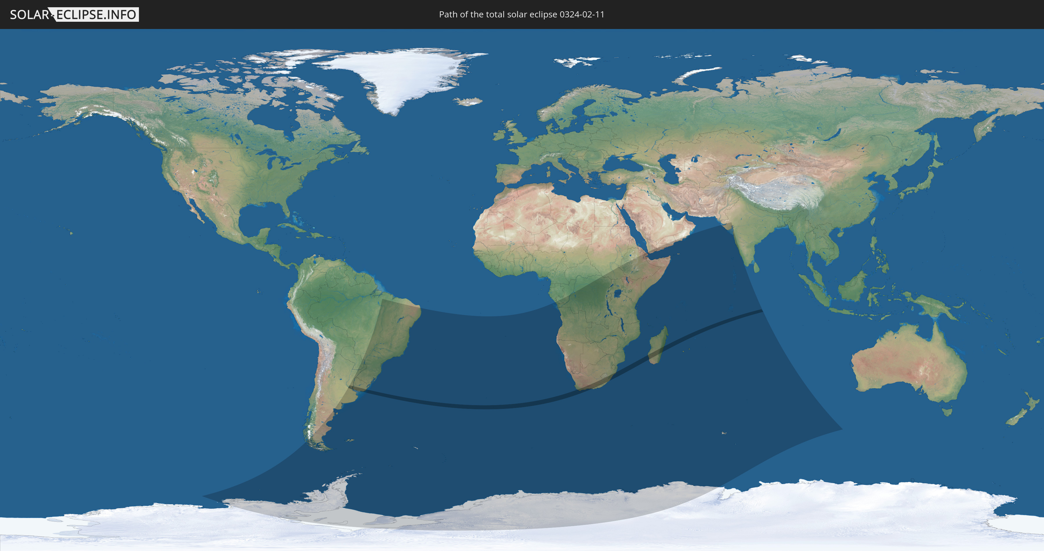
Die Sonnenfinsternis am 11.02.0324 kann man in 44 Ländern als partielle Sonnenfinsternis beobachten.
Der Finsternispfad verläuft durch 6 Länder. Nur in diesen Ländern ist sie als totale Sonnenfinsternis zu sehen.
In den folgenden Ländern ist die Sonnenfinsternis total zu sehen
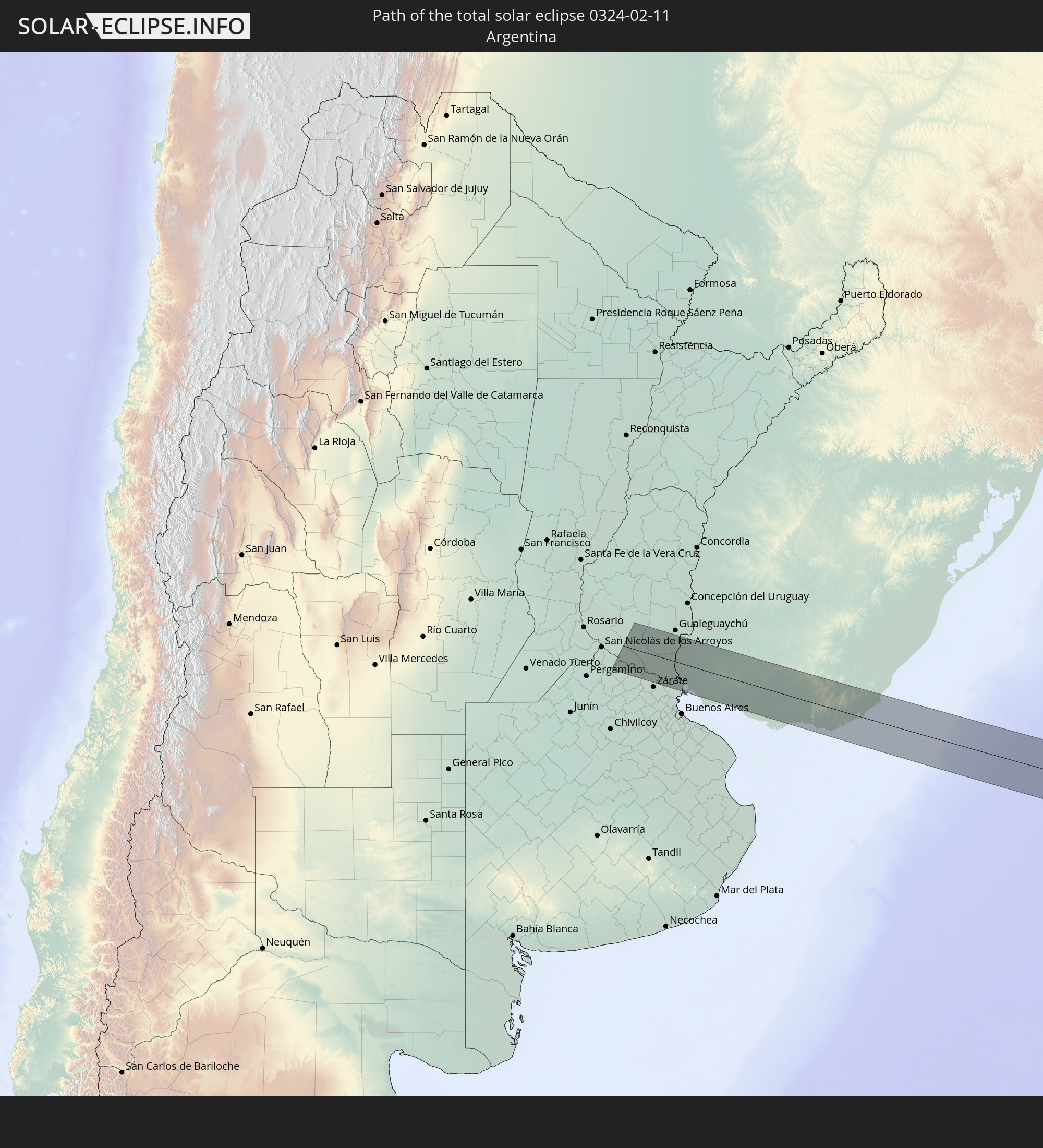 Argentinien
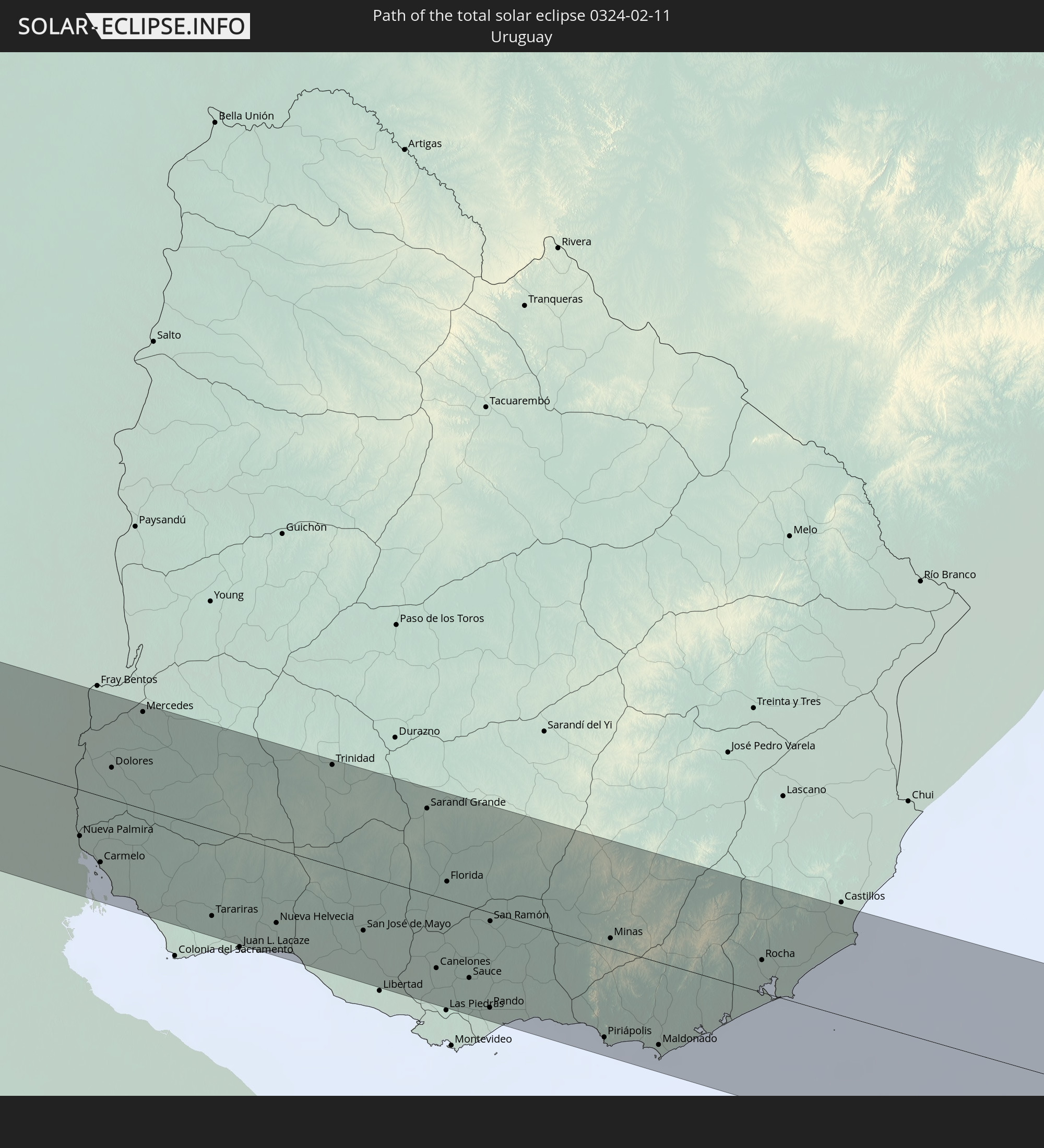 Uruguay
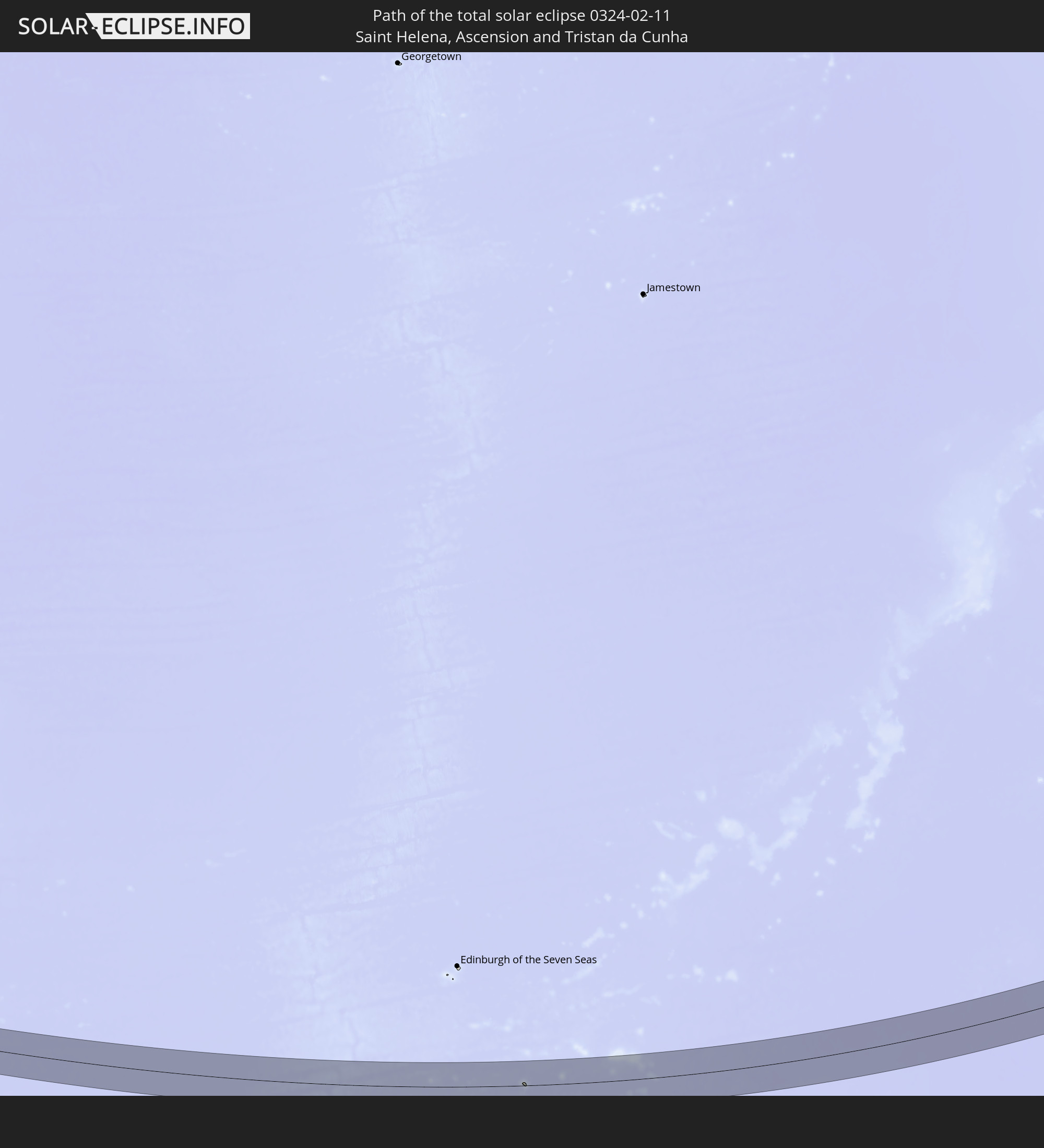 St. Helena
 Südafrika
 Lesotho
 Madagaskar
In den folgenden Ländern ist die Sonnenfinsternis partiell zu sehen
 Antarktika
 Chile
Chile
 Brasilien
 Argentinien
 Paraguay
 Falklandinseln
 Uruguay
 Südgeorgien und die Südlichen Sandwichinseln
 St. Helena
 Bouvetinsel
 Republik Kongo
 Angola
 Namibia
 Demokratische Republik Kongo
 Südafrika
 Botswana
 Sambia
 Simbabwe
 Lesotho
 Ruanda
 Burundi
 Tansania
 Uganda
 Mosambik
 Swasiland
 Malawi
 Äthiopien
 Kenia
Kenia
 Eritrea
 Französische Süd- und Antarktisgebiete
 Somalia
 Dschibuti
 Jemen
Jemen
 Madagaskar
 Komoren
 Mayotte
 Seychellen
 Oman
Oman
 Réunion
 Mauritius
 Indien
 Britisches Territorium im Indischen Ozean
 Heard und McDonaldinseln
 Malediven
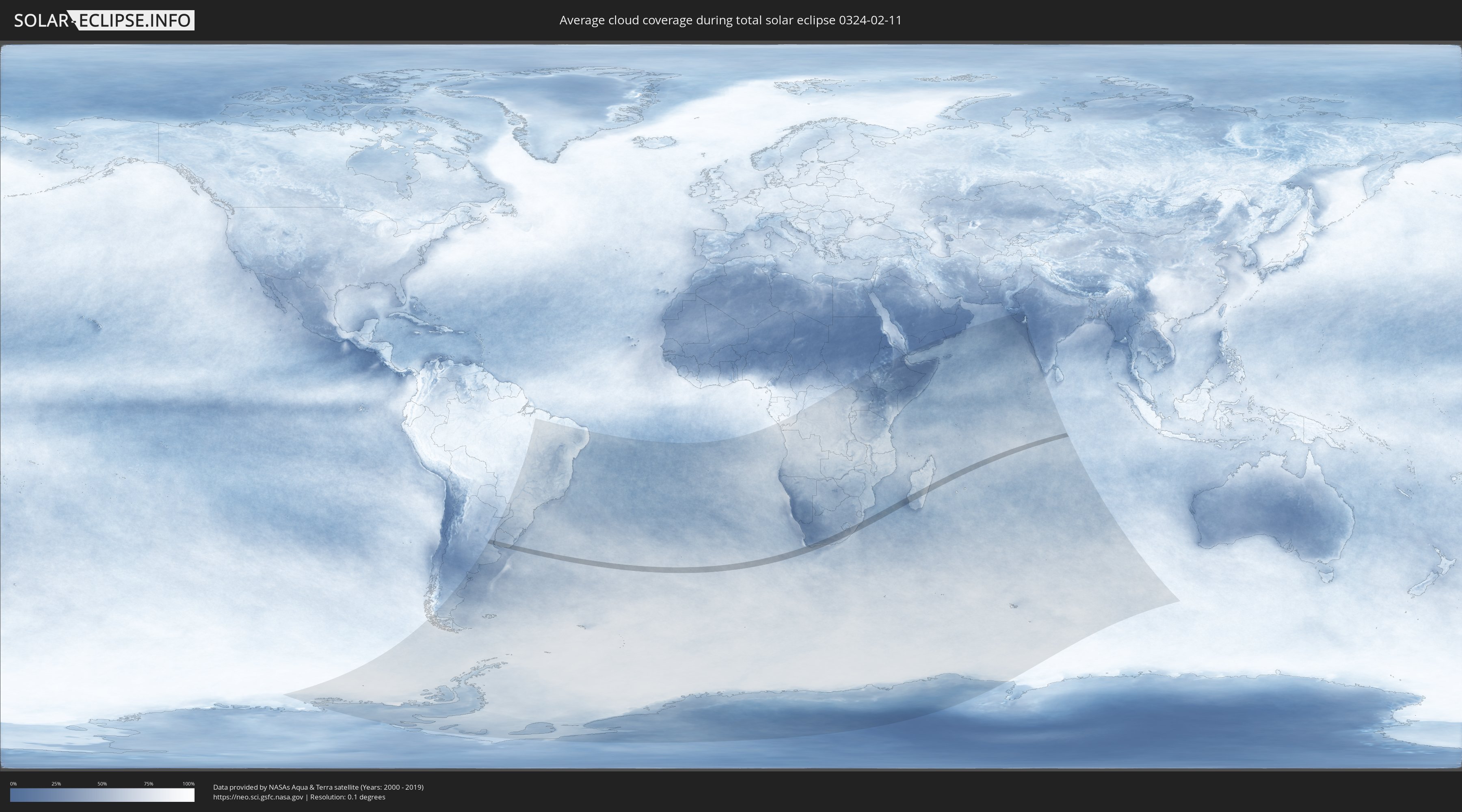
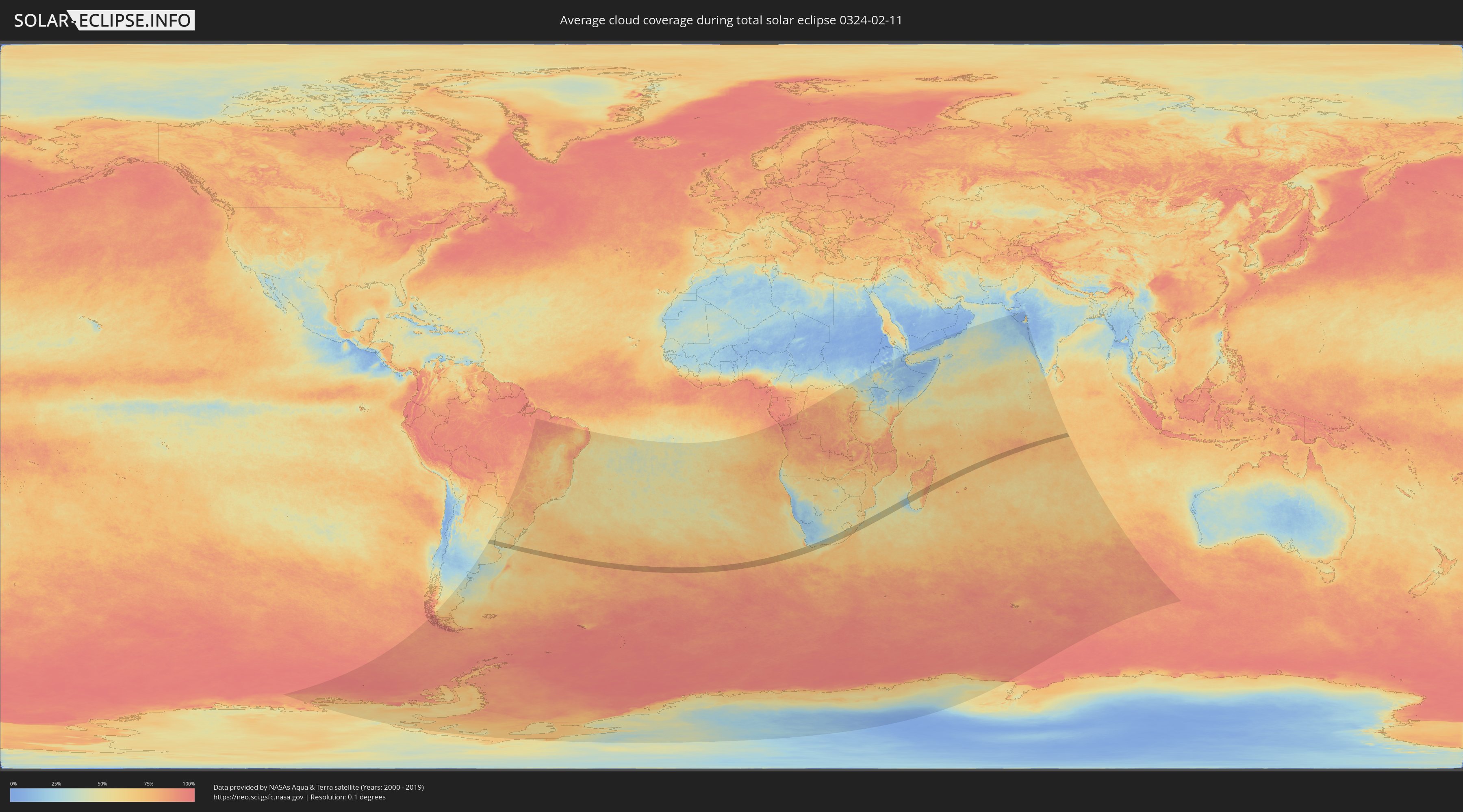
Wie wird das Wetter während der totalen Sonnenfinsternis am 11.02.0324?
Wo ist der beste Ort, um die totale Sonnenfinsternis vom 11.02.0324 zu beobachten?
Die folgenden Karten zeigen die durchschnittliche Bewölkung für den Tag, an dem die totale Sonnenfinsternis
stattfindet. Mit Hilfe der Karten lässt sich der Ort entlang des Finsternispfades eingrenzen,
der die besten Aussichen auf einen klaren wolkenfreien Himmel bietet.
Trotzdem muss man immer lokale Gegenenheiten beachten und sollte sich genau über das Wetter an seinem
gewählten Beobachtungsort informieren.
Die Daten stammen von den beiden NASA-Satelliten
AQUA und TERRA
und wurden über einen Zeitraum von 19 Jahren (2000 - 2019) gemittelt.
Detaillierte Länderkarten
 Argentinien
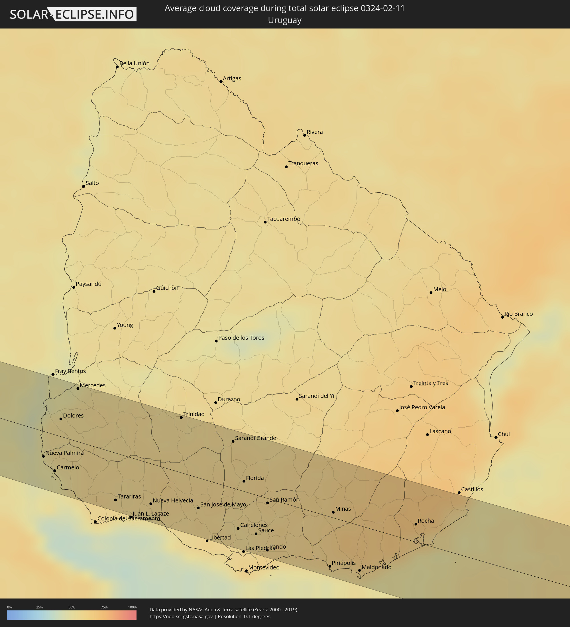 Uruguay
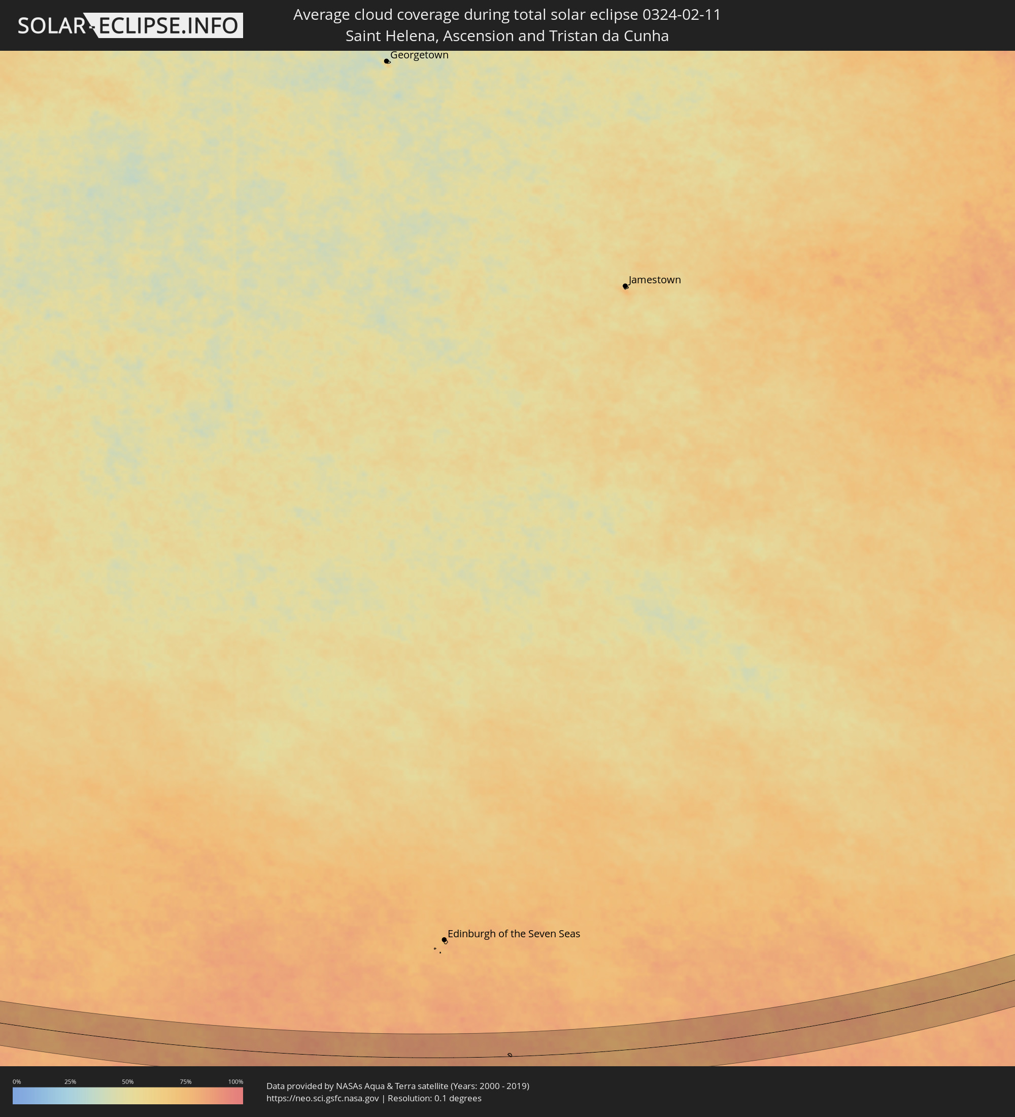 St. Helena
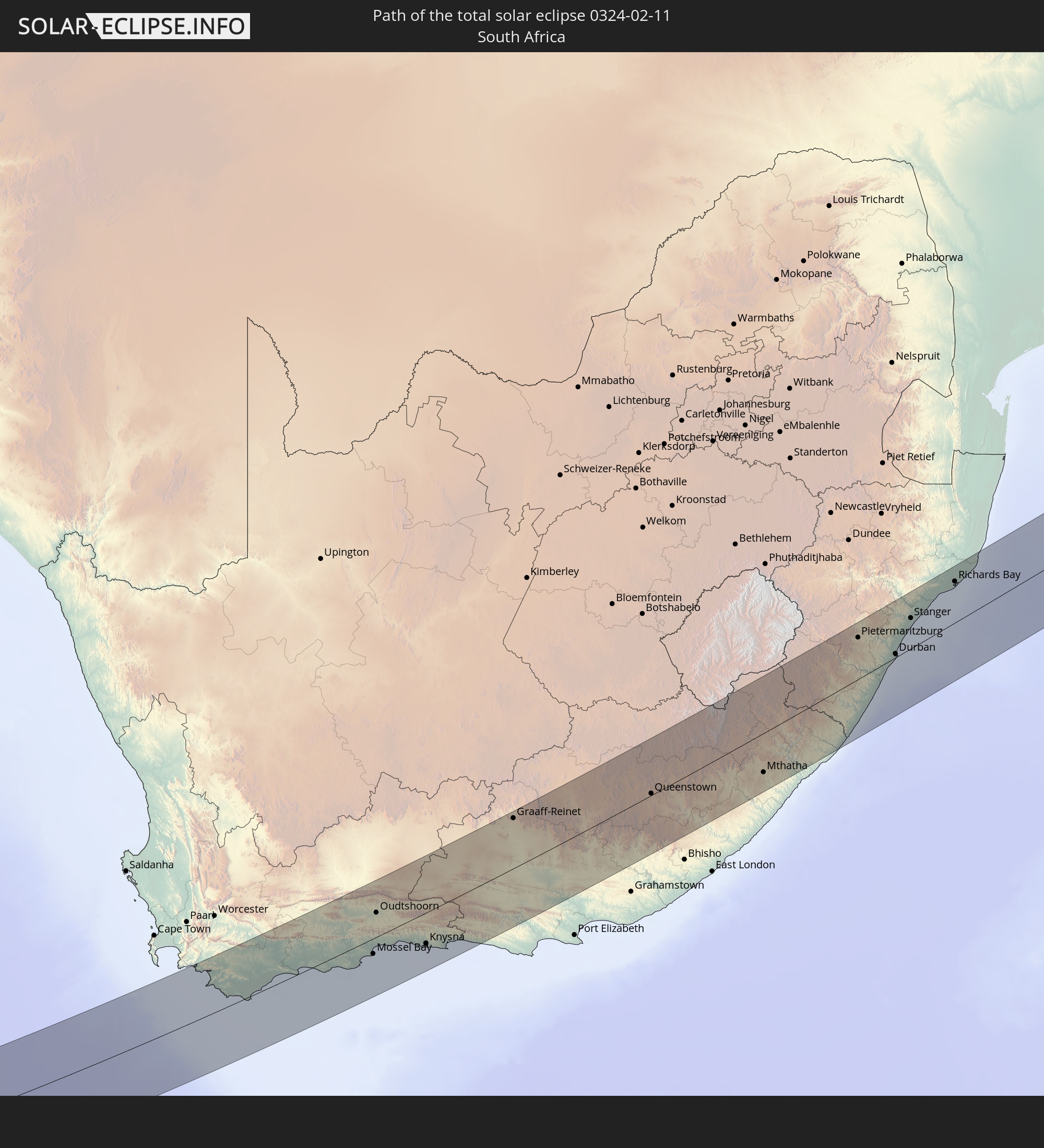
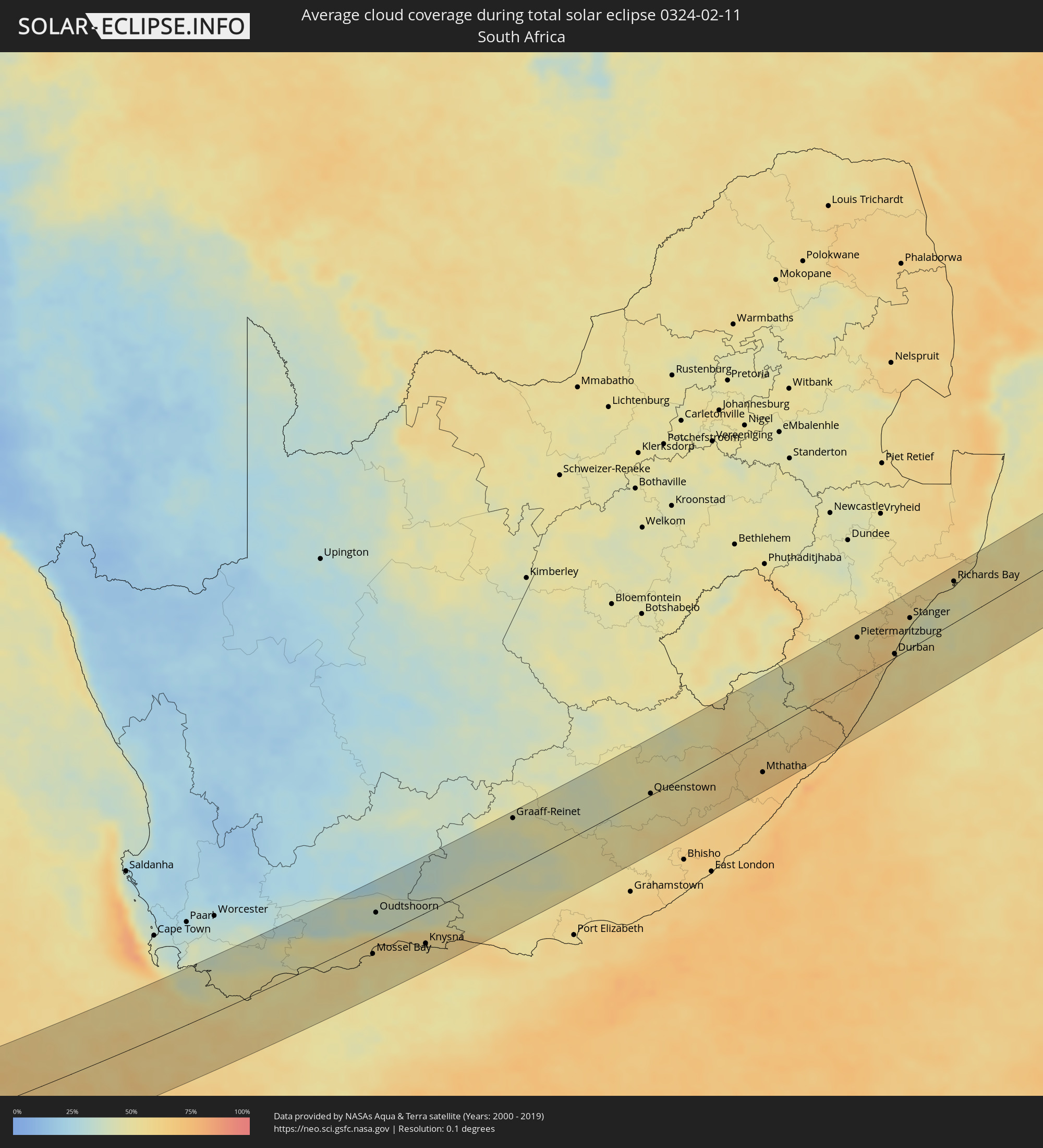 Südafrika
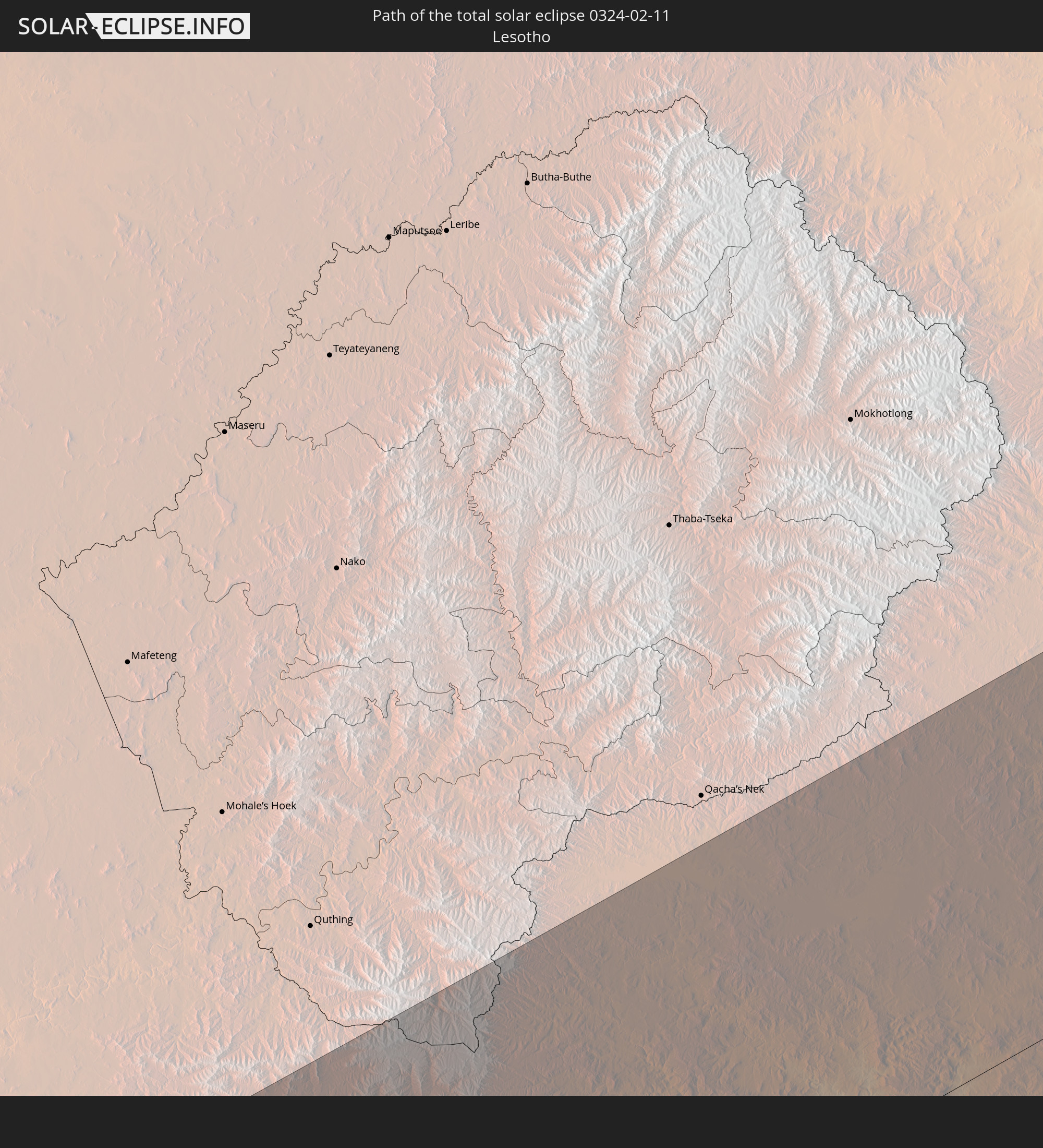
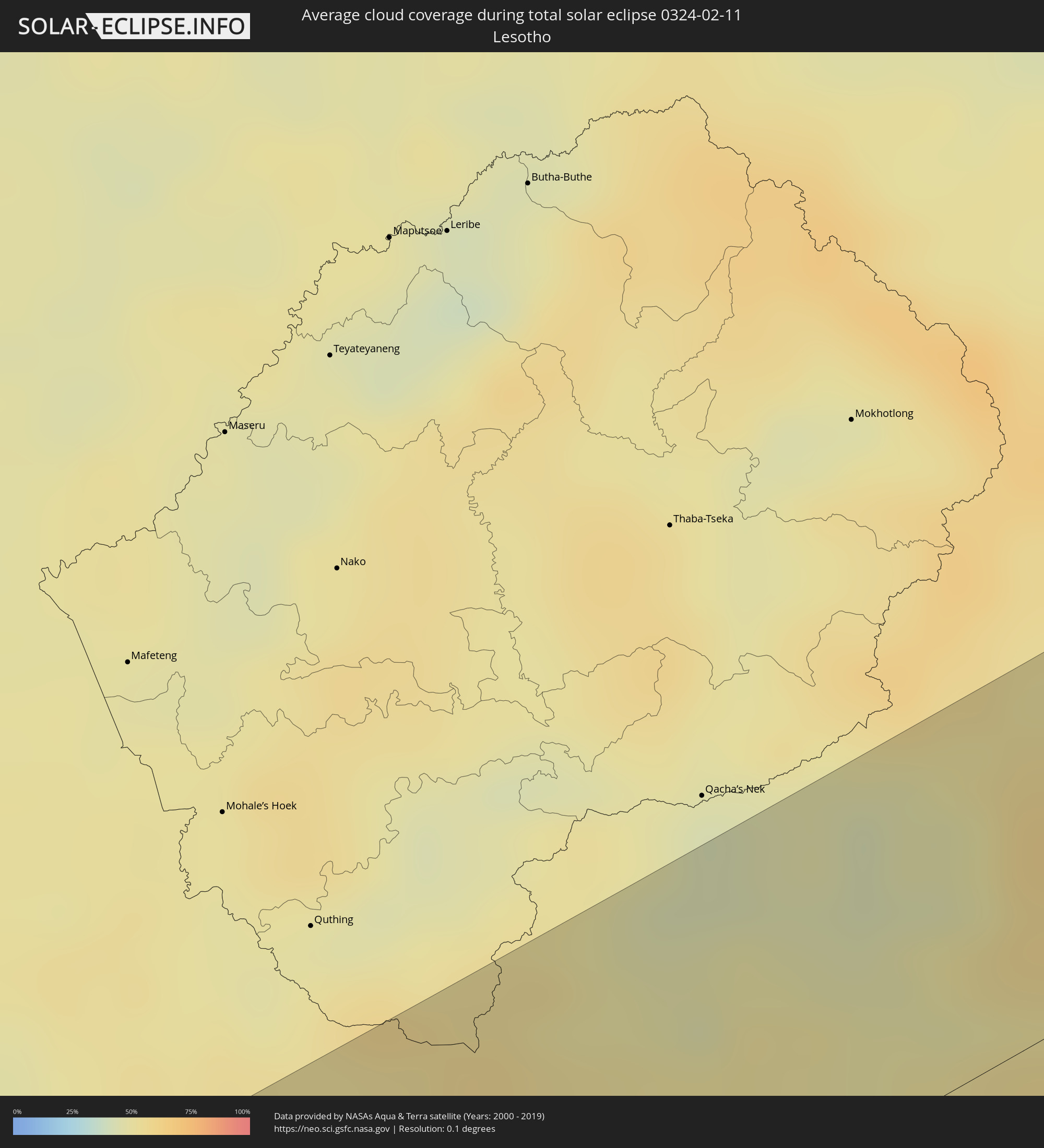 Lesotho
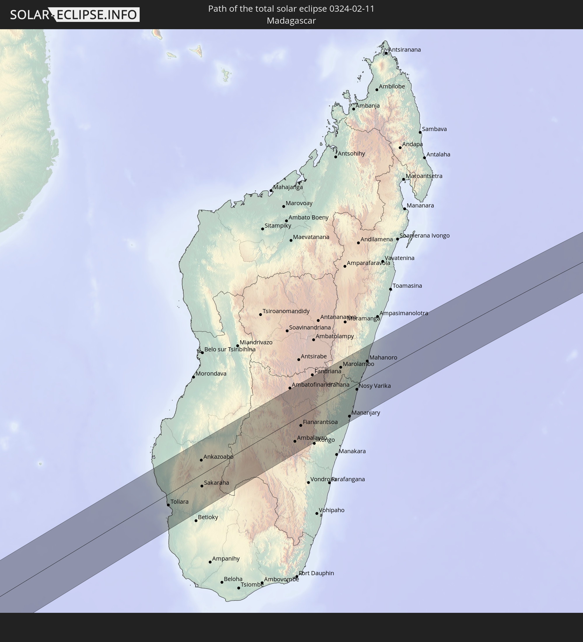
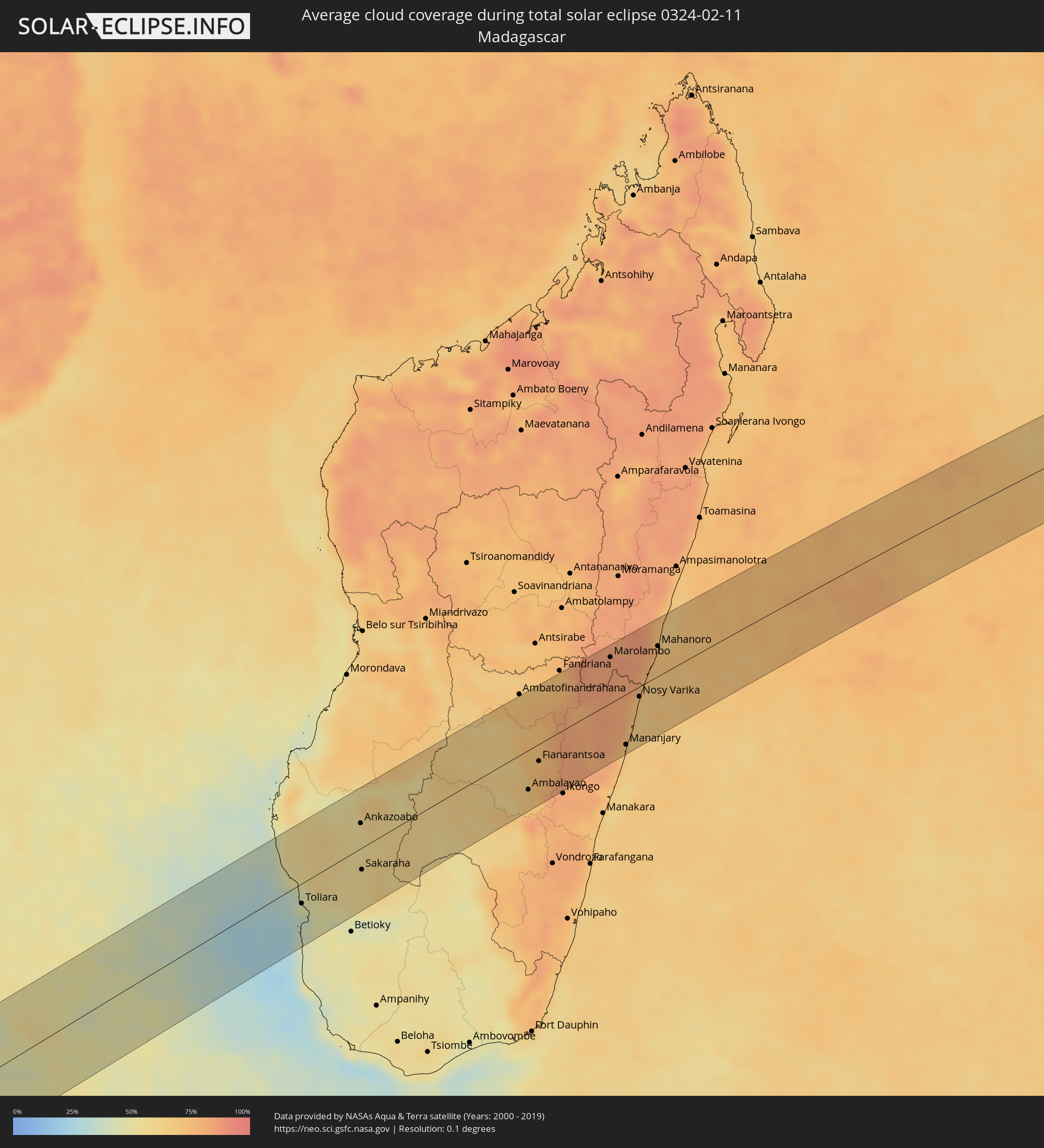 Madagaskar
Orte im Finsternispfad
Die nachfolgene Tabelle zeigt Städte und Orte mit mehr als 5.000 Einwohnern, die sich im Finsternispfad befinden. Städte mit mehr als 100.000 Einwohnern sind dick gekennzeichnet. Mit einem Klick auf den Ort öffnet sich eine Detailkarte die die Lage des jeweiligen Ortes zusammen mit dem Verlauf der zentralen Finsternis präsentiert.
| Ort | Typ | Dauer der Verfinsterung | Ortszeit bei maximaler Verfinsterung | Entfernung zur Zentrallinie | Ø Bewölkung |
|
Gualeguay, Entre Ríos Province
|
total | - | 05:21:15 UTC-04:16 | 30 km | 54% |
|
Larroque, Entre Ríos Province
|
total | - | 05:21:07 UTC-04:16 | 48 km | 51% |
|
Nueva Palmira, Colonia
|
total | - | 05:53:35 UTC-03:44 | 25 km | 49% |
|
Carmelo, Colonia
|
total | - | 05:53:40 UTC-03:44 | 35 km | 48% |
|
Dolores, Soriano
|
total | - | 05:53:18 UTC-03:44 | 17 km | 55% |
|
Mercedes, Soriano
|
total | - | 05:53:04 UTC-03:44 | 51 km | 55% |
|
Tarariras, Colonia
|
total | - | 05:53:47 UTC-03:44 | 46 km | 54% |
|
Rosario, Colonia
|
total | - | 05:53:47 UTC-03:44 | 44 km | 54% |
|
Nueva Helvecia, Colonia
|
total | - | 05:53:45 UTC-03:44 | 39 km | 54% |
|
Trinidad, Flores
|
total | - | 05:53:07 UTC-03:44 | 53 km | 57% |
|
Trinidad, Flores
|
total | - | 05:53:08 UTC-03:44 | 51 km | 57% |
|
San José de Mayo, San José
|
total | - | 05:53:44 UTC-03:44 | 29 km | 59% |
|
Santa Lucía, Canelones
|
total | - | 05:53:47 UTC-03:44 | 33 km | 57% |
|
Sarandí Grande, Florida
|
total | - | 05:53:13 UTC-03:44 | 45 km | 59% |
|
Canelones, Canelones
|
total | - | 05:53:50 UTC-03:44 | 38 km | 57% |
|
Progreso, Canelones
|
total | - | 05:53:56 UTC-03:44 | 52 km | 58% |
|
Florida, Florida
|
total | - | 05:53:29 UTC-03:44 | 10 km | 59% |
|
Sauce, Canelones
|
total | - | 05:53:51 UTC-03:44 | 38 km | 57% |
|
Joaquín Suárez, Canelones
|
total | - | 05:53:58 UTC-03:44 | 54 km | 59% |
|
Pando, Canelones
|
total | - | 05:53:57 UTC-03:44 | 50 km | 59% |
|
San Ramón, Canelones
|
total | - | 05:53:37 UTC-03:44 | 5 km | 57% |
|
Piriápolis, Maldonado
|
total | - | 05:54:01 UTC-03:44 | 48 km | 46% |
|
Minas, Lavalleja
|
total | - | 05:53:37 UTC-03:44 | 5 km | 63% |
|
Pan de Azúcar, Maldonado
|
total | - | 05:53:56 UTC-03:44 | 38 km | 55% |
|
Maldonado, Maldonado
|
total | - | 05:54:01 UTC-03:44 | 43 km | 53% |
|
Punta del Este, Maldonado
|
total | - | 05:54:03 UTC-03:44 | 48 km | 52% |
|
San Carlos, Maldonado
|
total | - | 05:53:56 UTC-03:44 | 31 km | 59% |
|
Rocha, Rocha
|
total | - | 05:53:39 UTC-03:44 | 17 km | 61% |
|
Hermanus, Western Cape
|
total | - | 12:41:02 UTC+01:30 | 67 km | 46% |
|
Bredasdorp, Western Cape
|
total | - | 12:42:38 UTC+01:30 | 25 km | 51% |
|
Swellendam, Western Cape
|
total | - | 12:44:03 UTC+01:30 | 62 km | 46% |
|
Hardys Memories of Africa, Western Cape
|
total | - | 12:44:47 UTC+01:30 | 63 km | 42% |
|
Riversdale, Western Cape
|
total | - | 12:45:43 UTC+01:30 | 23 km | 52% |
|
Albertina, Western Cape
|
total | - | 12:46:16 UTC+01:30 | 1 km | 52% |
|
Prince Albert, Western Cape
|
total | - | 12:48:22 UTC+01:30 | 79 km | 28% |
|
Mossel Bay, Western Cape
|
total | - | 12:47:29 UTC+01:30 | 22 km | 55% |
|
Oudtshoorn, Western Cape
|
total | - | 12:48:18 UTC+01:30 | 35 km | 37% |
|
George, Western Cape
|
total | - | 12:48:25 UTC+01:30 | 12 km | 59% |
|
Knysna, Western Cape
|
total | - | 12:49:33 UTC+01:30 | 44 km | 54% |
|
Plettenberg Bay, Western Cape
|
total | - | 12:50:12 UTC+01:30 | 59 km | 60% |
|
Willowmore, Eastern Cape
|
total | - | 12:51:23 UTC+01:30 | 12 km | 43% |
|
Graaff-Reinet, Eastern Cape
|
total | - | 12:54:54 UTC+01:30 | 71 km | 45% |
|
Kirkwood, Eastern Cape
|
total | - | 12:55:17 UTC+01:30 | 81 km | 54% |
|
Somerset East, Eastern Cape
|
total | - | 12:56:29 UTC+01:30 | 21 km | 51% |
|
Cradock, Eastern Cape
|
total | - | 12:57:17 UTC+01:30 | 32 km | 43% |
|
Adelaide, Eastern Cape
|
total | - | 12:57:57 UTC+01:30 | 51 km | 51% |
|
Molteno, Eastern Cape
|
total | - | 12:59:53 UTC+01:30 | 75 km | 48% |
|
Fort Beaufort, Eastern Cape
|
total | - | 12:58:32 UTC+01:30 | 73 km | 54% |
|
Whittlesea, Eastern Cape
|
total | - | 12:59:44 UTC+01:30 | 23 km | 51% |
|
Queenstown, Eastern Cape
|
total | - | 13:00:14 UTC+01:30 | 2 km | 52% |
|
Queensdale, Eastern Cape
|
total | - | 13:00:29 UTC+01:30 | 0 km | 53% |
|
Ilinge, Eastern Cape
|
total | - | 13:00:28 UTC+01:30 | 13 km | 52% |
|
Dordrecht, Eastern Cape
|
total | - | 13:01:19 UTC+01:30 | 46 km | 51% |
|
Lady Frere, Eastern Cape
|
total | - | 13:01:14 UTC+01:30 | 5 km | 50% |
|
Elliot, Eastern Cape
|
total | - | 13:03:00 UTC+01:30 | 13 km | 54% |
|
Mthatha, Eastern Cape
|
total | - | 13:04:29 UTC+01:30 | 55 km | 66% |
|
Kokstad, KwaZulu-Natal
|
total | - | 13:07:16 UTC+01:30 | 16 km | 49% |
|
Mpophomeni, KwaZulu-Natal
|
total | - | 13:10:14 UTC+01:30 | 74 km | 56% |
|
Howick, KwaZulu-Natal
|
total | - | 13:10:27 UTC+01:30 | 80 km | 55% |
|
Richmond, KwaZulu-Natal
|
total | - | 13:09:56 UTC+01:30 | 40 km | 59% |
|
Margate, KwaZulu-Natal
|
total | - | 13:08:39 UTC+01:30 | 60 km | 63% |
|
Pietermaritzburg, KwaZulu-Natal
|
total | - | 13:10:34 UTC+01:30 | 59 km | 56% |
|
Port Shepstone, KwaZulu-Natal
|
total | - | 13:08:59 UTC+01:30 | 52 km | 59% |
|
Mpumalanga, KwaZulu-Natal
|
total | - | 13:10:44 UTC+01:30 | 28 km | 64% |
|
Scottburgh, KwaZulu-Natal
|
total | - | 13:10:15 UTC+01:30 | 23 km | 54% |
|
Umkomaas, KwaZulu-Natal
|
total | - | 13:10:27 UTC+01:30 | 17 km | 55% |
|
Berea, KwaZulu-Natal
|
total | - | 13:11:22 UTC+01:30 | 7 km | 57% |
|
Durban, KwaZulu-Natal
|
total | - | 13:11:25 UTC+01:30 | 5 km | 57% |
|
Ballitoville, KwaZulu-Natal
|
total | - | 13:12:16 UTC+01:30 | 27 km | 49% |
|
Stanger, KwaZulu-Natal
|
total | - | 13:12:44 UTC+01:30 | 43 km | 50% |
|
Sundumbili, KwaZulu-Natal
|
total | - | 13:13:14 UTC+01:30 | 57 km | 52% |
|
Eshowe, KwaZulu-Natal
|
total | - | 13:13:45 UTC+01:30 | 77 km | 59% |
|
Empangeni, KwaZulu-Natal
|
total | - | 13:14:45 UTC+01:30 | 68 km | 53% |
|
eSikhawini, KwaZulu-Natal
|
total | - | 13:14:36 UTC+01:30 | 57 km | 50% |
|
Richards Bay, KwaZulu-Natal
|
total | - | 13:15:00 UTC+01:30 | 59 km | 51% |
|
Toliara, Atsimo-Andrefana
|
total | - | 14:40:03 UTC+02:27 | 25 km | 38% |
|
Behompy, Atsimo-Andrefana
|
total | - | 14:40:28 UTC+02:27 | 25 km | 48% |
|
Ankazoabo, Atsimo-Andrefana
|
total | - | 14:42:53 UTC+02:27 | 32 km | 56% |
|
Sakaraha, Atsimo-Andrefana
|
total | - | 14:41:56 UTC+02:27 | 28 km | 57% |
|
Beroroha, Atsimo-Andrefana
|
total | - | 14:44:42 UTC+02:27 | 57 km | 55% |
|
Ranohira, Ihorombe
|
total | - | 14:43:44 UTC+02:27 | 33 km | 60% |
|
Ihosy, Ihorombe
|
total | - | 14:44:47 UTC+02:27 | 64 km | 61% |
|
Ikalamavony, Upper Matsiatra
|
total | - | 14:47:17 UTC+02:27 | 33 km | 61% |
|
Ambalavao, Upper Matsiatra
|
total | - | 14:46:39 UTC+02:27 | 51 km | 66% |
|
Fianarantsoa, Upper Matsiatra
|
total | - | 14:47:26 UTC+02:27 | 22 km | 76% |
|
Ambositra, Amoron'i Mania
|
total | - | 14:49:01 UTC+02:27 | 59 km | 73% |
|
Fandrandava, Upper Matsiatra
|
total | - | 14:47:32 UTC+02:27 | 37 km | 77% |
|
Ifanadiana, Vatovavy Fitovinany
|
total | - | 14:48:19 UTC+02:27 | 36 km | 82% |
|
Marolambo, Atsinanana
|
total | - | 14:50:46 UTC+02:27 | 60 km | 82% |
|
Sahavato, Vatovavy Fitovinany
|
total | - | 14:50:11 UTC+02:27 | 4 km | 80% |
|
Mananjary, Vatovavy Fitovinany
|
total | - | 14:49:15 UTC+02:27 | 66 km | 70% |
|
Nosy Varika, Vatovavy Fitovinany
|
total | - | 14:50:26 UTC+02:27 | 13 km | 70% |
|
Mahanoro, Atsinanana
|
total | - | 14:51:46 UTC+02:27 | 40 km | 72% |