Total solar eclipse of 02/11/0324
| Day of week: | Monday |
| Maximum duration of eclipse: | 03m50s |
| Maximum width of eclipse path: | 163 km |
| Saros cycle: | 84 |
| Coverage: | 100% |
| Magnitude: | 1.0457 |
| Gamma: | -0.3543 |
Wo kann man die Sonnenfinsternis vom 02/11/0324 sehen?
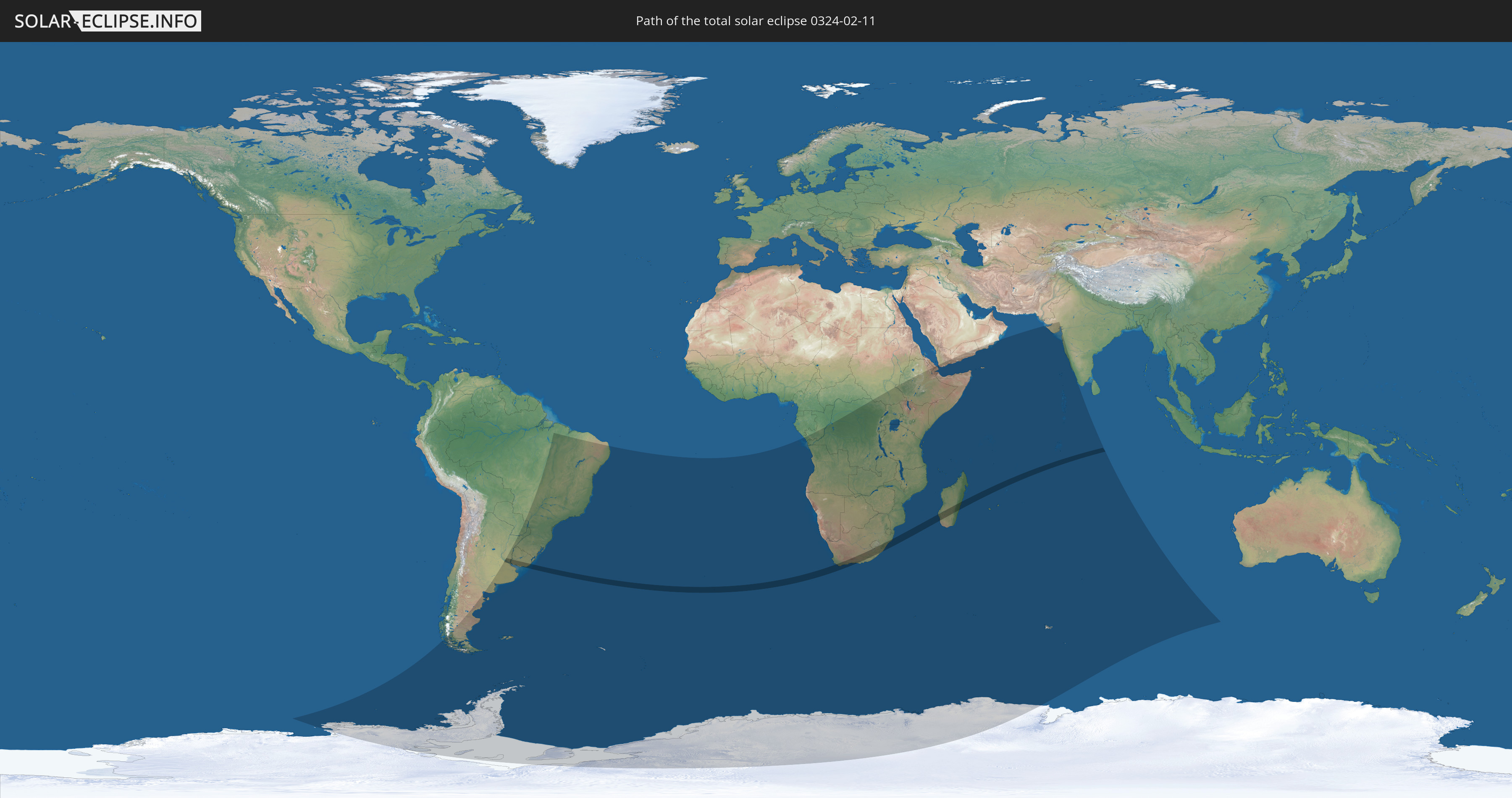
Die Sonnenfinsternis am 02/11/0324 kann man in 44 Ländern als partielle Sonnenfinsternis beobachten.
Der Finsternispfad verläuft durch 6 Länder. Nur in diesen Ländern ist sie als total Sonnenfinsternis zu sehen.
In den folgenden Ländern ist die Sonnenfinsternis total zu sehen
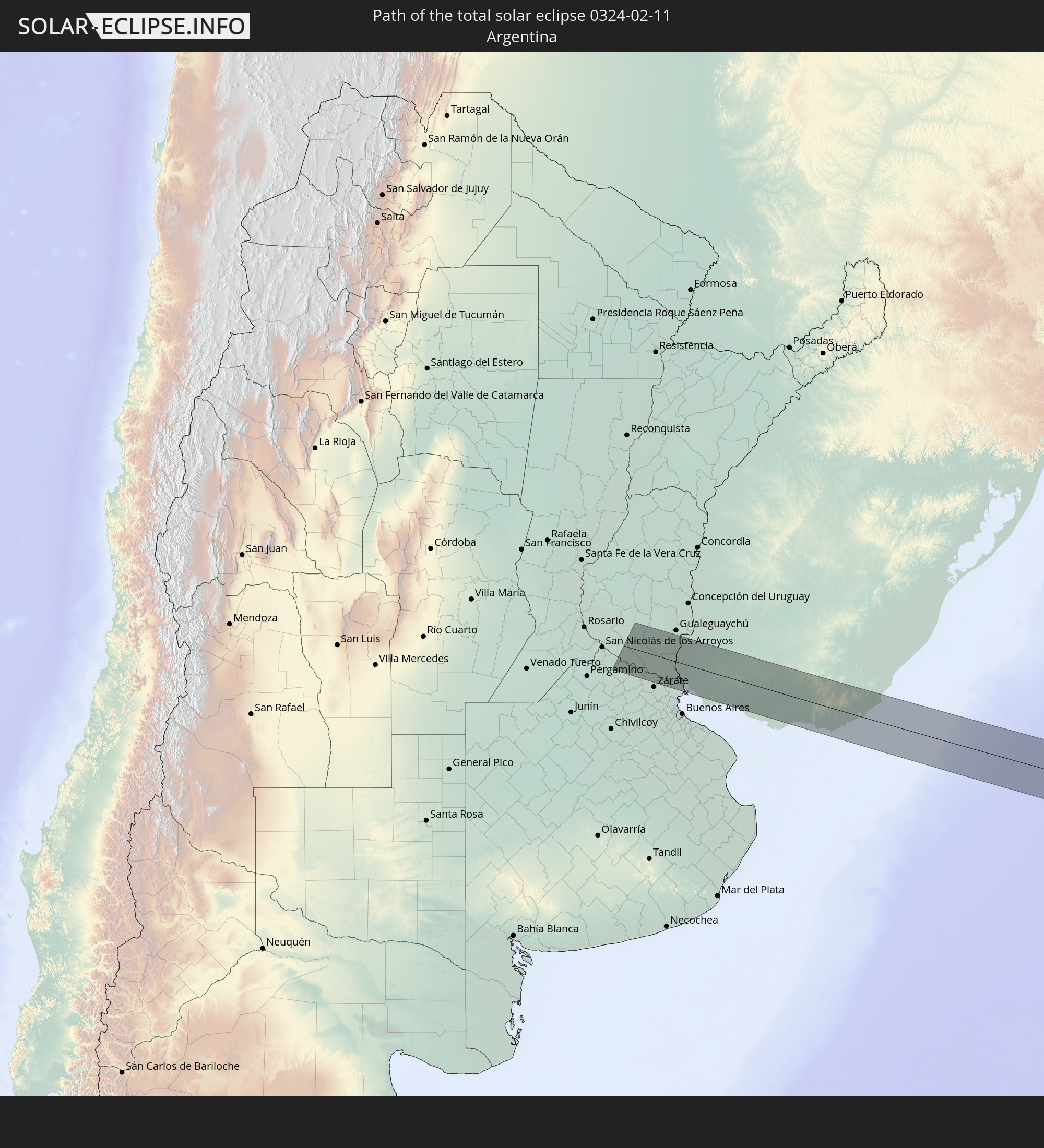 Argentina
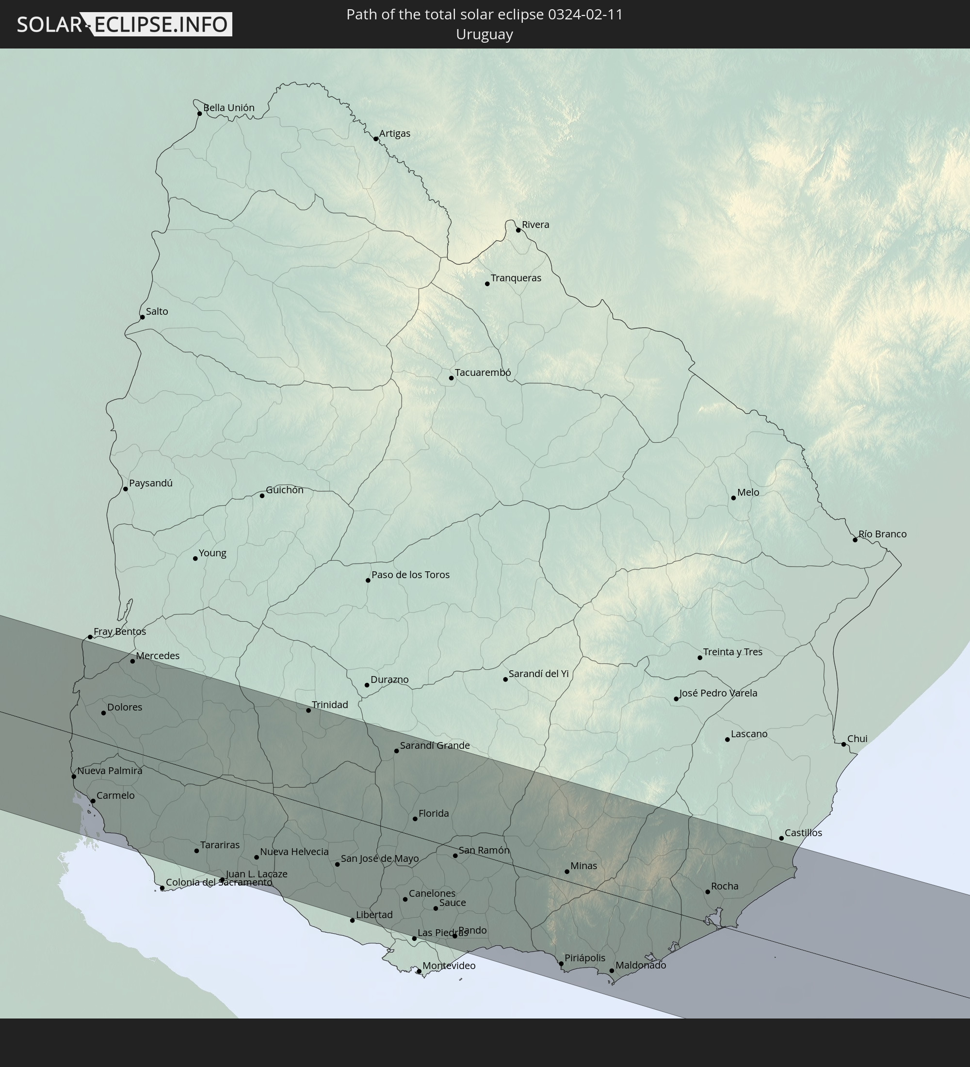 Uruguay
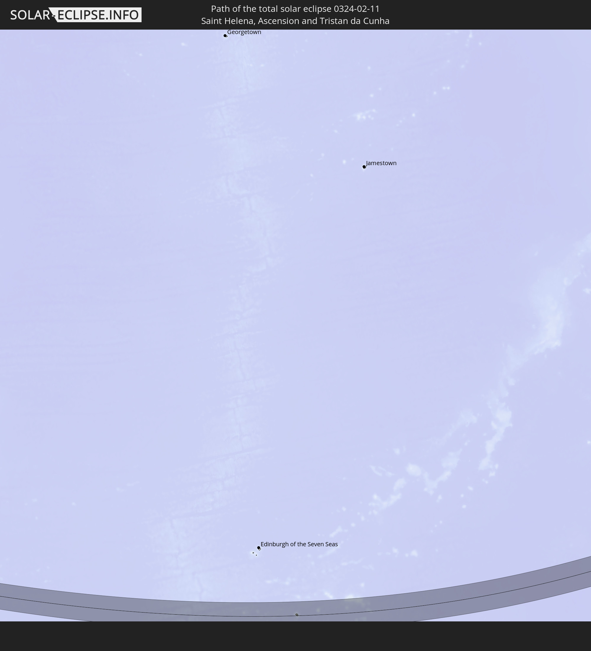 Saint Helena, Ascension and Tristan da Cunha
 South Africa
 Lesotho
 Madagascar
In den folgenden Ländern ist die Sonnenfinsternis partiell zu sehen
 Antarctica
 Chile
Chile
 Brazil
 Argentina
 Paraguay
 Falkland Islands
 Uruguay
 South Georgia and the South Sandwich Islands
 Saint Helena, Ascension and Tristan da Cunha
 Bouvet Island
 Republic of the Congo
 Angola
 Namibia
 Democratic Republic of the Congo
 South Africa
 Botswana
 Zambia
 Zimbabwe
 Lesotho
 Rwanda
 Burundi
 Tanzania
 Uganda
 Mozambique
 Swaziland
 Malawi
 Ethiopia
 Kenya
Kenya
 Eritrea
 French Southern and Antarctic Lands
 Somalia
 Djibouti
 Yemen
Yemen
 Madagascar
 Comoros
 Mayotte
 Seychelles
 Oman
Oman
 Réunion
 Mauritius
 India
India
 British Indian Ocean Territory
 Heard Island and McDonald Islands
 Maldives
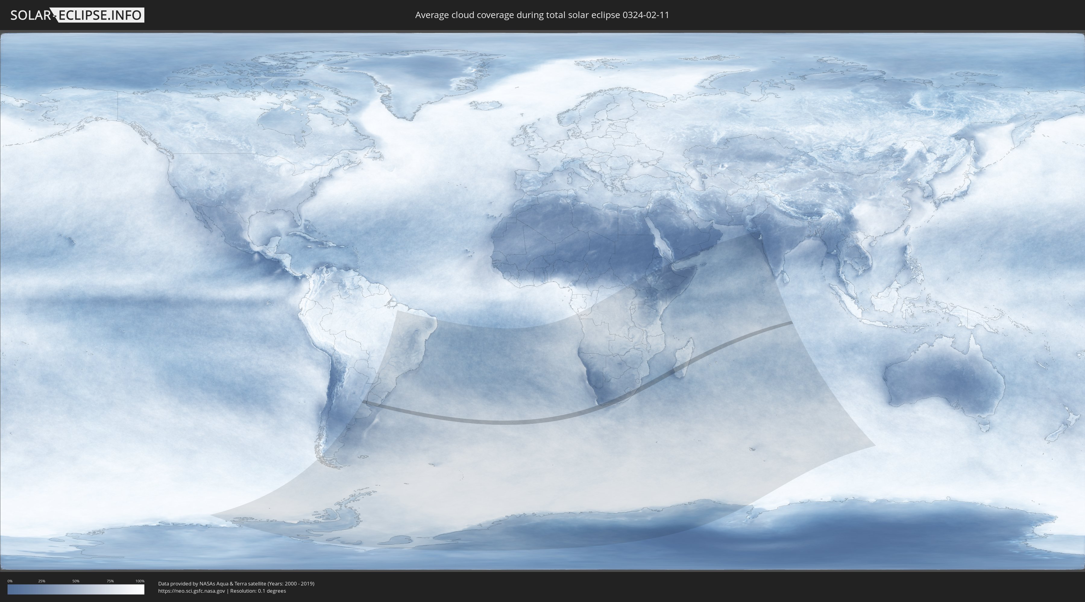
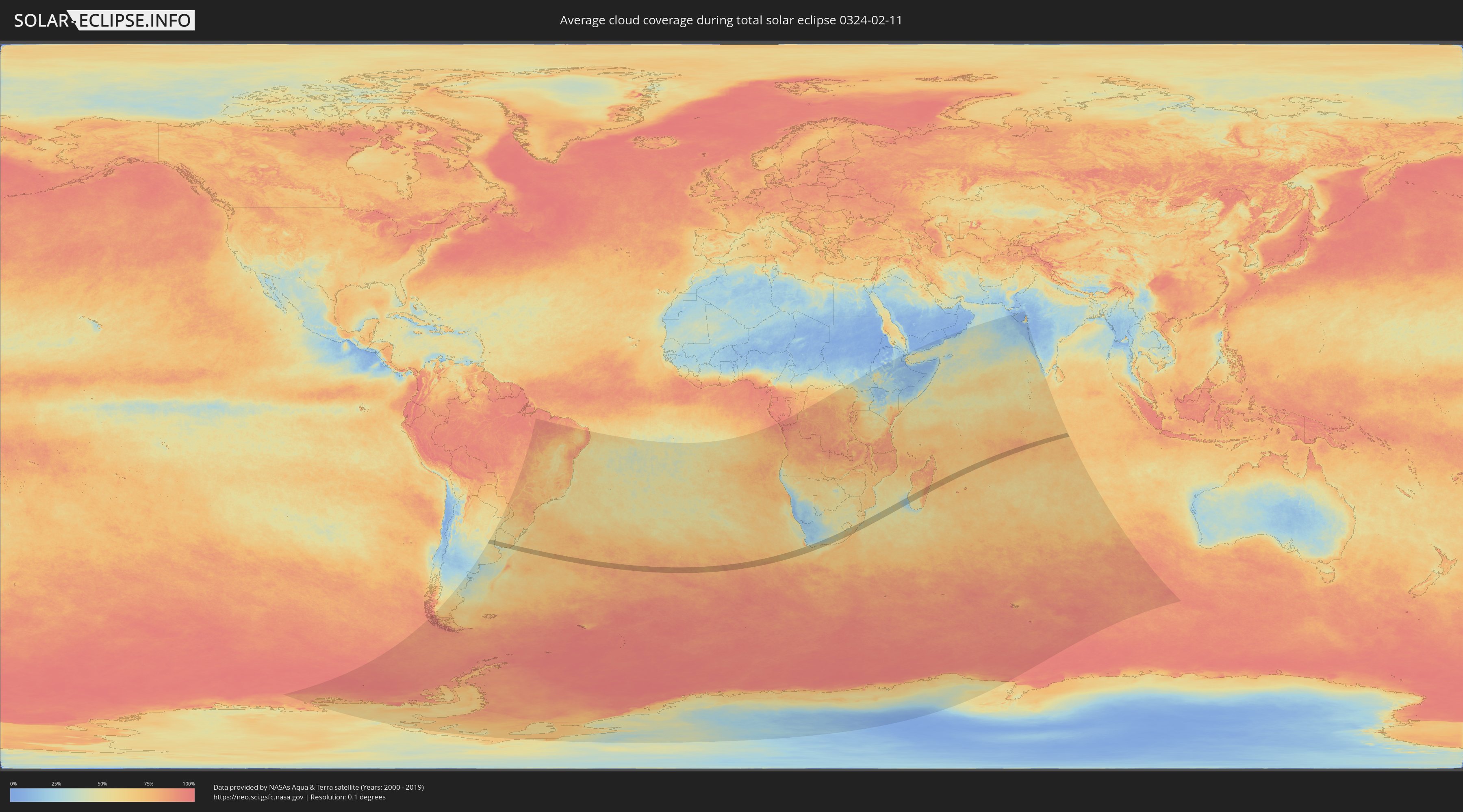
How will be the weather during the total solar eclipse on 02/11/0324?
Where is the best place to see the total solar eclipse of 02/11/0324?
The following maps show the average cloud coverage for the day of the total solar eclipse.
With the help of these maps, it is possible to find the place along the eclipse path, which has the best
chance of a cloudless sky.
Nevertheless, you should consider local circumstances and inform about the weather of your chosen
observation site.
The data is provided by NASAs satellites
AQUA and TERRA.
The cloud maps are averaged over a period of 19 years (2000 - 2019).
Detailed country maps
 Argentina
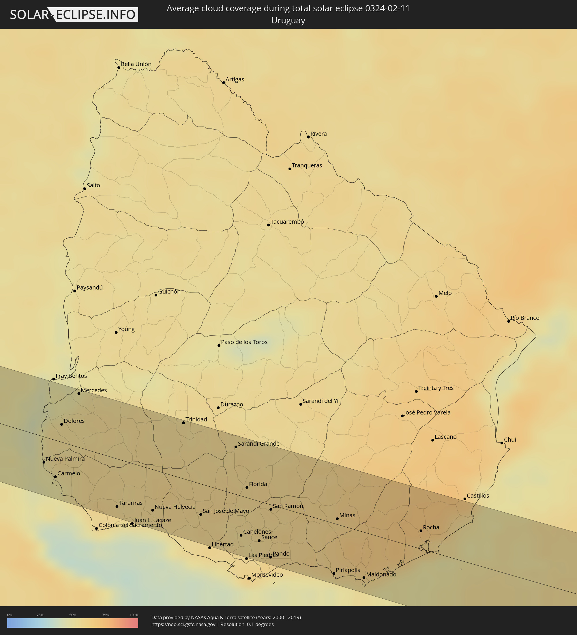 Uruguay
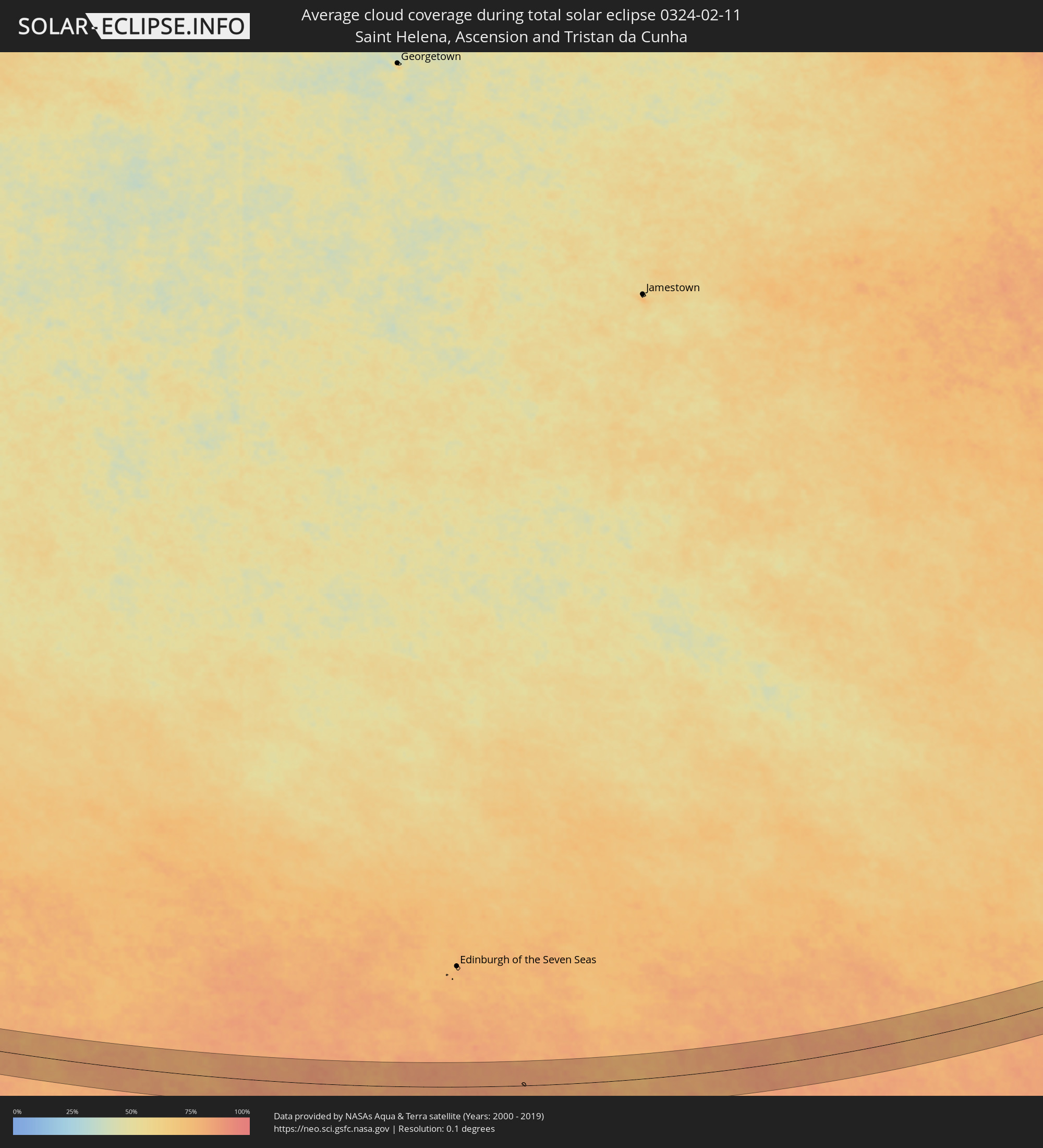 Saint Helena, Ascension and Tristan da Cunha
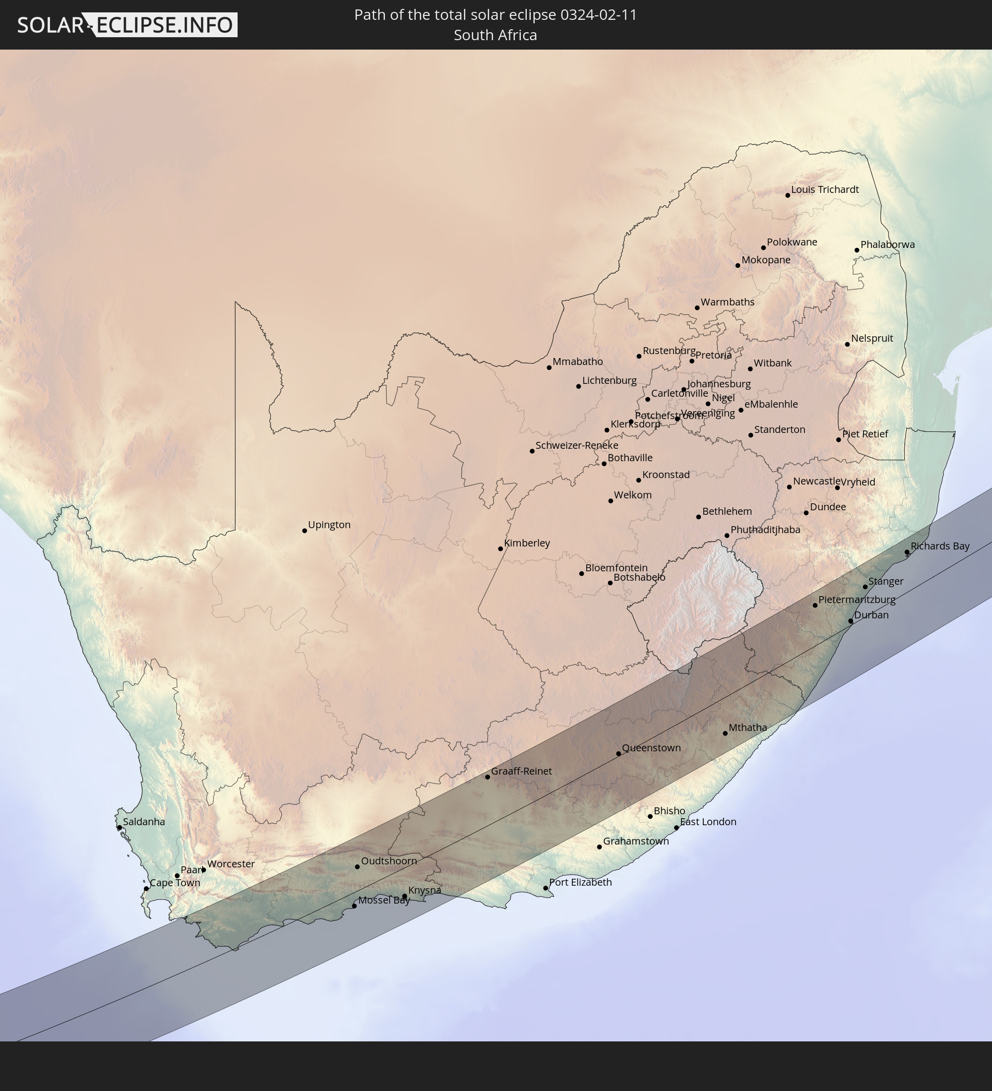
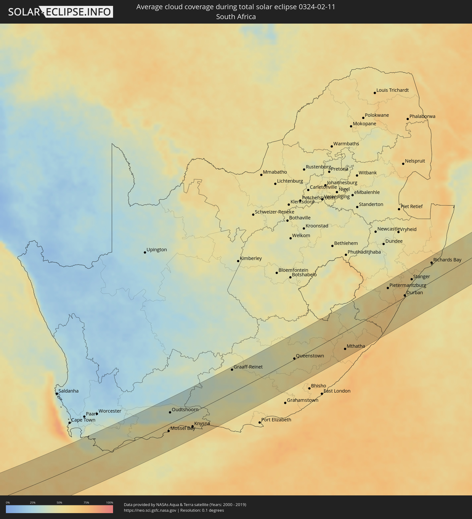 South Africa
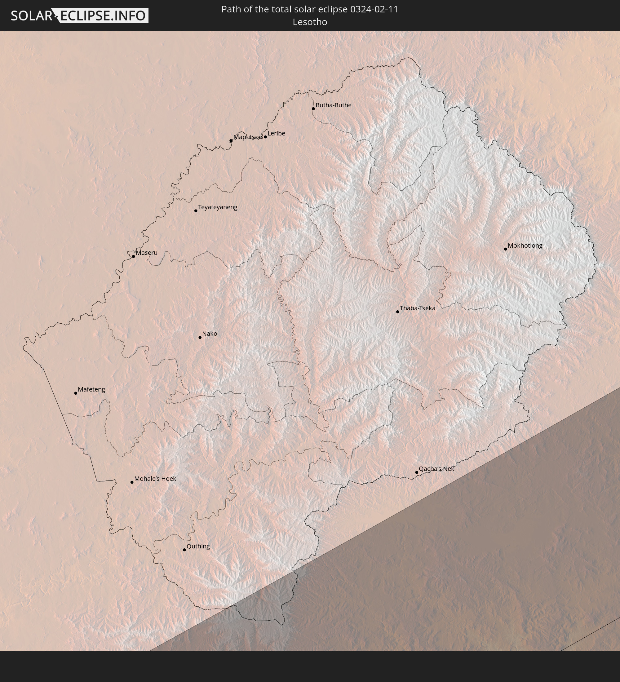
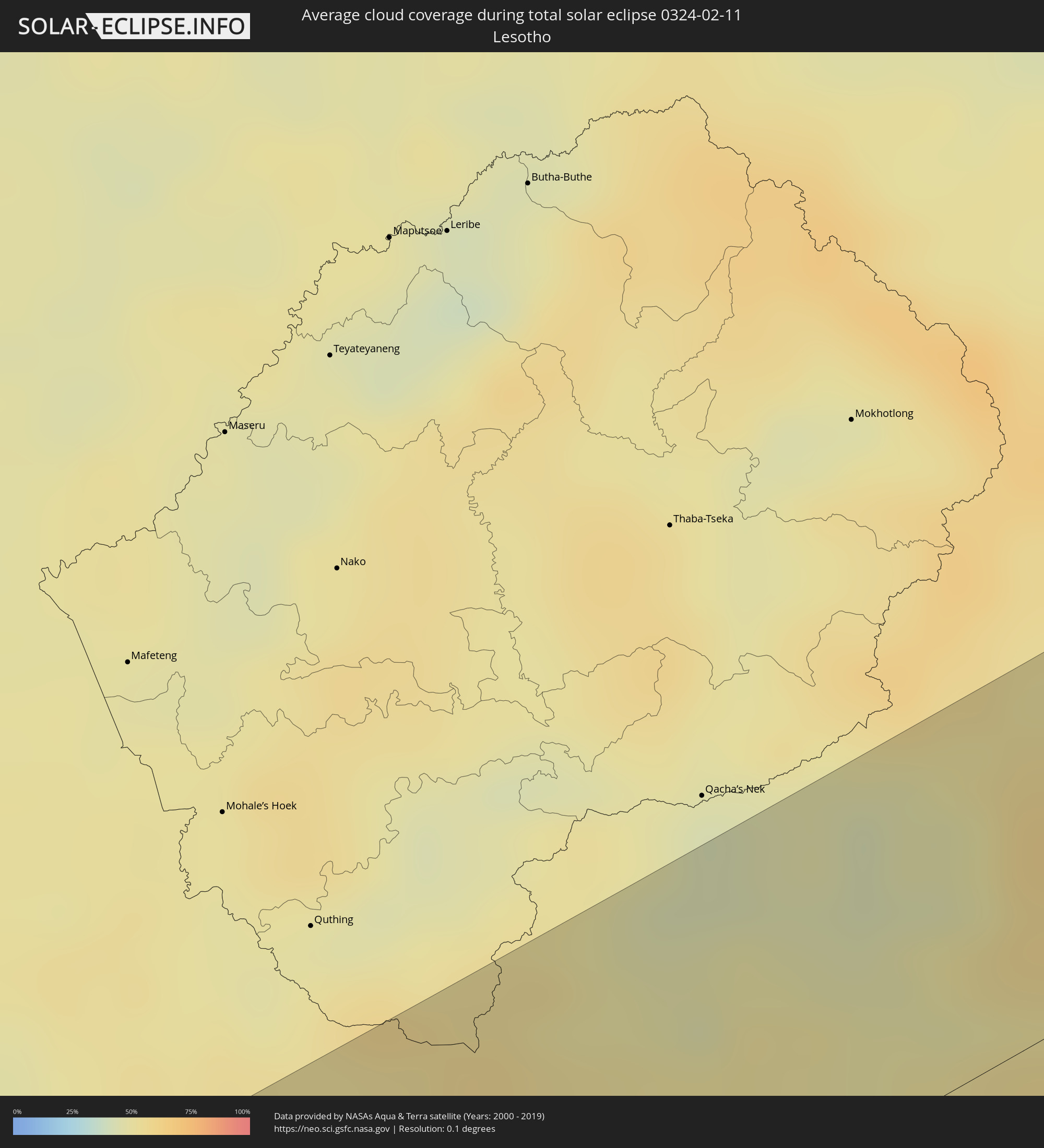 Lesotho
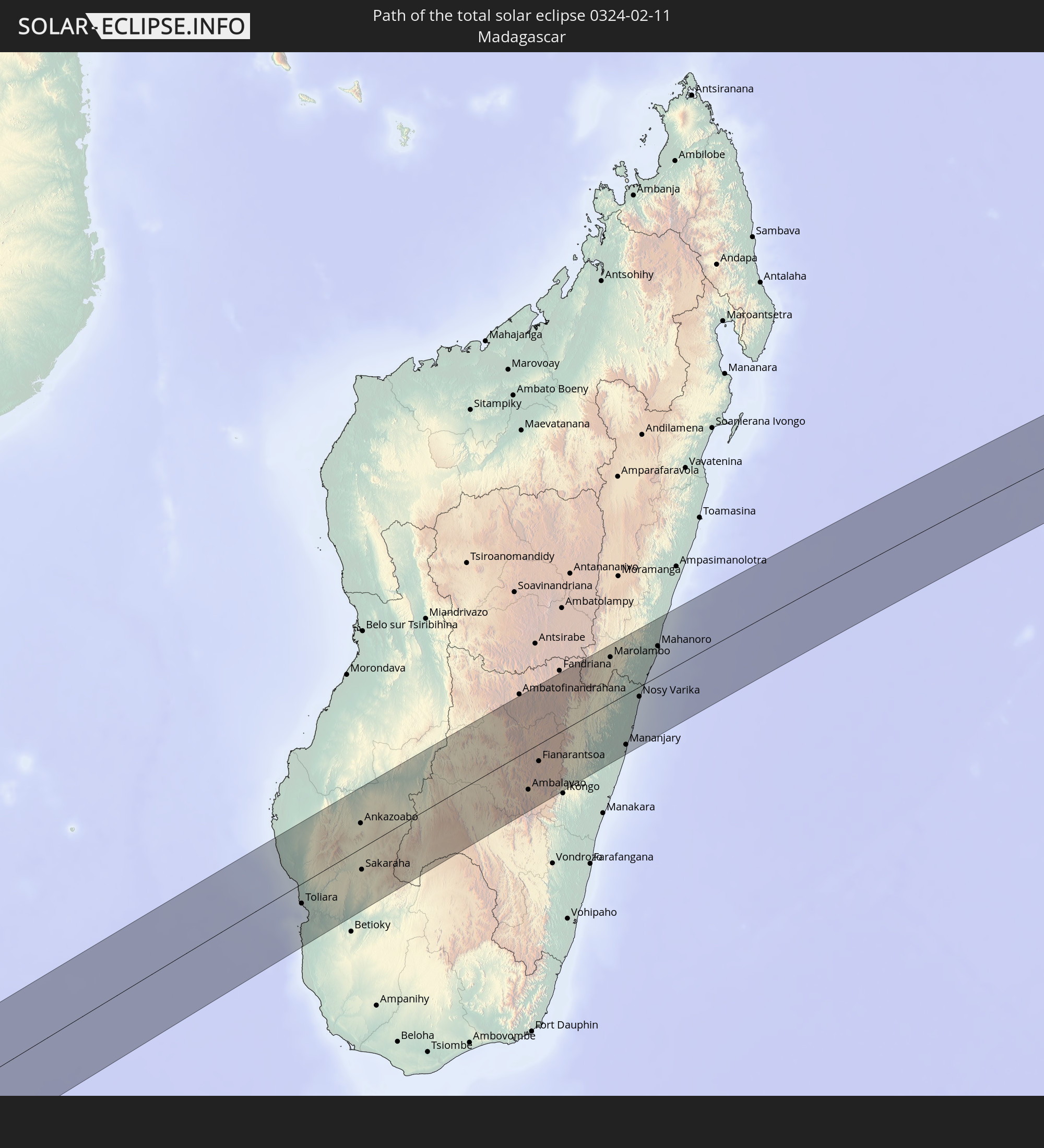
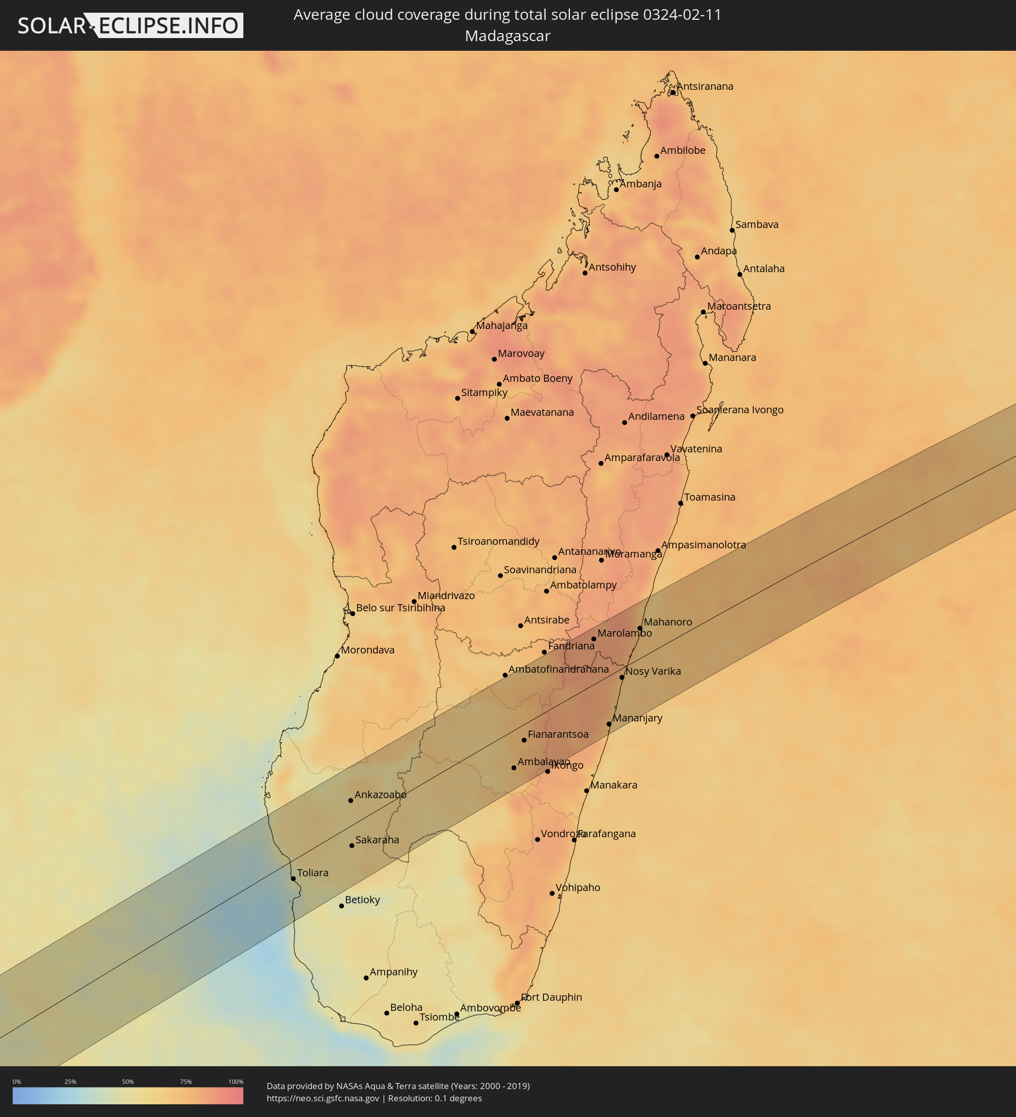 Madagascar
Cities inside the path of the eclipse
The following table shows all locations with a population of more than 5,000 inside the eclipse path. Cities which have more than 100,000 inhabitants are marked bold. A click at the locations opens a detailed map.
| City | Type | Eclipse duration | Local time of max. eclipse | Distance to central line | Ø Cloud coverage |
|
Gualeguay, Entre Ríos Province
|
total | - | 05:21:15 UTC-04:16 | 30 km | 54% |
|
Larroque, Entre Ríos Province
|
total | - | 05:21:07 UTC-04:16 | 48 km | 51% |
|
Nueva Palmira, Colonia
|
total | - | 05:53:35 UTC-03:44 | 25 km | 49% |
|
Carmelo, Colonia
|
total | - | 05:53:40 UTC-03:44 | 35 km | 48% |
|
Dolores, Soriano
|
total | - | 05:53:18 UTC-03:44 | 17 km | 55% |
|
Mercedes, Soriano
|
total | - | 05:53:04 UTC-03:44 | 51 km | 55% |
|
Tarariras, Colonia
|
total | - | 05:53:47 UTC-03:44 | 46 km | 54% |
|
Rosario, Colonia
|
total | - | 05:53:47 UTC-03:44 | 44 km | 54% |
|
Nueva Helvecia, Colonia
|
total | - | 05:53:45 UTC-03:44 | 39 km | 54% |
|
Trinidad, Flores
|
total | - | 05:53:07 UTC-03:44 | 53 km | 57% |
|
Trinidad, Flores
|
total | - | 05:53:08 UTC-03:44 | 51 km | 57% |
|
San José de Mayo, San José
|
total | - | 05:53:44 UTC-03:44 | 29 km | 59% |
|
Santa Lucía, Canelones
|
total | - | 05:53:47 UTC-03:44 | 33 km | 57% |
|
Sarandí Grande, Florida
|
total | - | 05:53:13 UTC-03:44 | 45 km | 59% |
|
Canelones, Canelones
|
total | - | 05:53:50 UTC-03:44 | 38 km | 57% |
|
Progreso, Canelones
|
total | - | 05:53:56 UTC-03:44 | 52 km | 58% |
|
Florida, Florida
|
total | - | 05:53:29 UTC-03:44 | 10 km | 59% |
|
Sauce, Canelones
|
total | - | 05:53:51 UTC-03:44 | 38 km | 57% |
|
Joaquín Suárez, Canelones
|
total | - | 05:53:58 UTC-03:44 | 54 km | 59% |
|
Pando, Canelones
|
total | - | 05:53:57 UTC-03:44 | 50 km | 59% |
|
San Ramón, Canelones
|
total | - | 05:53:37 UTC-03:44 | 5 km | 57% |
|
Piriápolis, Maldonado
|
total | - | 05:54:01 UTC-03:44 | 48 km | 46% |
|
Minas, Lavalleja
|
total | - | 05:53:37 UTC-03:44 | 5 km | 63% |
|
Pan de Azúcar, Maldonado
|
total | - | 05:53:56 UTC-03:44 | 38 km | 55% |
|
Maldonado, Maldonado
|
total | - | 05:54:01 UTC-03:44 | 43 km | 53% |
|
Punta del Este, Maldonado
|
total | - | 05:54:03 UTC-03:44 | 48 km | 52% |
|
San Carlos, Maldonado
|
total | - | 05:53:56 UTC-03:44 | 31 km | 59% |
|
Rocha, Rocha
|
total | - | 05:53:39 UTC-03:44 | 17 km | 61% |
|
Hermanus, Western Cape
|
total | - | 12:41:02 UTC+01:30 | 67 km | 46% |
|
Bredasdorp, Western Cape
|
total | - | 12:42:38 UTC+01:30 | 25 km | 51% |
|
Swellendam, Western Cape
|
total | - | 12:44:03 UTC+01:30 | 62 km | 46% |
|
Hardys Memories of Africa, Western Cape
|
total | - | 12:44:47 UTC+01:30 | 63 km | 42% |
|
Riversdale, Western Cape
|
total | - | 12:45:43 UTC+01:30 | 23 km | 52% |
|
Albertina, Western Cape
|
total | - | 12:46:16 UTC+01:30 | 1 km | 52% |
|
Prince Albert, Western Cape
|
total | - | 12:48:22 UTC+01:30 | 79 km | 28% |
|
Mossel Bay, Western Cape
|
total | - | 12:47:29 UTC+01:30 | 22 km | 55% |
|
Oudtshoorn, Western Cape
|
total | - | 12:48:18 UTC+01:30 | 35 km | 37% |
|
George, Western Cape
|
total | - | 12:48:25 UTC+01:30 | 12 km | 59% |
|
Knysna, Western Cape
|
total | - | 12:49:33 UTC+01:30 | 44 km | 54% |
|
Plettenberg Bay, Western Cape
|
total | - | 12:50:12 UTC+01:30 | 59 km | 60% |
|
Willowmore, Eastern Cape
|
total | - | 12:51:23 UTC+01:30 | 12 km | 43% |
|
Graaff-Reinet, Eastern Cape
|
total | - | 12:54:54 UTC+01:30 | 71 km | 45% |
|
Kirkwood, Eastern Cape
|
total | - | 12:55:17 UTC+01:30 | 81 km | 54% |
|
Somerset East, Eastern Cape
|
total | - | 12:56:29 UTC+01:30 | 21 km | 51% |
|
Cradock, Eastern Cape
|
total | - | 12:57:17 UTC+01:30 | 32 km | 43% |
|
Adelaide, Eastern Cape
|
total | - | 12:57:57 UTC+01:30 | 51 km | 51% |
|
Molteno, Eastern Cape
|
total | - | 12:59:53 UTC+01:30 | 75 km | 48% |
|
Fort Beaufort, Eastern Cape
|
total | - | 12:58:32 UTC+01:30 | 73 km | 54% |
|
Whittlesea, Eastern Cape
|
total | - | 12:59:44 UTC+01:30 | 23 km | 51% |
|
Queenstown, Eastern Cape
|
total | - | 13:00:14 UTC+01:30 | 2 km | 52% |
|
Queensdale, Eastern Cape
|
total | - | 13:00:29 UTC+01:30 | 0 km | 53% |
|
Ilinge, Eastern Cape
|
total | - | 13:00:28 UTC+01:30 | 13 km | 52% |
|
Dordrecht, Eastern Cape
|
total | - | 13:01:19 UTC+01:30 | 46 km | 51% |
|
Lady Frere, Eastern Cape
|
total | - | 13:01:14 UTC+01:30 | 5 km | 50% |
|
Elliot, Eastern Cape
|
total | - | 13:03:00 UTC+01:30 | 13 km | 54% |
|
Mthatha, Eastern Cape
|
total | - | 13:04:29 UTC+01:30 | 55 km | 66% |
|
Kokstad, KwaZulu-Natal
|
total | - | 13:07:16 UTC+01:30 | 16 km | 49% |
|
Mpophomeni, KwaZulu-Natal
|
total | - | 13:10:14 UTC+01:30 | 74 km | 56% |
|
Howick, KwaZulu-Natal
|
total | - | 13:10:27 UTC+01:30 | 80 km | 55% |
|
Richmond, KwaZulu-Natal
|
total | - | 13:09:56 UTC+01:30 | 40 km | 59% |
|
Margate, KwaZulu-Natal
|
total | - | 13:08:39 UTC+01:30 | 60 km | 63% |
|
Pietermaritzburg, KwaZulu-Natal
|
total | - | 13:10:34 UTC+01:30 | 59 km | 56% |
|
Port Shepstone, KwaZulu-Natal
|
total | - | 13:08:59 UTC+01:30 | 52 km | 59% |
|
Mpumalanga, KwaZulu-Natal
|
total | - | 13:10:44 UTC+01:30 | 28 km | 64% |
|
Scottburgh, KwaZulu-Natal
|
total | - | 13:10:15 UTC+01:30 | 23 km | 54% |
|
Umkomaas, KwaZulu-Natal
|
total | - | 13:10:27 UTC+01:30 | 17 km | 55% |
|
Berea, KwaZulu-Natal
|
total | - | 13:11:22 UTC+01:30 | 7 km | 57% |
|
Durban, KwaZulu-Natal
|
total | - | 13:11:25 UTC+01:30 | 5 km | 57% |
|
Ballitoville, KwaZulu-Natal
|
total | - | 13:12:16 UTC+01:30 | 27 km | 49% |
|
Stanger, KwaZulu-Natal
|
total | - | 13:12:44 UTC+01:30 | 43 km | 50% |
|
Sundumbili, KwaZulu-Natal
|
total | - | 13:13:14 UTC+01:30 | 57 km | 52% |
|
Eshowe, KwaZulu-Natal
|
total | - | 13:13:45 UTC+01:30 | 77 km | 59% |
|
Empangeni, KwaZulu-Natal
|
total | - | 13:14:45 UTC+01:30 | 68 km | 53% |
|
eSikhawini, KwaZulu-Natal
|
total | - | 13:14:36 UTC+01:30 | 57 km | 50% |
|
Richards Bay, KwaZulu-Natal
|
total | - | 13:15:00 UTC+01:30 | 59 km | 51% |
|
Toliara, Atsimo-Andrefana
|
total | - | 14:40:03 UTC+02:27 | 25 km | 38% |
|
Behompy, Atsimo-Andrefana
|
total | - | 14:40:28 UTC+02:27 | 25 km | 48% |
|
Ankazoabo, Atsimo-Andrefana
|
total | - | 14:42:53 UTC+02:27 | 32 km | 56% |
|
Sakaraha, Atsimo-Andrefana
|
total | - | 14:41:56 UTC+02:27 | 28 km | 57% |
|
Beroroha, Atsimo-Andrefana
|
total | - | 14:44:42 UTC+02:27 | 57 km | 55% |
|
Ranohira, Ihorombe
|
total | - | 14:43:44 UTC+02:27 | 33 km | 60% |
|
Ihosy, Ihorombe
|
total | - | 14:44:47 UTC+02:27 | 64 km | 61% |
|
Ikalamavony, Upper Matsiatra
|
total | - | 14:47:17 UTC+02:27 | 33 km | 61% |
|
Ambalavao, Upper Matsiatra
|
total | - | 14:46:39 UTC+02:27 | 51 km | 66% |
|
Fianarantsoa, Upper Matsiatra
|
total | - | 14:47:26 UTC+02:27 | 22 km | 76% |
|
Ambositra, Amoron'i Mania
|
total | - | 14:49:01 UTC+02:27 | 59 km | 73% |
|
Fandrandava, Upper Matsiatra
|
total | - | 14:47:32 UTC+02:27 | 37 km | 77% |
|
Ifanadiana, Vatovavy Fitovinany
|
total | - | 14:48:19 UTC+02:27 | 36 km | 82% |
|
Marolambo, Atsinanana
|
total | - | 14:50:46 UTC+02:27 | 60 km | 82% |
|
Sahavato, Vatovavy Fitovinany
|
total | - | 14:50:11 UTC+02:27 | 4 km | 80% |
|
Mananjary, Vatovavy Fitovinany
|
total | - | 14:49:15 UTC+02:27 | 66 km | 70% |
|
Nosy Varika, Vatovavy Fitovinany
|
total | - | 14:50:26 UTC+02:27 | 13 km | 70% |
|
Mahanoro, Atsinanana
|
total | - | 14:51:46 UTC+02:27 | 40 km | 72% |