Totale Sonnenfinsternis vom 11.10.0497
| Wochentag: | Freitag |
| Maximale Dauer der Verfinsterung: | 03m04s |
| Maximale Breite des Finsternispfades: | 119 km |
| Saroszyklus: | 90 |
| Bedeckungsgrad: | 100% |
| Magnitude: | 1.0354 |
| Gamma: | -0.0243 |
Wo kann man die Sonnenfinsternis vom 11.10.0497 sehen?
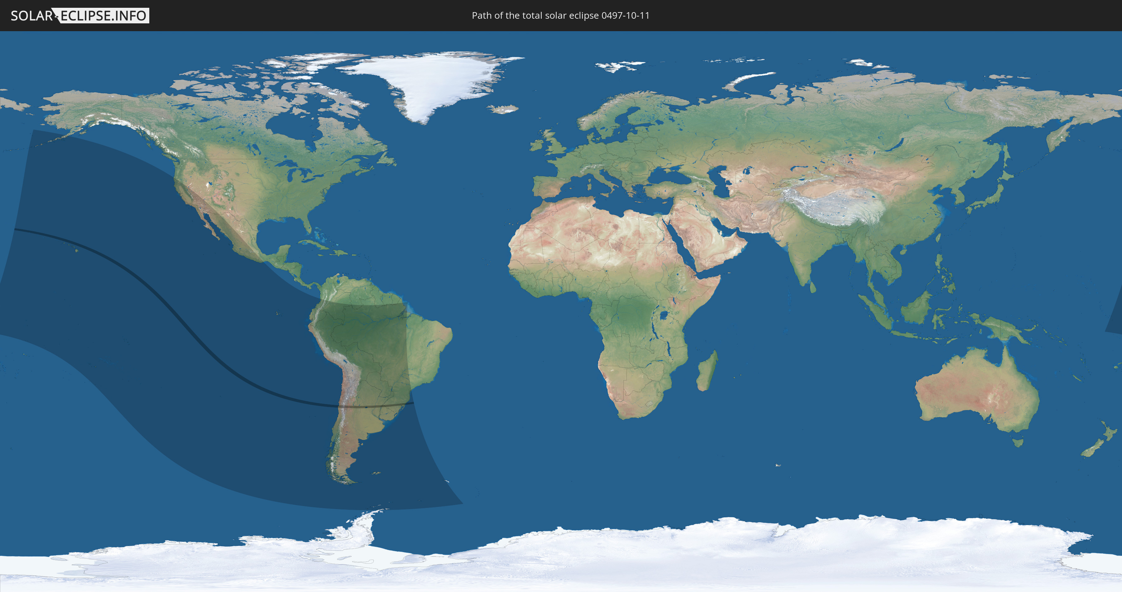
Die Sonnenfinsternis am 11.10.0497 kann man in 26 Ländern als partielle Sonnenfinsternis beobachten.
Der Finsternispfad verläuft durch 5 Länder. Nur in diesen Ländern ist sie als totale Sonnenfinsternis zu sehen.
In den folgenden Ländern ist die Sonnenfinsternis total zu sehen
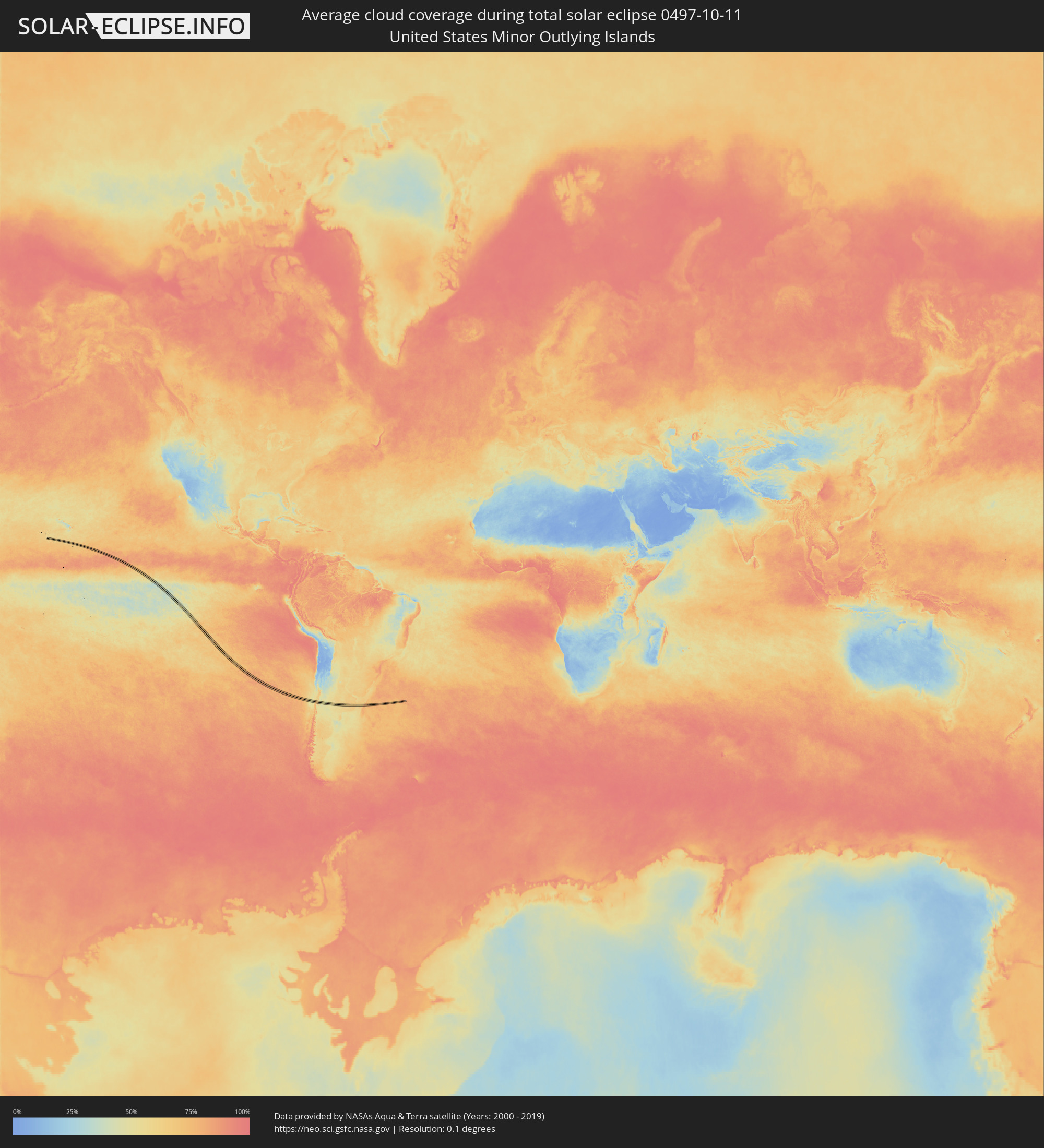
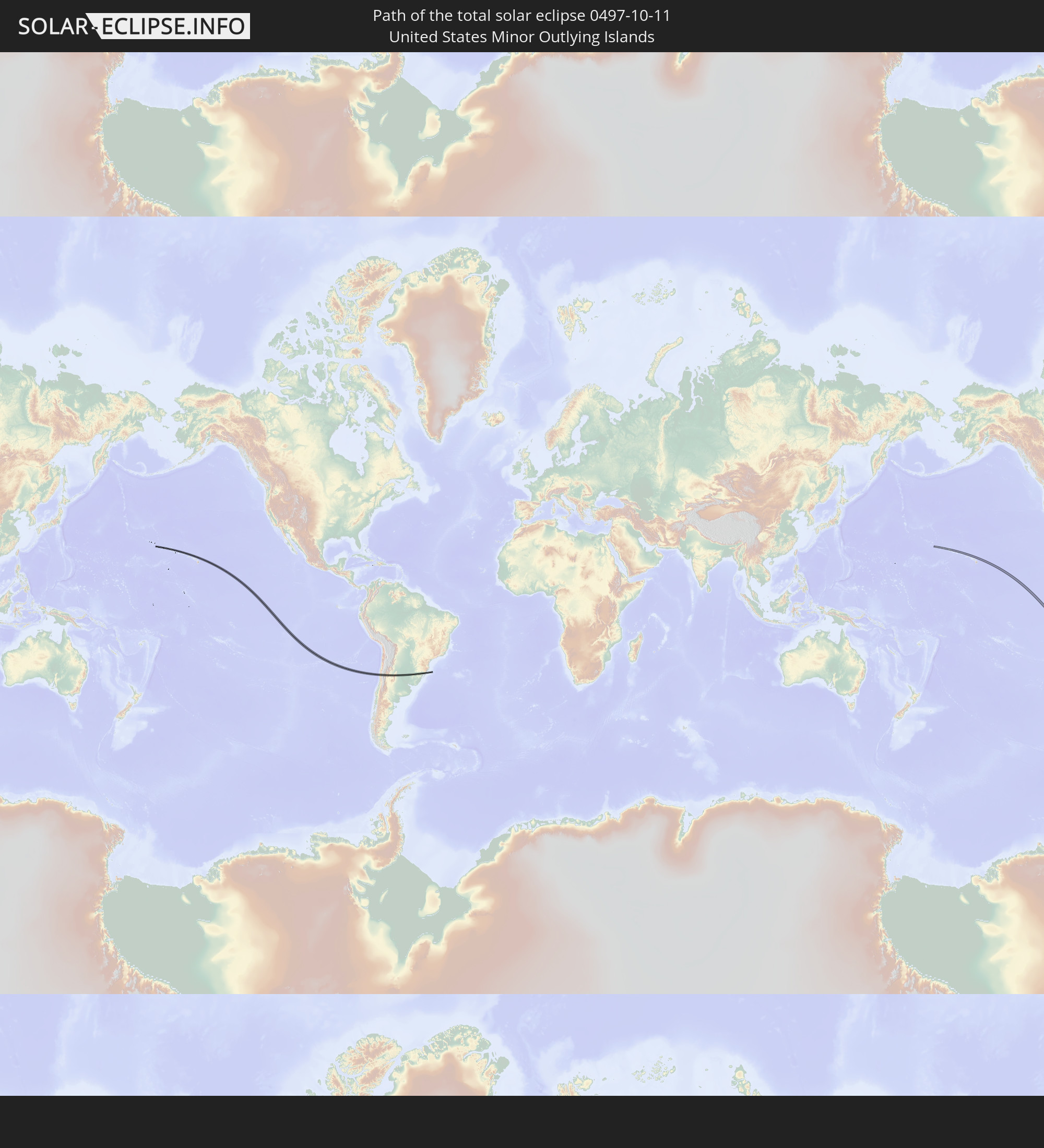 United States Minor Outlying Islands
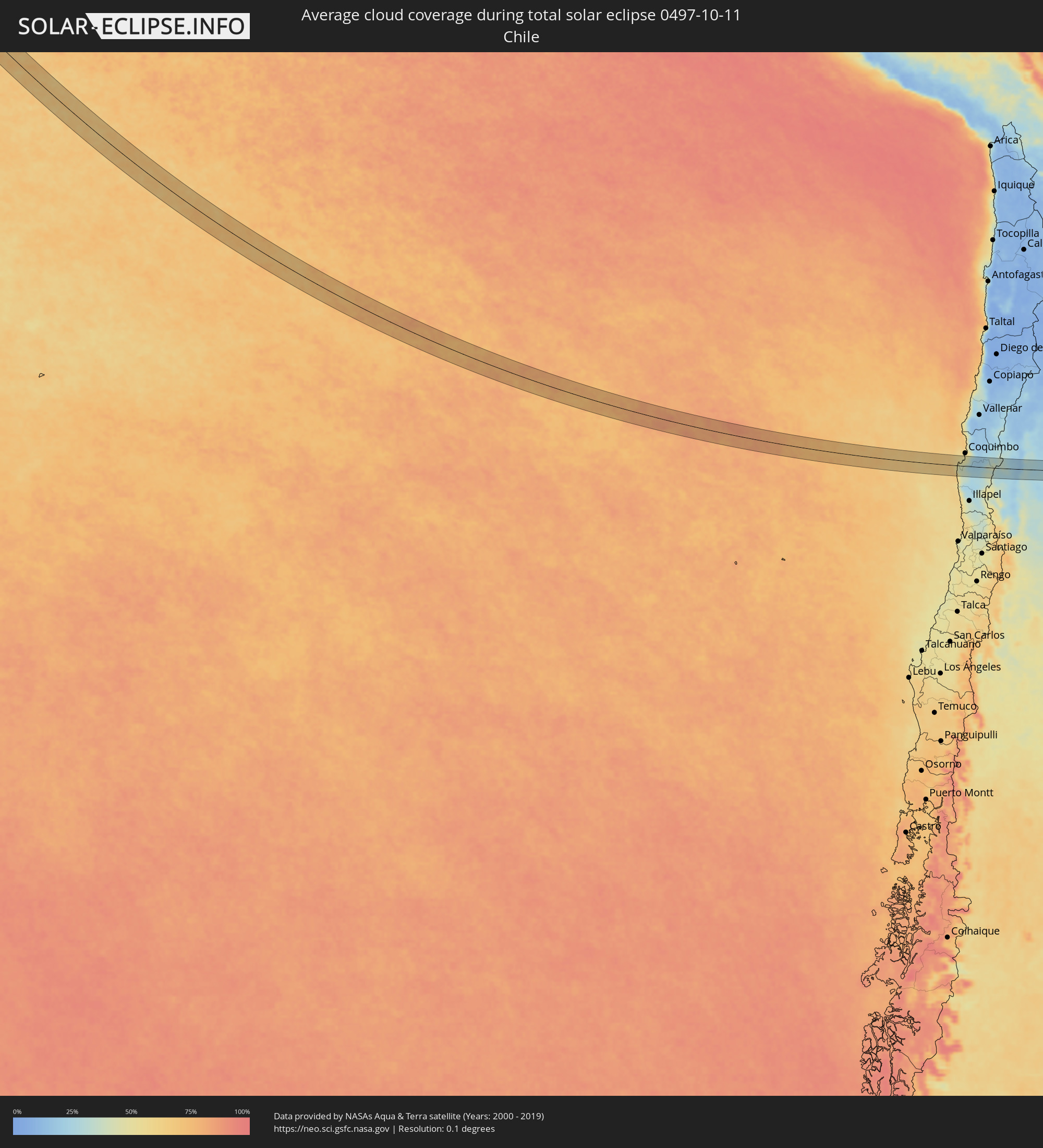
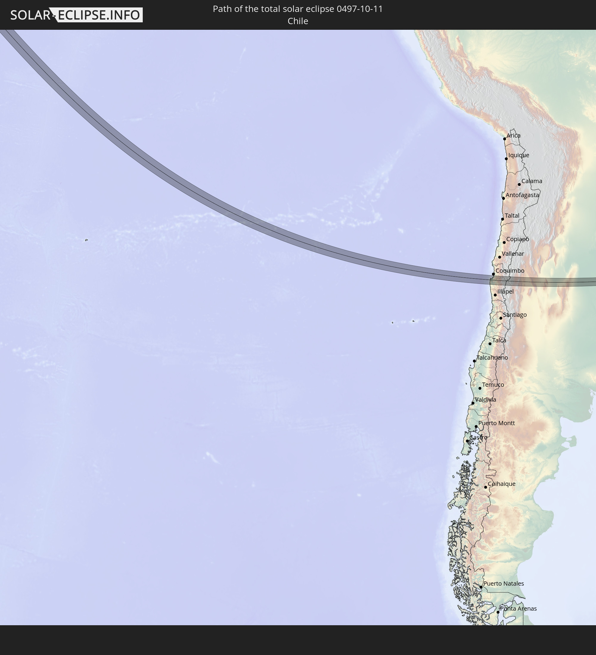 Chile
Chile
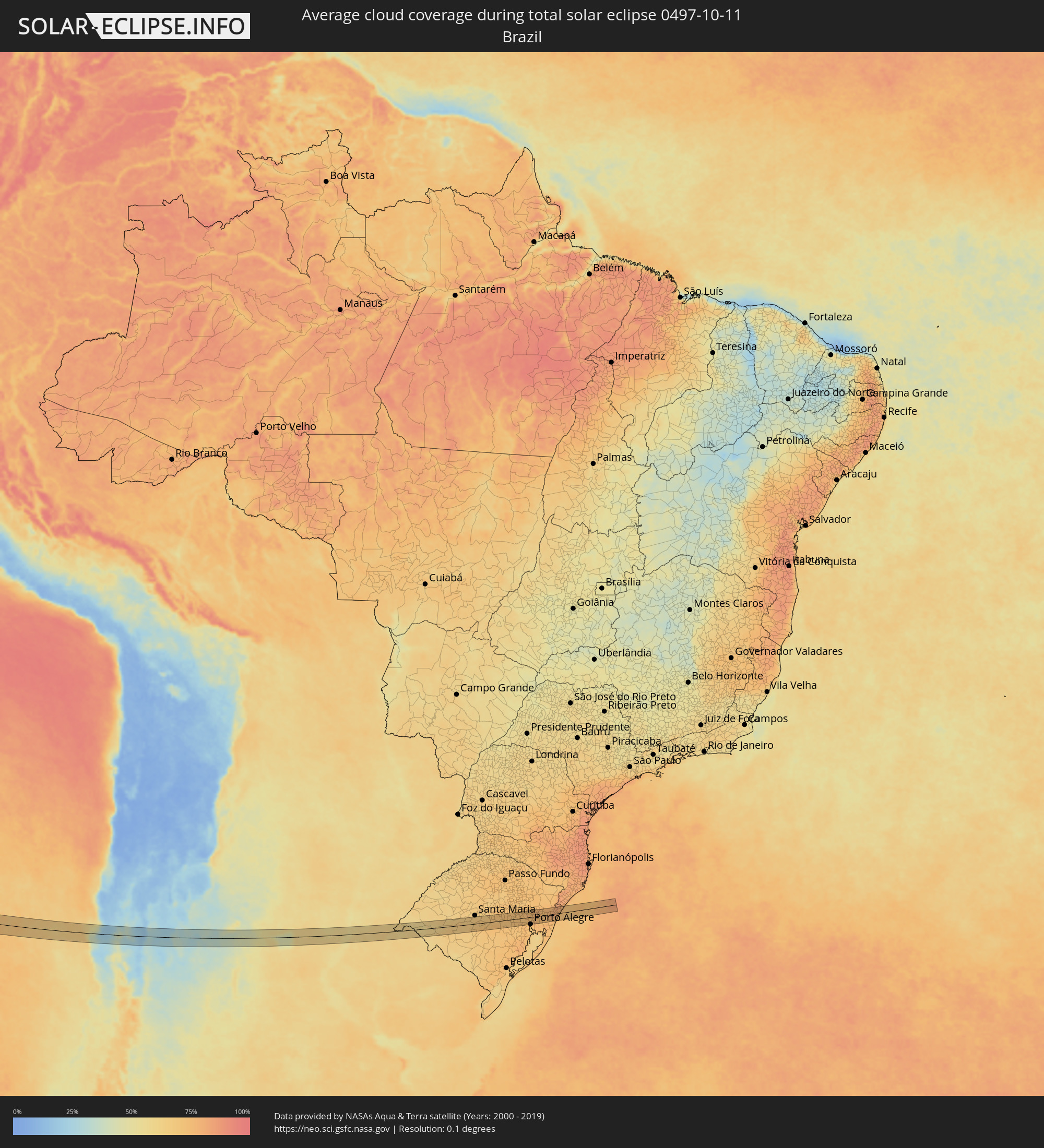
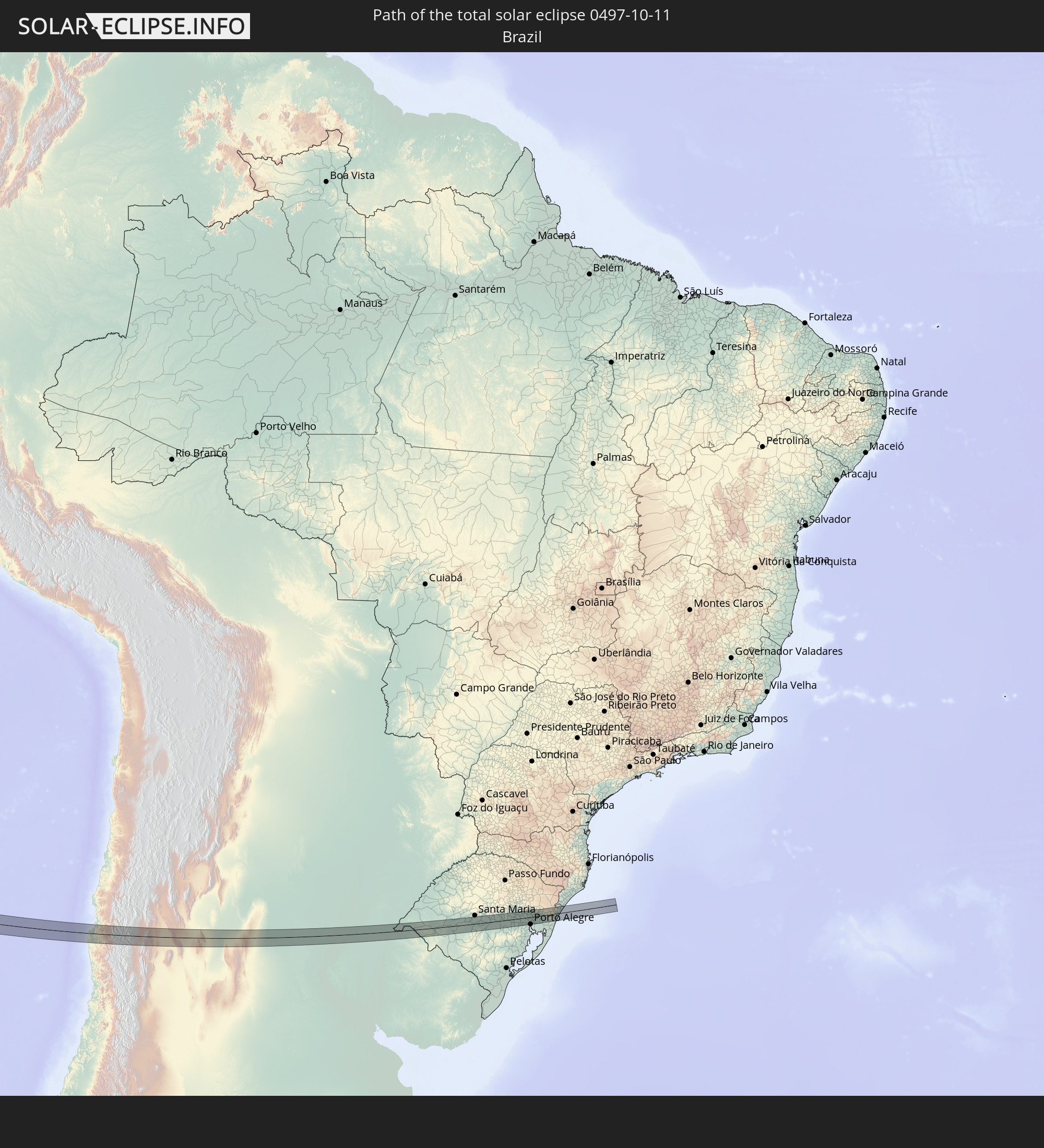 Brasilien
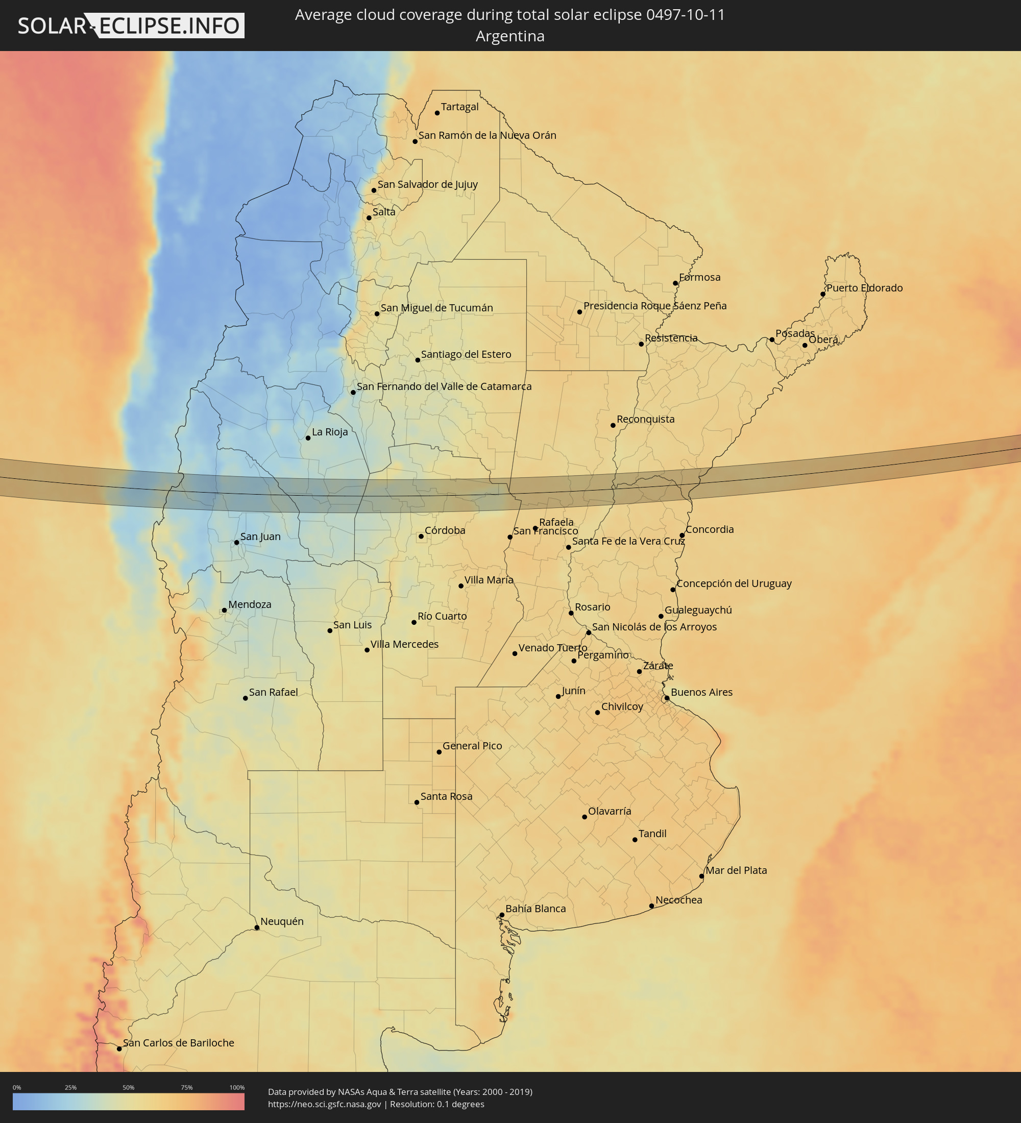
 Argentinien
 Uruguay
In den folgenden Ländern ist die Sonnenfinsternis partiell zu sehen
 Antarktika
 Vereinigte Staaten
 United States Minor Outlying Islands
 Kiribati
 Tokelau
 Cookinseln
 Französisch-Polynesien
 Pitcairninseln
 Mexiko
 Chile
Chile
 Ecuador
 Costa Rica
 Kolumbien
 Peru
Peru
 Brasilien
 Argentinien
 Venezuela
 Bolivien
 Paraguay
 Falklandinseln
 Guyana
 Uruguay
 Suriname
 Französisch-Guayana
 Südgeorgien und die Südlichen Sandwichinseln
 Tuvalu
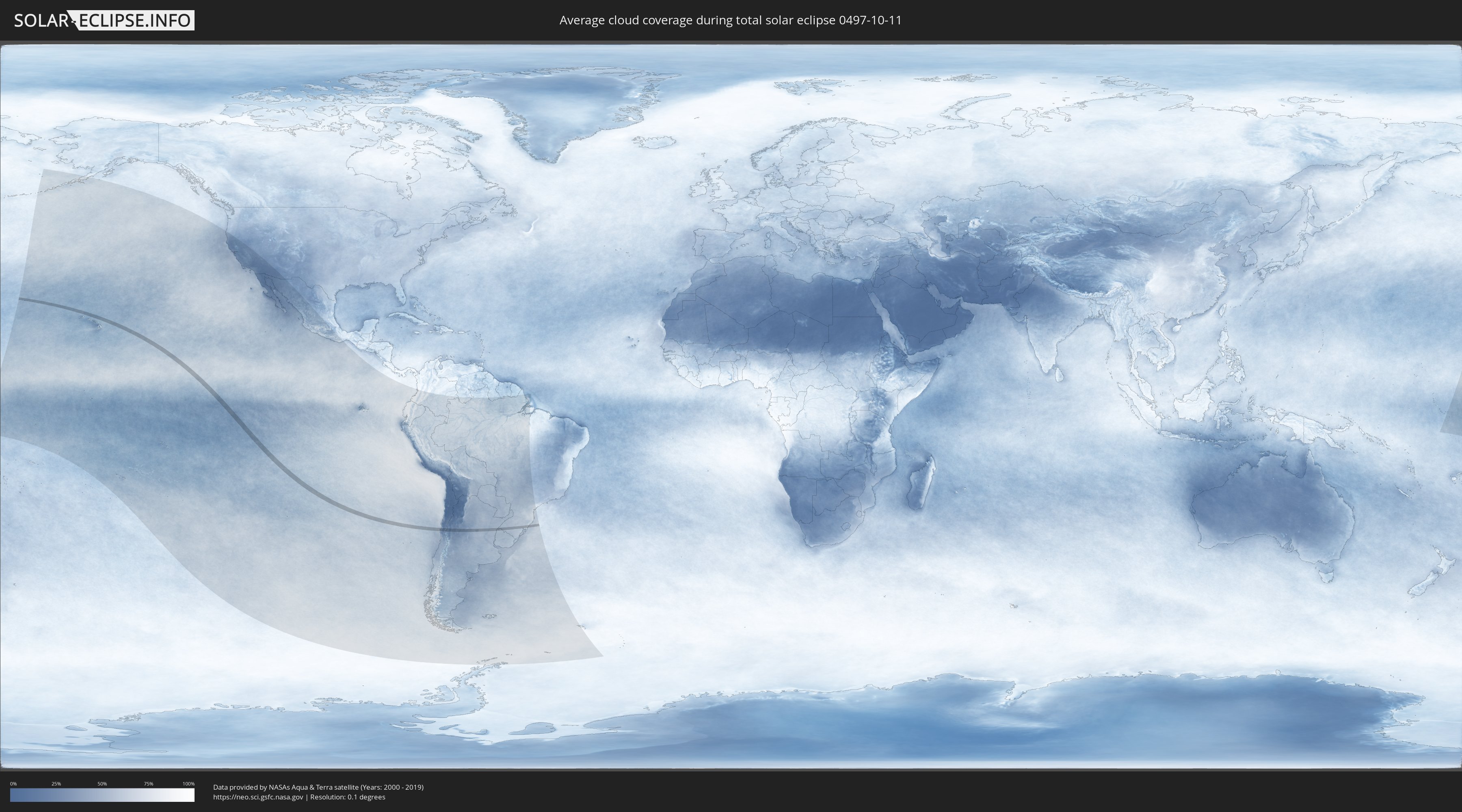
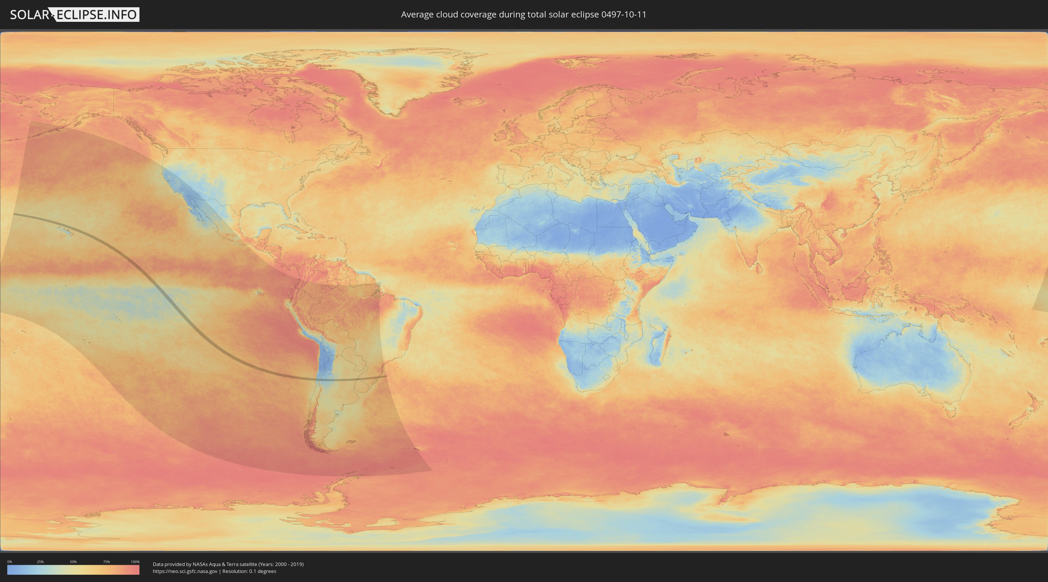
Wie wird das Wetter während der totalen Sonnenfinsternis am 11.10.0497?
Wo ist der beste Ort, um die totale Sonnenfinsternis vom 11.10.0497 zu beobachten?
Die folgenden Karten zeigen die durchschnittliche Bewölkung für den Tag, an dem die totale Sonnenfinsternis
stattfindet. Mit Hilfe der Karten lässt sich der Ort entlang des Finsternispfades eingrenzen,
der die besten Aussichen auf einen klaren wolkenfreien Himmel bietet.
Trotzdem muss man immer lokale Gegenenheiten beachten und sollte sich genau über das Wetter an seinem
gewählten Beobachtungsort informieren.
Die Daten stammen von den beiden NASA-Satelliten
AQUA und TERRA
und wurden über einen Zeitraum von 19 Jahren (2000 - 2019) gemittelt.
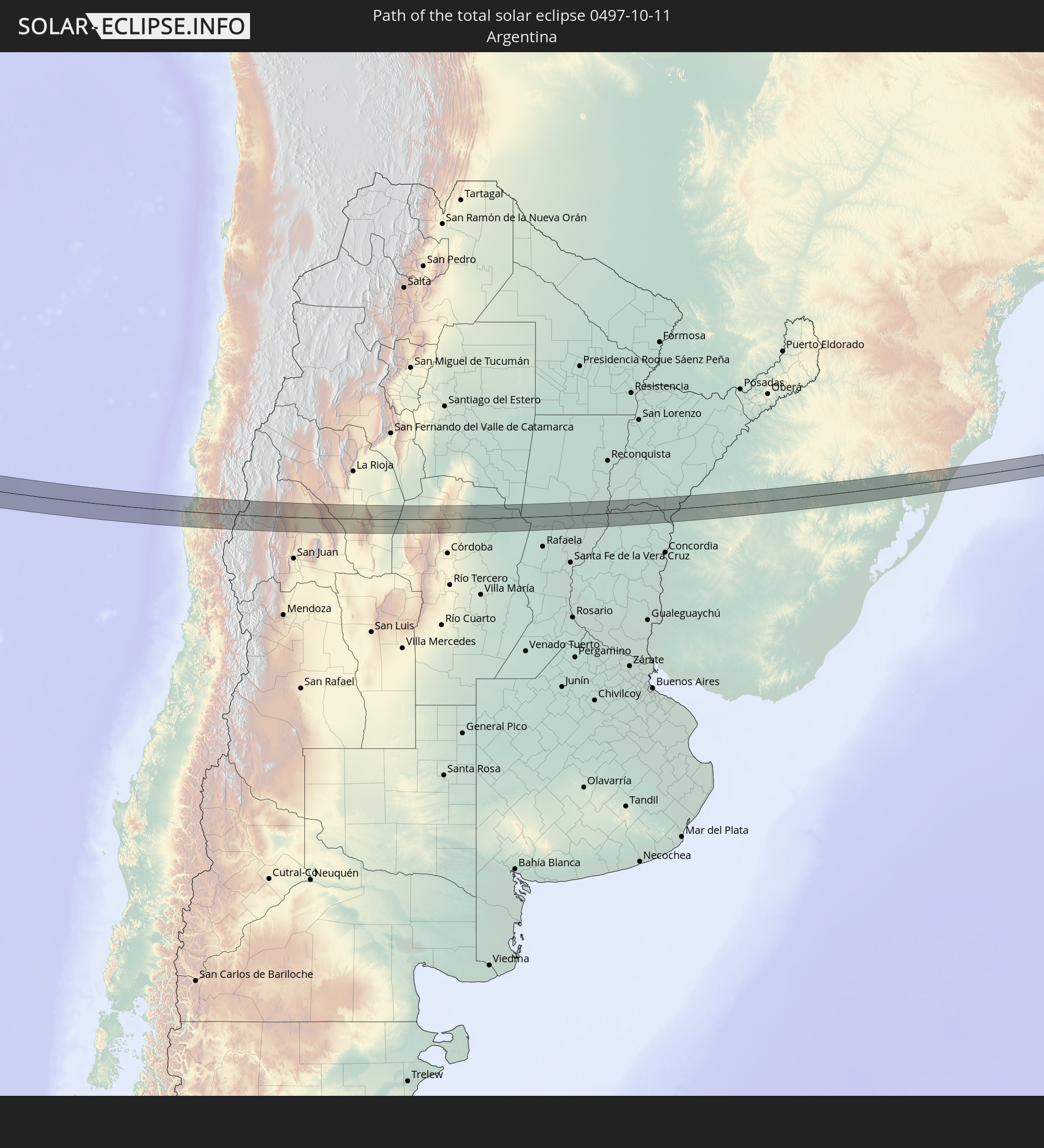
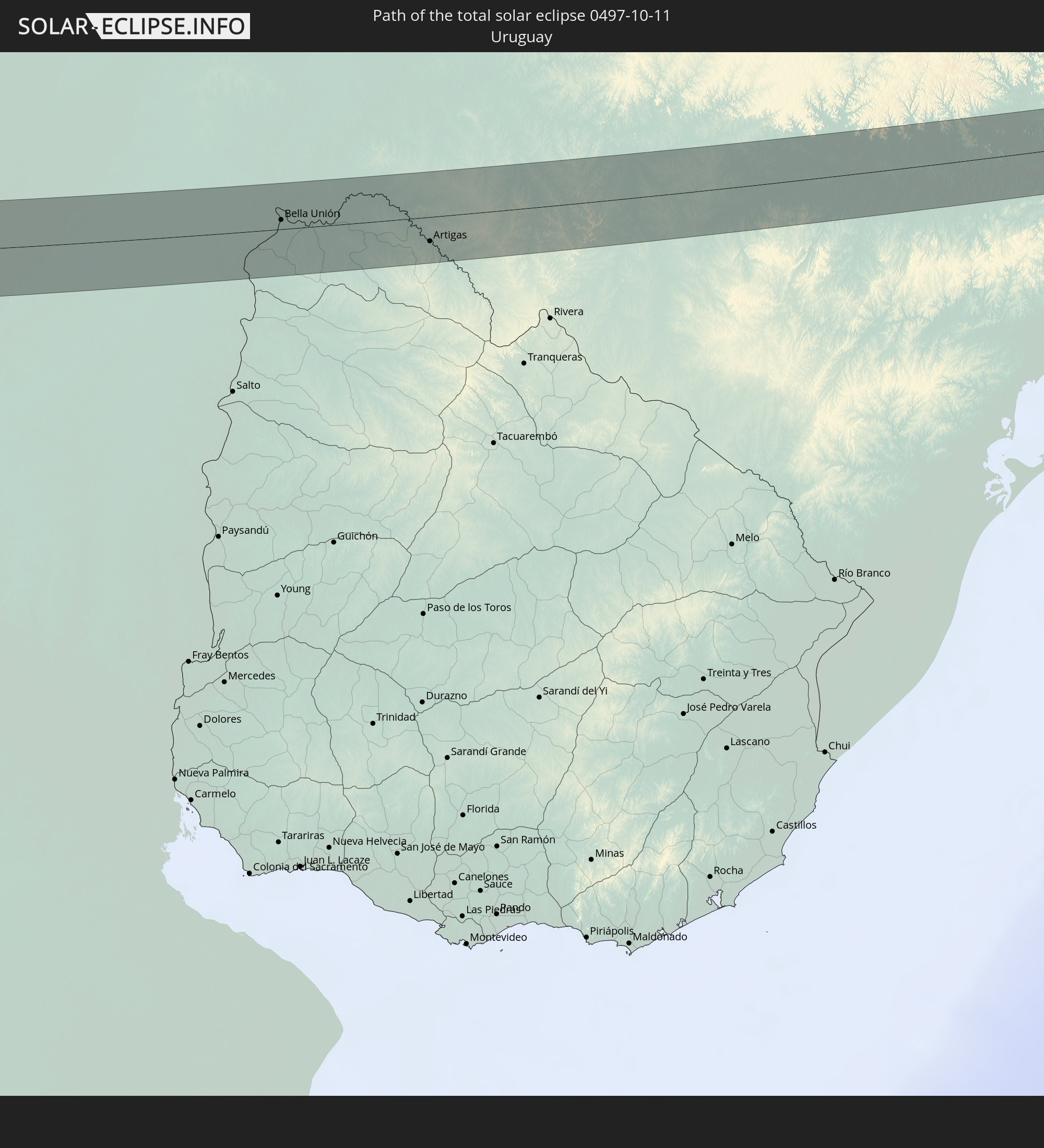
Detaillierte Länderkarten
 United States Minor Outlying Islands
 Chile
Chile
 Brasilien
 Argentinien
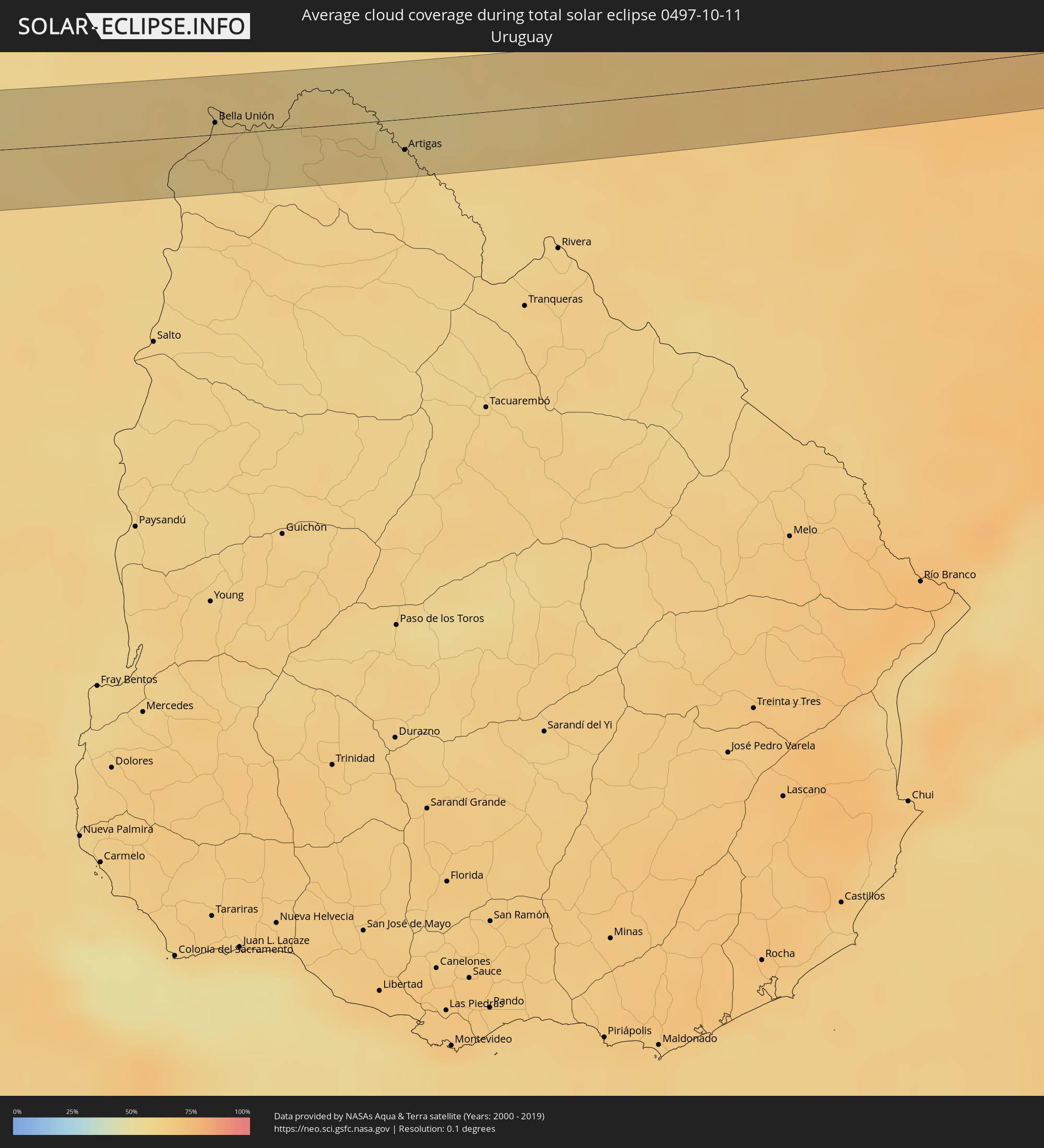 Uruguay
Orte im Finsternispfad
Die nachfolgene Tabelle zeigt Städte und Orte mit mehr als 5.000 Einwohnern, die sich im Finsternispfad befinden. Städte mit mehr als 100.000 Einwohnern sind dick gekennzeichnet. Mit einem Klick auf den Ort öffnet sich eine Detailkarte die die Lage des jeweiligen Ortes zusammen mit dem Verlauf der zentralen Finsternis präsentiert.
| Ort | Typ | Dauer der Verfinsterung | Ortszeit bei maximaler Verfinsterung | Entfernung zur Zentrallinie | Ø Bewölkung |
|
Ovalle, Coquimbo
|
total | - | 16:23:42 UTC-04:42 | 21 km | 33% |
|
Monte Patria, Coquimbo
|
total | - | 16:23:52 UTC-04:42 | 30 km | 26% |
|
San José de Jáchal, San Juan Province
|
total | - | 16:51:17 UTC-04:16 | 32 km | 28% |
|
San Agustín de Valle Fértil, San Juan Province
|
total | - | 16:52:04 UTC-04:16 | 8 km | 34% |
|
Chamical, La Rioja Province
|
total | - | 16:52:43 UTC-04:16 | 24 km | 34% |
|
Villa de Soto, Cordoba Province
|
total | - | 16:53:22 UTC-04:16 | 30 km | 40% |
|
Cruz del Eje, Cordoba Province
|
total | - | 16:53:29 UTC-04:16 | 16 km | 42% |
|
Capilla del Monte, Cordoba Province
|
total | - | 16:53:36 UTC-04:16 | 31 km | 46% |
|
Deán Funes, Cordoba Province
|
total | - | 16:53:43 UTC-04:16 | 18 km | 43% |
|
Villa del Totoral, Cordoba Province
|
total | - | 16:53:59 UTC-04:16 | 27 km | 51% |
|
Morteros, Cordoba Province
|
total | - | 16:54:44 UTC-04:16 | 20 km | 59% |
|
San Cristóbal, Santa Fe Province
|
total | - | 16:55:04 UTC-04:16 | 22 km | 58% |
|
San Justo, Santa Fe Province
|
total | - | 16:55:15 UTC-04:16 | 34 km | 59% |
|
San Javier, Santa Fe Province
|
total | - | 16:55:30 UTC-04:16 | 14 km | 55% |
|
La Paz, Entre Ríos Province
|
total | - | 16:55:34 UTC-04:16 | 34 km | 57% |
|
San José de Feliciano, Entre Ríos Province
|
total | - | 16:55:54 UTC-04:16 | 1 km | 60% |
|
Mocoretá, Corrientes Province
|
total | - | 16:56:06 UTC-04:16 | 30 km | 61% |
|
Monte Caseros, Corrientes Province
|
total | - | 16:56:14 UTC-04:16 | 8 km | 61% |
|
Bella Unión, Artigas
|
total | - | 17:28:11 UTC-03:44 | 7 km | 61% |
|
Artigas, Artigas
|
total | - | 17:28:27 UTC-03:44 | 18 km | 60% |
|
Quaraí, Rio Grande do Sul
|
total | - | 18:06:50 UTC-03:06 | 16 km | 60% |
|
Rosário do Sul, Rio Grande do Sul
|
total | - | 18:07:11 UTC-03:06 | 16 km | 67% |
|
Cacequi, Rio Grande do Sul
|
total | - | 18:07:15 UTC-03:06 | 25 km | 64% |
|
São Gabriel, Rio Grande do Sul
|
total | - | 18:07:16 UTC-03:06 | 30 km | 66% |
|
São Sepé, Rio Grande do Sul
|
total | - | 18:07:25 UTC-03:06 | 19 km | 69% |
|
Cachoeira do Sul, Rio Grande do Sul
|
total | - | 18:07:32 UTC-03:06 | 13 km | 74% |
|
Candelária, Rio Grande do Sul
|
total | - | 18:07:36 UTC-03:06 | 27 km | 70% |
|
Santa Cruz do Sul, Rio Grande do Sul
|
total | - | 18:07:38 UTC-03:06 | 17 km | 73% |
|
Rio Pardo, Rio Grande do Sul
|
total | - | 18:07:36 UTC-03:06 | 13 km | 70% |
|
Venâncio Aires, Rio Grande do Sul
|
total | - | 18:07:41 UTC-03:06 | 27 km | 72% |
|
Taquari, Rio Grande do Sul
|
total | - | 18:07:41 UTC-03:06 | 2 km | 71% |
|
Arroio dos Ratos, Rio Grande do Sul
|
total | - | 18:07:39 UTC-03:06 | 31 km | 72% |
|
São Jerônimo, Rio Grande do Sul
|
total | - | 18:07:40 UTC-03:06 | 18 km | 72% |
|
Triunfo, Rio Grande do Sul
|
total | - | 18:07:41 UTC-03:06 | 16 km | 71% |
|
Charqueadas, Rio Grande do Sul
|
total | - | 18:07:41 UTC-03:06 | 19 km | 73% |
|
Montenegro, Rio Grande do Sul
|
total | - | 18:07:44 UTC-03:06 | 9 km | 71% |
|
São Sebastião do Caí, Rio Grande do Sul
|
total | - | 18:07:46 UTC-03:06 | 19 km | 74% |
|
Portão, Rio Grande do Sul
|
total | - | 18:07:45 UTC-03:06 | 5 km | 74% |
|
Canoas, Rio Grande do Sul
|
total | - | 18:07:44 UTC-03:06 | 20 km | 76% |
|
Esteio, Rio Grande do Sul
|
total | - | 18:07:44 UTC-03:06 | 14 km | 76% |
|
Estância Velha, Rio Grande do Sul
|
total | - | 18:07:46 UTC-03:06 | 10 km | 75% |
|
Ivoti, Rio Grande do Sul
|
total | - | 18:07:47 UTC-03:06 | 16 km | 75% |
|
Sapucaia, Rio Grande do Sul
|
total | - | 18:07:45 UTC-03:06 | 11 km | 76% |
|
São Leopoldo, Rio Grande do Sul
|
total | - | 18:07:45 UTC-03:06 | 3 km | 76% |
|
Novo Hamburgo, Rio Grande do Sul
|
total | - | 18:07:46 UTC-03:06 | 6 km | 75% |
|
Cachoeirinha, Rio Grande do Sul
|
total | - | 18:07:44 UTC-03:06 | 25 km | 76% |
|
Sapiranga, Rio Grande do Sul
|
total | - | 18:07:47 UTC-03:06 | 9 km | 76% |
|
Gravataí, Rio Grande do Sul
|
total | - | 18:07:44 UTC-03:06 | 25 km | 76% |
|
Parobé, Rio Grande do Sul
|
total | - | 18:07:48 UTC-03:06 | 8 km | 75% |
|
Igrejinha, Rio Grande do Sul
|
total | - | 18:07:49 UTC-03:06 | 13 km | 75% |
|
Taquara, Rio Grande do Sul
|
total | - | 18:07:48 UTC-03:06 | 4 km | 75% |
|
Três Coroas, Rio Grande do Sul
|
total | - | 18:07:49 UTC-03:06 | 19 km | 75% |
|
São Francisco de Paula, Rio Grande do Sul
|
total | - | 18:07:51 UTC-03:06 | 24 km | 76% |
|
Rolante, Rio Grande do Sul
|
total | - | 18:07:49 UTC-03:06 | 2 km | 75% |
|
Osório, Rio Grande do Sul
|
total | - | 18:07:48 UTC-03:06 | 28 km | 74% |
|
Capão da Canoa, Rio Grande do Sul
|
total | - | 18:07:50 UTC-03:06 | 16 km | 73% |
|
Torres, Rio Grande do Sul
|
total | - | 18:07:55 UTC-03:06 | 25 km | 74% |