Total solar eclipse of 10/11/0497
| Day of week: | Friday |
| Maximum duration of eclipse: | 03m04s |
| Maximum width of eclipse path: | 119 km |
| Saros cycle: | 90 |
| Coverage: | 100% |
| Magnitude: | 1.0354 |
| Gamma: | -0.0243 |
Wo kann man die Sonnenfinsternis vom 10/11/0497 sehen?
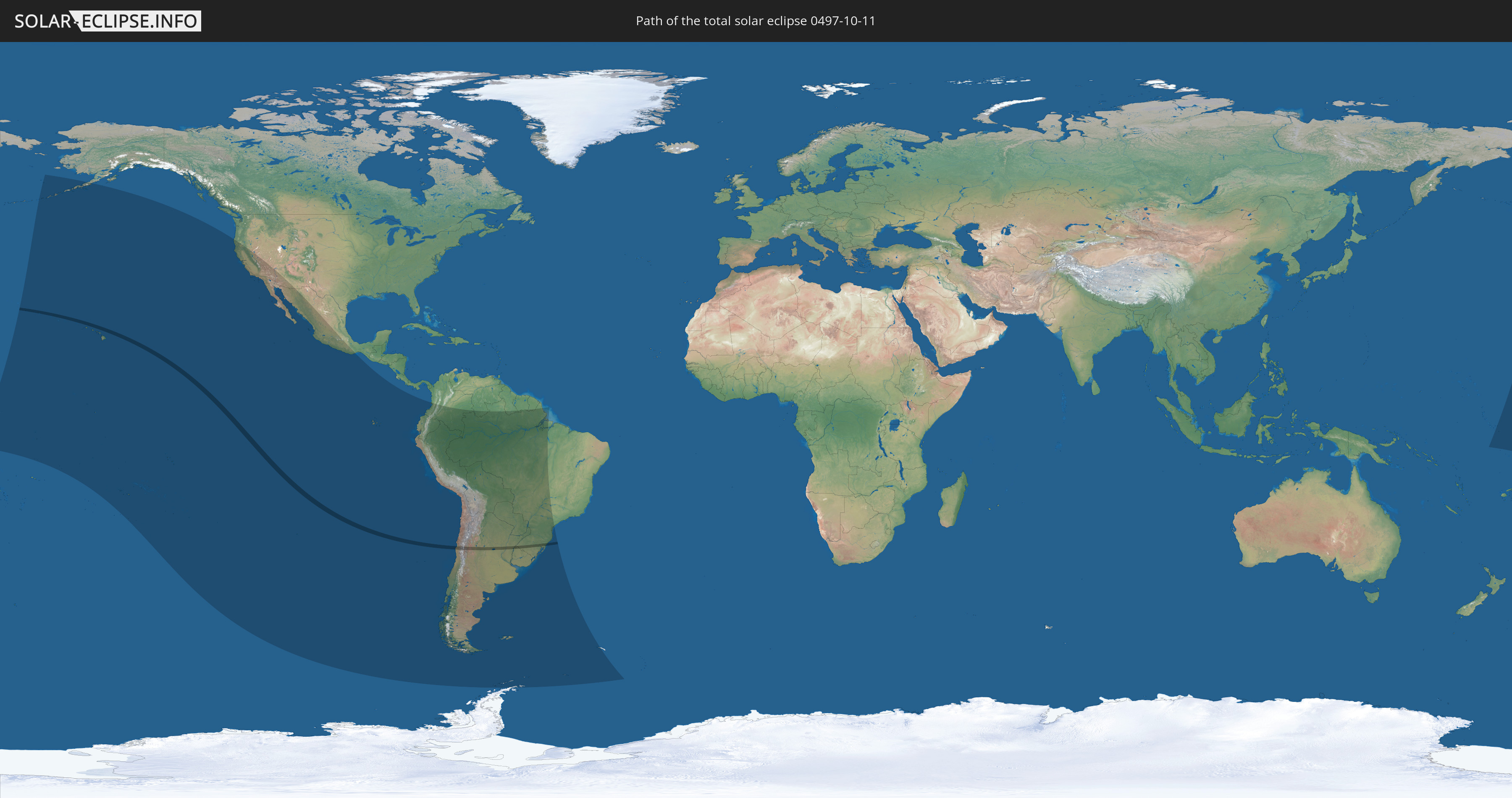
Die Sonnenfinsternis am 10/11/0497 kann man in 26 Ländern als partielle Sonnenfinsternis beobachten.
Der Finsternispfad verläuft durch 5 Länder. Nur in diesen Ländern ist sie als total Sonnenfinsternis zu sehen.
In den folgenden Ländern ist die Sonnenfinsternis total zu sehen
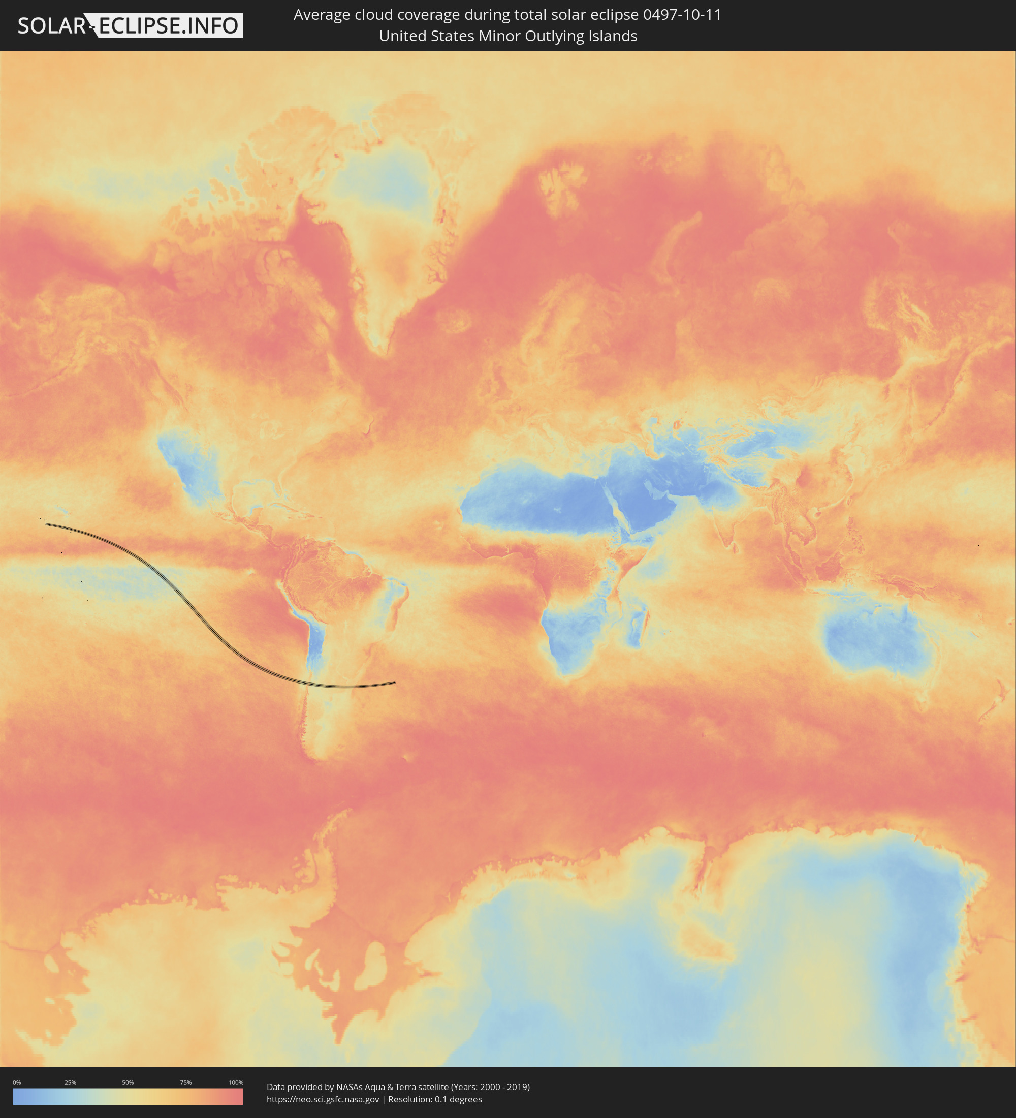
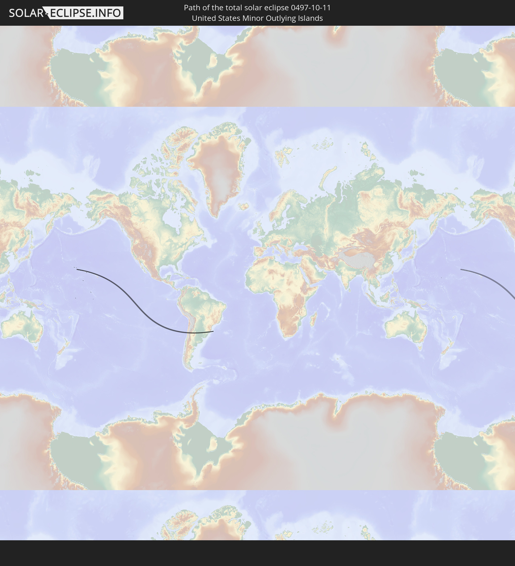 United States Minor Outlying Islands
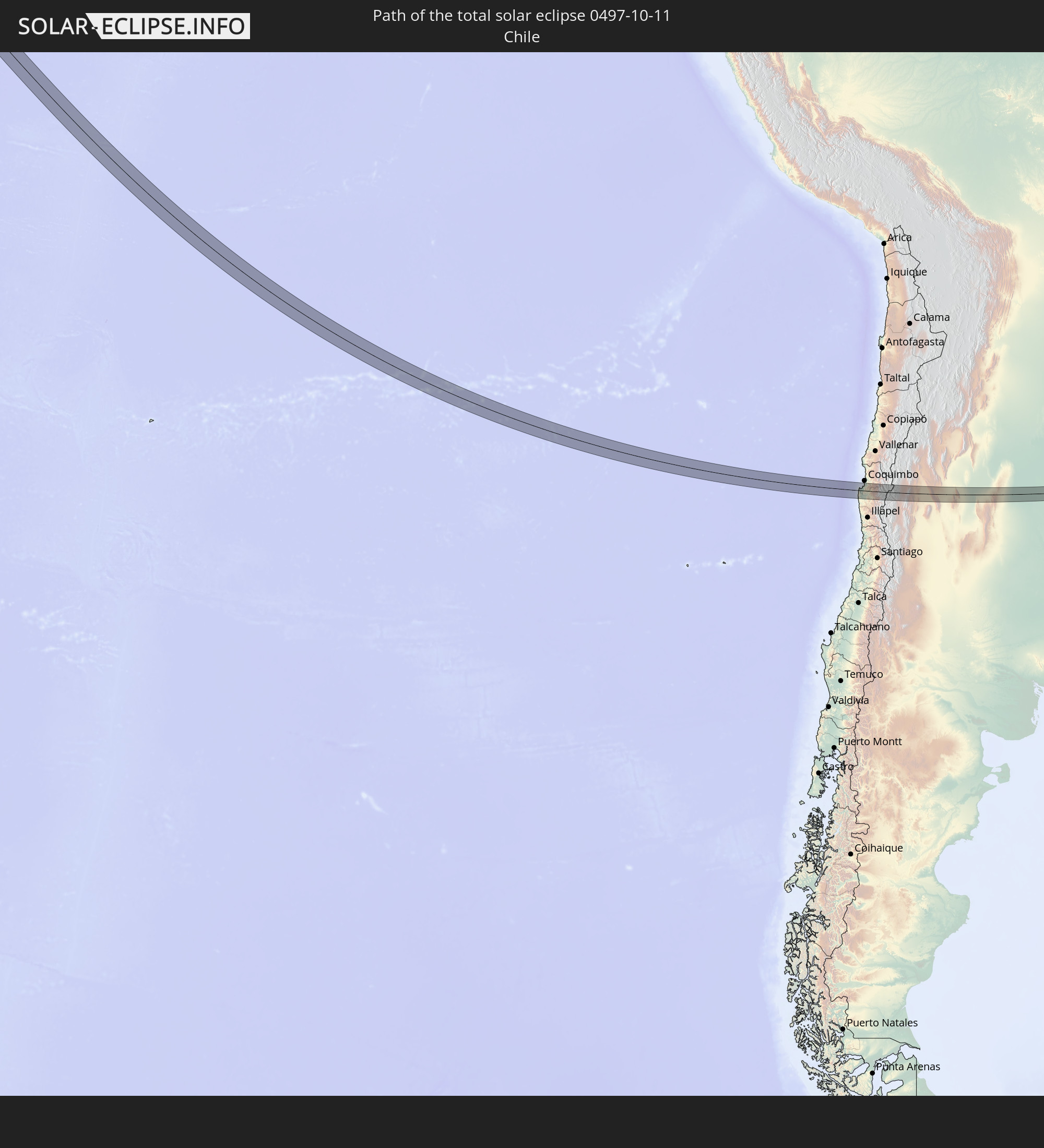 Chile
Chile
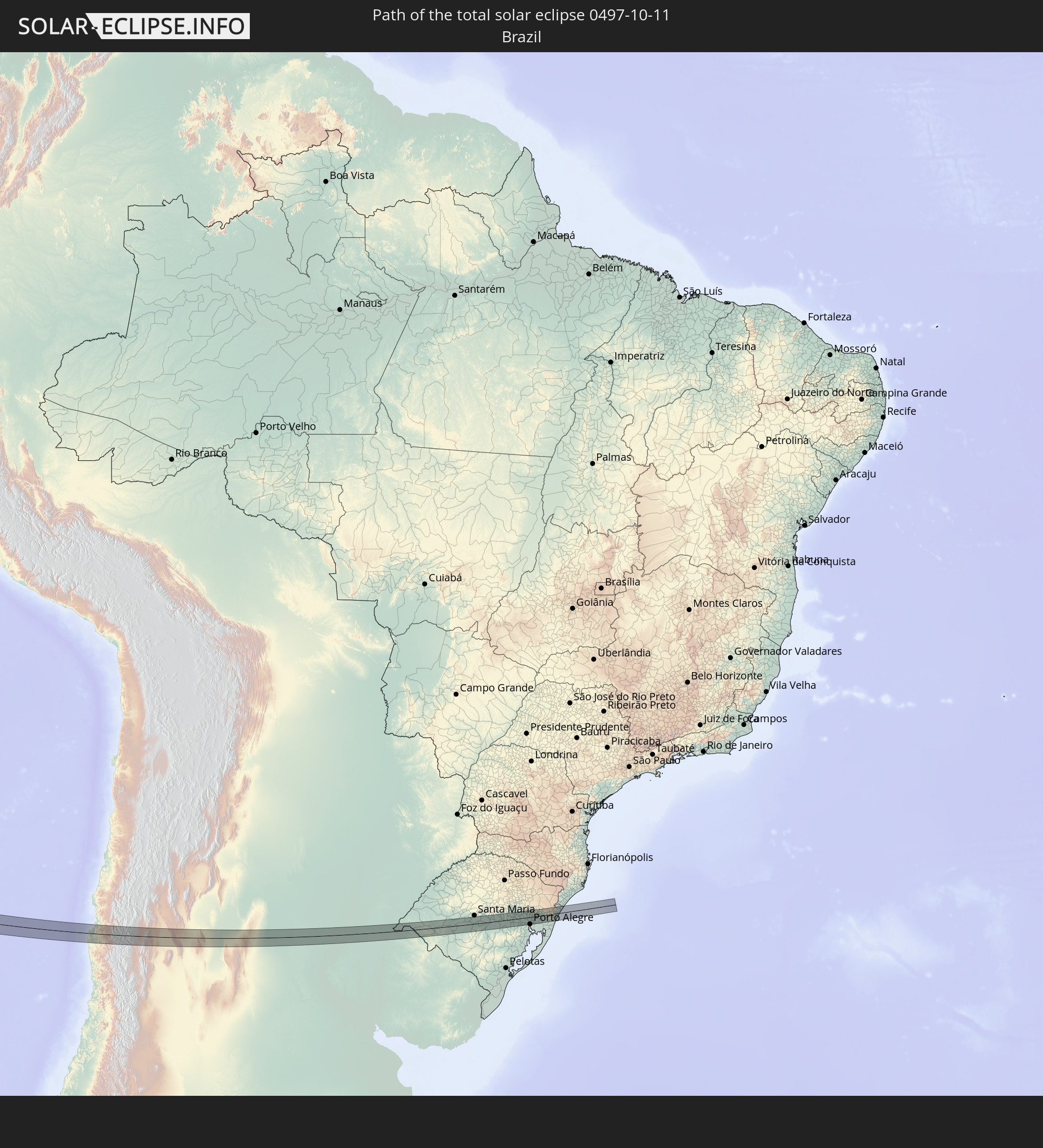 Brazil
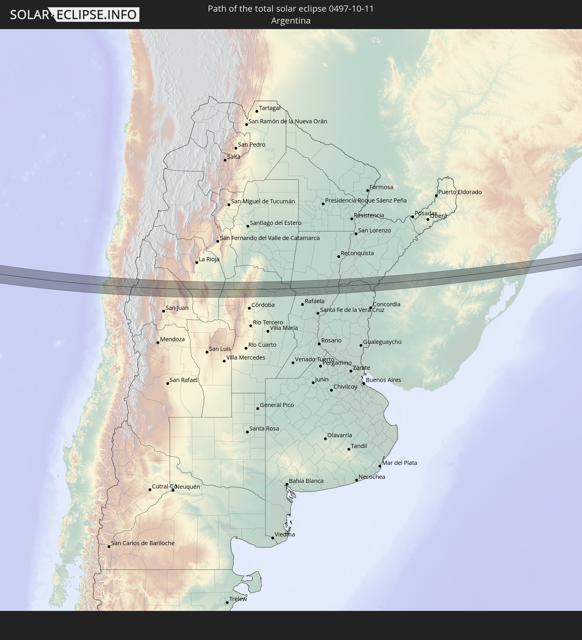 Argentina
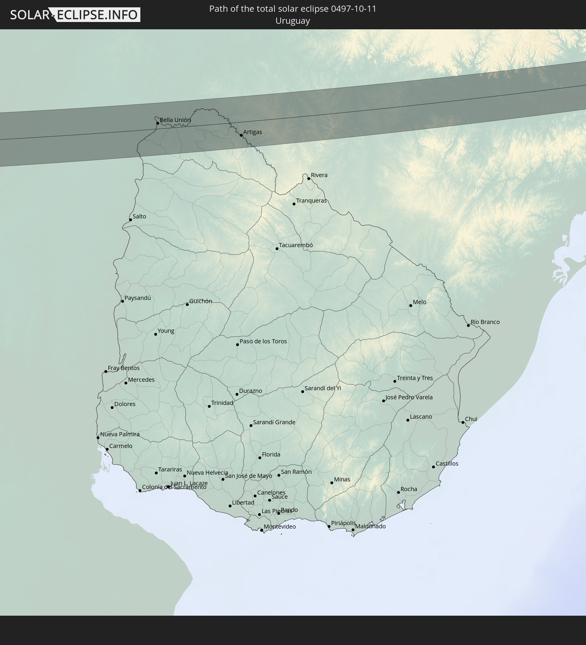 Uruguay
In den folgenden Ländern ist die Sonnenfinsternis partiell zu sehen
 Antarctica
 United States
 United States Minor Outlying Islands
 Kiribati
 Tokelau
 Cook Islands
 French Polynesia
 Pitcairn Islands
 Mexico
 Chile
Chile
 Ecuador
 Costa Rica
 Colombia
 Peru
Peru
 Brazil
 Argentina
 Venezuela
 Bolivia
 Paraguay
 Falkland Islands
 Guyana
 Uruguay
 Suriname
 French Guiana
 South Georgia and the South Sandwich Islands
 Tuvalu
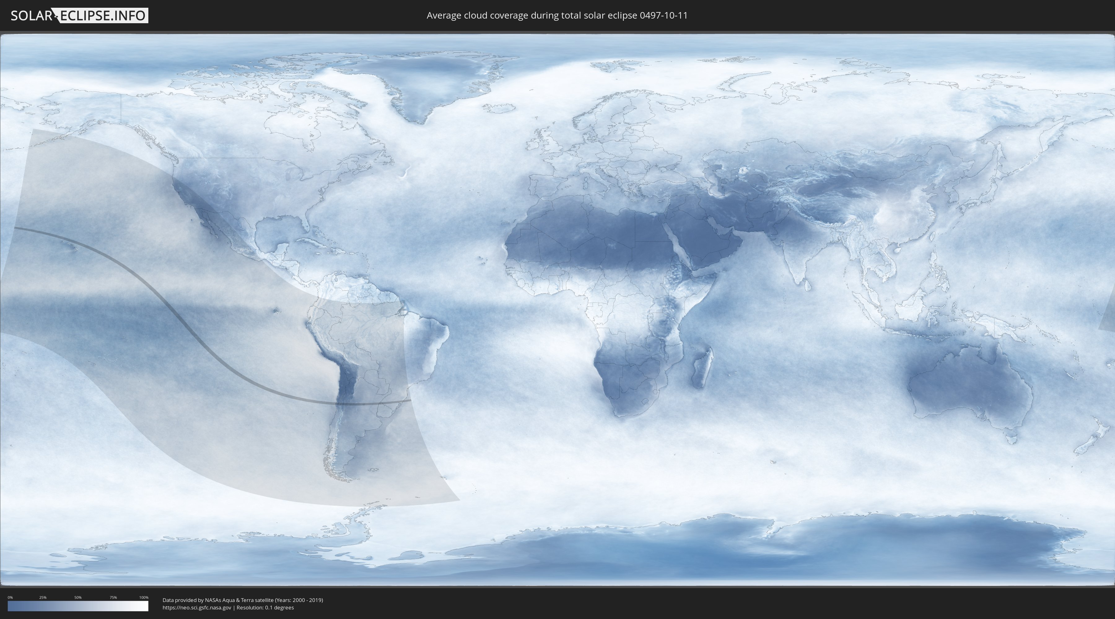
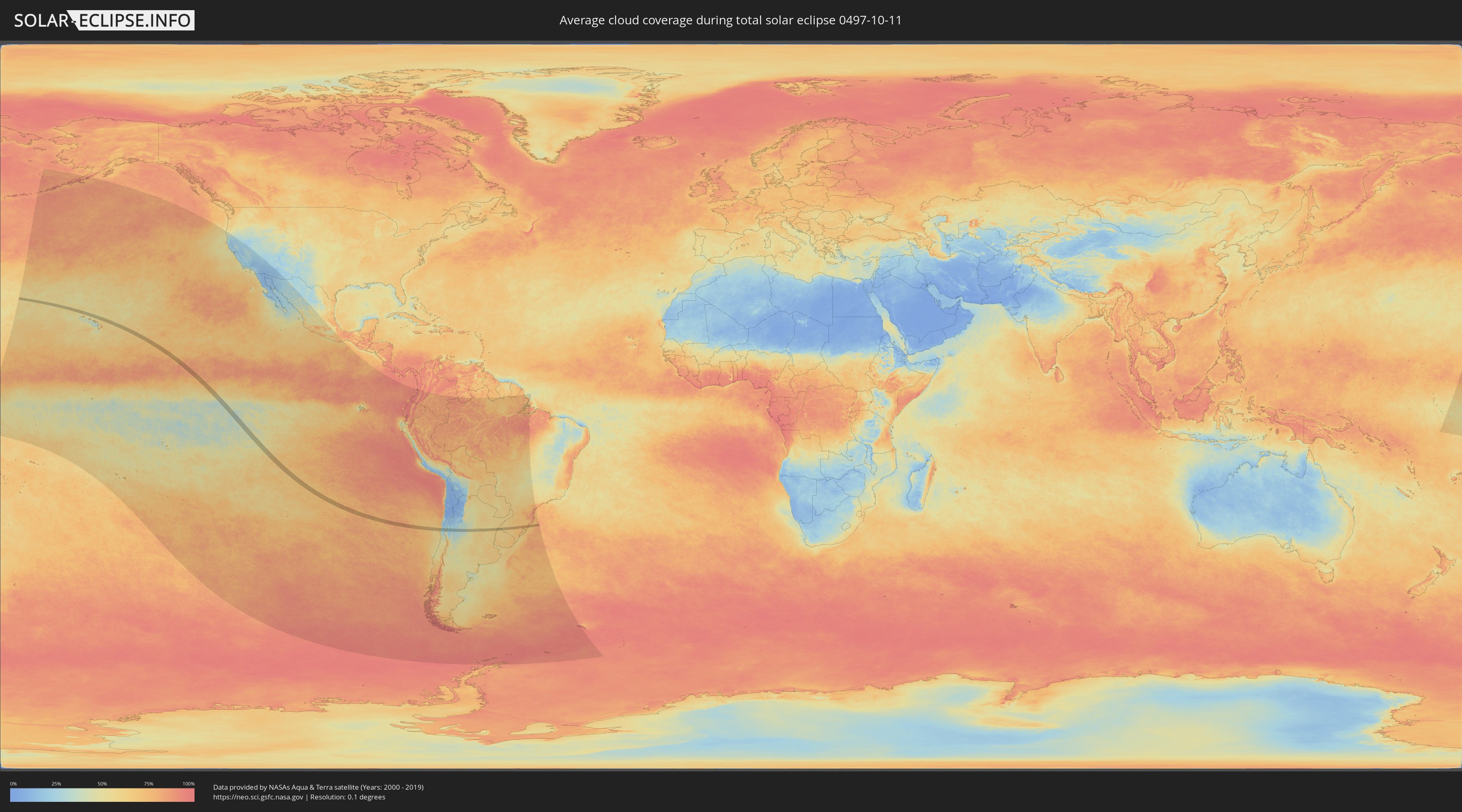
How will be the weather during the total solar eclipse on 10/11/0497?
Where is the best place to see the total solar eclipse of 10/11/0497?
The following maps show the average cloud coverage for the day of the total solar eclipse.
With the help of these maps, it is possible to find the place along the eclipse path, which has the best
chance of a cloudless sky.
Nevertheless, you should consider local circumstances and inform about the weather of your chosen
observation site.
The data is provided by NASAs satellites
AQUA and TERRA.
The cloud maps are averaged over a period of 19 years (2000 - 2019).
Detailed country maps
 United States Minor Outlying Islands
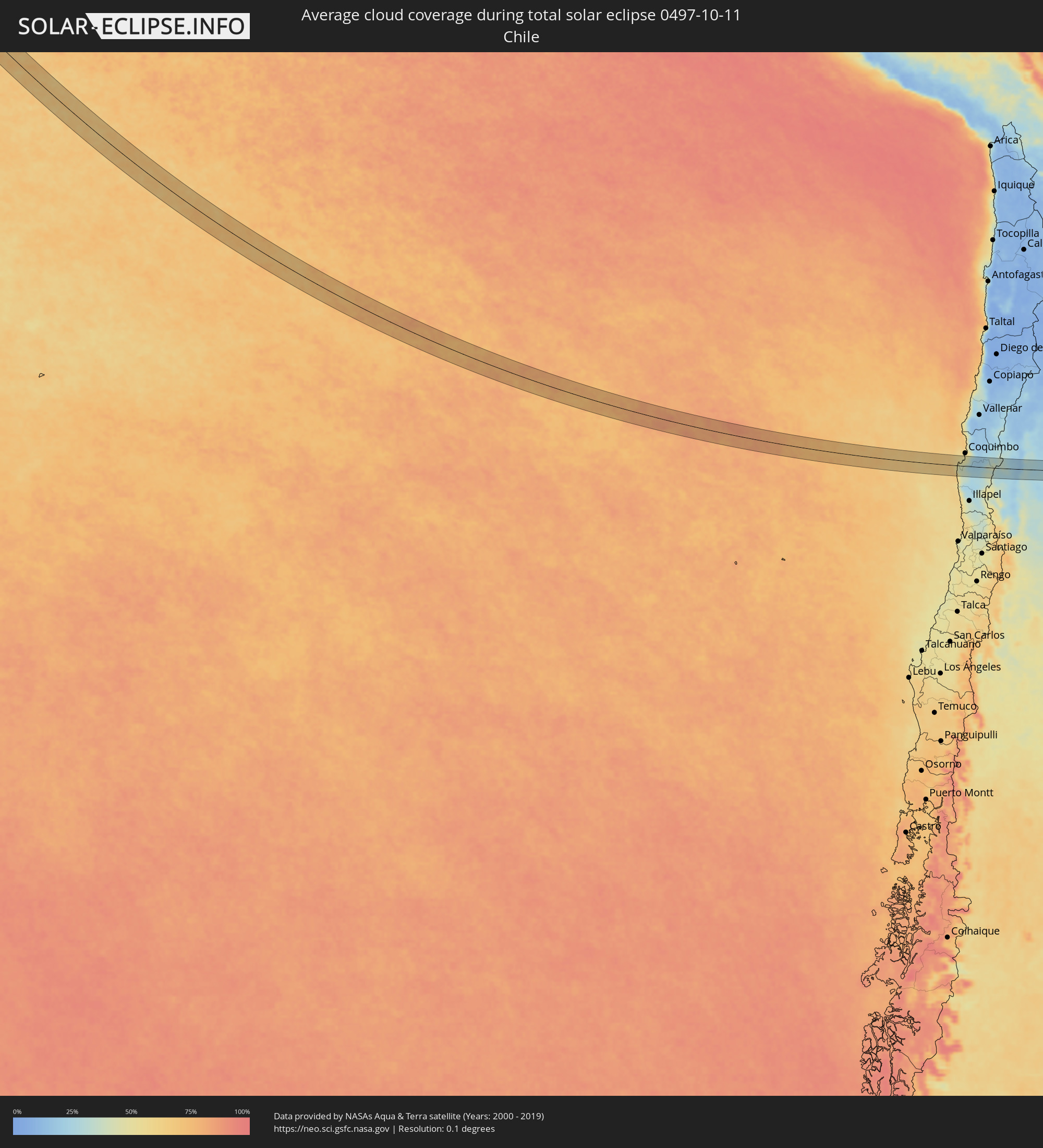 Chile
Chile
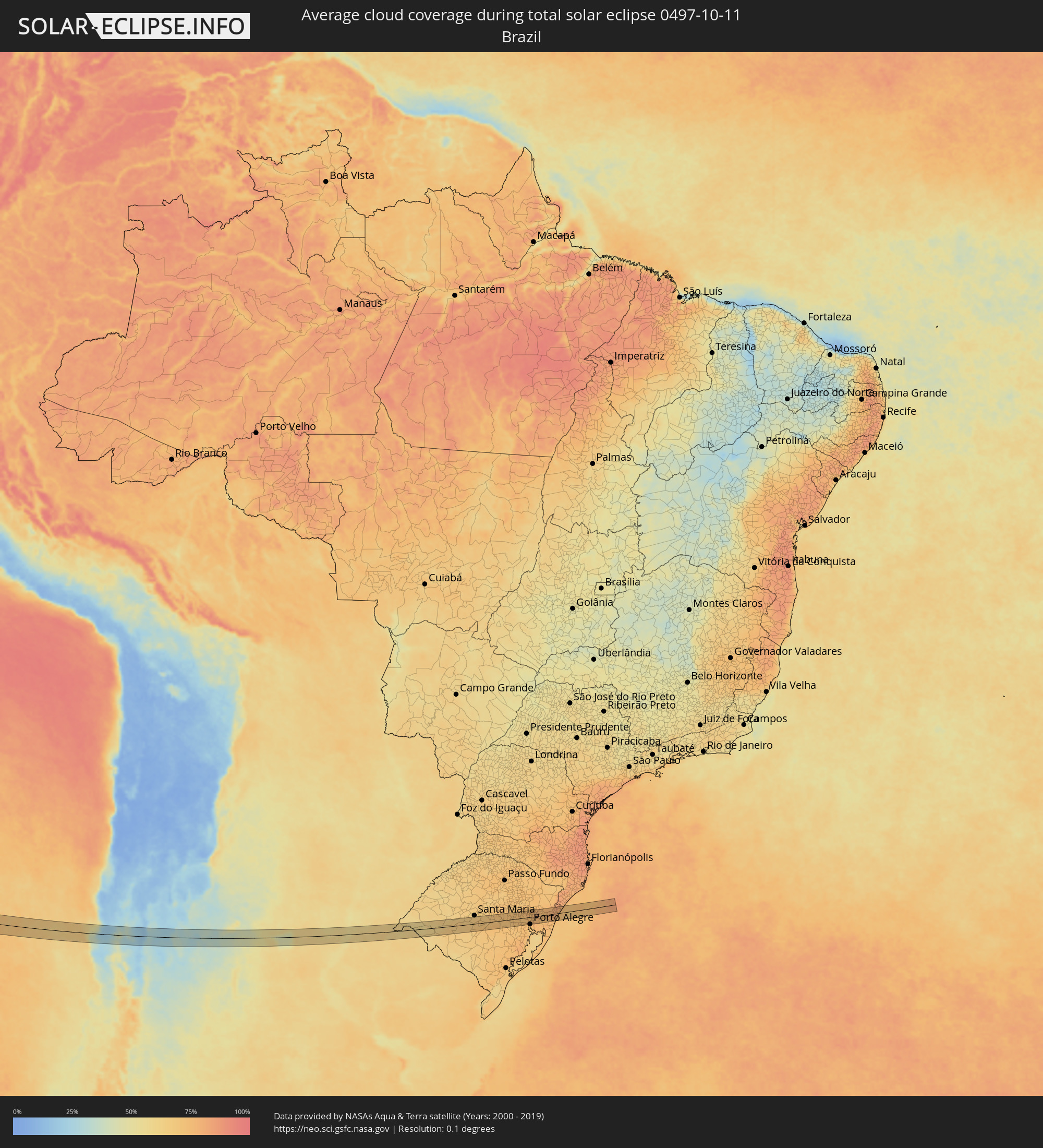 Brazil
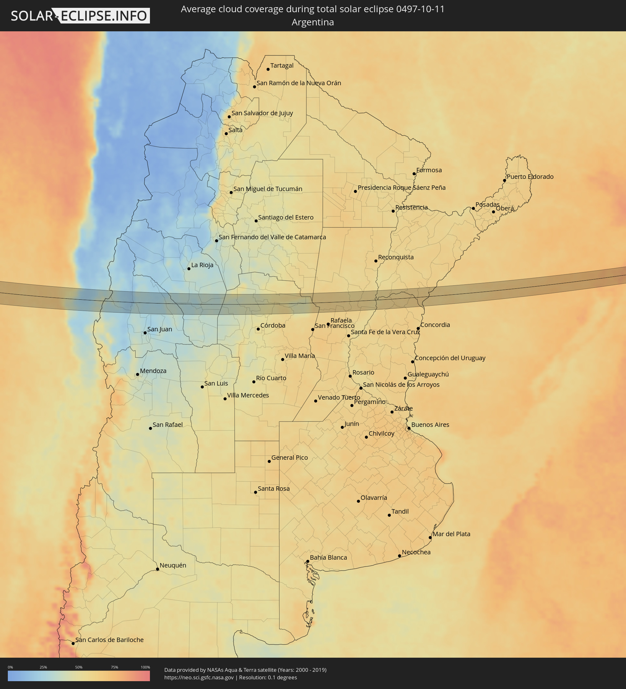 Argentina
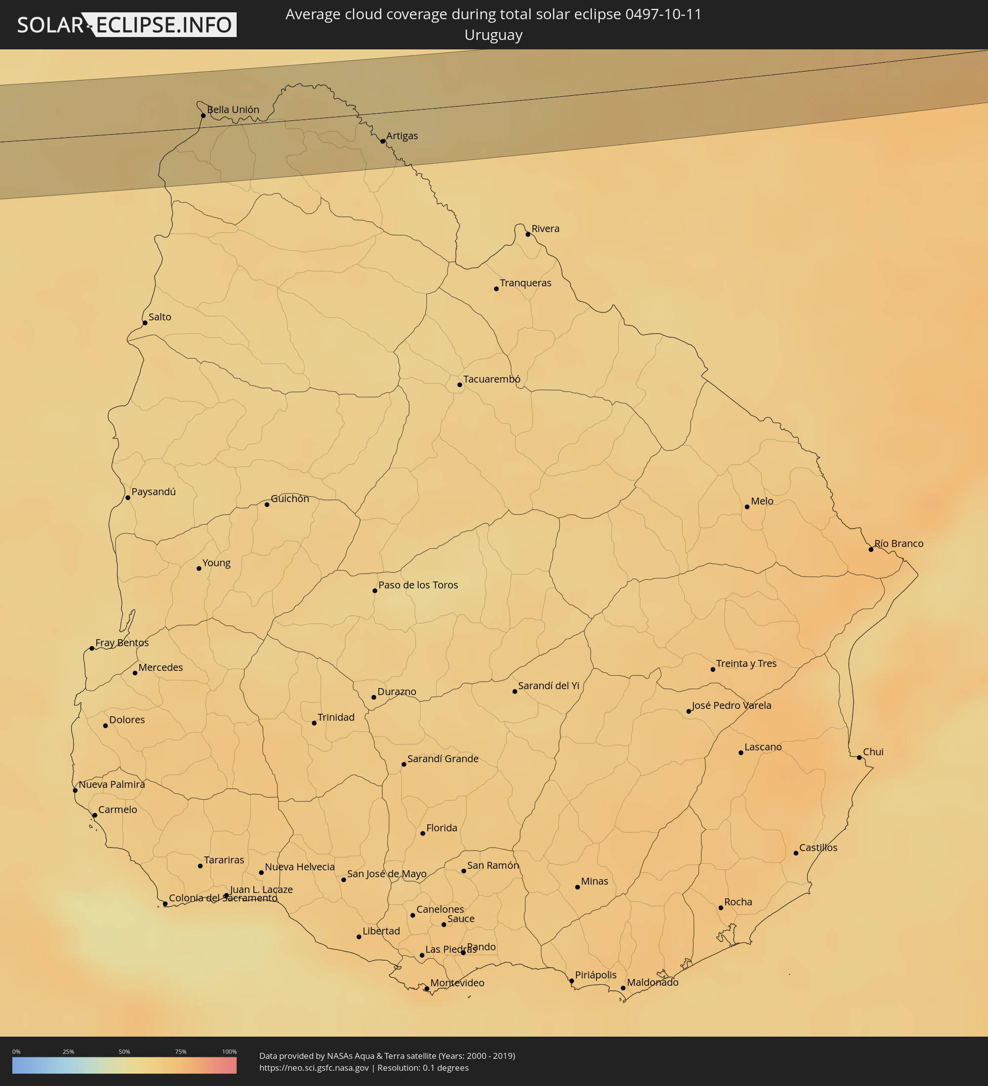 Uruguay
Cities inside the path of the eclipse
The following table shows all locations with a population of more than 5,000 inside the eclipse path. Cities which have more than 100,000 inhabitants are marked bold. A click at the locations opens a detailed map.
| City | Type | Eclipse duration | Local time of max. eclipse | Distance to central line | Ø Cloud coverage |
|
Ovalle, Coquimbo
|
total | - | 16:23:42 UTC-04:42 | 21 km | 33% |
|
Monte Patria, Coquimbo
|
total | - | 16:23:52 UTC-04:42 | 30 km | 26% |
|
San José de Jáchal, San Juan Province
|
total | - | 16:51:17 UTC-04:16 | 32 km | 28% |
|
San Agustín de Valle Fértil, San Juan Province
|
total | - | 16:52:04 UTC-04:16 | 8 km | 34% |
|
Chamical, La Rioja Province
|
total | - | 16:52:43 UTC-04:16 | 24 km | 34% |
|
Villa de Soto, Cordoba Province
|
total | - | 16:53:22 UTC-04:16 | 30 km | 40% |
|
Cruz del Eje, Cordoba Province
|
total | - | 16:53:29 UTC-04:16 | 16 km | 42% |
|
Capilla del Monte, Cordoba Province
|
total | - | 16:53:36 UTC-04:16 | 31 km | 46% |
|
Deán Funes, Cordoba Province
|
total | - | 16:53:43 UTC-04:16 | 18 km | 43% |
|
Villa del Totoral, Cordoba Province
|
total | - | 16:53:59 UTC-04:16 | 27 km | 51% |
|
Morteros, Cordoba Province
|
total | - | 16:54:44 UTC-04:16 | 20 km | 59% |
|
San Cristóbal, Santa Fe Province
|
total | - | 16:55:04 UTC-04:16 | 22 km | 58% |
|
San Justo, Santa Fe Province
|
total | - | 16:55:15 UTC-04:16 | 34 km | 59% |
|
San Javier, Santa Fe Province
|
total | - | 16:55:30 UTC-04:16 | 14 km | 55% |
|
La Paz, Entre Ríos Province
|
total | - | 16:55:34 UTC-04:16 | 34 km | 57% |
|
San José de Feliciano, Entre Ríos Province
|
total | - | 16:55:54 UTC-04:16 | 1 km | 60% |
|
Mocoretá, Corrientes Province
|
total | - | 16:56:06 UTC-04:16 | 30 km | 61% |
|
Monte Caseros, Corrientes Province
|
total | - | 16:56:14 UTC-04:16 | 8 km | 61% |
|
Bella Unión, Artigas
|
total | - | 17:28:11 UTC-03:44 | 7 km | 61% |
|
Artigas, Artigas
|
total | - | 17:28:27 UTC-03:44 | 18 km | 60% |
|
Quaraí, Rio Grande do Sul
|
total | - | 18:06:50 UTC-03:06 | 16 km | 60% |
|
Rosário do Sul, Rio Grande do Sul
|
total | - | 18:07:11 UTC-03:06 | 16 km | 67% |
|
Cacequi, Rio Grande do Sul
|
total | - | 18:07:15 UTC-03:06 | 25 km | 64% |
|
São Gabriel, Rio Grande do Sul
|
total | - | 18:07:16 UTC-03:06 | 30 km | 66% |
|
São Sepé, Rio Grande do Sul
|
total | - | 18:07:25 UTC-03:06 | 19 km | 69% |
|
Cachoeira do Sul, Rio Grande do Sul
|
total | - | 18:07:32 UTC-03:06 | 13 km | 74% |
|
Candelária, Rio Grande do Sul
|
total | - | 18:07:36 UTC-03:06 | 27 km | 70% |
|
Santa Cruz do Sul, Rio Grande do Sul
|
total | - | 18:07:38 UTC-03:06 | 17 km | 73% |
|
Rio Pardo, Rio Grande do Sul
|
total | - | 18:07:36 UTC-03:06 | 13 km | 70% |
|
Venâncio Aires, Rio Grande do Sul
|
total | - | 18:07:41 UTC-03:06 | 27 km | 72% |
|
Taquari, Rio Grande do Sul
|
total | - | 18:07:41 UTC-03:06 | 2 km | 71% |
|
Arroio dos Ratos, Rio Grande do Sul
|
total | - | 18:07:39 UTC-03:06 | 31 km | 72% |
|
São Jerônimo, Rio Grande do Sul
|
total | - | 18:07:40 UTC-03:06 | 18 km | 72% |
|
Triunfo, Rio Grande do Sul
|
total | - | 18:07:41 UTC-03:06 | 16 km | 71% |
|
Charqueadas, Rio Grande do Sul
|
total | - | 18:07:41 UTC-03:06 | 19 km | 73% |
|
Montenegro, Rio Grande do Sul
|
total | - | 18:07:44 UTC-03:06 | 9 km | 71% |
|
São Sebastião do Caí, Rio Grande do Sul
|
total | - | 18:07:46 UTC-03:06 | 19 km | 74% |
|
Portão, Rio Grande do Sul
|
total | - | 18:07:45 UTC-03:06 | 5 km | 74% |
|
Canoas, Rio Grande do Sul
|
total | - | 18:07:44 UTC-03:06 | 20 km | 76% |
|
Esteio, Rio Grande do Sul
|
total | - | 18:07:44 UTC-03:06 | 14 km | 76% |
|
Estância Velha, Rio Grande do Sul
|
total | - | 18:07:46 UTC-03:06 | 10 km | 75% |
|
Ivoti, Rio Grande do Sul
|
total | - | 18:07:47 UTC-03:06 | 16 km | 75% |
|
Sapucaia, Rio Grande do Sul
|
total | - | 18:07:45 UTC-03:06 | 11 km | 76% |
|
São Leopoldo, Rio Grande do Sul
|
total | - | 18:07:45 UTC-03:06 | 3 km | 76% |
|
Novo Hamburgo, Rio Grande do Sul
|
total | - | 18:07:46 UTC-03:06 | 6 km | 75% |
|
Cachoeirinha, Rio Grande do Sul
|
total | - | 18:07:44 UTC-03:06 | 25 km | 76% |
|
Sapiranga, Rio Grande do Sul
|
total | - | 18:07:47 UTC-03:06 | 9 km | 76% |
|
Gravataí, Rio Grande do Sul
|
total | - | 18:07:44 UTC-03:06 | 25 km | 76% |
|
Parobé, Rio Grande do Sul
|
total | - | 18:07:48 UTC-03:06 | 8 km | 75% |
|
Igrejinha, Rio Grande do Sul
|
total | - | 18:07:49 UTC-03:06 | 13 km | 75% |
|
Taquara, Rio Grande do Sul
|
total | - | 18:07:48 UTC-03:06 | 4 km | 75% |
|
Três Coroas, Rio Grande do Sul
|
total | - | 18:07:49 UTC-03:06 | 19 km | 75% |
|
São Francisco de Paula, Rio Grande do Sul
|
total | - | 18:07:51 UTC-03:06 | 24 km | 76% |
|
Rolante, Rio Grande do Sul
|
total | - | 18:07:49 UTC-03:06 | 2 km | 75% |
|
Osório, Rio Grande do Sul
|
total | - | 18:07:48 UTC-03:06 | 28 km | 74% |
|
Capão da Canoa, Rio Grande do Sul
|
total | - | 18:07:50 UTC-03:06 | 16 km | 73% |
|
Torres, Rio Grande do Sul
|
total | - | 18:07:55 UTC-03:06 | 25 km | 74% |