Totale Sonnenfinsternis vom 17.11.0765
| Wochentag: | Mittwoch |
| Maximale Dauer der Verfinsterung: | 03m49s |
| Maximale Breite des Finsternispfades: | 145 km |
| Saroszyklus: | 103 |
| Bedeckungsgrad: | 100% |
| Magnitude: | 1.0389 |
| Gamma: | 0.443 |
Wo kann man die Sonnenfinsternis vom 17.11.0765 sehen?
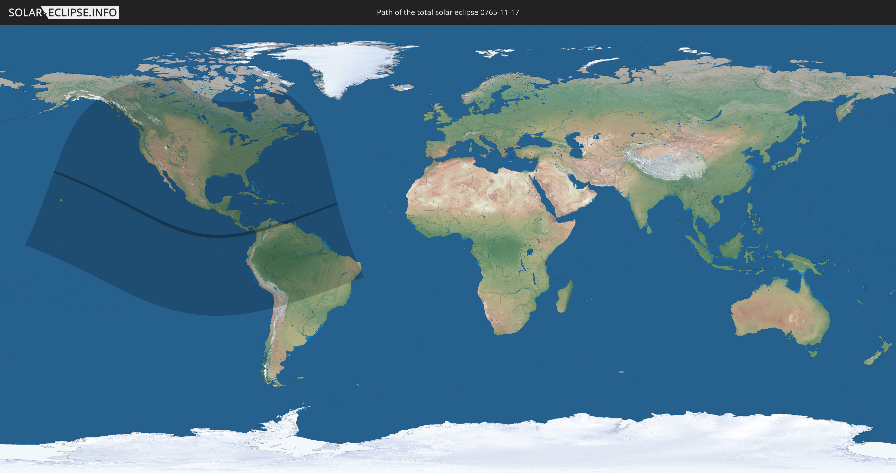
Die Sonnenfinsternis am 17.11.0765 kann man in 53 Ländern als partielle Sonnenfinsternis beobachten.
Der Finsternispfad verläuft durch 7 Länder. Nur in diesen Ländern ist sie als totale Sonnenfinsternis zu sehen.
In den folgenden Ländern ist die Sonnenfinsternis total zu sehen
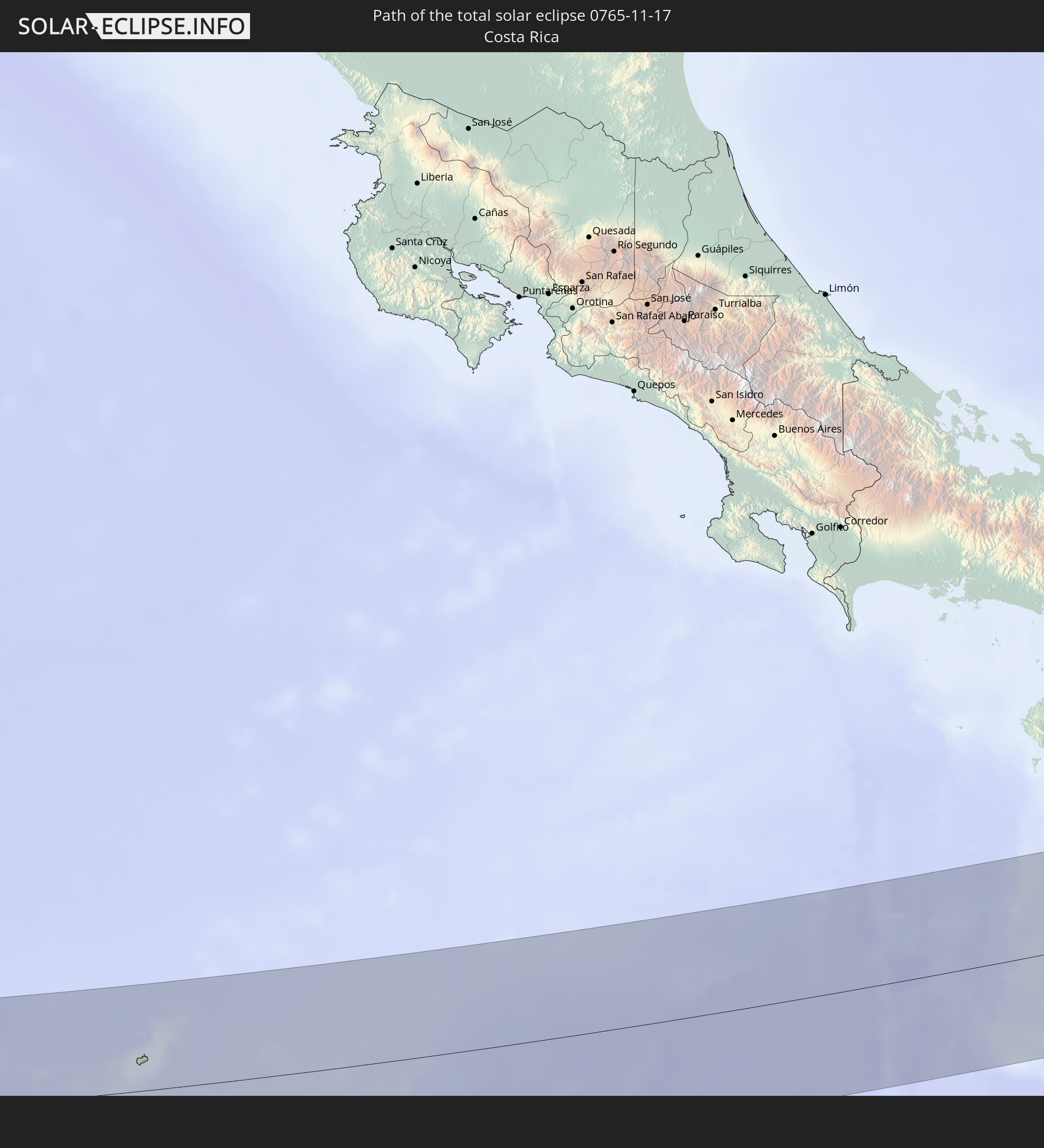 Costa Rica
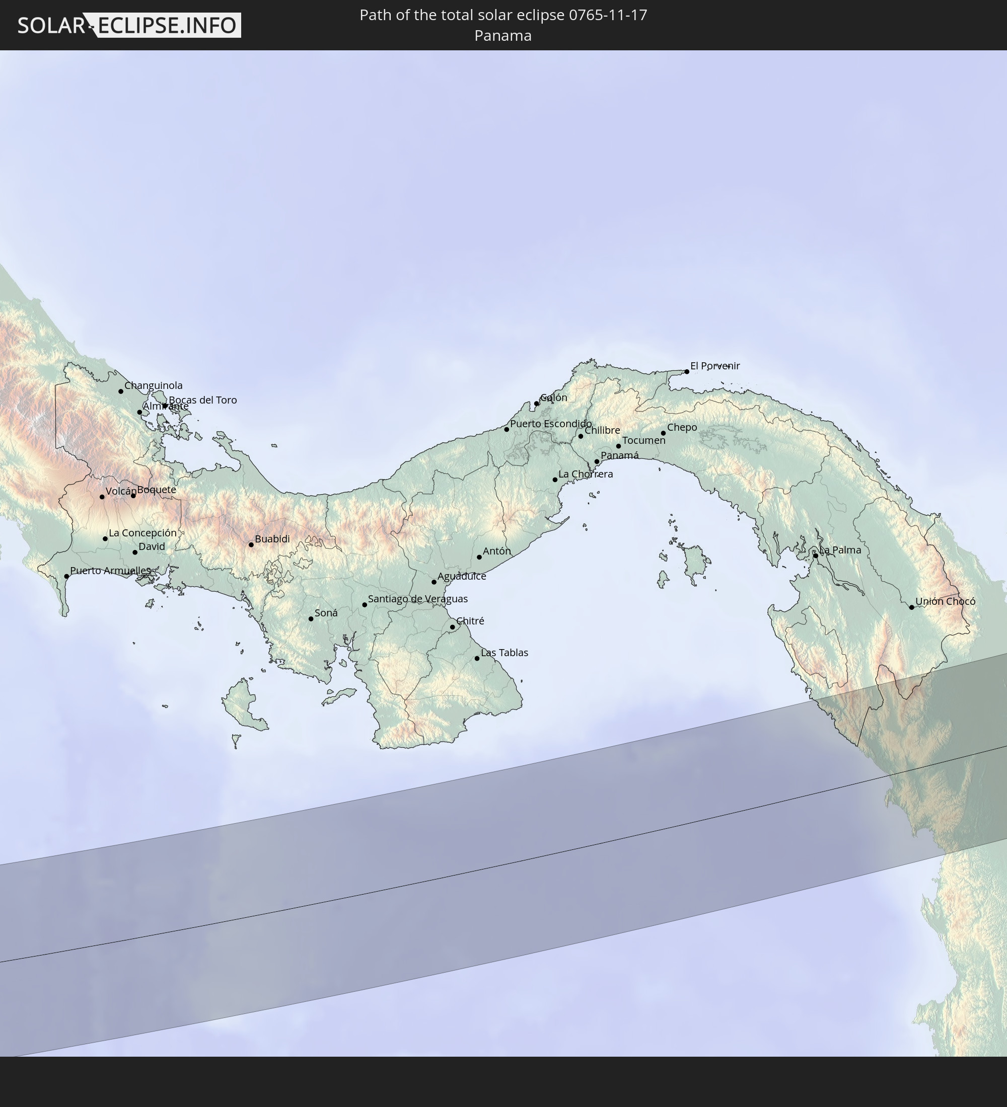 Panama
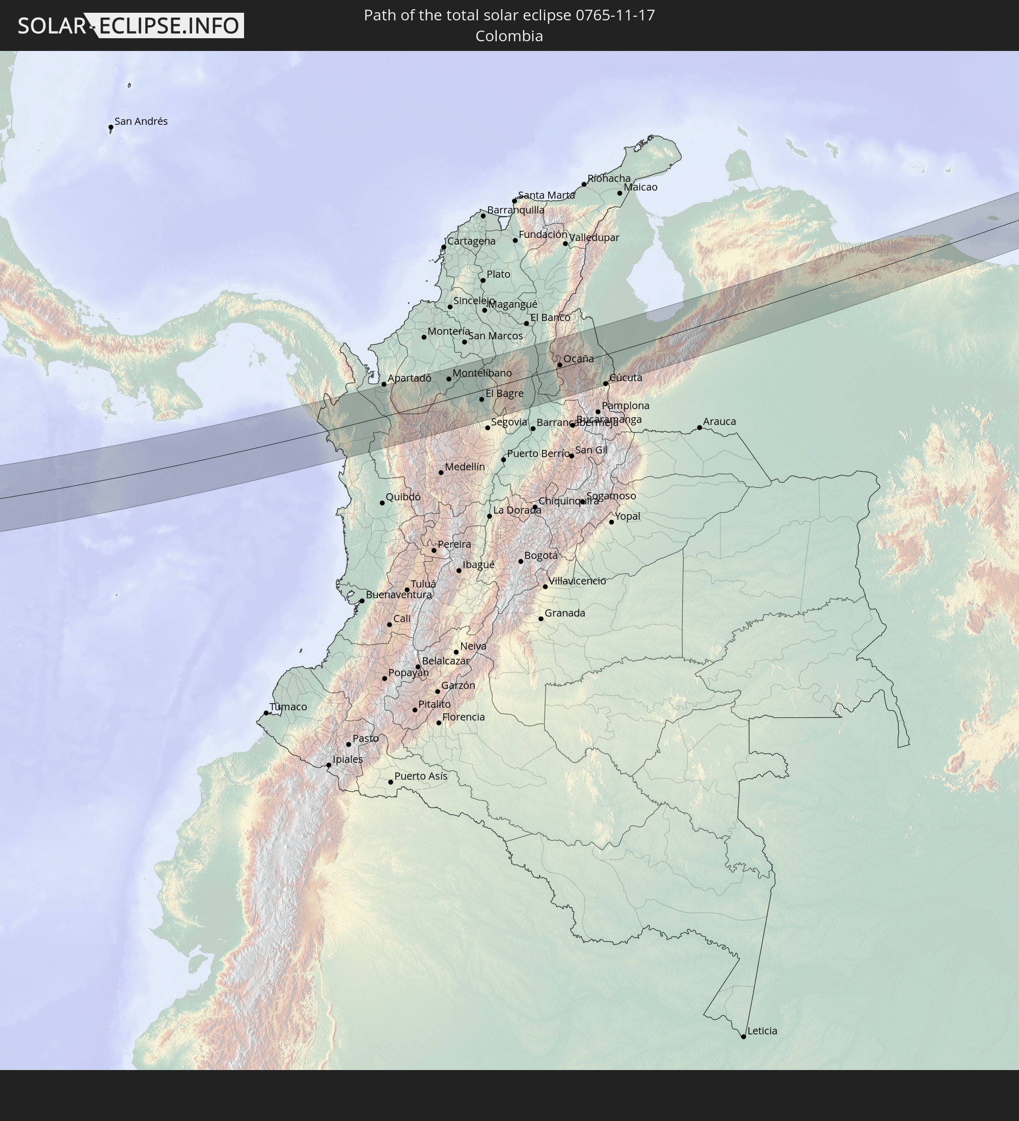 Kolumbien
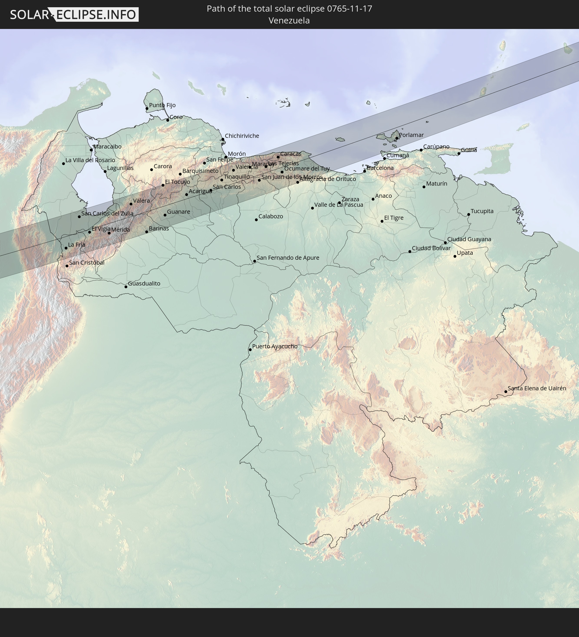 Venezuela
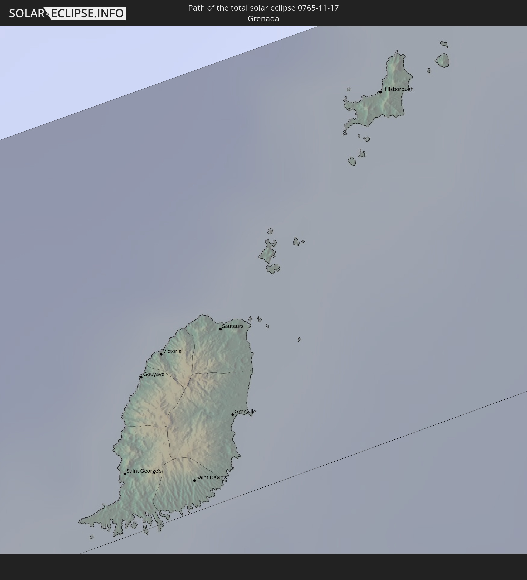 Grenada
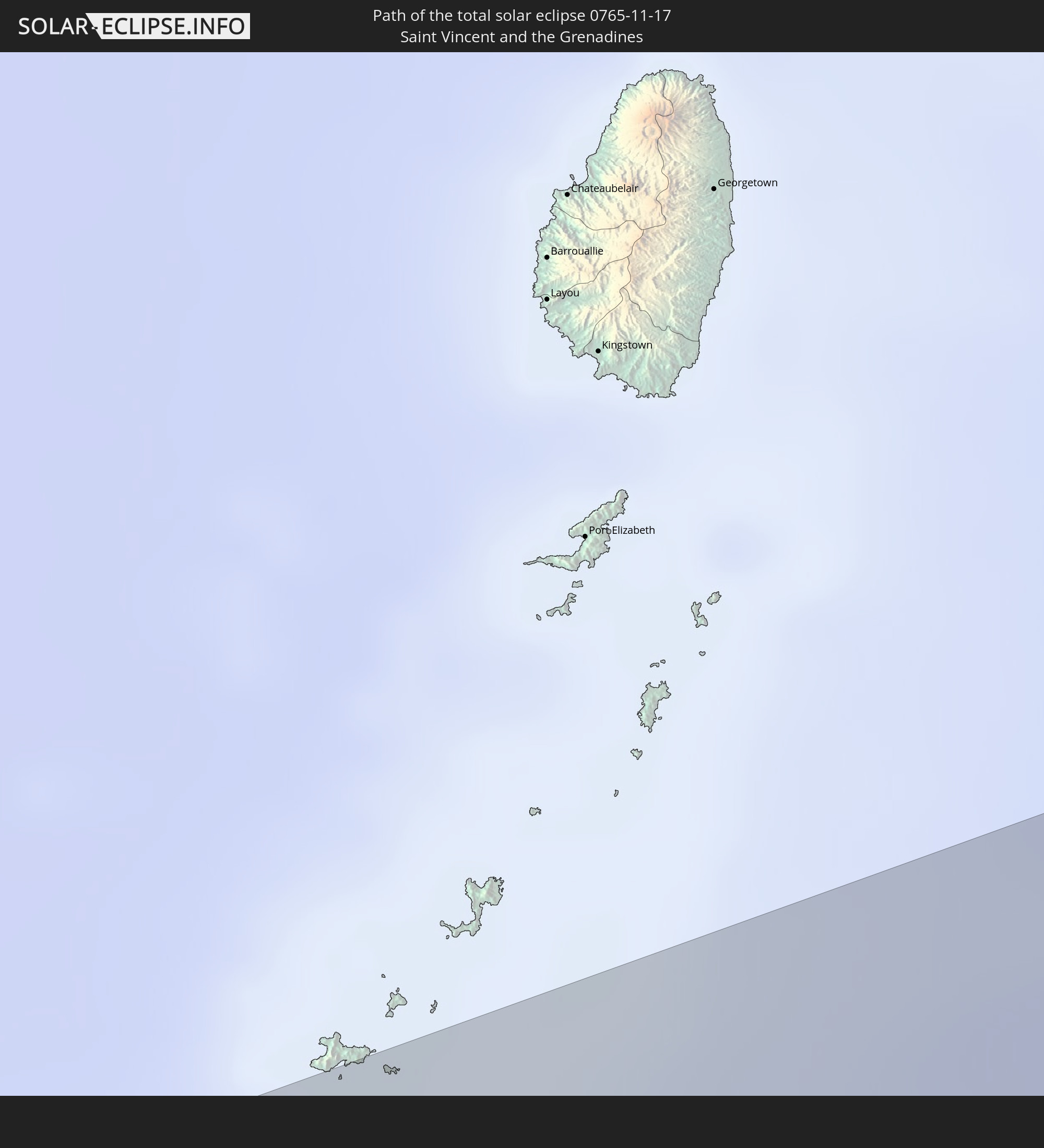 St. Vincent und die Grenadinen
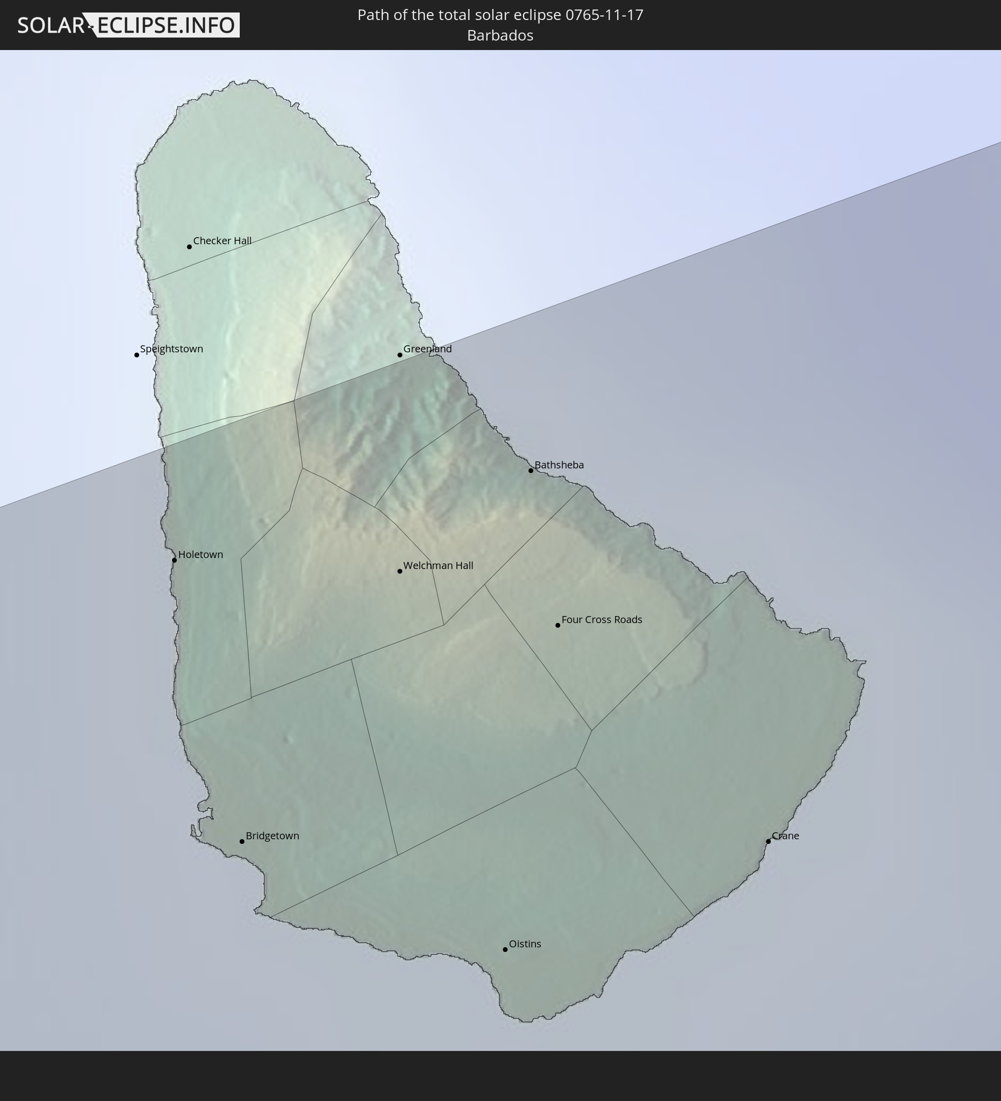 Barbados
In den folgenden Ländern ist die Sonnenfinsternis partiell zu sehen
 Vereinigte Staaten
 United States Minor Outlying Islands
 Kiribati
 Französisch-Polynesien
 Kanada
 Mexiko
 Chile
Chile
 Grönland
 Guatemala
 Ecuador
 El Salvador
 Honduras
 Belize
 Nicaragua
 Costa Rica
 Kuba
Kuba
 Panama
 Kolumbien
 Kaimaninseln
 Peru
Peru
 Bahamas
 Jamaika
 Haiti
Haiti
 Brasilien
 Argentinien
 Venezuela
 Turks- und Caicosinseln
 Dominikanische Republik
 Aruba
Aruba
 Bolivien
 Puerto Rico
 Amerikanische Jungferninseln
 Bermuda
 Britische Jungferninseln
 Anguilla
 Saint-Martin
 Saint-Barthélemy
 St. Kitts und Nevis
 Paraguay
 Antigua und Barbuda
 Montserrat
 Trinidad und Tobago
 Guadeloupe
 Grenada
 Dominica
 St. Vincent und die Grenadinen
 Guyana
 Martinique
 St. Lucia
 Barbados
 Suriname
 Saint-Pierre und Miquelon
 Französisch-Guayana
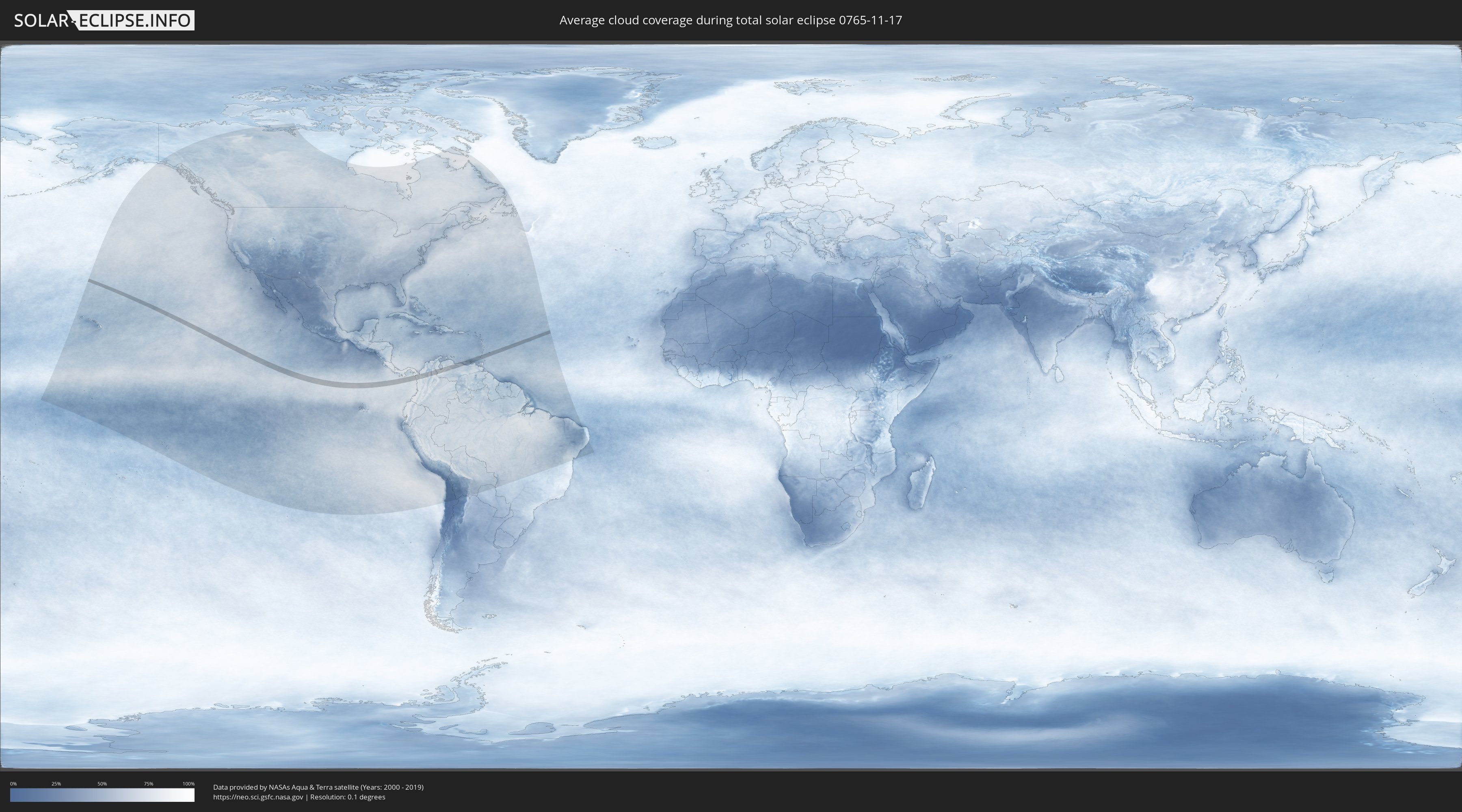
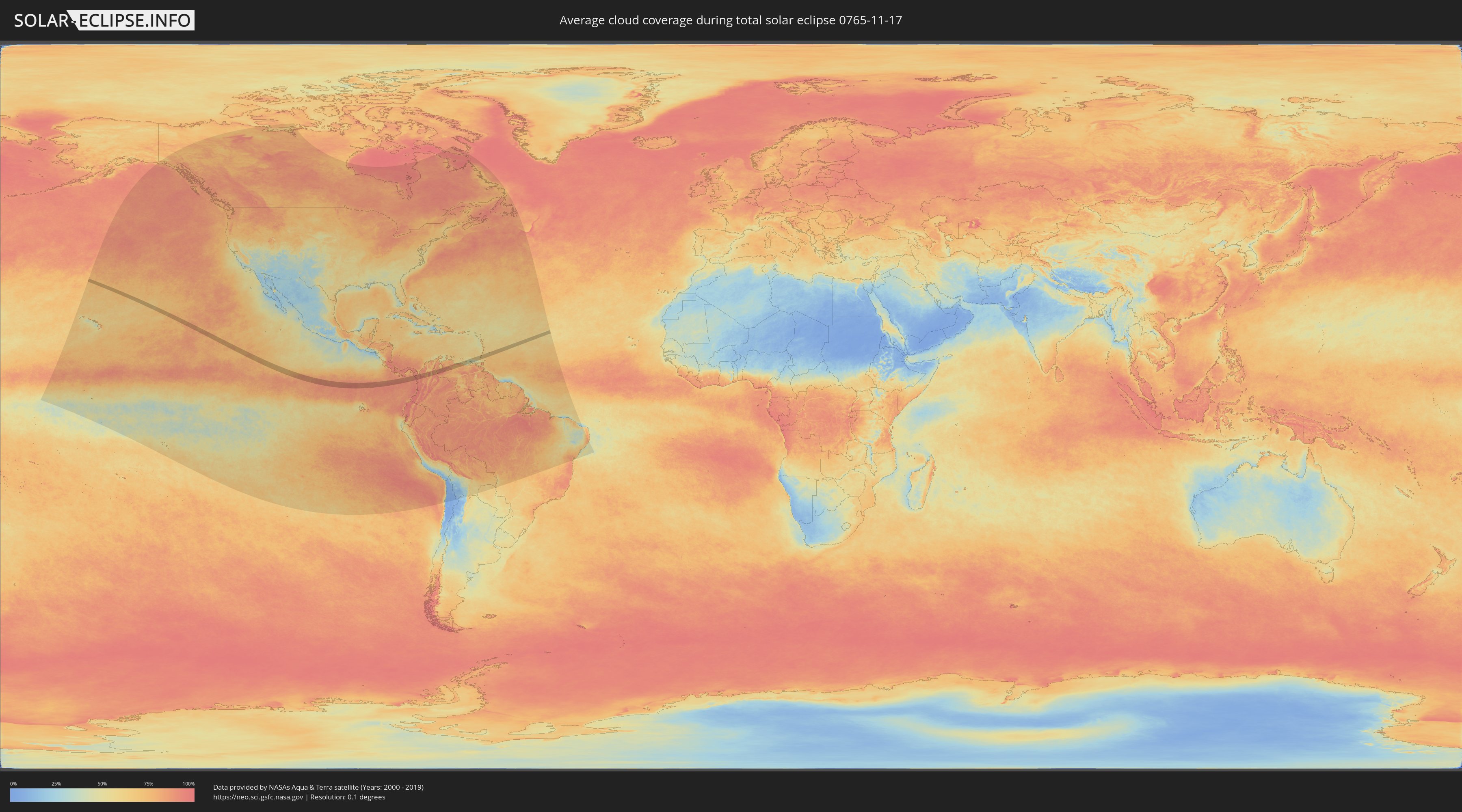
Wie wird das Wetter während der totalen Sonnenfinsternis am 17.11.0765?
Wo ist der beste Ort, um die totale Sonnenfinsternis vom 17.11.0765 zu beobachten?
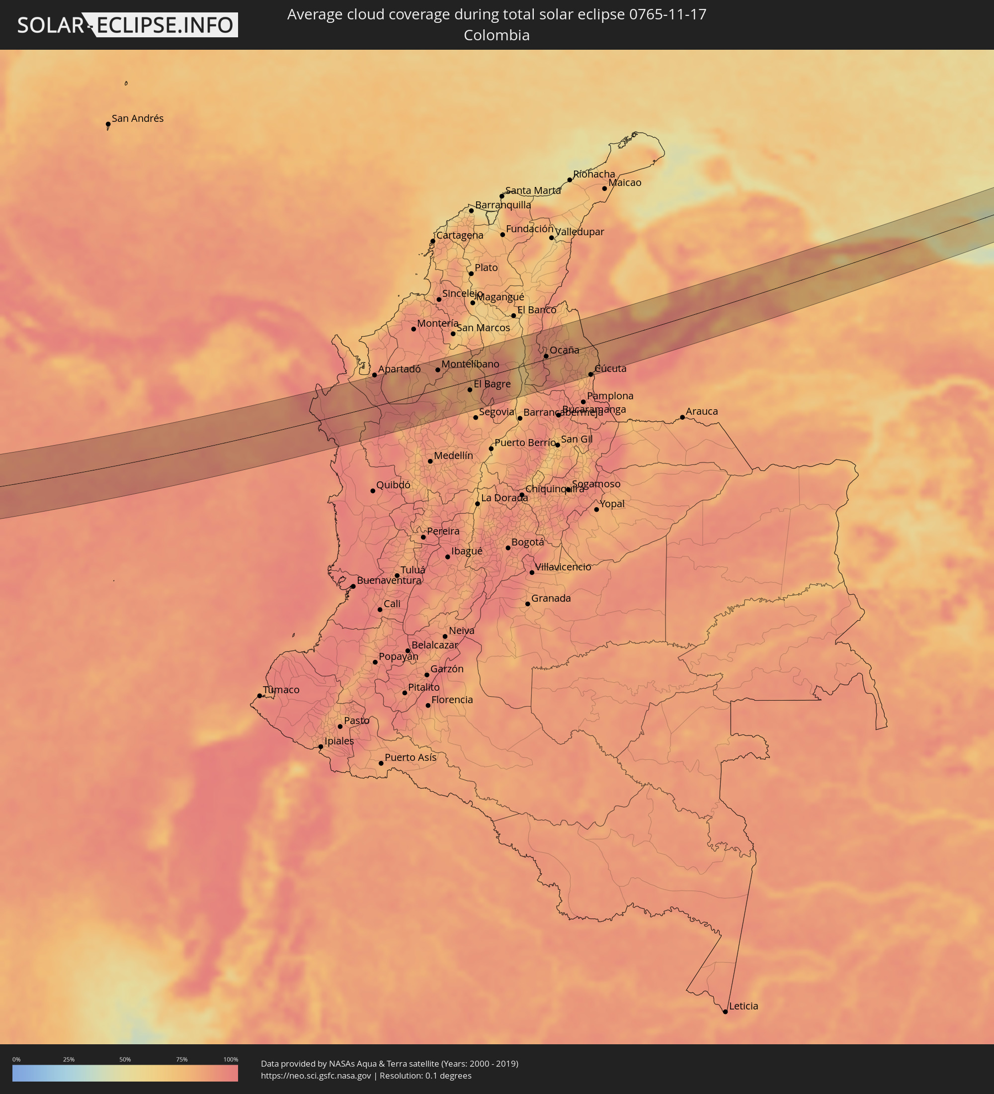
Die folgenden Karten zeigen die durchschnittliche Bewölkung für den Tag, an dem die totale Sonnenfinsternis
stattfindet. Mit Hilfe der Karten lässt sich der Ort entlang des Finsternispfades eingrenzen,
der die besten Aussichen auf einen klaren wolkenfreien Himmel bietet.
Trotzdem muss man immer lokale Gegenenheiten beachten und sollte sich genau über das Wetter an seinem
gewählten Beobachtungsort informieren.
Die Daten stammen von den beiden NASA-Satelliten
AQUA und TERRA
und wurden über einen Zeitraum von 19 Jahren (2000 - 2019) gemittelt.
Detaillierte Länderkarten
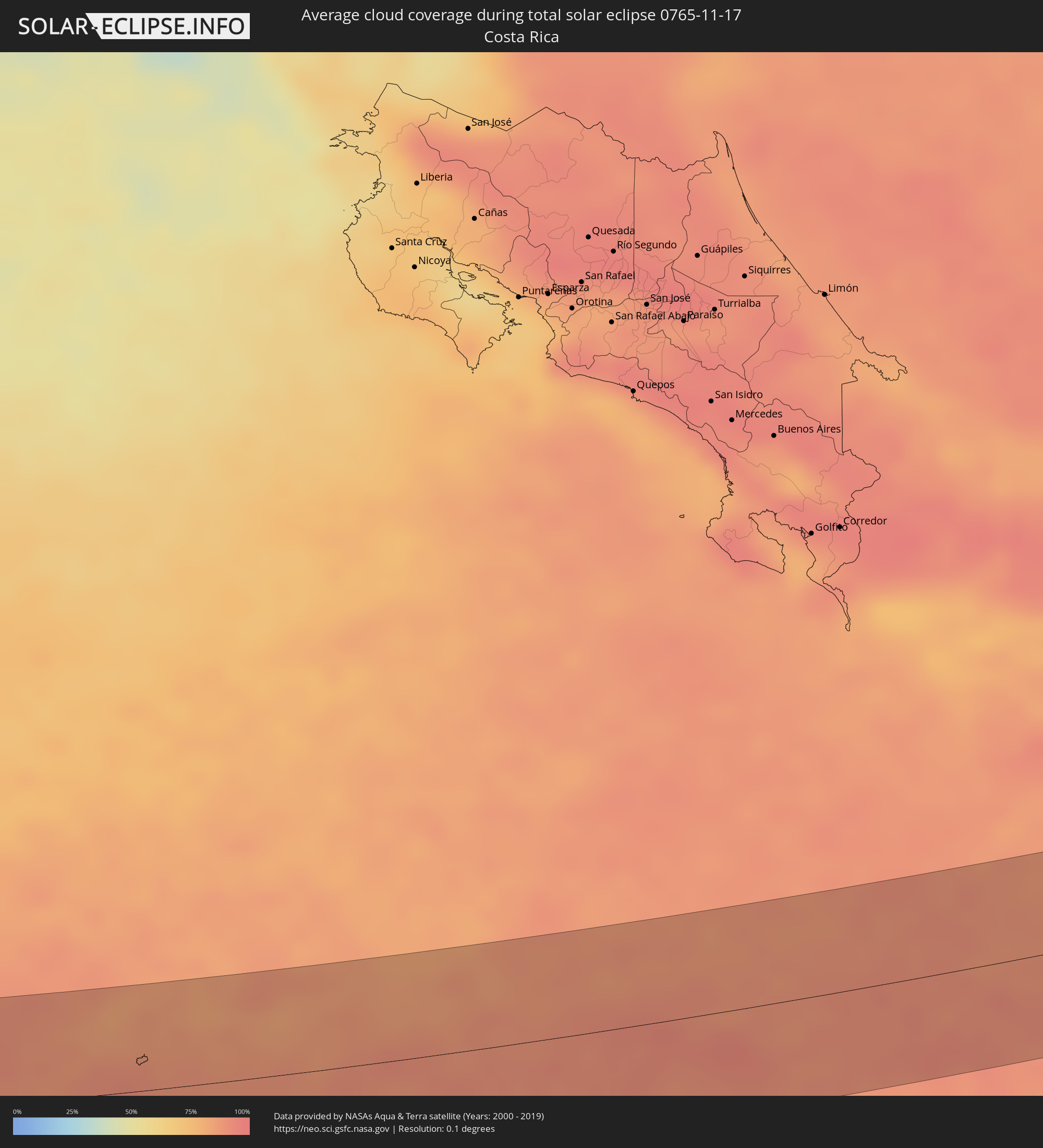 Costa Rica
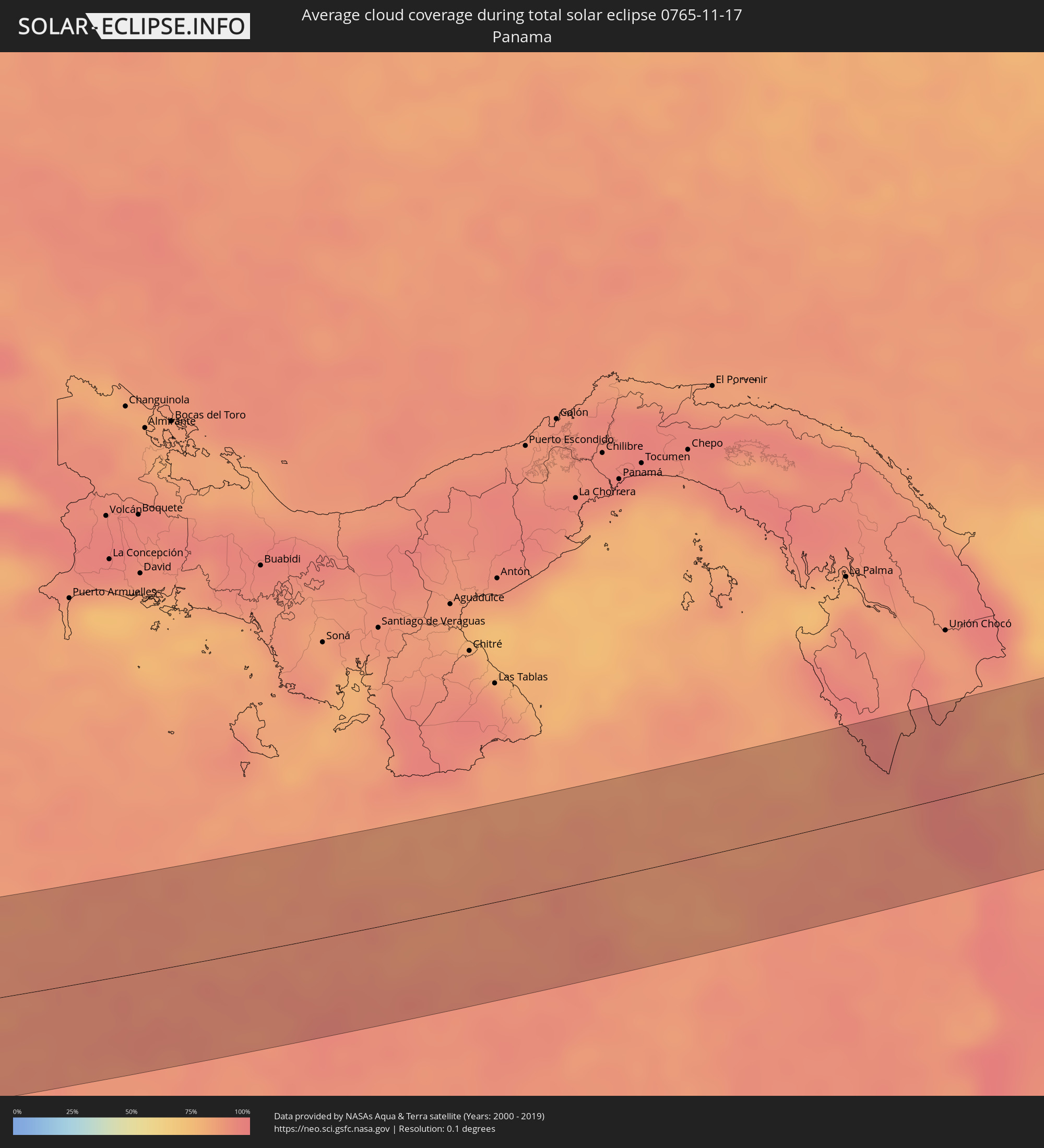 Panama
 Kolumbien
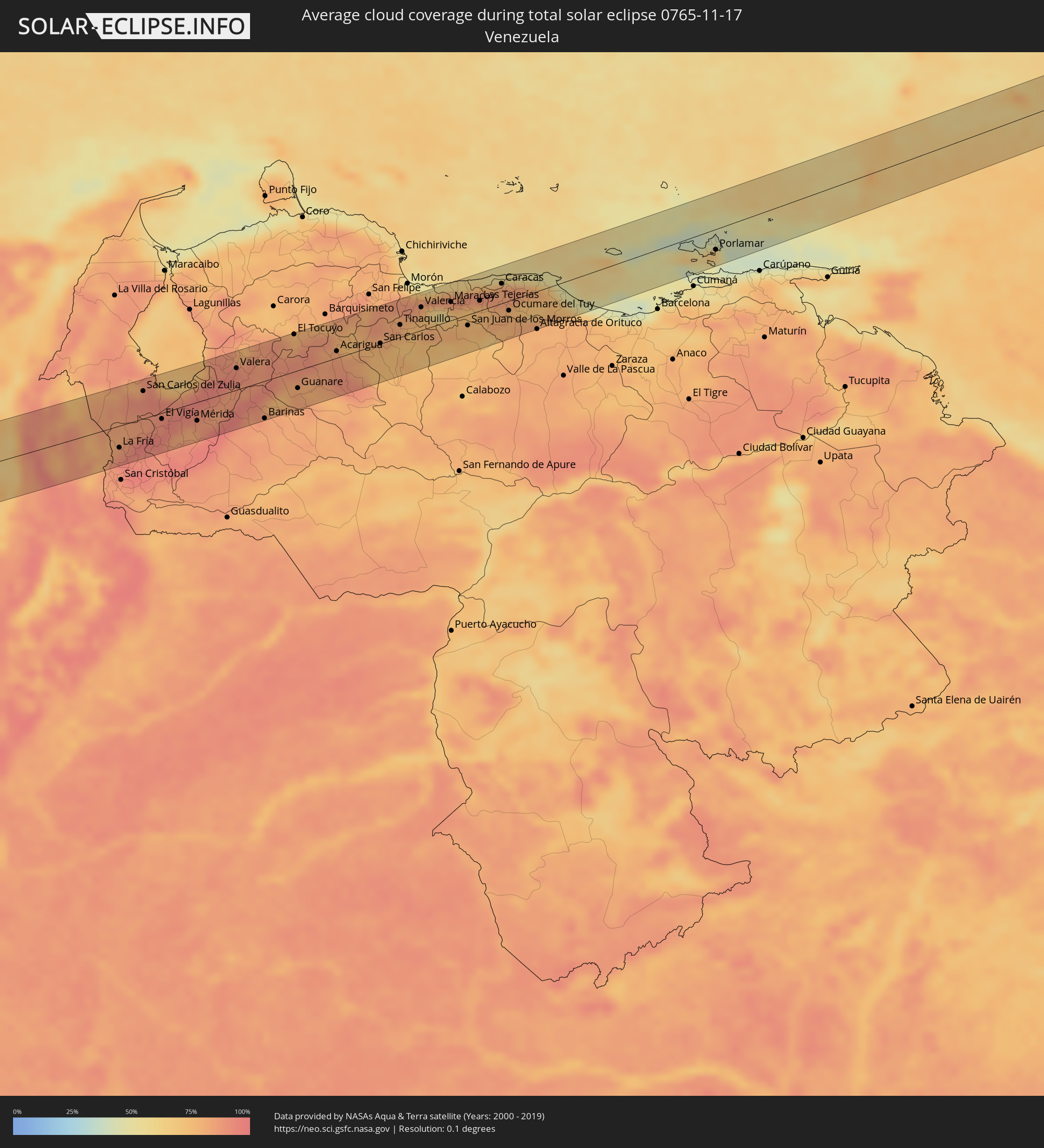 Venezuela
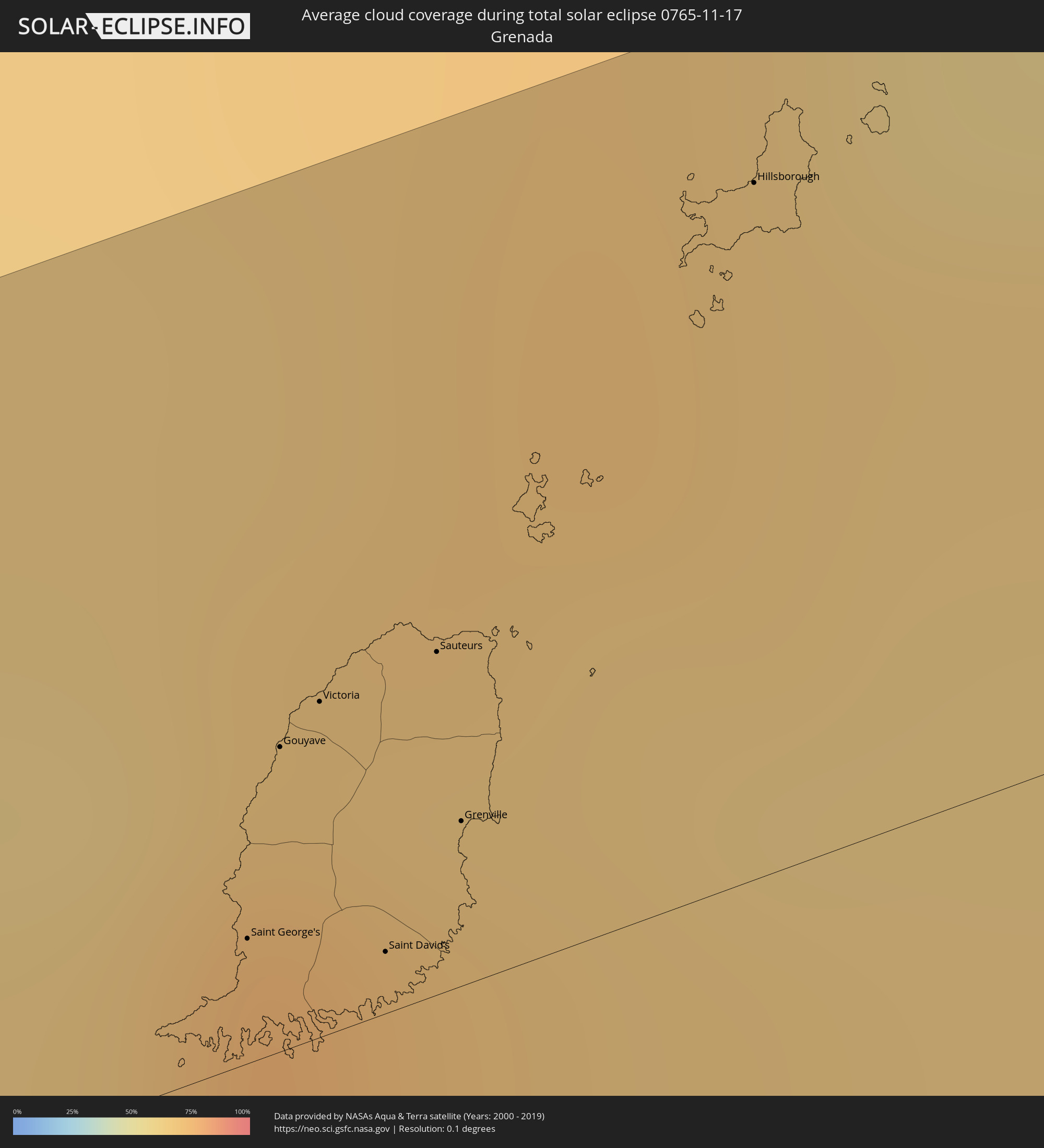 Grenada
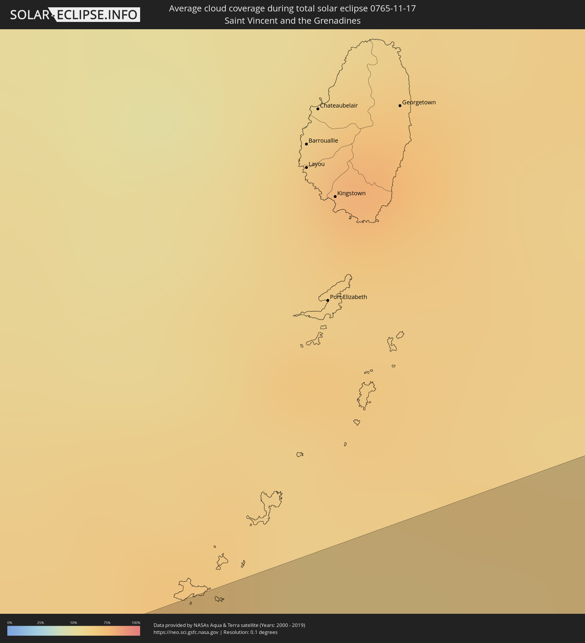 St. Vincent und die Grenadinen
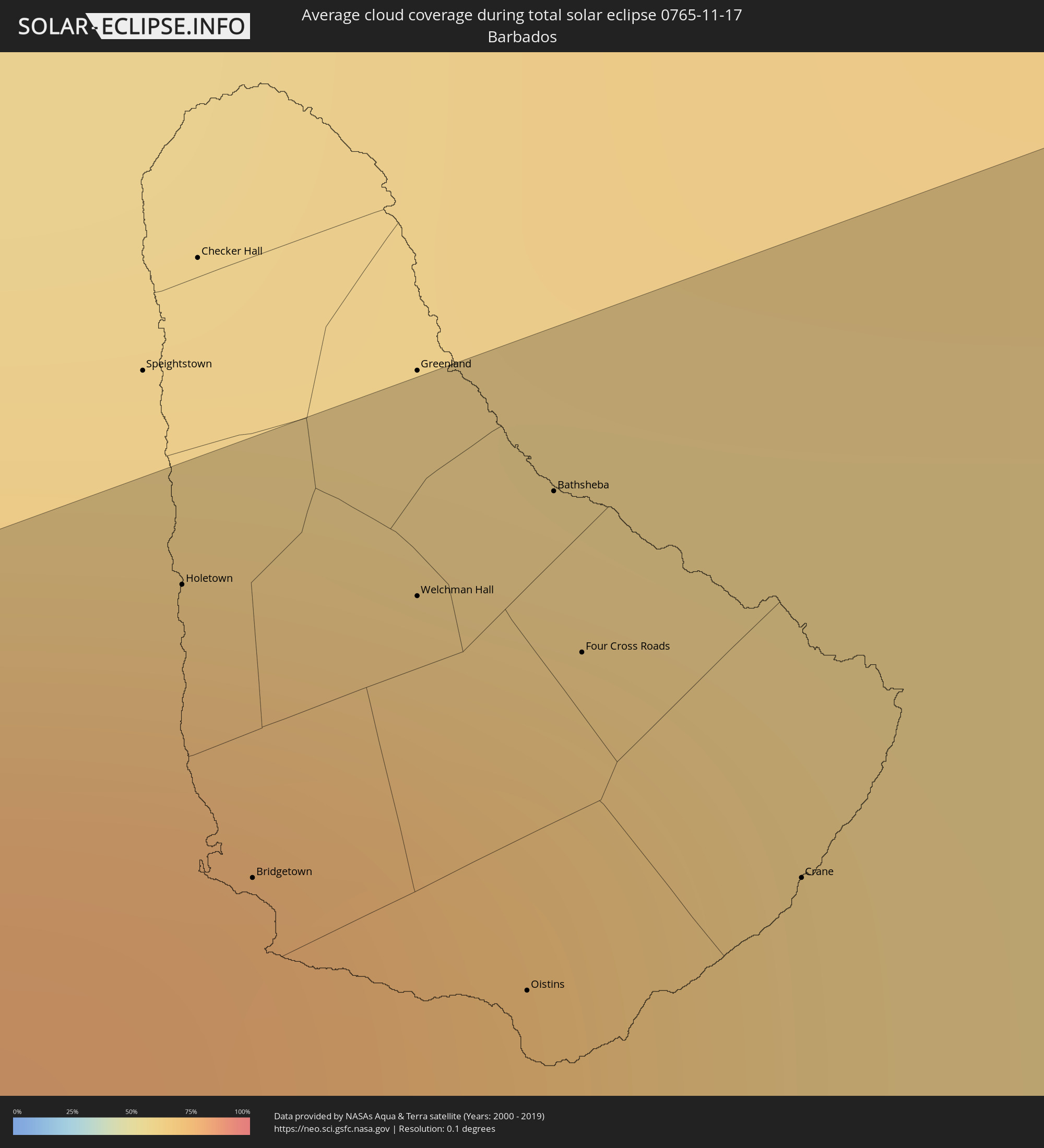 Barbados
Orte im Finsternispfad
Die nachfolgene Tabelle zeigt Städte und Orte mit mehr als 5.000 Einwohnern, die sich im Finsternispfad befinden. Städte mit mehr als 100.000 Einwohnern sind dick gekennzeichnet. Mit einem Klick auf den Ort öffnet sich eine Detailkarte die die Lage des jeweiligen Ortes zusammen mit dem Verlauf der zentralen Finsternis präsentiert.
| Ort | Typ | Dauer der Verfinsterung | Ortszeit bei maximaler Verfinsterung | Entfernung zur Zentrallinie | Ø Bewölkung |
|
Riosucio, Chocó
|
total | - | 14:55:06 UTC-04:56 | 29 km | 82% |
|
Chigorodó, Antioquia
|
total | - | 14:55:53 UTC-04:56 | 41 km | 91% |
|
Carepa, Antioquia
|
total | - | 14:55:55 UTC-04:56 | 50 km | 91% |
|
Dabeiba, Antioquia
|
total | - | 14:56:51 UTC-04:56 | 43 km | 92% |
|
Ituango, Antioquia
|
total | - | 14:57:45 UTC-04:56 | 38 km | 86% |
|
Montelíbano, Córdoba
|
total | - | 14:58:10 UTC-04:56 | 39 km | 88% |
|
Caucasia, Antioquia
|
total | - | 14:58:34 UTC-04:56 | 33 km | 77% |
|
Pueblo Nuevo, Córdoba
|
total | - | 14:58:55 UTC-04:56 | 53 km | 87% |
|
Zaragoza, Antioquia
|
total | - | 14:59:18 UTC-04:56 | 30 km | 78% |
|
El Bagre, Antioquia
|
total | - | 14:59:22 UTC-04:56 | 20 km | 75% |
|
Nechí, Antioquia
|
total | - | 14:59:18 UTC-04:56 | 32 km | 75% |
|
San Carlos, Antioquia
|
total | - | 14:59:23 UTC-04:56 | 1 km | 77% |
|
Montecristo, Bolívar
|
total | - | 14:59:46 UTC-04:56 | 45 km | 82% |
|
Santa Rosa del Sur, Bolívar
|
total | - | 15:00:36 UTC-04:56 | 3 km | 88% |
|
Simití, Bolívar
|
total | - | 15:00:47 UTC-04:56 | 7 km | 63% |
|
Arenal, Bolívar
|
total | - | 15:00:39 UTC-04:56 | 46 km | 68% |
|
Morales, Bolívar
|
total | - | 15:00:50 UTC-04:56 | 24 km | 66% |
|
Río Viejo, Bolívar
|
total | - | 15:00:47 UTC-04:56 | 57 km | 68% |
|
La Gloria, Cesar
|
total | - | 15:00:50 UTC-04:56 | 59 km | 68% |
|
Gamarra, Cesar
|
total | - | 15:01:02 UTC-04:56 | 26 km | 77% |
|
Aguachica, Cesar
|
total | - | 15:01:15 UTC-04:56 | 20 km | 88% |
|
San Martín, Cesar
|
total | - | 15:01:31 UTC-04:56 | 16 km | 86% |
|
El Carmen, Norte de Santander
|
total | - | 15:01:29 UTC-04:56 | 37 km | 88% |
|
San Alberto, Cesar
|
total | - | 15:01:47 UTC-04:56 | 45 km | 87% |
|
Río de Oro, Cesar
|
total | - | 15:01:39 UTC-04:56 | 11 km | 90% |
|
González, Cesar
|
total | - | 15:01:38 UTC-04:56 | 22 km | 86% |
|
Ocaña, Norte de Santander
|
total | - | 15:01:43 UTC-04:56 | 5 km | 94% |
|
Ábrego, Norte de Santander
|
total | - | 15:01:59 UTC-04:56 | 16 km | 81% |
|
Sardinata, Norte de Santander
|
total | - | 15:02:41 UTC-04:56 | 29 km | 85% |
|
Tibú, Norte de Santander
|
total | - | 15:02:37 UTC-04:56 | 28 km | 78% |
|
El Zulia, Norte de Santander
|
total | - | 15:03:02 UTC-04:56 | 51 km | 79% |
|
Cúcuta, Norte de Santander
|
total | - | 15:03:12 UTC-04:56 | 59 km | 85% |
|
Puerto Santander, Norte de Santander
|
total | - | 15:03:14 UTC-04:56 | 12 km | 79% |
|
San Juan de Colón, Táchira
|
total | - | 15:32:10 UTC-04:27 | 52 km | 88% |
|
San Carlos del Zulia, Zulia
|
total | - | 15:32:26 UTC-04:27 | 41 km | 92% |
|
El Vigía, Mérida
|
total | - | 15:32:58 UTC-04:27 | 9 km | 89% |
|
Ejido, Mérida
|
total | - | 15:33:37 UTC-04:27 | 29 km | 81% |
|
Mérida, Mérida
|
total | - | 15:33:44 UTC-04:27 | 28 km | 84% |
|
Mucumpiz, Mérida
|
total | - | 15:33:49 UTC-04:27 | 47 km | 94% |
|
Valera, Trujillo
|
total | - | 15:34:21 UTC-04:27 | 32 km | 90% |
|
Trujillo, Trujillo
|
total | - | 15:34:35 UTC-04:27 | 31 km | 88% |
|
Barinas, Barinas
|
total | - | 15:35:08 UTC-04:27 | 55 km | 84% |
|
El Tocuyo, Lara
|
total | - | 15:35:23 UTC-04:27 | 55 km | 78% |
|
Guanare, Portuguesa
|
total | - | 15:35:42 UTC-04:27 | 26 km | 83% |
|
Araure, Portuguesa
|
total | - | 15:36:17 UTC-04:27 | 11 km | 85% |
|
Acarigua, Portuguesa
|
total | - | 15:36:19 UTC-04:27 | 10 km | 85% |
|
San Carlos, Cojedes
|
total | - | 15:37:07 UTC-04:27 | 0 km | 77% |
|
Tinaquillo, Cojedes
|
total | - | 15:37:25 UTC-04:27 | 18 km | 79% |
|
Valencia, Carabobo
|
total | - | 15:37:44 UTC-04:27 | 33 km | 75% |
|
Tacarigua, Carabobo
|
total | - | 15:37:52 UTC-04:27 | 22 km | 74% |
|
Guacara, Carabobo
|
total | - | 15:37:53 UTC-04:27 | 36 km | 64% |
|
San Joaquín, Carabobo
|
total | - | 15:37:59 UTC-04:27 | 36 km | 65% |
|
Güigüe, Carabobo
|
total | - | 15:38:03 UTC-04:27 | 17 km | 70% |
|
Mariara, Carabobo
|
total | - | 15:38:04 UTC-04:27 | 38 km | 66% |
|
El Limón, Aragua
|
total | - | 15:38:10 UTC-04:27 | 36 km | 76% |
|
Maracay, Aragua
|
total | - | 15:38:15 UTC-04:27 | 27 km | 64% |
|
Palo Negro, Aragua
|
total | - | 15:38:20 UTC-04:27 | 19 km | 73% |
|
Villa de Cura, Aragua
|
total | - | 15:38:27 UTC-04:27 | 2 km | 77% |
|
Cagua, Aragua
|
total | - | 15:38:26 UTC-04:27 | 17 km | 73% |
|
San Mateo, Aragua
|
total | - | 15:38:28 UTC-04:27 | 19 km | 74% |
|
San Juan de los Morros, Guárico
|
total | - | 15:38:39 UTC-04:27 | 16 km | 76% |
|
La Victoria, Aragua
|
total | - | 15:38:35 UTC-04:27 | 16 km | 74% |
|
Los Teques, Miranda
|
total | - | 15:38:55 UTC-04:27 | 19 km | 79% |
|
Catia La Mar, Vargas
|
total | - | 15:38:50 UTC-04:27 | 46 km | 77% |
|
Carrizal, Miranda
|
total | - | 15:38:59 UTC-04:27 | 18 km | 79% |
|
Maiquetía, Vargas
|
total | - | 15:38:56 UTC-04:27 | 43 km | 77% |
|
San Antonio de Los Altos, Miranda
|
total | - | 15:39:01 UTC-04:27 | 21 km | 85% |
|
Cúa, Miranda
|
total | - | 15:39:10 UTC-04:27 | 6 km | 78% |
|
Caracas, Capital
|
total | - | 15:39:04 UTC-04:27 | 29 km | 82% |
|
Charallave, Miranda
|
total | - | 15:39:11 UTC-04:27 | 2 km | 78% |
|
Chacao, Miranda
|
total | - | 15:39:06 UTC-04:27 | 28 km | 82% |
|
Caraballeda, Vargas
|
total | - | 15:39:04 UTC-04:27 | 41 km | 82% |
|
El Cafetal, Miranda
|
total | - | 15:39:08 UTC-04:27 | 25 km | 84% |
|
Los Dos Caminos, Miranda
|
total | - | 15:39:08 UTC-04:27 | 27 km | 84% |
|
El Hatillo, Miranda
|
total | - | 15:39:10 UTC-04:27 | 20 km | 83% |
|
Caucaguita, Miranda
|
total | - | 15:39:13 UTC-04:27 | 12 km | 83% |
|
La Dolorita, Miranda
|
total | - | 15:39:11 UTC-04:27 | 25 km | 84% |
|
Ocumare del Tuy, Miranda
|
total | - | 15:39:19 UTC-04:27 | 14 km | 79% |
|
Caucagüito, Miranda
|
total | - | 15:39:15 UTC-04:27 | 23 km | 86% |
|
Santa Teresa, Miranda
|
total | - | 15:39:25 UTC-04:27 | 6 km | 76% |
|
Guarenas, Miranda
|
total | - | 15:39:25 UTC-04:27 | 17 km | 83% |
|
Guatire, Miranda
|
total | - | 15:39:29 UTC-04:27 | 15 km | 80% |
|
Porlamar, Nueva Esparta
|
total | - | 15:42:23 UTC-04:27 | 30 km | 63% |
|
Saint George's, Saint George
|
total | - | 16:05:44 UTC-04:06 | 7 km | 73% |
|
Gouyave, Saint John
|
total | - | 16:05:43 UTC-04:06 | 18 km | 75% |
|
Victoria, Saint Mark
|
total | - | 16:05:43 UTC-04:06 | 20 km | 75% |
|
Saint David’s, Saint David
|
total | - | 16:05:49 UTC-04:06 | 4 km | 66% |
|
Sauteurs, Saint Patrick
|
total | - | 16:05:47 UTC-04:06 | 20 km | 70% |
|
Grenville, Saint Andrew
|
total | - | 16:05:50 UTC-04:06 | 10 km | 70% |
|
Hillsborough, Carriacou and Petite Martinique
|
total | - | 16:05:51 UTC-04:06 | 41 km | 70% |
|
Holetown, Saint James
|
total | - | 16:14:45 UTC-03:58 | 46 km | 78% |
|
Bridgetown, Saint Michael
|
total | - | 16:14:49 UTC-03:58 | 37 km | 70% |
|
Welchman Hall, Saint Thomas
|
total | - | 16:14:49 UTC-03:58 | 43 km | 78% |
|
Oistins, Christ Church
|
total | - | 16:14:54 UTC-03:58 | 30 km | 70% |
|
Bathsheba, Saint Joseph
|
total | - | 16:14:50 UTC-03:58 | 45 km | 72% |
|
Four Cross Roads, Saint John
|
total | - | 16:14:52 UTC-03:58 | 40 km | 72% |
|
Crane, Saint Philip
|
total | - | 16:14:57 UTC-03:58 | 30 km | 70% |