Totale Sonnenfinsternis vom 31.08.1551
| Wochentag: | Freitag |
| Maximale Dauer der Verfinsterung: | 02m52s |
| Maximale Breite des Finsternispfades: | 391 km |
| Saroszyklus: | 137 |
| Bedeckungsgrad: | 100% |
| Magnitude: | 1.046 |
| Gamma: | 0.9185 |
Wo kann man die Sonnenfinsternis vom 31.08.1551 sehen?
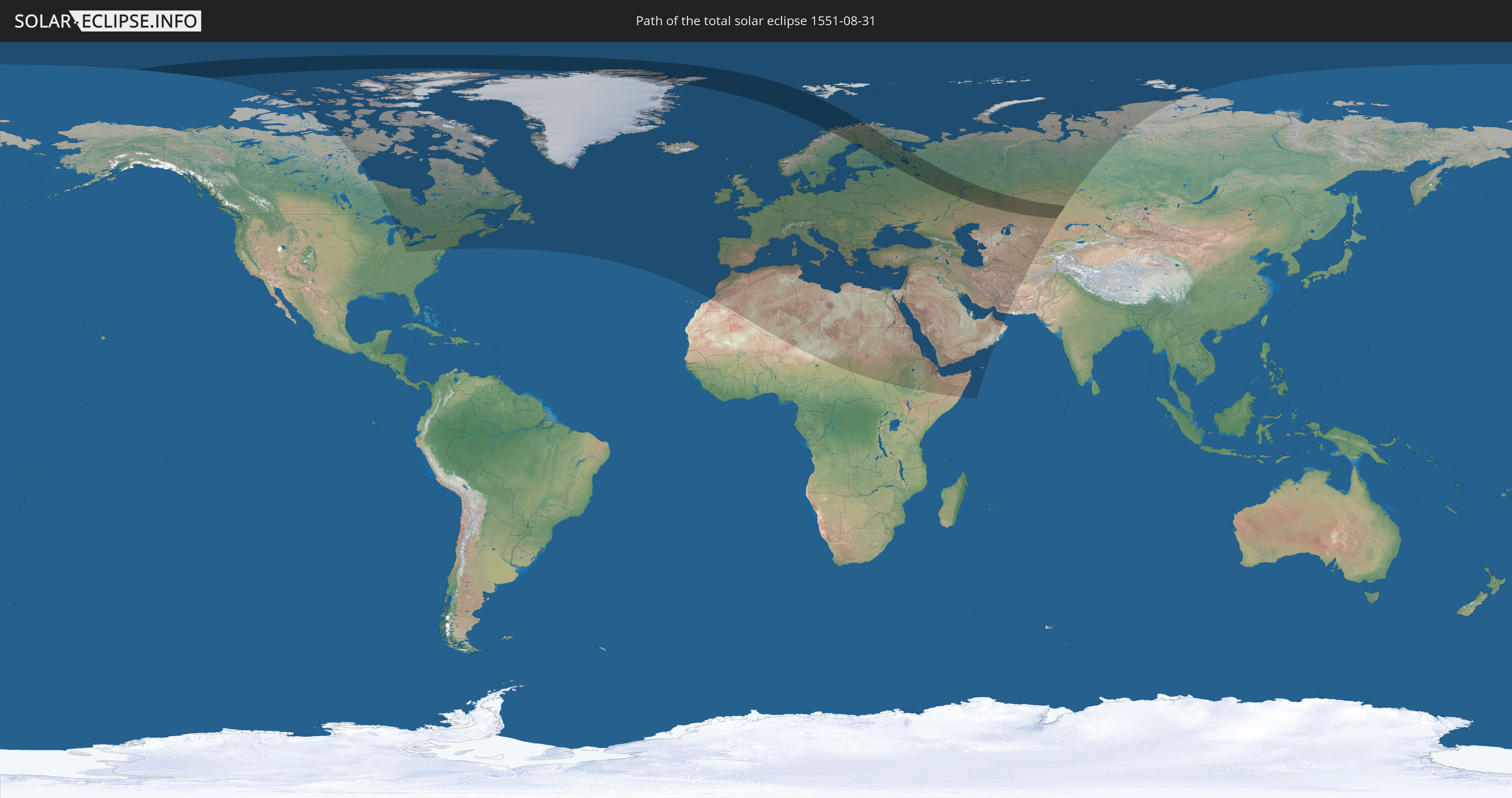
Die Sonnenfinsternis am 31.08.1551 kann man in 91 Ländern als partielle Sonnenfinsternis beobachten.
Der Finsternispfad verläuft durch 7 Länder. Nur in diesen Ländern ist sie als totale Sonnenfinsternis zu sehen.
In den folgenden Ländern ist die Sonnenfinsternis total zu sehen
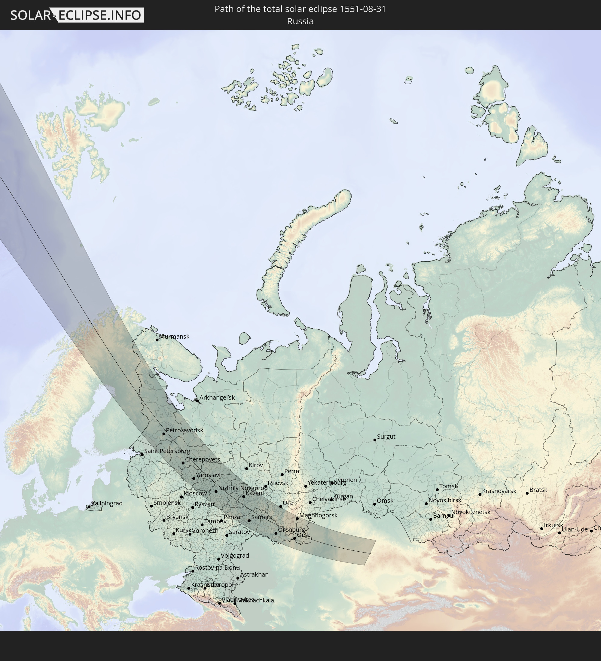 Russland
 Grönland
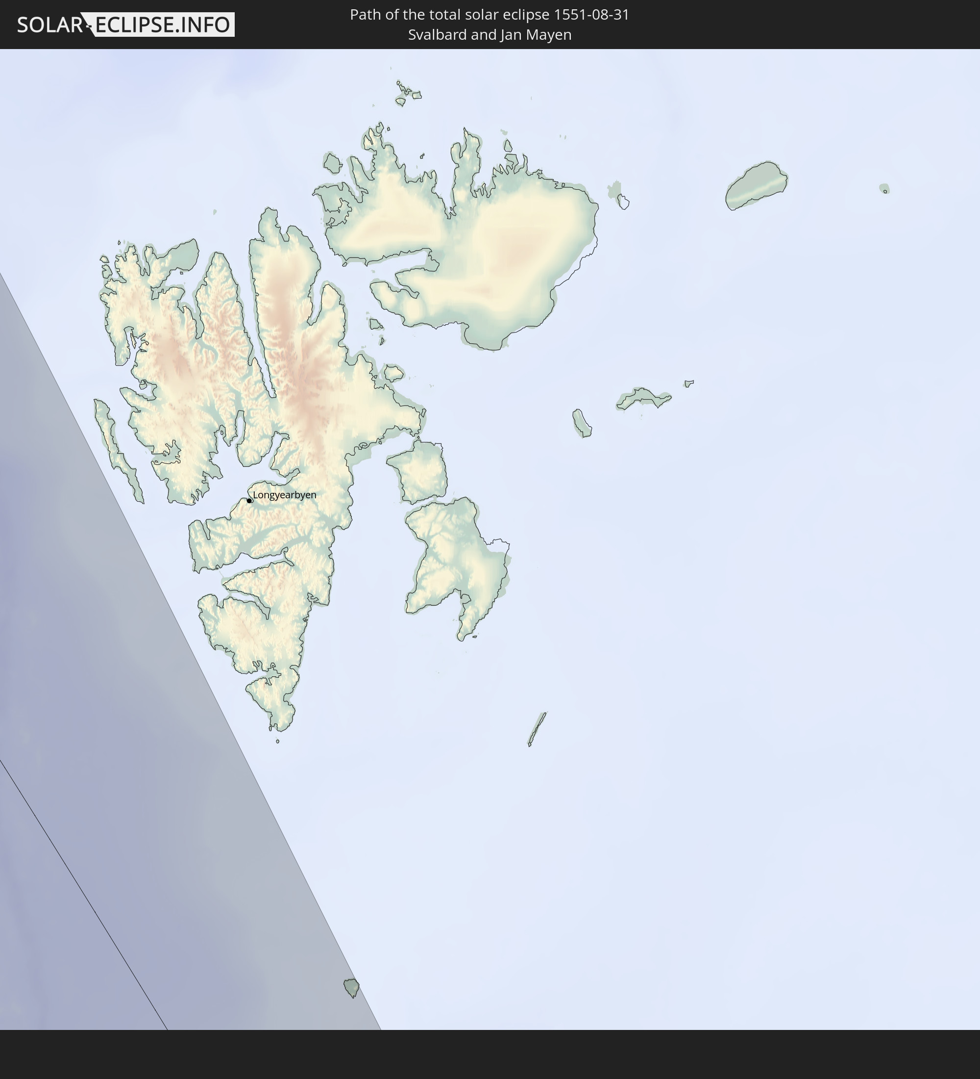 Spitzbergen
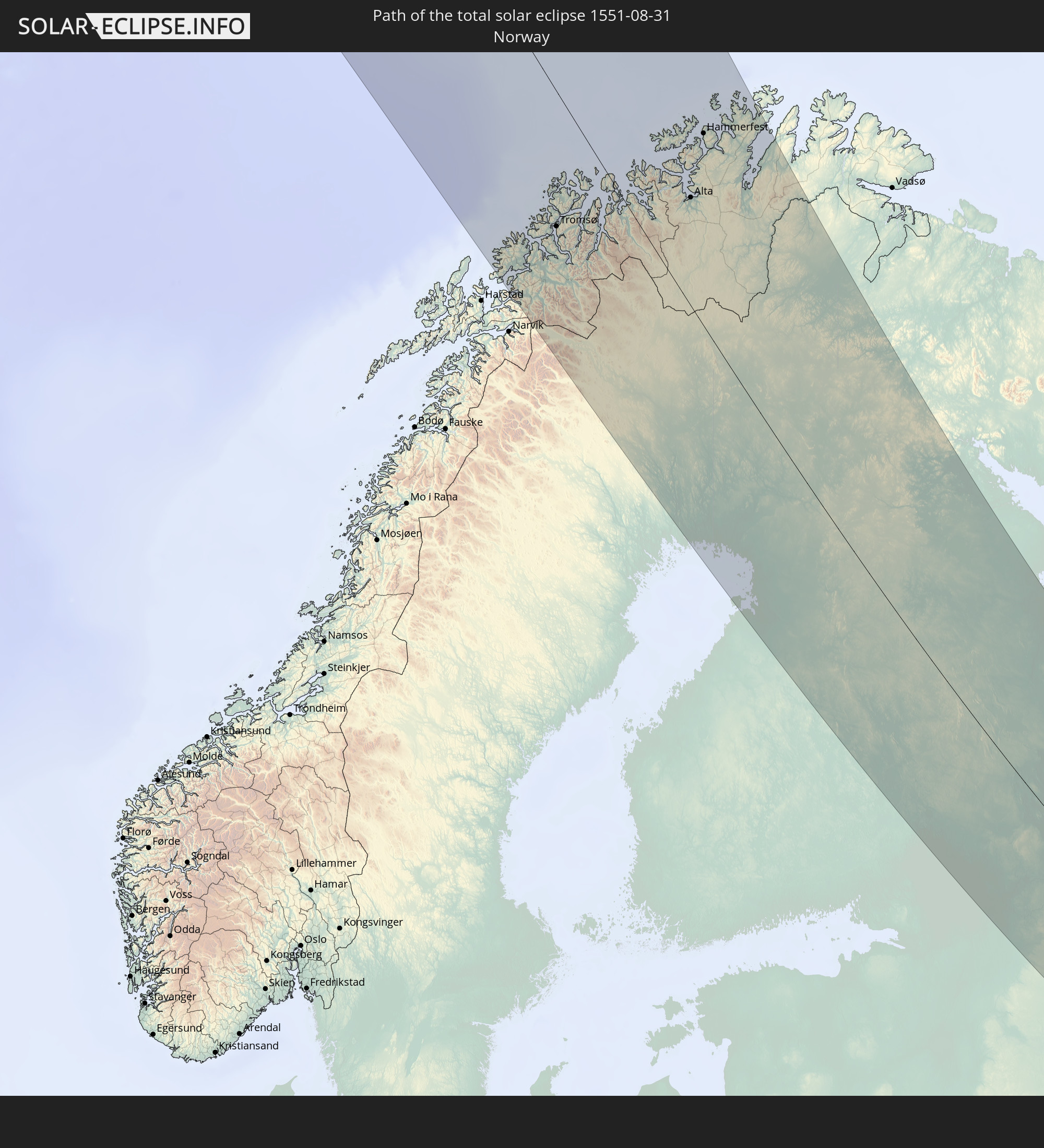 Norwegen
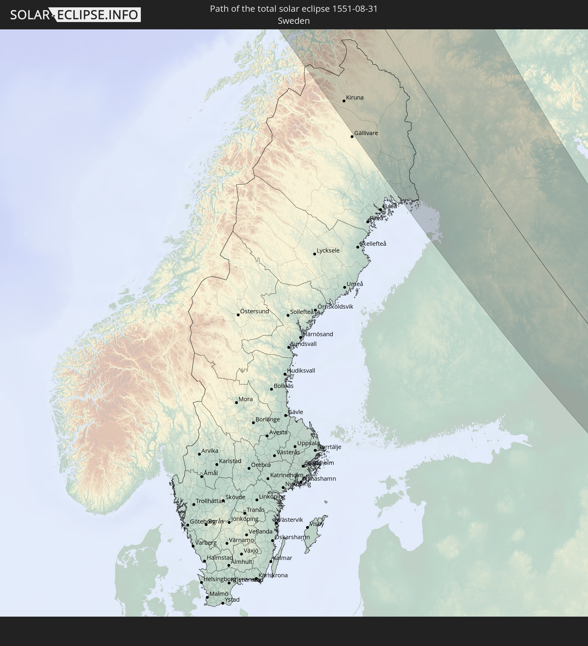 Schweden
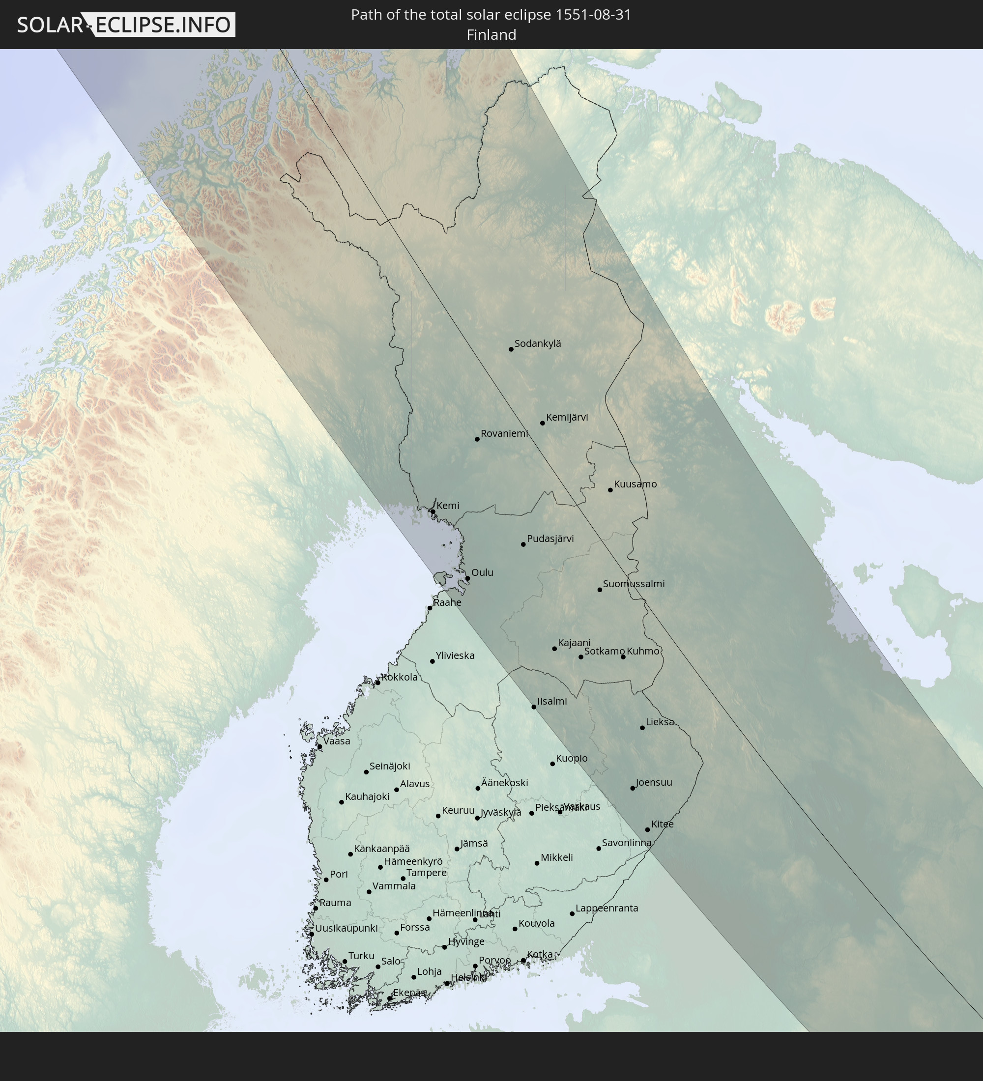 Finnland
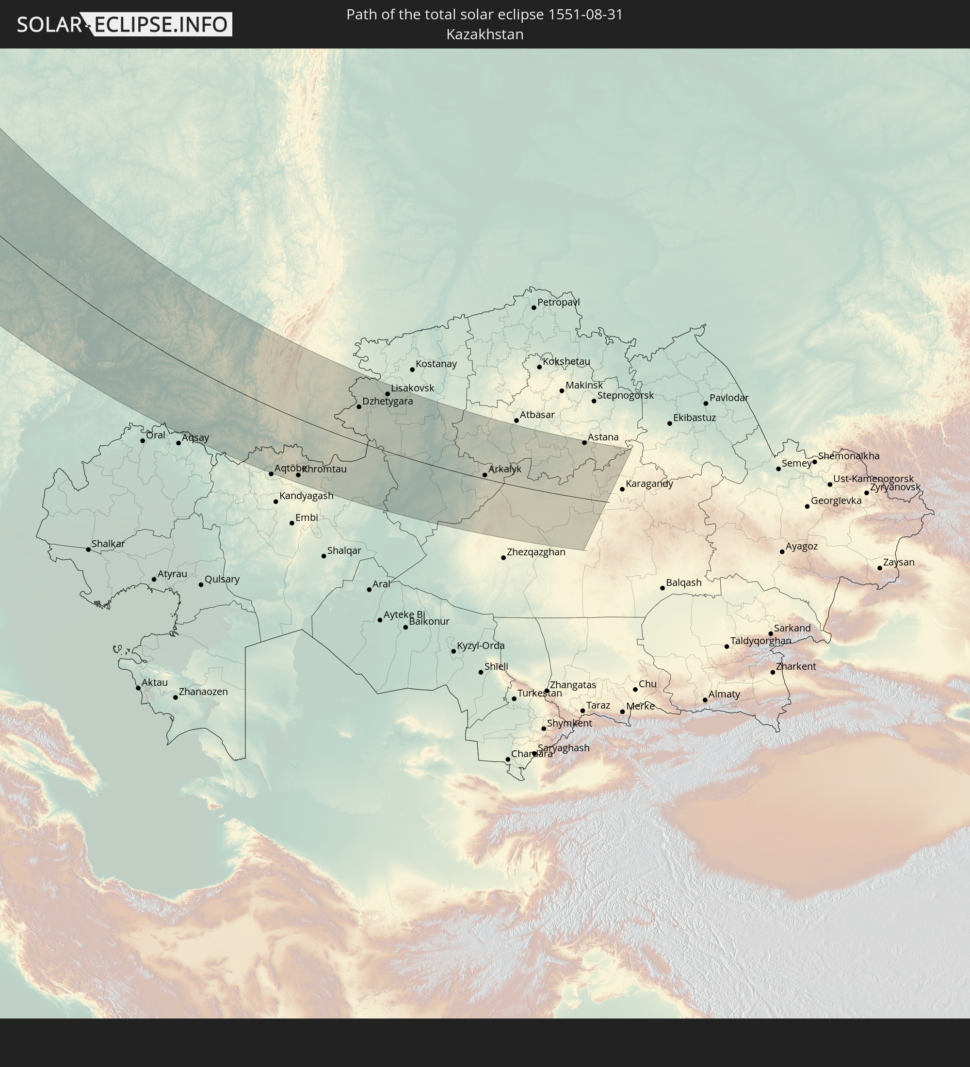 Kasachstan
In den folgenden Ländern ist die Sonnenfinsternis partiell zu sehen
 Russland
 Vereinigte Staaten
 Kanada
 Grönland
 Saint-Pierre und Miquelon
 Portugal
 Island
 Spanien
 Marokko
 Irland
 Spitzbergen
 Algerien
 Vereinigtes Königreich
 Färöer
 Gibraltar
 Frankreich
 Isle of Man
 Guernsey
 Jersey
 Niger
Niger
 Andorra
 Belgien
 Niederlande
 Norwegen
 Luxemburg
 Deutschland
 Schweiz
 Italien
 Monaco
 Tunesien
 Dänemark
 Libyen
 Liechtenstein
 Österreich
 Schweden
 Tschechien
 San Marino
 Vatikanstadt
 Slowenien
 Tschad
 Kroatien
 Polen
Polen
 Malta
Malta
 Bosnien und Herzegowina
 Ungarn
 Slowakei
 Montenegro
 Serbien
 Albanien
 Åland Islands
 Griechenland
 Rumänien
 Mazedonien
 Finnland
 Litauen
 Lettland
 Estland
 Sudan
Sudan
 Ukraine
 Bulgarien
 Weißrussland
 Ägypten
 Türkei
 Moldawien
 Republik Zypern
 Äthiopien
 Staat Palästina
 Israel
 Saudi-Arabien
 Jordanien
 Libanon
 Syrien
 Eritrea
 Irak
Irak
 Georgien
 Somalia
 Dschibuti
 Jemen
Jemen
 Armenien
 Iran
Iran
 Aserbaidschan
 Kasachstan
 Kuwait
 Bahrain
 Katar
Katar
 Vereinigte Arabische Emirate
 Oman
Oman
 Turkmenistan
 Usbekistan
 Afghanistan
 Pakistan
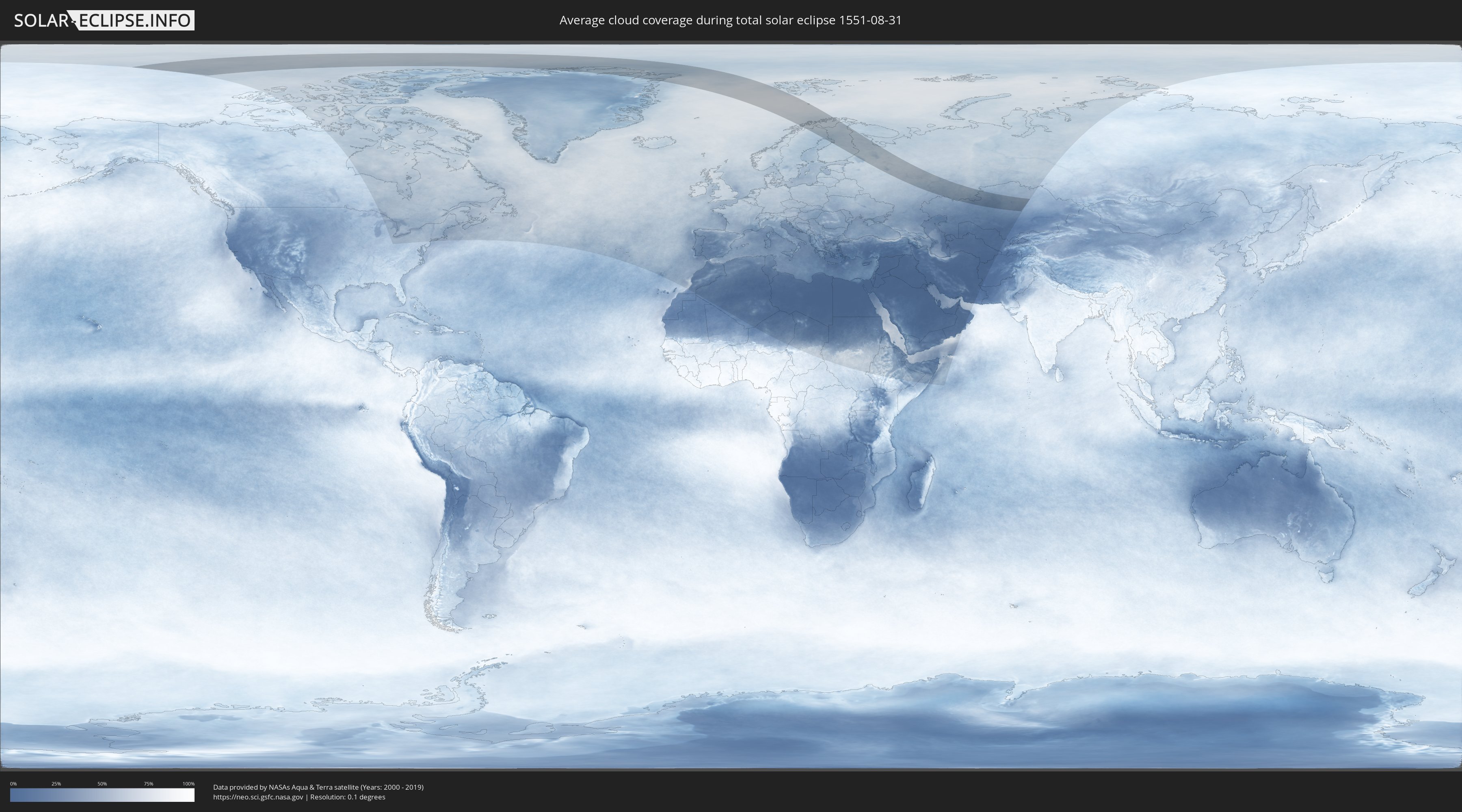
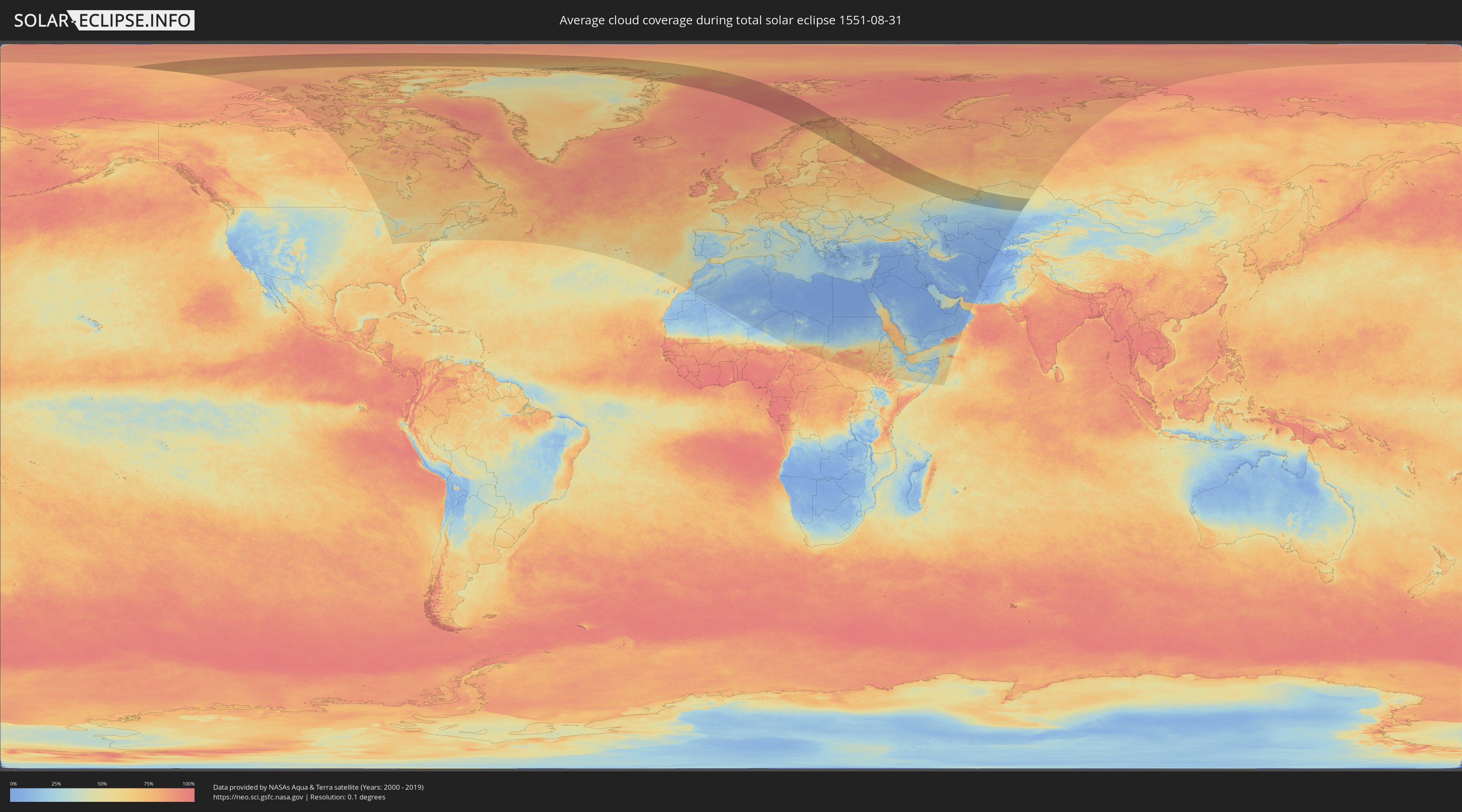
Wie wird das Wetter während der totalen Sonnenfinsternis am 31.08.1551?
Wo ist der beste Ort, um die totale Sonnenfinsternis vom 31.08.1551 zu beobachten?
Die folgenden Karten zeigen die durchschnittliche Bewölkung für den Tag, an dem die totale Sonnenfinsternis
stattfindet. Mit Hilfe der Karten lässt sich der Ort entlang des Finsternispfades eingrenzen,
der die besten Aussichen auf einen klaren wolkenfreien Himmel bietet.
Trotzdem muss man immer lokale Gegenenheiten beachten und sollte sich genau über das Wetter an seinem
gewählten Beobachtungsort informieren.
Die Daten stammen von den beiden NASA-Satelliten
AQUA und TERRA
und wurden über einen Zeitraum von 19 Jahren (2000 - 2019) gemittelt.
Detaillierte Länderkarten
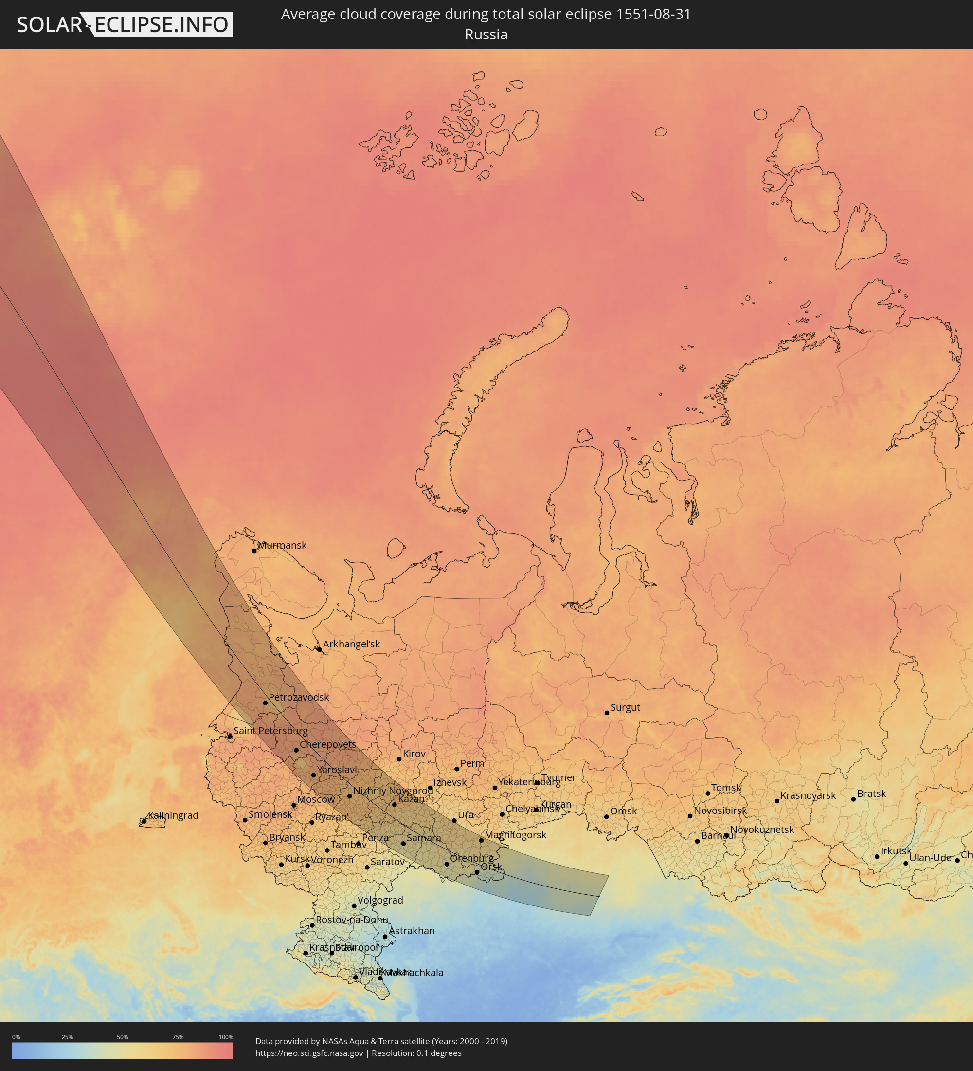 Russland
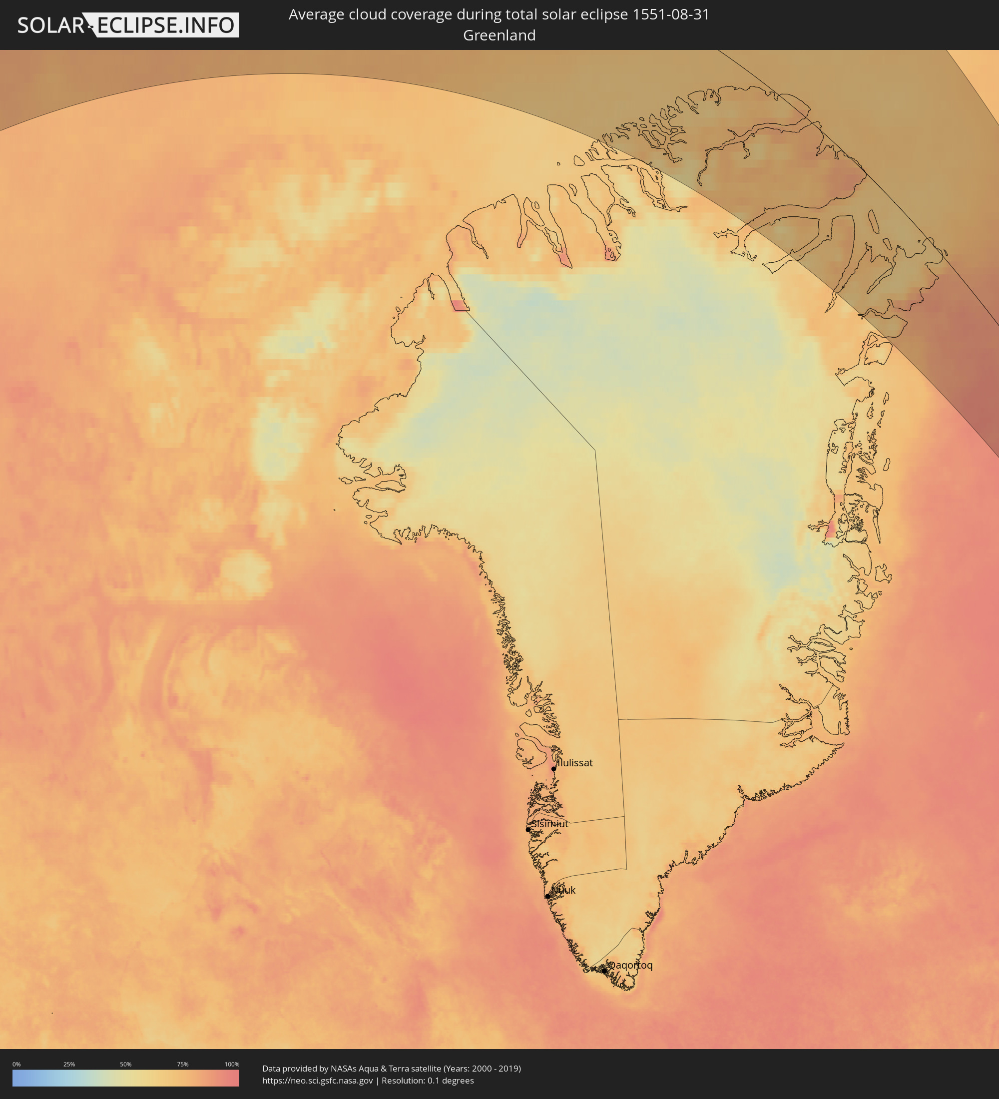 Grönland
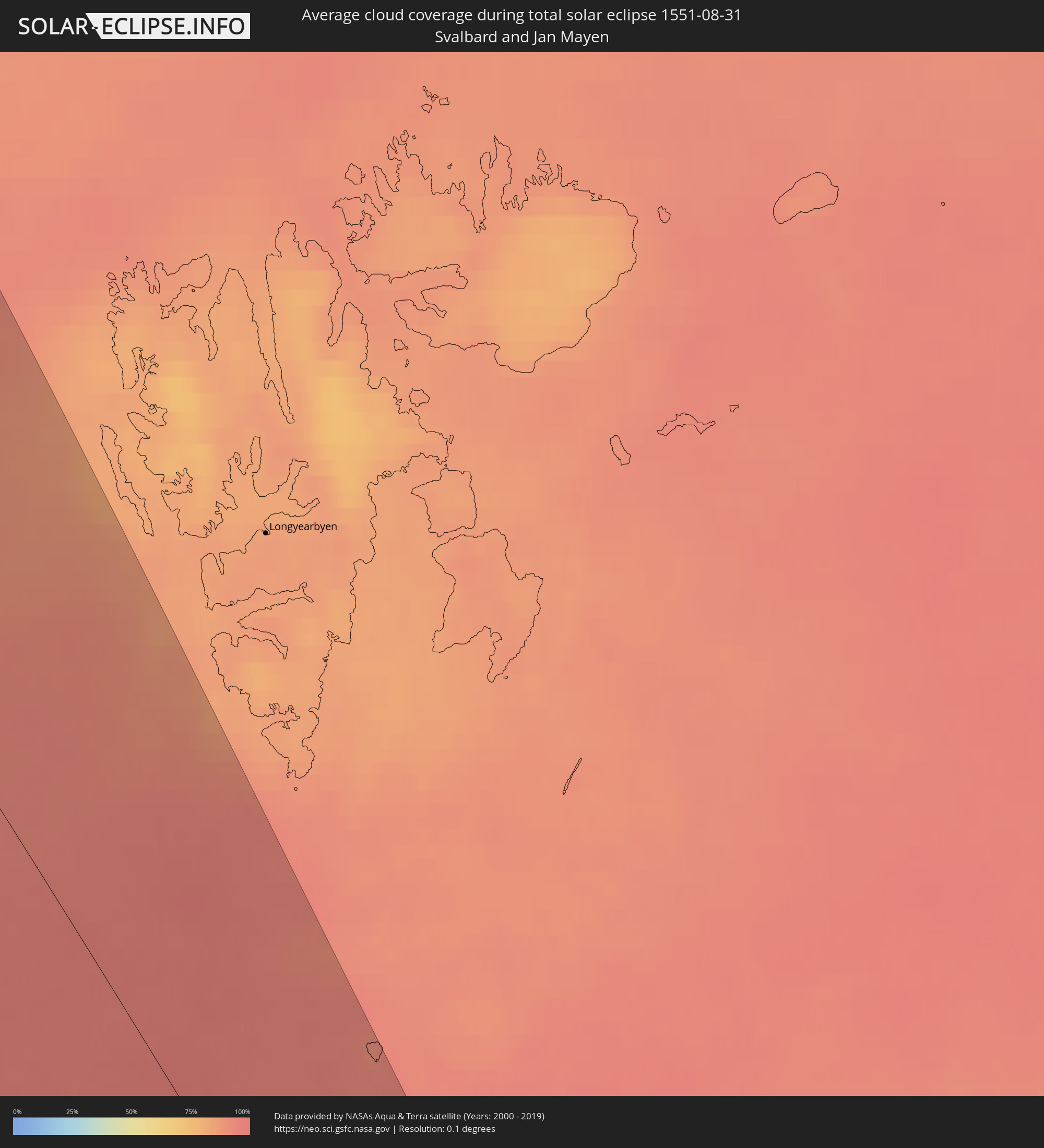 Spitzbergen
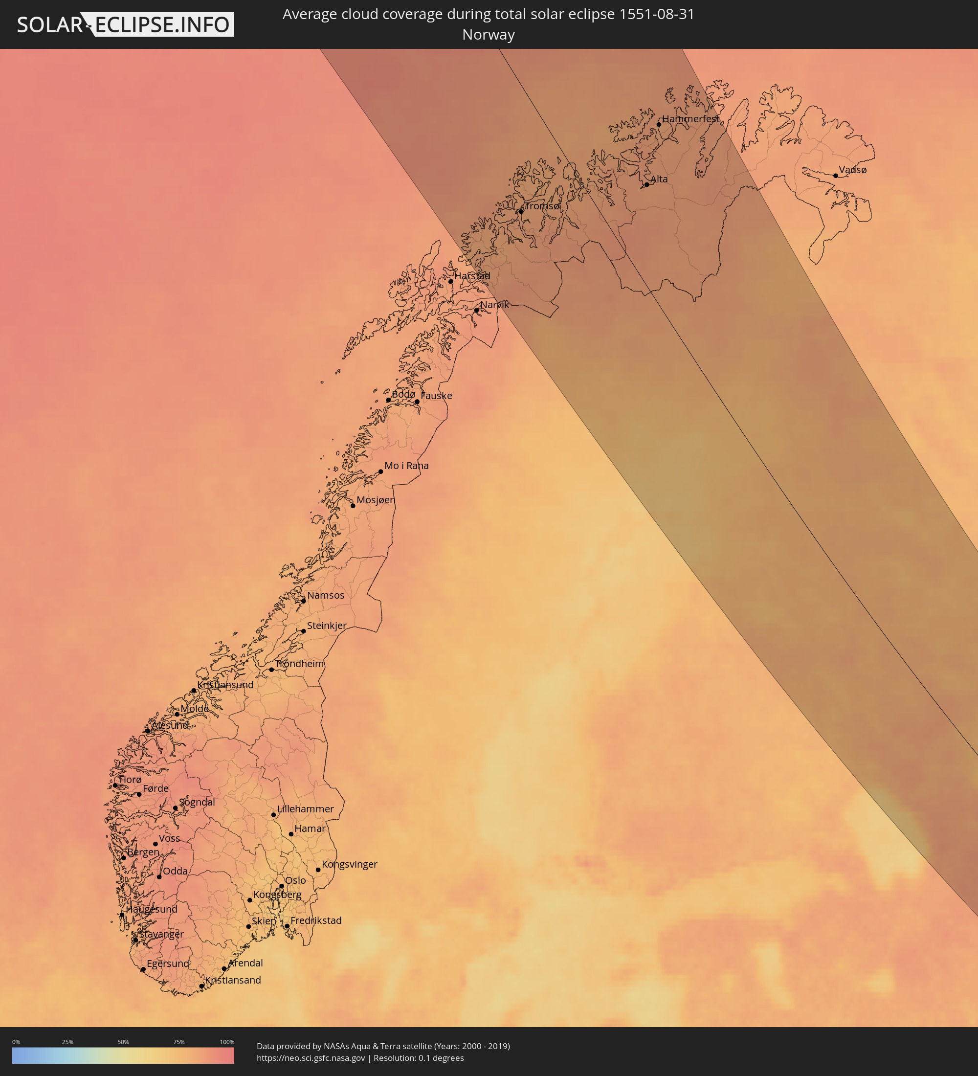 Norwegen
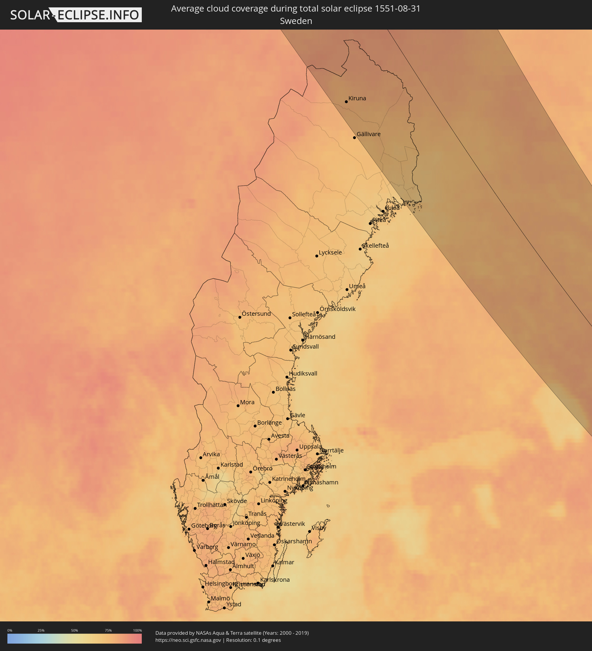 Schweden
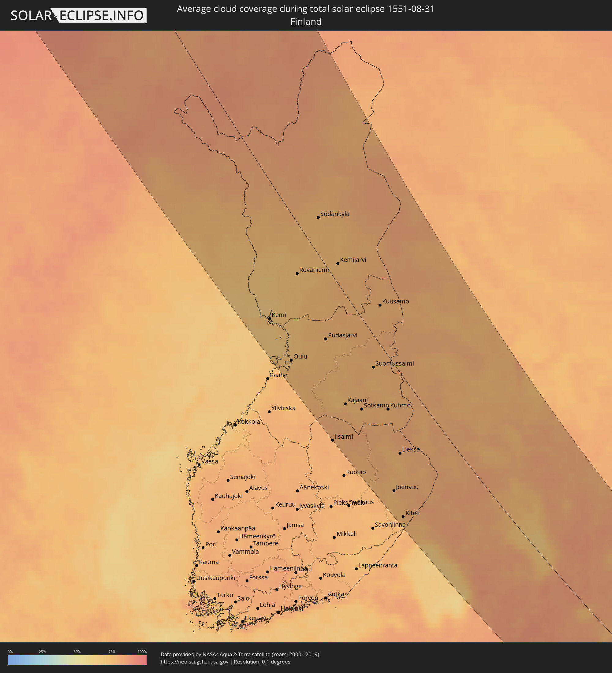 Finnland
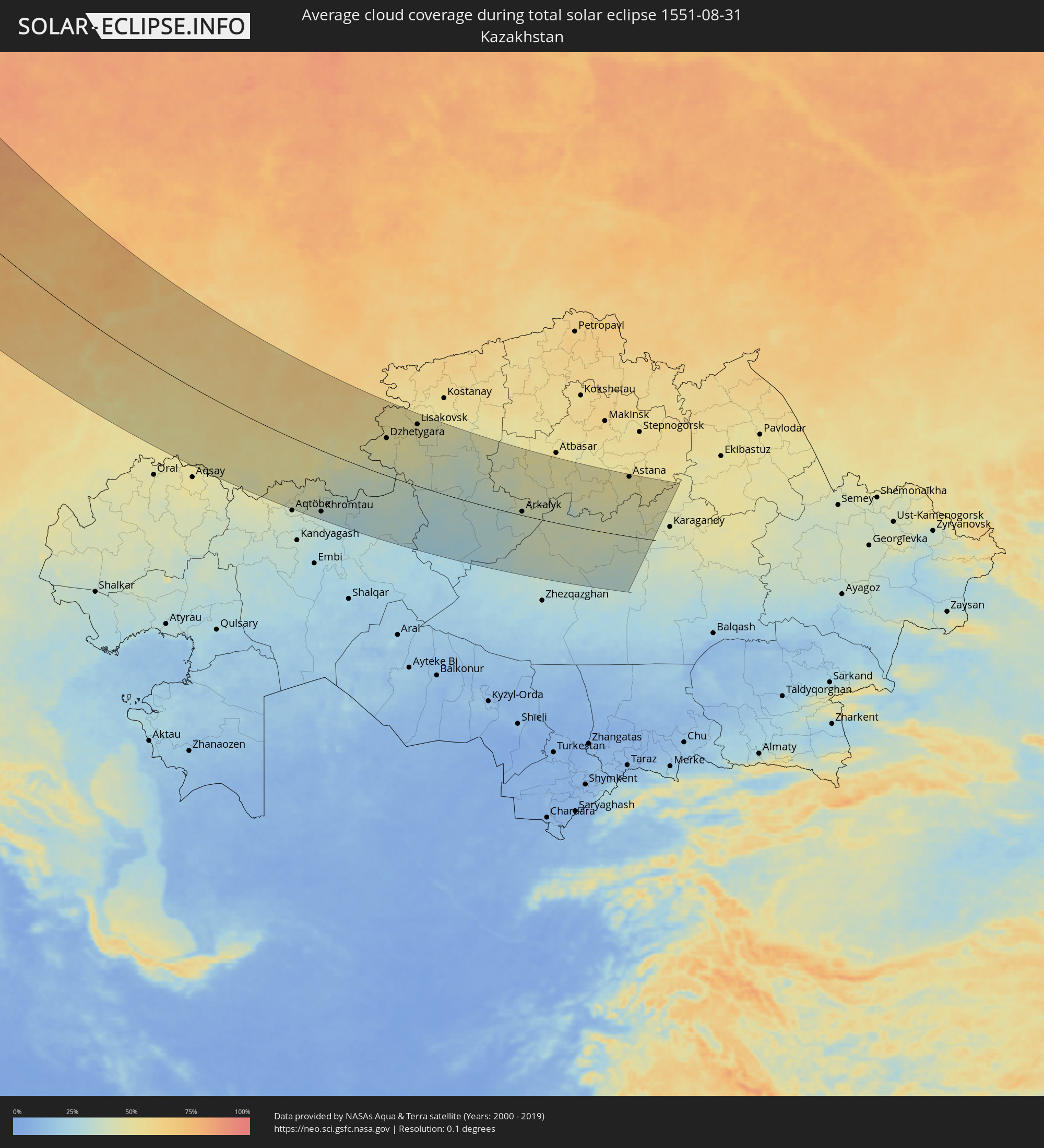 Kasachstan
Orte im Finsternispfad
Die nachfolgene Tabelle zeigt Städte und Orte mit mehr als 5.000 Einwohnern, die sich im Finsternispfad befinden. Städte mit mehr als 100.000 Einwohnern sind dick gekennzeichnet. Mit einem Klick auf den Ort öffnet sich eine Detailkarte die die Lage des jeweiligen Ortes zusammen mit dem Verlauf der zentralen Finsternis präsentiert.
| Ort | Typ | Dauer der Verfinsterung | Ortszeit bei maximaler Verfinsterung | Entfernung zur Zentrallinie | Ø Bewölkung |
|
Tromsø, Troms
|
total | - | 13:39:37 UTC+01:00 | 88 km | 83% |
|
Kiruna, Norrbotten
|
total | - | 13:42:37 UTC+01:00 | 159 km | 78% |
|
Kalix, Norrbotten
|
total | - | 13:47:11 UTC+01:00 | 187 km | 67% |
|
Alta, Finnmark Fylke
|
total | - | 13:41:37 UTC+01:00 | 73 km | 83% |
|
Ylitornio, Lapland
|
total | - | 14:26:41 UTC+01:39 | 140 km | 69% |
|
Hammerfest, Finnmark Fylke
|
total | - | 13:40:54 UTC+01:00 | 124 km | 82% |
|
Tornio, Lapland
|
total | - | 14:27:38 UTC+01:39 | 152 km | 73% |
|
Keminmaa, Lapland
|
total | - | 14:27:57 UTC+01:39 | 140 km | 70% |
|
Kemi, Lapland
|
total | - | 14:28:03 UTC+01:39 | 144 km | 69% |
|
Kittilä, Lapland
|
total | - | 14:25:29 UTC+01:39 | 10 km | 78% |
|
Haukipudas, Northern Ostrobothnia
|
total | - | 14:29:22 UTC+01:39 | 152 km | 71% |
|
Ii, Northern Ostrobothnia
|
total | - | 14:29:10 UTC+01:39 | 142 km | 70% |
|
Oulunsalo, Northern Ostrobothnia
|
total | - | 14:29:46 UTC+01:39 | 167 km | 75% |
|
Liminka, Northern Ostrobothnia
|
total | - | 14:29:57 UTC+01:39 | 174 km | 75% |
|
Oulu, Northern Ostrobothnia
|
total | - | 14:29:41 UTC+01:39 | 160 km | 72% |
|
Kempele, Northern Ostrobothnia
|
total | - | 14:29:51 UTC+01:39 | 164 km | 76% |
|
Tyrnävä, Northern Ostrobothnia
|
total | - | 14:30:10 UTC+01:39 | 168 km | 77% |
|
Rovaniemi, Lapland
|
total | - | 14:27:39 UTC+01:39 | 54 km | 72% |
|
Kiiminki, Northern Ostrobothnia
|
total | - | 14:29:43 UTC+01:39 | 139 km | 74% |
|
Muhos, Northern Ostrobothnia
|
total | - | 14:30:19 UTC+01:39 | 153 km | 77% |
|
Sodankylä, Lapland
|
total | - | 14:26:49 UTC+01:39 | 38 km | 75% |
|
Pudasjärvi, Northern Ostrobothnia
|
total | - | 14:30:01 UTC+01:39 | 81 km | 74% |
|
Inari, Lapland
|
total | - | 14:24:53 UTC+01:39 | 139 km | 79% |
|
Pyhäjärvi, Lapland
|
total | - | 14:27:40 UTC+01:39 | 38 km | 75% |
|
Kemijärvi, Lapland
|
total | - | 14:28:23 UTC+01:39 | 21 km | 74% |
|
Kajaani, Kainuu
|
total | - | 14:32:17 UTC+01:39 | 126 km | 78% |
|
Nilsiä, Northern Savo
|
total | - | 14:34:06 UTC+01:39 | 182 km | 79% |
|
Vuokatti, Kainuu
|
total | - | 14:32:45 UTC+01:39 | 110 km | 76% |
|
Juankoski, Northern Savo
|
total | - | 14:34:30 UTC+01:39 | 181 km | 77% |
|
Sotkamo, Kainuu
|
total | - | 14:32:51 UTC+01:39 | 106 km | 76% |
|
Suomussalmi, Kainuu
|
total | - | 14:31:58 UTC+01:39 | 37 km | 77% |
|
Outokumpu, North Karelia
|
total | - | 14:35:27 UTC+01:39 | 179 km | 76% |
|
Nurmes, North Karelia
|
total | - | 14:34:14 UTC+01:39 | 118 km | 77% |
|
Kuusamo, Northern Ostrobothnia
|
total | - | 14:30:27 UTC+01:39 | 44 km | 77% |
|
Juuka, North Karelia
|
total | - | 14:34:48 UTC+01:39 | 134 km | 79% |
|
Liperi, North Karelia
|
total | - | 14:35:59 UTC+01:39 | 179 km | 77% |
|
Kuhmo, Kainuu
|
total | - | 14:33:31 UTC+01:39 | 63 km | 78% |
|
Joensuu, North Karelia
|
total | - | 14:36:08 UTC+01:39 | 158 km | 77% |
|
Kontiolahti, North Karelia
|
total | - | 14:35:55 UTC+01:39 | 144 km | 76% |
|
Pyhäselkä, North Karelia
|
total | - | 14:36:32 UTC+01:39 | 162 km | 77% |
|
Lieksa, North Karelia
|
total | - | 14:35:08 UTC+01:39 | 99 km | 77% |
|
Kitee, North Karelia
|
total | - | 14:37:11 UTC+01:39 | 179 km | 75% |
|
Eno, North Karelia
|
total | - | 14:36:02 UTC+01:39 | 129 km | 79% |
|
Ilomantsi, North Karelia
|
total | - | 14:36:44 UTC+01:39 | 107 km | 79% |
|
Petrozavodsk, Republic of Karelia
|
total | - | 15:30:40 UTC+02:30 | 33 km | 79% |
|
Cherepovets, Vologda
|
total | - | 15:37:14 UTC+02:30 | 84 km | 76% |
|
Rybinsk, Jaroslavl
|
total | - | 15:39:40 UTC+02:30 | 132 km | 79% |
|
Yaroslavl, Jaroslavl
|
total | - | 15:40:56 UTC+02:30 | 123 km | 78% |
|
Vologda, Vologda
|
total | - | 15:38:05 UTC+02:30 | 4 km | 84% |
|
Kostroma, Kostroma
|
total | - | 15:41:13 UTC+02:30 | 70 km | 78% |
|
Ivanovo, Ivanovo
|
total | - | 15:42:38 UTC+02:30 | 131 km | 77% |
|
Kovrov, Vladimir
|
total | - | 15:43:58 UTC+02:30 | 171 km | 77% |
|
Kineshma, Ivanovo
|
total | - | 15:42:23 UTC+02:30 | 50 km | 77% |
|
Dzerzhinsk, Nizjnij Novgorod
|
total | - | 15:45:10 UTC+02:30 | 96 km | 74% |
|
Arzamas, Nizjnij Novgorod
|
total | - | 15:46:53 UTC+02:30 | 155 km | 73% |
|
Nizhniy Novgorod, Nizjnij Novgorod
|
total | - | 15:45:15 UTC+02:30 | 67 km | 71% |
|
Kstovo, Nizjnij Novgorod
|
total | - | 15:45:40 UTC+02:30 | 75 km | 74% |
|
Cheboksary, Chuvashia
|
total | - | 15:46:55 UTC+02:30 | 41 km | 72% |
|
Yoshkar-Ola, Mariy-El
|
total | - | 15:46:13 UTC+02:30 | 110 km | 70% |
|
Ulyanovsk, Ulyanovsk
|
total | - | 16:40:40 UTC+03:20 | 79 km | 55% |
|
Syzran’, Samara
|
total | - | 16:42:50 UTC+03:20 | 185 km | 53% |
|
Zelenodolsk, Tatarstan
|
total | - | 15:47:54 UTC+02:30 | 63 km | 70% |
|
Kazan, Tatarstan
|
total | - | 15:48:12 UTC+02:30 | 81 km | 67% |
|
Tol’yatti, Samara
|
total | - | 16:42:27 UTC+03:20 | 119 km | 53% |
|
Dimitrovgrad, Ulyanovsk
|
total | - | 16:41:17 UTC+03:20 | 46 km | 60% |
|
Chapayevsk, Samara
|
total | - | 16:43:34 UTC+03:20 | 159 km | 50% |
|
Novokuybyshevsk, Samara
|
total | - | 16:43:26 UTC+03:20 | 140 km | 51% |
|
Samara, Samara
|
total | - | 16:43:18 UTC+03:20 | 123 km | 53% |
|
Nizhnekamsk, Tatarstan
|
total | - | 15:49:19 UTC+02:30 | 164 km | 64% |
|
Yelabuga, Tatarstan
|
total | - | 15:49:09 UTC+02:30 | 184 km | 63% |
|
Buzuluk, Orenburg
|
total | - | 17:26:54 UTC+04:02 | 92 km | 53% |
|
Al’met’yevsk, Tatarstan
|
total | - | 15:50:47 UTC+02:30 | 113 km | 62% |
|
Naberezhnyye Chelny, Tatarstan
|
total | - | 15:49:19 UTC+02:30 | 193 km | 67% |
|
Leninogorsk, Tatarstan
|
total | - | 15:51:22 UTC+02:30 | 89 km | 62% |
|
Bugul’ma, Tatarstan
|
total | - | 15:51:35 UTC+02:30 | 95 km | 63% |
|
Oktyabr’skiy, Bashkortostan
|
total | - | 17:24:07 UTC+04:02 | 112 km | 61% |
|
Tuymazy, Bashkortostan
|
total | - | 17:23:57 UTC+04:02 | 131 km | 60% |
|
Orenburg, Orenburg
|
total | - | 17:29:22 UTC+04:02 | 104 km | 50% |
|
Salavat, Bashkortostan
|
total | - | 17:26:38 UTC+04:02 | 81 km | 58% |
|
Meleuz, Bashkortostan
|
total | - | 17:27:24 UTC+04:02 | 40 km | 57% |
|
Sterlitamak, Bashkortostan
|
total | - | 17:26:13 UTC+04:02 | 106 km | 58% |
|
Martuk, Aqtöbe
|
total | - | 16:54:18 UTC+03:25 | 168 km | 46% |
|
Batamshinskiy, Aqtöbe
|
total | - | 16:54:54 UTC+03:25 | 140 km | 37% |
|
Novotroitsk, Orenburg
|
total | - | 17:30:55 UTC+04:02 | 72 km | 45% |
|
Khromtau, Aqtöbe
|
total | - | 16:55:27 UTC+03:25 | 168 km | 33% |
|
Orsk, Orenburg
|
total | - | 17:30:57 UTC+04:02 | 65 km | 42% |
|
Magnitogorsk, Chelyabinsk
|
total | - | 17:27:05 UTC+04:02 | 174 km | 57% |
|
Dzhetygara, Qostanay
|
total | - | 17:48:49 UTC+04:21 | 102 km | 49% |
|
Lisakovsk, Qostanay
|
total | - | 17:48:17 UTC+04:21 | 170 km | 49% |
|
Tobol, Qostanay
|
total | - | 17:48:02 UTC+04:21 | 188 km | 51% |
|
Torghay, Qostanay
|
total | - | 17:53:21 UTC+04:21 | 118 km | 29% |
|
Derzhavīnsk, Aqmola
|
total | - | 17:50:52 UTC+04:21 | 92 km | 38% |
|
Esil, Aqmola
|
total | - | 17:49:24 UTC+04:21 | 186 km | 44% |
|
Arkalyk, Qostanay
|
total | - | 17:52:16 UTC+04:21 | 11 km | 37% |
|
Astana, Astana Qalasy
|
total | - | 17:50:23 UTC+04:21 | 176 km | 51% |
|
Kīevka, Qaraghandy
|
total | - | 17:51:53 UTC+04:21 | 77 km | 44% |
|
Atasū, Qaraghandy
|
total | - | 17:54:25 UTC+04:21 | 95 km | 33% |
|
Osakarovka, Qaraghandy
|
total | - | 17:51:15 UTC+04:21 | 122 km | 48% |
|
Shakhan, Qaraghandy
|
total | - | 17:52:27 UTC+04:21 | 40 km | 41% |