Totale Sonnenfinsternis vom 25.03.1857
| Wochentag: | Mittwoch |
| Maximale Dauer der Verfinsterung: | 04m28s |
| Maximale Breite des Finsternispfades: | 177 km |
| Saroszyklus: | 127 |
| Bedeckungsgrad: | 100% |
| Magnitude: | 1.0534 |
| Gamma: | -0.0892 |
Wo kann man die Sonnenfinsternis vom 25.03.1857 sehen?
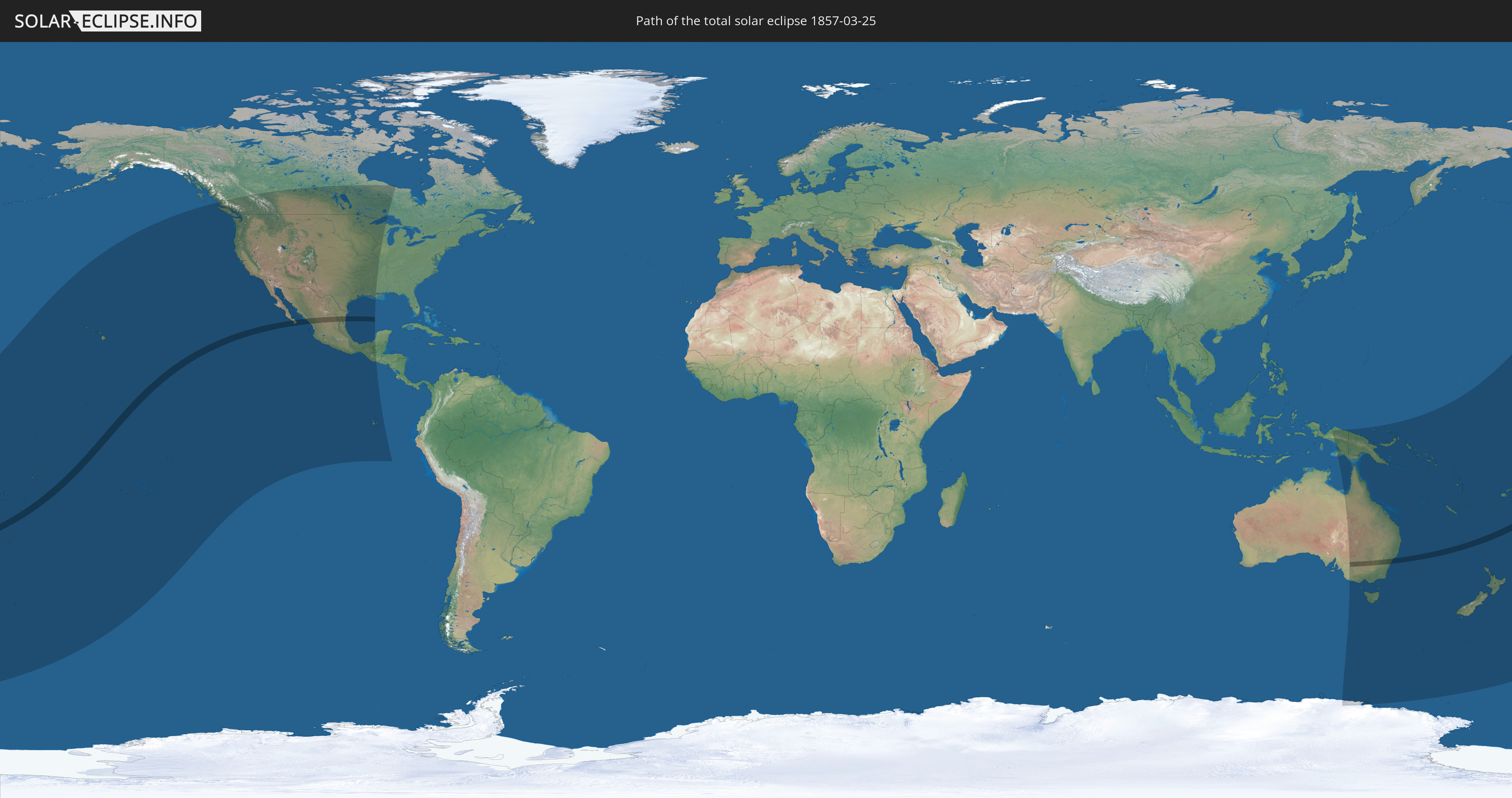
Die Sonnenfinsternis am 25.03.1857 kann man in 29 Ländern als partielle Sonnenfinsternis beobachten.
Der Finsternispfad verläuft durch 5 Länder. Nur in diesen Ländern ist sie als totale Sonnenfinsternis zu sehen.
In den folgenden Ländern ist die Sonnenfinsternis total zu sehen
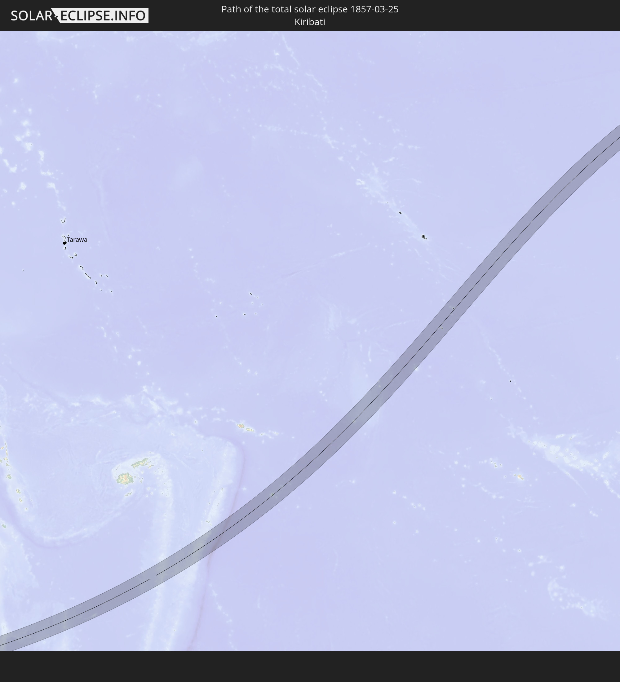 Kiribati
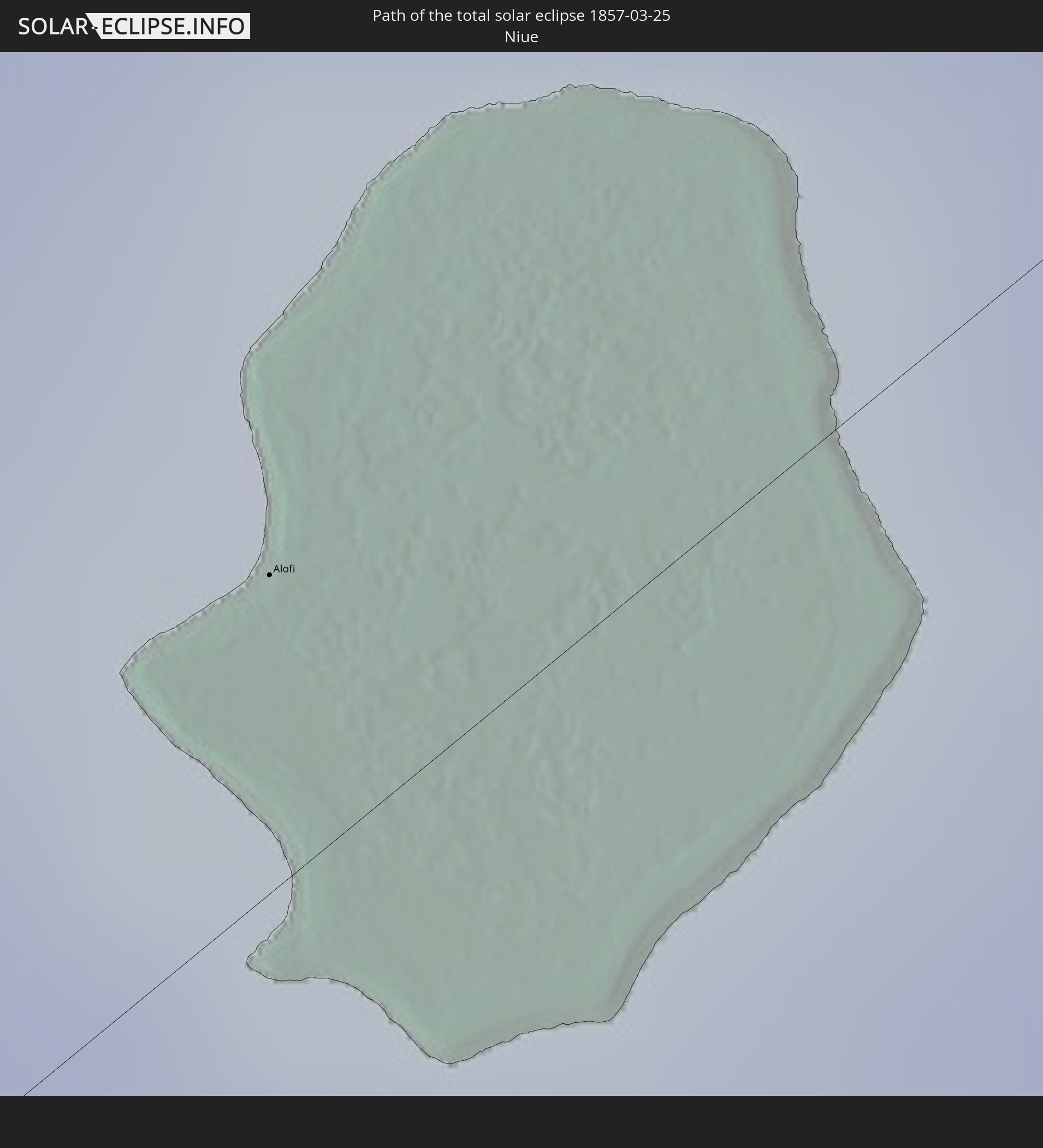 Niue
Niue
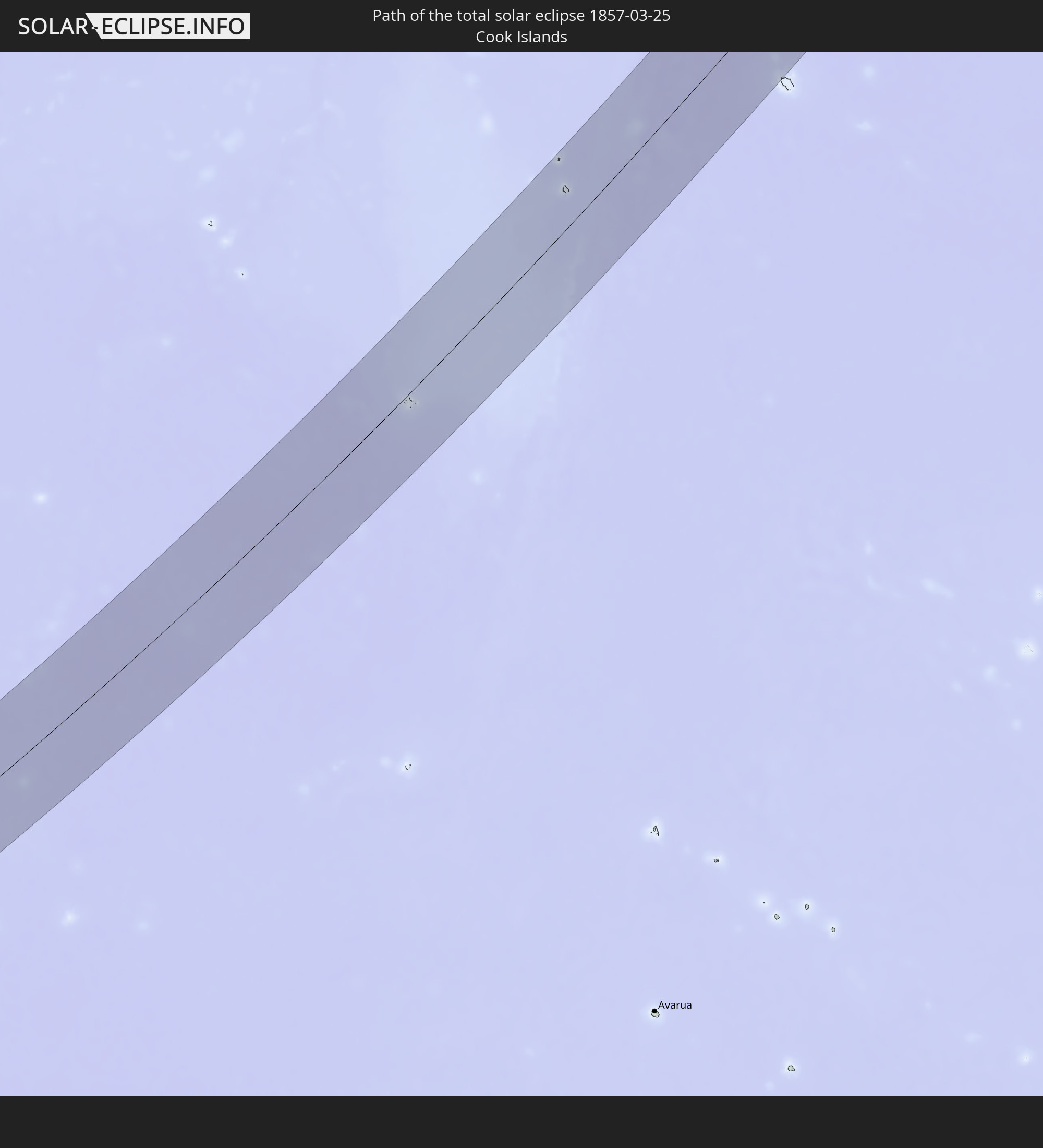 Cookinseln
 Mexiko
 Australien
In den folgenden Ländern ist die Sonnenfinsternis partiell zu sehen
 Antarktika
 Fidschi
 Vereinigte Staaten
 Neuseeland
 United States Minor Outlying Islands
 Wallis und Futuna
 Tonga
Tonga
 Kiribati
 Samoa
Samoa
 Tokelau
 Amerikanisch-Samoa
 Niue
Niue
 Cookinseln
 Französisch-Polynesien
 Kanada
 Pitcairninseln
 Mexiko
 Guatemala
 Ecuador
 Indonesien
 Australien
 Papua-Neuguinea
 Salomonen
 Neukaledonien
 Marshallinseln
 Vanuatu
 Nauru
Nauru
 Norfolkinsel
 Tuvalu
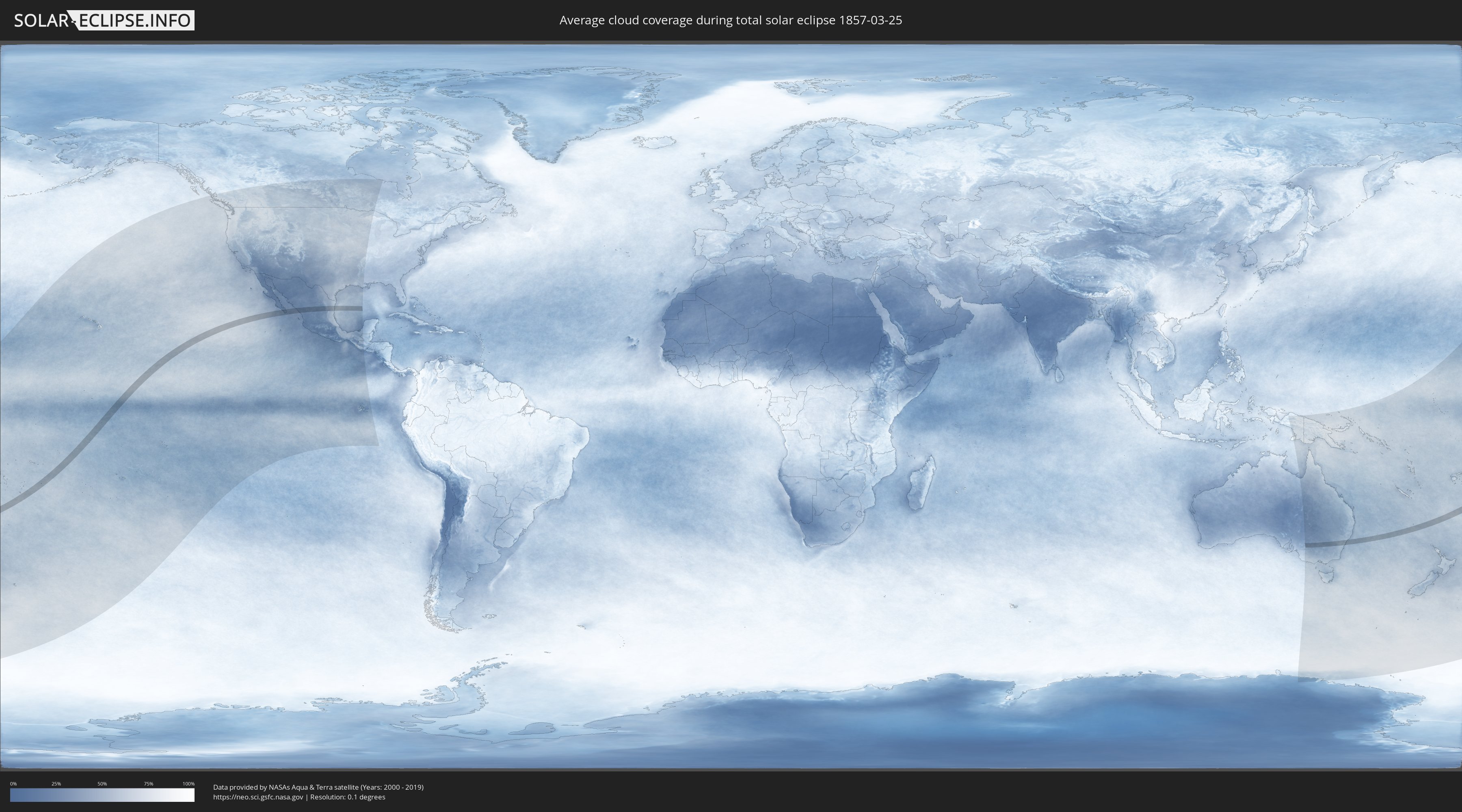
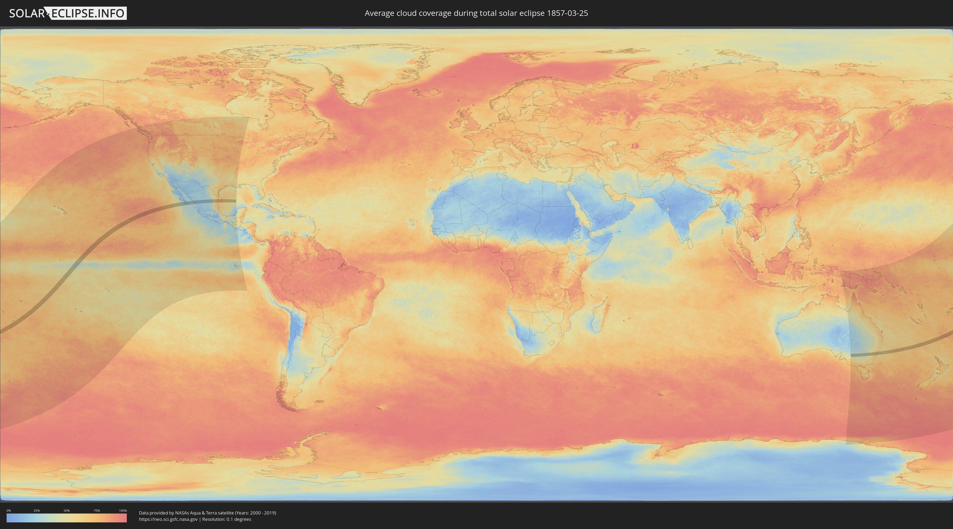
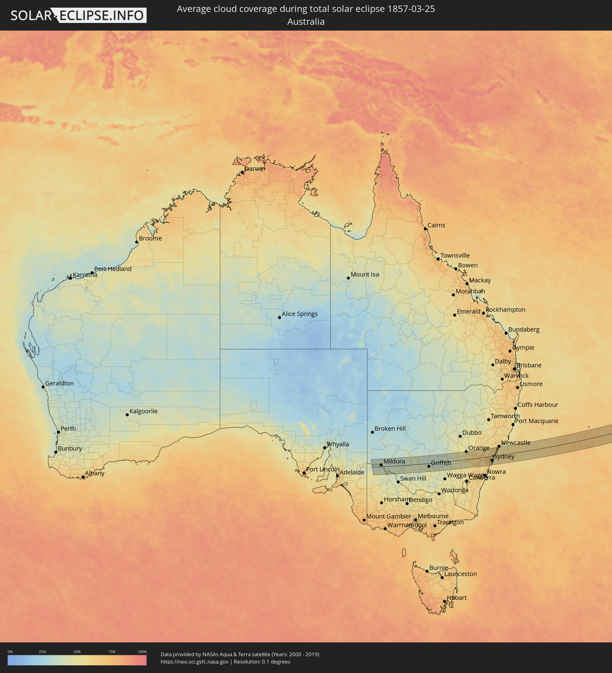
Wie wird das Wetter während der totalen Sonnenfinsternis am 25.03.1857?
Wo ist der beste Ort, um die totale Sonnenfinsternis vom 25.03.1857 zu beobachten?
Die folgenden Karten zeigen die durchschnittliche Bewölkung für den Tag, an dem die totale Sonnenfinsternis
stattfindet. Mit Hilfe der Karten lässt sich der Ort entlang des Finsternispfades eingrenzen,
der die besten Aussichen auf einen klaren wolkenfreien Himmel bietet.
Trotzdem muss man immer lokale Gegenenheiten beachten und sollte sich genau über das Wetter an seinem
gewählten Beobachtungsort informieren.
Die Daten stammen von den beiden NASA-Satelliten
AQUA und TERRA
und wurden über einen Zeitraum von 19 Jahren (2000 - 2019) gemittelt.
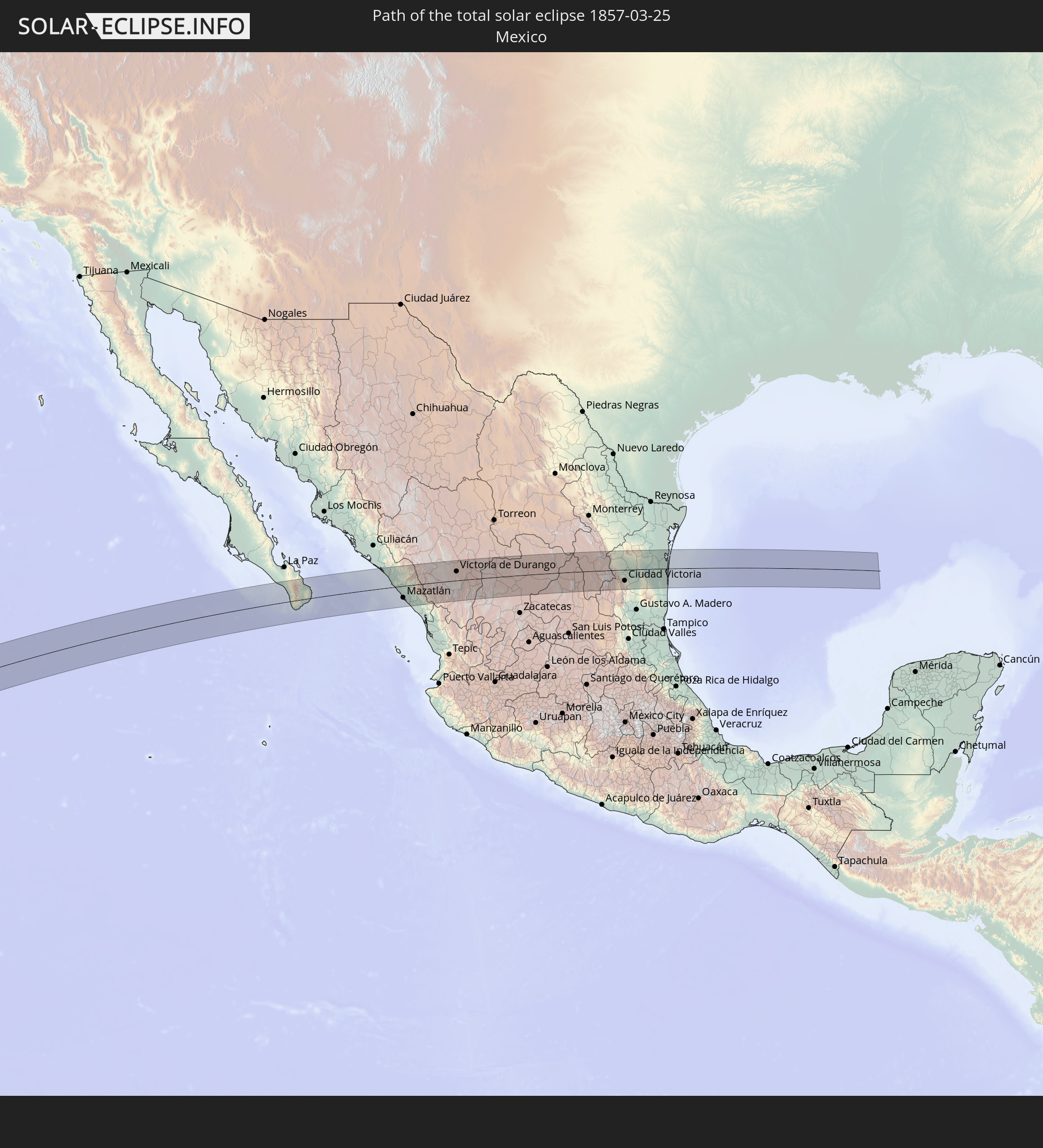
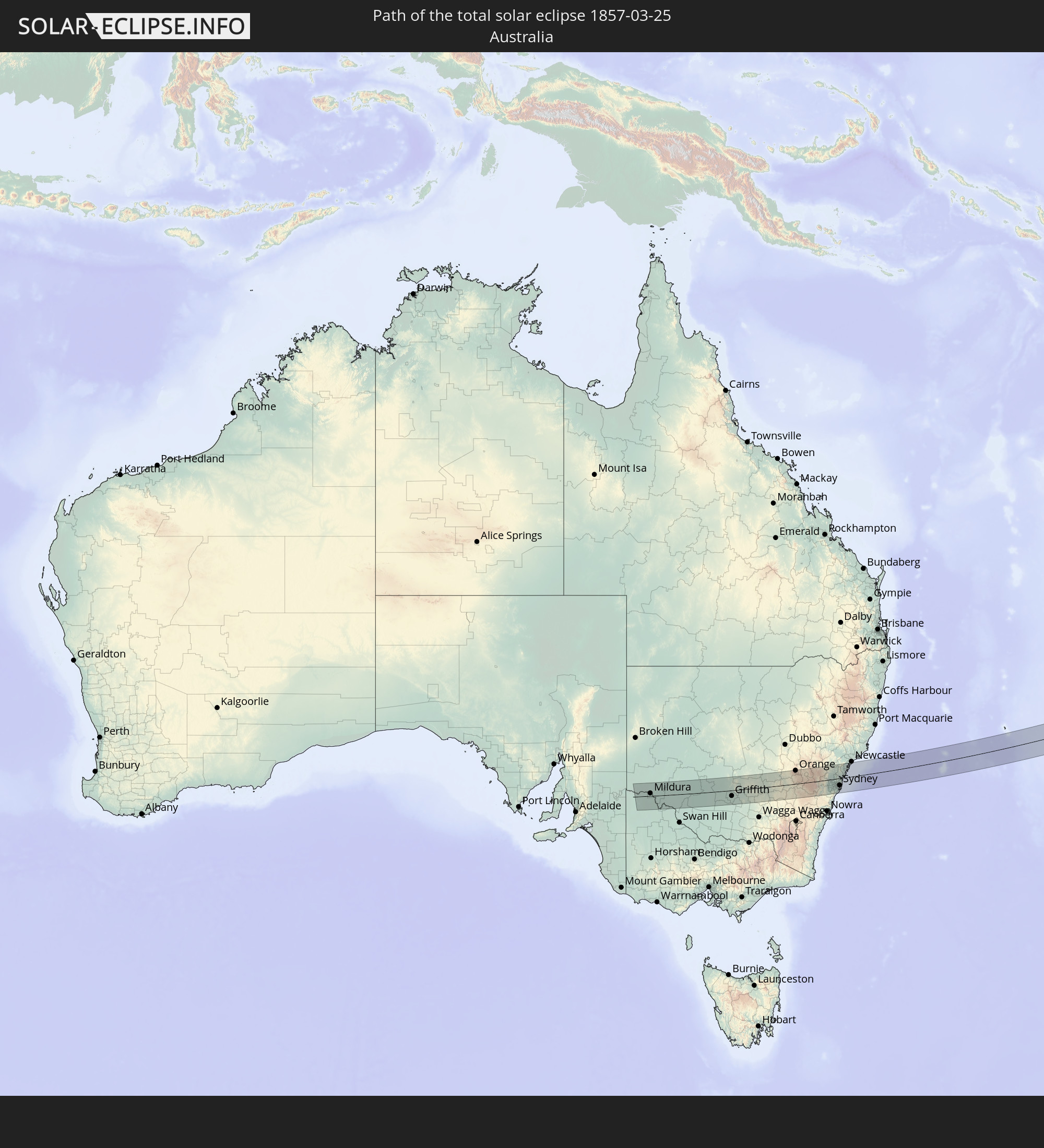
Detaillierte Länderkarten
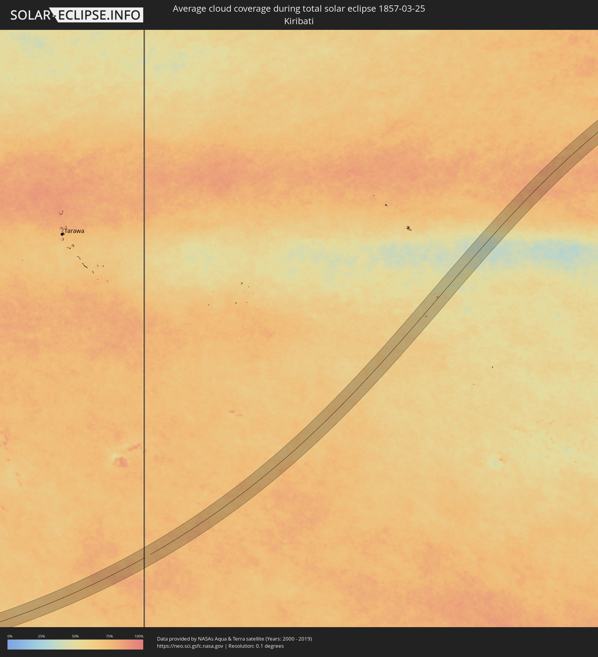 Kiribati
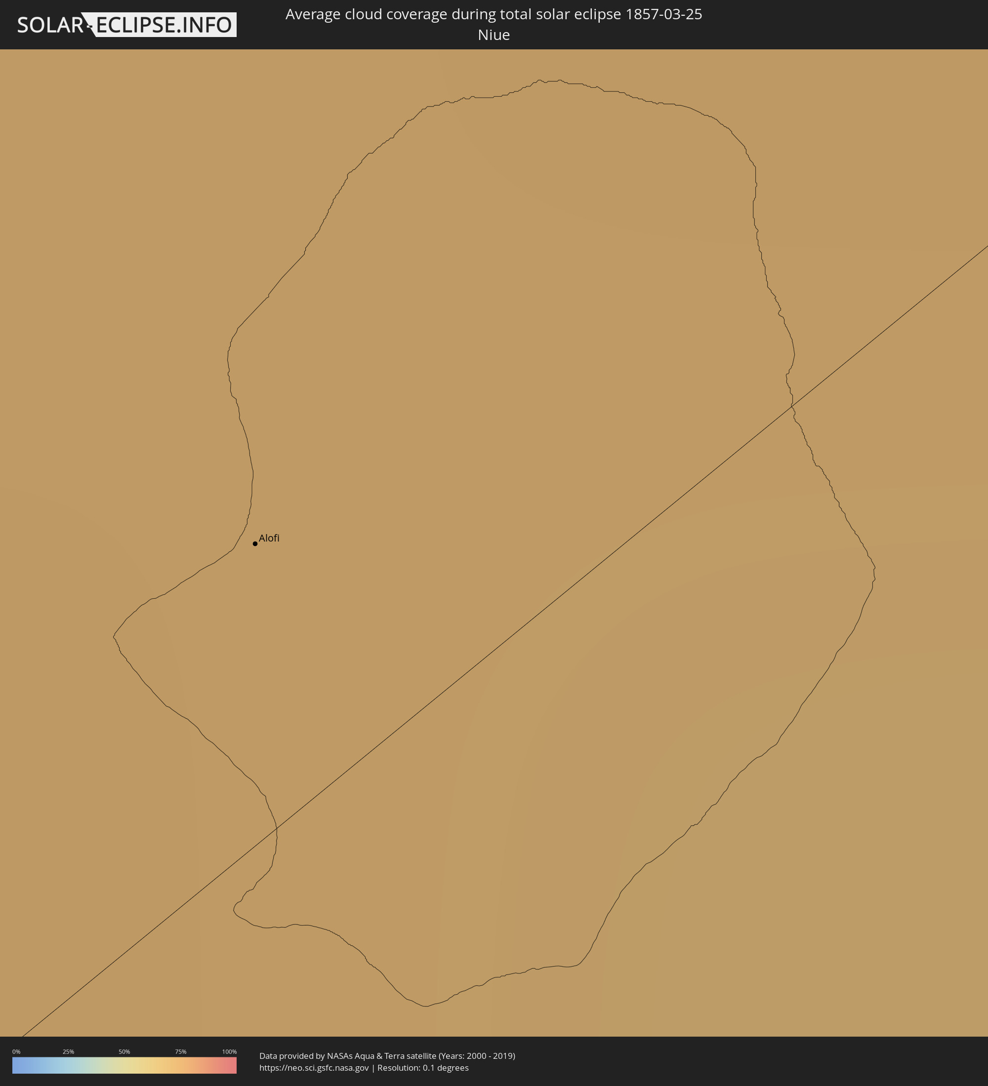 Niue
Niue
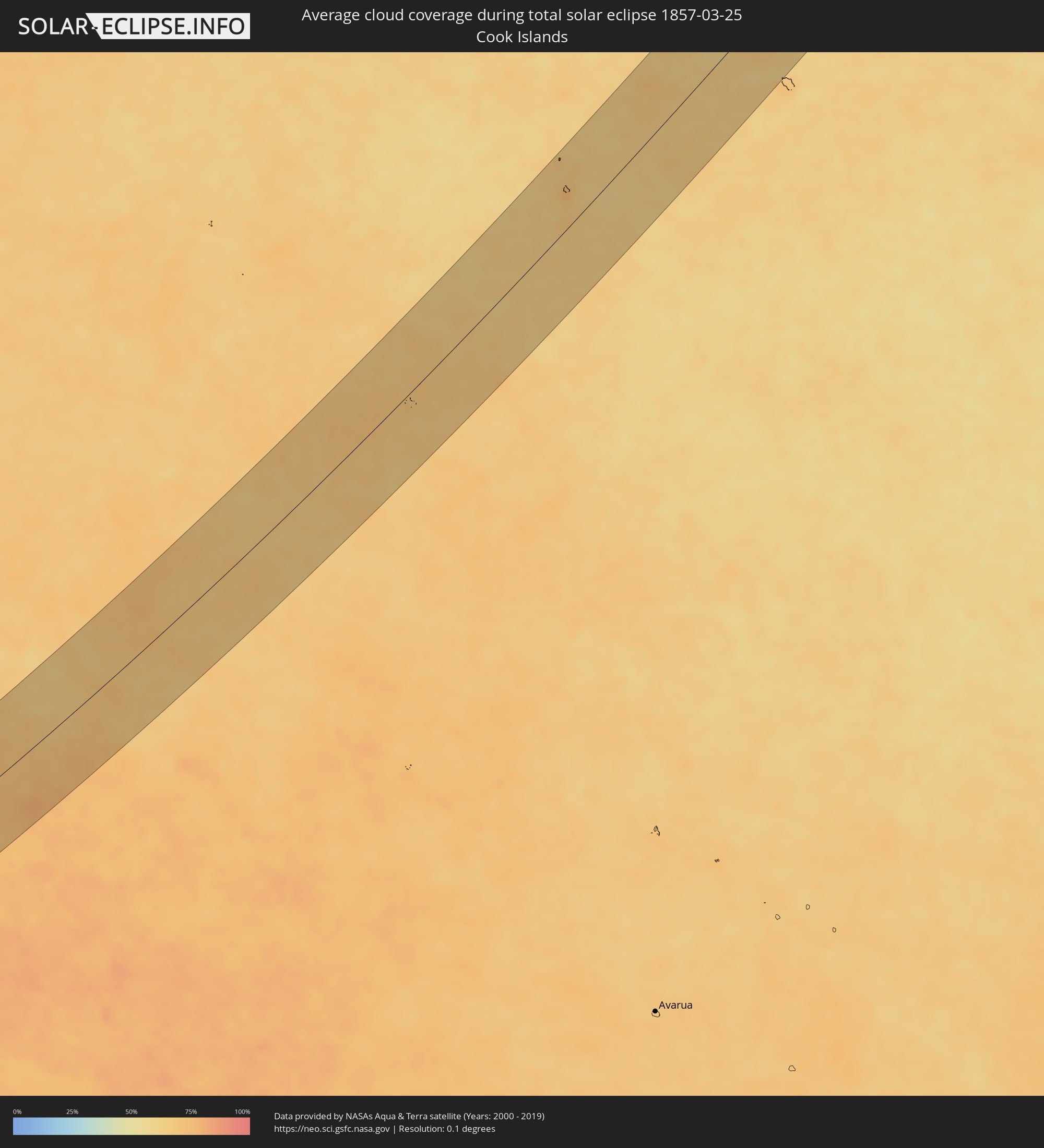 Cookinseln
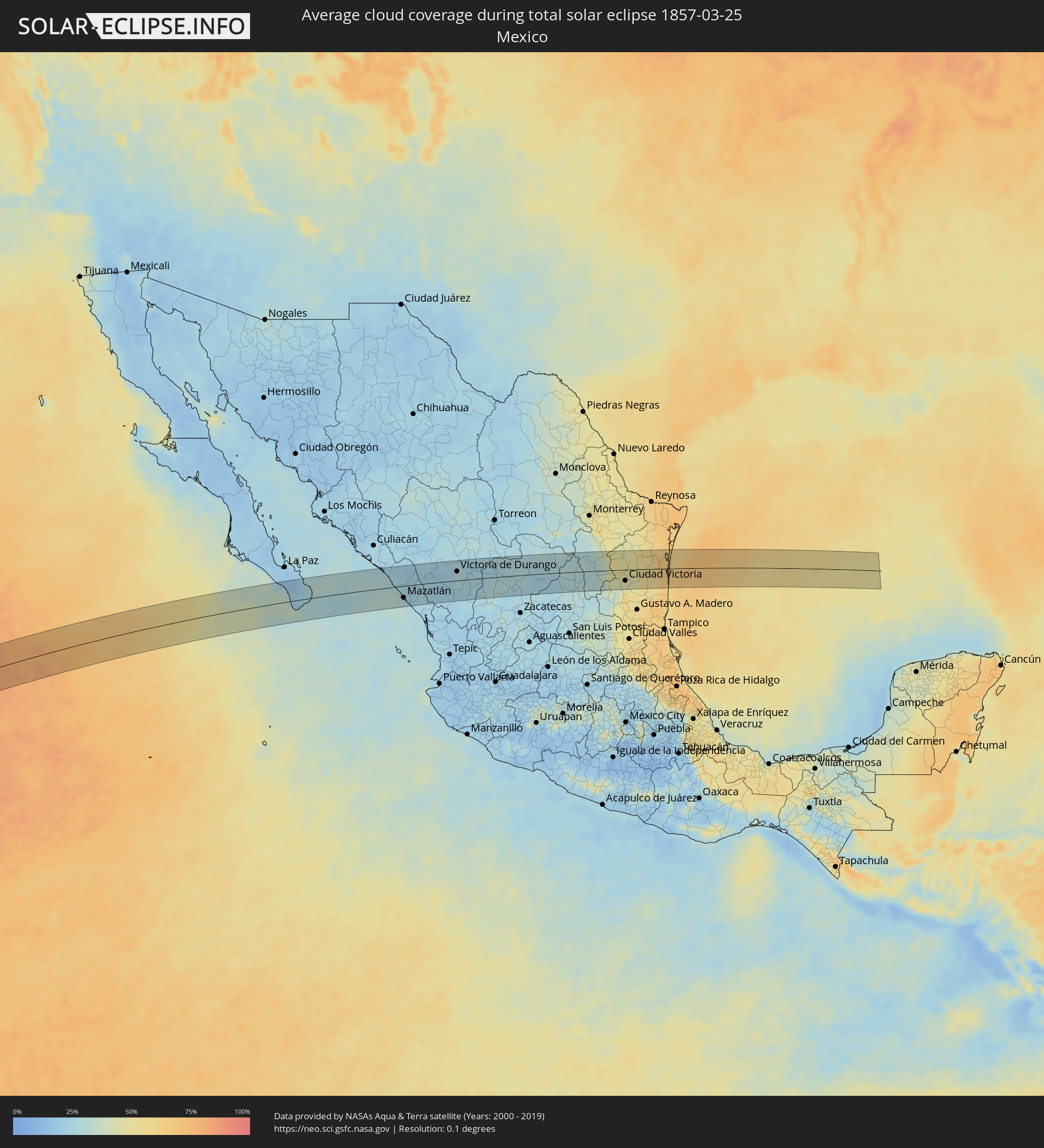 Mexiko
 Australien
Orte im Finsternispfad
Die nachfolgene Tabelle zeigt Städte und Orte mit mehr als 5.000 Einwohnern, die sich im Finsternispfad befinden. Städte mit mehr als 100.000 Einwohnern sind dick gekennzeichnet. Mit einem Klick auf den Ort öffnet sich eine Detailkarte die die Lage des jeweiligen Ortes zusammen mit dem Verlauf der zentralen Finsternis präsentiert.
| Ort | Typ | Dauer der Verfinsterung | Ortszeit bei maximaler Verfinsterung | Entfernung zur Zentrallinie | Ø Bewölkung |
|
Alofi
|
total | - | 10:10:22 UTC-11:20 | 6 km | 73% |
|
Las Palmas, Baja California Sur
|
total | - | 17:01:27 UTC-07:05 | 23 km | 33% |
|
Cabo San Lucas, Baja California Sur
|
total | - | 17:01:27 UTC-07:05 | 29 km | 33% |
|
Las Veredas, Baja California Sur
|
total | - | 17:01:40 UTC-07:05 | 3 km | 23% |
|
San José del Cabo, Baja California Sur
|
total | - | 17:01:39 UTC-07:05 | 13 km | 26% |
|
La Cruz, Sinaloa
|
total | - | 17:03:24 UTC-07:05 | 43 km | 28% |
|
Mazatlán, Sinaloa
|
total | - | 17:03:24 UTC-07:05 | 39 km | 29% |
|
Fraccionamiento los Ángeles, Sinaloa
|
total | - | 17:03:25 UTC-07:05 | 45 km | 25% |
|
Villa Unión, Sinaloa
|
total | - | 17:03:28 UTC-07:05 | 46 km | 23% |
|
Concordia, Sinaloa
|
total | - | 17:03:35 UTC-07:05 | 37 km | 23% |
|
Tayoltita, Durango
|
total | - | 17:32:57 UTC-06:36 | 52 km | 22% |
|
Pueblo Nuevo, Durango
|
total | - | 17:32:58 UTC-06:36 | 34 km | 23% |
|
Victoria de Durango, Durango
|
total | - | 17:33:27 UTC-06:36 | 30 km | 26% |
|
Vicente Guerrero, Durango
|
total | - | 17:33:38 UTC-06:36 | 8 km | 27% |
|
Sombrerete, Zacatecas
|
total | - | 17:33:45 UTC-06:36 | 22 km | 28% |
|
Miguel Auza, Zacatecas
|
total | - | 17:33:59 UTC-06:36 | 50 km | 26% |
|
Juan Aldama, Zacatecas
|
total | - | 17:34:00 UTC-06:36 | 49 km | 26% |
|
Río Grande, Zacatecas
|
total | - | 17:34:01 UTC-06:36 | 5 km | 30% |
|
Nieves, Zacatecas
|
total | - | 17:34:04 UTC-06:36 | 13 km | 26% |
|
Cañitas de Felipe Pescador, Zacatecas
|
total | - | 17:34:04 UTC-06:36 | 32 km | 25% |
|
Matehuala, San Luis Potosí
|
total | - | 17:34:44 UTC-06:36 | 40 km | 29% |
|
Doctor Arroyo, Nuevo León
|
total | - | 17:34:52 UTC-06:36 | 40 km | 31% |
|
Estación Santa Engracia, Tamaulipas
|
total | - | 17:35:11 UTC-06:36 | 6 km | 47% |
|
Guillermo Zúñiga, Tamaulipas
|
total | - | 17:35:11 UTC-06:36 | 6 km | 47% |
|
Ciudad Victoria, Tamaulipas
|
total | - | 17:35:08 UTC-06:36 | 36 km | 44% |
|
Nuevo Padilla, Tamaulipas
|
total | - | 17:35:15 UTC-06:36 | 3 km | 48% |
|
Santander Jiménez, Tamaulipas
|
total | - | 17:35:23 UTC-06:36 | 14 km | 56% |
|
Abasolo, Tamaulipas
|
total | - | 17:35:23 UTC-06:36 | 4 km | 55% |
|
Soto la Marina, Tamaulipas
|
total | - | 17:35:21 UTC-06:36 | 36 km | 58% |
|
Mildura, Victoria
|
total | - | 06:46:16 UTC+10:00 | 11 km | 44% |
|
Griffith, New South Wales
|
total | - | 06:46:33 UTC+10:00 | 25 km | 45% |
|
Leeton, New South Wales
|
total | - | 06:46:37 UTC+10:00 | 57 km | 46% |
|
Young, New South Wales
|
total | - | 06:46:52 UTC+10:00 | 48 km | 49% |
|
Cowra, New South Wales
|
total | - | 06:46:54 UTC+10:00 | 1 km | 47% |
|
Orange, New South Wales
|
total | - | 06:46:56 UTC+10:00 | 58 km | 55% |
|
Bathurst, New South Wales
|
total | - | 06:47:02 UTC+10:00 | 38 km | 56% |
|
Kelso, New South Wales
|
total | - | 06:47:03 UTC+10:00 | 38 km | 56% |
|
Lithgow, New South Wales
|
total | - | 06:47:10 UTC+10:00 | 24 km | 60% |
|
Katoomba, New South Wales
|
total | - | 06:47:13 UTC+10:00 | 4 km | 64% |
|
Blaxland, New South Wales
|
total | - | 06:47:17 UTC+10:00 | 11 km | 59% |
|
Glenmore Park, New South Wales
|
total | - | 06:47:18 UTC+10:00 | 16 km | 65% |
|
Cambridge Park, New South Wales
|
total | - | 06:47:18 UTC+10:00 | 12 km | 63% |
|
Narellan, New South Wales
|
total | - | 06:47:19 UTC+10:00 | 43 km | 66% |
|
Narellan Vale, New South Wales
|
total | - | 06:47:20 UTC+10:00 | 45 km | 66% |
|
Richmond, New South Wales
|
total | - | 06:47:18 UTC+10:00 | 4 km | 62% |
|
South Windsor, New South Wales
|
total | - | 06:47:19 UTC+10:00 | 1 km | 62% |
|
Riverstone, New South Wales
|
total | - | 06:47:20 UTC+10:00 | 7 km | 66% |
|
Ingleburn, New South Wales
|
total | - | 06:47:21 UTC+10:00 | 41 km | 65% |
|
Glenfield, New South Wales
|
total | - | 06:47:21 UTC+10:00 | 38 km | 65% |
|
Cabramatta West, New South Wales
|
total | - | 06:47:21 UTC+10:00 | 31 km | 67% |
|
Rouse Hill, New South Wales
|
total | - | 06:47:21 UTC+10:00 | 7 km | 66% |
|
Blacktown, New South Wales
|
total | - | 06:47:21 UTC+10:00 | 16 km | 66% |
|
Fairfield Heights, New South Wales
|
total | - | 06:47:22 UTC+10:00 | 27 km | 67% |
|
Beaumont Hills, New South Wales
|
total | - | 06:47:21 UTC+10:00 | 9 km | 66% |
|
Northmead, New South Wales
|
total | - | 06:47:22 UTC+10:00 | 19 km | 66% |
|
Merrylands, New South Wales
|
total | - | 06:47:22 UTC+10:00 | 24 km | 66% |
|
Helensburgh, New South Wales
|
total | - | 06:47:23 UTC+10:00 | 63 km | 57% |
|
Glenhaven, New South Wales
|
total | - | 06:47:22 UTC+10:00 | 10 km | 66% |
|
Heathcote, New South Wales
|
total | - | 06:47:23 UTC+10:00 | 53 km | 59% |
|
Bankstown, New South Wales
|
total | - | 06:47:23 UTC+10:00 | 34 km | 64% |
|
Lugarno, New South Wales
|
total | - | 06:47:23 UTC+10:00 | 42 km | 62% |
|
Jannali, New South Wales
|
total | - | 06:47:24 UTC+10:00 | 46 km | 58% |
|
Pennant Hills, New South Wales
|
total | - | 06:47:23 UTC+10:00 | 15 km | 63% |
|
Belfield, New South Wales
|
total | - | 06:47:24 UTC+10:00 | 33 km | 61% |
|
Gymea, New South Wales
|
total | - | 06:47:24 UTC+10:00 | 48 km | 58% |
|
Concord West, New South Wales
|
total | - | 06:47:24 UTC+10:00 | 27 km | 62% |
|
Gymea Bay, New South Wales
|
total | - | 06:47:24 UTC+10:00 | 50 km | 55% |
|
Hornsby Heights, New South Wales
|
total | - | 06:47:23 UTC+10:00 | 8 km | 63% |
|
Hornsby, New South Wales
|
total | - | 06:47:23 UTC+10:00 | 12 km | 63% |
|
Macquarie Park, New South Wales
|
total | - | 06:47:24 UTC+10:00 | 20 km | 62% |
|
Mount Colah, New South Wales
|
total | - | 06:47:24 UTC+10:00 | 10 km | 63% |
|
Caringbah, New South Wales
|
total | - | 06:47:25 UTC+10:00 | 50 km | 58% |
|
Summer Hill, New South Wales
|
total | - | 06:47:25 UTC+10:00 | 33 km | 61% |
|
Brighton-Le-Sands, New South Wales
|
total | - | 06:47:25 UTC+10:00 | 41 km | 55% |
|
Lilyfield, New South Wales
|
total | - | 06:47:25 UTC+10:00 | 31 km | 58% |
|
Lindfield, New South Wales
|
total | - | 06:47:25 UTC+10:00 | 21 km | 59% |
|
Camperdown, New South Wales
|
total | - | 06:47:25 UTC+10:00 | 33 km | 58% |
|
Botany, New South Wales
|
total | - | 06:47:25 UTC+10:00 | 40 km | 58% |
|
Haberfield, New South Wales
|
total | - | 06:47:25 UTC+10:00 | 33 km | 58% |
|
Alexandria, New South Wales
|
total | - | 06:47:25 UTC+10:00 | 35 km | 58% |
|
North Sydney, New South Wales
|
total | - | 06:47:25 UTC+10:00 | 28 km | 59% |
|
Sydney, New South Wales
|
total | - | 06:47:25 UTC+10:00 | 31 km | 58% |
|
Cammeray, New South Wales
|
total | - | 06:47:25 UTC+10:00 | 26 km | 59% |
|
Woollahra, New South Wales
|
total | - | 06:47:26 UTC+10:00 | 34 km | 58% |
|
Allambie Heights, New South Wales
|
total | - | 06:47:26 UTC+10:00 | 20 km | 59% |
|
Balgowlah, New South Wales
|
total | - | 06:47:26 UTC+10:00 | 24 km | 56% |
|
Bronte, New South Wales
|
total | - | 06:47:26 UTC+10:00 | 36 km | 55% |
|
Fairlight, New South Wales
|
total | - | 06:47:26 UTC+10:00 | 24 km | 56% |
|
Narrabeen, New South Wales
|
total | - | 06:47:26 UTC+10:00 | 15 km | 56% |
|
Dee Why, New South Wales
|
total | - | 06:47:26 UTC+10:00 | 19 km | 56% |
|
Umina, New South Wales
|
total | - | 06:47:26 UTC+10:00 | 6 km | 55% |
|
Bateau Bay, New South Wales
|
total | - | 06:47:28 UTC+10:00 | 19 km | 55% |
|
Gorokan, New South Wales
|
total | - | 06:47:29 UTC+10:00 | 32 km | 57% |
|
Rathmines, New South Wales
|
total | - | 06:47:29 UTC+10:00 | 56 km | 59% |
|
Eleebana, New South Wales
|
total | - | 06:47:30 UTC+10:00 | 60 km | 59% |
|
Belmont North, New South Wales
|
total | - | 06:47:31 UTC+10:00 | 56 km | 55% |