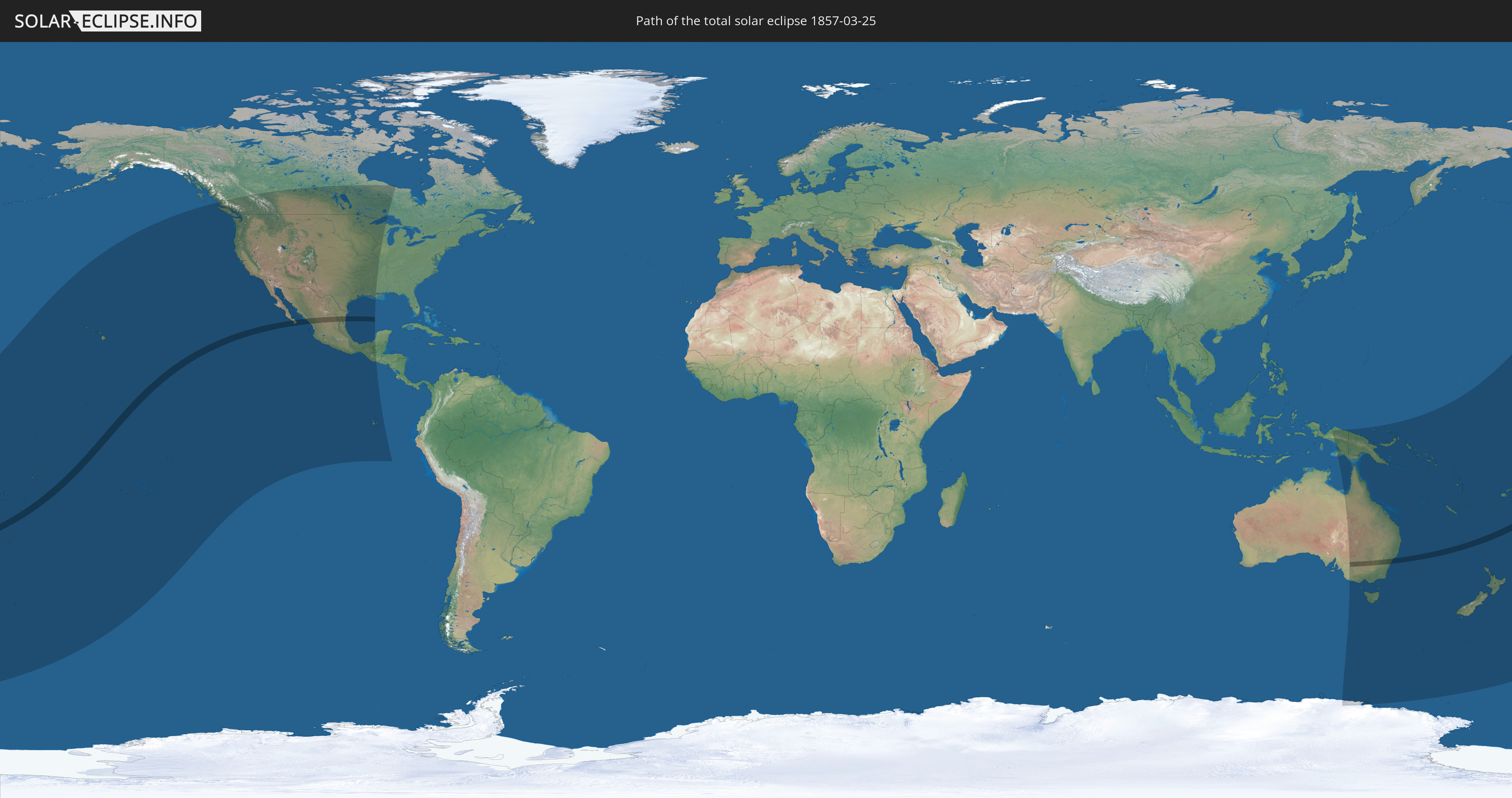
Total solar eclipse of 03/25/1857
| Day of week: | Wednesday |
| Maximum duration of eclipse: | 04m28s |
| Maximum width of eclipse path: | 177 km |
| Saros cycle: | 127 |
| Coverage: | 100% |
| Magnitude: | 1.0534 |
| Gamma: | -0.0892 |
Wo kann man die Sonnenfinsternis vom 03/25/1857 sehen?
Die Sonnenfinsternis am 03/25/1857 kann man in 29 Ländern als partielle Sonnenfinsternis beobachten.
Der Finsternispfad verläuft durch 5 Länder. Nur in diesen Ländern ist sie als total Sonnenfinsternis zu sehen.
In den folgenden Ländern ist die Sonnenfinsternis total zu sehen
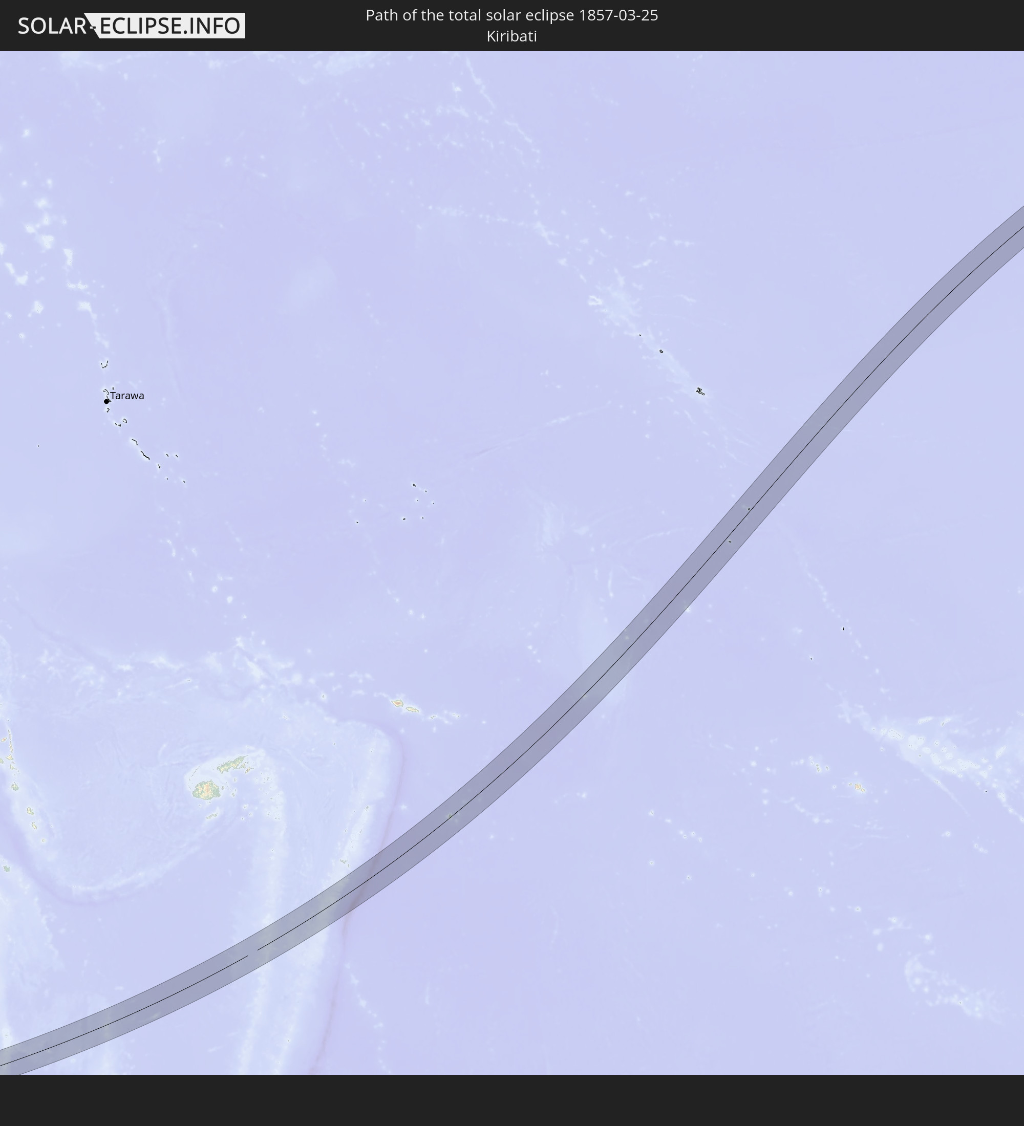 Kiribati
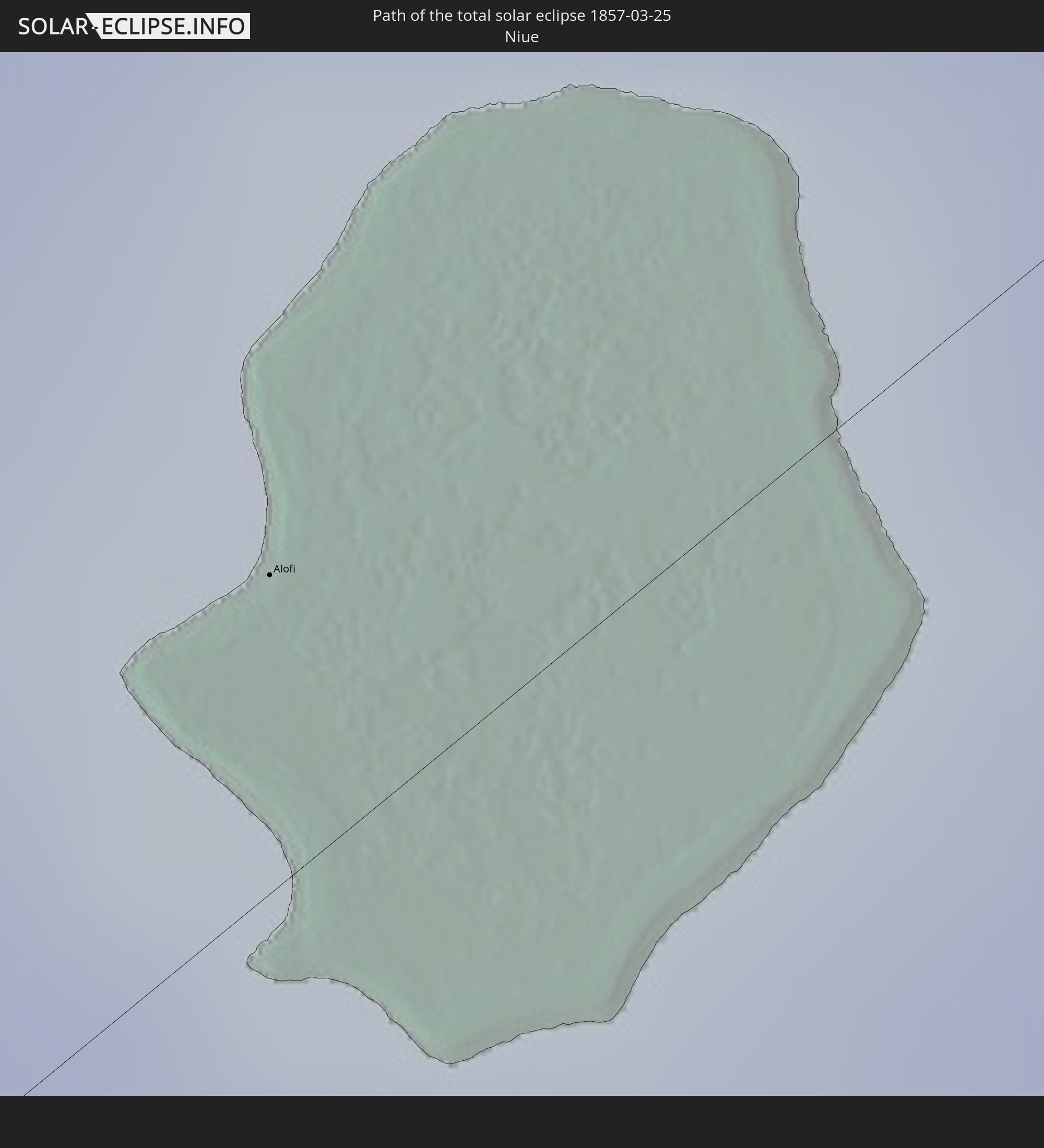 Niue
Niue
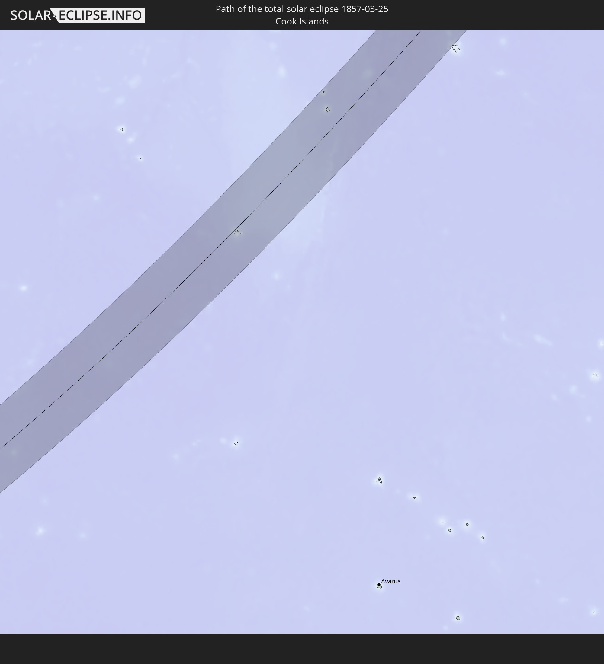 Cook Islands
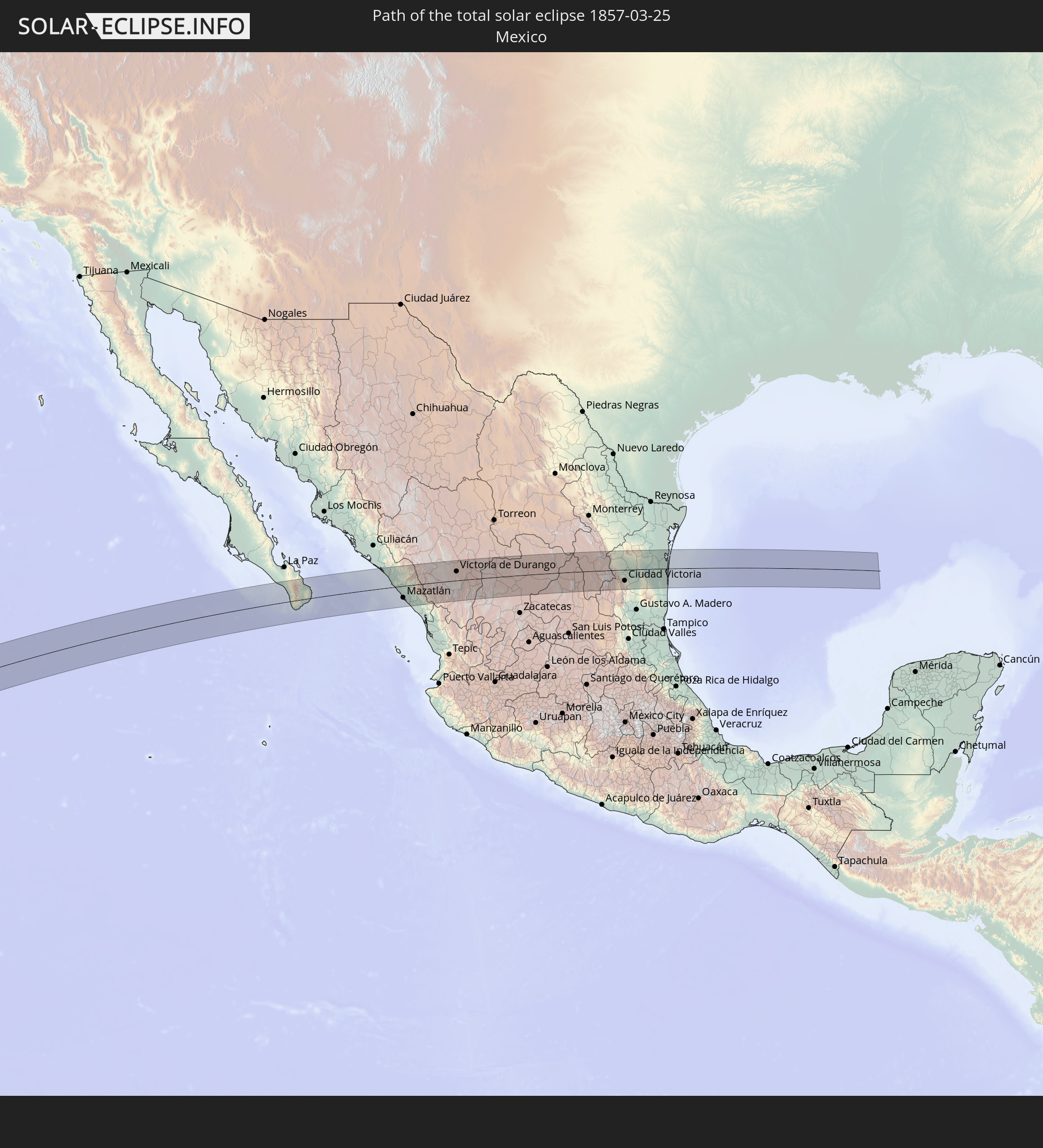 Mexico
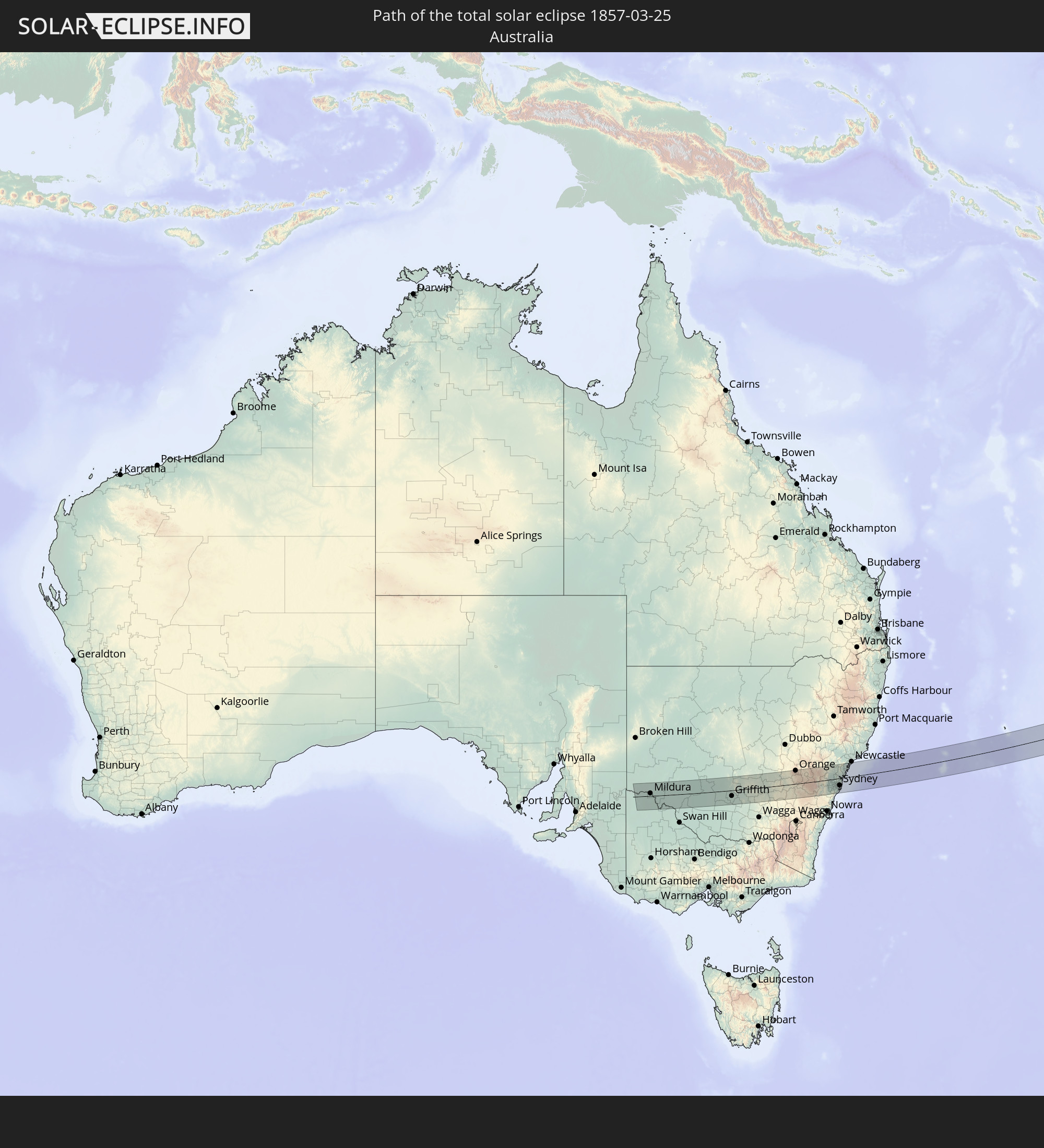 Australia
In den folgenden Ländern ist die Sonnenfinsternis partiell zu sehen
 Antarctica
 Fiji
Fiji
 United States
 New Zealand
 United States Minor Outlying Islands
 Wallis and Futuna
 Tonga
Tonga
 Kiribati
 Samoa
Samoa
 Tokelau
 American Samoa
 Niue
Niue
 Cook Islands
 French Polynesia
 Canada
 Pitcairn Islands
 Mexico
 Guatemala
 Ecuador
 Indonesia
 Australia
 Papua New Guinea
 Solomon Islands
 New Caledonia
 Marshall Islands
 Vanuatu
 Nauru
Nauru
 Norfolk Island
 Tuvalu
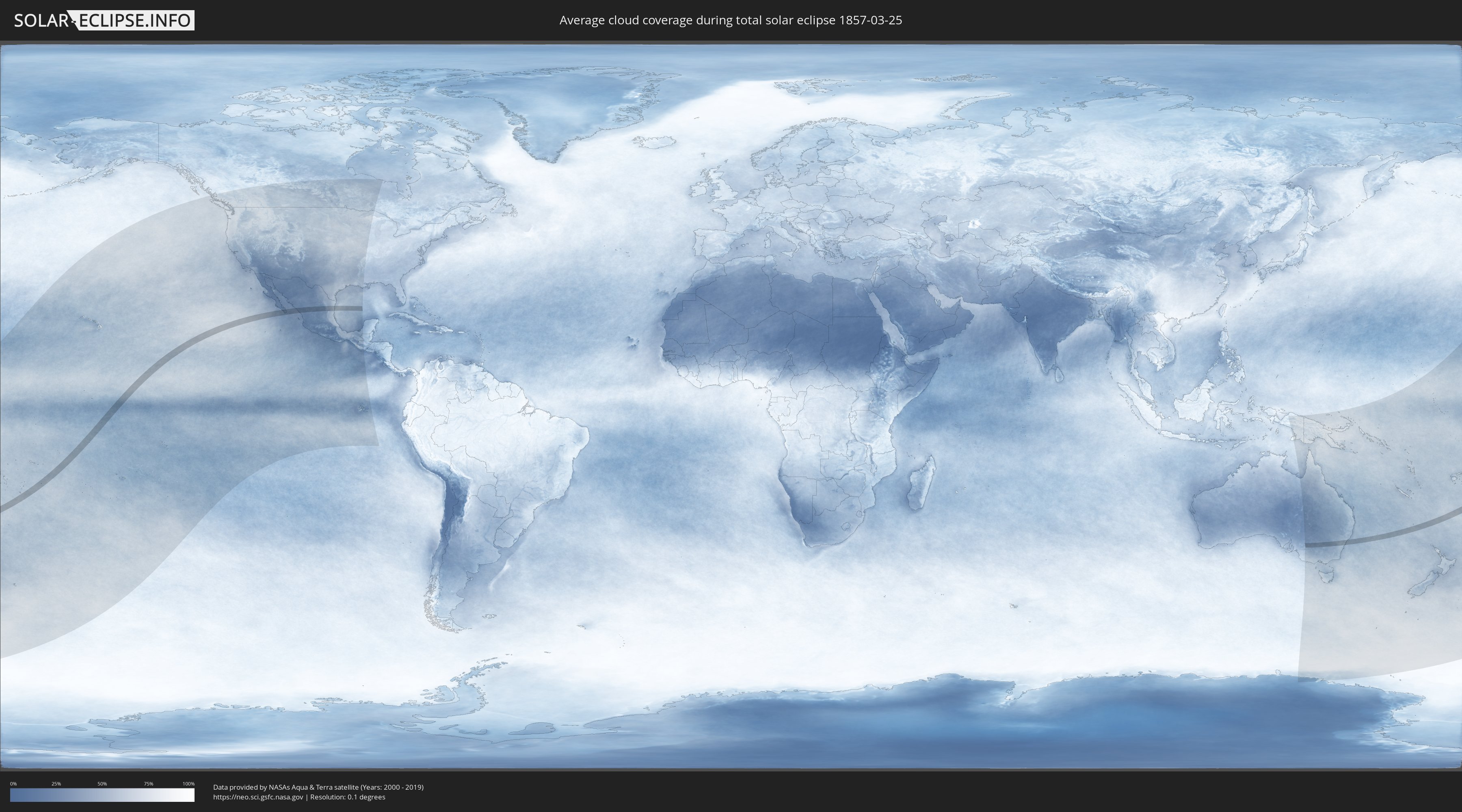
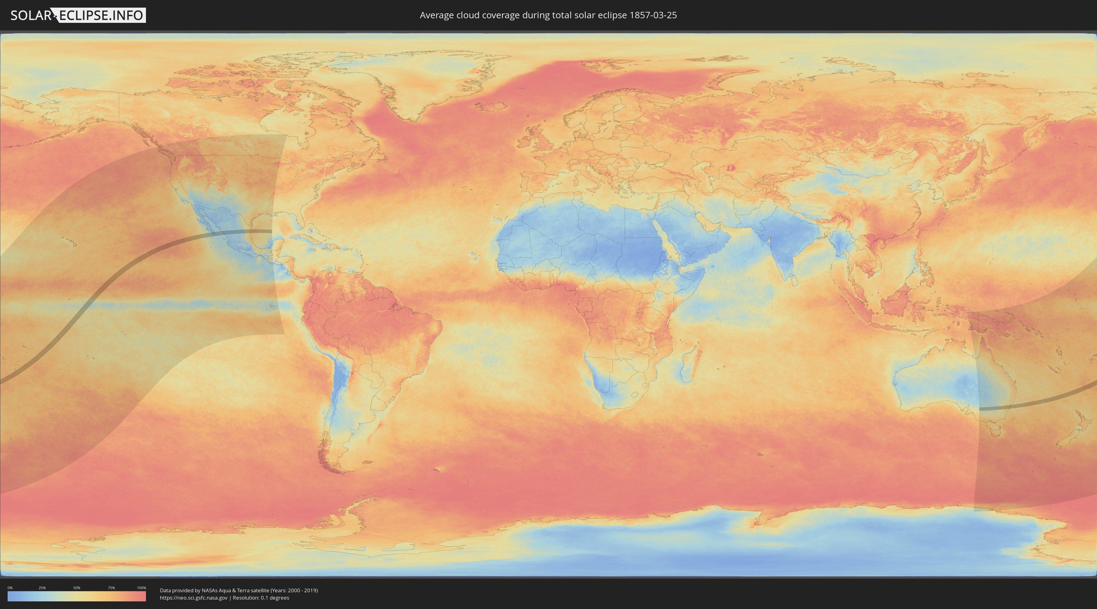
How will be the weather during the total solar eclipse on 03/25/1857?
Where is the best place to see the total solar eclipse of 03/25/1857?
The following maps show the average cloud coverage for the day of the total solar eclipse.
With the help of these maps, it is possible to find the place along the eclipse path, which has the best
chance of a cloudless sky.
Nevertheless, you should consider local circumstances and inform about the weather of your chosen
observation site.
The data is provided by NASAs satellites
AQUA and TERRA.
The cloud maps are averaged over a period of 19 years (2000 - 2019).
Detailed country maps
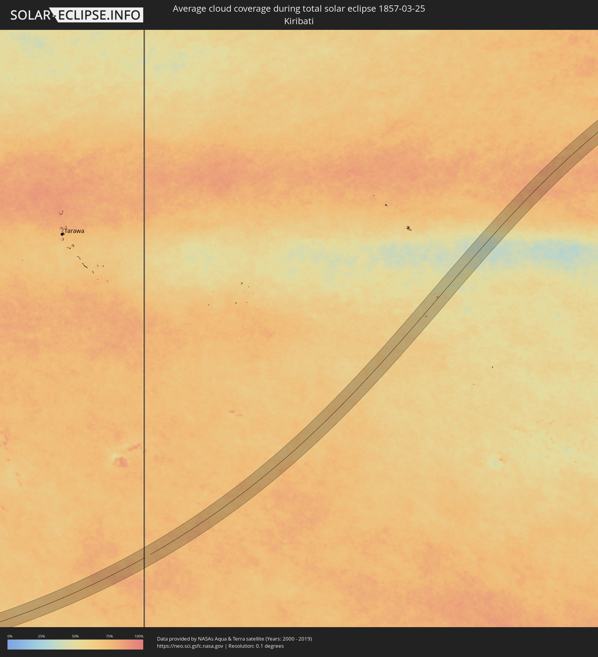 Kiribati
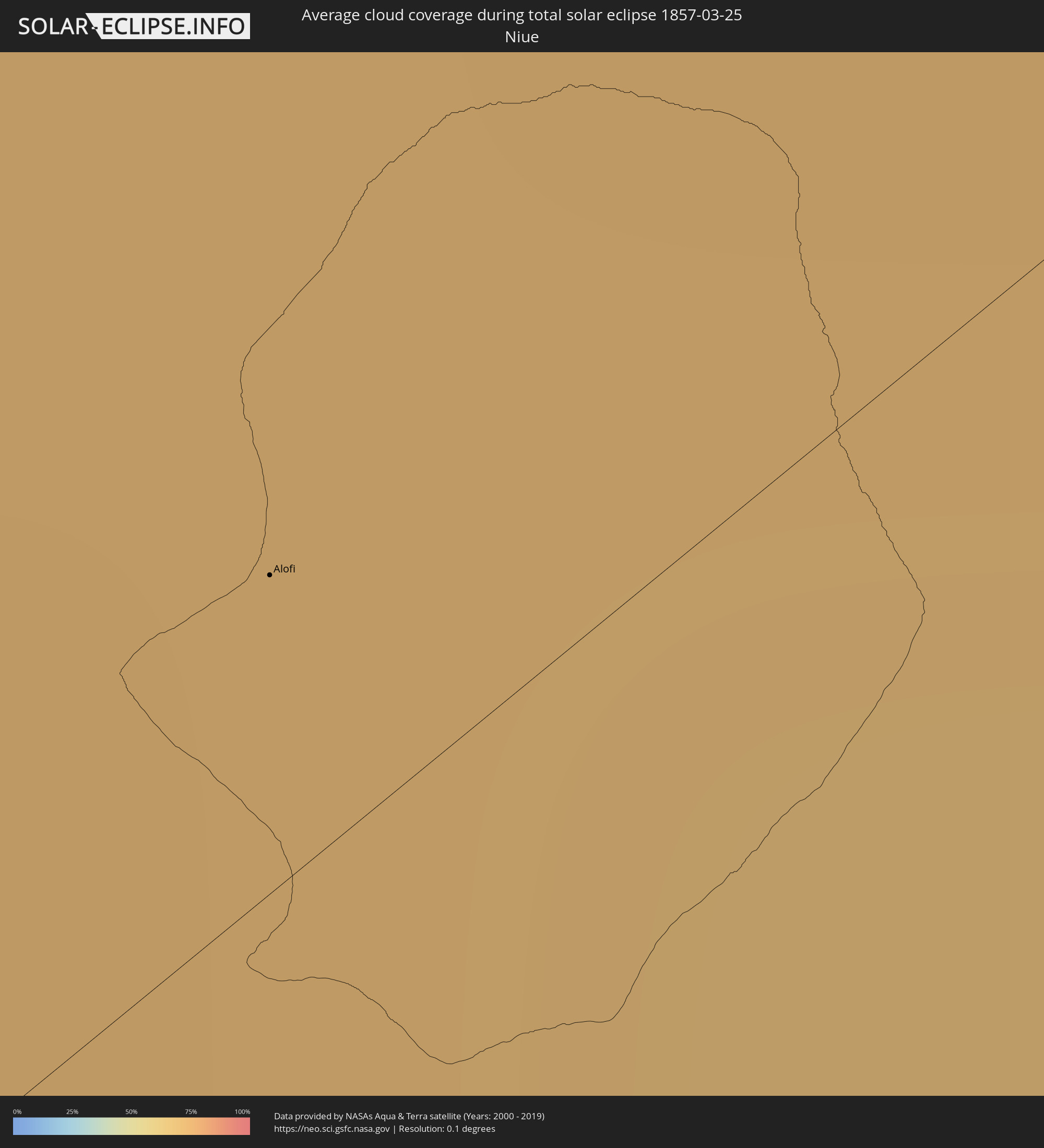 Niue
Niue
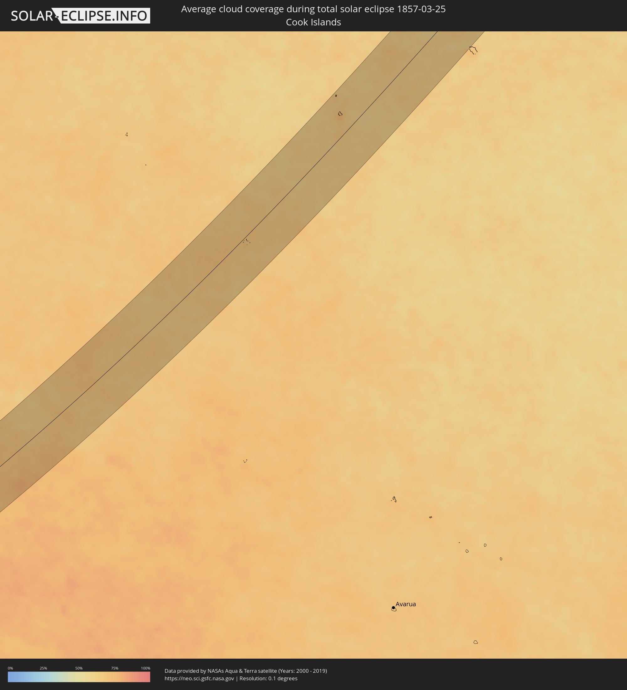 Cook Islands
 Mexico
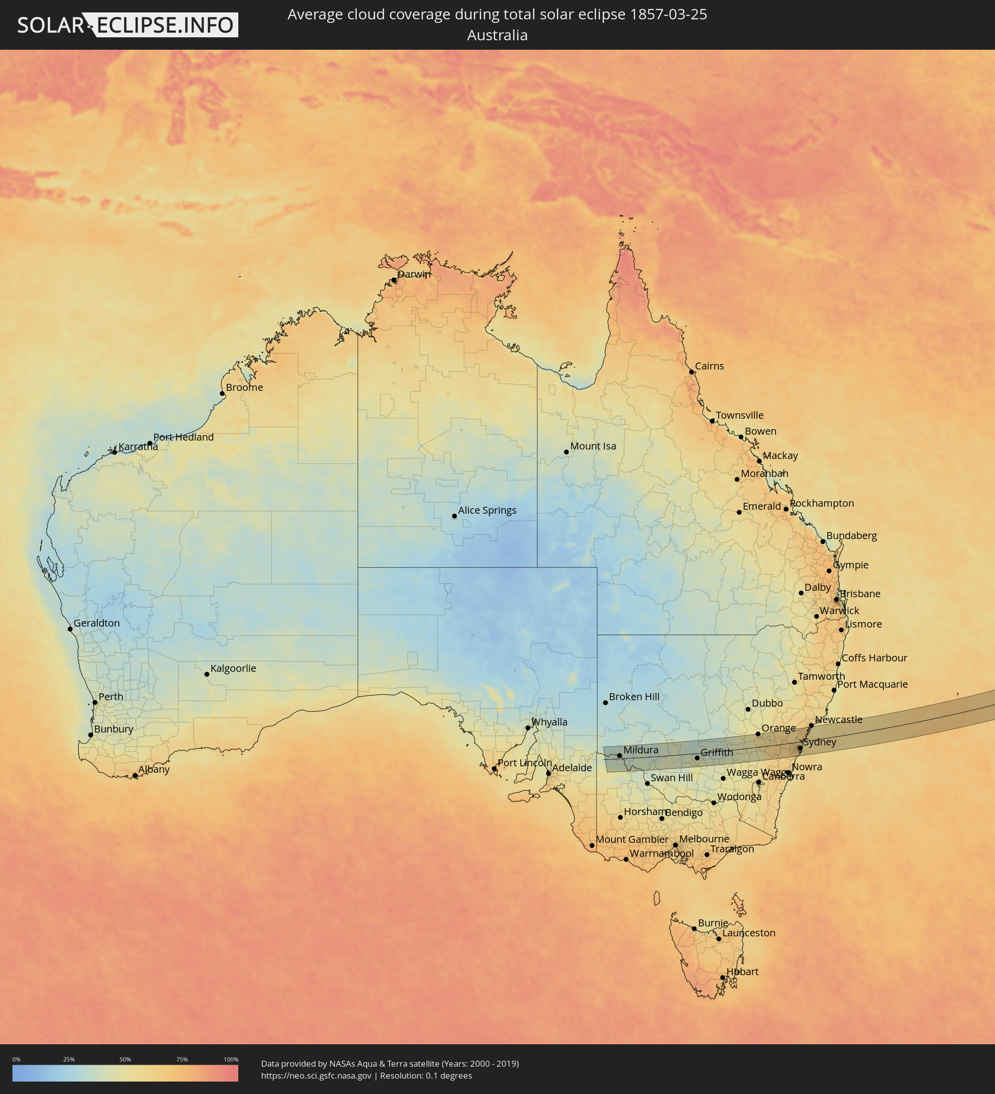 Australia
Cities inside the path of the eclipse
The following table shows all locations with a population of more than 5,000 inside the eclipse path. Cities which have more than 100,000 inhabitants are marked bold. A click at the locations opens a detailed map.
| City | Type | Eclipse duration | Local time of max. eclipse | Distance to central line | Ø Cloud coverage |
|
Alofi
|
total | - | 10:10:22 UTC-11:20 | 6 km | 73% |
|
Las Palmas, Baja California Sur
|
total | - | 17:01:27 UTC-07:05 | 23 km | 33% |
|
Cabo San Lucas, Baja California Sur
|
total | - | 17:01:27 UTC-07:05 | 29 km | 33% |
|
Las Veredas, Baja California Sur
|
total | - | 17:01:40 UTC-07:05 | 3 km | 23% |
|
San José del Cabo, Baja California Sur
|
total | - | 17:01:39 UTC-07:05 | 13 km | 26% |
|
La Cruz, Sinaloa
|
total | - | 17:03:24 UTC-07:05 | 43 km | 28% |
|
Mazatlán, Sinaloa
|
total | - | 17:03:24 UTC-07:05 | 39 km | 29% |
|
Fraccionamiento los Ángeles, Sinaloa
|
total | - | 17:03:25 UTC-07:05 | 45 km | 25% |
|
Villa Unión, Sinaloa
|
total | - | 17:03:28 UTC-07:05 | 46 km | 23% |
|
Concordia, Sinaloa
|
total | - | 17:03:35 UTC-07:05 | 37 km | 23% |
|
Tayoltita, Durango
|
total | - | 17:32:57 UTC-06:36 | 52 km | 22% |
|
Pueblo Nuevo, Durango
|
total | - | 17:32:58 UTC-06:36 | 34 km | 23% |
|
Victoria de Durango, Durango
|
total | - | 17:33:27 UTC-06:36 | 30 km | 26% |
|
Vicente Guerrero, Durango
|
total | - | 17:33:38 UTC-06:36 | 8 km | 27% |
|
Sombrerete, Zacatecas
|
total | - | 17:33:45 UTC-06:36 | 22 km | 28% |
|
Miguel Auza, Zacatecas
|
total | - | 17:33:59 UTC-06:36 | 50 km | 26% |
|
Juan Aldama, Zacatecas
|
total | - | 17:34:00 UTC-06:36 | 49 km | 26% |
|
Río Grande, Zacatecas
|
total | - | 17:34:01 UTC-06:36 | 5 km | 30% |
|
Nieves, Zacatecas
|
total | - | 17:34:04 UTC-06:36 | 13 km | 26% |
|
Cañitas de Felipe Pescador, Zacatecas
|
total | - | 17:34:04 UTC-06:36 | 32 km | 25% |
|
Matehuala, San Luis Potosí
|
total | - | 17:34:44 UTC-06:36 | 40 km | 29% |
|
Doctor Arroyo, Nuevo León
|
total | - | 17:34:52 UTC-06:36 | 40 km | 31% |
|
Estación Santa Engracia, Tamaulipas
|
total | - | 17:35:11 UTC-06:36 | 6 km | 47% |
|
Guillermo Zúñiga, Tamaulipas
|
total | - | 17:35:11 UTC-06:36 | 6 km | 47% |
|
Ciudad Victoria, Tamaulipas
|
total | - | 17:35:08 UTC-06:36 | 36 km | 44% |
|
Nuevo Padilla, Tamaulipas
|
total | - | 17:35:15 UTC-06:36 | 3 km | 48% |
|
Santander Jiménez, Tamaulipas
|
total | - | 17:35:23 UTC-06:36 | 14 km | 56% |
|
Abasolo, Tamaulipas
|
total | - | 17:35:23 UTC-06:36 | 4 km | 55% |
|
Soto la Marina, Tamaulipas
|
total | - | 17:35:21 UTC-06:36 | 36 km | 58% |
|
Mildura, Victoria
|
total | - | 06:46:16 UTC+10:00 | 11 km | 44% |
|
Griffith, New South Wales
|
total | - | 06:46:33 UTC+10:00 | 25 km | 45% |
|
Leeton, New South Wales
|
total | - | 06:46:37 UTC+10:00 | 57 km | 46% |
|
Young, New South Wales
|
total | - | 06:46:52 UTC+10:00 | 48 km | 49% |
|
Cowra, New South Wales
|
total | - | 06:46:54 UTC+10:00 | 1 km | 47% |
|
Orange, New South Wales
|
total | - | 06:46:56 UTC+10:00 | 58 km | 55% |
|
Bathurst, New South Wales
|
total | - | 06:47:02 UTC+10:00 | 38 km | 56% |
|
Kelso, New South Wales
|
total | - | 06:47:03 UTC+10:00 | 38 km | 56% |
|
Lithgow, New South Wales
|
total | - | 06:47:10 UTC+10:00 | 24 km | 60% |
|
Katoomba, New South Wales
|
total | - | 06:47:13 UTC+10:00 | 4 km | 64% |
|
Blaxland, New South Wales
|
total | - | 06:47:17 UTC+10:00 | 11 km | 59% |
|
Glenmore Park, New South Wales
|
total | - | 06:47:18 UTC+10:00 | 16 km | 65% |
|
Cambridge Park, New South Wales
|
total | - | 06:47:18 UTC+10:00 | 12 km | 63% |
|
Narellan, New South Wales
|
total | - | 06:47:19 UTC+10:00 | 43 km | 66% |
|
Narellan Vale, New South Wales
|
total | - | 06:47:20 UTC+10:00 | 45 km | 66% |
|
Richmond, New South Wales
|
total | - | 06:47:18 UTC+10:00 | 4 km | 62% |
|
South Windsor, New South Wales
|
total | - | 06:47:19 UTC+10:00 | 1 km | 62% |
|
Riverstone, New South Wales
|
total | - | 06:47:20 UTC+10:00 | 7 km | 66% |
|
Ingleburn, New South Wales
|
total | - | 06:47:21 UTC+10:00 | 41 km | 65% |
|
Glenfield, New South Wales
|
total | - | 06:47:21 UTC+10:00 | 38 km | 65% |
|
Cabramatta West, New South Wales
|
total | - | 06:47:21 UTC+10:00 | 31 km | 67% |
|
Rouse Hill, New South Wales
|
total | - | 06:47:21 UTC+10:00 | 7 km | 66% |
|
Blacktown, New South Wales
|
total | - | 06:47:21 UTC+10:00 | 16 km | 66% |
|
Fairfield Heights, New South Wales
|
total | - | 06:47:22 UTC+10:00 | 27 km | 67% |
|
Beaumont Hills, New South Wales
|
total | - | 06:47:21 UTC+10:00 | 9 km | 66% |
|
Merrylands, New South Wales
|
total | - | 06:47:22 UTC+10:00 | 24 km | 66% |
|
Northmead, New South Wales
|
total | - | 06:47:22 UTC+10:00 | 19 km | 66% |
|
Helensburgh, New South Wales
|
total | - | 06:47:23 UTC+10:00 | 63 km | 57% |
|
Glenhaven, New South Wales
|
total | - | 06:47:22 UTC+10:00 | 10 km | 66% |
|
Heathcote, New South Wales
|
total | - | 06:47:23 UTC+10:00 | 53 km | 59% |
|
Bankstown, New South Wales
|
total | - | 06:47:23 UTC+10:00 | 34 km | 64% |
|
Lugarno, New South Wales
|
total | - | 06:47:23 UTC+10:00 | 42 km | 62% |
|
Jannali, New South Wales
|
total | - | 06:47:24 UTC+10:00 | 46 km | 58% |
|
Pennant Hills, New South Wales
|
total | - | 06:47:23 UTC+10:00 | 15 km | 63% |
|
Belfield, New South Wales
|
total | - | 06:47:24 UTC+10:00 | 33 km | 61% |
|
Gymea, New South Wales
|
total | - | 06:47:24 UTC+10:00 | 48 km | 58% |
|
Concord West, New South Wales
|
total | - | 06:47:24 UTC+10:00 | 27 km | 62% |
|
Gymea Bay, New South Wales
|
total | - | 06:47:24 UTC+10:00 | 50 km | 55% |
|
Hornsby Heights, New South Wales
|
total | - | 06:47:23 UTC+10:00 | 8 km | 63% |
|
Hornsby, New South Wales
|
total | - | 06:47:23 UTC+10:00 | 12 km | 63% |
|
Macquarie Park, New South Wales
|
total | - | 06:47:24 UTC+10:00 | 20 km | 62% |
|
Mount Colah, New South Wales
|
total | - | 06:47:24 UTC+10:00 | 10 km | 63% |
|
Caringbah, New South Wales
|
total | - | 06:47:25 UTC+10:00 | 50 km | 58% |
|
Summer Hill, New South Wales
|
total | - | 06:47:25 UTC+10:00 | 33 km | 61% |
|
Brighton-Le-Sands, New South Wales
|
total | - | 06:47:25 UTC+10:00 | 41 km | 55% |
|
Lilyfield, New South Wales
|
total | - | 06:47:25 UTC+10:00 | 31 km | 58% |
|
Lindfield, New South Wales
|
total | - | 06:47:25 UTC+10:00 | 21 km | 59% |
|
Camperdown, New South Wales
|
total | - | 06:47:25 UTC+10:00 | 33 km | 58% |
|
Botany, New South Wales
|
total | - | 06:47:25 UTC+10:00 | 40 km | 58% |
|
Haberfield, New South Wales
|
total | - | 06:47:25 UTC+10:00 | 33 km | 58% |
|
Alexandria, New South Wales
|
total | - | 06:47:25 UTC+10:00 | 35 km | 58% |
|
North Sydney, New South Wales
|
total | - | 06:47:25 UTC+10:00 | 28 km | 59% |
|
Sydney, New South Wales
|
total | - | 06:47:25 UTC+10:00 | 31 km | 58% |
|
Cammeray, New South Wales
|
total | - | 06:47:25 UTC+10:00 | 26 km | 59% |
|
Woollahra, New South Wales
|
total | - | 06:47:26 UTC+10:00 | 34 km | 58% |
|
Allambie Heights, New South Wales
|
total | - | 06:47:26 UTC+10:00 | 20 km | 59% |
|
Balgowlah, New South Wales
|
total | - | 06:47:26 UTC+10:00 | 24 km | 56% |
|
Bronte, New South Wales
|
total | - | 06:47:26 UTC+10:00 | 36 km | 55% |
|
Fairlight, New South Wales
|
total | - | 06:47:26 UTC+10:00 | 24 km | 56% |
|
Narrabeen, New South Wales
|
total | - | 06:47:26 UTC+10:00 | 15 km | 56% |
|
Dee Why, New South Wales
|
total | - | 06:47:26 UTC+10:00 | 19 km | 56% |
|
Umina, New South Wales
|
total | - | 06:47:26 UTC+10:00 | 6 km | 55% |
|
Bateau Bay, New South Wales
|
total | - | 06:47:28 UTC+10:00 | 19 km | 55% |
|
Gorokan, New South Wales
|
total | - | 06:47:29 UTC+10:00 | 32 km | 57% |
|
Rathmines, New South Wales
|
total | - | 06:47:29 UTC+10:00 | 56 km | 59% |
|
Eleebana, New South Wales
|
total | - | 06:47:30 UTC+10:00 | 60 km | 59% |
|
Belmont North, New South Wales
|
total | - | 06:47:31 UTC+10:00 | 56 km | 55% |