Totale Sonnenfinsternis vom 18.08.1868
| Wochentag: | Dienstag |
| Maximale Dauer der Verfinsterung: | 06m47s |
| Maximale Breite des Finsternispfades: | 245 km |
| Saroszyklus: | 133 |
| Bedeckungsgrad: | 100% |
| Magnitude: | 1.0756 |
| Gamma: | -0.0443 |
Wo kann man die Sonnenfinsternis vom 18.08.1868 sehen?
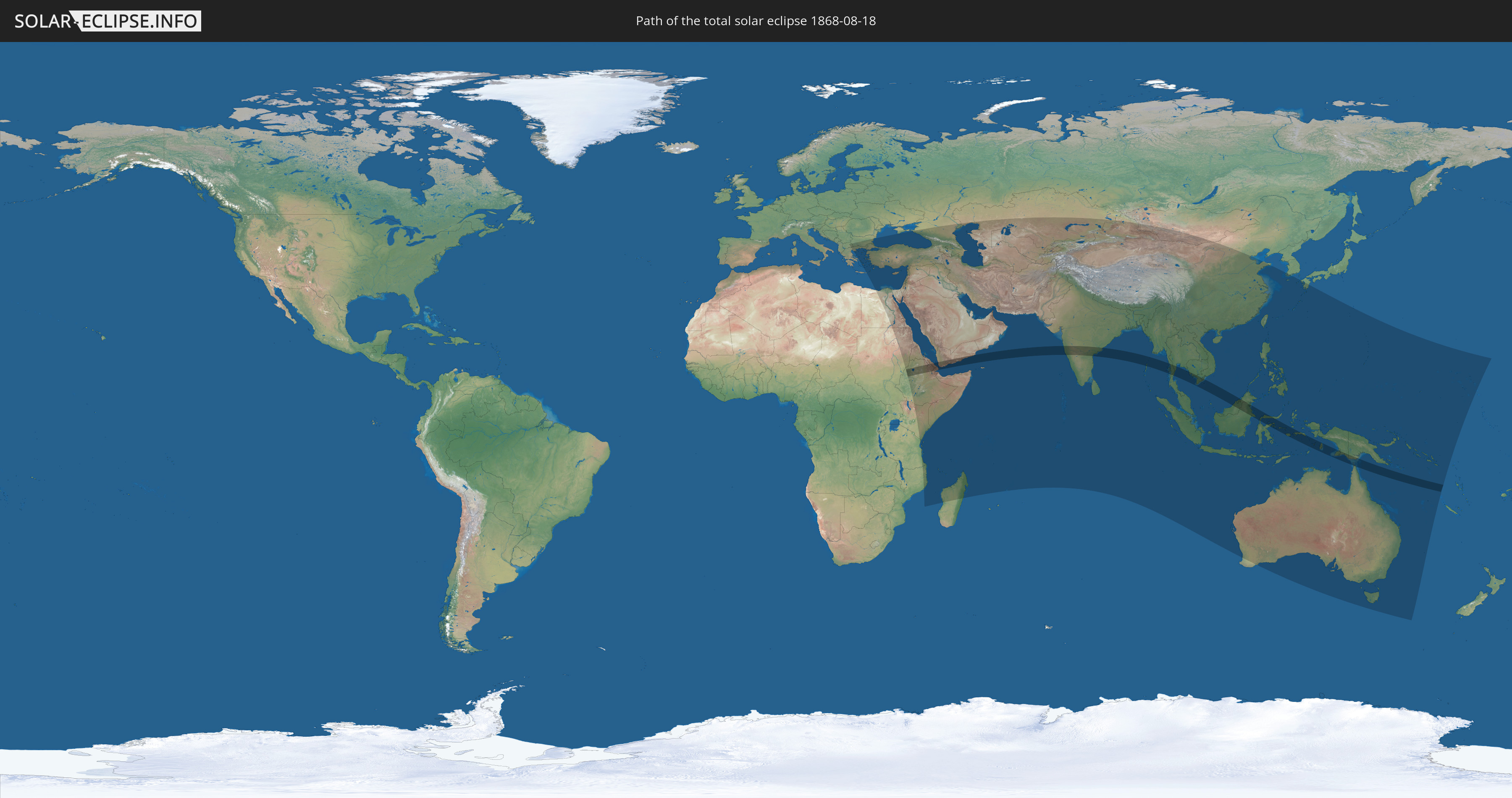
Die Sonnenfinsternis am 18.08.1868 kann man in 83 Ländern als partielle Sonnenfinsternis beobachten.
Der Finsternispfad verläuft durch 14 Länder. Nur in diesen Ländern ist sie als totale Sonnenfinsternis zu sehen.
In den folgenden Ländern ist die Sonnenfinsternis total zu sehen
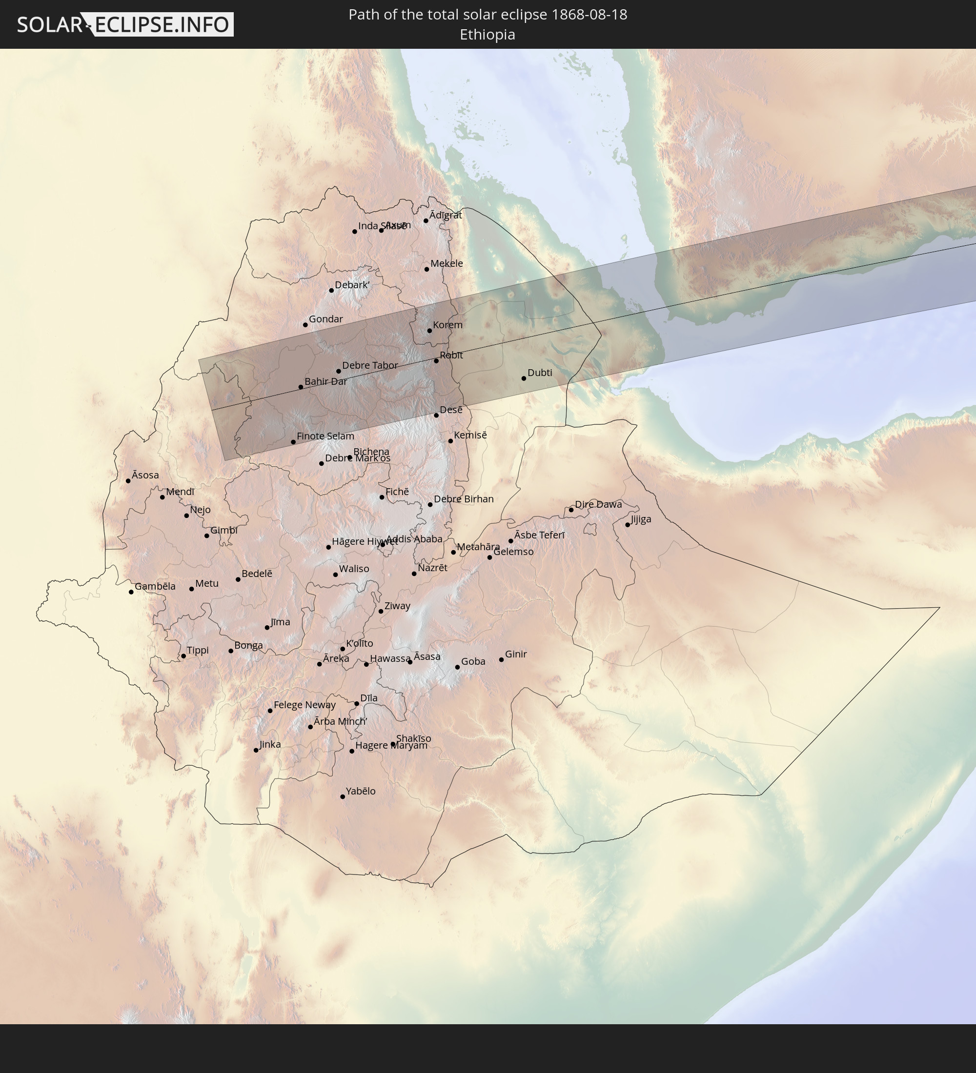 Äthiopien
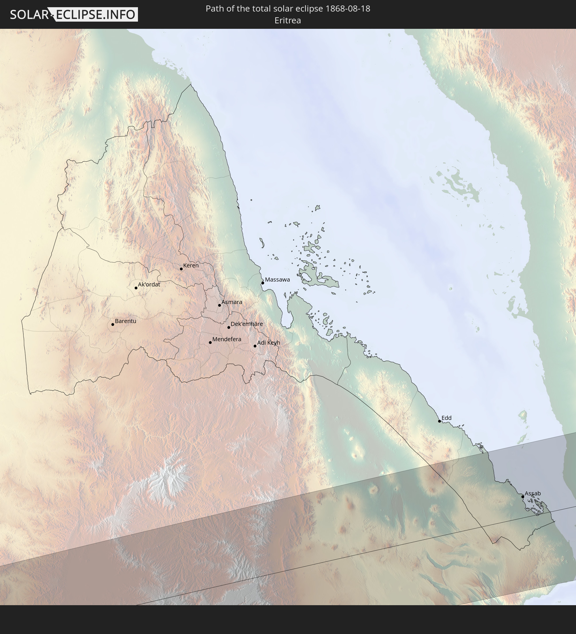 Eritrea
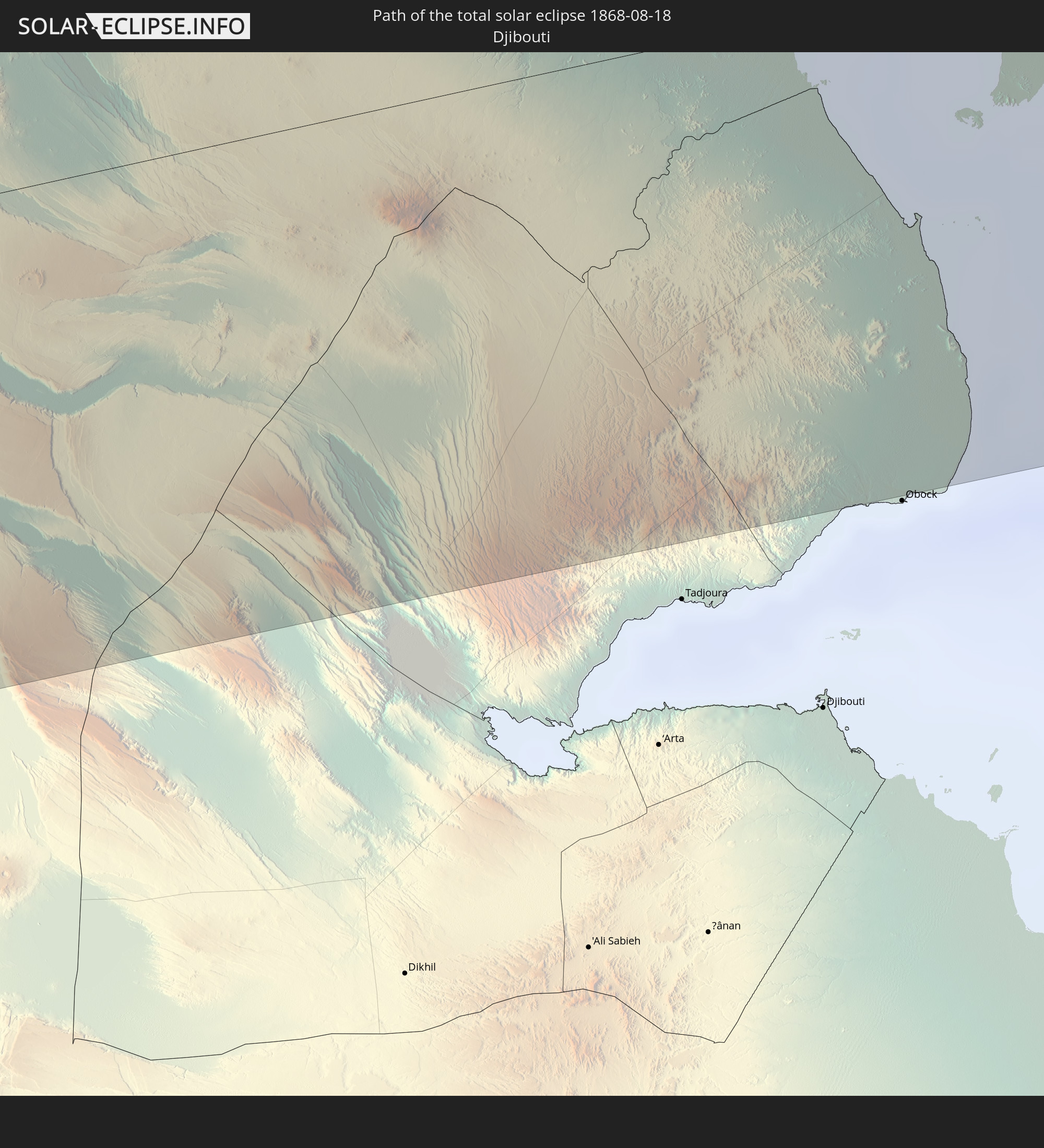 Dschibuti
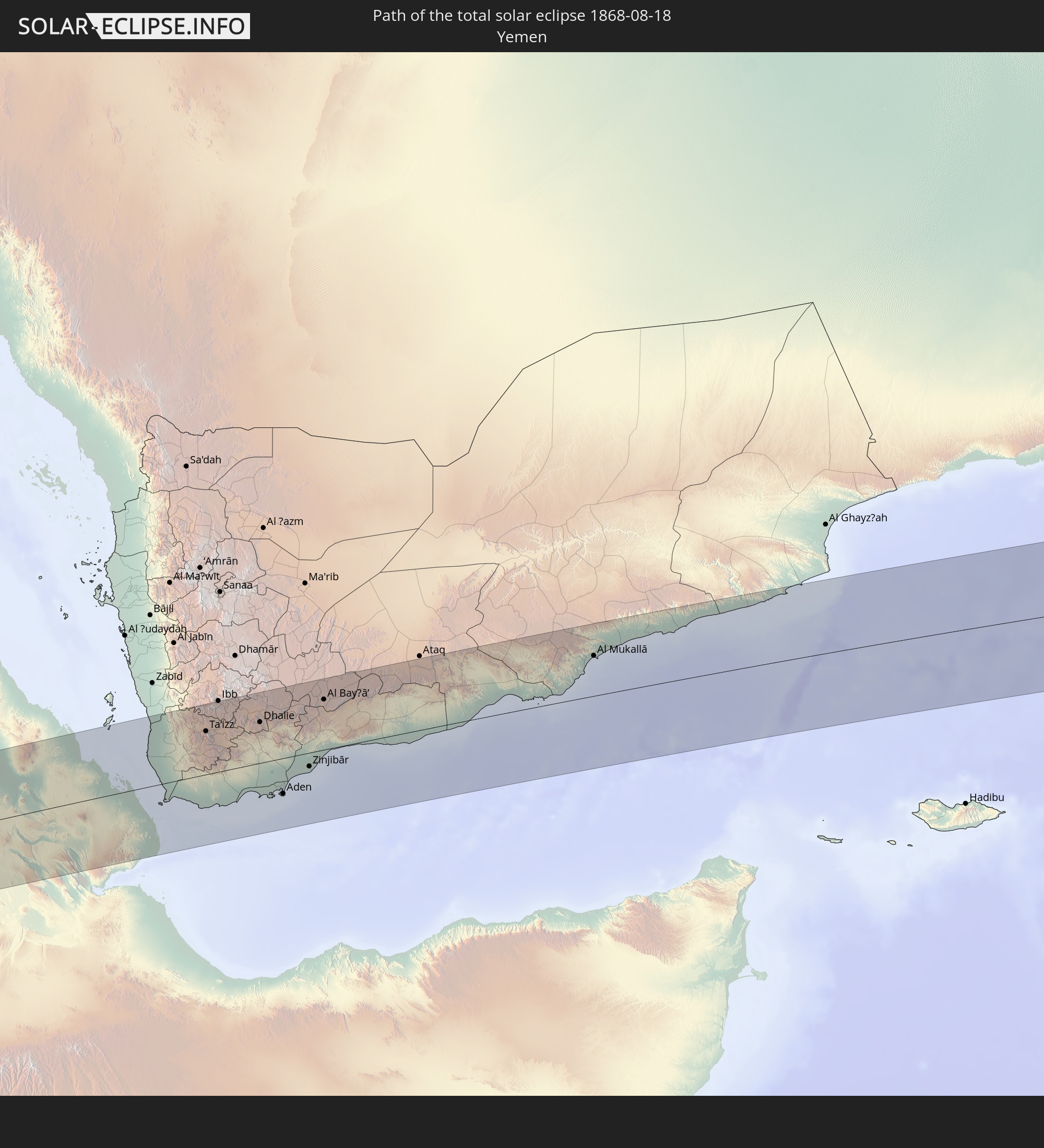 Jemen
Jemen
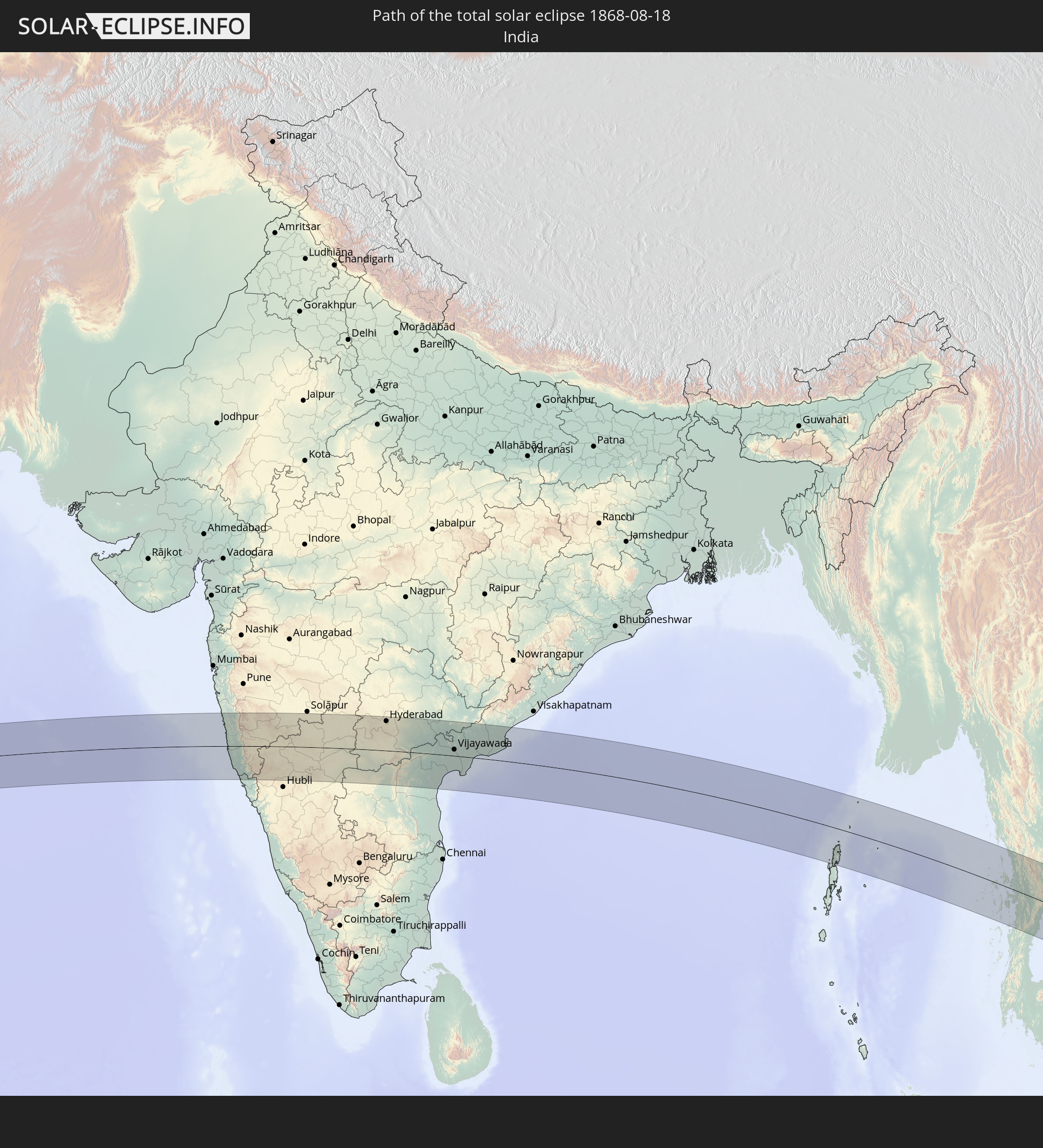 Indien
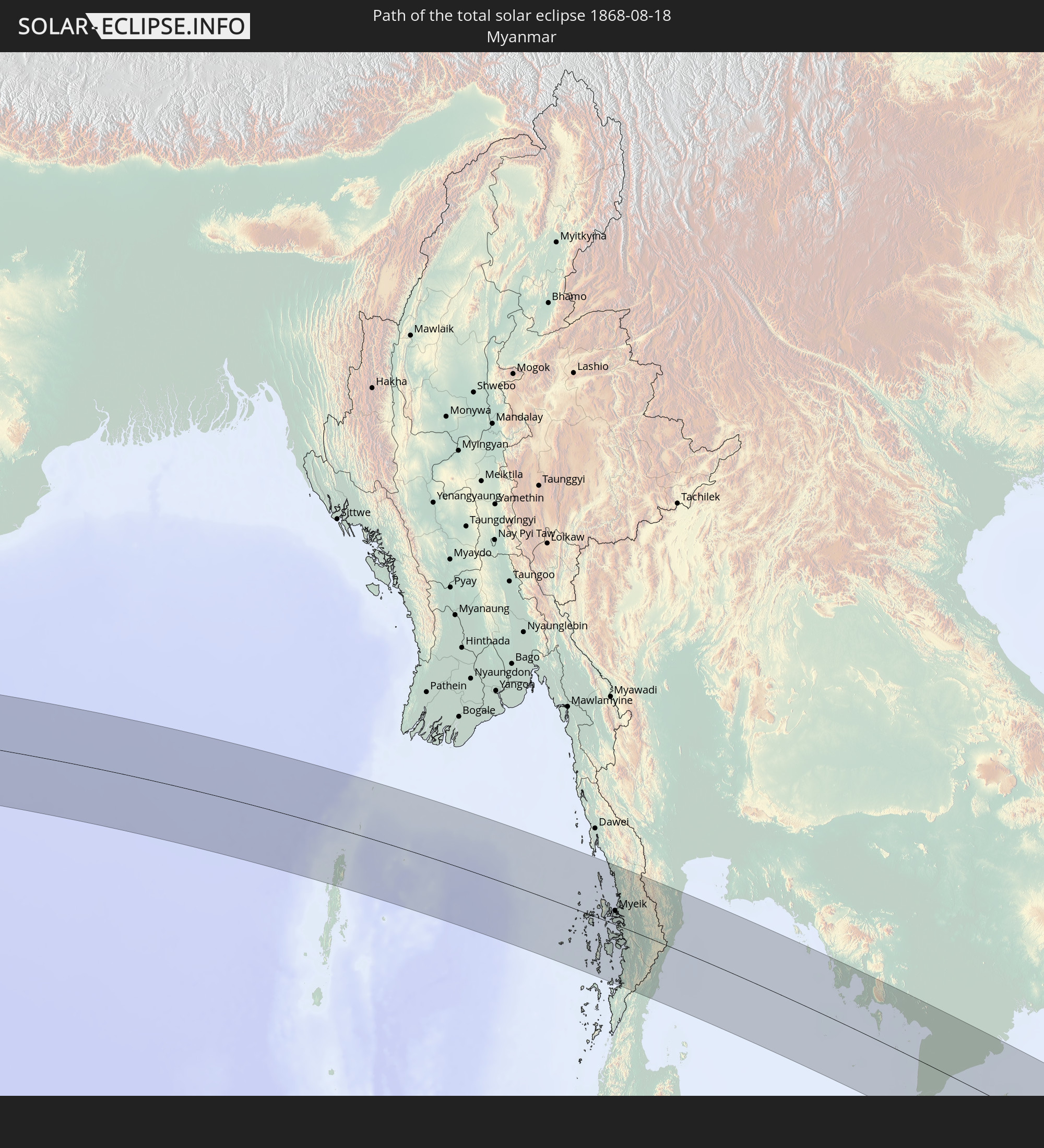 Myanmar
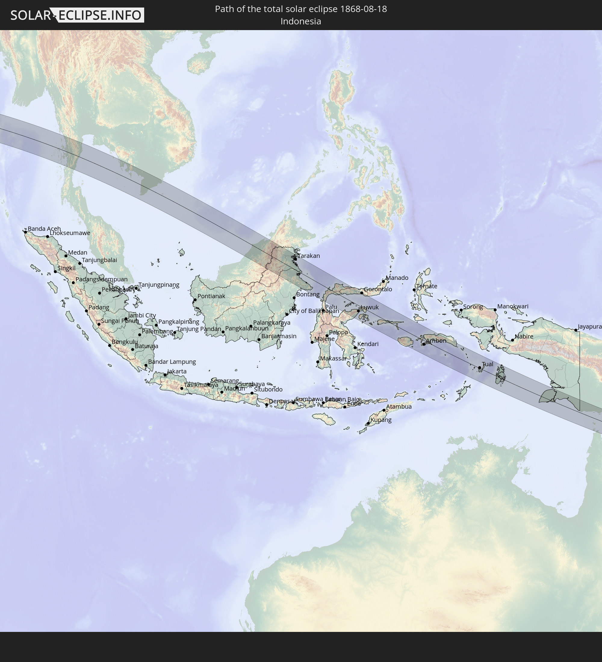 Indonesien
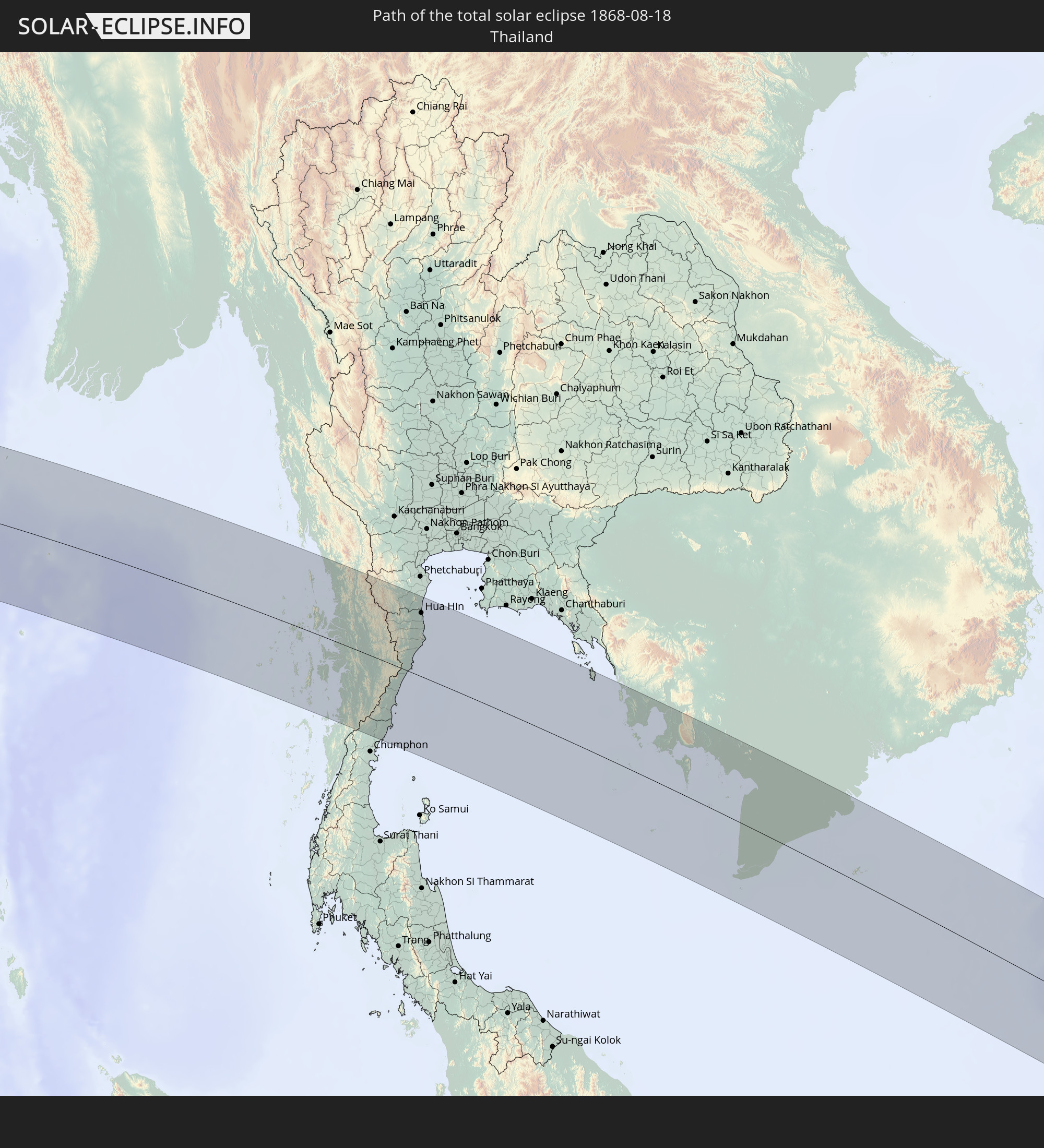 Thailand
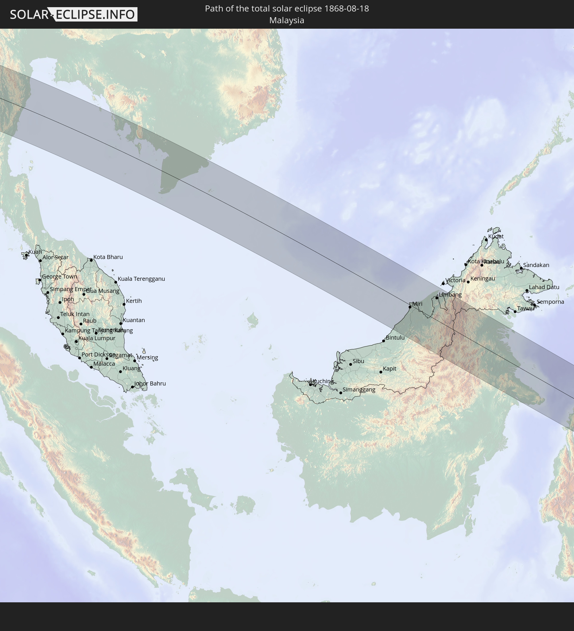 Malaysia
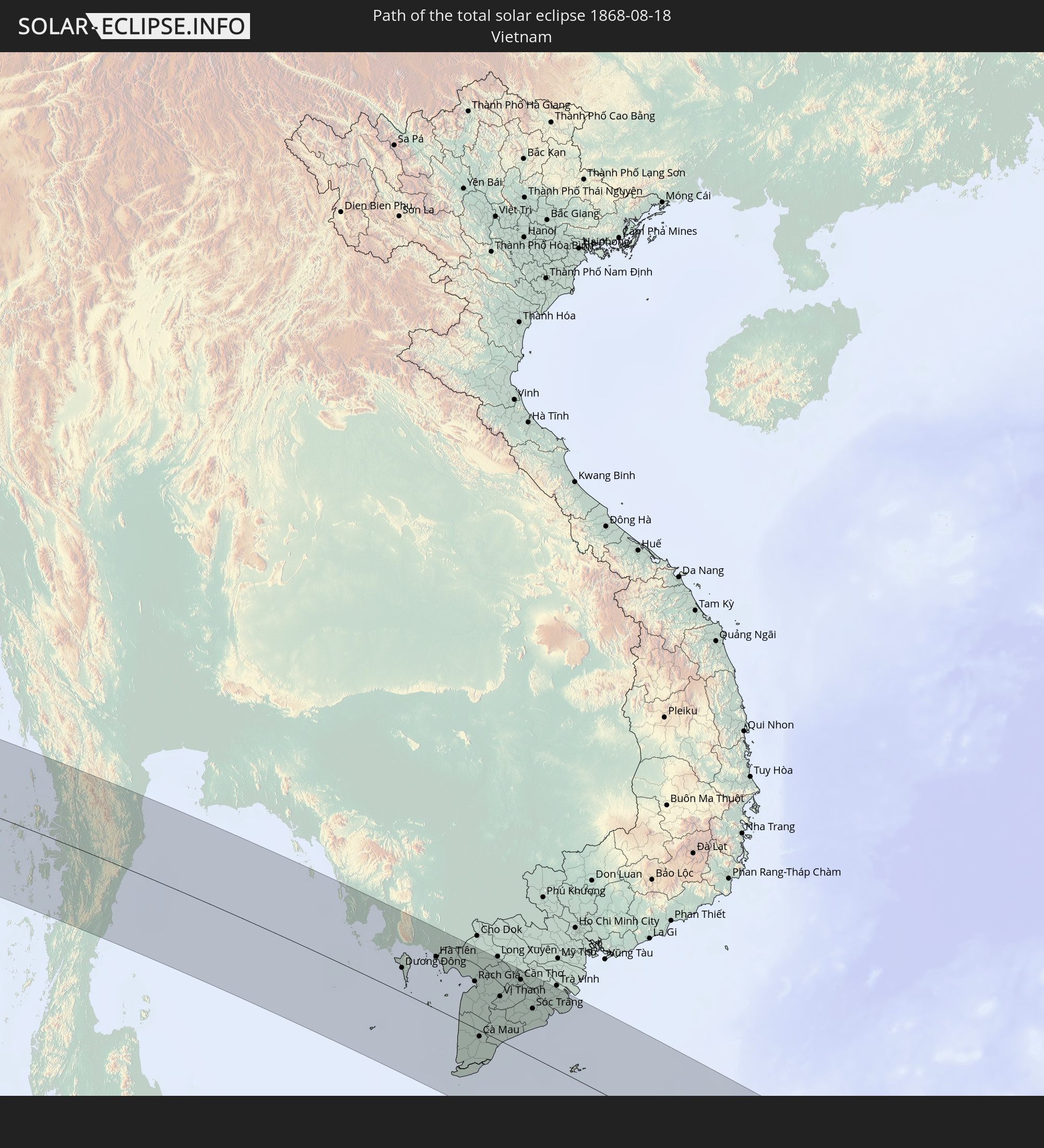 Vietnam
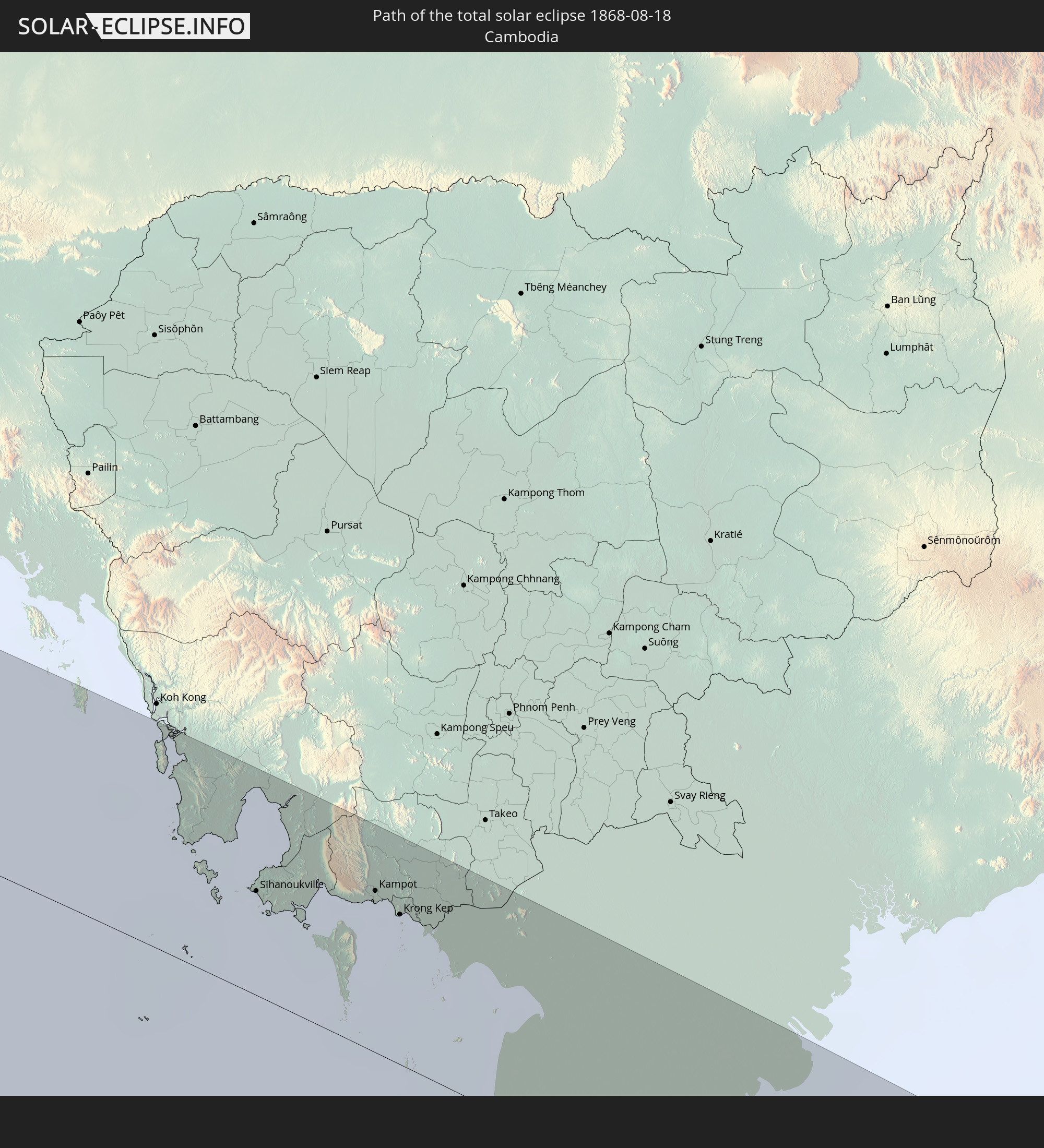 Kambodscha
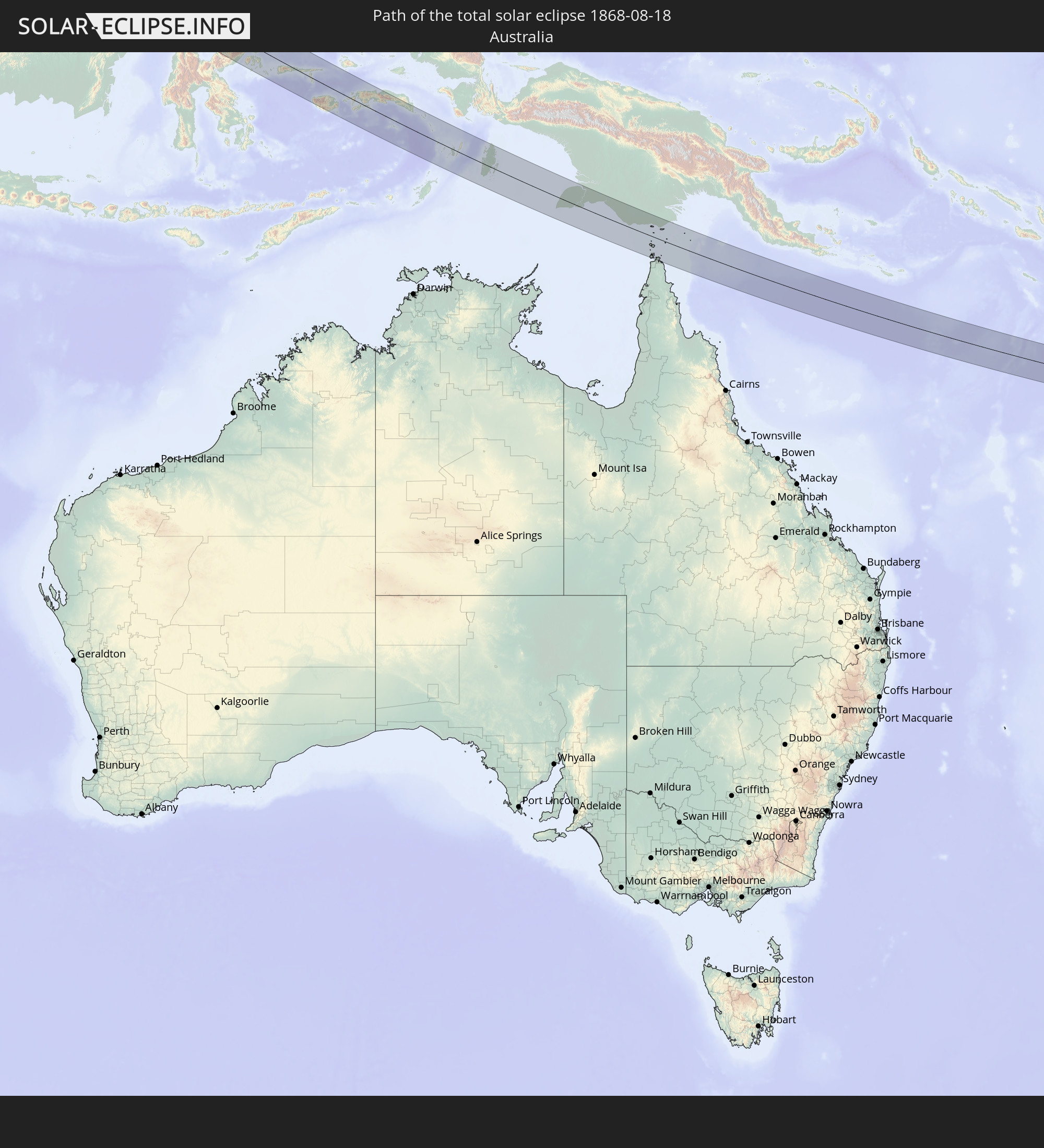 Australien
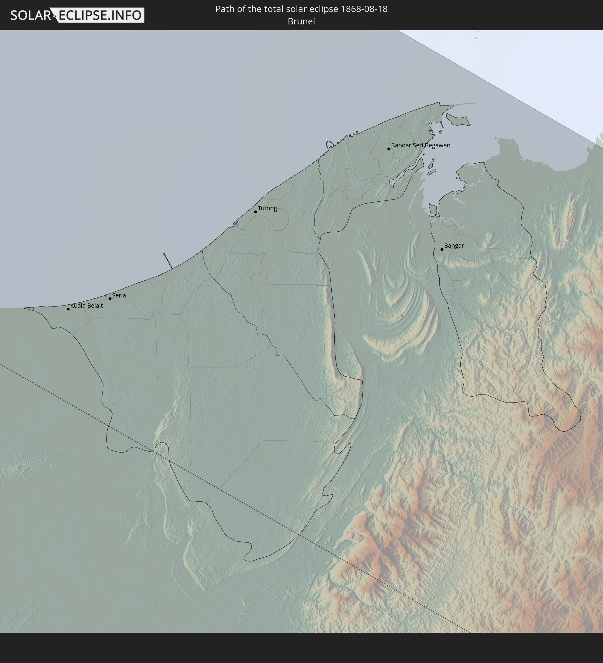 Brunei
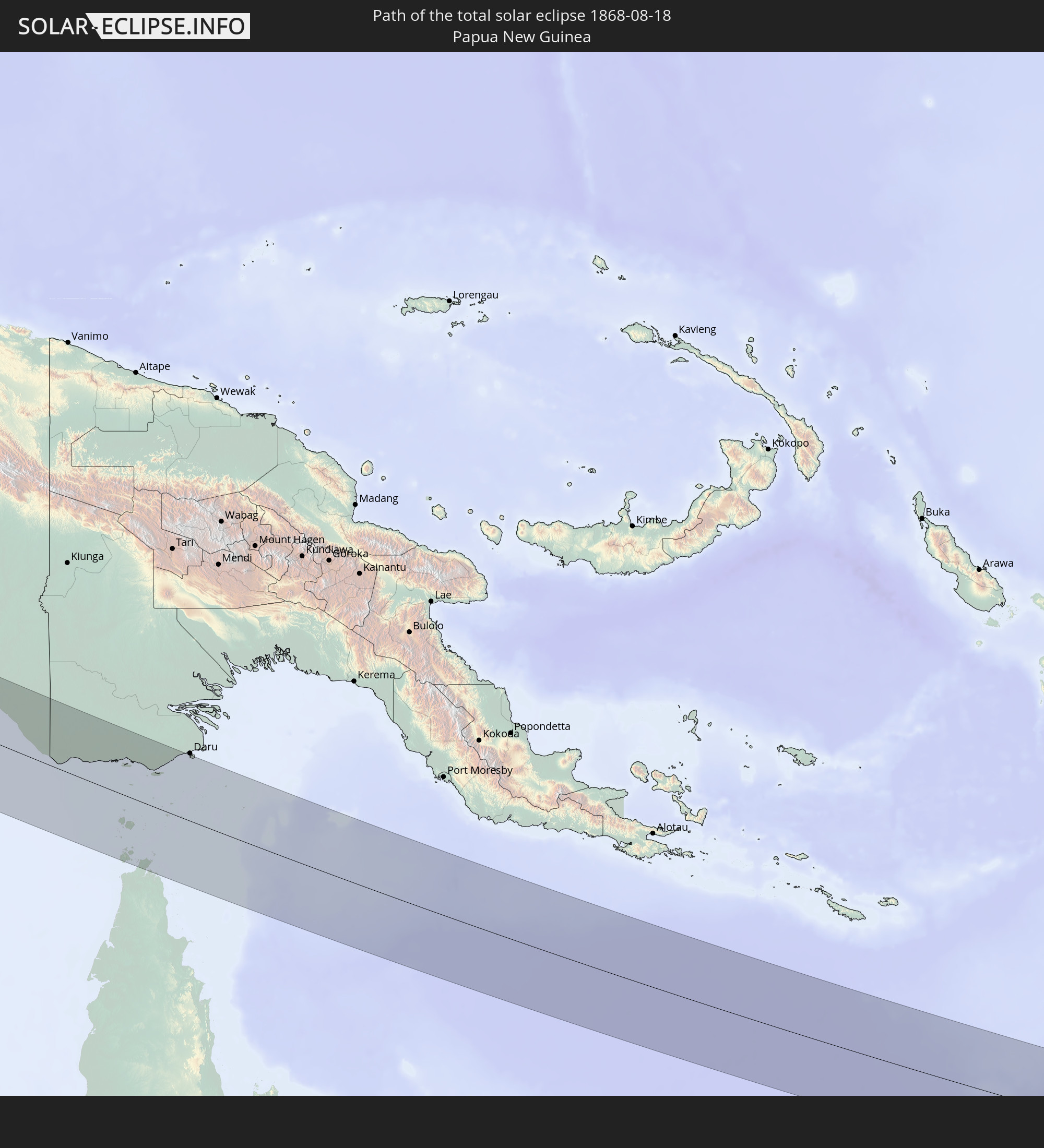 Papua-Neuguinea
In den folgenden Ländern ist die Sonnenfinsternis partiell zu sehen
 Russland
 Griechenland
 Mazedonien
 Sudan
Sudan
 Ukraine
 Bulgarien
 Ägypten
 Türkei
 Tansania
 Mosambik
 Republik Zypern
 Äthiopien
 Kenia
Kenia
 Staat Palästina
 Israel
 Saudi-Arabien
 Jordanien
 Libanon
 Syrien
 Eritrea
 Irak
Irak
 Georgien
 Französische Süd- und Antarktisgebiete
 Somalia
 Dschibuti
 Jemen
Jemen
 Madagaskar
 Komoren
 Armenien
 Iran
Iran
 Aserbaidschan
 Mayotte
 Seychellen
 Kasachstan
 Kuwait
 Bahrain
 Katar
Katar
 Vereinigte Arabische Emirate
 Oman
Oman
 Turkmenistan
 Usbekistan
 Mauritius
 Afghanistan
 Pakistan
 Tadschikistan
 Indien
 Kirgisistan
 Britisches Territorium im Indischen Ozean
 Malediven
 Volksrepublik China
 Sri Lanka
 Nepal
Nepal
 Mongolei
 Bangladesch
 Bhutan
 Myanmar
 Indonesien
 Kokosinseln
 Thailand
 Malaysia
 Laos
Laos
 Vietnam
 Kambodscha
 Singapur
 Weihnachtsinsel
 Australien
 Macau
Macau
 Hongkong
 Brunei
 Taiwan
 Philippinen
 Japan
Japan
 Osttimor
 Südkorea
 Palau
Palau
 Föderierte Staaten von Mikronesien
 Papua-Neuguinea
 Guam
Guam
 Nördliche Marianen
 Salomonen
 Neukaledonien
 Marshallinseln
 Nauru
Nauru
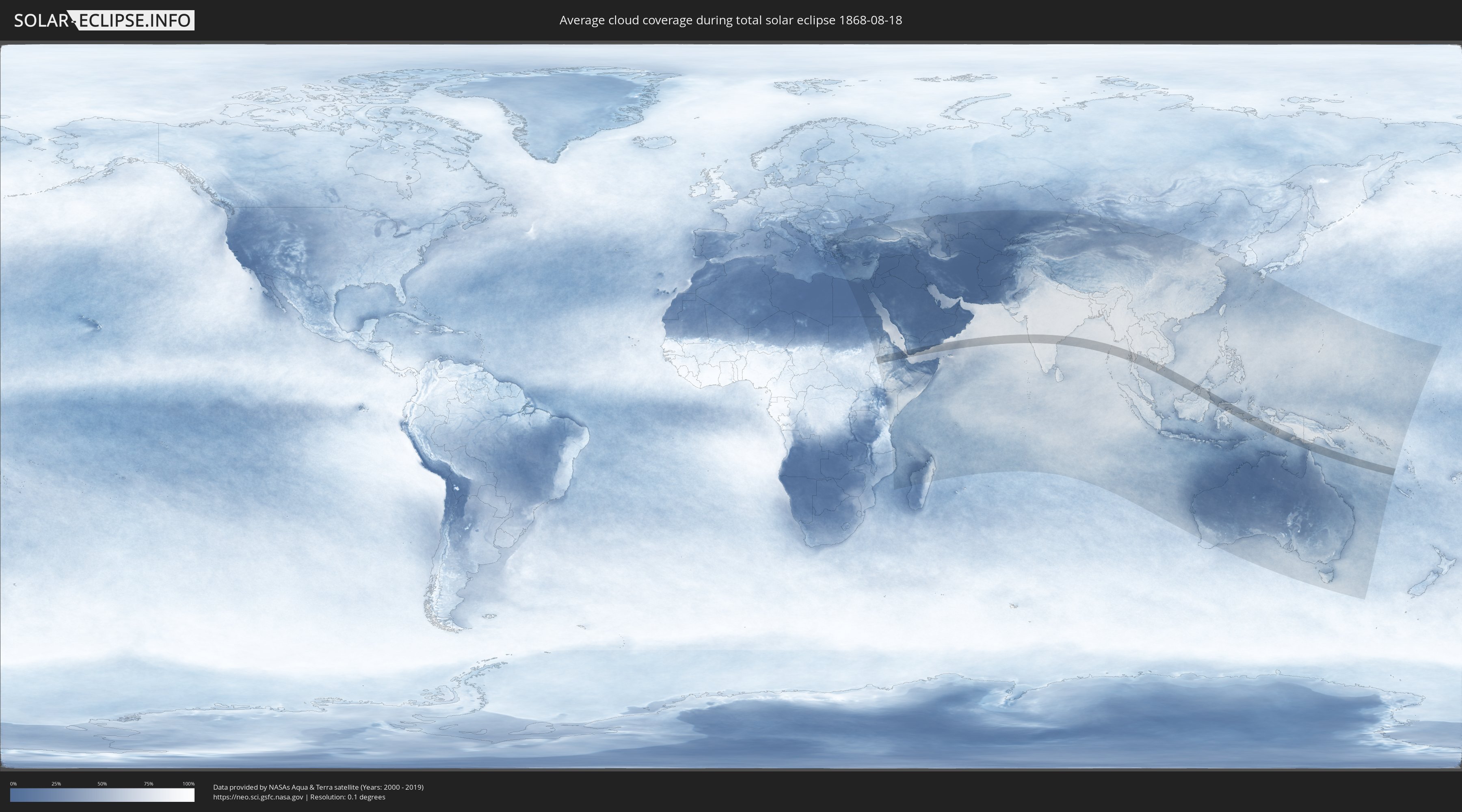
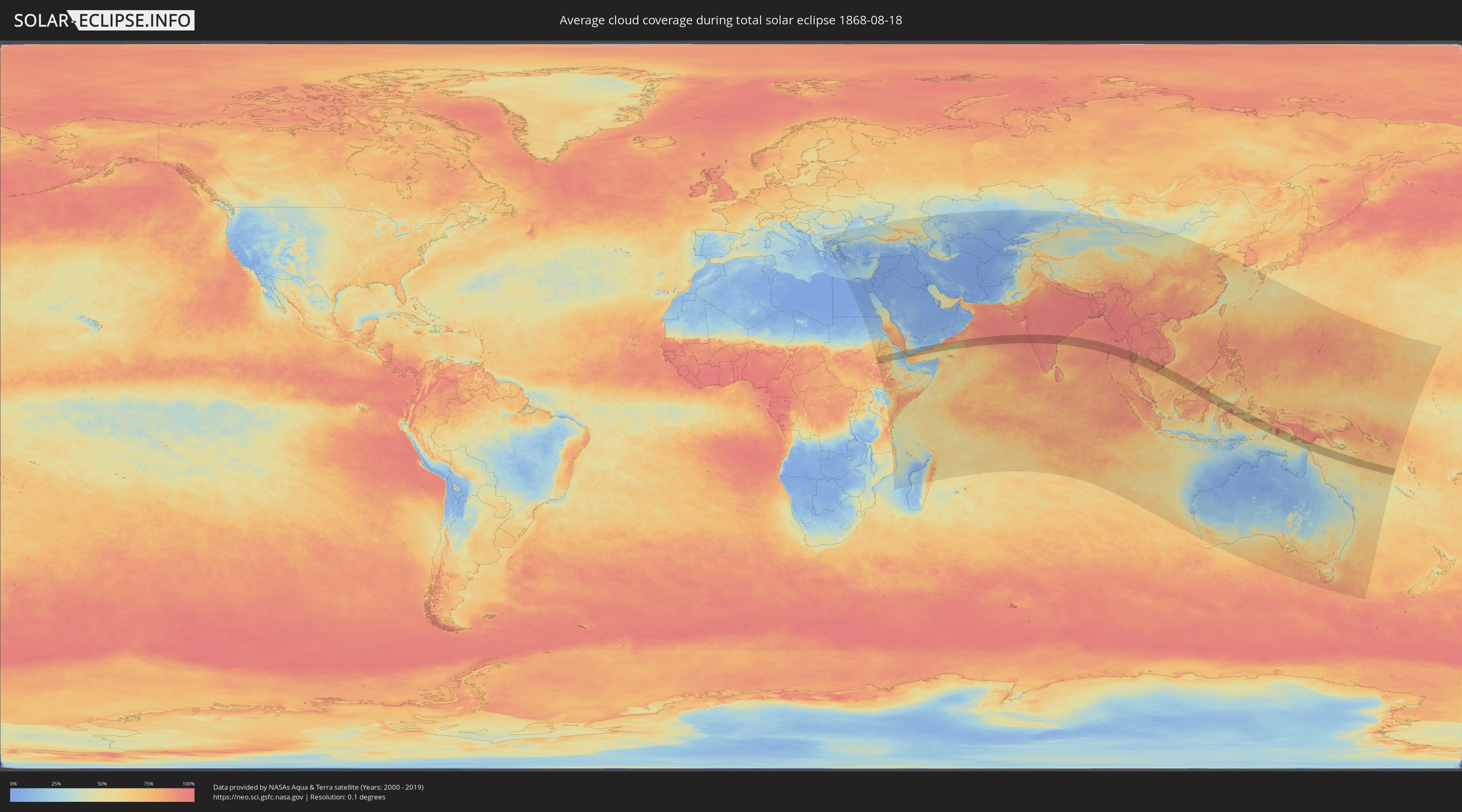
Wie wird das Wetter während der totalen Sonnenfinsternis am 18.08.1868?
Wo ist der beste Ort, um die totale Sonnenfinsternis vom 18.08.1868 zu beobachten?
Die folgenden Karten zeigen die durchschnittliche Bewölkung für den Tag, an dem die totale Sonnenfinsternis
stattfindet. Mit Hilfe der Karten lässt sich der Ort entlang des Finsternispfades eingrenzen,
der die besten Aussichen auf einen klaren wolkenfreien Himmel bietet.
Trotzdem muss man immer lokale Gegenenheiten beachten und sollte sich genau über das Wetter an seinem
gewählten Beobachtungsort informieren.
Die Daten stammen von den beiden NASA-Satelliten
AQUA und TERRA
und wurden über einen Zeitraum von 19 Jahren (2000 - 2019) gemittelt.
Detaillierte Länderkarten
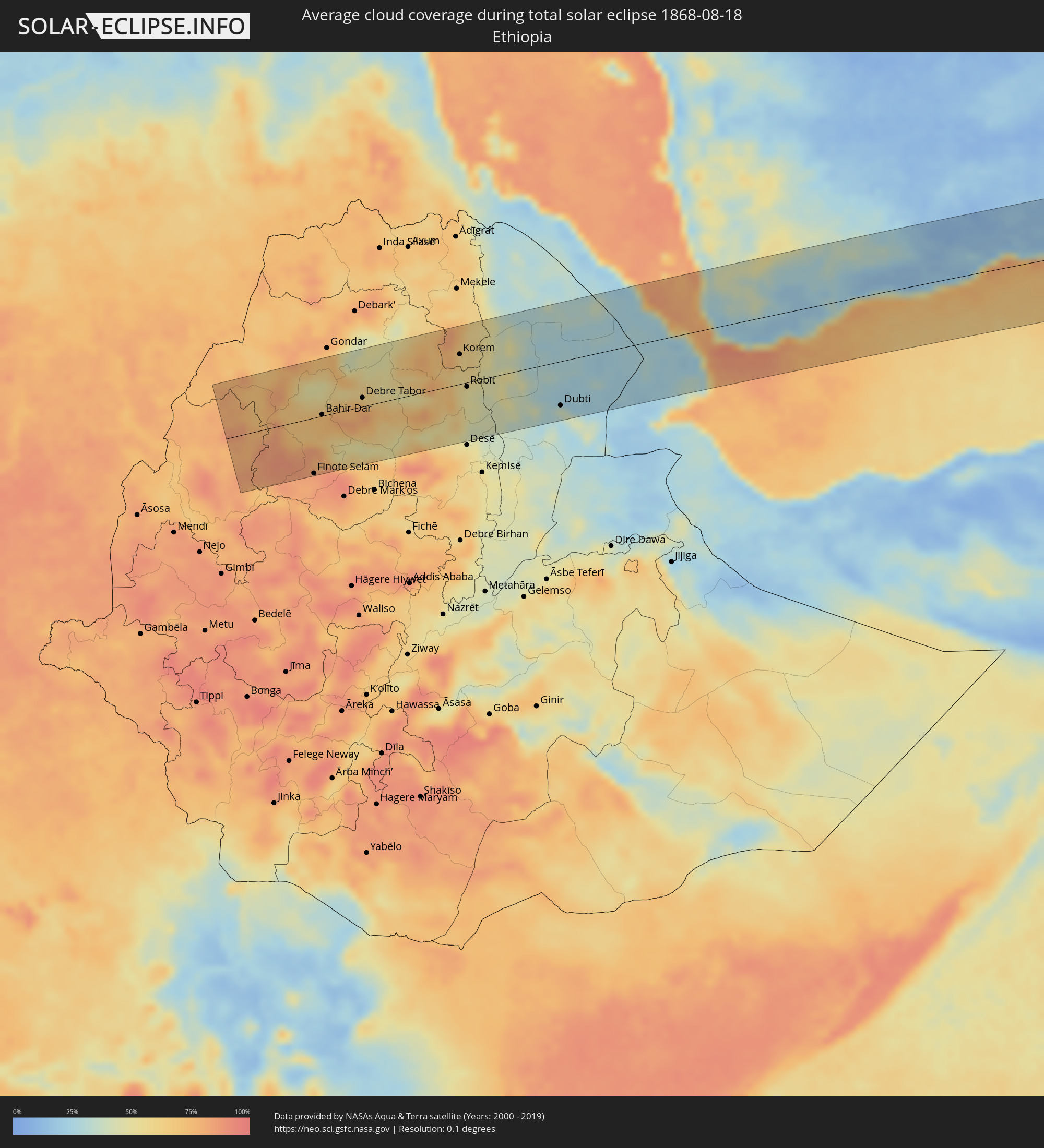 Äthiopien
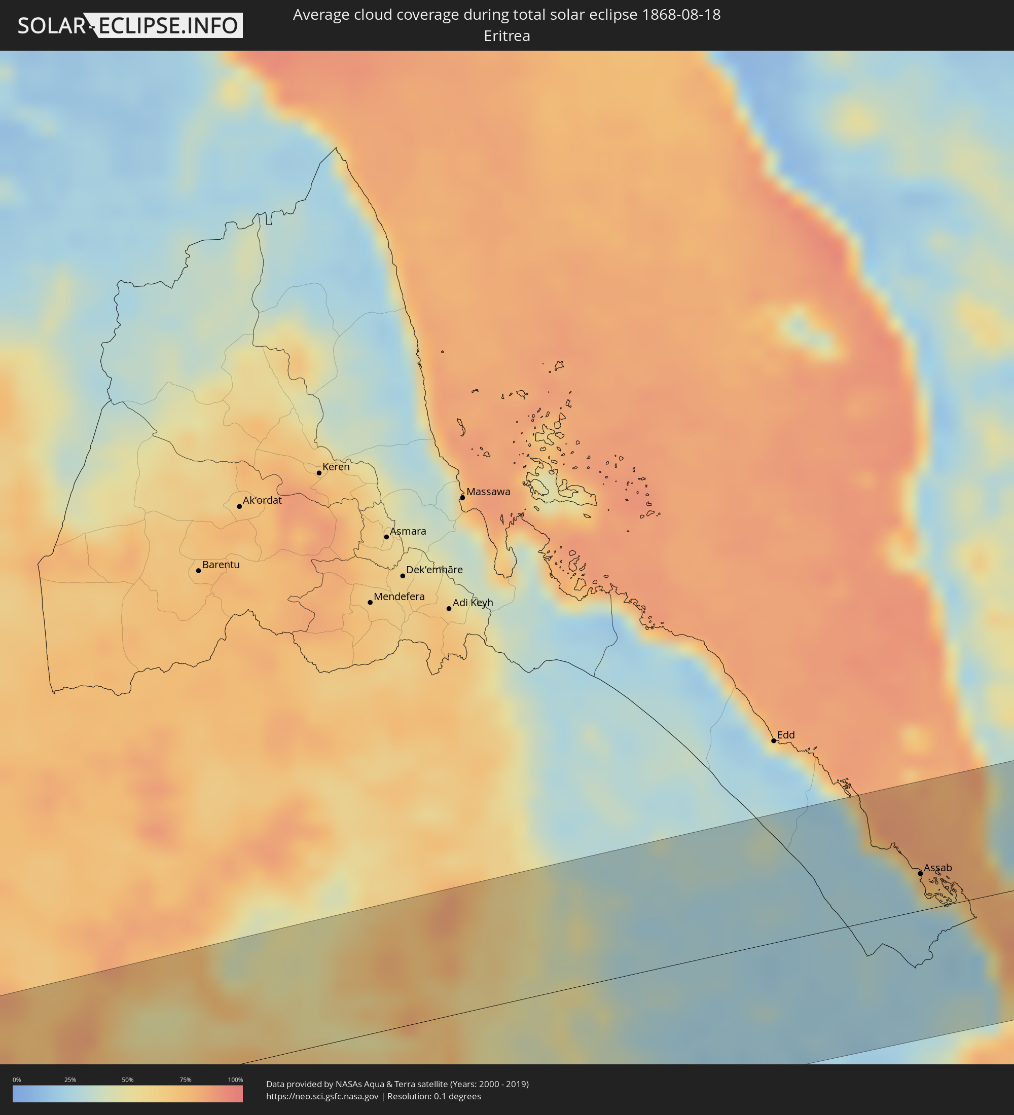 Eritrea
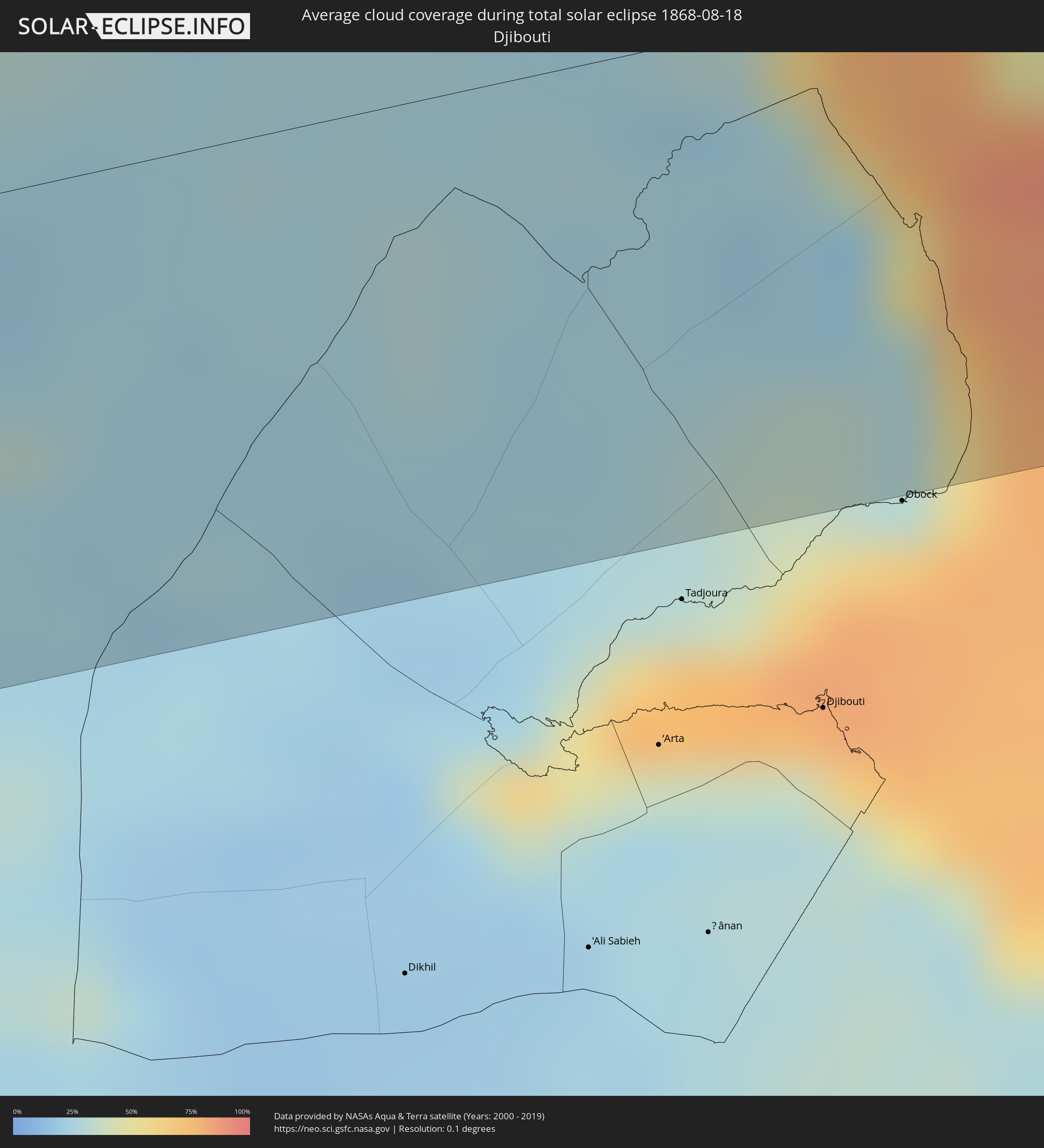 Dschibuti
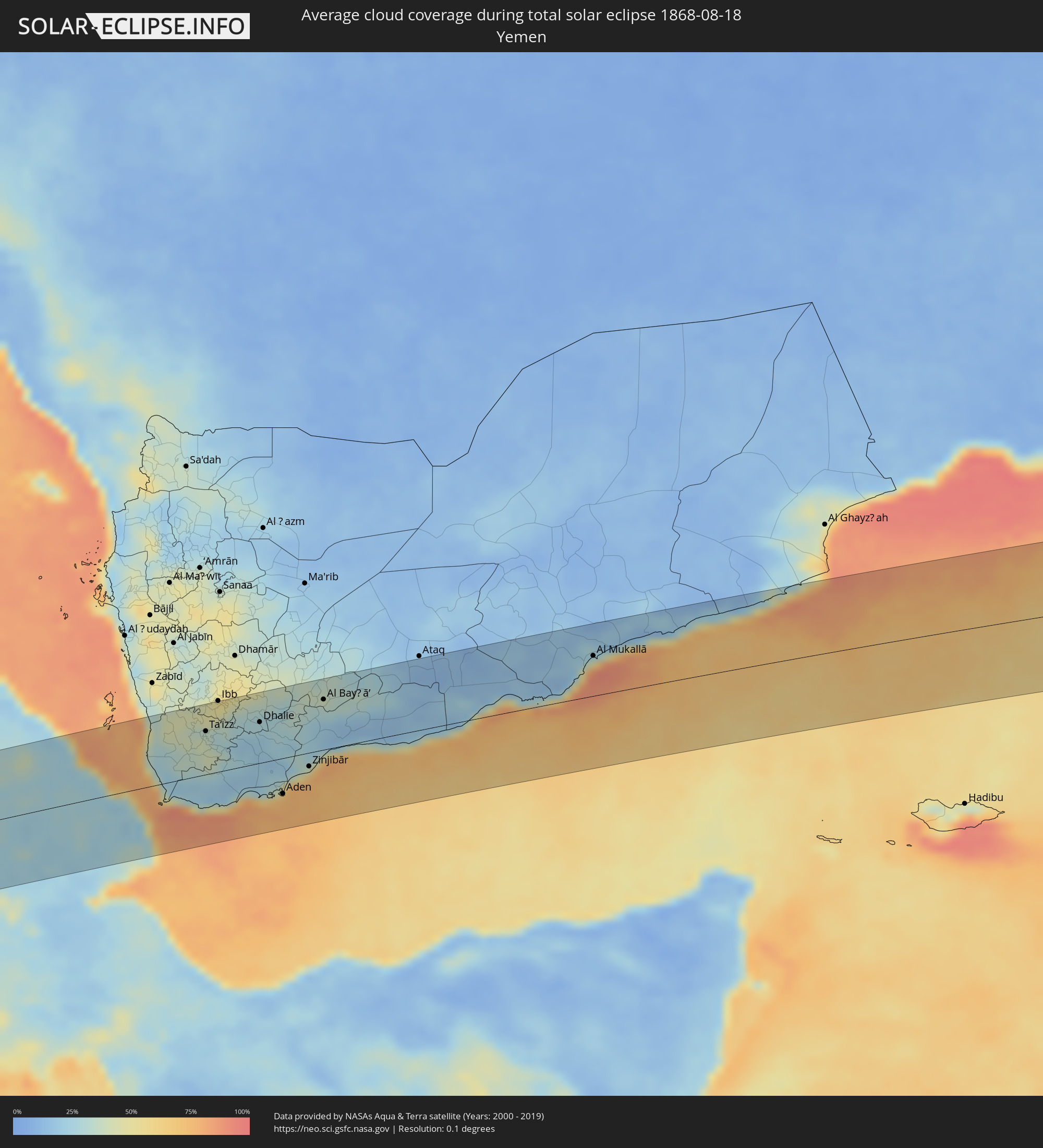 Jemen
Jemen
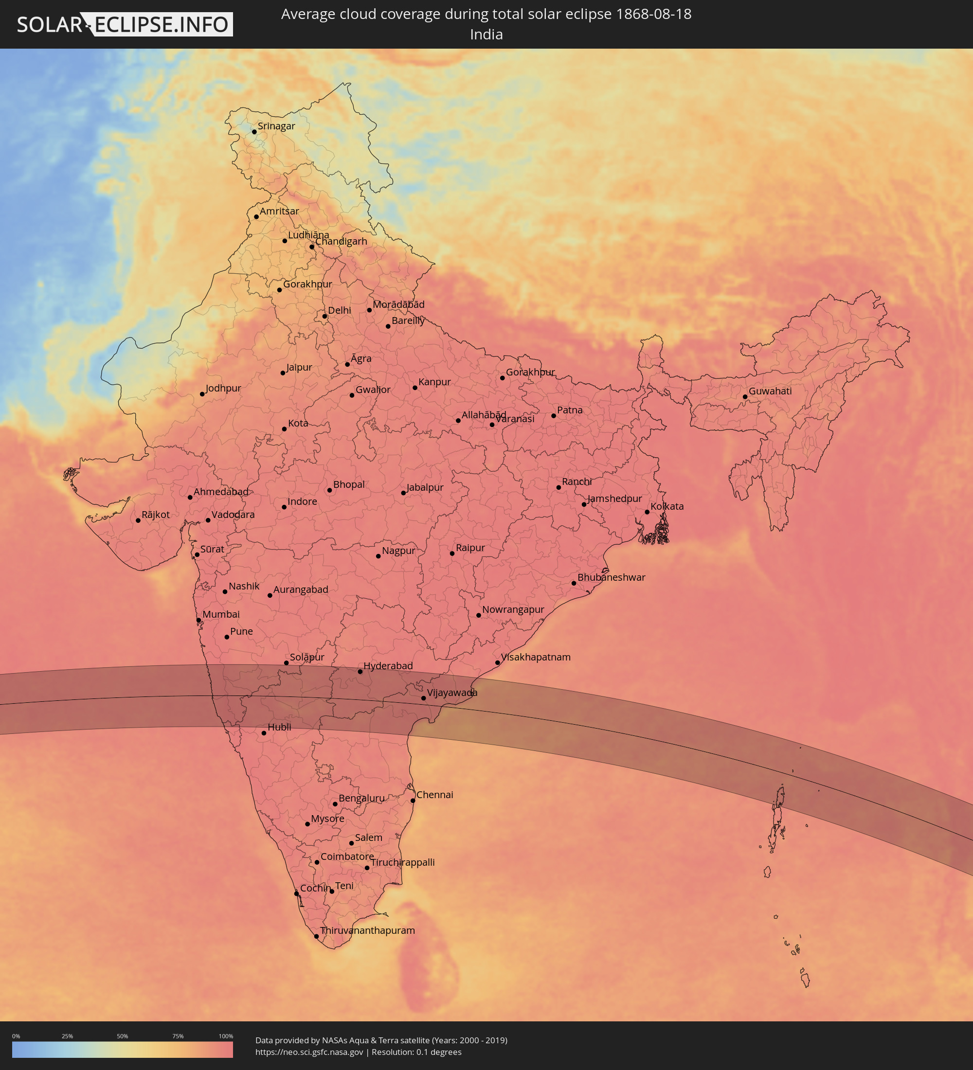 Indien
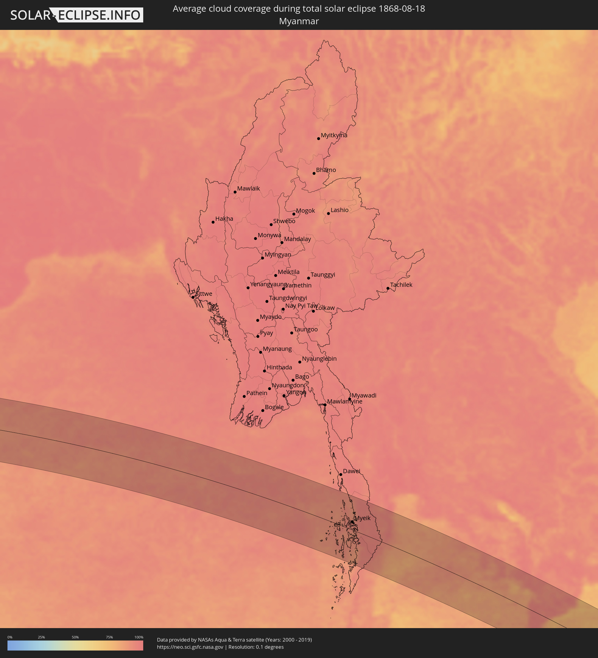 Myanmar
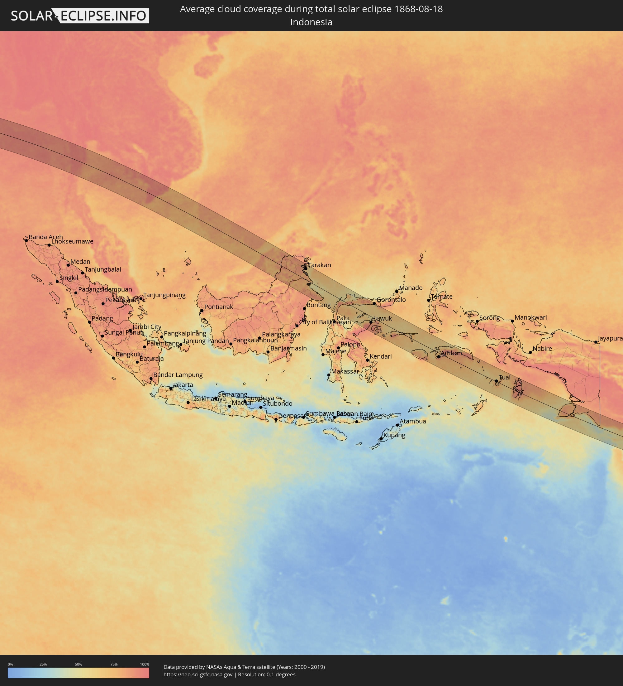 Indonesien
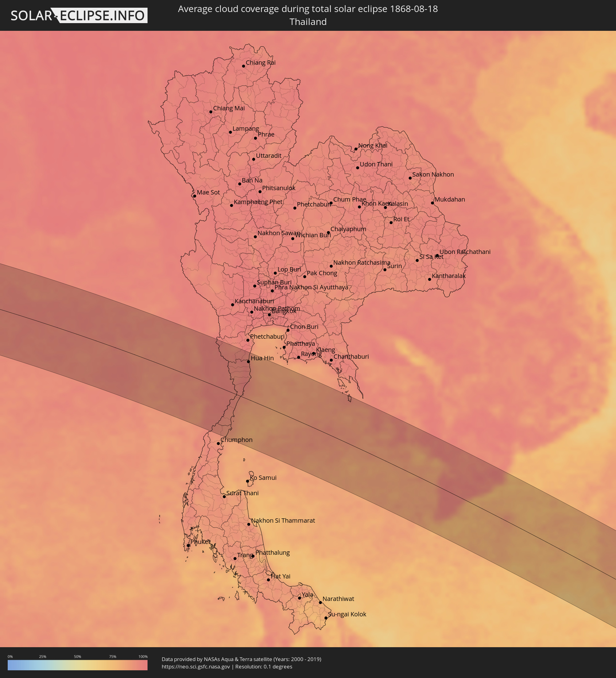 Thailand
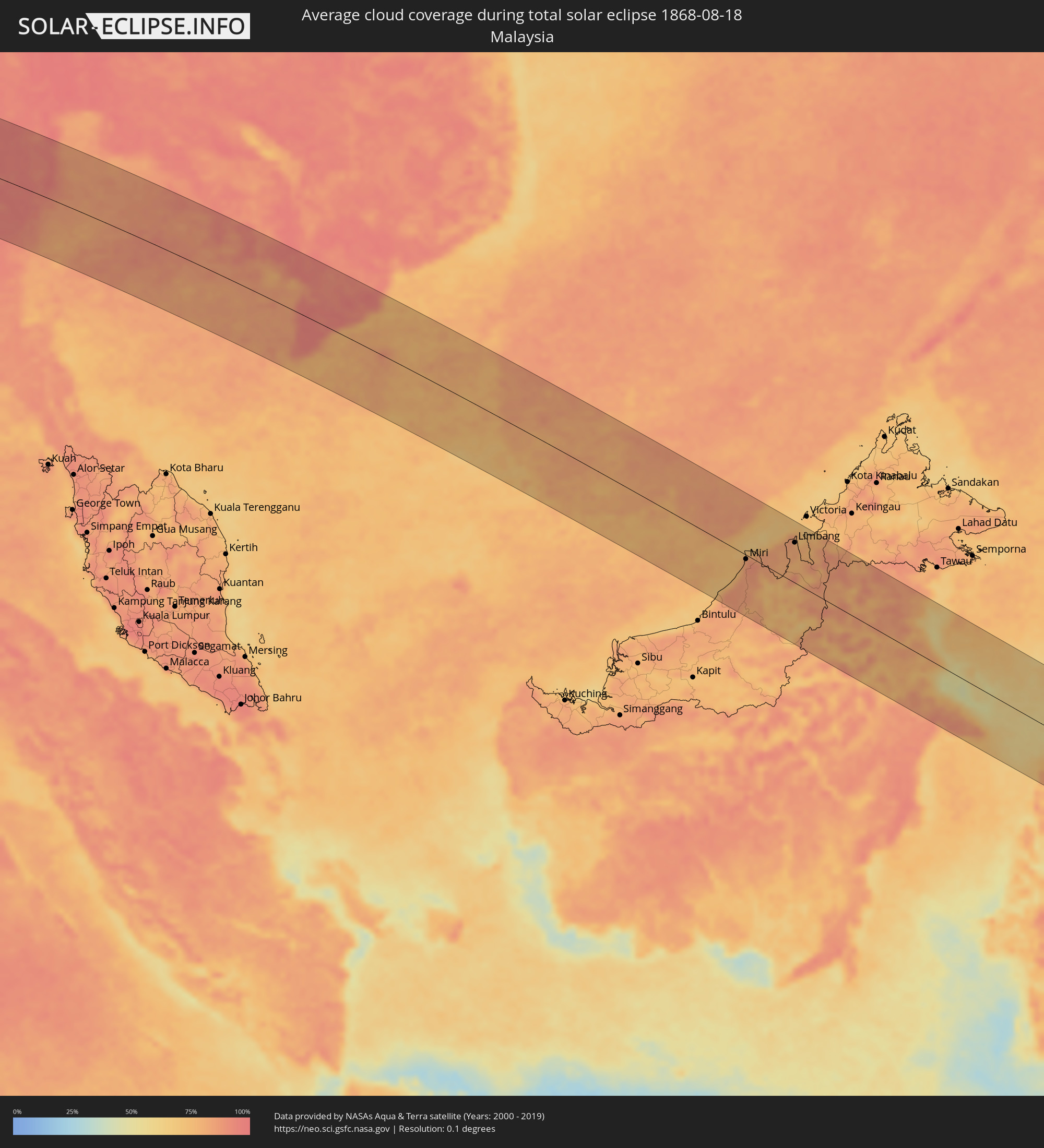 Malaysia
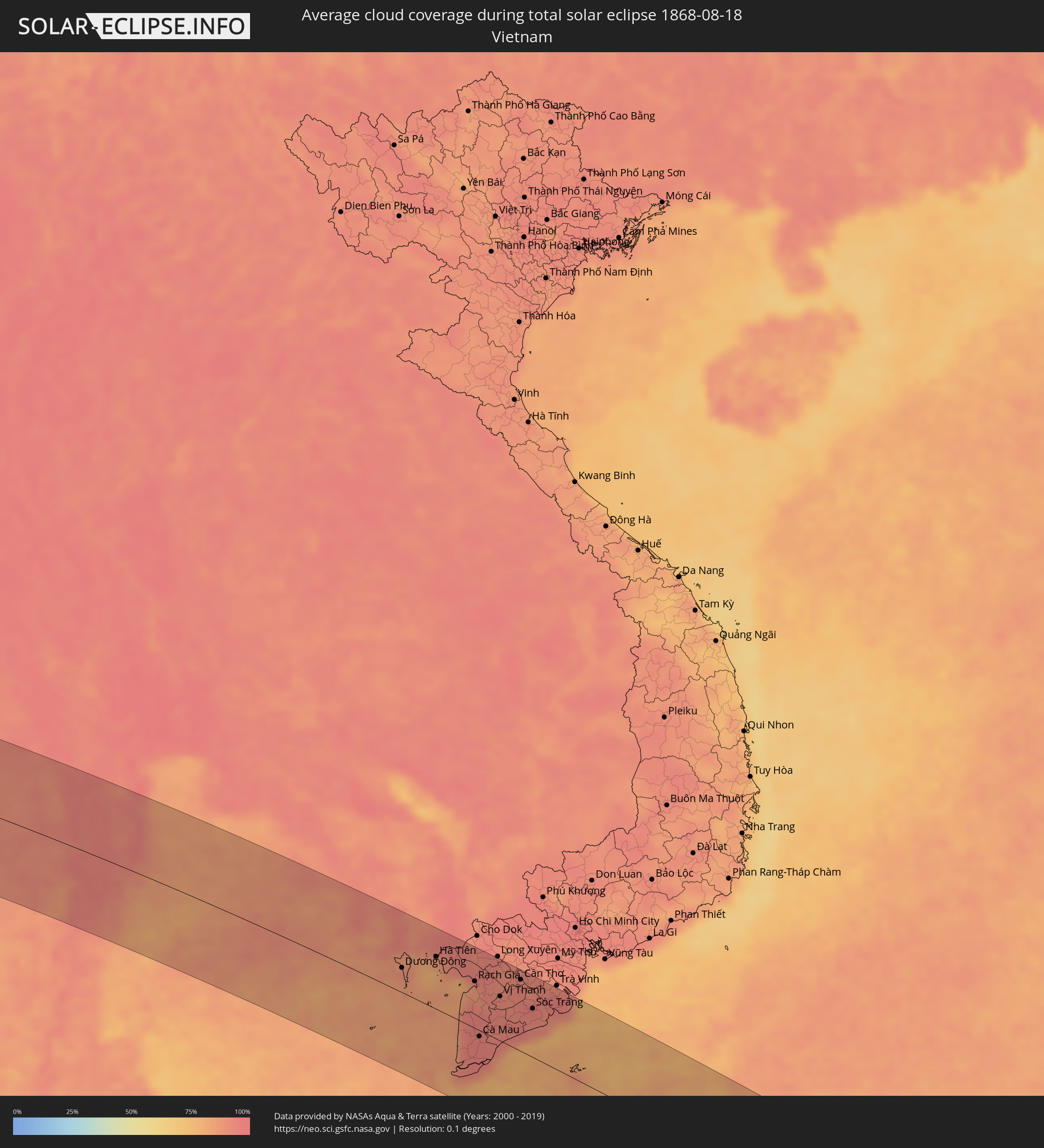 Vietnam
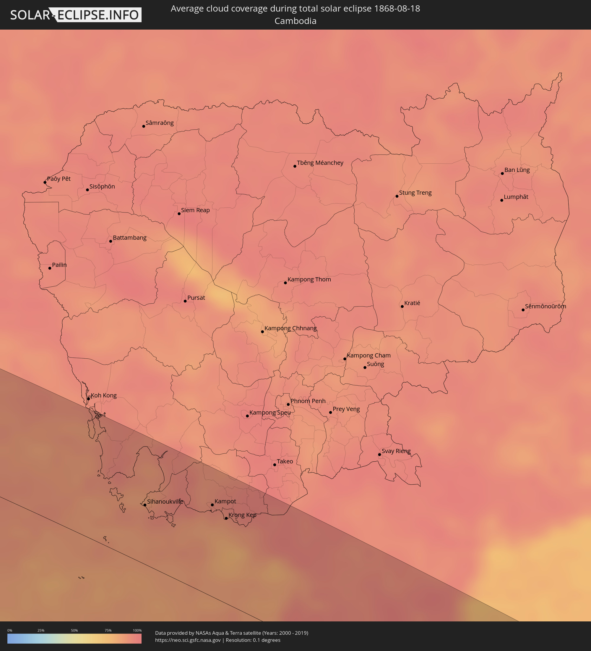 Kambodscha
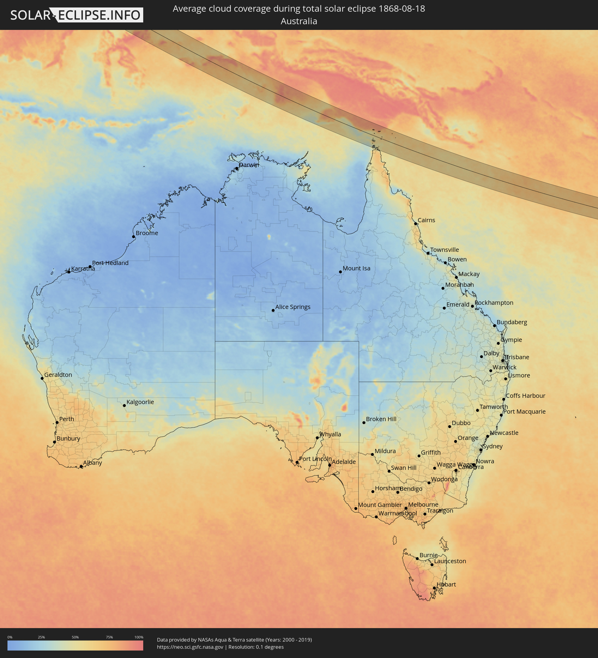 Australien
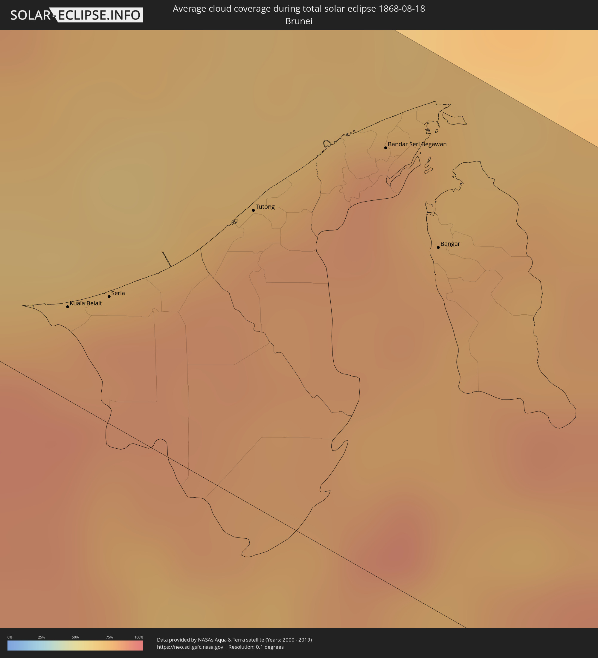 Brunei
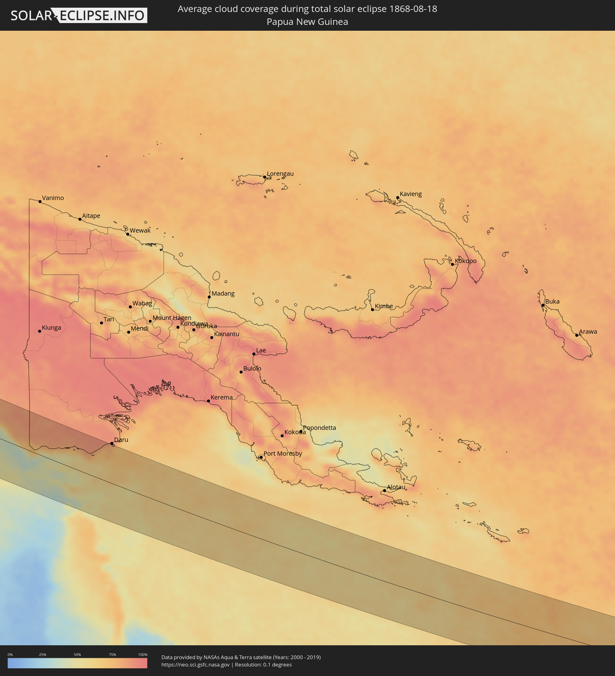 Papua-Neuguinea
Orte im Finsternispfad
Die nachfolgene Tabelle zeigt Städte und Orte mit mehr als 5.000 Einwohnern, die sich im Finsternispfad befinden. Städte mit mehr als 100.000 Einwohnern sind dick gekennzeichnet. Mit einem Klick auf den Ort öffnet sich eine Detailkarte die die Lage des jeweiligen Ortes zusammen mit dem Verlauf der zentralen Finsternis präsentiert.
| Ort | Typ | Dauer der Verfinsterung | Ortszeit bei maximaler Verfinsterung | Entfernung zur Zentrallinie | Ø Bewölkung |
|
Burē, Amhara
|
total | - | 05:56:40 UTC+02:27 | 87 km | 82% |
|
Finote Selam, Amhara
|
total | - | 05:56:40 UTC+02:27 | 92 km | 83% |
|
Bahir Dar, Amhara
|
total | - | 05:56:45 UTC+02:27 | 2 km | 72% |
|
Addiet Canna, Amhara
|
total | - | 05:56:43 UTC+02:27 | 36 km | 63% |
|
Werota, Amhara
|
total | - | 05:56:48 UTC+02:27 | 30 km | 70% |
|
Ādīs Zemen, Amhara
|
total | - | 05:56:50 UTC+02:27 | 49 km | 57% |
|
Debre Tabor, Amhara
|
total | - | 05:56:48 UTC+02:27 | 15 km | 73% |
|
Lalībela, Amhara
|
total | - | 05:56:53 UTC+02:27 | 9 km | 57% |
|
Korem, Tigray
|
total | - | 05:56:59 UTC+02:27 | 49 km | 67% |
|
Maych’ew, Tigray
|
total | - | 05:57:02 UTC+02:27 | 79 km | 76% |
|
Robīt, Amhara
|
total | - | 05:56:56 UTC+02:27 | 7 km | 51% |
|
Semera, Āfar
|
total | - | 05:57:04 UTC+02:27 | 64 km | 32% |
|
Dubti, Āfar
|
total | - | 05:57:05 UTC+02:27 | 72 km | 34% |
|
Assab, Southern Red Sea
|
total | - | 05:57:32 UTC+02:27 | 27 km | 35% |
|
Ta‘izz, Ta‘izz
|
total | - | 06:37:30 UTC+03:06 | 60 km | 39% |
|
Dhī as Sufāl, Ibb
|
total | - | 06:37:34 UTC+03:06 | 86 km | 43% |
|
Dhalie, Aḑ Ḑāli‘
|
total | - | 06:37:42 UTC+03:06 | 57 km | 27% |
|
Laḩij, Laḩij
|
total | - | 06:37:39 UTC+03:06 | 16 km | 26% |
|
Aden, Aden
|
total | - | 06:37:39 UTC+03:06 | 50 km | 70% |
|
Zinjibār, Abyan
|
total | - | 06:37:48 UTC+03:06 | 19 km | 68% |
|
Al Bayḑā’, Al Bayḑāʼ
|
total | - | 06:38:00 UTC+03:06 | 70 km | 31% |
|
Jawf al Maqbābah, Abyan
|
total | - | 06:38:03 UTC+03:06 | 48 km | 17% |
|
Al Mukallā, Muḩāfaz̧at Ḩaḑramawt
|
total | - | 06:39:25 UTC+03:06 | 56 km | 79% |
|
Kolhāpur, Maharashtra
|
total | - | 09:20:17 UTC+05:21 | 9 km | 96% |
|
Ichalkaranji, Maharashtra
|
total | - | 09:20:41 UTC+05:21 | 9 km | 97% |
|
Belgaum, Karnataka
|
total | - | 09:20:52 UTC+05:21 | 85 km | 98% |
|
Sāngli, Maharashtra
|
total | - | 09:20:51 UTC+05:21 | 27 km | 96% |
|
Bijapur, Karnataka
|
total | - | 09:22:54 UTC+05:21 | 26 km | 95% |
|
Gulbarga, Karnataka
|
total | - | 09:24:54 UTC+05:21 | 87 km | 93% |
|
Ādoni, Andhra Pradesh
|
total | - | 09:26:02 UTC+05:21 | 101 km | 94% |
|
Rāichūr, Karnataka
|
total | - | 09:26:04 UTC+05:21 | 36 km | 96% |
|
Hyderabad, Telangana
|
total | - | 09:27:59 UTC+05:21 | 101 km | 95% |
|
Nandyāl, Andhra Pradesh
|
total | - | 09:28:28 UTC+05:21 | 110 km | 95% |
|
Secunderabad, Telangana
|
total | - | 09:28:07 UTC+05:21 | 115 km | 96% |
|
Ongole, Andhra Pradesh
|
total | - | 09:31:40 UTC+05:21 | 96 km | 94% |
|
Khammam, Telangana
|
total | - | 09:31:23 UTC+05:21 | 99 km | 96% |
|
Guntur, Andhra Pradesh
|
total | - | 09:32:18 UTC+05:21 | 4 km | 96% |
|
Vijayawada, Andhra Pradesh
|
total | - | 09:32:38 UTC+05:21 | 21 km | 95% |
|
Ellore, Andhra Pradesh
|
total | - | 09:33:32 UTC+05:21 | 49 km | 95% |
|
Machilīpatnam, Andhra Pradesh
|
total | - | 09:33:47 UTC+05:21 | 9 km | 95% |
|
Rājahmundry, Andhra Pradesh
|
total | - | 09:34:53 UTC+05:21 | 88 km | 95% |
|
Kākināda, Andhra Pradesh
|
total | - | 09:35:53 UTC+05:21 | 89 km | 95% |
|
Myeik, Tanintharyi
|
total | - | 11:24:39 UTC+06:24 | 29 km | 92% |
|
Bang Saphan, Prachuap Khiri Khan
|
total | - | 11:45:53 UTC+06:42 | 61 km | 91% |
|
Prachuap Khiri Khan, Prachuap Khiri Khan
|
total | - | 11:45:55 UTC+06:42 | 13 km | 90% |
|
Kui Buri, Prachuap Khiri Khan
|
total | - | 11:45:48 UTC+06:42 | 43 km | 95% |
|
Sam Roi Yot, Prachuap Khiri Khan
|
total | - | 11:45:38 UTC+06:42 | 63 km | 96% |
|
Pran Buri, Prachuap Khiri Khan
|
total | - | 11:45:35 UTC+06:42 | 76 km | 95% |
|
Hua Hin, Prachuap Khiri Khan
|
total | - | 11:45:31 UTC+06:42 | 98 km | 91% |
|
Cha-am, Phetchaburi
|
total | - | 11:45:17 UTC+06:42 | 122 km | 91% |
|
Sihanoukville, Preah Sihanouk
|
total | - | 11:57:45 UTC+06:42 | 56 km | 88% |
|
Dương Đông, Kiến Giang
|
total | - | 12:24:02 UTC+07:06 | 37 km | 87% |
|
Kampot, Kampot
|
total | - | 11:59:31 UTC+06:42 | 87 km | 88% |
|
Krong Kep, Kep
|
total | - | 12:00:03 UTC+06:42 | 81 km | 83% |
|
Hà Tiên, Kiến Giang
|
total | - | 12:25:15 UTC+07:06 | 79 km | 85% |
|
Rạch Giá, Kiến Giang
|
total | - | 12:27:20 UTC+07:06 | 71 km | 88% |
|
Cà Mau, Cà Mau
|
total | - | 12:28:38 UTC+07:06 | 9 km | 95% |
|
Vị Thanh, Hau Giang
|
total | - | 12:28:41 UTC+07:06 | 67 km | 93% |
|
Thành phố Bạc Liêu, Bạc Liêu
|
total | - | 12:30:02 UTC+07:06 | 31 km | 94% |
|
Cần Thơ, Cần Thơ
|
total | - | 12:29:12 UTC+07:06 | 108 km | 94% |
|
Sóc Trăng, Sóc Trăng
|
total | - | 12:30:16 UTC+07:06 | 73 km | 94% |
|
Miri, Sarawak
|
total | - | 13:12:13 UTC+07:21 | 8 km | 84% |
|
Kuala Belait, Belait
|
total | - | 13:30:50 UTC+07:39 | 20 km | 79% |
|
Seria, Belait
|
total | - | 13:31:01 UTC+07:39 | 28 km | 83% |
|
Tutong, Tutong
|
total | - | 13:31:30 UTC+07:39 | 64 km | 82% |
|
Bandar Seri Begawan, Brunei and Muara
|
total | - | 13:31:59 UTC+07:39 | 94 km | 85% |
|
Limbang, Sarawak
|
total | - | 13:14:01 UTC+07:21 | 79 km | 80% |
|
Bangar, Temburong
|
total | - | 13:32:33 UTC+07:39 | 79 km | 80% |
|
Sembakung, East Kalimantan
|
total | - | 13:56:28 UTC+07:57 | 113 km | 83% |
|
Tanjung Selor, North Kalimantan
|
total | - | 13:58:00 UTC+07:57 | 25 km | 82% |
|
Tarakan, North Kalimantan
|
total | - | 13:57:51 UTC+07:57 | 83 km | 65% |
|
Luwuk, Central Sulawesi
|
total | - | 14:13:06 UTC+07:57 | 46 km | 84% |
|
Gorontalo, Gorontalo
|
total | - | 14:11:54 UTC+07:57 | 114 km | 62% |
|
Ambon, Maluku
|
total | - | 15:49:46 UTC+09:22 | 32 km | 85% |
|
Amahai, Maluku
|
total | - | 15:50:29 UTC+09:22 | 40 km | 80% |
|
Tual, Maluku
|
total | - | 15:57:27 UTC+09:22 | 3 km | 66% |