Totale Sonnenfinsternis vom 12.09.2444
| Wochentag: | Montag |
| Maximale Dauer der Verfinsterung: | 05m23s |
| Maximale Breite des Finsternispfades: | 268 km |
| Saroszyklus: | 161 |
| Bedeckungsgrad: | 100% |
| Magnitude: | 1.0688 |
| Gamma: | 0.5548 |
Wo kann man die Sonnenfinsternis vom 12.09.2444 sehen?
Die Sonnenfinsternis am 12.09.2444 kann man in 73 Ländern als partielle Sonnenfinsternis beobachten.
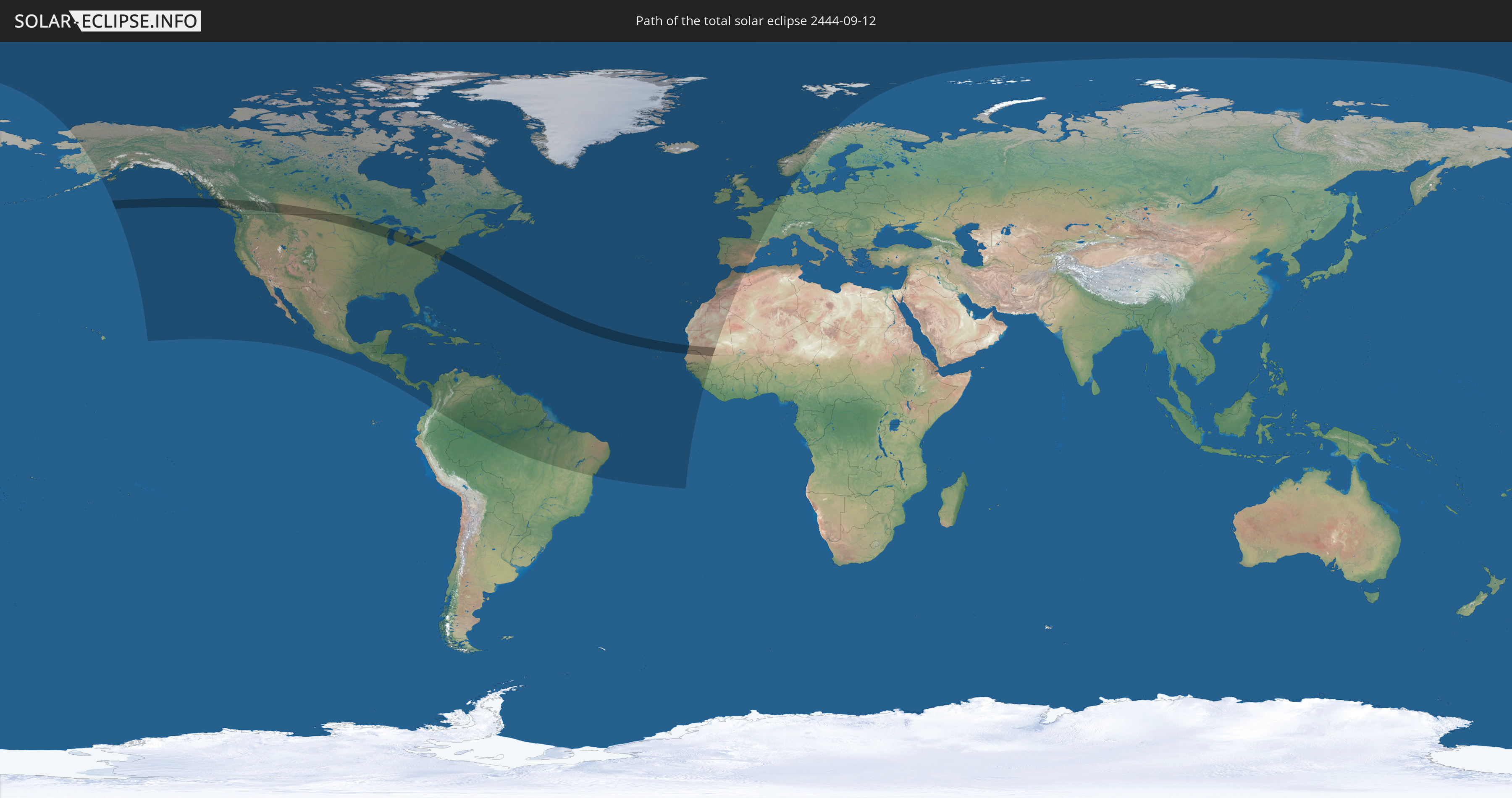
Der Finsternispfad verläuft durch 6 Länder. Nur in diesen Ländern ist sie als totale Sonnenfinsternis zu sehen.
In den folgenden Ländern ist die Sonnenfinsternis total zu sehen
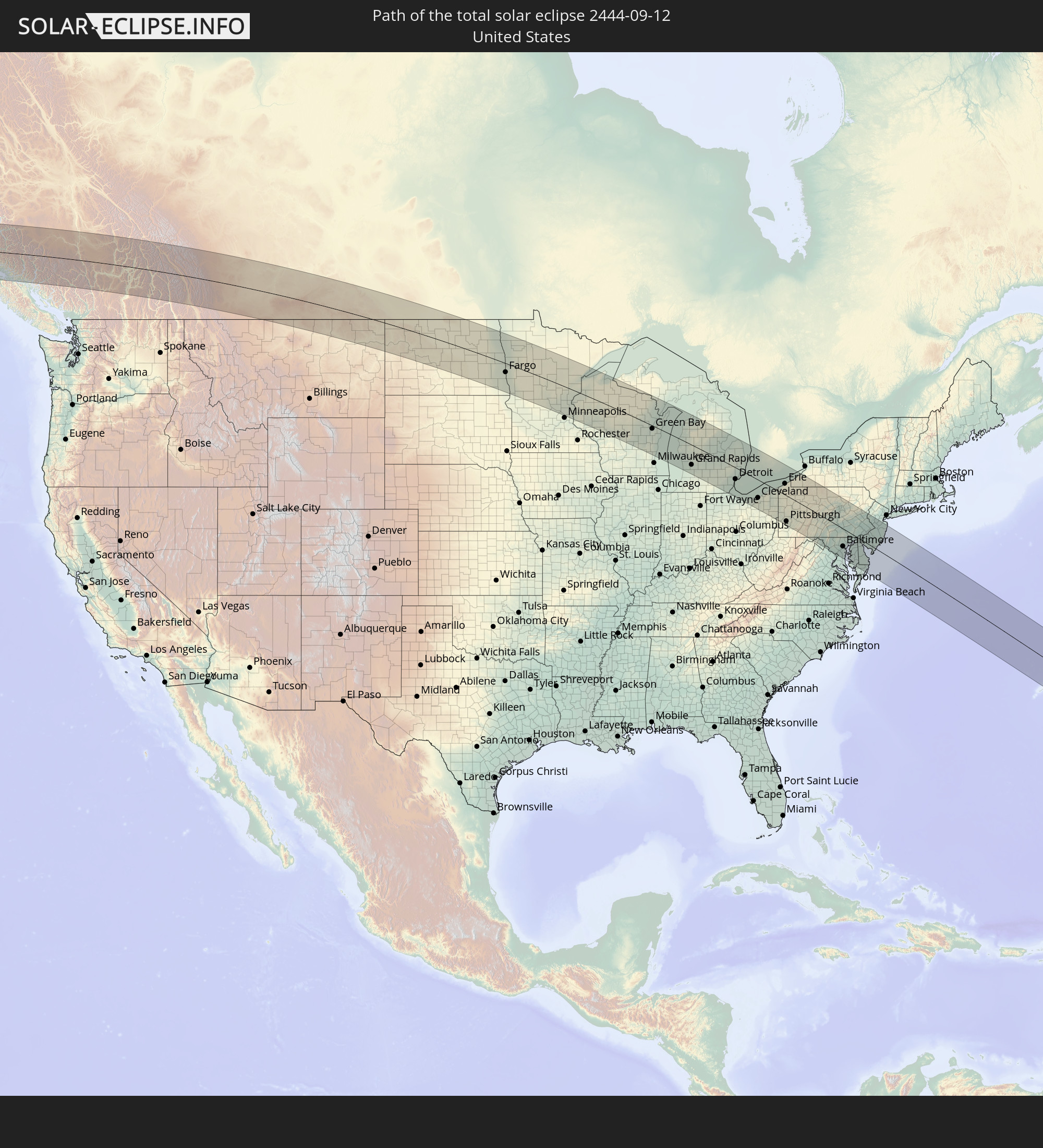 Vereinigte Staaten
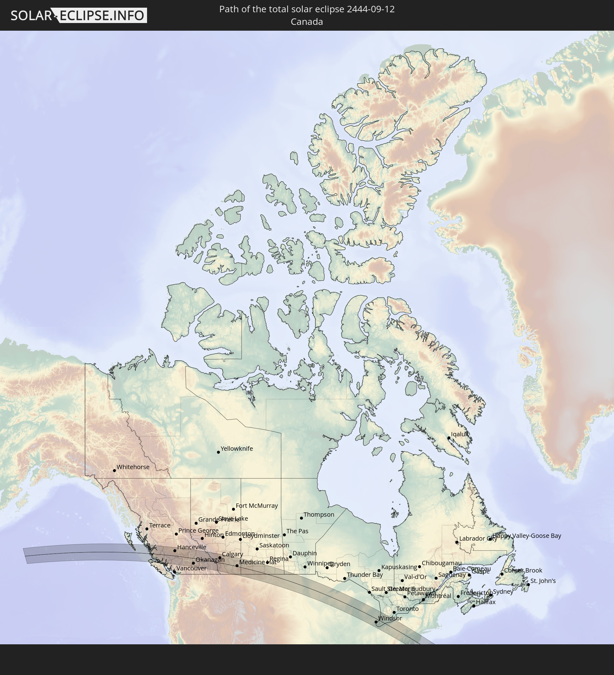 Kanada
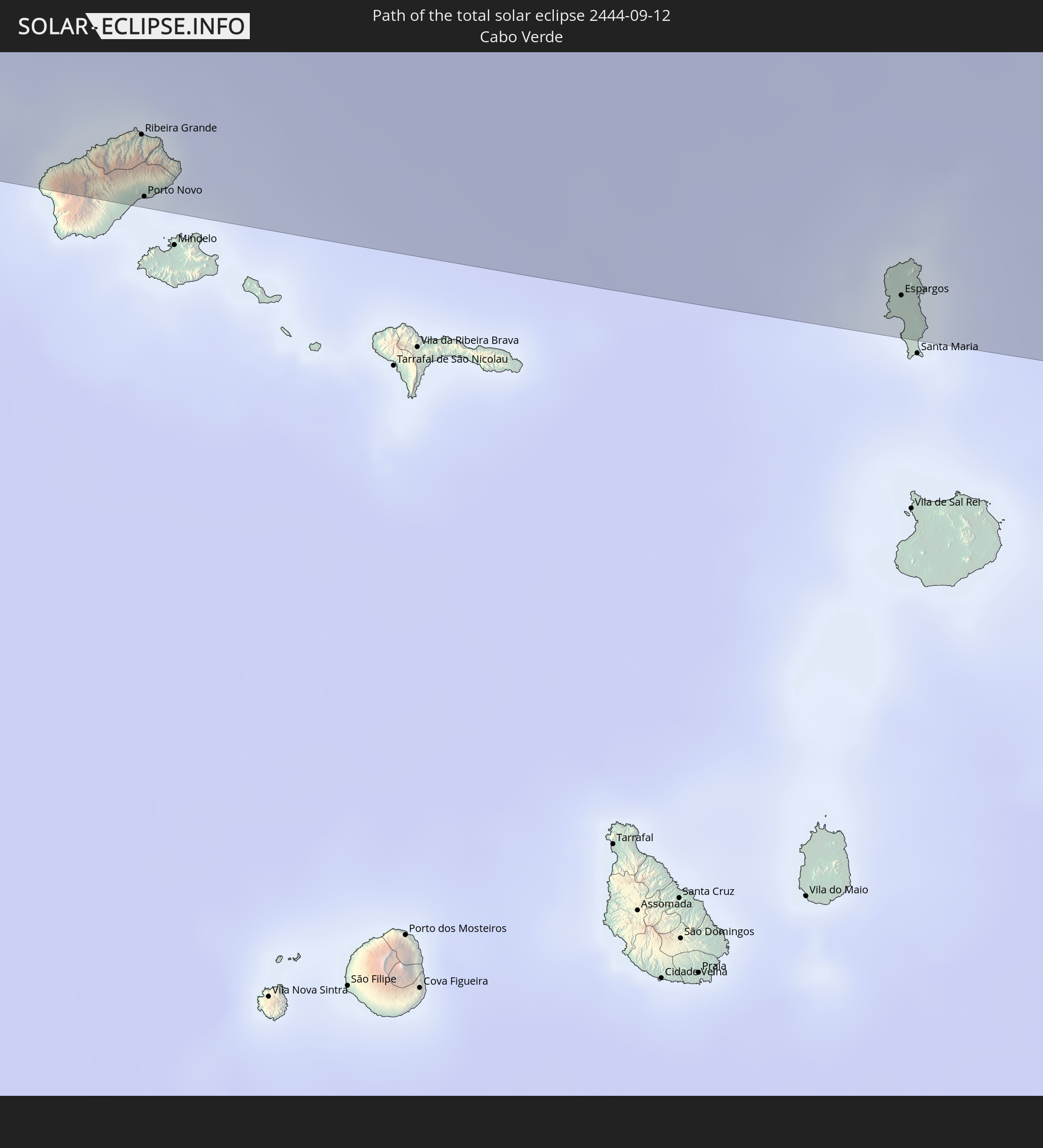 Kap Verde
 Senegal
 Mauretanien
 Mali
Mali
In den folgenden Ländern ist die Sonnenfinsternis partiell zu sehen
 Vereinigte Staaten
 United States Minor Outlying Islands
 Kanada
 Mexiko
 Grönland
 Guatemala
 El Salvador
 Honduras
 Belize
 Nicaragua
 Costa Rica
 Kuba
Kuba
 Panama
 Kolumbien
 Kaimaninseln
 Bahamas
 Jamaika
 Haiti
Haiti
 Brasilien
 Venezuela
 Turks- und Caicosinseln
 Dominikanische Republik
 Aruba
Aruba
 Puerto Rico
 Amerikanische Jungferninseln
 Bermuda
 Britische Jungferninseln
 Anguilla
 Saint-Martin
 Saint-Barthélemy
 St. Kitts und Nevis
 Antigua und Barbuda
 Montserrat
 Trinidad und Tobago
 Guadeloupe
 Grenada
 Dominica
 St. Vincent und die Grenadinen
 Guyana
 Martinique
 St. Lucia
 Barbados
 Suriname
 Saint-Pierre und Miquelon
 Französisch-Guayana
 Portugal
 Kap Verde
 Island
 Spanien
 Senegal
 Mauretanien
 Gambia
 Guinea-Bissau
 Guinea
 Sierra Leone
 Marokko
 Mali
Mali
 Irland
 Spitzbergen
 Algerien
 Vereinigtes Königreich
 Färöer
 Gibraltar
 Frankreich
 Isle of Man
 Guernsey
 Jersey
 Belgien
 Niederlande
 Norwegen
 Deutschland
 Dänemark
 Schweden
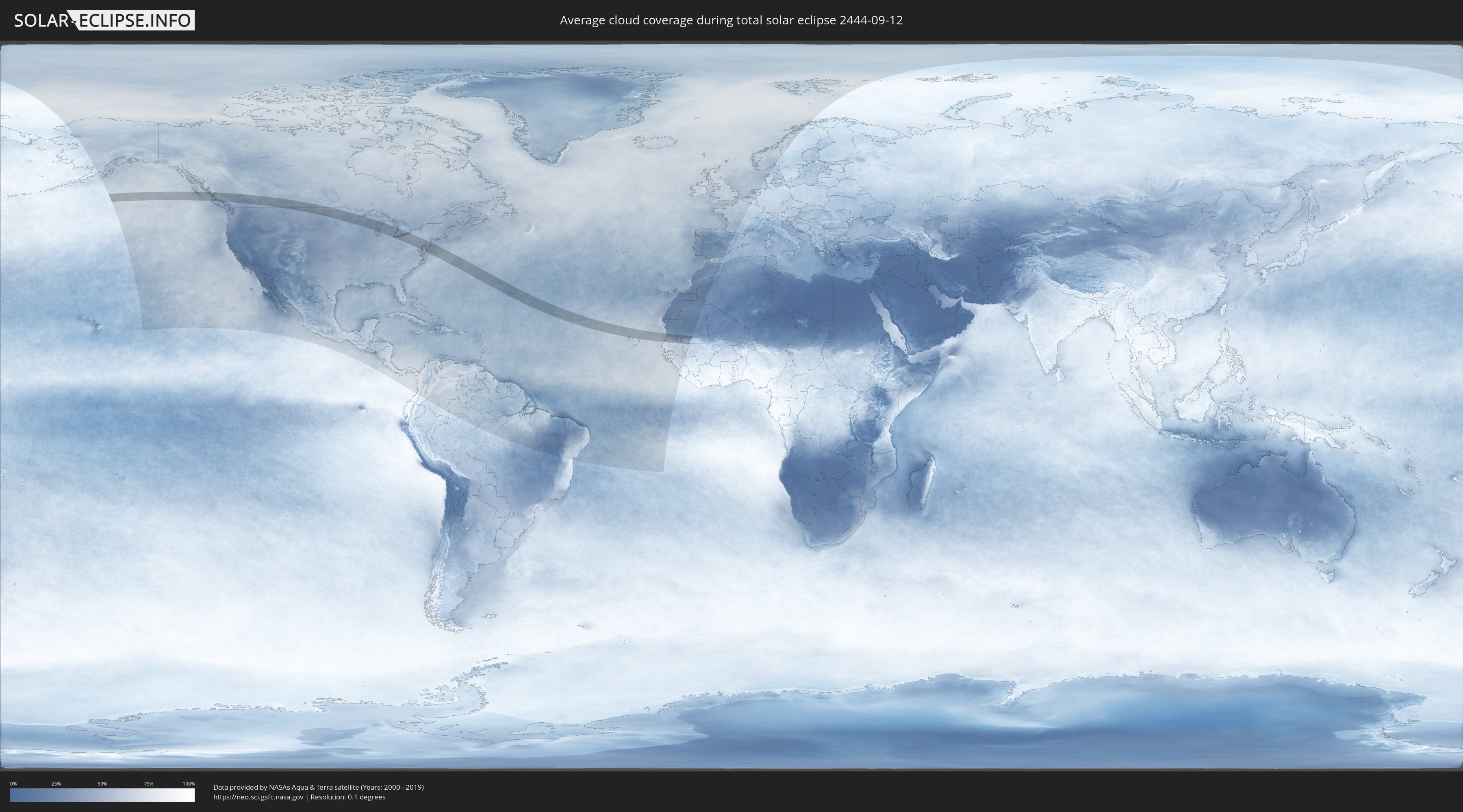
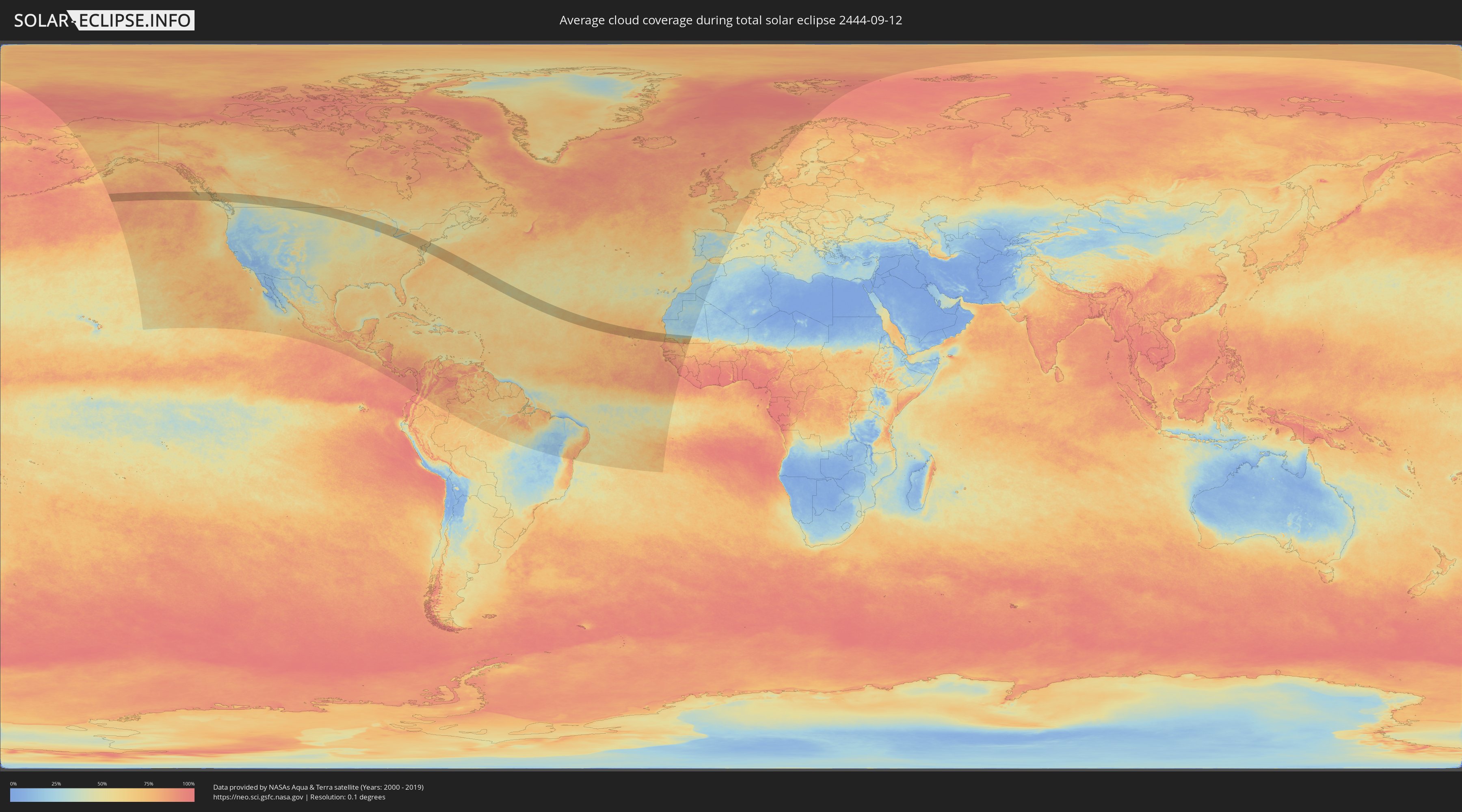
Wie wird das Wetter während der totalen Sonnenfinsternis am 12.09.2444?
Wo ist der beste Ort, um die totale Sonnenfinsternis vom 12.09.2444 zu beobachten?
Die folgenden Karten zeigen die durchschnittliche Bewölkung für den Tag, an dem die totale Sonnenfinsternis
stattfindet. Mit Hilfe der Karten lässt sich der Ort entlang des Finsternispfades eingrenzen,
der die besten Aussichen auf einen klaren wolkenfreien Himmel bietet.
Trotzdem muss man immer lokale Gegenenheiten beachten und sollte sich genau über das Wetter an seinem
gewählten Beobachtungsort informieren.
Die Daten stammen von den beiden NASA-Satelliten
AQUA und TERRA
und wurden über einen Zeitraum von 19 Jahren (2000 - 2019) gemittelt.
Detaillierte Länderkarten
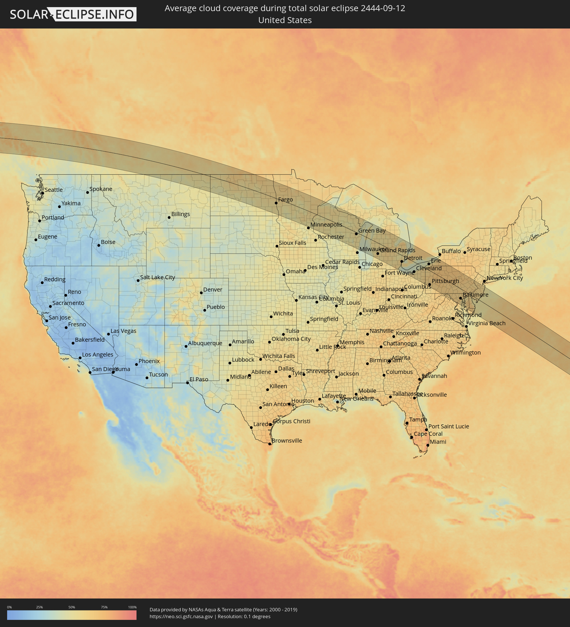 Vereinigte Staaten
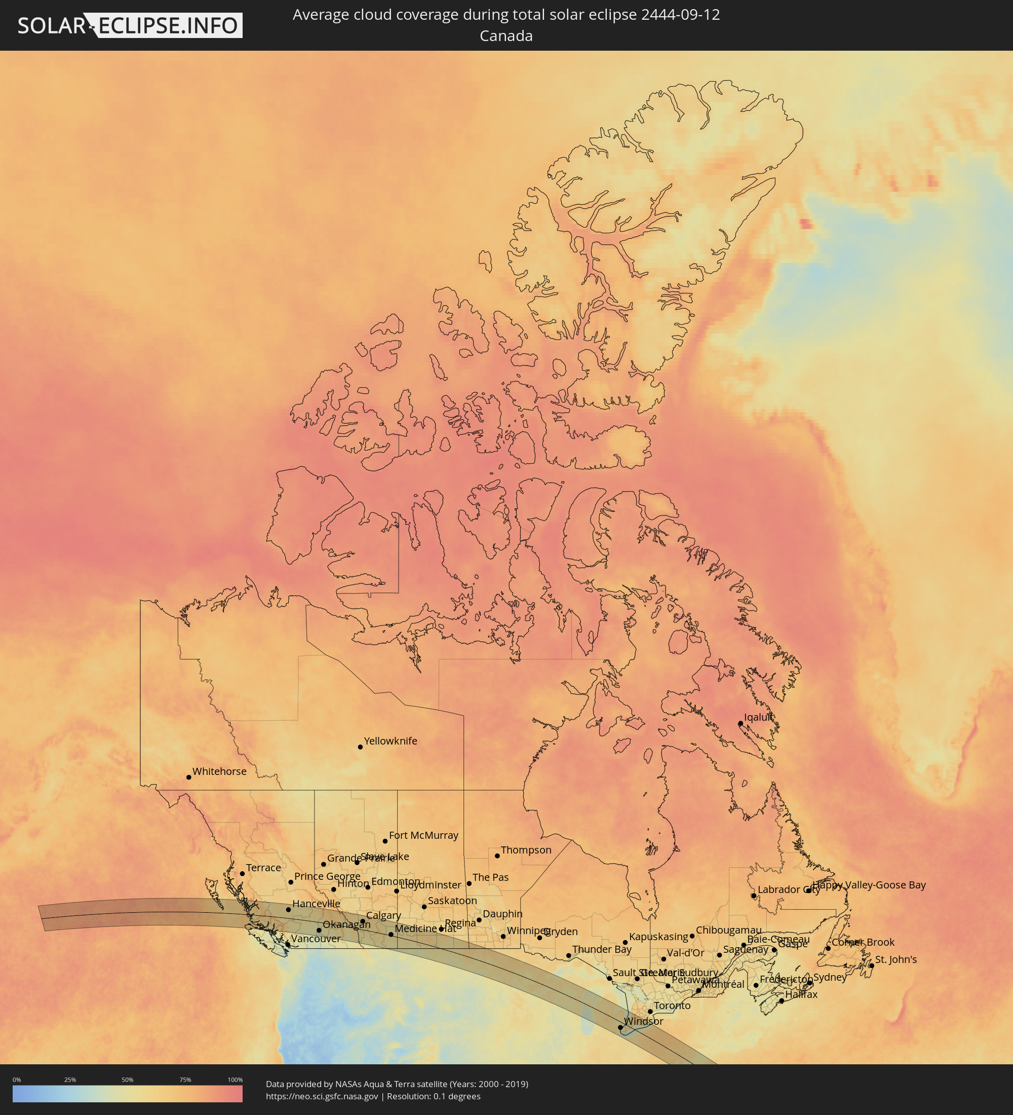 Kanada
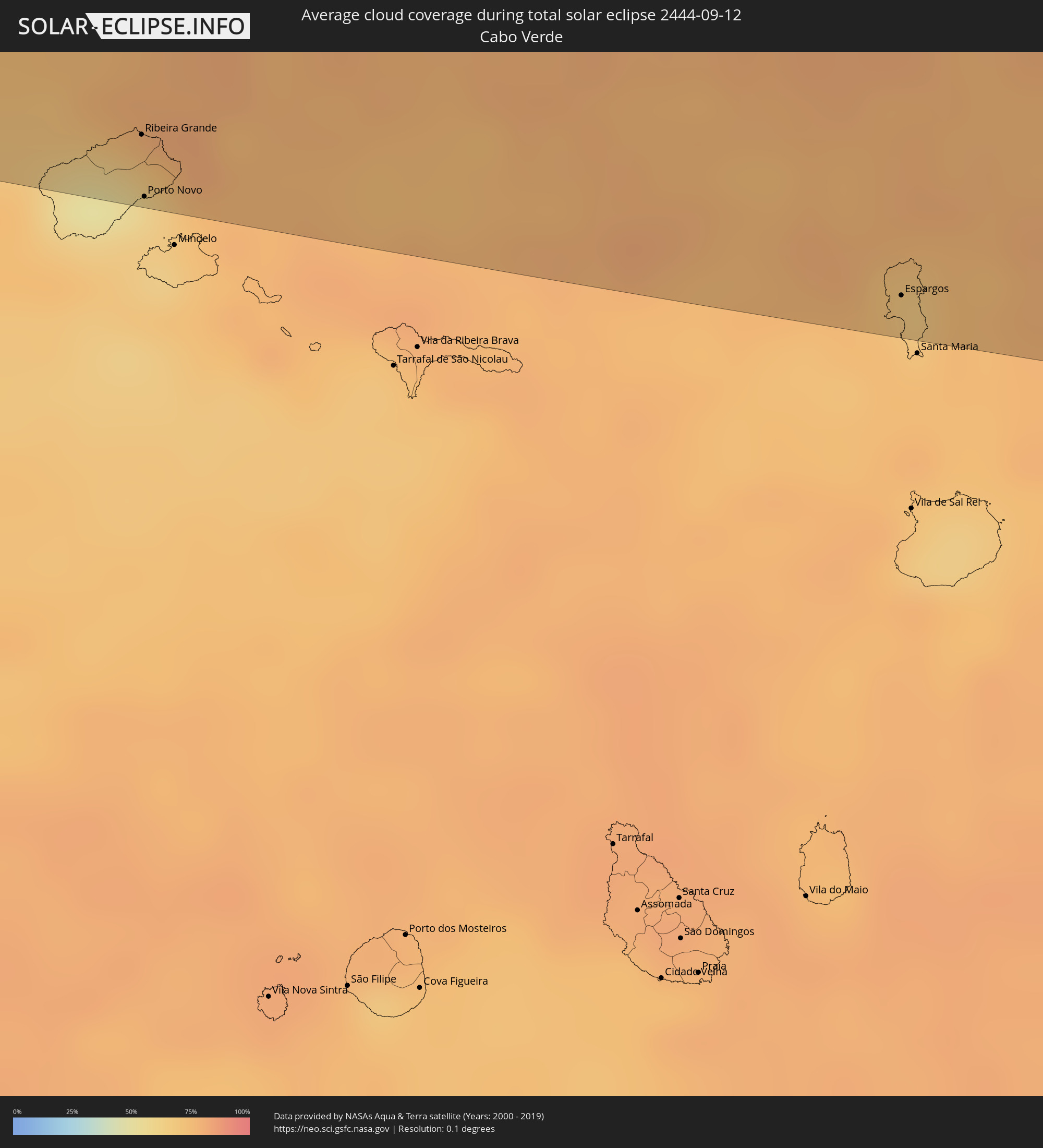 Kap Verde
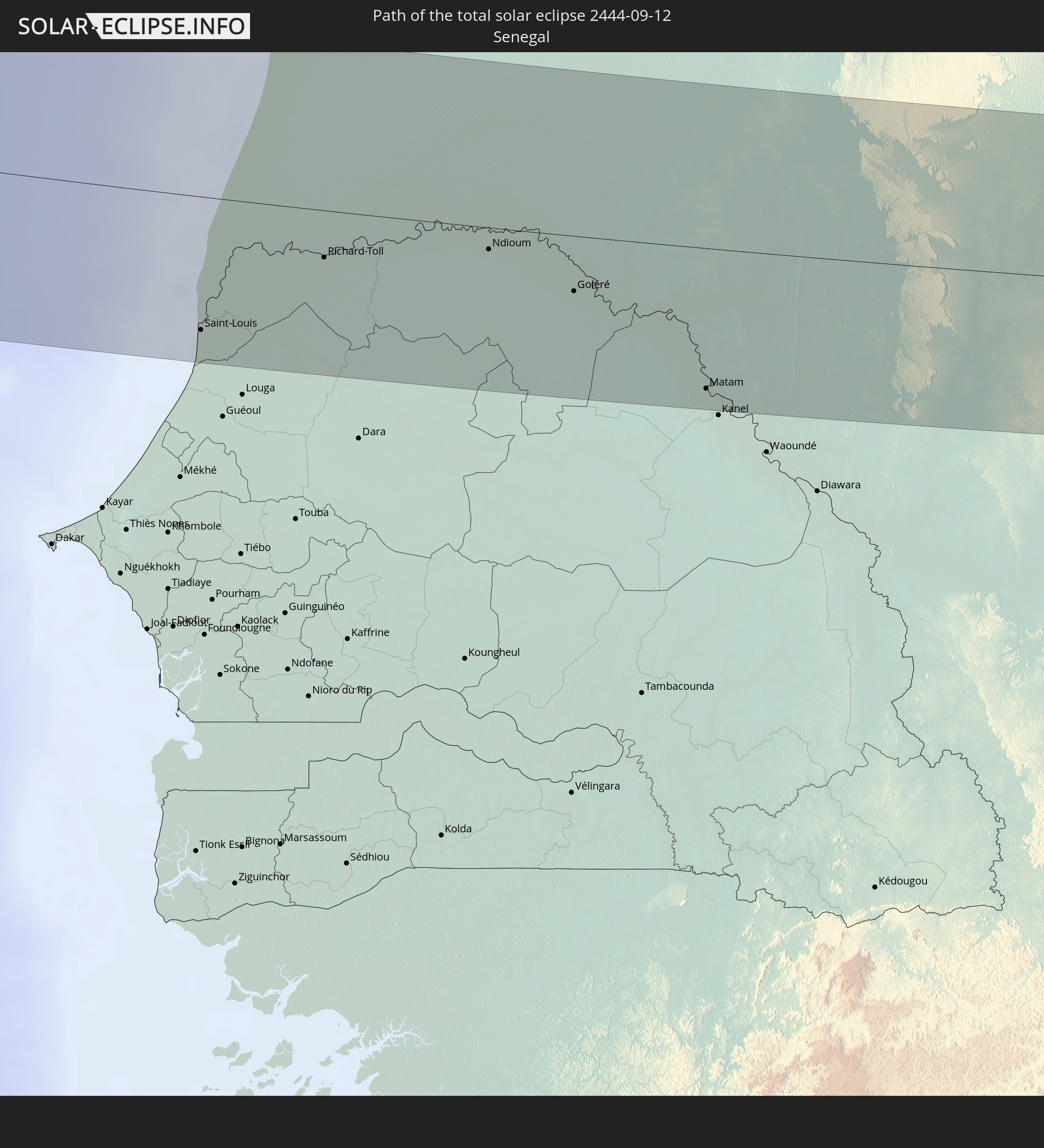
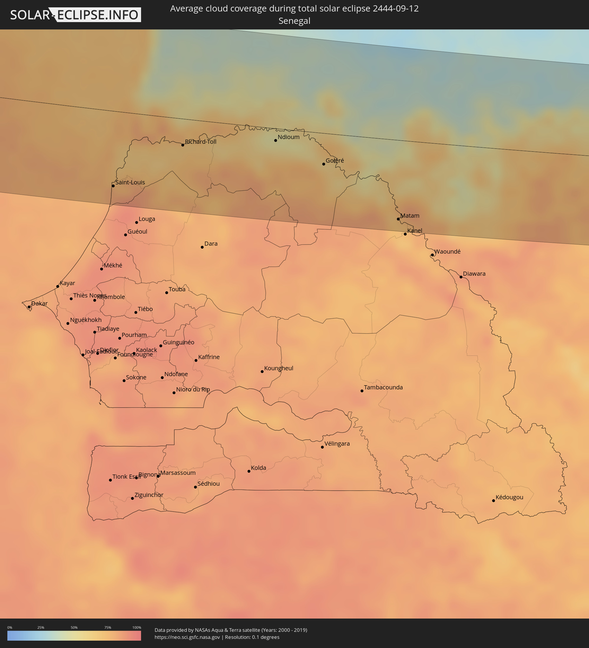 Senegal
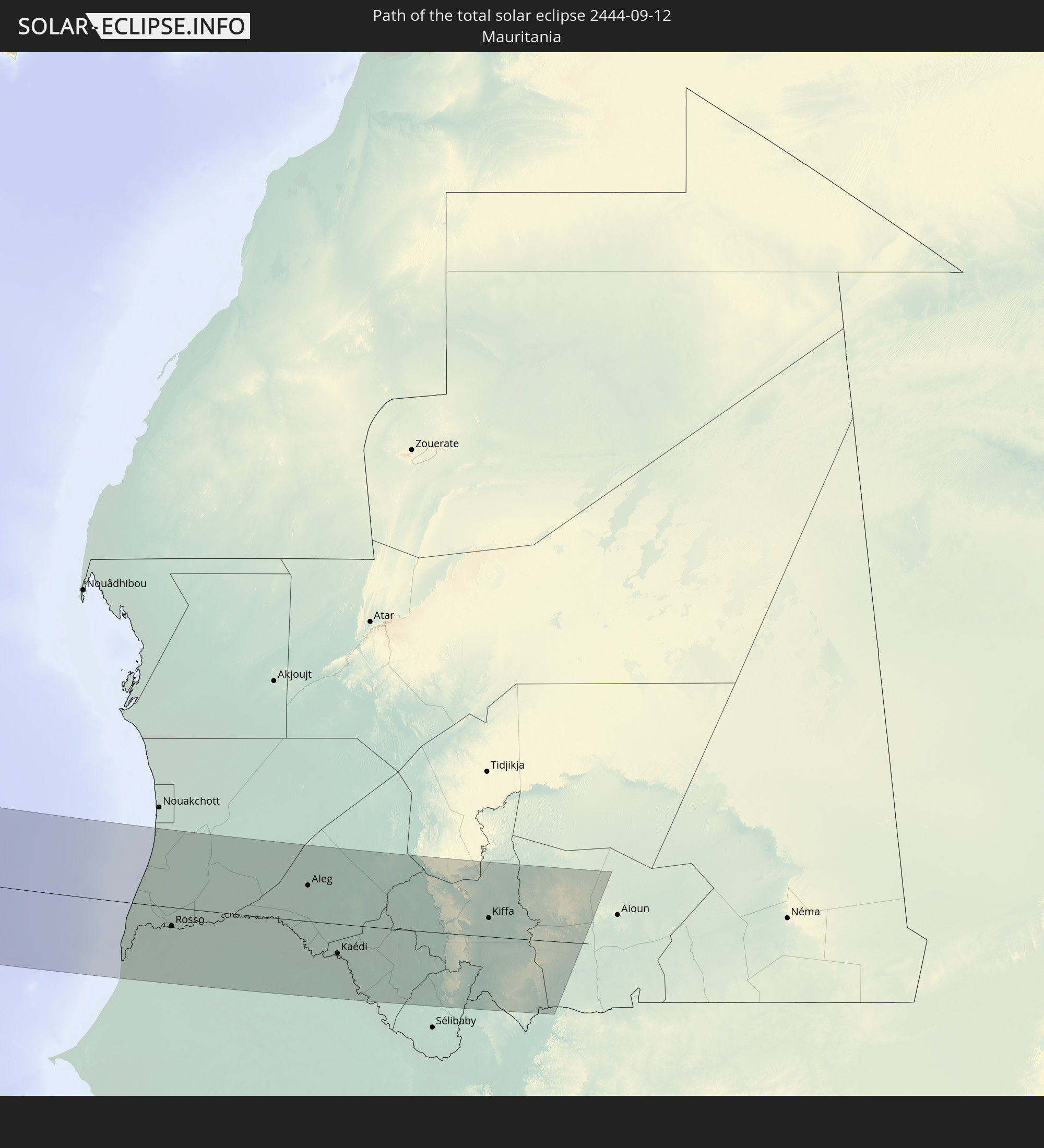
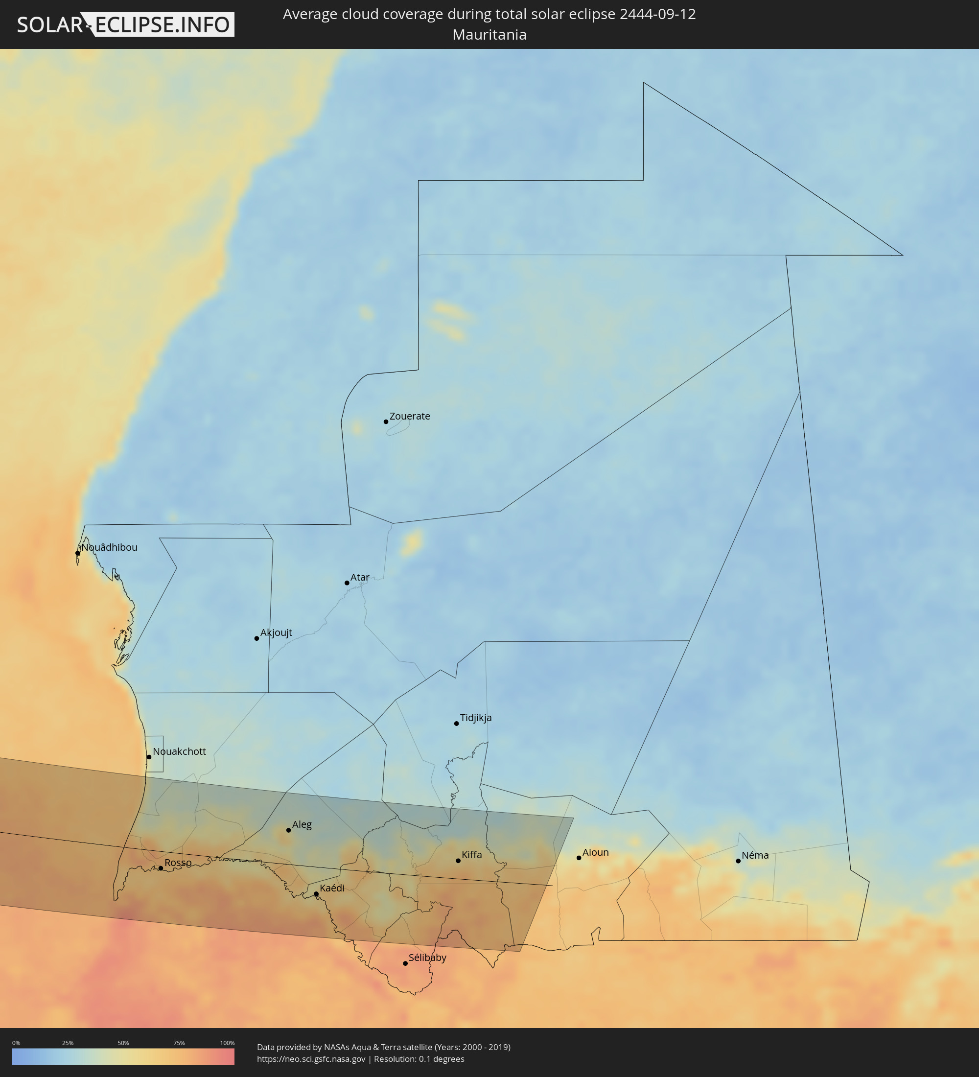 Mauretanien
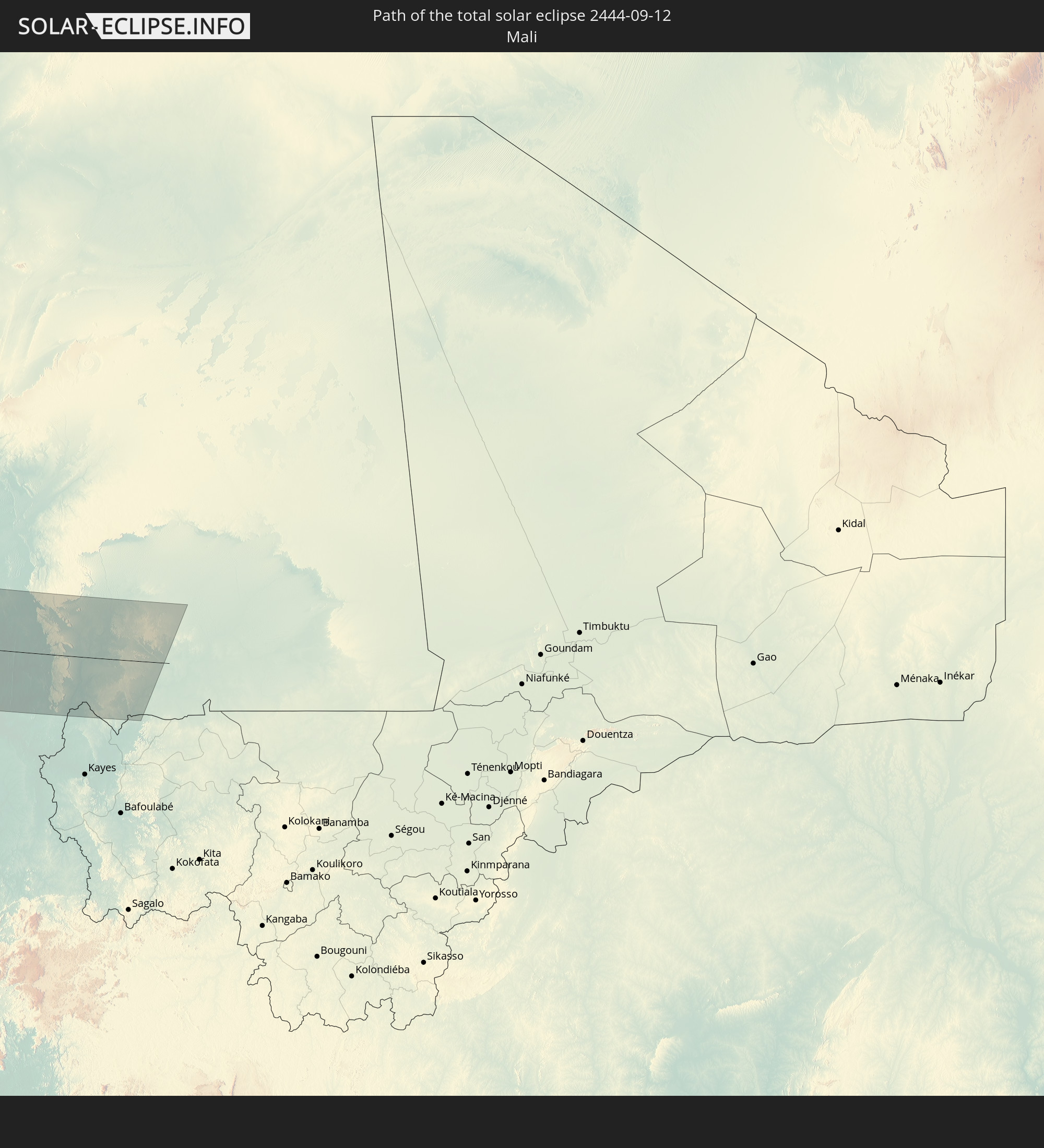
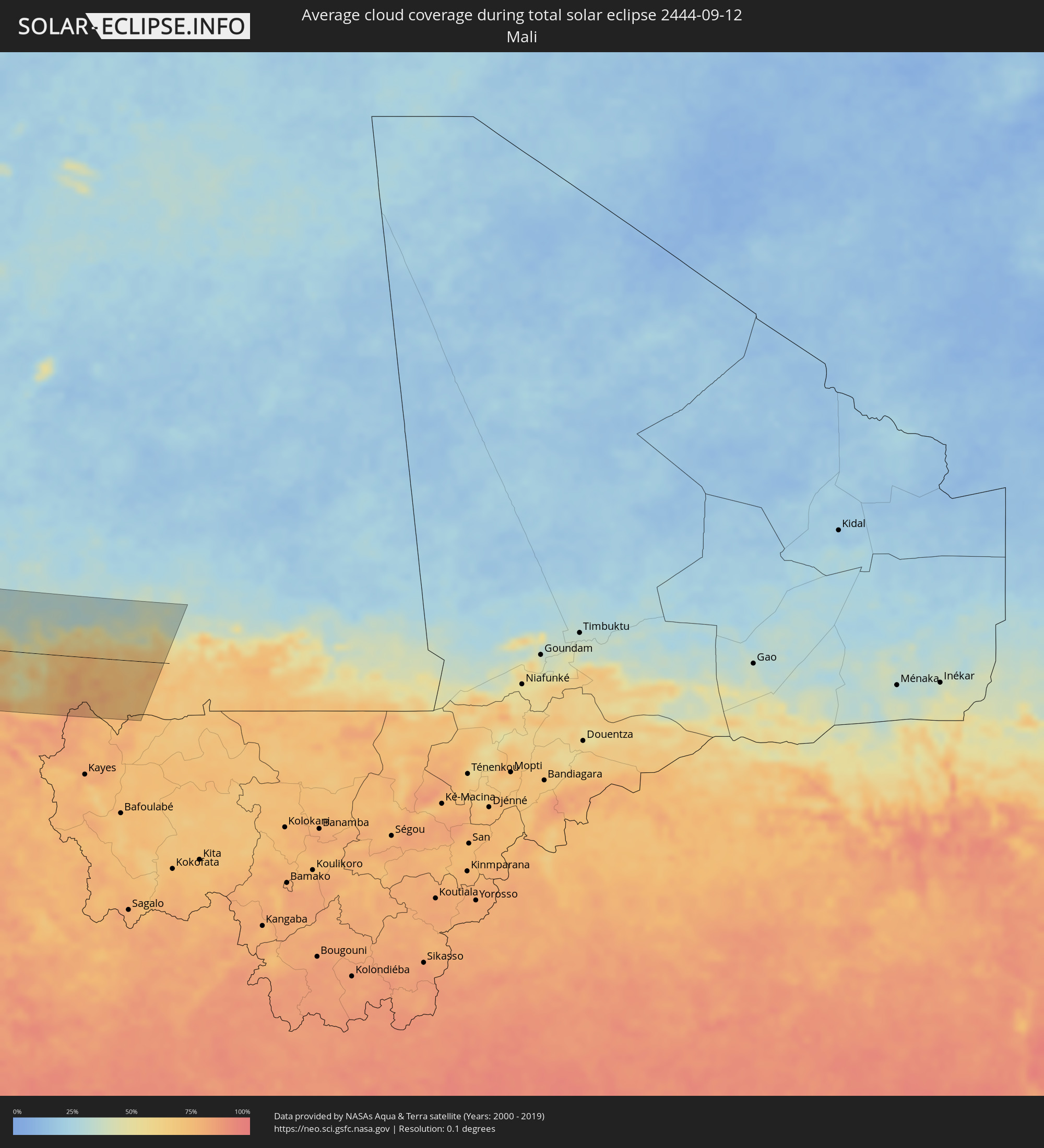 Mali
Mali
Orte im Finsternispfad
Die nachfolgene Tabelle zeigt Städte und Orte mit mehr als 5.000 Einwohnern, die sich im Finsternispfad befinden. Städte mit mehr als 100.000 Einwohnern sind dick gekennzeichnet. Mit einem Klick auf den Ort öffnet sich eine Detailkarte die die Lage des jeweiligen Ortes zusammen mit dem Verlauf der zentralen Finsternis präsentiert.
| Ort | Typ | Dauer der Verfinsterung | Ortszeit bei maximaler Verfinsterung | Entfernung zur Zentrallinie | Ø Bewölkung |
|
Hanceville, British Columbia
|
total | - | 07:57:40 UTC-08:00 | 66 km | 52% |
|
Williams Lake, British Columbia
|
total | - | 07:58:24 UTC-08:00 | 98 km | 51% |
|
Merritt, British Columbia
|
total | - | 07:57:26 UTC-08:00 | 114 km | 45% |
|
Kamloops, British Columbia
|
total | - | 07:58:13 UTC-08:00 | 48 km | 46% |
|
Okanagan, British Columbia
|
total | - | 07:58:36 UTC-08:00 | 72 km | 42% |
|
Salmon Arm, British Columbia
|
total | - | 07:58:55 UTC-08:00 | 34 km | 48% |
|
Vernon, British Columbia
|
total | - | 07:58:35 UTC-08:00 | 82 km | 41% |
|
Revelstoke, British Columbia
|
total | - | 07:59:56 UTC-08:00 | 10 km | 53% |
|
Kimberley, British Columbia
|
total | - | 09:00:31 UTC-07:00 | 110 km | 49% |
|
Banff, Alberta
|
total | - | 09:02:00 UTC-07:00 | 60 km | 58% |
|
Canmore, Alberta
|
total | - | 09:02:06 UTC-07:00 | 53 km | 58% |
|
Cochrane, Alberta
|
total | - | 09:02:51 UTC-07:00 | 75 km | 55% |
|
Calgary, Alberta
|
total | - | 09:03:04 UTC-07:00 | 66 km | 57% |
|
Airdrie, Alberta
|
total | - | 09:03:17 UTC-07:00 | 94 km | 61% |
|
Okotoks, Alberta
|
total | - | 09:02:54 UTC-07:00 | 32 km | 57% |
|
High River, Alberta
|
total | - | 09:02:53 UTC-07:00 | 18 km | 58% |
|
Strathmore, Alberta
|
total | - | 09:03:37 UTC-07:00 | 75 km | 57% |
|
Lethbridge, Alberta
|
total | - | 09:03:07 UTC-07:00 | 64 km | 54% |
|
Coaldale, Alberta
|
total | - | 09:03:18 UTC-07:00 | 59 km | 57% |
|
Taber, Alberta
|
total | - | 09:03:46 UTC-07:00 | 45 km | 58% |
|
Brooks, Alberta
|
total | - | 09:04:33 UTC-07:00 | 46 km | 59% |
|
Medicine Hat, Alberta
|
total | - | 09:05:14 UTC-07:00 | 5 km | 55% |
|
Swift Current, Saskatchewan
|
total | - | 10:08:05 UTC-06:00 | 80 km | 59% |
|
Weyburn, Saskatchewan
|
total | - | 10:11:47 UTC-06:00 | 90 km | 56% |
|
Estevan, Saskatchewan
|
total | - | 10:12:29 UTC-06:00 | 51 km | 51% |
|
Fargo, North Dakota
|
total | - | 10:19:19 UTC-06:00 | 38 km | 53% |
|
Saint Cloud, Minnesota
|
total | - | 10:22:48 UTC-06:00 | 101 km | 51% |
|
West Coon Rapids, Minnesota
|
total | - | 10:23:58 UTC-06:00 | 119 km | 51% |
|
Duluth, Minnesota
|
total | - | 10:25:42 UTC-06:00 | 85 km | 55% |
|
Eau Claire, Wisconsin
|
total | - | 10:26:42 UTC-06:00 | 98 km | 53% |
|
Oshkosh, Wisconsin
|
total | - | 10:31:23 UTC-06:00 | 81 km | 46% |
|
Appleton, Wisconsin
|
total | - | 10:31:31 UTC-06:00 | 53 km | 49% |
|
Green Bay, Wisconsin
|
total | - | 10:32:05 UTC-06:00 | 13 km | 53% |
|
Grand Rapids, Michigan
|
total | - | 11:36:22 UTC-05:00 | 86 km | 58% |
|
Lansing, Michigan
|
total | - | 11:38:19 UTC-05:00 | 68 km | 59% |
|
Ann Arbor, Michigan
|
total | - | 11:39:55 UTC-05:00 | 82 km | 57% |
|
Flint, Michigan
|
total | - | 11:39:38 UTC-05:00 | 8 km | 57% |
|
Novi, Michigan
|
total | - | 11:40:16 UTC-05:00 | 52 km | 57% |
|
Waterford, Michigan
|
total | - | 11:40:15 UTC-05:00 | 28 km | 51% |
|
Livonia, Michigan
|
total | - | 11:40:32 UTC-05:00 | 58 km | 59% |
|
Taylor, Michigan
|
total | - | 11:40:44 UTC-05:00 | 68 km | 59% |
|
Southfield, Michigan
|
total | - | 11:40:42 UTC-05:00 | 43 km | 60% |
|
Troy, Michigan
|
total | - | 11:40:45 UTC-05:00 | 27 km | 58% |
|
Amherstburg, Ontario
|
total | - | 11:41:11 UTC-05:00 | 71 km | 51% |
|
Detroit, Michigan
|
total | - | 11:41:04 UTC-05:00 | 50 km | 58% |
|
Warren, Michigan
|
total | - | 11:41:01 UTC-05:00 | 35 km | 55% |
|
Windsor, Ontario
|
total | - | 11:41:08 UTC-05:00 | 52 km | 58% |
|
Clinton, Michigan
|
total | - | 11:41:09 UTC-05:00 | 20 km | 52% |
|
Sarnia, Ontario
|
total | - | 11:41:48 UTC-05:00 | 38 km | 50% |
|
Lorain, Ohio
|
total | - | 11:43:03 UTC-05:00 | 102 km | 49% |
|
Camlachie, Ontario
|
total | - | 11:42:11 UTC-05:00 | 53 km | 56% |
|
Petrolia, Ontario
|
total | - | 11:42:18 UTC-05:00 | 37 km | 63% |
|
Lambton Shores, Ontario
|
total | - | 11:42:30 UTC-05:00 | 75 km | 57% |
|
Cleveland, Ohio
|
total | - | 11:43:53 UTC-05:00 | 78 km | 53% |
|
Bluewater, Ontario
|
total | - | 11:42:53 UTC-05:00 | 117 km | 63% |
|
Akron, Ohio
|
total | - | 11:44:27 UTC-05:00 | 112 km | 54% |
|
South Huron, Ontario
|
total | - | 11:43:07 UTC-05:00 | 106 km | 64% |
|
London, Ontario
|
total | - | 11:43:47 UTC-05:00 | 85 km | 65% |
|
St. Thomas, Ontario
|
total | - | 11:43:59 UTC-05:00 | 66 km | 59% |
|
Dorchester, Ontario
|
total | - | 11:44:04 UTC-05:00 | 91 km | 64% |
|
Aylmer, Ontario
|
total | - | 11:44:20 UTC-05:00 | 74 km | 62% |
|
Ingersoll, Ontario
|
total | - | 11:44:20 UTC-05:00 | 103 km | 65% |
|
Woodstock, Ontario
|
total | - | 11:44:30 UTC-05:00 | 118 km | 66% |
|
Youngstown, Ohio
|
total | - | 11:45:59 UTC-05:00 | 75 km | 64% |
|
Norfolk County, Ontario
|
total | - | 11:45:19 UTC-05:00 | 104 km | 60% |
|
Erie, Pennsylvania
|
total | - | 11:46:16 UTC-05:00 | 48 km | 60% |
|
Pittsburgh, Pennsylvania
|
total | - | 11:47:36 UTC-05:00 | 112 km | 62% |
|
Frederick, Maryland
|
total | - | 11:53:08 UTC-05:00 | 101 km | 64% |
|
Germantown, Maryland
|
total | - | 11:53:36 UTC-05:00 | 118 km | 64% |
|
Silver Spring, Maryland
|
total | - | 11:54:13 UTC-05:00 | 124 km | 67% |
|
Columbia, Maryland
|
total | - | 11:54:20 UTC-05:00 | 92 km | 67% |
|
Baltimore, Maryland
|
total | - | 11:54:43 UTC-05:00 | 77 km | 61% |
|
Lancaster, Pennsylvania
|
total | - | 11:54:36 UTC-05:00 | 7 km | 62% |
|
Reading, Pennsylvania
|
total | - | 11:55:01 UTC-05:00 | 52 km | 62% |
|
Wilmington, Delaware
|
total | - | 11:56:15 UTC-05:00 | 13 km | 58% |
|
Allentown, Pennsylvania
|
total | - | 11:55:34 UTC-05:00 | 98 km | 64% |
|
Philadelphia, Pennsylvania
|
total | - | 11:56:45 UTC-05:00 | 50 km | 62% |
|
Vineland, New Jersey
|
total | - | 11:57:27 UTC-05:00 | 12 km | 62% |
|
Trenton, New Jersey
|
total | - | 11:57:16 UTC-05:00 | 94 km | 60% |
|
Toms River, New Jersey
|
total | - | 11:58:30 UTC-05:00 | 94 km | 57% |
|
Ribeira Grande, Ribeira Grande
|
total | - | 17:37:12 UTC-01:00 | 99 km | 63% |
|
Porto Novo, Porto Novo
|
total | - | 17:37:24 UTC-01:00 | 117 km | 64% |
|
Pombas, Paul
|
total | - | 17:37:16 UTC-01:00 | 102 km | 73% |
|
Espargos, Sal
|
total | - | 17:38:29 UTC-01:00 | 106 km | 67% |
|
Saint-Louis, Saint-Louis
|
total | - | 18:40:45 UTC+00:00 | 90 km | 80% |
|
Rosso, Trarza
|
total | - | 18:40:17 UTC+00:00 | 28 km | 68% |
|
Rosso, Saint-Louis
|
total | - | 18:40:23 UTC+00:00 | 38 km | 70% |
|
Richard-Toll, Saint-Louis
|
total | - | 18:40:21 UTC+00:00 | 32 km | 68% |
|
Tékane, Trarza
|
total | - | 18:40:15 UTC+00:00 | 16 km | 69% |
|
Ndioum, Saint-Louis
|
total | - | 18:40:23 UTC+00:00 | 15 km | 63% |
|
Goléré, Saint-Louis
|
total | - | 18:40:41 UTC+00:00 | 38 km | 72% |
|
Aleg, Brakna
|
total | - | 18:39:51 UTC+00:00 | 53 km | 51% |
|
Kaédi, Gorgol
|
total | - | 18:40:49 UTC+00:00 | 43 km | 56% |
|
Ouro Sogui, Matam
|
total | - | 18:41:23 UTC+00:00 | 102 km | 79% |
|
Matam, Matam
|
total | - | 18:41:20 UTC+00:00 | 96 km | 73% |
|
Kiffa, Assaba
|
total | - | 18:40:21 UTC+00:00 | 28 km | 68% |