Hybrid solar eclipse of 11/07/-0314
| Day of week: | Tuesday |
| Maximum duration of eclipse: | 01m30s |
| Maximum width of eclipse path: | 61 km |
| Saros cycle: | 57 |
| Coverage: | 100% |
| Magnitude: | 1.0168 |
| Gamma: | -0.3363 |
Wo kann man die Sonnenfinsternis vom 11/07/-0314 sehen?
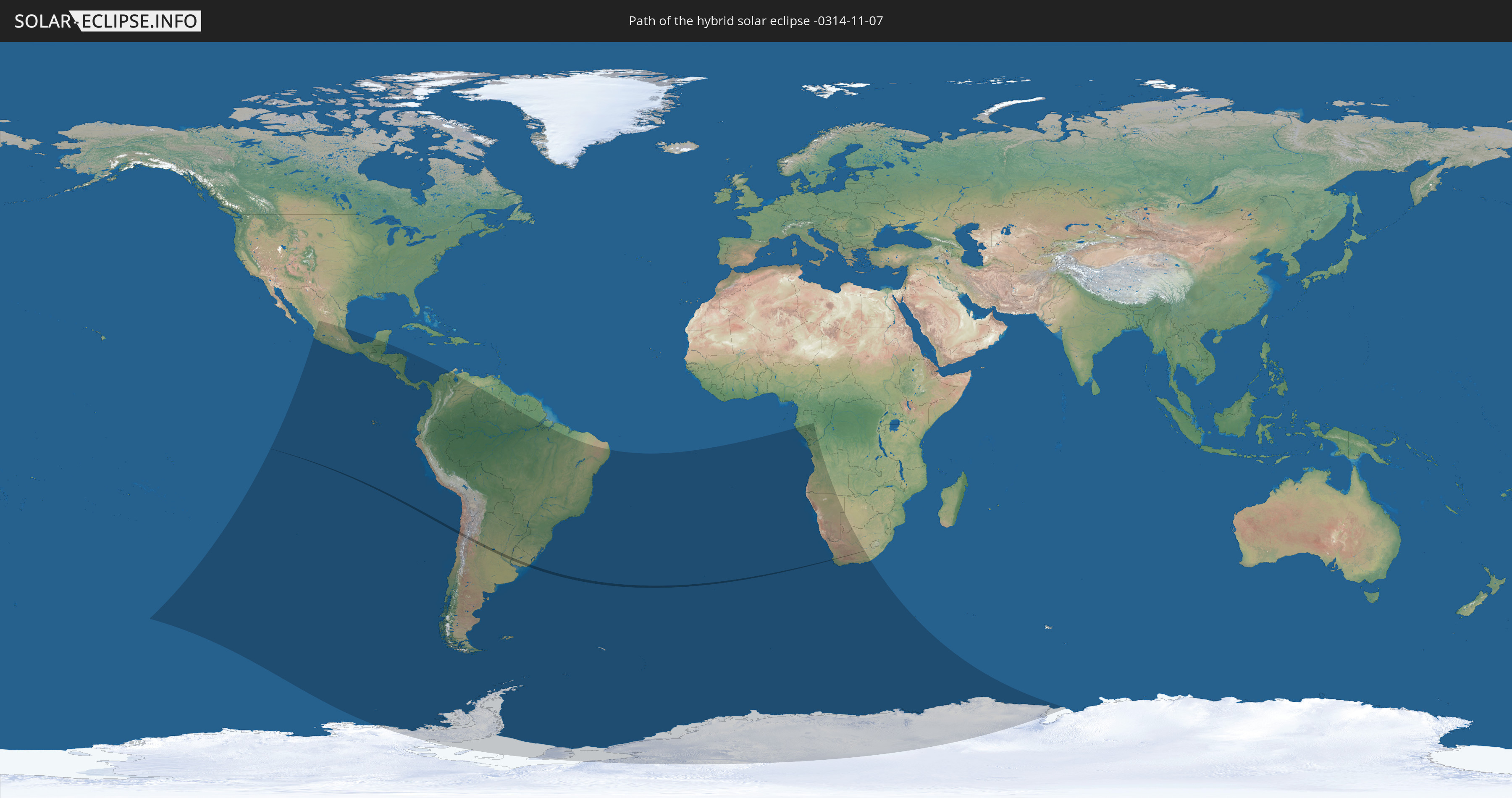
Die Sonnenfinsternis am 11/07/-0314 kann man in 33 Ländern als partielle Sonnenfinsternis beobachten.
Der Finsternispfad verläuft durch 4 Länder. Nur in diesen Ländern ist sie als hybrid Sonnenfinsternis zu sehen.
In den folgenden Ländern ist die Sonnenfinsternis hybrid zu sehen
 Chile
Chile
 Argentina
 Uruguay
 South Africa
In den folgenden Ländern ist die Sonnenfinsternis partiell zu sehen
 Antarctica
 Pitcairn Islands
 Mexico
 Chile
Chile
 Guatemala
 Ecuador
 El Salvador
 Honduras
 Belize
 Nicaragua
 Costa Rica
 Panama
 Colombia
 Peru
Peru
 Brazil
 Argentina
 Venezuela
 Bolivia
 Paraguay
 Falkland Islands
 Guyana
 Uruguay
 Suriname
 South Georgia and the South Sandwich Islands
 Saint Helena, Ascension and Tristan da Cunha
 Bouvet Island
 Gabon
Gabon
 Republic of the Congo
 Angola
 Namibia
 Democratic Republic of the Congo
 South Africa
 Botswana
How will be the weather during the hybrid solar eclipse on 11/07/-0314?
Where is the best place to see the hybrid solar eclipse of 11/07/-0314?
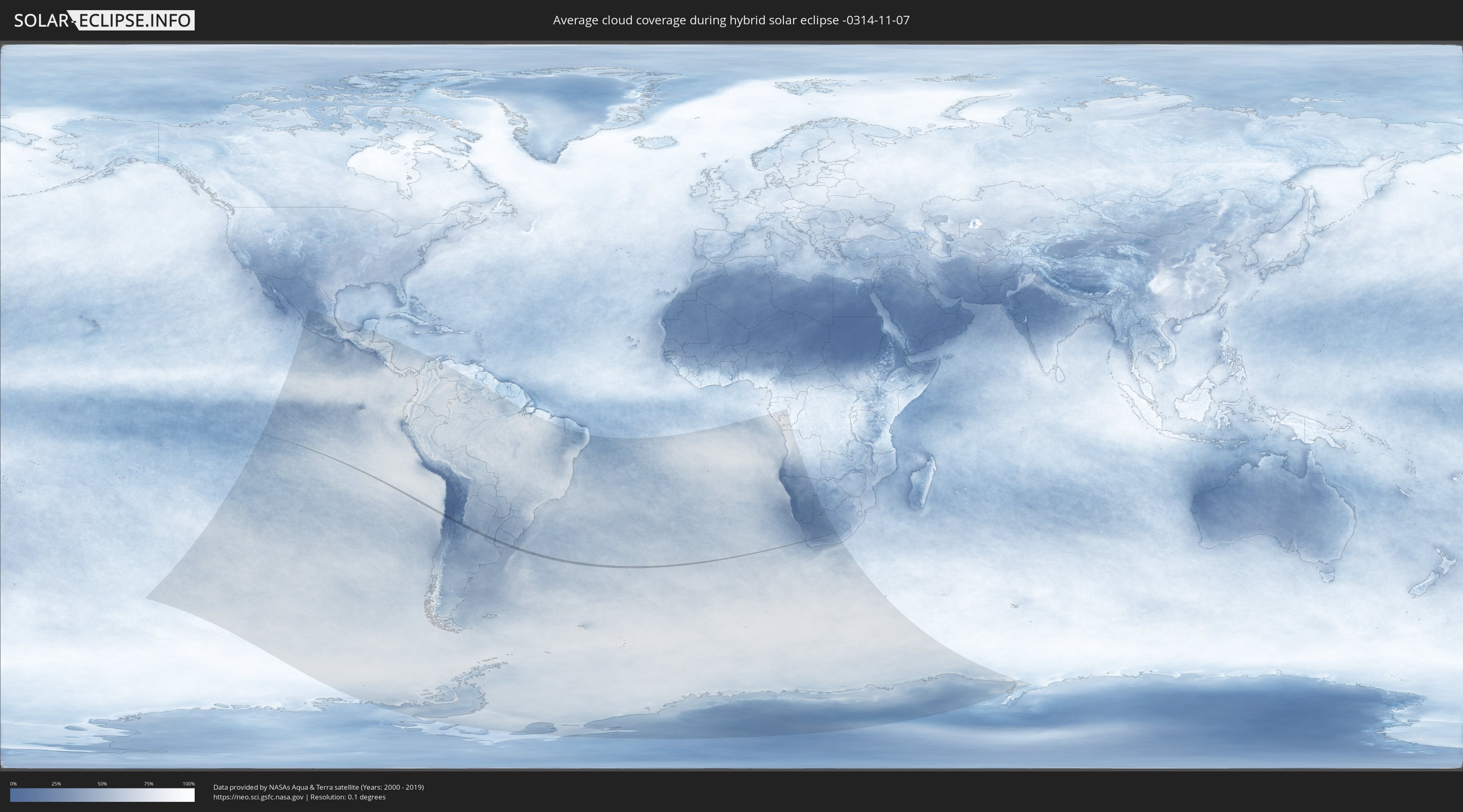
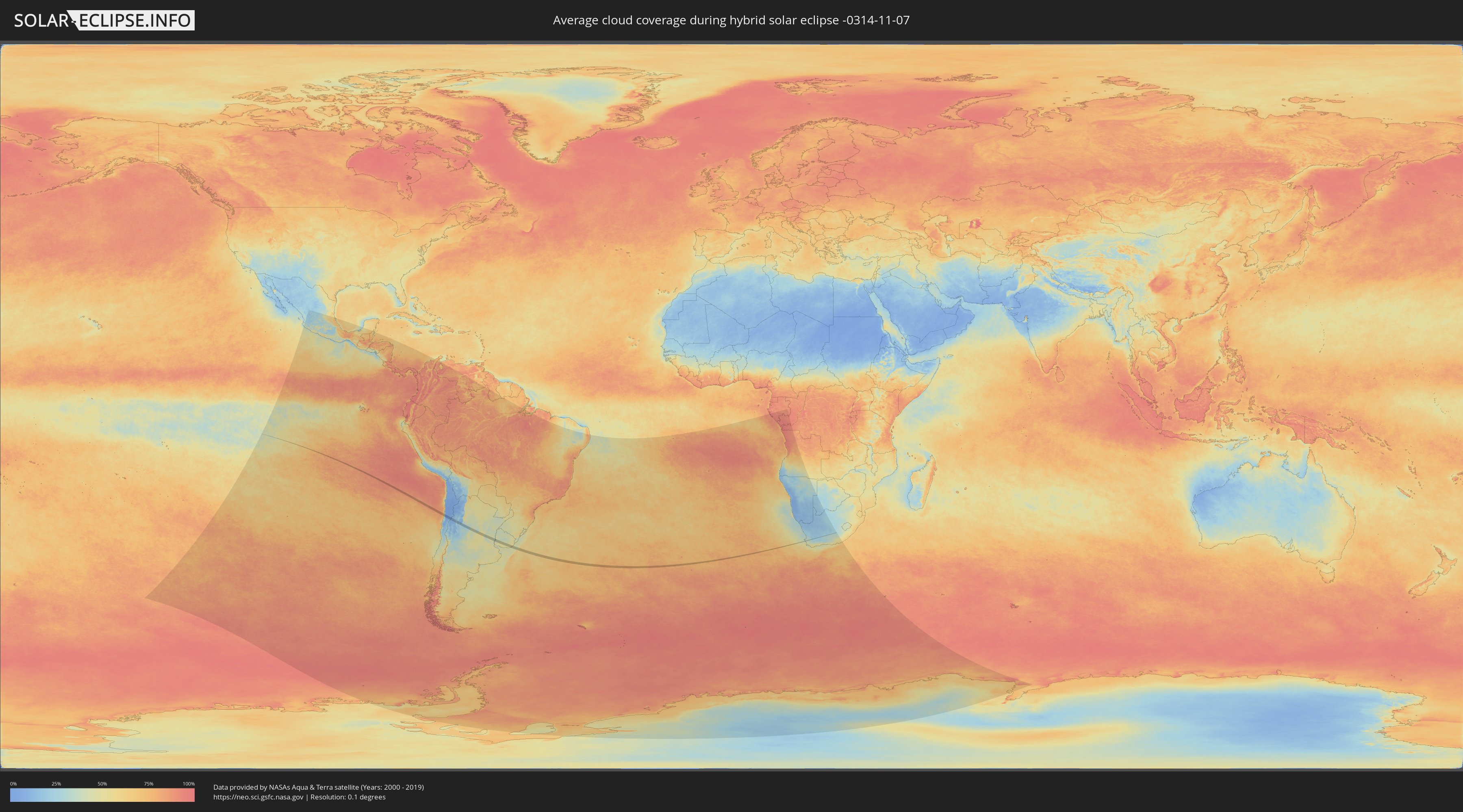
The following maps show the average cloud coverage for the day of the hybrid solar eclipse.
With the help of these maps, it is possible to find the place along the eclipse path, which has the best
chance of a cloudless sky.
Nevertheless, you should consider local circumstances and inform about the weather of your chosen
observation site.
The data is provided by NASAs satellites
AQUA and TERRA.
The cloud maps are averaged over a period of 19 years (2000 - 2019).
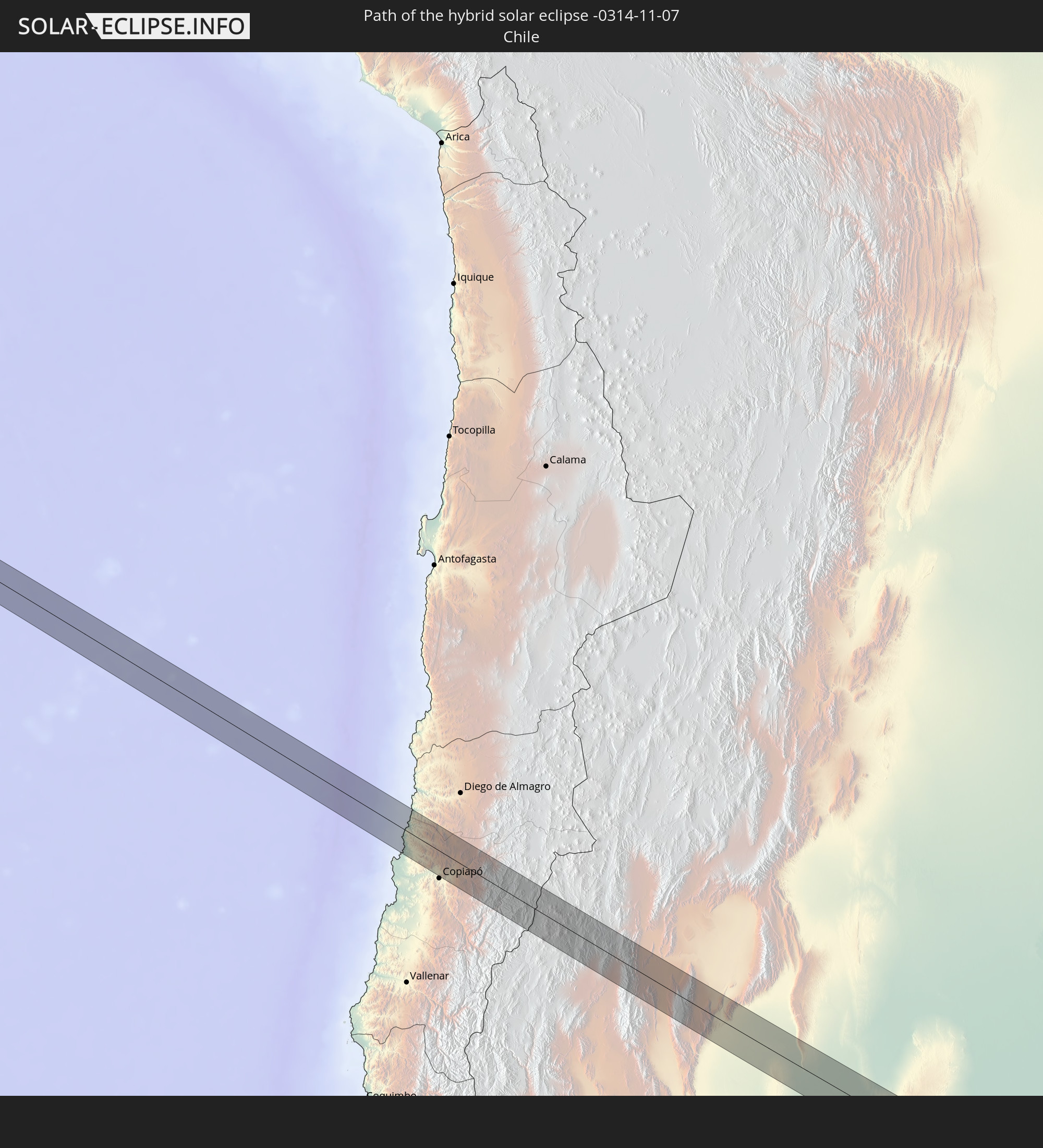
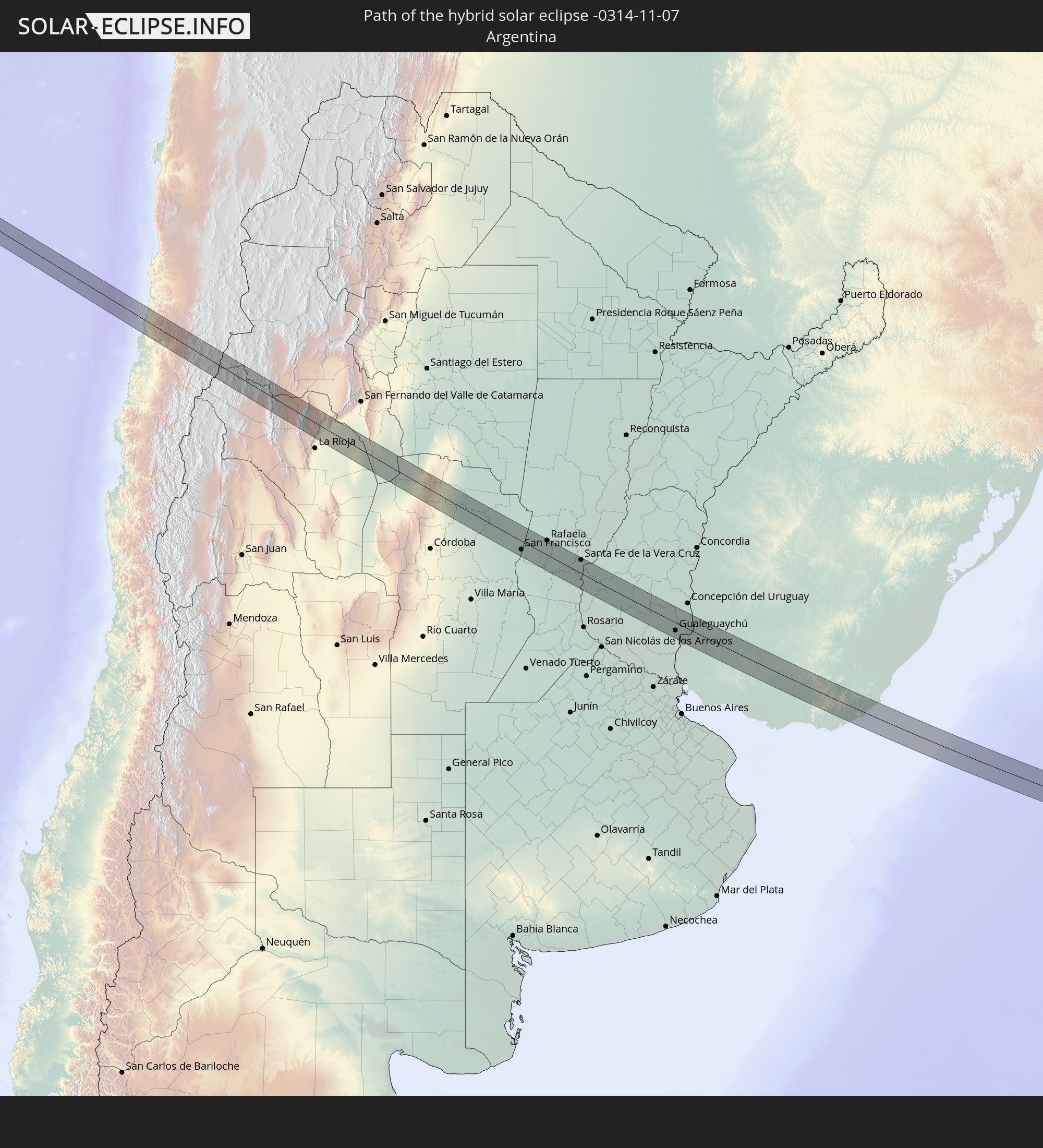
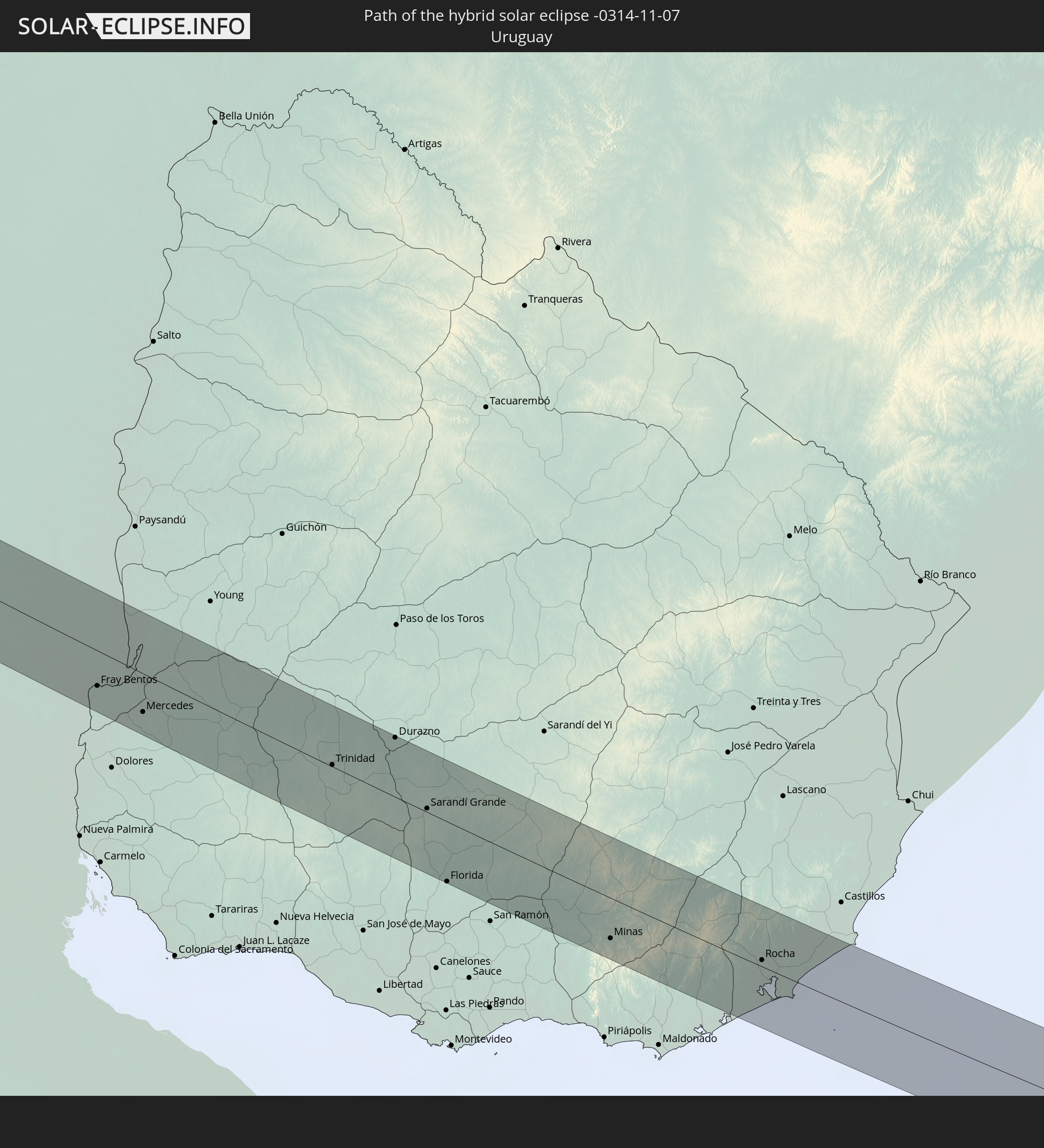
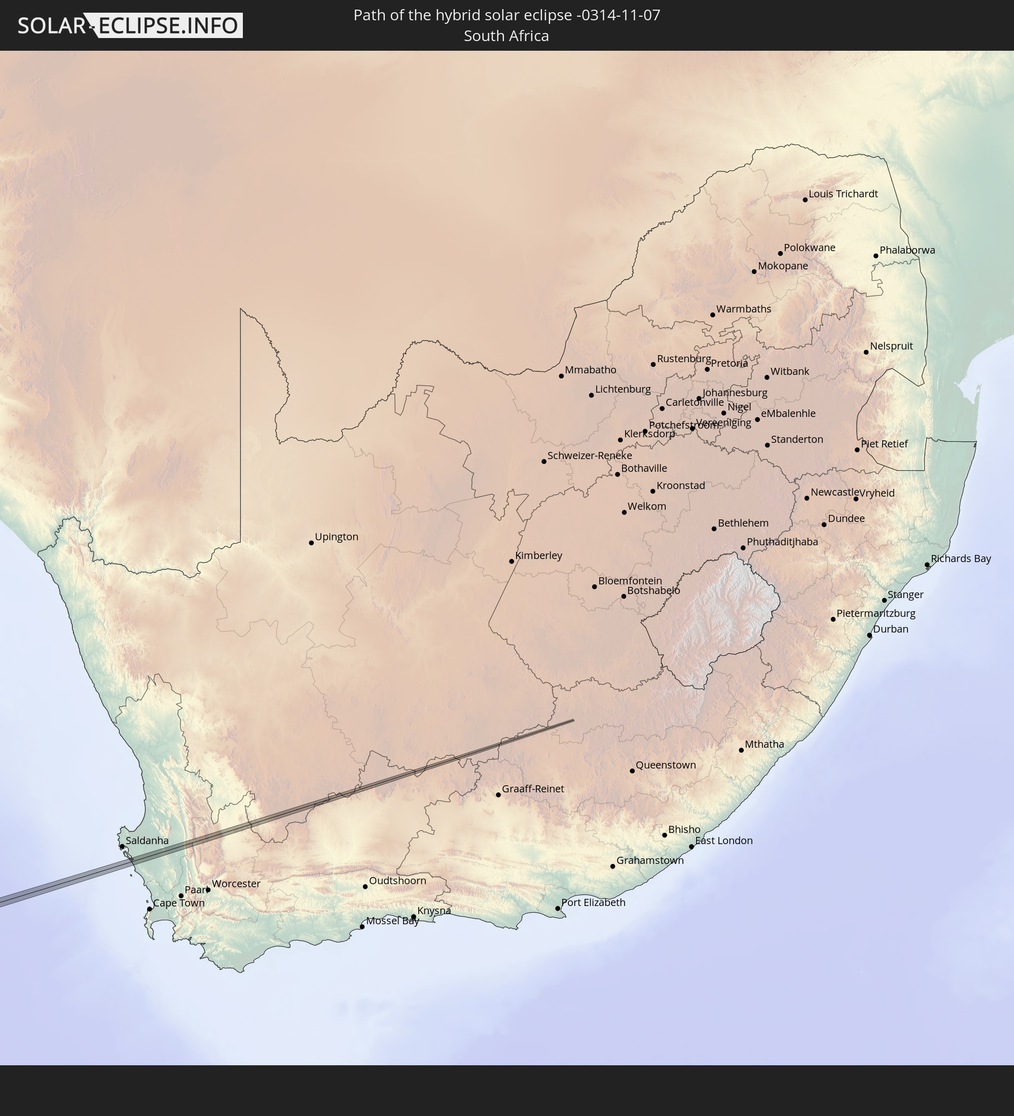
Detailed country maps
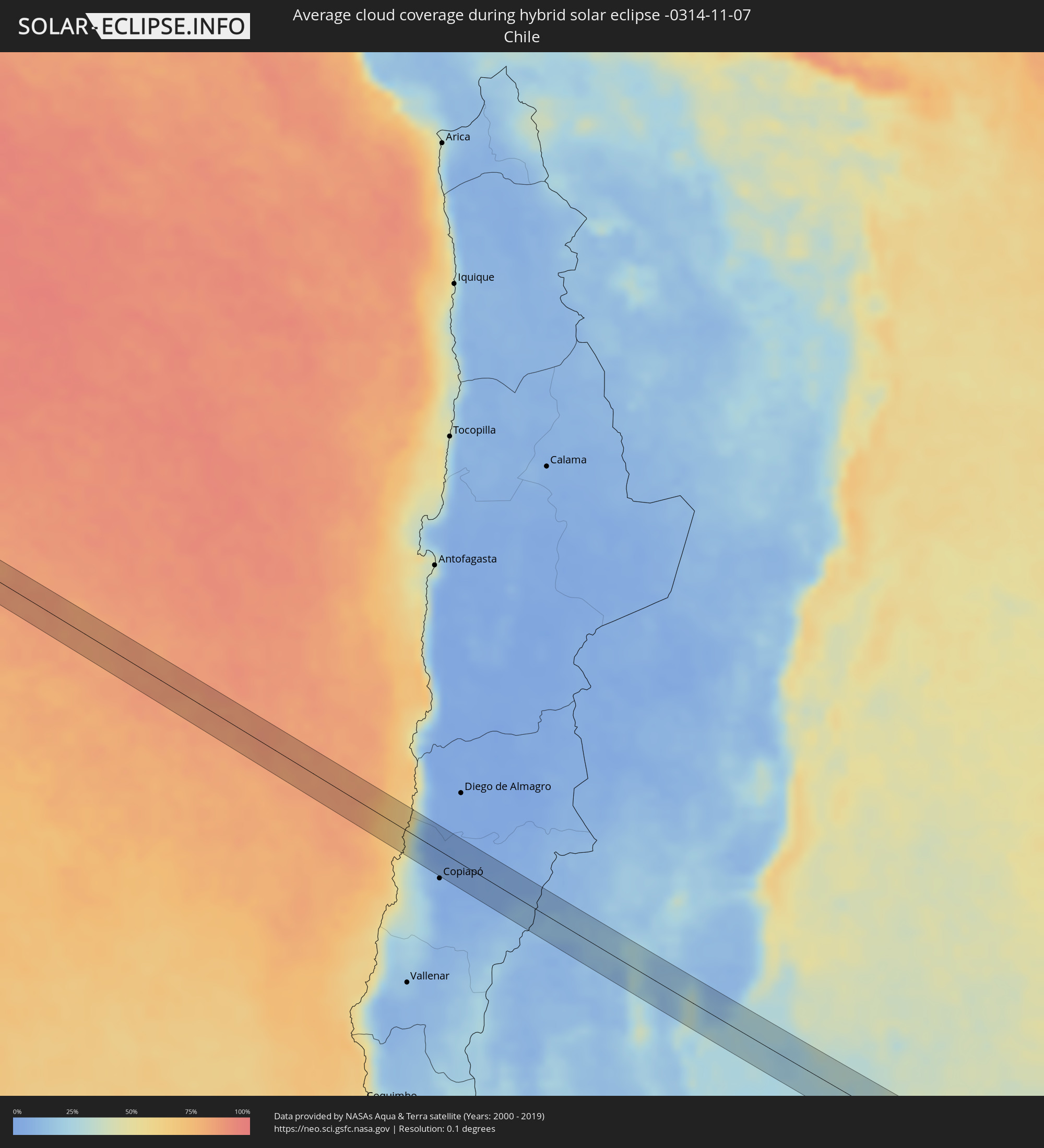 Chile
Chile
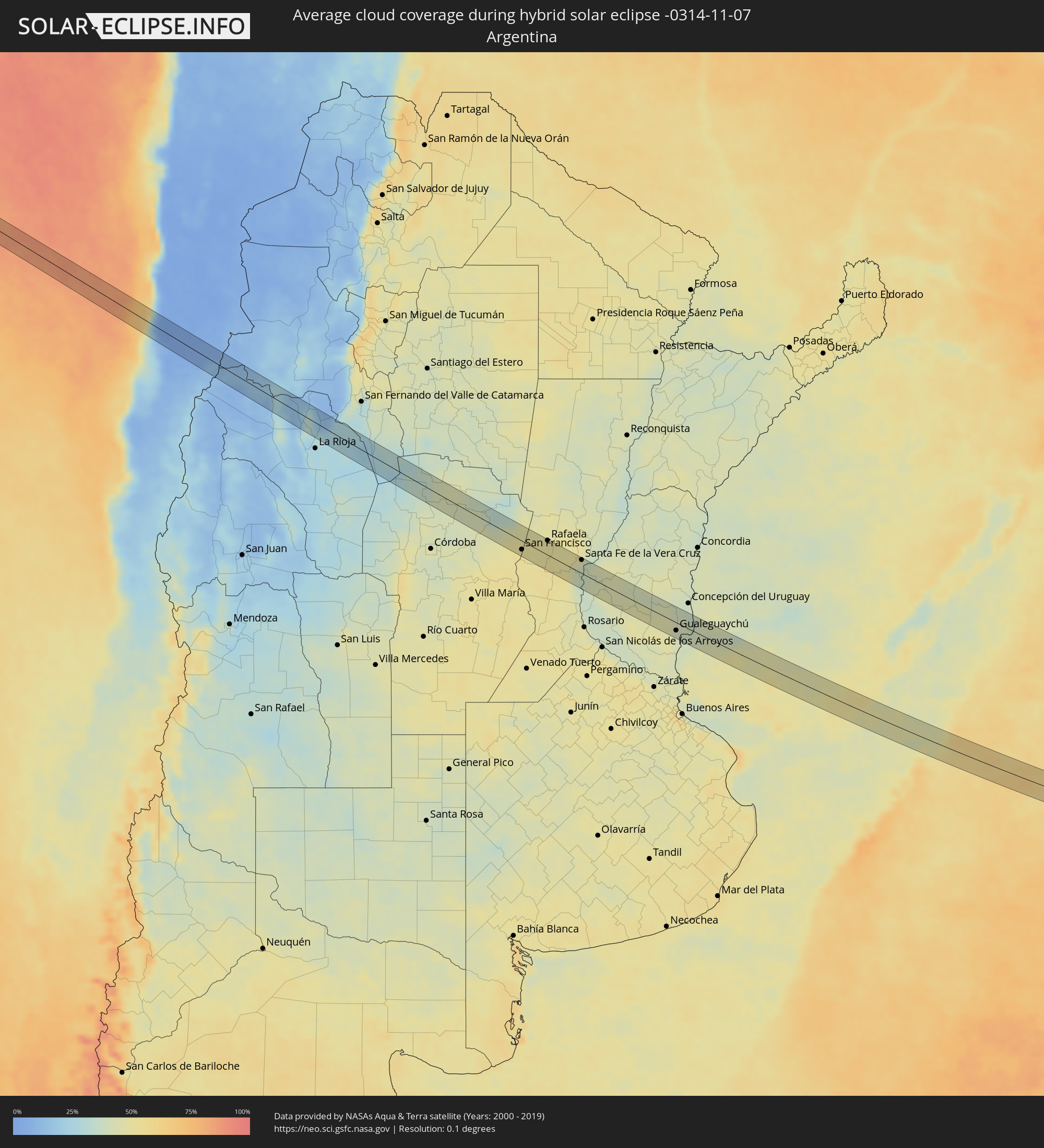 Argentina
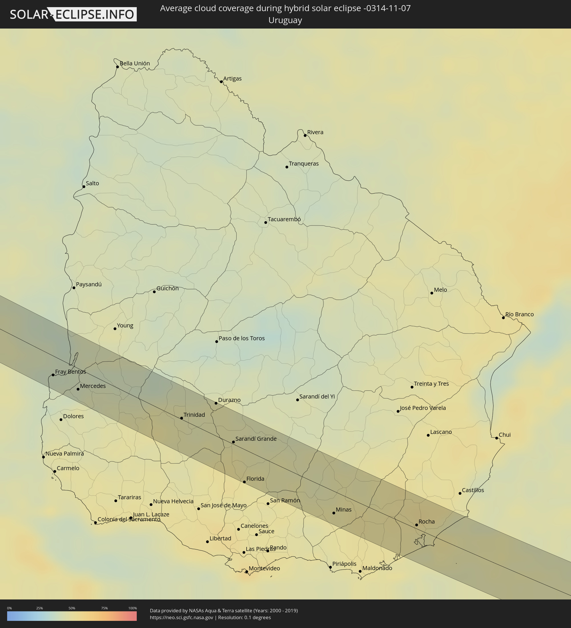 Uruguay
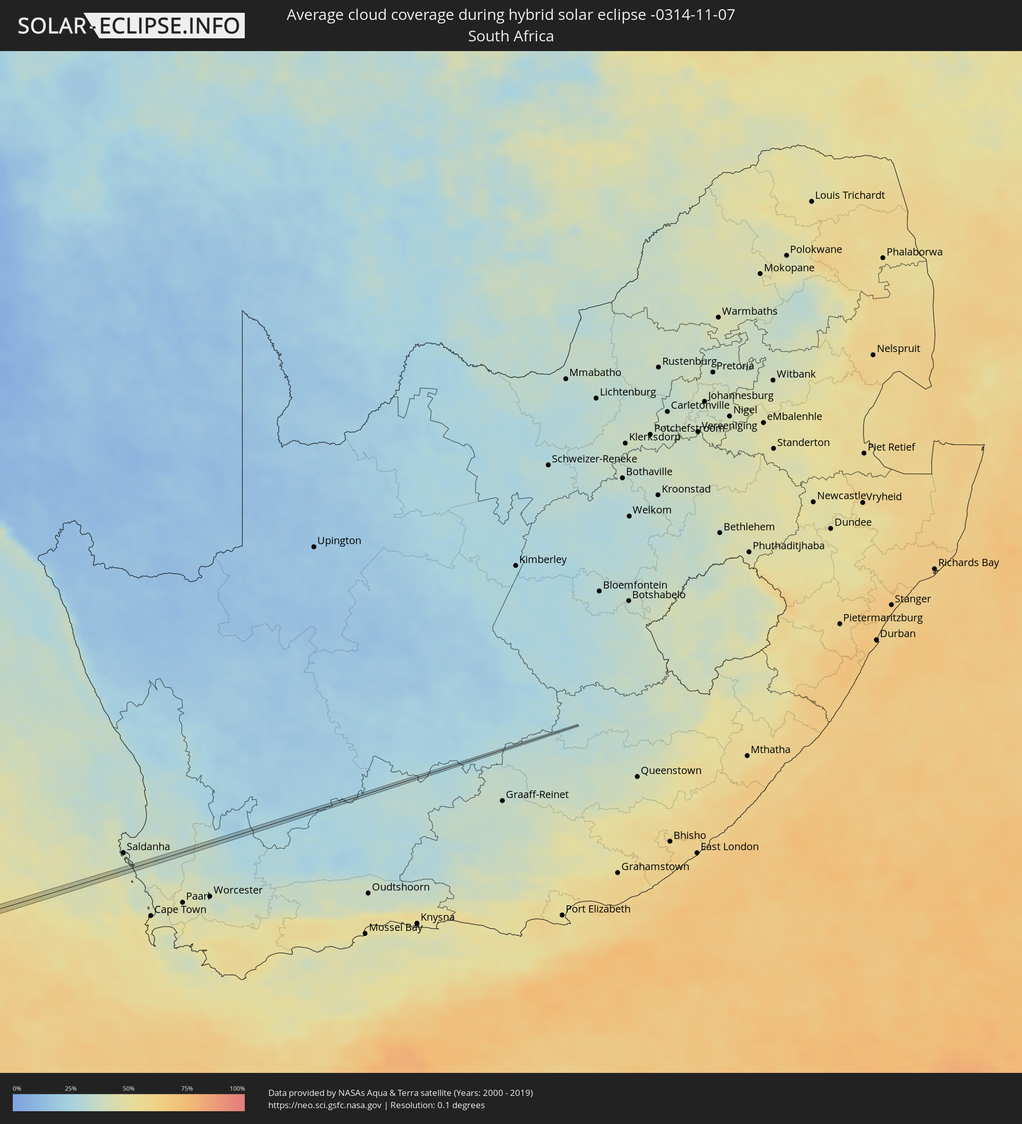 South Africa
Cities inside the path of the eclipse
The following table shows all locations with a population of more than 5,000 inside the eclipse path. Cities which have more than 100,000 inhabitants are marked bold. A click at the locations opens a detailed map.
| City | Type | Eclipse duration | Local time of max. eclipse | Distance to central line | Ø Cloud coverage |
|
Deán Funes, Cordoba Province
|
total | - | 10:17:52 UTC-04:16 | 25 km | 38% |
|
Balnearia, Cordoba Province
|
total | - | 10:22:07 UTC-04:16 | 3 km | 42% |
|
Devoto, Cordoba Province
|
total | - | 10:23:27 UTC-04:16 | 25 km | 52% |
|
San Francisco, Cordoba Province
|
total | - | 10:23:56 UTC-04:16 | 17 km | 51% |
|
Rafaela, Santa Fe Province
|
total | - | 10:24:54 UTC-04:16 | 28 km | 50% |
|
San Carlos Centro, Santa Fe Province
|
total | - | 10:26:24 UTC-04:16 | 1 km | 49% |
|
Coronda, Santa Fe Province
|
total | - | 10:27:07 UTC-04:16 | 17 km | 42% |
|
Santo Tomé, Santa Fe Province
|
total | - | 10:26:59 UTC-04:16 | 20 km | 40% |
|
Santa Fe de la Vera Cruz, Santa Fe Province
|
total | - | 10:27:05 UTC-04:16 | 26 km | 44% |
|
Diamante, Entre Ríos Province
|
total | - | 10:27:50 UTC-04:16 | 14 km | 39% |
|
Paraná, Entre Ríos Province
|
total | - | 10:27:36 UTC-04:16 | 24 km | 41% |
|
San Benito, Entre Ríos Province
|
total | - | 10:27:51 UTC-04:16 | 22 km | 43% |
|
Crespo, Entre Ríos Province
|
total | - | 10:28:28 UTC-04:16 | 4 km | 43% |
|
General Ramírez, Entre Ríos Province
|
total | - | 10:28:54 UTC-04:16 | 6 km | 45% |
|
Maciá, Entre Ríos Province
|
total | - | 10:30:35 UTC-04:16 | 30 km | 41% |
|
Rosario del Tala, Entre Ríos Province
|
total | - | 10:31:19 UTC-04:16 | 28 km | 39% |
|
Urdinarrain, Entre Ríos Province
|
total | - | 10:32:22 UTC-04:16 | 1 km | 46% |
|
Gualeguaychú, Entre Ríos Province
|
total | - | 10:33:37 UTC-04:16 | 15 km | 40% |
|
Fray Bentos, Río Negro
|
total | - | 11:06:10 UTC-03:44 | 18 km | 39% |
|
Mercedes, Soriano
|
total | - | 11:06:55 UTC-03:44 | 19 km | 46% |
|
Trinidad, Flores
|
total | - | 11:09:42 UTC-03:44 | 1 km | 47% |
|
Trinidad, Flores
|
total | - | 11:09:45 UTC-03:44 | 1 km | 47% |
|
Durazno, Durazno
|
total | - | 11:10:21 UTC-03:44 | 30 km | 46% |
|
Sarandí Grande, Florida
|
total | - | 11:11:12 UTC-03:44 | 2 km | 49% |
|
Florida, Florida
|
total | - | 11:11:54 UTC-03:44 | 30 km | 48% |
|
Minas, Lavalleja
|
total | - | 11:14:22 UTC-03:44 | 20 km | 49% |
|
Rocha, Rocha
|
total | - | 11:16:28 UTC-03:44 | 3 km | 47% |