Hybrid solar eclipse of 12/17/-0437
| Day of week: | Monday |
| Maximum duration of eclipse: | 01m45s |
| Maximum width of eclipse path: | 60 km |
| Saros cycle: | 54 |
| Coverage: | 100% |
| Magnitude: | 1.0173 |
| Gamma: | 0.1286 |
Wo kann man die Sonnenfinsternis vom 12/17/-0437 sehen?
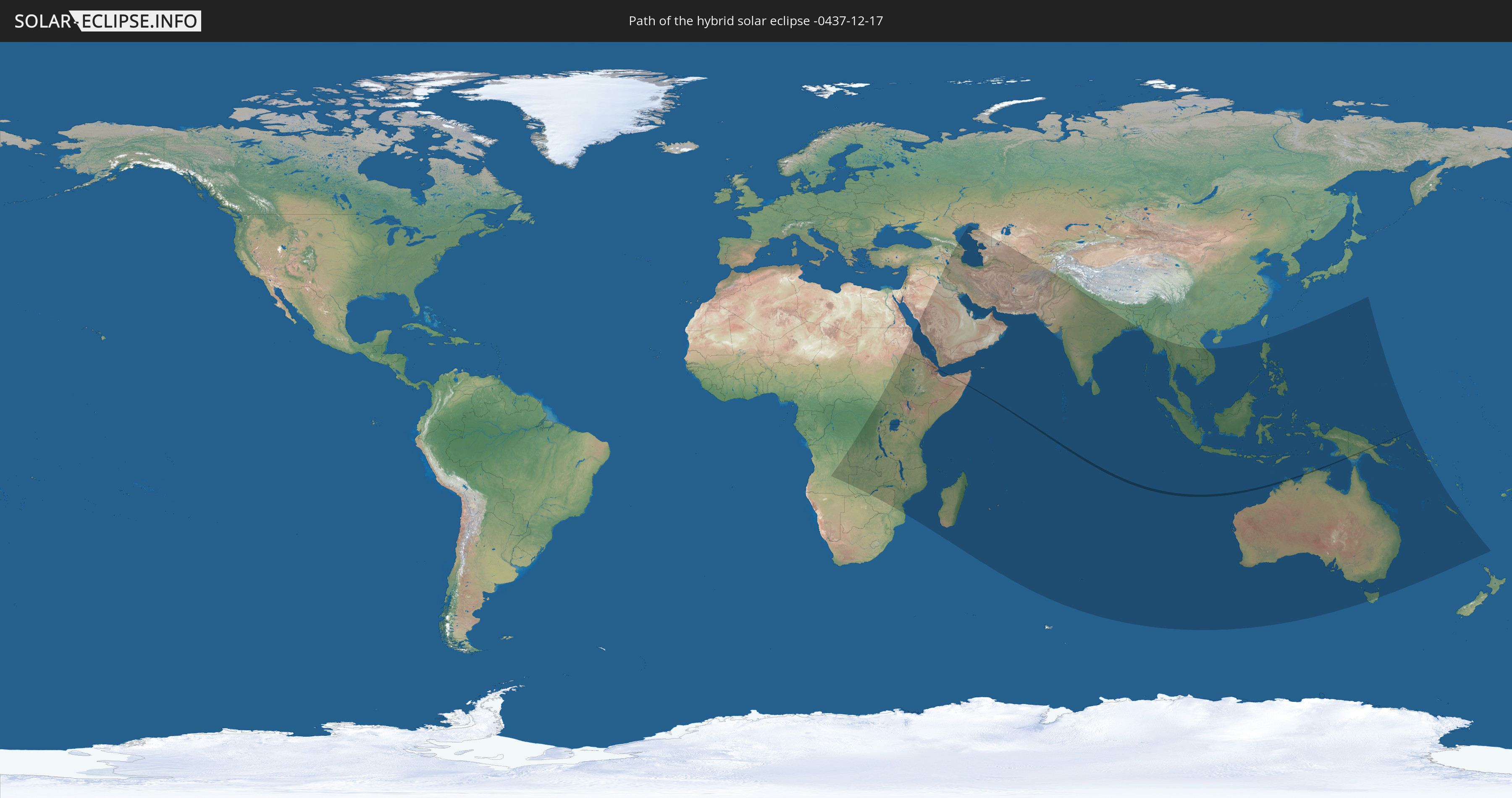
Die Sonnenfinsternis am 12/17/-0437 kann man in 69 Ländern als partielle Sonnenfinsternis beobachten.
Der Finsternispfad verläuft durch 9 Länder. Nur in diesen Ländern ist sie als hybrid Sonnenfinsternis zu sehen.
In den folgenden Ländern ist die Sonnenfinsternis hybrid zu sehen
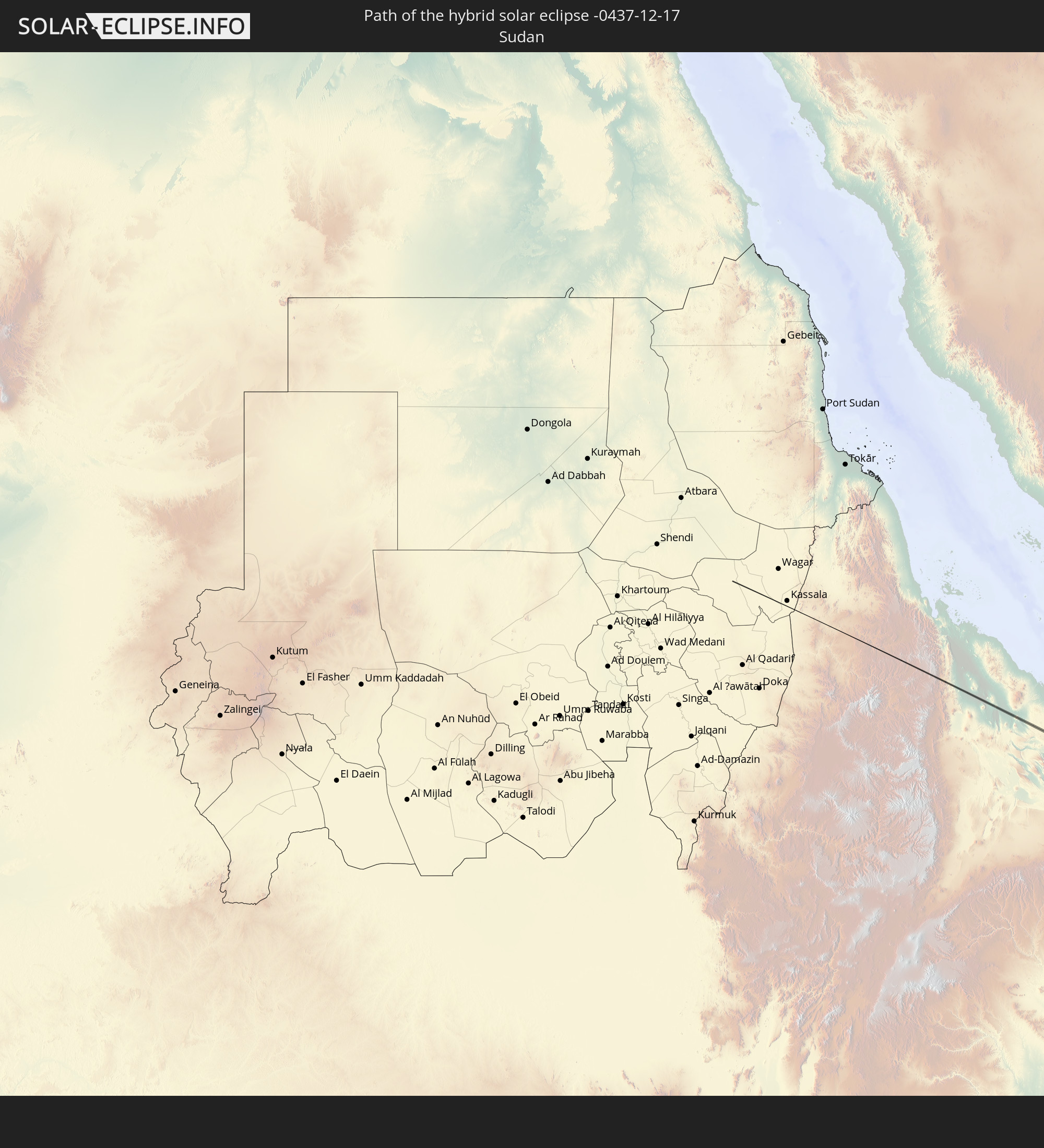 Sudan
Sudan
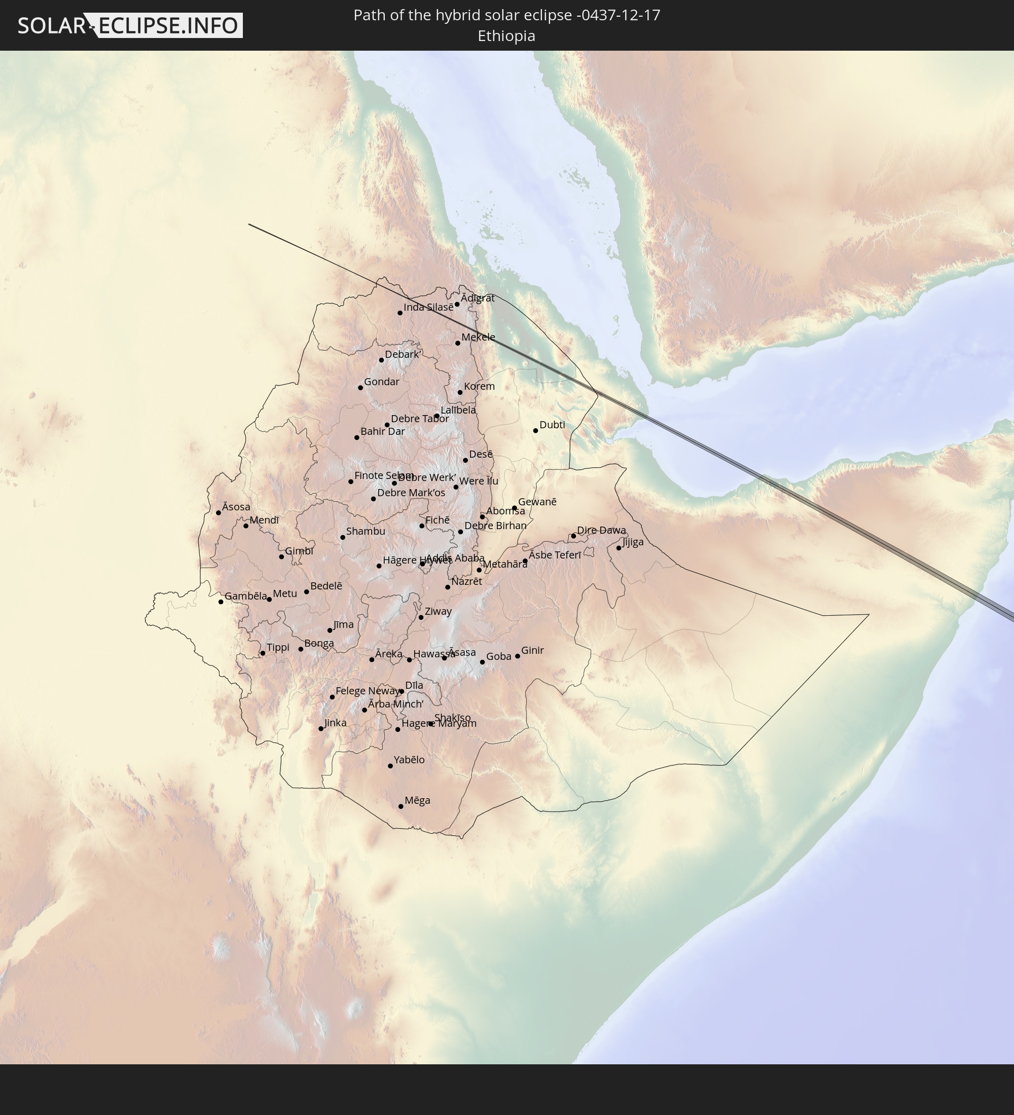 Ethiopia
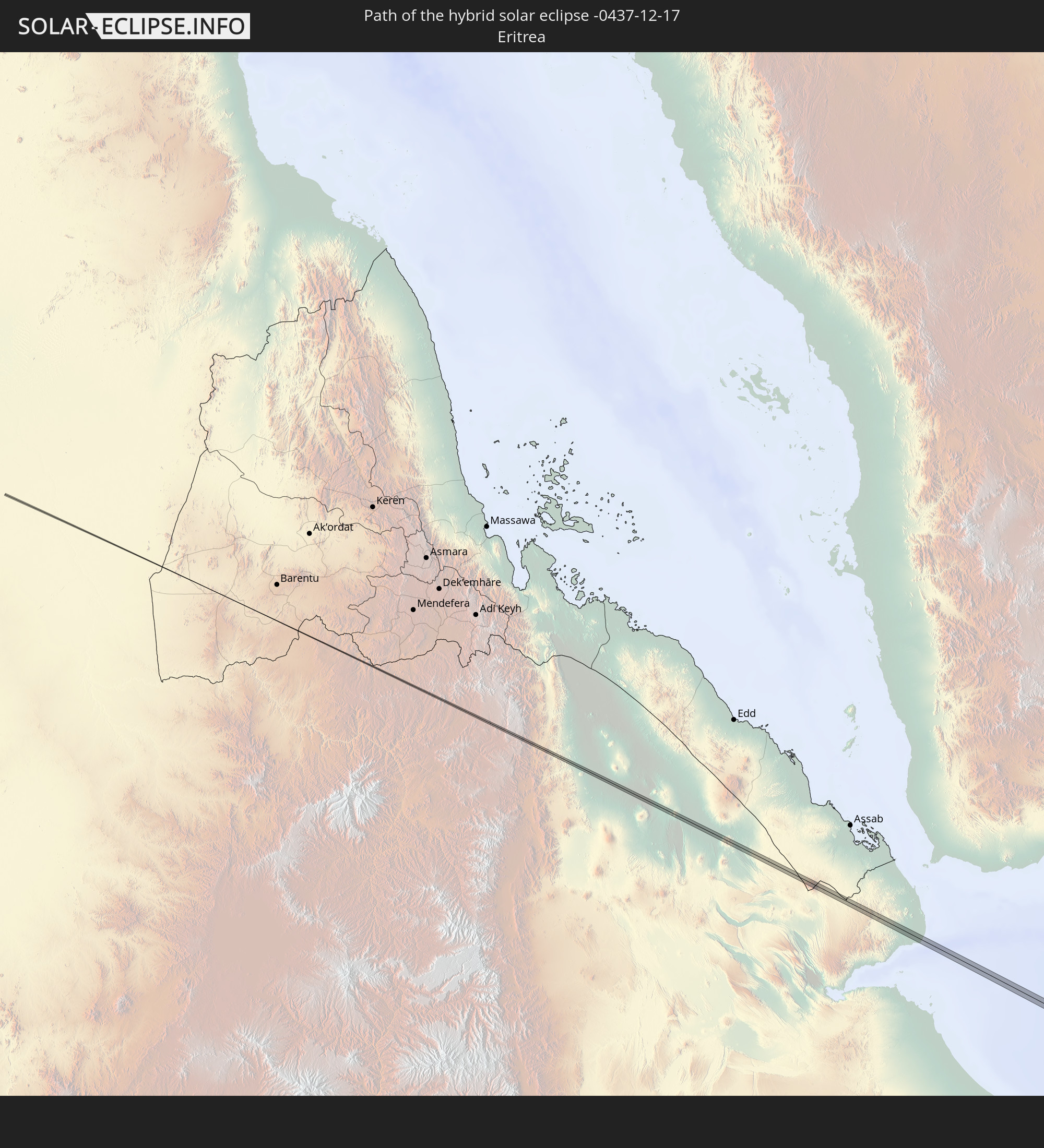 Eritrea
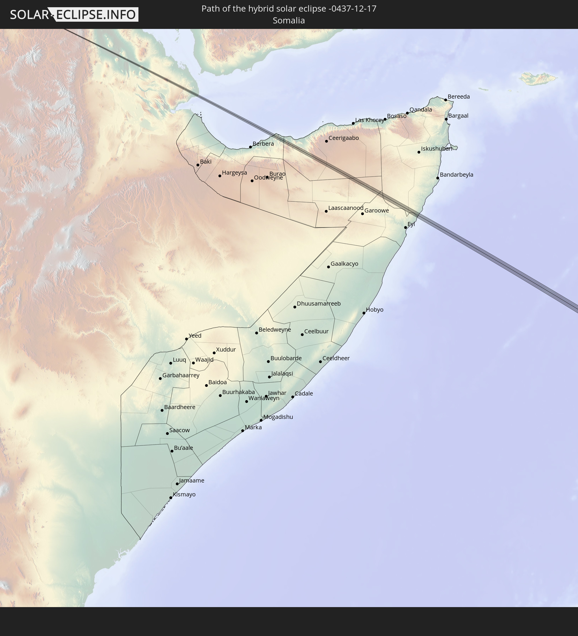 Somalia
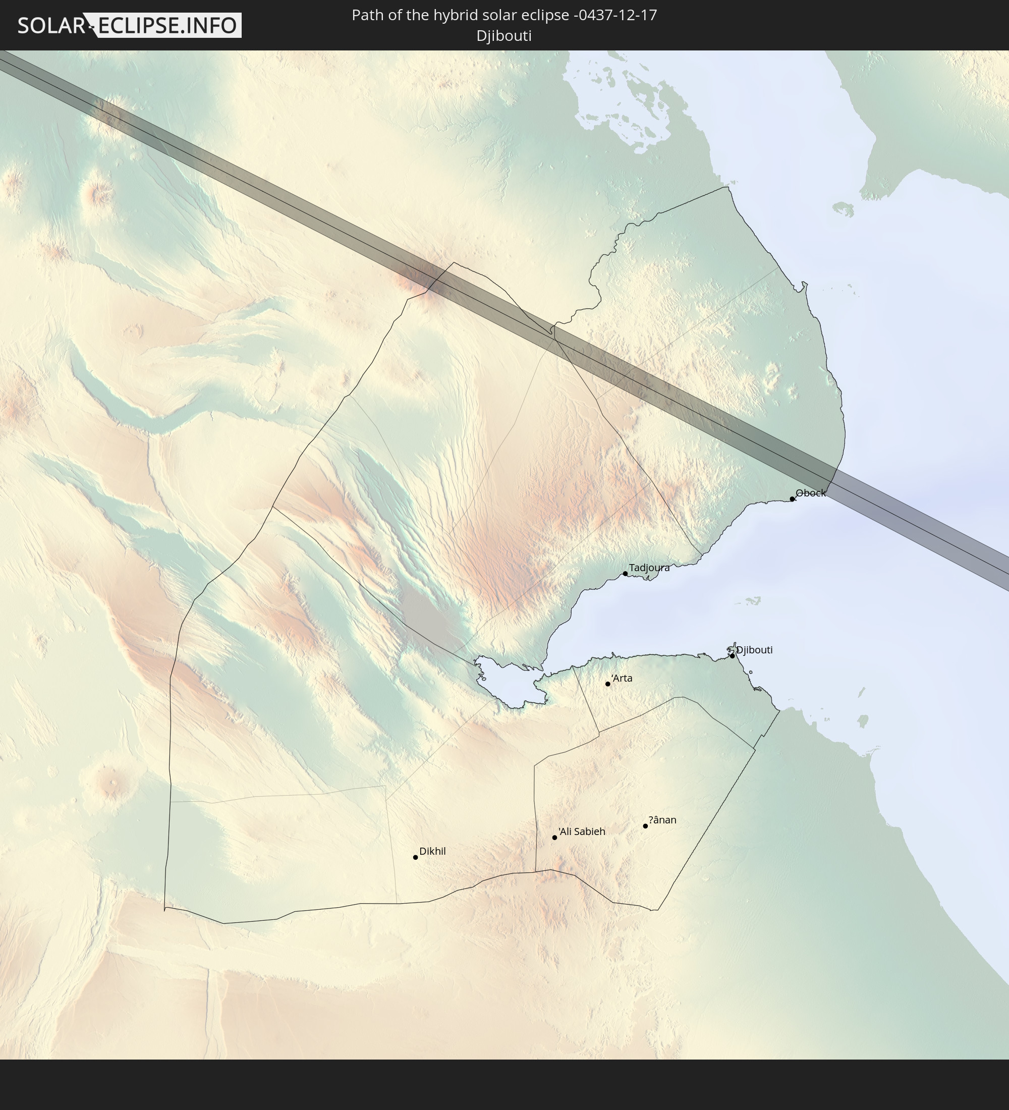 Djibouti
 British Indian Ocean Territory
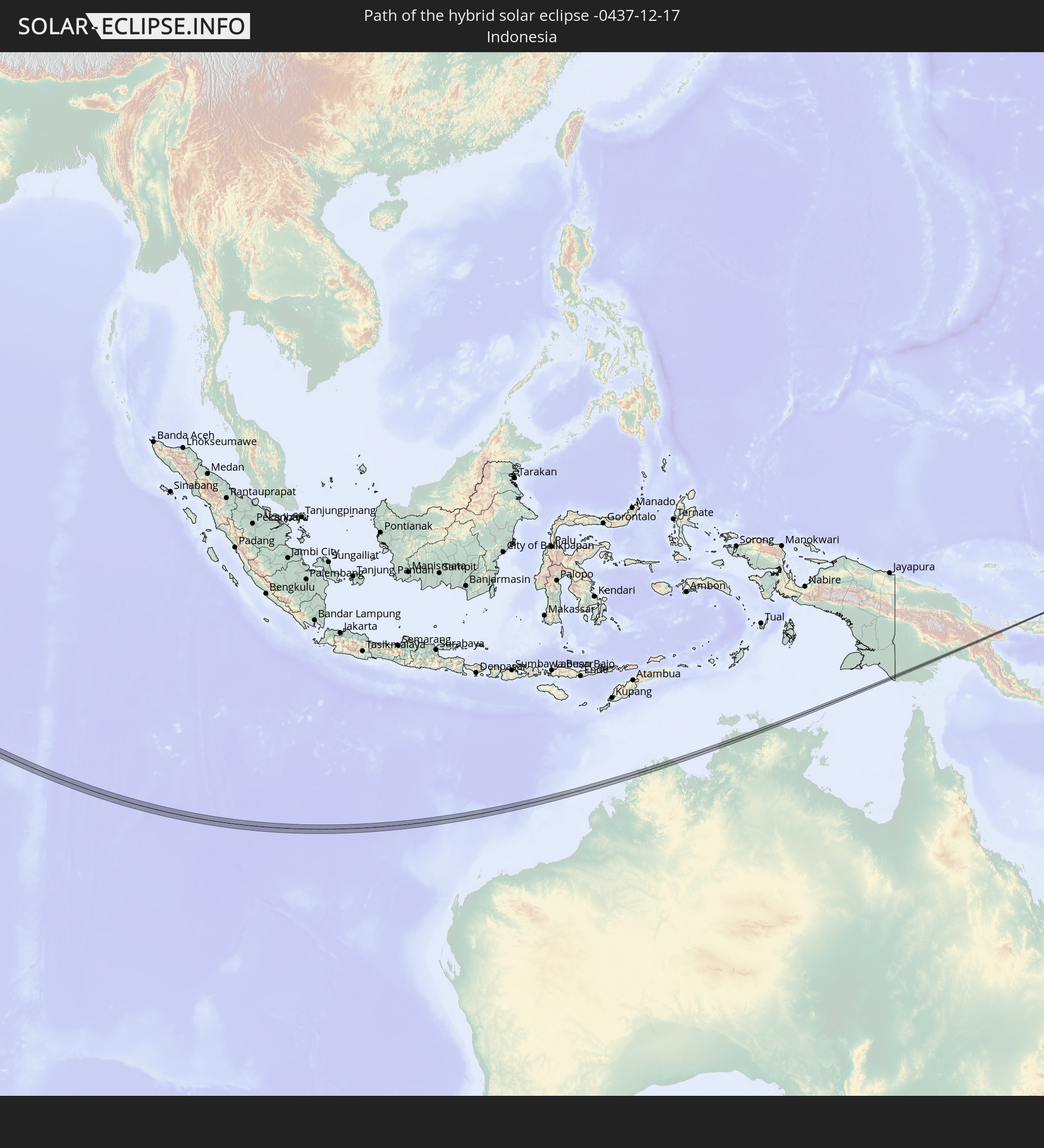 Indonesia
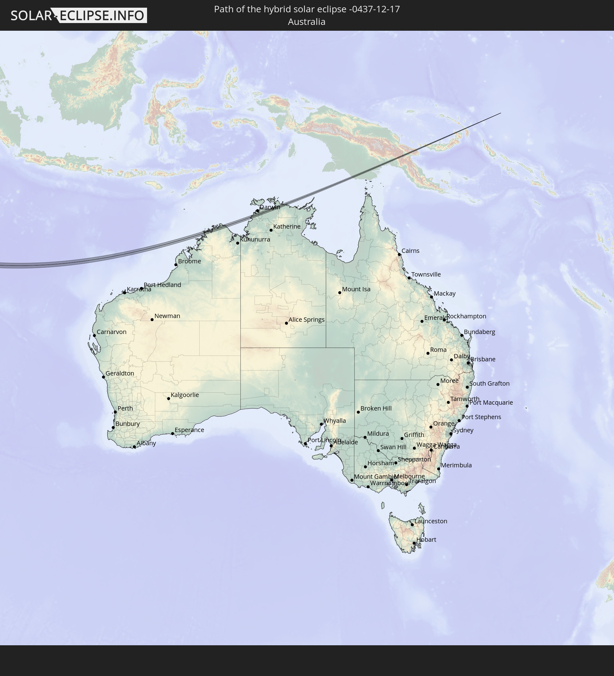 Australia
 Papua New Guinea
In den folgenden Ländern ist die Sonnenfinsternis partiell zu sehen
 Russia
 Angola
 Democratic Republic of the Congo
 Sudan
Sudan
 Zambia
 Zimbabwe
 Rwanda
 Burundi
 Tanzania
 Uganda
 Mozambique
 Malawi
 Ethiopia
 Kenya
Kenya
 Saudi Arabia
 Eritrea
 Iraq
Iraq
 French Southern and Antarctic Lands
 Somalia
 Djibouti
 Yemen
Yemen
 Madagascar
 Comoros
 Armenia
 Iran
Iran
 Azerbaijan
 Mayotte
 Seychelles
 Kazakhstan
 Kuwait
 Bahrain
 Qatar
Qatar
 United Arab Emirates
 Oman
Oman
 Turkmenistan
 Réunion
 Uzbekistan
 Mauritius
 Afghanistan
 Pakistan
 India
India
 British Indian Ocean Territory
 Maldives
 Sri Lanka
 Nepal
Nepal
 Bangladesh
 Myanmar
 Indonesia
 Cocos Islands
 Thailand
 Malaysia
 Laos
Laos
 Vietnam
 Cambodia
 Singapore
 Christmas Island
 Australia
 Brunei
 Philippines
 Japan
Japan
 East Timor
 Palau
Palau
 Federated States of Micronesia
 Papua New Guinea
 Guam
Guam
 Northern Mariana Islands
 Solomon Islands
 New Caledonia
 Norfolk Island
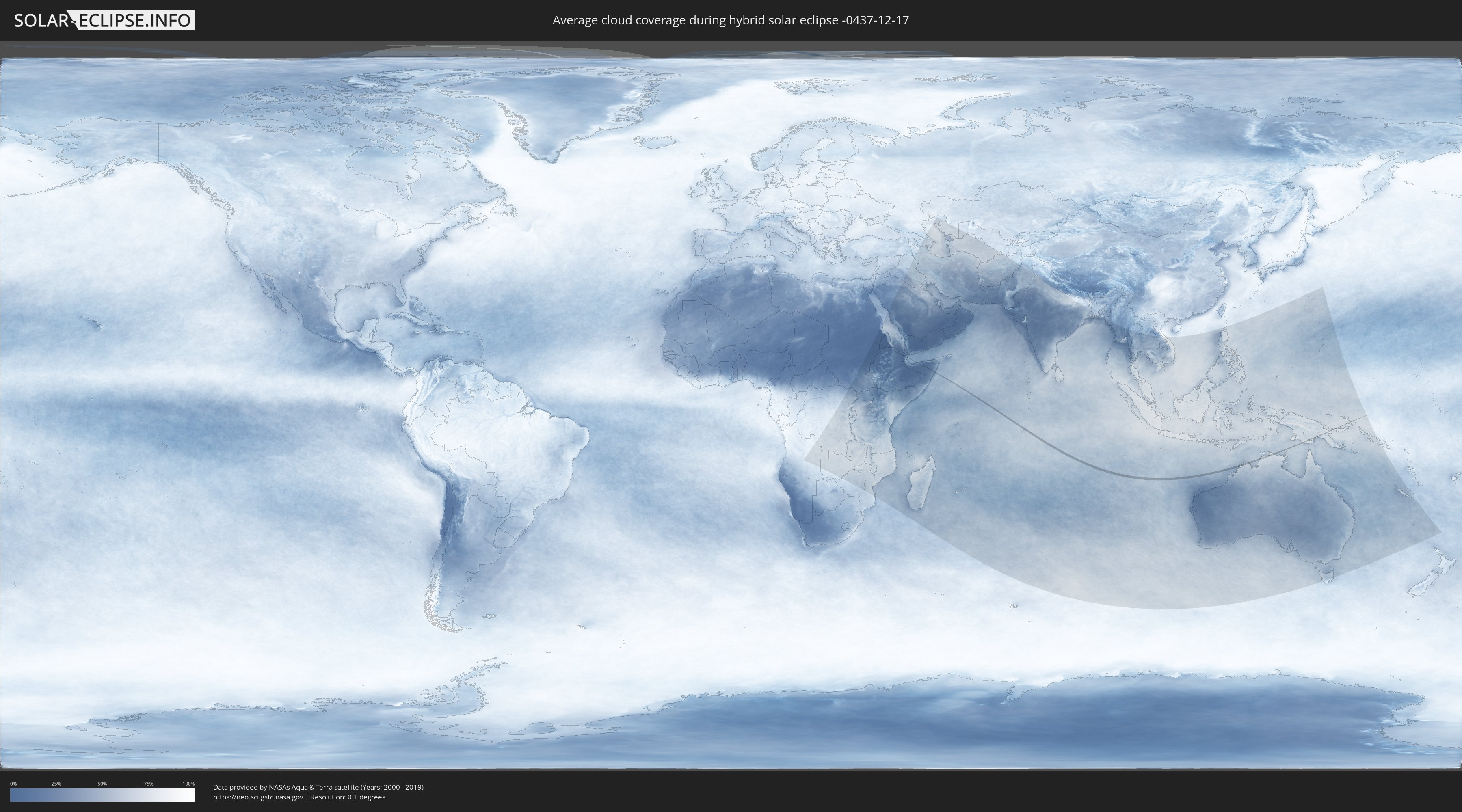
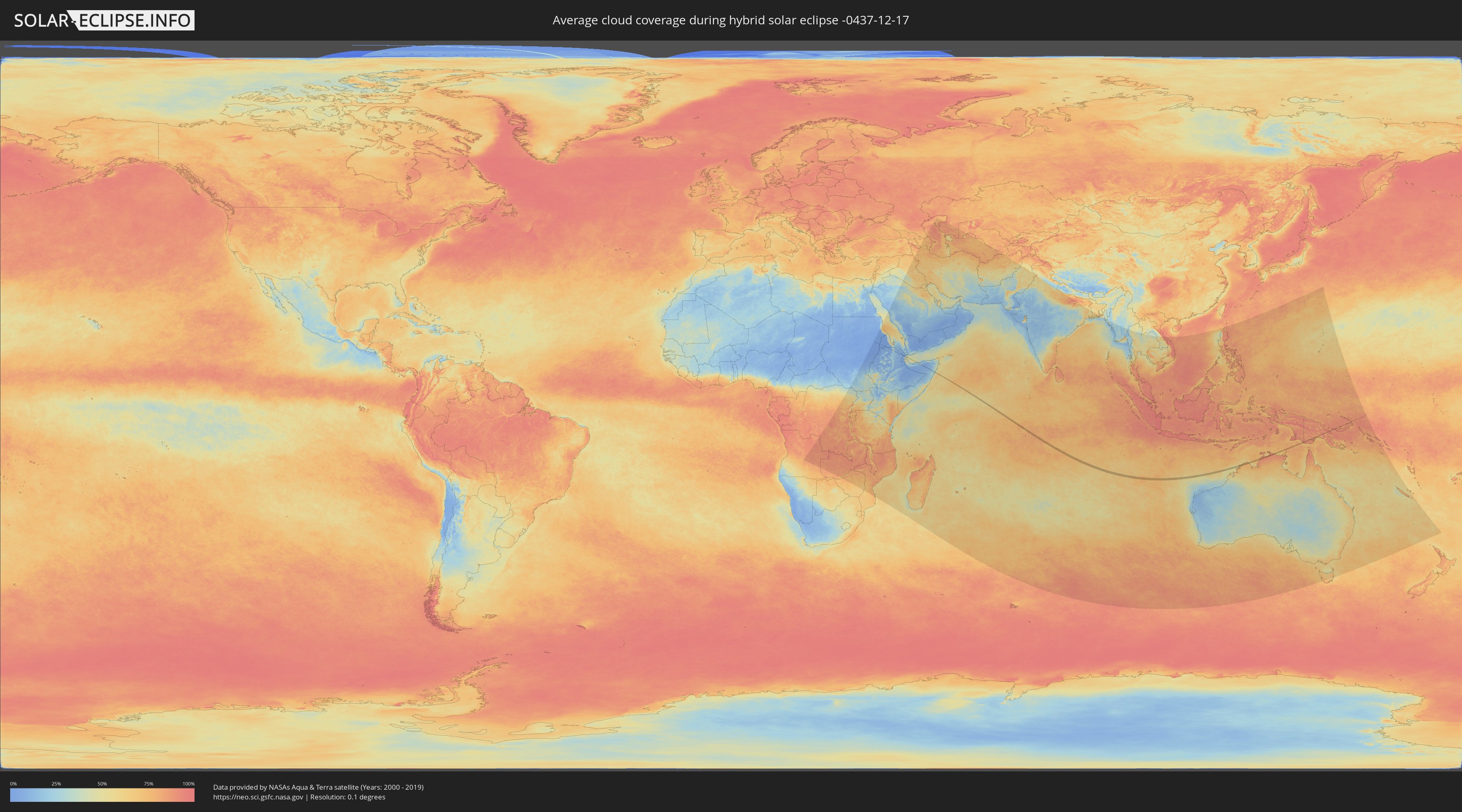
How will be the weather during the hybrid solar eclipse on 12/17/-0437?
Where is the best place to see the hybrid solar eclipse of 12/17/-0437?
The following maps show the average cloud coverage for the day of the hybrid solar eclipse.
With the help of these maps, it is possible to find the place along the eclipse path, which has the best
chance of a cloudless sky.
Nevertheless, you should consider local circumstances and inform about the weather of your chosen
observation site.
The data is provided by NASAs satellites
AQUA and TERRA.
The cloud maps are averaged over a period of 19 years (2000 - 2019).
Detailed country maps
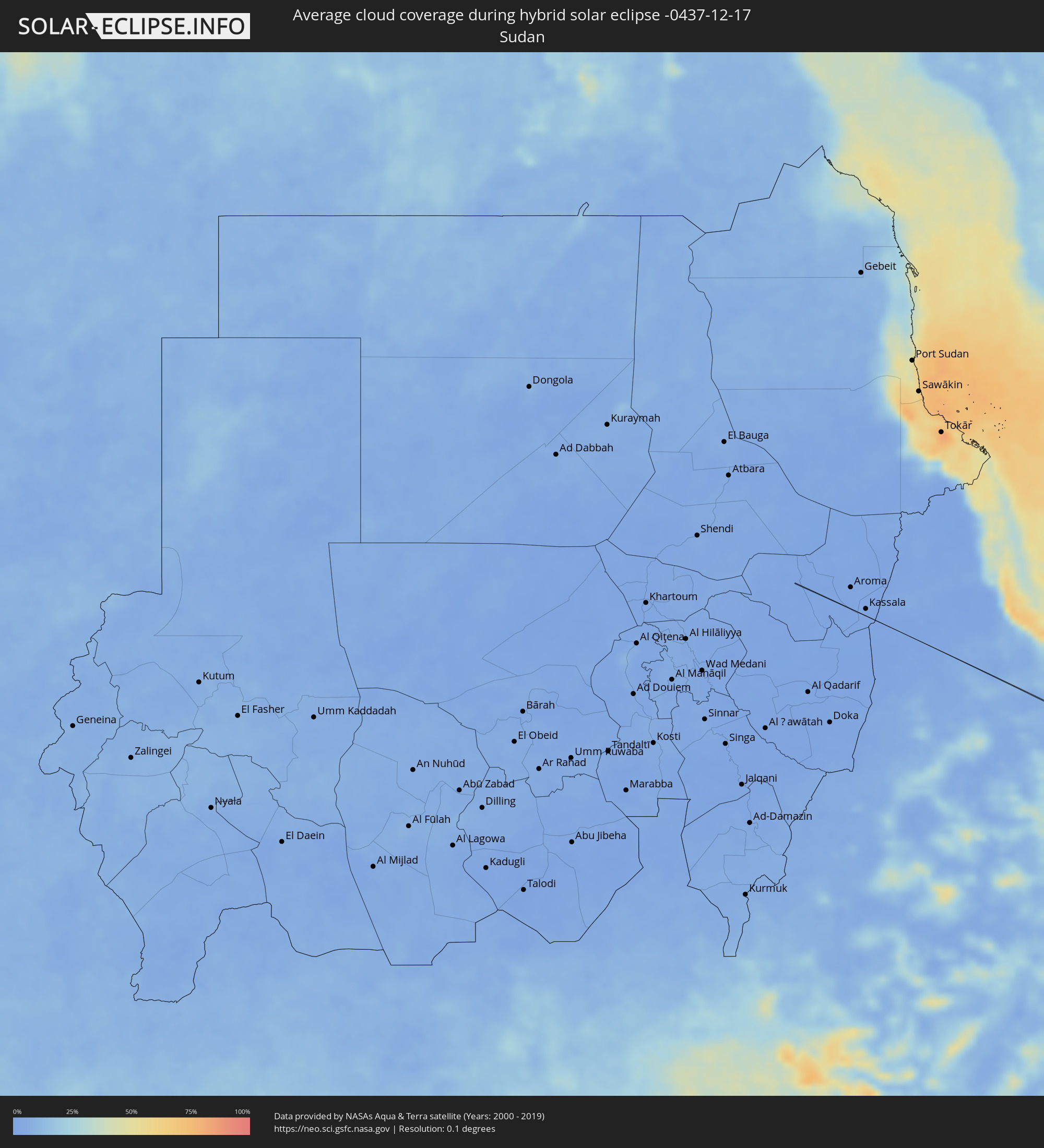 Sudan
Sudan
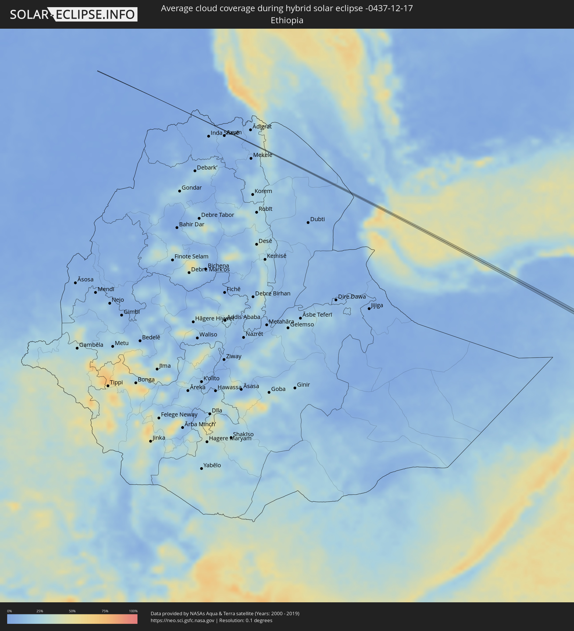 Ethiopia
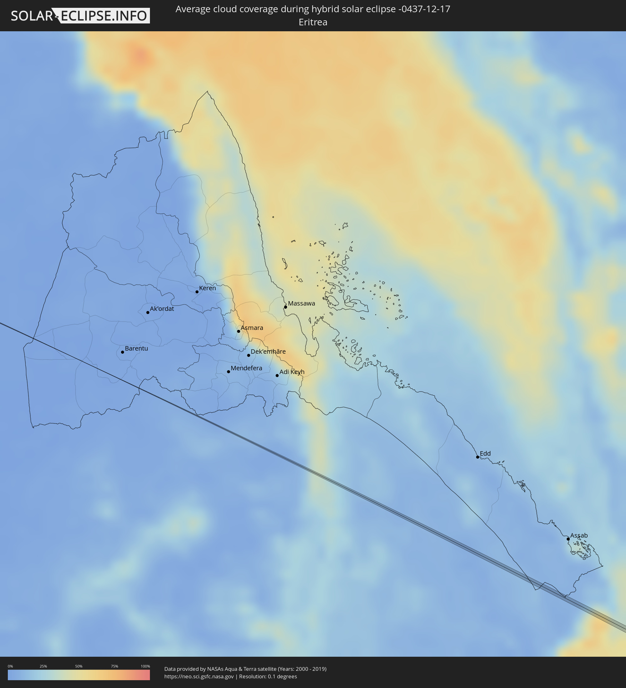 Eritrea
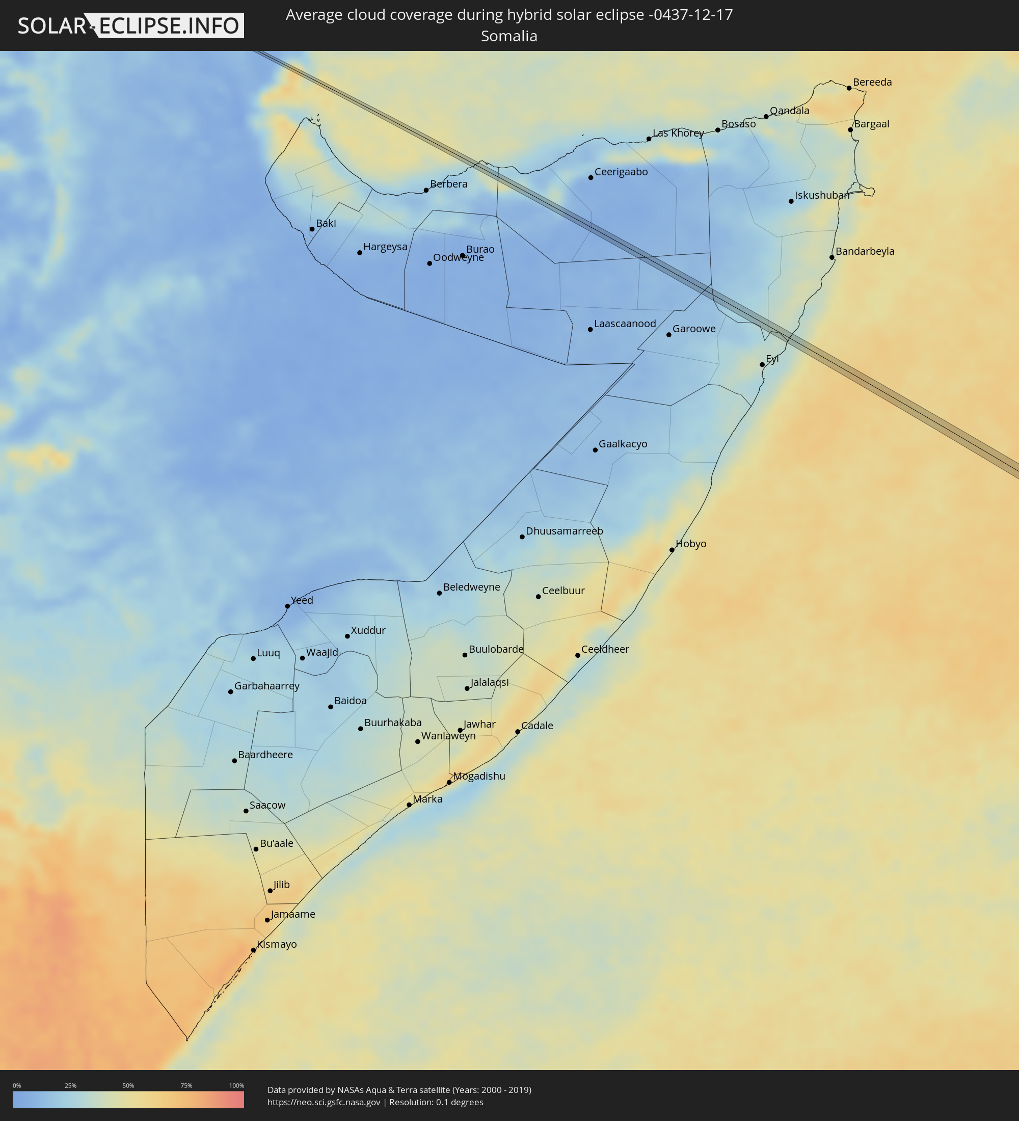 Somalia
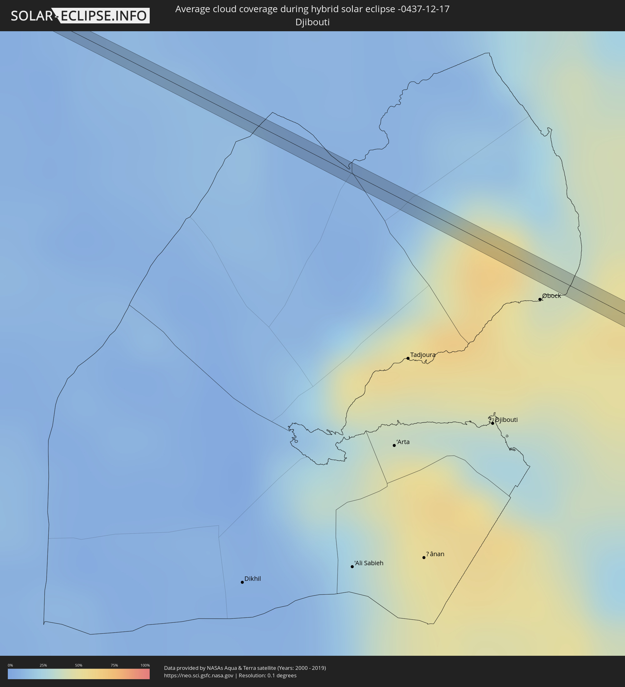 Djibouti
 British Indian Ocean Territory
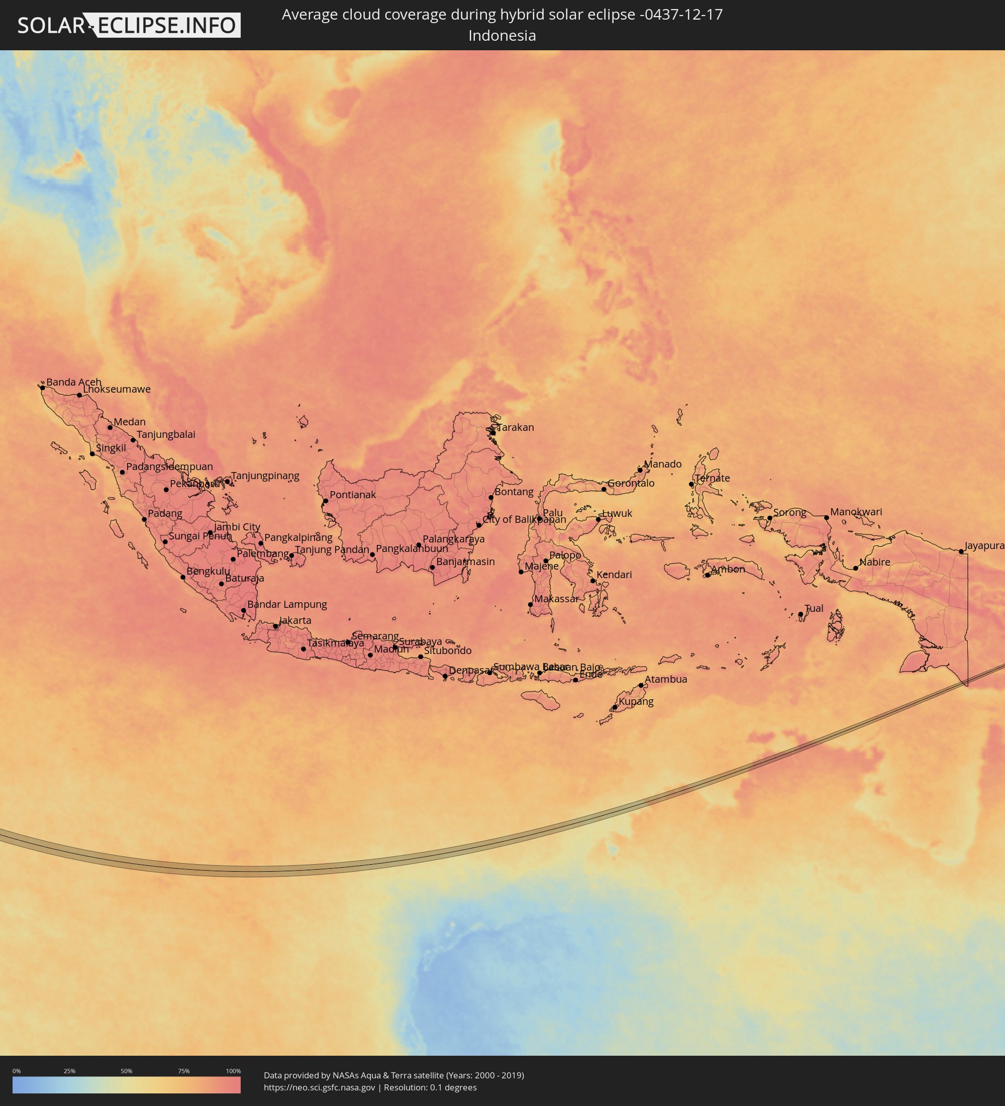 Indonesia
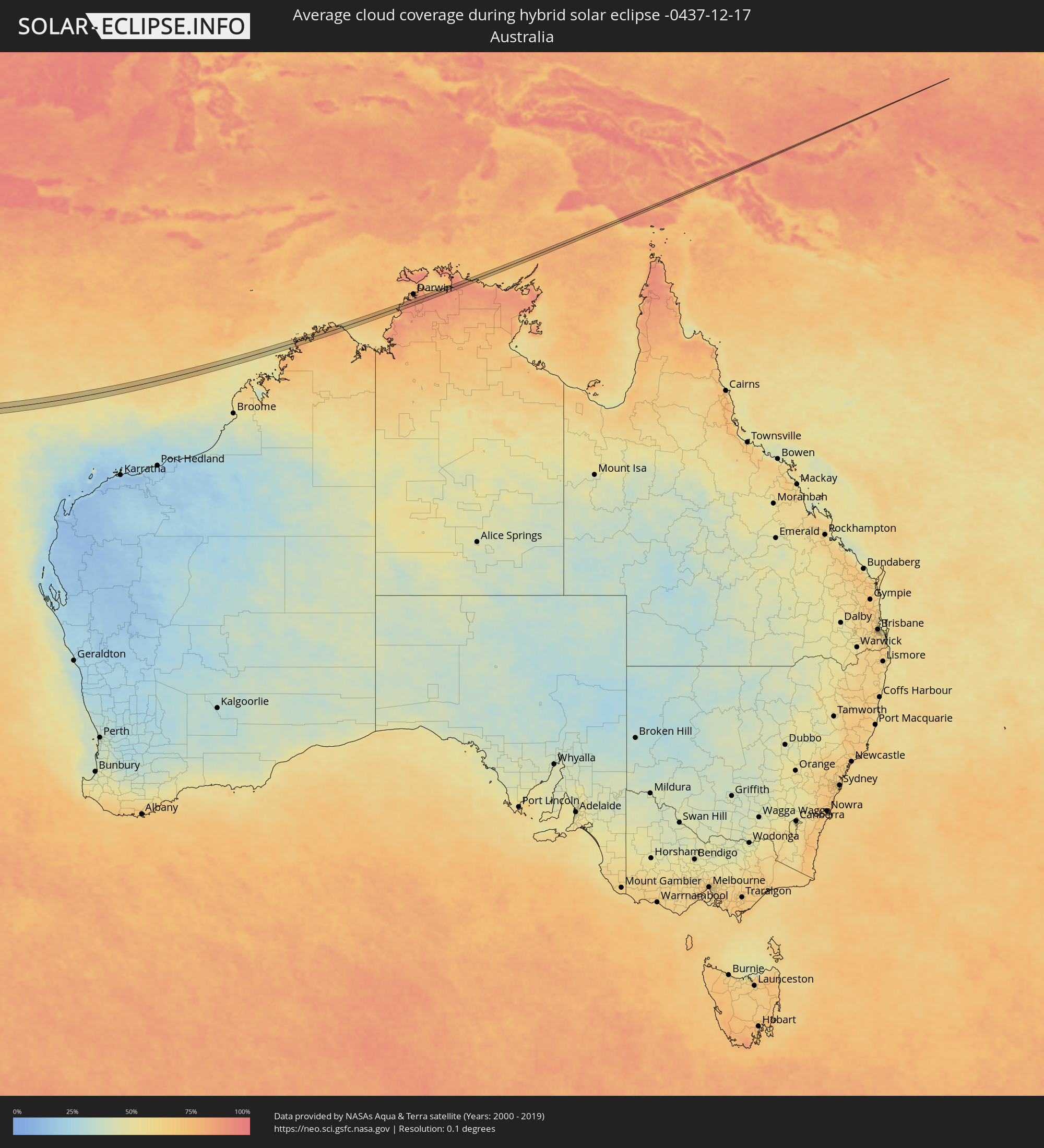 Australia
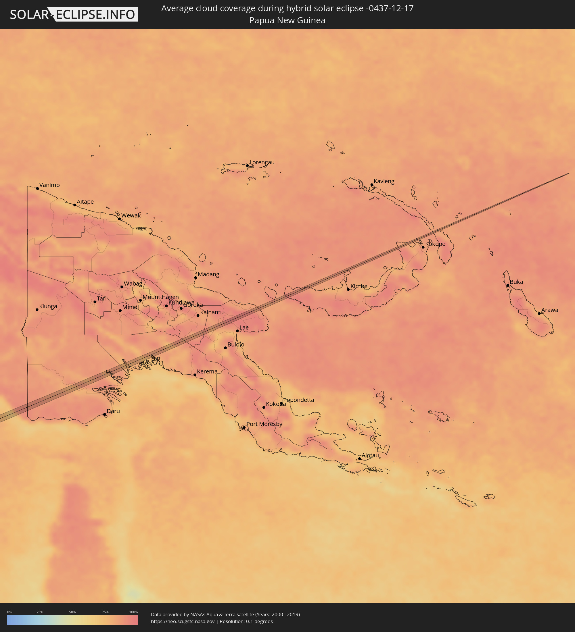 Papua New Guinea