Annular solar eclipse of 03/20/-0450
| Day of week: | Sunday |
| Maximum duration of eclipse: | 03m31s |
| Maximum width of eclipse path: | 157 km |
| Saros cycle: | 61 |
| Coverage: | 96.4% |
| Magnitude: | 0.9641 |
| Gamma: | 0.5865 |
Wo kann man die Sonnenfinsternis vom 03/20/-0450 sehen?
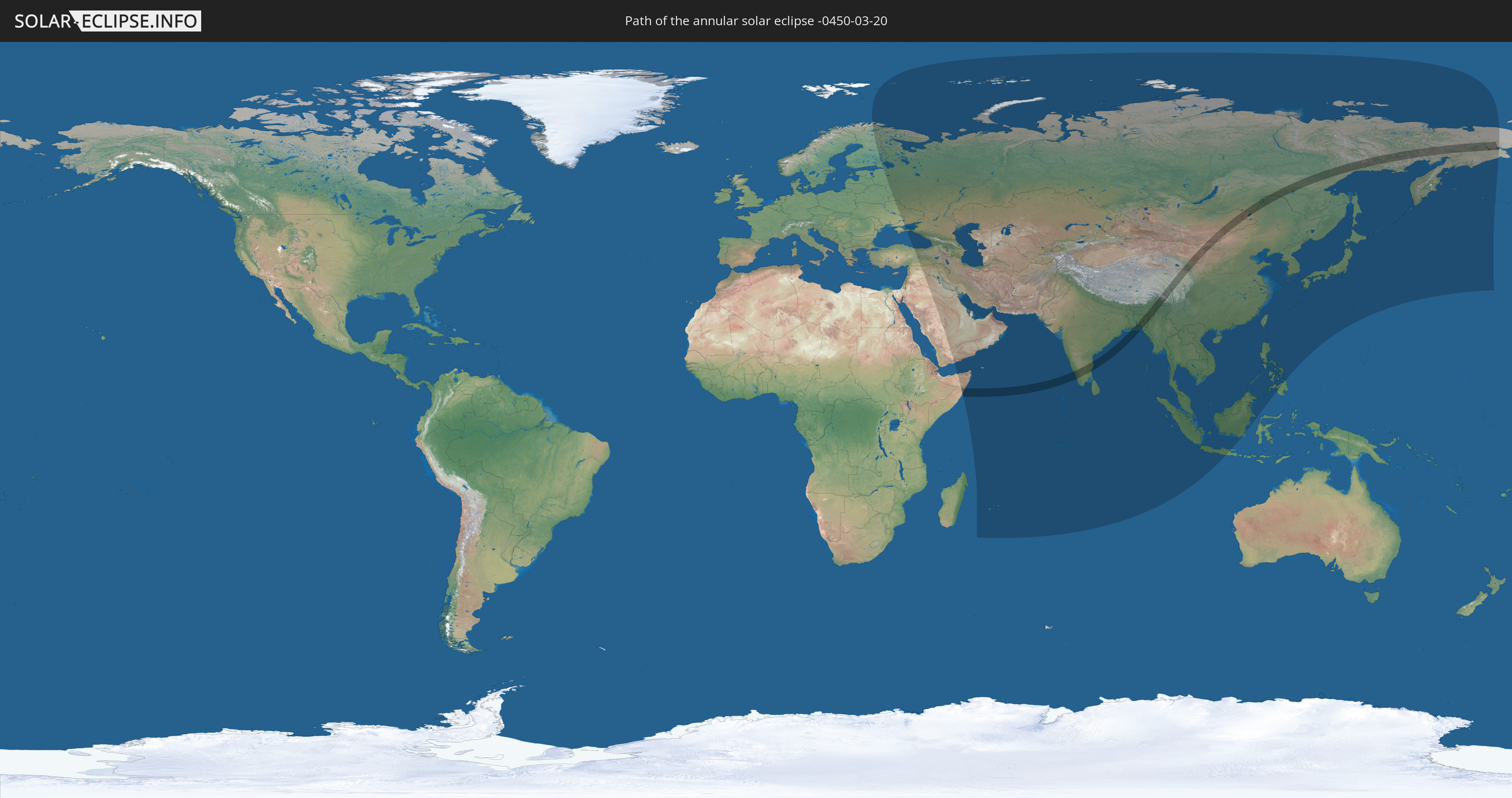
Die Sonnenfinsternis am 03/20/-0450 kann man in 60 Ländern als partielle Sonnenfinsternis beobachten.
Der Finsternispfad verläuft durch 7 Länder. Nur in diesen Ländern ist sie als annular Sonnenfinsternis zu sehen.
In den folgenden Ländern ist die Sonnenfinsternis annular zu sehen
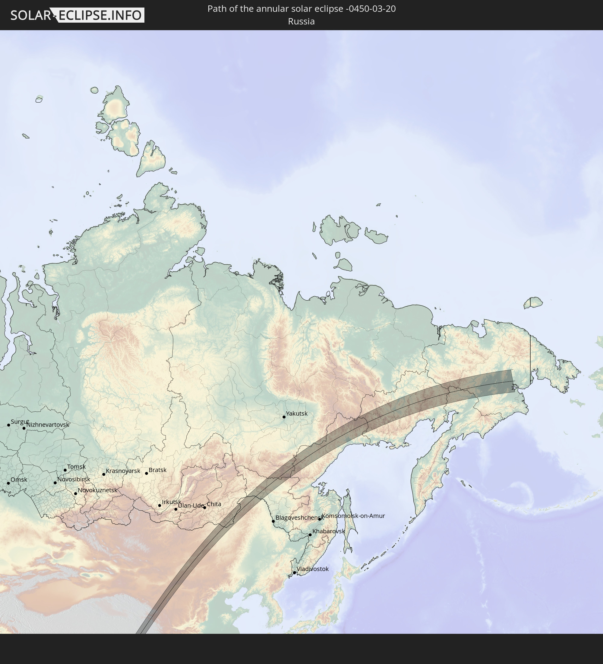 Russia
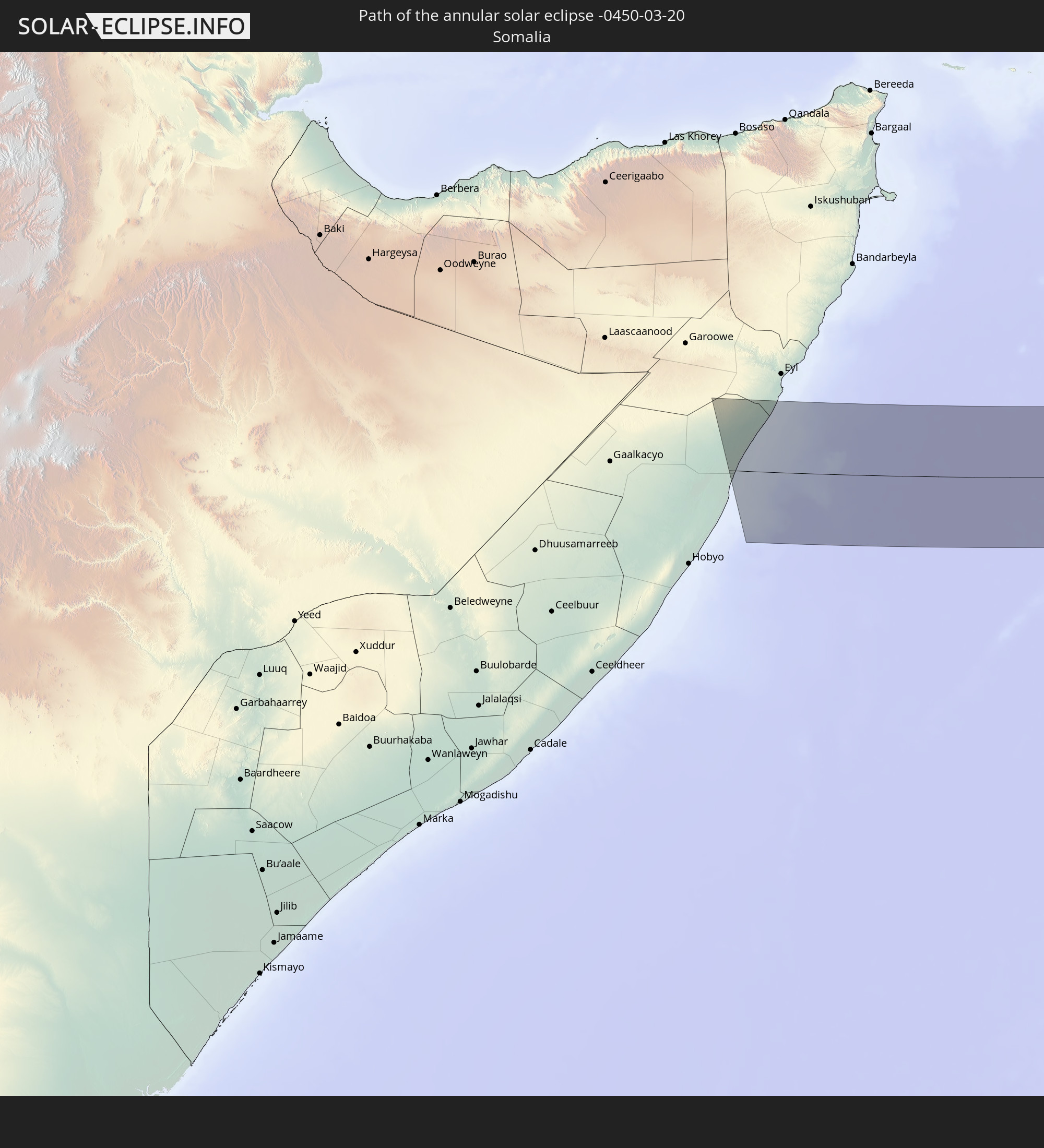 Somalia
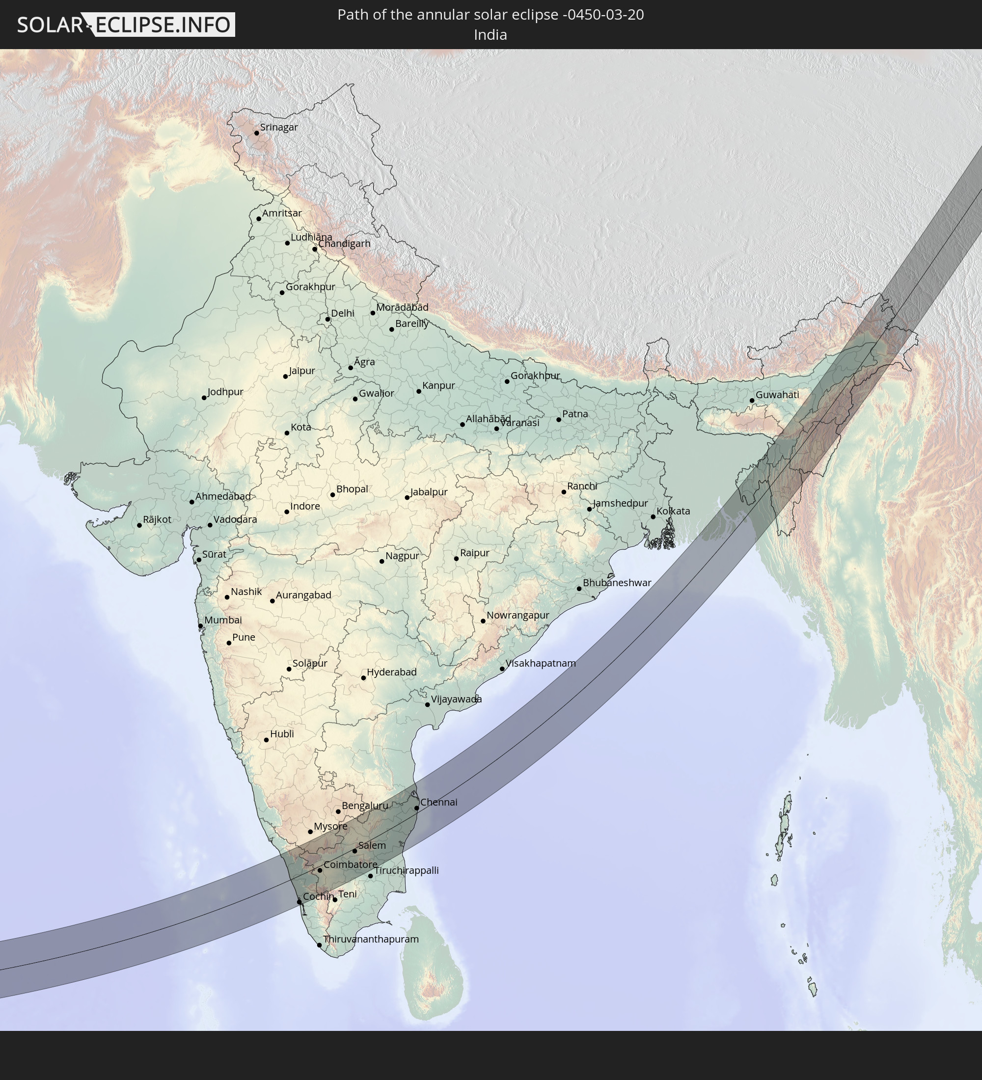 India
India
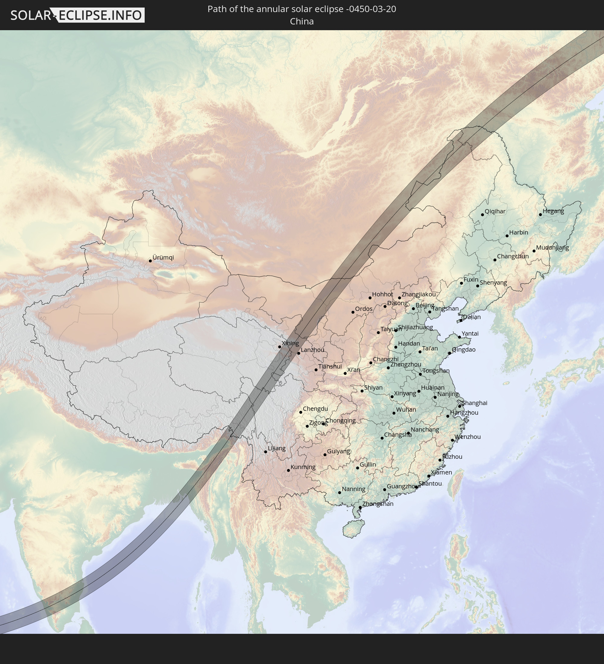 China
China
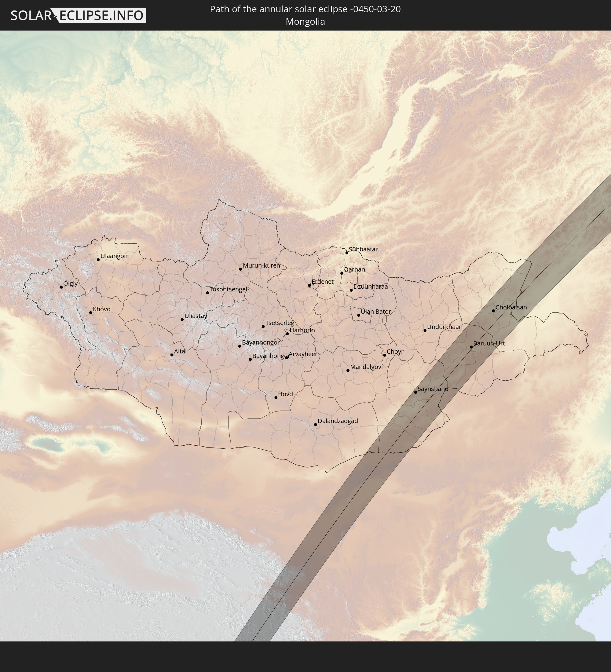 Mongolia
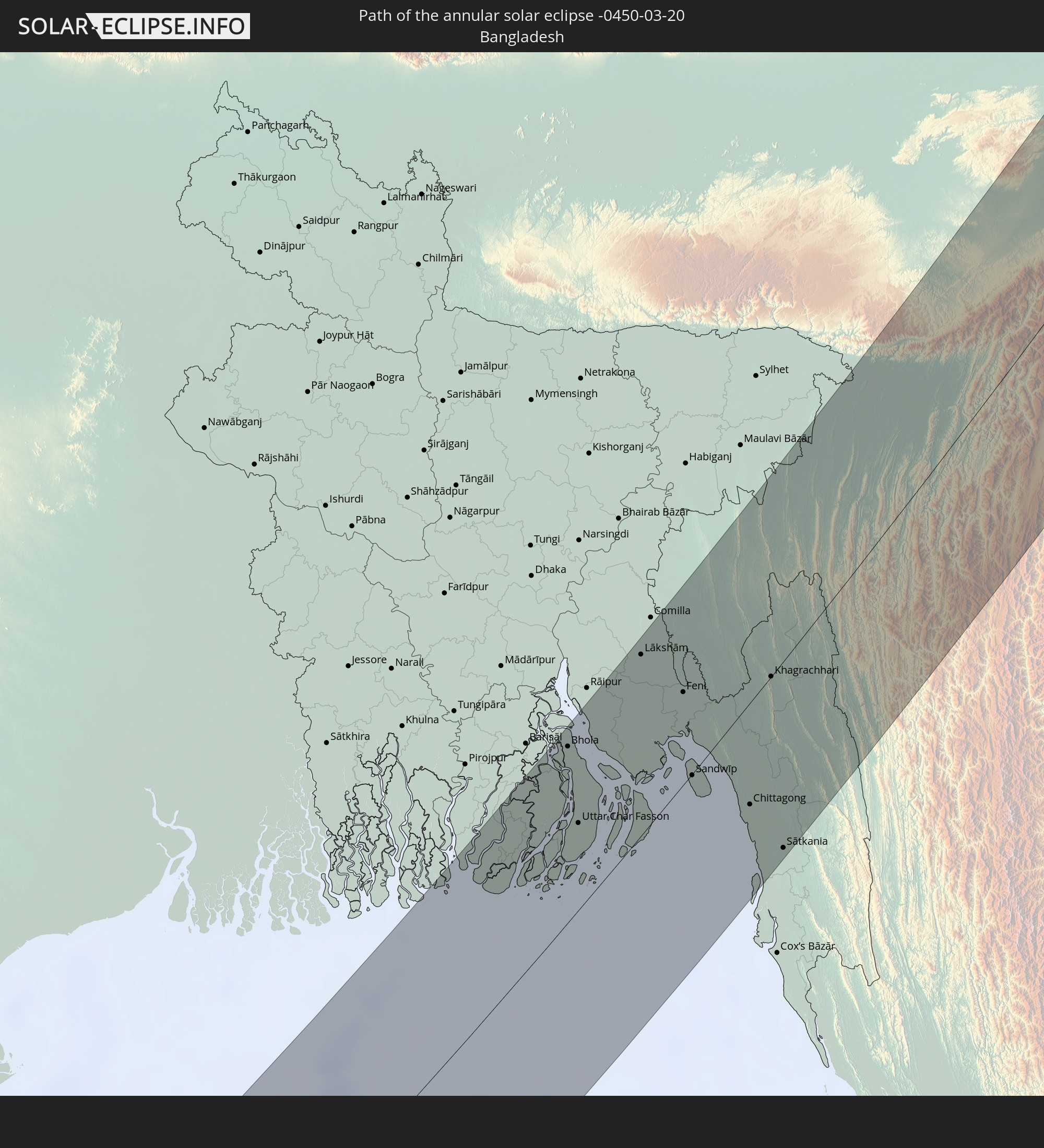 Bangladesh
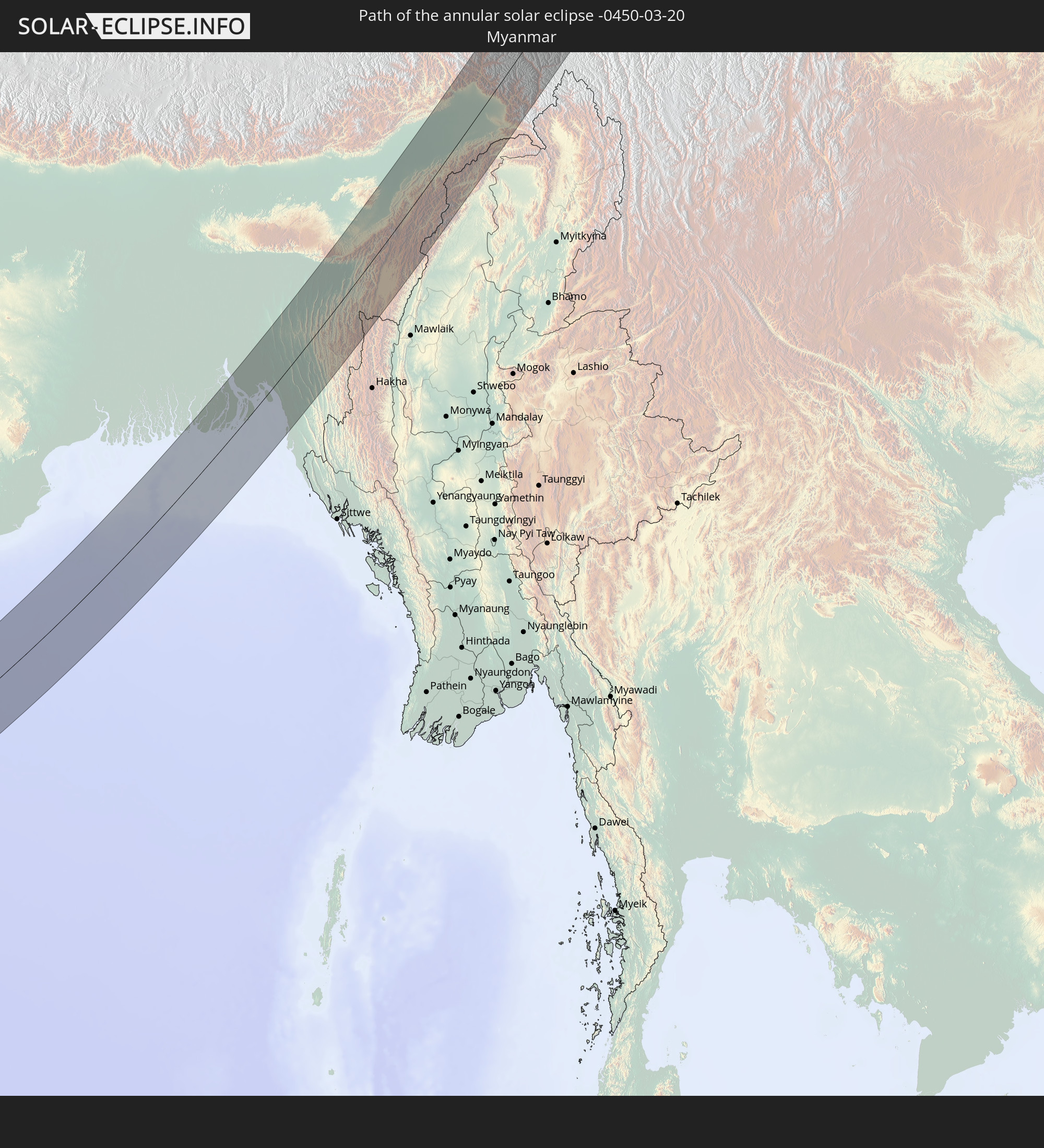 Myanmar
In den folgenden Ländern ist die Sonnenfinsternis partiell zu sehen
 Russia
 United States
 Svalbard and Jan Mayen
 Norway
 Finland
 Ukraine
 Belarus
 Turkey
 Saudi Arabia
 Syria
Syria
 Iraq
Iraq
 Georgia
 French Southern and Antarctic Lands
 Somalia
 Yemen
Yemen
 Armenia
 Iran
Iran
 Azerbaijan
 Seychelles
 Kazakhstan
 Kuwait
 Bahrain
 Qatar
Qatar
 United Arab Emirates
 Oman
Oman
 Turkmenistan
 Réunion
 Uzbekistan
 Mauritius
 Afghanistan
 Pakistan
 Tajikistan
 India
India
 Kyrgyzstan
 British Indian Ocean Territory
 Maldives
 China
China
 Sri Lanka
 Nepal
Nepal
 Mongolia
 Bangladesh
 Bhutan
 Myanmar
 Indonesia
 Cocos Islands
 Thailand
 Malaysia
 Laos
Laos
 Vietnam
 Cambodia
 Singapore
 Christmas Island
 Macau
Macau
 Hong Kong
 Brunei
 Taiwan
 Philippines
 Japan
Japan
 North Korea
 South Korea
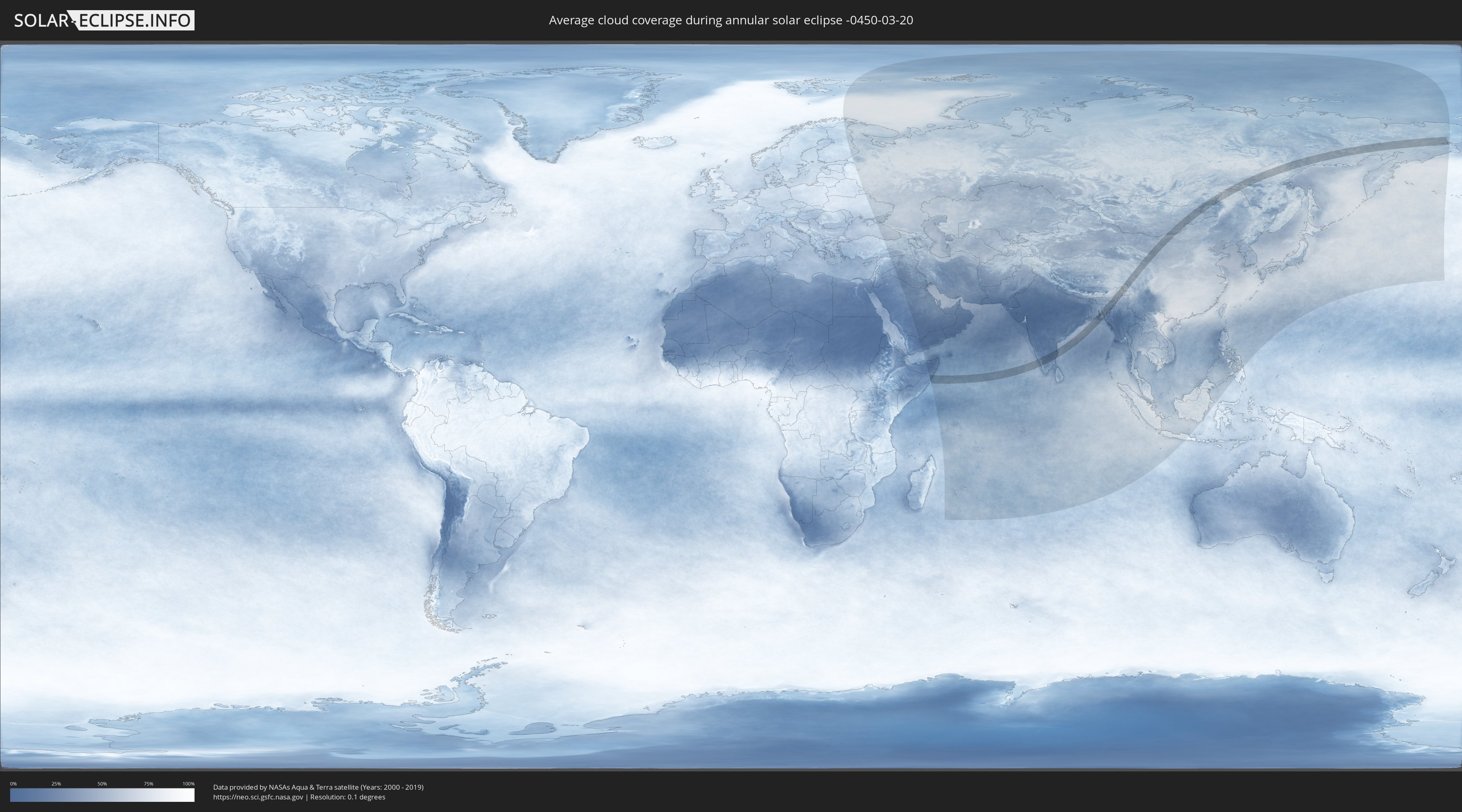
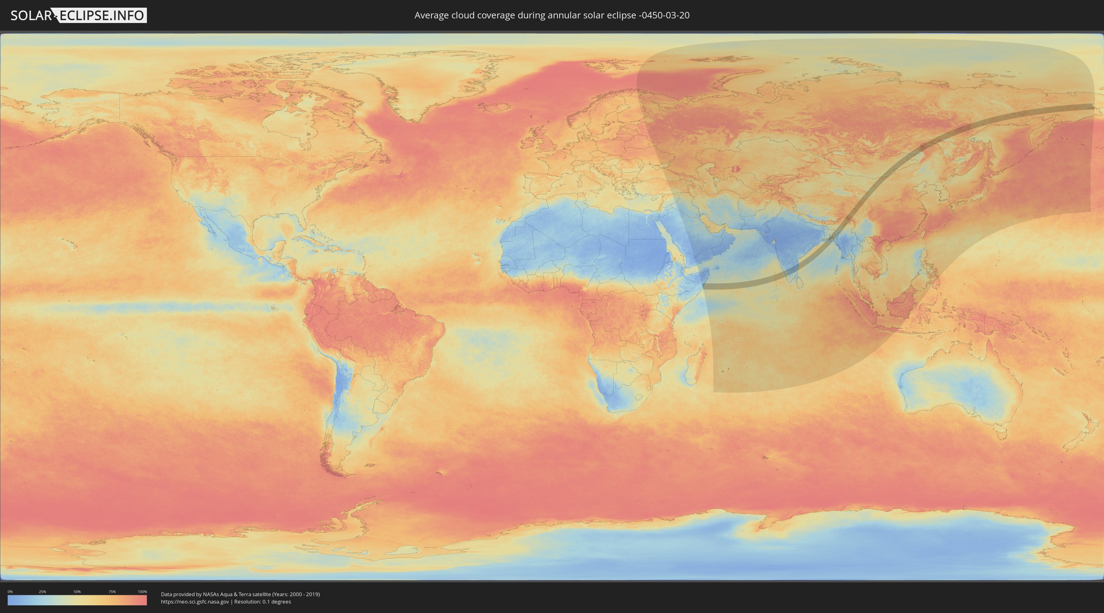
How will be the weather during the annular solar eclipse on 03/20/-0450?
Where is the best place to see the annular solar eclipse of 03/20/-0450?
The following maps show the average cloud coverage for the day of the annular solar eclipse.
With the help of these maps, it is possible to find the place along the eclipse path, which has the best
chance of a cloudless sky.
Nevertheless, you should consider local circumstances and inform about the weather of your chosen
observation site.
The data is provided by NASAs satellites
AQUA and TERRA.
The cloud maps are averaged over a period of 19 years (2000 - 2019).
Detailed country maps
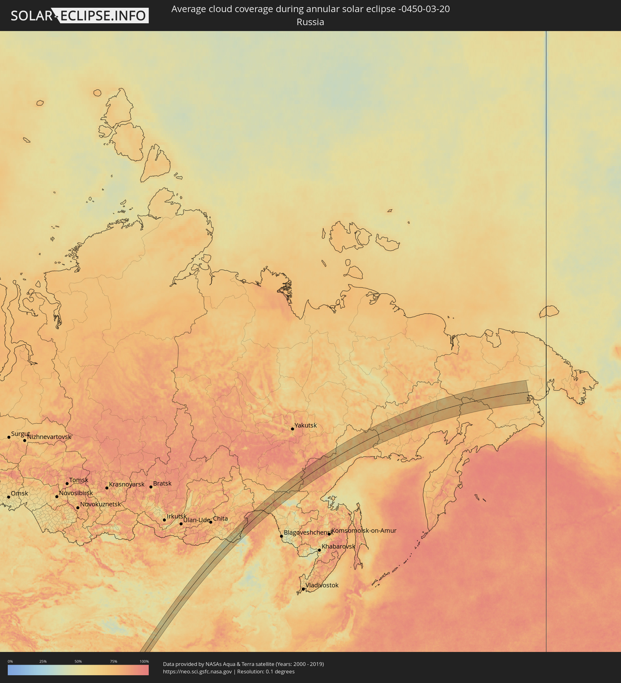 Russia
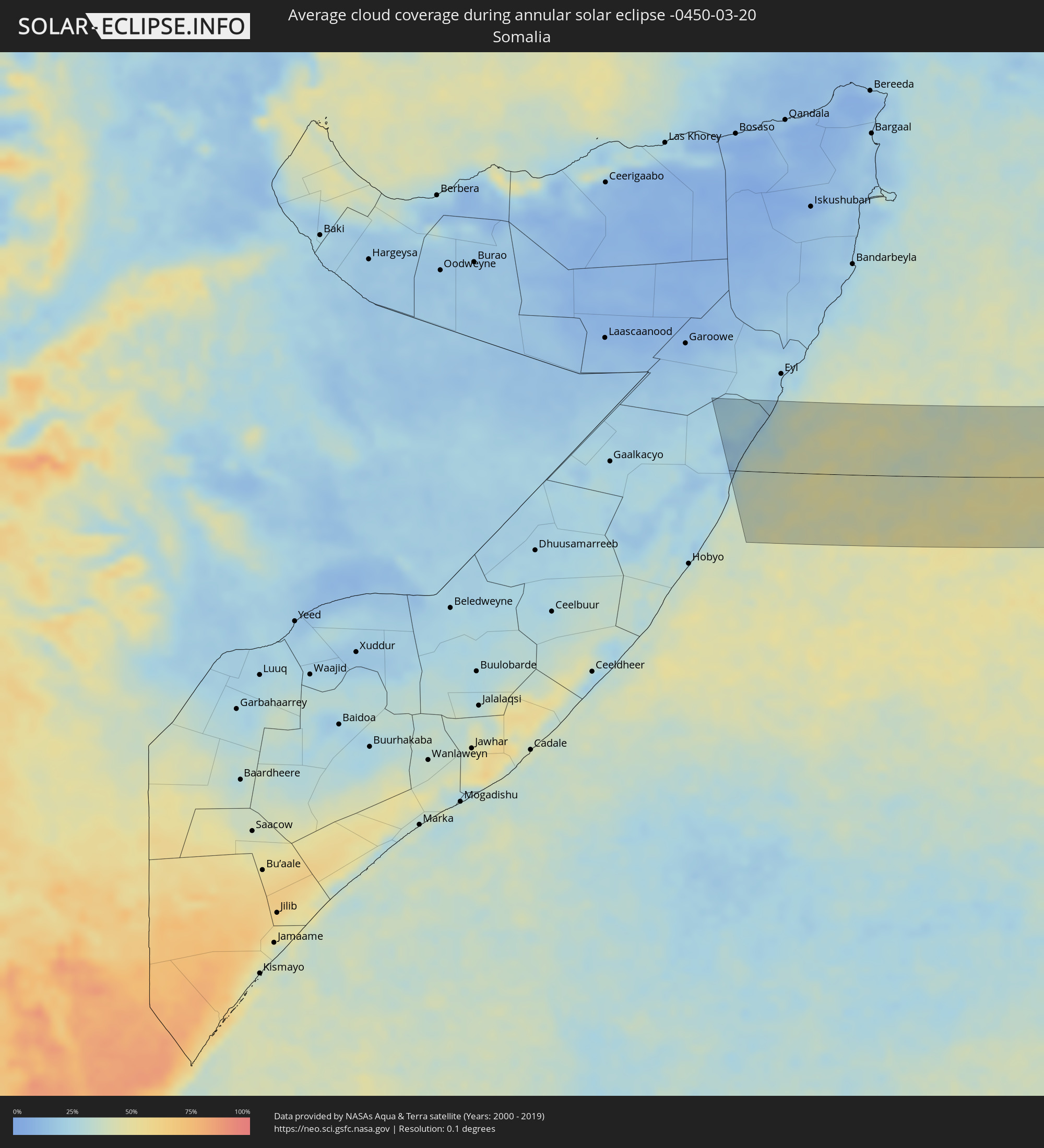 Somalia
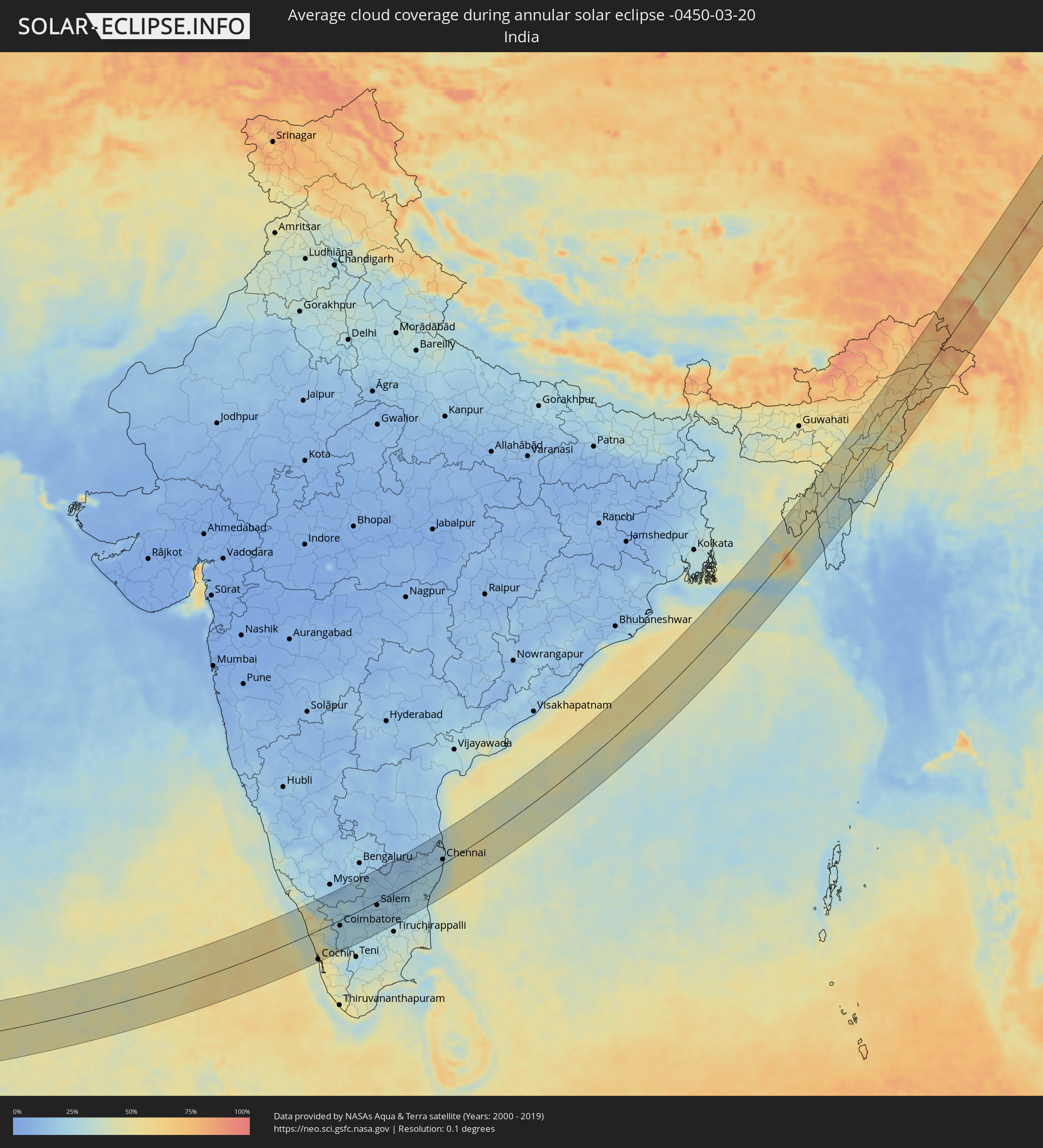 India
India
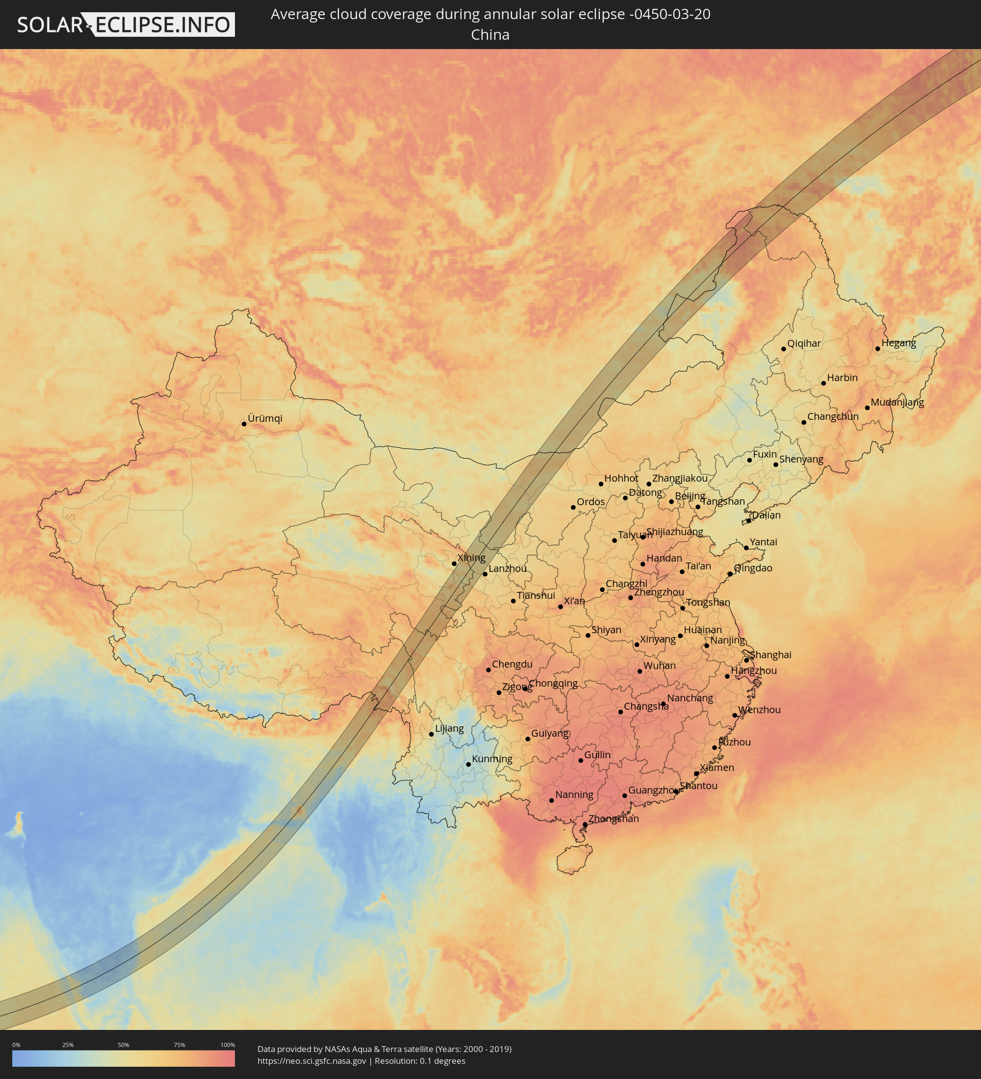 China
China
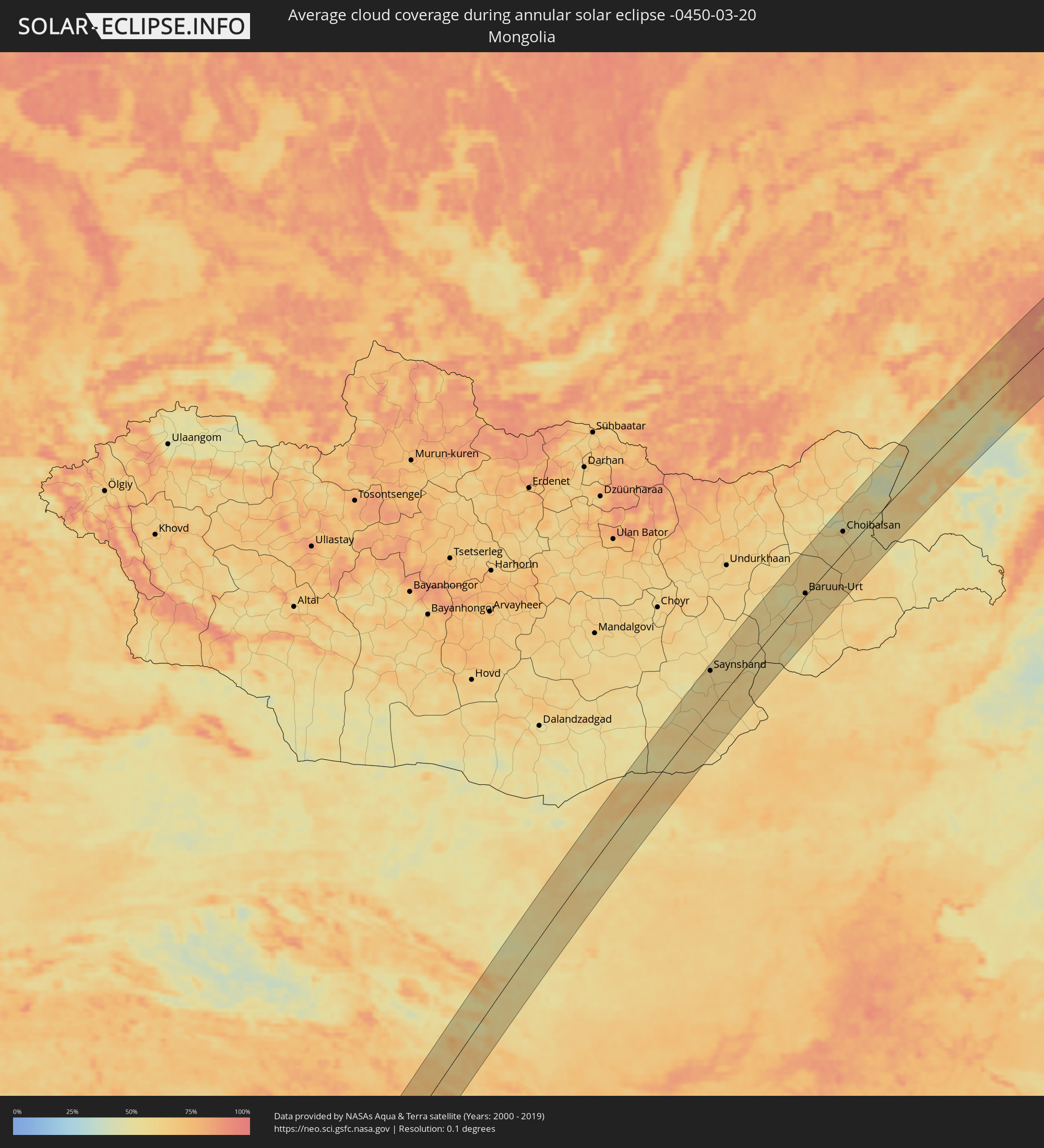 Mongolia
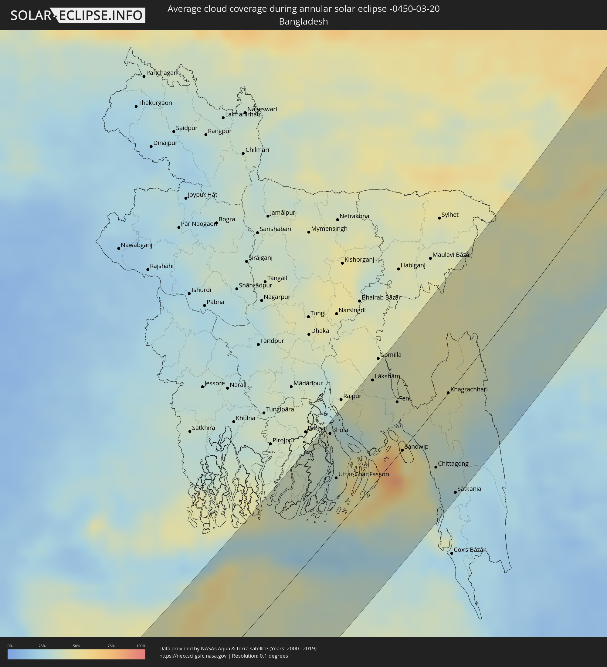 Bangladesh
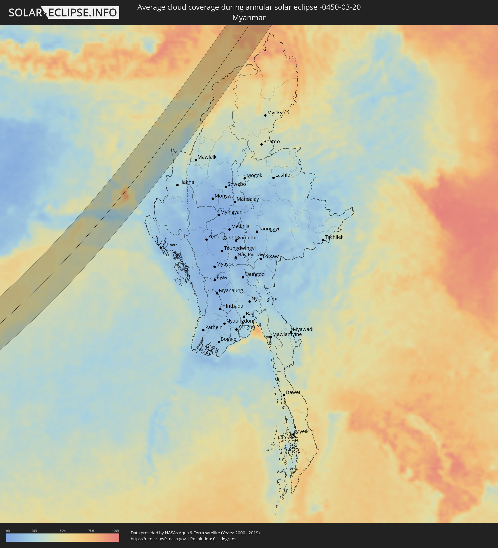 Myanmar
Cities inside the path of the eclipse
The following table shows all locations with a population of more than 5,000 inside the eclipse path. Cities which have more than 100,000 inhabitants are marked bold. A click at the locations opens a detailed map.
| City | Type | Eclipse duration | Local time of max. eclipse | Distance to central line | Ø Cloud coverage |
|
Kozhikode, Kerala
|
annular | - | 08:38:52 UTC+05:21 | 62 km | 38% |
|
Ponnāni, Kerala
|
annular | - | 08:38:08 UTC+05:21 | 6 km | 37% |
|
Manjeri, Kerala
|
annular | - | 08:39:01 UTC+05:21 | 33 km | 50% |
|
Trichūr, Kerala
|
annular | - | 08:38:00 UTC+05:21 | 32 km | 46% |
|
Cochin, Kerala
|
annular | - | 08:36:58 UTC+05:21 | 93 km | 45% |
|
Palakkad, Kerala
|
annular | - | 08:39:00 UTC+05:21 | 26 km | 26% |
|
Ooty, Tamil Nadu
|
annular | - | 08:40:16 UTC+05:21 | 36 km | 30% |
|
Mettupalayam, Tamil Nadu
|
annular | - | 08:40:20 UTC+05:21 | 13 km | 22% |
|
Chamrajnagar, Karnataka
|
annular | - | 08:41:32 UTC+05:21 | 75 km | 20% |
|
Valparai, Tamil Nadu
|
annular | - | 08:38:30 UTC+05:21 | 85 km | 38% |
|
Coimbatore, Tamil Nadu
|
annular | - | 08:39:48 UTC+05:21 | 18 km | 24% |
|
Pollachi, Tamil Nadu
|
annular | - | 08:39:11 UTC+05:21 | 55 km | 23% |
|
Tiruppur, Tamil Nadu
|
annular | - | 08:40:29 UTC+05:21 | 25 km | 24% |
|
Dharapuram, Tamil Nadu
|
annular | - | 08:39:58 UTC+05:21 | 72 km | 26% |
|
Erode, Tamil Nadu
|
annular | - | 08:41:23 UTC+05:21 | 21 km | 22% |
|
Tiruchengode, Tamil Nadu
|
annular | - | 08:41:39 UTC+05:21 | 26 km | 23% |
|
Karur, Tamil Nadu
|
annular | - | 08:41:04 UTC+05:21 | 77 km | 23% |
|
Salem, Tamil Nadu
|
annular | - | 08:42:31 UTC+05:21 | 12 km | 20% |
|
Vaniyambadi, Tamil Nadu
|
annular | - | 08:45:09 UTC+05:21 | 65 km | 18% |
|
Ambur, Tamil Nadu
|
annular | - | 08:45:29 UTC+05:21 | 71 km | 17% |
|
Gudiyatham, Tamil Nadu
|
annular | - | 08:46:00 UTC+05:21 | 77 km | 12% |
|
Tiruvannāmalai, Tamil Nadu
|
annular | - | 08:44:49 UTC+05:21 | 3 km | 19% |
|
Vellore, Tamil Nadu
|
annular | - | 08:46:17 UTC+05:21 | 60 km | 14% |
|
Villupuram, Tamil Nadu
|
annular | - | 08:44:47 UTC+05:21 | 54 km | 25% |
|
Tindivanam, Tamil Nadu
|
annular | - | 08:45:36 UTC+05:21 | 34 km | 24% |
|
Arakkonam, Tamil Nadu
|
annular | - | 08:47:20 UTC+05:21 | 47 km | 20% |
|
Kānchipuram, Tamil Nadu
|
annular | - | 08:46:52 UTC+05:21 | 21 km | 22% |
|
Cuddalore, Tamil Nadu
|
annular | - | 08:44:45 UTC+05:21 | 87 km | 32% |
|
Puducherry, Pondicherry
|
annular | - | 08:45:13 UTC+05:21 | 72 km | 29% |
|
Āvadi, Tamil Nadu
|
annular | - | 08:47:59 UTC+05:21 | 25 km | 22% |
|
Pallāvaram, Tamil Nadu
|
annular | - | 08:47:45 UTC+05:21 | 9 km | 22% |
|
Chennai, Tamil Nadu
|
annular | - | 08:48:10 UTC+05:21 | 13 km | 28% |
|
Bhola, Barisāl
|
annular | - | 09:58:00 UTC+05:53 | 76 km | 37% |
|
Uttar Char Fasson, Khulna
|
annular | - | 09:57:02 UTC+05:53 | 38 km | 35% |
|
Burhānuddin, Barisāl
|
annular | - | 09:57:41 UTC+05:53 | 56 km | 35% |
|
Lālmohan, Barisāl
|
annular | - | 09:57:20 UTC+05:53 | 44 km | 36% |
|
Lakshmīpur, Chittagong
|
annular | - | 09:58:54 UTC+05:53 | 79 km | 32% |
|
Lākshām, Chittagong
|
annular | - | 10:00:06 UTC+05:53 | 77 km | 43% |
|
Feni, Chittagong
|
annular | - | 10:00:03 UTC+05:53 | 39 km | 41% |
|
Sandwīp, Chittagong
|
annular | - | 09:58:59 UTC+05:53 | 1 km | 50% |
|
Chhāgalnāiya, Chittagong
|
annular | - | 10:00:16 UTC+05:53 | 31 km | 43% |
|
Fatikchari, Chittagong
|
annular | - | 09:59:57 UTC+05:53 | 14 km | 36% |
|
Chittagong, Chittagong
|
annular | - | 09:59:13 UTC+05:53 | 43 km | 35% |
|
Manikchari, Chittagong
|
annular | - | 10:00:24 UTC+05:53 | 9 km | 37% |
|
Raojān, Chittagong
|
annular | - | 09:59:50 UTC+05:53 | 36 km | 35% |
|
Khagrachhari, Chittagong
|
annular | - | 10:01:15 UTC+05:53 | 0 km | 43% |
|
Patiya, Chittagong
|
annular | - | 09:59:23 UTC+05:53 | 58 km | 29% |
|
Sātkania, Chittagong
|
annular | - | 09:58:59 UTC+05:53 | 79 km | 29% |
|
Aizawl, Mizoram
|
annular | - | 09:31:49 UTC+05:21 | 17 km | 34% |
|
Silchar, Assam
|
annular | - | 09:34:30 UTC+05:21 | 51 km | 42% |
|
Dimāpur, Nagaland
|
annular | - | 09:38:35 UTC+05:21 | 49 km | 43% |
|
Imphal, Manipur
|
annular | - | 09:36:27 UTC+05:21 | 43 km | 32% |
|
Kohima, Nagaland
|
annular | - | 09:38:44 UTC+05:21 | 2 km | 54% |
|
Jorhāt, Assam
|
annular | - | 09:41:21 UTC+05:21 | 65 km | 58% |
|
Dibrugarh, Assam
|
annular | - | 09:44:12 UTC+05:21 | 55 km | 65% |
|
Tinsukia, Assam
|
annular | - | 09:45:01 UTC+05:21 | 19 km | 64% |
|
Shitanjing, Ningsia Hui Autonomous Region
|
annular | - | 13:05:14 UTC+08:00 | 71 km | 57% |
|
Wuhai, Inner Mongolia
|
annular | - | 13:06:40 UTC+08:00 | 74 km | 57% |
|
Saynshand, East Gobi Aymag
|
annular | - | 12:26:01 UTC+07:07 | 64 km | 56% |
|
Baruun-Urt, Sühbaatar
|
annular | - | 12:32:14 UTC+07:07 | 4 km | 59% |
|
Choibalsan, East Aimak
|
annular | - | 12:35:05 UTC+07:07 | 36 km | 60% |
|
Zabaykal’sk, Transbaikal Territory
|
annular | - | 14:11:10 UTC+08:38 | 5 km | 62% |
|
Manzhouli, Inner Mongolia
|
annular | - | 13:32:18 UTC+08:00 | 4 km | 63% |
|
Jalai Nur, Inner Mongolia
|
annular | - | 13:32:32 UTC+08:00 | 30 km | 69% |
|
Krasnokamensk, Transbaikal Territory
|
annular | - | 14:12:18 UTC+08:38 | 3 km | 57% |
|
Priargunsk, Transbaikal Territory
|
annular | - | 14:13:43 UTC+08:38 | 29 km | 56% |
|
Skovorodino, Amur
|
annular | - | 14:20:19 UTC+08:38 | 40 km | 76% |
|
Susuman, Magadan
|
annular | - | 16:11:01 UTC+10:14 | 92 km | 74% |