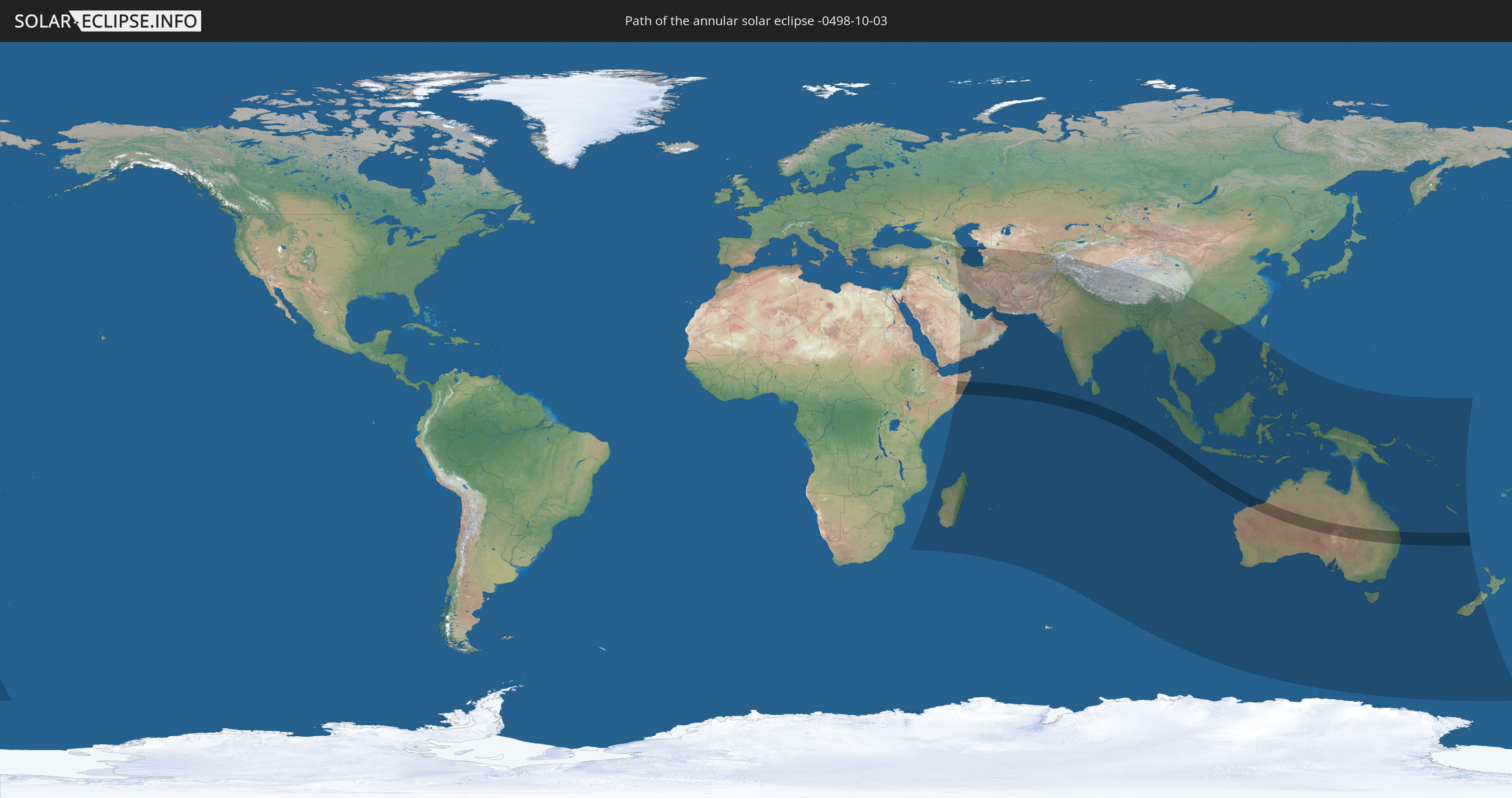
Annular solar eclipse of 10/03/-0498
| Day of week: | Thursday |
| Maximum duration of eclipse: | 09m29s |
| Maximum width of eclipse path: | 280 km |
| Saros cycle: | 55 |
| Coverage: | 92.7% |
| Magnitude: | 0.9266 |
| Gamma: | -0.1775 |
Wo kann man die Sonnenfinsternis vom 10/03/-0498 sehen?
Die Sonnenfinsternis am 10/03/-0498 kann man in 62 Ländern als partielle Sonnenfinsternis beobachten.
Der Finsternispfad verläuft durch 6 Länder. Nur in diesen Ländern ist sie als annular Sonnenfinsternis zu sehen.
In den folgenden Ländern ist die Sonnenfinsternis annular zu sehen
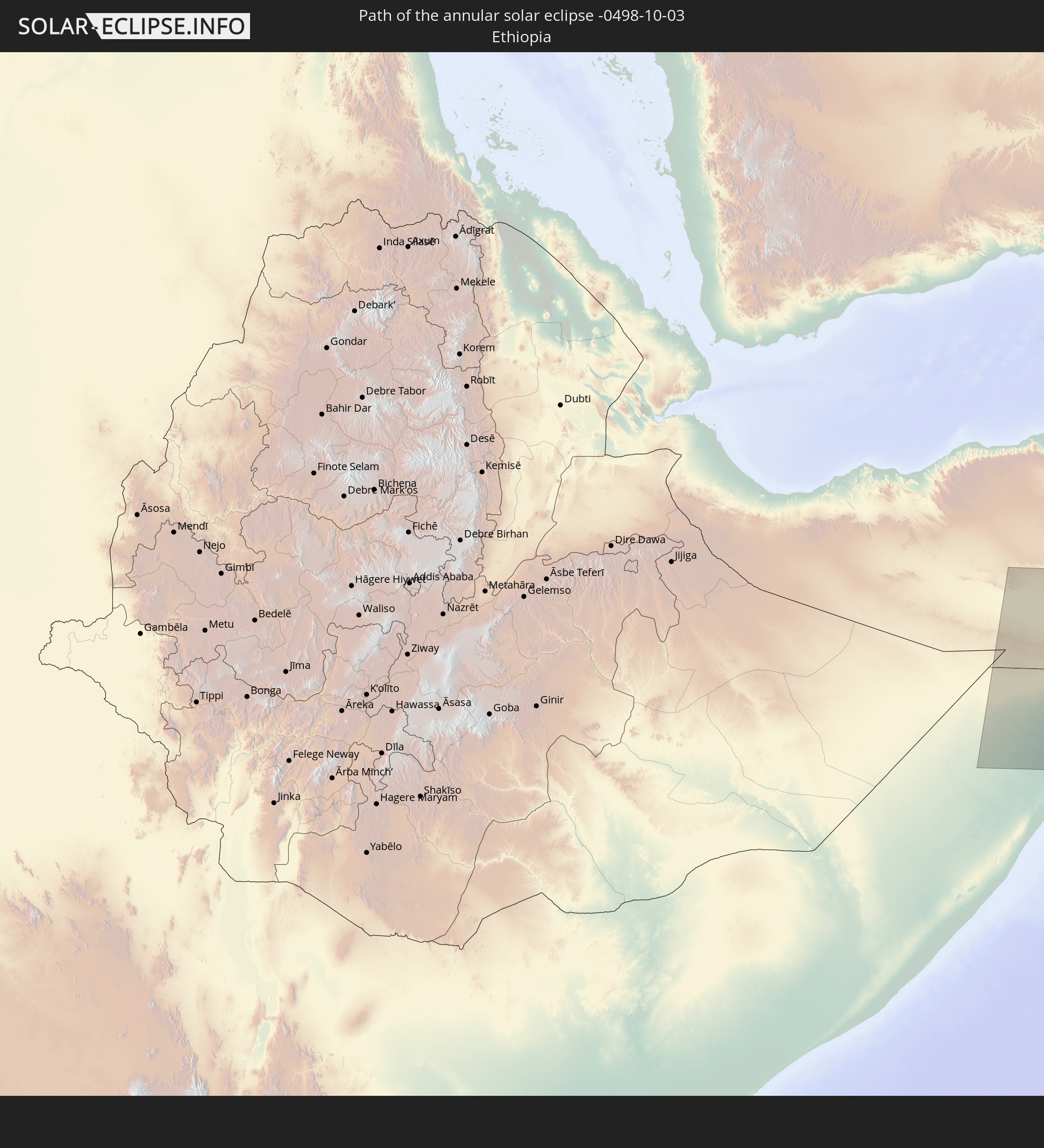 Ethiopia
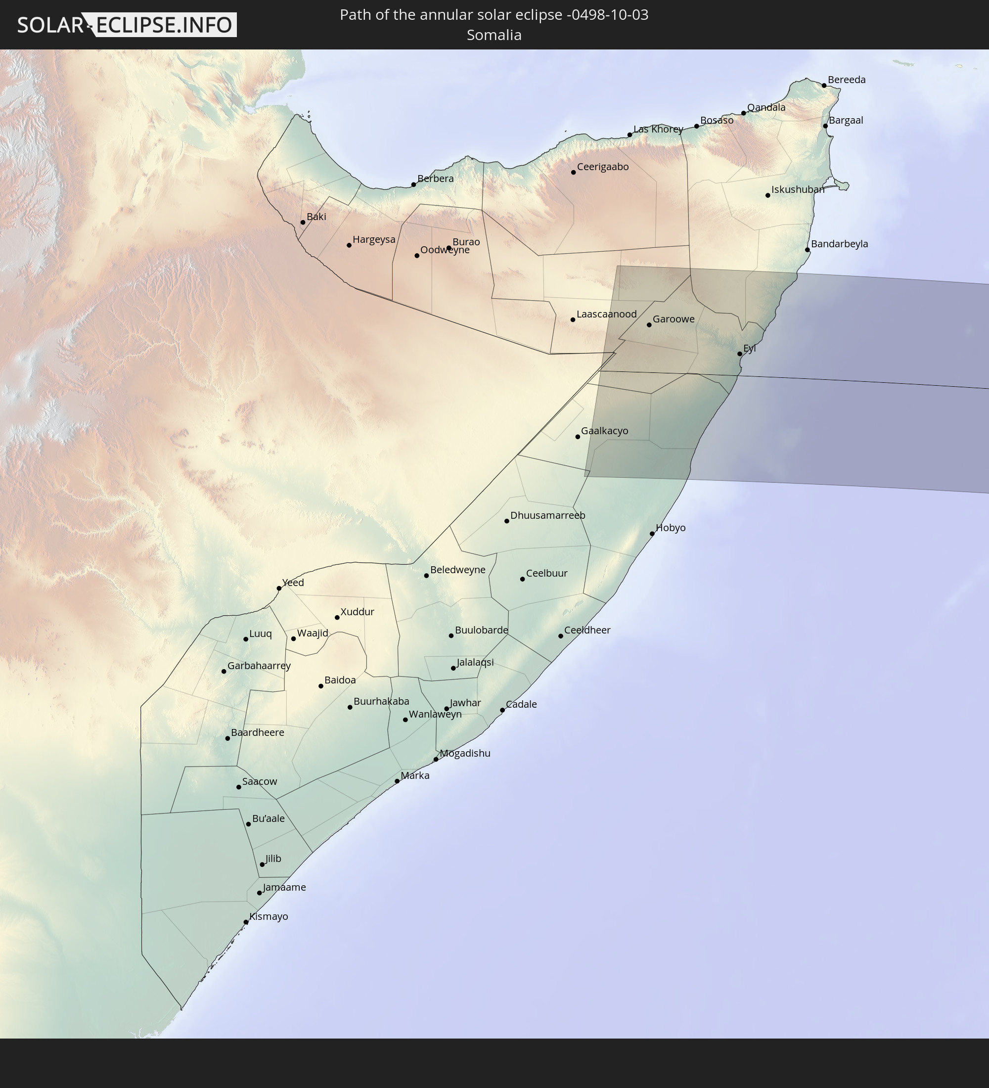 Somalia
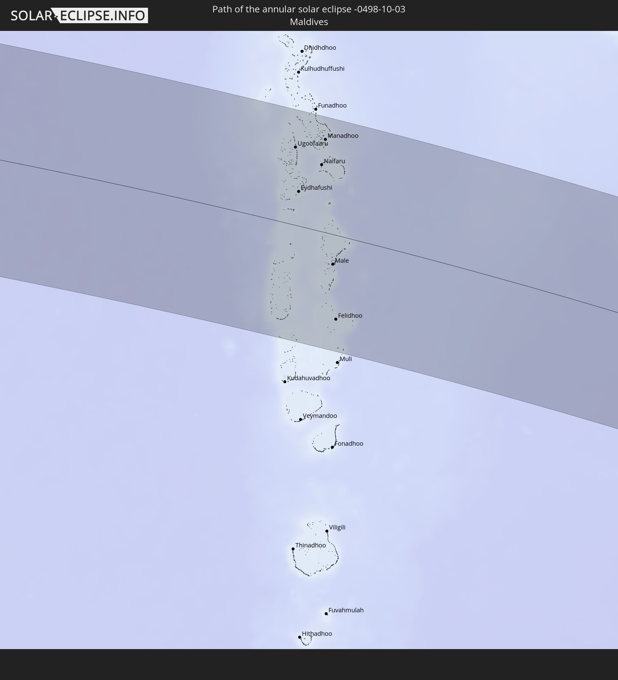 Maldives
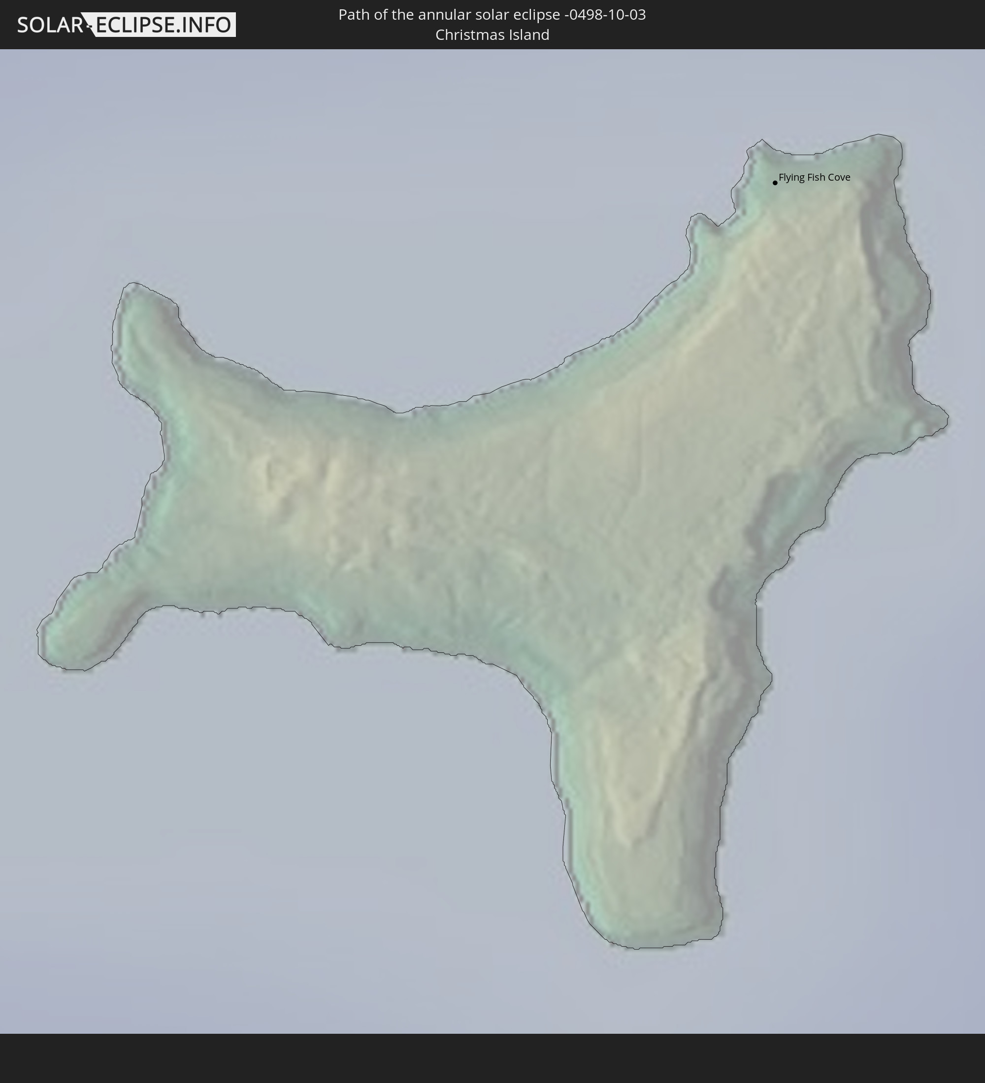 Christmas Island
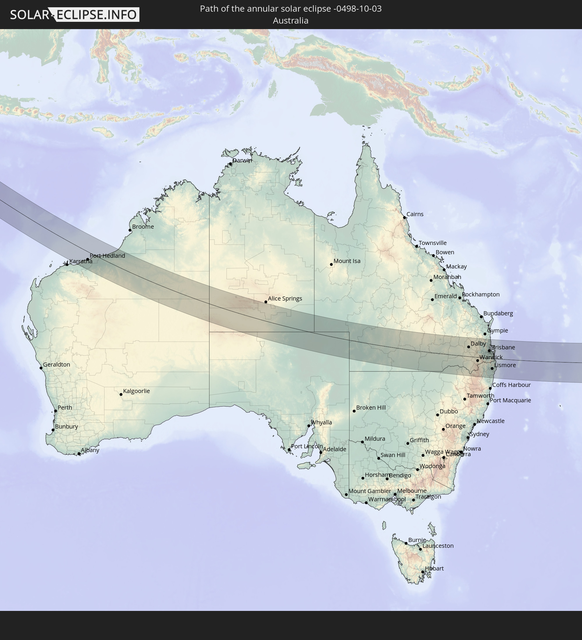 Australia
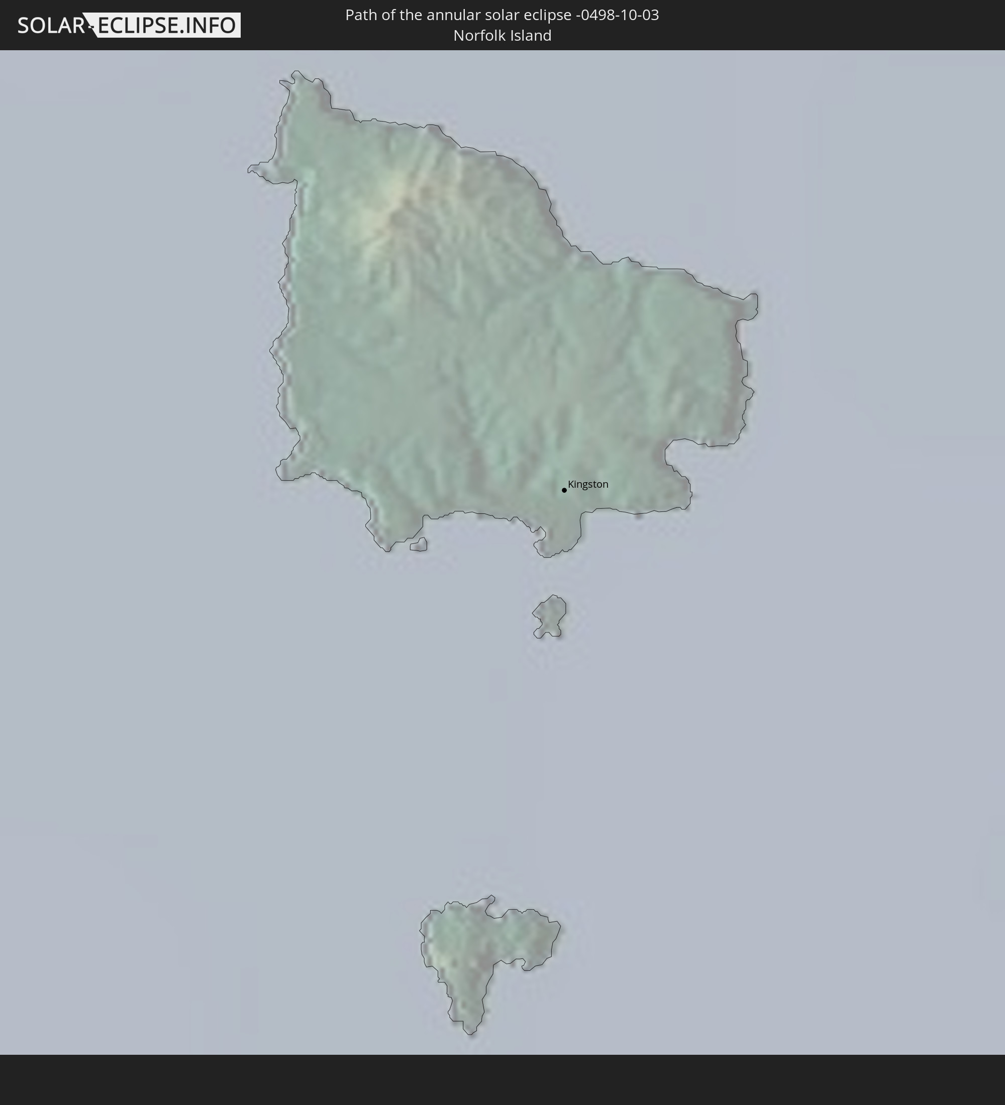 Norfolk Island
In den folgenden Ländern ist die Sonnenfinsternis partiell zu sehen
 Antarctica
 Russia
 New Zealand
 Kiribati
 Ethiopia
 Saudi Arabia
 Iraq
Iraq
 French Southern and Antarctic Lands
 Somalia
 Yemen
Yemen
 Madagascar
 Comoros
 Iran
Iran
 Azerbaijan
 Mayotte
 Seychelles
 Kuwait
 Bahrain
 Qatar
Qatar
 United Arab Emirates
 Oman
Oman
 Turkmenistan
 Réunion
 Uzbekistan
 Mauritius
 Afghanistan
 Pakistan
 Tajikistan
 India
India
 British Indian Ocean Territory
 Maldives
 China
China
 Sri Lanka
 Nepal
Nepal
 Bangladesh
 Bhutan
 Myanmar
 Indonesia
 Cocos Islands
 Thailand
 Malaysia
 Laos
Laos
 Vietnam
 Cambodia
 Singapore
 Christmas Island
 Australia
 Macau
Macau
 Hong Kong
 Brunei
 Taiwan
 Philippines
 East Timor
 Palau
Palau
 Federated States of Micronesia
 Papua New Guinea
 Solomon Islands
 New Caledonia
 Marshall Islands
 Vanuatu
 Nauru
Nauru
 Norfolk Island
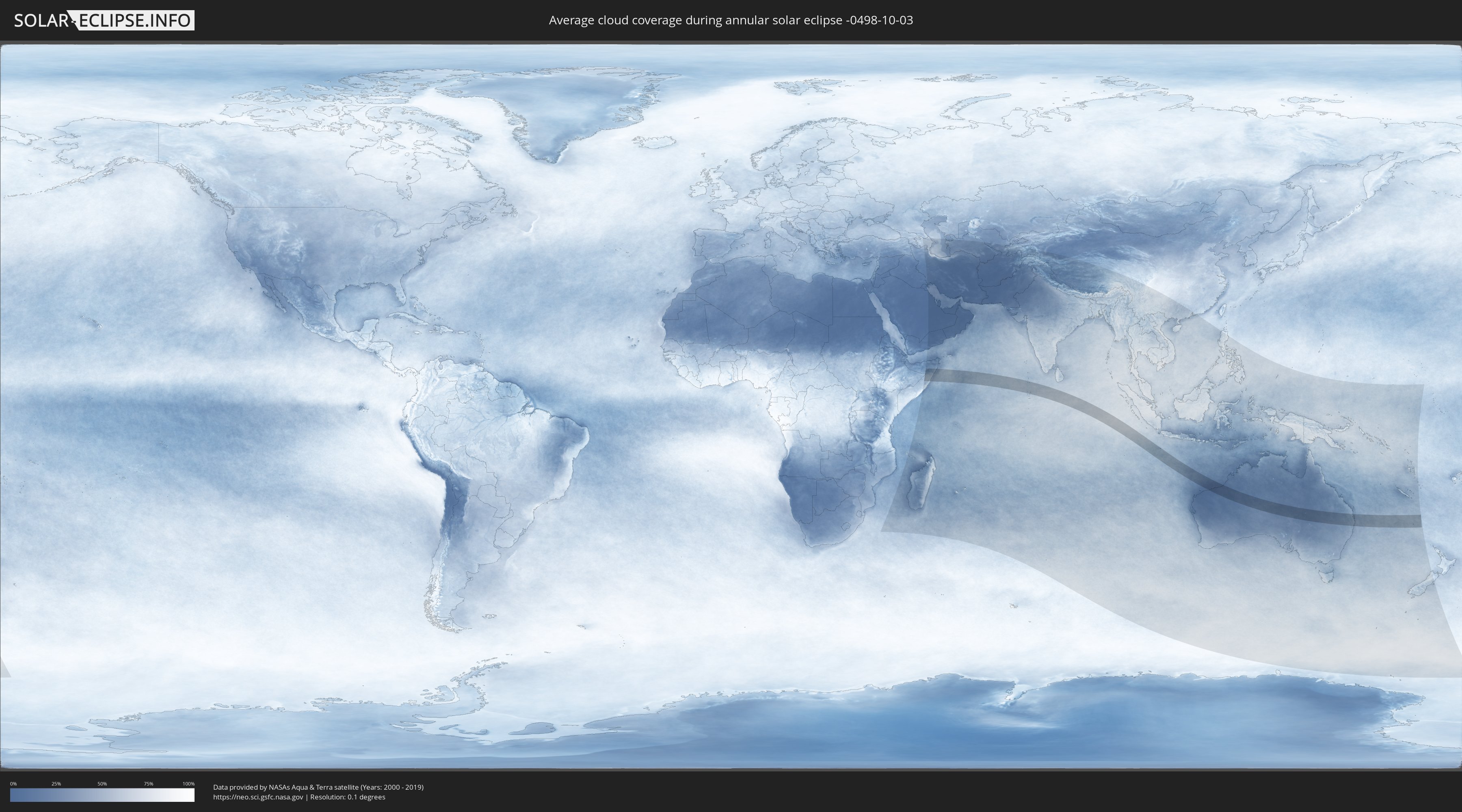
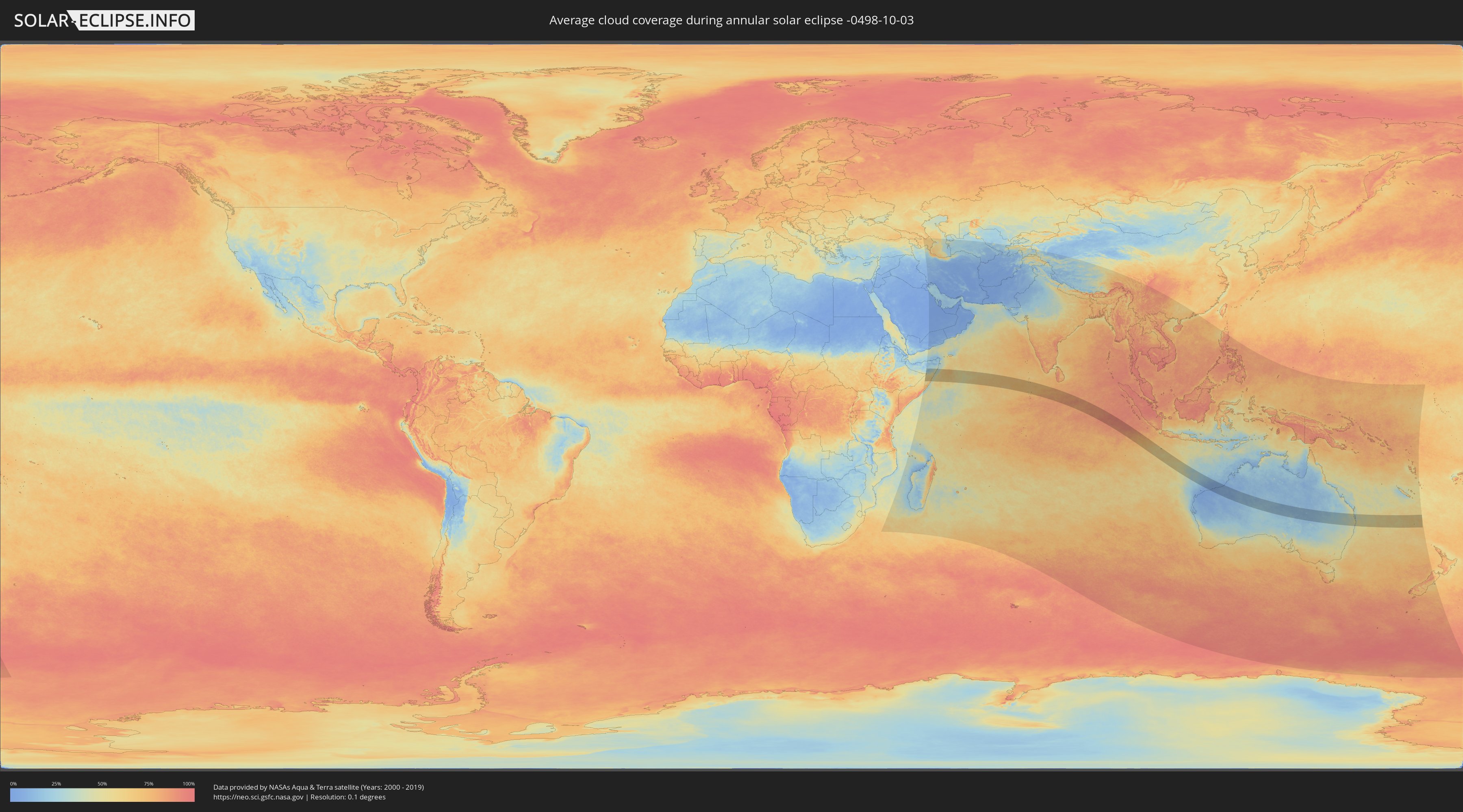
How will be the weather during the annular solar eclipse on 10/03/-0498?
Where is the best place to see the annular solar eclipse of 10/03/-0498?
The following maps show the average cloud coverage for the day of the annular solar eclipse.
With the help of these maps, it is possible to find the place along the eclipse path, which has the best
chance of a cloudless sky.
Nevertheless, you should consider local circumstances and inform about the weather of your chosen
observation site.
The data is provided by NASAs satellites
AQUA and TERRA.
The cloud maps are averaged over a period of 19 years (2000 - 2019).
Detailed country maps
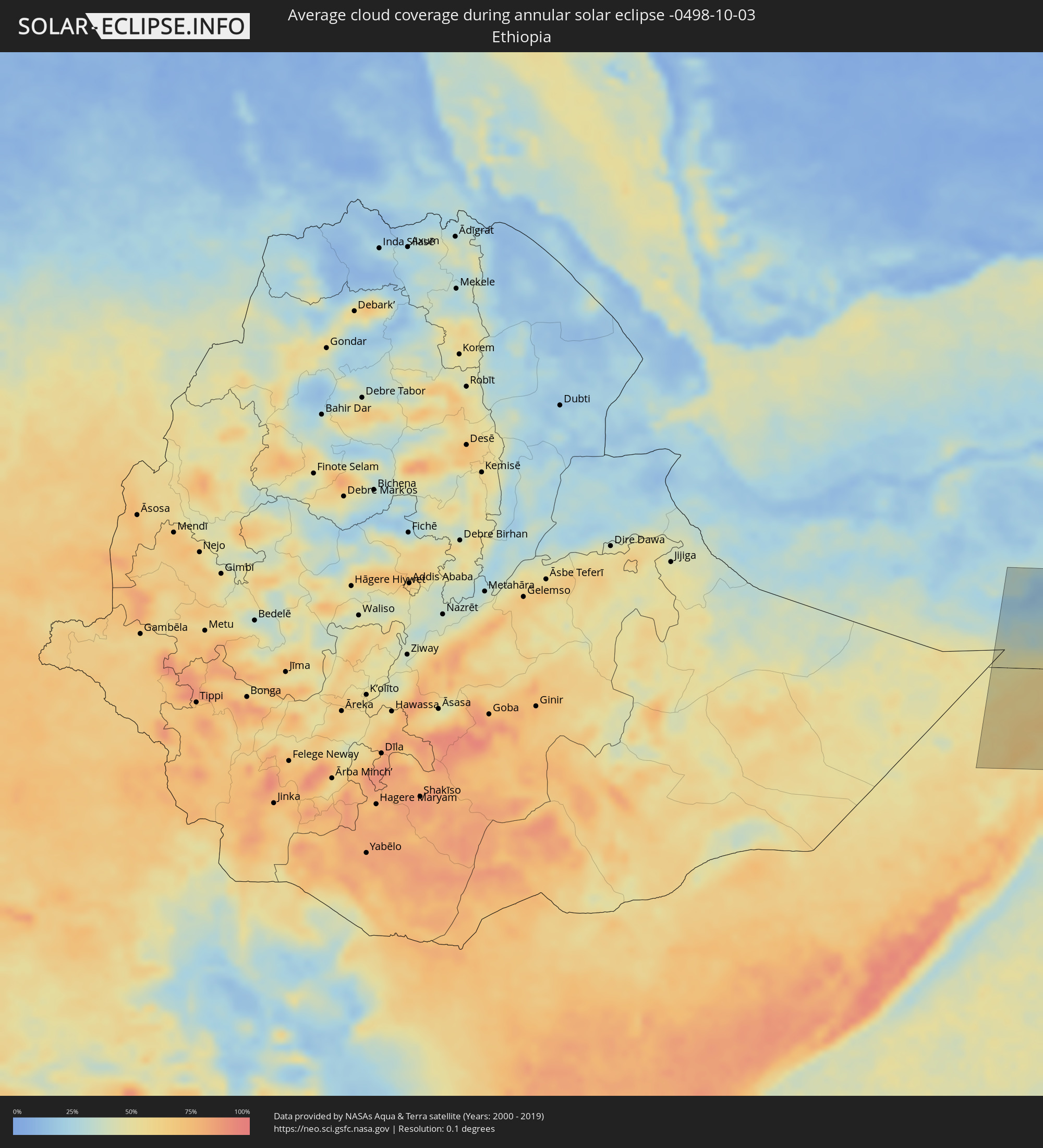 Ethiopia
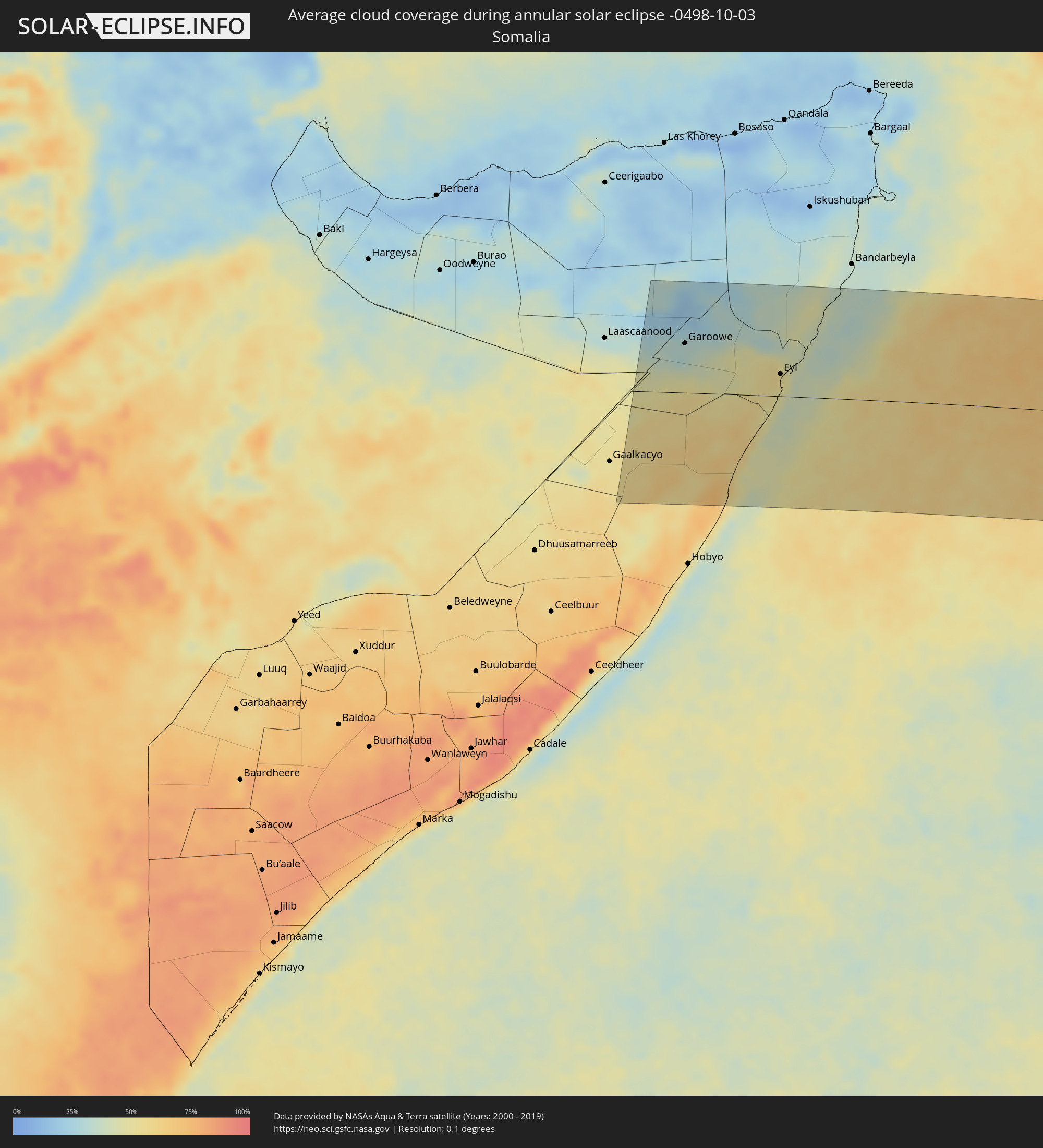 Somalia
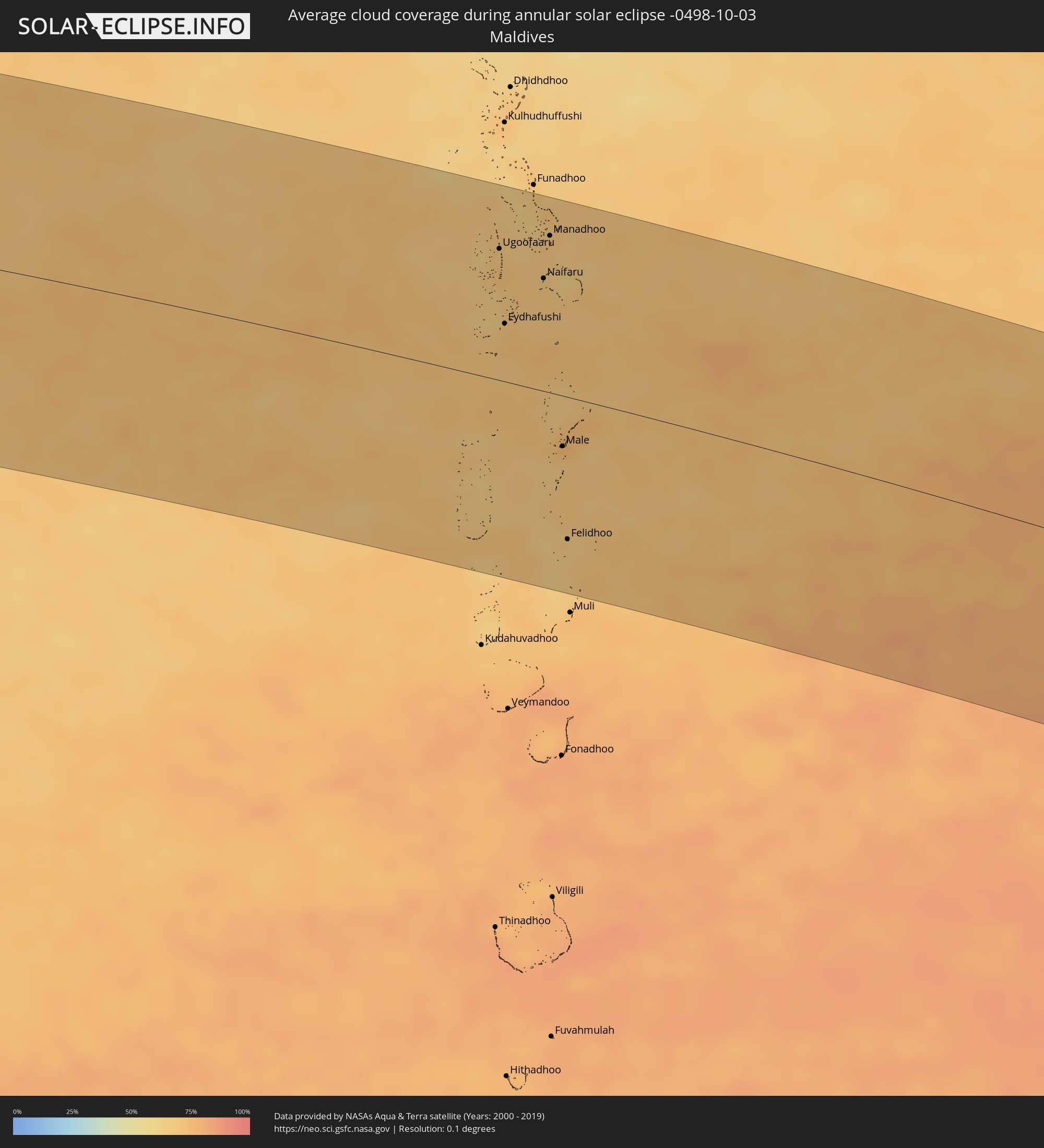 Maldives
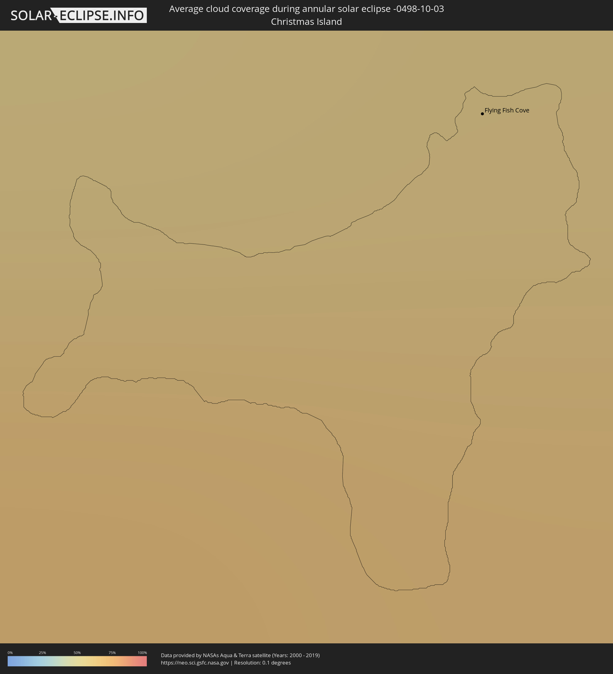 Christmas Island
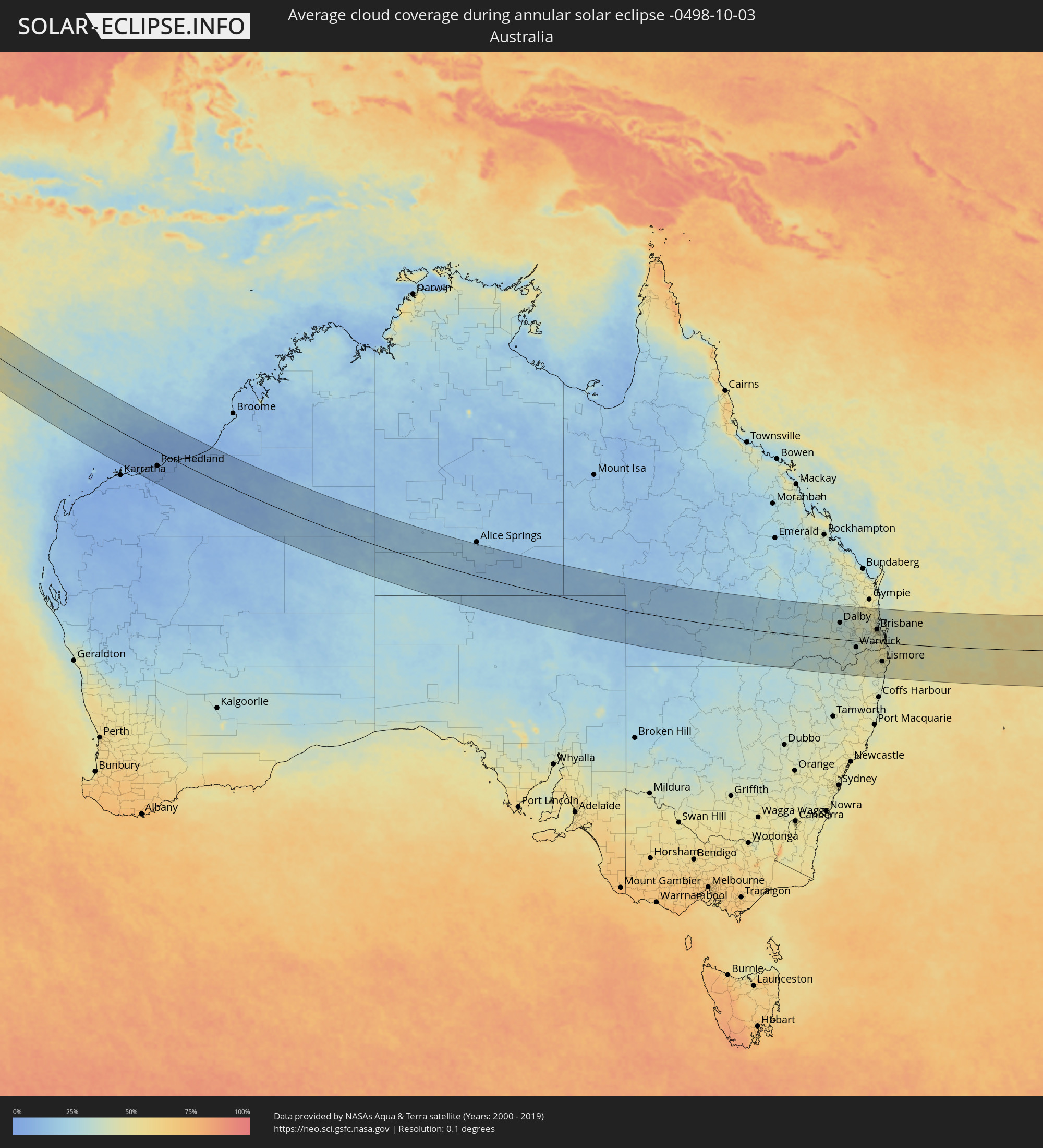 Australia
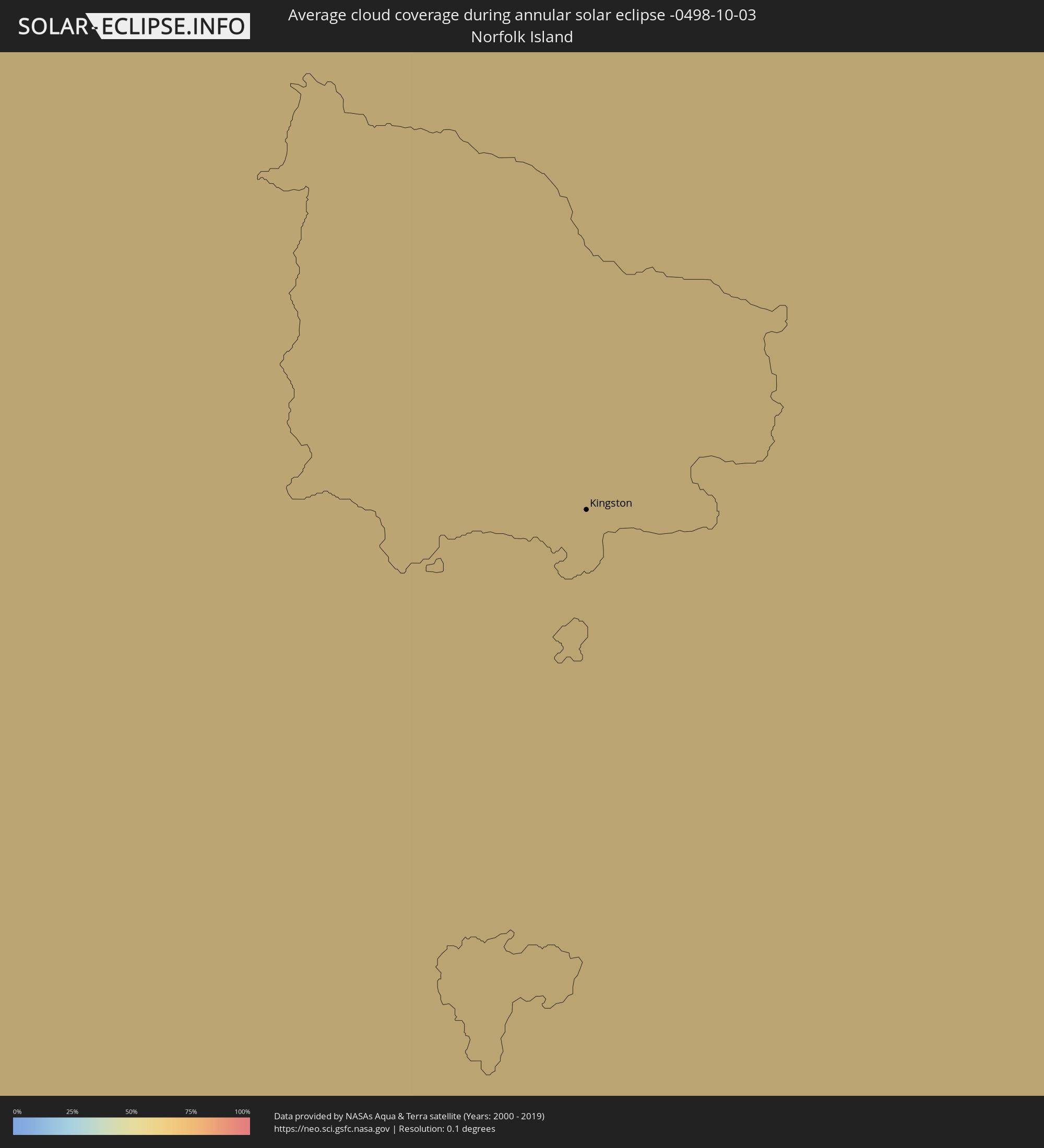 Norfolk Island
Cities inside the path of the eclipse
The following table shows all locations with a population of more than 5,000 inside the eclipse path. Cities which have more than 100,000 inhabitants are marked bold. A click at the locations opens a detailed map.
| City | Type | Eclipse duration | Local time of max. eclipse | Distance to central line | Ø Cloud coverage |
|
Garoowe, Nugaal
|
annular | - | 05:09:34 UTC+02:27 | 76 km | 32% |
|
Eyl, Nugaal
|
annular | - | 05:09:47 UTC+02:27 | 34 km | 54% |
|
Ugoofaaru, Raa Atoll
|
annular | - | 07:50:52 UTC+04:54 | 107 km | 68% |
|
Eydhafushi, Baa Atholhu
|
annular | - | 07:51:26 UTC+04:54 | 47 km | 71% |
|
Naifaru, Lhaviyani Atholhu
|
annular | - | 07:51:27 UTC+04:54 | 92 km | 69% |
|
Manadhoo, Noonu Atoll
|
annular | - | 07:51:13 UTC+04:54 | 128 km | 70% |
|
Male, Kaafu Atoll
|
annular | - | 07:52:49 UTC+04:54 | 41 km | 74% |
|
Felidhoo, Vaavu Atholhu
|
annular | - | 07:53:34 UTC+04:54 | 116 km | 67% |
|
Flying Fish Cove
|
annular | - | 11:38:58 UTC+07:00 | 125 km | 65% |
|
Port Hedland, Western Australia
|
annular | - | 13:34:37 UTC+08:00 | 63 km | 6% |
|
Dalby, Queensland
|
annular | - | 16:30:27 UTC+10:00 | 78 km | 31% |
|
Kingaroy, Queensland
|
annular | - | 16:30:59 UTC+10:00 | 154 km | 37% |
|
Toowoomba, Queensland
|
annular | - | 16:30:49 UTC+10:00 | 42 km | 38% |
|
Rangeville, Queensland
|
annular | - | 16:30:50 UTC+10:00 | 40 km | 38% |
|
Warwick, Queensland
|
annular | - | 16:30:42 UTC+10:00 | 30 km | 35% |
|
Gatton, Queensland
|
annular | - | 16:31:02 UTC+10:00 | 45 km | 39% |
|
Raceview, Queensland
|
annular | - | 16:31:20 UTC+10:00 | 40 km | 41% |
|
Booval, Queensland
|
annular | - | 16:31:21 UTC+10:00 | 43 km | 41% |
|
Samford Valley, Queensland
|
annular | - | 16:31:27 UTC+10:00 | 70 km | 46% |
|
Goodna, Queensland
|
annular | - | 16:31:25 UTC+10:00 | 44 km | 42% |
|
Springfield, Queensland
|
annular | - | 16:31:25 UTC+10:00 | 39 km | 42% |
|
Caboolture, Queensland
|
annular | - | 16:31:35 UTC+10:00 | 103 km | 40% |
|
Nambour, Queensland
|
annular | - | 16:31:42 UTC+10:00 | 154 km | 46% |
|
Taringa, Queensland
|
annular | - | 16:31:30 UTC+10:00 | 58 km | 44% |
|
Bridegman Downs, Queensland
|
annular | - | 16:31:32 UTC+10:00 | 73 km | 47% |
|
Stafford Heights, Queensland
|
annular | - | 16:31:32 UTC+10:00 | 69 km | 47% |
|
Chermside West, Queensland
|
annular | - | 16:31:33 UTC+10:00 | 70 km | 47% |
|
Brisbane, Queensland
|
annular | - | 16:31:32 UTC+10:00 | 61 km | 44% |
|
Windsor, Queensland
|
annular | - | 16:31:32 UTC+10:00 | 64 km | 47% |
|
Bracken Ridge, Queensland
|
annular | - | 16:31:34 UTC+10:00 | 78 km | 45% |
|
Zillmere, Queensland
|
annular | - | 16:31:34 UTC+10:00 | 73 km | 47% |
|
Casino, New South Wales
|
annular | - | 16:31:08 UTC+10:00 | 93 km | 44% |
|
Clontarf, Queensland
|
annular | - | 16:31:37 UTC+10:00 | 85 km | 39% |
|
Margate, Queensland
|
annular | - | 16:31:38 UTC+10:00 | 86 km | 35% |
|
Logan City, Queensland
|
annular | - | 16:31:32 UTC+10:00 | 42 km | 45% |
|
Mooloolaba, Queensland
|
annular | - | 16:31:47 UTC+10:00 | 149 km | 42% |
|
Caloundra, Queensland
|
annular | - | 16:31:45 UTC+10:00 | 135 km | 41% |
|
Waterford West, Queensland
|
annular | - | 16:31:32 UTC+10:00 | 37 km | 44% |
|
Bongaree, Queensland
|
annular | - | 16:31:43 UTC+10:00 | 104 km | 33% |
|
Tamborine Mountain, Queensland
|
annular | - | 16:31:30 UTC+10:00 | 6 km | 49% |
|
Beenleigh, Queensland
|
annular | - | 16:31:34 UTC+10:00 | 35 km | 44% |
|
Cleveland, Queensland
|
annular | - | 16:31:40 UTC+10:00 | 56 km | 40% |
|
Lismore, New South Wales
|
annular | - | 16:31:17 UTC+10:00 | 87 km | 45% |
|
Oxenford, Queensland
|
annular | - | 16:31:35 UTC+10:00 | 16 km | 47% |
|
Murwillumbah, New South Wales
|
annular | - | 16:31:30 UTC+10:00 | 32 km | 47% |
|
Gold Coast, Queensland
|
annular | - | 16:31:38 UTC+10:00 | 5 km | 43% |
|
Banora Point, New South Wales
|
annular | - | 16:31:38 UTC+10:00 | 18 km | 44% |
|
Ballina, New South Wales
|
annular | - | 16:31:26 UTC+10:00 | 90 km | 45% |
|
Byron Bay, New South Wales
|
annular | - | 16:31:32 UTC+10:00 | 65 km | 44% |
|
Kingston
|
annular | - | 17:47:42 UTC+11:12 | 80 km | 59% |