Total solar eclipse of 07/18/-0689
| Day of week: | Thursday |
| Maximum duration of eclipse: | 06m35s |
| Maximum width of eclipse path: | 240 km |
| Saros cycle: | 54 |
| Coverage: | 100% |
| Magnitude: | 1.0724 |
| Gamma: | -0.1957 |
Wo kann man die Sonnenfinsternis vom 07/18/-0689 sehen?
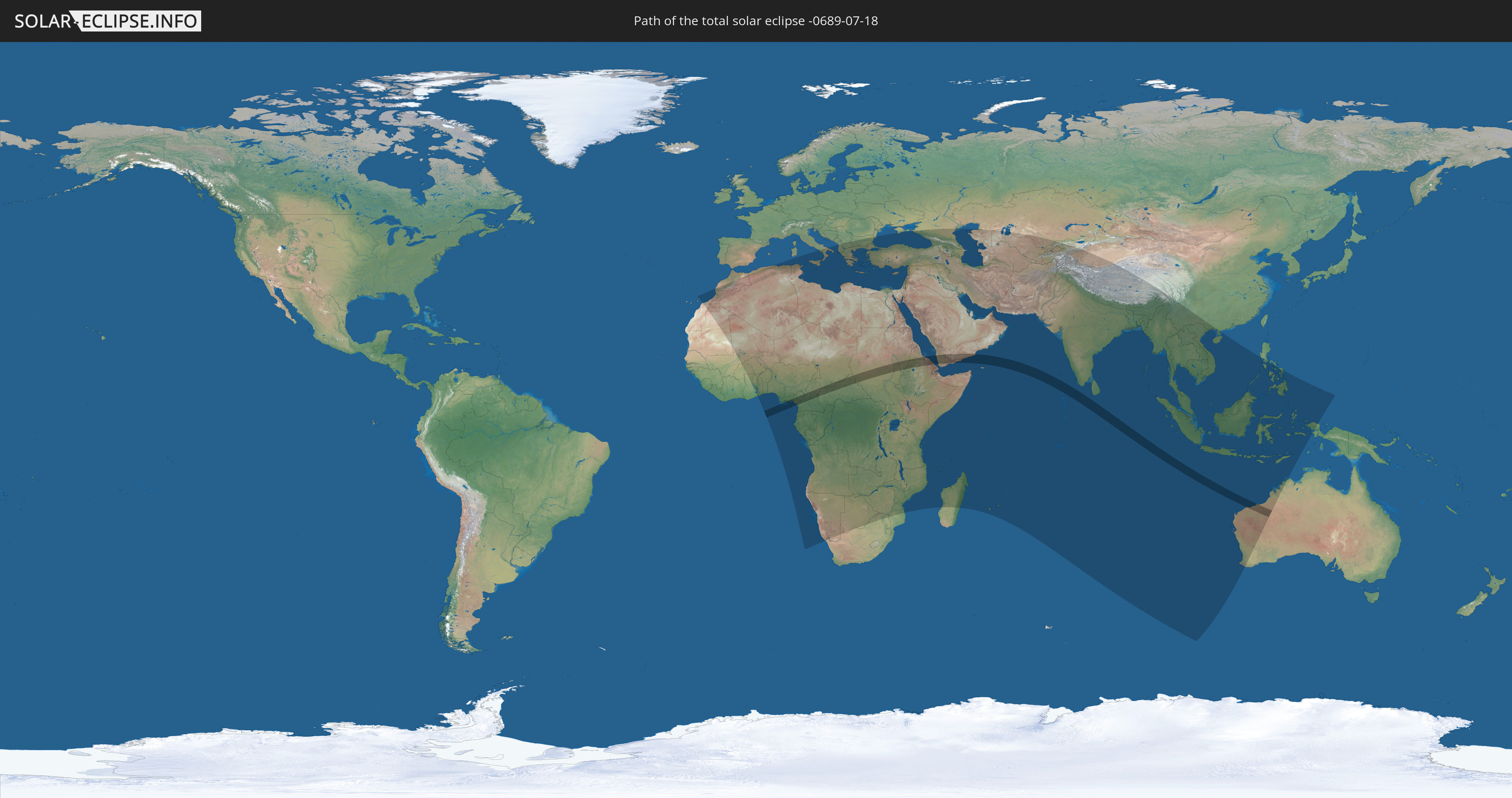
Die Sonnenfinsternis am 07/18/-0689 kann man in 105 Ländern als partielle Sonnenfinsternis beobachten.
Der Finsternispfad verläuft durch 12 Länder. Nur in diesen Ländern ist sie als total Sonnenfinsternis zu sehen.
In den folgenden Ländern ist die Sonnenfinsternis total zu sehen
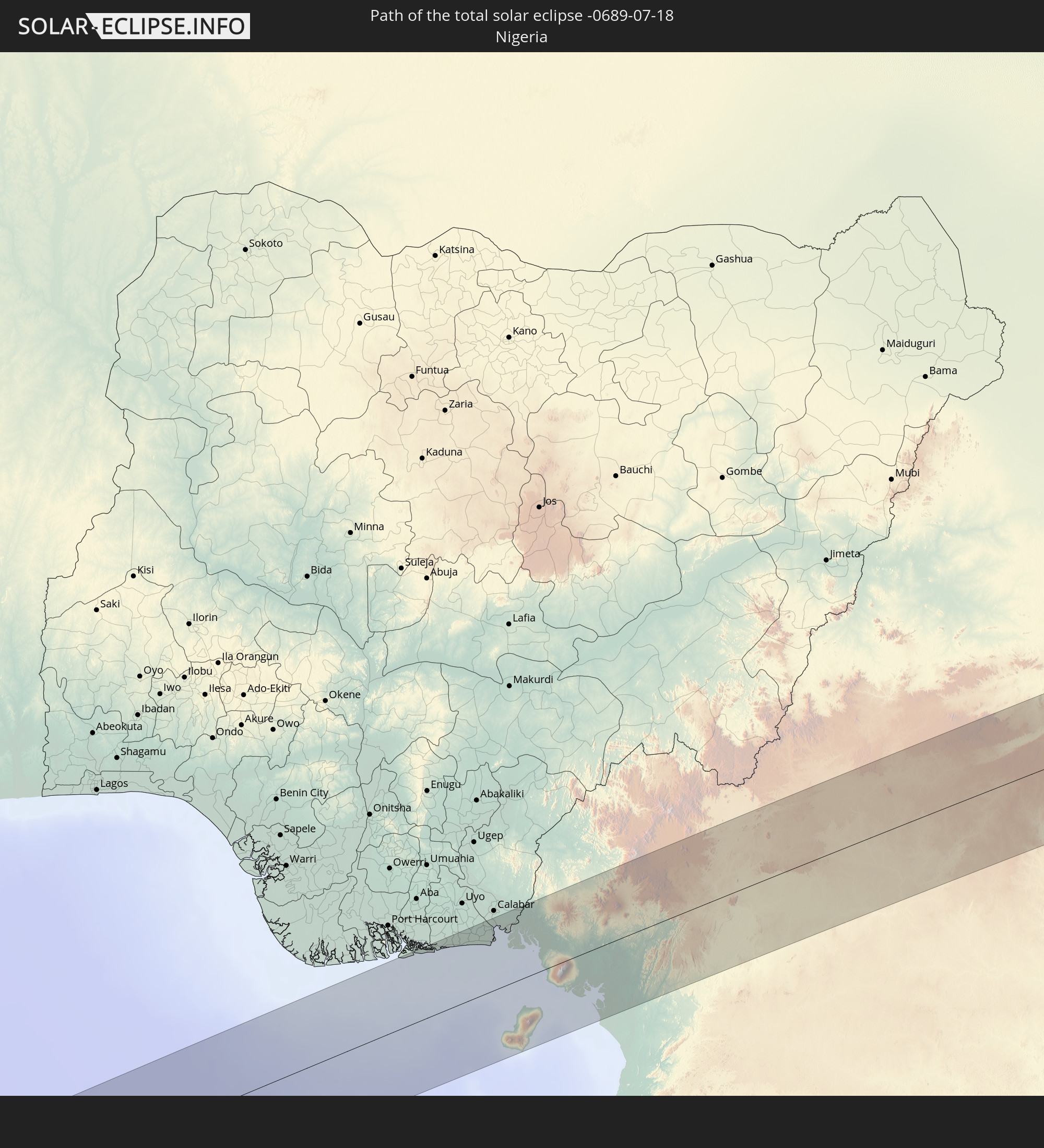 Nigeria
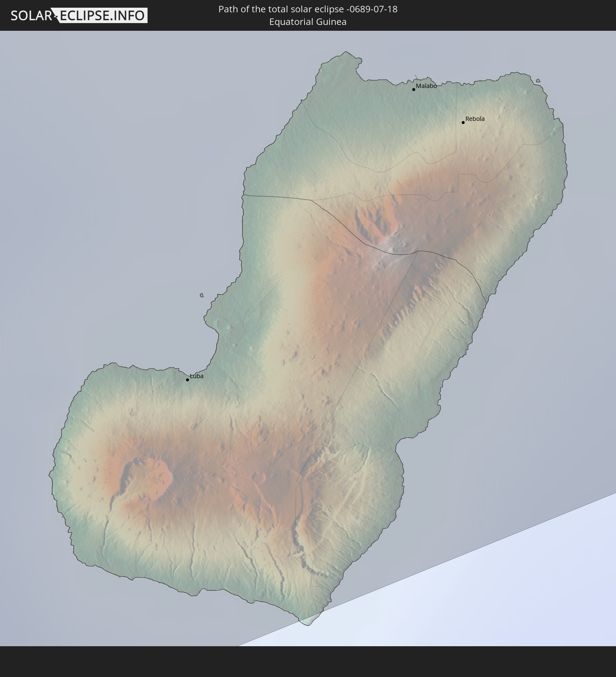 Equatorial Guinea
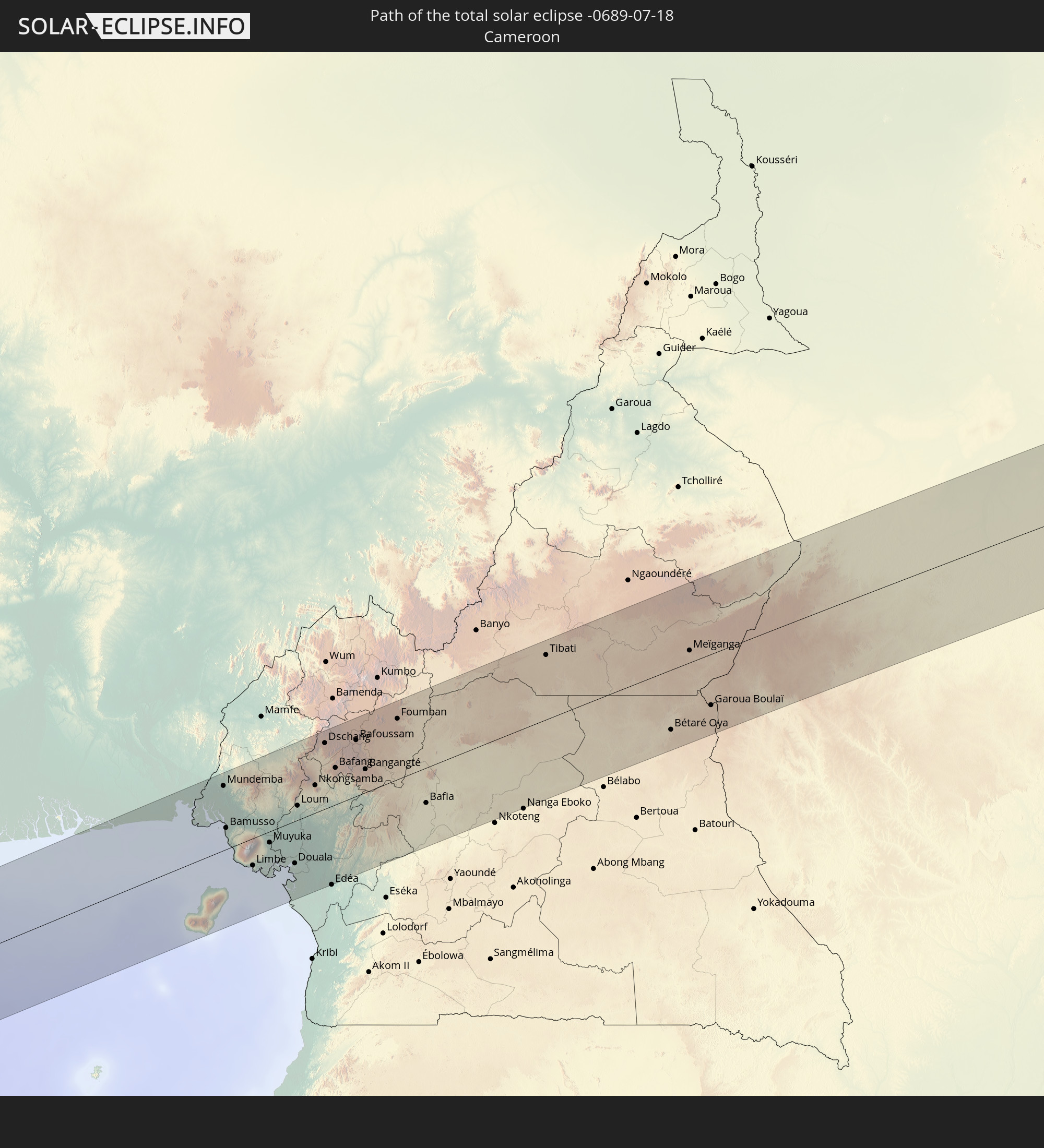 Cameroon
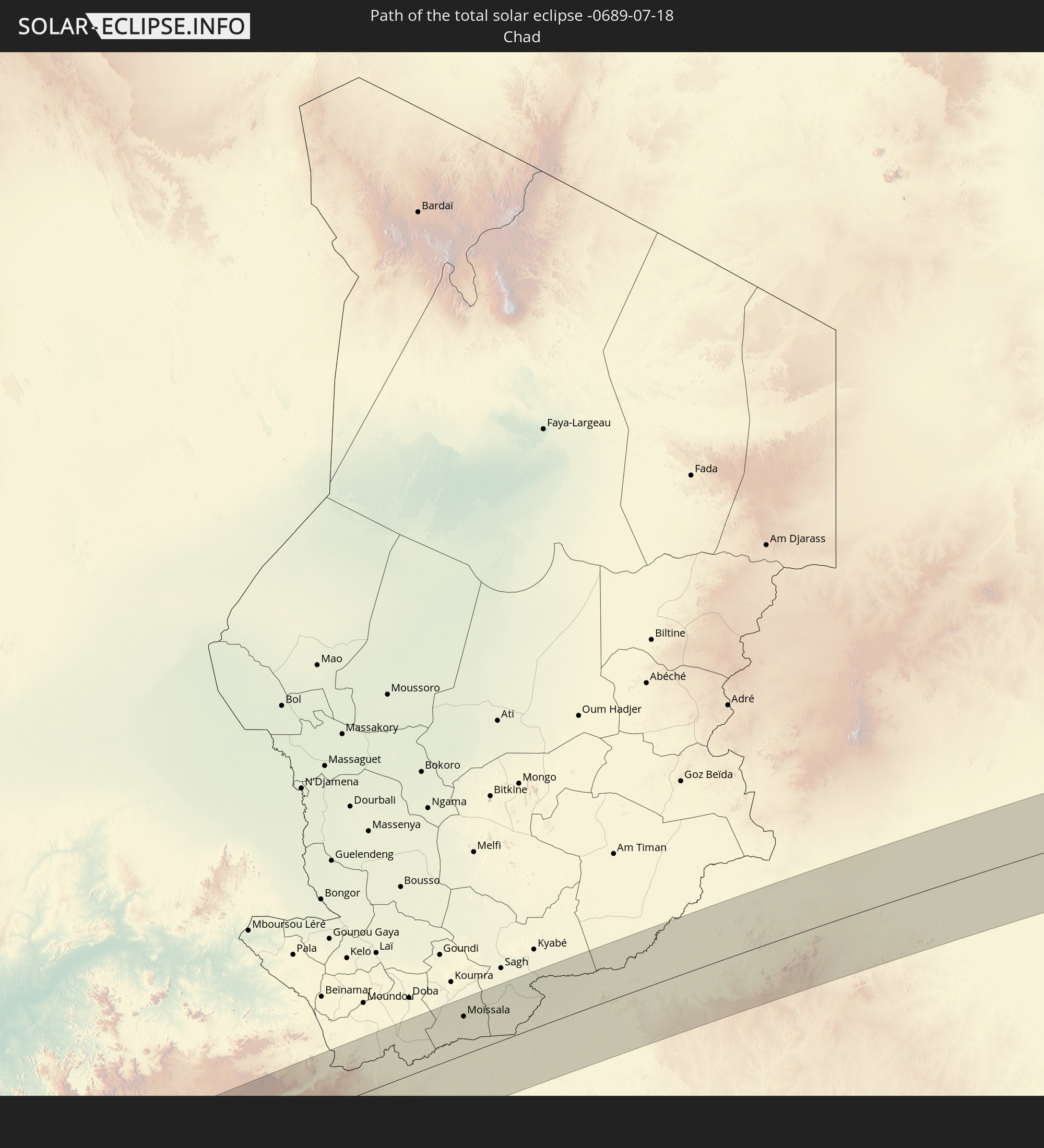 Chad
Chad
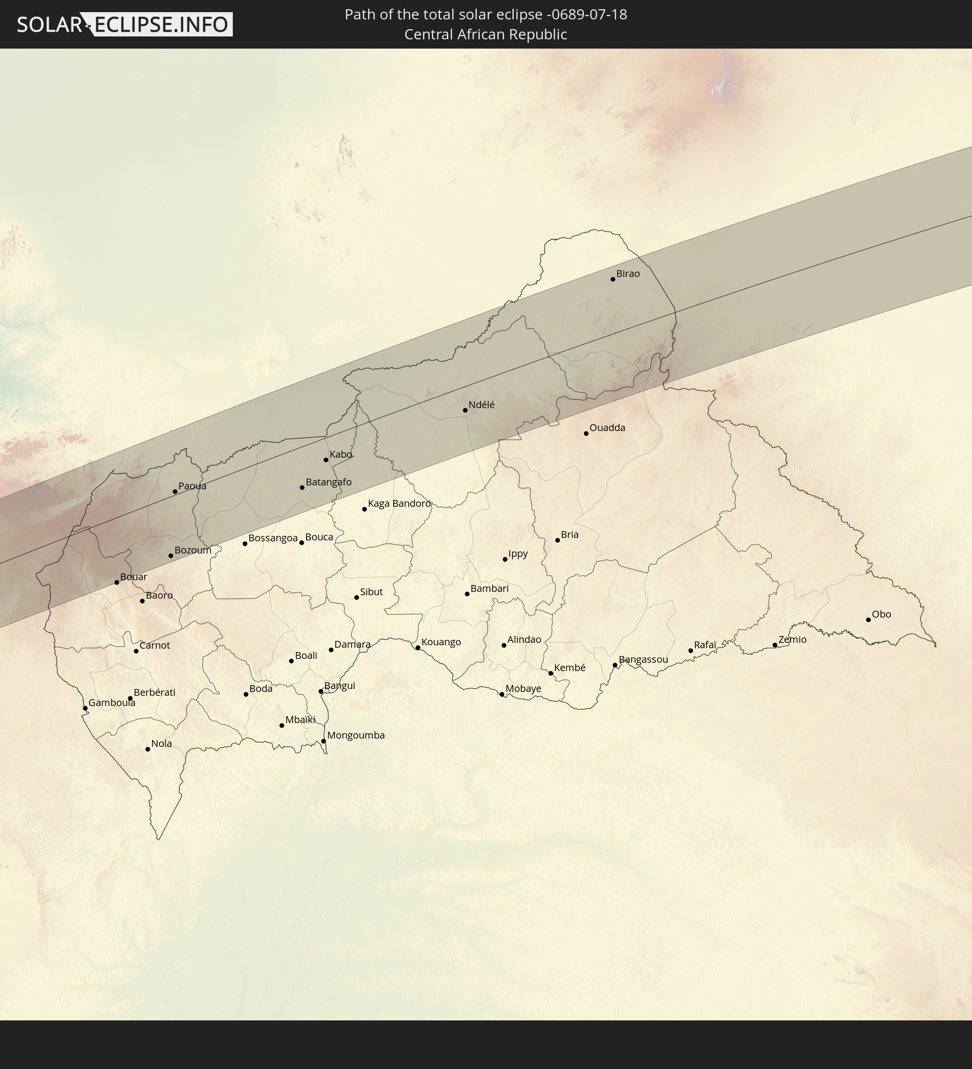 Central African Republic
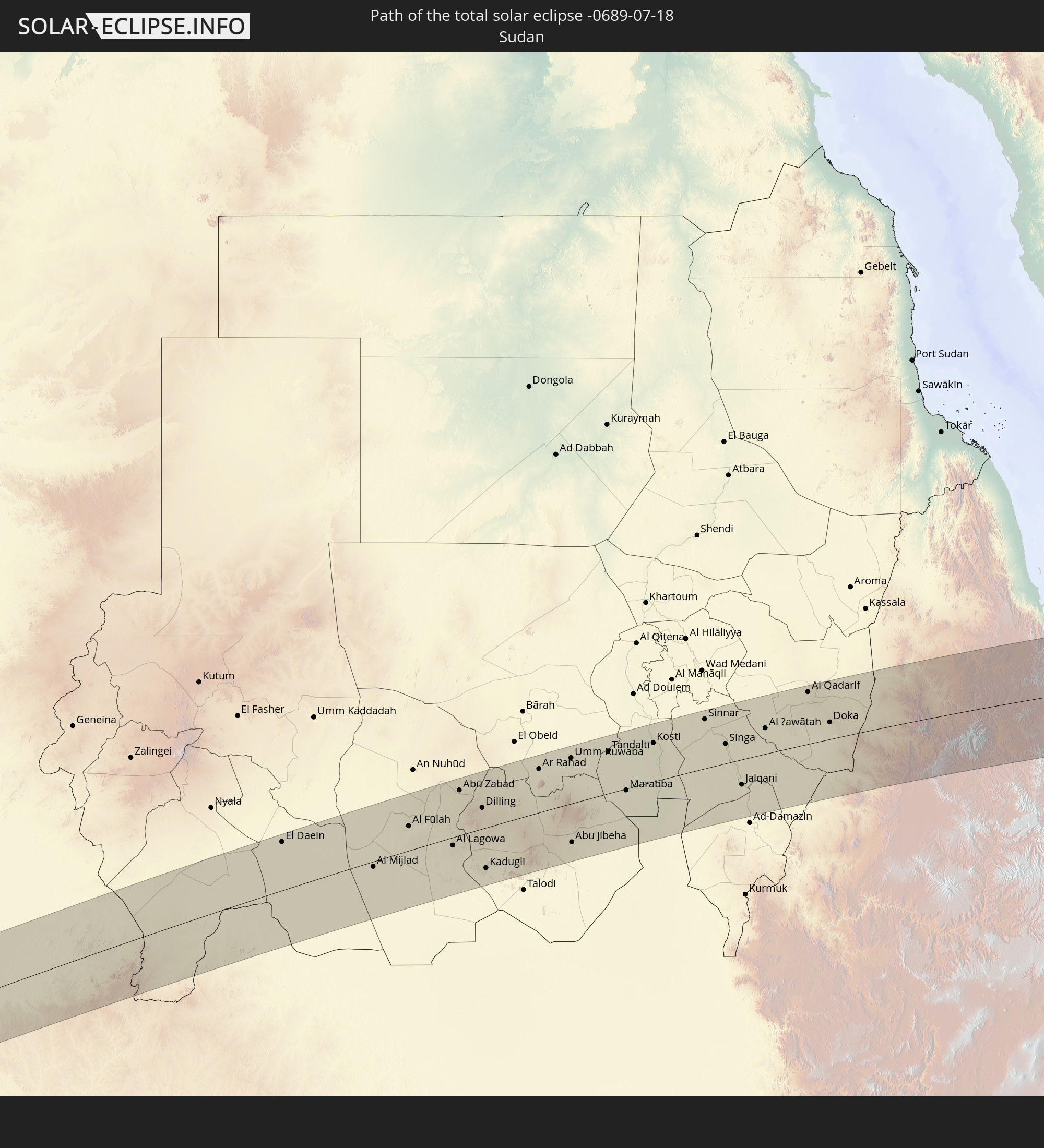 Sudan
Sudan
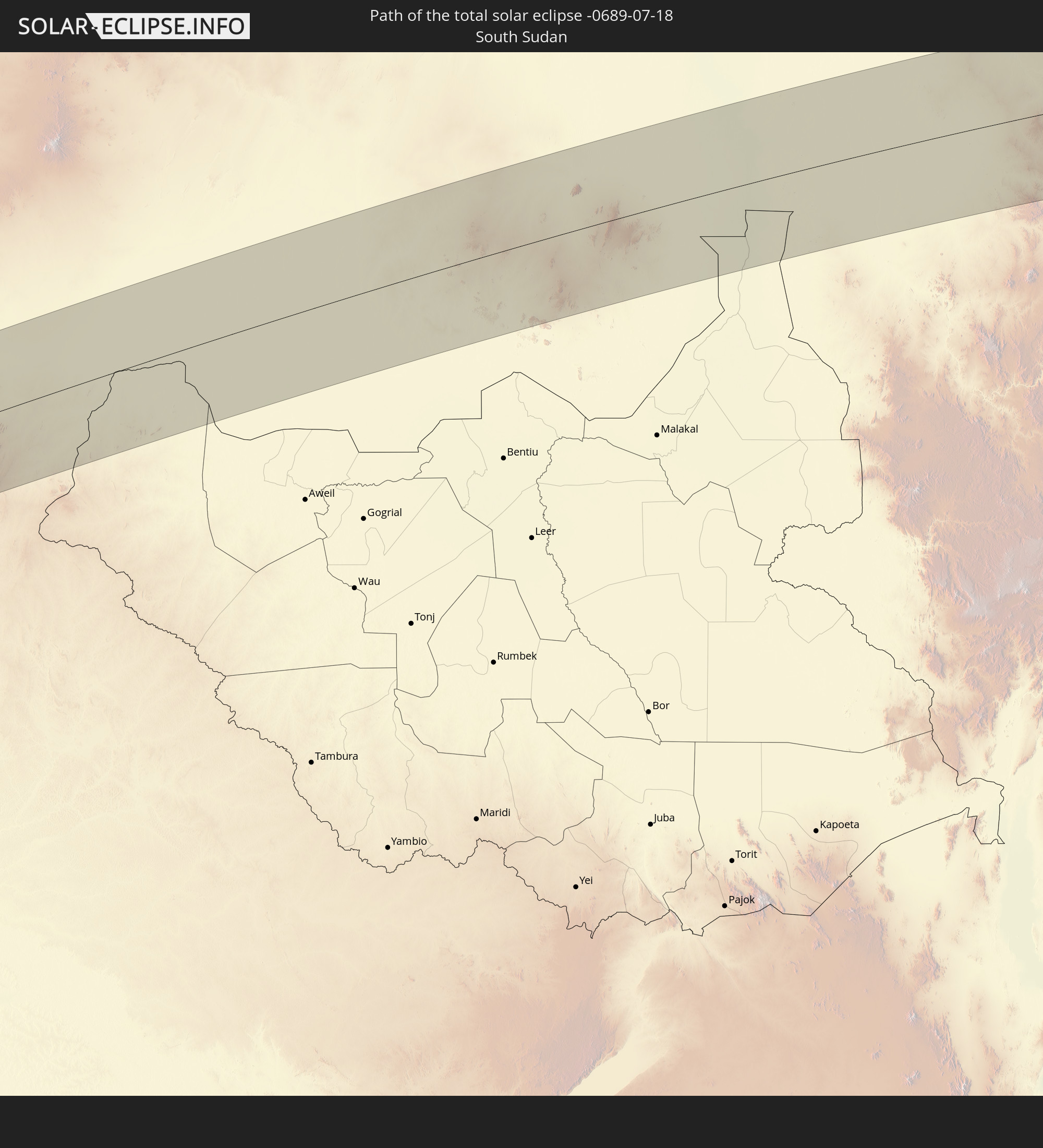 South Sudan
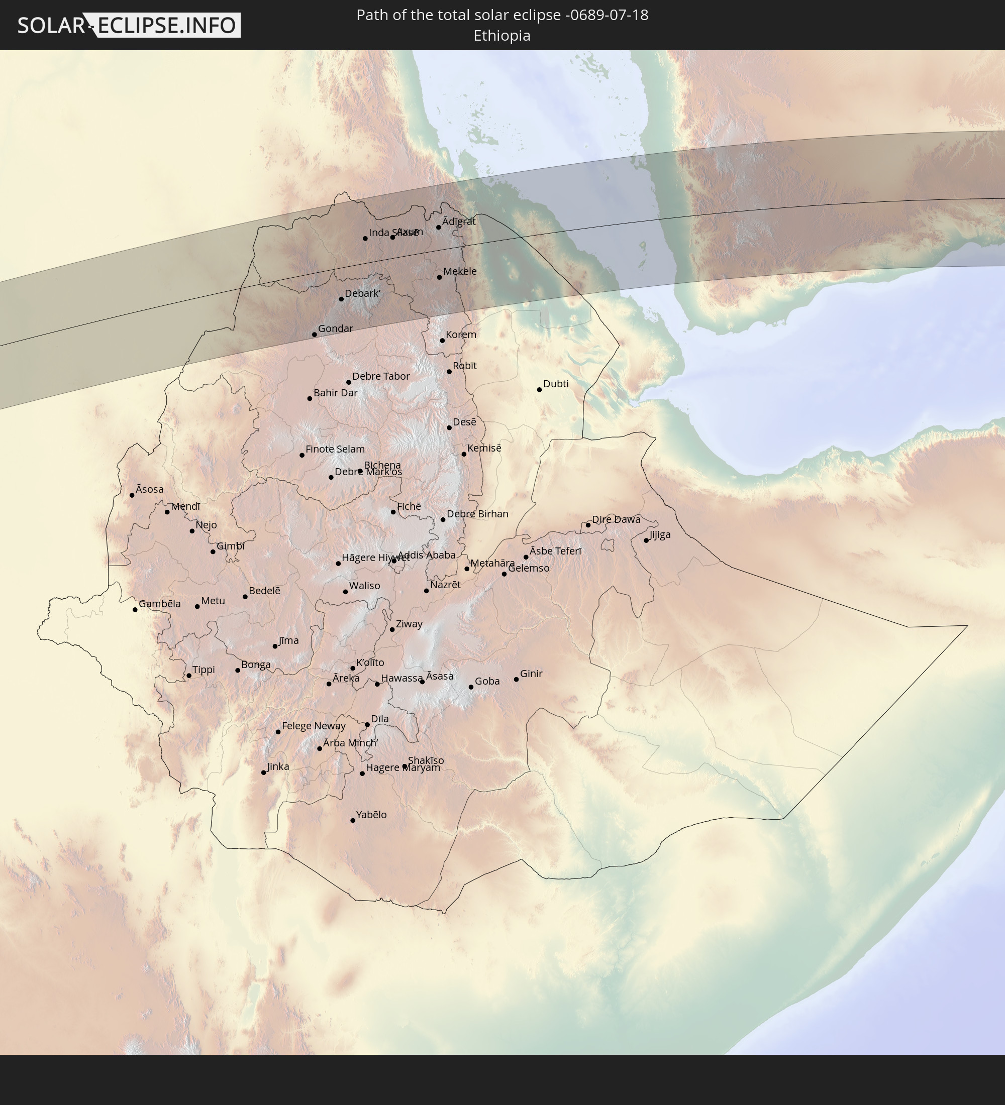 Ethiopia
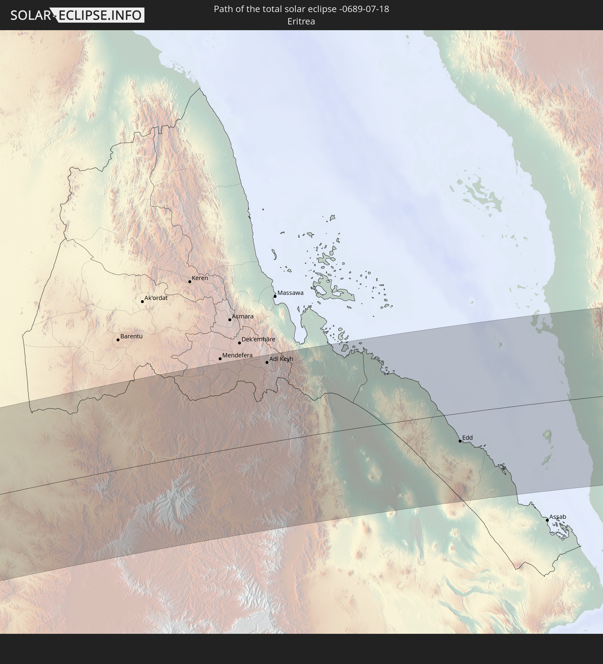 Eritrea
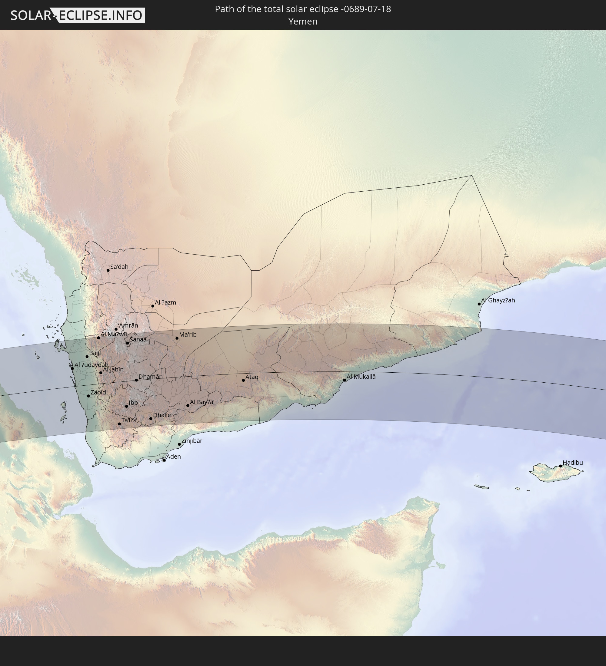 Yemen
Yemen
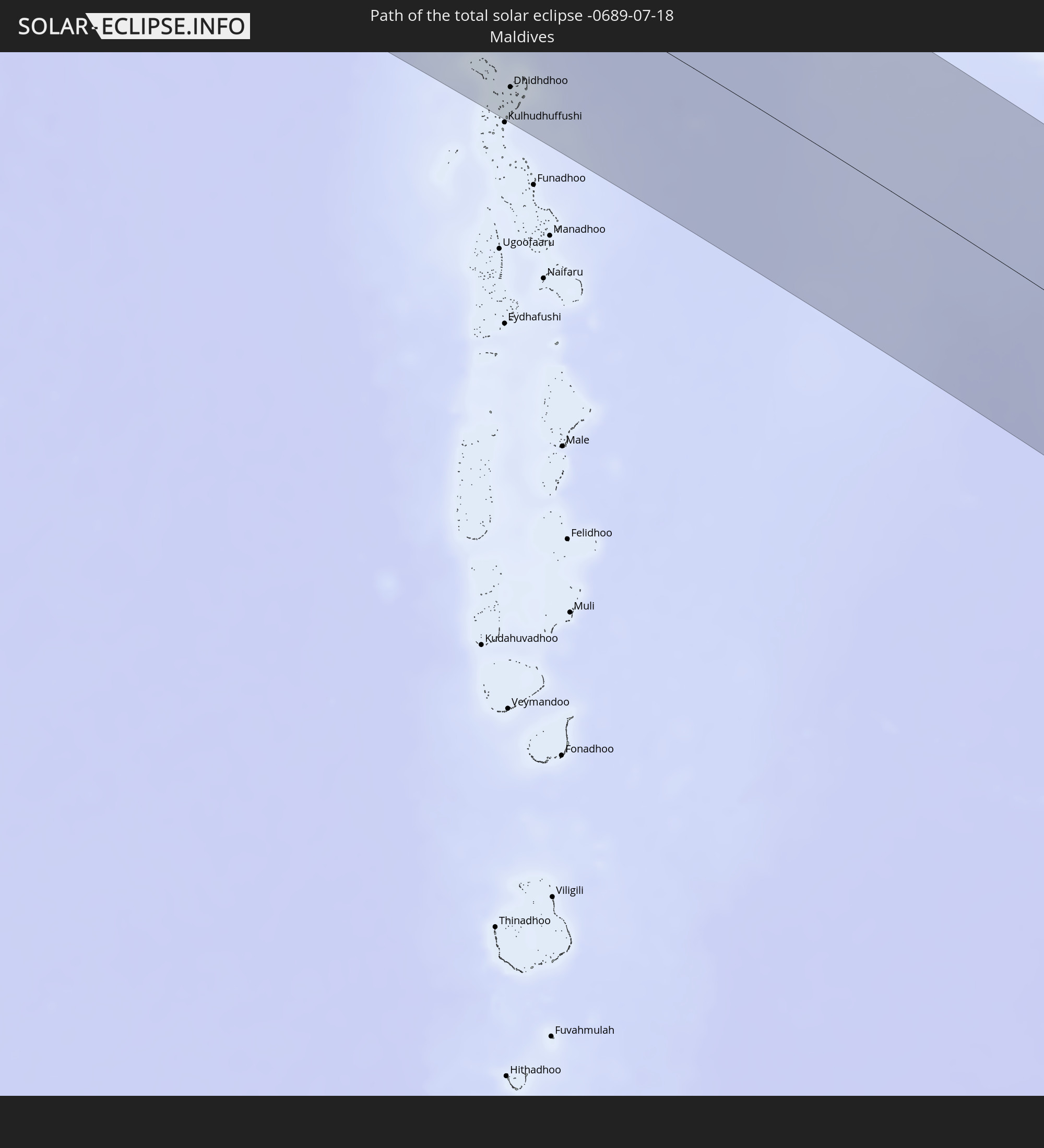 Maldives
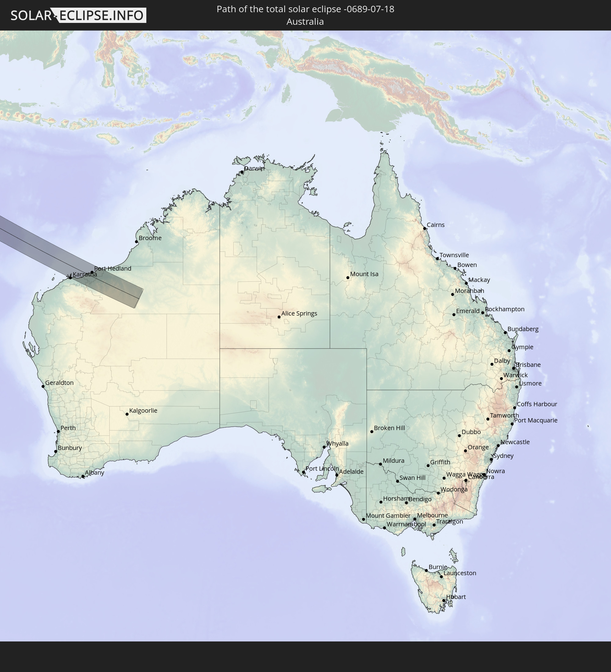 Australia
In den folgenden Ländern ist die Sonnenfinsternis partiell zu sehen
 Russia
 Spain
Spain
 Mauritania
 Morocco
 Mali
Mali
 Algeria
 Burkina Faso
 Ghana
Ghana
 Togo
Togo
 Niger
Niger
 Benin
Benin
 Nigeria
 Equatorial Guinea
 São Tomé and Príncipe
 Italy
Italy
 Tunisia
 Cameroon
 Gabon
Gabon
 Libya
Libya
 Republic of the Congo
 Angola
 Namibia
 Democratic Republic of the Congo
 Chad
Chad
 Malta
Malta
 Central African Republic
 South Africa
 Serbia
 Albania
 Greece
 Botswana
 Republic of Macedonia
 Sudan
Sudan
 Zambia
 Ukraine
 Bulgaria
 Egypt
Egypt
 Zimbabwe
 Turkey
 Rwanda
 Burundi
 Tanzania
 Uganda
 Mozambique
 Cyprus
 Malawi
 Ethiopia
 Kenya
Kenya
 State of Palestine
 Israel
 Saudi Arabia
 Jordan
 Lebanon
 Syria
Syria
 Eritrea
 Iraq
Iraq
 Georgia
 French Southern and Antarctic Lands
 Somalia
 Djibouti
 Yemen
Yemen
 Madagascar
 Comoros
 Armenia
 Iran
Iran
 Azerbaijan
 Mayotte
 Seychelles
 Kazakhstan
 Kuwait
 Bahrain
 Qatar
Qatar
 United Arab Emirates
 Oman
Oman
 Turkmenistan
 Réunion
 Uzbekistan
 Mauritius
 Afghanistan
 Pakistan
 Tajikistan
 India
India
 Kyrgyzstan
 British Indian Ocean Territory
 Maldives
 China
China
 Sri Lanka
 Nepal
Nepal
 Bangladesh
 Bhutan
 Myanmar
 Indonesia
 Cocos Islands
 Thailand
 Malaysia
 Laos
Laos
 Vietnam
 Cambodia
 Singapore
 Christmas Island
 Australia
 Brunei
 Philippines
 East Timor
 Palau
Palau
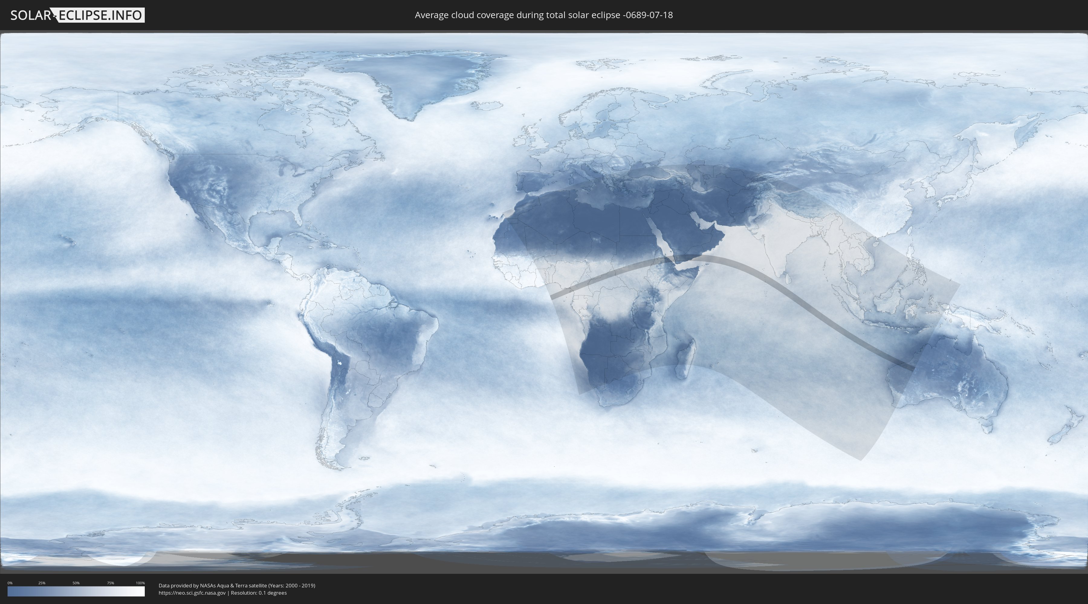
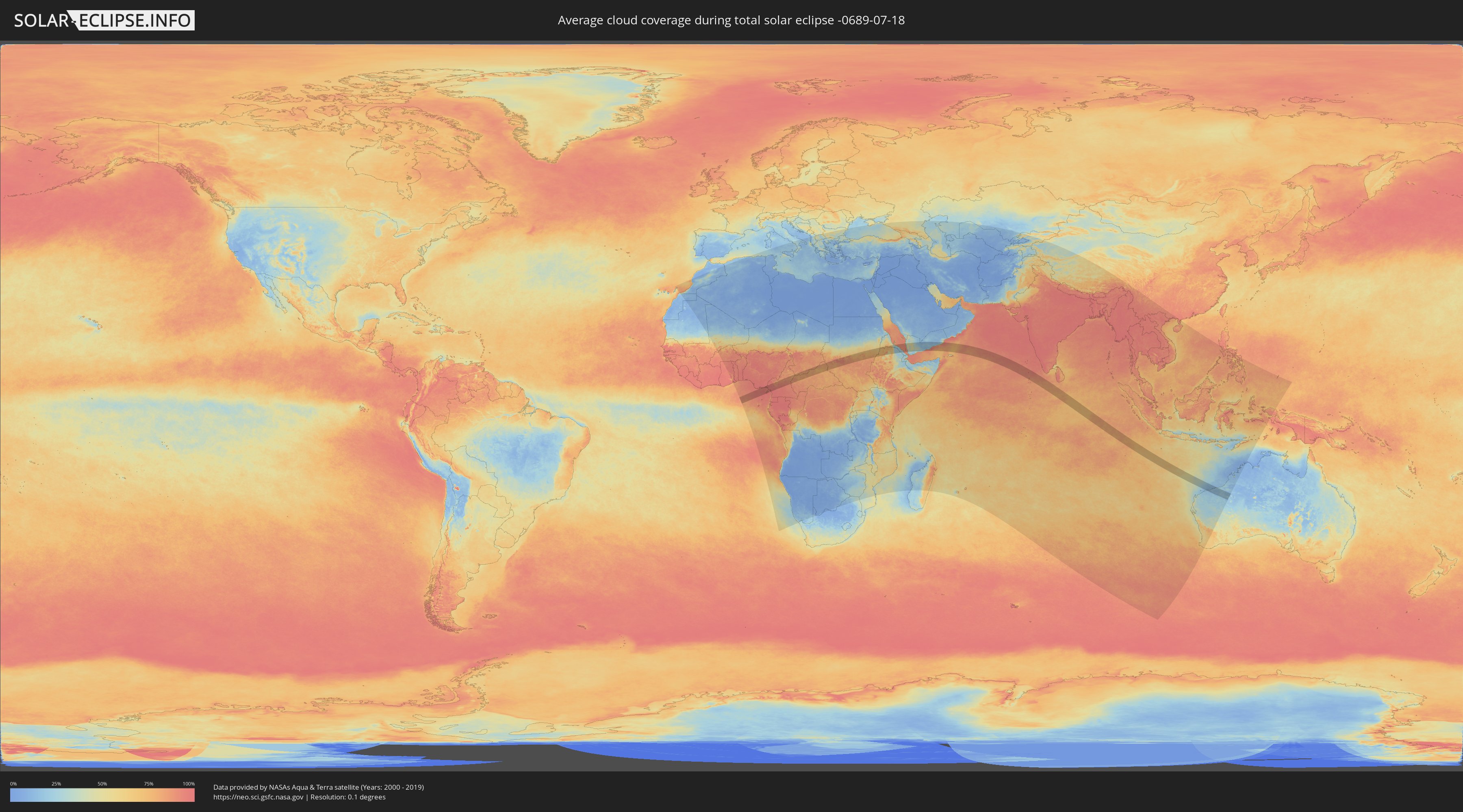
How will be the weather during the total solar eclipse on 07/18/-0689?
Where is the best place to see the total solar eclipse of 07/18/-0689?
The following maps show the average cloud coverage for the day of the total solar eclipse.
With the help of these maps, it is possible to find the place along the eclipse path, which has the best
chance of a cloudless sky.
Nevertheless, you should consider local circumstances and inform about the weather of your chosen
observation site.
The data is provided by NASAs satellites
AQUA and TERRA.
The cloud maps are averaged over a period of 19 years (2000 - 2019).
Detailed country maps
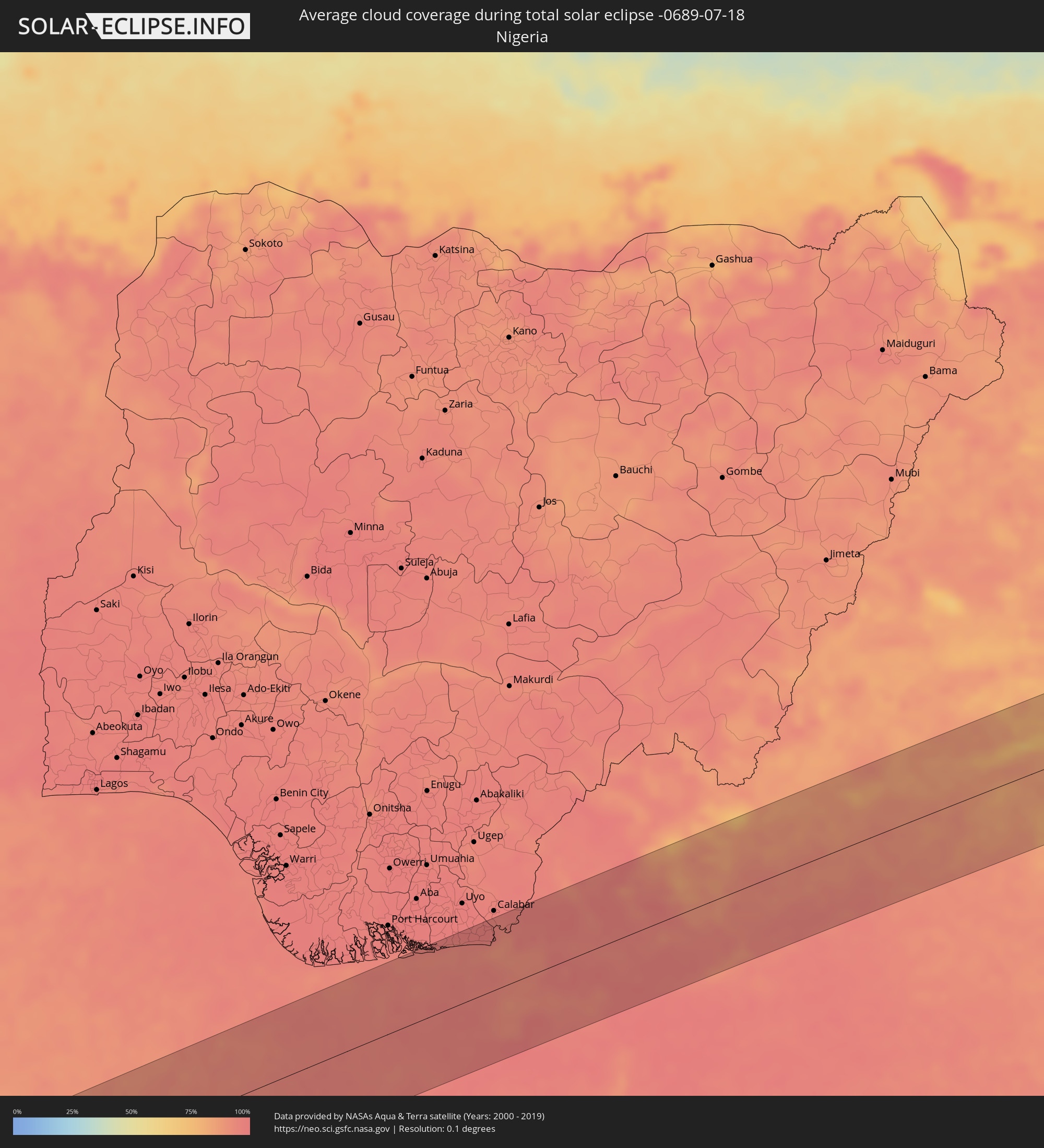 Nigeria
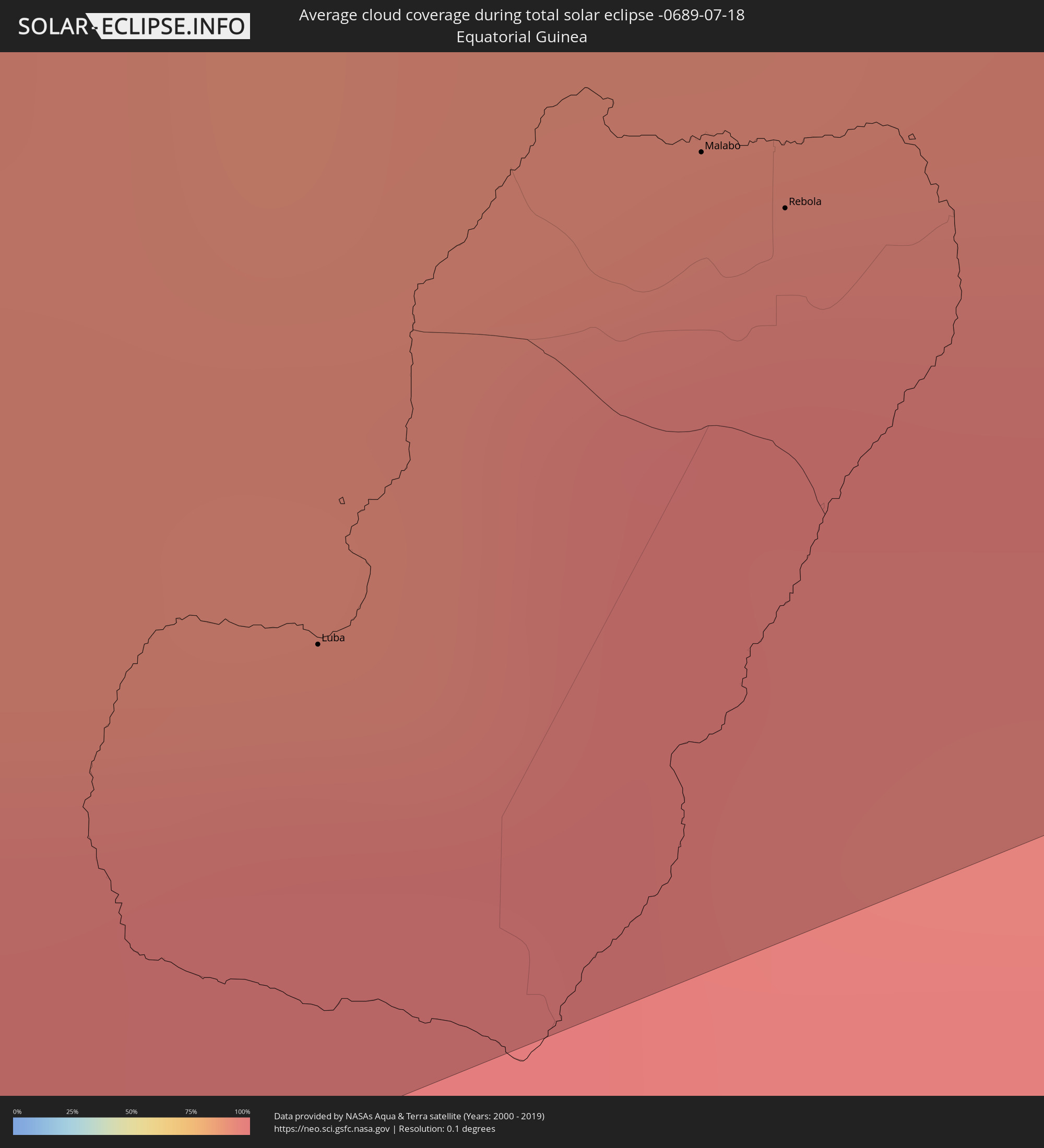 Equatorial Guinea
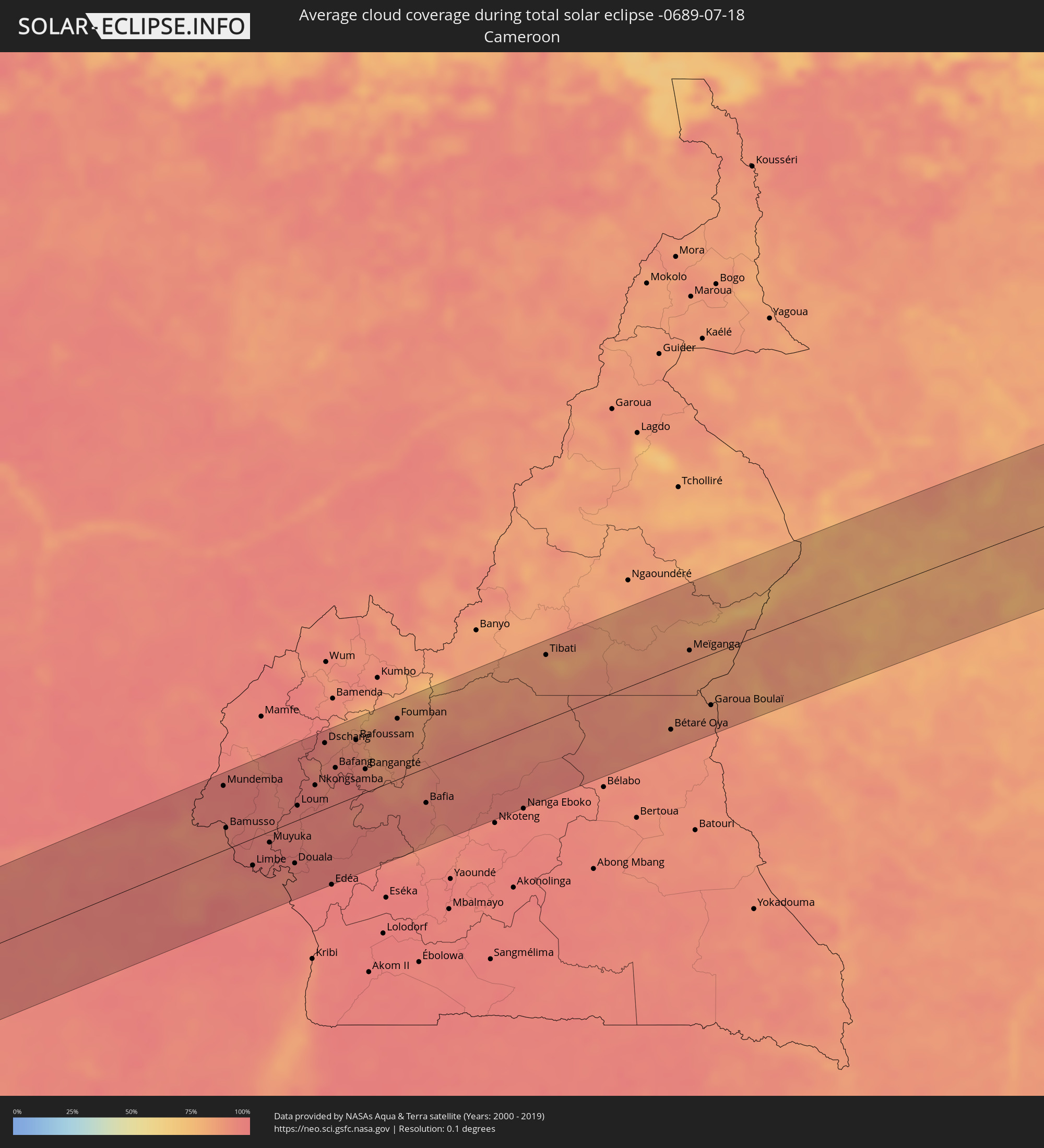 Cameroon
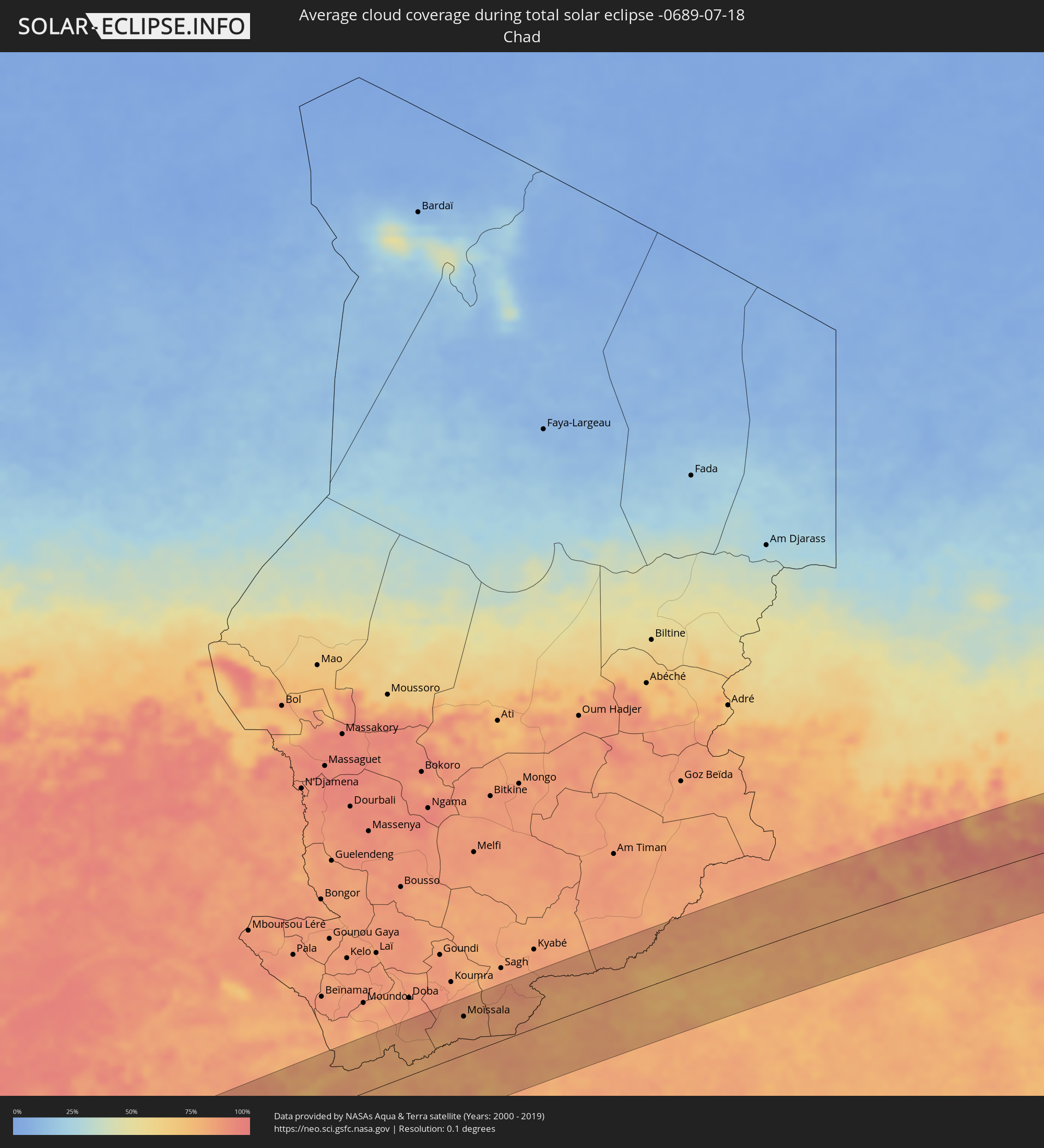 Chad
Chad
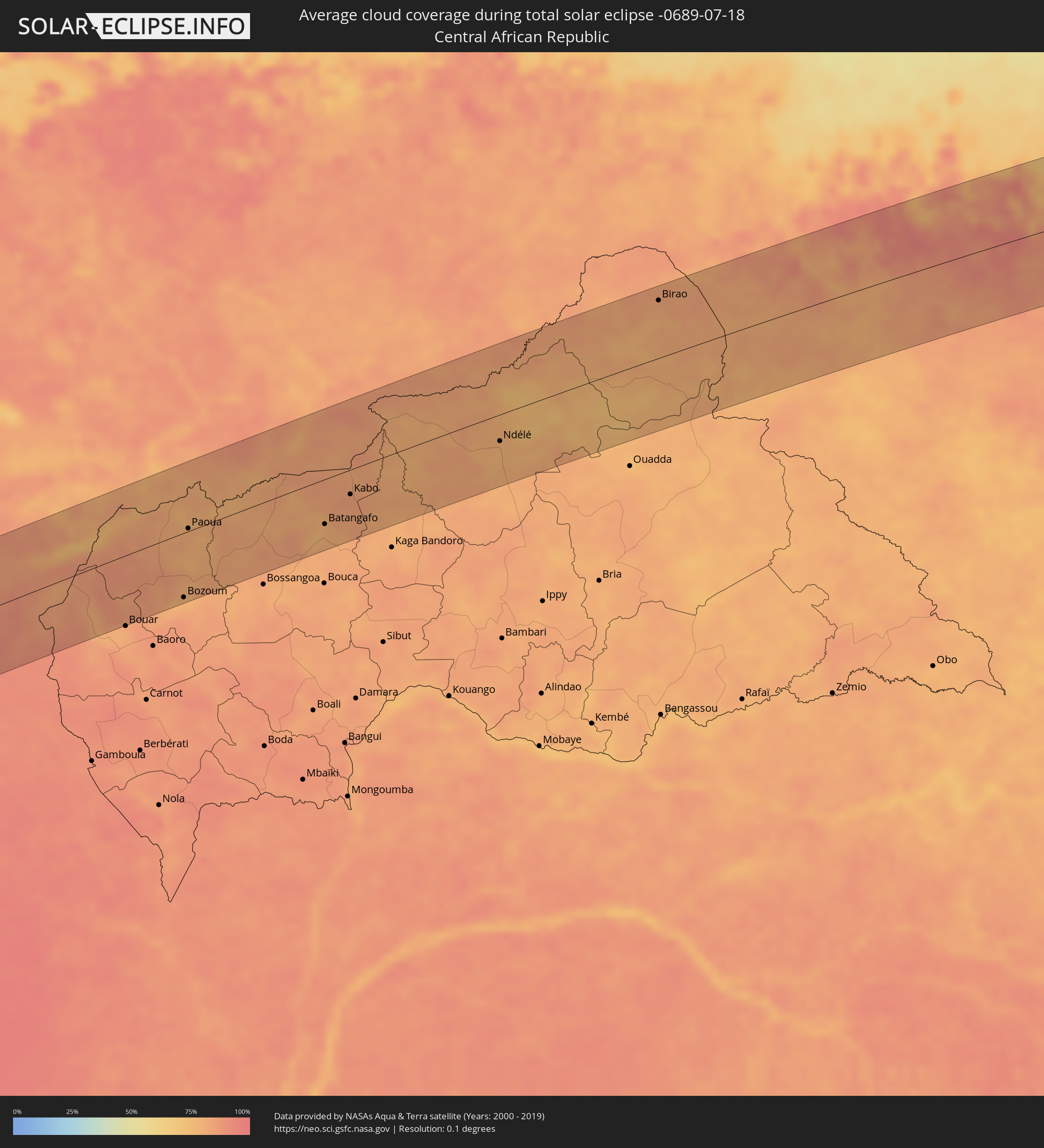 Central African Republic
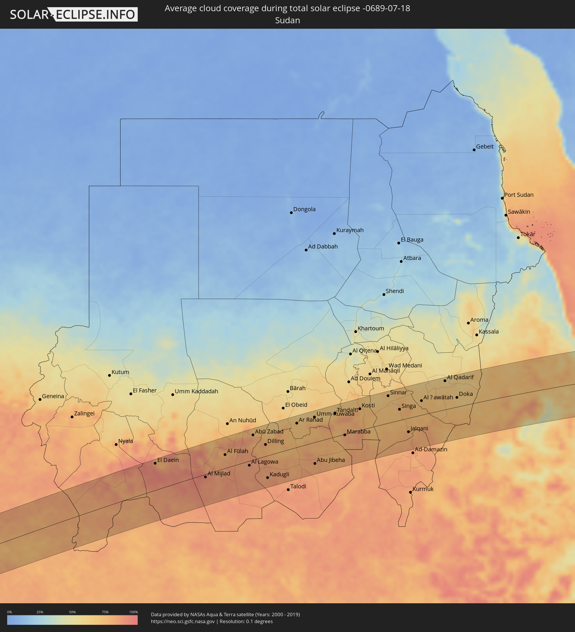 Sudan
Sudan
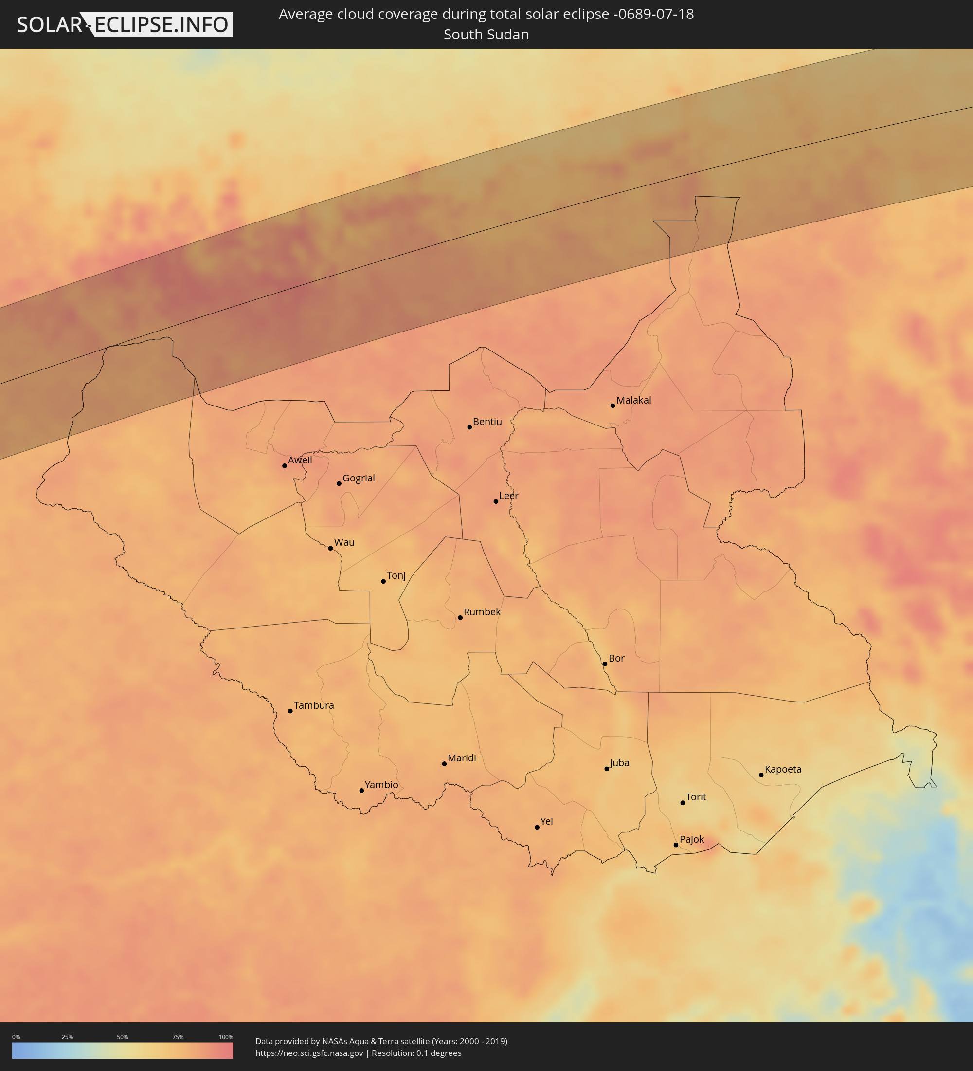 South Sudan
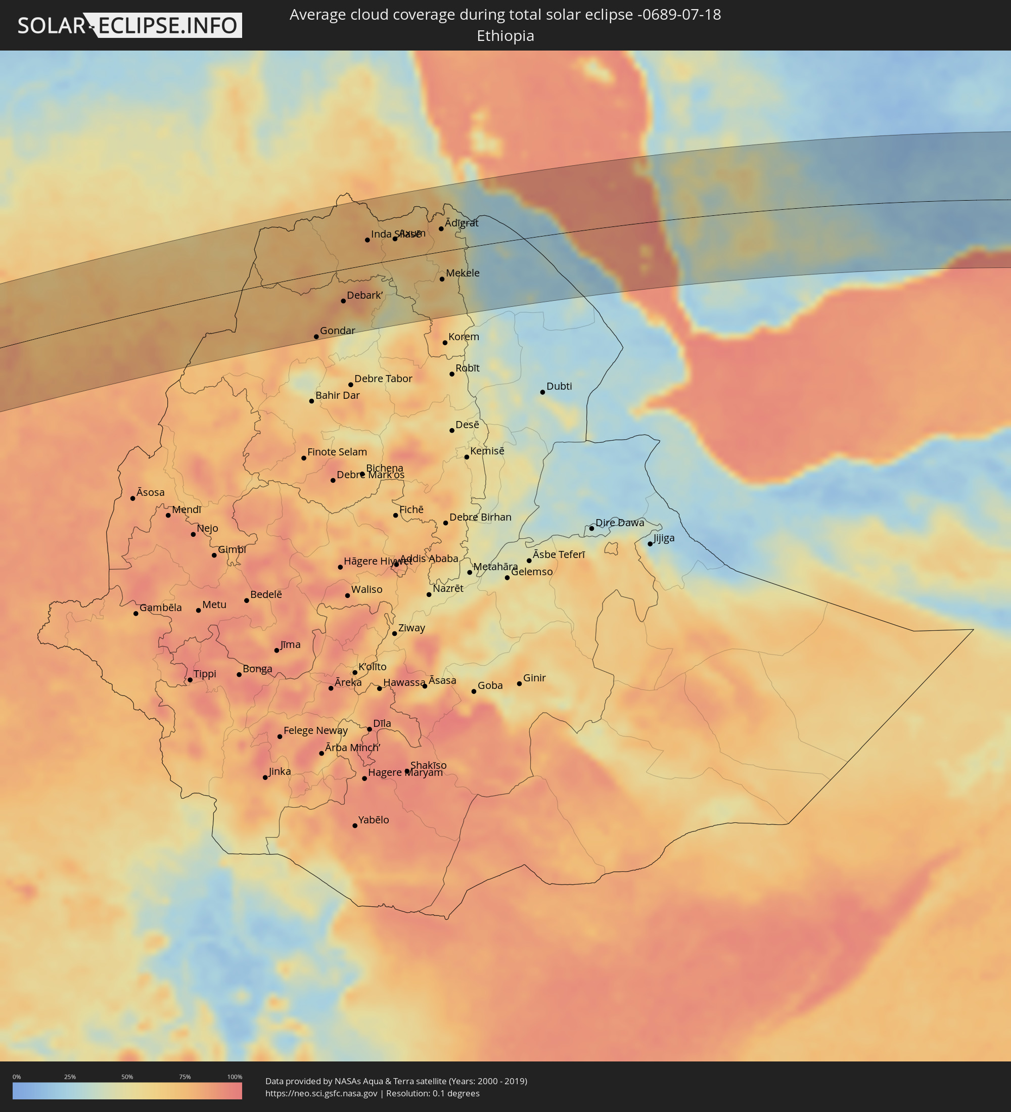 Ethiopia
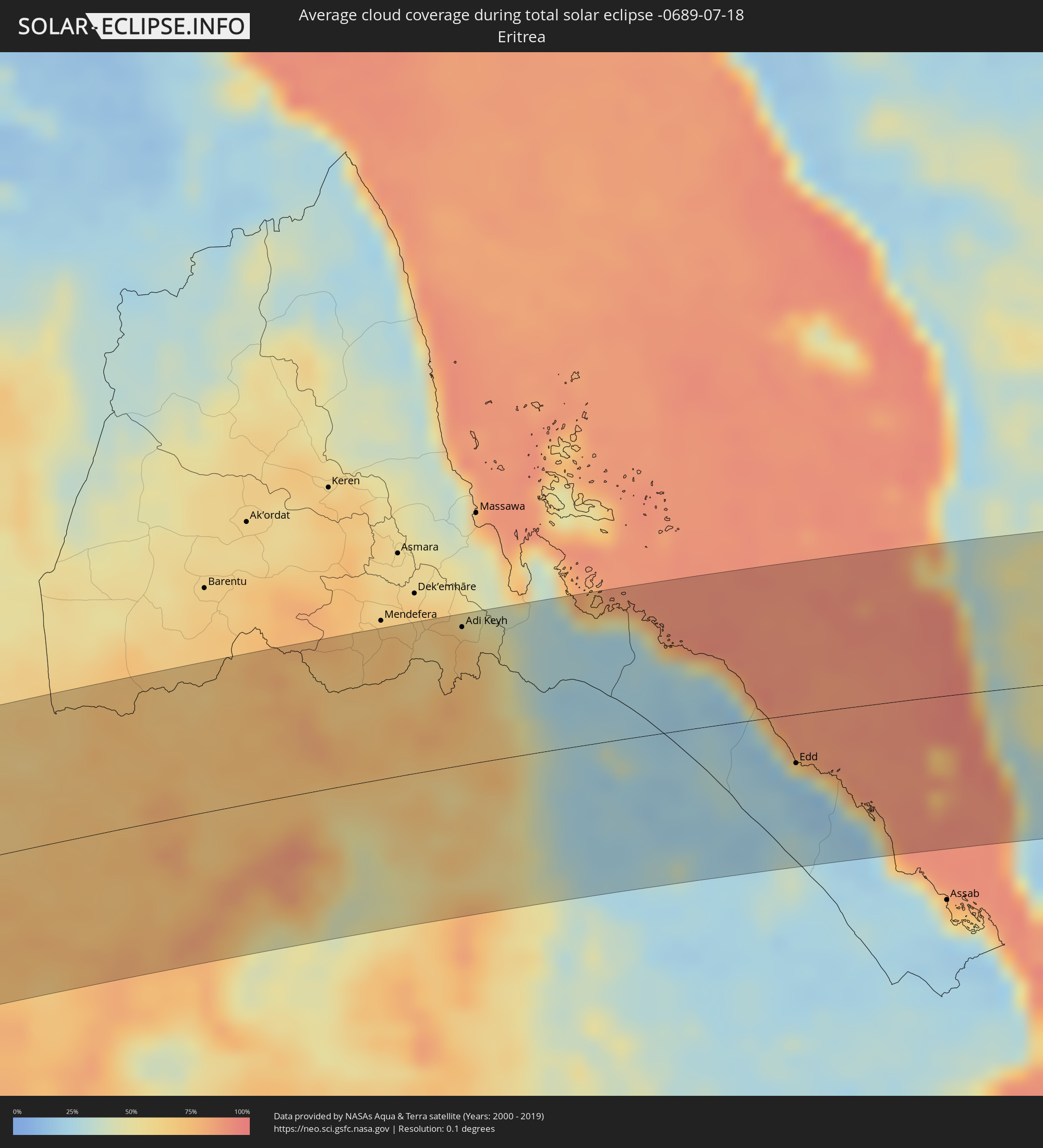 Eritrea
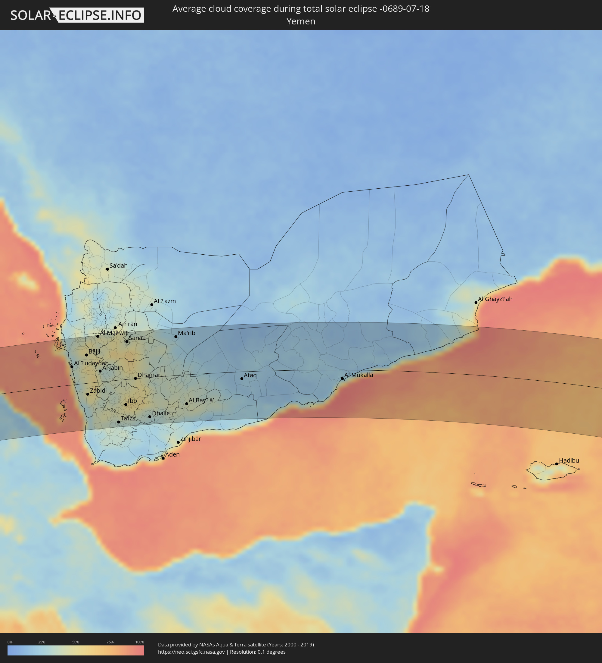 Yemen
Yemen
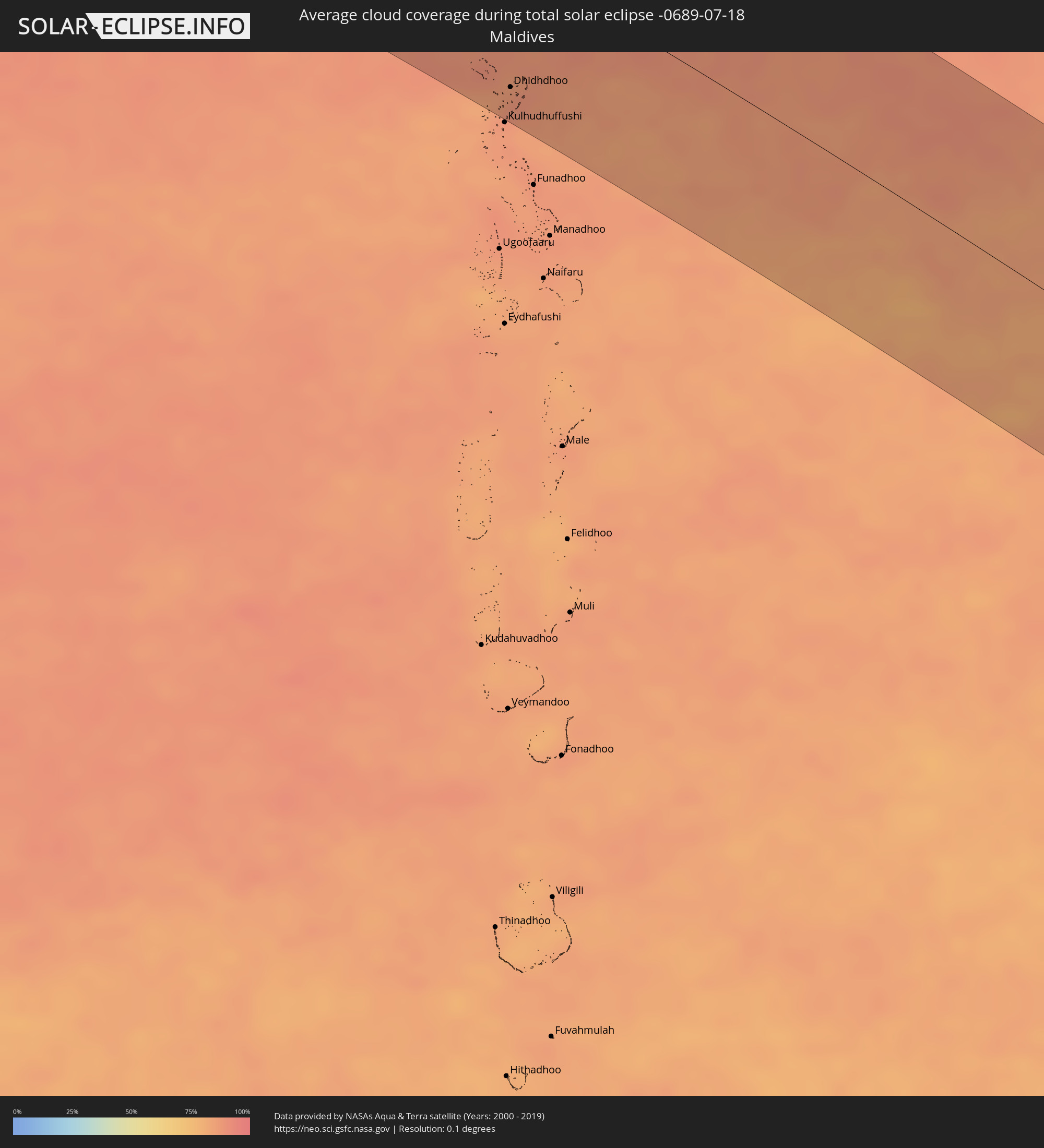 Maldives
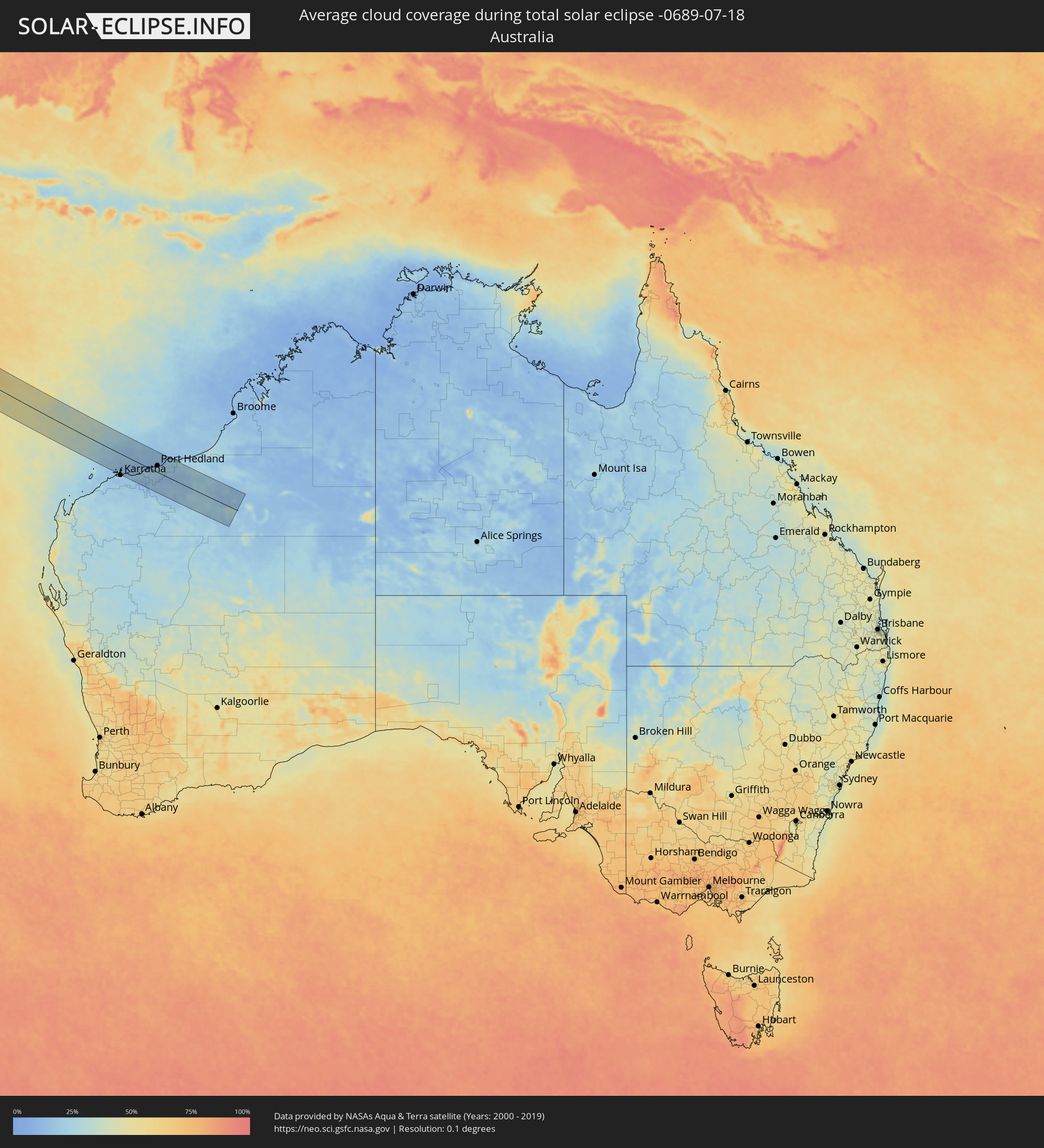 Australia
Cities inside the path of the eclipse
The following table shows all locations with a population of more than 5,000 inside the eclipse path. Cities which have more than 100,000 inhabitants are marked bold. A click at the locations opens a detailed map.
| City | Type | Eclipse duration | Local time of max. eclipse | Distance to central line | Ø Cloud coverage |
|
Eket, Akwa Ibom
|
total | - | 06:03:11 UTC+00:13 | 86 km | 94% |
|
Esuk Oron, Akwa Ibom
|
total | - | 06:03:16 UTC+00:13 | 88 km | 96% |
|
Ikang, Cross River
|
total | - | 06:03:19 UTC+00:13 | 75 km | 95% |
|
Luba, Bioko Sur
|
total | - | 06:03:16 UTC+00:13 | 63 km | 94% |
|
Malabo, Bioko Norte
|
total | - | 06:03:20 UTC+00:13 | 43 km | 94% |
|
Rebola, Bioko Norte
|
total | - | 06:03:21 UTC+00:13 | 48 km | 97% |
|
Limbe, South-West
|
total | - | 06:03:27 UTC+00:13 | 32 km | 94% |
|
Tiko, South-West
|
total | - | 06:03:30 UTC+00:13 | 33 km | 96% |
|
Kumba, South-West
|
total | - | 06:03:33 UTC+00:13 | 21 km | 94% |
|
Mbanga, Littoral
|
total | - | 06:03:34 UTC+00:13 | 2 km | 94% |
|
Douala, Littoral
|
total | - | 06:03:35 UTC+00:13 | 51 km | 94% |
|
Loum, Littoral
|
total | - | 06:03:38 UTC+00:13 | 17 km | 95% |
|
Manjo, Littoral
|
total | - | 06:03:40 UTC+00:13 | 26 km | 96% |
|
Fontem, South-West
|
total | - | 06:03:44 UTC+00:13 | 88 km | 97% |
|
Nkongsamba, Littoral
|
total | - | 06:03:42 UTC+00:13 | 33 km | 96% |
|
Dschang, West
|
total | - | 06:03:47 UTC+00:13 | 79 km | 94% |
|
Bafang, West
|
total | - | 06:03:47 UTC+00:13 | 44 km | 95% |
|
Mbouda, West
|
total | - | 06:03:51 UTC+00:13 | 89 km | 87% |
|
Bafoussam, West
|
total | - | 06:03:53 UTC+00:13 | 67 km | 90% |
|
Bangangté, West
|
total | - | 06:03:54 UTC+00:13 | 28 km | 94% |
|
Foumbot, West
|
total | - | 06:03:58 UTC+00:13 | 61 km | 84% |
|
Foumban, West
|
total | - | 06:04:04 UTC+00:13 | 73 km | 87% |
|
Bafia, Centre
|
total | - | 06:04:06 UTC+00:13 | 42 km | 92% |
|
Meïganga, Adamaoua
|
total | - | 06:05:31 UTC+00:13 | 14 km | 87% |
|
Garoua Boulaï, East
|
total | - | 06:05:34 UTC+00:13 | 61 km | 86% |
|
Bozoum, Ouham-Pendé
|
total | - | 06:06:34 UTC+00:13 | 90 km | 78% |
|
Paoua, Ouham-Pendé
|
total | - | 06:06:43 UTC+00:13 | 4 km | 80% |
|
Béboto, Logone Oriental
|
total | - | 06:53:46 UTC+01:00 | 91 km | 85% |
|
Moïssala, Mandoul
|
total | - | 06:54:17 UTC+01:00 | 66 km | 81% |
|
Batangafo, Ouham
|
total | - | 06:07:51 UTC+00:13 | 63 km | 79% |
|
Kabo, Ouham
|
total | - | 06:08:08 UTC+00:13 | 34 km | 85% |
|
Ndélé, Bamingui-Bangoran
|
total | - | 06:09:43 UTC+00:13 | 37 km | 78% |
|
Birao, Vakaga
|
total | - | 06:11:49 UTC+00:13 | 81 km | 81% |
|
El Daein, Eastern Darfur
|
total | - | 08:11:52 UTC+02:10 | 89 km | 90% |
|
Al Mijlad, West Kordofan State
|
total | - | 08:13:34 UTC+02:10 | 10 km | 88% |
|
Abū Zabad, West Kordofan State
|
total | - | 08:15:40 UTC+02:10 | 83 km | 81% |
|
Dilling, Southern Kordofan
|
total | - | 08:16:07 UTC+02:10 | 38 km | 76% |
|
Kadugli, Southern Kordofan
|
total | - | 08:16:01 UTC+02:10 | 75 km | 85% |
|
Ar Rahad, North Kordofan
|
total | - | 08:17:33 UTC+02:10 | 80 km | 70% |
|
Umm Ruwaba, North Kordofan
|
total | - | 08:18:21 UTC+02:10 | 84 km | 67% |
|
Abu Jibeha, Southern Kordofan
|
total | - | 08:18:06 UTC+02:10 | 72 km | 81% |
|
Tandaltī, White Nile
|
total | - | 08:19:16 UTC+02:10 | 77 km | 74% |
|
Marabba, White Nile
|
total | - | 08:19:36 UTC+02:10 | 3 km | 80% |
|
Kosti, White Nile
|
total | - | 08:20:26 UTC+02:10 | 71 km | 73% |
|
Sinnar, Sinnār
|
total | - | 08:21:51 UTC+02:10 | 91 km | 68% |
|
Maiurno, Sinnār
|
total | - | 08:21:59 UTC+02:10 | 72 km | 71% |
|
As Sūkī, Sinnār
|
total | - | 08:22:18 UTC+02:10 | 56 km | 72% |
|
Singa, Sinnār
|
total | - | 08:22:20 UTC+02:10 | 36 km | 74% |
|
Ad Dindar, Sinnār
|
total | - | 08:22:43 UTC+02:10 | 36 km | 77% |
|
Al Ḩawātah, Al Qaḑārif
|
total | - | 08:23:29 UTC+02:10 | 48 km | 70% |
|
Al Qadarif, Al Qaḑārif
|
total | - | 08:24:47 UTC+02:10 | 96 km | 64% |
|
Doka, Al Qaḑārif
|
total | - | 08:25:20 UTC+02:10 | 31 km | 66% |
|
Gondar, Amhara
|
total | - | 08:45:19 UTC+02:27 | 107 km | 77% |
|
Dabat, Amhara
|
total | - | 08:45:53 UTC+02:27 | 71 km | 76% |
|
Debark’, Amhara
|
total | - | 08:46:09 UTC+02:27 | 55 km | 81% |
|
Inda Silasē, Tigray
|
total | - | 08:46:56 UTC+02:27 | 41 km | 78% |
|
Axum, Tigray
|
total | - | 08:47:44 UTC+02:27 | 34 km | 73% |
|
Adi Keyh, Debub
|
total | - | 08:49:01 UTC+02:27 | 102 km | 73% |
|
Ādīgrat, Tigray
|
total | - | 08:49:08 UTC+02:27 | 38 km | 70% |
|
Mekele, Tigray
|
total | - | 08:49:07 UTC+02:27 | 48 km | 66% |
|
Edd, Southern Red Sea
|
total | - | 08:53:33 UTC+02:27 | 36 km | 21% |
|
Al Ḩudaydah, Muḩāfaz̧at al Ḩudaydah
|
total | - | 09:35:47 UTC+03:06 | 43 km | 38% |
|
Bājil, Muḩāfaz̧at al Ḩudaydah
|
total | - | 09:36:29 UTC+03:06 | 68 km | 46% |
|
Zabīd, Muḩāfaz̧at al Ḩudaydah
|
total | - | 09:36:35 UTC+03:06 | 28 km | 38% |
|
Bayt al Faqīh, Muḩāfaz̧at al Ḩudaydah
|
total | - | 09:36:35 UTC+03:06 | 8 km | 43% |
|
Al Maḩwīt, Al Maḩwīt
|
total | - | 09:37:02 UTC+03:06 | 111 km | 45% |
|
Ta‘izz, Ta‘izz
|
total | - | 09:38:11 UTC+03:06 | 104 km | 34% |
|
Dhī as Sufāl, Ibb
|
total | - | 09:38:22 UTC+03:06 | 76 km | 41% |
|
Ibb, Ibb
|
total | - | 09:38:31 UTC+03:06 | 62 km | 48% |
|
Sanaa, Sanaa
|
total | - | 09:38:28 UTC+03:06 | 91 km | 47% |
|
Saḩar, Sanaa
|
total | - | 09:38:42 UTC+03:06 | 86 km | 59% |
|
Sayyān, Sanaa
|
total | - | 09:38:44 UTC+03:06 | 70 km | 58% |
|
Yarīm, Ibb
|
total | - | 09:38:55 UTC+03:06 | 28 km | 50% |
|
Dhamār, Dhamār
|
total | - | 09:38:58 UTC+03:06 | 1 km | 46% |
|
Dhalie, Aḑ Ḑāli‘
|
total | - | 09:39:47 UTC+03:06 | 98 km | 28% |
|
Ma'rib, Ma’rib
|
total | - | 09:40:57 UTC+03:06 | 94 km | 30% |
|
Al Bayḑā’, Al Bayḑāʼ
|
total | - | 09:41:41 UTC+03:06 | 72 km | 39% |
|
Jawf al Maqbābah, Abyan
|
total | - | 09:42:19 UTC+03:06 | 90 km | 26% |
|
Ataq, Shabwah
|
total | - | 09:44:34 UTC+03:06 | 18 km | 18% |
|
Al Mukallā, Muḩāfaz̧at Ḩaḑramawt
|
total | - | 09:50:11 UTC+03:06 | 22 km | 84% |
|
Dhidhdhoo, Haa Alifu Atholhu
|
total | - | 12:52:02 UTC+04:54 | 93 km | 86% |
|
Port Hedland, Western Australia
|
total | - | 17:10:40 UTC+08:00 | 29 km | 24% |