Total solar eclipse of 03/12/-0859
| Day of week: | Tuesday |
| Maximum duration of eclipse: | 03m52s |
| Maximum width of eclipse path: | 156 km |
| Saros cycle: | 45 |
| Coverage: | 100% |
| Magnitude: | 1.0447 |
| Gamma: | 0.3192 |
Wo kann man die Sonnenfinsternis vom 03/12/-0859 sehen?
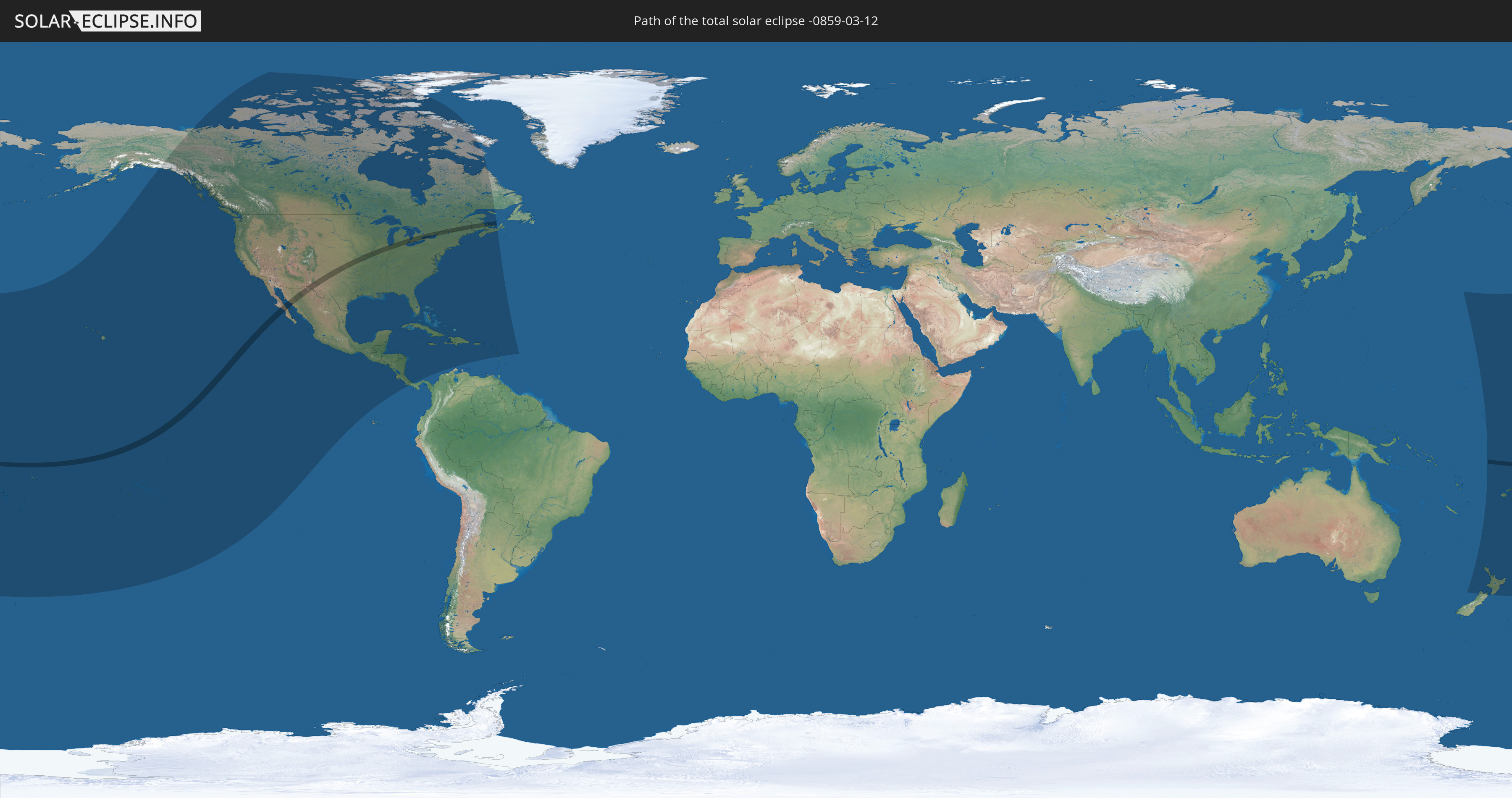
Die Sonnenfinsternis am 03/12/-0859 kann man in 45 Ländern als partielle Sonnenfinsternis beobachten.
Der Finsternispfad verläuft durch 6 Länder. Nur in diesen Ländern ist sie als total Sonnenfinsternis zu sehen.
In den folgenden Ländern ist die Sonnenfinsternis total zu sehen
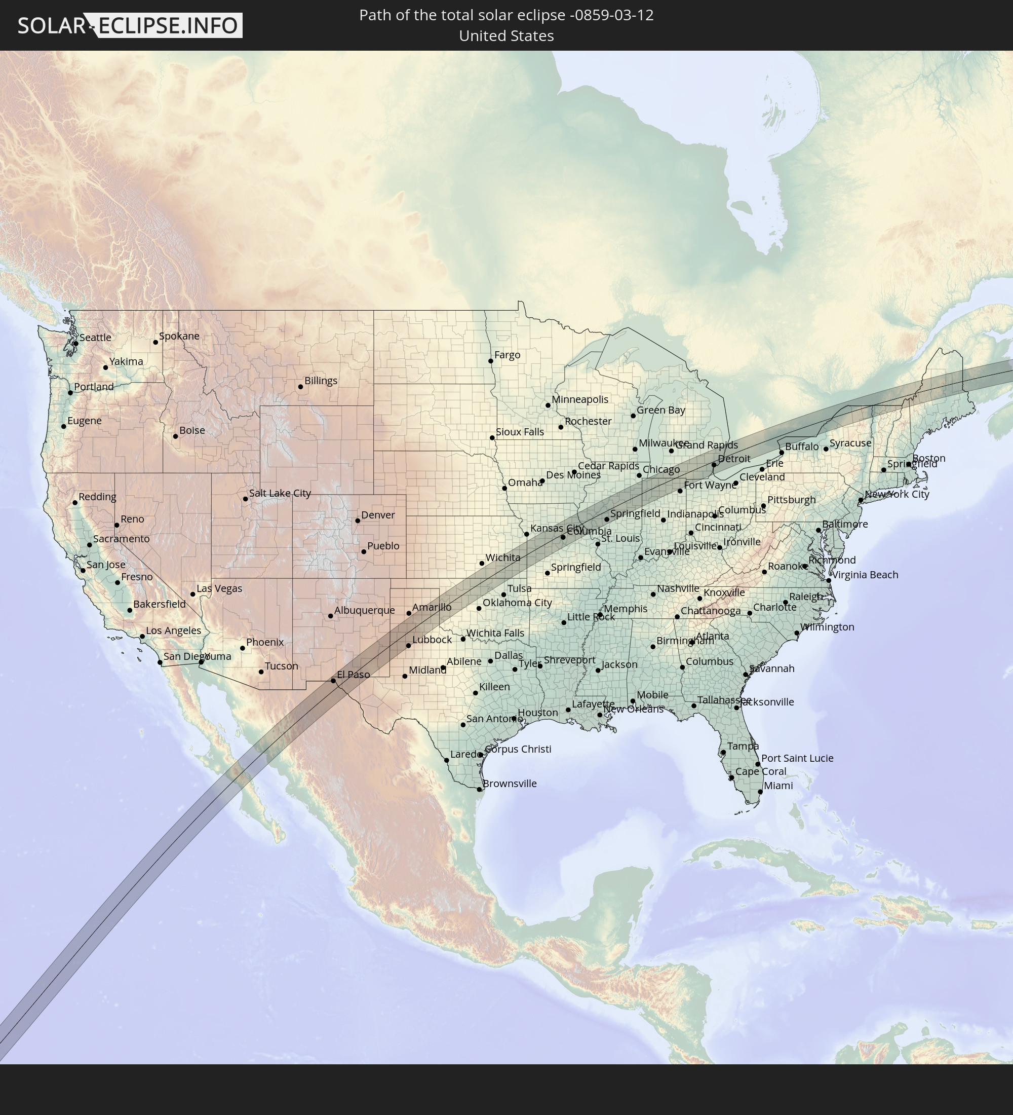 United States
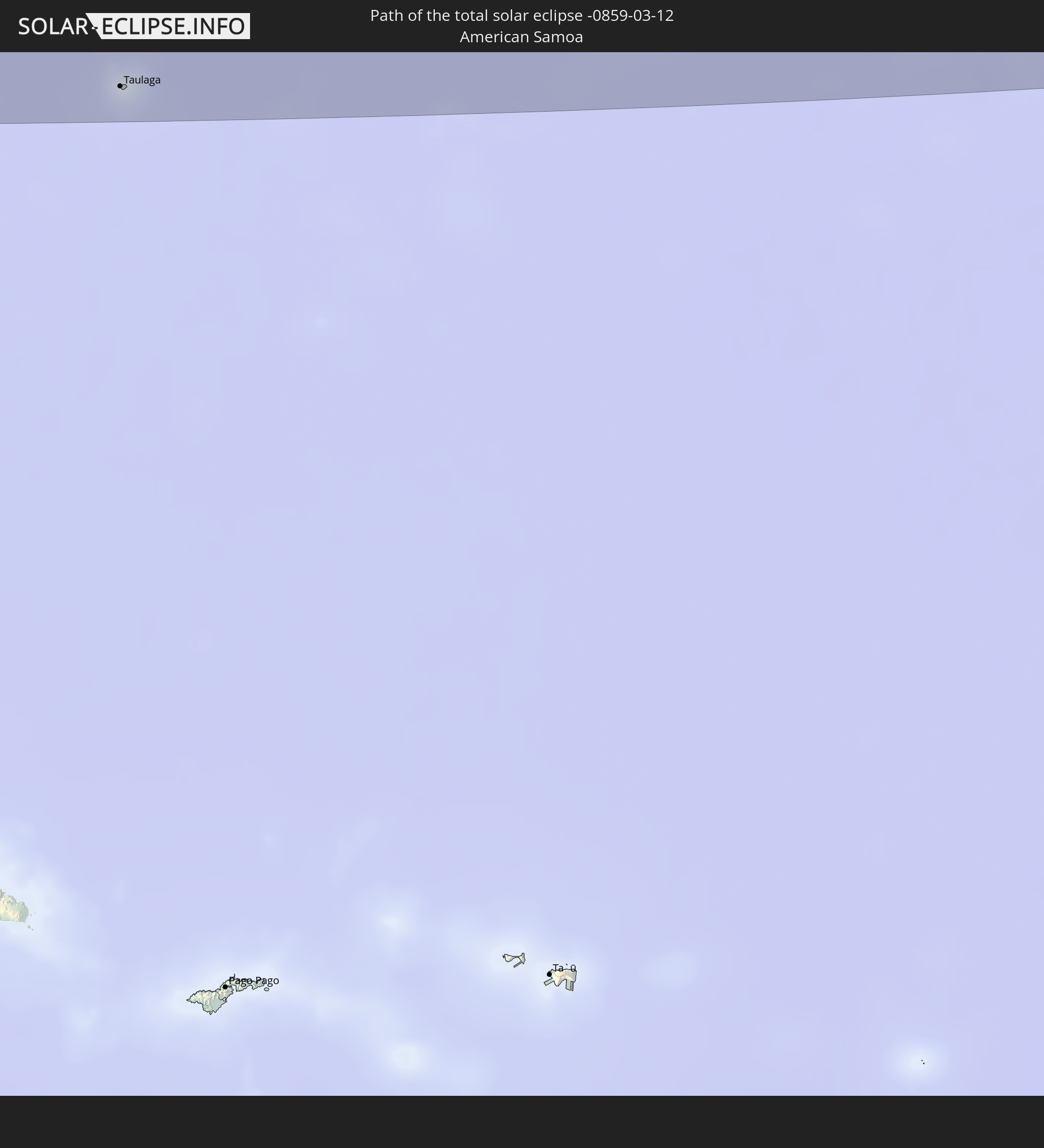 American Samoa
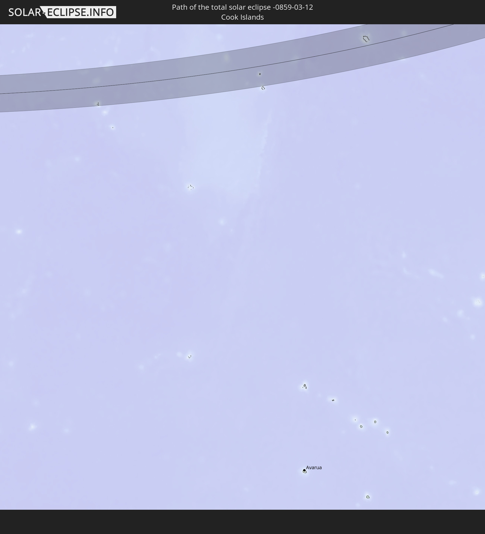 Cook Islands
 Canada
 Mexico
 Tuvalu
In den folgenden Ländern ist die Sonnenfinsternis partiell zu sehen
 Fiji
Fiji
 United States
 New Zealand
 United States Minor Outlying Islands
 Wallis and Futuna
 Tonga
Tonga
 Kiribati
 Samoa
Samoa
 Tokelau
 American Samoa
 Niue
Niue
 Cook Islands
 French Polynesia
 Canada
 Pitcairn Islands
 Mexico
 Greenland
 Guatemala
 El Salvador
 Honduras
 Belize
 Nicaragua
 Costa Rica
 Cuba
Cuba
 Panama
 Colombia
 Cayman Islands
 The Bahamas
 Jamaica
 Haiti
Haiti
 Turks and Caicos Islands
 Dominican Republic
 Puerto Rico
 United States Virgin Islands
 Bermuda
 British Virgin Islands
 Anguilla
 Collectivity of Saint Martin
 Saint Barthélemy
 Saint Kitts and Nevis
 Antigua and Barbuda
 Montserrat
 Guadeloupe
 Dominica
 Tuvalu
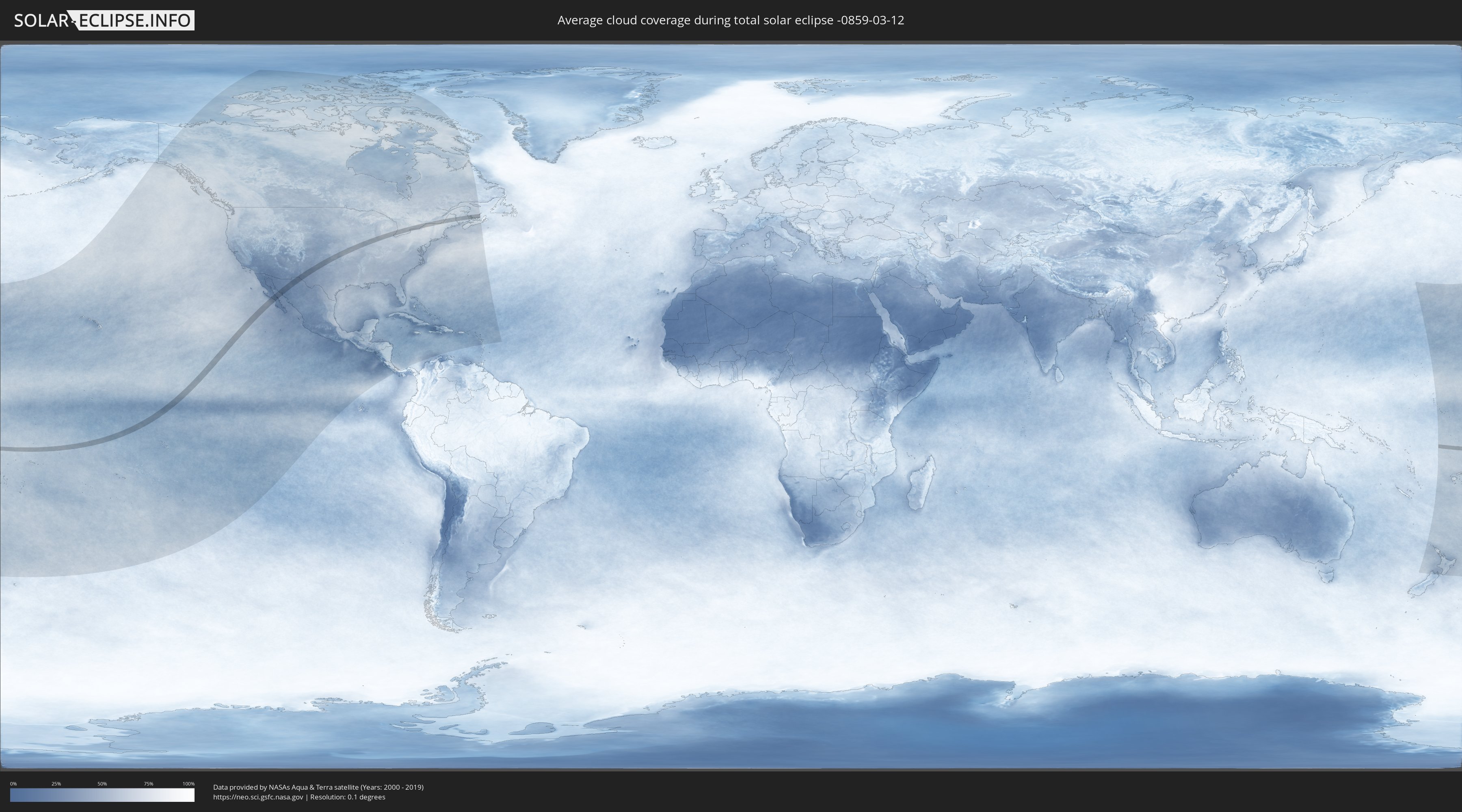
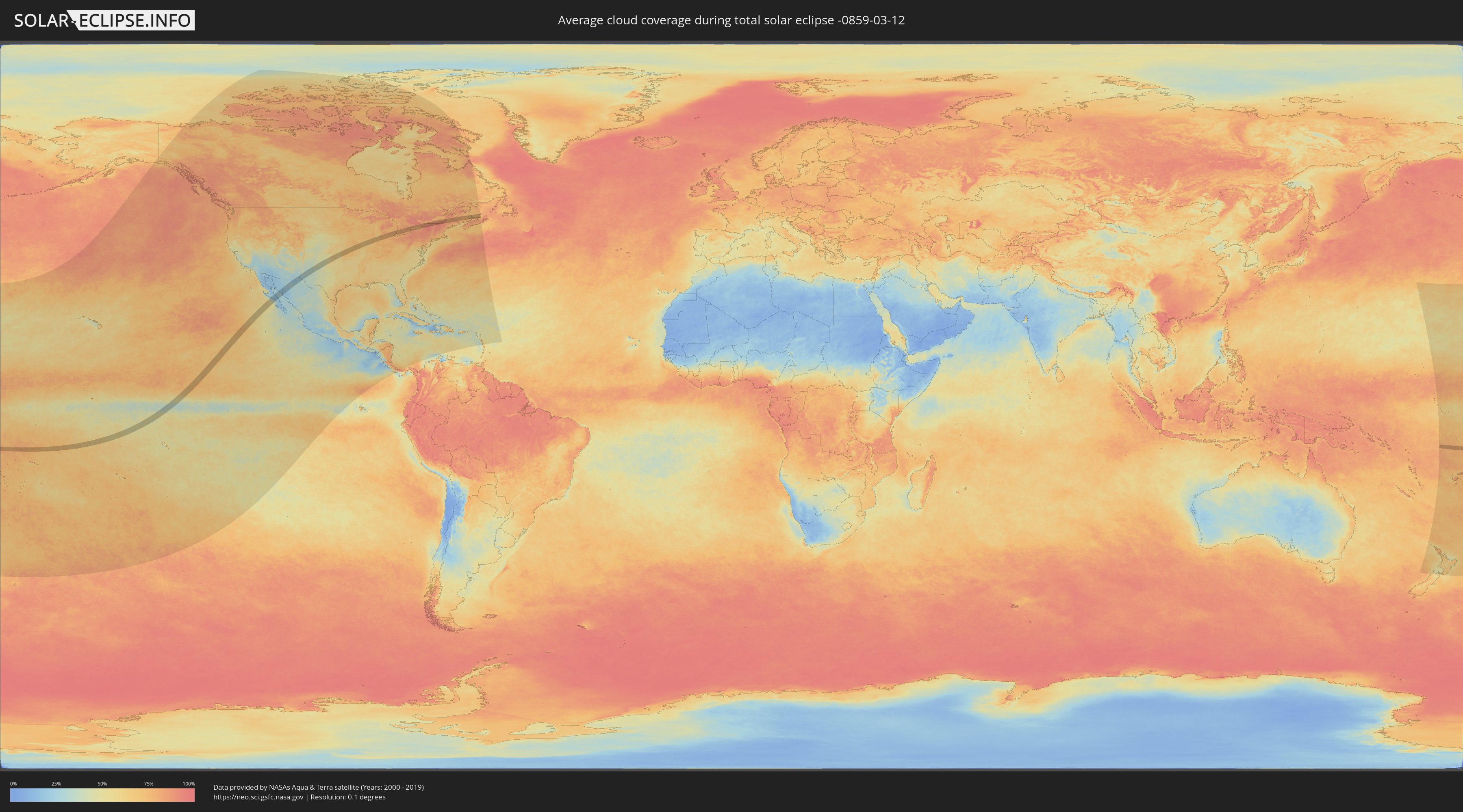
How will be the weather during the total solar eclipse on 03/12/-0859?
Where is the best place to see the total solar eclipse of 03/12/-0859?
The following maps show the average cloud coverage for the day of the total solar eclipse.
With the help of these maps, it is possible to find the place along the eclipse path, which has the best
chance of a cloudless sky.
Nevertheless, you should consider local circumstances and inform about the weather of your chosen
observation site.
The data is provided by NASAs satellites
AQUA and TERRA.
The cloud maps are averaged over a period of 19 years (2000 - 2019).
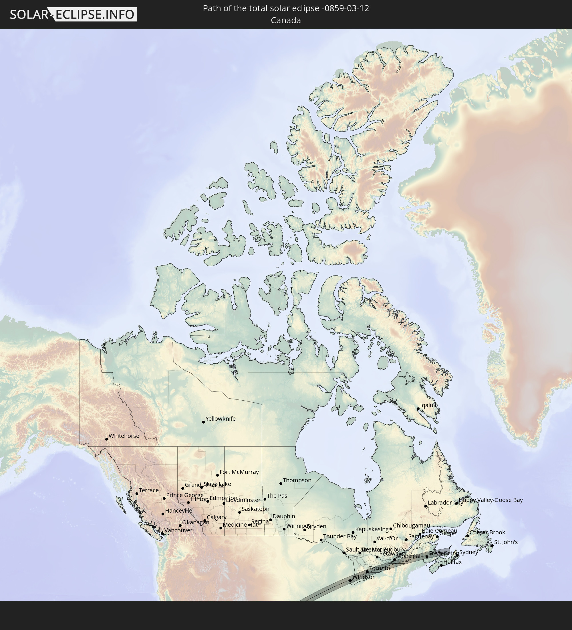
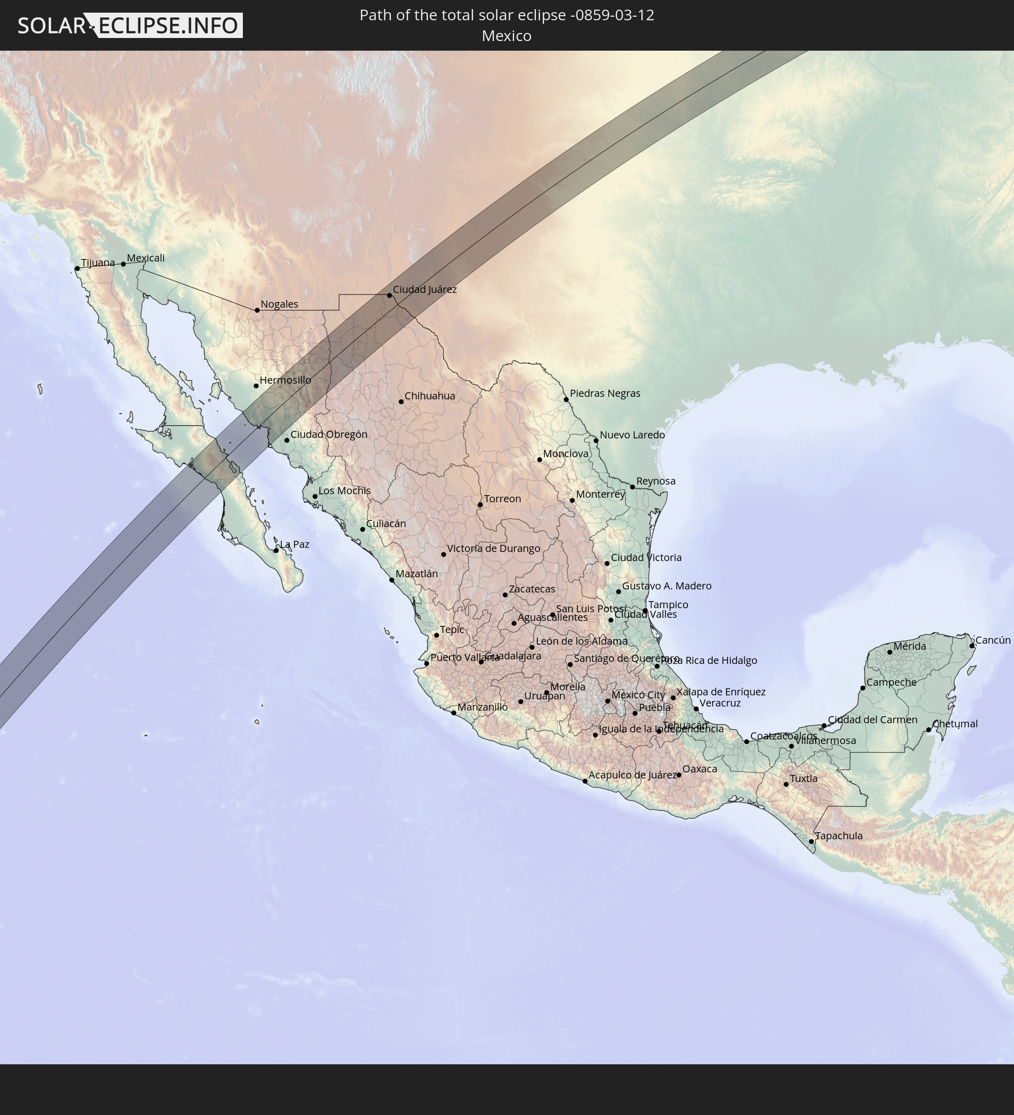
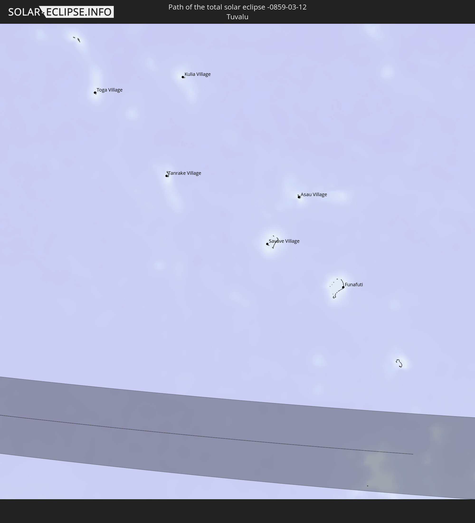
Detailed country maps
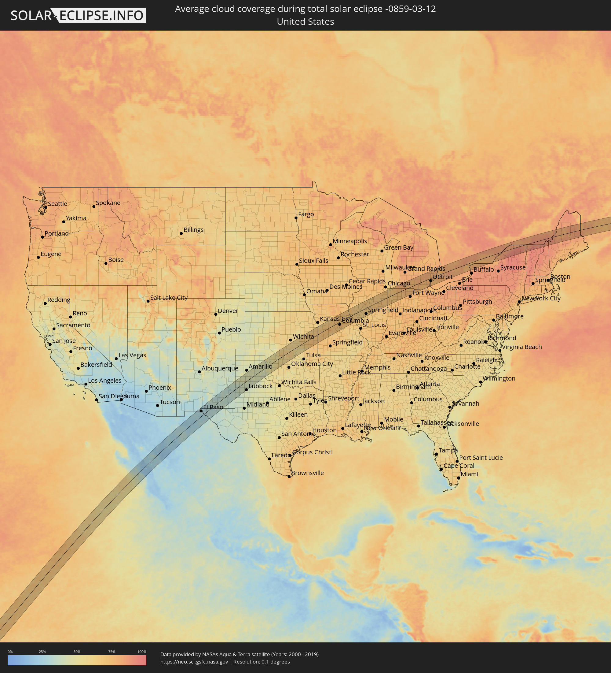 United States
 American Samoa
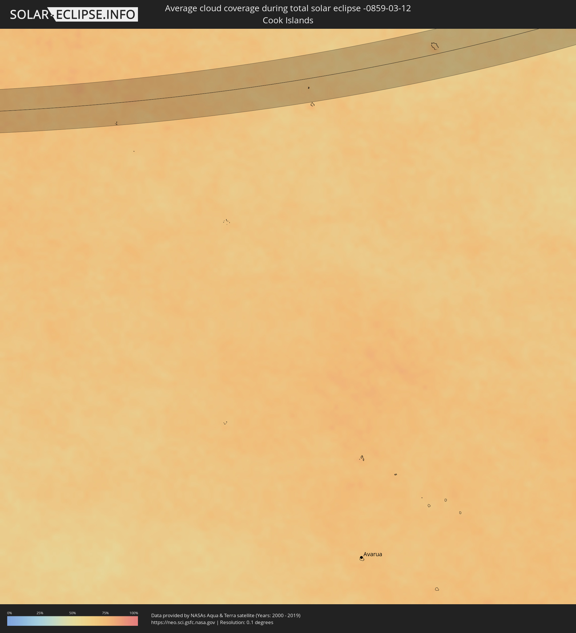 Cook Islands
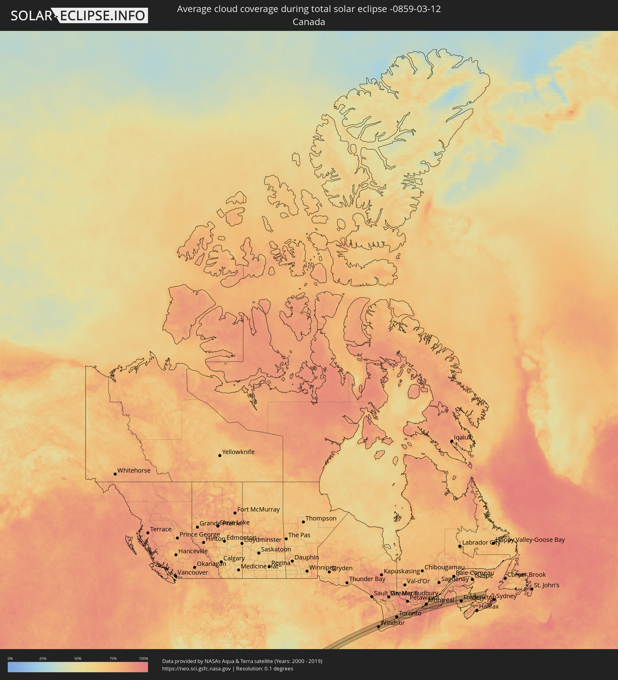 Canada
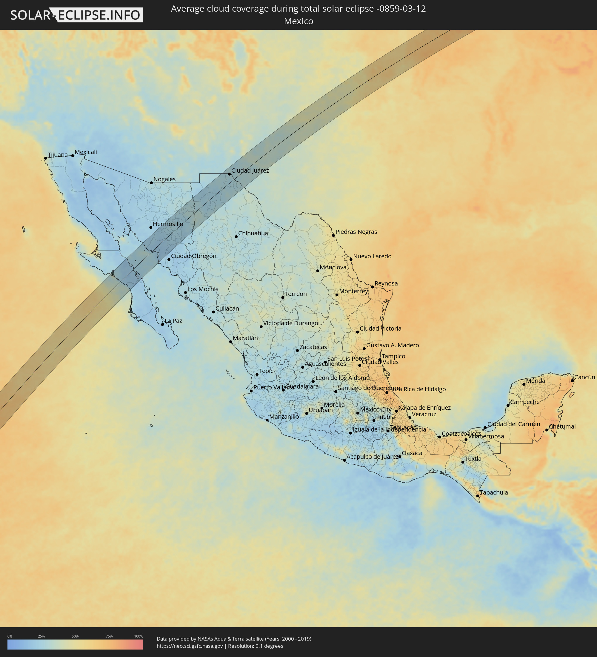 Mexico
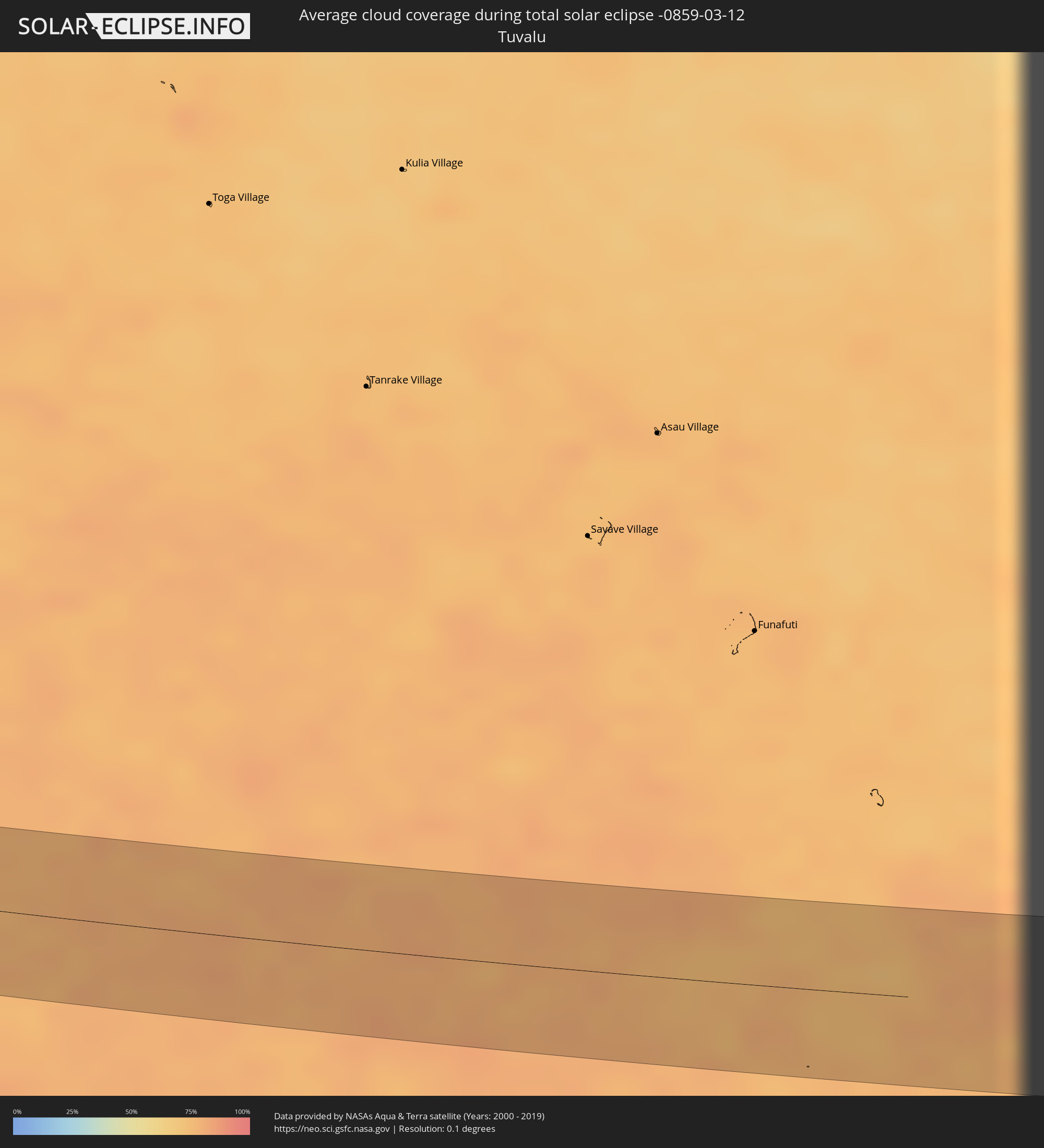 Tuvalu
Cities inside the path of the eclipse
The following table shows all locations with a population of more than 5,000 inside the eclipse path. Cities which have more than 100,000 inhabitants are marked bold. A click at the locations opens a detailed map.
| City | Type | Eclipse duration | Local time of max. eclipse | Distance to central line | Ø Cloud coverage |
|
Taulaga, Swains Island
|
total | - | 18:36:25 UTC+00:00 | 43 km | 75% |
|
Santa Rosalia, Baja California Sur
|
total | - | 14:05:27 UTC-07:05 | 45 km | 17% |
|
Heroica Guaymas, Sonora
|
total | - | 13:49:53 UTC-07:23 | 2 km | 25% |
|
Empalme, Sonora
|
total | - | 13:50:03 UTC-07:23 | 4 km | 21% |
|
Potam, Sonora
|
total | - | 13:50:14 UTC-07:23 | 58 km | 22% |
|
Vicam, Sonora
|
total | - | 13:50:26 UTC-07:23 | 65 km | 23% |
|
Benito Juárez, Chihuahua
|
total | - | 14:14:04 UTC-07:05 | 43 km | 28% |
|
Nuevo Casas Grandes, Chihuahua
|
total | - | 14:14:44 UTC-07:05 | 11 km | 23% |
|
Buenaventura, Chihuahua
|
total | - | 14:14:47 UTC-07:05 | 65 km | 29% |
|
Miguel Ahumada, Chihuahua
|
total | - | 14:16:43 UTC-07:05 | 58 km | 28% |
|
El Paso, Texas
|
total | - | 14:23:24 UTC-07:00 | 38 km | 28% |
|
Ciudad Juárez, Chihuahua
|
total | - | 14:17:43 UTC-07:05 | 36 km | 28% |
|
Chaparral, New Mexico
|
total | - | 14:23:45 UTC-07:00 | 55 km | 28% |
|
Socorro, Texas
|
total | - | 14:23:33 UTC-07:00 | 18 km | 27% |
|
Roswell, New Mexico
|
total | - | 14:27:02 UTC-07:00 | 65 km | 34% |
|
Carlsbad, New Mexico
|
total | - | 14:26:40 UTC-07:00 | 37 km | 35% |
|
Plainview, Texas
|
total | - | 15:30:44 UTC-06:00 | 21 km | 39% |
|
Pampa, Texas
|
total | - | 15:32:16 UTC-06:00 | 62 km | 41% |
|
Enid, Oklahoma
|
total | - | 15:35:46 UTC-06:00 | 14 km | 59% |
|
Ponca City, Oklahoma
|
total | - | 15:36:38 UTC-06:00 | 23 km | 61% |
|
Belton, Missouri
|
total | - | 15:39:31 UTC-06:00 | 60 km | 67% |
|
Warrensburg, Missouri
|
total | - | 15:40:10 UTC-06:00 | 21 km | 72% |
|
Sedalia, Missouri
|
total | - | 15:40:35 UTC-06:00 | 6 km | 72% |
|
Columbia, Missouri
|
total | - | 15:41:20 UTC-06:00 | 20 km | 71% |
|
Quincy, Illinois
|
total | - | 15:42:11 UTC-06:00 | 38 km | 70% |
|
Hannibal, Missouri
|
total | - | 15:42:12 UTC-06:00 | 14 km | 71% |
|
Jacksonville, Illinois
|
total | - | 15:43:02 UTC-06:00 | 29 km | 65% |
|
Canton, Illinois
|
total | - | 15:43:14 UTC-06:00 | 45 km | 69% |
|
Springfield, Illinois
|
total | - | 15:43:28 UTC-06:00 | 45 km | 68% |
|
Peoria, Illinois
|
total | - | 15:43:33 UTC-06:00 | 42 km | 71% |
|
Washington, Illinois
|
total | - | 15:43:41 UTC-06:00 | 36 km | 68% |
|
Lincoln, Illinois
|
total | - | 15:43:41 UTC-06:00 | 21 km | 67% |
|
Bloomington, Illinois
|
total | - | 15:43:57 UTC-06:00 | 2 km | 71% |
|
Kankakee, Illinois
|
total | - | 15:44:43 UTC-06:00 | 20 km | 66% |
|
Park Forest, Illinois
|
total | - | 15:44:50 UTC-06:00 | 50 km | 73% |
|
Hammond, Indiana
|
total | - | 15:44:57 UTC-06:00 | 53 km | 69% |
|
Merrillville, Indiana
|
total | - | 15:45:03 UTC-06:00 | 37 km | 69% |
|
Portage, Indiana
|
total | - | 15:45:09 UTC-06:00 | 41 km | 67% |
|
Michigan City, Indiana
|
total | - | 15:45:19 UTC-06:00 | 44 km | 69% |
|
LaPorte, Indiana
|
total | - | 15:45:26 UTC-06:00 | 29 km | 73% |
|
South Bend, Indiana
|
total | - | 16:45:43 UTC-05:00 | 20 km | 75% |
|
Elkhart, Indiana
|
total | - | 16:45:53 UTC-05:00 | 10 km | 76% |
|
Goshen, Indiana
|
total | - | 16:45:59 UTC-05:00 | 5 km | 77% |
|
Portage, Michigan
|
total | - | 16:46:05 UTC-05:00 | 49 km | 79% |
|
Battle Creek, Michigan
|
total | - | 16:46:18 UTC-05:00 | 47 km | 77% |
|
Jackson, Michigan
|
total | - | 16:46:45 UTC-05:00 | 15 km | 77% |
|
Adrian, Michigan
|
total | - | 16:47:00 UTC-05:00 | 33 km | 74% |
|
Ann Arbor, Michigan
|
total | - | 16:47:07 UTC-05:00 | 4 km | 76% |
|
Novi, Michigan
|
total | - | 16:47:14 UTC-05:00 | 9 km | 78% |
|
Waterford, Michigan
|
total | - | 16:47:14 UTC-05:00 | 28 km | 81% |
|
Monroe, Michigan
|
total | - | 16:47:21 UTC-05:00 | 52 km | 78% |
|
Livonia, Michigan
|
total | - | 16:47:19 UTC-05:00 | 7 km | 76% |
|
Taylor, Michigan
|
total | - | 16:47:22 UTC-05:00 | 22 km | 79% |
|
Southfield, Michigan
|
total | - | 16:47:22 UTC-05:00 | 0 km | 75% |
|
Troy, Michigan
|
total | - | 16:47:23 UTC-05:00 | 11 km | 78% |
|
Detroit, Michigan
|
total | - | 16:47:29 UTC-05:00 | 20 km | 76% |
|
Warren, Michigan
|
total | - | 16:47:28 UTC-05:00 | 6 km | 79% |
|
Windsor, Ontario
|
total | - | 16:47:30 UTC-05:00 | 24 km | 76% |
|
Clinton, Michigan
|
total | - | 16:47:31 UTC-05:00 | 2 km | 77% |
|
Port Huron, Michigan
|
total | - | 16:47:42 UTC-05:00 | 26 km | 81% |
|
Sarnia, Ontario
|
total | - | 16:47:43 UTC-05:00 | 26 km | 81% |
|
London, Ontario
|
total | - | 16:48:17 UTC-05:00 | 8 km | 86% |
|
St. Thomas, Ontario
|
total | - | 16:48:21 UTC-05:00 | 32 km | 81% |
|
Stratford, Ontario
|
total | - | 16:48:21 UTC-05:00 | 23 km | 79% |
|
Ingersoll, Ontario
|
total | - | 16:48:27 UTC-05:00 | 13 km | 79% |
|
Woodstock, Ontario
|
total | - | 16:48:30 UTC-05:00 | 7 km | 80% |
|
Kitchener, Ontario
|
total | - | 16:48:32 UTC-05:00 | 16 km | 79% |
|
Norfolk County, Ontario
|
total | - | 16:48:43 UTC-05:00 | 49 km | 81% |
|
Cambridge, Ontario
|
total | - | 16:48:39 UTC-05:00 | 4 km | 81% |
|
Brantford, Ontario
|
total | - | 16:48:43 UTC-05:00 | 21 km | 80% |
|
Guelph, Ontario
|
total | - | 16:48:38 UTC-05:00 | 22 km | 81% |
|
Orangeville, Ontario
|
total | - | 16:48:37 UTC-05:00 | 56 km | 81% |
|
Milton, Ontario
|
total | - | 16:48:48 UTC-05:00 | 8 km | 81% |
|
Hamilton, Ontario
|
total | - | 16:48:53 UTC-05:00 | 21 km | 82% |
|
Burlington, Ontario
|
total | - | 16:48:51 UTC-05:00 | 7 km | 81% |
|
Mississauga, Ontario
|
total | - | 16:48:53 UTC-05:00 | 8 km | 84% |
|
Vaughan, Ontario
|
total | - | 16:48:54 UTC-05:00 | 31 km | 85% |
|
Newmarket, Ontario
|
total | - | 16:48:51 UTC-05:00 | 52 km | 85% |
|
Toronto, Ontario
|
total | - | 16:48:58 UTC-05:00 | 14 km | 83% |
|
Scarborough, Ontario
|
total | - | 16:49:01 UTC-05:00 | 17 km | 83% |
|
St. Catharines, Ontario
|
total | - | 16:49:10 UTC-05:00 | 46 km | 81% |
|
Thorold, Ontario
|
total | - | 16:49:12 UTC-05:00 | 53 km | 84% |
|
Ajax, Ontario
|
total | - | 16:49:06 UTC-05:00 | 19 km | 81% |
|
Oshawa, Ontario
|
total | - | 16:49:10 UTC-05:00 | 19 km | 78% |
|
Peterborough, Ontario
|
total | - | 16:49:16 UTC-05:00 | 47 km | 83% |
|
Cobourg, Ontario
|
total | - | 16:49:26 UTC-05:00 | 7 km | 78% |
|
Belleville, Ontario
|
total | - | 16:49:41 UTC-05:00 | 8 km | 81% |
|
Prince Edward, Ontario
|
total | - | 16:49:47 UTC-05:00 | 13 km | 77% |
|
Greater Napanee, Ontario
|
total | - | 16:49:49 UTC-05:00 | 6 km | 77% |
|
Kingston, Ontario
|
total | - | 16:50:00 UTC-05:00 | 8 km | 78% |
|
Watertown, New York
|
total | - | 16:50:17 UTC-05:00 | 49 km | 87% |
|
Brockville, Ontario
|
total | - | 16:50:10 UTC-05:00 | 11 km | 82% |
|
Cornwall, Ontario
|
total | - | 16:50:21 UTC-05:00 | 33 km | 84% |
|
Salaberry-de-Valleyfield, Quebec
|
total | - | 16:50:28 UTC-05:00 | 44 km | 81% |
|
Beauharnois, Quebec
|
total | - | 16:50:31 UTC-05:00 | 45 km | 80% |
|
Châteauguay, Quebec
|
total | - | 16:50:32 UTC-05:00 | 49 km | 83% |
|
Saint-Constant, Quebec
|
total | - | 16:50:35 UTC-05:00 | 43 km | 84% |
|
Candiac, Quebec
|
total | - | 16:50:36 UTC-05:00 | 44 km | 83% |
|
La Prairie, Quebec
|
total | - | 16:50:35 UTC-05:00 | 47 km | 83% |
|
Brossard, Quebec
|
total | - | 16:50:35 UTC-05:00 | 50 km | 84% |
|
Plattsburgh, New York
|
total | - | 16:50:52 UTC-05:00 | 30 km | 86% |
|
Chambly, Quebec
|
total | - | 16:50:38 UTC-05:00 | 46 km | 83% |
|
Saint-Jean-sur-Richelieu, Quebec
|
total | - | 16:50:42 UTC-05:00 | 30 km | 83% |
|
Granby, Quebec
|
total | - | 16:50:49 UTC-05:00 | 28 km | 87% |
|
Magog, Quebec
|
total | - | 16:51:02 UTC-05:00 | 2 km | 89% |
|
Sherbrooke, Quebec
|
total | - | 16:51:03 UTC-05:00 | 11 km | 88% |
|
Fredericton, New Brunswick
|
total | - | 17:37:31 UTC-04:14 | 30 km | 81% |
|
Lutes Mountain, New Brunswick
|
total | - | 17:37:40 UTC-04:14 | 38 km | 77% |
|
Moncton, New Brunswick
|
total | - | 17:37:42 UTC-04:14 | 44 km | 78% |
|
Dieppe, New Brunswick
|
total | - | 17:37:43 UTC-04:14 | 48 km | 77% |
|
Summerside, Prince Edward Island
|
total | - | 17:37:40 UTC-04:14 | 27 km | 71% |