Annular solar eclipse of 12/13/-1088
| Day of week: | Sunday |
| Maximum duration of eclipse: | 09m49s |
| Maximum width of eclipse path: | 282 km |
| Saros cycle: | 34 |
| Coverage: | 92.6% |
| Magnitude: | 0.9256 |
| Gamma: | 0.1263 |
Wo kann man die Sonnenfinsternis vom 12/13/-1088 sehen?
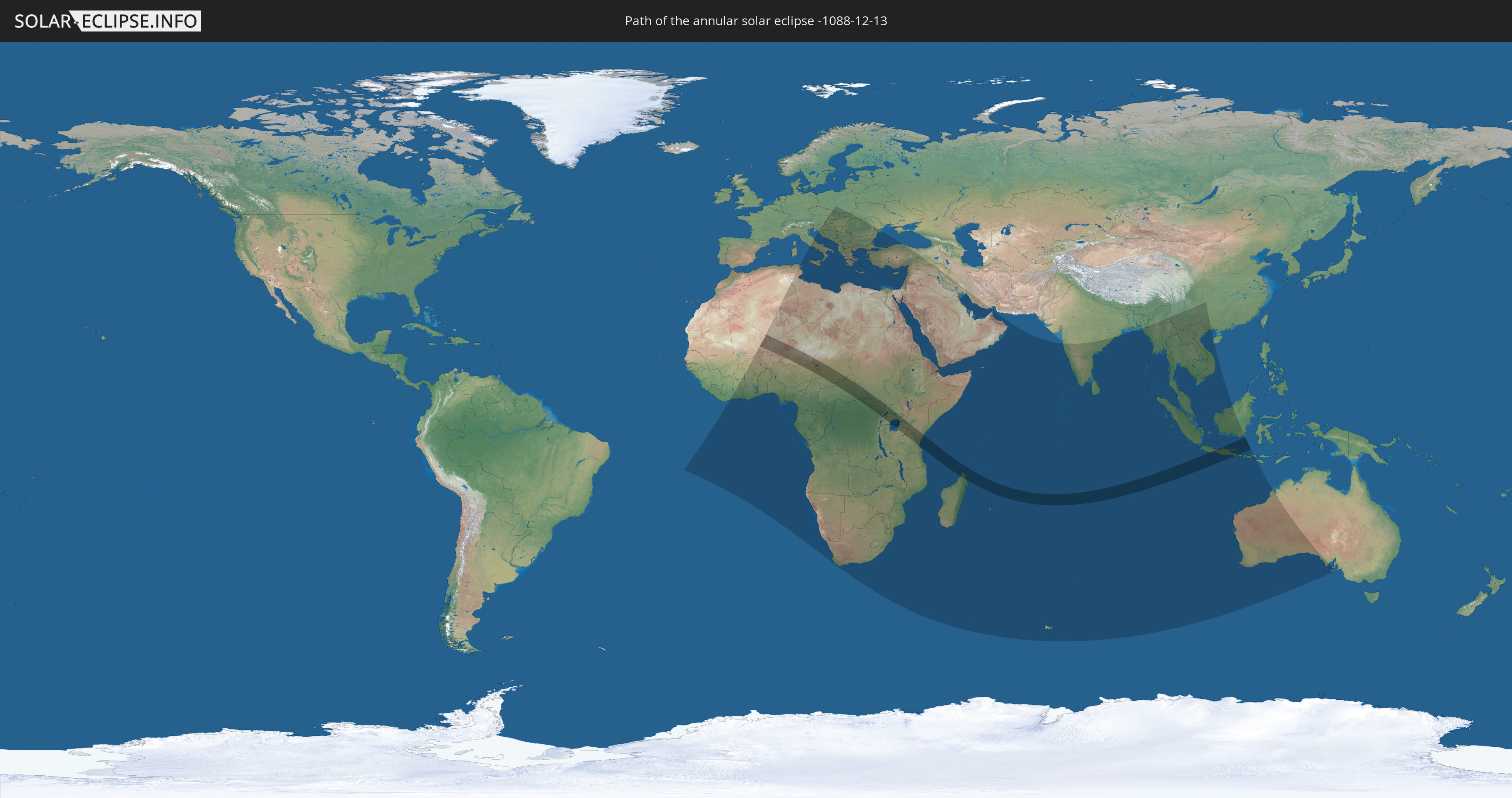
Die Sonnenfinsternis am 12/13/-1088 kann man in 100 Ländern als partielle Sonnenfinsternis beobachten.
Der Finsternispfad verläuft durch 20 Länder. Nur in diesen Ländern ist sie als annular Sonnenfinsternis zu sehen.
In den folgenden Ländern ist die Sonnenfinsternis annular zu sehen
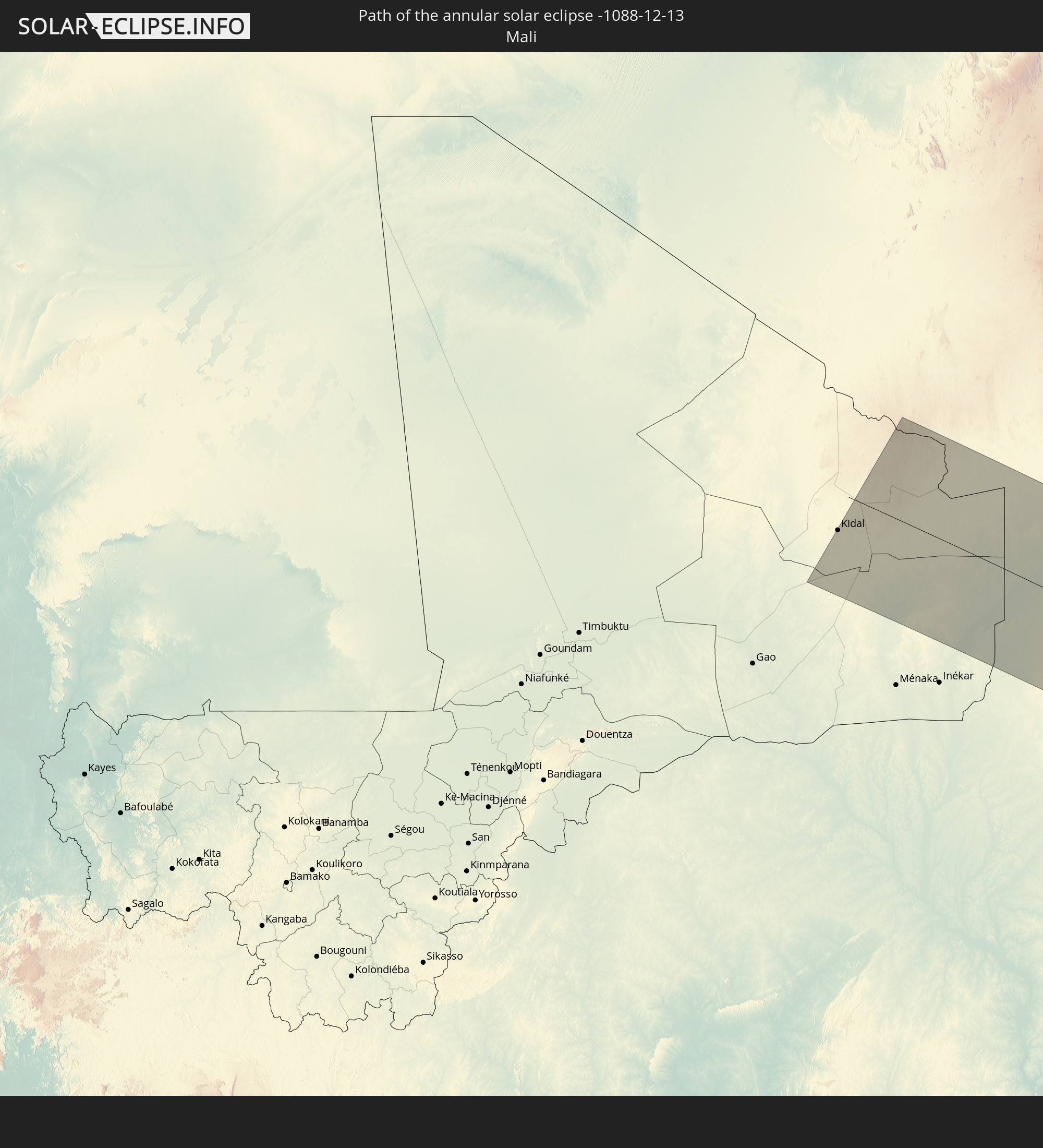 Mali
Mali
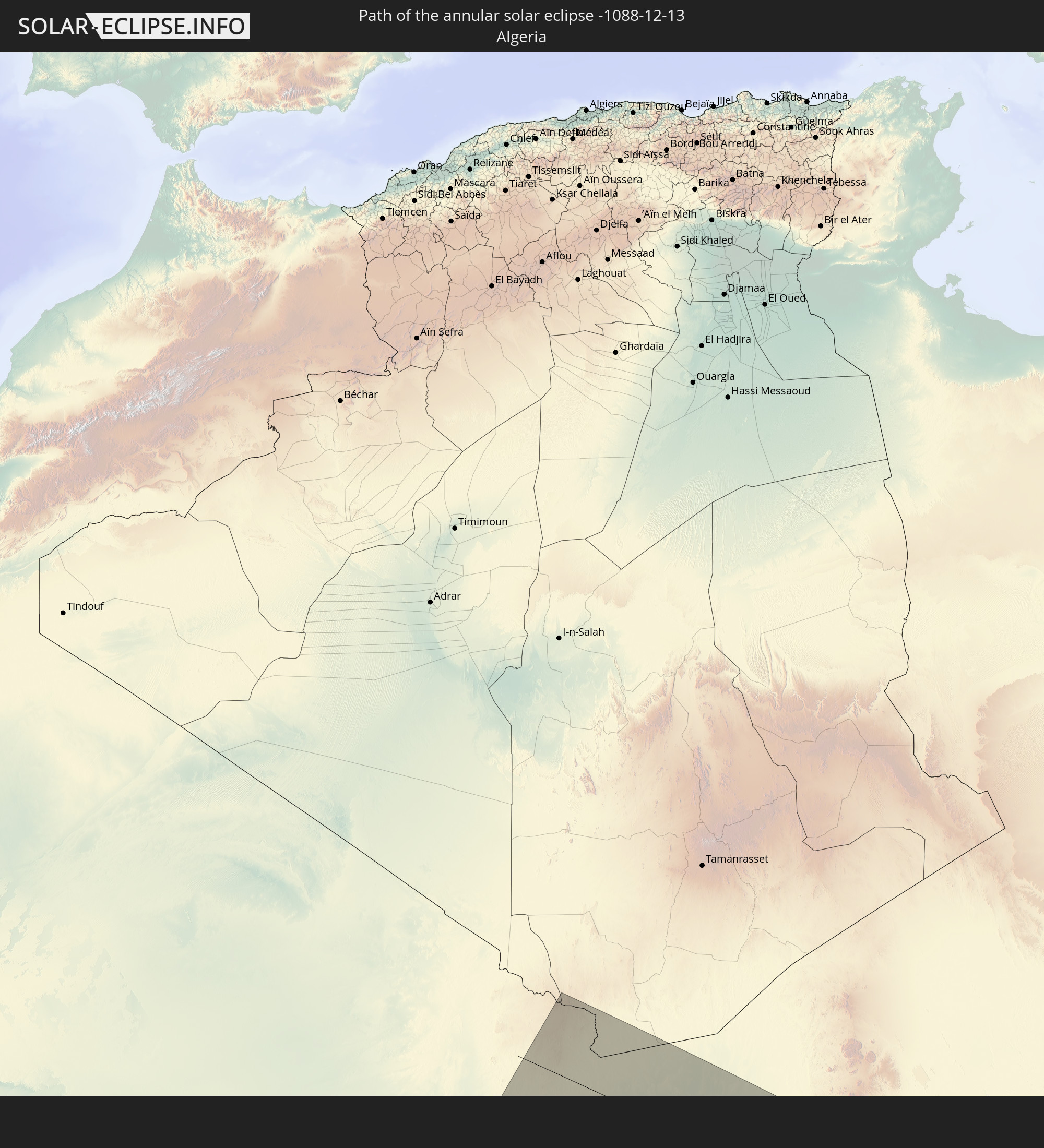 Algeria
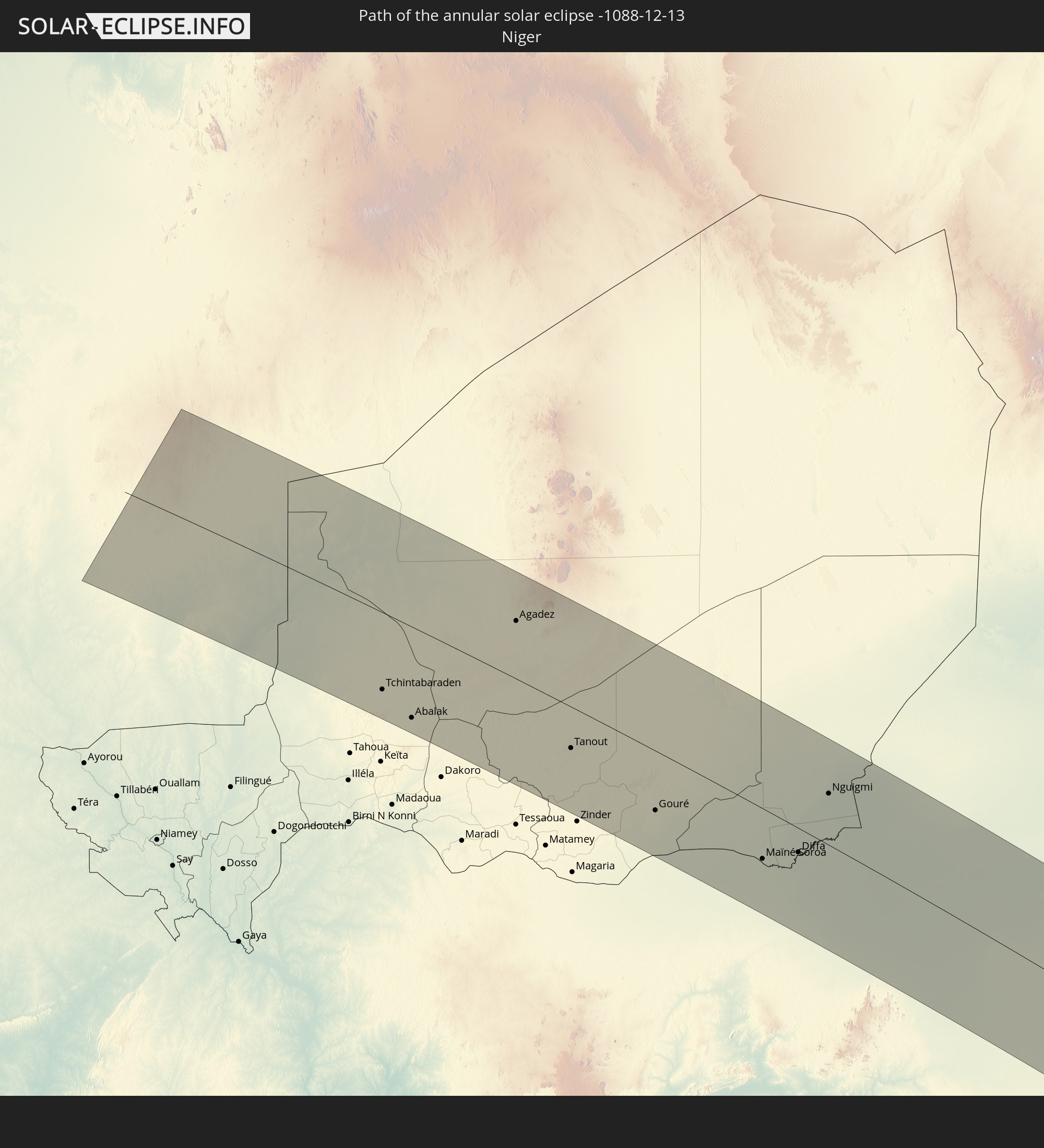 Niger
Niger
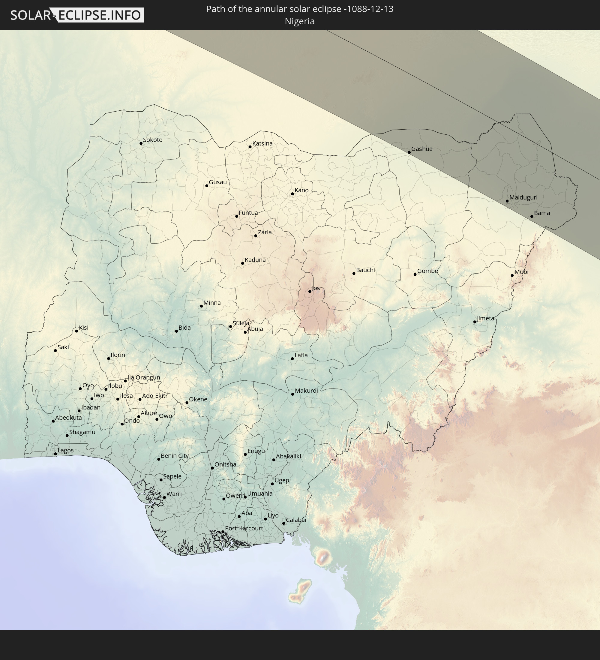 Nigeria
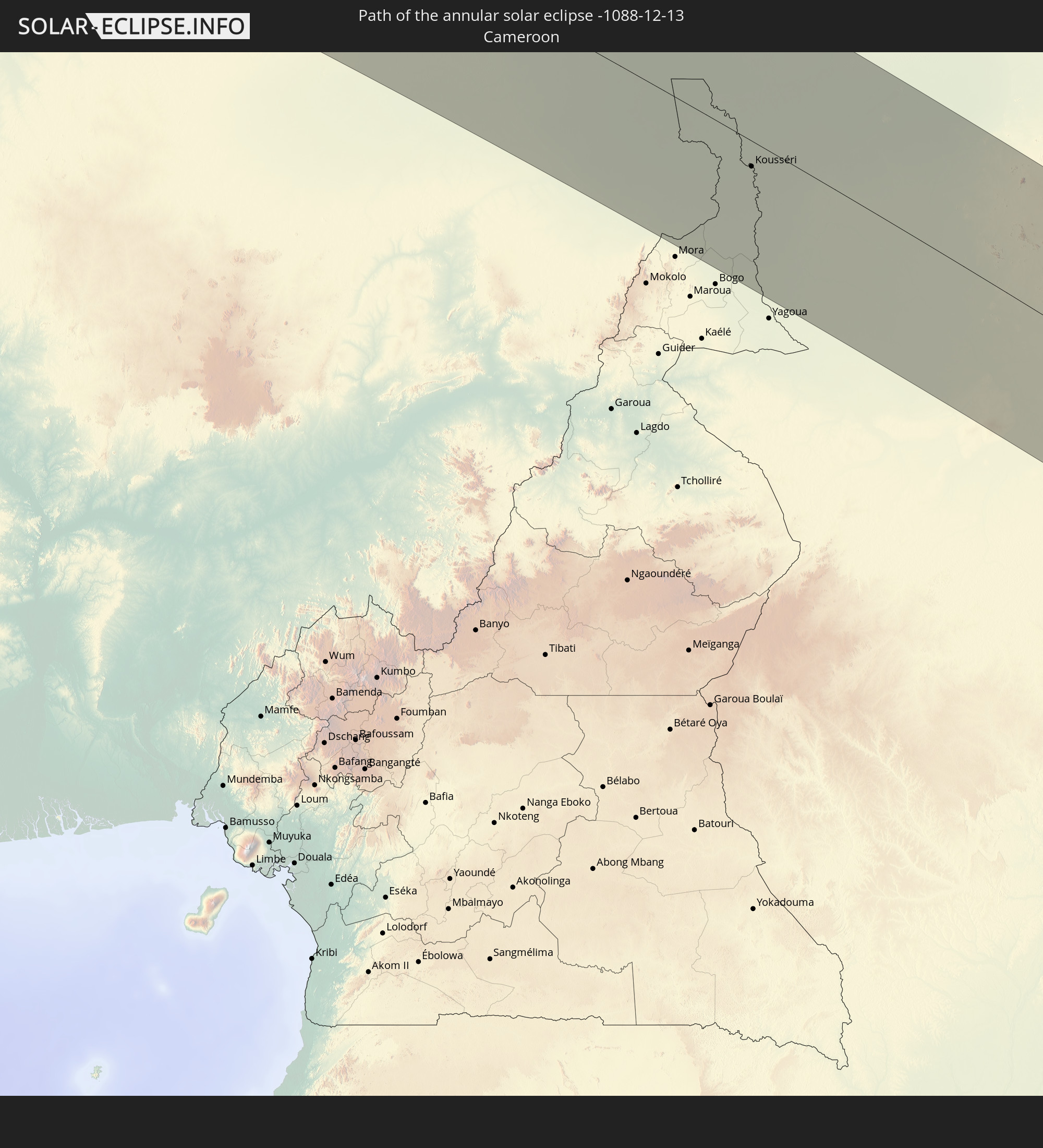 Cameroon
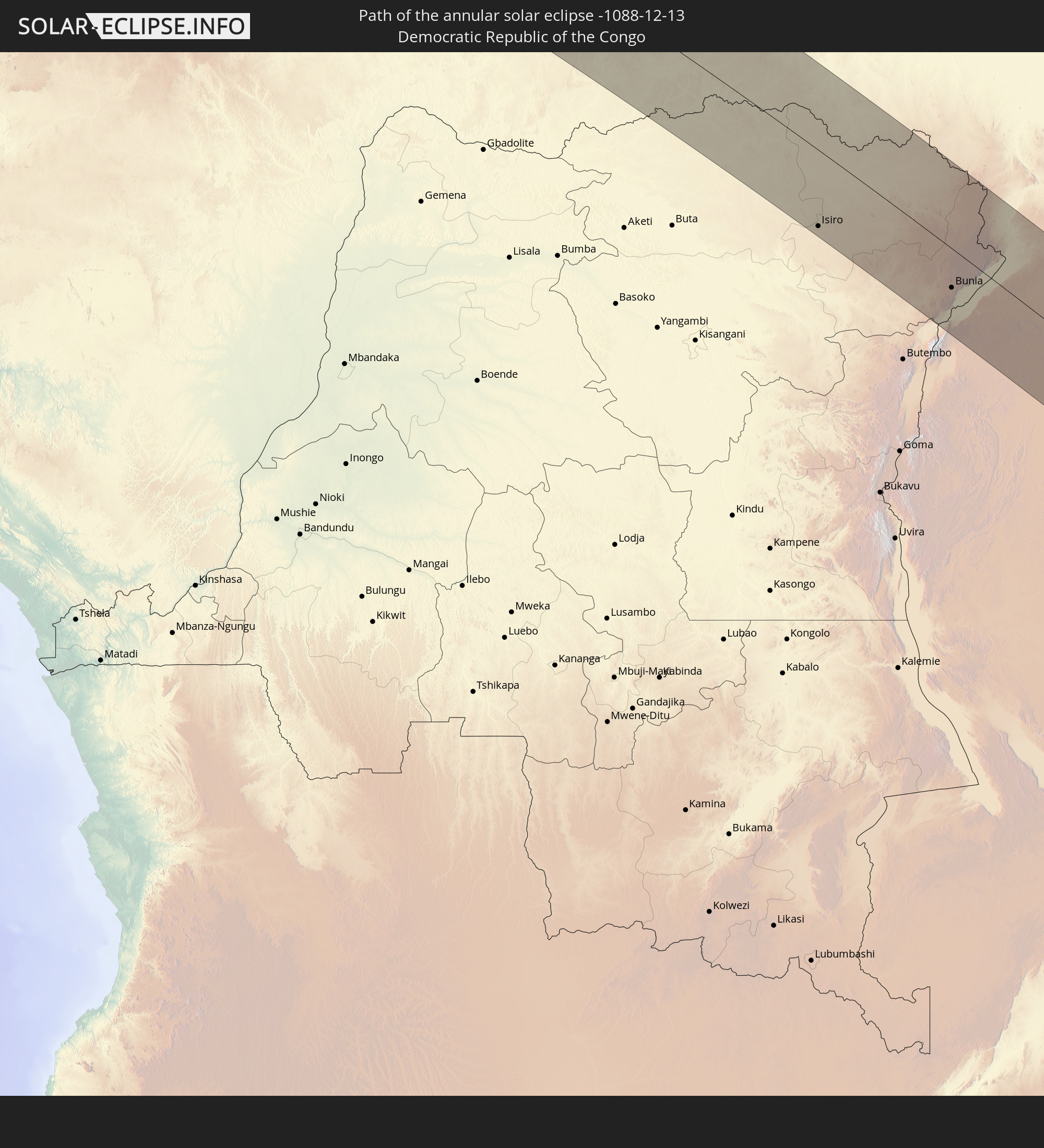 Democratic Republic of the Congo
 Chad
Chad
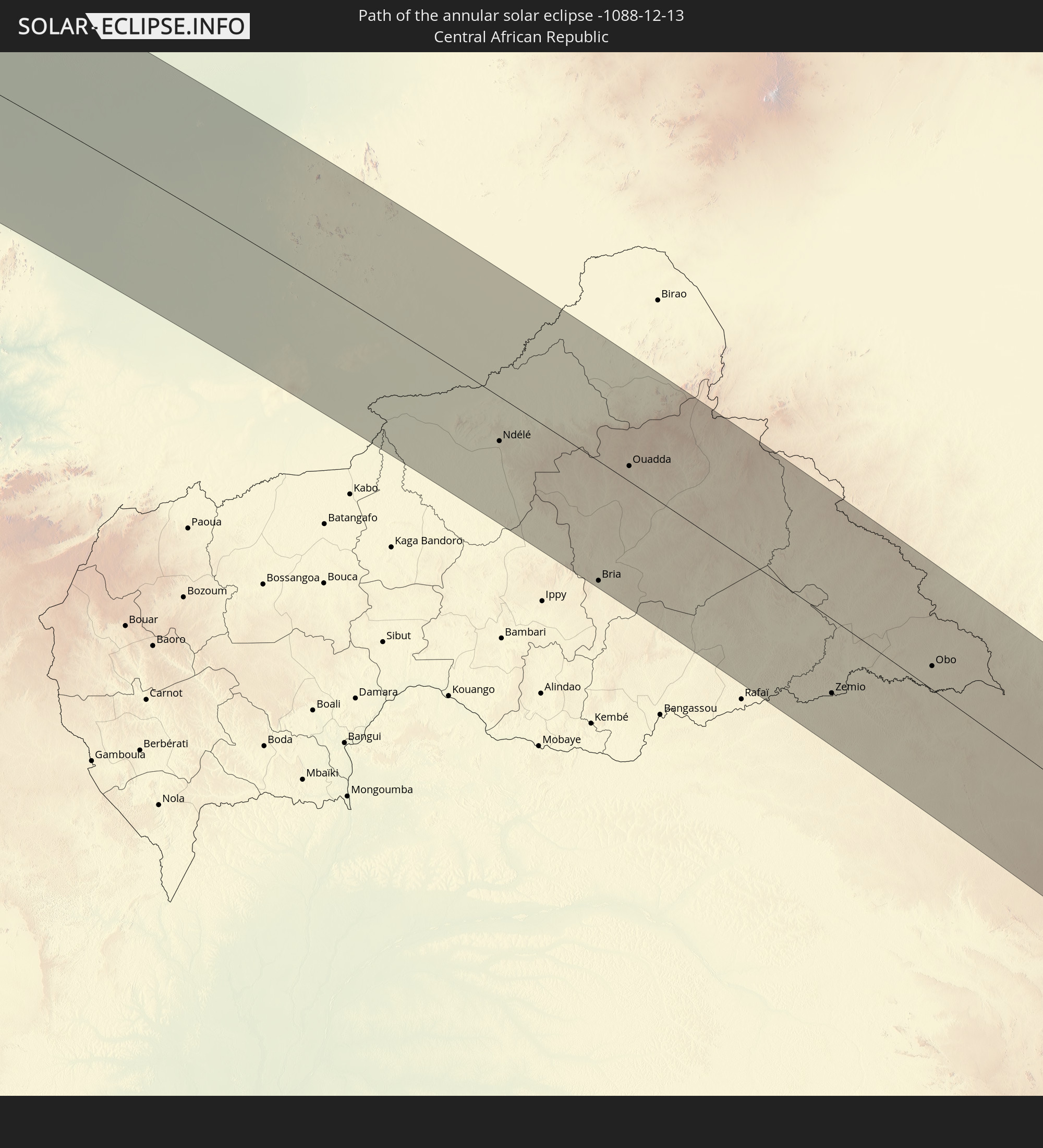 Central African Republic
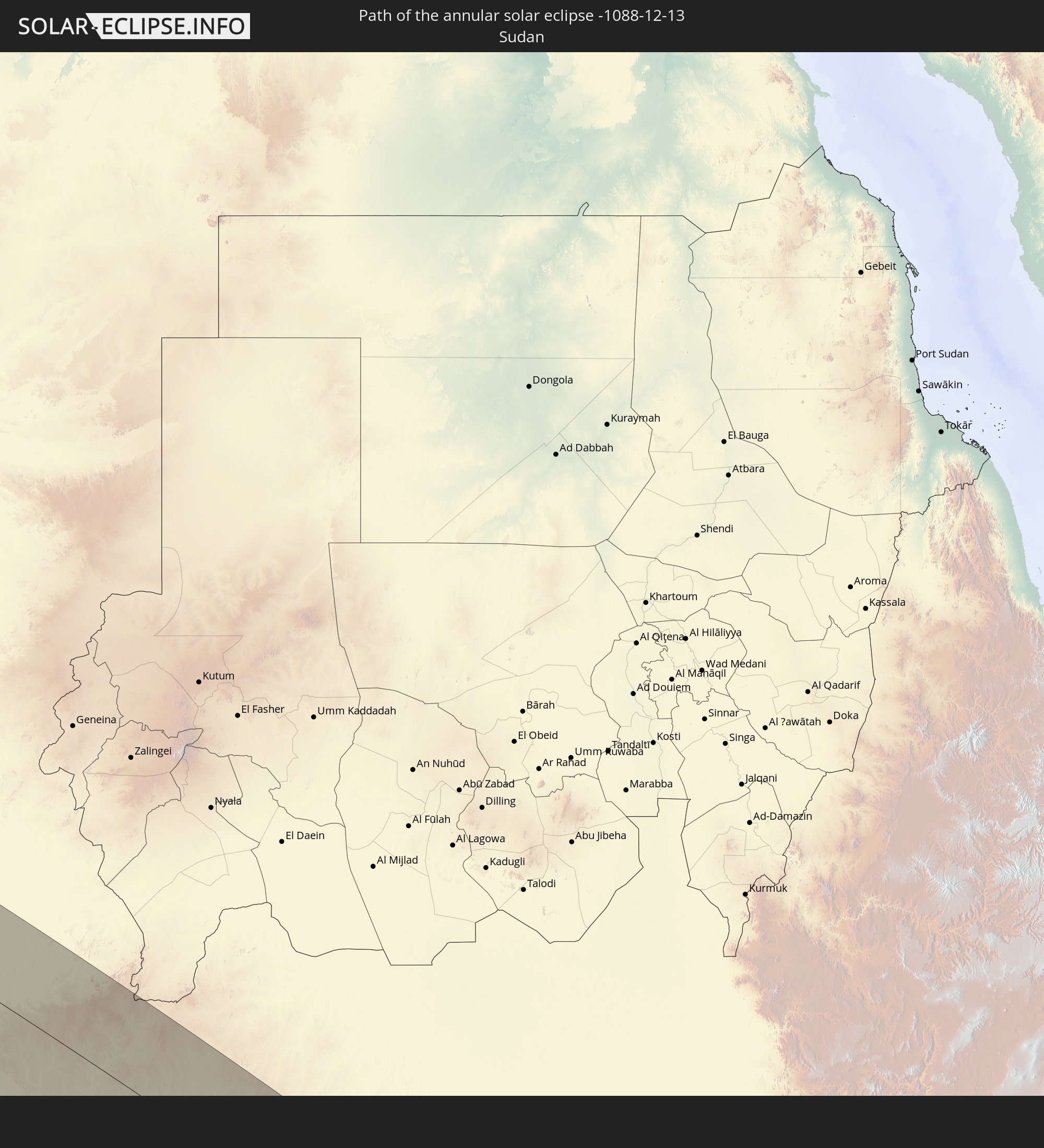 Sudan
Sudan
 South Sudan
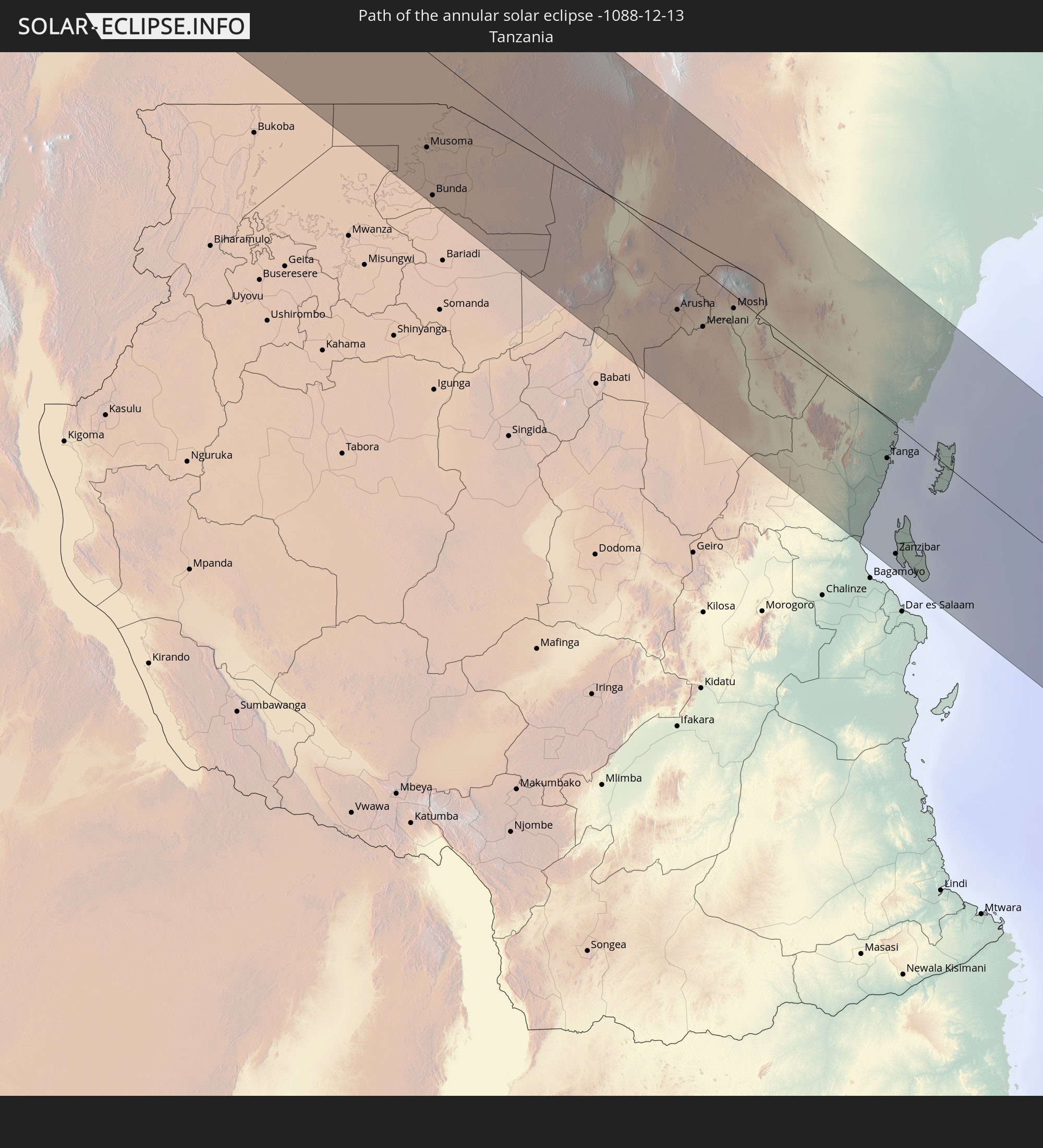 Tanzania
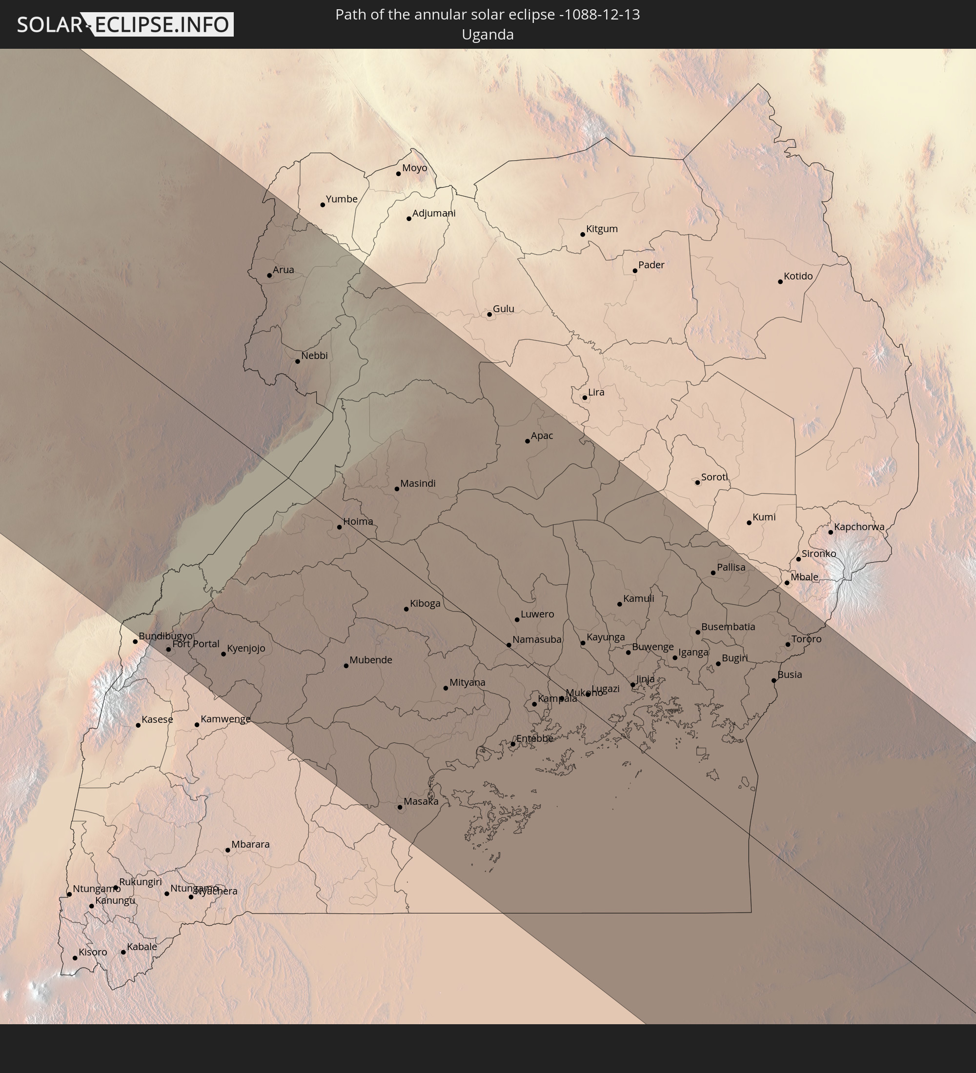 Uganda
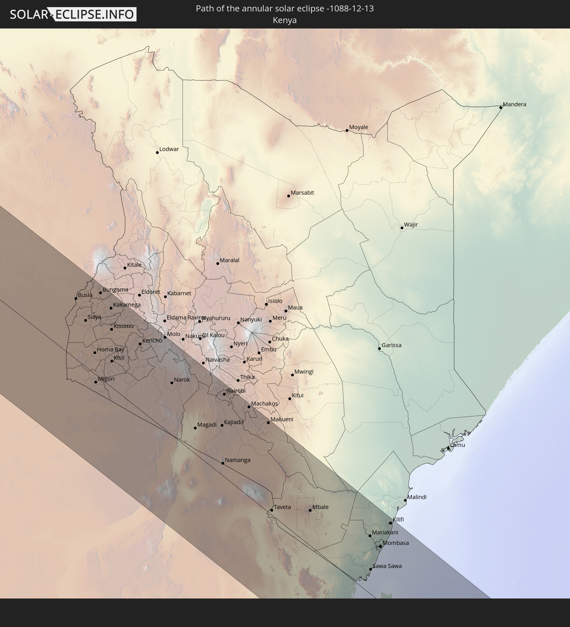 Kenya
Kenya
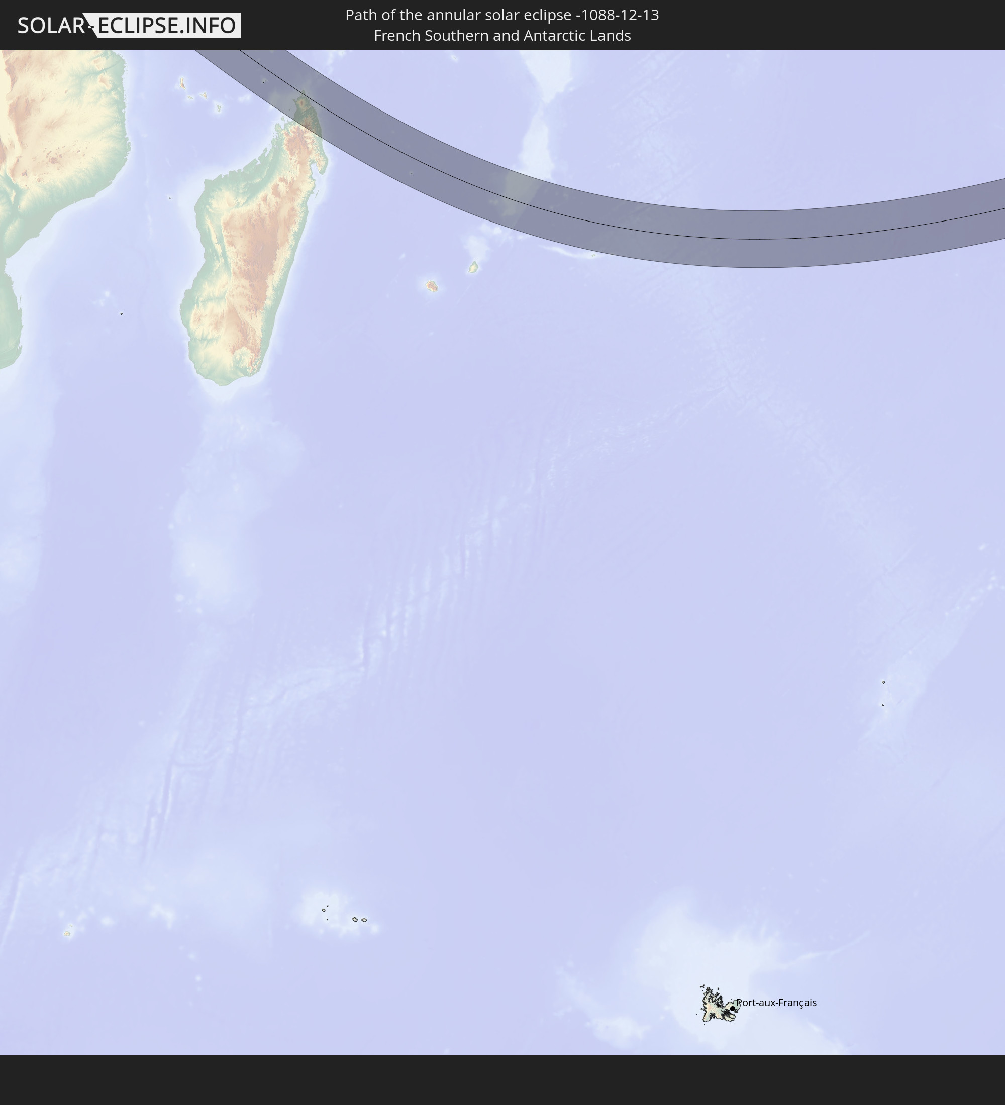 French Southern and Antarctic Lands
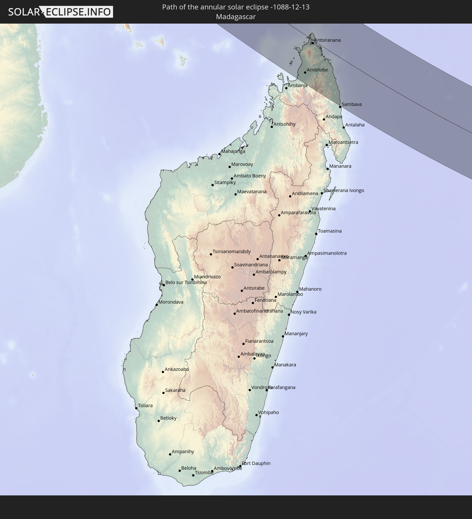 Madagascar
 Seychelles
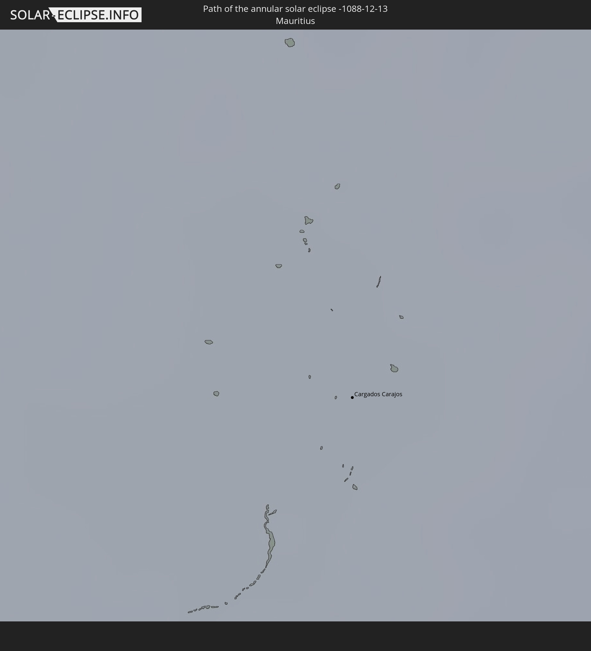 Mauritius
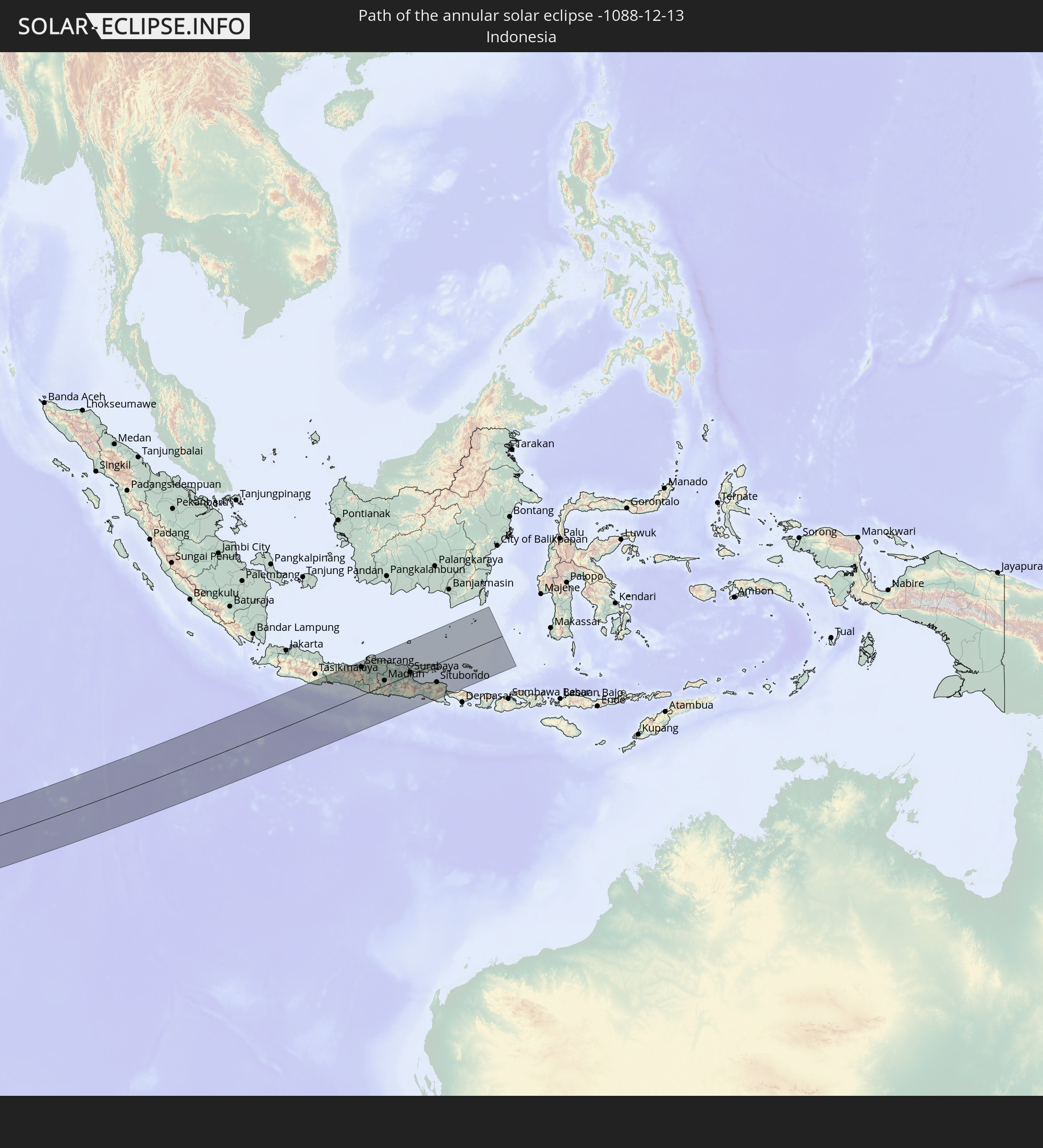 Indonesia
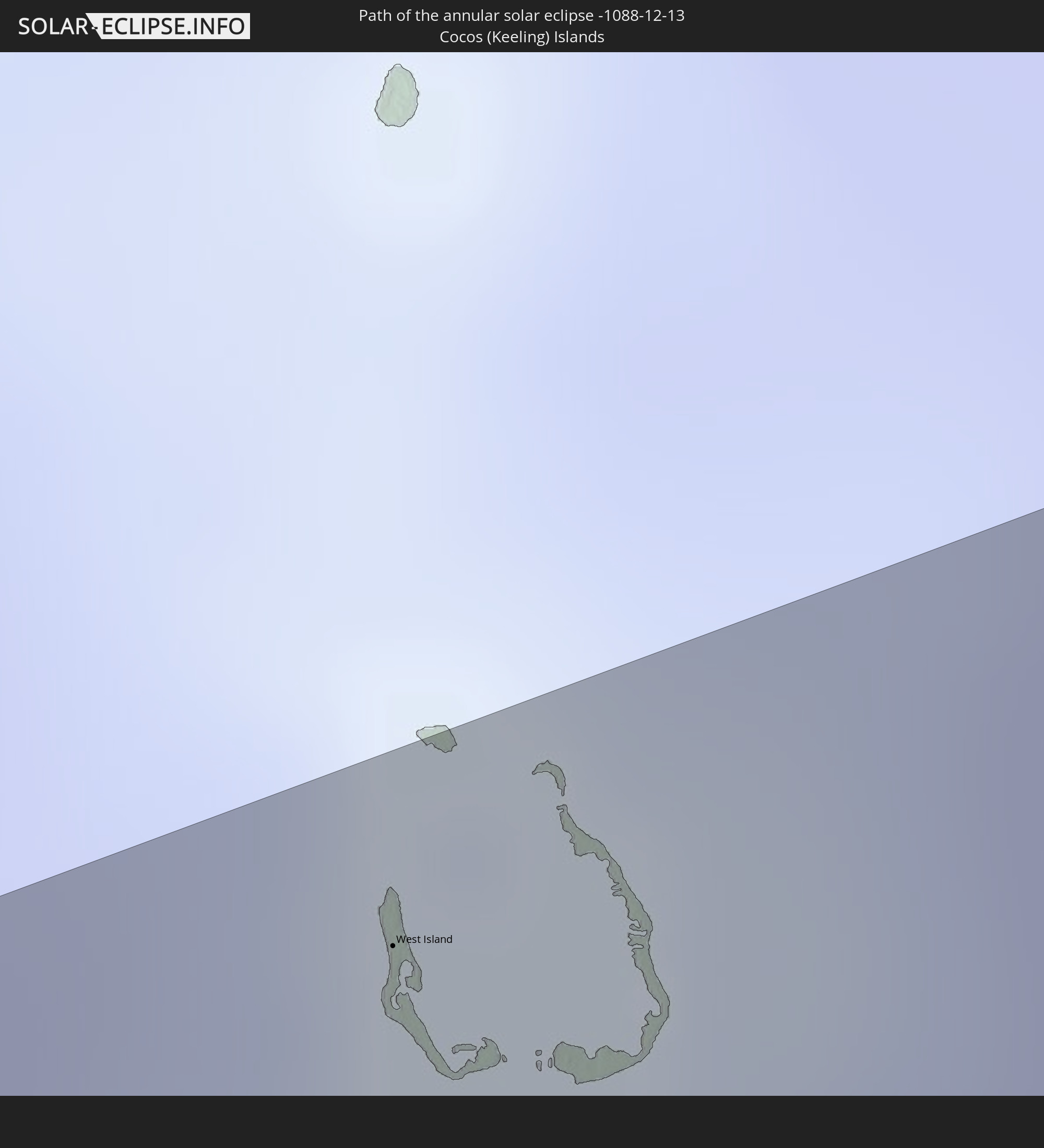 Cocos Islands
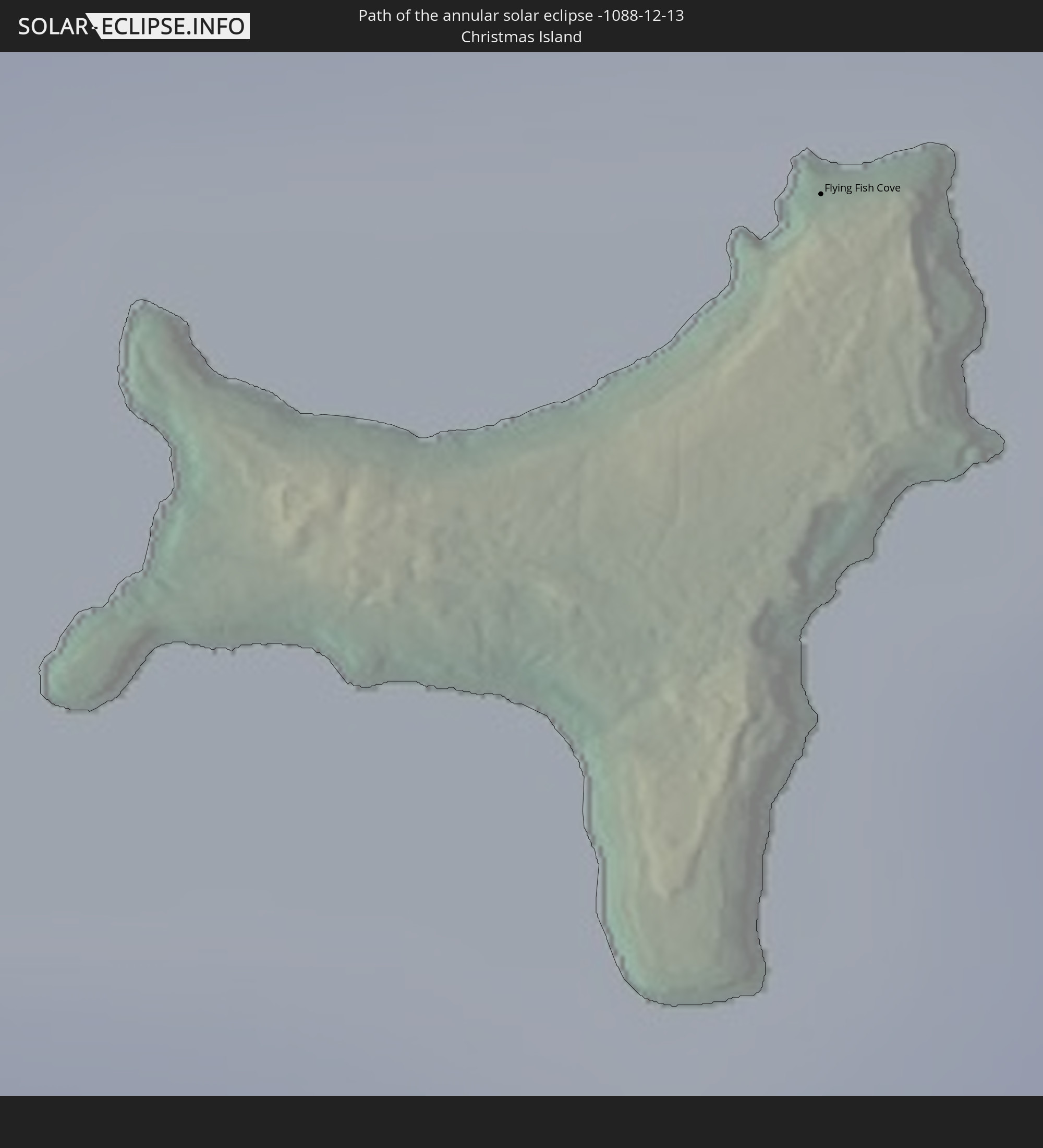 Christmas Island
In den folgenden Ländern ist die Sonnenfinsternis partiell zu sehen
 Saint Helena, Ascension and Tristan da Cunha
 Mali
Mali
 Algeria
 Ivory Coast
 Burkina Faso
 Ghana
Ghana
 Togo
Togo
 Niger
Niger
 Benin
Benin
 Nigeria
 Equatorial Guinea
 São Tomé and Príncipe
 Italy
Italy
 Tunisia
 Cameroon
 Gabon
Gabon
 Libya
Libya
 Austria
 Republic of the Congo
 Angola
 Namibia
 Czechia
 Democratic Republic of the Congo
 Slovenia
 Chad
Chad
 Croatia
 Poland
 Malta
Malta
 Central African Republic
 Bosnia and Herzegovina
 Hungary
 South Africa
 Slovakia
 Montenegro
 Serbia
 Albania
 Greece
 Botswana
 Romania
 Republic of Macedonia
 Sudan
Sudan
 Zambia
 Ukraine
 Bulgaria
 Egypt
Egypt
 Zimbabwe
 Turkey
 Moldova
 Lesotho
 Rwanda
 Burundi
 Tanzania
 Uganda
 Mozambique
 Swaziland
 Cyprus
 Malawi
 Ethiopia
 Kenya
Kenya
 State of Palestine
 Israel
 Saudi Arabia
 Jordan
 Lebanon
 Syria
Syria
 Eritrea
 Iraq
Iraq
 French Southern and Antarctic Lands
 Somalia
 Djibouti
 Yemen
Yemen
 Madagascar
 Comoros
 Iran
Iran
 Mayotte
 Seychelles
 Kuwait
 Bahrain
 Qatar
Qatar
 United Arab Emirates
 Oman
Oman
 Réunion
 Mauritius
 India
India
 British Indian Ocean Territory
 Maldives
 China
China
 Sri Lanka
 Bangladesh
 Myanmar
 Indonesia
 Cocos Islands
 Thailand
 Malaysia
 Laos
Laos
 Vietnam
 Cambodia
 Singapore
 Christmas Island
 Australia
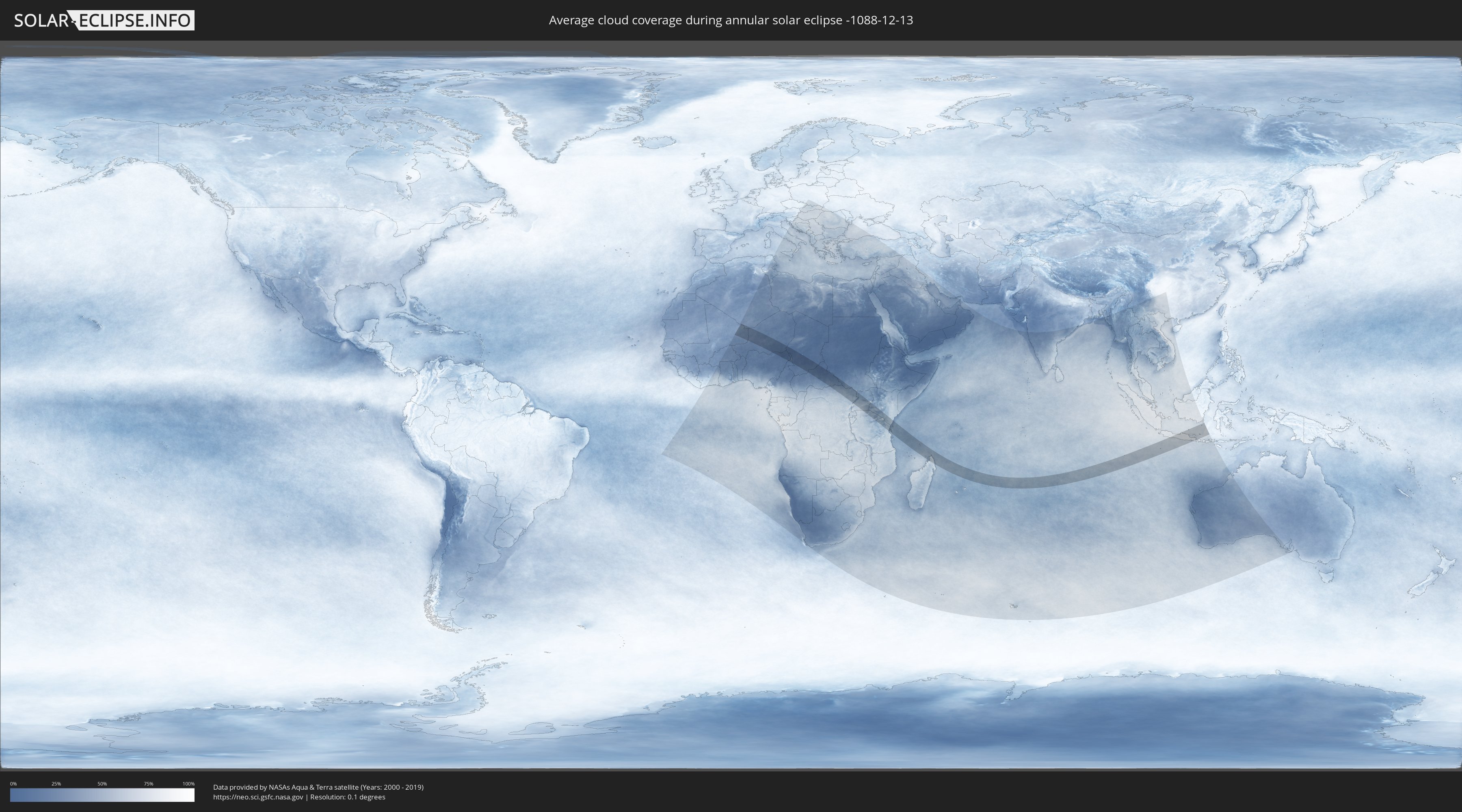
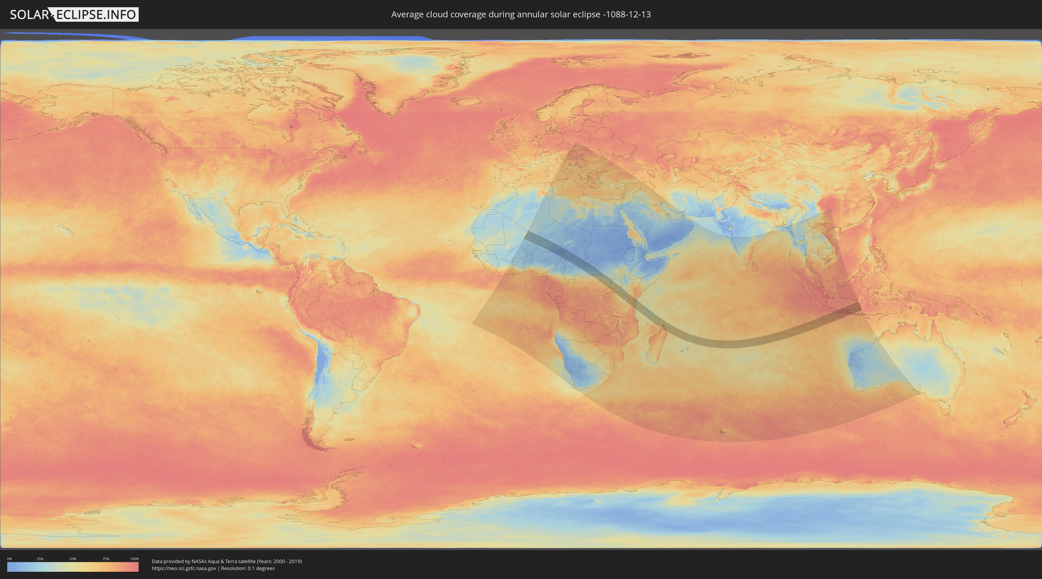
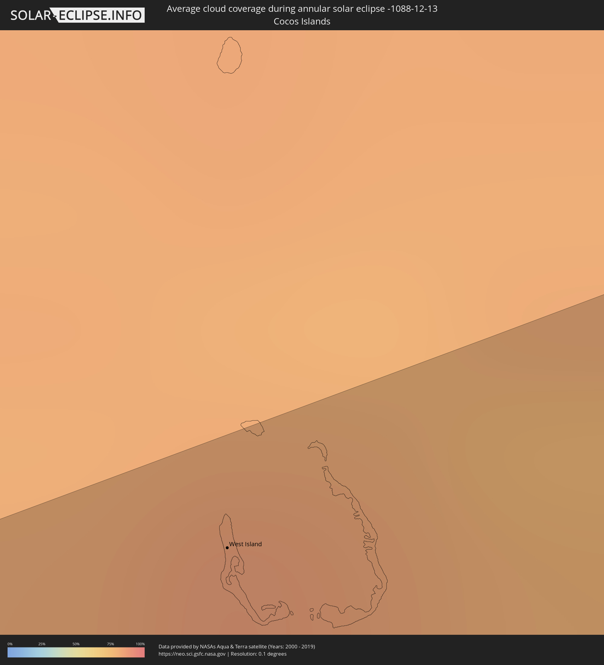
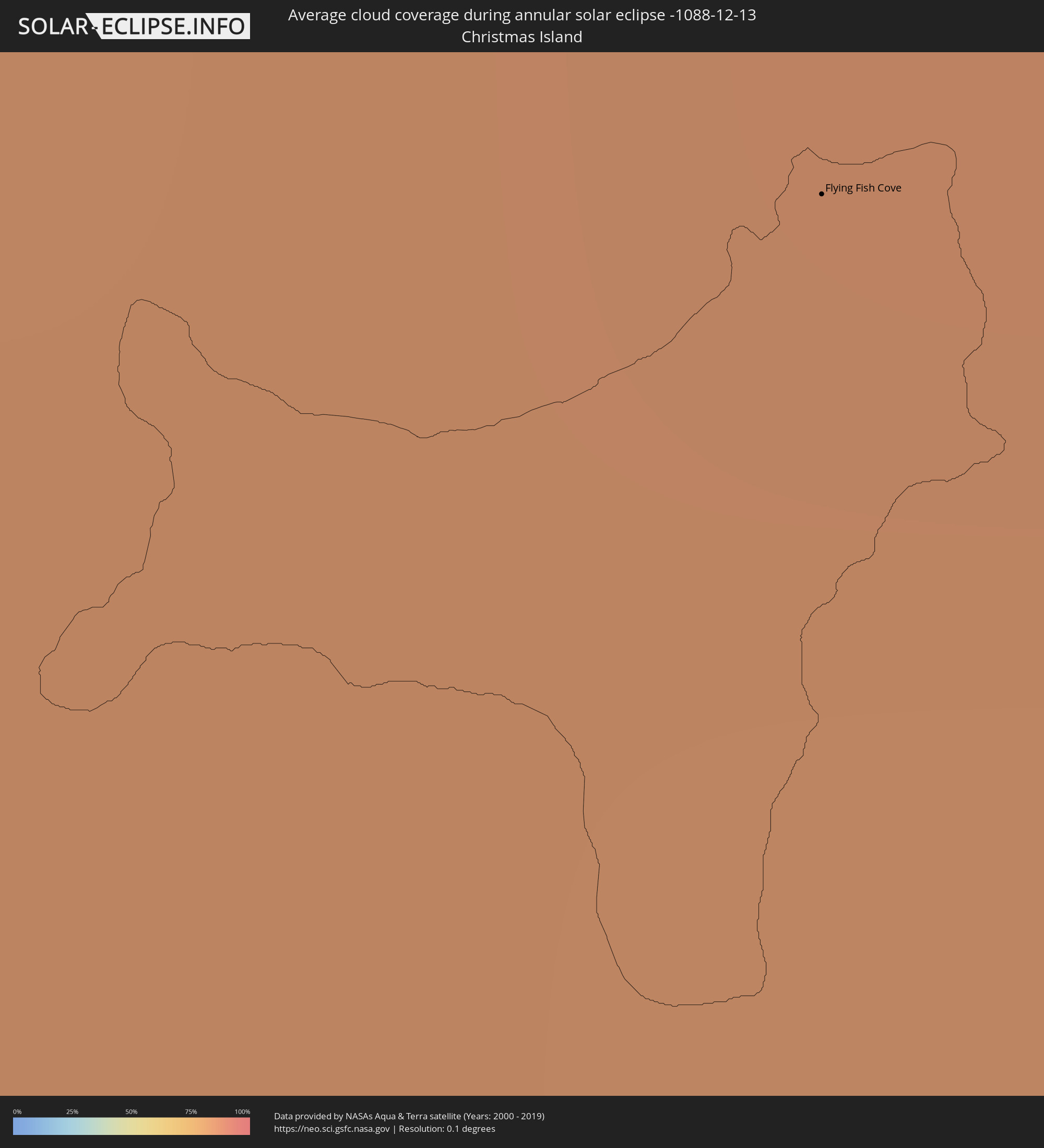
How will be the weather during the annular solar eclipse on 12/13/-1088?
Where is the best place to see the annular solar eclipse of 12/13/-1088?
The following maps show the average cloud coverage for the day of the annular solar eclipse.
With the help of these maps, it is possible to find the place along the eclipse path, which has the best
chance of a cloudless sky.
Nevertheless, you should consider local circumstances and inform about the weather of your chosen
observation site.
The data is provided by NASAs satellites
AQUA and TERRA.
The cloud maps are averaged over a period of 19 years (2000 - 2019).
Detailed country maps
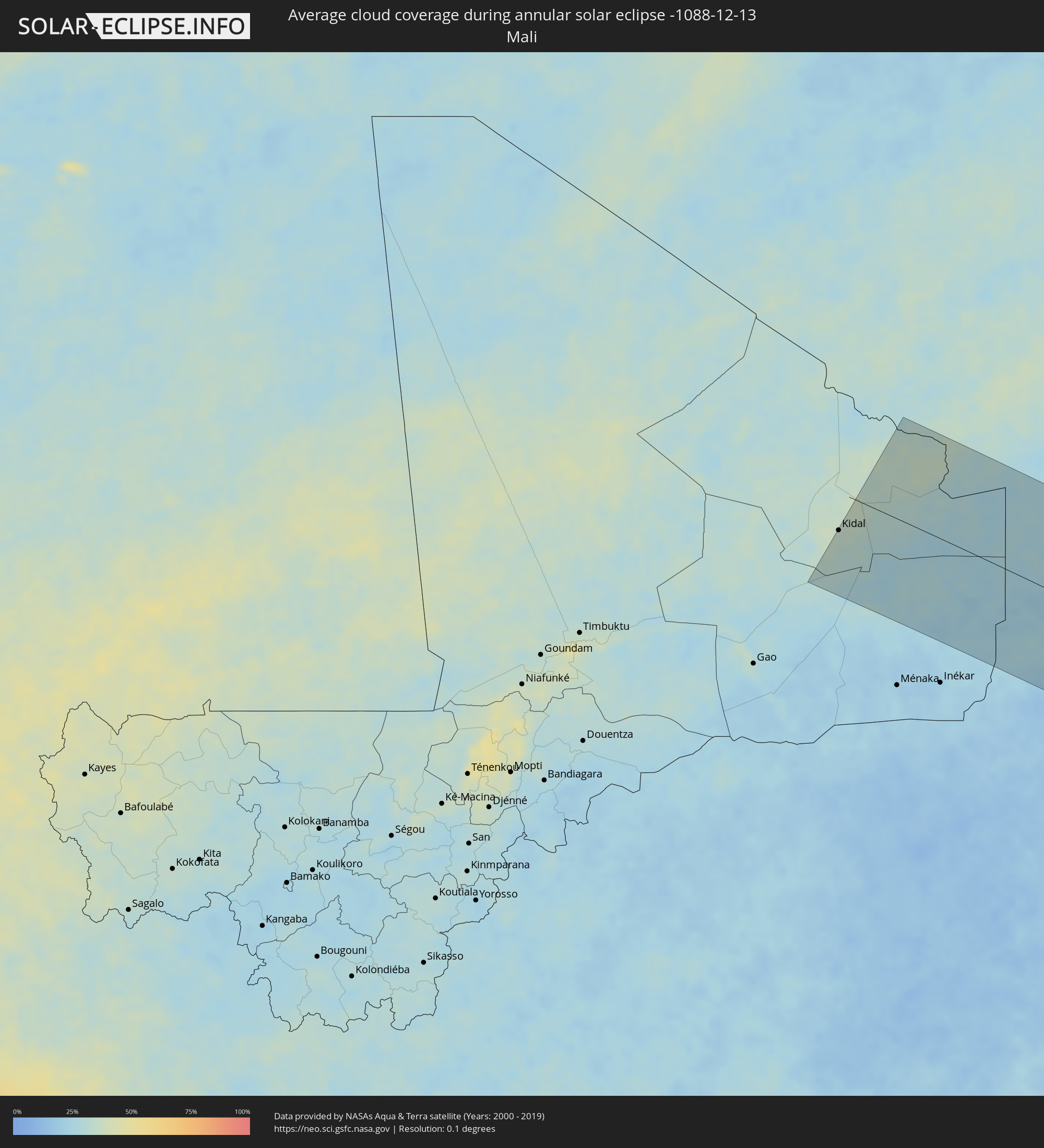 Mali
Mali
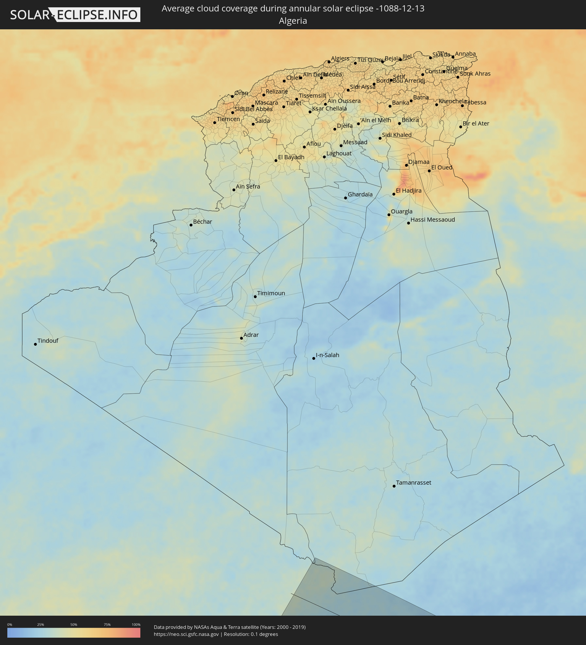 Algeria
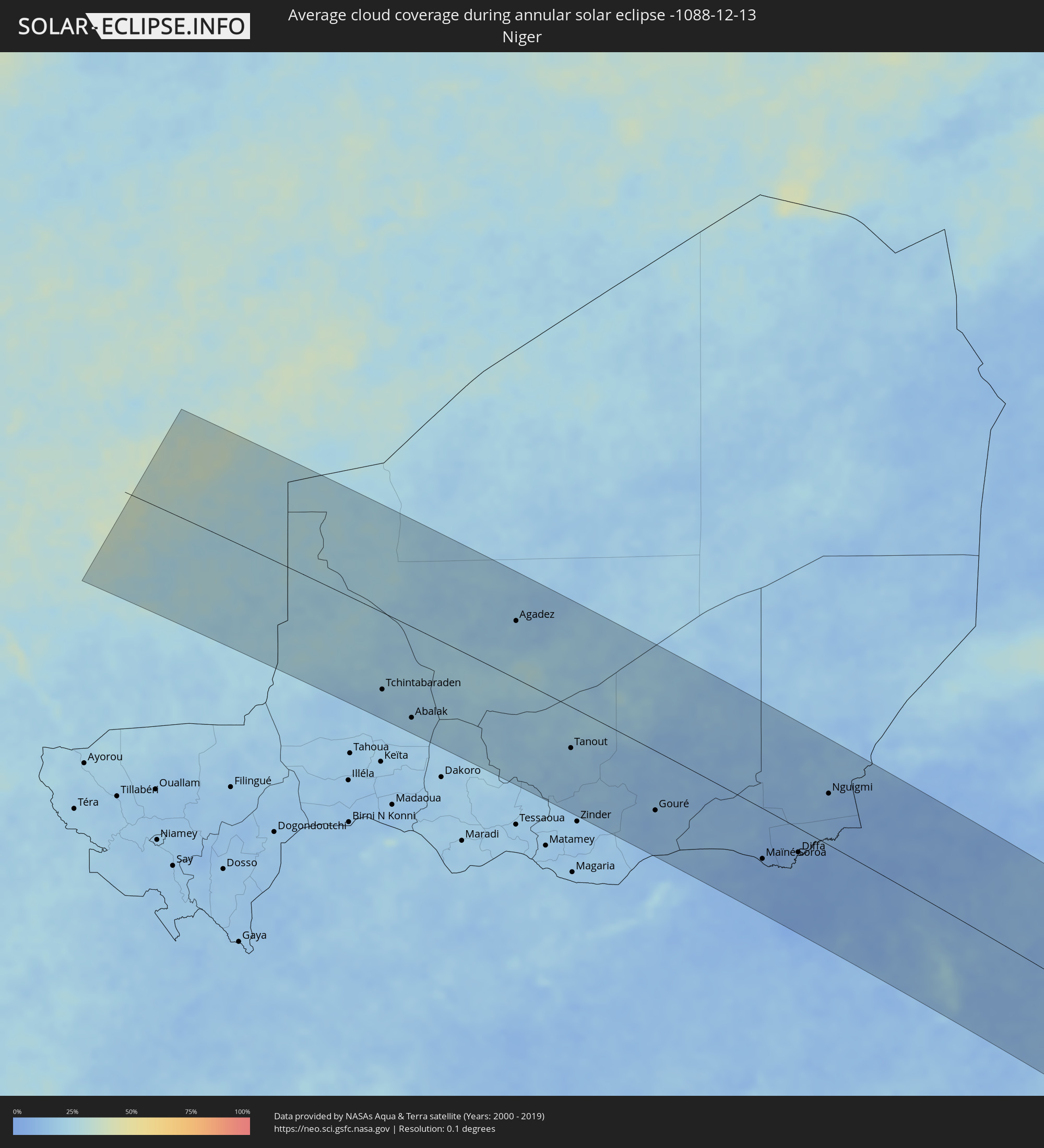 Niger
Niger
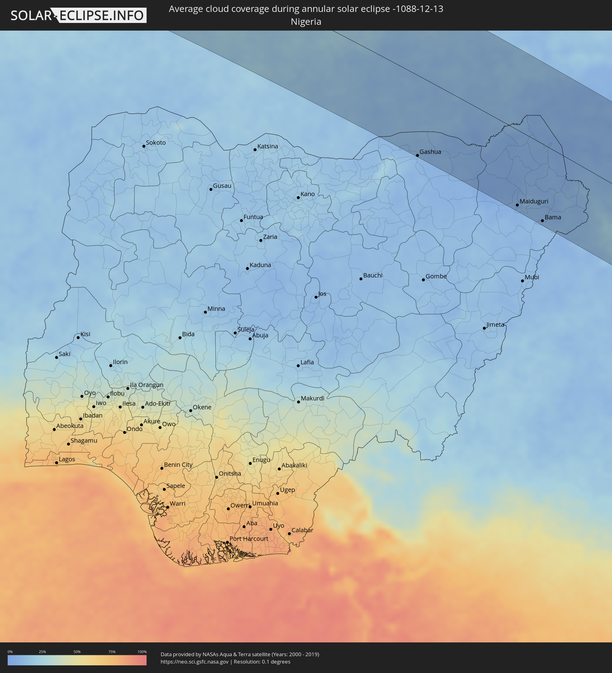 Nigeria
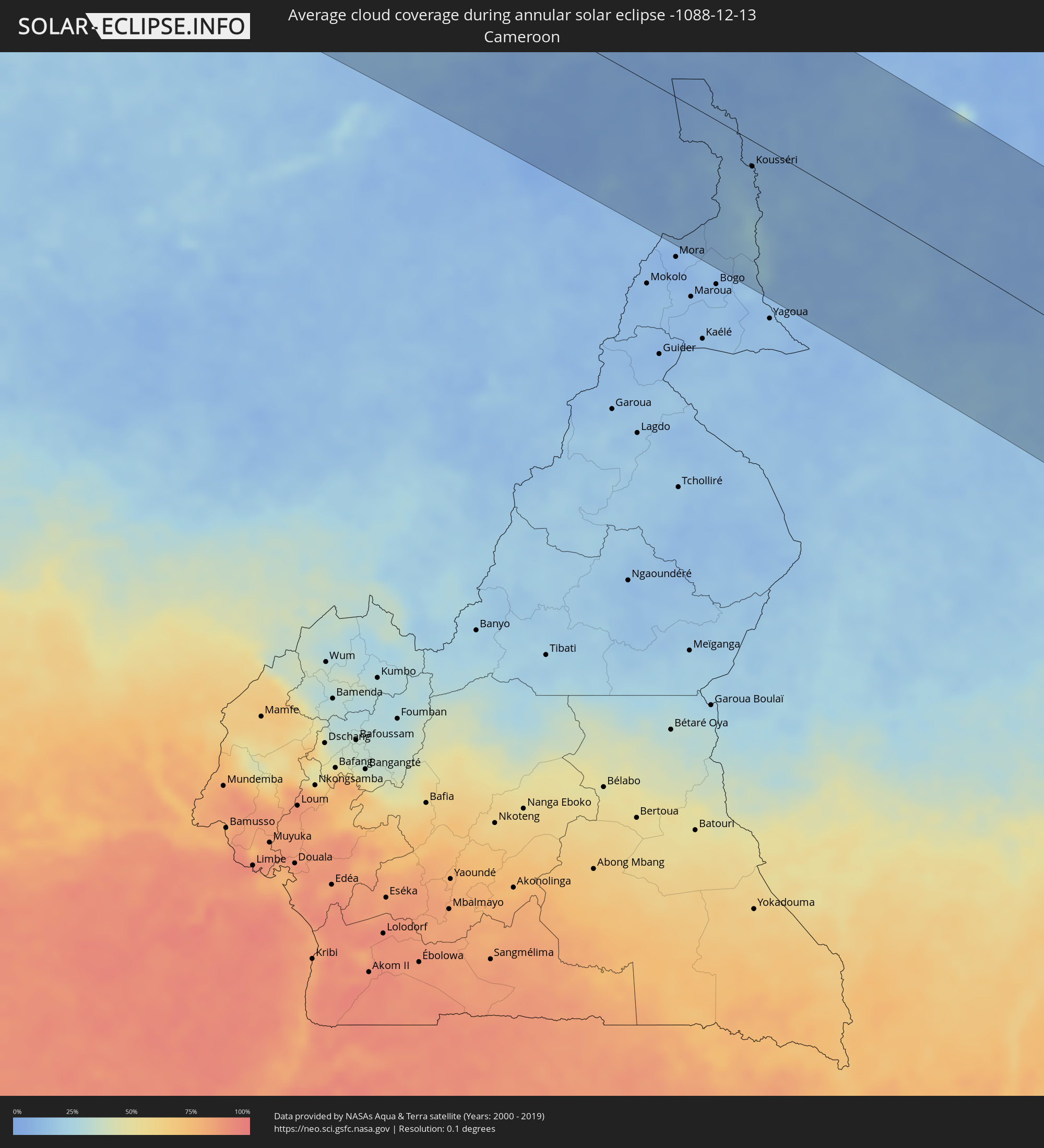 Cameroon
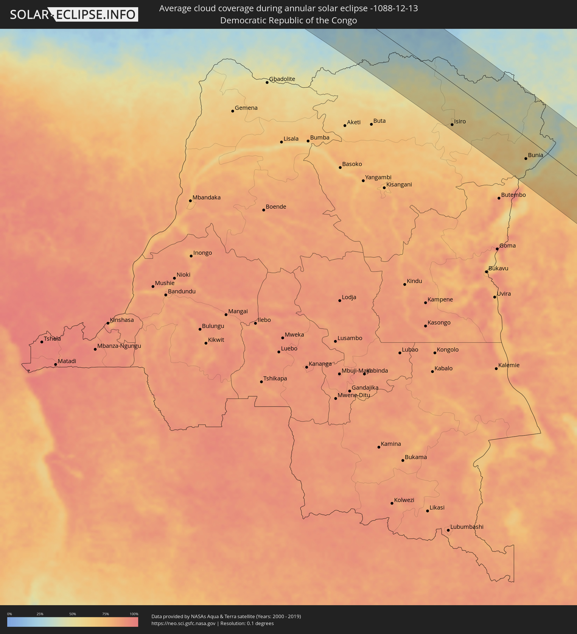 Democratic Republic of the Congo
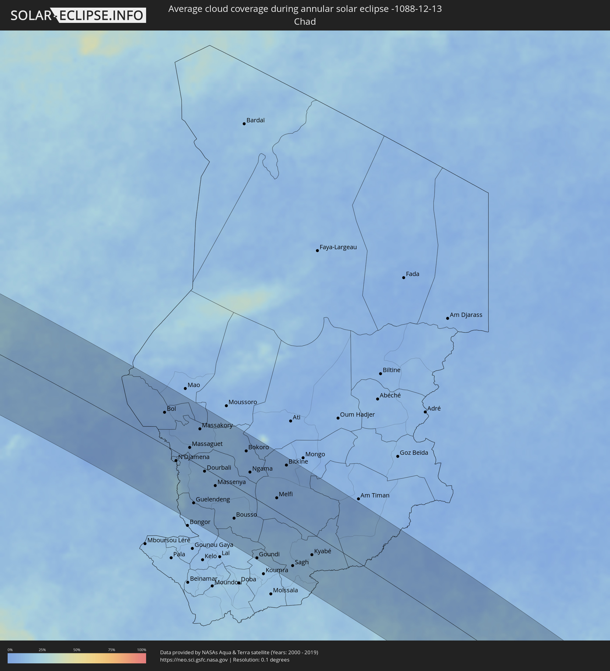 Chad
Chad
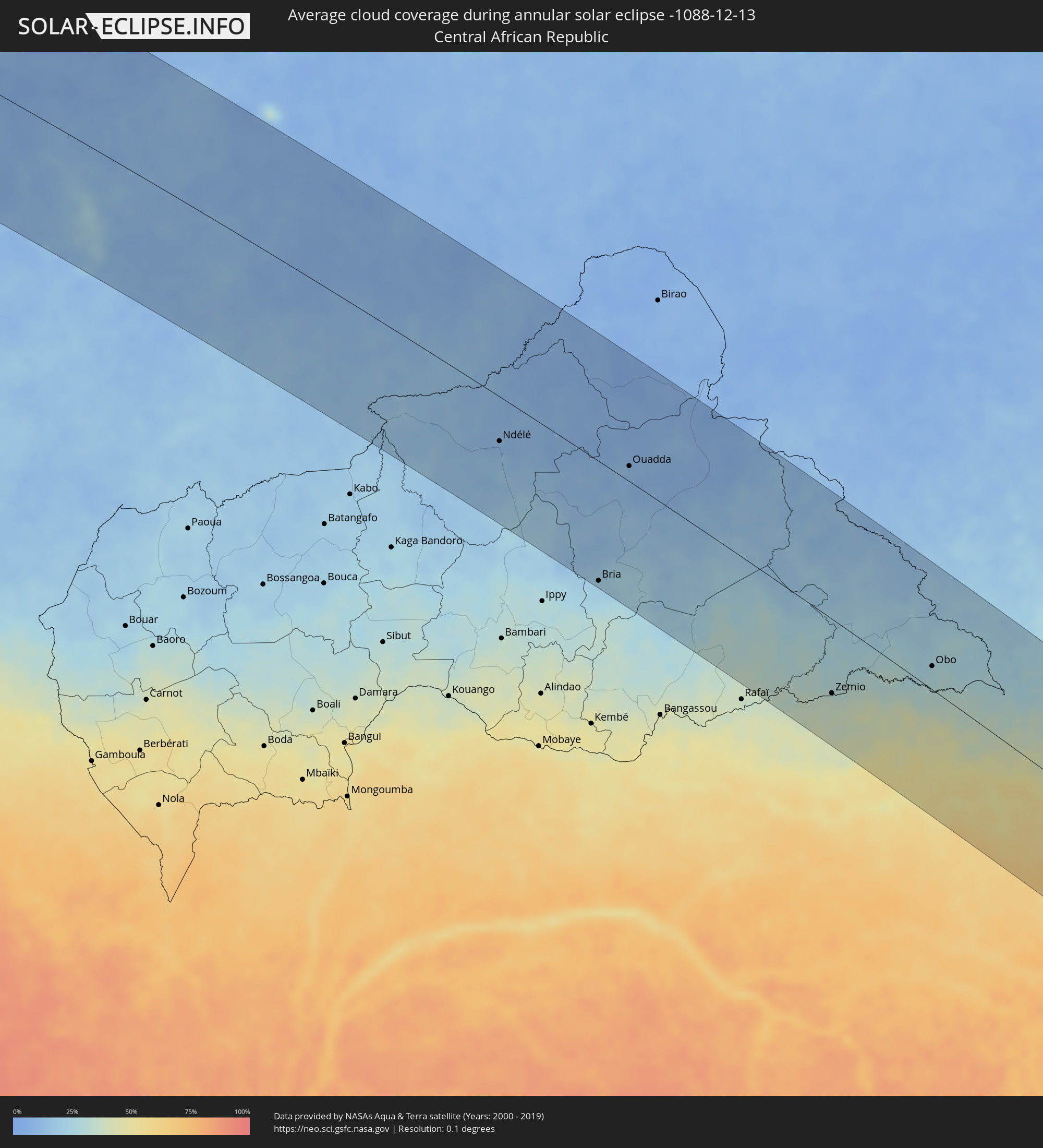 Central African Republic
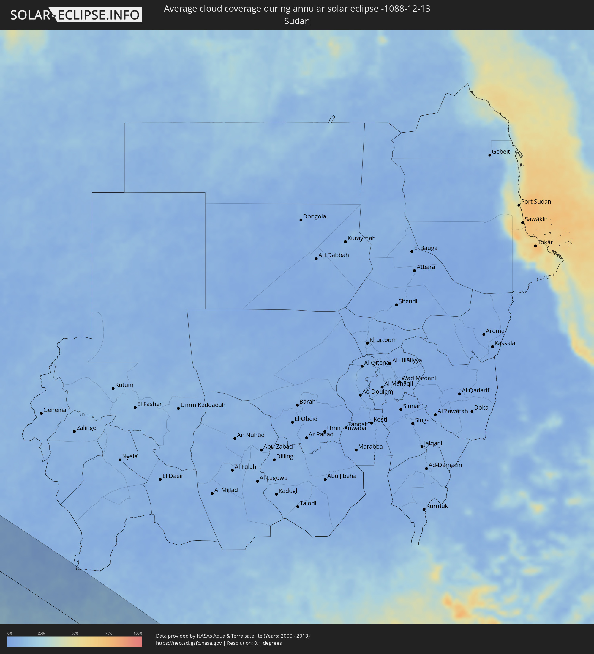 Sudan
Sudan
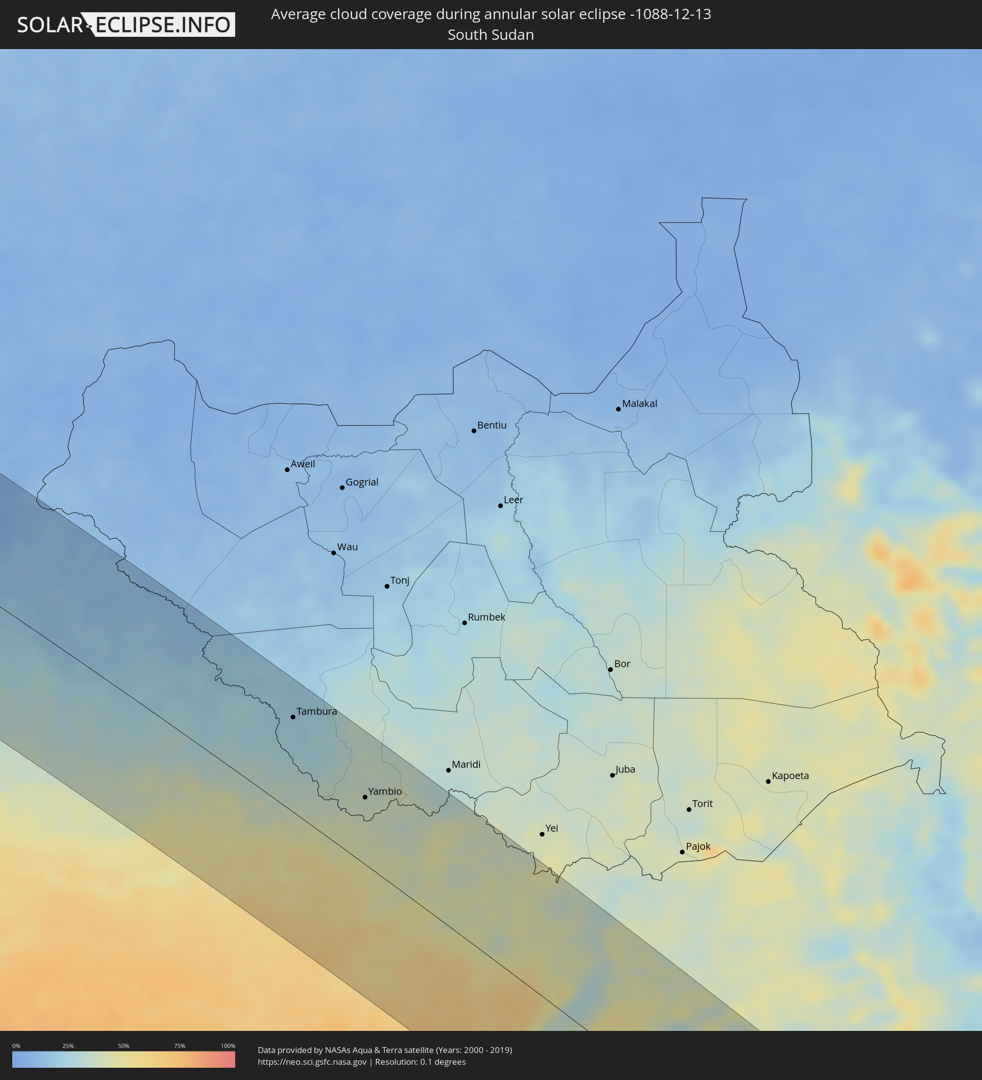 South Sudan
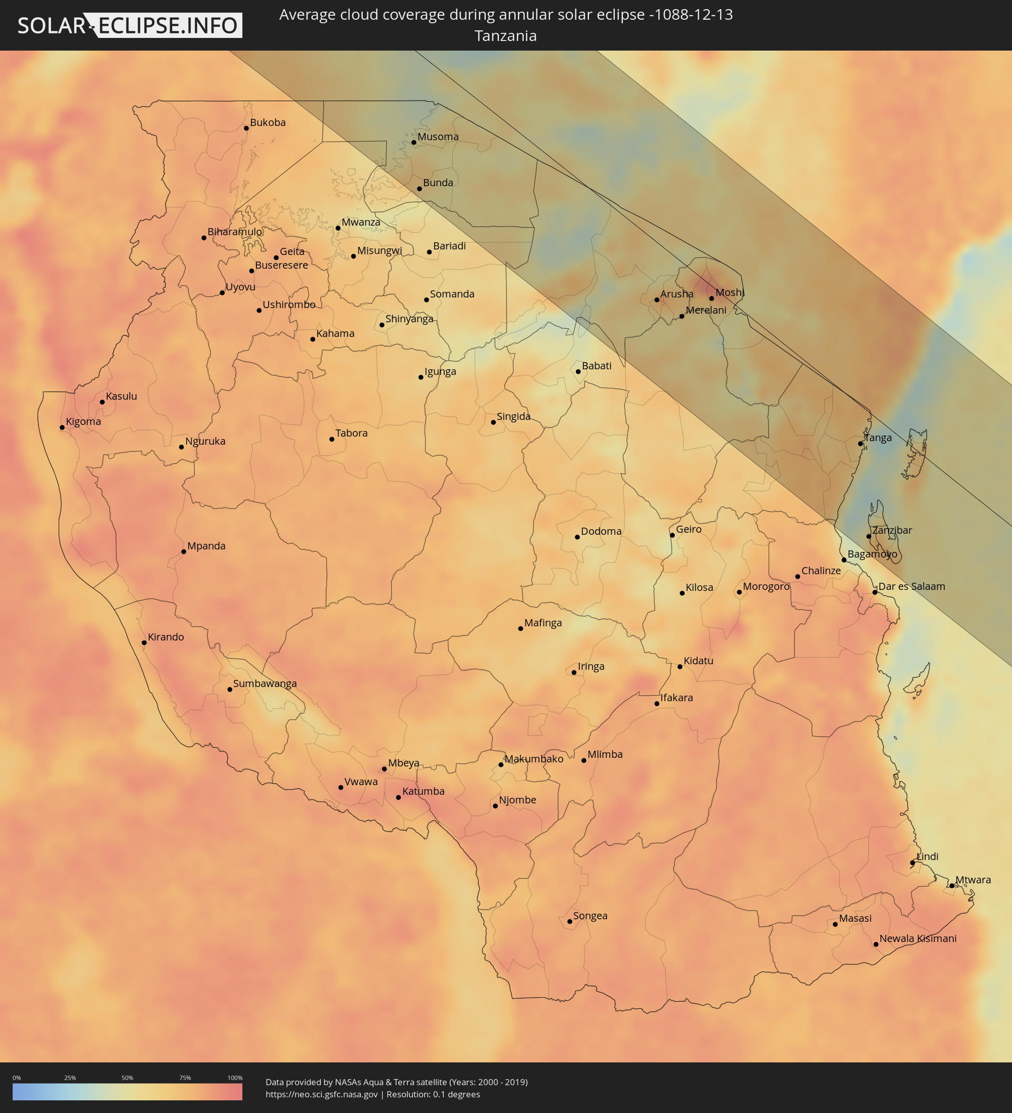 Tanzania
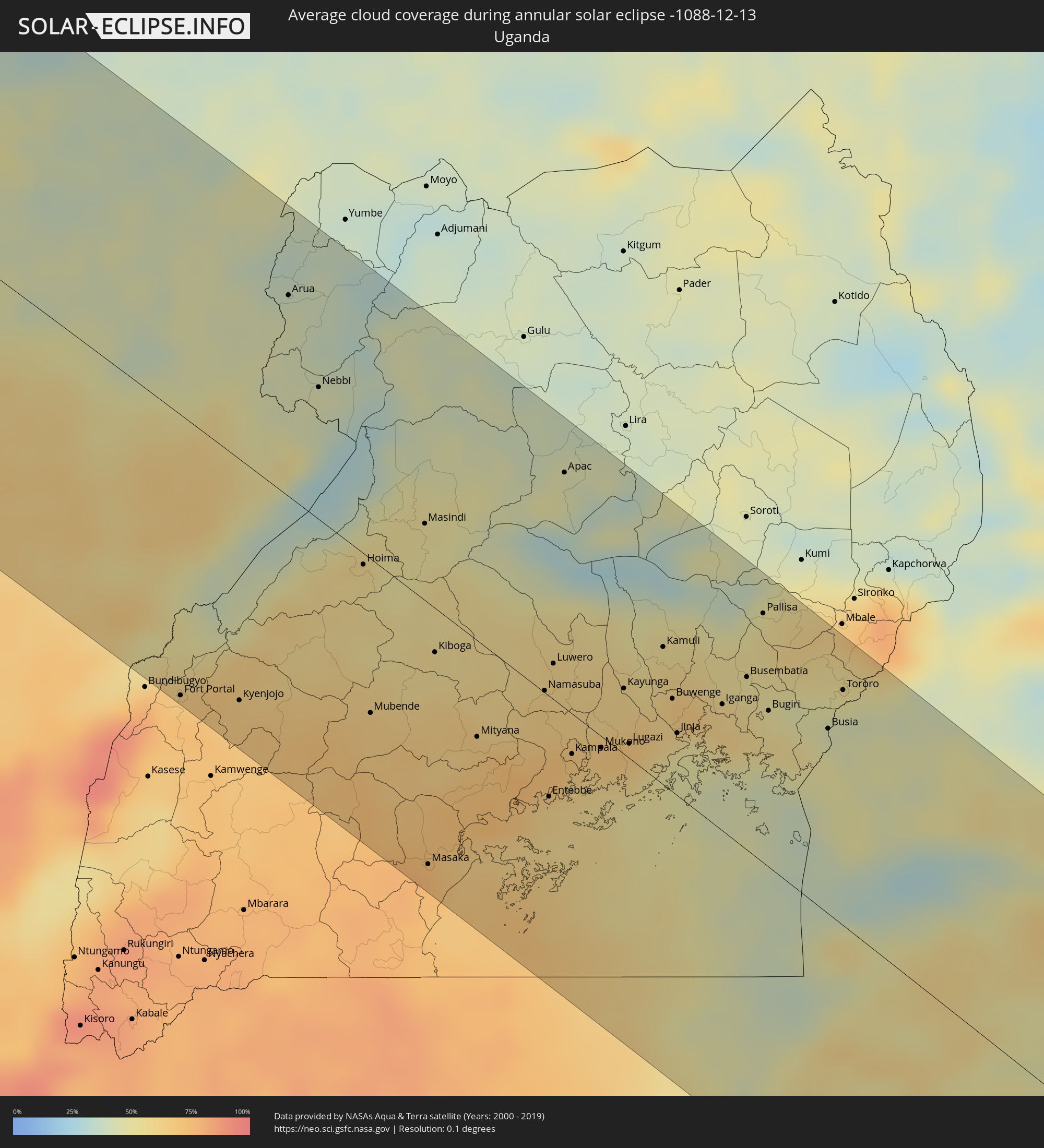 Uganda
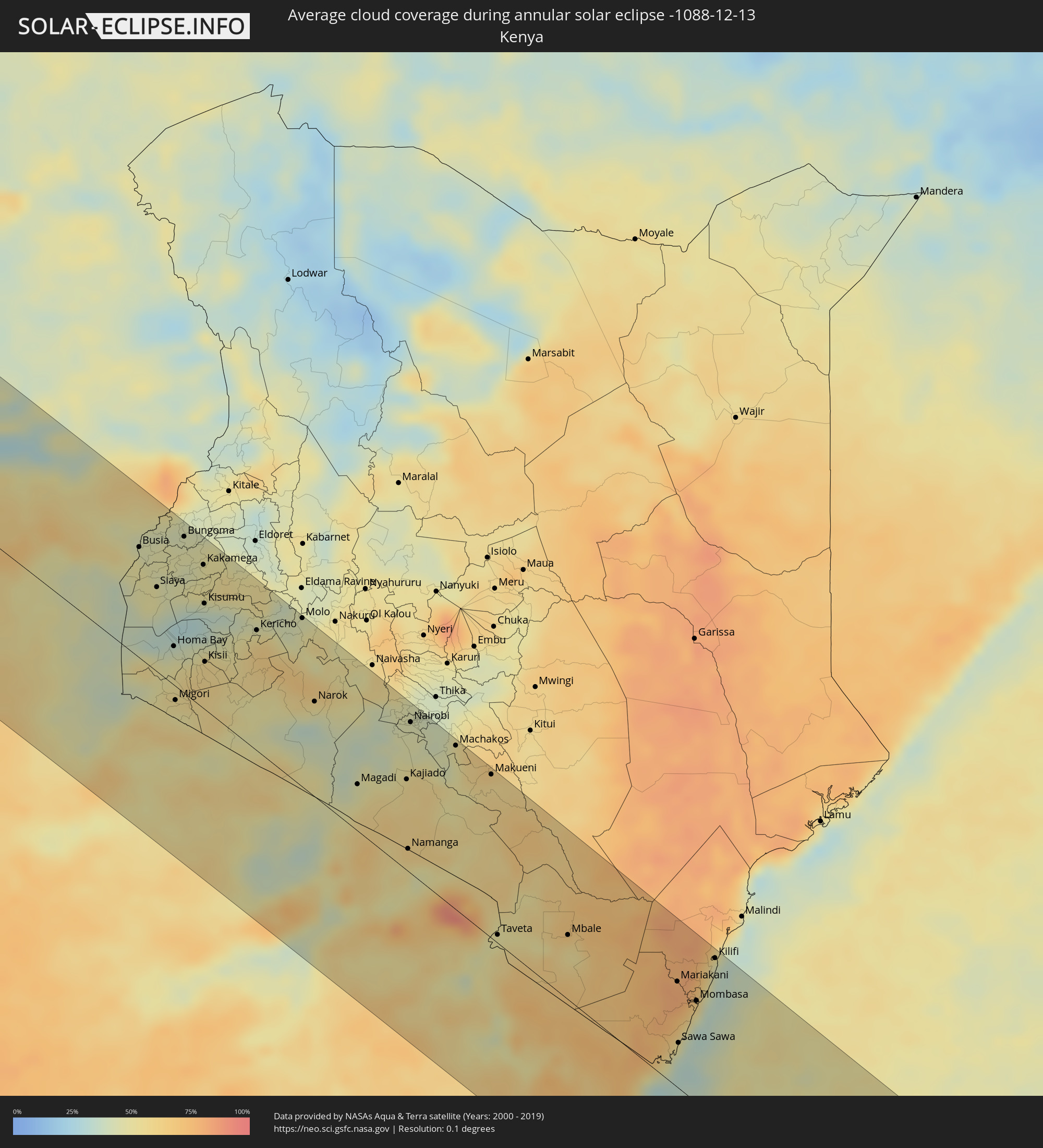 Kenya
Kenya
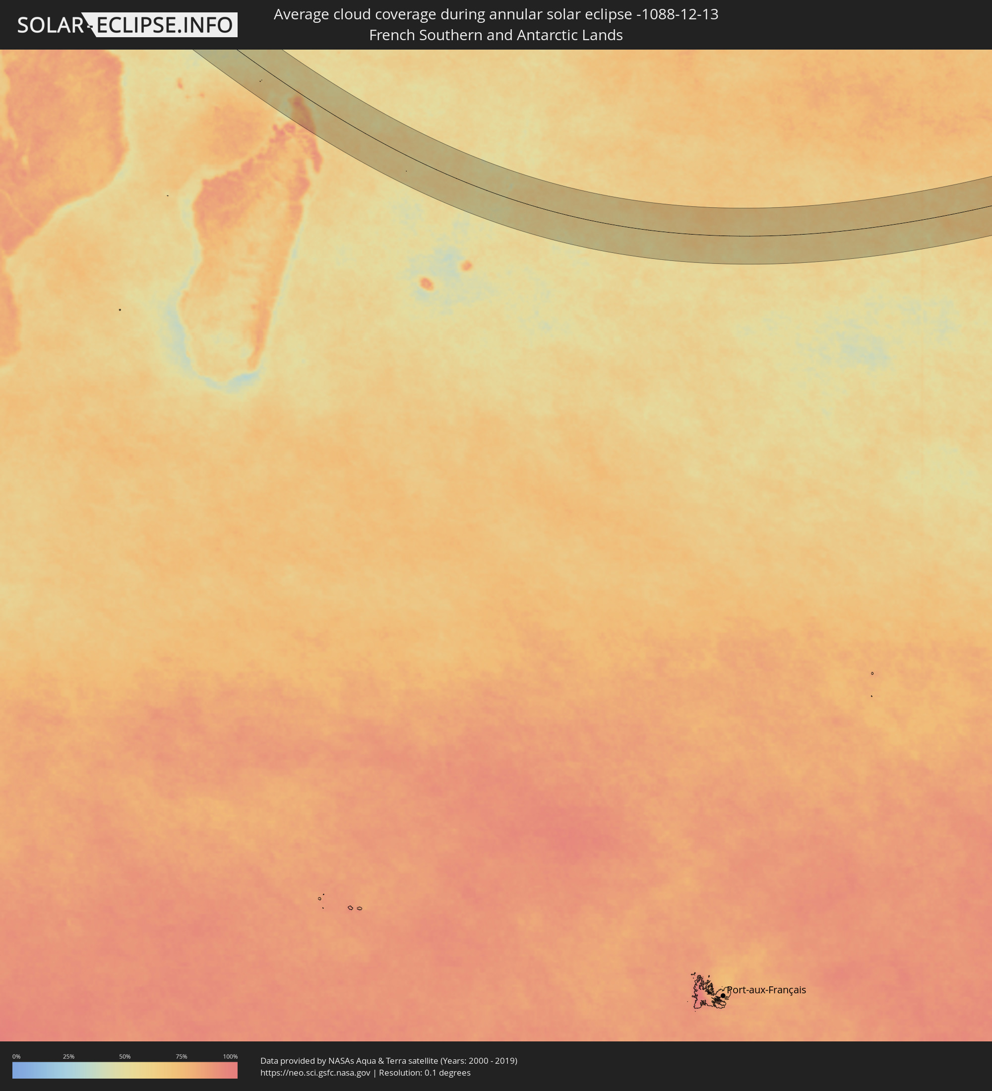 French Southern and Antarctic Lands
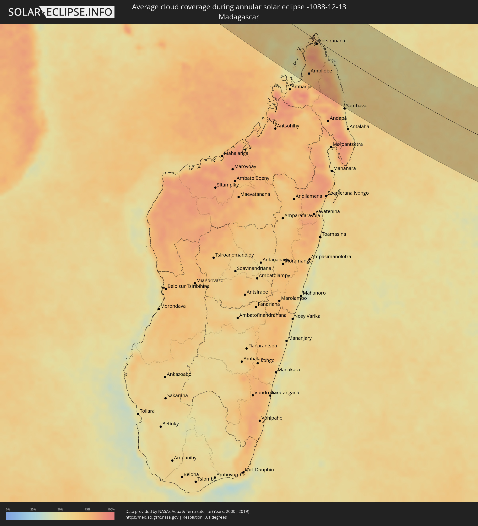 Madagascar
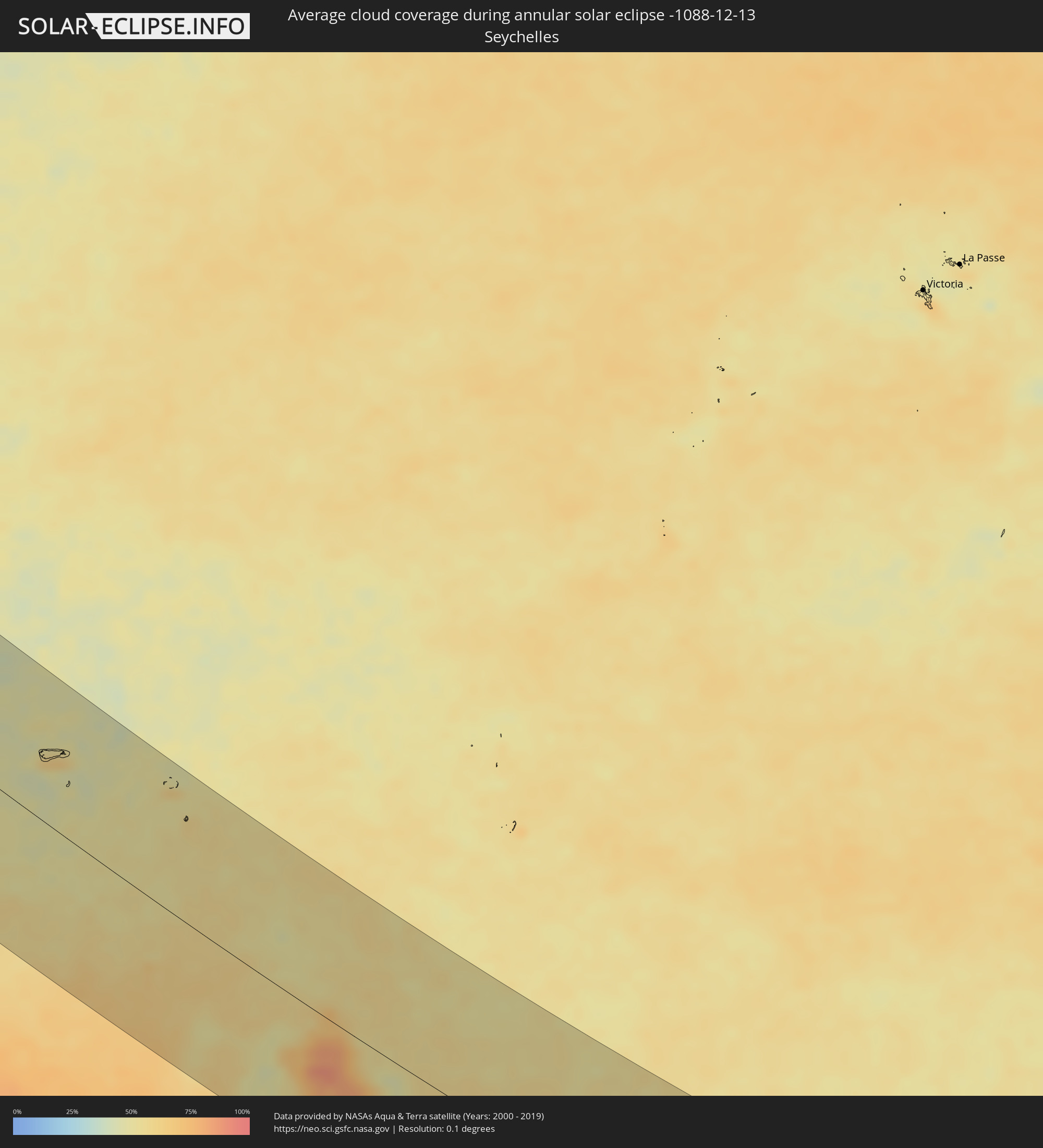 Seychelles
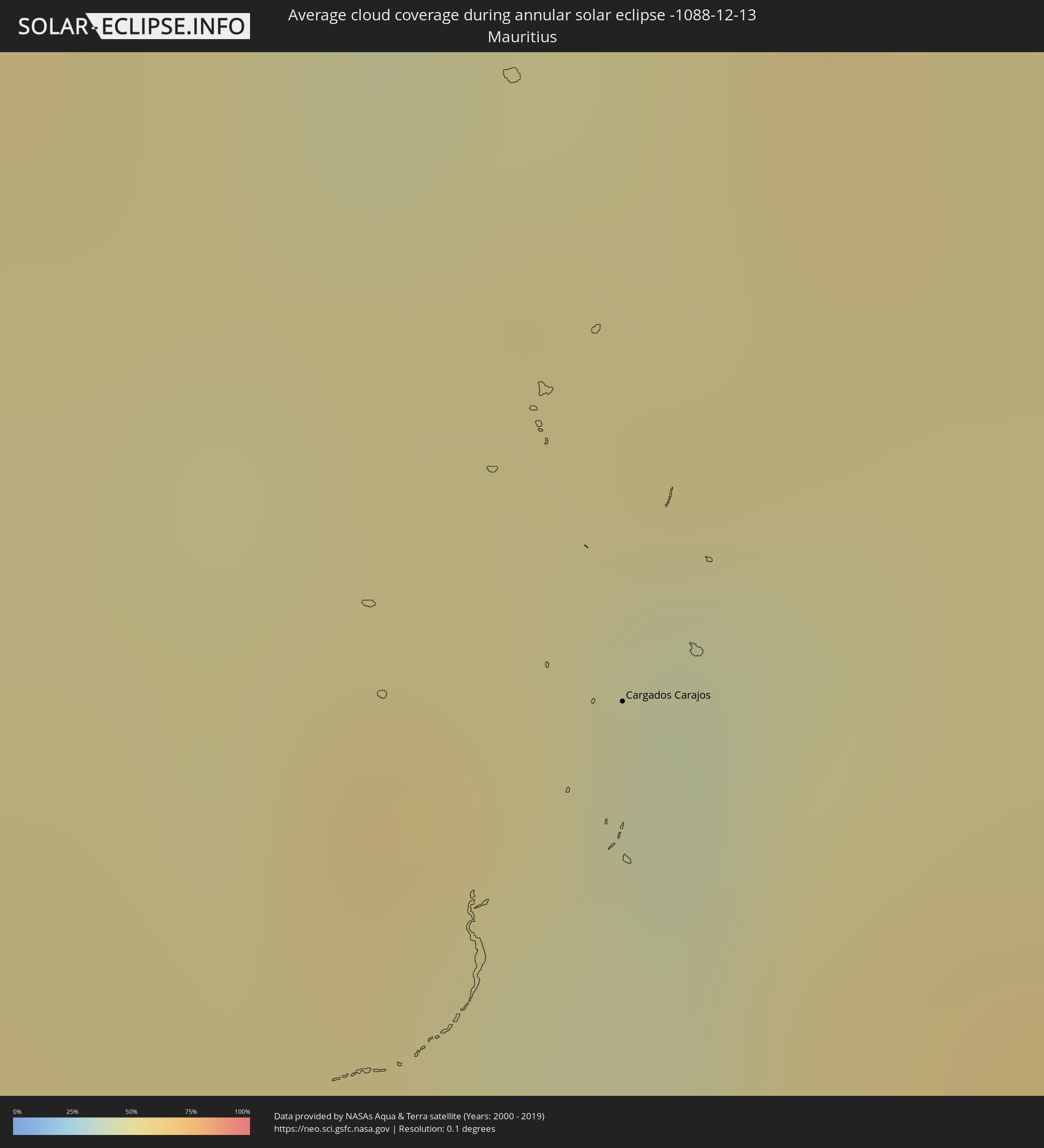 Mauritius
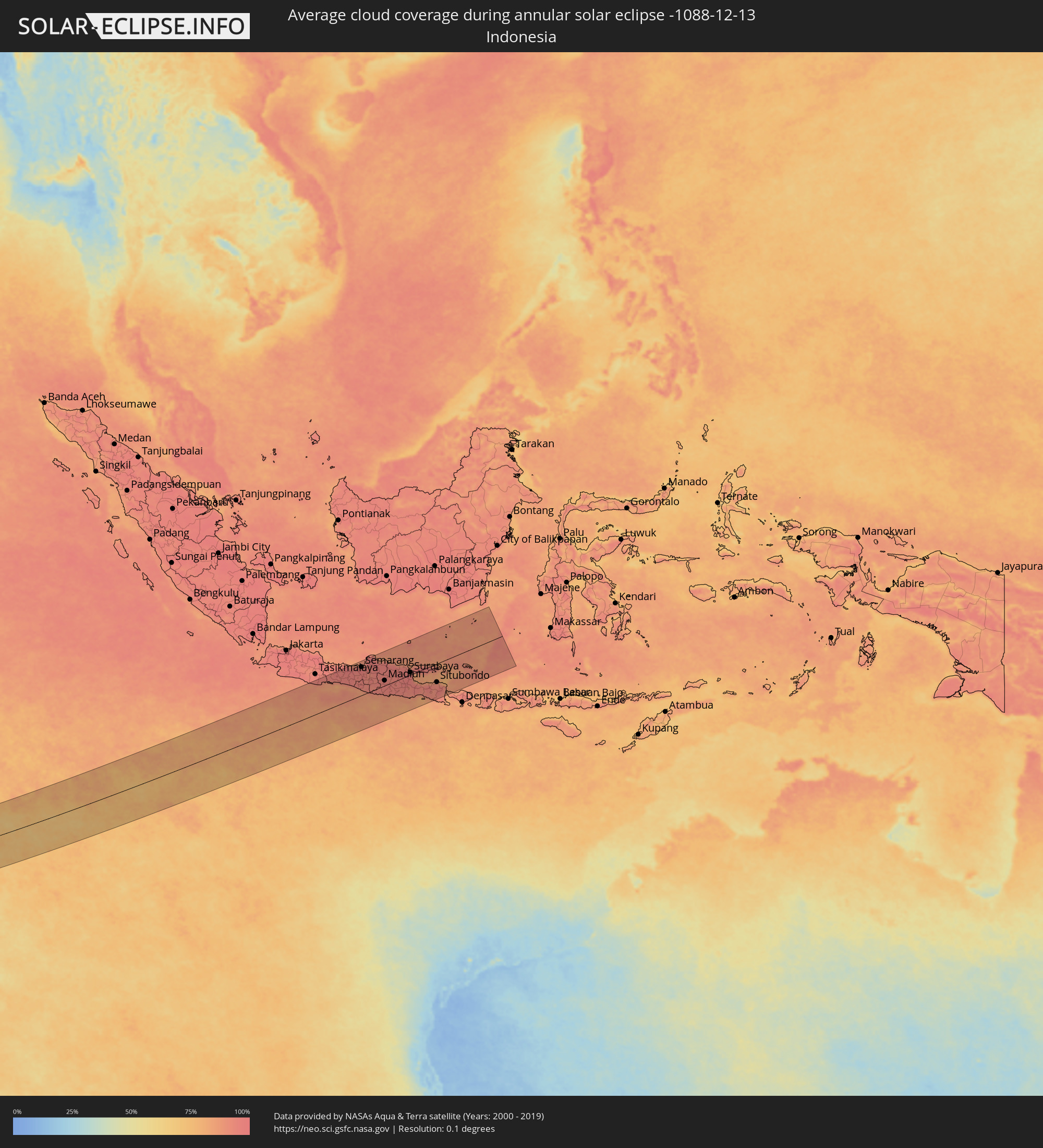 Indonesia
 Cocos Islands
 Christmas Island
Cities inside the path of the eclipse
The following table shows all locations with a population of more than 5,000 inside the eclipse path. Cities which have more than 100,000 inhabitants are marked bold. A click at the locations opens a detailed map.
| City | Type | Eclipse duration | Local time of max. eclipse | Distance to central line | Ø Cloud coverage |
|
Kidal, Kidal
|
annular | - | 06:08:40 UTC-00:16 | 62 km | 35% |
|
Tchintabaraden, Tahoua
|
annular | - | 06:38:59 UTC+00:13 | 121 km | 20% |
|
Abalak, Tahoua
|
annular | - | 06:39:09 UTC+00:13 | 143 km | 20% |
|
Agadez, Agadez
|
annular | - | 06:38:55 UTC+00:13 | 90 km | 19% |
|
Alaghsas, Agadez
|
annular | - | 06:38:54 UTC+00:13 | 96 km | 19% |
|
Tanout, Zinder
|
annular | - | 06:39:40 UTC+00:13 | 65 km | 18% |
|
Gouré, Zinder
|
annular | - | 06:40:19 UTC+00:13 | 93 km | 12% |
|
Kumagunnam, Yobe
|
annular | - | 06:40:46 UTC+00:13 | 156 km | 11% |
|
Gashua, Yobe
|
annular | - | 06:41:00 UTC+00:13 | 162 km | 11% |
|
Geidam, Yobe
|
annular | - | 06:41:14 UTC+00:13 | 114 km | 8% |
|
Maïné Soroa, Diffa
|
annular | - | 06:41:07 UTC+00:13 | 78 km | 6% |
|
Damasak, Borno
|
annular | - | 06:41:19 UTC+00:13 | 63 km | 9% |
|
Diffa, Diffa
|
annular | - | 06:41:15 UTC+00:13 | 38 km | 10% |
|
Magumeri, Borno
|
annular | - | 06:41:55 UTC+00:13 | 143 km | 7% |
|
Nguigmi, Diffa
|
annular | - | 06:40:59 UTC+00:13 | 79 km | 10% |
|
Maiduguri, Borno
|
annular | - | 06:42:10 UTC+00:13 | 151 km | 8% |
|
Kukawa, Borno
|
annular | - | 06:41:45 UTC+00:13 | 25 km | 6% |
|
Monguno, Borno
|
annular | - | 06:41:54 UTC+00:13 | 47 km | 6% |
|
Bama, Borno
|
annular | - | 06:42:32 UTC+00:13 | 154 km | 11% |
|
Marte, Borno
|
annular | - | 06:42:08 UTC+00:13 | 65 km | 8% |
|
Dikwa, Borno
|
annular | - | 06:42:20 UTC+00:13 | 92 km | 7% |
|
Ngala, Borno
|
annular | - | 06:42:17 UTC+00:13 | 48 km | 9% |
|
Gamboru, Borno
|
annular | - | 06:42:16 UTC+00:13 | 44 km | 7% |
|
Makary, Far North
|
annular | - | 06:42:15 UTC+00:13 | 11 km | 10% |
|
Bol, Lac
|
annular | - | 07:28:32 UTC+01:00 | 88 km | 8% |
|
Kousséri, Far North
|
annular | - | 06:42:45 UTC+00:13 | 28 km | 12% |
|
N'Djamena, Chari-Baguirmi
|
annular | - | 07:29:21 UTC+01:00 | 24 km | 12% |
|
Massaguet, Hadjer-Lamis
|
annular | - | 07:29:19 UTC+01:00 | 32 km | 8% |
|
Guelendeng, Mayo-Kebbi Est
|
annular | - | 07:30:15 UTC+01:00 | 111 km | 10% |
|
Massakory, Hadjer-Lamis
|
annular | - | 07:29:10 UTC+01:00 | 99 km | 9% |
|
Dourbali, Chari-Baguirmi
|
annular | - | 07:29:52 UTC+01:00 | 8 km | 10% |
|
Bousso, Chari-Baguirmi
|
annular | - | 07:31:04 UTC+01:00 | 88 km | 12% |
|
Bokoro, Hadjer-Lamis
|
annular | - | 07:30:06 UTC+01:00 | 113 km | 8% |
|
Ngama, Chari-Baguirmi
|
annular | - | 07:30:30 UTC+01:00 | 62 km | 7% |
|
Goundi, Mandoul
|
annular | - | 07:32:10 UTC+01:00 | 157 km | 16% |
|
Bitkine, Guéra
|
annular | - | 07:30:55 UTC+01:00 | 140 km | 7% |
|
Sagh, Moyen-Chari
|
annular | - | 07:32:53 UTC+01:00 | 119 km | 12% |
|
Kyabé, Moyen-Chari
|
annular | - | 07:32:59 UTC+01:00 | 58 km | 15% |
|
Ndélé, Bamingui-Bangoran
|
annular | - | 06:48:14 UTC+00:13 | 56 km | 11% |
|
Bria, Haute-Kotto
|
annular | - | 06:50:47 UTC+00:13 | 149 km | 20% |
|
Ouadda, Haute-Kotto
|
annular | - | 06:49:46 UTC+00:13 | 19 km | 12% |
|
Zemio, Haut-Mbomou
|
annular | - | 06:54:55 UTC+00:13 | 91 km | 36% |
|
Obo, Haut-Mbomou
|
annular | - | 06:55:51 UTC+00:13 | 29 km | 28% |
 Tambura, Western Equatoria
|
annular | - | 08:49:30 UTC+02:06 | 110 km | 22% |
|
Isiro, Orientale
|
annular | - | 08:56:41 UTC+02:10 | 135 km | 63% |
|
Yambio, Western Equatoria
|
annular | - | 08:51:37 UTC+02:06 | 77 km | 38% |
|
Watsa, Orientale
|
annular | - | 08:58:35 UTC+02:10 | 15 km | 42% |
|
Bunia, Orientale
|
annular | - | 09:01:19 UTC+02:10 | 69 km | 57% |
|
Fort Portal, Western Region
|
annular | - | 09:19:28 UTC+02:27 | 147 km | 68% |
|
Arua, Northern Region
|
annular | - | 09:17:14 UTC+02:27 | 105 km | 42% |
|
Hoima, Western Region
|
annular | - | 09:19:51 UTC+02:27 | 6 km | 56% |
|
Masaka, Central Region
|
annular | - | 09:22:47 UTC+02:27 | 136 km | 75% |
|
Mityana, Central Region
|
annular | - | 09:22:08 UTC+02:27 | 50 km | 66% |
|
Entebbe, Central Region
|
annular | - | 09:23:14 UTC+02:27 | 52 km | 62% |
|
Kampala, Central Region
|
annular | - | 09:23:04 UTC+02:27 | 21 km | 65% |
|
Mukono, Central Region
|
annular | - | 09:23:16 UTC+02:27 | 6 km | 68% |
|
Lugazi, Central Region
|
annular | - | 09:23:29 UTC+02:27 | 8 km | 68% |
|
Jinja, Eastern Region
|
annular | - | 09:23:48 UTC+02:27 | 32 km | 50% |
|
Iganga, Eastern Region
|
annular | - | 09:23:57 UTC+02:27 | 65 km | 59% |
|
Musoma, Mara
|
annular | - | 09:27:32 UTC+02:27 | 97 km | 57% |
|
Bunda, Mara
|
annular | - | 09:28:28 UTC+02:27 | 140 km | 52% |
|
Busia, Eastern Region
|
annular | - | 09:25:06 UTC+02:27 | 96 km | 44% |
|
Busia, Busia
|
annular | - | 09:25:08 UTC+02:27 | 96 km | 44% |
|
Tororo, Eastern Region
|
annular | - | 09:24:55 UTC+02:27 | 122 km | 48% |
|
Lugulu, Busia
|
annular | - | 09:25:32 UTC+02:27 | 104 km | 47% |
|
Tarime, Mara
|
annular | - | 09:28:12 UTC+02:27 | 44 km | 54% |
|
Homa Bay, Homa Bay
|
annular | - | 09:27:06 UTC+02:27 | 34 km | 44% |
|
Sirari, Mara
|
annular | - | 09:28:13 UTC+02:27 | 28 km | 61% |
|
Mumias, Kakamega
|
annular | - | 09:25:54 UTC+02:27 | 111 km | 47% |
|
Bungoma, Bungoma
|
annular | - | 09:25:41 UTC+02:27 | 136 km | 44% |
|
Kakamega, Kakamega
|
annular | - | 09:26:23 UTC+02:27 | 125 km | 49% |
|
Kisumu, Kisumu
|
annular | - | 09:26:58 UTC+02:27 | 92 km | 34% |
|
Narok, Narok
|
annular | - | 09:30:13 UTC+02:27 | 82 km | 44% |
|
Arusha, Arusha
|
annular | - | 09:35:17 UTC+02:27 | 60 km | 59% |
|
Nairobi, Nairobi Area
|
annular | - | 09:32:11 UTC+02:27 | 131 km | 45% |
|
Merelani, Arusha
|
annular | - | 09:36:08 UTC+02:27 | 56 km | 61% |
|
Moshi, Kilimanjaro
|
annular | - | 09:36:26 UTC+02:27 | 13 km | 57% |
|
Chanika, Tanga
|
annular | - | 09:41:14 UTC+02:27 | 145 km | 66% |
|
Mbale, Vihiga
|
annular | - | 09:38:29 UTC+02:27 | 56 km | 56% |
|
Voi, Taita Taveta
|
annular | - | 09:38:49 UTC+02:27 | 68 km | 66% |
|
Maramba, Tanga
|
annular | - | 09:41:46 UTC+02:27 | 71 km | 70% |
|
Tanga, Tanga
|
annular | - | 09:42:45 UTC+02:27 | 40 km | 53% |
|
Zanzibar, Zanzibar Urban/West
|
annular | - | 09:44:53 UTC+02:27 | 128 km | 71% |
|
Sokoni, Zanzibar Central/South
|
annular | - | 09:46:06 UTC+02:27 | 127 km | 51% |
|
Mombasa, Mombasa
|
annular | - | 09:42:08 UTC+02:27 | 88 km | 46% |
|
Wete, Pemba North
|
annular | - | 09:44:01 UTC+02:27 | 5 km | 68% |
|
Kilifi, Kilifi
|
annular | - | 09:41:47 UTC+02:27 | 138 km | 61% |
|
Antsohimbondrona, Diana
|
annular | - | 10:22:07 UTC+02:27 | 110 km | 66% |
|
Ambilobe, Diana
|
annular | - | 10:22:55 UTC+02:27 | 109 km | 76% |
|
Antsiranana, Diana
|
annular | - | 10:21:53 UTC+02:27 | 9 km | 77% |
|
Sadjoavato, Diana
|
annular | - | 10:22:42 UTC+02:27 | 37 km | 79% |
|
Cargados Carajos, Cargados Carajos
|
annular | - | 12:26:39 UTC+03:50 | 63 km | 46% |
|
West Island
|
annular | - | 16:39:16 UTC+06:30 | 152 km | 83% |
|
Flying Fish Cove
|
annular | - | 17:15:48 UTC+07:00 | 18 km | 82% |
|
Purwokerto, Central Java
|
annular | - | 17:25:01 UTC+07:07 | 143 km | 95% |
|
Yogyakarta, Yogyakarta
|
annular | - | 17:25:12 UTC+07:07 | 56 km | 95% |
|
Semarang, Central Java
|
annular | - | 17:25:23 UTC+07:07 | 137 km | 96% |
|
Salatiga, Central Java
|
annular | - | 17:25:20 UTC+07:07 | 99 km | 96% |
|
Surakarta, Central Java
|
annular | - | 17:25:21 UTC+07:07 | 61 km | 95% |
|
Madiun, East Java
|
annular | - | 17:25:27 UTC+07:07 | 24 km | 96% |
|
Kediri, East Java
|
annular | - | 17:25:29 UTC+07:07 | 16 km | 94% |
|
Malang, East Java
|
annular | - | 17:25:31 UTC+07:07 | 59 km | 94% |
|
Lawang, East Java
|
annular | - | 17:25:33 UTC+07:07 | 47 km | 93% |
|
Surabaya, East Java
|
annular | - | 17:25:41 UTC+07:07 | 11 km | 89% |
|
Probolinggo, East Java
|
annular | - | 17:25:38 UTC+07:07 | 61 km | 94% |
|
Jember, East Java
|
annular | - | 17:25:34 UTC+07:07 | 124 km | 93% |
|
Situbondo, East Java
|
annular | - | 17:25:42 UTC+07:07 | 90 km | 92% |