Annular solar eclipse of 10/27/-1355
| Day of week: | Saturday |
| Maximum duration of eclipse: | 11m10s |
| Maximum width of eclipse path: | 314 km |
| Saros cycle: | 31 |
| Coverage: | 91.8% |
| Magnitude: | 0.918 |
| Gamma: | 0.1429 |
Wo kann man die Sonnenfinsternis vom 10/27/-1355 sehen?
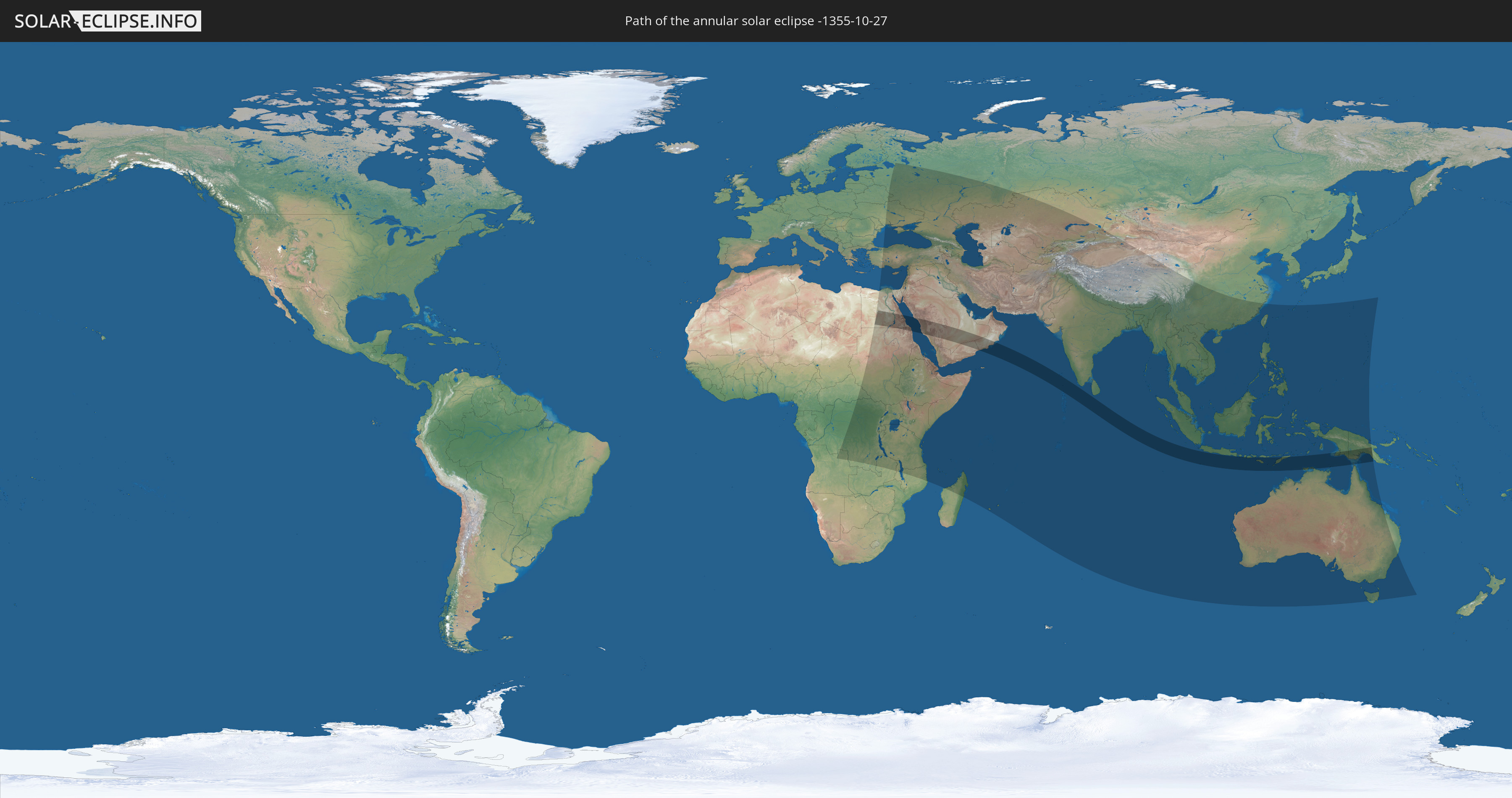
Die Sonnenfinsternis am 10/27/-1355 kann man in 84 Ländern als partielle Sonnenfinsternis beobachten.
Der Finsternispfad verläuft durch 11 Länder. Nur in diesen Ländern ist sie als annular Sonnenfinsternis zu sehen.
In den folgenden Ländern ist die Sonnenfinsternis annular zu sehen
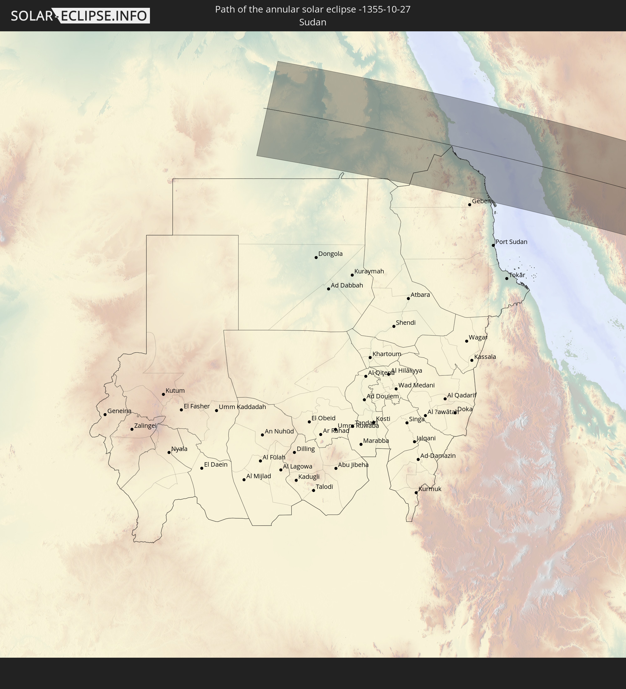 Sudan
Sudan
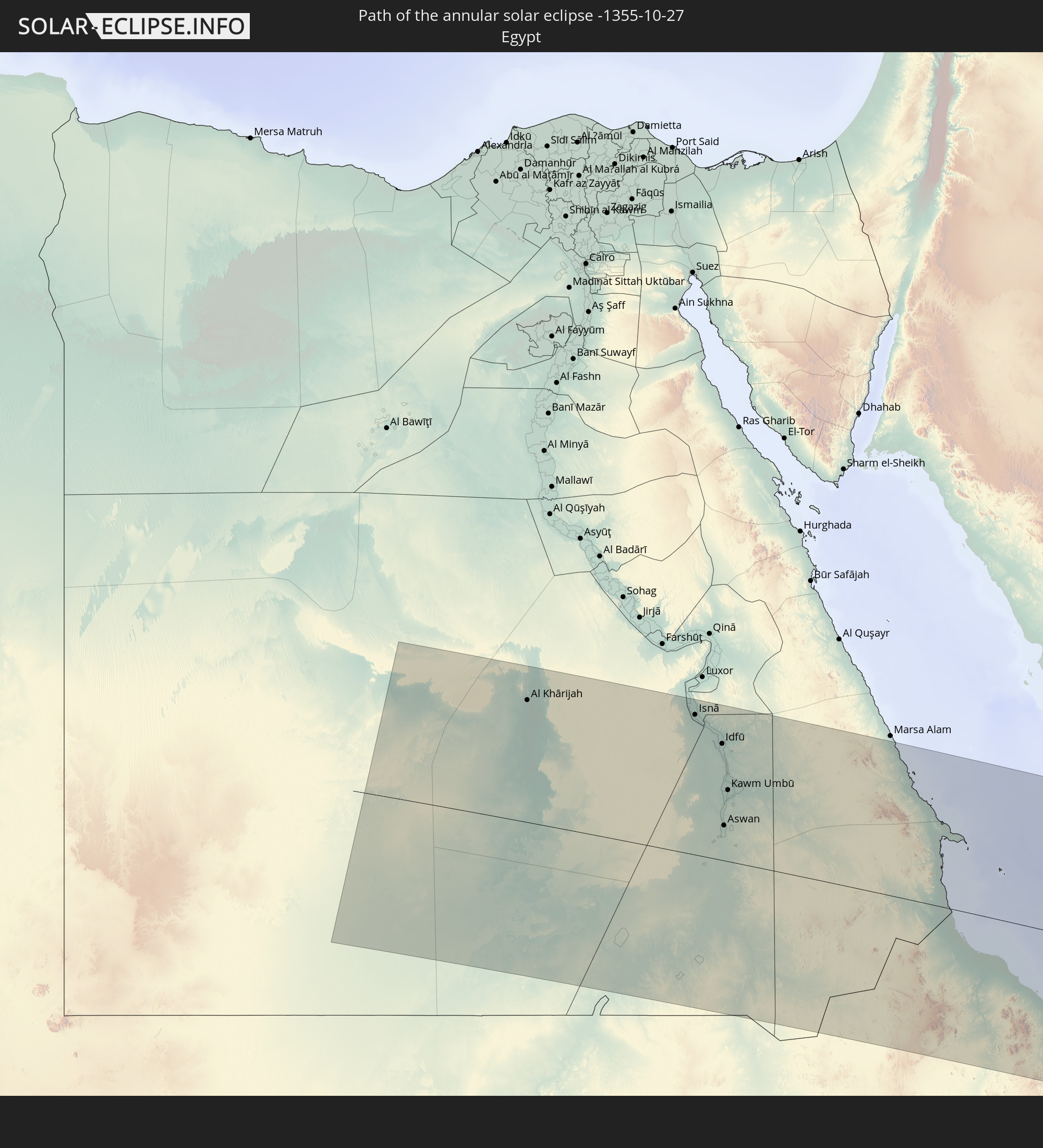 Egypt
Egypt
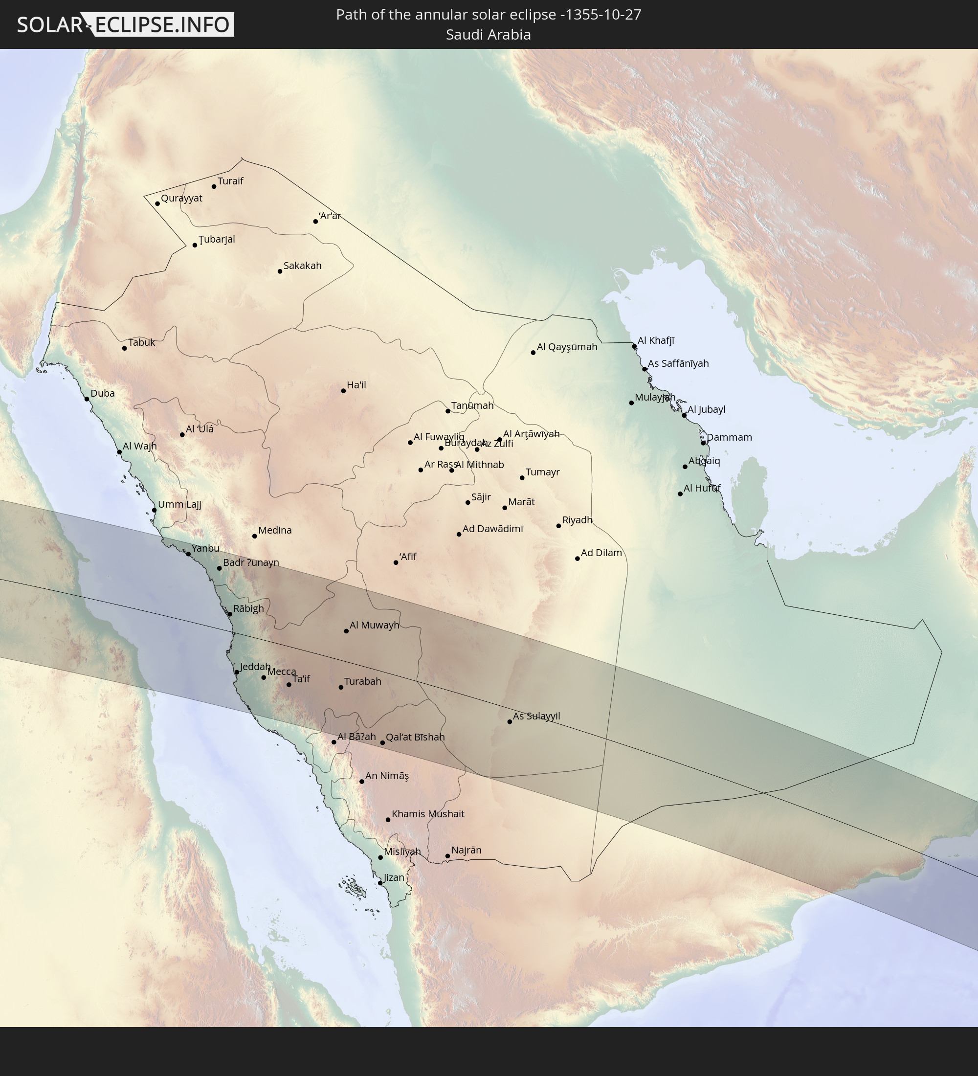 Saudi Arabia
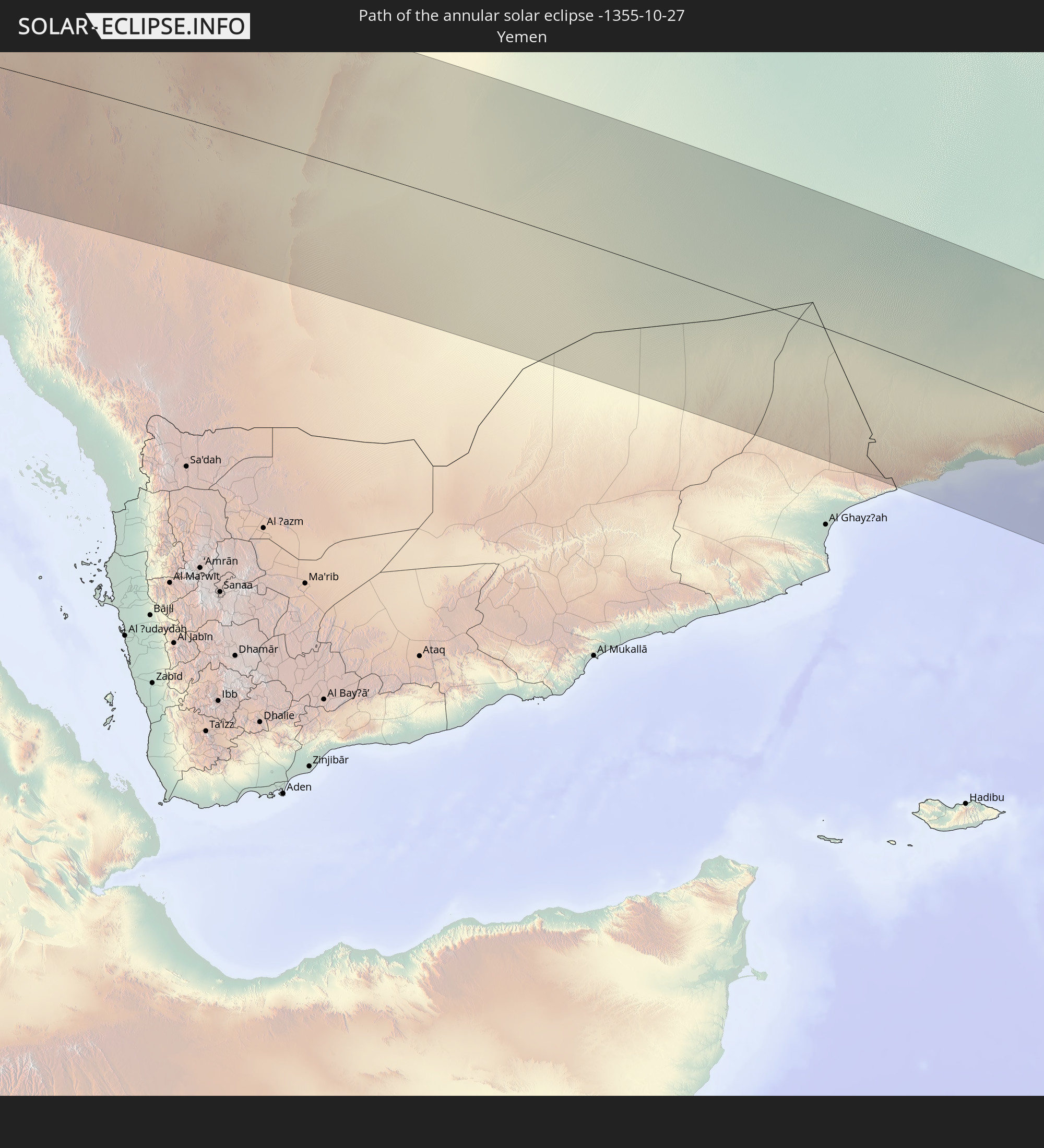 Yemen
Yemen
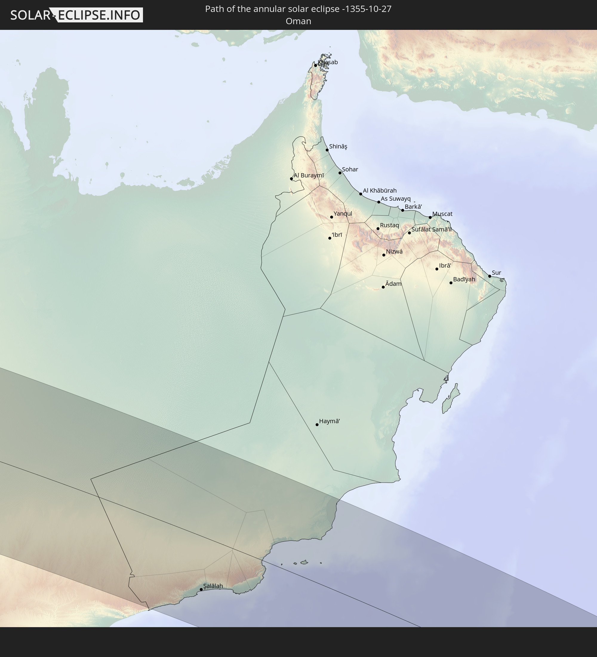 Oman
Oman
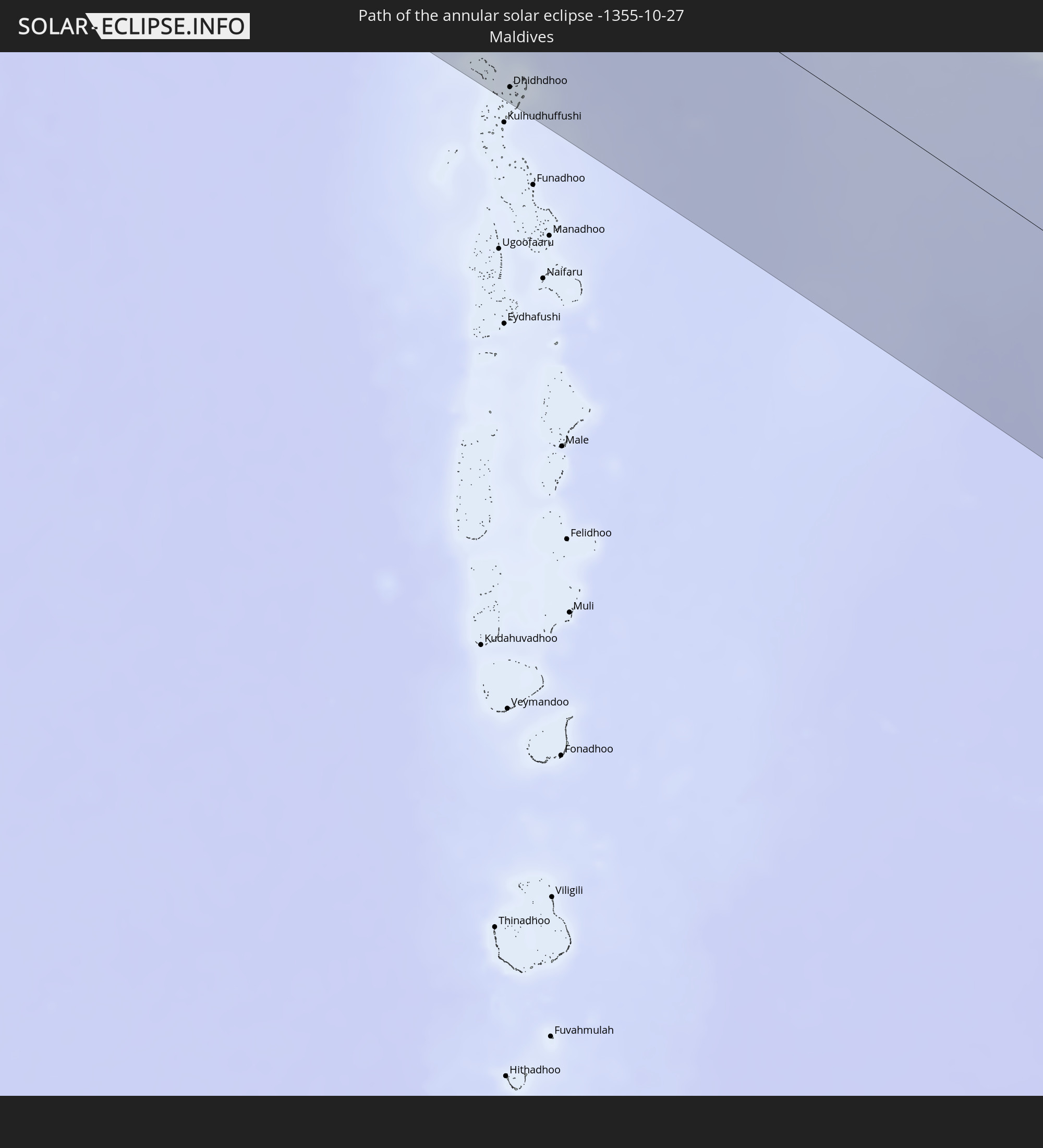 Maldives
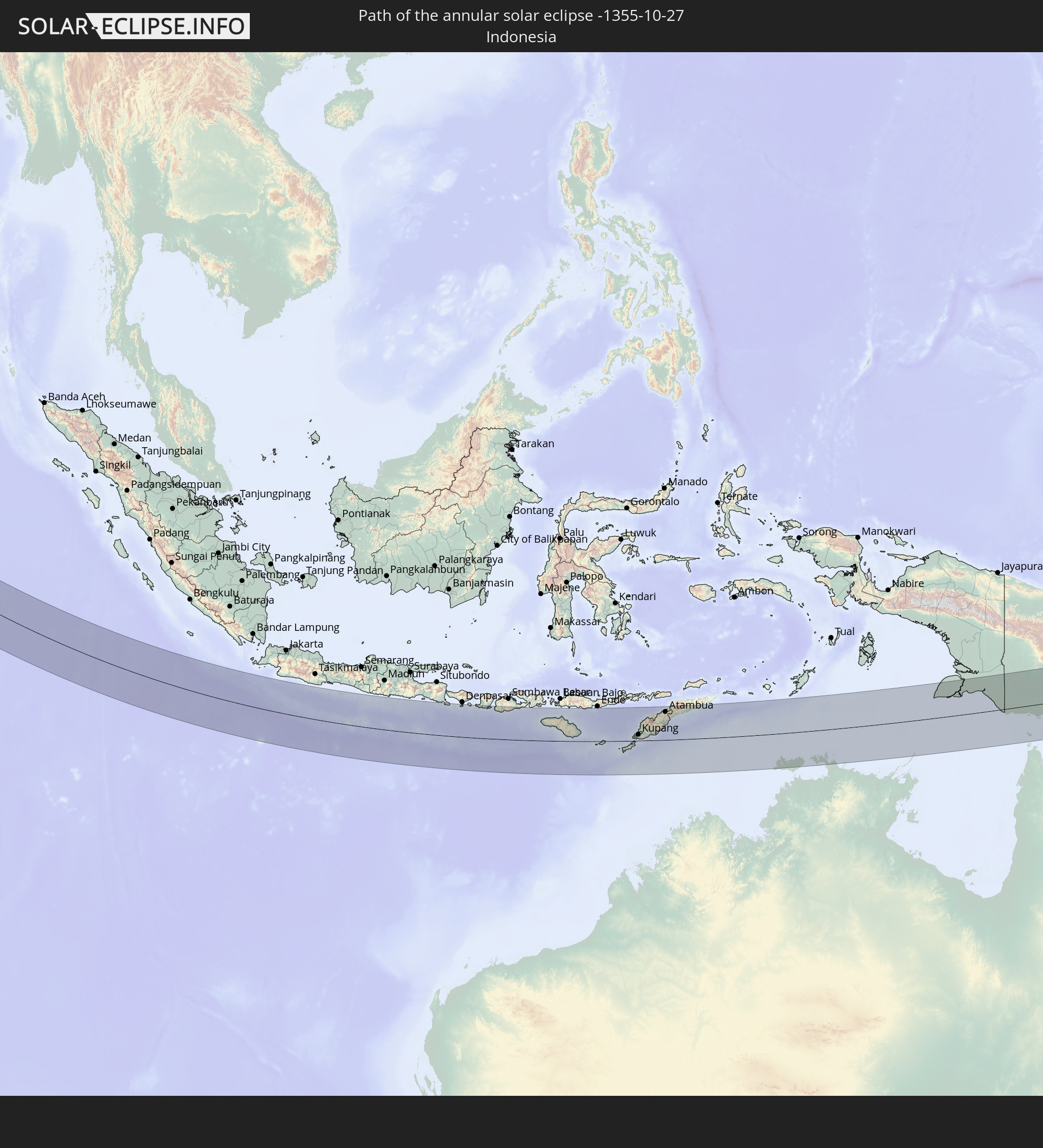 Indonesia
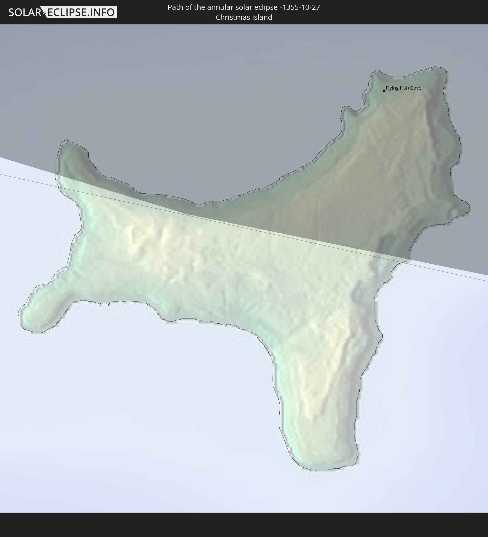 Christmas Island
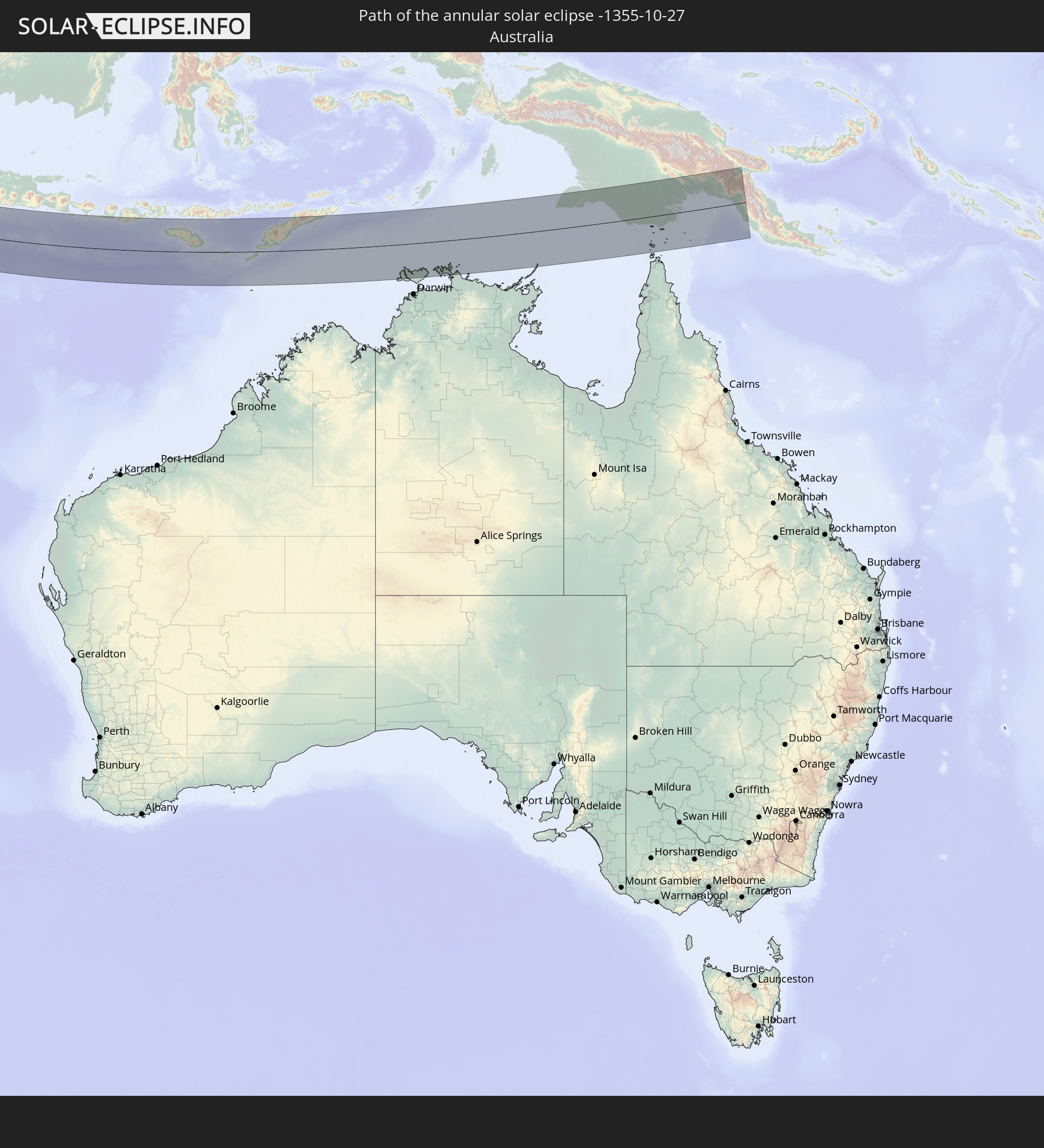 Australia
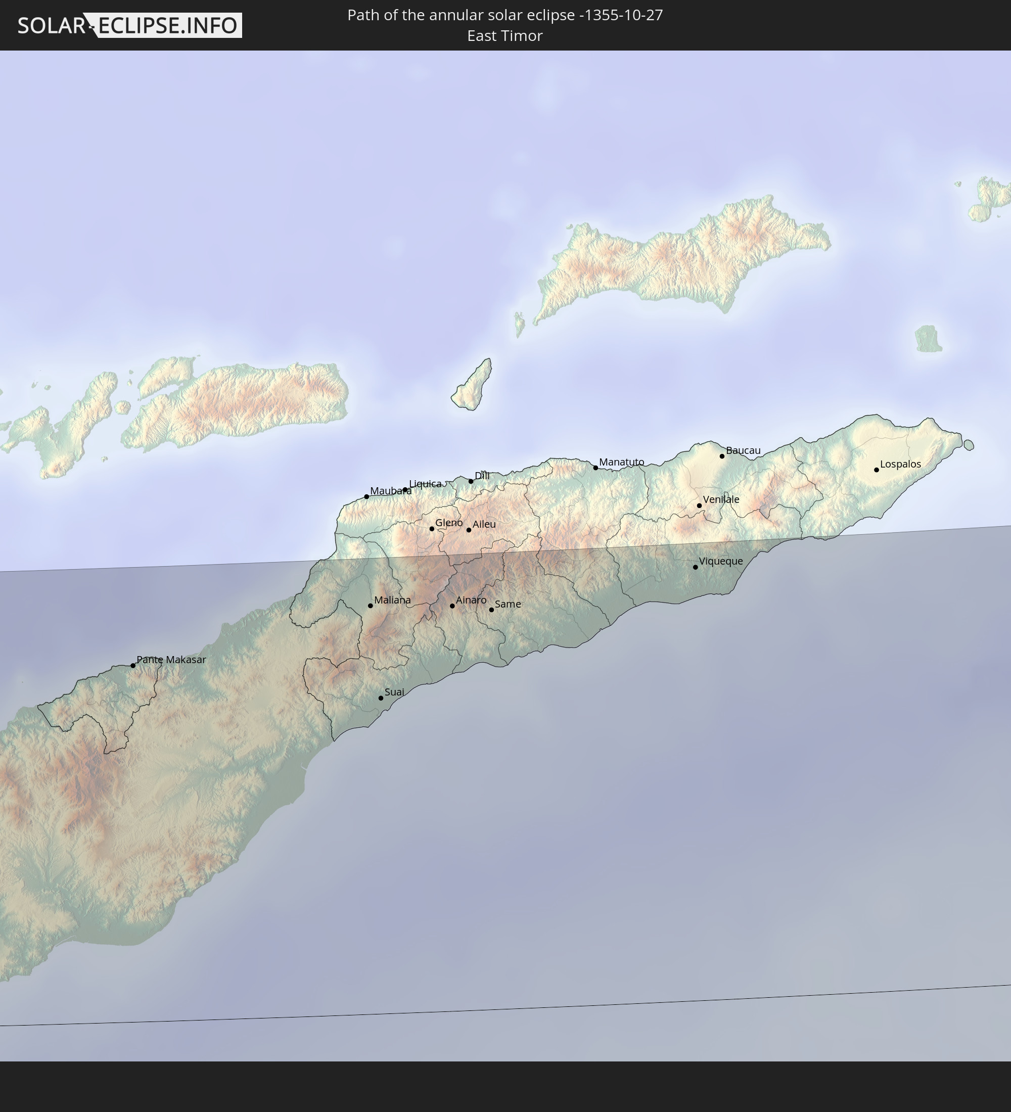 East Timor
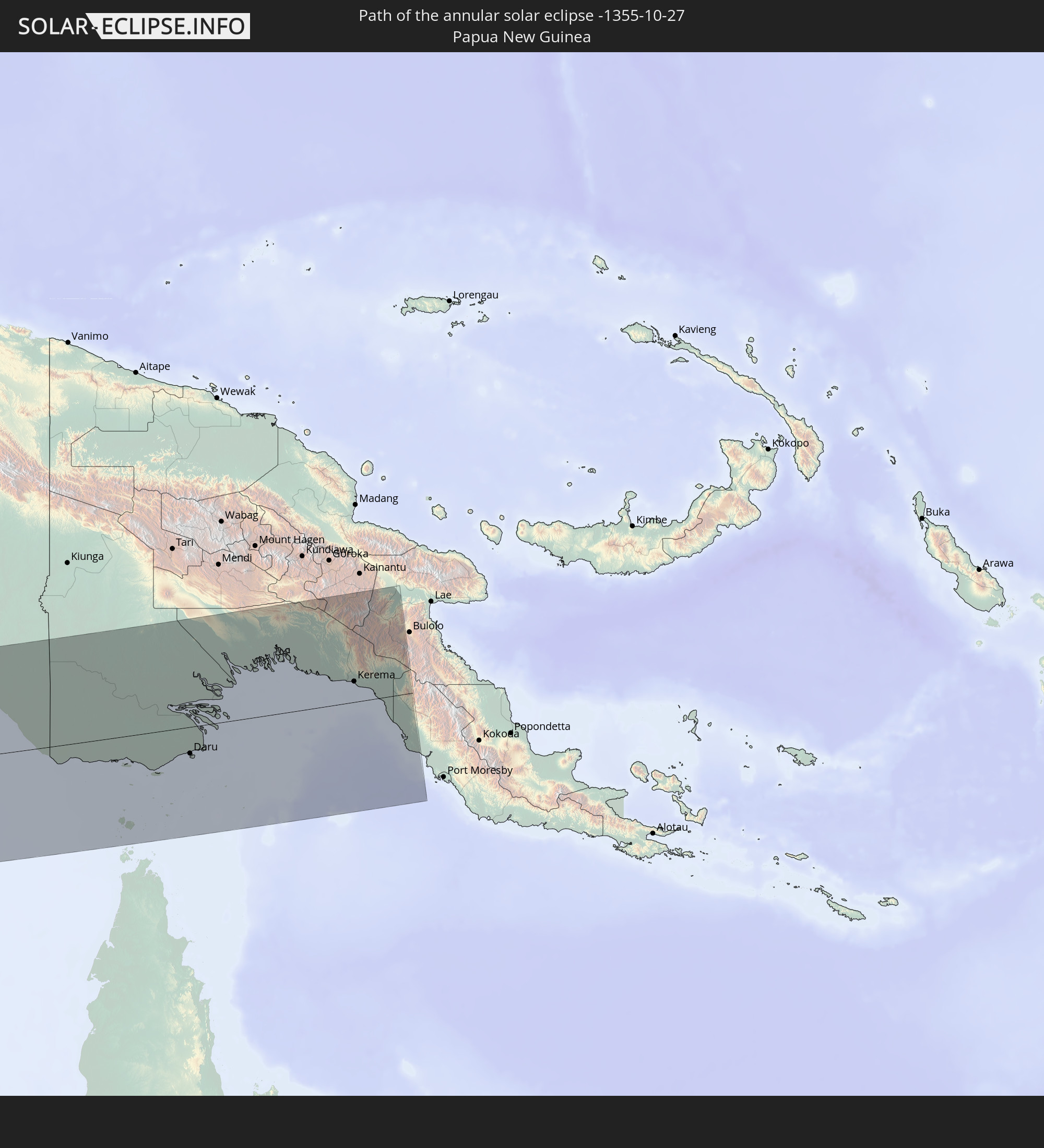 Papua New Guinea
In den folgenden Ländern ist die Sonnenfinsternis partiell zu sehen
 Russia
 Angola
 Democratic Republic of the Congo
 Central African Republic
 Sudan
Sudan
 Zambia
 Ukraine
 Belarus
 Egypt
Egypt
 Turkey
 Rwanda
 Burundi
 Tanzania
 Uganda
 Mozambique
 Cyprus
 Malawi
 Ethiopia
 Kenya
Kenya
 State of Palestine
 Israel
 Saudi Arabia
 Jordan
 Lebanon
 Syria
Syria
 Eritrea
 Iraq
Iraq
 Georgia
 French Southern and Antarctic Lands
 Somalia
 Djibouti
 Yemen
Yemen
 Madagascar
 Comoros
 Armenia
 Iran
Iran
 Azerbaijan
 Mayotte
 Seychelles
 Kazakhstan
 Kuwait
 Bahrain
 Qatar
Qatar
 United Arab Emirates
 Oman
Oman
 Turkmenistan
 Réunion
 Uzbekistan
 Mauritius
 Afghanistan
 Pakistan
 Tajikistan
 India
India
 Kyrgyzstan
 British Indian Ocean Territory
 Maldives
 China
China
 Sri Lanka
 Nepal
Nepal
 Bangladesh
 Bhutan
 Myanmar
 Indonesia
 Cocos Islands
 Thailand
 Malaysia
 Laos
Laos
 Vietnam
 Cambodia
 Singapore
 Christmas Island
 Australia
 Macau
Macau
 Hong Kong
 Brunei
 Taiwan
 Philippines
 Japan
Japan
 East Timor
 Palau
Palau
 Federated States of Micronesia
 Papua New Guinea
 Guam
Guam
 Northern Mariana Islands
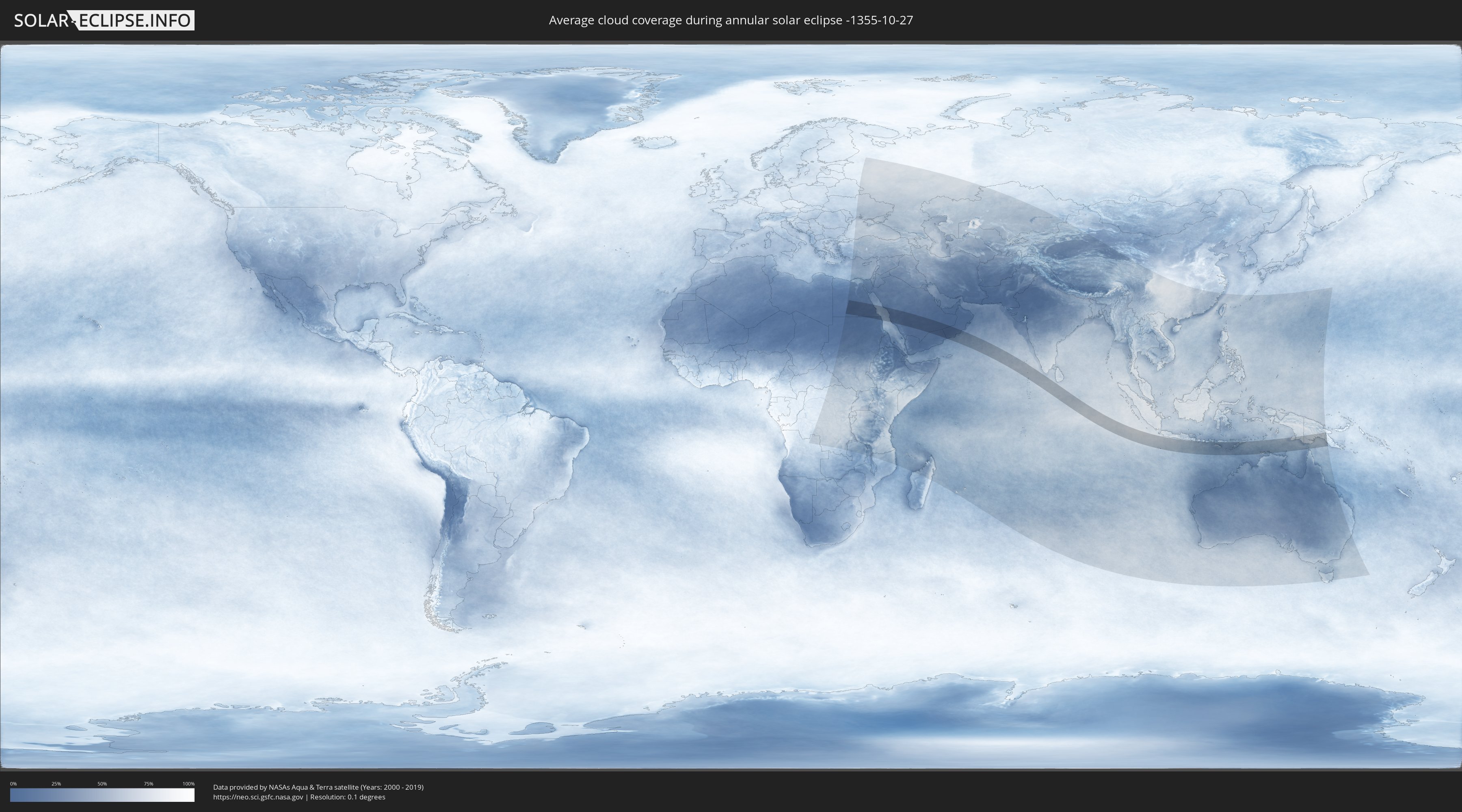
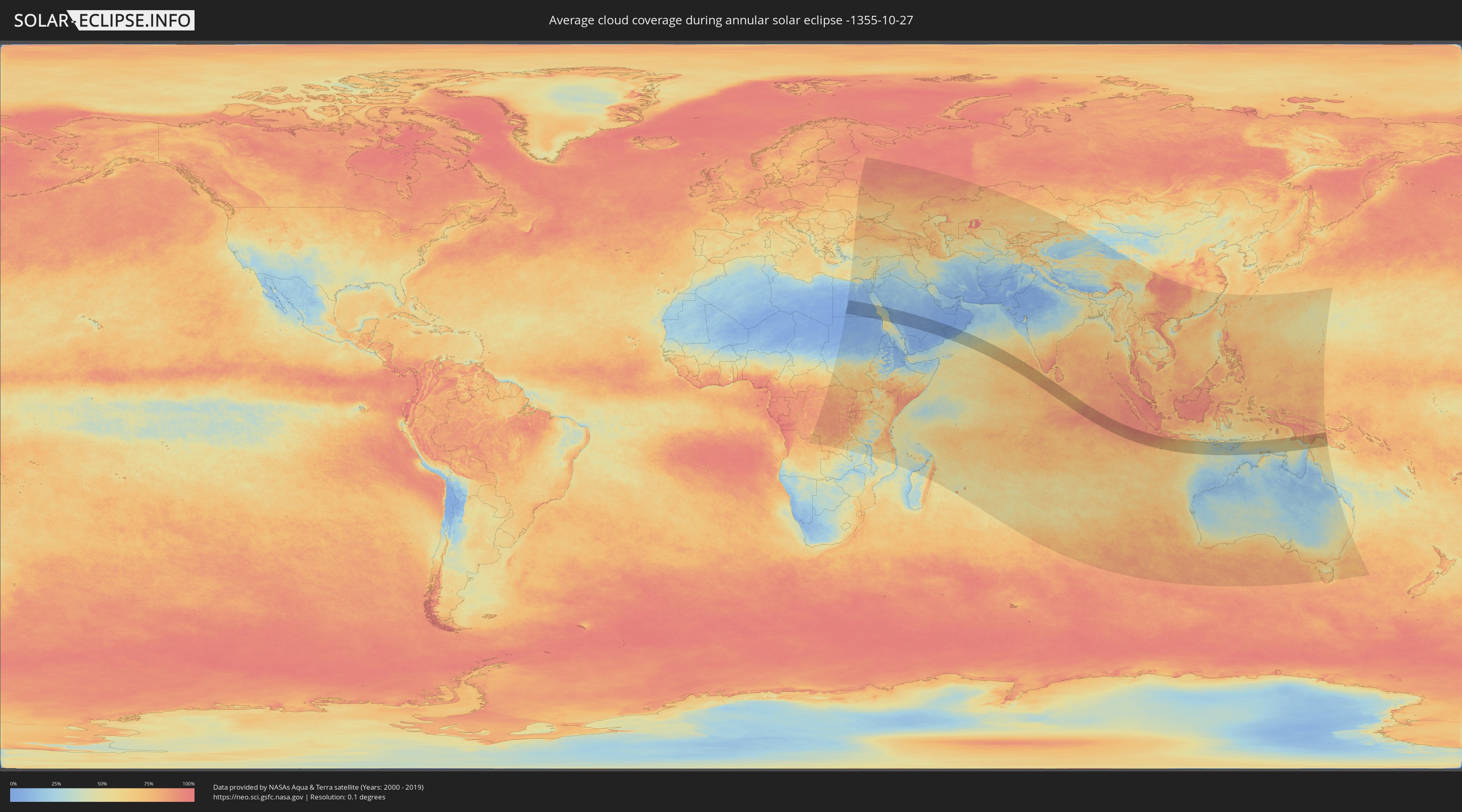
How will be the weather during the annular solar eclipse on 10/27/-1355?
Where is the best place to see the annular solar eclipse of 10/27/-1355?
The following maps show the average cloud coverage for the day of the annular solar eclipse.
With the help of these maps, it is possible to find the place along the eclipse path, which has the best
chance of a cloudless sky.
Nevertheless, you should consider local circumstances and inform about the weather of your chosen
observation site.
The data is provided by NASAs satellites
AQUA and TERRA.
The cloud maps are averaged over a period of 19 years (2000 - 2019).
Detailed country maps
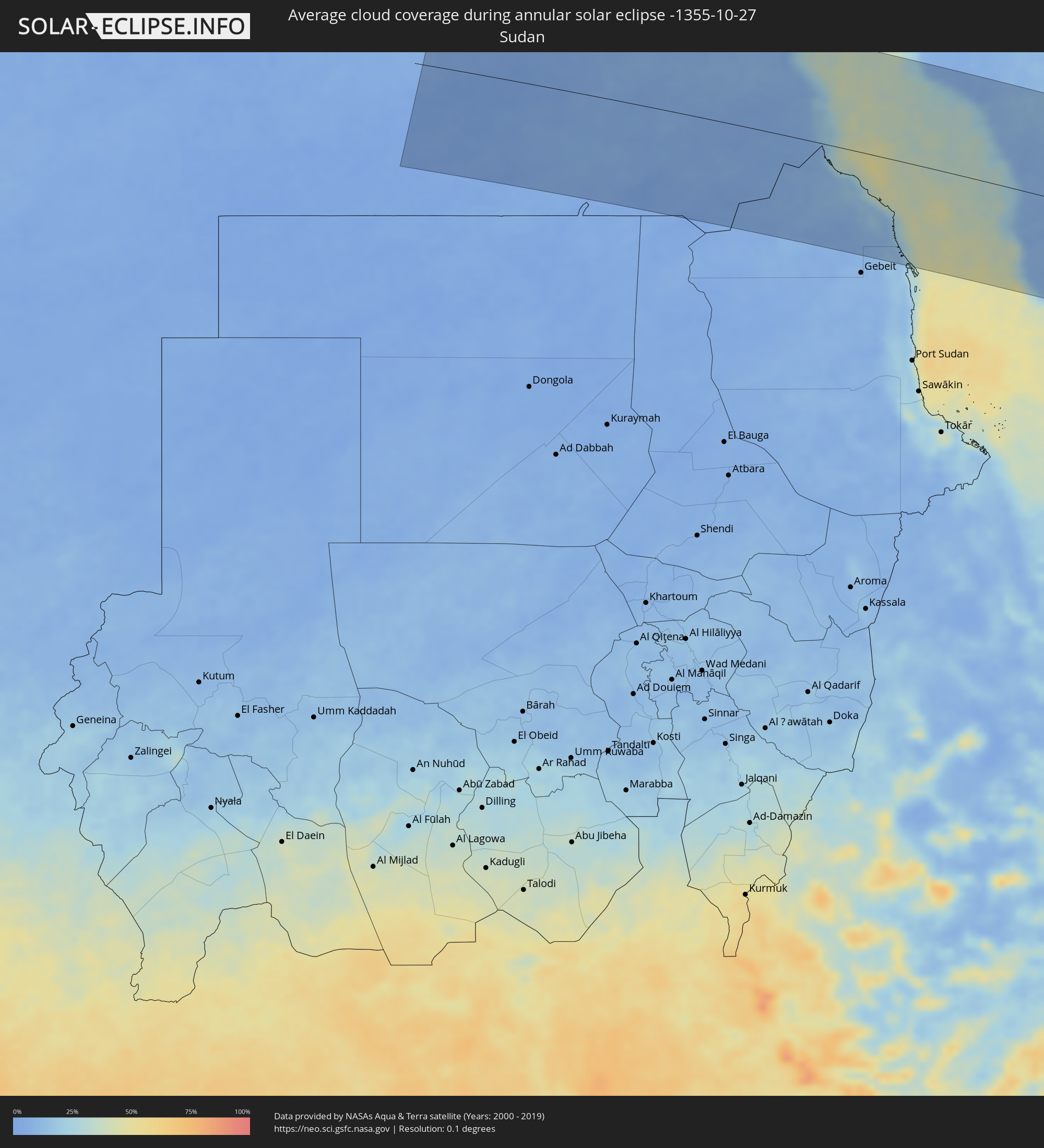 Sudan
Sudan
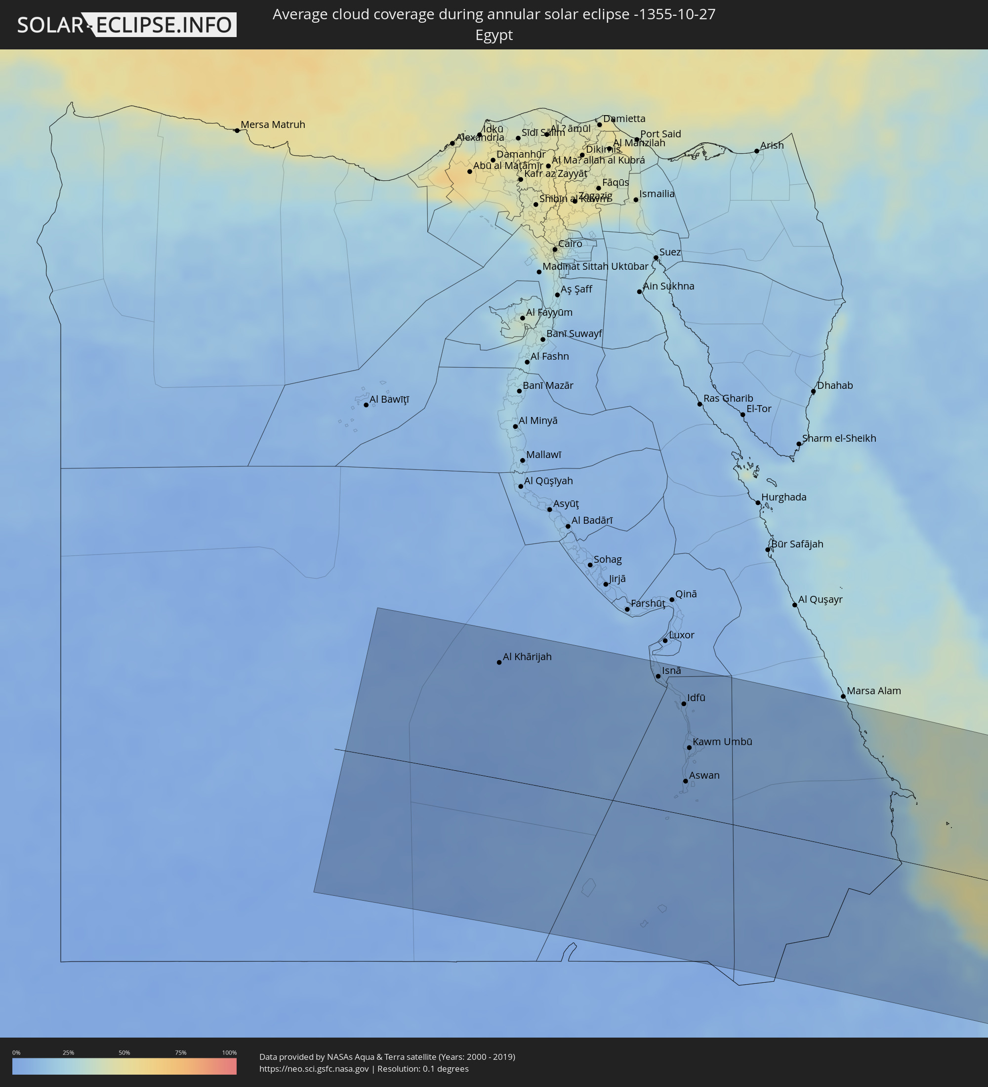 Egypt
Egypt
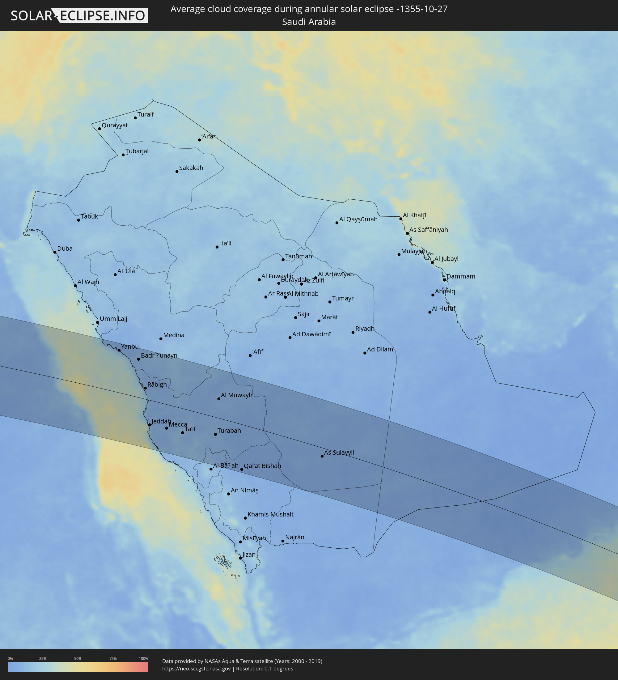 Saudi Arabia
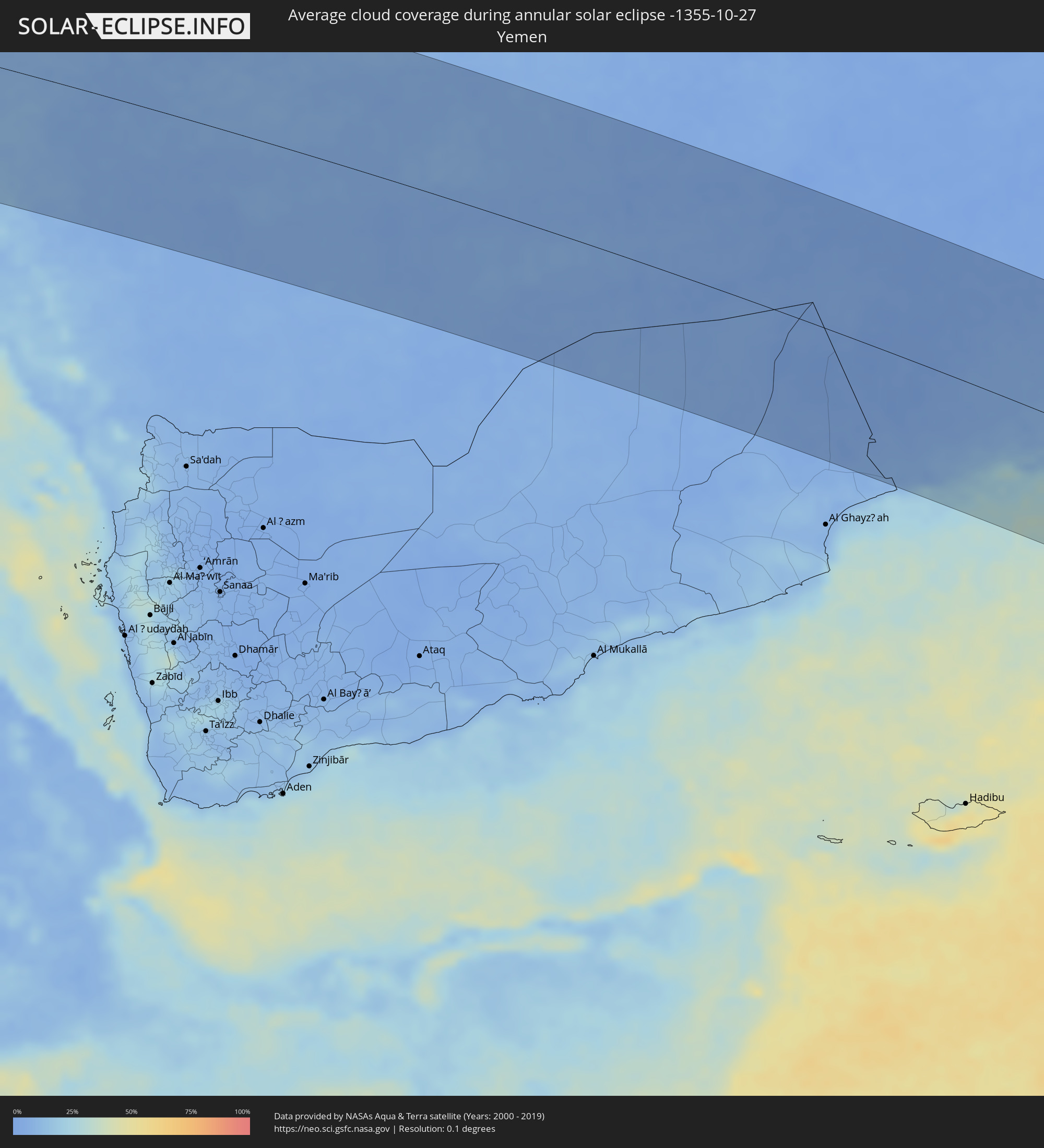 Yemen
Yemen
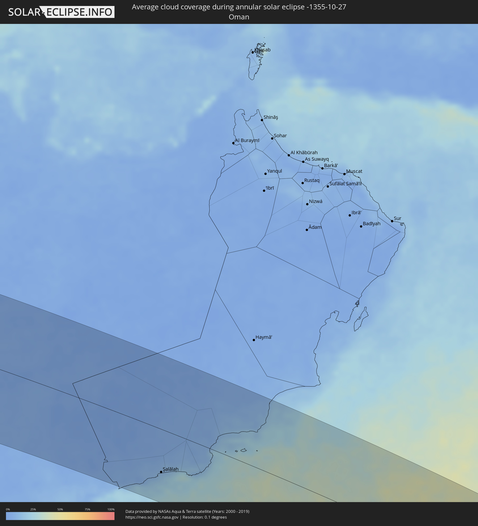 Oman
Oman
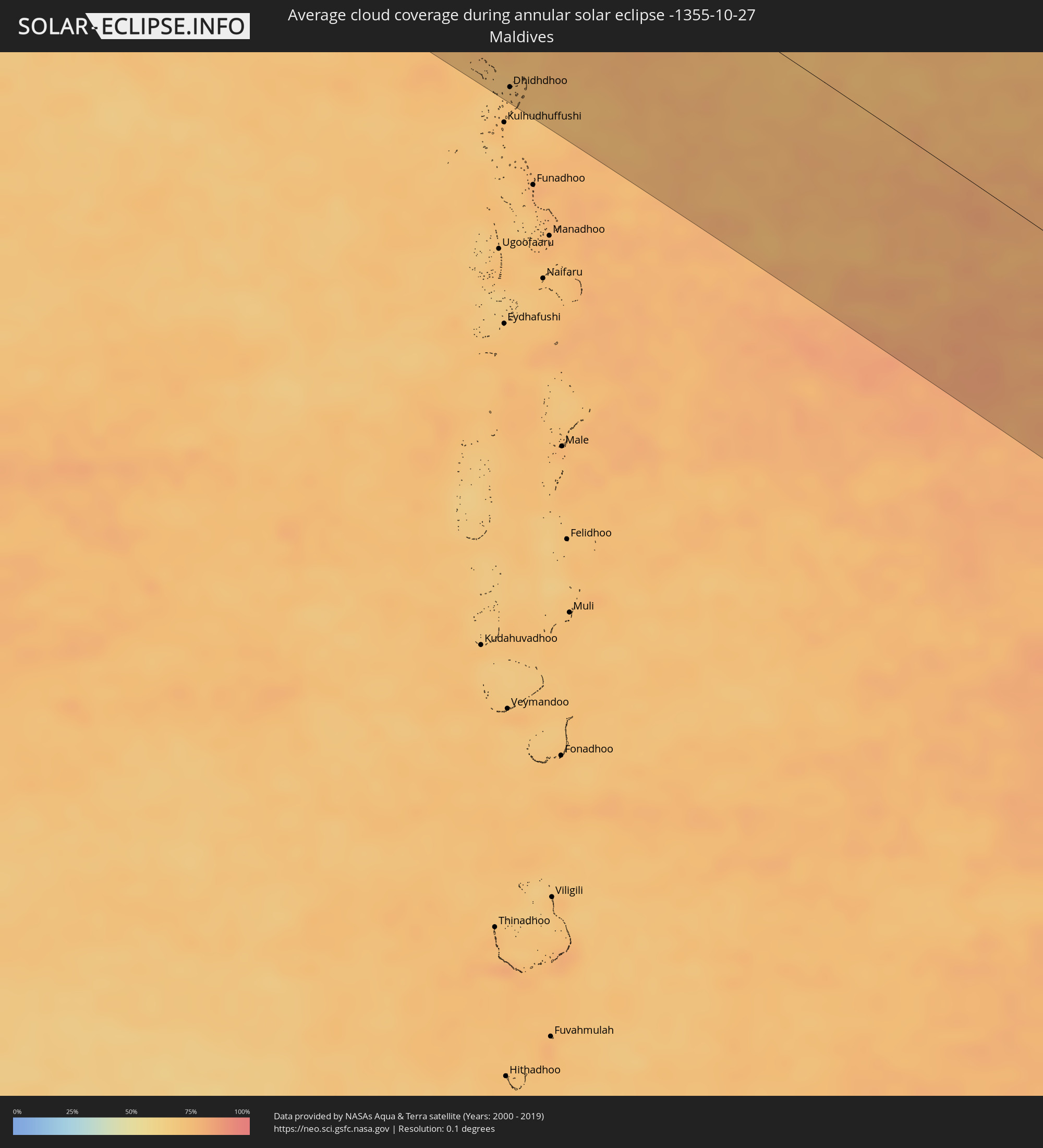 Maldives
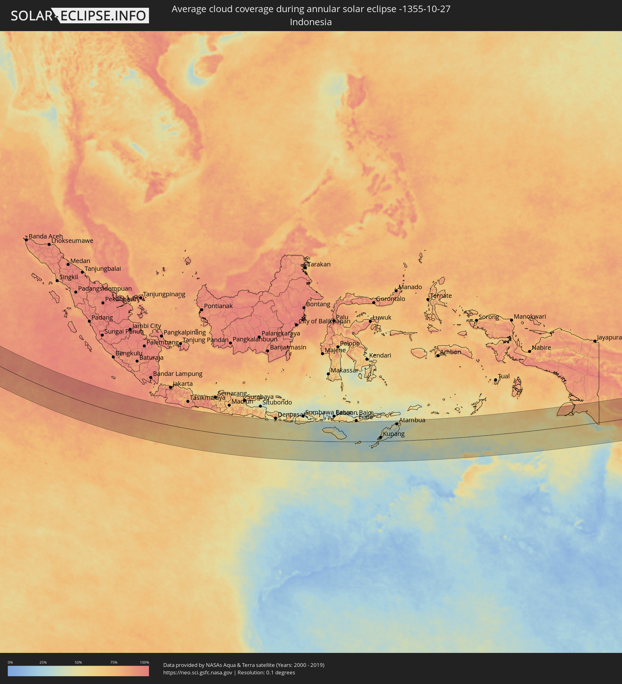 Indonesia
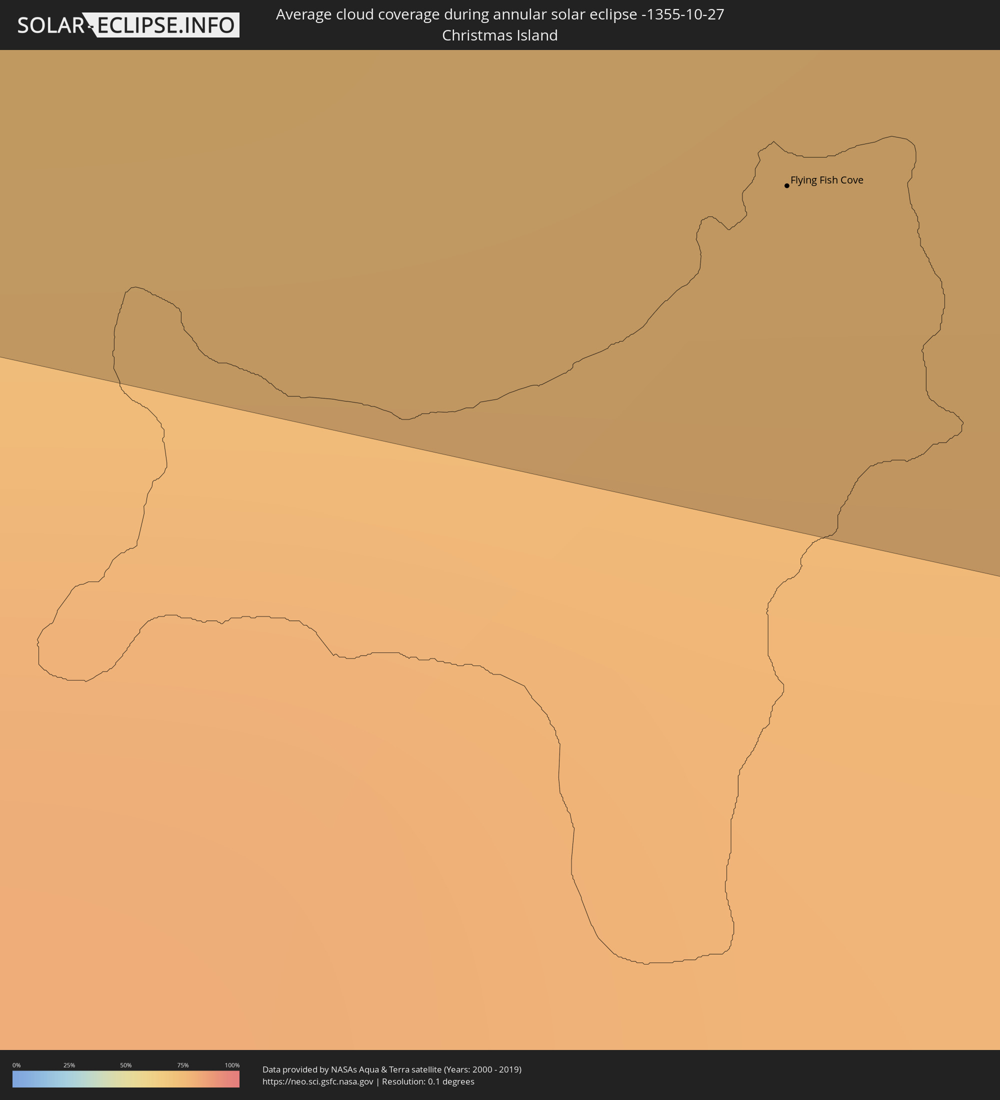 Christmas Island
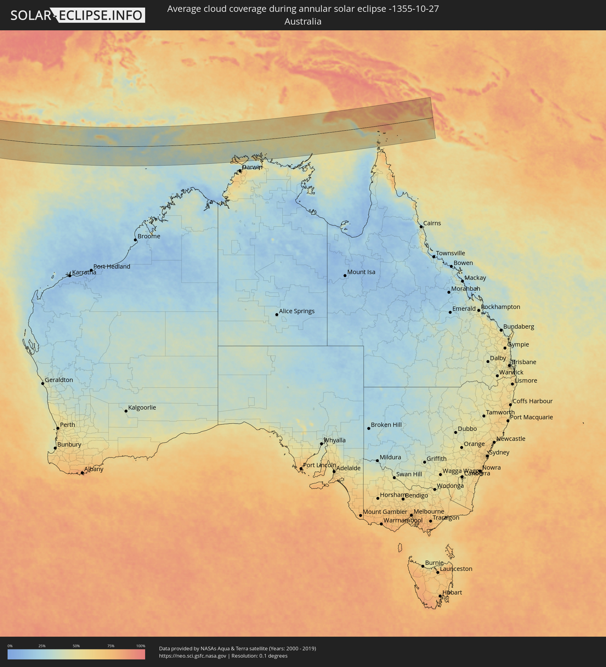 Australia
 East Timor
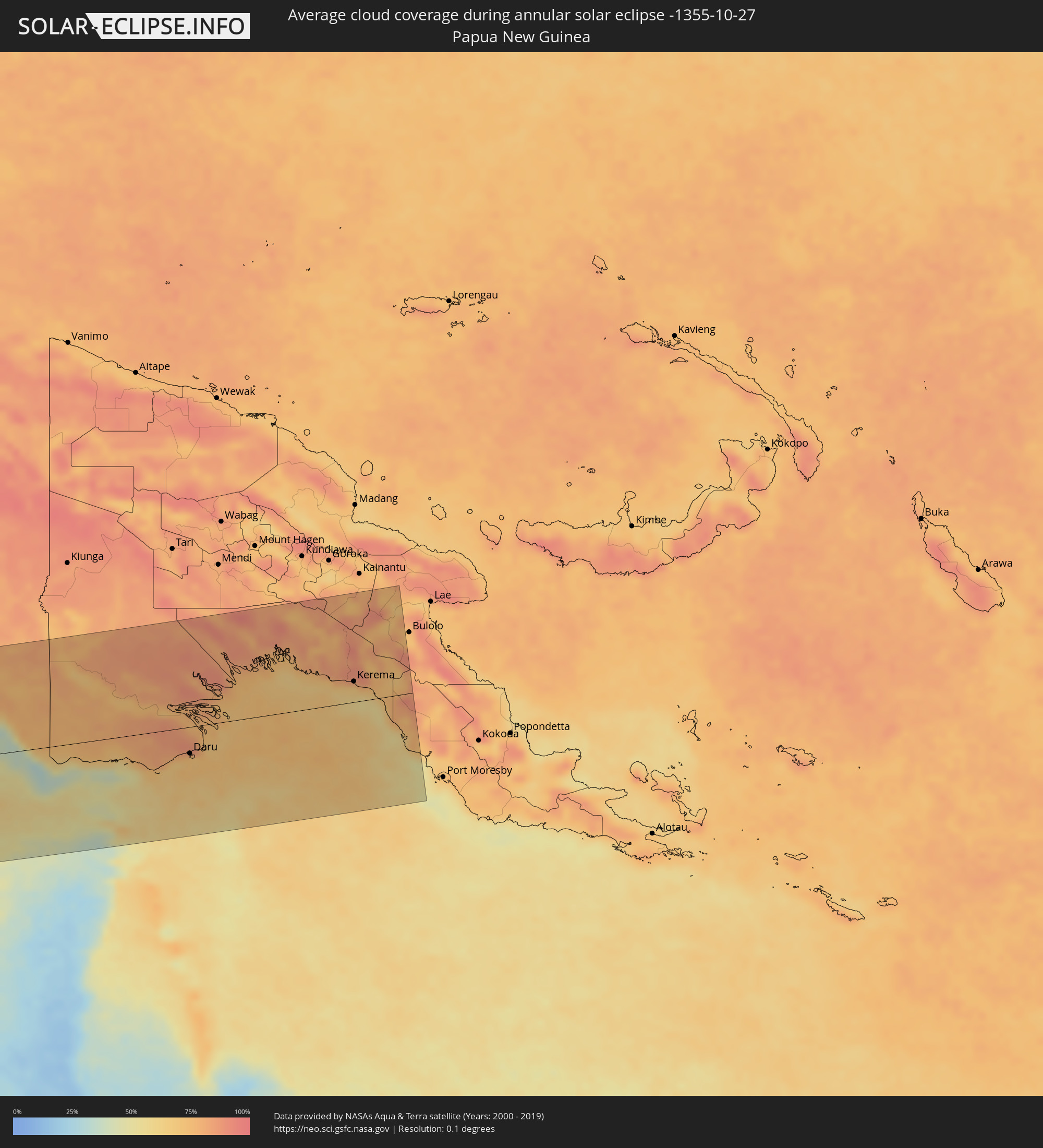 Papua New Guinea
Cities inside the path of the eclipse
The following table shows all locations with a population of more than 5,000 inside the eclipse path. Cities which have more than 100,000 inhabitants are marked bold. A click at the locations opens a detailed map.
| City | Type | Eclipse duration | Local time of max. eclipse | Distance to central line | Ø Cloud coverage |
|
Al Khārijah, New Valley
|
annular | - | 06:13:36 UTC+02:00 | 145 km | 4% |
|
Isnā, Qena
|
annular | - | 06:13:48 UTC+02:00 | 166 km | 9% |
|
Idfū, Aswan
|
annular | - | 06:13:48 UTC+02:00 | 138 km | 8% |
|
Aswan, Aswan
|
annular | - | 06:13:43 UTC+02:00 | 42 km | 6% |
|
Kawm Umbū, Aswan
|
annular | - | 06:13:45 UTC+02:00 | 85 km | 7% |
|
Yanbu, Al Madīnah al Munawwarah
|
annular | - | 07:21:51 UTC+03:06 | 155 km | 14% |
|
Badr Ḩunayn, Al Madīnah al Munawwarah
|
annular | - | 07:22:06 UTC+03:06 | 140 km | 9% |
|
Rābigh, Makkah
|
annular | - | 07:22:11 UTC+03:06 | 39 km | 15% |
|
Jeddah, Makkah
|
annular | - | 07:22:17 UTC+03:06 | 92 km | 16% |
|
Al Jumūm, Makkah
|
annular | - | 07:22:29 UTC+03:06 | 72 km | 8% |
|
Mecca, Makkah
|
annular | - | 07:22:34 UTC+03:06 | 89 km | 9% |
|
Al Hadā, Makkah
|
annular | - | 07:22:46 UTC+03:06 | 84 km | 13% |
|
Ash Shafā, Makkah
|
annular | - | 07:22:48 UTC+03:06 | 115 km | 13% |
|
Ta’if, Makkah
|
annular | - | 07:22:50 UTC+03:06 | 91 km | 14% |
|
Turabah, Makkah
|
annular | - | 07:23:25 UTC+03:06 | 64 km | 10% |
|
Al Muwayh, Makkah
|
annular | - | 07:23:22 UTC+03:06 | 70 km | 10% |
|
Qal‘at Bīshah, 'Asir
|
annular | - | 07:24:06 UTC+03:06 | 168 km | 5% |
|
As Sulayyil, Ar Riyāḑ
|
annular | - | 07:25:50 UTC+03:06 | 32 km | 6% |
|
Şalālah, Z̧ufār
|
annular | - | 08:09:00 UTC+03:41 | 100 km | 16% |
|
Dhidhdhoo, Haa Alifu Atholhu
|
annular | - | 10:07:06 UTC+04:54 | 149 km | 72% |
|
Flying Fish Cove
|
annular | - | 14:24:29 UTC+07:00 | 159 km | 76% |
|
Waingapu, East Nusa Tenggara
|
annular | - | 15:50:12 UTC+07:57 | 91 km | 37% |
|
Kupang, East Nusa Tenggara
|
annular | - | 15:54:43 UTC+07:57 | 32 km | 37% |
|
Soe, East Nusa Tenggara
|
annular | - | 15:55:24 UTC+07:57 | 64 km | 35% |
|
Pante Makasar, Oecusse
|
annular | - | 16:20:02 UTC+08:22 | 137 km | 44% |
|
Kefamenanu, East Nusa Tenggara
|
annular | - | 15:55:30 UTC+07:57 | 110 km | 34% |
|
Atambua, East Nusa Tenggara
|
annular | - | 15:55:51 UTC+07:57 | 146 km | 46% |
|
Maliana, Bobonaro
|
annular | - | 16:20:54 UTC+08:22 | 158 km | 49% |
|
Suai, Cova Lima
|
annular | - | 16:21:03 UTC+08:22 | 122 km | 36% |
|
Ainaro, Ainaro
|
annular | - | 16:21:13 UTC+08:22 | 156 km | 49% |
|
Same, Manufahi
|
annular | - | 16:21:22 UTC+08:22 | 154 km | 46% |
|
Viqueque, Viqueque
|
annular | - | 16:22:04 UTC+08:22 | 167 km | 48% |
|
Daru, Western Province
|
annular | - | 18:09:04 UTC+10:00 | 45 km | 71% |
|
Kerema, Gulf
|
annular | - | 18:09:11 UTC+10:00 | 35 km | 64% |