Total solar eclipse of 08/24/-1379
| Day of week: | Wednesday |
| Maximum duration of eclipse: | 04m14s |
| Maximum width of eclipse path: | 302 km |
| Saros cycle: | 42 |
| Coverage: | 100% |
| Magnitude: | 1.054 |
| Gamma: | -0.8141 |
Wo kann man die Sonnenfinsternis vom 08/24/-1379 sehen?
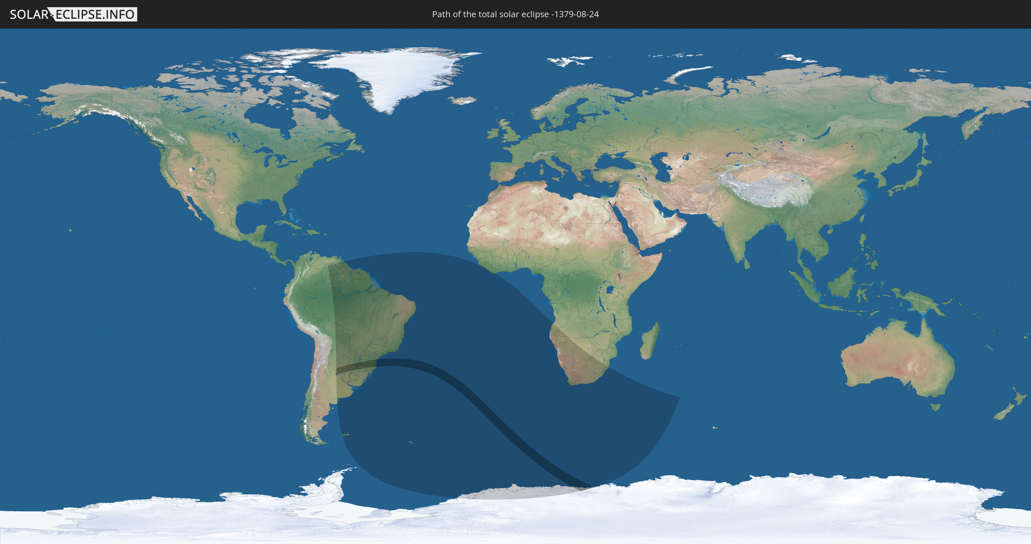
Die Sonnenfinsternis am 08/24/-1379 kann man in 23 Ländern als partielle Sonnenfinsternis beobachten.
Der Finsternispfad verläuft durch 5 Länder. Nur in diesen Ländern ist sie als total Sonnenfinsternis zu sehen.
In den folgenden Ländern ist die Sonnenfinsternis total zu sehen
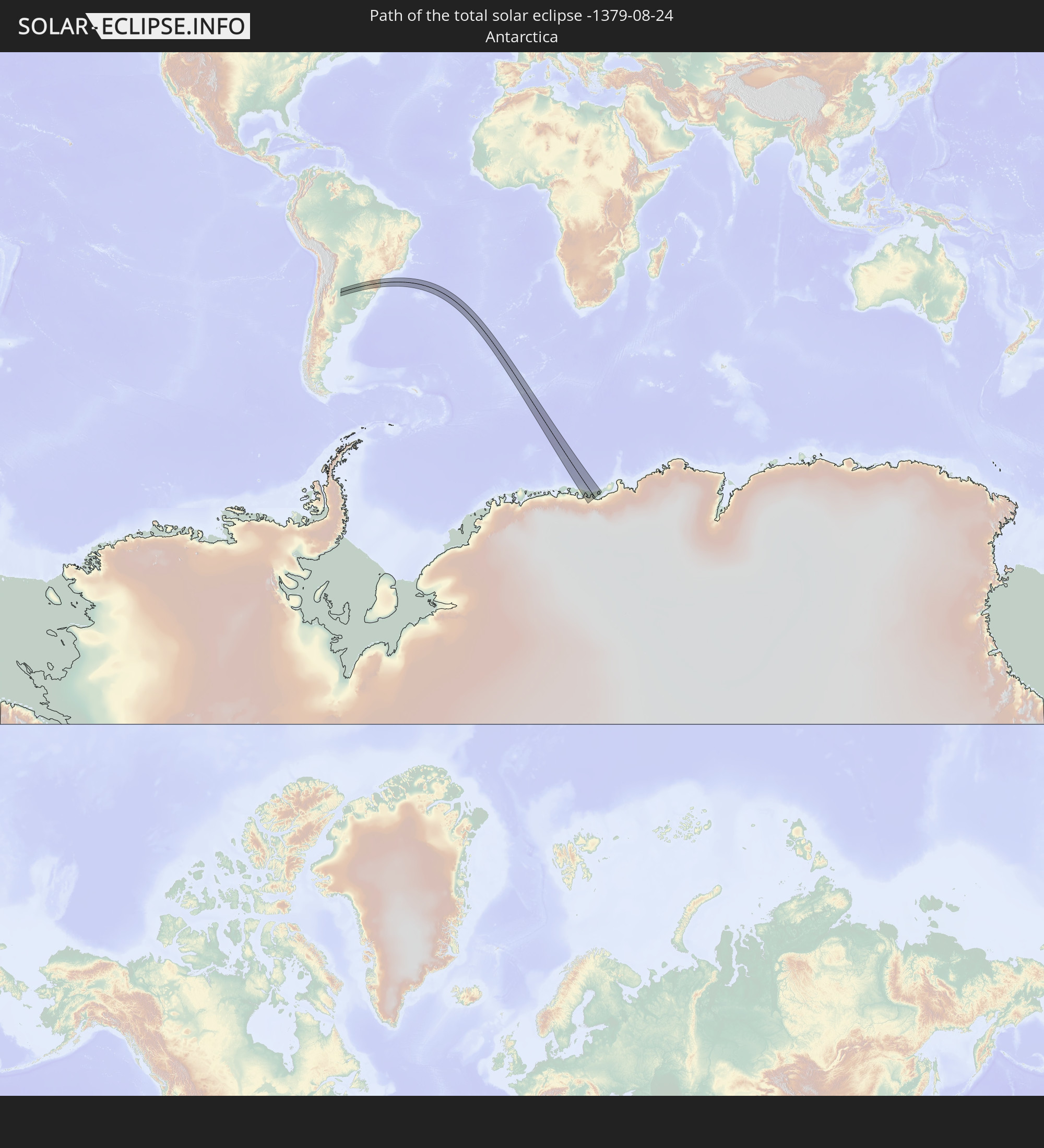 Antarctica
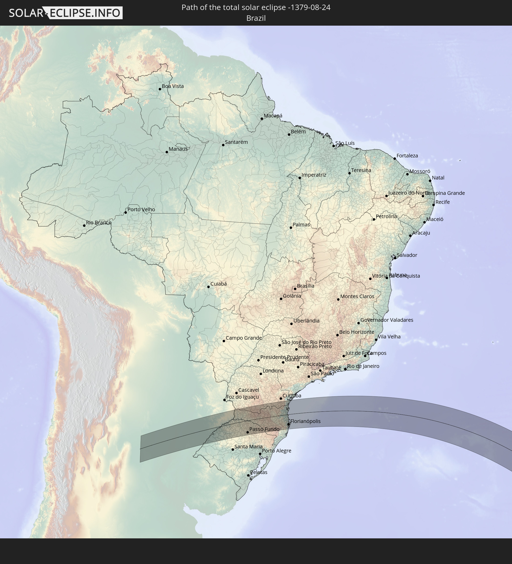 Brazil
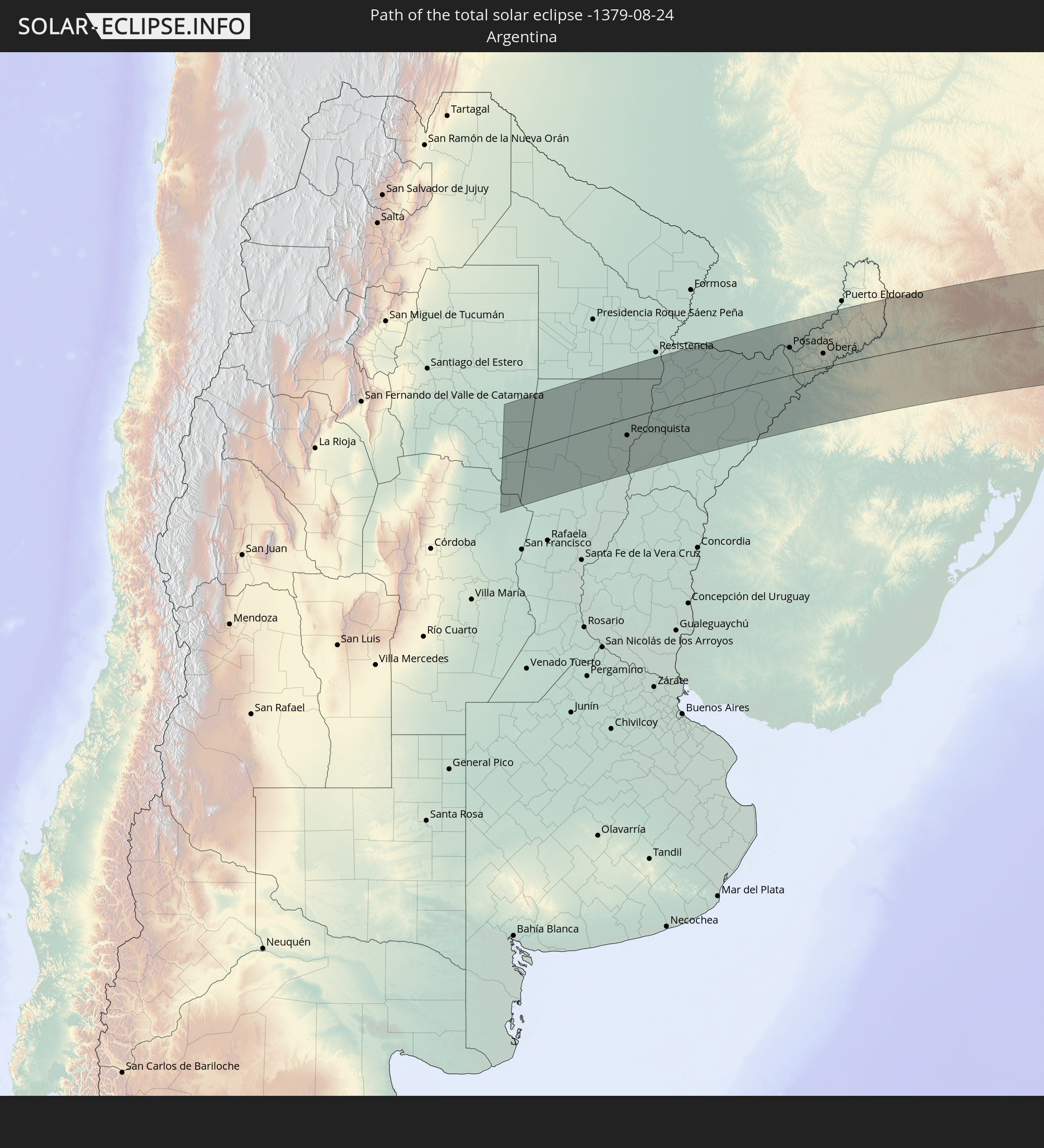 Argentina
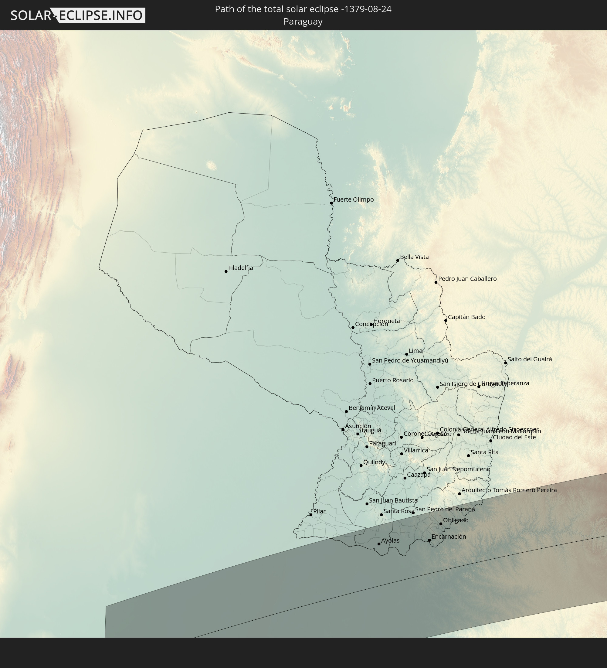 Paraguay
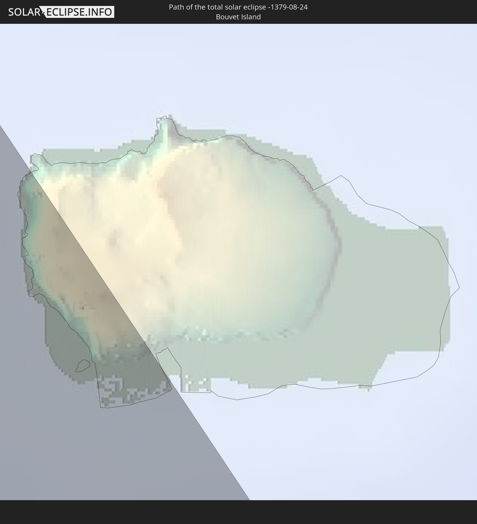 Bouvet Island
In den folgenden Ländern ist die Sonnenfinsternis partiell zu sehen
 Antarctica
 Brazil
 Argentina
 Venezuela
 Bolivia
 Paraguay
 Falkland Islands
 Guyana
 Uruguay
 Suriname
 French Guiana
 South Georgia and the South Sandwich Islands
 Saint Helena, Ascension and Tristan da Cunha
 Sierra Leone
 Liberia
 Ivory Coast
 Bouvet Island
 Angola
 Namibia
 South Africa
 Botswana
 Lesotho
 French Southern and Antarctic Lands
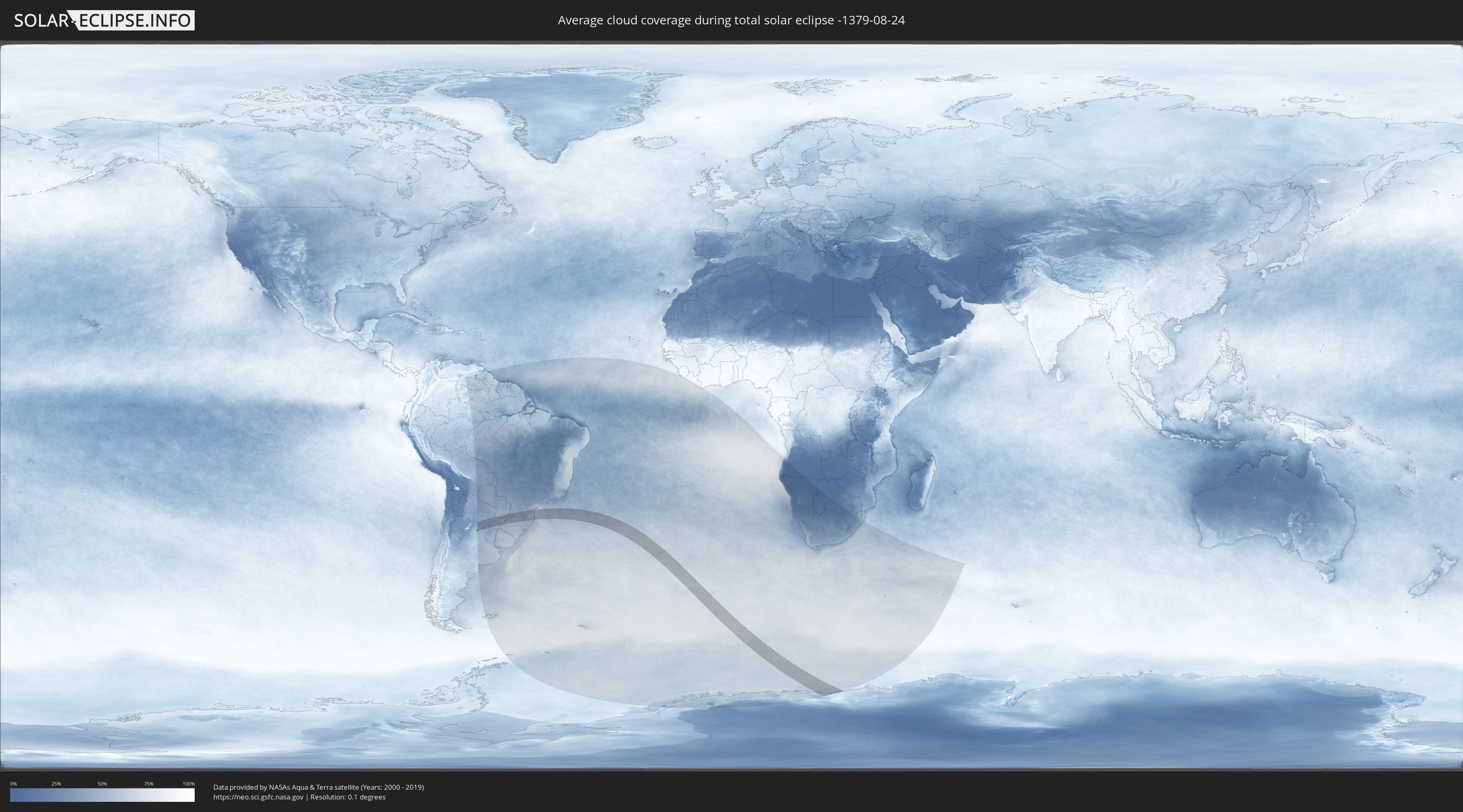
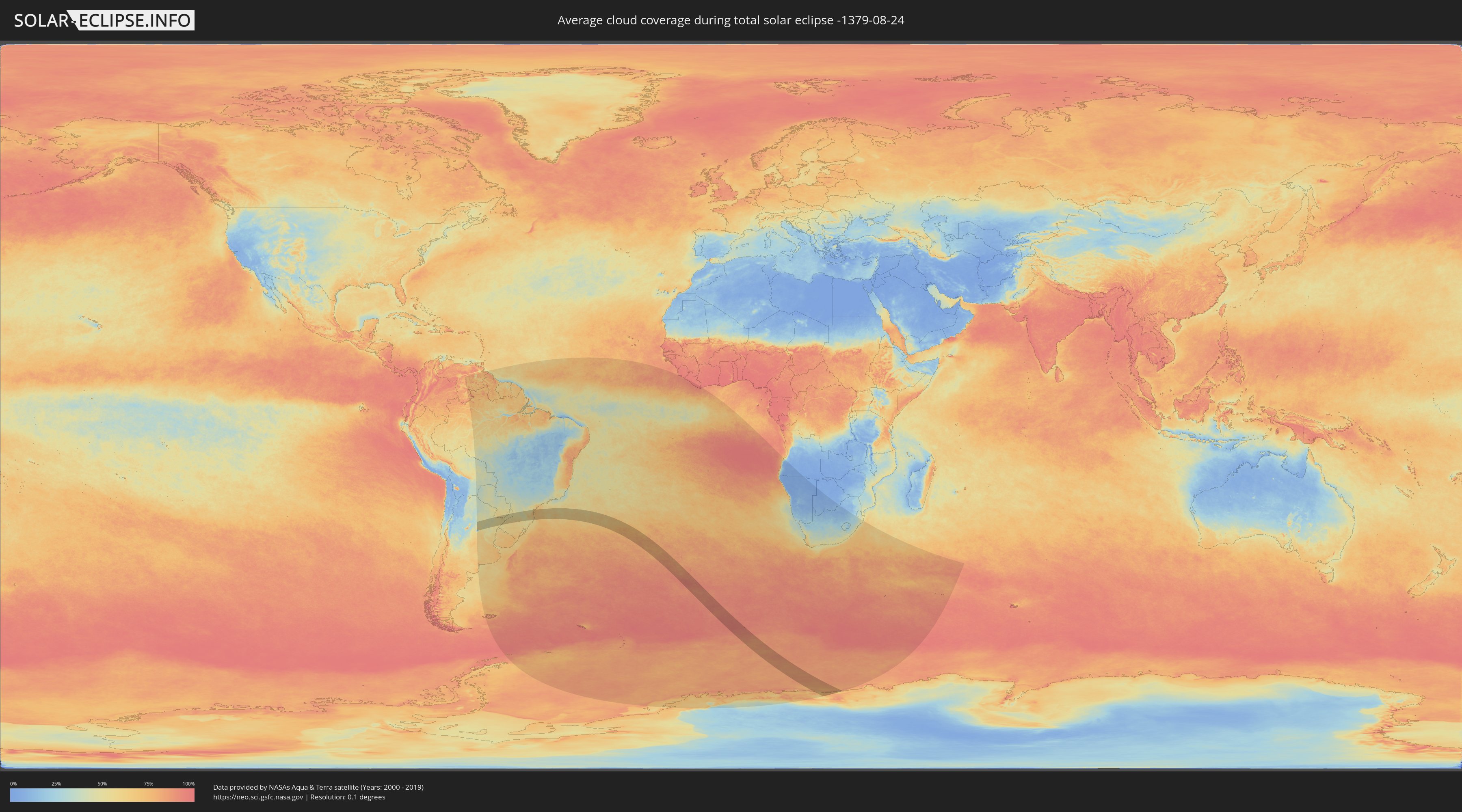
How will be the weather during the total solar eclipse on 08/24/-1379?
Where is the best place to see the total solar eclipse of 08/24/-1379?
The following maps show the average cloud coverage for the day of the total solar eclipse.
With the help of these maps, it is possible to find the place along the eclipse path, which has the best
chance of a cloudless sky.
Nevertheless, you should consider local circumstances and inform about the weather of your chosen
observation site.
The data is provided by NASAs satellites
AQUA and TERRA.
The cloud maps are averaged over a period of 19 years (2000 - 2019).
Detailed country maps
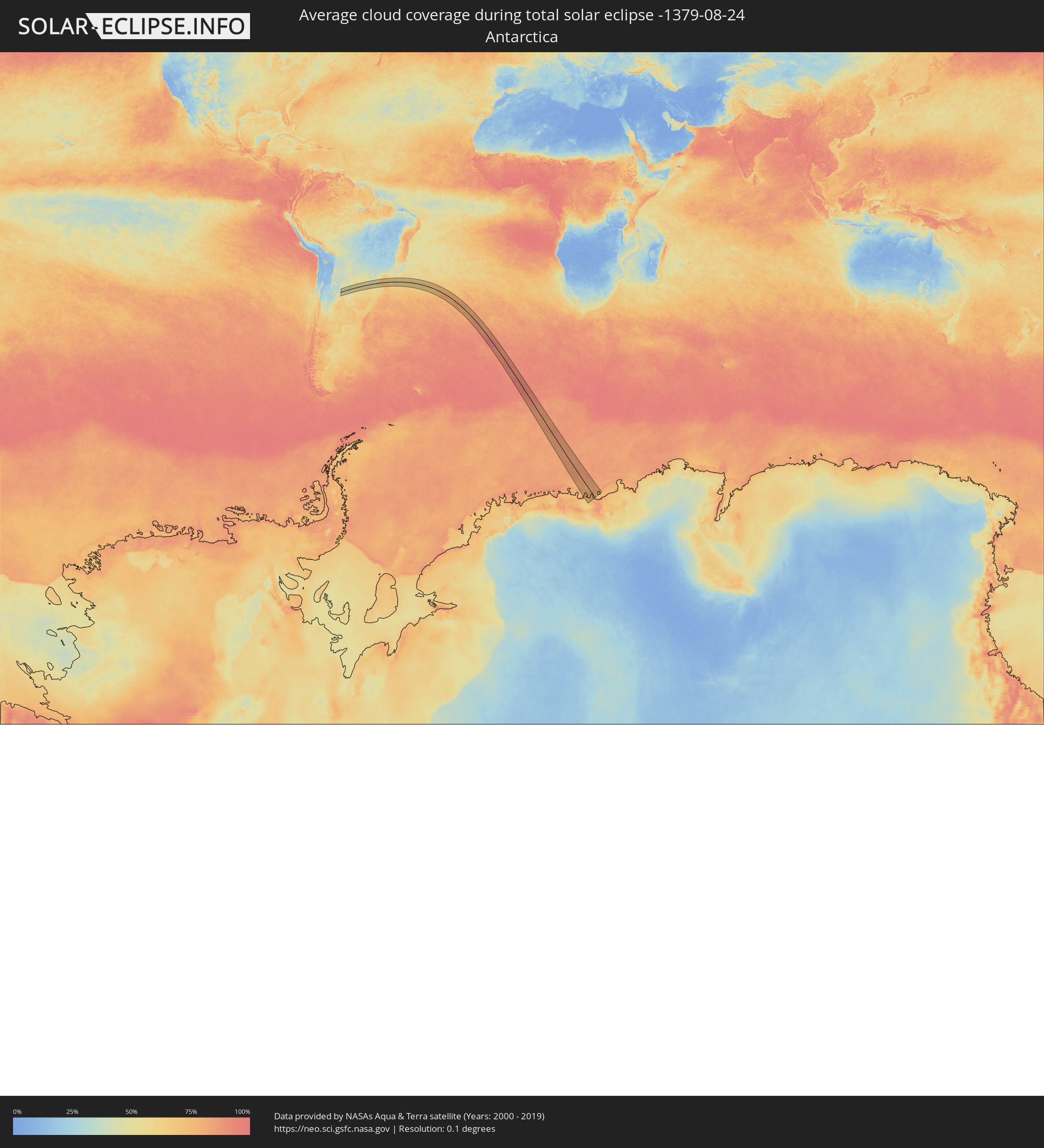 Antarctica
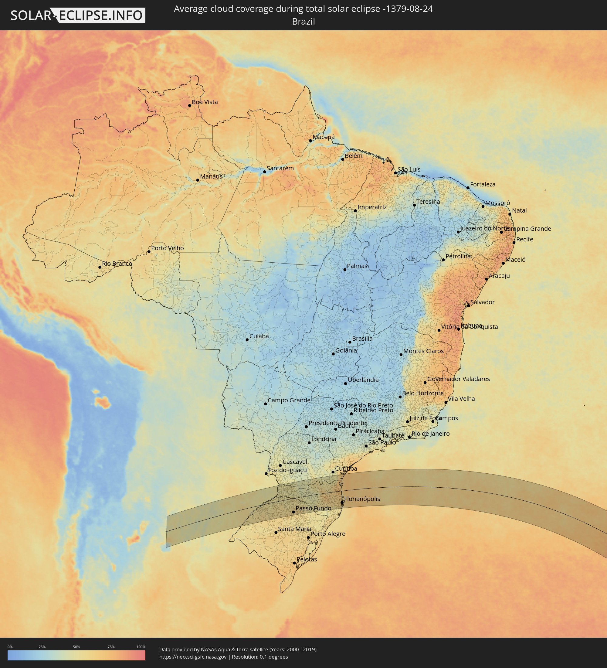 Brazil
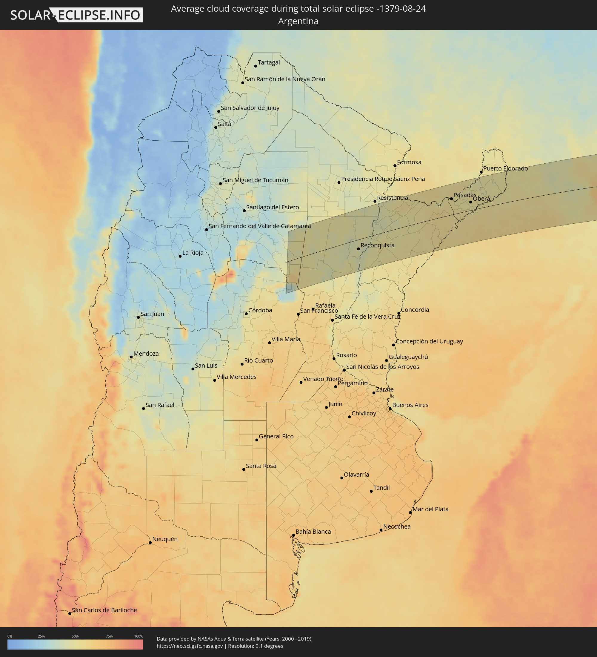 Argentina
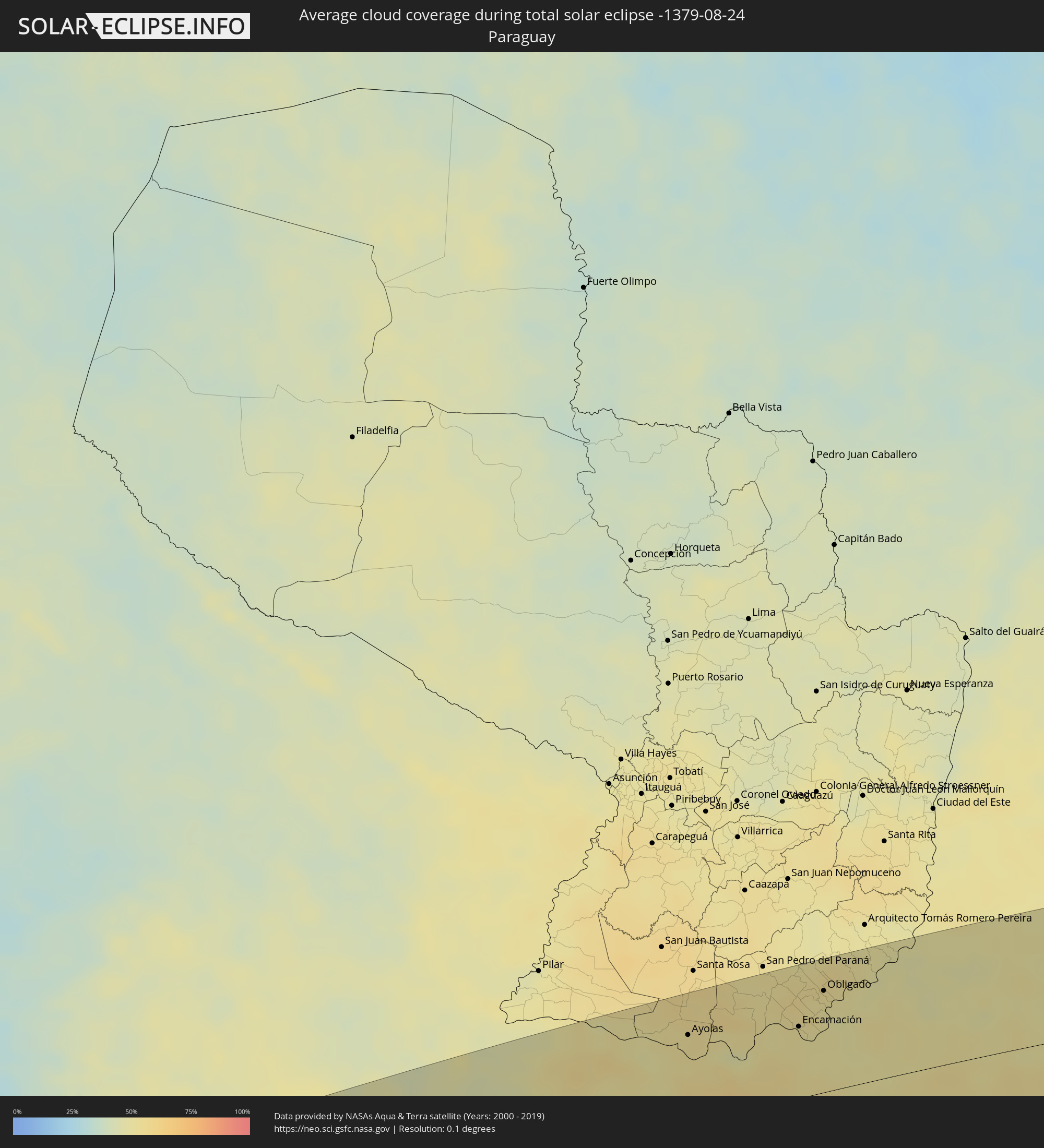 Paraguay
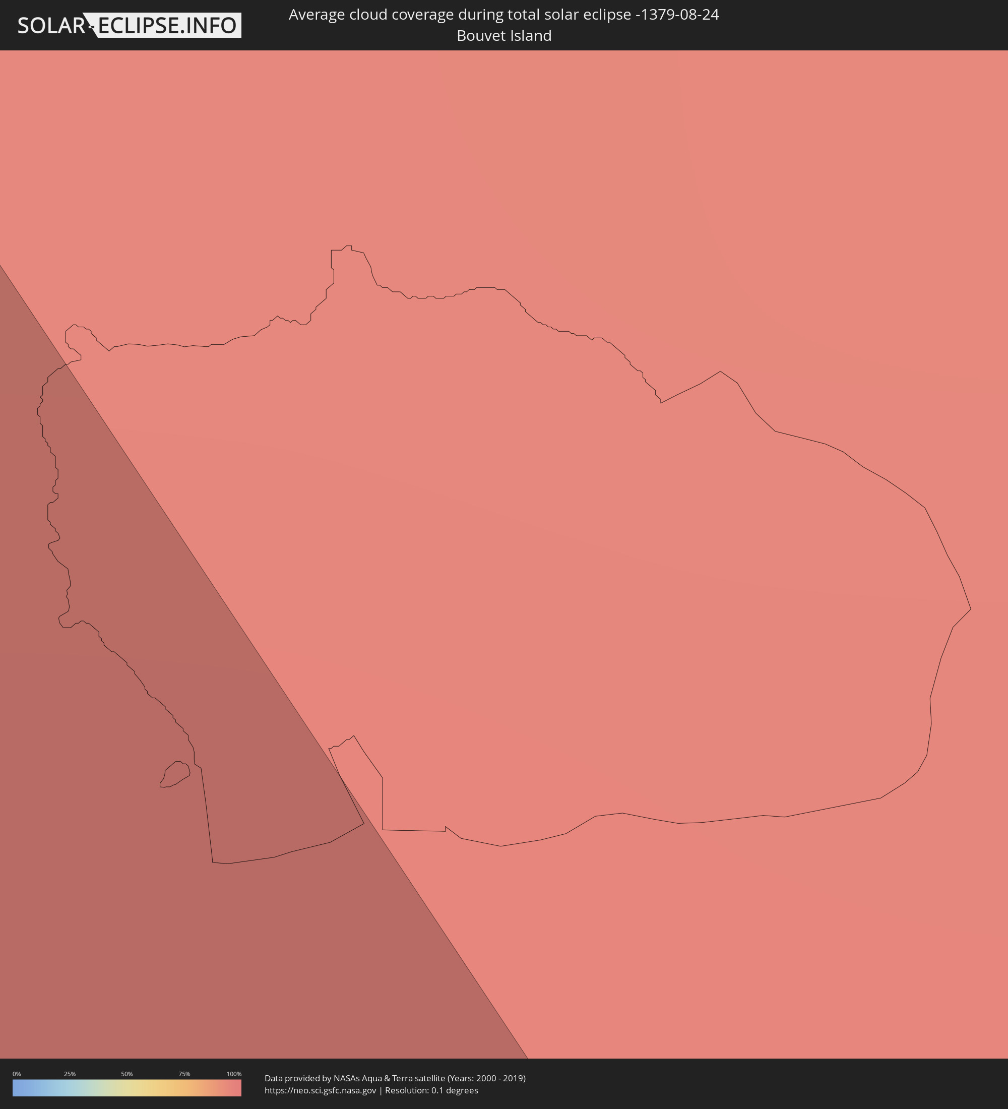 Bouvet Island
Cities inside the path of the eclipse
The following table shows all locations with a population of more than 5,000 inside the eclipse path. Cities which have more than 100,000 inhabitants are marked bold. A click at the locations opens a detailed map.
| City | Type | Eclipse duration | Local time of max. eclipse | Distance to central line | Ø Cloud coverage |
|
Ceres, Santa Fe Province
|
total | - | 06:33:51 UTC-04:16 | 49 km | 52% |
|
Tostado, Santa Fe Province
|
total | - | 06:32:59 UTC-04:16 | 15 km | 51% |
|
San Cristóbal, Santa Fe Province
|
total | - | 06:34:49 UTC-04:16 | 115 km | 50% |
|
Calchaquí, Santa Fe Province
|
total | - | 06:34:39 UTC-04:16 | 97 km | 50% |
|
Vera, Santa Fe Province
|
total | - | 06:34:03 UTC-04:16 | 54 km | 47% |
|
Malabrigo, Santa Fe Province
|
total | - | 06:34:00 UTC-04:16 | 48 km | 46% |
|
Avellaneda, Santa Fe Province
|
total | - | 06:33:50 UTC-04:16 | 33 km | 48% |
|
Reconquista, Santa Fe Province
|
total | - | 06:33:53 UTC-04:16 | 36 km | 48% |
|
Villa Ocampo, Santa Fe Province
|
total | - | 06:33:04 UTC-04:16 | 27 km | 48% |
|
Goya, Corrientes Province
|
total | - | 06:34:04 UTC-04:16 | 46 km | 46% |
|
Las Toscas, Santa Fe Province
|
total | - | 06:32:55 UTC-04:16 | 38 km | 47% |
|
Santa Lucía, Corrientes Province
|
total | - | 06:33:56 UTC-04:16 | 34 km | 49% |
|
San Lorenzo, Corrientes Province
|
total | - | 06:32:52 UTC-04:16 | 49 km | 43% |
|
Saladas, Corrientes Province
|
total | - | 06:33:07 UTC-04:16 | 32 km | 43% |
|
Perugorría, Corrientes Province
|
total | - | 06:34:43 UTC-04:16 | 85 km | 50% |
|
San Luis del Palmar, Corrientes Province
|
total | - | 06:32:05 UTC-04:16 | 110 km | 46% |
|
Mburucuyá, Corrientes Province
|
total | - | 06:33:02 UTC-04:16 | 44 km | 47% |
|
Santa Rosa, Corrientes Province
|
total | - | 06:33:25 UTC-04:16 | 18 km | 49% |
|
Mercedes, Corrientes Province
|
total | - | 06:34:47 UTC-04:16 | 82 km | 52% |
|
Nuestra Señora del Rosario de Caa Catí, Corrientes Province
|
total | - | 06:32:57 UTC-04:16 | 61 km | 51% |
|
San Miguel, Corrientes Province
|
total | - | 06:33:19 UTC-04:16 | 34 km | 49% |
|
Ayolas, Misiones
|
total | - | 06:59:00 UTC-03:50 | 81 km | 53% |
|
La Cruz, Corrientes Province
|
total | - | 06:35:39 UTC-04:16 | 117 km | 57% |
|
Itaqui, Rio Grande do Sul
|
total | - | 07:45:58 UTC-03:06 | 114 km | 54% |
|
Alvear, Corrientes Province
|
total | - | 06:35:35 UTC-04:16 | 111 km | 54% |
|
Santo Tomé, Corrientes Province
|
total | - | 06:35:06 UTC-04:16 | 64 km | 57% |
|
Gobernador Ingeniero Valentín Virasoro, Corrientes Province
|
total | - | 06:34:22 UTC-04:16 | 10 km | 55% |
|
São Borja, Rio Grande do Sul
|
total | - | 07:45:37 UTC-03:06 | 76 km | 55% |
|
Posadas, Misiones Province
|
total | - | 06:33:27 UTC-04:16 | 61 km | 51% |
|
Encarnación, Itapúa
|
total | - | 06:59:33 UTC-03:50 | 64 km | 52% |
|
Garupá, Misiones Province
|
total | - | 06:33:39 UTC-04:16 | 47 km | 50% |
|
San José, Misiones Province
|
total | - | 06:34:07 UTC-04:16 | 15 km | 51% |
|
Hohenau, Itapúa
|
total | - | 06:59:16 UTC-03:50 | 88 km | 54% |
|
Candelaria, Misiones Province
|
total | - | 06:33:41 UTC-04:16 | 48 km | 50% |
|
Obligado, Itapúa
|
total | - | 06:59:16 UTC-03:50 | 91 km | 52% |
|
Concepción de la Sierra, Misiones Province
|
total | - | 06:34:36 UTC-04:16 | 14 km | 52% |
|
Cerro Azul, Misiones Province
|
total | - | 06:34:06 UTC-04:16 | 23 km | 50% |
|
Gobernador Roca, Misiones Province
|
total | - | 06:33:28 UTC-04:16 | 71 km | 48% |
|
Santo Pipó, Misiones Province
|
total | - | 06:33:26 UTC-04:16 | 75 km | 50% |
|
Jardín América, Misiones Province
|
total | - | 06:33:25 UTC-04:16 | 81 km | 48% |
|
Oberá, Misiones Province
|
total | - | 06:34:08 UTC-04:16 | 31 km | 50% |
|
Capioví, Misiones Province
|
total | - | 06:33:21 UTC-04:16 | 90 km | 48% |
|
Campo Viera, Misiones Province
|
total | - | 06:34:02 UTC-04:16 | 40 km | 50% |
|
Puerto Rico, Misiones Province
|
total | - | 06:33:11 UTC-04:16 | 104 km | 49% |
|
Campo Ramón, Misiones Province
|
total | - | 06:34:10 UTC-04:16 | 31 km | 50% |
|
Campo Grande, Misiones Province
|
total | - | 06:33:49 UTC-04:16 | 58 km | 52% |
|
São Luiz Gonzaga, Rio Grande do Sul
|
total | - | 07:45:56 UTC-03:06 | 73 km | 55% |
|
Garuhapé, Misiones Province
|
total | - | 06:33:16 UTC-04:16 | 100 km | 49% |
|
Panambí, Misiones Province
|
total | - | 06:34:37 UTC-04:16 | 1 km | 52% |
|
Aristóbulo del Valle, Misiones Province
|
total | - | 06:33:43 UTC-04:16 | 68 km | 50% |
|
El Alcázar, Misiones Province
|
total | - | 06:33:13 UTC-04:16 | 108 km | 47% |
|
Veinticinco de Mayo, Misiones Province
|
total | - | 06:34:14 UTC-04:16 | 34 km | 50% |
|
Dos de Mayo, Misiones Province
|
total | - | 06:33:45 UTC-04:16 | 72 km | 47% |
|
Alba Posse, Misiones Province
|
total | - | 06:34:33 UTC-04:16 | 12 km | 52% |
|
Colonia Aurora, Misiones Province
|
total | - | 06:34:31 UTC-04:16 | 19 km | 53% |
|
Santa Rosa, Rio Grande do Sul
|
total | - | 07:45:28 UTC-03:06 | 25 km | 55% |
|
Santo Ângelo, Rio Grande do Sul
|
total | - | 07:46:16 UTC-03:06 | 76 km | 56% |
|
Três de Maio, Rio Grande do Sul
|
total | - | 07:45:30 UTC-03:06 | 19 km | 54% |
|
El Soberbio, Misiones Province
|
total | - | 06:34:30 UTC-04:16 | 32 km | 51% |
|
San Vicente, Misiones Province
|
total | - | 06:33:32 UTC-04:16 | 104 km | 48% |
|
San Pedro, Misiones Province
|
total | - | 06:33:34 UTC-04:16 | 103 km | 48% |
|
Três Passos, Rio Grande do Sul
|
total | - | 07:45:15 UTC-03:06 | 9 km | 53% |
|
Ijuí, Rio Grande do Sul
|
total | - | 07:46:39 UTC-03:06 | 93 km | 57% |
|
Cruz Alta, Rio Grande do Sul
|
total | - | 07:47:16 UTC-03:06 | 126 km | 59% |
|
Panambi, Rio Grande do Sul
|
total | - | 07:46:49 UTC-03:06 | 91 km | 55% |
|
Frederico Westphalen, Rio Grande do Sul
|
total | - | 07:45:30 UTC-03:06 | 9 km | 52% |
|
Palmeira das Missões, Rio Grande do Sul
|
total | - | 07:46:22 UTC-03:06 | 52 km | 56% |
|
Sarandi, Rio Grande do Sul
|
total | - | 07:46:44 UTC-03:06 | 64 km | 57% |
|
Carazinho, Rio Grande do Sul
|
total | - | 07:47:21 UTC-03:06 | 104 km | 60% |
|
Pato Branco, Paraná
|
total | - | 07:44:23 UTC-03:06 | 119 km | 49% |
|
Chapecó, Santa Catarina
|
total | - | 07:45:42 UTC-03:06 | 23 km | 53% |
|
Passo Fundo, Rio Grande do Sul
|
total | - | 07:47:37 UTC-03:06 | 109 km | 58% |
|
Xanxerê, Santa Catarina
|
total | - | 07:45:33 UTC-03:06 | 43 km | 48% |
|
Erechim, Rio Grande do Sul
|
total | - | 07:46:47 UTC-03:06 | 42 km | 54% |
|
Concórdia, Santa Catarina
|
total | - | 07:46:22 UTC-03:06 | 3 km | 50% |
|
Palmas, Paraná
|
total | - | 07:45:17 UTC-03:06 | 79 km | 44% |
|
Capinzal, Santa Catarina
|
total | - | 07:46:53 UTC-03:06 | 22 km | 49% |
|
Lagoa Vermelha, Rio Grande do Sul
|
total | - | 07:48:15 UTC-03:06 | 118 km | 55% |
|
Joaçaba, Santa Catarina
|
total | - | 07:46:43 UTC-03:06 | 6 km | 49% |
|
Celso Ramos, Santa Catarina
|
total | - | 07:47:33 UTC-03:06 | 59 km | 48% |
|
Campos Novos, Santa Catarina
|
total | - | 07:47:17 UTC-03:06 | 35 km | 49% |
|
Videira, Santa Catarina
|
total | - | 07:46:45 UTC-03:06 | 7 km | 46% |
|
União da Vitória, Paraná
|
total | - | 07:45:39 UTC-03:06 | 91 km | 52% |
|
Porto União, Santa Catarina
|
total | - | 07:45:40 UTC-03:06 | 90 km | 52% |
|
Caçador, Santa Catarina
|
total | - | 07:46:31 UTC-03:06 | 30 km | 45% |
|
Estrela, Rio Grande do Sul
|
total | - | 07:48:32 UTC-03:06 | 112 km | 52% |
|
Curitibanos, Santa Catarina
|
total | - | 07:47:39 UTC-03:06 | 32 km | 48% |
|
Santa Cecília, Santa Catarina
|
total | - | 07:47:18 UTC-03:06 | 1 km | 52% |
|
Canoinhas, Santa Catarina
|
total | - | 07:46:10 UTC-03:06 | 87 km | 53% |
|
São Mateus do Sul, Paraná
|
total | - | 07:45:43 UTC-03:06 | 120 km | 50% |
|
Lages, Santa Catarina
|
total | - | 07:48:41 UTC-03:06 | 95 km | 53% |
|
Mafra, Santa Catarina
|
total | - | 07:46:34 UTC-03:06 | 86 km | 51% |
|
Rio Negro, Paraná
|
total | - | 07:46:34 UTC-03:06 | 86 km | 51% |
|
Lapa, Paraná
|
total | - | 07:46:09 UTC-03:06 | 122 km | 48% |
|
Rio do Sul, Santa Catarina
|
total | - | 07:48:23 UTC-03:06 | 38 km | 62% |
|
Rio Negrinho, Santa Catarina
|
total | - | 07:47:03 UTC-03:06 | 66 km | 54% |
|
Ibirama, Santa Catarina
|
total | - | 07:48:15 UTC-03:06 | 23 km | 62% |
|
São Bento do Sul, Santa Catarina
|
total | - | 07:47:10 UTC-03:06 | 65 km | 56% |
|
Timbó, Santa Catarina
|
total | - | 07:48:07 UTC-03:06 | 0 km | 64% |
|
Indaial, Santa Catarina
|
total | - | 07:48:16 UTC-03:06 | 9 km | 63% |
|
Pomerode, Santa Catarina
|
total | - | 07:48:05 UTC-03:06 | 8 km | 65% |
|
Schroeder, Santa Catarina
|
total | - | 07:47:41 UTC-03:06 | 43 km | 67% |
|
Jaraguá do Sul, Santa Catarina
|
total | - | 07:47:48 UTC-03:06 | 34 km | 67% |
|
Blumenau, Santa Catarina
|
total | - | 07:48:27 UTC-03:06 | 13 km | 63% |
|
Guaramirim, Santa Catarina
|
total | - | 07:47:50 UTC-03:06 | 35 km | 68% |
|
Gaspar, Santa Catarina
|
total | - | 07:48:35 UTC-03:06 | 16 km | 65% |
|
Brusque, Santa Catarina
|
total | - | 07:48:52 UTC-03:06 | 35 km | 64% |
|
Joinville, Santa Catarina
|
total | - | 07:47:44 UTC-03:06 | 52 km | 66% |
|
Santo Amaro da Imperatriz, Santa Catarina
|
total | - | 07:49:54 UTC-03:06 | 102 km | 61% |
|
Barra Velha, Santa Catarina
|
total | - | 07:48:23 UTC-03:06 | 14 km | 66% |
|
Itajaí, Santa Catarina
|
total | - | 07:48:49 UTC-03:06 | 17 km | 67% |
|
Biguaçu, Santa Catarina
|
total | - | 07:49:43 UTC-03:06 | 82 km | 64% |
|
Penha, Santa Catarina
|
total | - | 07:48:37 UTC-03:06 | 2 km | 62% |
|
São Francisco do Sul, Santa Catarina
|
total | - | 07:47:50 UTC-03:06 | 56 km | 65% |
|
Tijucas, Santa Catarina
|
total | - | 07:49:21 UTC-03:06 | 54 km | 60% |
|
Itapema, Santa Catarina
|
total | - | 07:49:09 UTC-03:06 | 38 km | 62% |
|
Campinas, Santa Catarina
|
total | - | 07:49:55 UTC-03:06 | 94 km | 60% |
|
Guaratuba, Paraná
|
total | - | 07:47:21 UTC-03:06 | 95 km | 65% |
|
Freguesia do Ribeirao da Ilha, Santa Catarina
|
total | - | 07:50:09 UTC-03:06 | 108 km | 57% |
|
Florianópolis, Santa Catarina
|
total | - | 07:49:59 UTC-03:06 | 94 km | 59% |
|
Ribeirão da Ilha, Santa Catarina
|
total | - | 07:50:09 UTC-03:06 | 106 km | 58% |
|
Trindade, Santa Catarina
|
total | - | 07:49:59 UTC-03:06 | 94 km | 59% |