Hybrid solar eclipse of 11/04/-1467
| Day of week: | Monday |
| Maximum duration of eclipse: | 01m39s |
| Maximum width of eclipse path: | 58 km |
| Saros cycle: | 29 |
| Coverage: | 100% |
| Magnitude: | 1.0164 |
| Gamma: | 0.2581 |
Wo kann man die Sonnenfinsternis vom 11/04/-1467 sehen?
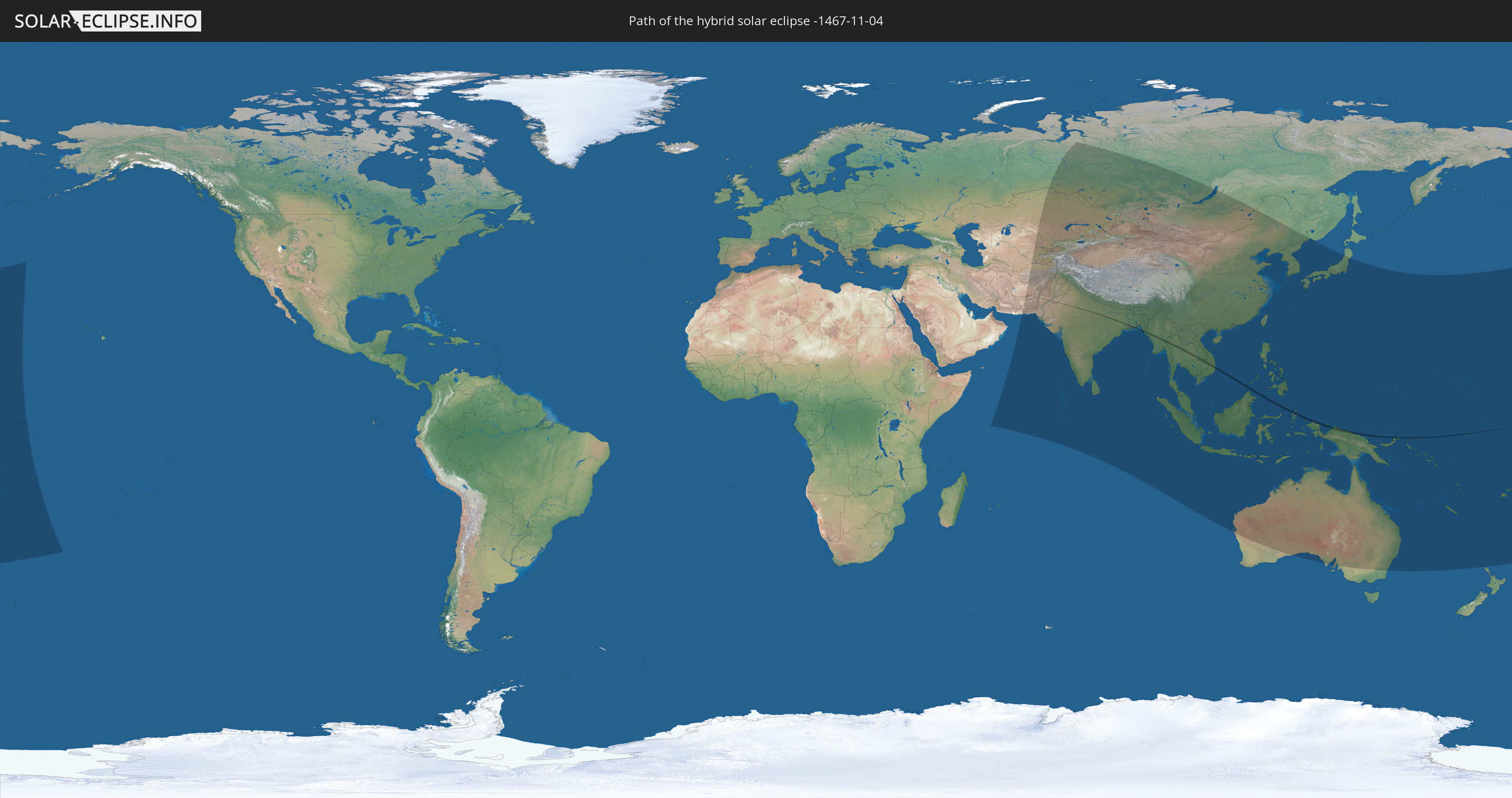
Die Sonnenfinsternis am 11/04/-1467 kann man in 58 Ländern als partielle Sonnenfinsternis beobachten.
Der Finsternispfad verläuft durch 12 Länder. Nur in diesen Ländern ist sie als hybrid Sonnenfinsternis zu sehen.
In den folgenden Ländern ist die Sonnenfinsternis hybrid zu sehen
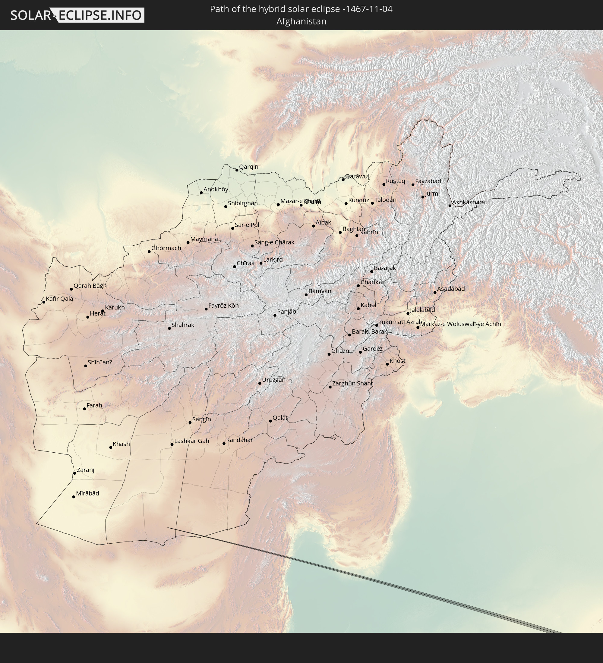 Afghanistan
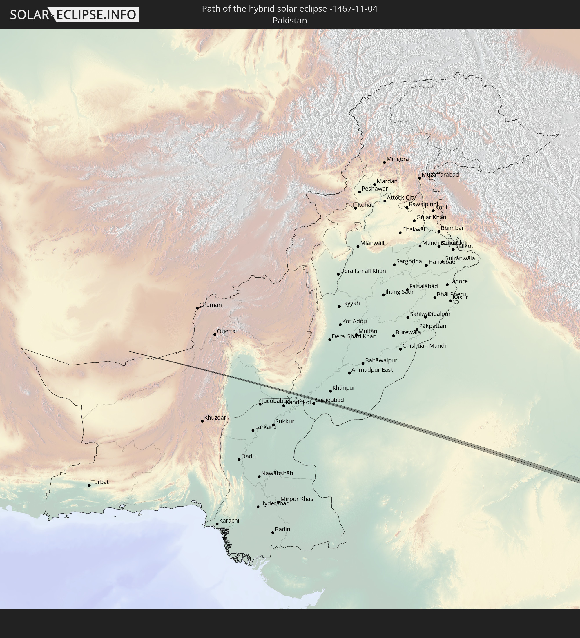 Pakistan
 India
India
 Bangladesh
 Myanmar
 Indonesia
 Thailand
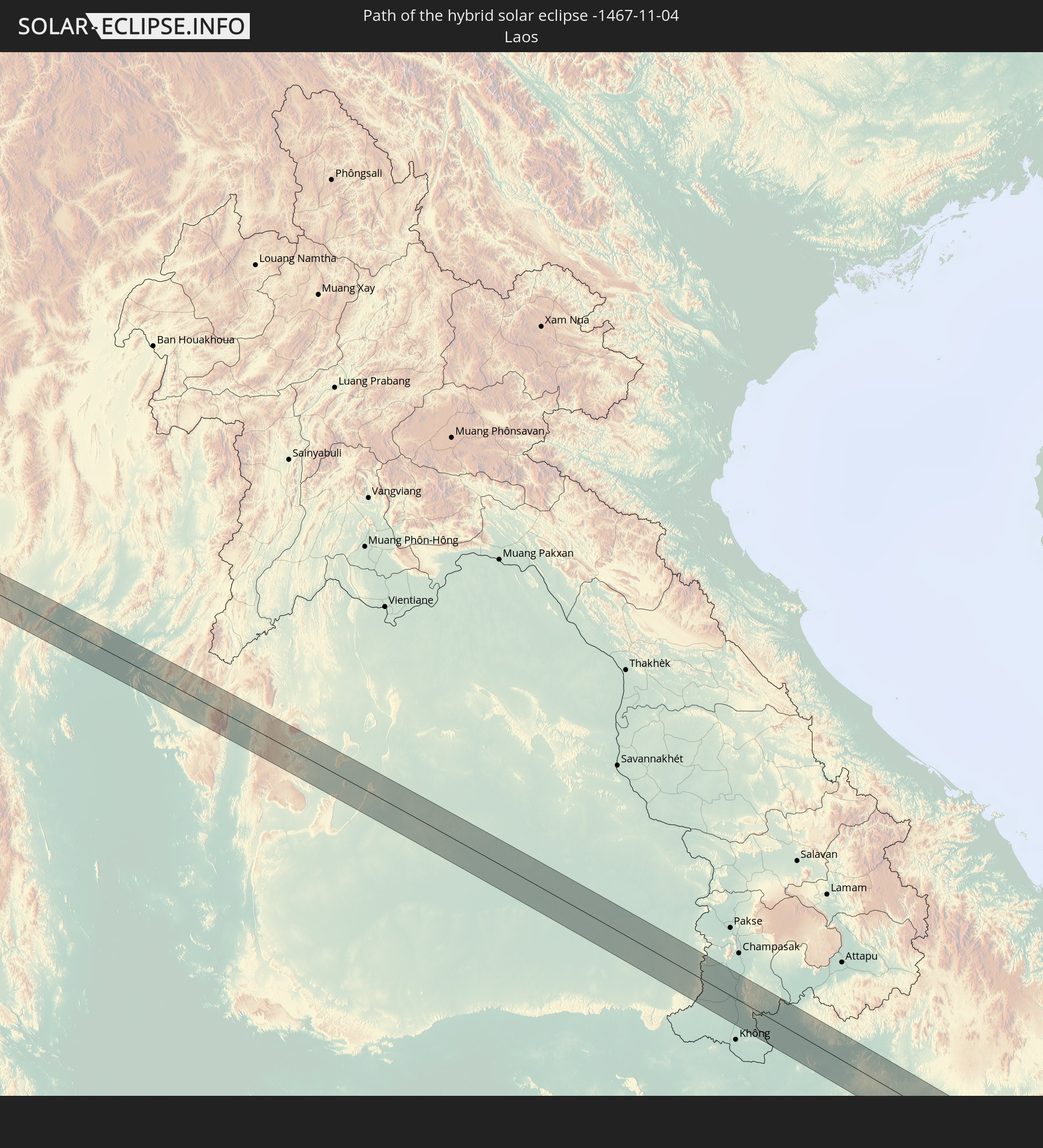 Laos
Laos
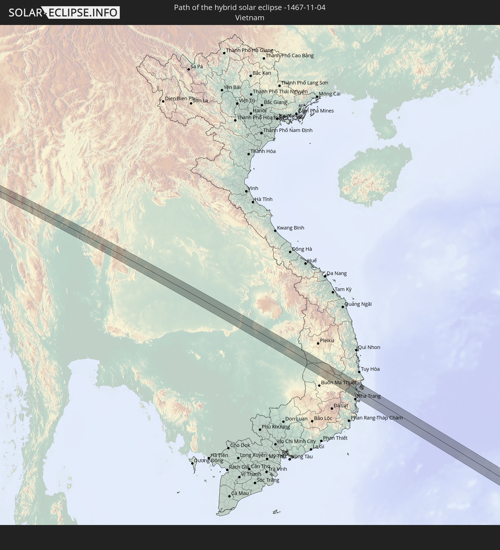 Vietnam
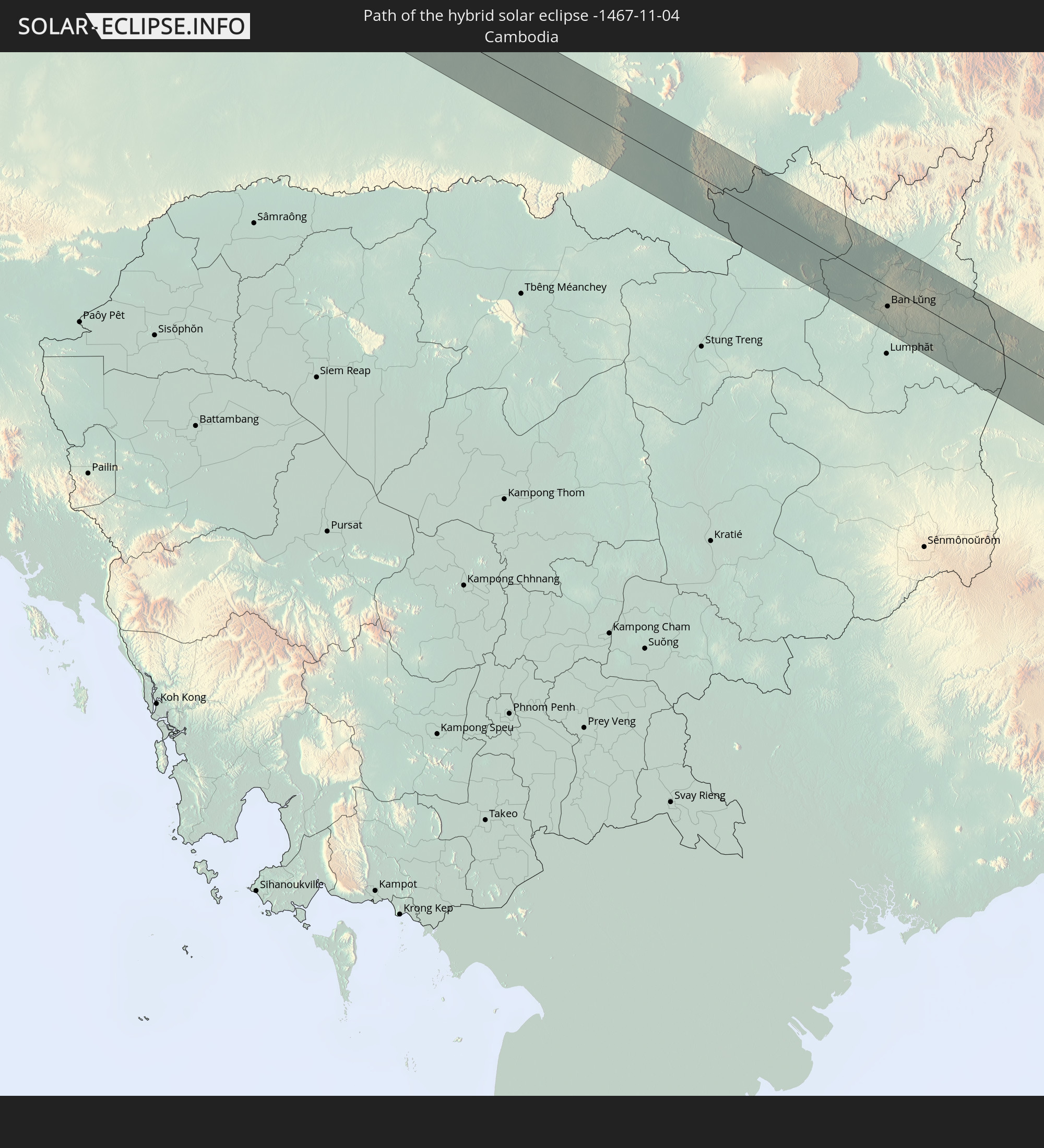 Cambodia
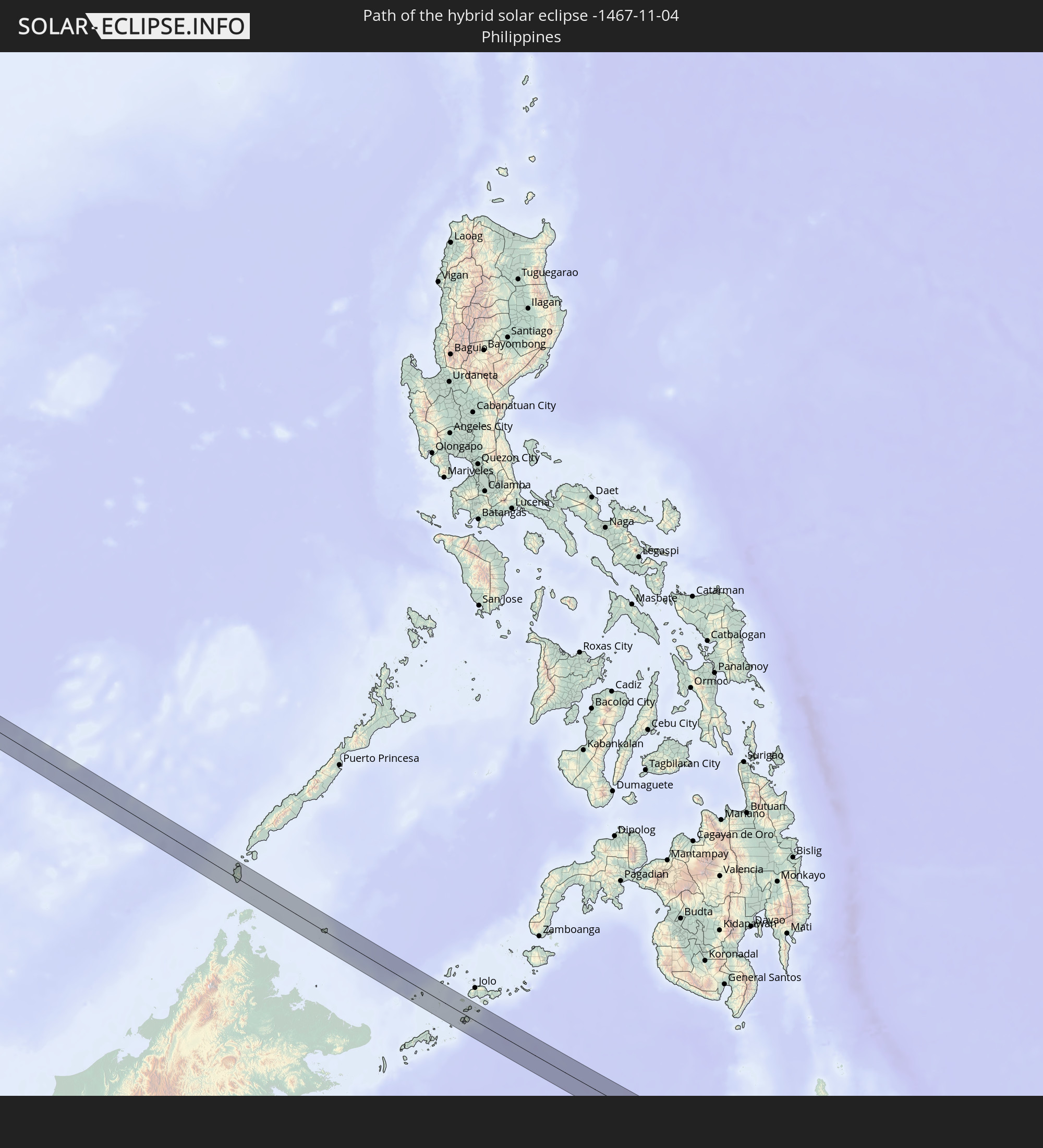 Philippines
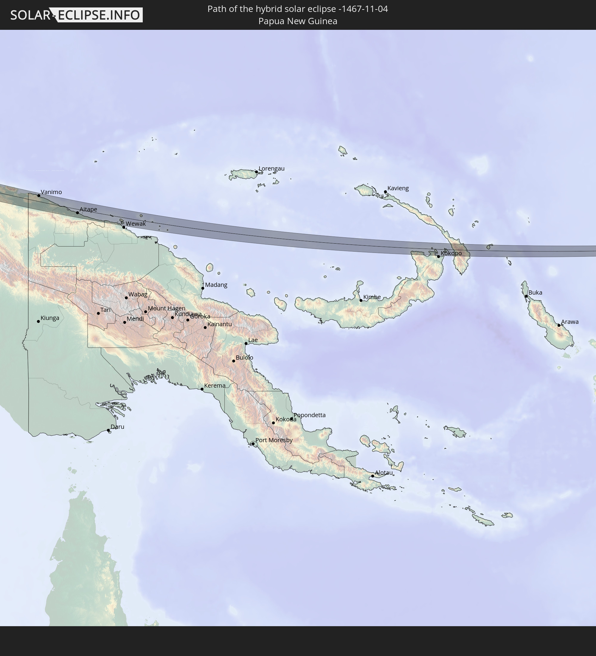 Papua New Guinea
In den folgenden Ländern ist die Sonnenfinsternis partiell zu sehen
 Fiji
Fiji
 Russia
 New Zealand
 United States Minor Outlying Islands
 Wallis and Futuna
 Tonga
Tonga
 Kiribati
 Samoa
Samoa
 Tokelau
 Niue
Niue
 Kazakhstan
 Turkmenistan
 Uzbekistan
 Afghanistan
 Pakistan
 Tajikistan
 India
India
 Kyrgyzstan
 British Indian Ocean Territory
 Maldives
 China
China
 Sri Lanka
 Nepal
Nepal
 Mongolia
 Bangladesh
 Bhutan
 Myanmar
 Indonesia
 Cocos Islands
 Thailand
 Malaysia
 Laos
Laos
 Vietnam
 Cambodia
 Singapore
 Christmas Island
 Australia
 Macau
Macau
 Hong Kong
 Brunei
 Taiwan
 Philippines
 Japan
Japan
 East Timor
 North Korea
 South Korea
 Palau
Palau
 Federated States of Micronesia
 Papua New Guinea
 Guam
Guam
 Northern Mariana Islands
 Solomon Islands
 New Caledonia
 Marshall Islands
 Vanuatu
 Nauru
Nauru
 Norfolk Island
 Tuvalu
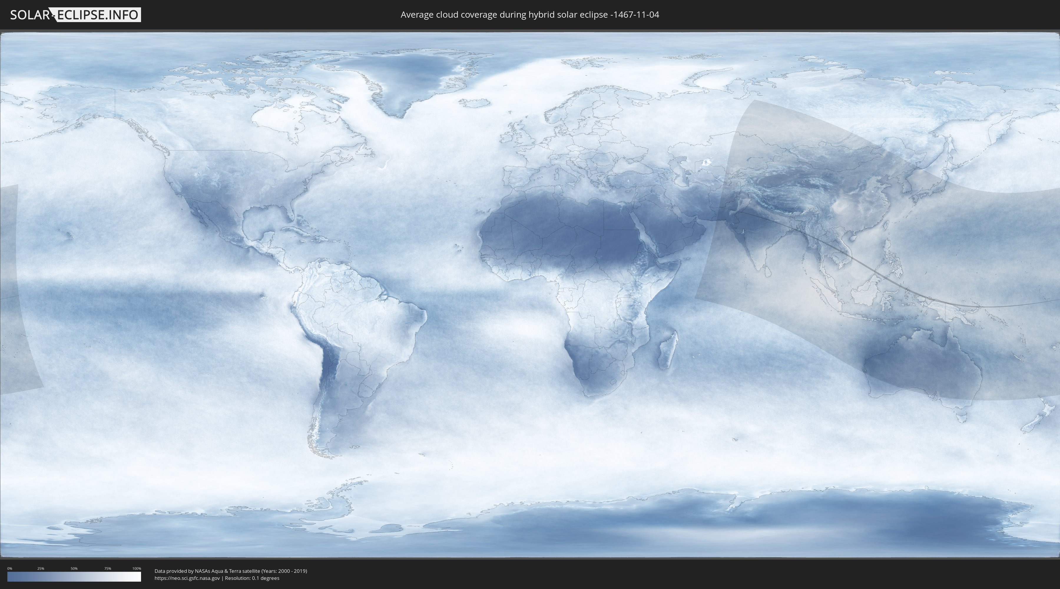
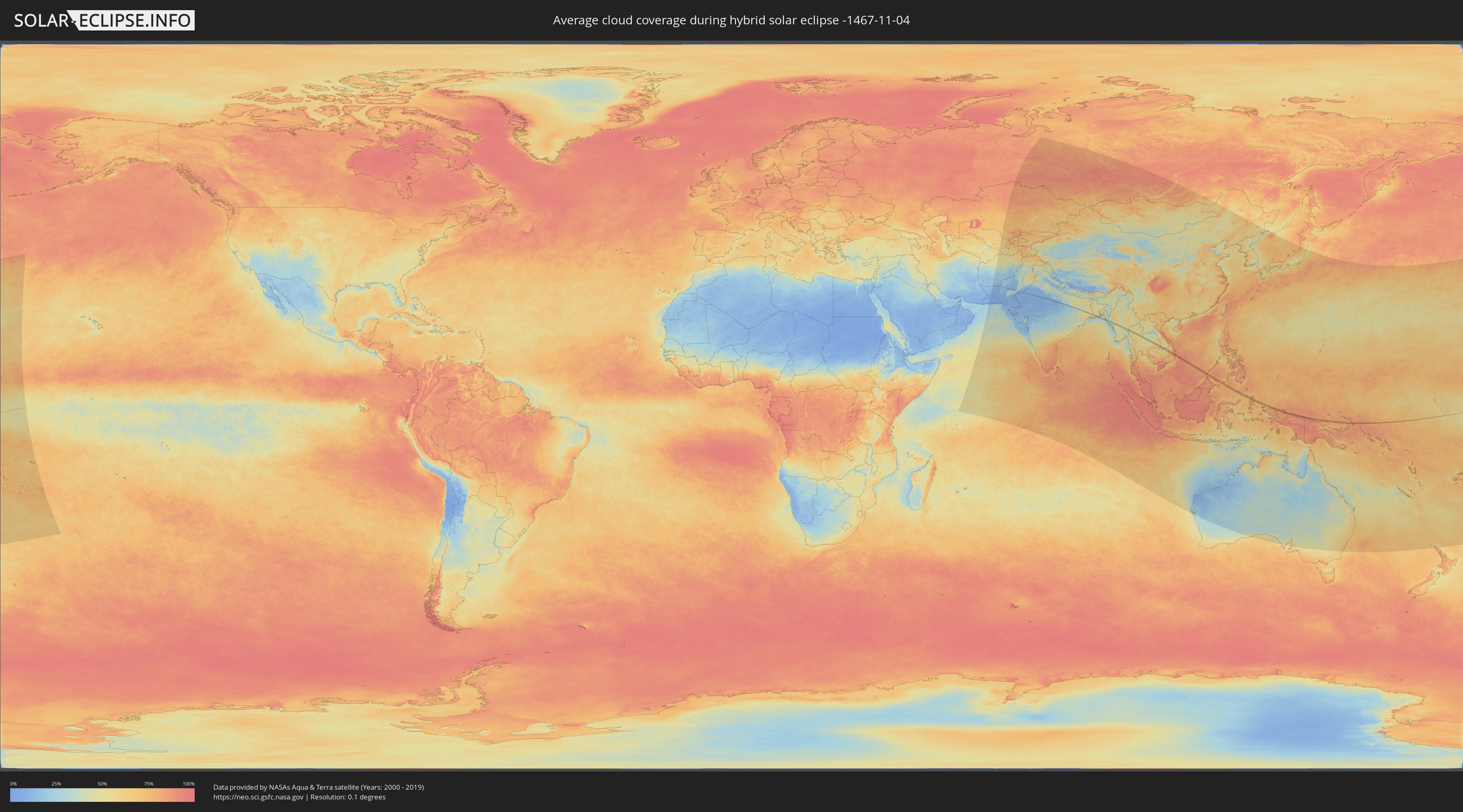
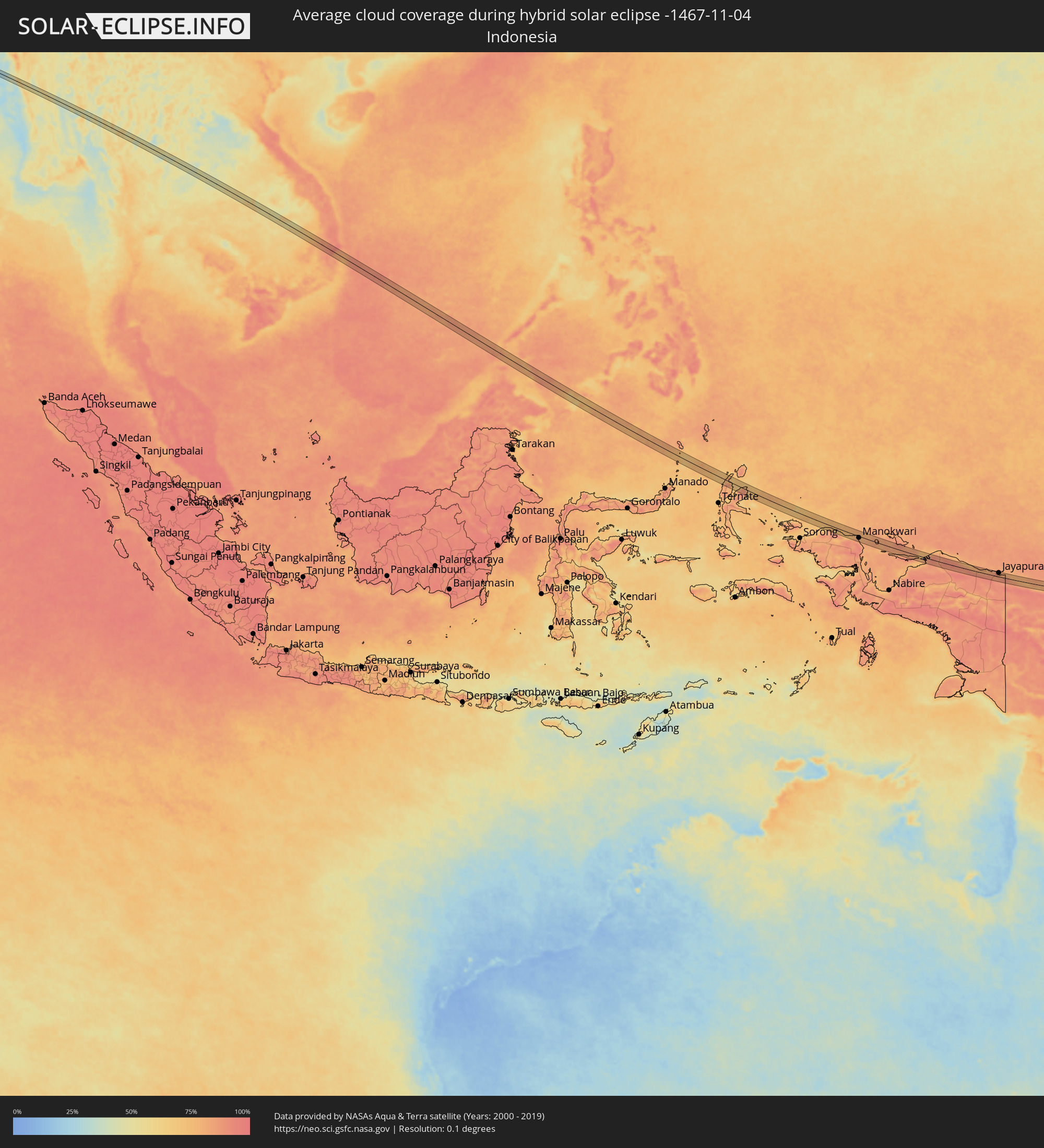
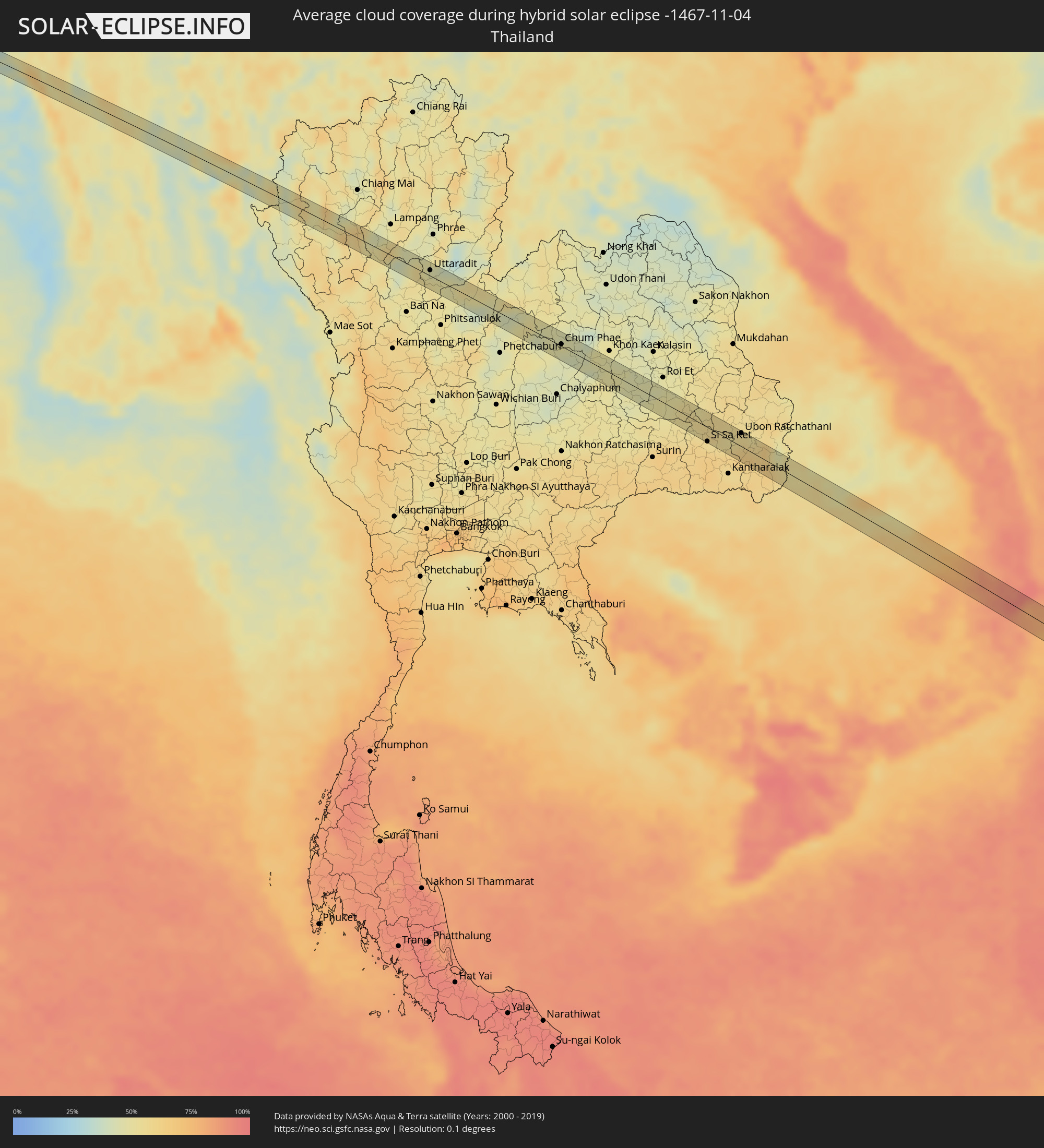
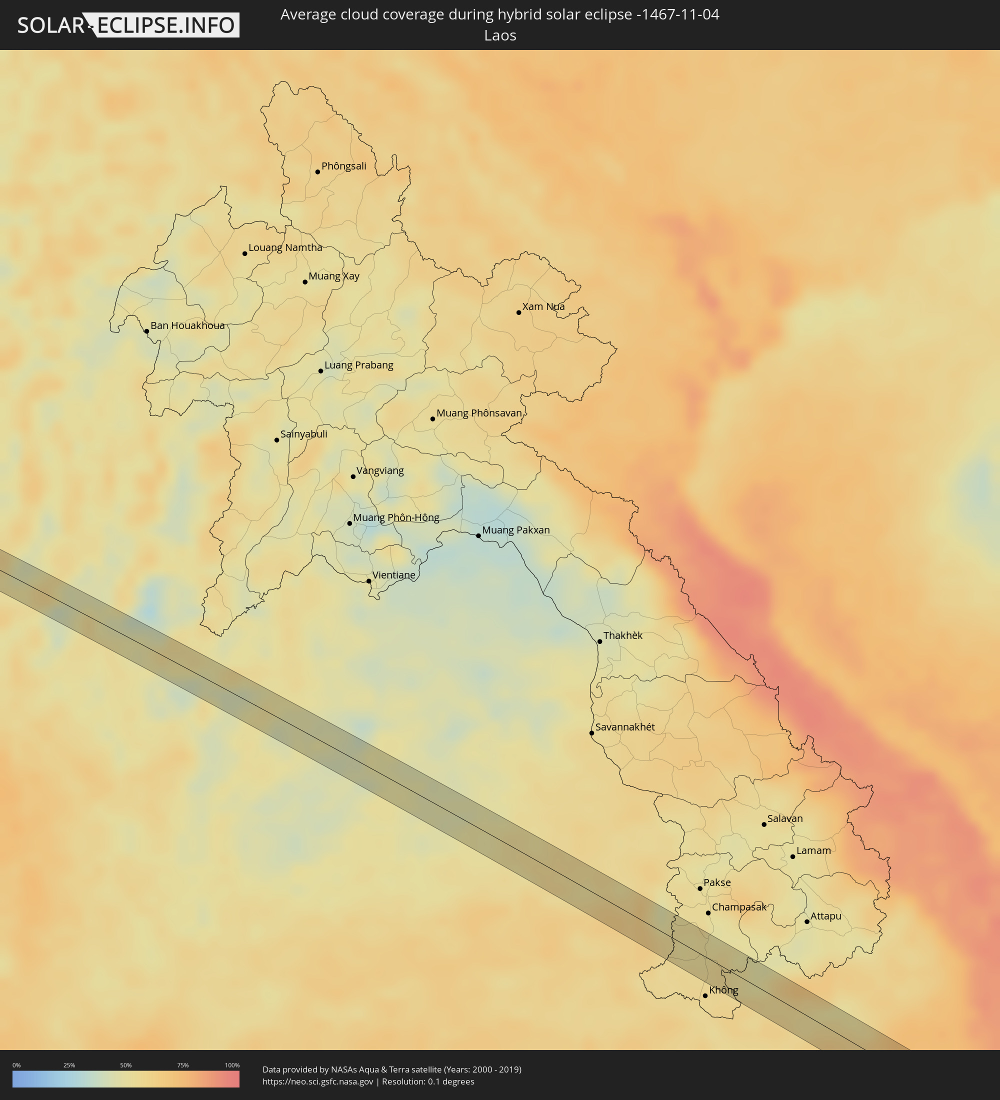
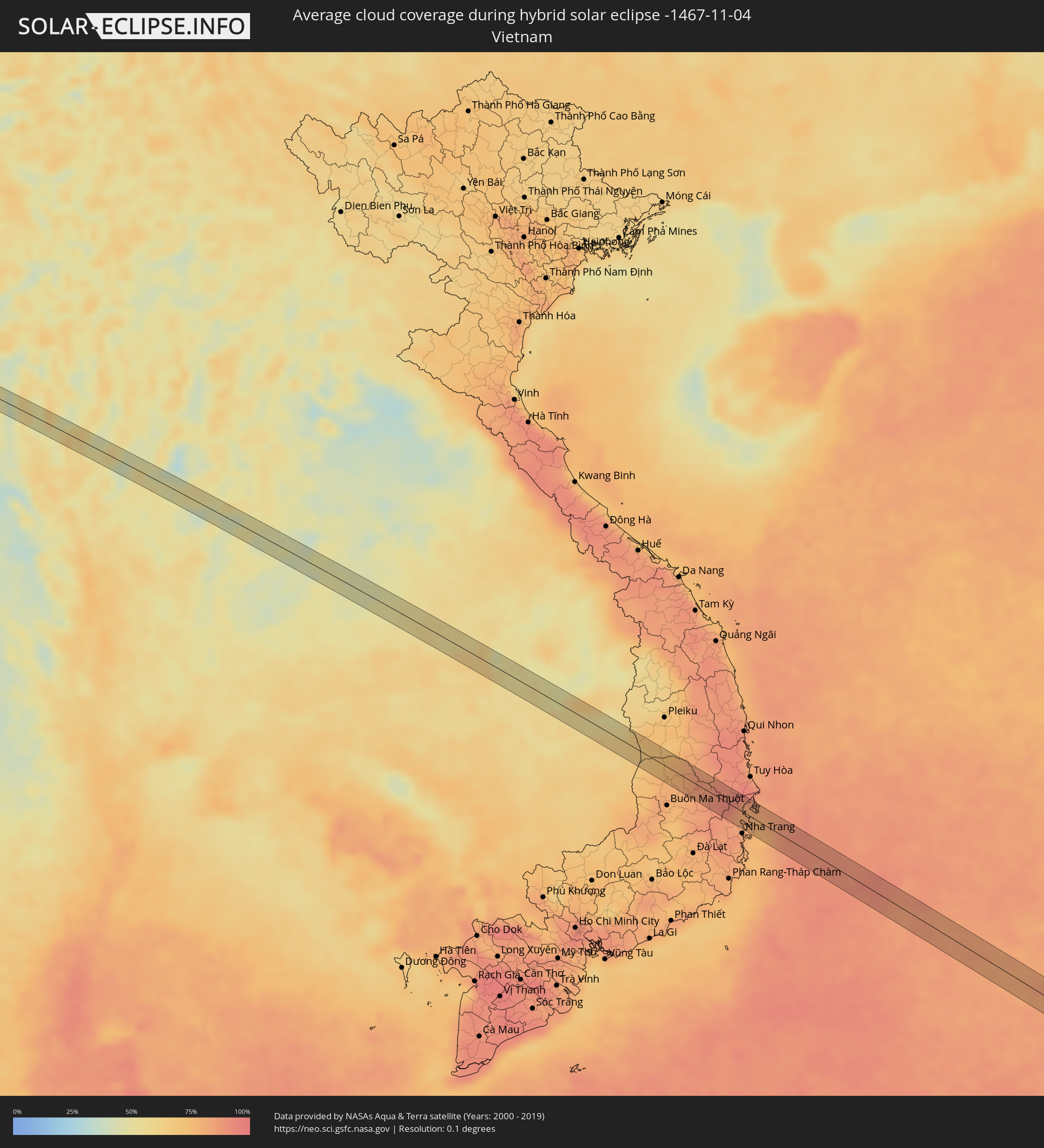
How will be the weather during the hybrid solar eclipse on 11/04/-1467?
Where is the best place to see the hybrid solar eclipse of 11/04/-1467?
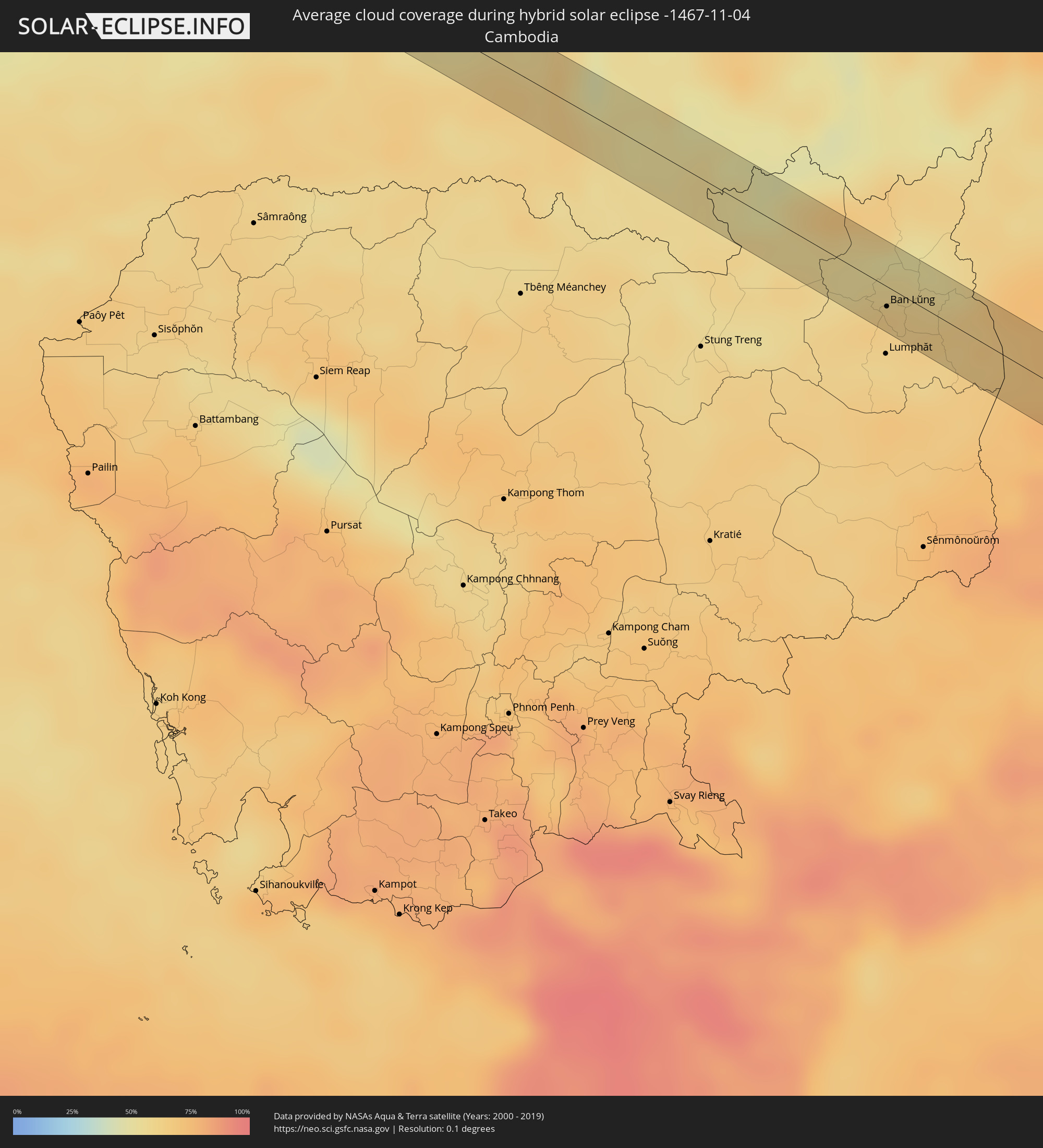
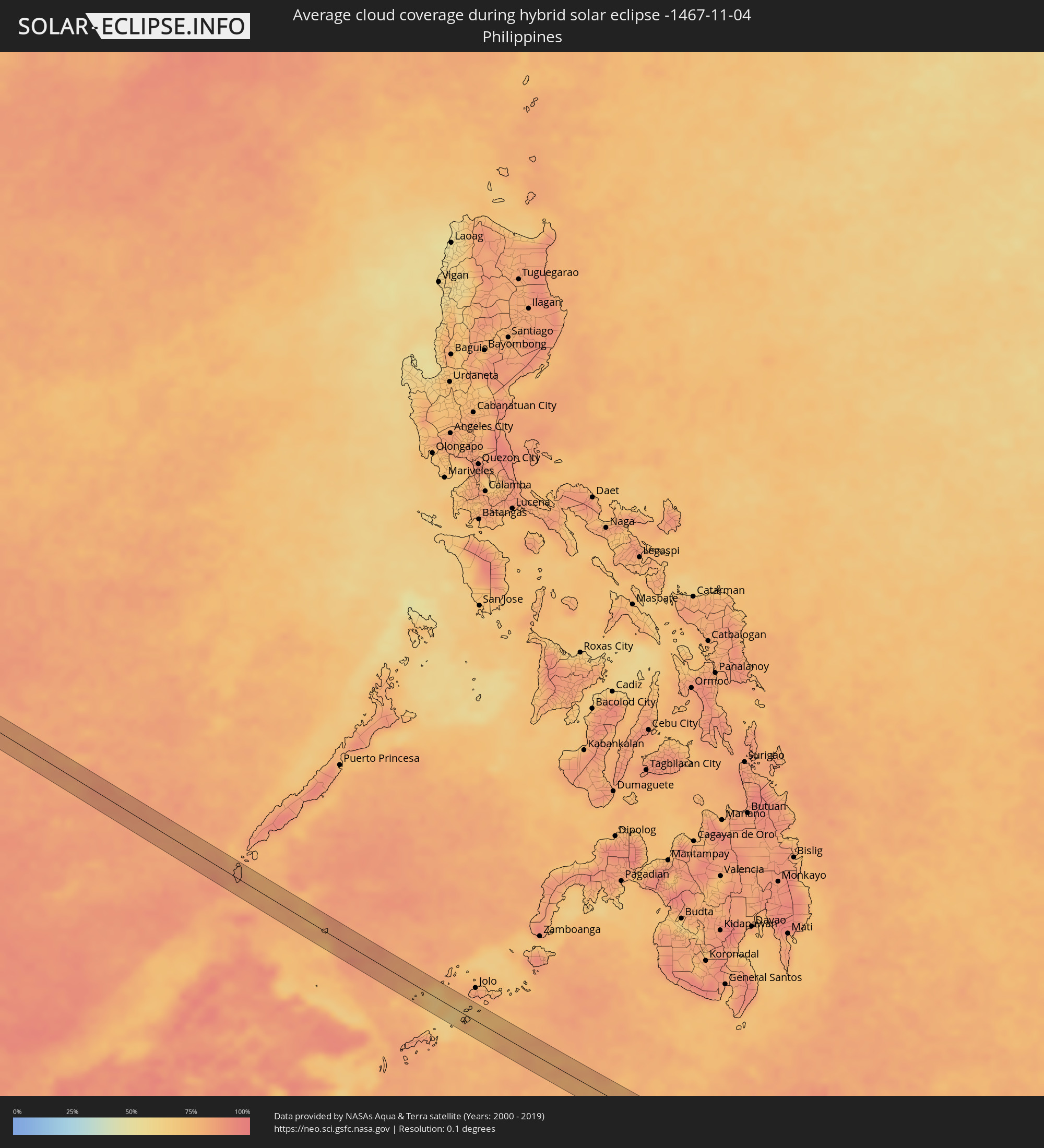
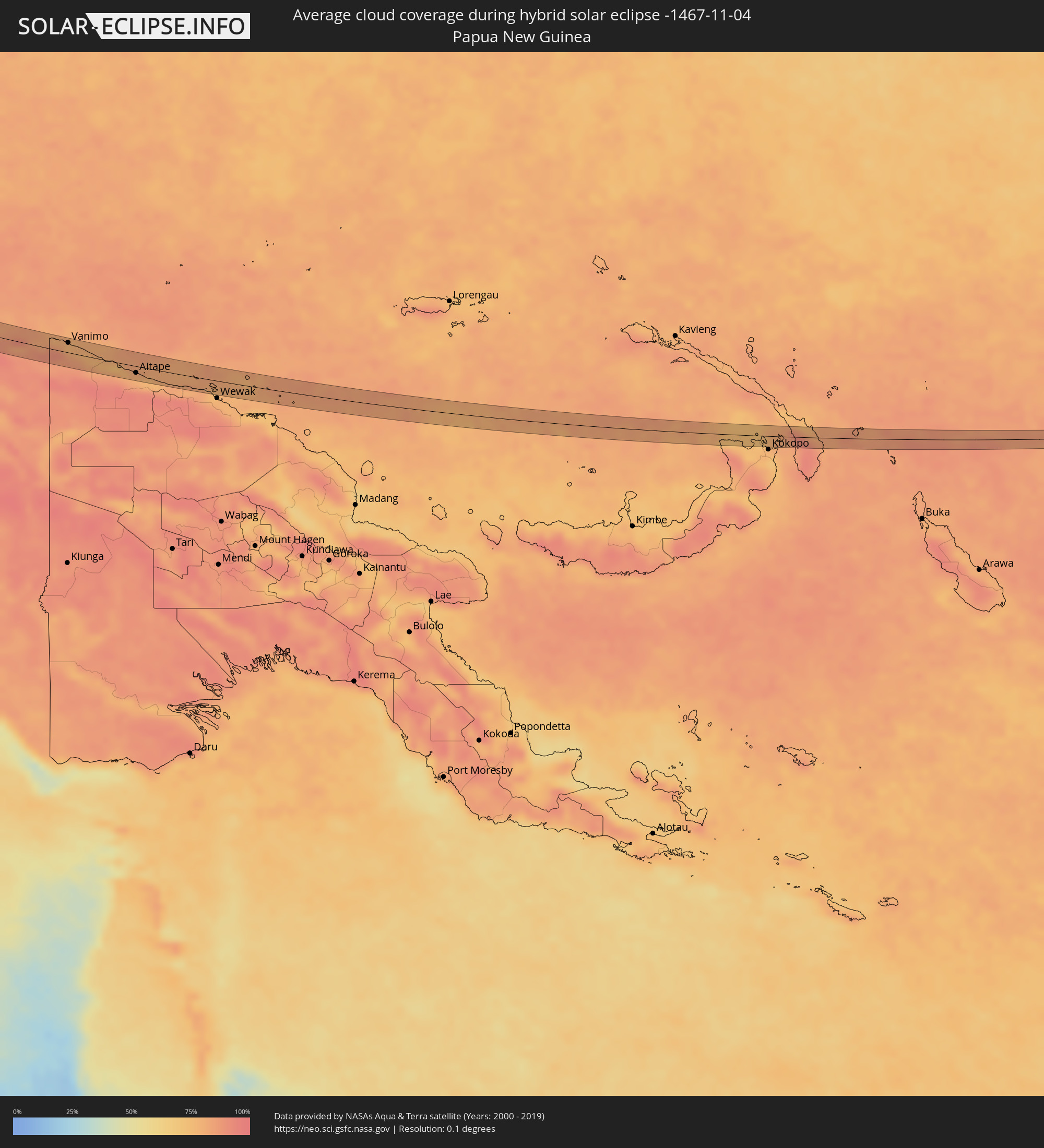
The following maps show the average cloud coverage for the day of the hybrid solar eclipse.
With the help of these maps, it is possible to find the place along the eclipse path, which has the best
chance of a cloudless sky.
Nevertheless, you should consider local circumstances and inform about the weather of your chosen
observation site.
The data is provided by NASAs satellites
AQUA and TERRA.
The cloud maps are averaged over a period of 19 years (2000 - 2019).
Detailed country maps
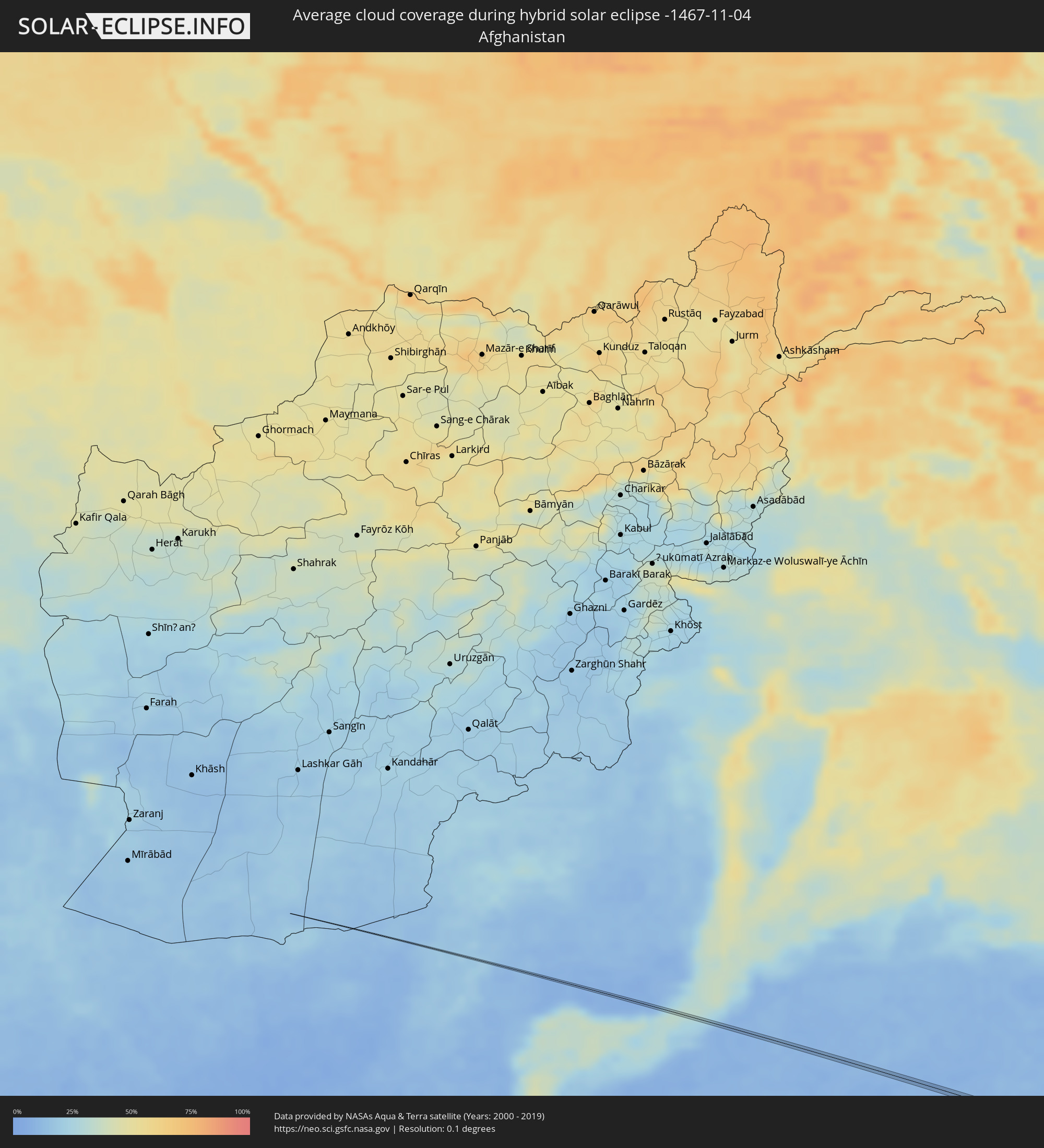 Afghanistan
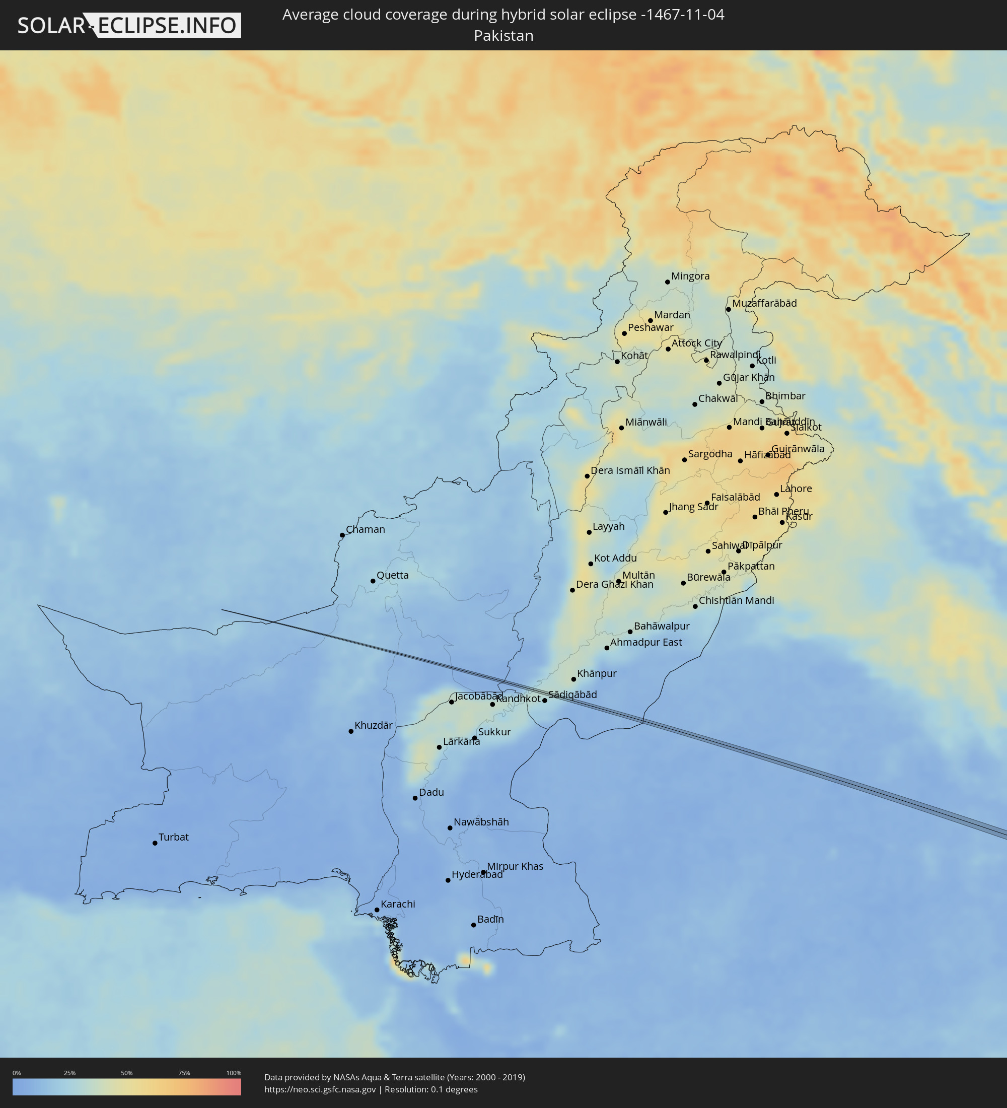 Pakistan
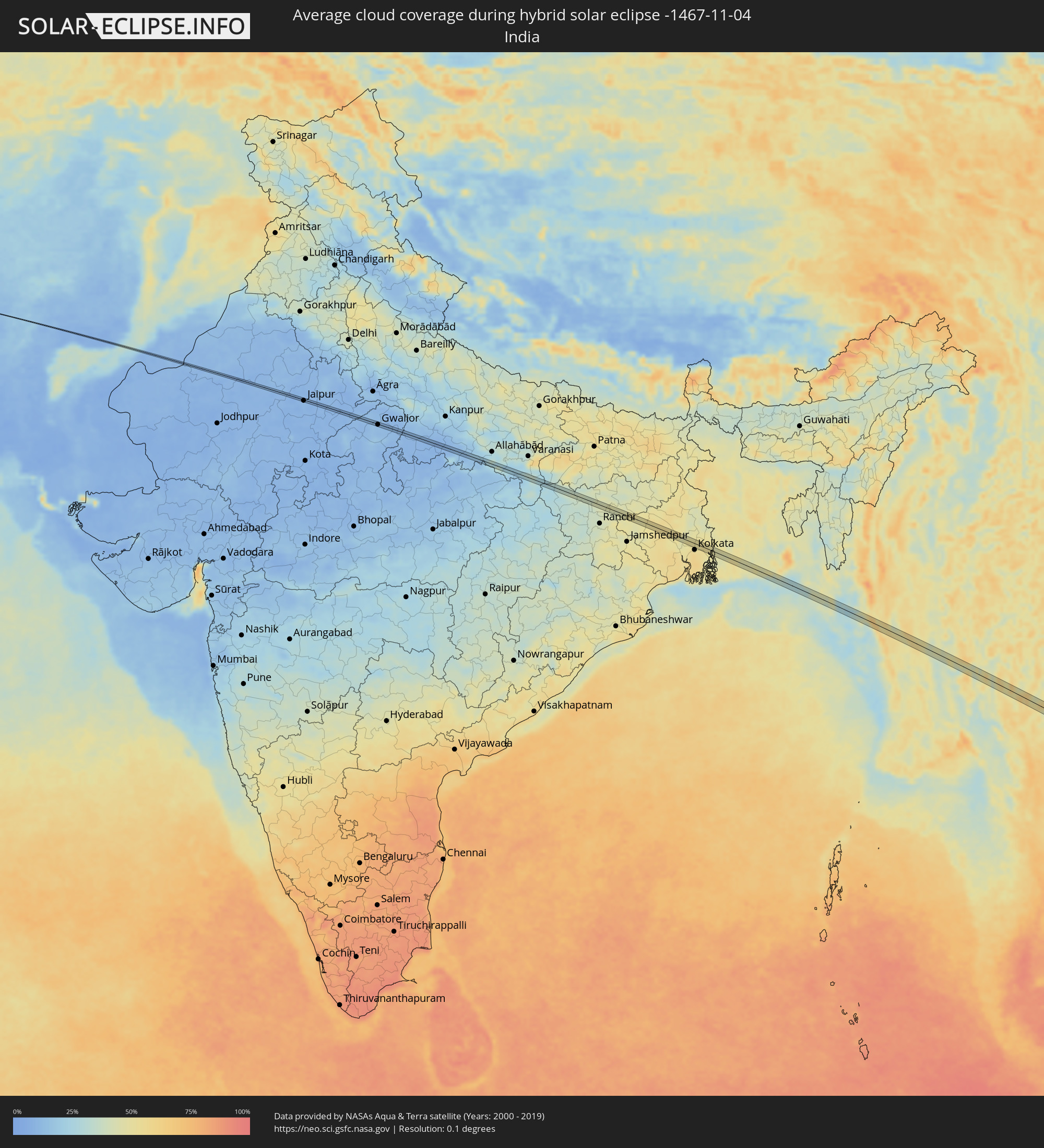 India
India
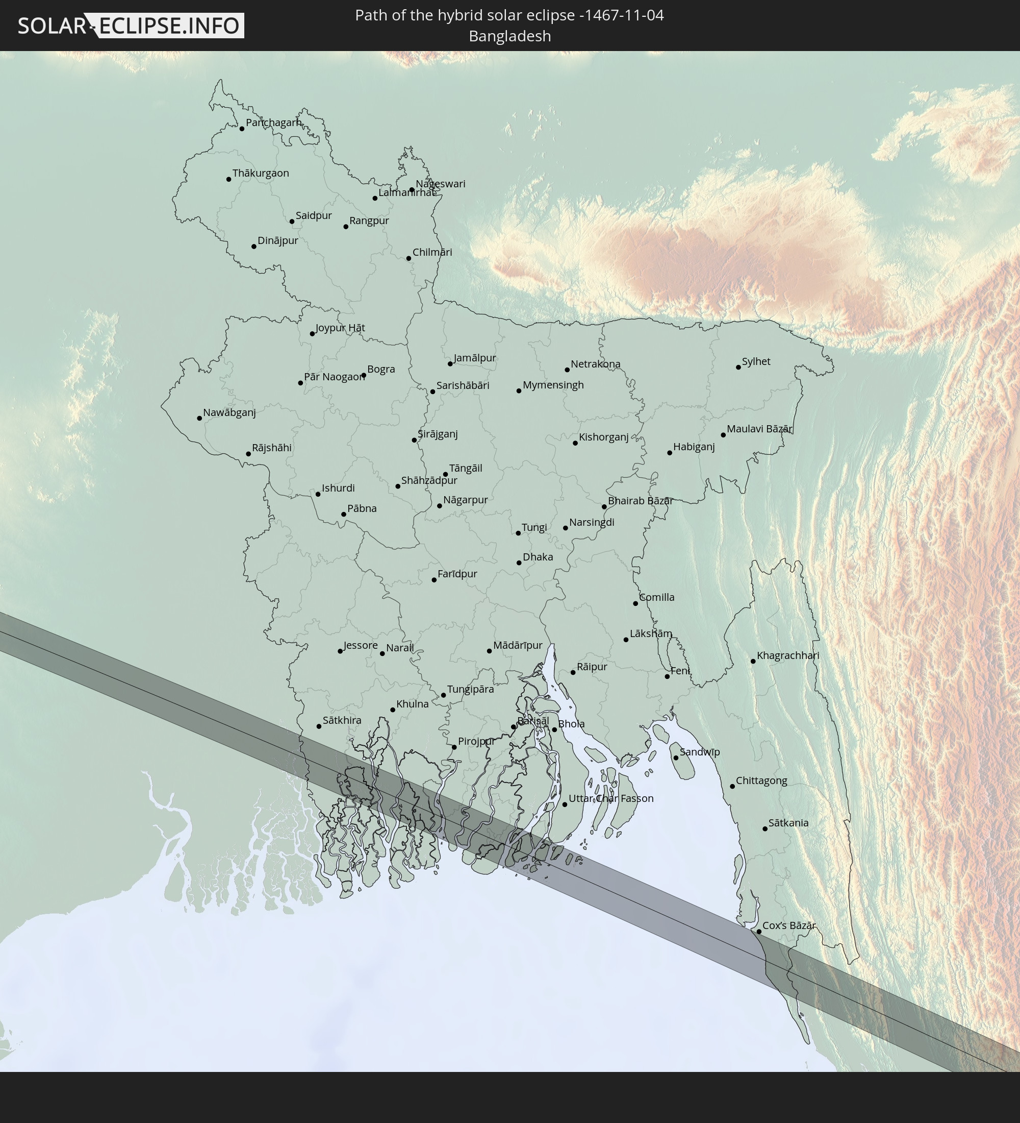
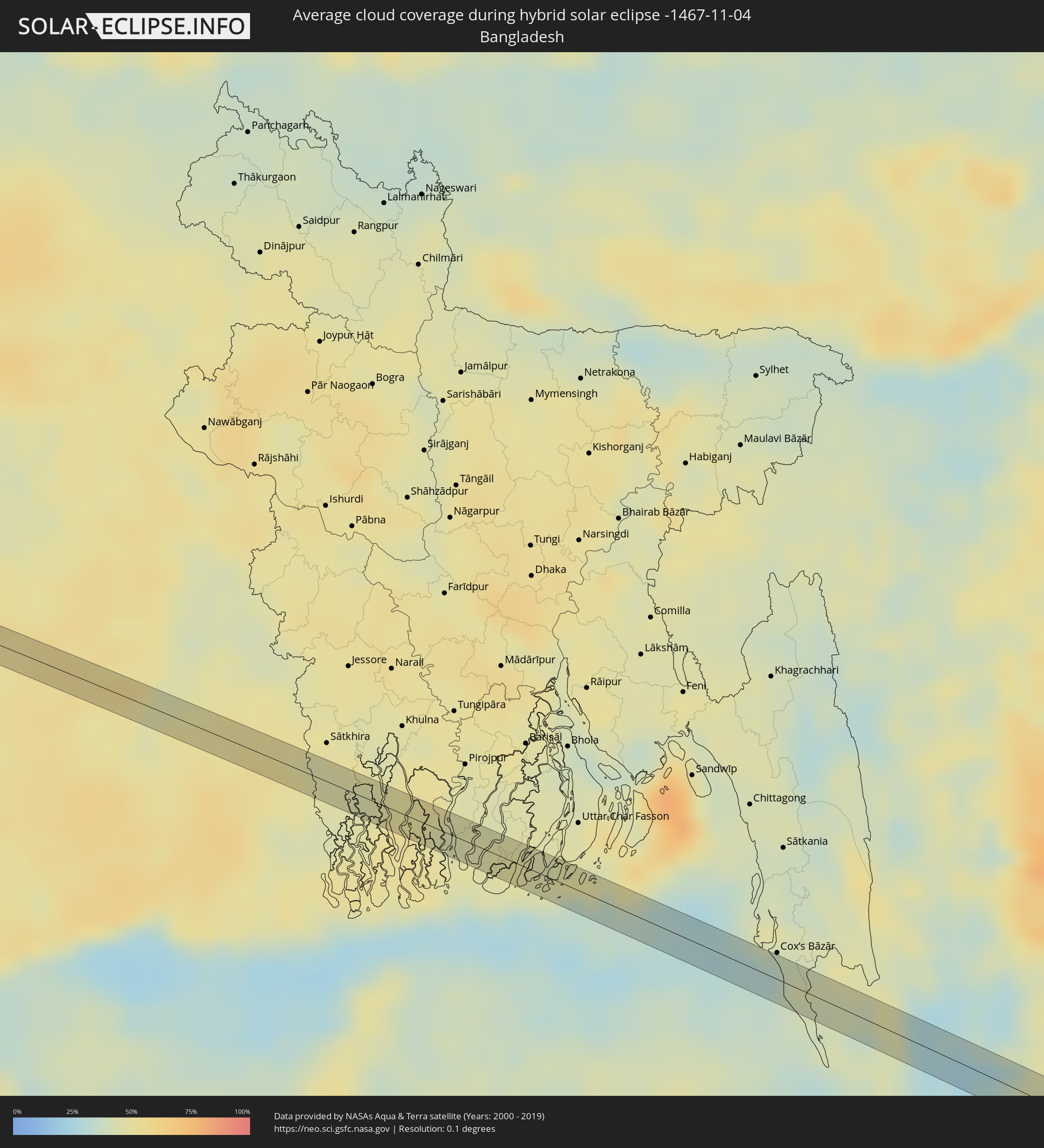 Bangladesh
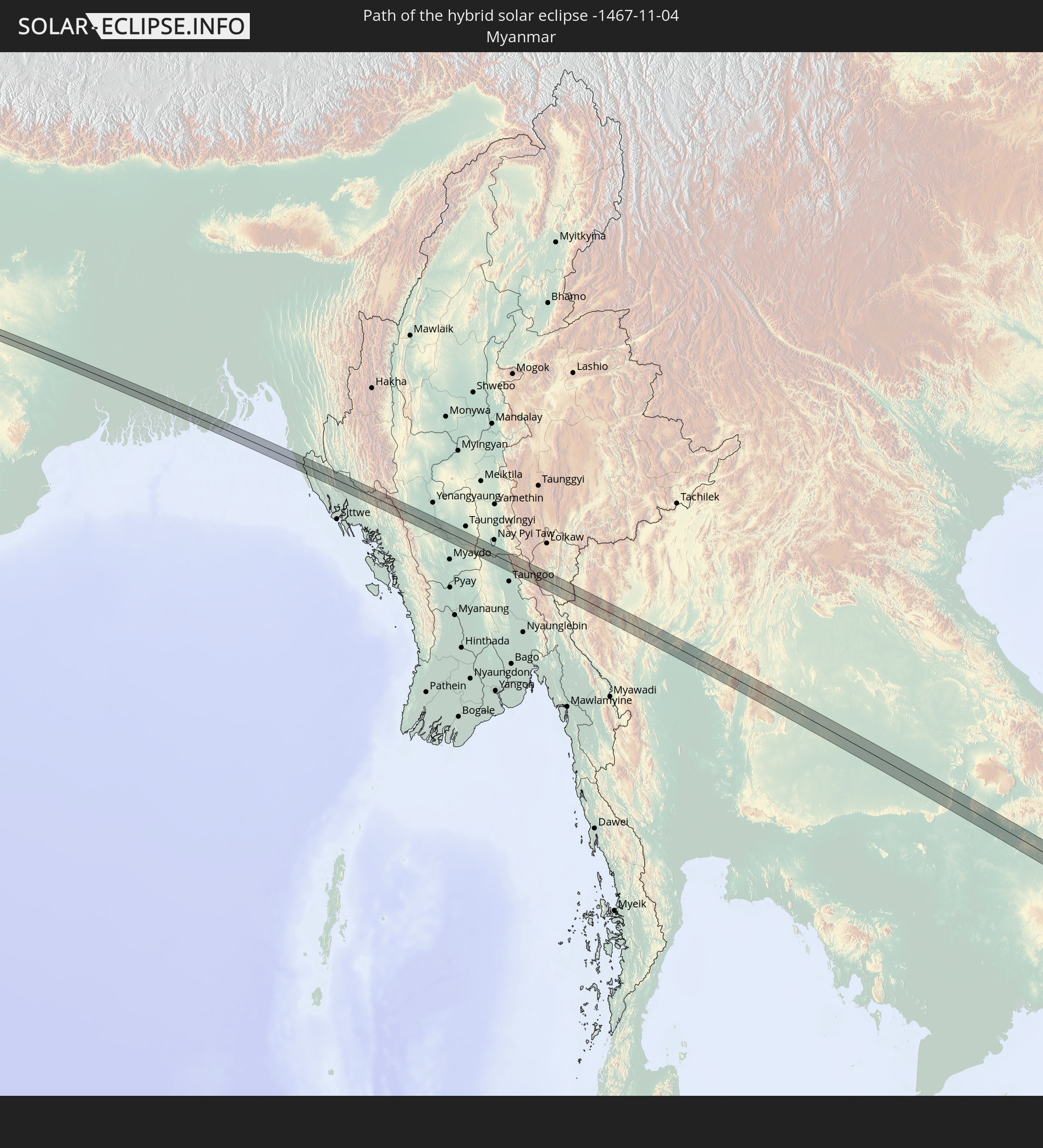
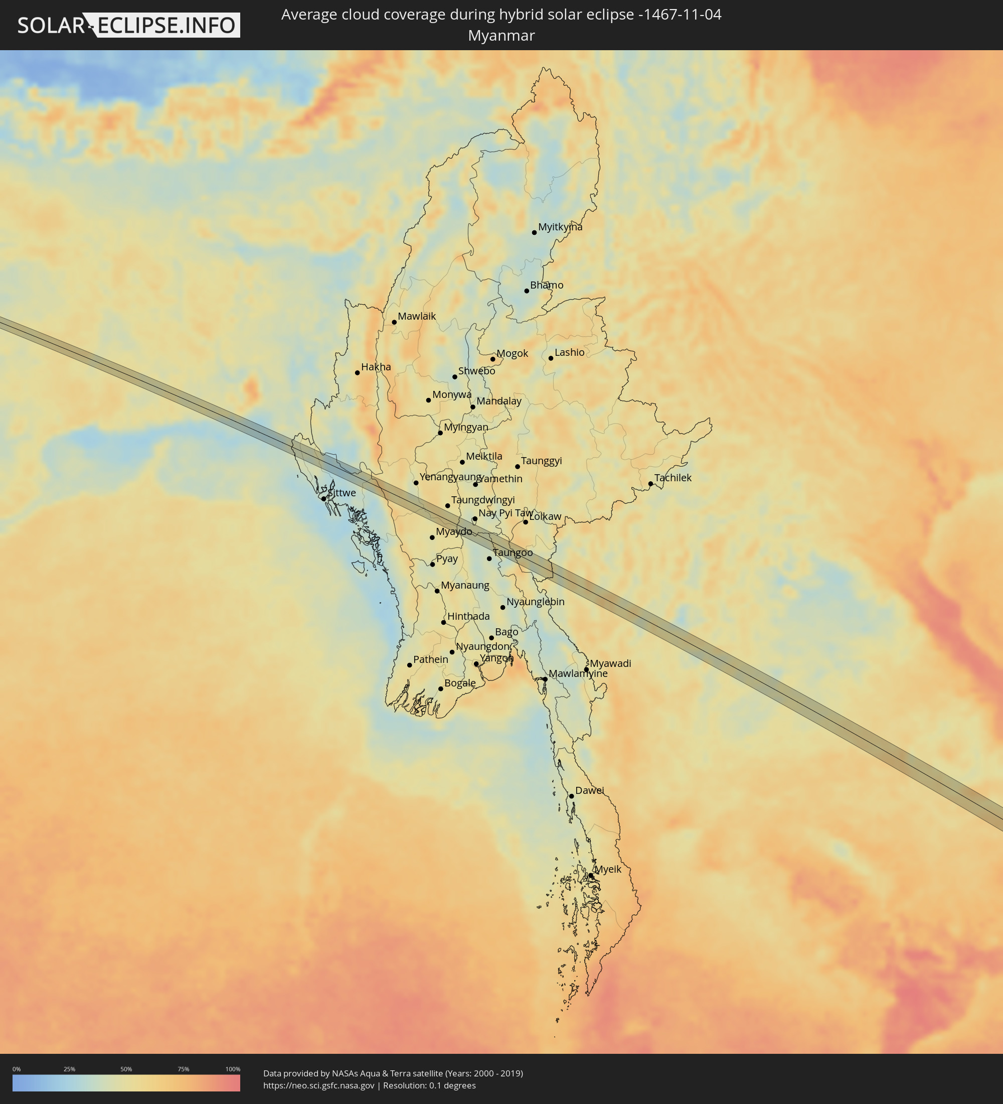 Myanmar
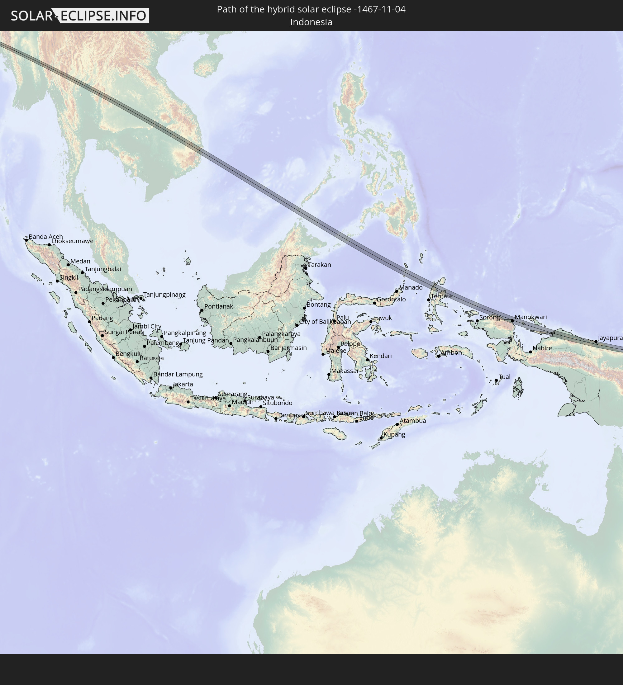
 Indonesia
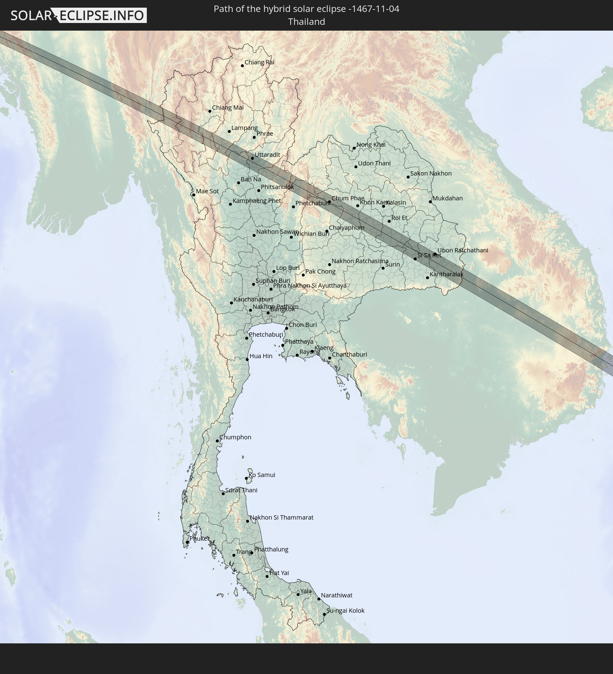
 Thailand
 Laos
Laos
 Vietnam
 Cambodia
 Philippines
 Papua New Guinea
Cities inside the path of the eclipse
The following table shows all locations with a population of more than 5,000 inside the eclipse path. Cities which have more than 100,000 inhabitants are marked bold. A click at the locations opens a detailed map.
| City | Type | Eclipse duration | Local time of max. eclipse | Distance to central line | Ø Cloud coverage |
|
Nokha, Rajasthan
|
total | - | 07:22:53 UTC+05:21 | 2 km | 9% |
|
Jaipur, Rajasthan
|
total | - | 07:23:39 UTC+05:21 | 3 km | 8% |
|
Basi, Rajasthan
|
total | - | 07:23:44 UTC+05:21 | 4 km | 7% |
|
Jora, Madhya Pradesh
|
total | - | 07:24:28 UTC+05:21 | 2 km | 10% |
|
Gwalior, Madhya Pradesh
|
total | - | 07:24:38 UTC+05:21 | 2 km | 11% |
|
Daboh, Madhya Pradesh
|
total | - | 07:24:59 UTC+05:21 | 3 km | 10% |
|
Konch, Uttar Pradesh
|
total | - | 07:25:07 UTC+05:21 | 5 km | 10% |
|
Maudaha, Uttar Pradesh
|
total | - | 07:25:38 UTC+05:21 | 4 km | 7% |
|
Rājāpur, Uttar Pradesh
|
total | - | 07:26:13 UTC+05:21 | 7 km | 15% |
|
Shankargarh, Uttar Pradesh
|
total | - | 07:26:30 UTC+05:21 | 2 km | 21% |
|
Robertsganj, Uttar Pradesh
|
total | - | 07:27:27 UTC+05:21 | 1 km | 32% |
|
Kuju, Jharkhand
|
total | - | 07:29:17 UTC+05:21 | 10 km | 42% |
|
Gumia, Jharkhand
|
total | - | 07:29:32 UTC+05:21 | 9 km | 42% |
|
Chās, Jharkhand
|
total | - | 07:29:49 UTC+05:21 | 6 km | 49% |
|
Adra, West Bengal
|
total | - | 07:30:15 UTC+05:21 | 11 km | 48% |
|
Bānkura, West Bengal
|
total | - | 07:30:37 UTC+05:21 | 1 km | 54% |
|
Bishnupur, West Bengal
|
total | - | 07:30:51 UTC+05:21 | 8 km | 53% |
|
Arāmbāgh, West Bengal
|
total | - | 07:31:17 UTC+05:21 | 10 km | 50% |
|
Tarakeswar, West Bengal
|
total | - | 07:31:29 UTC+05:21 | 1 km | 48% |
|
Srirāmpur, West Bengal
|
total | - | 07:31:29 UTC+05:21 | 6 km | 48% |
|
Singur, West Bengal
|
total | - | 07:31:42 UTC+05:21 | 0 km | 50% |
|
Shyamnagar, West Bengal
|
total | - | 07:31:49 UTC+05:21 | 8 km | 50% |
|
Pānihāti, West Bengal
|
total | - | 07:31:51 UTC+05:21 | 6 km | 51% |
|
Garui, West Bengal
|
total | - | 07:31:53 UTC+05:21 | 11 km | 52% |
|
Tāki, West Bengal
|
total | - | 07:32:23 UTC+05:21 | 6 km | 51% |
|
Sarankhola, Khulna
|
total | - | 08:05:25 UTC+05:53 | 12 km | 45% |
|
Minbu, Magway
|
total | - | 08:43:05 UTC+06:24 | 15 km | 46% |
|
Magway, Magway
|
total | - | 08:43:10 UTC+06:24 | 15 km | 49% |
|
Chom Thong, Chiang Mai
|
total | - | 09:06:15 UTC+06:42 | 17 km | 47% |
|
Si Satchanalai, Sukhothai
|
total | - | 09:08:22 UTC+06:42 | 19 km | 54% |
|
Uttaradit, Uttaradit
|
total | - | 09:08:49 UTC+06:42 | 8 km | 51% |
|
Nakhon Thai, Phitsanulok
|
total | - | 09:10:17 UTC+06:42 | 7 km | 38% |
|
Lom Sak, Phetchabun
|
total | - | 09:11:08 UTC+06:42 | 18 km | 44% |
|
Chum Phae, Khon Kaen
|
total | - | 09:12:41 UTC+06:42 | 3 km | 45% |
|
Phu Khiao, Chaiyaphum
|
total | - | 09:12:51 UTC+06:42 | 12 km | 44% |
|
Ban Phai, Khon Kaen
|
total | - | 09:14:05 UTC+06:42 | 12 km | 50% |
|
Wapi Pathum, Maha Sarakham
|
total | - | 09:15:21 UTC+06:42 | 1 km | 46% |
|
Kaset Wisai, Roi Et
|
total | - | 09:15:51 UTC+06:42 | 7 km | 50% |
|
Suwannaphum, Roi Et
|
total | - | 09:16:16 UTC+06:42 | 1 km | 52% |
|
Si Sa Ket, Sisaket
|
total | - | 09:17:36 UTC+06:42 | 20 km | 61% |
|
Ubon Ratchathani, Changwat Ubon Ratchathani
|
total | - | 09:18:26 UTC+06:42 | 19 km | 56% |
|
Warin Chamrap, Changwat Ubon Ratchathani
|
total | - | 09:18:30 UTC+06:42 | 16 km | 57% |
|
Det Udom, Changwat Ubon Ratchathani
|
total | - | 09:19:07 UTC+06:42 | 1 km | 62% |
|
Ban Lŭng, Ratanakiri
|
total | - | 09:23:46 UTC+06:42 | 10 km | 63% |
|
Balabac, Mimaropa
|
total | - | 11:11:15 UTC+08:00 | 12 km | 86% |
|
Siasi, Autonomous Region in Muslim Mindanao
|
total | - | 11:24:45 UTC+08:00 | 7 km | 79% |
|
Lugus, Autonomous Region in Muslim Mindanao
|
total | - | 11:24:32 UTC+08:00 | 9 km | 71% |
|
Laminusa, Autonomous Region in Muslim Mindanao
|
total | - | 11:25:01 UTC+08:00 | 1 km | 74% |
|
Tobelo, North Maluku
|
total | - | 13:13:50 UTC+09:22 | 3 km | 73% |
|
Manokwari, West Papua
|
total | - | 13:35:00 UTC+09:22 | 8 km | 82% |
|
Abepura, Papua
|
total | - | 13:54:50 UTC+09:22 | 10 km | 83% |
|
Jayapura, Papua
|
total | - | 13:54:59 UTC+09:22 | 19 km | 85% |
|
Vanimo, Sandaun
|
total | - | 14:33:42 UTC+10:00 | 18 km | 83% |
|
Vanimo, Sandaun
|
total | - | 14:33:49 UTC+10:00 | 17 km | 83% |
|
Aitape, Sandaun
|
total | - | 14:36:53 UTC+10:00 | 11 km | 83% |
|
Rabaul, East New Britain
|
total | - | 14:58:32 UTC+10:00 | 7 km | 77% |