Total solar eclipse of 01/04/-1553
| Day of week: | Wednesday |
| Maximum duration of eclipse: | 02m01s |
| Maximum width of eclipse path: | 97 km |
| Saros cycle: | 26 |
| Coverage: | 100% |
| Magnitude: | 1.0254 |
| Gamma: | -0.4474 |
Wo kann man die Sonnenfinsternis vom 01/04/-1553 sehen?
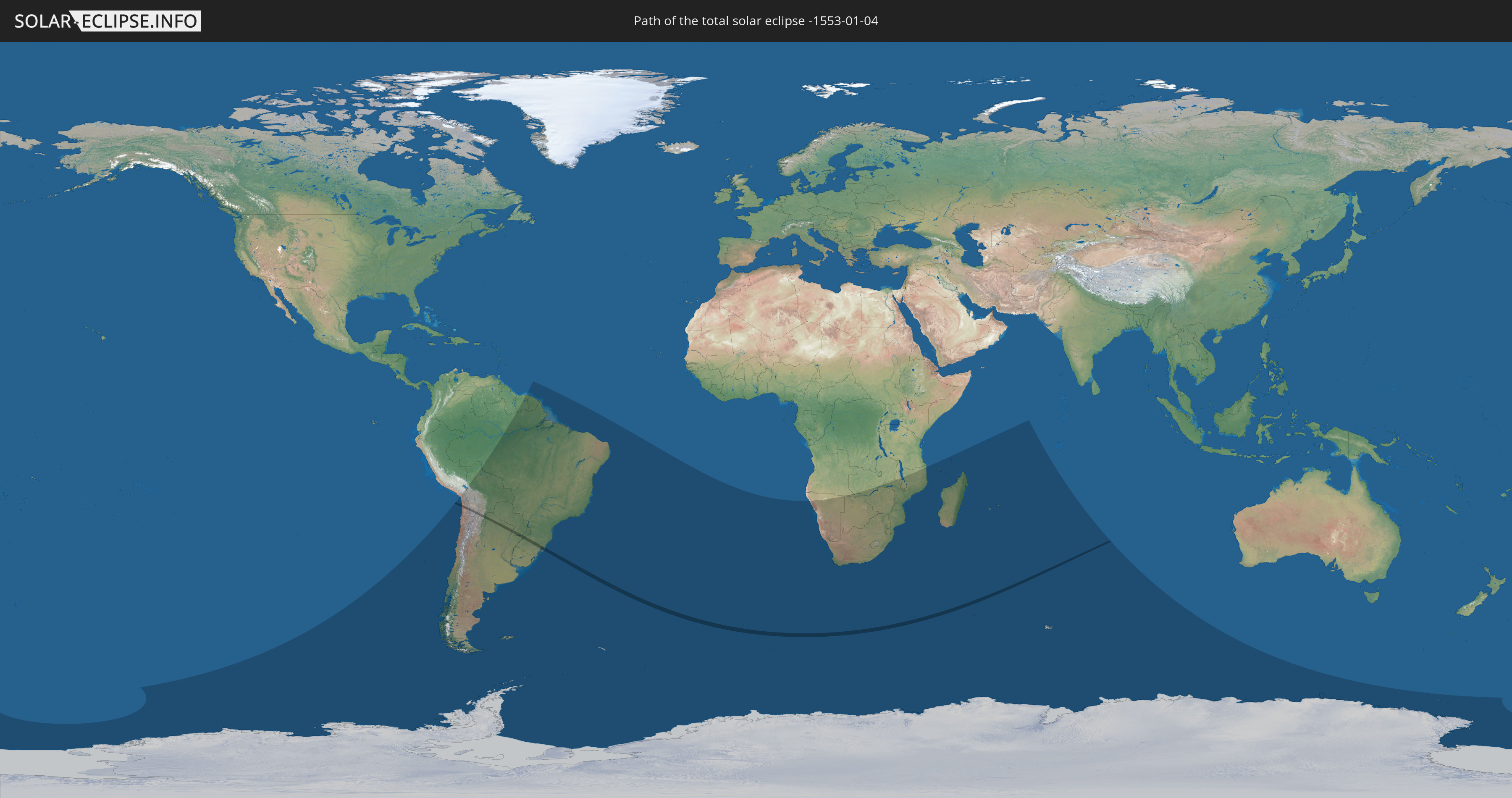
Die Sonnenfinsternis am 01/04/-1553 kann man in 33 Ländern als partielle Sonnenfinsternis beobachten.
Der Finsternispfad verläuft durch 5 Länder. Nur in diesen Ländern ist sie als total Sonnenfinsternis zu sehen.
In den folgenden Ländern ist die Sonnenfinsternis total zu sehen
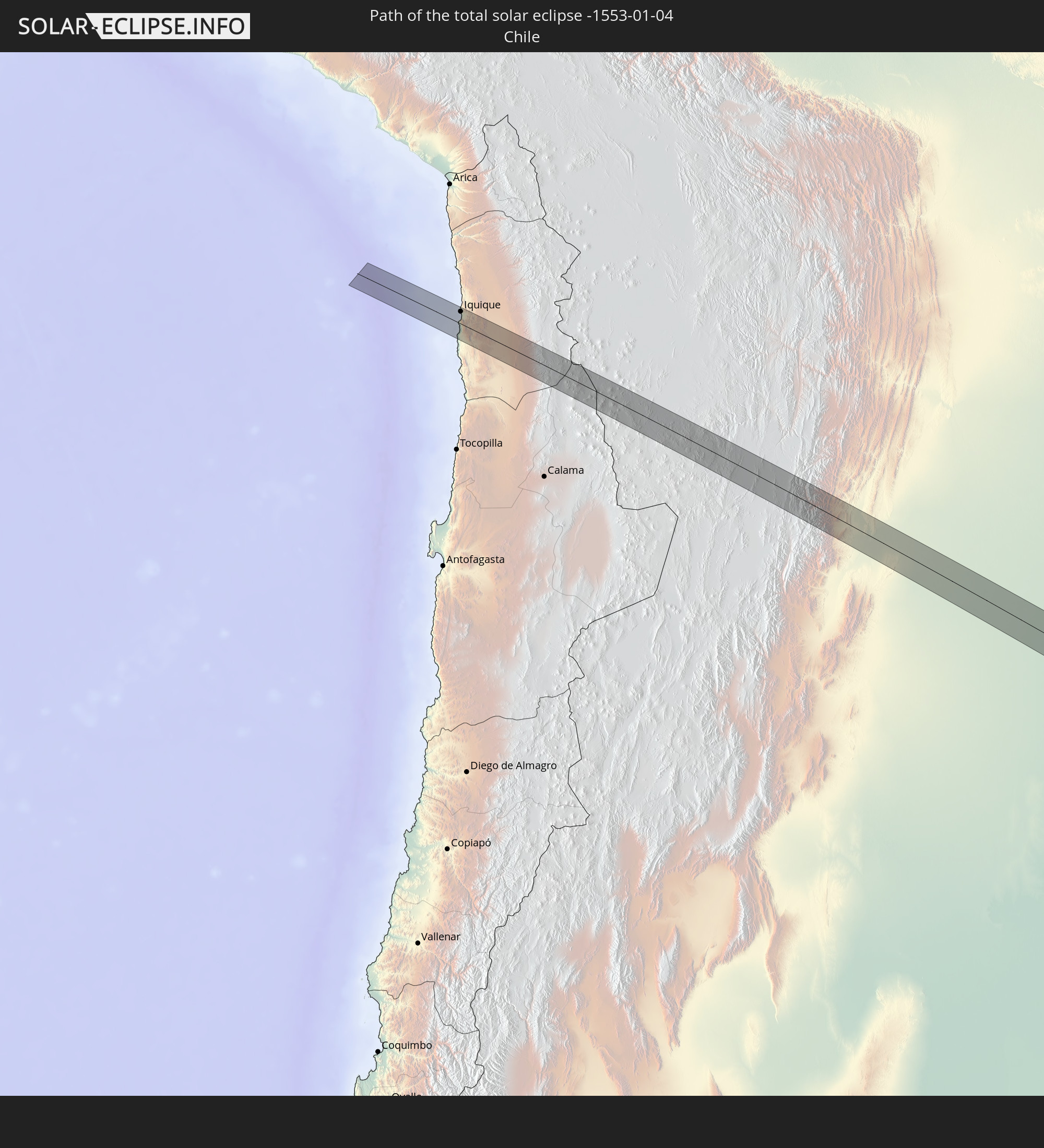 Chile
Chile
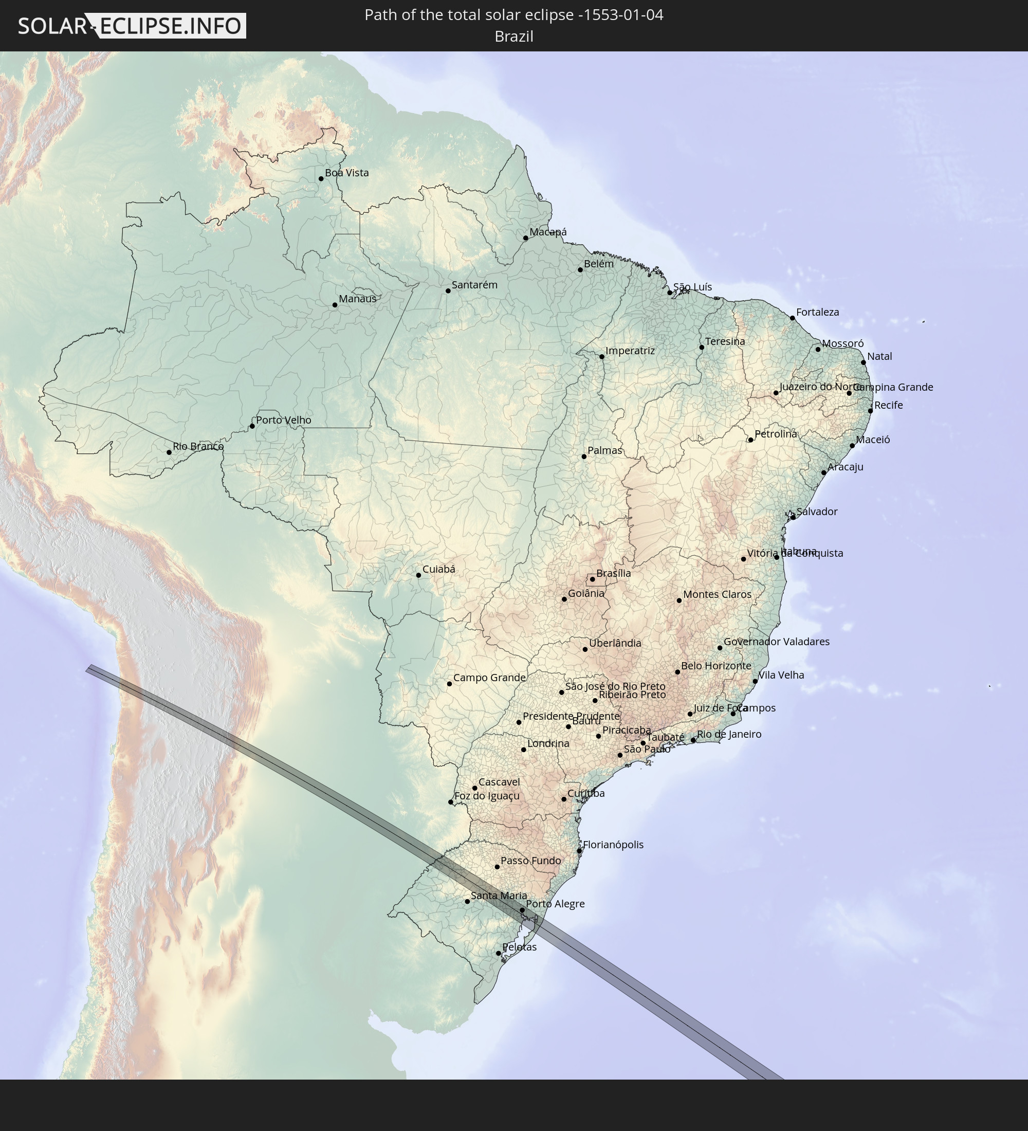 Brazil
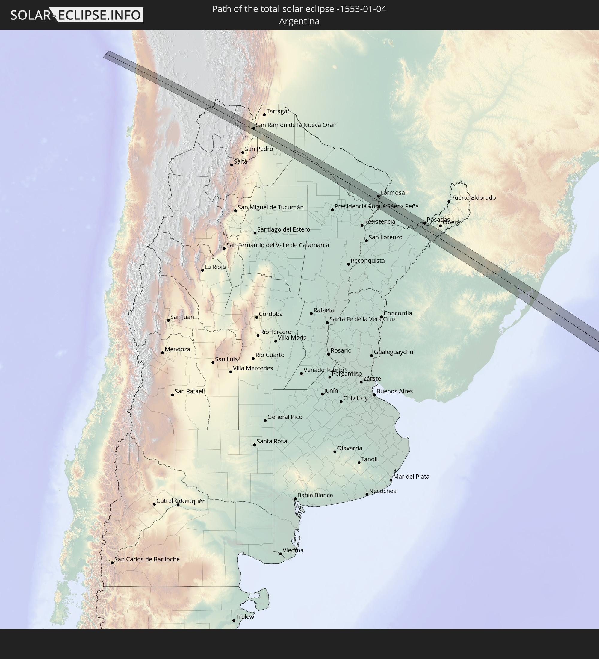 Argentina
 Bolivia
 Paraguay
In den folgenden Ländern ist die Sonnenfinsternis partiell zu sehen
 Antarctica
 Chile
Chile
 Peru
Peru
 Brazil
 Argentina
 Bolivia
 Paraguay
 Falkland Islands
 Guyana
 Uruguay
 Suriname
 French Guiana
 South Georgia and the South Sandwich Islands
 Saint Helena, Ascension and Tristan da Cunha
 Bouvet Island
 Angola
 Namibia
 South Africa
 Botswana
 Zambia
 Zimbabwe
 Lesotho
 Mozambique
 Swaziland
 Malawi
 French Southern and Antarctic Lands
 Madagascar
 Comoros
 Mayotte
 Seychelles
 Réunion
 Mauritius
 Heard Island and McDonald Islands
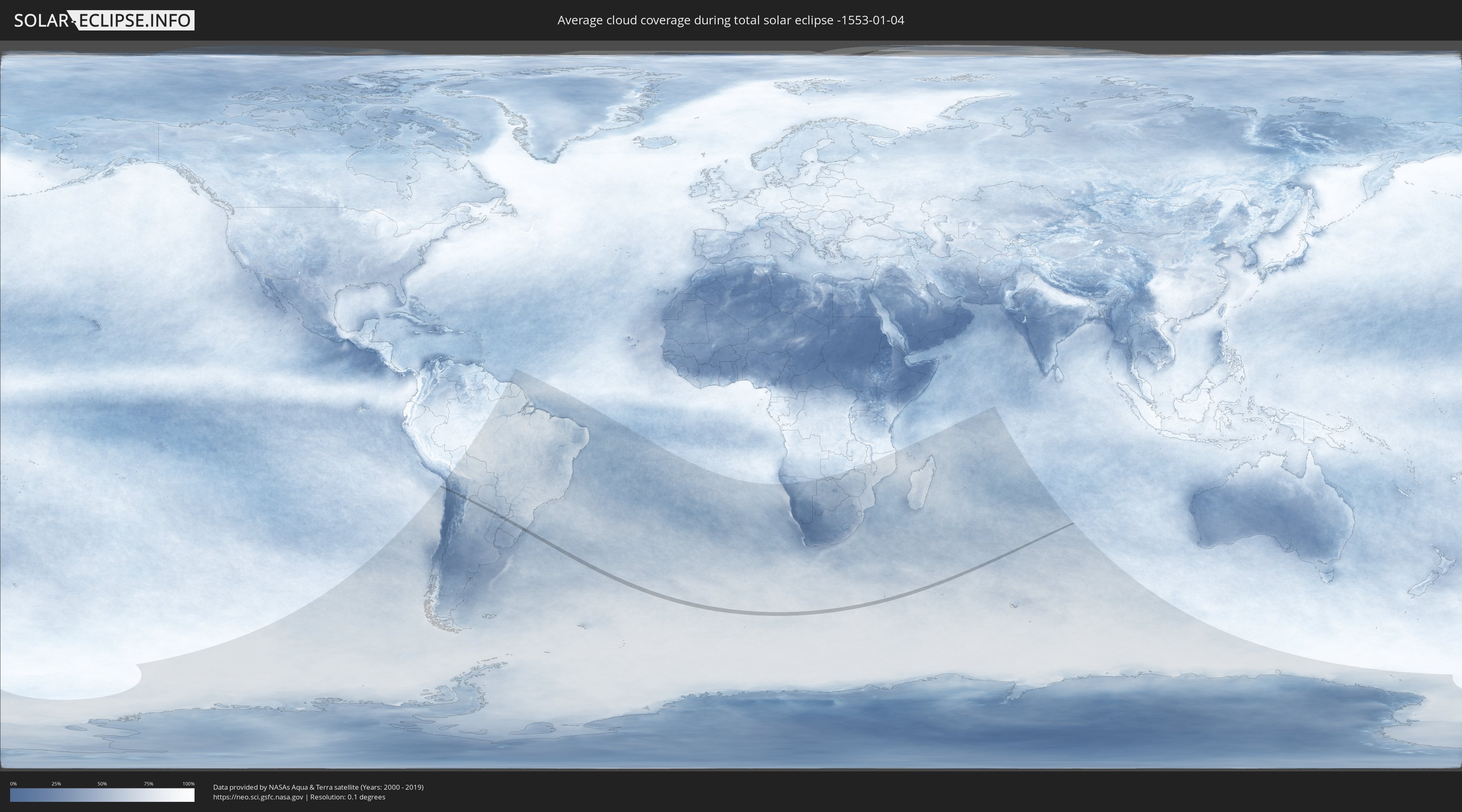
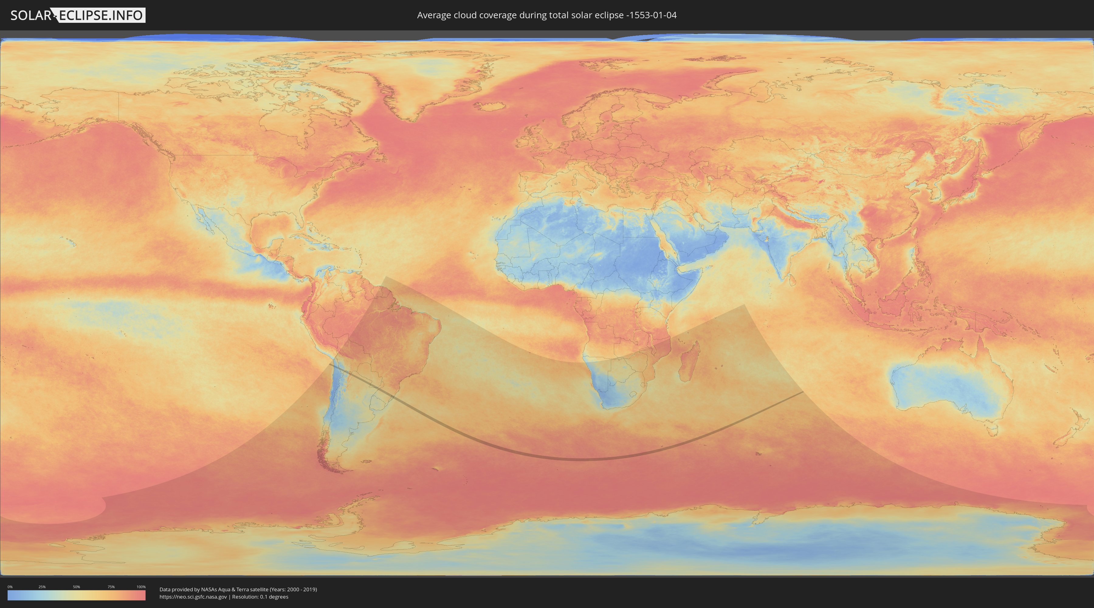
How will be the weather during the total solar eclipse on 01/04/-1553?
Where is the best place to see the total solar eclipse of 01/04/-1553?
The following maps show the average cloud coverage for the day of the total solar eclipse.
With the help of these maps, it is possible to find the place along the eclipse path, which has the best
chance of a cloudless sky.
Nevertheless, you should consider local circumstances and inform about the weather of your chosen
observation site.
The data is provided by NASAs satellites
AQUA and TERRA.
The cloud maps are averaged over a period of 19 years (2000 - 2019).
Detailed country maps
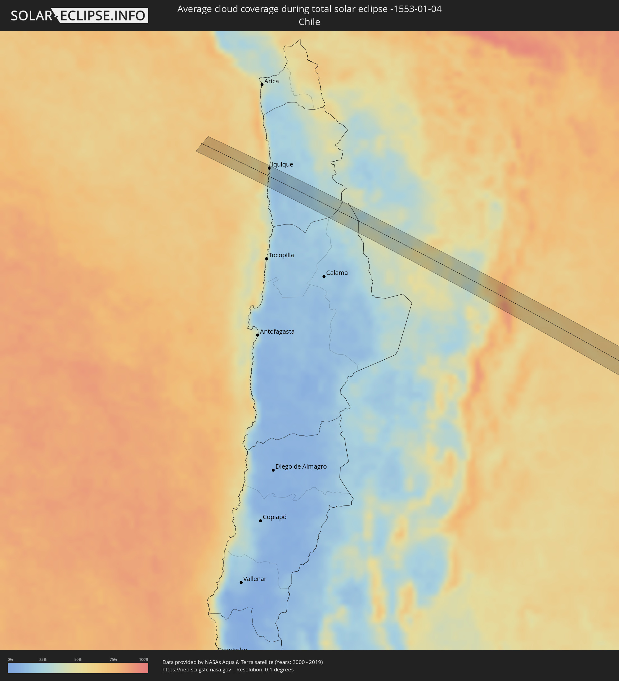 Chile
Chile
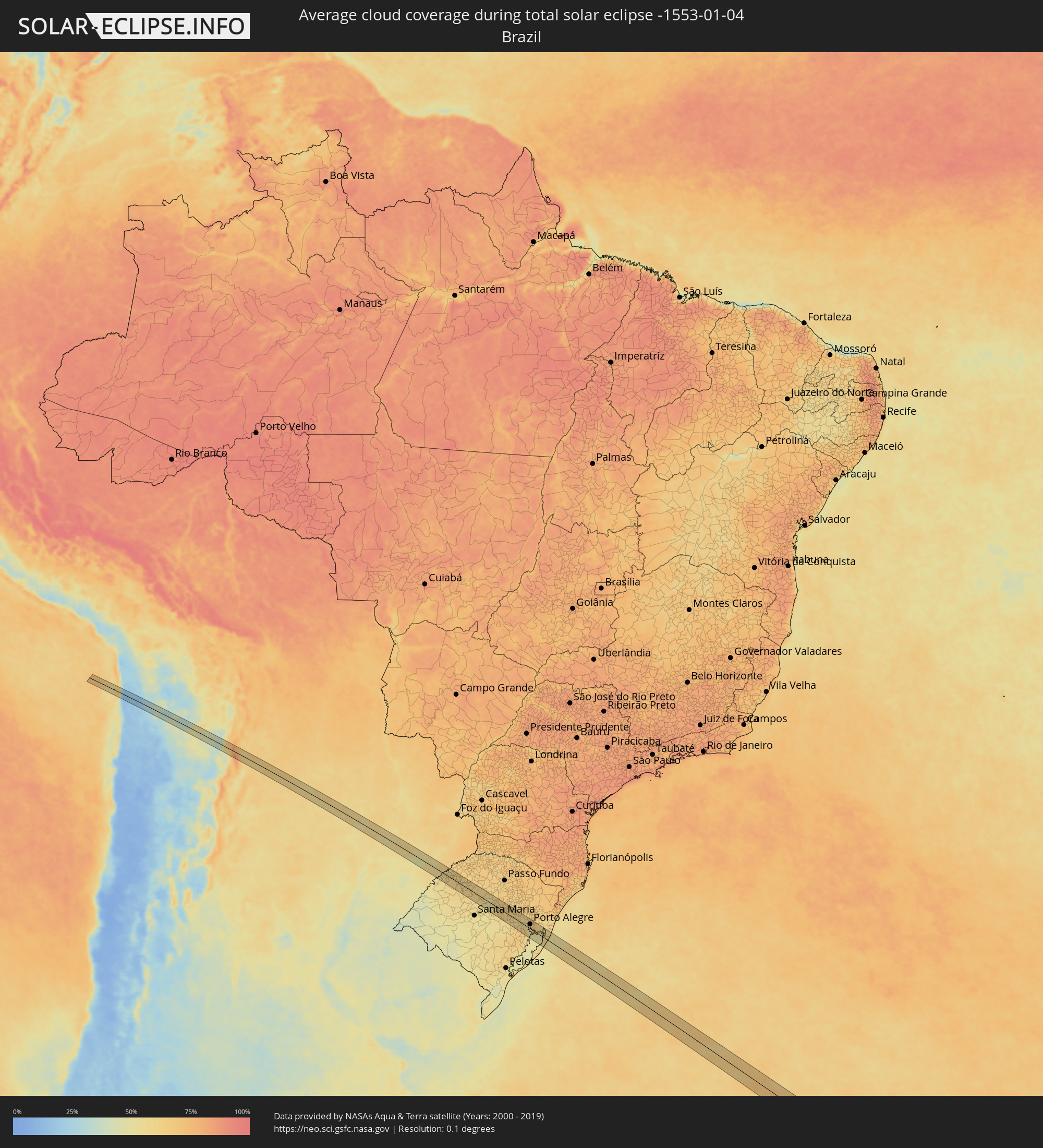 Brazil
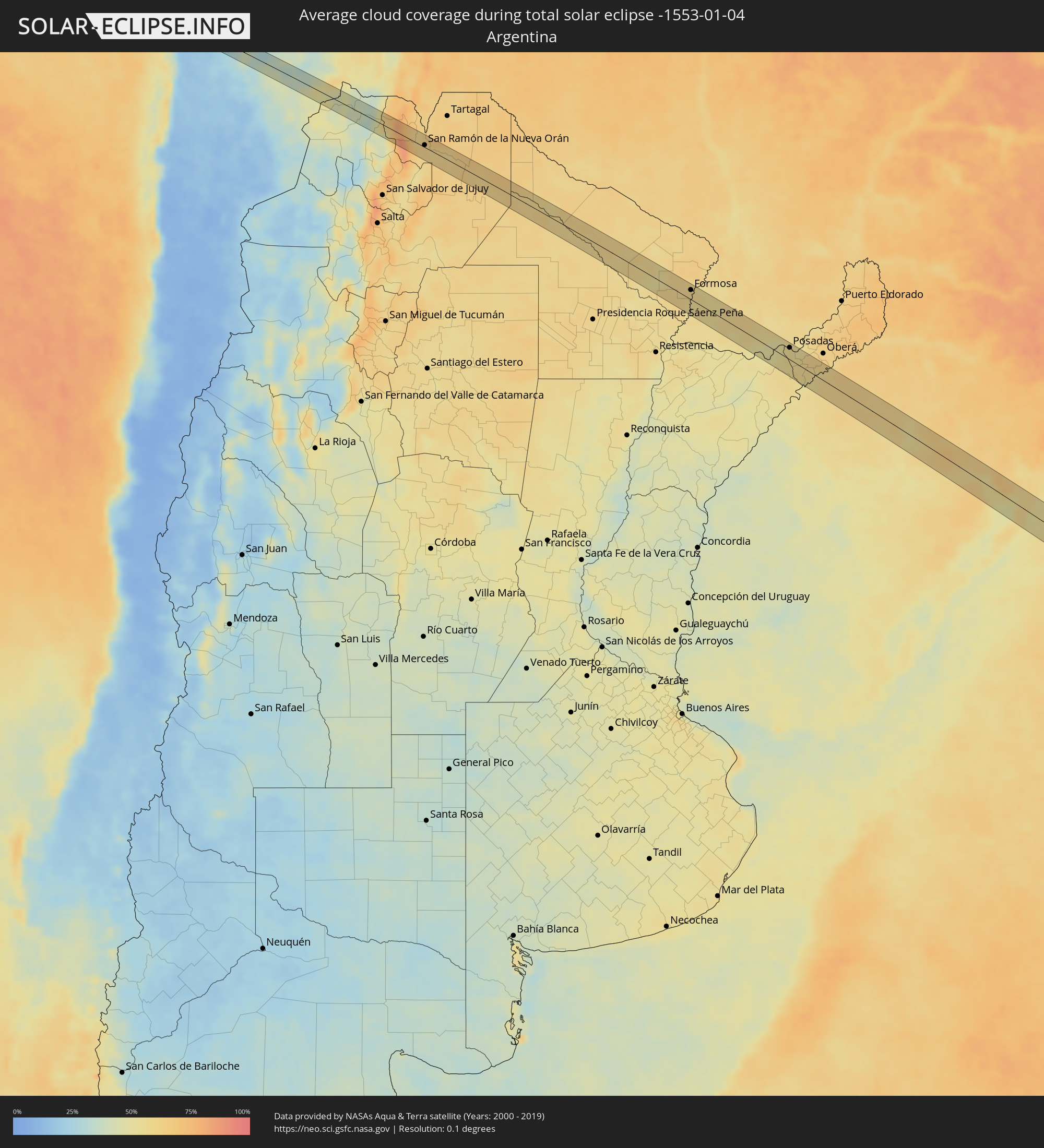 Argentina
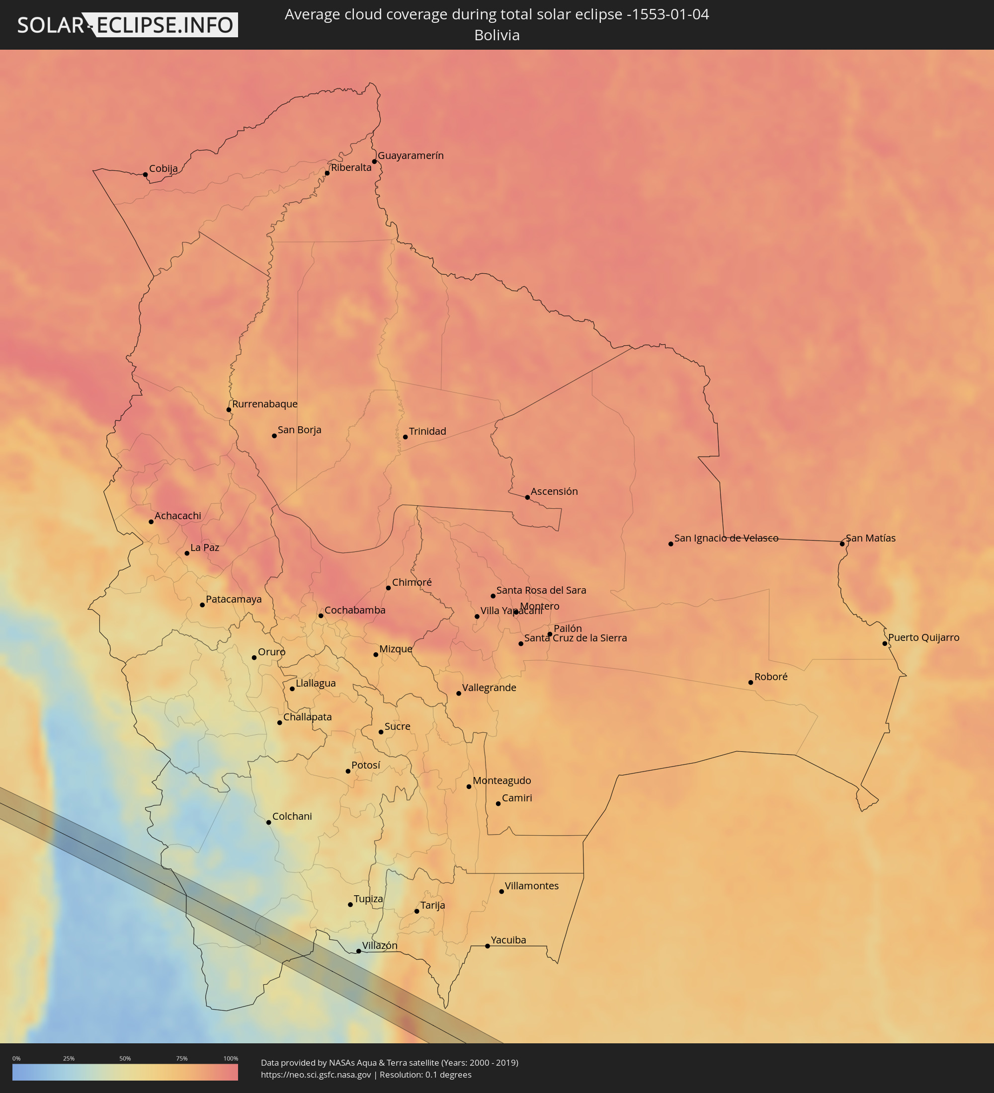 Bolivia
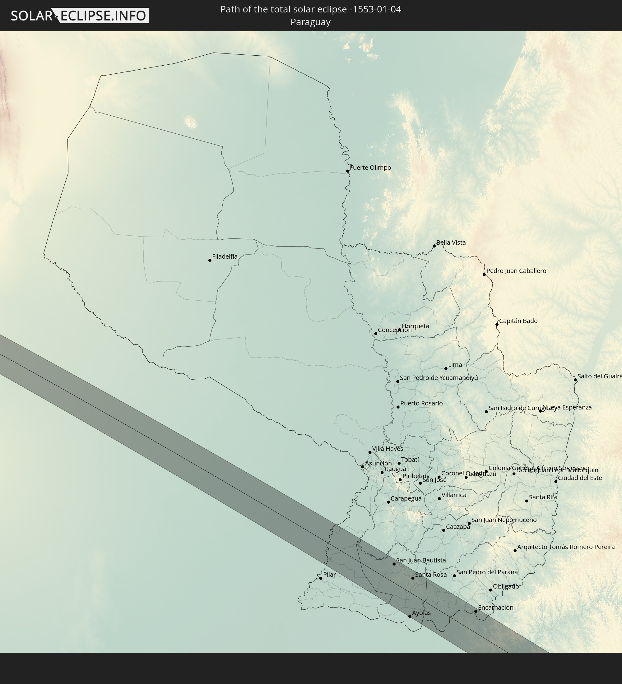
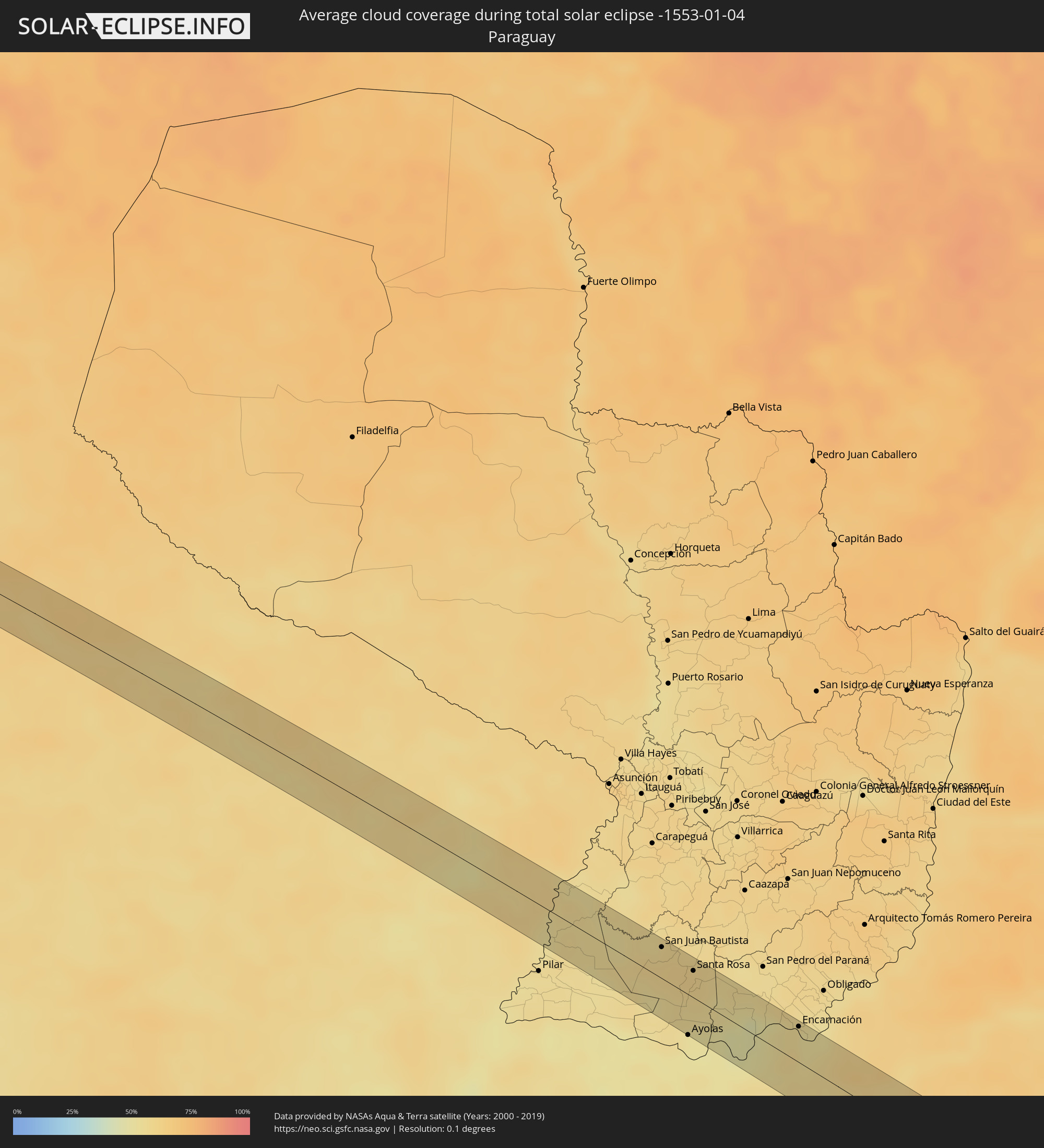 Paraguay
Cities inside the path of the eclipse
The following table shows all locations with a population of more than 5,000 inside the eclipse path. Cities which have more than 100,000 inhabitants are marked bold. A click at the locations opens a detailed map.
| City | Type | Eclipse duration | Local time of max. eclipse | Distance to central line | Ø Cloud coverage |
|
Iquique, Tarapacá
|
total | - | 05:35:10 UTC-04:42 | 29 km | 23% |
|
Abra Pampa, Jujuy Province
|
total | - | 06:02:12 UTC-04:16 | 24 km | 33% |
|
San Ramón de la Nueva Orán, Salta Province
|
total | - | 06:02:19 UTC-04:16 | 19 km | 62% |
|
Embarcación, Salta Province
|
total | - | 06:02:21 UTC-04:16 | 18 km | 59% |
|
Ibarreta, Formosa Province
|
total | - | 06:03:56 UTC-04:16 | 26 km | 60% |
|
Comandante Fontana, Formosa Province
|
total | - | 06:04:04 UTC-04:16 | 33 km | 57% |
|
Palo Santo, Formosa Province
|
total | - | 06:04:18 UTC-04:16 | 20 km | 57% |
|
Pirané, Formosa Province
|
total | - | 06:04:29 UTC-04:16 | 25 km | 55% |
|
Formosa, Formosa Province
|
total | - | 06:04:58 UTC-04:16 | 32 km | 59% |
|
San Juan Bautista, Misiones
|
total | - | 06:31:41 UTC-03:50 | 36 km | 59% |
|
Ayolas, Misiones
|
total | - | 06:32:35 UTC-03:50 | 42 km | 50% |
|
Santa Rosa, Misiones
|
total | - | 06:31:55 UTC-03:50 | 22 km | 59% |
|
Posadas, Misiones Province
|
total | - | 06:06:26 UTC-04:16 | 23 km | 58% |
|
Encarnación, Itapúa
|
total | - | 06:32:32 UTC-03:50 | 28 km | 56% |
|
Garupá, Misiones Province
|
total | - | 06:06:35 UTC-04:16 | 16 km | 54% |
|
San José, Misiones Province
|
total | - | 06:06:57 UTC-04:16 | 29 km | 58% |
|
Candelaria, Misiones Province
|
total | - | 06:06:34 UTC-04:16 | 22 km | 55% |
|
Concepción de la Sierra, Misiones Province
|
total | - | 06:07:14 UTC-04:16 | 17 km | 54% |
|
Cerro Azul, Misiones Province
|
total | - | 06:06:47 UTC-04:16 | 22 km | 59% |
|
São Luiz Gonzaga, Rio Grande do Sul
|
total | - | 07:18:08 UTC-03:06 | 34 km | 58% |
|
Cerro Largo, Rio Grande do Sul
|
total | - | 07:17:50 UTC-03:06 | 26 km | 61% |
|
Santo Ângelo, Rio Grande do Sul
|
total | - | 07:18:04 UTC-03:06 | 25 km | 60% |
|
Ijuí, Rio Grande do Sul
|
total | - | 07:18:13 UTC-03:06 | 31 km | 59% |
|
Tupanciretã, Rio Grande do Sul
|
total | - | 07:19:08 UTC-03:06 | 37 km | 54% |
|
Cruz Alta, Rio Grande do Sul
|
total | - | 07:18:35 UTC-03:06 | 34 km | 60% |
|
Candelária, Rio Grande do Sul
|
total | - | 07:20:03 UTC-03:06 | 34 km | 55% |
|
Santa Cruz do Sul, Rio Grande do Sul
|
total | - | 07:20:11 UTC-03:06 | 26 km | 62% |
|
Venâncio Aires, Rio Grande do Sul
|
total | - | 07:20:04 UTC-03:06 | 26 km | 63% |
|
Butiá, Rio Grande do Sul
|
total | - | 07:20:48 UTC-03:06 | 39 km | 60% |
|
Lajeado, Rio Grande do Sul
|
total | - | 07:19:55 UTC-03:06 | 34 km | 61% |
|
Taquari, Rio Grande do Sul
|
total | - | 07:20:23 UTC-03:06 | 13 km | 56% |
|
Arroio dos Ratos, Rio Grande do Sul
|
total | - | 07:20:47 UTC-03:06 | 22 km | 63% |
|
São Jerônimo, Rio Grande do Sul
|
total | - | 07:20:38 UTC-03:06 | 24 km | 60% |
|
Triunfo, Rio Grande do Sul
|
total | - | 07:20:36 UTC-03:06 | 24 km | 56% |
|
Charqueadas, Rio Grande do Sul
|
total | - | 07:20:39 UTC-03:06 | 16 km | 60% |
|
Guaíba, Rio Grande do Sul
|
total | - | 07:20:55 UTC-03:06 | 18 km | 55% |
|
Porto Alegre, Rio Grande do Sul
|
total | - | 07:20:50 UTC-03:06 | 26 km | 62% |
|
Canoas, Rio Grande do Sul
|
total | - | 07:20:41 UTC-03:06 | 34 km | 61% |
|
Esteio, Rio Grande do Sul
|
total | - | 07:20:36 UTC-03:06 | 38 km | 61% |
|
Cachoeirinha, Rio Grande do Sul
|
total | - | 07:20:45 UTC-03:06 | 41 km | 66% |
|
Viamão, Rio Grande do Sul
|
total | - | 07:20:56 UTC-03:06 | 28 km | 65% |
|
Palmares do Sul, Rio Grande do Sul
|
total | - | 07:21:18 UTC-03:06 | 40 km | 56% |