Annular solar eclipse of 12/23/-1656
| Day of week: | Friday |
| Maximum duration of eclipse: | 07m06s |
| Maximum width of eclipse path: | 216 km |
| Saros cycle: | 15 |
| Coverage: | 94.2% |
| Magnitude: | 0.9417 |
| Gamma: | -0.0731 |
Wo kann man die Sonnenfinsternis vom 12/23/-1656 sehen?
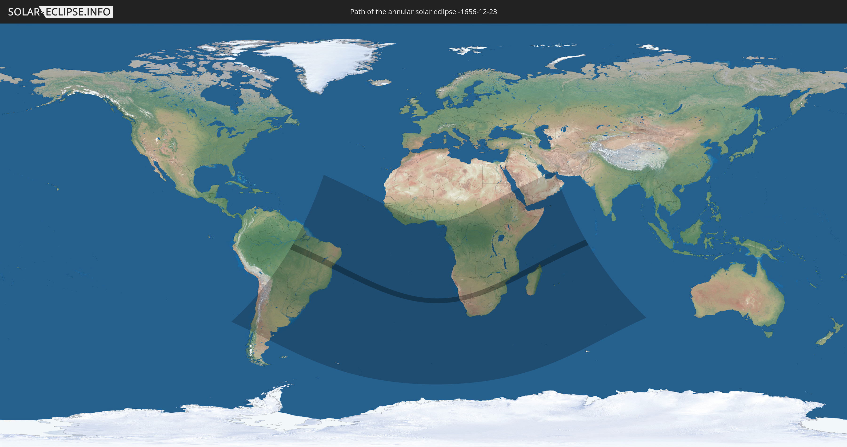
Die Sonnenfinsternis am 12/23/-1656 kann man in 63 Ländern als partielle Sonnenfinsternis beobachten.
Der Finsternispfad verläuft durch 8 Länder. Nur in diesen Ländern ist sie als annular Sonnenfinsternis zu sehen.
In den folgenden Ländern ist die Sonnenfinsternis annular zu sehen
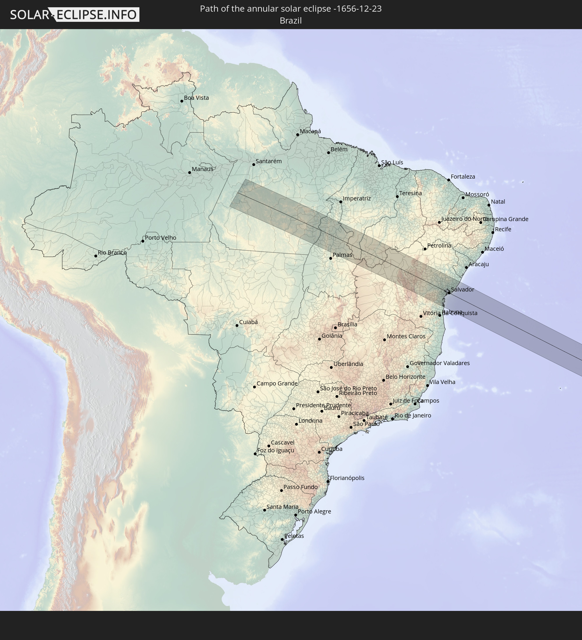 Brazil
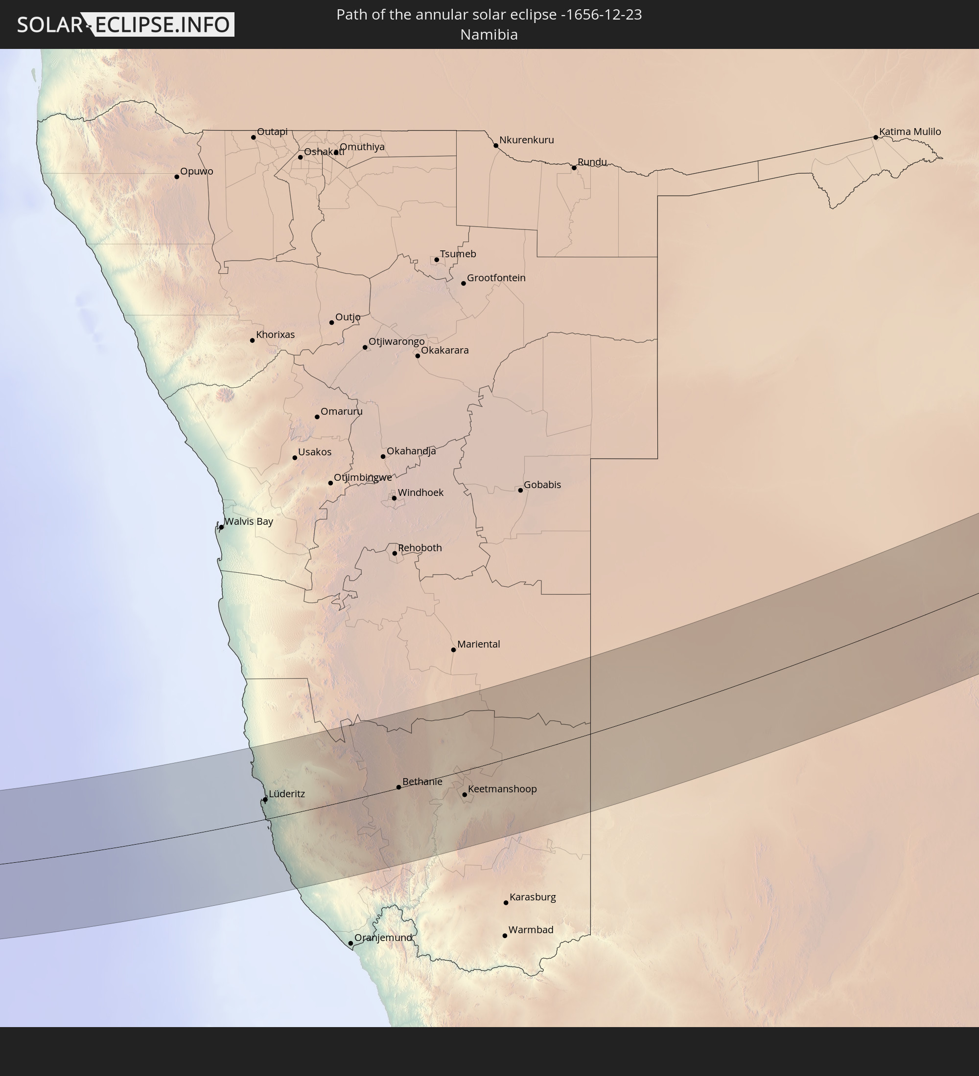 Namibia
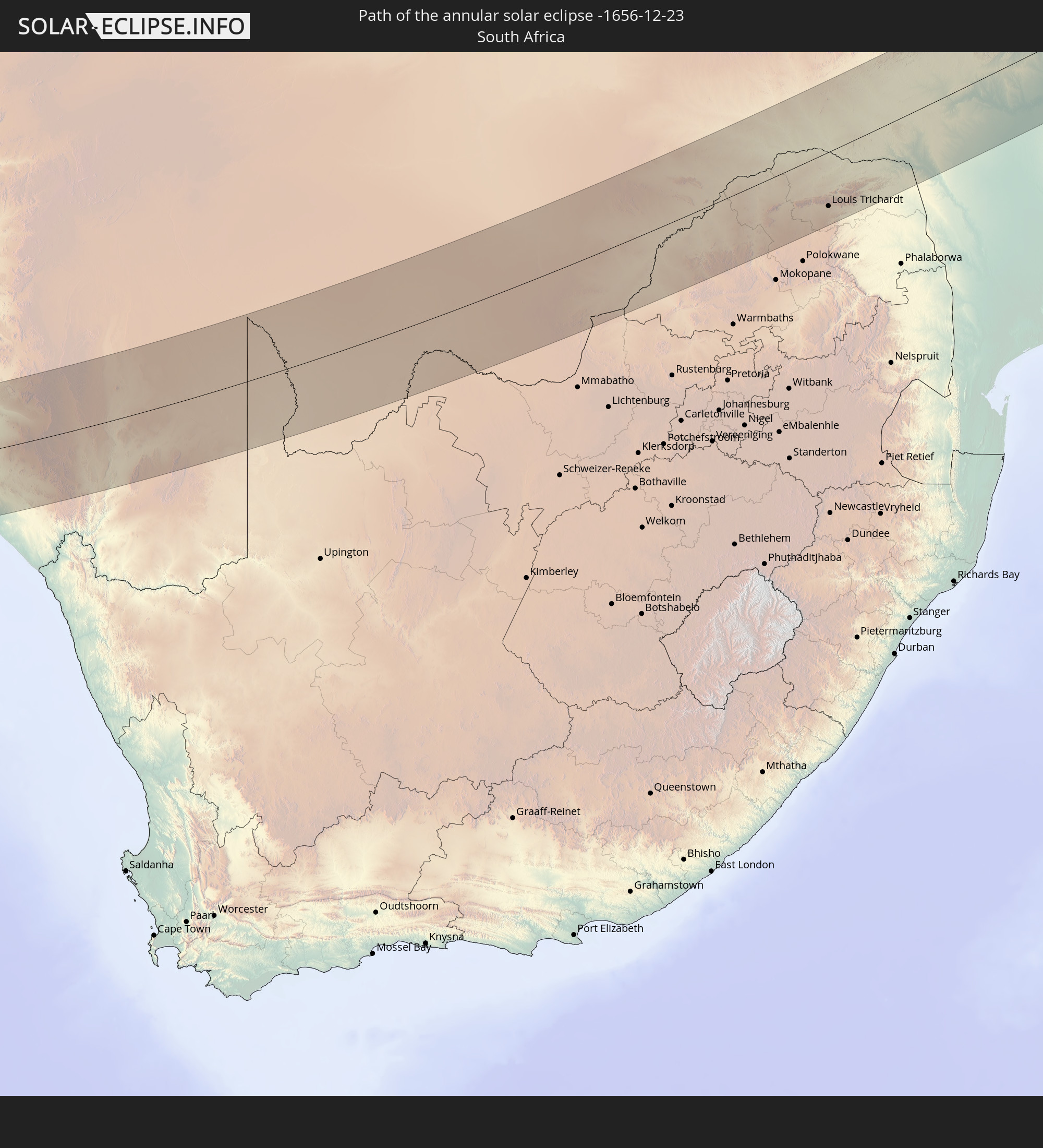 South Africa
 Botswana
 Zimbabwe
 Mozambique
 French Southern and Antarctic Lands
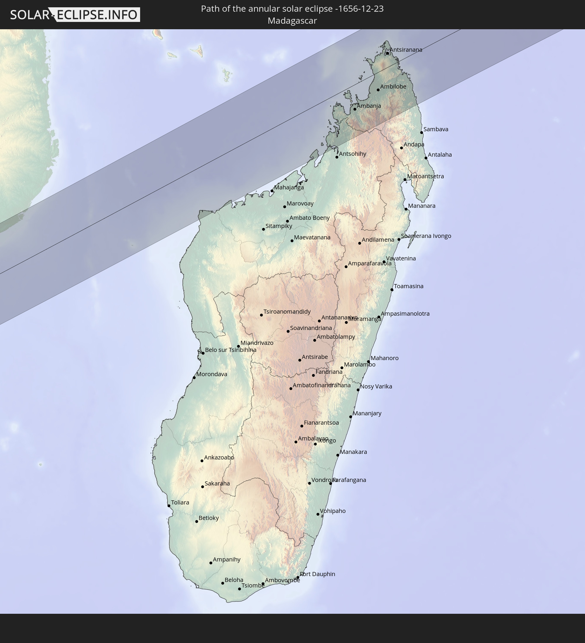 Madagascar
In den folgenden Ländern ist die Sonnenfinsternis partiell zu sehen
 Chile
Chile
 Brazil
 Argentina
 Bolivia
 Paraguay
 Uruguay
 South Georgia and the South Sandwich Islands
 Cabo Verde
 Senegal
 The Gambia
 Guinea-Bissau
 Guinea
 Saint Helena, Ascension and Tristan da Cunha
 Sierra Leone
 Liberia
 Ivory Coast
 Ghana
Ghana
 Togo
Togo
 Benin
Benin
 Nigeria
 Bouvet Island
 Equatorial Guinea
 São Tomé and Príncipe
 Cameroon
 Gabon
Gabon
 Republic of the Congo
 Angola
 Namibia
 Democratic Republic of the Congo
 Chad
Chad
 Central African Republic
 South Africa
 Botswana
 Sudan
Sudan
 Zambia
 Zimbabwe
 Lesotho
 Rwanda
 Burundi
 Tanzania
 Uganda
 Mozambique
 Swaziland
 Malawi
 Ethiopia
 Kenya
Kenya
 Saudi Arabia
 Eritrea
 French Southern and Antarctic Lands
 Somalia
 Djibouti
 Yemen
Yemen
 Madagascar
 Comoros
 Iran
Iran
 Mayotte
 Seychelles
 Qatar
Qatar
 United Arab Emirates
 Oman
Oman
 Réunion
 Mauritius
 British Indian Ocean Territory
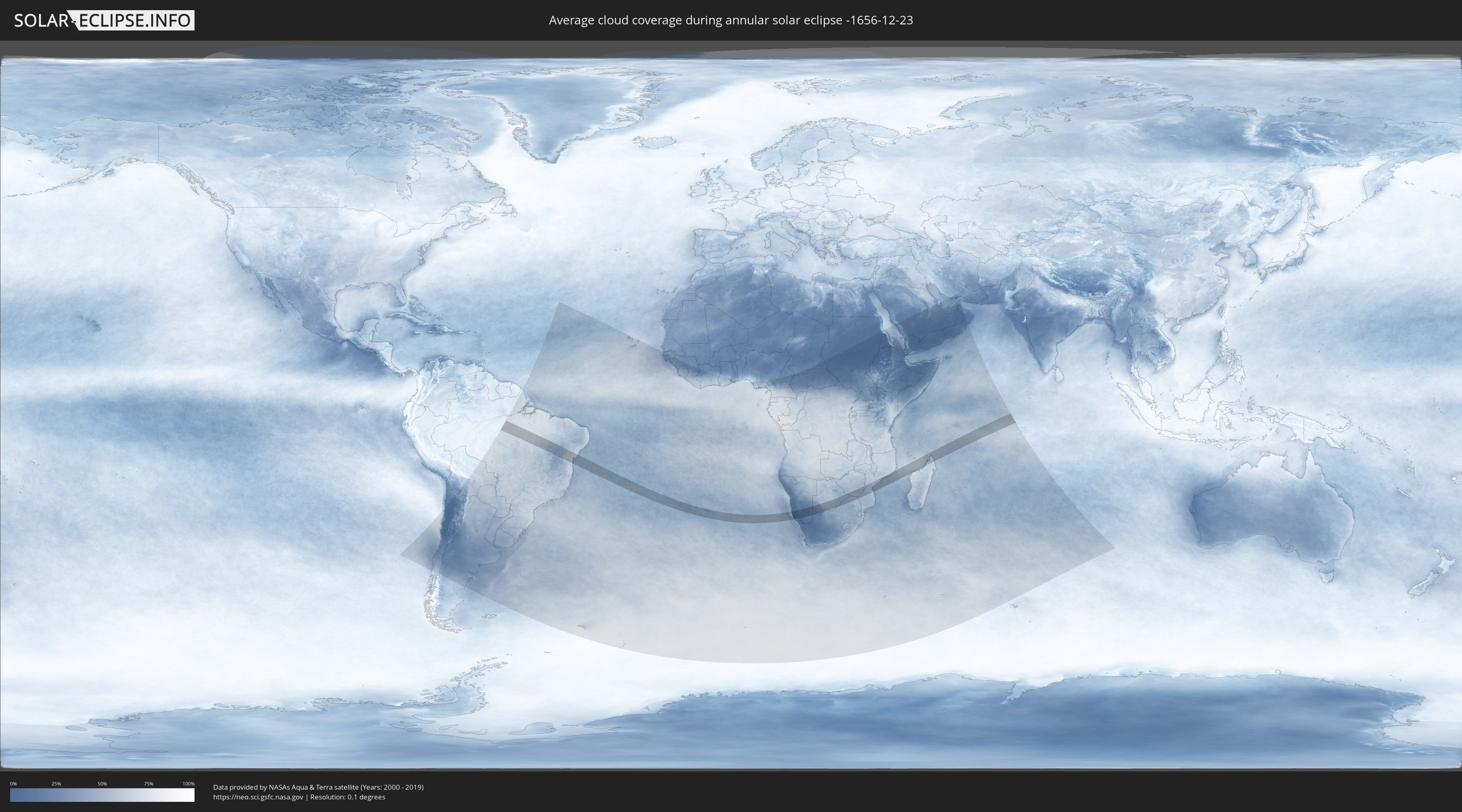
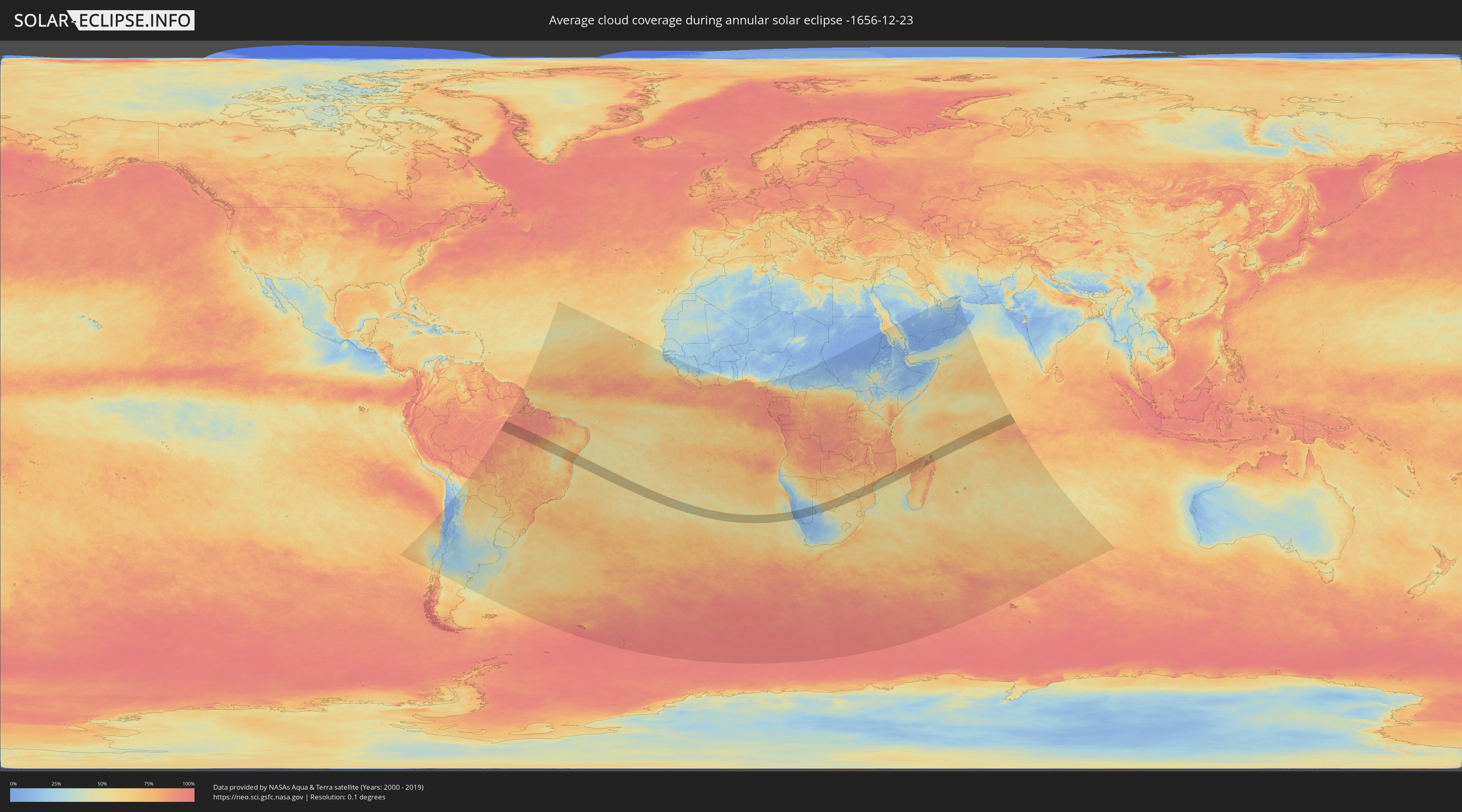
How will be the weather during the annular solar eclipse on 12/23/-1656?
Where is the best place to see the annular solar eclipse of 12/23/-1656?
The following maps show the average cloud coverage for the day of the annular solar eclipse.
With the help of these maps, it is possible to find the place along the eclipse path, which has the best
chance of a cloudless sky.
Nevertheless, you should consider local circumstances and inform about the weather of your chosen
observation site.
The data is provided by NASAs satellites
AQUA and TERRA.
The cloud maps are averaged over a period of 19 years (2000 - 2019).
Detailed country maps
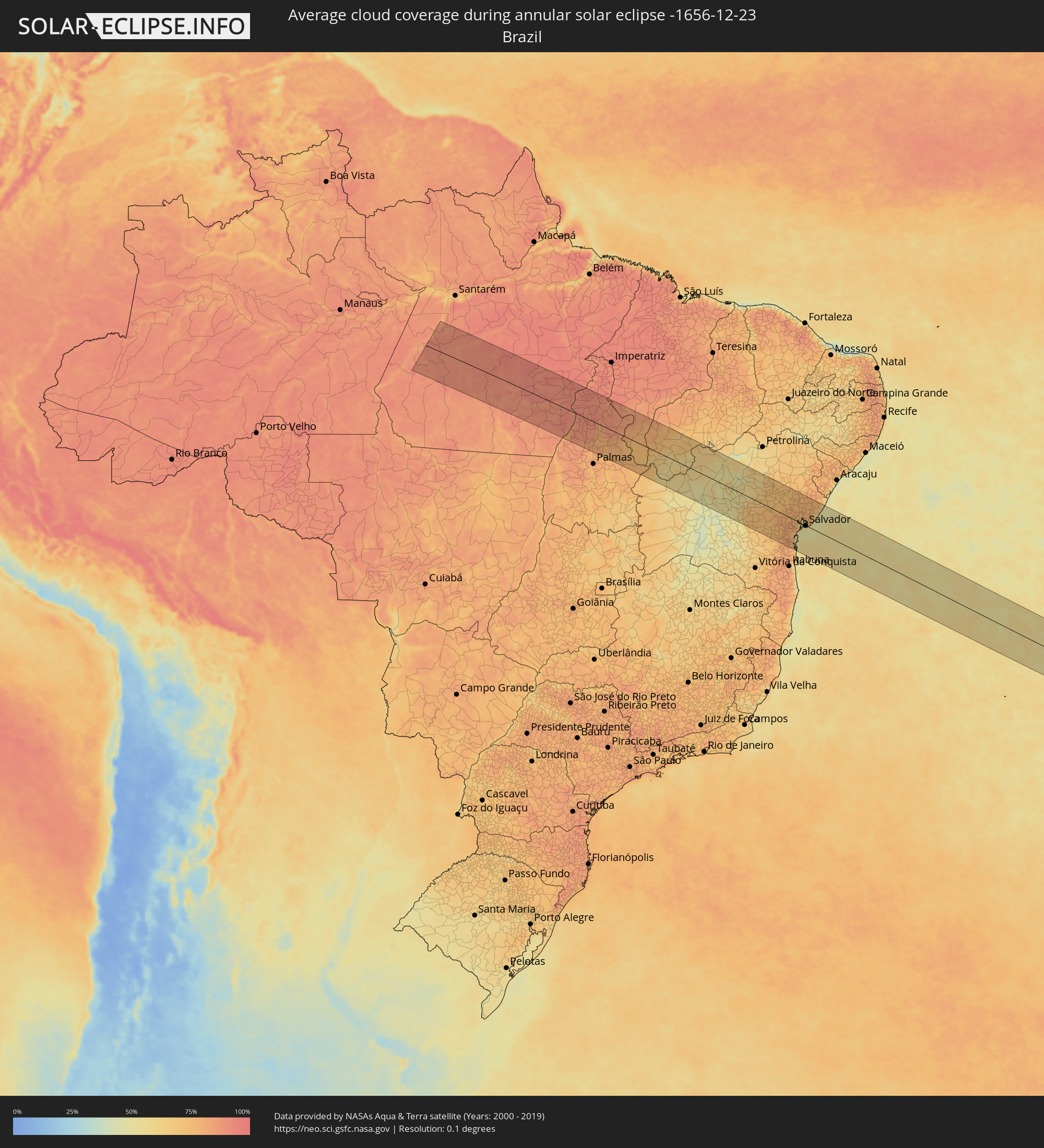 Brazil
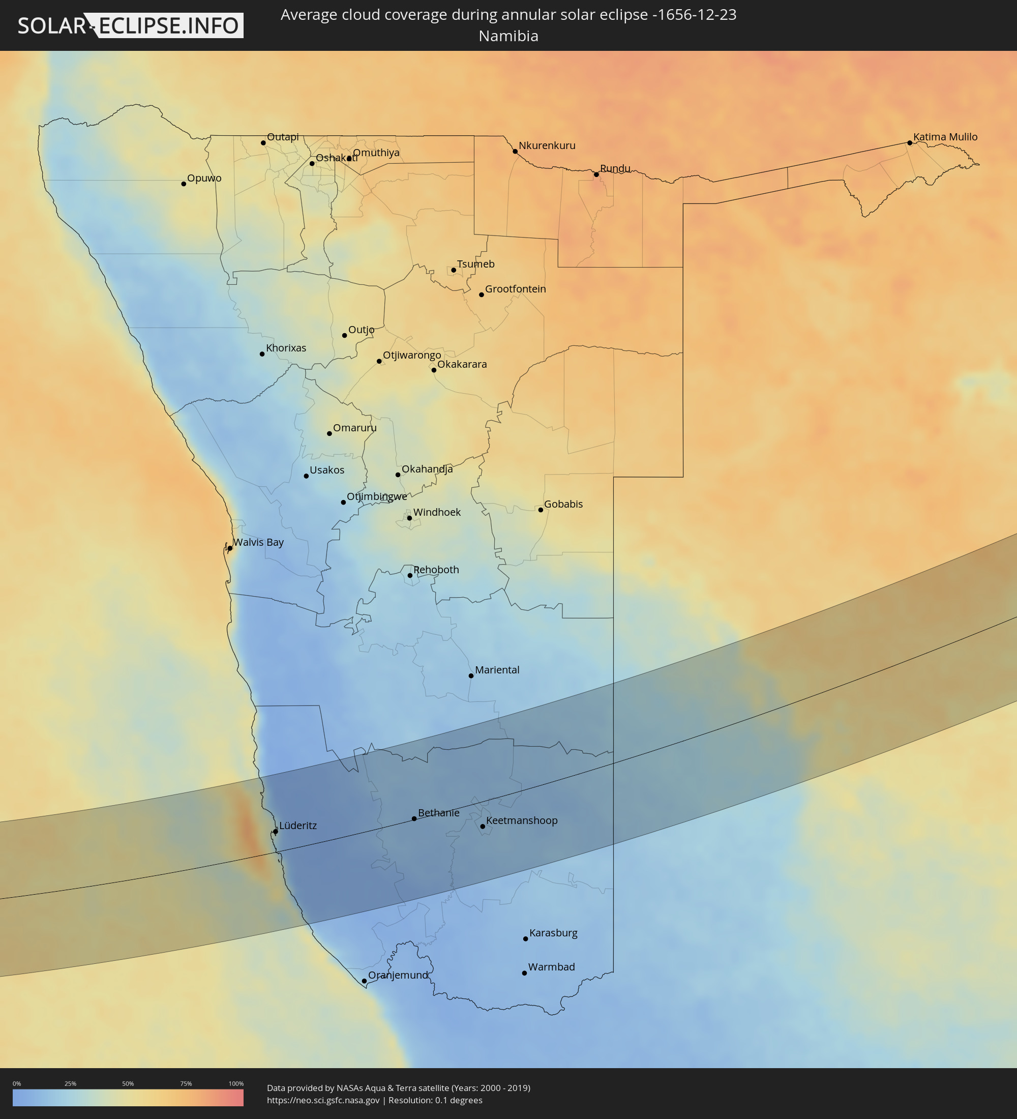 Namibia
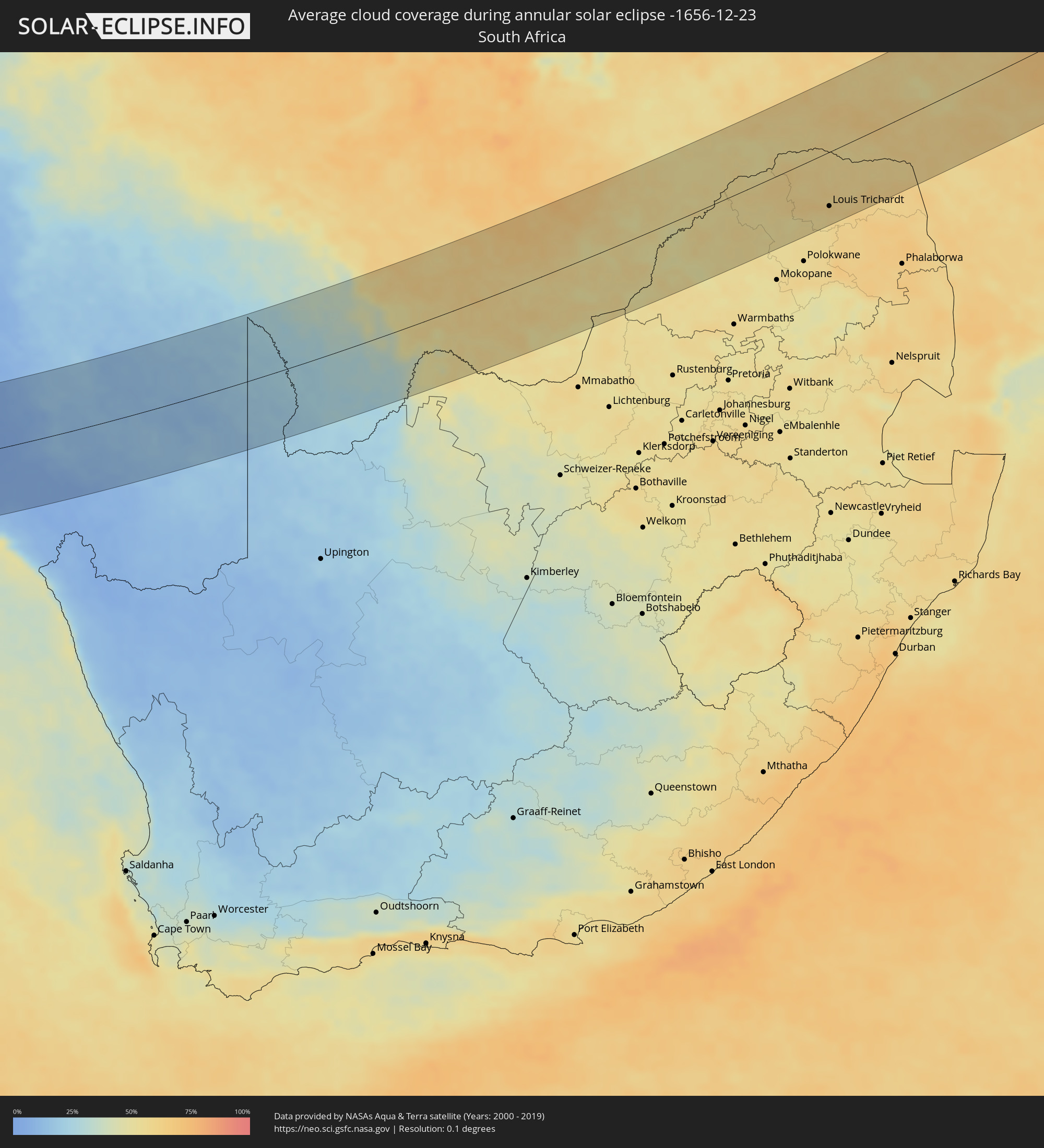 South Africa
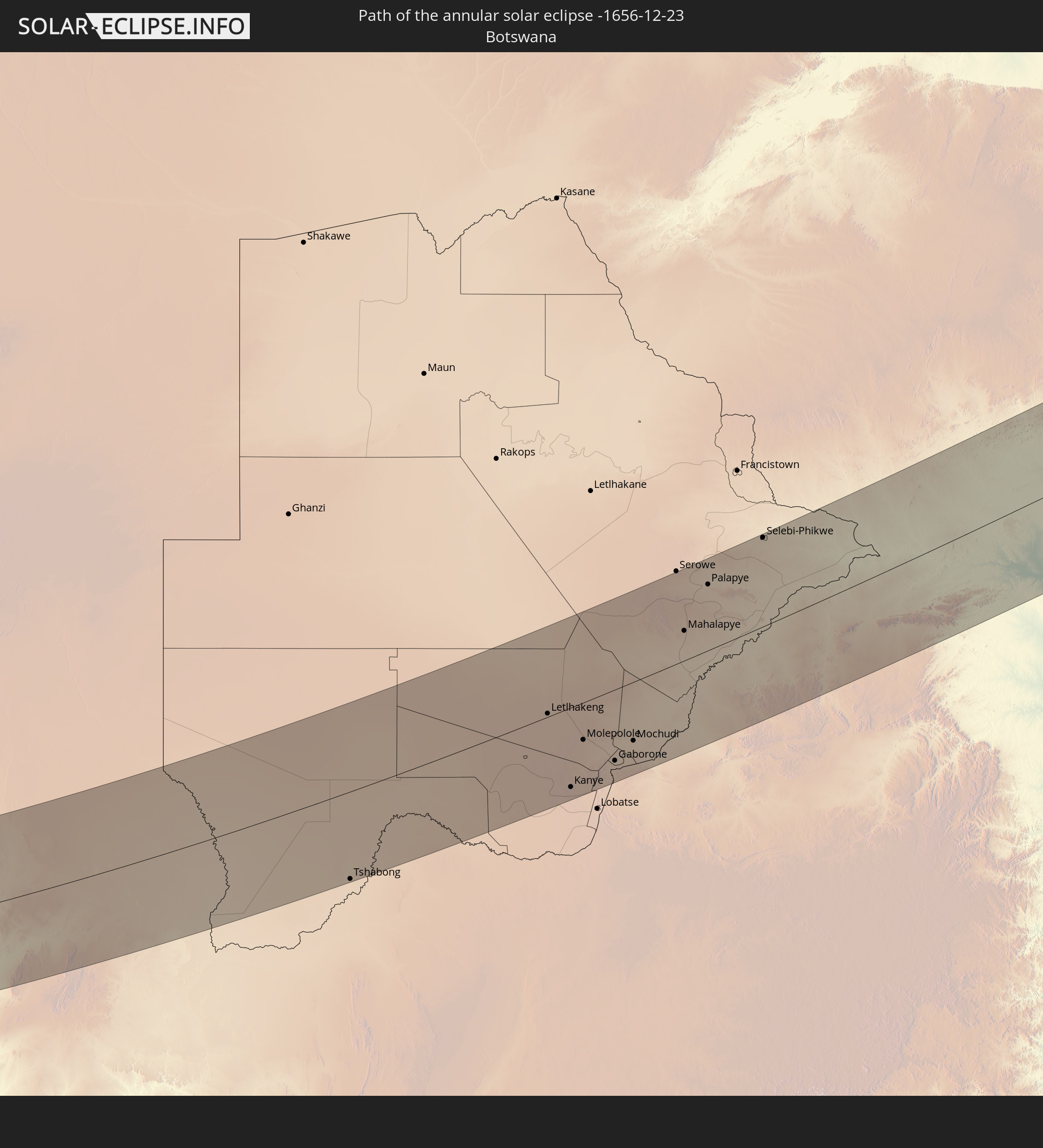
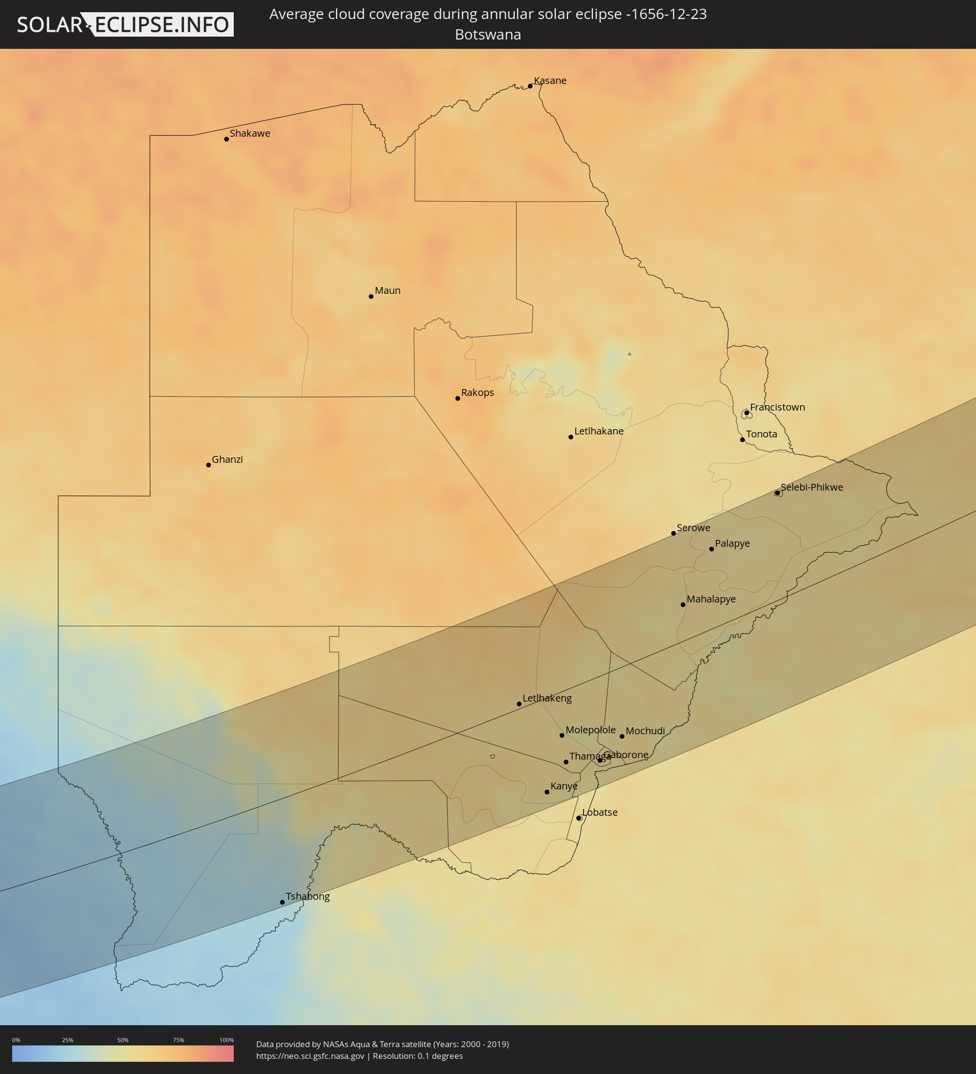 Botswana
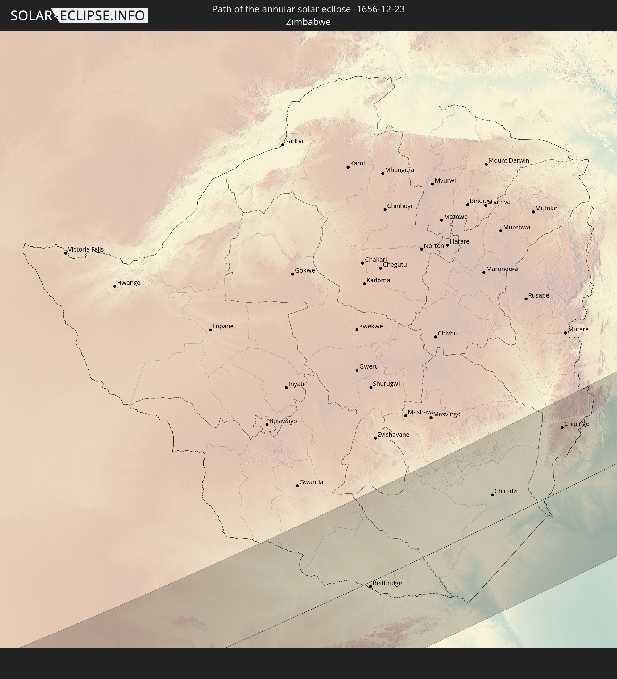
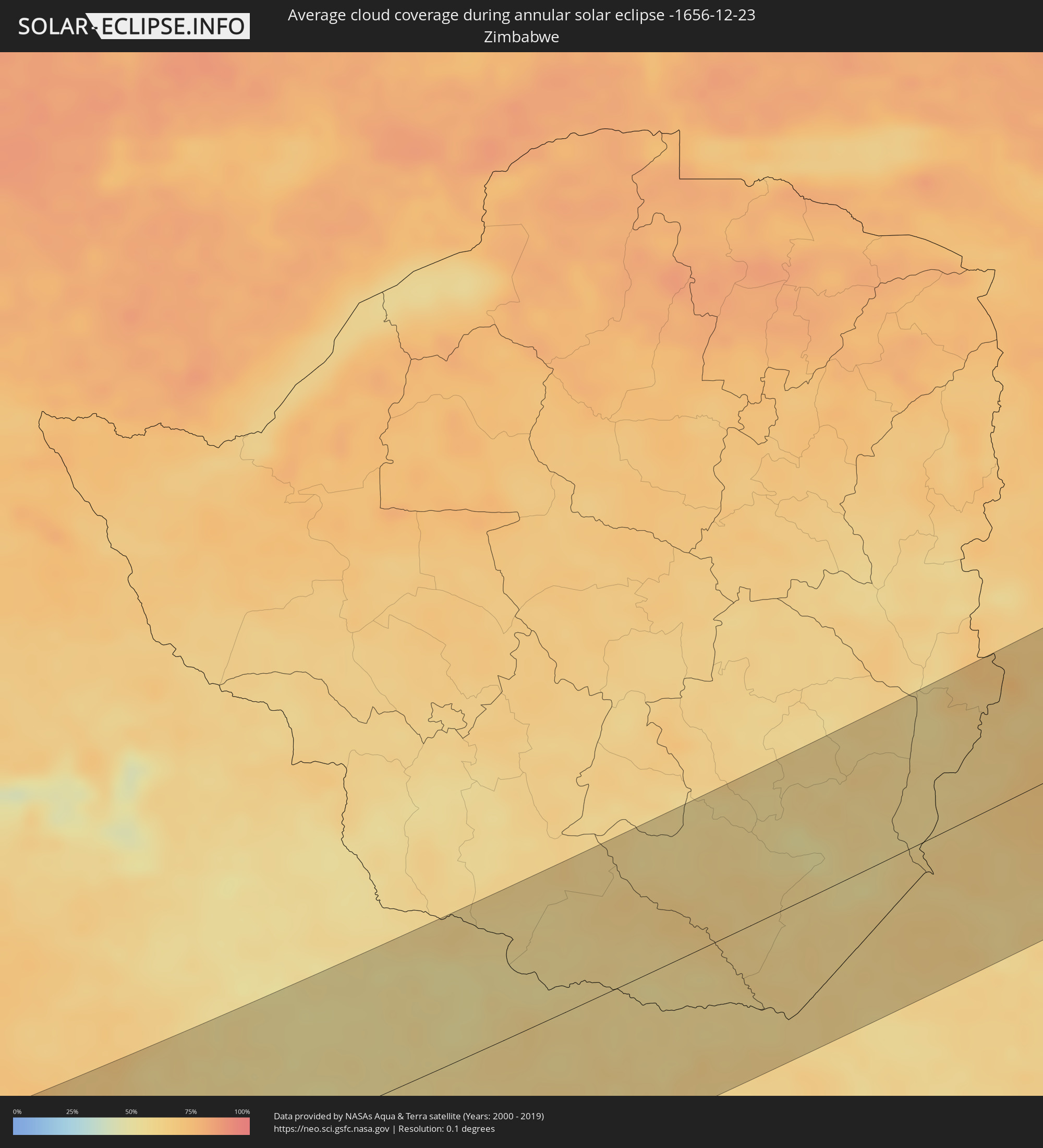 Zimbabwe
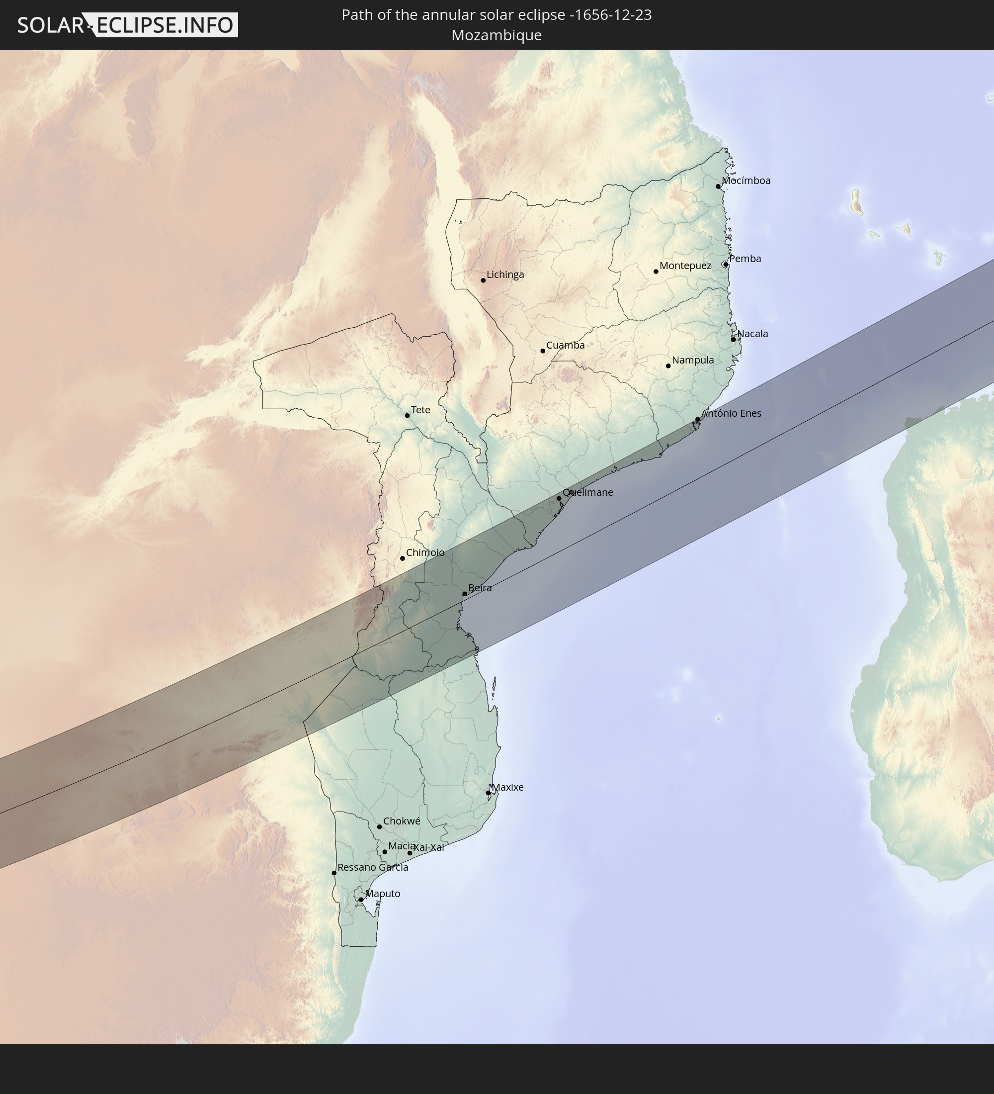
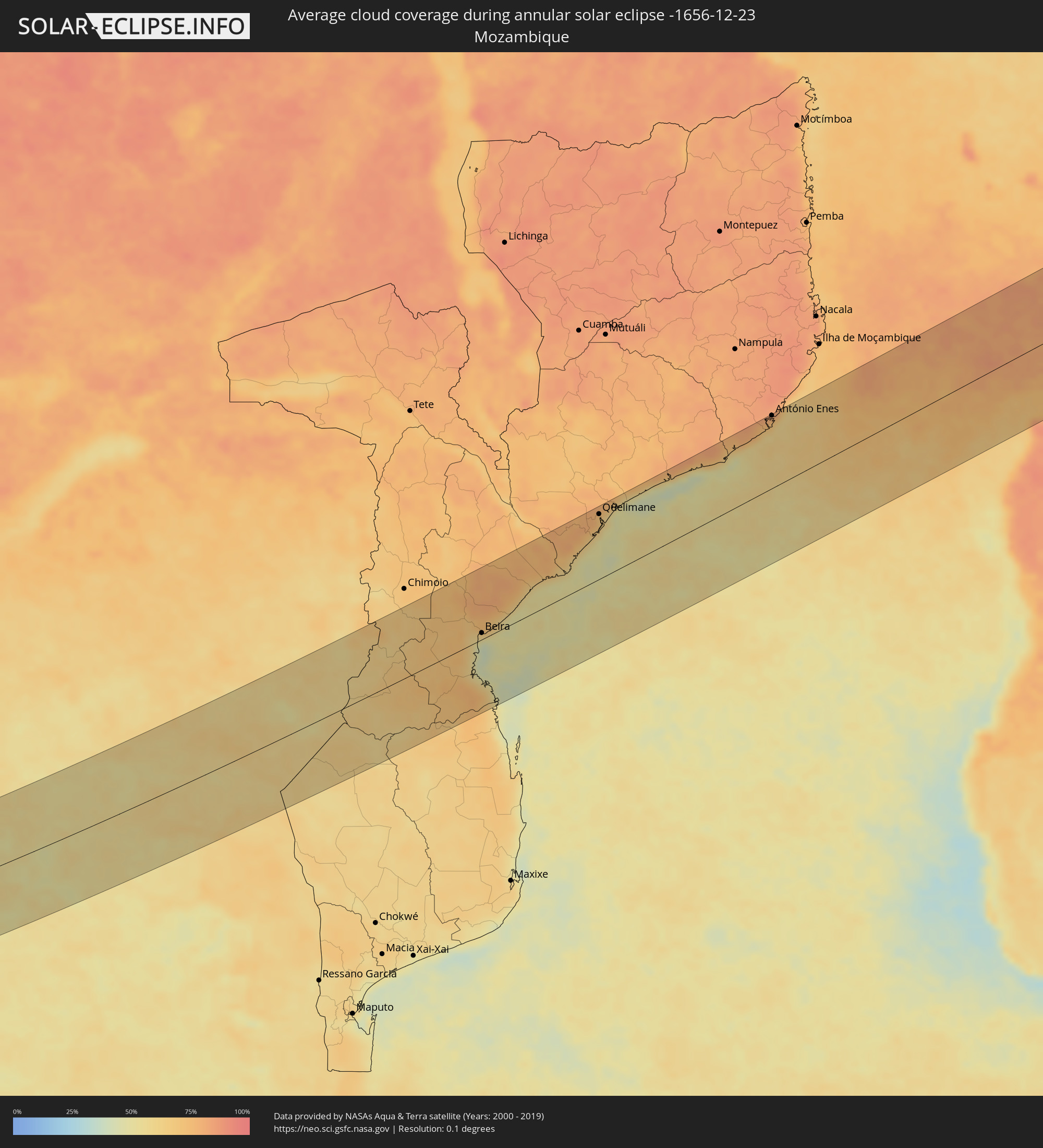 Mozambique
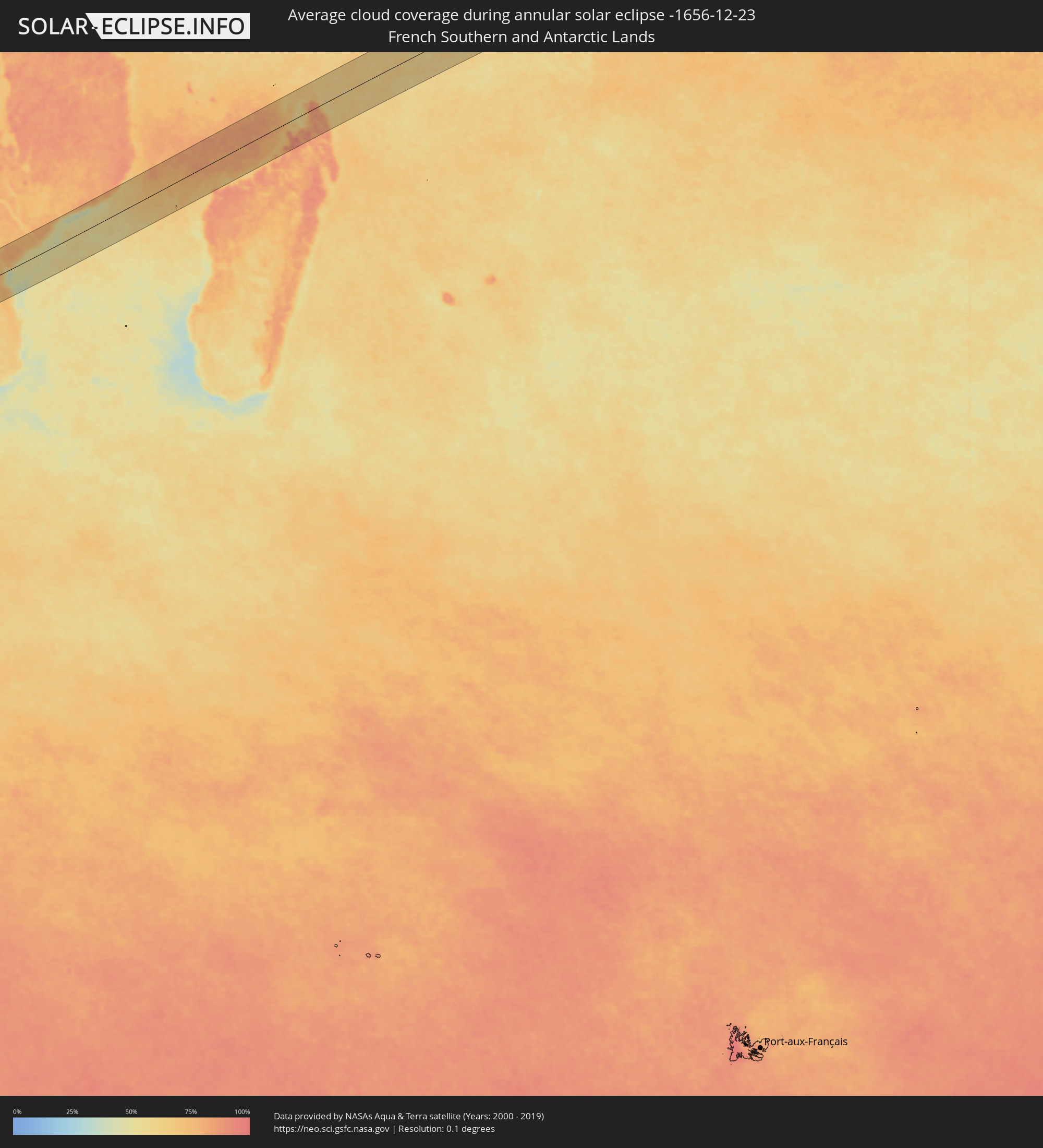 French Southern and Antarctic Lands
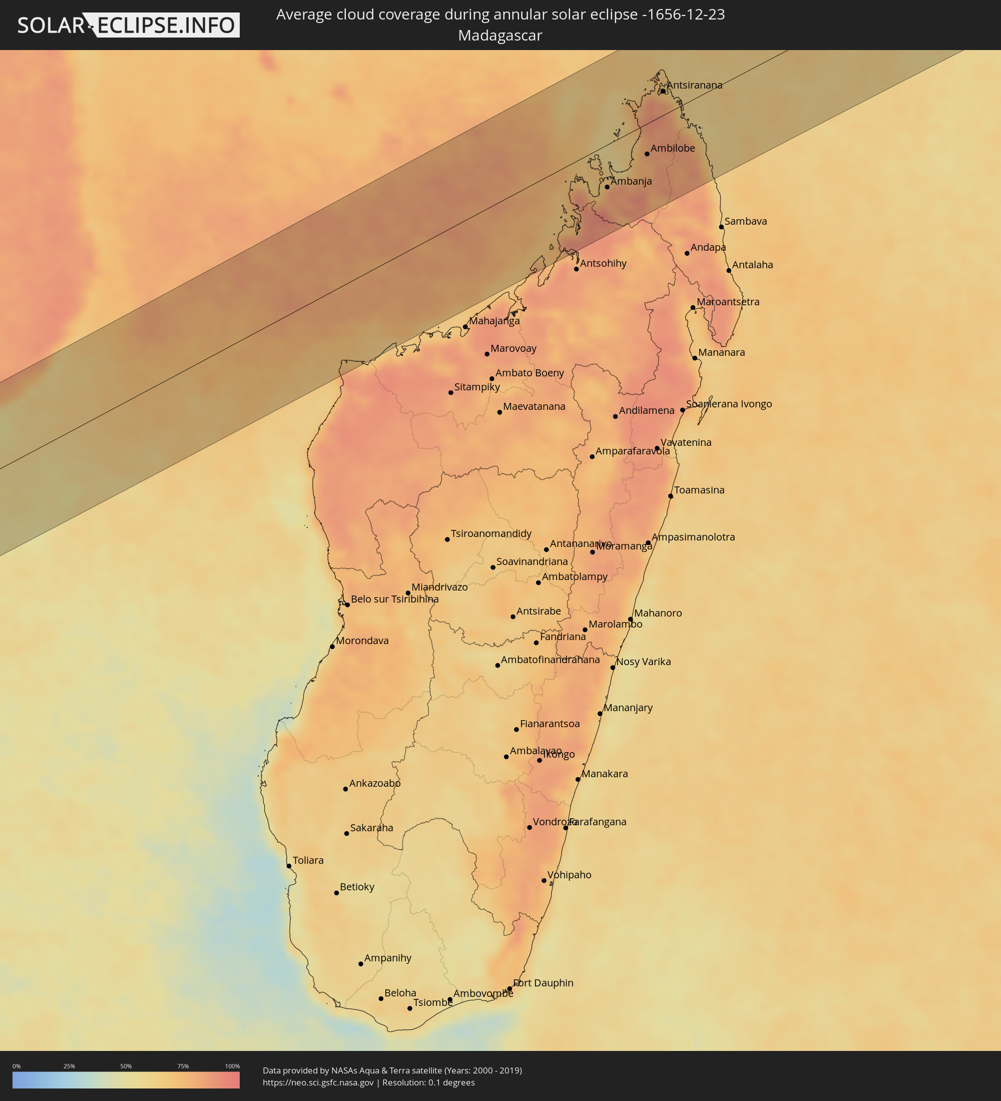 Madagascar
Cities inside the path of the eclipse
The following table shows all locations with a population of more than 5,000 inside the eclipse path. Cities which have more than 100,000 inhabitants are marked bold. A click at the locations opens a detailed map.
| City | Type | Eclipse duration | Local time of max. eclipse | Distance to central line | Ø Cloud coverage |
|
Conceição do Araguaia, Pará
|
annular | - | 06:25:52 UTC-03:13 | 47 km | 84% |
|
Araguaína, Tocantins
|
annular | - | 07:05:10 UTC-02:34 | 111 km | 91% |
|
Santa Luzia, Maranhão
|
annular | - | 07:05:31 UTC-02:34 | 112 km | 88% |
|
Xique Xique, Bahia
|
annular | - | 07:08:39 UTC-02:34 | 8 km | 51% |
|
Irecê, Bahia
|
annular | - | 07:09:19 UTC-02:34 | 2 km | 54% |
|
Morro do Chapéu, Bahia
|
annular | - | 07:09:46 UTC-02:34 | 11 km | 57% |
|
Vera Cruz, Bahia
|
annular | - | 07:10:44 UTC-02:34 | 91 km | 74% |
|
Jacobina, Bahia
|
annular | - | 07:09:42 UTC-02:34 | 79 km | 67% |
|
Ruy Barbosa, Bahia
|
annular | - | 07:10:38 UTC-02:34 | 30 km | 72% |
|
Itaberaba, Bahia
|
annular | - | 07:10:56 UTC-02:34 | 45 km | 75% |
|
Iaçu, Bahia
|
annular | - | 07:11:11 UTC-02:34 | 64 km | 74% |
|
Jaguaquara, Bahia
|
annular | - | 07:11:58 UTC-02:34 | 128 km | 72% |
|
Ipirá, Bahia
|
annular | - | 07:10:51 UTC-02:34 | 20 km | 75% |
|
Amargosa, Bahia
|
annular | - | 07:11:40 UTC-02:34 | 61 km | 79% |
|
Gandu, Bahia
|
annular | - | 07:12:23 UTC-02:34 | 126 km | 80% |
|
Santaluz, Bahia
|
annular | - | 07:10:14 UTC-02:34 | 127 km | 72% |
|
Conceição do Coité, Bahia
|
annular | - | 07:10:32 UTC-02:34 | 101 km | 74% |
|
Santo Antônio de Jesus, Bahia
|
annular | - | 07:11:46 UTC-02:34 | 38 km | 81% |
|
Santo Estêvão, Bahia
|
annular | - | 07:11:18 UTC-02:34 | 16 km | 75% |
|
Cruz das Almas, Bahia
|
annular | - | 07:11:35 UTC-02:34 | 0 km | 79% |
|
Valença, Bahia
|
annular | - | 07:12:14 UTC-02:34 | 68 km | 66% |
|
Nazaré, Bahia
|
annular | - | 07:11:57 UTC-02:34 | 32 km | 74% |
|
Serrinha, Bahia
|
annular | - | 07:10:45 UTC-02:34 | 105 km | 76% |
|
Feira de Santana, Bahia
|
annular | - | 07:11:17 UTC-02:34 | 47 km | 78% |
|
Conceição do Jacuípe, Bahia
|
annular | - | 07:11:26 UTC-02:34 | 51 km | 76% |
|
Santo Amaro, Bahia
|
annular | - | 07:11:39 UTC-02:34 | 31 km | 75% |
|
Salvador, Bahia
|
annular | - | 07:12:08 UTC-02:34 | 1 km | 52% |
|
São Sebastião do Passé, Bahia
|
annular | - | 07:11:44 UTC-02:34 | 45 km | 80% |
|
Alagoinhas, Bahia
|
annular | - | 07:11:26 UTC-02:34 | 86 km | 78% |
|
Catu, Bahia
|
annular | - | 07:11:39 UTC-02:34 | 67 km | 78% |
|
Lauro de Freitas, Bahia
|
annular | - | 07:12:10 UTC-02:34 | 15 km | 51% |
|
Camaçari, Bahia
|
annular | - | 07:11:59 UTC-02:34 | 35 km | 65% |
|
Mata de São João, Bahia
|
annular | - | 07:11:51 UTC-02:34 | 53 km | 73% |
|
Entre Rios, Bahia
|
annular | - | 07:11:26 UTC-02:34 | 122 km | 79% |
|
Lüderitz, Karas
|
annular | - | 13:30:18 UTC+01:30 | 28 km | 11% |
|
Bethanie, Karas
|
annular | - | 13:36:24 UTC+01:30 | 0 km | 11% |
|
Keetmanshoop, Karas
|
annular | - | 13:39:09 UTC+01:30 | 35 km | 14% |
|
Tshabong, Kgalagadi
|
annular | - | 14:31:42 UTC+02:10 | 108 km | 27% |
|
Letlhakeng, Kweneng
|
annular | - | 14:40:29 UTC+02:10 | 4 km | 55% |
|
Kanye, Ngwaketsi
|
annular | - | 14:40:04 UTC+02:10 | 98 km | 52% |
|
Mosopa, Ngwaketsi
|
annular | - | 14:40:32 UTC+02:10 | 81 km | 53% |
|
Molepolole, Kweneng
|
annular | - | 14:41:10 UTC+02:10 | 46 km | 55% |
|
Thamaga, Kweneng
|
annular | - | 14:40:56 UTC+02:10 | 75 km | 53% |
|
Gabane, Kweneng
|
annular | - | 14:41:30 UTC+02:10 | 84 km | 50% |
|
Metsemotlhaba, Kweneng
|
annular | - | 14:41:42 UTC+02:10 | 72 km | 54% |
|
Mogoditshane, Kweneng
|
annular | - | 14:41:44 UTC+02:10 | 83 km | 53% |
|
Ramotswa, South-East
|
annular | - | 14:41:26 UTC+02:10 | 108 km | 52% |
|
Kopong, South-East
|
annular | - | 14:41:58 UTC+02:10 | 69 km | 56% |
|
Gaborone, South-East
|
annular | - | 14:41:48 UTC+02:10 | 87 km | 49% |
|
Mochudi, Kgatleng
|
annular | - | 14:42:40 UTC+02:10 | 72 km | 57% |
|
Mahalapye, Central
|
annular | - | 14:45:53 UTC+02:10 | 37 km | 56% |
|
Palapye, Central
|
annular | - | 14:47:19 UTC+02:10 | 81 km | 56% |
|
Selebi-Phikwe, Central
|
annular | - | 14:49:38 UTC+02:10 | 109 km | 54% |
|
Louis Trichardt, Limpopo
|
annular | - | 14:12:08 UTC+01:30 | 86 km | 60% |
|
Thohoyandou, Limpopo
|
annular | - | 14:13:24 UTC+01:30 | 101 km | 60% |
|
Dondo, Sofala
|
annular | - | 15:05:46 UTC+02:10 | 38 km | 70% |
|
Beira, Sofala
|
annular | - | 15:05:36 UTC+02:10 | 10 km | 58% |
|
Quelimane, Zambézia
|
annular | - | 15:11:16 UTC+02:10 | 106 km | 70% |
|
António Enes, Nampula
|
annular | - | 15:17:17 UTC+02:10 | 120 km | 76% |
|
Hell-Ville, Diana
|
annular | - | 15:45:13 UTC+02:27 | 25 km | 69% |
|
Ambanja, Diana
|
annular | - | 15:45:03 UTC+02:27 | 62 km | 84% |
|
Antsohimbondrona, Diana
|
annular | - | 15:45:56 UTC+02:27 | 23 km | 74% |
|
Ambarakaraka, Diana
|
annular | - | 15:45:31 UTC+02:27 | 65 km | 82% |
|
Ambilobe, Diana
|
annular | - | 15:45:56 UTC+02:27 | 45 km | 79% |
|
Antsiranana, Diana
|
annular | - | 15:47:01 UTC+02:27 | 34 km | 75% |
|
Sadjoavato, Diana
|
annular | - | 15:46:43 UTC+02:27 | 3 km | 83% |